Embed Size (px)
Citation preview
South Dakota Large Scale (Automated) Engineering
& Base Level Engineering
AMFM March 2017
1
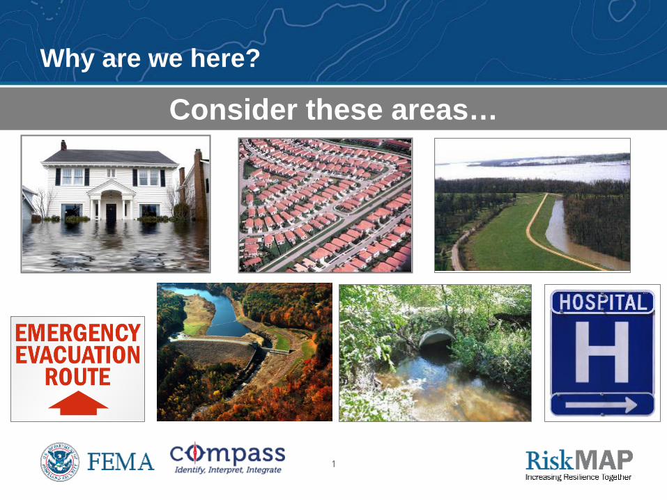
Consider these areas…
Why are we here?
2
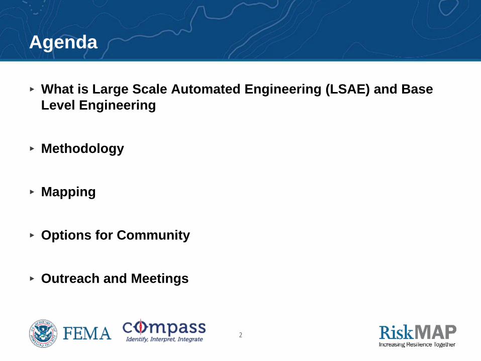
Agenda
▸ What is Large Scale Automated Engineering (LSAE) and Base Level Engineering
▸ Methodology
▸ Mapping
▸ Options for Community
▸ Outreach and Meetings
3
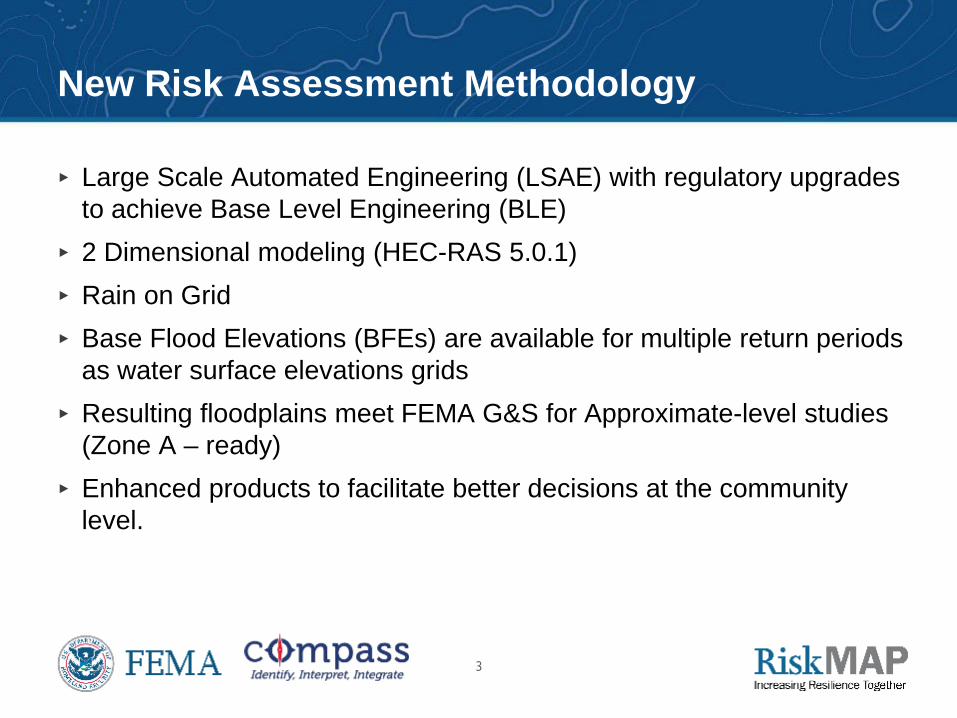
New Risk Assessment Methodology
▸ Large Scale Automated Engineering (LSAE) with regulatory upgrades to achieve Base Level Engineering (BLE)
▸ 2 Dimensional modeling (HEC-RAS 5.0.1) ▸ Rain on Grid ▸ Base Flood Elevations (BFEs) are available for multiple return periods
as water surface elevations grids ▸ Resulting floodplains meet FEMA G&S for Approximate-level studies
(Zone A – ready) ▸ Enhanced products to facilitate better decisions at the community
level.
4
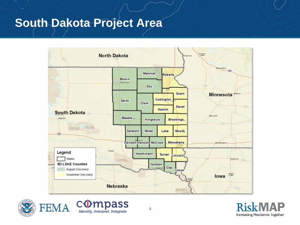
South Dakota Project Area
5
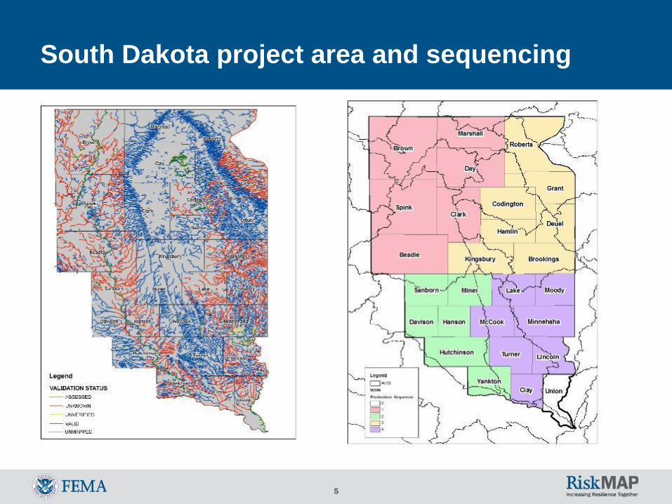
South Dakota project area and sequencing
6
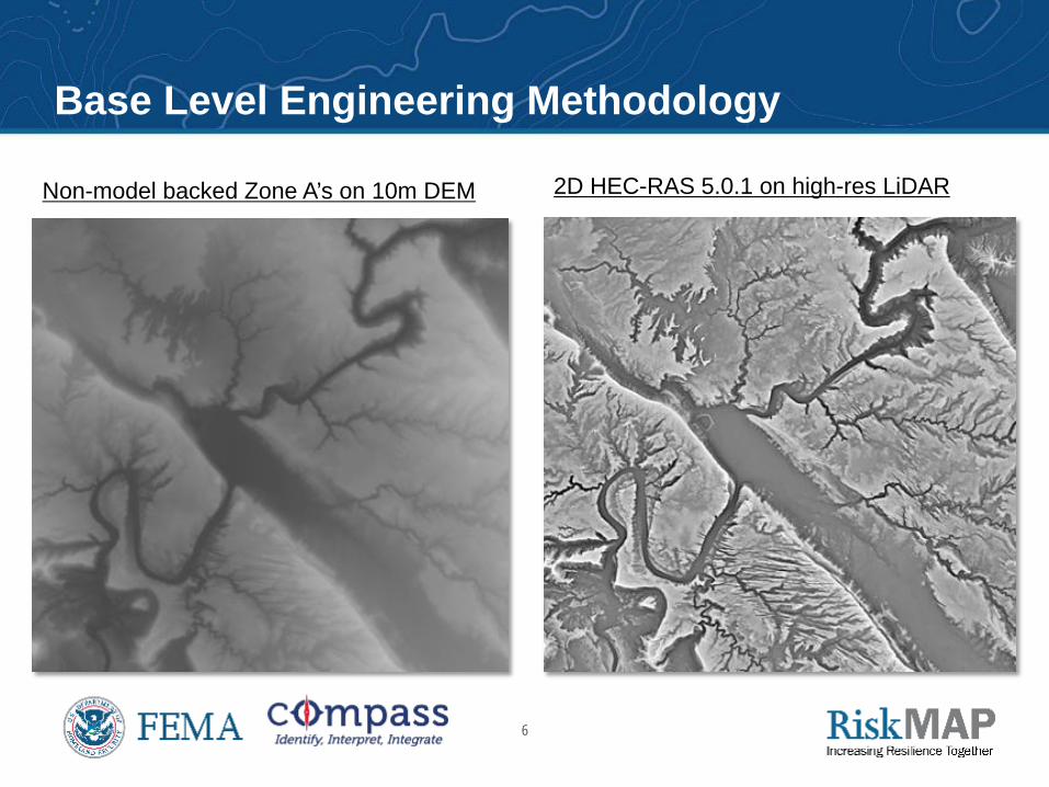
Base Level Engineering Base Level Engineering Methodology
Non-model backed Zone A’s on 10m DEM 2D HEC-RAS 5.0.1 on high-res LiDAR
7
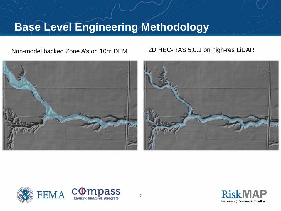
Base Level Engineering Base Level Engineering Methodology
Non-model backed Zone A’s on 10m DEM 2D HEC-RAS 5.0.1 on high-res LiDAR
8
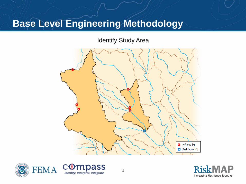
Identify Study Area
Base Level Engineering Methodology
9
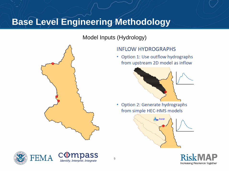
Model Inputs (Hydrology)
Base Level Engineering Methodology
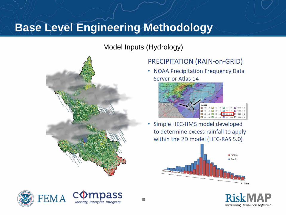
10
Model Inputs (Hydrology)
Base Level Engineering Methodology
11
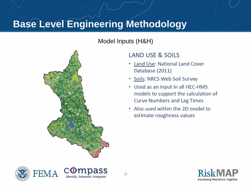
Model Inputs (H&H)
Base Level Engineering Methodology
12
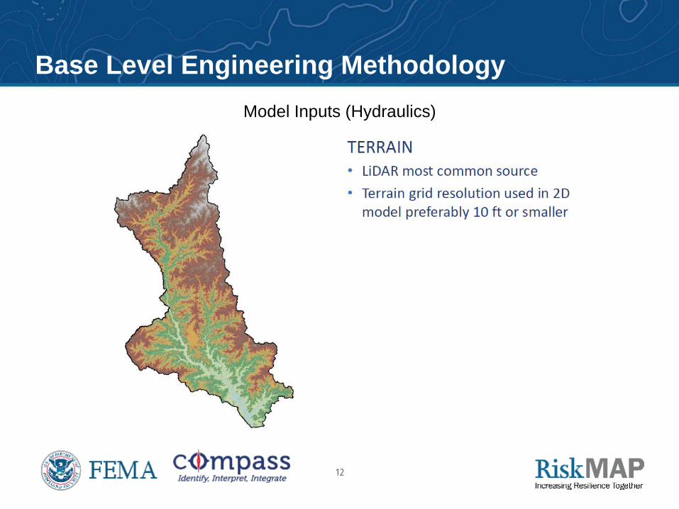
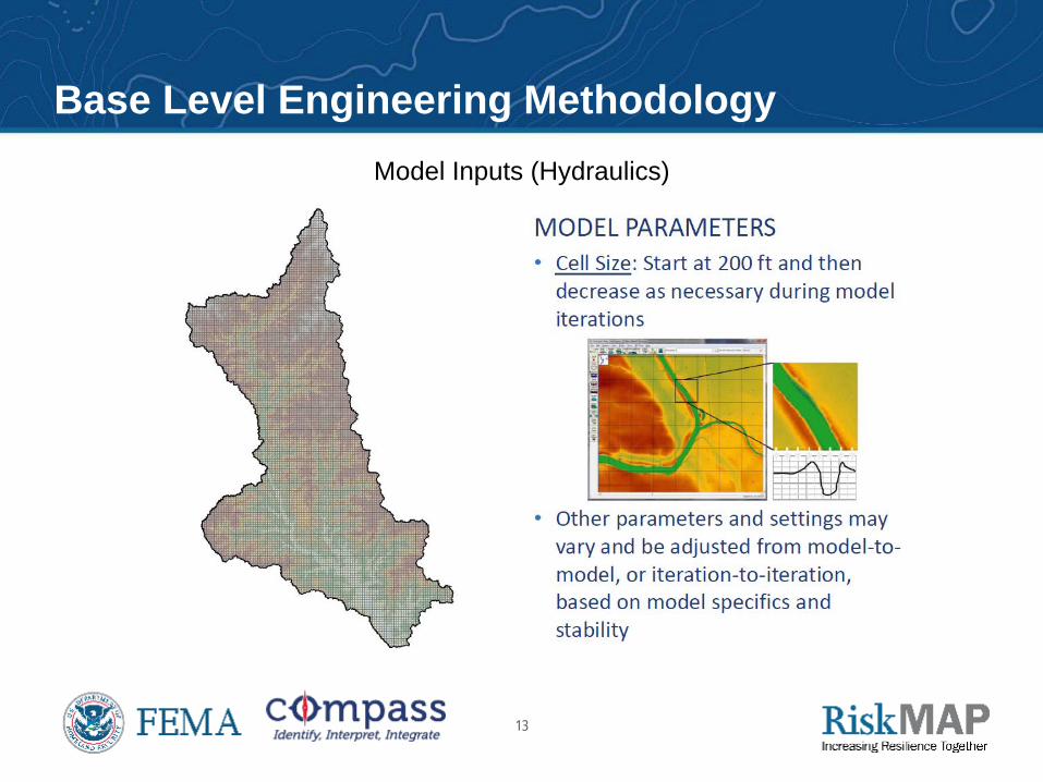
Model Inputs (Hydraulics)
Base Level Engineering Methodology
13
Model Inputs (Hydraulics)
Base Level Engineering Methodology
14
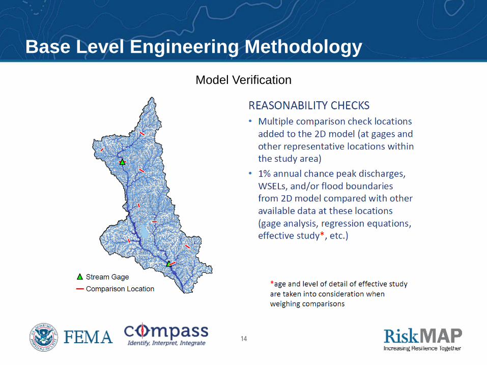
Model Verification
Base Level Engineering Methodology
15
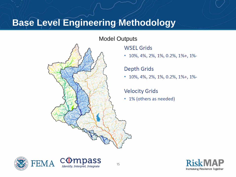
Model Outputs
Base Level Engineering Methodology
16
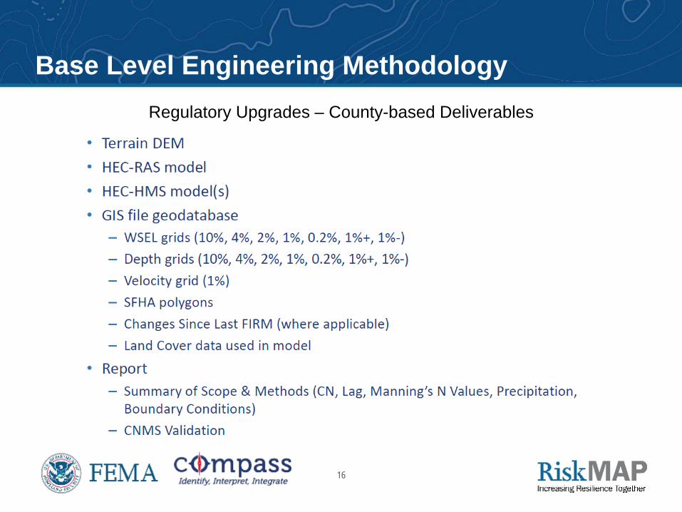
Regulatory Upgrades – County-based Deliverables
Base Level Engineering Methodology
17
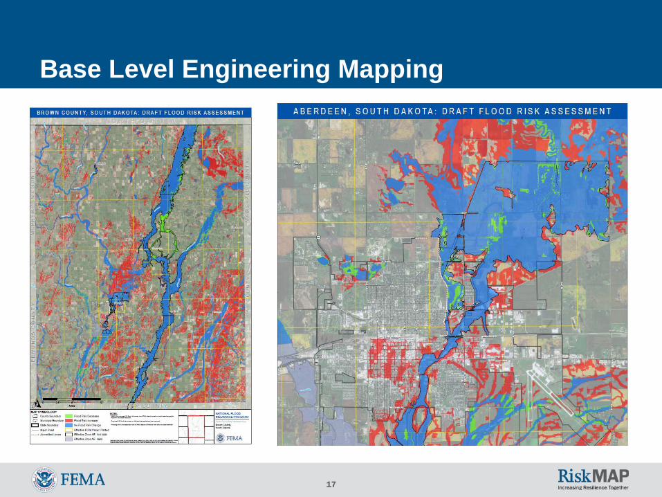
Base Level Engineering Mapping
18
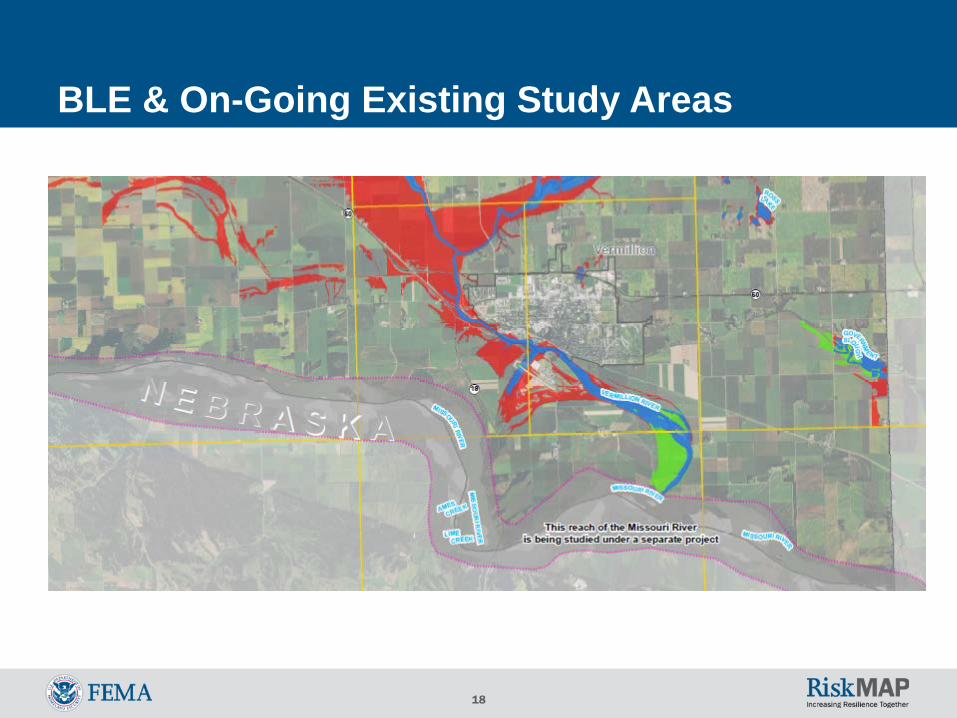
BLE & On-Going Existing Study Areas
19
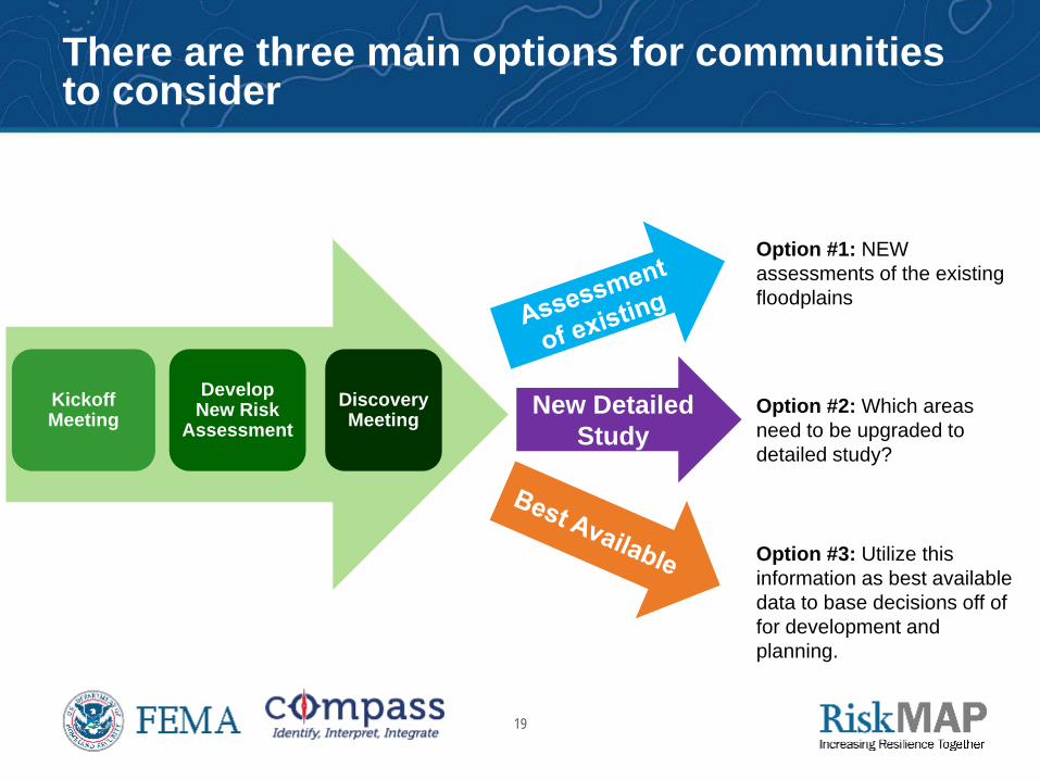
There are three main options for communities to consider
Kickoff Meeting
Develop New Risk
Assessment Discovery Meeting New Detailed
Study
Option #1: NEW assessments of the existing floodplains
Option #2: Which areas need to be upgraded to detailed study?
Option #3: Utilize this information as best available data to base decisions off of for development and planning.
20
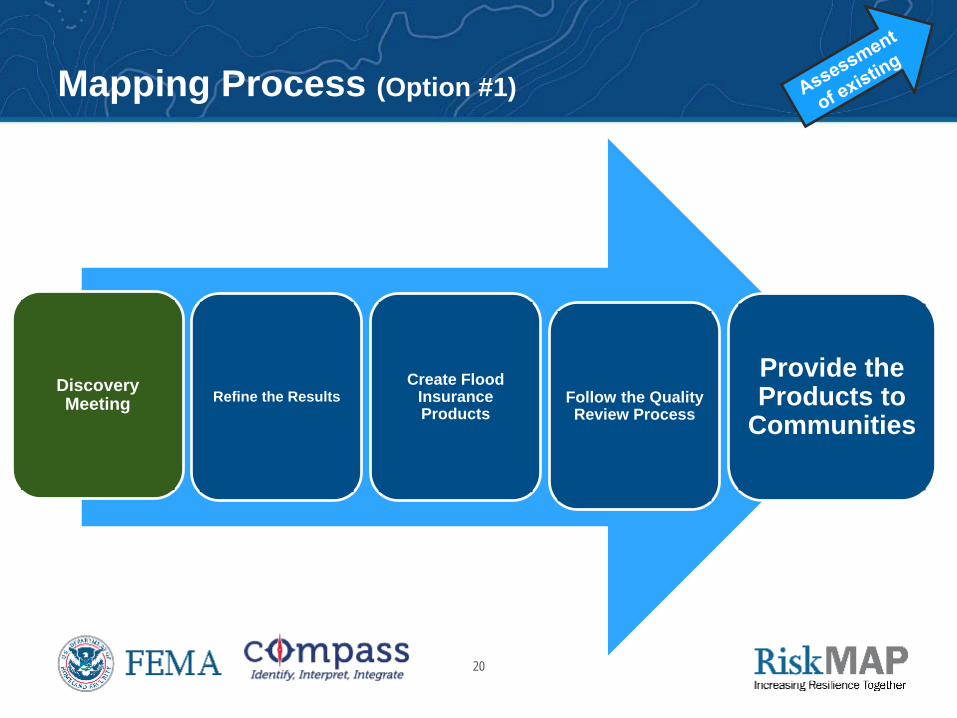
Mapping Process (Option #1)
Discovery Meeting Refine the Results
Create Flood Insurance Products
Follow the Quality Review Process
Provide the Products to
Communities
21
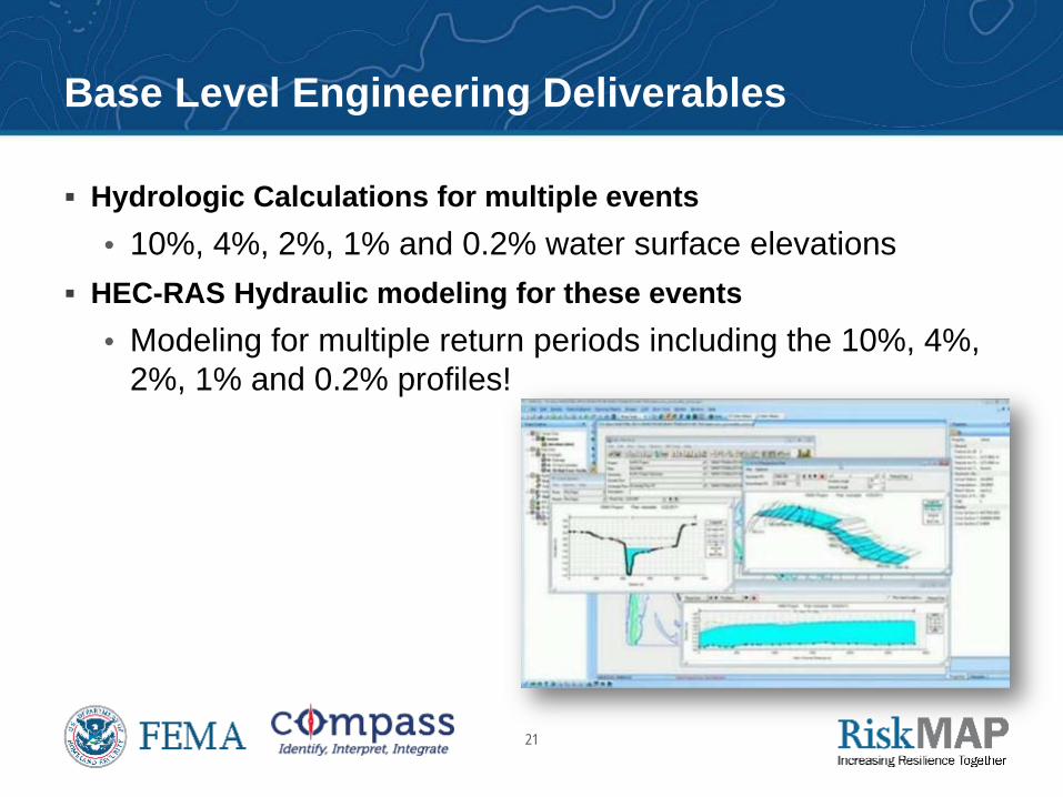
Base Level Engineering Deliverables
Hydrologic Calculations for multiple events • 10%, 4%, 2%, 1% and 0.2% water surface elevations
HEC-RAS Hydraulic modeling for these events • Modeling for multiple return periods including the 10%, 4%,
2%, 1% and 0.2% profiles!
22
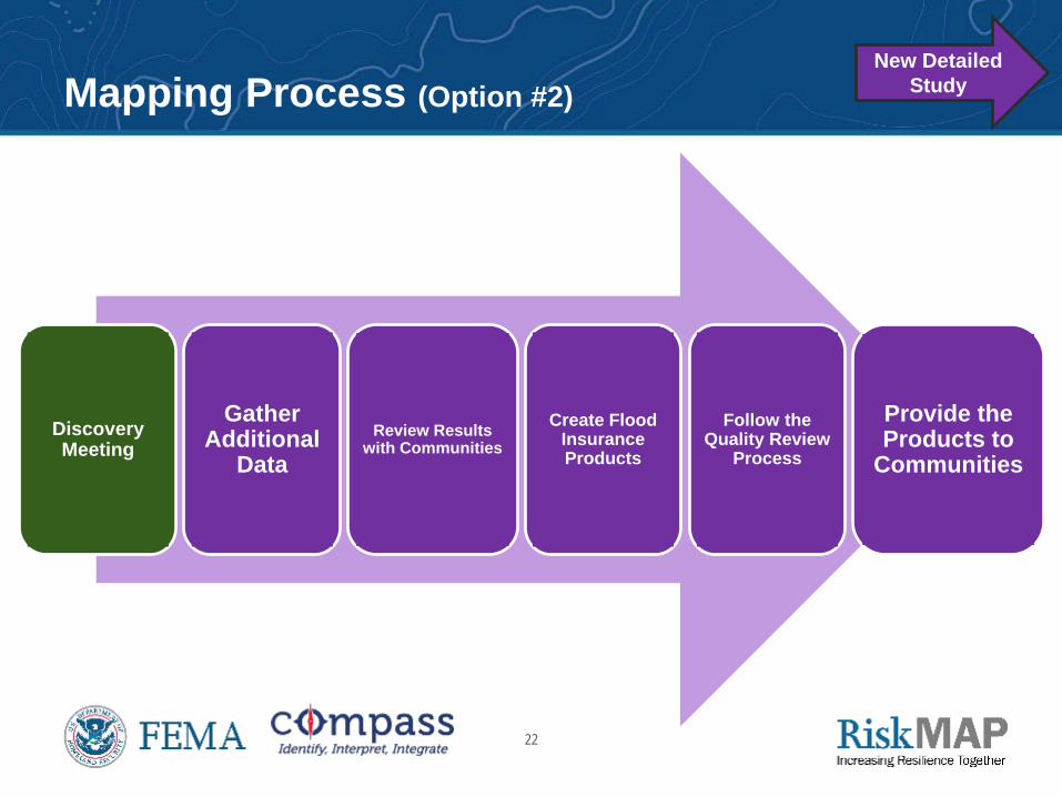
Mapping Process (Option #2)
Discovery Meeting
Gather Additional
Data Review Results
with Communities Create Flood
Insurance Products
Follow the Quality Review
Process
Provide the Products to
Communities
New Detailed Study
23
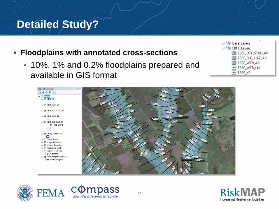
Detailed Study?
Floodplains with annotated cross-sections • 10%, 1% and 0.2% floodplains prepared and
available in GIS format
24
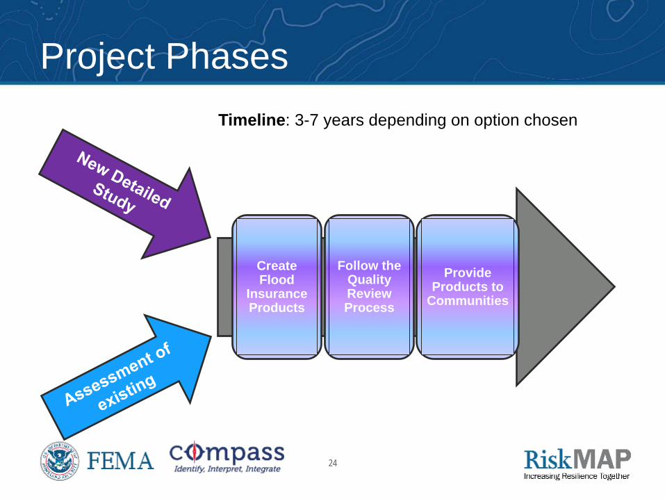
Create Flood
Insurance Products
Follow the Quality Review Process
Provide Products to
Communities
Project Phases
Timeline: 3-7 years depending on option chosen
25
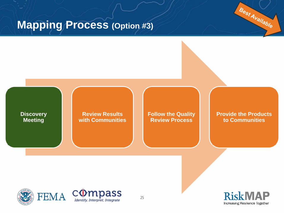
Mapping Process (Option #3)
Discovery Meeting
Review Results with Communities
Follow the Quality Review Process
Provide the Products to Communities
26
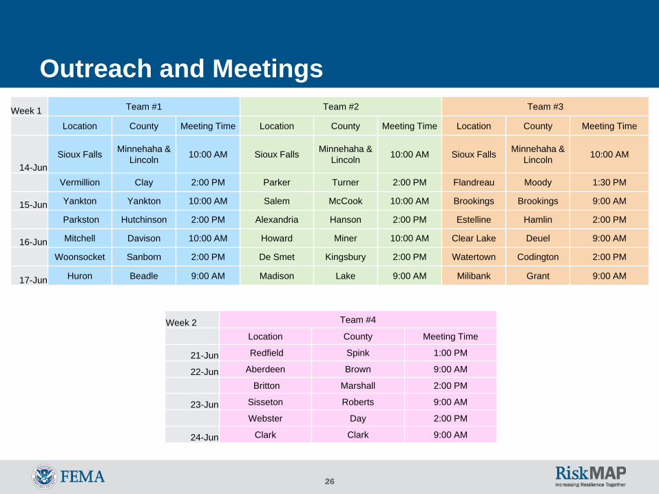
Outreach and Meetings April 8th, 2016: Pre-Kick off meetings emails went out to each community. April 12th, 2016: Follow up phone calls to each community May 2th, 2016: Kick Off meeting invitations were sent out June 1st, 2016: Congressional Notifications June 13th – 24th, 2016: Three teams simultaneously conducted a Kick Off
Meeting (KOM) in every county (26 total meetings)
July 8th, 2016: KOM Thank You emails were sent out
Week 1 Team #1 Team #2 Team #3
Location County Meeting Time Location County Meeting Time Location County Meeting Time
14-Jun Sioux Falls Minnehaha &
Lincoln 10:00 AM Sioux Falls Minnehaha & Lincoln 10:00 AM Sioux Falls Minnehaha &
Lincoln 10:00 AM
Vermillion Clay 2:00 PM Parker Turner 2:00 PM Flandreau Moody 1:30 PM
15-Jun Yankton Yankton 10:00 AM Salem McCook 10:00 AM Brookings Brookings 9:00 AM
Parkston Hutchinson 2:00 PM Alexandria Hanson 2:00 PM Estelline Hamlin 2:00 PM
16-Jun Mitchell Davison 10:00 AM Howard Miner 10:00 AM Clear Lake Deuel 9:00 AM
Woonsocket Sanborn 2:00 PM De Smet Kingsbury 2:00 PM Watertown Codington 2:00 PM
17-Jun Huron Beadle 9:00 AM Madison Lake 9:00 AM Milibank Grant 9:00 AM
Week 2 Team #4
Location County Meeting Time
21-Jun Redfield Spink 1:00 PM
22-Jun Aberdeen Brown 9:00 AM
Britton Marshall 2:00 PM
23-Jun Sisseton Roberts 9:00 AM
Webster Day 2:00 PM
24-Jun Clark Clark 9:00 AM
Questions?
Comments?
28
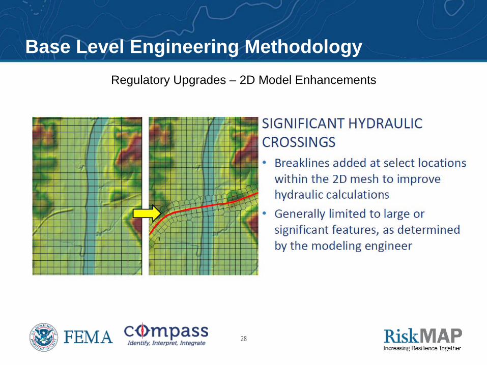
Regulatory Upgrades – 2D Model Enhancements
Base Level Engineering Methodology
29
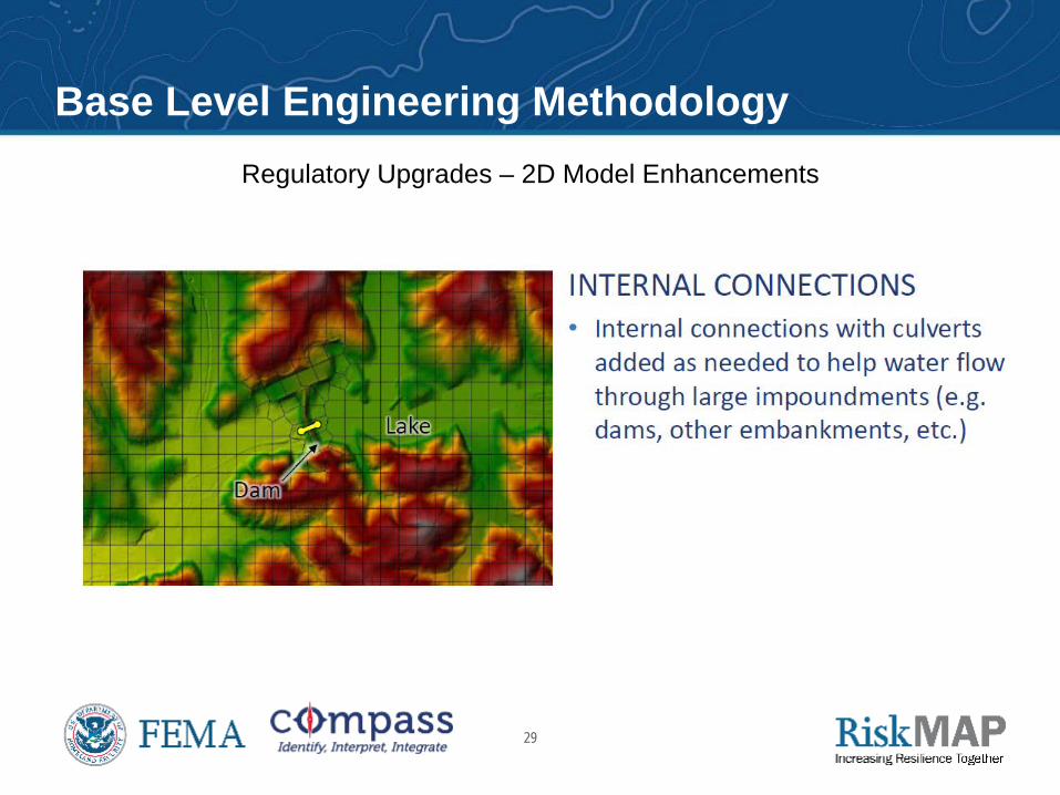
Regulatory Upgrades – 2D Model Enhancements
Base Level Engineering Methodology
30
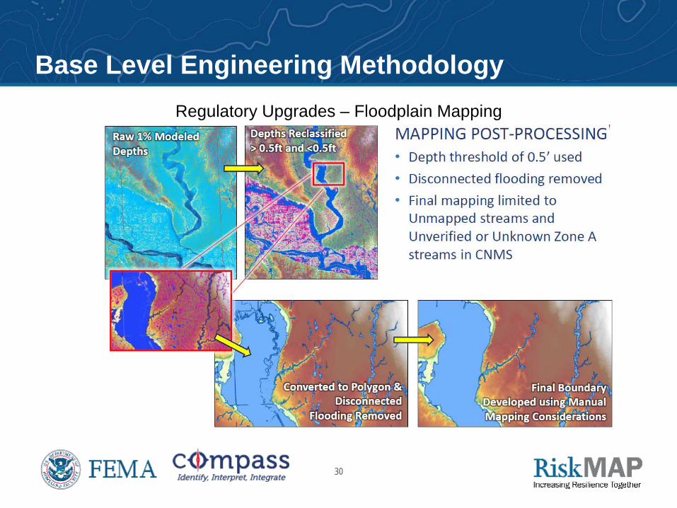
Regulatory Upgrades – Floodplain Mapping
Base Level Engineering Methodology