Embed Size (px)
Citation preview
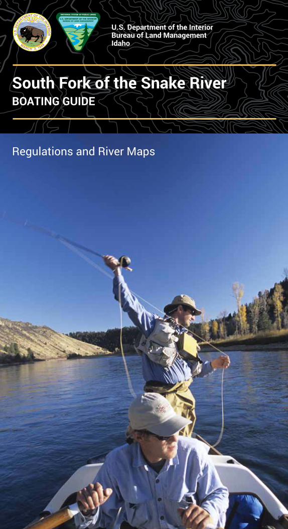
South Fork of the Snake RiverBOATING GUIDE
Regulations and River Maps
U.S. Department of the Interior Bureau of Land Management Idaho
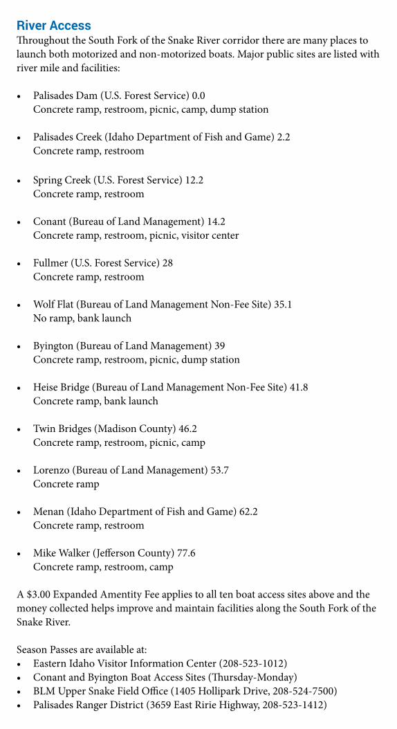
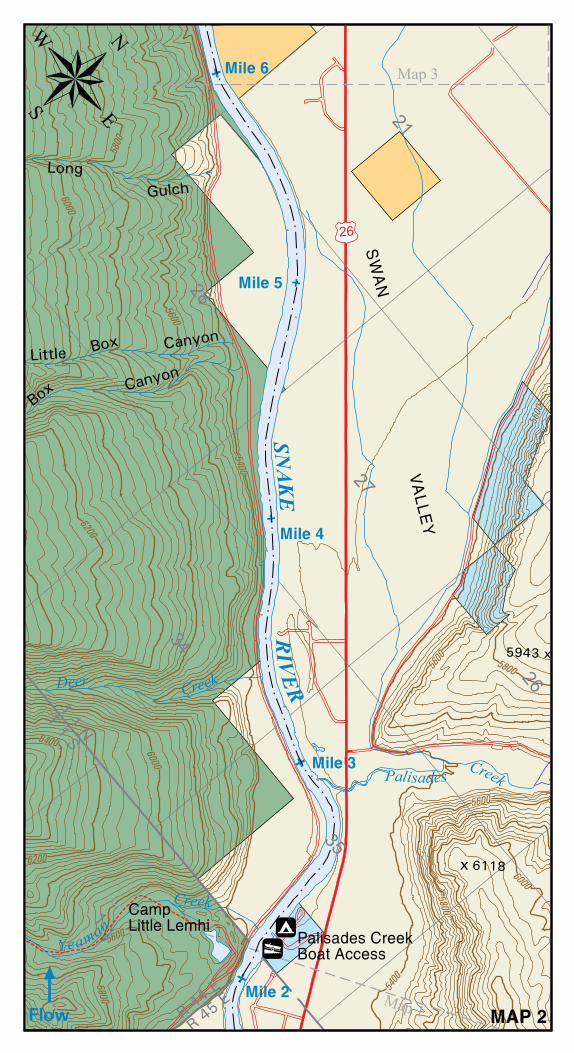
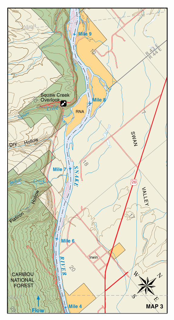
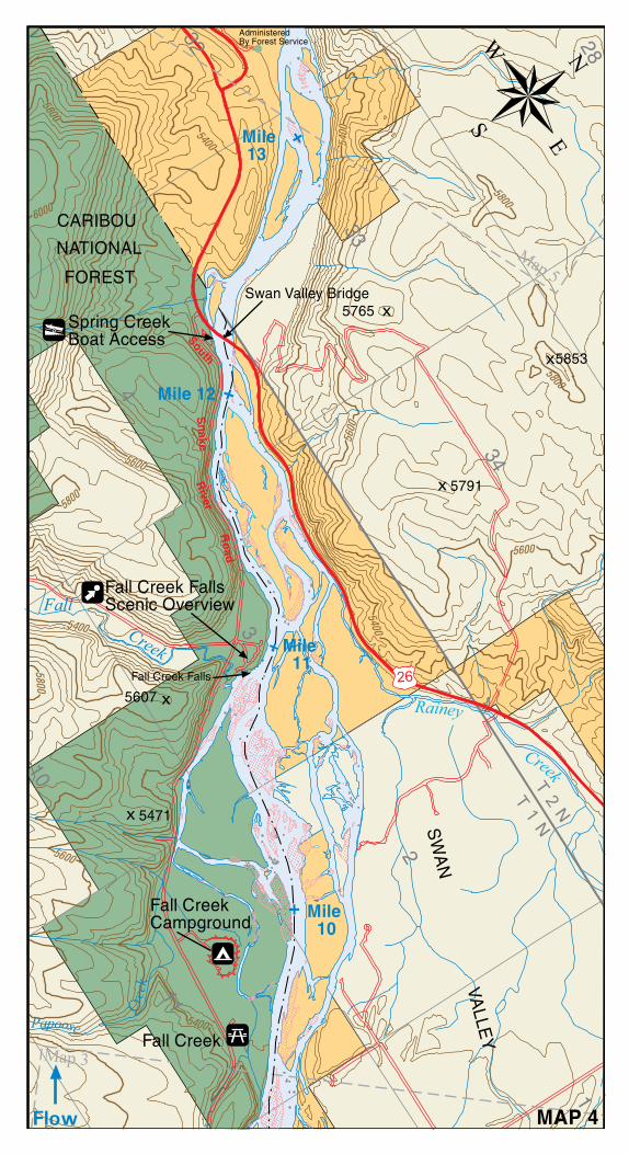
River AccessThroughout the South Fork of the Snake River corridor there are many places to launch both motorized and non-motorized boats. Major public sites are listed with river mile and facilities:
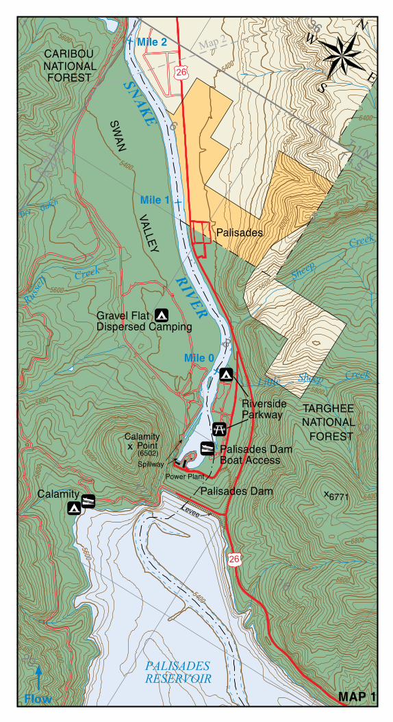
• Palisades Dam (U.S. Forest Service) 0.0 Concrete ramp, restroom, picnic, camp, dump station
• Palisades Creek (Idaho Department of Fish and Game) 2.2 Concrete ramp, restroom
• Spring Creek (U.S. Forest Service) 12.2 Concrete ramp, restroom
• Conant (Bureau of Land Management) 14.2 Concrete ramp, restroom, picnic, visitor center
• Fullmer (U.S. Forest Service) 28 Concrete ramp, restroom
• Wolf Flat (Bureau of Land Management Non-Fee Site) 35.1 No ramp, bank launch
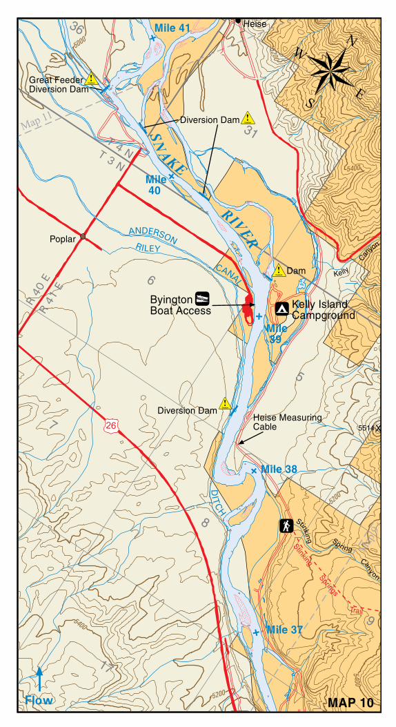
• Byington (Bureau of Land Management) 39 Concrete ramp, restroom, picnic, dump station
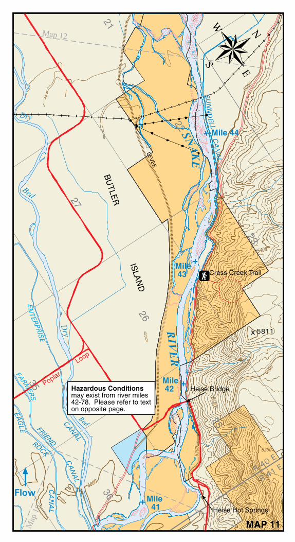
• Heise Bridge (Bureau of Land Management Non-Fee Site) 41.8 Concrete ramp, bank launch
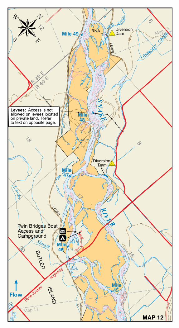
• Twin Bridges (Madison County) 46.2 Concrete ramp, restroom, picnic, camp
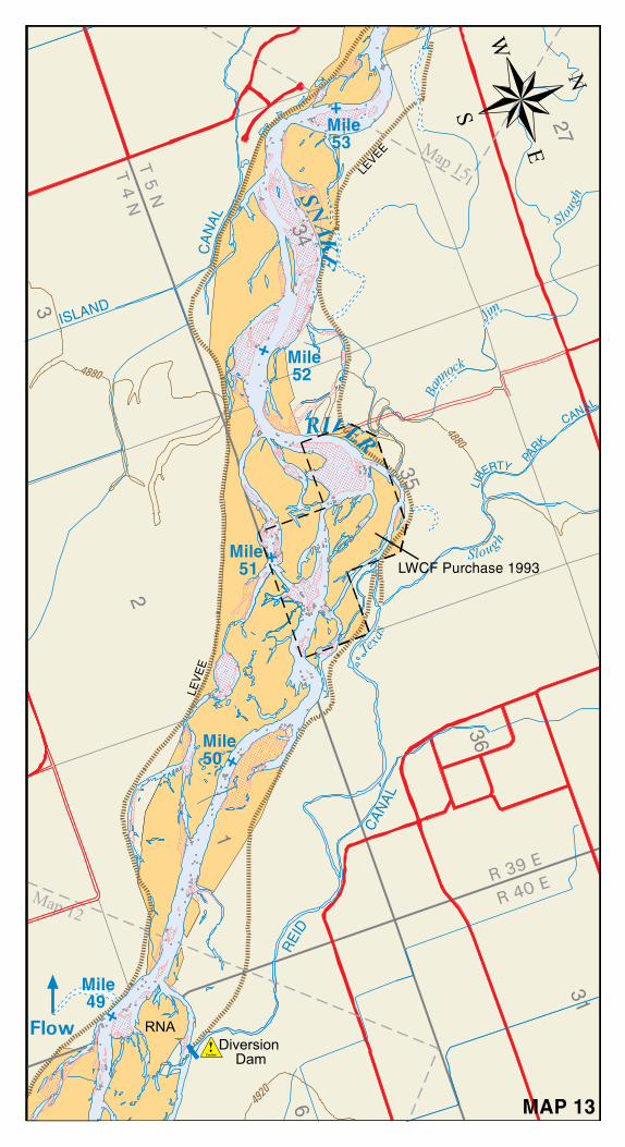
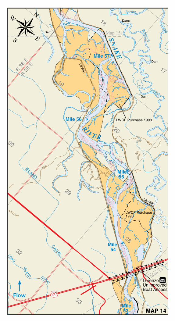
• Lorenzo (Bureau of Land Management) 53.7 Concrete ramp
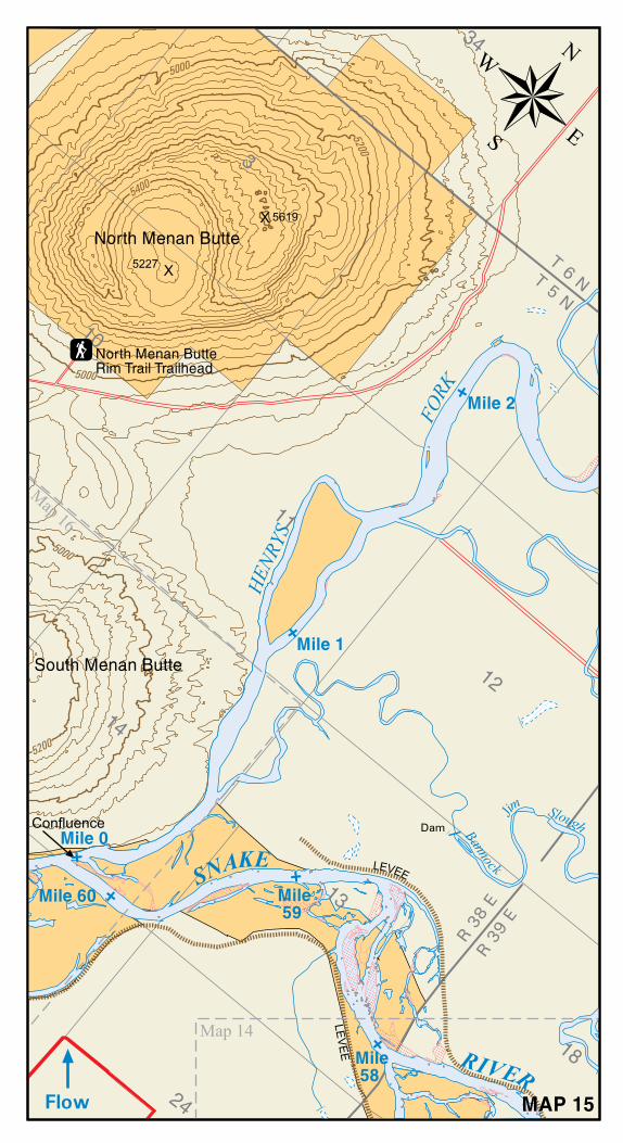
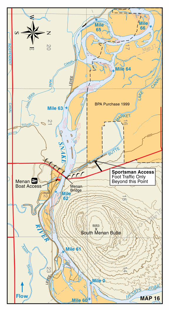
• Menan (Idaho Department of Fish and Game) 62.2 Concrete ramp, restroom
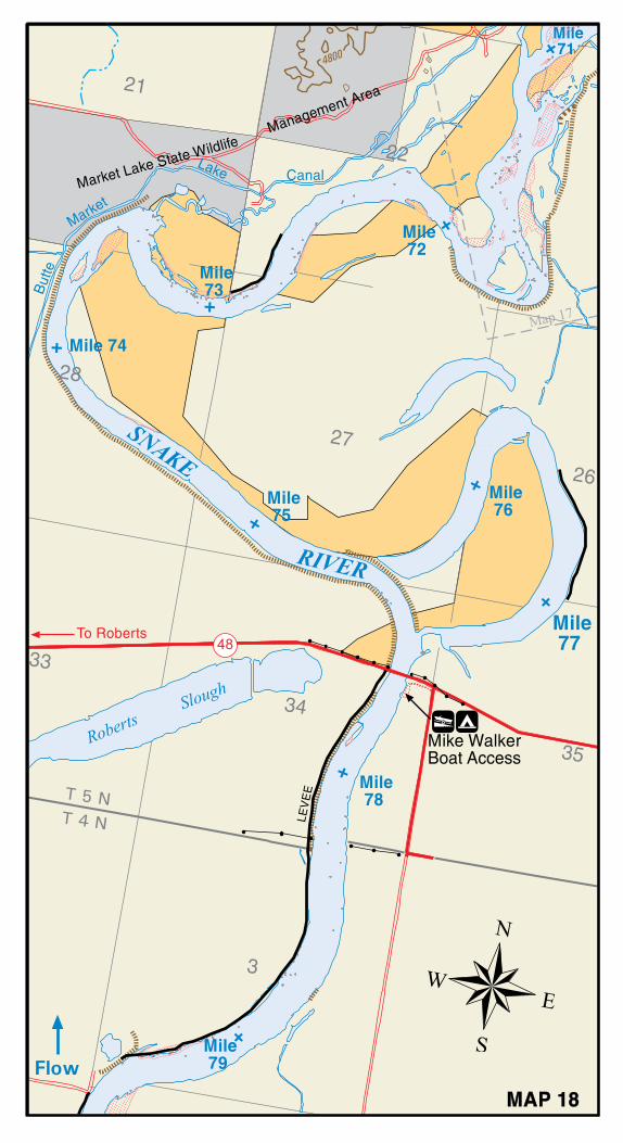
• Mike Walker (Jefferson County) 77.6 Concrete ramp, restroom, camp
A $3.00 Expanded Amentity Fee applies to all ten boat access sites above and the money collected helps improve and maintain facilities along the South Fork of the Snake River.
Season Passes are available at:• Eastern Idaho Visitor Information Center (208-523-1012)• Conant and Byington Boat Access Sites (Thursday-Monday)• BLM Upper Snake Field Office (1405 Hollipark Drive, 208-524-7500)• Palisades Ranger District (3659 East Ririe Highway, 208-523-1412)
South Fork of the Snake RiverBOATING GUIDE
Regulations and River Maps
Bureau of Land ManagementUpper Snake Field Office
1405 Hollipark DriveIdaho Falls, ID 83401
208-524-7500
U.S. Department of the Interior Bureau of Land Management Idaho
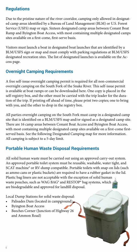
Regulations
Due to the pristine nature of the river cooridor, camping only allowed in designat-ed camp areas identified by a Bureau of Land Management (BLM) or U.S. Forest Service (USFS) map or sign. Sixteen designated camp areas between Conant Boat Ramp and Byington Boat Access, with most containing multiple designated camps sites available on a first-come, first-serve basis.
Visitors must launch a boat in designated boat launches that are identified by a BLM/USFS sign or map and must comply with parking regulations at BLM/USFS designated recreation sites. The list of designated launches is available on the Ac-cess page.
Overnight Camping Requirements
A free self-issue overnight camping permit is required for all non-commercial overnight camping on the South Fork of the Snake River. This self-issue permit is available at boat ramps or can be downloaded here. One copy is placed in the self-registry box, and the other must be carried with the trip leader for the dura-tion of the trip. If printing off ahead of time, please print two copies; one to bring with you, and the other to drop in the registry box.
All parties overnight camping on the South Fork must camp in a designated camp site that is identified on a BLM/USFS map and/or signed as a designated camp site. There are 16 camp areas between Conant Boat Access and Byington Boat Access, with most containing multiple designated camp sites available on a first-come first-served basis. See the following Designated Camping map for more information. All camping is subject to a 5-day limit.
Portable Human Waste Disposal Requirements
All solid human waste must be carried out using an approved carry-out system. An approved portable toilet system must be reusable, washable, water tight, and SCAT machine® or RV-dump compatible. Portable toilets with snap-on lids (such as ammo cans or plastic buckets) are required to have a rubber gasket in the lid. Plastic bag liners are not acceptable with the exception of solid human waste pouches, such as WAG BAG® and RESTOP® bag systems, which are biodegradable and approved for landfill disposal.
Local Dump Stations for solid waste disposal:• Palisades Dam (located in campground)• Byington Boat Access• Beeches Corner (Junction of Highway 26
and Ammon Road)
i
1
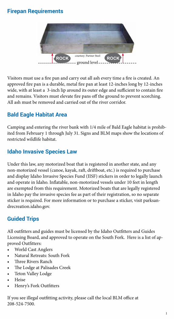
Firepan Requirements
Visitors must use a fire pan and carry out all ash every time a fire is created. An approved fire pan is a durable, metal fire pan at least 12-inches long by 12-inches wide, with at least a 3-inch lip around its outer edge and sufficient to contain fire and remains. Visitors must elevate fire pans off the ground to prevent scorching. All ash must be removed and carried out of the river corridor.
Bald Eagle Habitat Area
Camping and entering the river bank with 1/4 mile of Bald Eagle habitat is prohib-ited from February 1 through July 31. Signs and BLM maps show the locations of restricted wildlife habitat.
Idaho Invasive Species Law
Under this law, any motorized boat that is registered in another state, and any non-motorized vessel (canoe, kayak, raft, driftboat, etc.) is required to purchase and display Idaho Invasive Species Fund (IISF) stickers in order to legally launch and operate in Idaho. Inflatable, non-motorized vessels under 10 feet in length are exempted from this requirement. Motorized boats that are legally registered in Idaho pay the invasive species fee as part of their registration, so no separate sticker is required. For more information or to purchase a sticker, visit parksan-drecreation.idaho.gov.
Guided Trips
All outfitters and guides must be licensed by the Idaho Outfitters and Guides Licensing Board, and approved to operate on the South Fork. Here is a list of ap-proved Outfitters:• World Cast Anglers• Natural Retreats: South Fork• Three Rivers Ranch• The Lodge at Palisades Creek• Teton Valley Lodge• Heise• Henry’s Fork Outfitters
If you see illegal outfitting activity, please call the local BLM office at 208-524-7500.
courtesy: Partner Steel
ground levelROCK ROCK
Other Information
There is no cutting of trees allowed, including live or standing dead trees, for any reason along the river corridor.
State law requires one Coast Guard-approved Personal Flotation Device (PFD) for each person on your boat.
The Dry Beds Canal Diversion, 1.5 miles downstream from Byington access is extremely hazardous. The head gate is located on the south bank and nearly half of the river is funneled into it. Carefully float the north bank to safely avoid the diversion. Several water diversion structures are located 1/2 mile above the Bying-ton Boat Access to the confluence with the Henrys Fork. Do not attempt to boat near them. Diversions are shown on the maps. A boater’s guide is also available for purchase. Please call (208) 523-1012 for more information.
Swift water produces strong currents, standing waves, and frequent whirlpools that may overturn small boats and canoes. Boaters should avoid rocks, overhanging brush, fallen trees, log piles, bridge support piers, and irrigation canal diversions.
For more information on proper camping practices and safe boating practices, please visit the River Activities portion of this website, or visit www.lnt.org
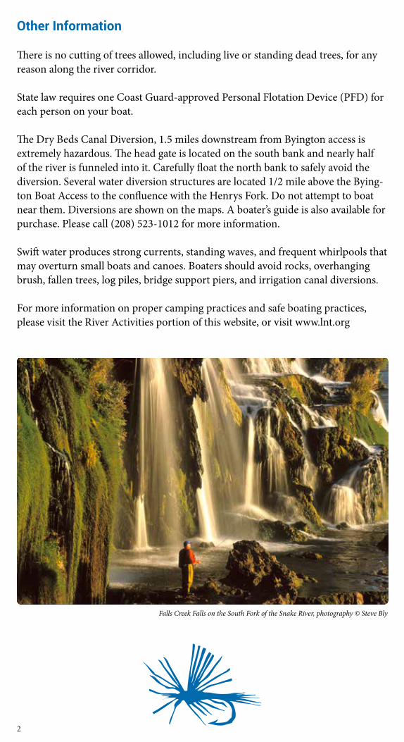
Falls Creek Falls on the South Fork of the Snake River, photography © Steve Bly
2
3
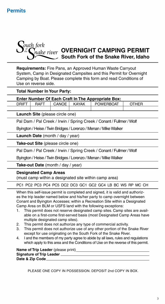
OVERNIGHT CAMPING PERMITSouth Fork of the Snake River, Idaho
Requirements: Fire Pans, an Approved Human Waste Carryout System, Camp in Designated Campsites and this Permit for Overnight Camping by Boat. Please complete this form and read Conditions of Use on reverse side.
Total Number In Your Party:
Enter Number Of Each Craft In The Appropriate Box:DRIFT RAFT CANOE KAYAK POWERBOAT OTHER
Launch Site (please circle one)
Pal Dam / Pal Creek / Irwin / Spring Creek / Conant / Fullmer / Wolf
Byington / Heise / Twin Bridges / Lorenzo / Menan / Mike Walker
Launch Date (month / day / year)
Take-out Site (please circle one)
Pal Dam / Pal Creek / Irwin / Spring Creek / Conant / Fullmer / Wolf
Byington / Heise / Twin Bridges / Lorenzo / Menan / Mike Walker
Take-out Date (month / day / year)
Designated Camp Areas (must camp within a designated site within camp area)
PC1 PC2 PC3 PC4 PC5 DC2 DC3 GC1 GC2 GC4 LB BC WS RP MC CH
When this self-issue permit is completed and signed, it is valid and authoriz-es the trip leader named below and his/her party to camp overnight between Conant and Byington Accesses; within a Recreation Site within a Designated Camp Area on BLM or USFS land with the following exceptions:1. This permit does not reserve designated camp sites. Camp sites are avail-
able on a first-come first-served basis (most Designated Camp Areas have multiple designated camp sites).
2. This permit does not authorize any type of commercial activity.3. This permit does not authorize use of any other portion of the Snake River
except for use originating on the South Fork of the Snake River.4. I and the members of my party agree to abide by all laws, rules and regulations
which apply to this area and the Conditions of Use on the reverse of this permit.
Name of Trip Leader (please print)Signature of Trip LeaderDate & Zip Code
PLEASE ONE COPY IN POSSESSION. DEPOSIT 2nd COPY IN BOX.
Permits
CONDITIONS OF USE
1. This permit is required for all non-commercial overnight camping on the South Fork of the Snake River between Conant and Byington Accesses.
2. The TRIP LEADER must have this permit in possession during the overnight river visit and display it upon request by the BLM or USFS personnel. The trip leader is responsible for the conduct of the members of his/her party for the duration of the stay, including their compliance with area regulations and these conditions of use.
3. You must launch a boat in designated boat launches that are identified by a BLM/USFS sign or map. You must comply with parking regulations at BLM/USFS designated recreation sites or identified by a BLM/USFS sign or map.
4. DESIGNATED CAMP SITES – All parties must camp in a designated camp site that is identified on a BLM/USFS map and/or signed as a designated camp site. There are 16 designated camp areas between Conant Boat Ramp and Byington Boat Access, with most containing multiple designated camp sites available on a first-come first-serve basis.
5. LENGTH OF STAY – All camping is subject to a five-day camping limit. 6. BALD EAGLE HABITAT AREA – Camping within a Bald Eagle habitat area is prohibited.
No camping is permitted within a 400-meter radius of an active Bald Eagle nest. These areas are closed to human entry from February 1 to July 31 each year. Bald Eagle nesting areas are indicated by a BLM/USFS sign or map.
7. IDAHO INVASIVE SPECIES LAW – Under this new law, any motorized boat that is registered in Idaho or another state, and any non-motorized vessel (canoe, kayak, raft, driftboat, etc.) is required to purchase and display Idaho Invasive Species Fund (IISF) stickers in order to legally launch and operate in Idaho. Inflatable, non-motorized vessels under 10 feet in length are exempted from this requirement.
8. HUMAN AND SOLID WASTE DISPOSAL – All solid human waste must be carried out using an approved carry-out system. An approved portable toilet system must be reusable, washable, water tight, and SCAT machine® or RV-dump compatible. Portable toilets with snap-on lids (such as ammo cans or plastic buckets) are required to have a rubber gasket in the lid. Plastic bag liners are not acceptable with the exception of solid human waste pouches, such as WAG BAG® and RESTOP® bag systems, which are biodegradable and approved for landfill disposal. Urinate at least 100 feet from any designated camp site; pref-erably urinate in the river.
9. FIREPAN REQUIREMENTS – You must use a fire pan and carry out all ash every time a fire is created. An approved fire pan is a durable, metal fire pan at least 12-inches long by 12-inches wide, with at least a 1.5-inch lip around its outer edge and sufficient to contain fire and remains. Visitors must elevate fire pans off the ground to prevent scorching. If the fire pan does not have legs to elevate, place rocks underneath the corners of the fire pan. All ash must be removed and carried out of the river corridor. Once the ash is cooled it can be placed in a container such as an ammo box, coffee can or trash bag. There is no cutting of trees allowed, including live or standing dead trees, for any reason along the river corridor.
10. GARBAGE AND WASTE WATER – Waste water should be strained to remove food parti-cles, then poured into a hole above the high-water mark. The hole must be covered before leaving camp. Food particles and microtrash (such as cigarette butts, cans, foil, condiment packages, and flip tops) shall be carried out of the river corridor with other waste. All garbage must be packed out of the river corridor.
11. FIREARMS AND FIREWORKS – Discharging firearms near or within an occupied area of the river or in an occupied camp is prohibited. Possession of and/or discharging fireworks is prohibited.
12. HISTORIC AND CULTURAL MATERIALS – Collection or vandalism of cultural sites and/or materials (any object over 50 years old) is strictly prohibited by Federal and State law.
13. PRIVATE LAND – Please respect private land along the river. Do not enter without permission of the land owner.
ADDITIONAL INFORMATION – Please contact the Bureau of Land Management (BLM), 1405 Hollipark Drive in Idaho Falls at 208-524-7500 or the Palisades Ranger District of the Cari-bou-Targhee National Forest, 3659 East Ririe Highway in Idaho Falls at 208-523-1412.
4
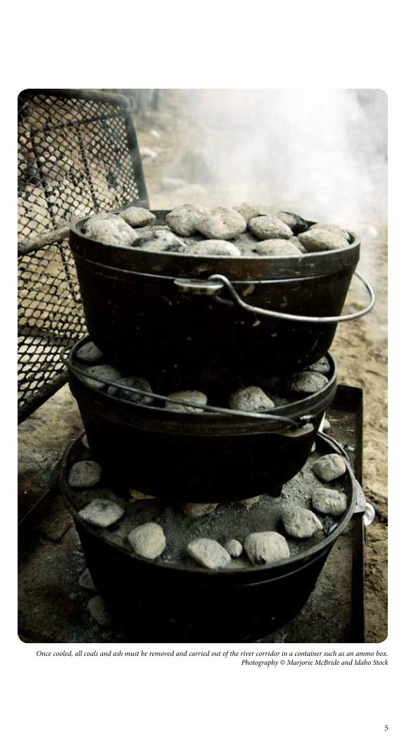
Once cooled, all coals and ash must be removed and carried out of the river corridor in a container such as an ammo box. Photography © Marjorie McBride and Idaho Stock
5
Wildlife of the South Fork
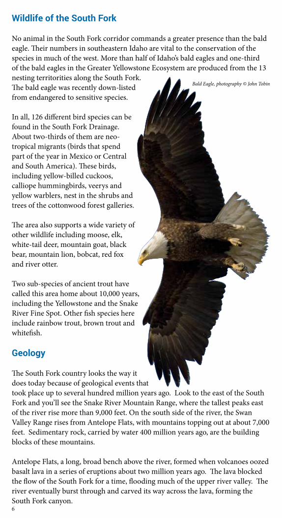
No animal in the South Fork corridor commands a greater presence than the bald eagle. Their numbers in southeastern Idaho are vital to the conservation of the species in much of the west. More than half of Idaho’s bald eagles and one-third of the bald eagles in the Greater Yellowstone Ecosystem are produced from the 13 nesting territorities along the South Fork. The bald eagle was recently down-listed from endangered to sensitive species.
In all, 126 different bird species can be found in the South Fork Drainage. About two-thirds of them are neo-tropical migrants (birds that spend part of the year in Mexico or Central and South America). These birds, including yellow-billed cuckoos, calliope hummingbirds, veerys and yellow warblers, nest in the shrubs and trees of the cottonwood forest galleries.
The area also supports a wide variety of other wildlife including moose, elk, white-tail deer, mountain goat, black bear, mountain lion, bobcat, red fox and river otter.
Two sub-species of ancient trout have called this area home about 10,000 years, including the Yellowstone and the Snake River Fine Spot. Other fish species here include rainbow trout, brown trout and whitefish.
Geology
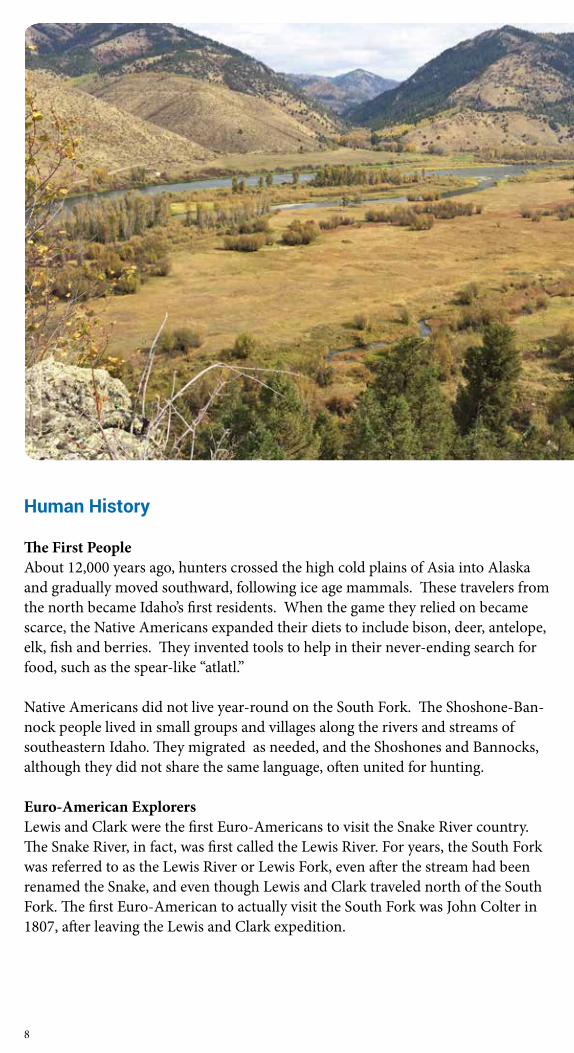
The South Fork country looks the way it does today because of geological events that took place up to several hundred million years ago. Look to the east of the South Fork and you’ll see the Snake River Mountain Range, where the tallest peaks east of the river rise more than 9,000 feet. On the south side of the river, the Swan Valley Range rises from Antelope Flats, with mountains topping out at about 7,000 feet. Sedimentary rock, carried by water 400 million years ago, are the building blocks of these mountains.
Antelope Flats, a long, broad bench above the river, formed when volcanoes oozed basalt lava in a series of eruptions about two million years ago. The lava blocked the flow of the South Fork for a time, flooding much of the upper river valley. The river eventually burst through and carved its way across the lava, forming the South Fork canyon.
Bald Eagle, photography © John Tobin
6
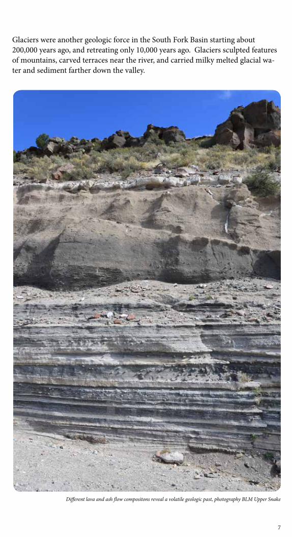
Glaciers were another geologic force in the South Fork Basin starting about 200,000 years ago, and retreating only 10,000 years ago. Glaciers sculpted features of mountains, carved terraces near the river, and carried milky melted glacial wa-ter and sediment farther down the valley.
Different lava and ash flow compositons reveal a volatile geologic past, photography BLM Upper Snake
7
Human History
The First People About 12,000 years ago, hunters crossed the high cold plains of Asia into Alaska and gradually moved southward, following ice age mammals. These travelers from the north became Idaho’s first residents. When the game they relied on became scarce, the Native Americans expanded their diets to include bison, deer, antelope, elk, fish and berries. They invented tools to help in their never-ending search for food, such as the spear-like “atlatl.”
Native Americans did not live year-round on the South Fork. The Shoshone-Ban-nock people lived in small groups and villages along the rivers and streams of southeastern Idaho. They migrated as needed, and the Shoshones and Bannocks, although they did not share the same language, often united for hunting.
Euro-American ExplorersLewis and Clark were the first Euro-Americans to visit the Snake River country. The Snake River, in fact, was first called the Lewis River. For years, the South Fork was referred to as the Lewis River or Lewis Fork, even after the stream had been renamed the Snake, and even though Lewis and Clark traveled north of the South Fork. The first Euro-American to actually visit the South Fork was John Colter in 1807, after leaving the Lewis and Clark expedition.
8
Euro-American TrappersThe hardships suffered by Colter, Robery Stuart and others did not diminish the hopes of other trappers. By 1818, Donald Mackenzie had established a base on Bear Lake. He led trappers into the Snake River country. Fierce competition developed between American and English trappers. Some of the most prominent names in western lore trapped in the area: Jedediah Smith, William Sublette, Jim Bridger, Etienne Provot and Osbourne Russell.
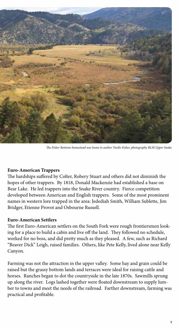
Euro-American SettlersThe first Euro-American settlers on the South Fork were rough frontiersmen look-ing for a place to build a cabin and live off the land. They followed no schedule, worked for no boss, and did pretty much as they pleased. A few, such as Richard “Beaver Dick” Leigh, raised families. Others, like Pete Kelly, lived alone near Kelly Canyon.
Farming was not the attraction in the upper valley. Some hay and grain could be raised but the grassy bottom lands and terraces were ideal for raising cattle and horses. Ranches began to dot the countryside in the late 1870s. Sawmills sprung up along the river. Logs lashed together were floated downstream to supply lum-ber to towns and meet the needs of the railroad. Farther downstream, farming was practical and profitable.
The Fisher Bottoms homestead was home to author Vardis Fisher, photography BLM Upper Snake
9
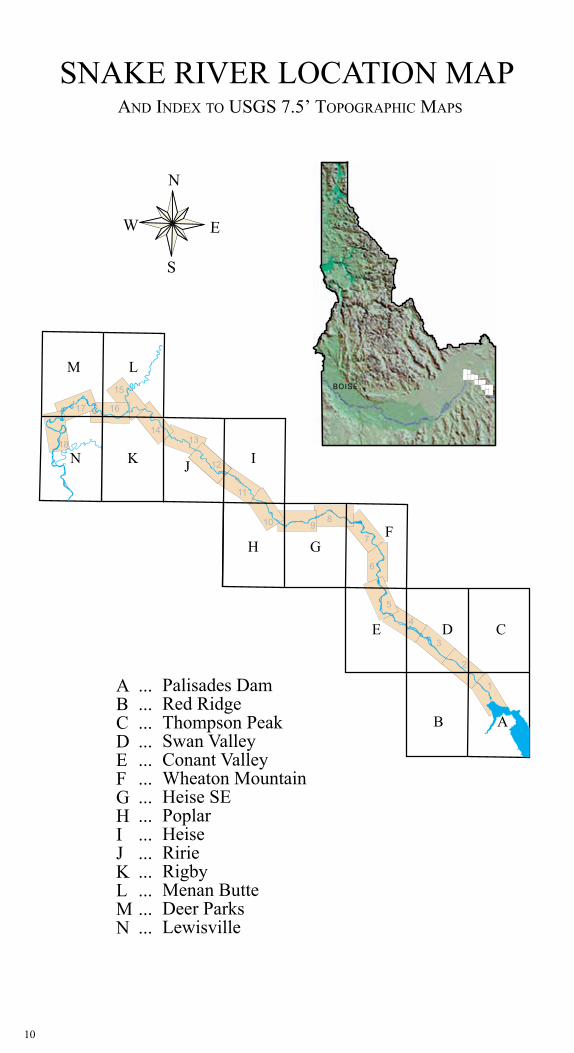
SNAKE RIVER LOCATION MAP
10
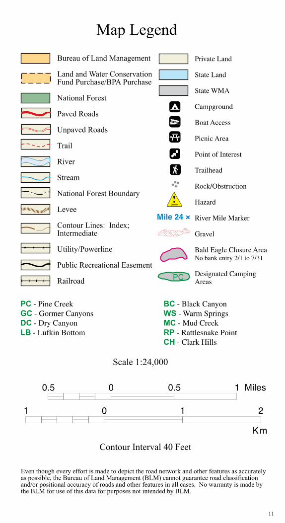
Private Land
State Land
State WMA
Campground
Boat Access
Picnic Area
Point of Interest
Trailhead
Rock/Obstruction
Hazard
River Mile Marker
Gravel
Bald Eagle Closure AreaNo bank entry 2/1 to 7/31
Designated Camping Areas
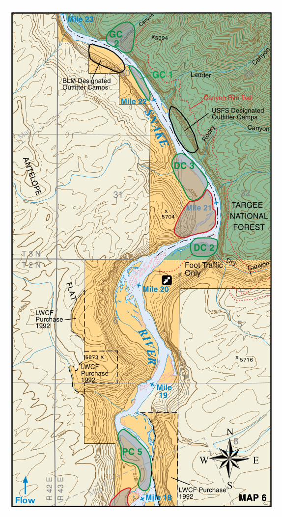
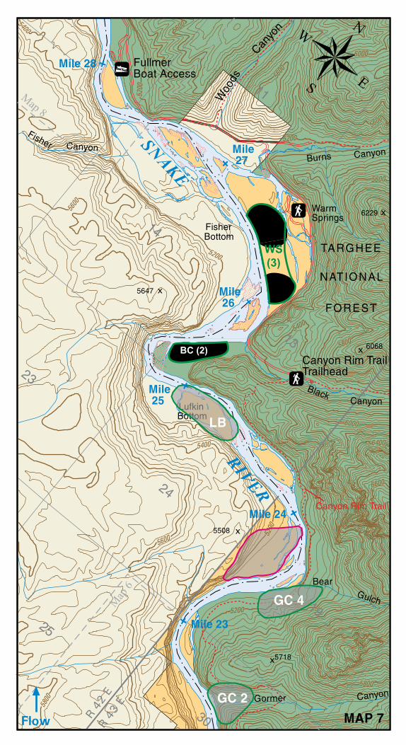
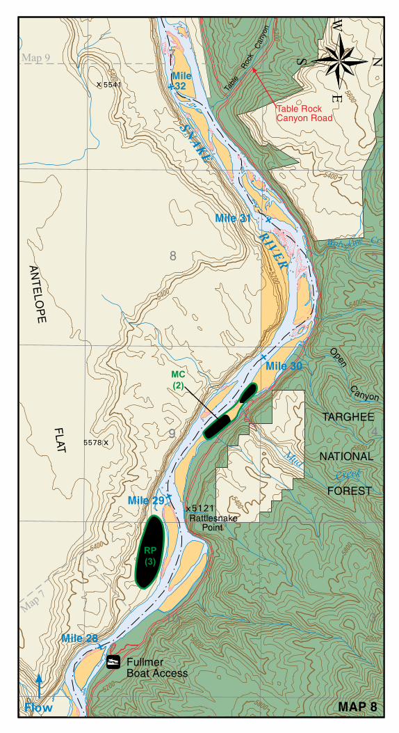
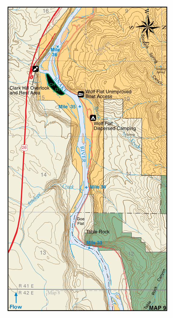
PC - Pine Creek BC - Black CanyonGC - Gormer Canyons WS - Warm SpringsDC - Dry Canyon MC - Mud CreekLB - Lufkin Bottom RP - Rattlesnake Point CH - Clark Hills
11
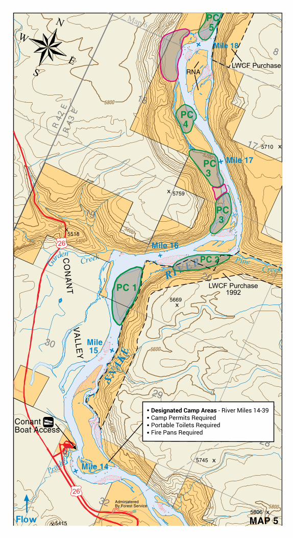
Designated Camp Areas - River Miles 14-39Camp Permits RequiredPortable Toilets RequiredFire Pans Required
WS(3)
BC (2)
RP(3)
MC(2)
CH (2)
Bureau of Land ManagementUpper Snake Field Office
1405 Hollipark DriveIdaho Falls, ID 83401
208-524-7500
Front Cover © Steve Bly | Back Cover © Glenn Oakley