Embed Size (px)
Citation preview
Spatial Measurement Spatial Measurement of Residential of Residential SegregationSegregation
Flávia F. Feitosa1, Gilberto Câmara1, Antônio M. V. Monteiro1, Thomas Koschitzki2, Marcelino P. S. Silva1,3
1 Instituto Nacional de Pesquisas Espaciais2 Martin-Luther Universität – Institut für Geographie
3 Universidade Estadual do Rio Grande do Norte
IV Brazilian Symposium on GeoInformatics. Campos do Jordão, November 22-24, 2004
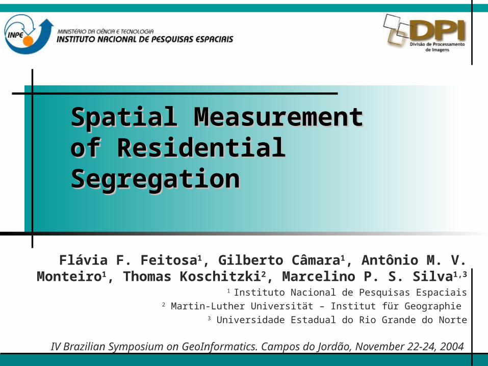
What is Segregation?What is Segregation?
Segregation is the separation between different social groups
Why Measure Segregation?Why Measure Segregation?
Measure segregation is necessary
Understand segregation betterPatterns, causes and consequences
Useful for public policiesHousing policiesInfrastructure policiesLand speculation control
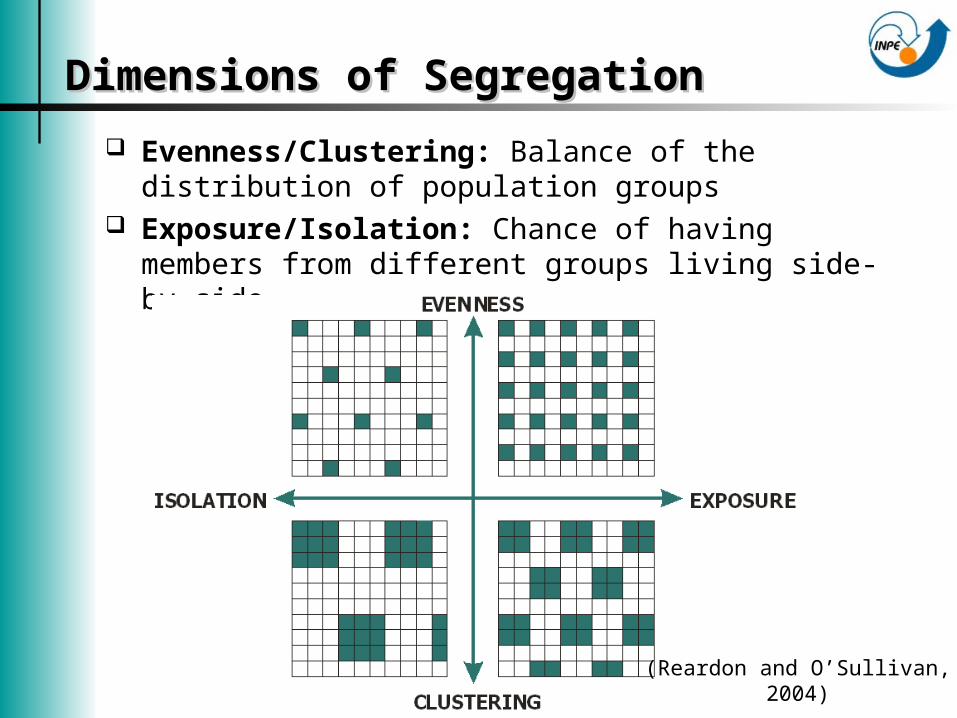
Dimensions of SegregationDimensions of Segregation
Evenness/Clustering: Balance of the distribution of population groups
Exposure/Isolation: Chance of having members from different groups living side-by-side
(Reardon and O’Sullivan, 2004)
Global MeasuresGlobal Measures
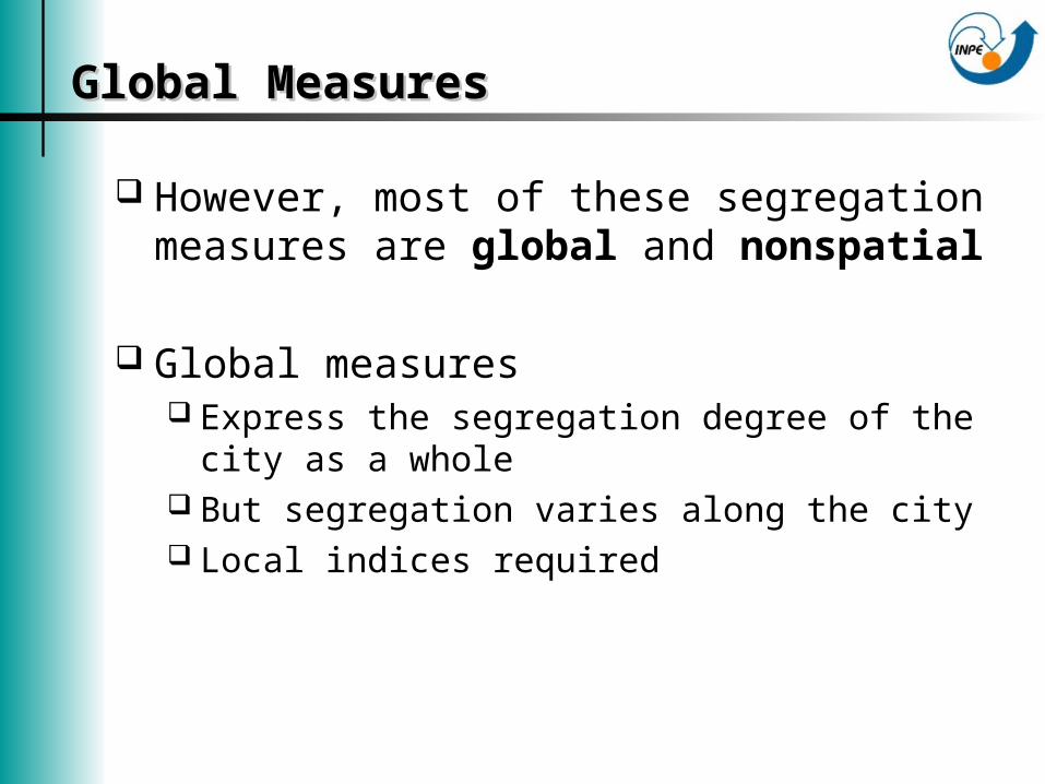
However, most of these segregation measures are global and nonspatial
Global measures Express the segregation degree of the city as
a whole But segregation varies along the city Local indices required
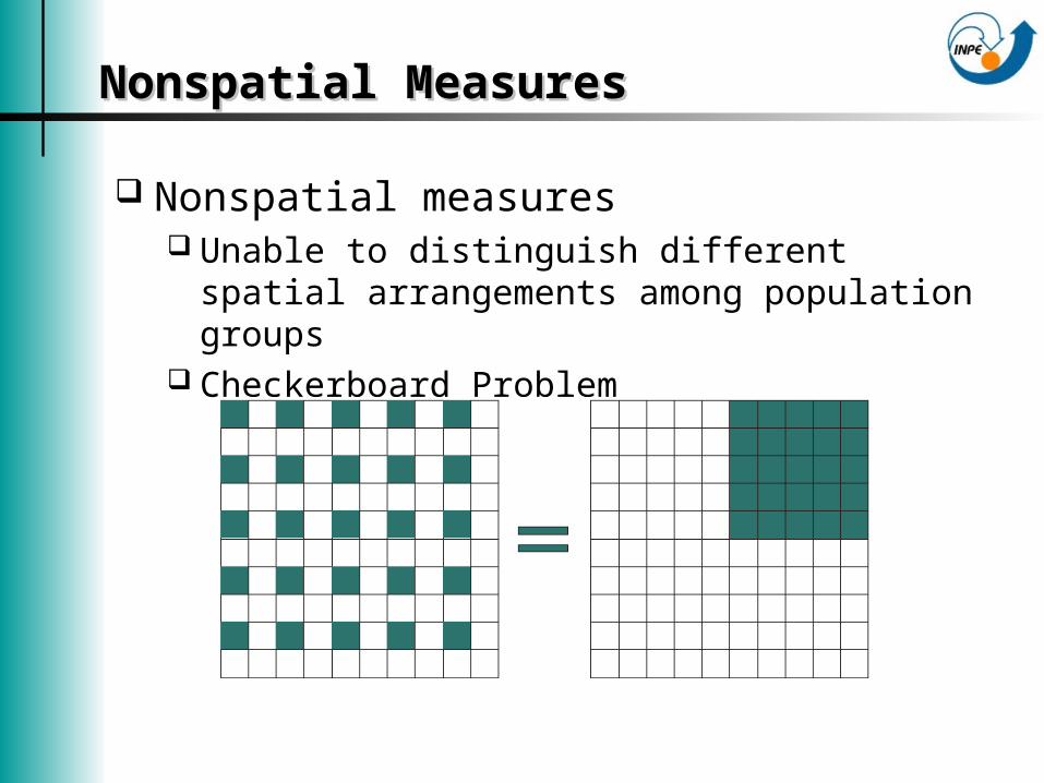
Nonspatial MeasuresNonspatial Measures
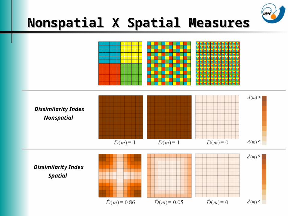
Nonspatial measures Unable to distinguish different spatial
arrangements among population groups Checkerboard Problem
Aim of this WorkAim of this Work
Build spatial measures of segregation Extend existing measures to enable the use
of geographical information in their formulation
Propose local measures of segregation Decomposition of the new spatial indices
Building Spatial MeasuresBuilding Spatial Measures
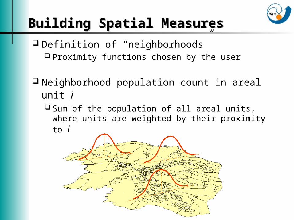
Definition of “neighborhoods” Proximity functions chosen by the user
Neighborhood population count in areal unit i Sum of the population of all areal units, where
units are weighted by their proximity to i
Building Spatial MeasuresBuilding Spatial Measures
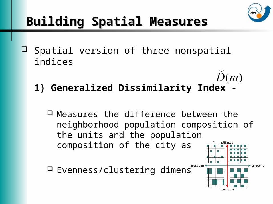
Spatial version of three nonspatial indices
1) Generalized Dissimilarity Index -
Measures the difference between the neighborhood population composition of the units and the population composition of the city as a whole
Evenness/clustering dimension
Building Spatial MeasuresBuilding Spatial Measures
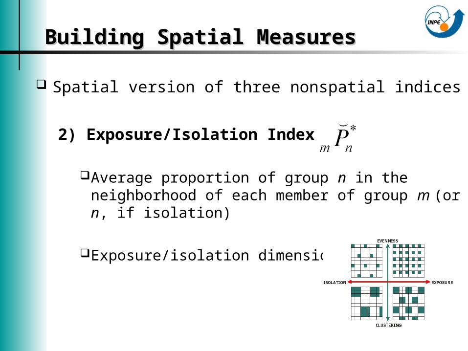
Spatial version of three nonspatial indices
2) Exposure/Isolation Index -
Average proportion of group n in the neighborhood of each member of group m (or n, if isolation)
Exposure/isolation dimension
Building Spatial MeasuresBuilding Spatial Measures
Spatial version of three nonspatial indices
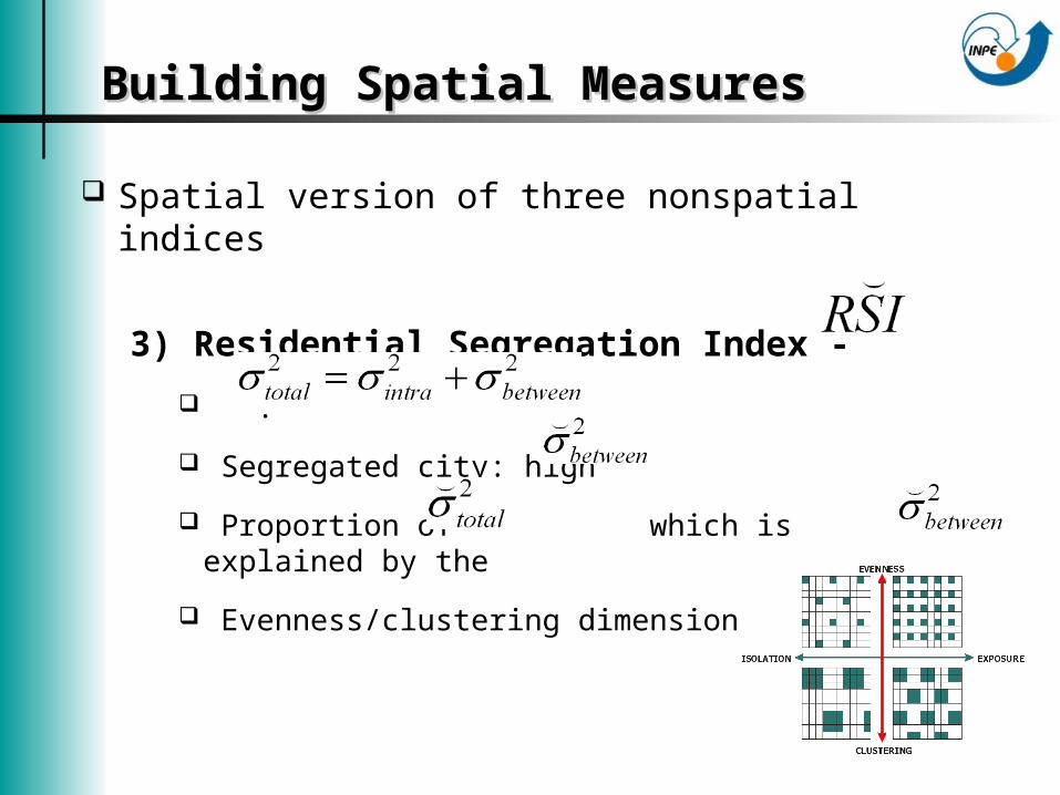
3) Residential Segregation Index -
.
Segregated city: high
Proportion of which is explained by the
Evenness/clustering dimension
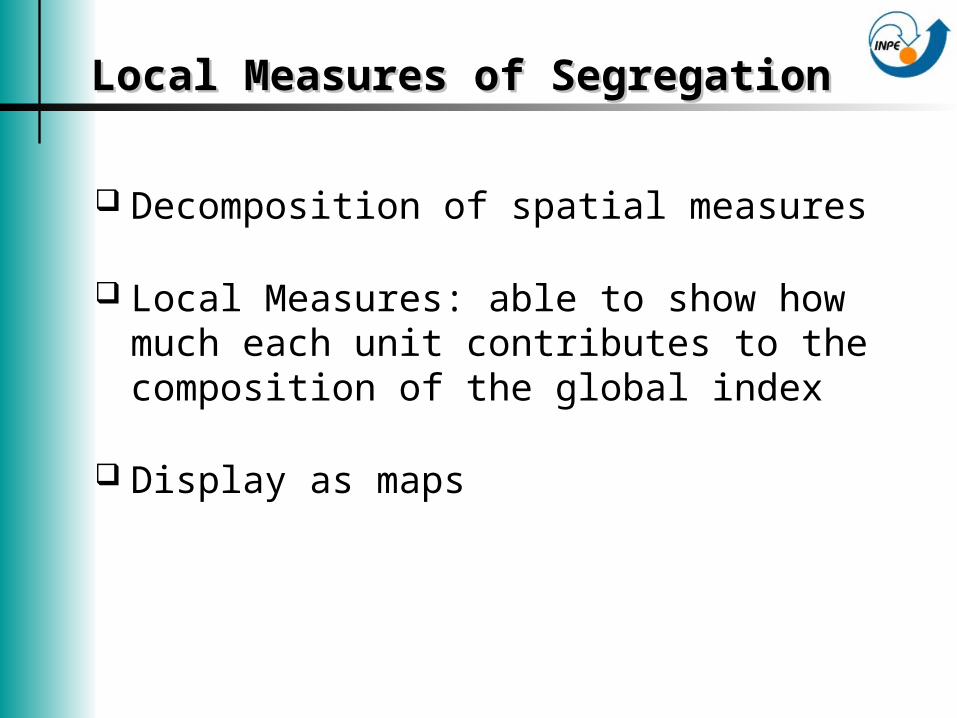
Local Measures of SegregationLocal Measures of Segregation
Decomposition of spatial measures
Local Measures: able to show how much each unit contributes to the composition of the global index
Display as maps
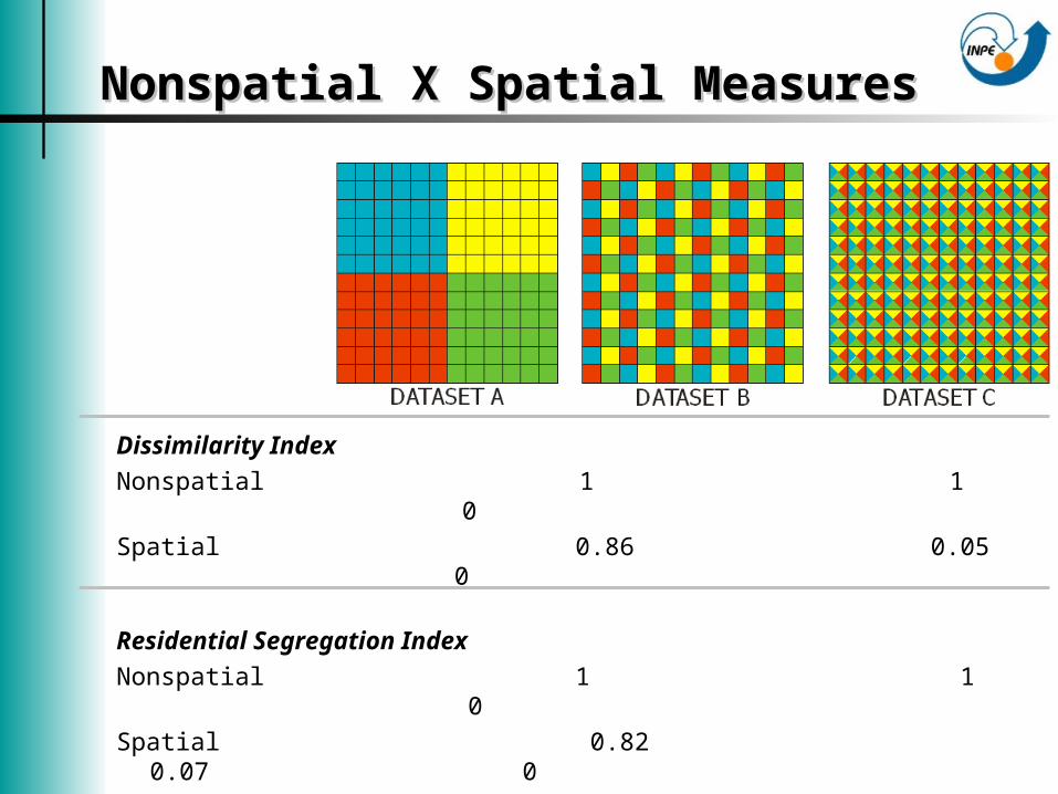
Nonspatial X Spatial MeasuresNonspatial X Spatial Measures
Dissimilarity IndexNonspatial 1 1 0Spatial 0.86 0.05 0
Residential Segregation IndexNonspatial 1 1 0Spatial 0.82 0.07 0
Nonspatial X Spatial MeasuresNonspatial X Spatial Measures
Dissimilarity Index
Nonspatial
Dissimilarity Index
Spatial
Case StudyCase Study
Segregation in São José dos Campos – SP Years: 1991 and 2000
Income of householders = socioeconomic status of the families
Neighborhood population count of each unit
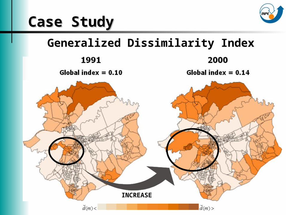
Case StudyCase StudyGeneralized Dissimilarity Index
INCREASE

Case StudyCase Study
Isolation Index of “Rich families”1991
Global index = 0.20
2000
Global index = 0.28
INCREASE
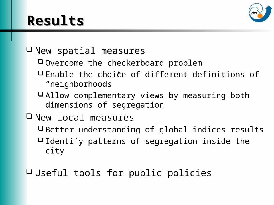
ResultsResults
New spatial measures Overcome the checkerboard problem Enable the choice of different definitions of
“neighborhoods” Allow complementary views by measuring both
dimensions of segregation New local measures
Better understanding of global indices results Identify patterns of segregation inside the city
Useful tools for public policies
Spatial Measurement Spatial Measurement of Residential of Residential SegregationSegregation
Flávia F. Feitosa1*, Gilberto Câmara1, Antônio M. V. Monteiro1, Thomas Koschitzki2, Marcelino P. S. Silva1,3
1 Instituto Nacional de Pesquisas Espaciais2 Martin-Luther Universität – Institut für Geographie
3 Universidade Estadual do Rio Grande do Norte
*E-mail address: [email protected]