Embed Size (px)
Citation preview

/65
Institute of Information and Communication Technologies
Bulgarian Academy of Sciences
University of Pavia March 2017 1
Navigation
Kiril Alexiev
/65
Institute of Information and Communication Technologies
Bulgarian Academy of Sciences
University of Pavia March 2017
Navigation
2
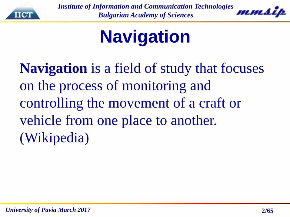
Navigation is a field of study that focuses
on the process of monitoring and
controlling the movement of a craft or
vehicle from one place to another.
(Wikipedia)

/65
Institute of Information and Communication Technologies
Bulgarian Academy of Sciences
University of Pavia March 2017
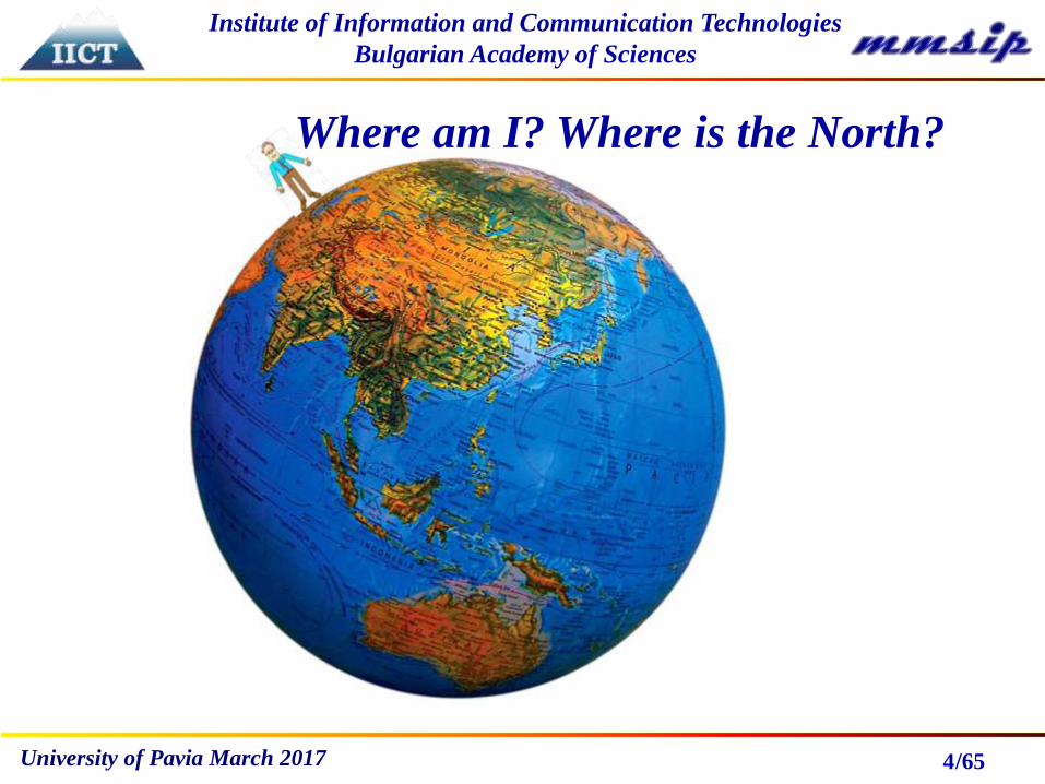
Navigation includes:
- Determination of position (Where am I?)
- Orienteering (Where is the North?).
3
/65
Institute of Information and Communication Technologies
Bulgarian Academy of Sciences
University of Pavia March 2017 4
Where am I? Where is the North?

/65
Institute of Information and Communication Technologies
Bulgarian Academy of Sciences
University of Pavia March 2017
Once upon a time (6000 years ago)…
5
/65
Institute of Information and Communication Technologies
Bulgarian Academy of Sciences
University of Pavia March 2017 6
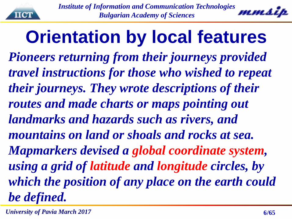
Orientation by local featuresPioneers returning from their journeys provided
travel instructions for those who wished to repeat
their journeys. They wrote descriptions of their
routes and made charts or maps pointing out
landmarks and hazards such as rivers, and
mountains on land or shoals and rocks at sea.
Mapmarkers devised a global coordinate system,
using a grid of latitude and longitude circles, by
which the position of any place on the earth could
be defined.

/65
Institute of Information and Communication Technologies
Bulgarian Academy of Sciences
University of Pavia March 2017
Orientation by local features
7

/65
Institute of Information and Communication Technologies
Bulgarian Academy of Sciences
University of Pavia March 2017
In darkness…pharos(lighthouse)
8
/65
Institute of Information and Communication Technologies
Bulgarian Academy of Sciences
University of Pavia March 2017
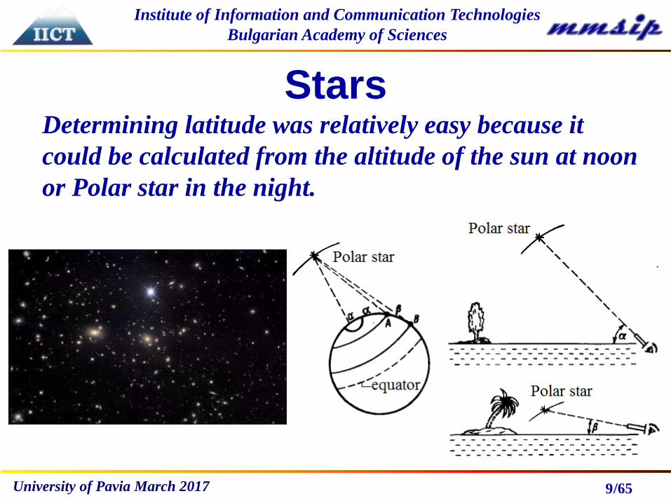
Stars
9
Determining latitude was relatively easy because it
could be calculated from the altitude of the sun at noon
or Polar star in the night.
/65
Institute of Information and Communication Technologies
Bulgarian Academy of Sciences
University of Pavia March 2017
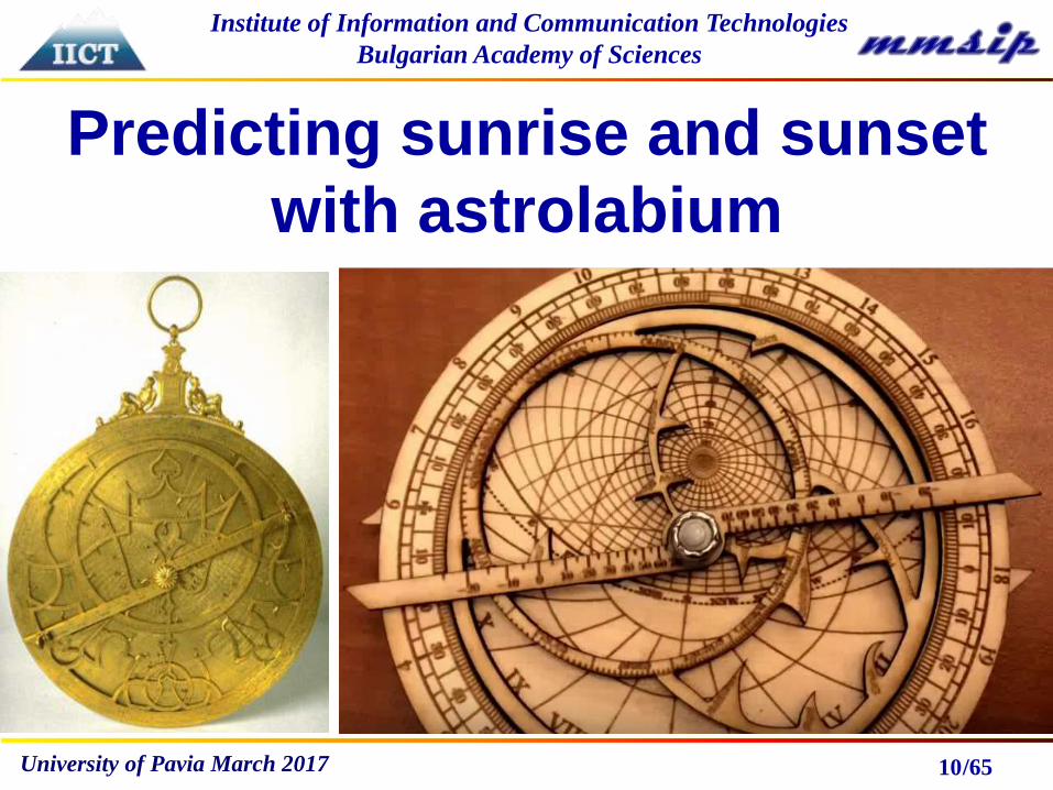
Predicting sunrise and sunset
with astrolabium
10

/65
Institute of Information and Communication Technologies
Bulgarian Academy of Sciences
University of Pavia March 2017 11
Inventor Claudius Ptolemaeus
c. AD 100 – c. 170

/65
Institute of Information and Communication Technologies
Bulgarian Academy of Sciences
University of Pavia March 2017
Ballastella
12

/65
Institute of Information and Communication Technologies
Bulgarian Academy of Sciences
University of Pavia March 2017
Compass
13
Chinise chariot with lodestone
figure, pointing to the North

/65
Institute of Information and Communication Technologies
Bulgarian Academy of Sciences
University of Pavia March 2017 14
/65
Institute of Information and Communication Technologies
Bulgarian Academy of Sciences
University of Pavia March 2017
Finding the longitude
15
Finding an accurate and reliable method of determining
longitude took centuries of study, and involved some of the
greatest scientific minds in human history. Time equals
longitude. Finding apparent local time is relatively easy.
The problem, ultimately, was how to determine the time at a
distant reference point while on a ship. In 1612, having
determined the orbital periods of Jupiter's four brightest
satellites, Galileo proposed that with sufficiently accurate
knowledge of their orbits one could use their positions as a
universal clock, which would make possible the
determination of longitude.But these observation were
complicated to be done on ship.

/65
Institute of Information and Communication Technologies
Bulgarian Academy of Sciences
University of Pavia March 2017
Summary
16
Until now we learnt how to orientate using local
features, how to find sunrise and sunset (the position
latitude), how to point North magnetic Pole and North
Pole. But we could not estimate yet our longitude. To
measure the longitude we have to measure by accurate
hronometer the difference between the local time of the
previous place and current local one.
In July 1714 the British Parliament passed the
Longitude Act and this established a Board of Longitude
which offered a £20,000 prize for the person who could
invent a means of calculating longitude.
/65
Institute of Information and Communication Technologies
Bulgarian Academy of Sciences
University of Pavia March 2017
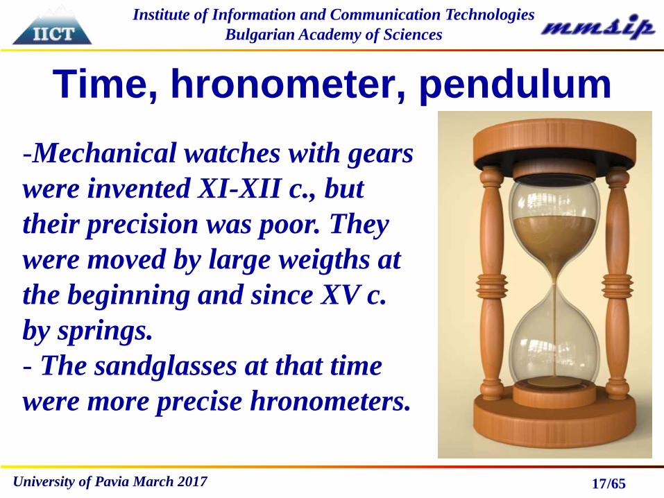
Time, hronometer, pendulum
17
-Mechanical watches with gears
were invented XI-XII c., but
their precision was poor. They
were moved by large weigths at
the beginning and since XV c.
by springs.
- The sandglasses at that time
were more precise hronometers.

/65
Institute of Information and Communication Technologies
Bulgarian Academy of Sciences
University of Pavia March 2017
Pendulum
18
A pendulum is an object hung from a fixed point that
swings back and forth under the action of gravity. The
swing continues moving back and forth without any
extra outside help until friction (between the air and
the swing and between the chains and the attachment
points) slows it down and eventually stops it. The
period of the pendulum depends on the force of
gravity, as well as the length of the pendulum. It
doesn’t depend on weight and on the arc of swing.
/65
Institute of Information and Communication Technologies
Bulgarian Academy of Sciences
University of Pavia March 2017
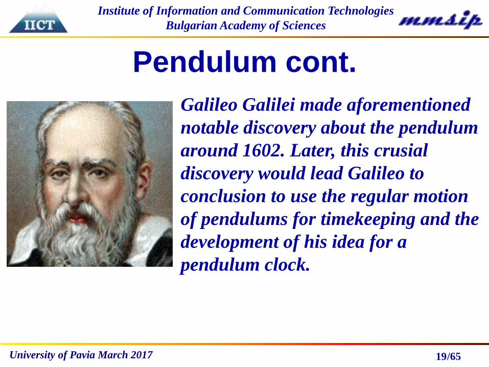
Pendulum cont.
19
Galileo Galilei made aforementioned
notable discovery about the pendulum
around 1602. Later, this crusial
discovery would lead Galileo to
conclusion to use the regular motion
of pendulums for timekeeping and the
development of his idea for a
pendulum clock.

/65
Institute of Information and Communication Technologies
Bulgarian Academy of Sciences
University of Pavia March 2017
Pendulum clock
20
In 1656 the Dutch scientist
Christiaan Huygens built the first
pendulum clock. This was a great
improvement over existing
mechanical clocks; their best
accuracy was increased from around
15 minutes deviation a day to around
15 seconds a day. Drawback - even
small change of temperature leads to
a change of pendulum length and
period.

/65
Institute of Information and Communication Technologies
Bulgarian Academy of Sciences
University of Pavia March 2017
Pendulum clock
21
In 1673 Huygens published
Horologium Oscillatorium sive de
motu pendulorum. Huygens was the
first to derive the formula for the
period of an ideal mathematical
pendulum. He later used spiral
springs and balancing wheel in more
conventional watches, made for him
by Thuret in Paris from around
1675.
/65
Institute of Information and Communication Technologies
Bulgarian Academy of Sciences
University of Pavia March 2017
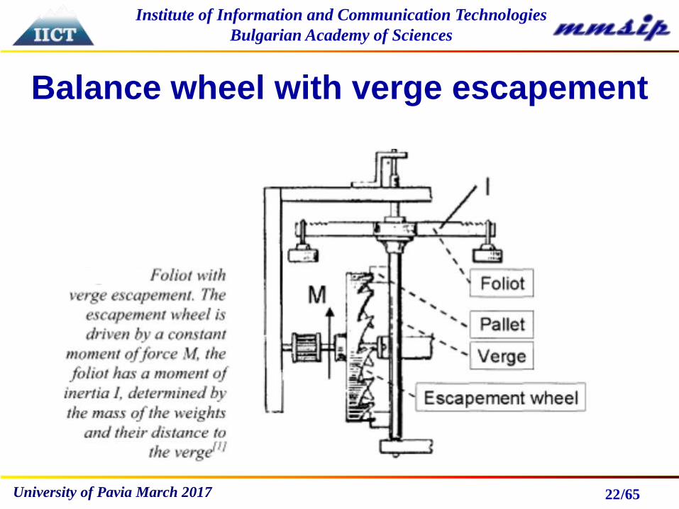
Balance wheel with verge escapement
22
/65
Institute of Information and Communication Technologies
Bulgarian Academy of Sciences
University of Pavia March 2017
After XVII c. …
23
• More ships were made of Steel and Iron
• They have their own magnetic field that can effect
changes in the ship’s magnetic compass
• Determined by angle in which the Keel is laid during
initial construction
• Equipment – electric/electronic can also cause
deviation
• The ships became with higher speed and more
maneuverable, compass is sensitive to accelerations

/65
Institute of Information and Communication Technologies
Bulgarian Academy of Sciences
University of Pavia March 2017
Spinning top
24
A spinning top is a toy designed to spin rapidly on
the ground, the motion of which causes it to
remain precisely balanced on its tip because of its
rotational inertia. Such toys have existed since
antiquity.

/65
Institute of Information and Communication Technologies
Bulgarian Academy of Sciences
University of Pavia March 2017
Spinning top
25
Euler was one of the most eminent
mathematicians of the 18th century.
Spinning top effect was theoretically
investigated by Euler in 1765, in the
book “Теория движения твердых
тел”
/65
Institute of Information and Communication Technologies
Bulgarian Academy of Sciences
University of Pavia March 2017
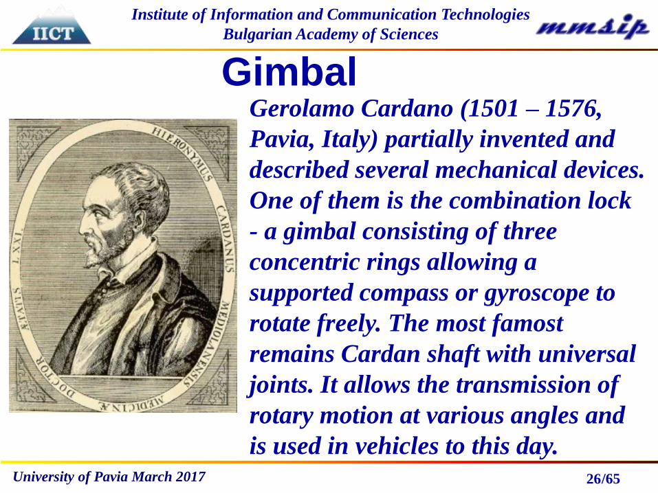
Gimbal
26
Gerolamo Cardano (1501 – 1576,
Pavia, Italy) partially invented and
described several mechanical devices.
One of them is the combination lock
- a gimbal consisting of three
concentric rings allowing a
supported compass or gyroscope to
rotate freely. The most famost
remains Cardan shaft with universal
joints. It allows the transmission of
rotary motion at various angles and
is used in vehicles to this day.

/65
Institute of Information and Communication Technologies
Bulgarian Academy of Sciences
University of Pavia March 2017 27

/65
Institute of Information and Communication Technologies
Bulgarian Academy of Sciences
University of Pavia March 2017
Leon Foucault Gyroscope
28
A gyroscope is a spinning wheel or
disc in which the axis of rotation is
free to assume any orientation by
itself. L. Foucault first conceived of
the gyro as an inertial reference in
1851. In 1890, one other event was
to set the stage for the practical
application of the gyrocompass; the
development of the first electrically
driven gyroscope by G.M. Hopkins.

/65
Institute of Information and Communication Technologies
Bulgarian Academy of Sciences
University of Pavia March 2017 29
/65
Institute of Information and Communication Technologies
Bulgarian Academy of Sciences
University of Pavia March 2017
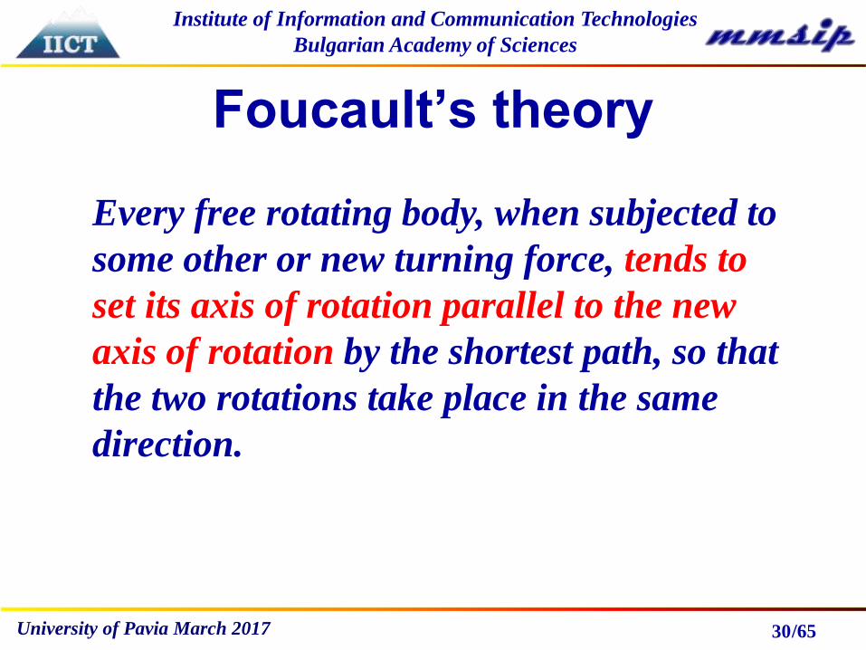
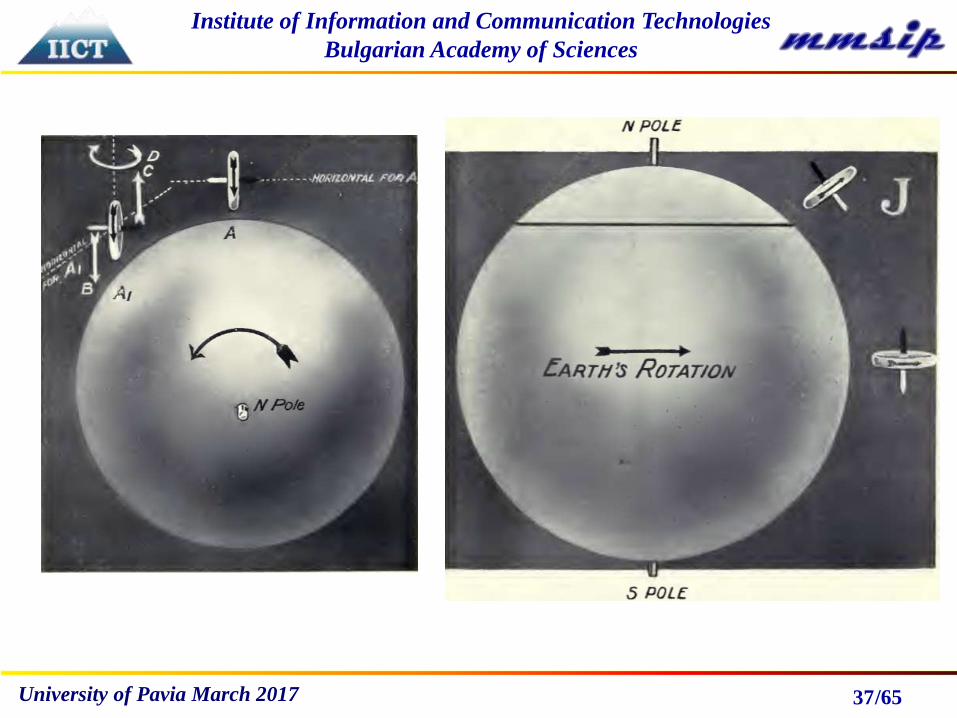
Foucault’s theory
30
Every free rotating body, when subjected to
some other or new turning force, tends to
set its axis of rotation parallel to the new
axis of rotation by the shortest path, so that
the two rotations take place in the same
direction.
/65
Institute of Information and Communication Technologies
Bulgarian Academy of Sciences
University of Pavia March 2017
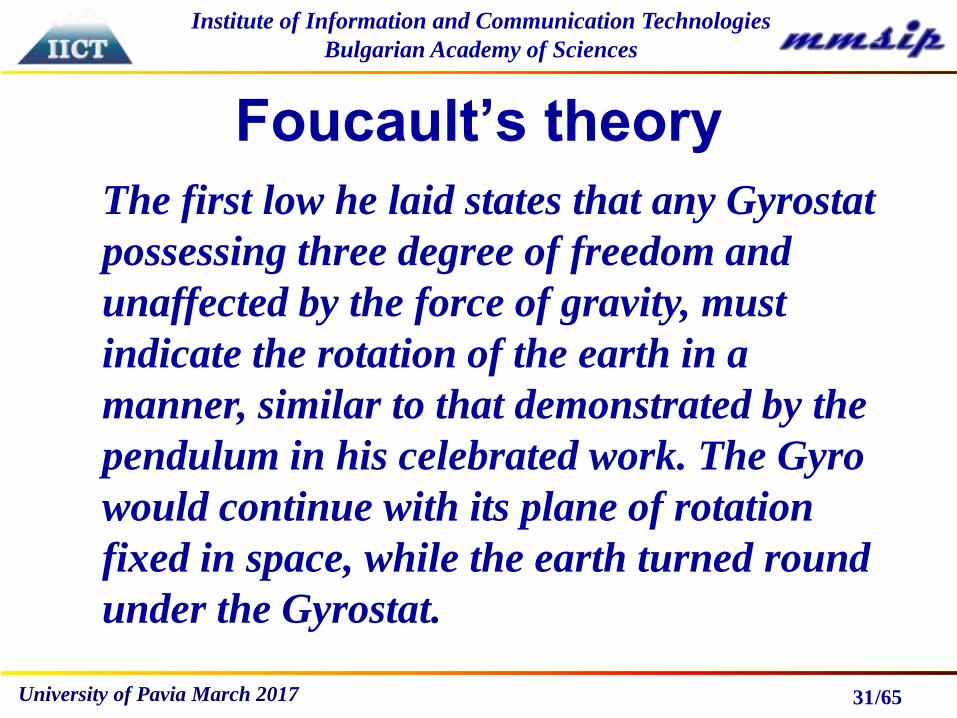
Foucault’s theory
31
The first low he laid states that any Gyrostat
possessing three degree of freedom and
unaffected by the force of gravity, must
indicate the rotation of the earth in a
manner, similar to that demonstrated by the
pendulum in his celebrated work. The Gyro
would continue with its plane of rotation
fixed in space, while the earth turned round
under the Gyrostat.

/65
Institute of Information and Communication Technologies
Bulgarian Academy of Sciences
University of Pavia March 2017
Foucault’s theory
32
He further arrived at the conclusion that any
Gyro with only two degree of freedom, free to
move in two planes only, will at any place on
the earth’s surface, other than two poles, tend
to set itself with its axis of rotation parallel to
the axis of the earth itself, by reason of relative
rotations of the two bodies.
/65
Institute of Information and Communication Technologies
Bulgarian Academy of Sciences
University of Pavia March 2017
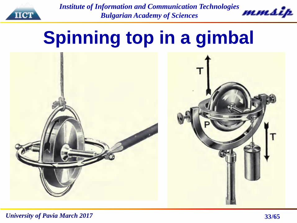
Spinning top in a gimbal
33

/65
Institute of Information and Communication Technologies
Bulgarian Academy of Sciences
University of Pavia March 2017 34
/65
Institute of Information and Communication Technologies
Bulgarian Academy of Sciences
University of Pavia March 2017
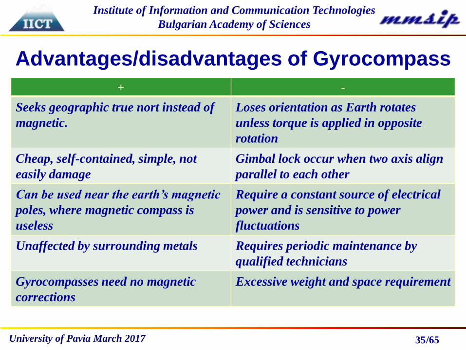
Advantages/disadvantages of Gyrocompass
35
+ -
Seeks geographic true nort instead of
magnetic.
Loses orientation as Earth rotates
unless torque is applied in opposite
rotation
Cheap, self-contained, simple, not
easily damage
Gimbal lock occur when two axis align
parallel to each other
Can be used near the earth’s magnetic
poles, where magnetic compass is
useless
Require a constant source of electrical
power and is sensitive to power
fluctuations
Unaffected by surrounding metals Requires periodic maintenance by
qualified technicians
Gyrocompasses need no magnetic
corrections
Excessive weight and space requirement

/65
Institute of Information and Communication Technologies
Bulgarian Academy of Sciences
University of Pavia March 2017 36
/65
Institute of Information and Communication Technologies
Bulgarian Academy of Sciences
University of Pavia March 2017 37

/65
Institute of Information and Communication Technologies
Bulgarian Academy of Sciences
University of Pavia March 2017
Trouve's
gyrocompass 1865
38
Hopkins Gyro 1878
(electric)
/65
Institute of Information and Communication Technologies
Bulgarian Academy of Sciences
University of Pavia March 2017
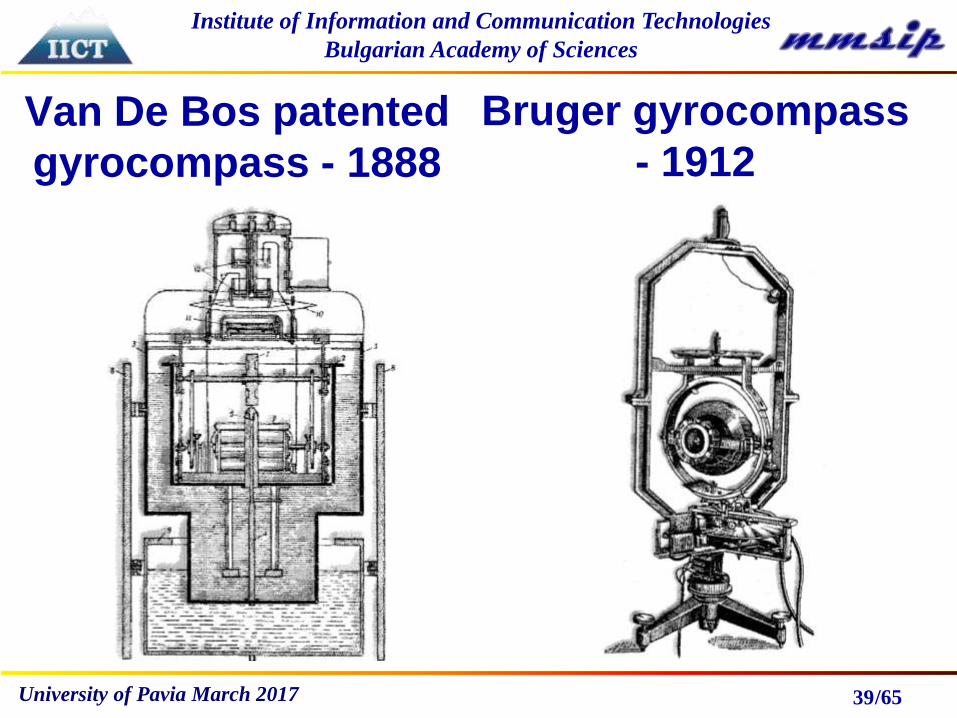
Van De Bos patented
gyrocompass - 1888
39
Bruger gyrocompass
- 1912
/65
Institute of Information and Communication Technologies
Bulgarian Academy of Sciences
University of Pavia March 2017
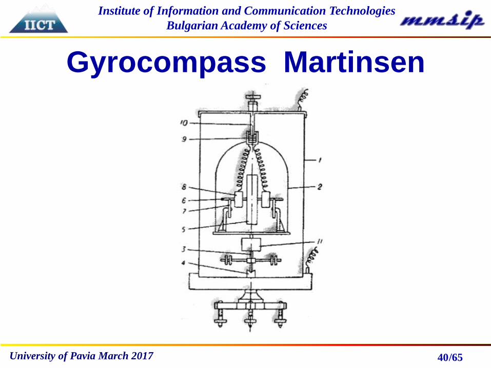
Gyrocompass Martinsen
40
/65
Institute of Information and Communication Technologies
Bulgarian Academy of Sciences
University of Pavia March 2017
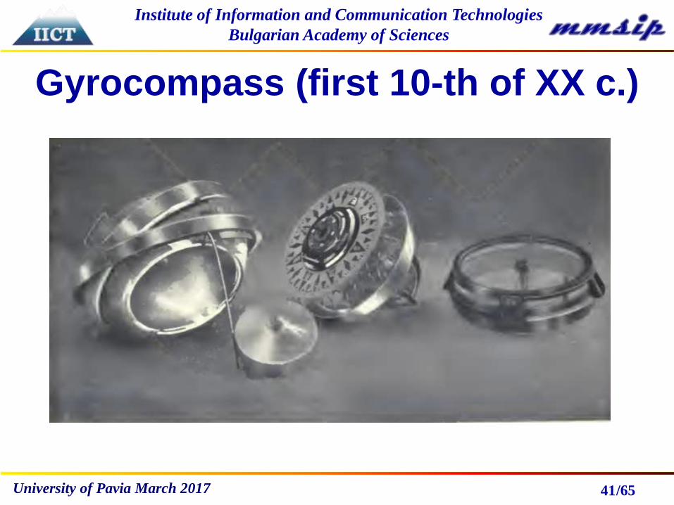
Gyrocompass (first 10-th of XX c.)
41

/65
Institute of Information and Communication Technologies
Bulgarian Academy of Sciences
University of Pavia March 2017
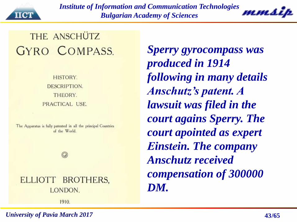
Two companies produced
gyrocompasses:Anshutz Sperry
42
/65
Institute of Information and Communication Technologies
Bulgarian Academy of Sciences
University of Pavia March 2017 43
Sperry gyrocompass was
produced in 1914
following in many details
Anschutz’s patent. A
lawsuit was filed in the
court agains Sperry. The
court apointed as expert
Еinstеin. The company
Anschutz received
compensation of 300000
DM.

/65
Institute of Information and Communication Technologies
Bulgarian Academy of Sciences
University of Pavia March 2017
Shuller theorem
44
Dr. Maximilian Schuler (a German scientist
active during the early 1900's time period)
reasoned condition when a pendulum would
remain vertical under random horizontal
acceleration of the suspension point.

/65
Institute of Information and Communication Technologies
Bulgarian Academy of Sciences
University of Pavia March 2017
Shuller theorem
45
but
then
s

/65
Institute of Information and Communication Technologies
Bulgarian Academy of Sciences
University of Pavia March 2017 46
INERTIAL NAVIGATION SYSTEMSINS are completely self-contained navigation system
capable of providing navigation without reference to
external information sources.
- The most complex and expensive flightdeck navigation
system currently in use.
- Developed for the military – accurate dead-reckoning
system, reliable, not susceptible to signal jamming or
erroneous signal transmission.
- Extremely simple in concept, extremely complicated in
execution.
-Still the navigation system of choice for many operations.

/65
Institute of Information and Communication Technologies
Bulgarian Academy of Sciences
University of Pavia March 2017
Dead reckoning
47
Dead reckoning (also ded for deduced reckoning or
DR) is the process of calculating one's current
position by using a previously determined position,
or fix, and advancing that position based upon
known or estimated speeds over elapsed time and
course. The mathematical term is path integration.
The main drawback – accumulation of errors.

/65
Institute of Information and Communication Technologies
Bulgarian Academy of Sciences
University of Pavia March 2017 48
- Starts from a known point, estimates next position based
on speed, direction and time.
- Uses acceleration and rotation velocity (changes in
speed & direction) in place of speed itself.
- Movement is detected by accelerometers mounted on a
stable platform (Stabilized gyroscopically, gimbal INS).
-Accelerometers are like pendulums but more
sophisticated, using sliding shutters with frictionless
bearings. Now MEMS realized accelerometers can detect
velocity changes up to 1,000 times greater than g.
INERTIAL NAVIGATION SYSTEMS
/65
Institute of Information and Communication Technologies
Bulgarian Academy of Sciences
University of Pavia March 2017 49
- The most critical element is platform stability.
- Gyros are of primary importance.
- Accelerometer technology fairly static; advances now
are mostly in gyro technology, especially Ring Laser
Gyros.
INERTIAL NAVIGATION SYSTEMS

/65
Institute of Information and Communication Technologies
Bulgarian Academy of Sciences
University of Pavia March 2017 50
Inertial navigation systems were originally developed for rockets.
American rocketry pioneer Robert Goddard experimented with
rudimentary gyroscopic systems. Inertial guidance using
gyroscopes saw its first use in a ballistic missile after Germany’s
defeat in World War I. This method of guidance was referred to as
“black box” navigation, as it could operate without any input from
its surroundings (such as from radio or the stars). Black box
navigation was considered superior over other methods because it
was not subject to outside influence. Real implementation of INS
realized Wernher von Braun. He designed V2 guidance systems
combined two gyroscopes and a lateral accelerometer with a simple
analog computer to adjust the azimuth for the rocket in flight.
INERTIAL NAVIGATION SYSTEMS
/65
Institute of Information and Communication Technologies
Bulgarian Academy of Sciences
University of Pavia March 2017
INERTIAL NAVIGATION SYSTEMS
51
Analog computer signals were used to drive four graphite
rudders in the rocket exhaust for flight control. The
GN&C (Guidance, Navigation, and Control) system for
V2 provided many innovations as an integrated platform
with closed loop guidance. The systems entered more
widespread use with the advent of spacecraft, guided
missiles, and commercial airliners. Radio guidance was
also an option at the time, but it was feared that radio
could be jammed.

/65
Institute of Information and Communication Technologies
Bulgarian Academy of Sciences
University of Pavia March 2017
INERTIAL NAVIGATION SYSTEMS
52
Germany did not pursue the gyroscope by chance. The
Treaty of Versailles attempted to limit Germany’s ability to
rearm itself after World War I. The effect, instead, was to
focus Germany’s resources into technological innovation
in order to compensate for these limitations. Germany,
still working within the confines of the treaty, had to
develop lightweight and accurate munitions instead of
simply manufacturing great quantities. The eventual
result was the V-2 rocket. While it was not very accurate,
it used gyroscopes for guidance and was effective in its
goal: striking anywhere in Greater London.
/65
Institute of Information and Communication Technologies
Bulgarian Academy of Sciences
University of Pavia March 2017 53
Simultaneously the development of black box inertial
guidance systems was organized in the United States. The
most influential individual during this period was Charles
Stark Draper from MIT Instrumentation Laboratory. He
had just become famous for his work on an extremely
successful gyroscopic gun sight used by the Navy. His
success made him a strong supporter of black box
navigation using his gyroscopes. The possibility of using the
gyroscope was met with severe opposition, however, as it
seemed like an unrealistic goal. Even Einstein stated that
“the effects of linear acceleration inside the box were
indistinguishable from the effects of Earth’s gravitational
field”, making black box navigation impossible.

/65
Institute of Information and Communication Technologies
Bulgarian Academy of Sciences
University of Pavia March 2017
Global Navigation Satellite
Systems
54
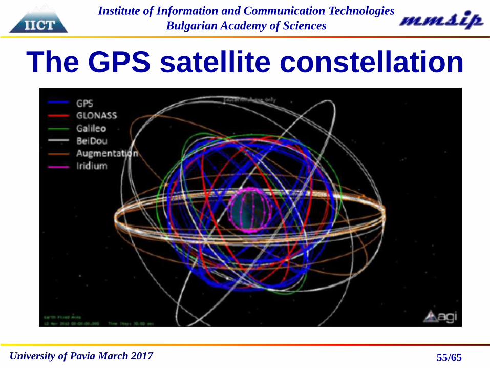
GNSS is a technology for outdoor navigation. The most
popular example is GPS, which is a constellation of
satellites that transmit encoded radio frequency (RF)
signals. By means of trilateration, ground receivers can
calculate their position using the travel time of the
satellites’s signals and information about their current
location, this being included in the transmitted signal.
/65
Institute of Information and Communication Technologies
Bulgarian Academy of Sciences
University of Pavia March 2017
The GPS satellite constellation
55

/65
Institute of Information and Communication Technologies
Bulgarian Academy of Sciences
University of Pavia March 2017
The concept of position fixing
by trilateration
56
/65
Institute of Information and Communication Technologies
Bulgarian Academy of Sciences
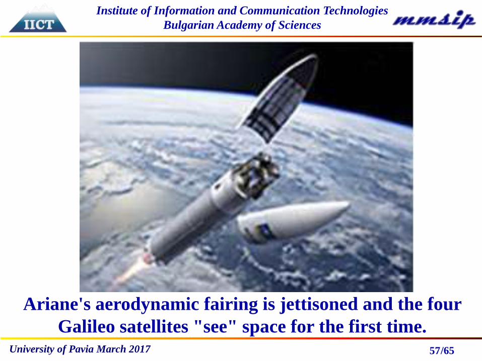
University of Pavia March 2017 57
Ariane's aerodynamic fairing is jettisoned and the four
Galileo satellites "see" space for the first time.
/65
Institute of Information and Communication Technologies
Bulgarian Academy of Sciences
University of Pavia March 2017
Summary
General Classification of
Positioning Techniques
58
• Techniques Using Relative Measurements
(Known as dead reckoning - DR);
• Techniques Using Absolute Measurements
(Known as Reference-based Systems)

/65
Institute of Information and Communication Technologies
Bulgarian Academy of Sciences
University of Pavia March 2017
DR Techniques
59
• OdometryThe odometry data is obtained by using sensors
that measure the rotation of the wheel axes and the
steer axes (e.g. high resolution encoders).
• Inertial NavigationInertial navigation systems employ inertial
sensors (gyroscopes and accelerometers) which
measure the rotation rates and the specific forces
from which acceleration can be obtained. They
are autonomous, self-contained; i.e. they don’t
need external references.

/65
Institute of Information and Communication Technologies
Bulgarian Academy of Sciences
University of Pavia March 2017
Reference-based Systems
60
• Electronic Compasses
• Active Beacons
• Global Navigation Satellite Systems
• Landmark Navigation
• Map-Based Positioning (Or Model
Matching)
/65
Institute of Information and Communication Technologies
Bulgarian Academy of Sciences
University of Pavia March 2017
Electronic Compasses
61
Compass is a device which provides heading
measurements relative to the Earth’s magnetic north by
observing the direction of the local magnetic field. To
convert the compass heading into an actual north
heading, the declination angle, which is the angle
between geographic and magnetic north, has to be
considered. The declination angle is position dependent,
so it is necessary to know the position of the compass in
order to calculate the heading relative to geographic
north.

/65
Institute of Information and Communication Technologies
Bulgarian Academy of Sciences
University of Pavia March 2017
Active Beacons
62
Several positioning algorithms can be used with
different active beacon systems, such as the
trilateration-based algorithm, the triangulation-based
algorithms, and the fingerprinting algorithms.
Trilateration is the calculation of a vehicle’s position
based on distance measurements relative to a known
beacon using, for example, time-of-flight information.
Triangulation is the calculation of a vehicle’s position
and possibly its orientation based on the angles at which
beacons are seen relative to the moving platform’s
longitudinal axis. Fingerprinting is template matching
technique.
/65
Institute of Information and Communication Technologies
Bulgarian Academy of Sciences
University of Pavia March 2017
Landmark Navigation
63
This approach can be used when the moving platform is
moving in well known environment. Landmarks are
distinct objects or features that can be detected and
distinguished by appropriate sensors on a vehicle. They
can be either natural or artificial. Artificial landmarks
are objects added to the environment specifically for
positioning and navigation, whereas natural ones are
already present in the environment. Each landmark
must have a fixed position. The vehicle preserves a
database of landmarks and their locations.

/65
Institute of Information and Communication Technologies
Bulgarian Academy of Sciences
University of Pavia March 2017
Map-Based Positioning
64
This approach can be used if the platform is moving in a
specific mapped environment. In this approach, the
moving platform uses its sensors to perceive its local
environment, and this perception is then compared to a
map previously stored in its memory. If a match is
found, then the vehicle can calculate its position and
orientation in this specific environment. Cameras and
laser range finders are examples of sensors that can be
used with this type of positioning.

/65
Institute of Information and Communication Technologies
Bulgarian Academy of Sciences
University of Pavia March 2017 65
Questions?