Embed Size (px)
Citation preview
Spodosol Distribution in Northern Idaho: Digital Modeling Using
Terrain Attributes
Mitch Valerio1, Paul McDaniel1, Bruce Knapp2, Paul Gessler1, Anita Falen1
1University of Idaho, Moscow2NRCS, Moscow
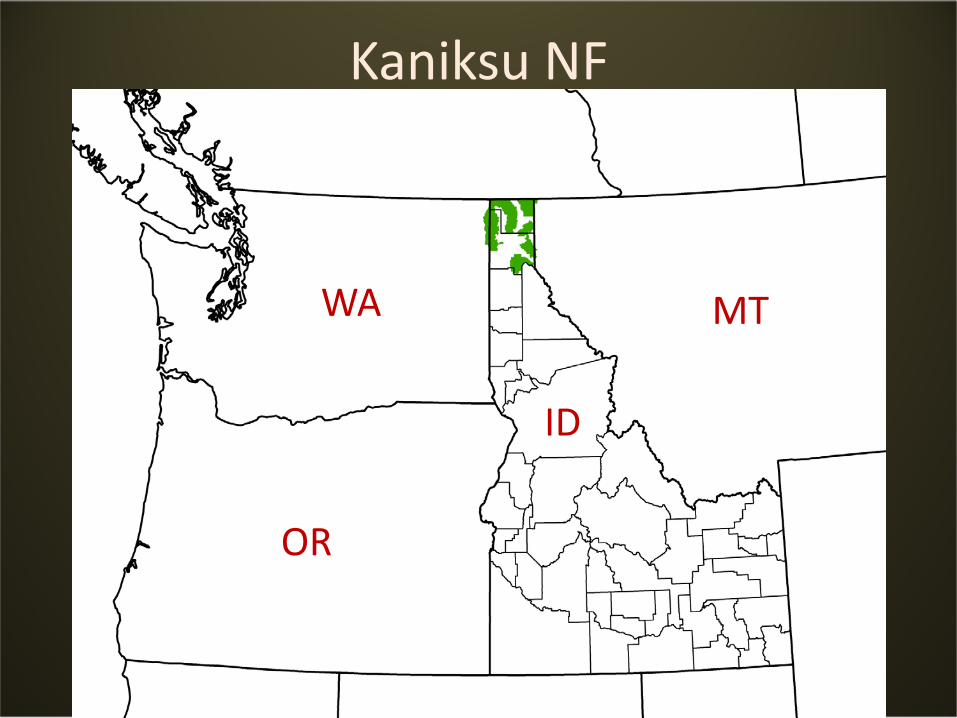
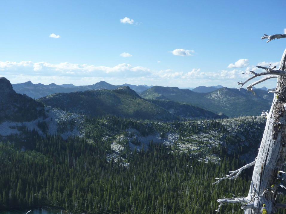
Kaniksu NF
WA MT
OR
ID
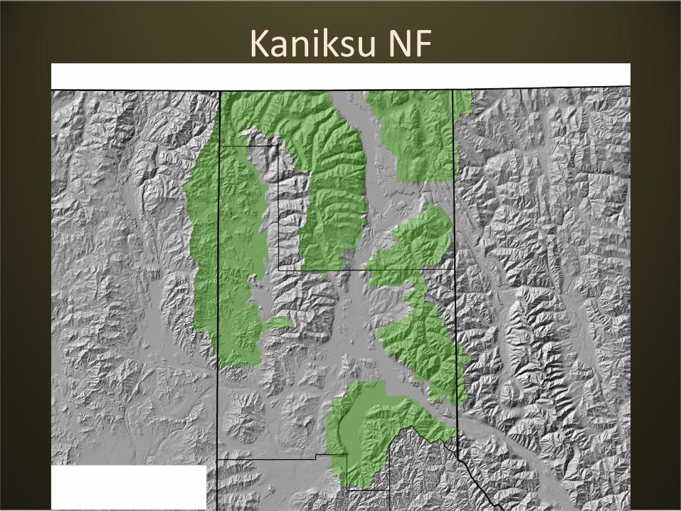
Kaniksu NF
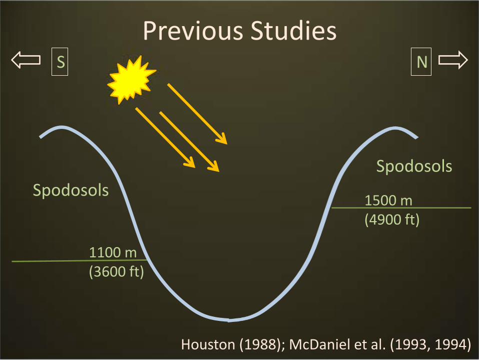
Previous StudiesNS
1100 m(3600 ft)
1500 m(4900 ft)
SpodosolsSpodosols
Houston (1988); McDaniel et al. (1993, 1994)
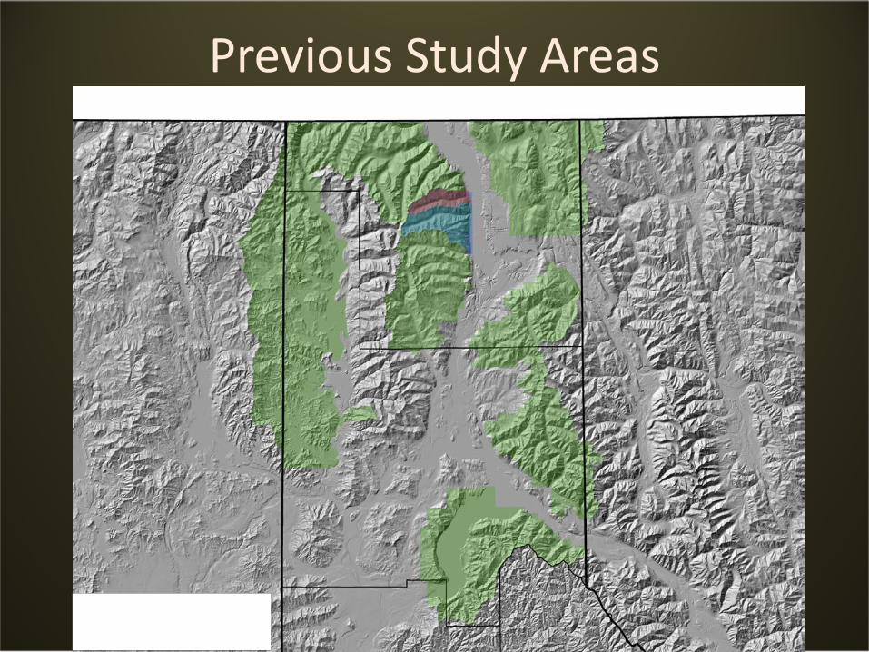
Previous Study Areas
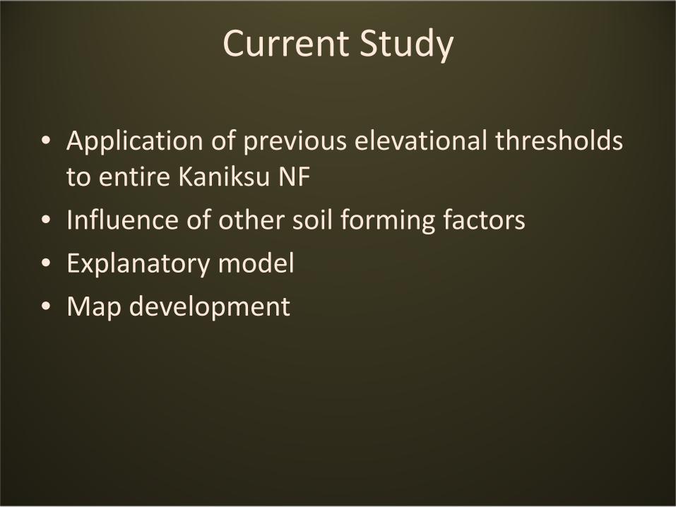
Current Study
• Application of previous elevational thresholds to entire Kaniksu NF
• Influence of other soil forming factors
• Explanatory model
• Map development
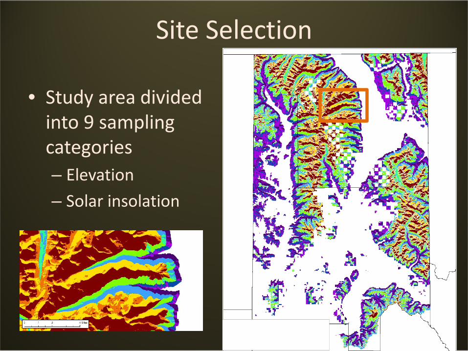
Site Selection
• Study area divided into 9 sampling categories– Elevation
– Solar insolation
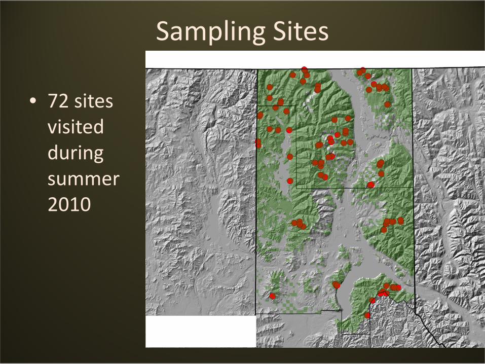
Sampling Sites
• 72 sites visited during summer 2010
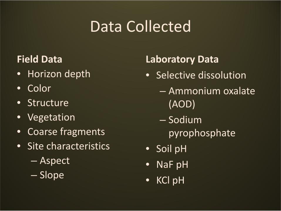
Data Collected
Field Data• Horizon depth• Color• Structure• Vegetation• Coarse fragments• Site characteristics
– Aspect– Slope
Laboratory Data
• Selective dissolution
– Ammonium oxalate (AOD)
– Sodium pyrophosphate
• Soil pH
• NaF pH
• KCl pH
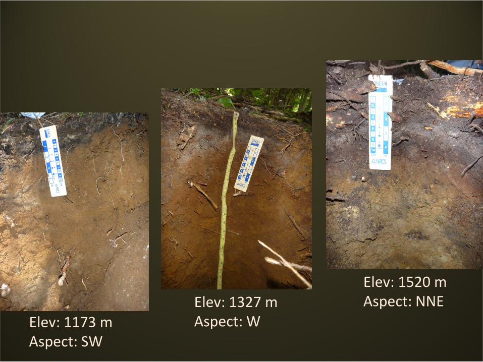
Elev: 1173 mAspect: SW
Elev: 1327 mAspect: W
Elev: 1520 mAspect: NNE
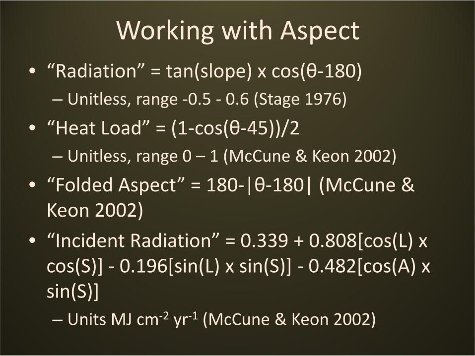
Working with Aspect• “Radiation” = tan(slope) x cos(θ-180)
– Unitless, range -0.5 - 0.6 (Stage 1976)
• “Heat Load” = (1-cos(θ-45))/2– Unitless, range 0 – 1 (McCune & Keon 2002)
• “Folded Aspect” = 180-|θ-180| (McCune & Keon 2002)
• “Incident Radiation” = 0.339 + 0.808[cos(L) x cos(S)] - 0.196[sin(L) x sin(S)] - 0.482[cos(A) x sin(S)]– Units MJ cm-2 yr-1 (McCune & Keon 2002)
Exploratory Data Analysis
• Sites categorized into Spodosol or non-Spodosol
• Sites categorized into spodic horizonation or not
• Boxplots used for initial trends
• Classification trees based on topographic variables
Boxplots (1)
Boxplots (2)
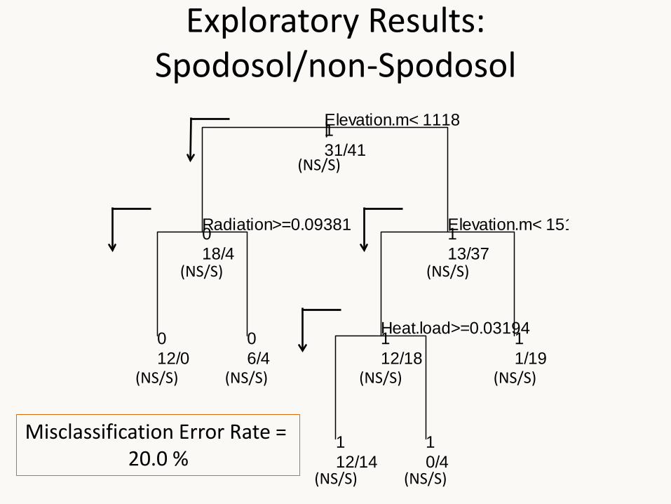
|Elevation.m< 1118
Radiation>=0.09381 Elevation.m< 151
Heat.load>=0.03194
131/41
018/4
012/0
06/4
113/37
112/18
112/14
10/4
11/19
Exploratory Results:Spodosol/non-Spodosol
Misclassification Error Rate = 20.0 %
(NS/S)
(NS/S)
(NS/S)
(NS/S)
(NS/S)
(NS/S)
(NS/S)(NS/S)
(NS/S)
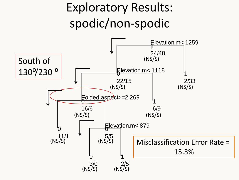
|Elevation.m< 1259
Elevation.m< 1118
Folded.aspect>=2.269
Elevation.m< 879
124/48
022/15
016/6
011/1
05/5
03/0
12/5
16/9
12/33
Exploratory Results:spodic/non-spodic
South of 130⁰/230 ⁰
Misclassification Error Rate = 15.3%
(NS/S)
(NS/S)
(NS/S)
(NS/S)
(NS/S)
(NS/S) (NS/S)
(NS/S) (NS/S)
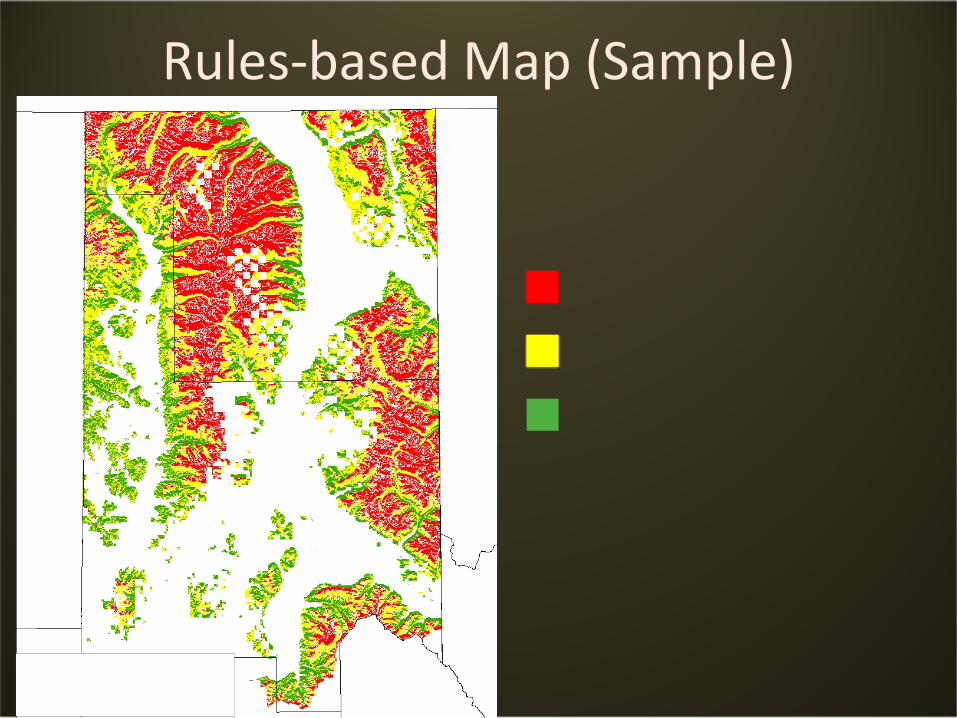
Rules-based Map (Sample)
Findings
• Elevation is most important variable
• Elevational thresholds confirmed across NF (Spodosol/non-Spodosol model)
• Aspect is significant
Ongoing Work
• Determine influence of vegetation and contrasting bedrock materials
• Develop initial map of potential Spodosol distribution based on best explanatory models
• Ground-truth predictive model
• Refine model and create final map
Acknowledgements
• NRCS
• Thomas Staples and Eric Robertson