Embed Size (px)
Citation preview
Spring 2013 Planning Studio
Edward J. Bloustein School of Planning and Public Policy
Presentation Outline
1. Who We Are
2. Background
3. Impacts of Hurricane Sandy
4. Previous Planning Efforts
5. Our Purpose
6. Community Engagement
7. Strengths, Weaknesses Opportunities & Threats
8. General Planning Goals
9. Specific Recommendations
10. Areas of Focus
11. Conclusions
Who We Are
Edward J. Bloustein School of Planning and Public Policy Graduate Planning Studio
Spring 2013
• Group Image
Background
• Approximately 60% of Sea Bright residents are owners and 40% are renters
• Majority of businesses in Sea Bright are restaurants and beach clubs
• Most Sea Bright residents work elsewhere
• Most goods and services are also acquired elsewhere • Sea Bright's municipal budget relies heavily on local property
taxes jeopardized by Hurricane Sandy
• As of April 2013, approximately 50% of Sea Bright’s 1,400 year-round residents were back
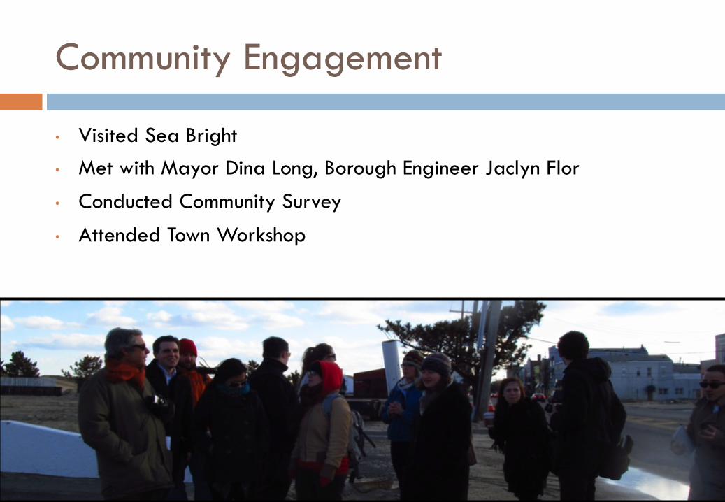
Community Engagement
• Visited Sea Bright • Met with Mayor Dina Long, Borough Engineer Jaclyn Flor
• Conducted Community Survey
• Attended Town Workshop
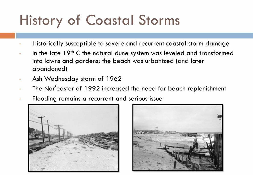
History of Coastal Storms • Historically susceptible to severe and recurrent coastal storm damage • In the late 19th C the natural dune system was leveled and transformed
into lawns and gardens; the beach was urbanized (and later abandoned)
• Ash Wednesday storm of 1962 • The Nor'easter of 1992 increased the need for beach replenishment • Flooding remains a recurrent and serious issue
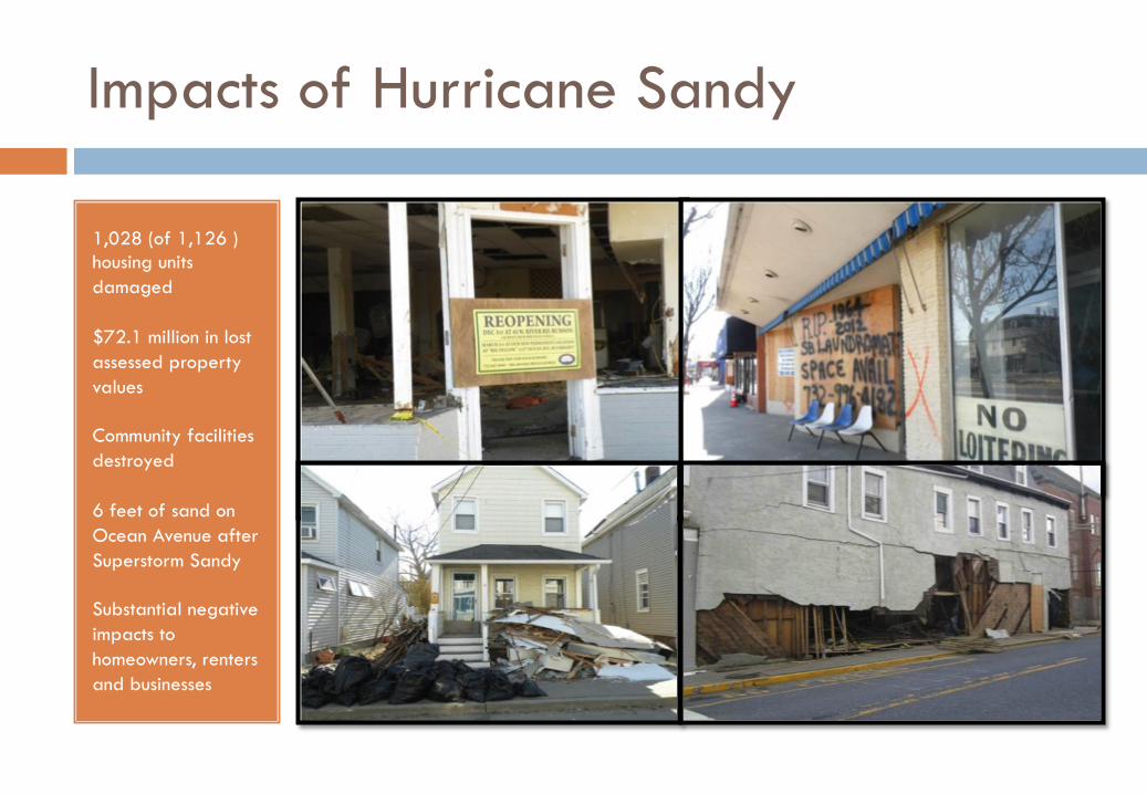
Impacts of Hurricane Sandy
1,028 (of 1,126 ) housing units damaged
$72.1 million in lost assessed property values
Community facilities destroyed
6 feet of sand on Ocean Avenue after Superstorm Sandy
Substantial negative impacts to homeowners, renters and businesses
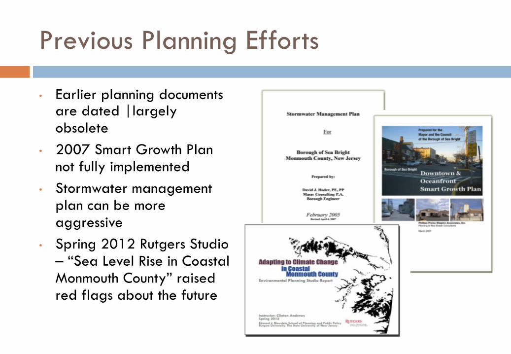
Previous Planning Efforts
• Earlier planning documents are dated |largely obsolete
• 2007 Smart Growth Plan not fully implemented
• Stormwater management plan can be more aggressive
• Spring 2012 Rutgers Studio – “Sea Level Rise in Coastal Monmouth County” raised red flags about the future
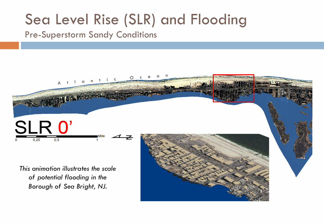
This animation illustrates the scale of potential flooding in the Borough of Sea Bright, NJ.
A t l a n t i c O c e a n
Sea Level Rise (SLR) and Flooding Pre-Superstorm Sandy Conditions
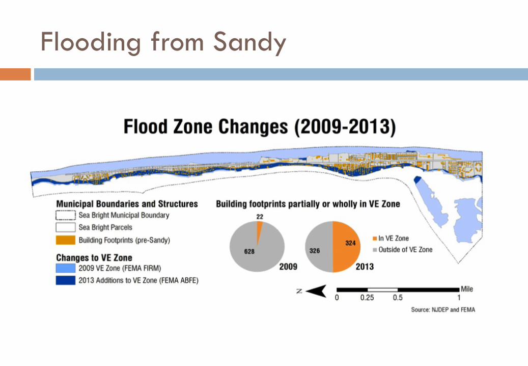
Flooding from Sandy
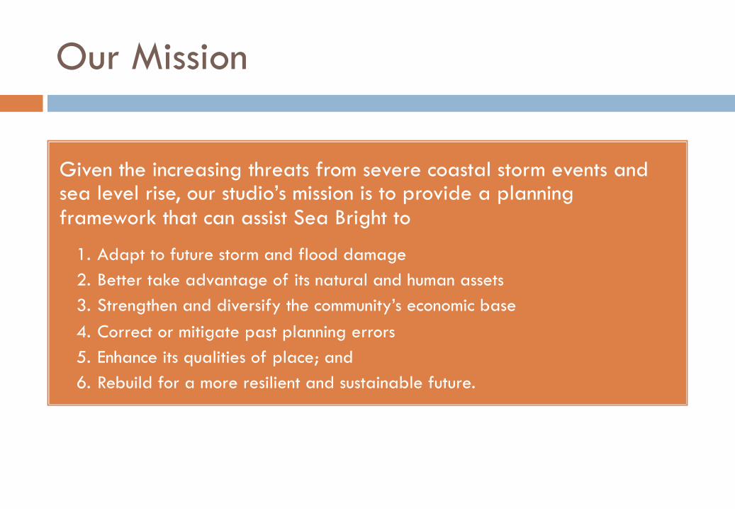
Our Mission
Given the increasing threats from severe coastal storm events and sea level rise, our studio’s mission is to provide a planning framework that can assist Sea Bright to
1. Adapt to future storm and flood damage 2. Better take advantage of its natural and human assets 3. Strengthen and diversify the community’s economic base 4. Correct or mitigate past planning errors 5. Enhance its qualities of place; and 6. Rebuild for a more resilient and sustainable future.
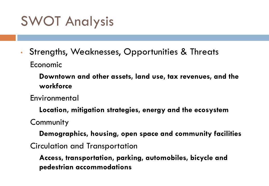
SWOT Analysis
• Strengths, Weaknesses, Opportunities & Threats Economic
Downtown and other assets, land use, tax revenues, and the workforce
Environmental Location, mitigation strategies, energy and the ecosystem
Community Demographics, housing, open space and community facilities
Circulation and Transportation Access, transportation, parking, automobiles, bicycle and pedestrian accommodations
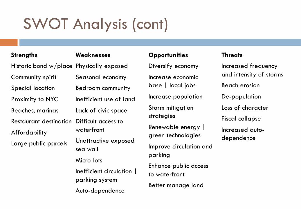
Strengths
Historic bond w/place
Community spirit
Special location
Proximity to NYC
Beaches, marinas
Restaurant destination
Affordability
Large public parcels
Weaknesses
Physically exposed
Seasonal economy
Bedroom community
Inefficient use of land
Lack of civic space
Difficult access to waterfront
Unattractive exposed sea wall
Micro-lots
Inefficient circulation | parking system
Auto-dependence
Opportunities
Diversify economy
Increase economic base | local jobs
Increase population
Storm mitigation strategies
Renewable energy | green technologies
Improve circulation and parking
Enhance public access to waterfront
Better manage land
Threats
Increased frequency and intensity of storms
Beach erosion
De-population
Loss of character
Fiscal collapse
Increased auto-dependence
SWOT Analysis (cont)
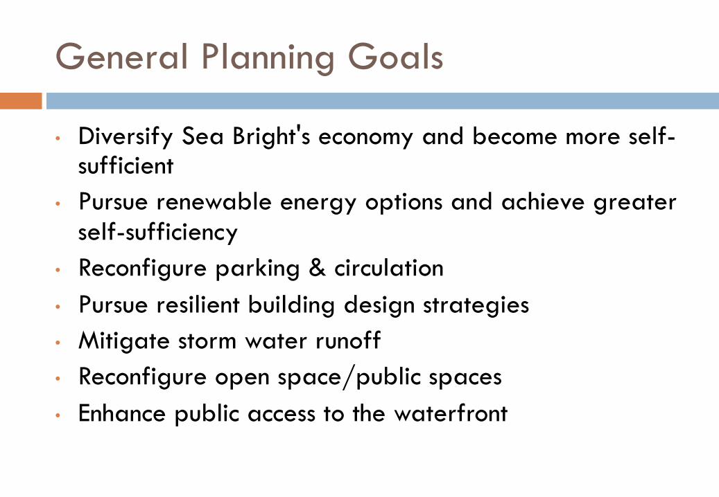
General Planning Goals
• Diversify Sea Bright's economy and become more self-sufficient
• Pursue renewable energy options and achieve greater self-sufficiency
• Reconfigure parking & circulation • Pursue resilient building design strategies • Mitigate storm water runoff • Reconfigure open space/public spaces • Enhance public access to the waterfront
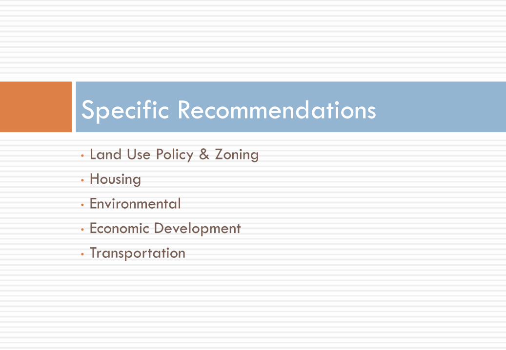
• Land Use Policy & Zoning • Housing • Environmental • Economic Development • Transportation
Specific Recommendations
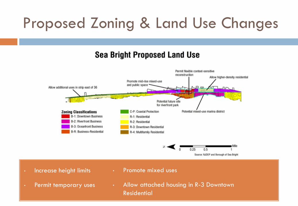
Proposed Zoning & Land Use Changes
• Increase height limits
• Permit temporary uses
• Promote mixed uses
• Allow attached housing in R-3 Downtown Residential
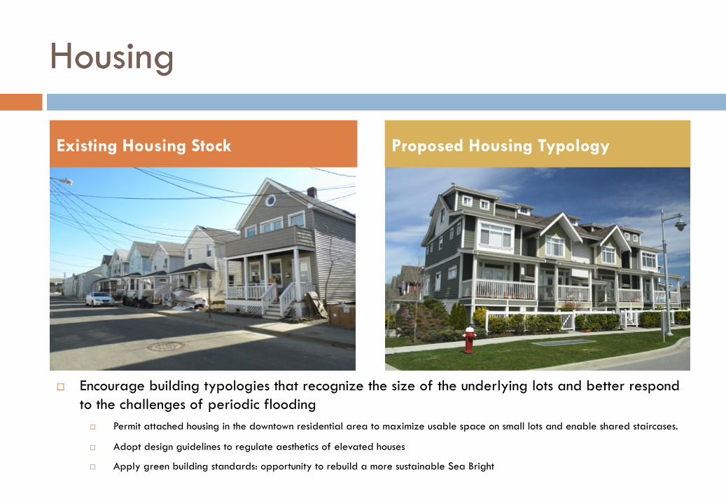
Housing
Existing Housing Stock Proposed Housing Typology
¨ Encourage building typologies that recognize the size of the underlying lots and better respond to the challenges of periodic flooding
¨ Permit attached housing in the downtown residential area to maximize usable space on small lots and enable shared staircases.
¨ Adopt design guidelines to regulate aesthetics of elevated houses
¨ Apply green building standards: opportunity to rebuild a more sustainable Sea Bright
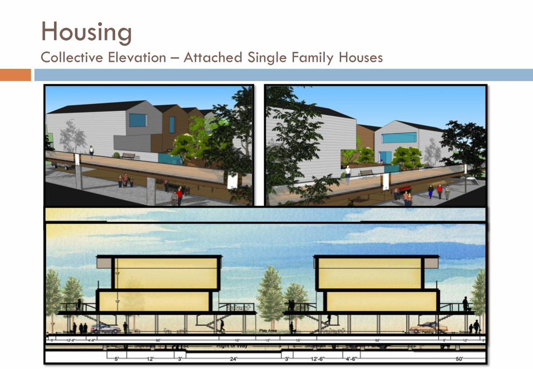
• Extra space • Extra covered parking • Collective vertical circulation • Reduced cost of maintenance per homeowner • Permanent relief from frequent flooding
Housing Collective Elevation – Attached Single Family Houses
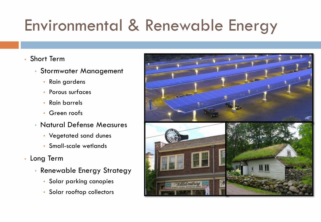
Environmental & Renewable Energy
• Short Term • Stormwater Management
• Rain gardens • Porous surfaces
• Rain barrels • Green roofs
• Natural Defense Measures • Vegetated sand dunes • Small-scale wetlands
• Long Term • Renewable Energy Strategy
• Solar parking canopies
• Solar rooftop collectors
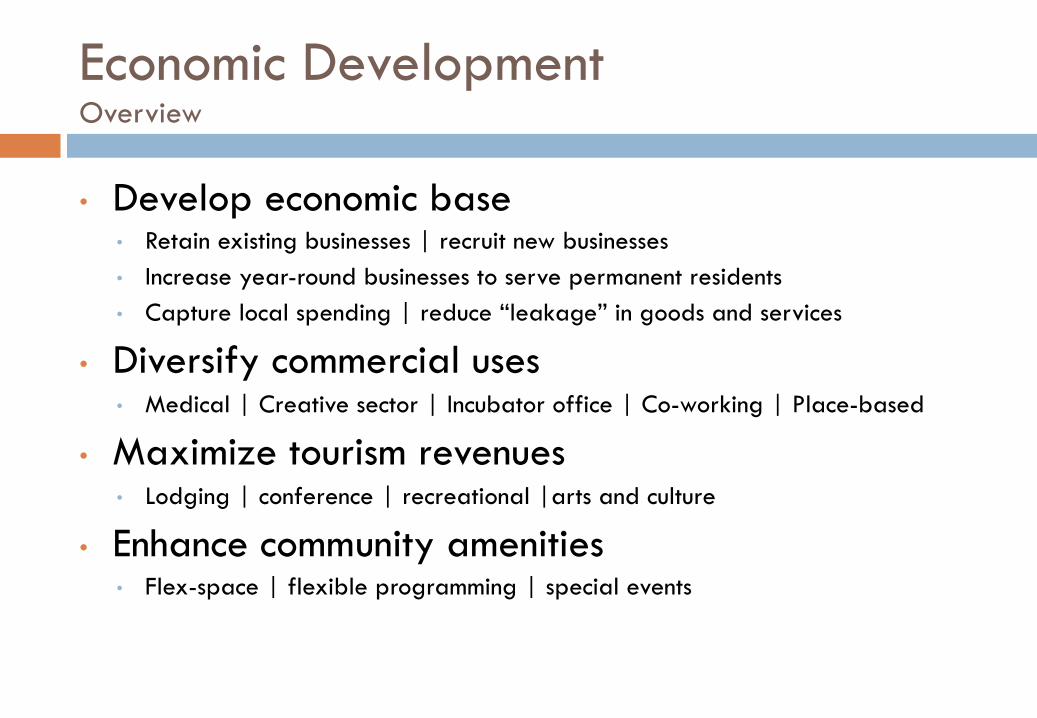
Economic Development Overview
• Develop economic base • Retain existing businesses | recruit new businesses • Increase year-round businesses to serve permanent residents • Capture local spending | reduce “leakage” in goods and services
• Diversify commercial uses • Medical | Creative sector | Incubator office | Co-working | Place-based
• Maximize tourism revenues • Lodging | conference | recreational |arts and culture
• Enhance community amenities • Flex-space | flexible programming | special events
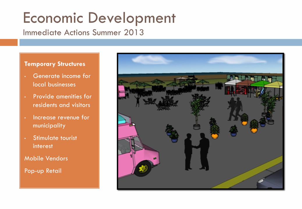
Economic Development Immediate Actions Summer 2013
Temporary Structures
• Generate income for local businesses
• Provide amenities for residents and visitors
• Increase revenue for municipality
• Stimulate tourist interest
Mobile Vendors
Pop-up Retail
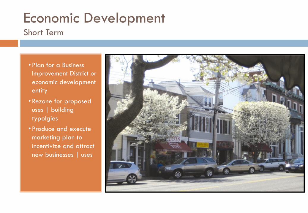
Economic Development Short Term
• Plan for a Business Improvement District or economic development entity
• Rezone for proposed uses | building typolgies • Produce and execute marketing plan to incentivize and attract new businesses | uses
INSERT IMAGE
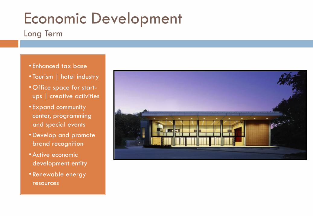
Economic Development Long Term
• Enhanced tax base • Tourism | hotel industry
• Office space for start-ups | creative activities
• Expand community center, programming and special events • Develop and promote brand recognition
• Active economic development entity
• Renewable energy resources
Transportation
• Manage Parking Assets • Shi0 parking away from the municipal lot • Create a fare structure to capitalize on parking revenue in municipal lot • Charge non-‐residents for on-‐street parking • Enforce parking @me limits and payment
• Pedestrian and Bicycle Safety • Employ traffic calming measures • Implement bike and pedestrian infrastructure
• ShuEle System • Create a shuEle to enhance local mobility, servicing the parking loca@ons, the
downtown, the beaches and poten@ally the train sta@on
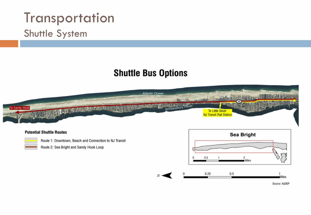
Transportation Shuttle System
• Route 36 North of Downtown • Rumson Bridge • Downtown • Marina
Areas of Focus
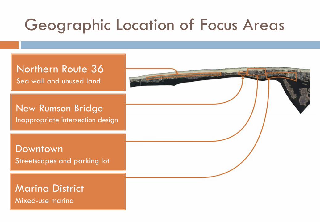
Geographic Location of Focus Areas
Northern Route 36 Sea wall and unused land
New Rumson Bridge Inappropriate intersection design
Downtown Streetscapes and parking lot
Marina District Mixed-use marina
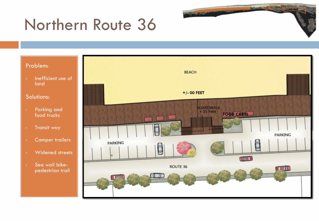
Northern Route 36
Problem:
• Inefficient use of land
Solutions:
• Parking and food trucks
• Transit way
• Camper trailers
• Widened streets
• Sea wall bike-pedestrian trail
FOOD CARTS
+/- 00 FEET
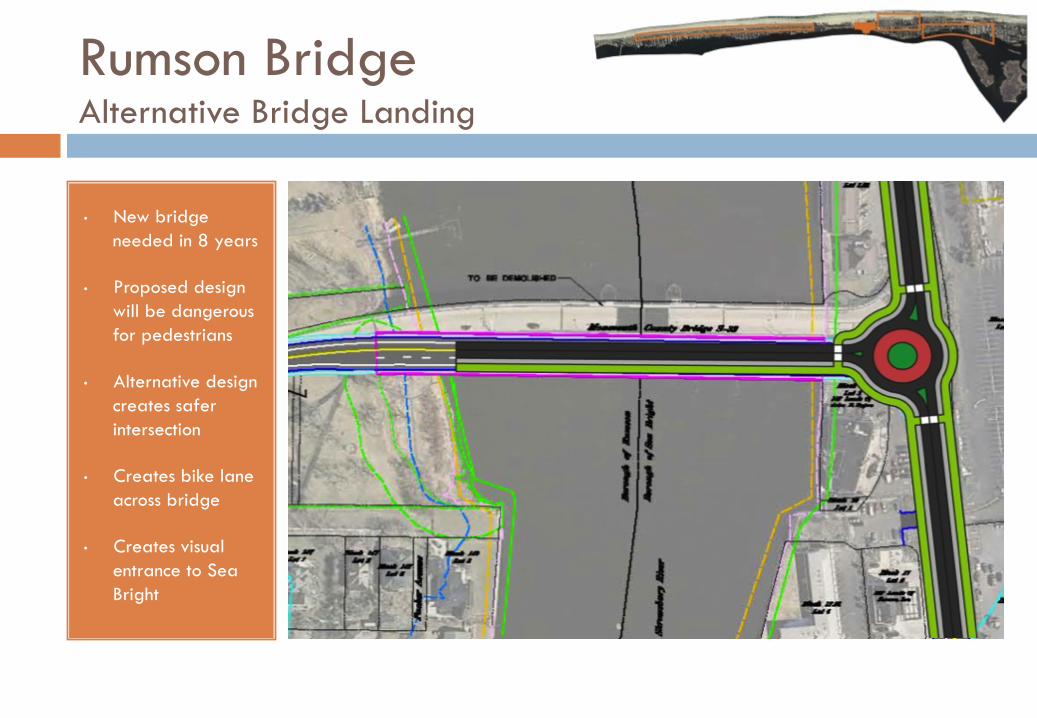
Rumson Bridge Alternative Bridge Landing
• New bridge needed in 8 years
• Proposed design will be dangerous for pedestrians
• Alternative design creates safer intersection
• Creates bike lane across bridge
• Creates visual entrance to Sea Bright
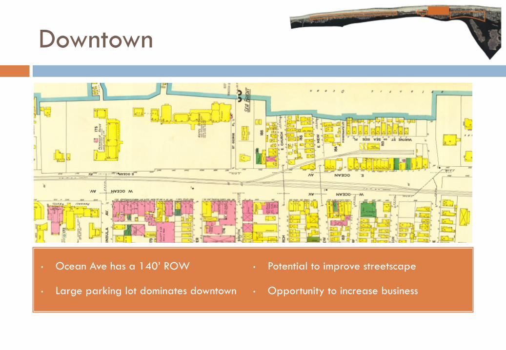
Downtown
• Ocean Ave has a 140’ ROW
• Large parking lot dominates downtown
• Potential to improve streetscape
• Opportunity to increase business
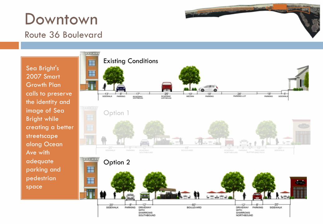
Sea Bright's 2007 Smart Growth Plan calls to preserve the identity and image of Sea Bright while creating a better streetscape along Ocean Ave with adequate parking and pedestrian space
Existing Conditions
Option 1
Option 2
Downtown Route 36 Boulevard
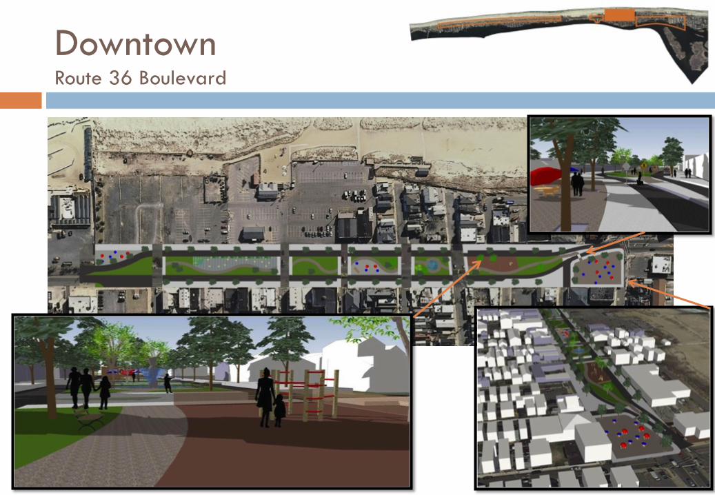
Downtown Route 36 Boulevard
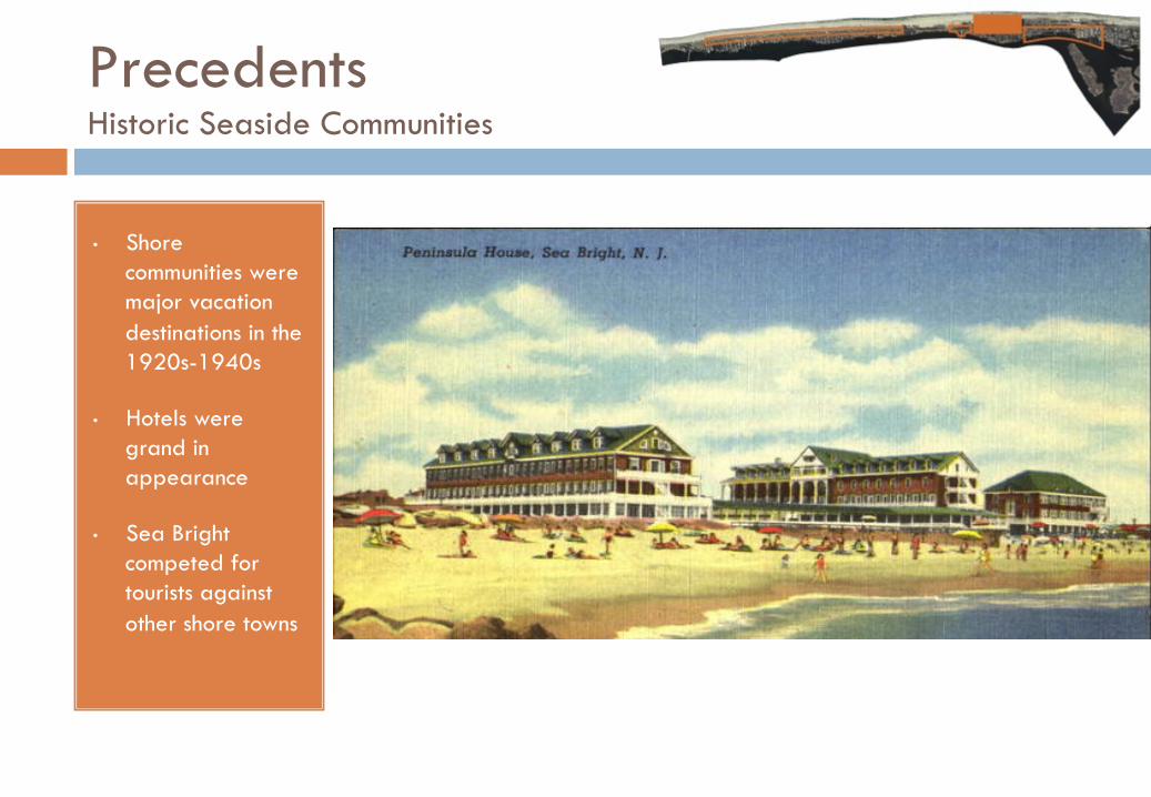
Precedents Historic Seaside Communities
• Shore communities were major vacation destinations in the 1920s-1940s
• Hotels were grand in appearance
• Sea Bright competed for tourists against other shore towns
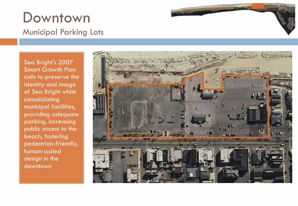
Downtown Municipal Parking Lots
Sea Bright's 2007 Smart Growth Plan calls to preserve the identity and image of Sea Bright while consolidating municipal facilities, providing adequate parking, increasing public access to the beach, fostering pedestrian-friendly, human-scaled design in the downtown
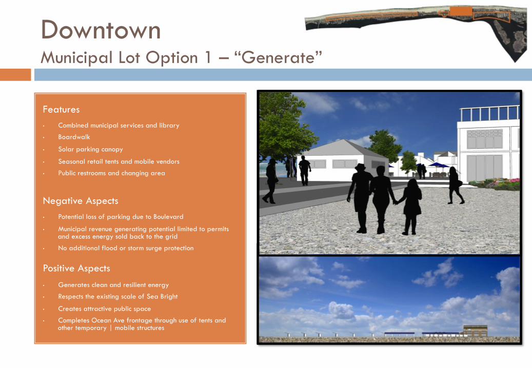
Features • Combined municipal services and library
• Boardwalk
• Solar parking canopy
• Seasonal retail tents and mobile vendors
• Public restrooms and changing area
Negative Aspects • Potential loss of parking due to Boulevard
• Municipal revenue generating potential limited to permits and excess energy sold back to the grid
• No additional flood or storm surge protection
Positive Aspects • Generates clean and resilient energy
• Respects the existing scale of Sea Bright
• Creates attractive public space
• Completes Ocean Ave frontage through use of tents and other temporary | mobile structures
Downtown Municipal Lot Option 1 – “Generate”
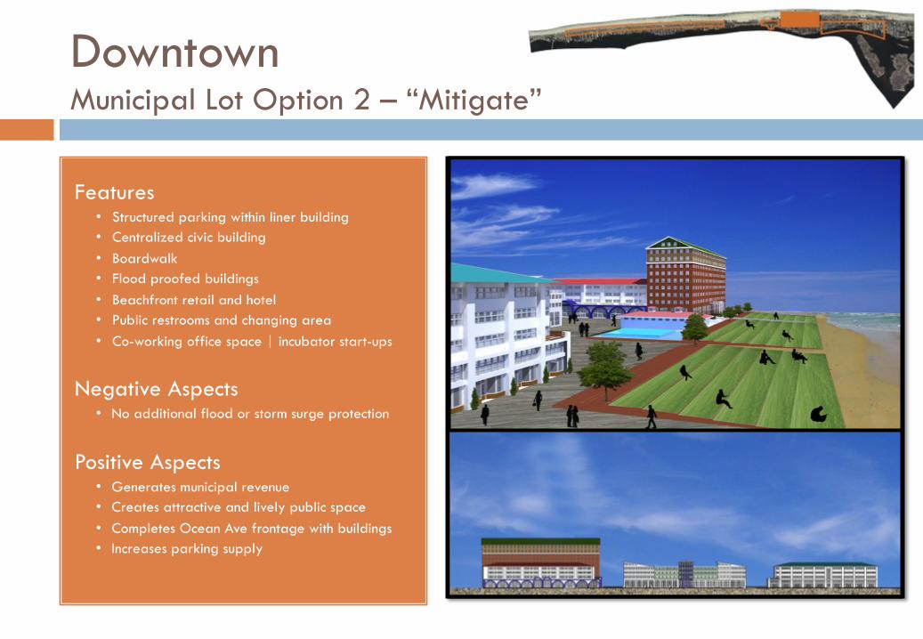
Features • Structured parking within liner building • Centralized civic building • Boardwalk • Flood proofed buildings • Beachfront retail and hotel • Public restrooms and changing area • Co-working office space | incubator start-ups
Negative Aspects • No additional flood or storm surge protection
Positive Aspects • Generates municipal revenue • Creates attractive and lively public space • Completes Ocean Ave frontage with buildings • Increases parking supply
Downtown Municipal Lot Option 2 – “Mitigate”
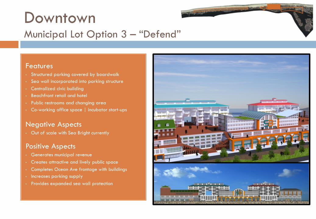
Features • Structured parking covered by boardwalk • Sea wall incorporated into parking structure • Centralized civic building • Beachfront retail and hotel • Public restrooms and changing area • Co-working office space | incubator start-ups
Negative Aspects • Out of scale with Sea Bright currently
Positive Aspects • Generates municipal revenue • Creates attractive and lively public space • Completes Ocean Ave frontage with buildings • Increases parking supply • Provides expanded sea wall protection
Downtown Municipal Lot Option 3 – “Defend”
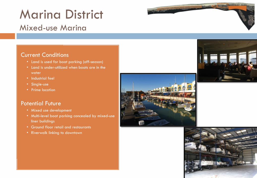
Marina District Mixed-use Marina
Current Conditions • Land is used for boat parking (off-season) • Land is under-utilized when boats are in the
water • Industrial feel • Single-use • Prime location
Potential Future • Mixed use development • Multi-level boat parking concealed by mixed-use
liner buildings • Ground floor retail and restaurants • Riverwalk linking to downtown
Conclusions
• Importance of proactive planning and of vision
• Implementation of immediate, short and long term strategies
• Rebuilding from super-storm Sandy provides valuable opportunities to rethink current conditions and adopt more creative and effective planning approaches
Thank you! Questions?