Embed Size (px)
Citation preview
-1-
STAFF REPORT
C73 A 17 12/03/18 AD 557
W 26279 G11-00.7 G11-01 R. Boggiano S 11 A. Kershen
CONSIDER A PARCEL BOUNDARY ADJUSTMENT AND MODIFIED FACILITIES PLAN IN CONNECTION WITH THE HUNTERS POINT
SHIPYARD/CANDLESTICK POINT TITLE SETTLEMENT, PUBLIC TRUST EXCHANGE AND BOUNDARY LINE AGREEMENT
PARTIES: California State Lands Commission Office of Community Investment and Infrastructure, successor agency to the Redevelopment Agency of the City and County of San Francisco City and County of San Francisco Port of San Francisco California Department of Parks and Recreation
INTRODUCTION: There are two requested actions associated with this staff report. The first is for a parcel boundary adjustment that would modify the boundary between the Public Trust and Trust Termination lands on the Hunters Point Shipyard site. The second is for a revised Facilities Plan.
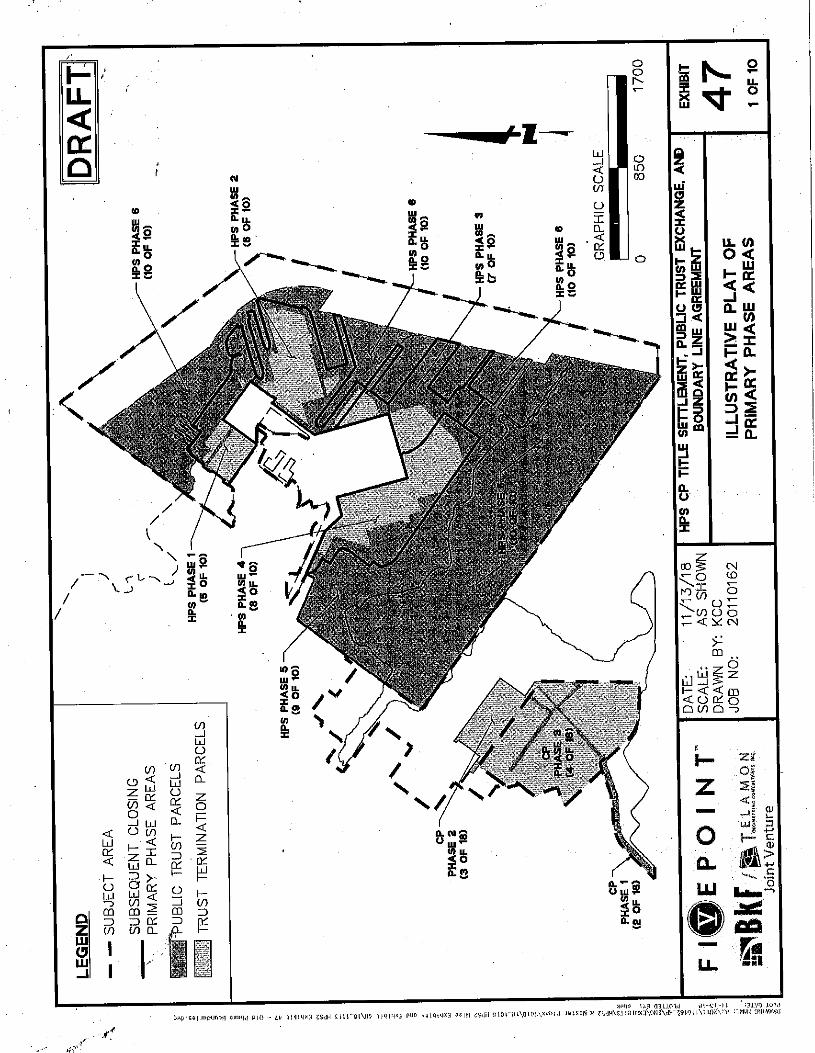
BACKGROUND: In April 2011, the Commission approved the Hunters Point Shipyard/Candlestick Point Title Settlement, Public Trust Exchange and Boundary Line Agreement (Agreement) involving lands within Candlestick Point and the former Hunters Point Shipyard (Item 67, April 6, 2011). The Agreement contemplated a series of phased conveyances—two of which have already closed escrow (Item C04, January 23, 2014 and Item C101, October 14, 2014)—that would settle title questions and confirm trust lands throughout Hunters Point and Candlestick Point.
STAFF REPORT NO. C73 (CONT’D)
-2-
The Agreement followed legislation enacted in 2009 (SB 792, Leno, Chapter 203, Statutes of 2009) that authorized the Commission to negotiate with the Redevelopment Agency of the City and County of San Francisco, today succeeded by the Office of Community Investment and Infrastructure (OCII), and other parties to carry out a land exchange. The exchange would place or confirm the Public Trust on lands with a substantial value for the Public Trust and terminate the Public Trust on lands that are no longer useful for trust purposes, provided that the Commission determines that the exchange furthers the Public Trust and that certain conditions are met. To assist the parties and ensure the State’s interests, Chapter 203 contains a map representing the configuration of Public Trust and non-trust land and requires detailed findings that the Commission must make to approve the Agreement.
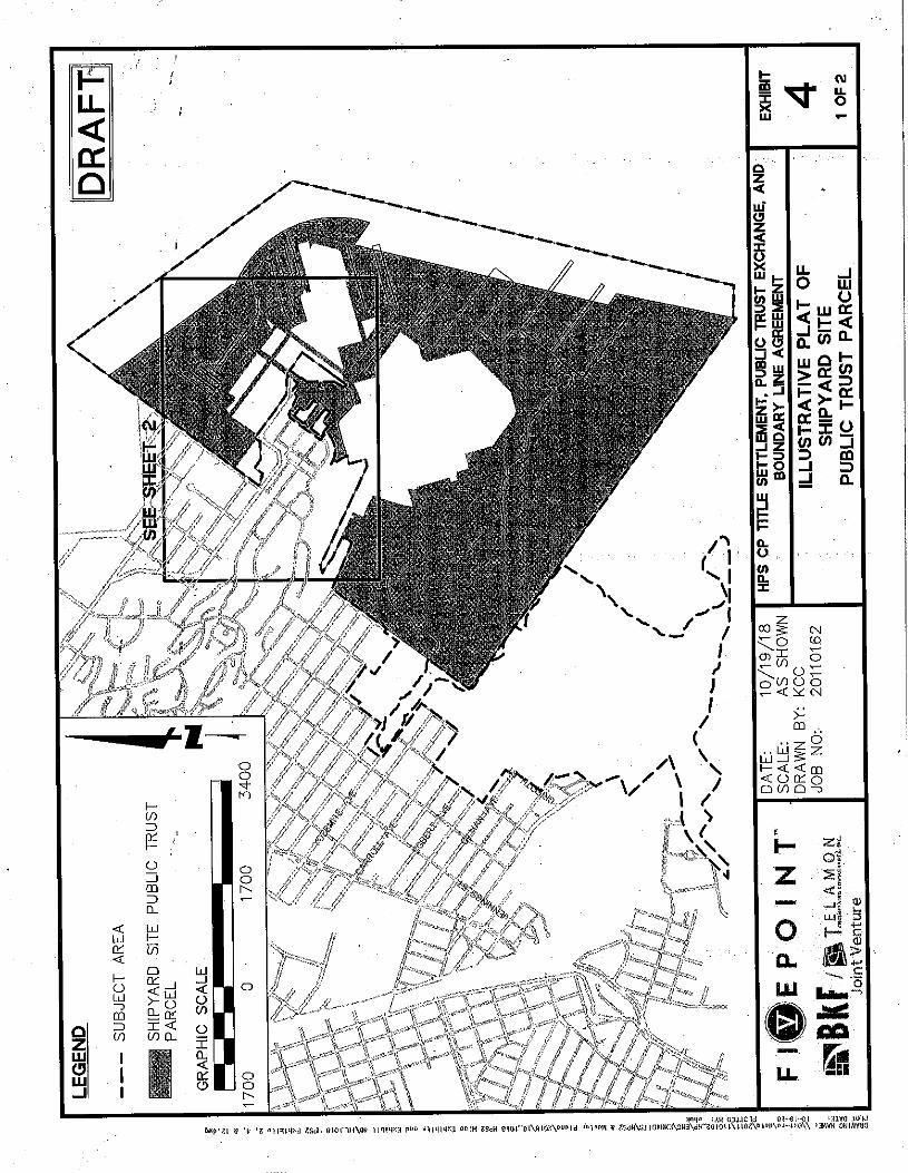
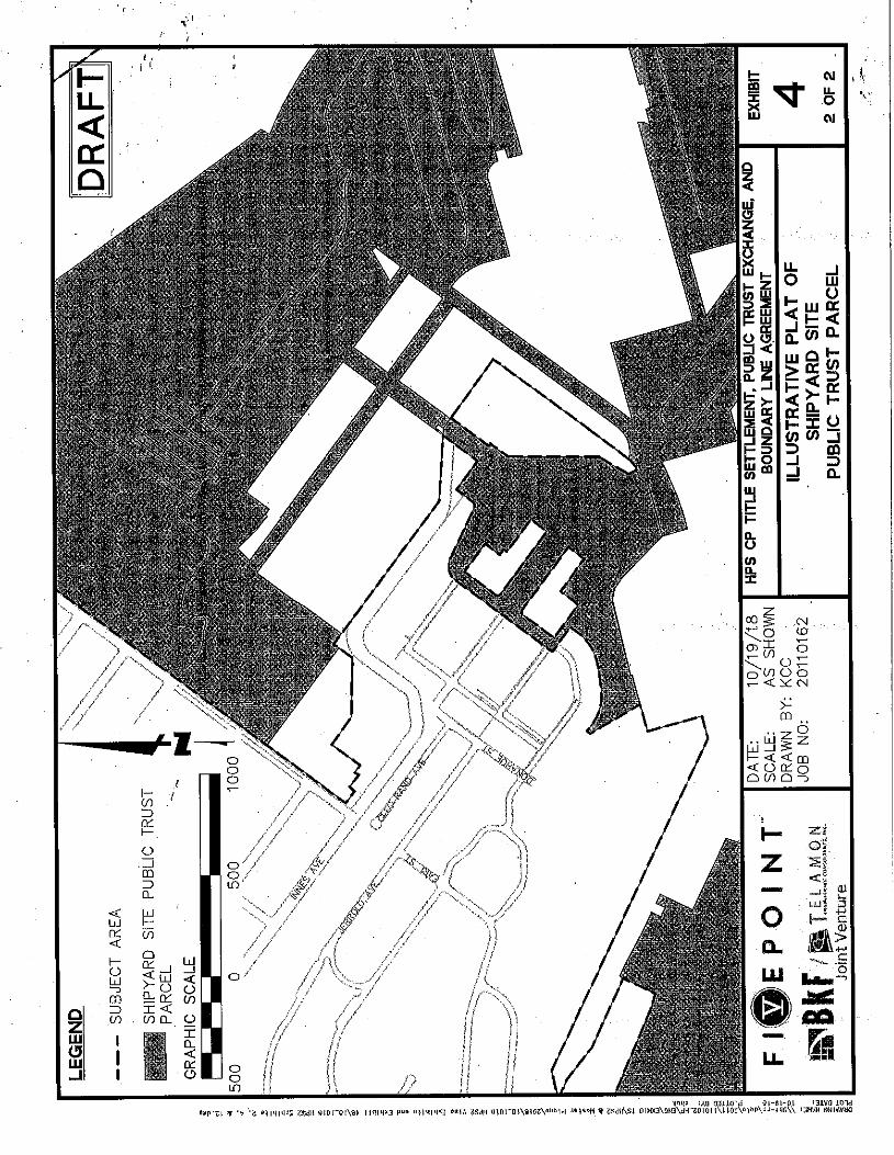
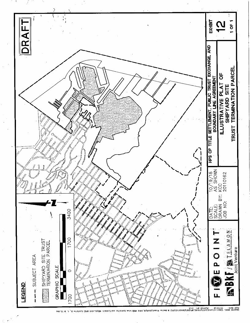
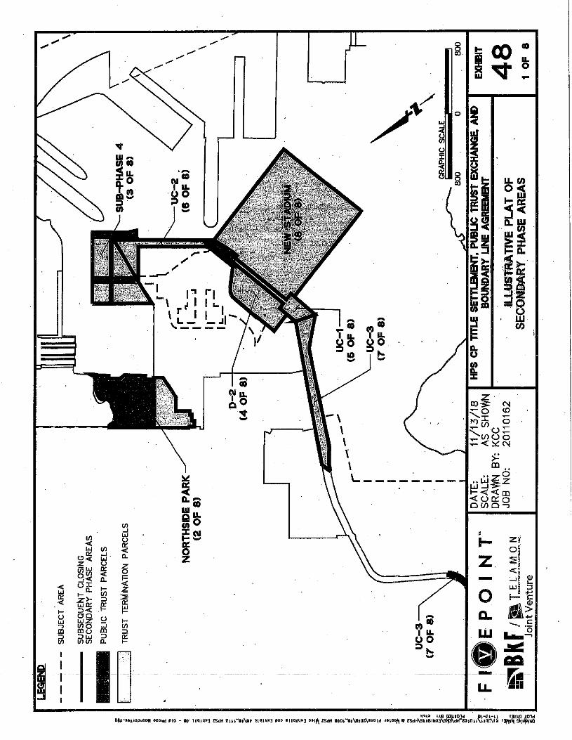
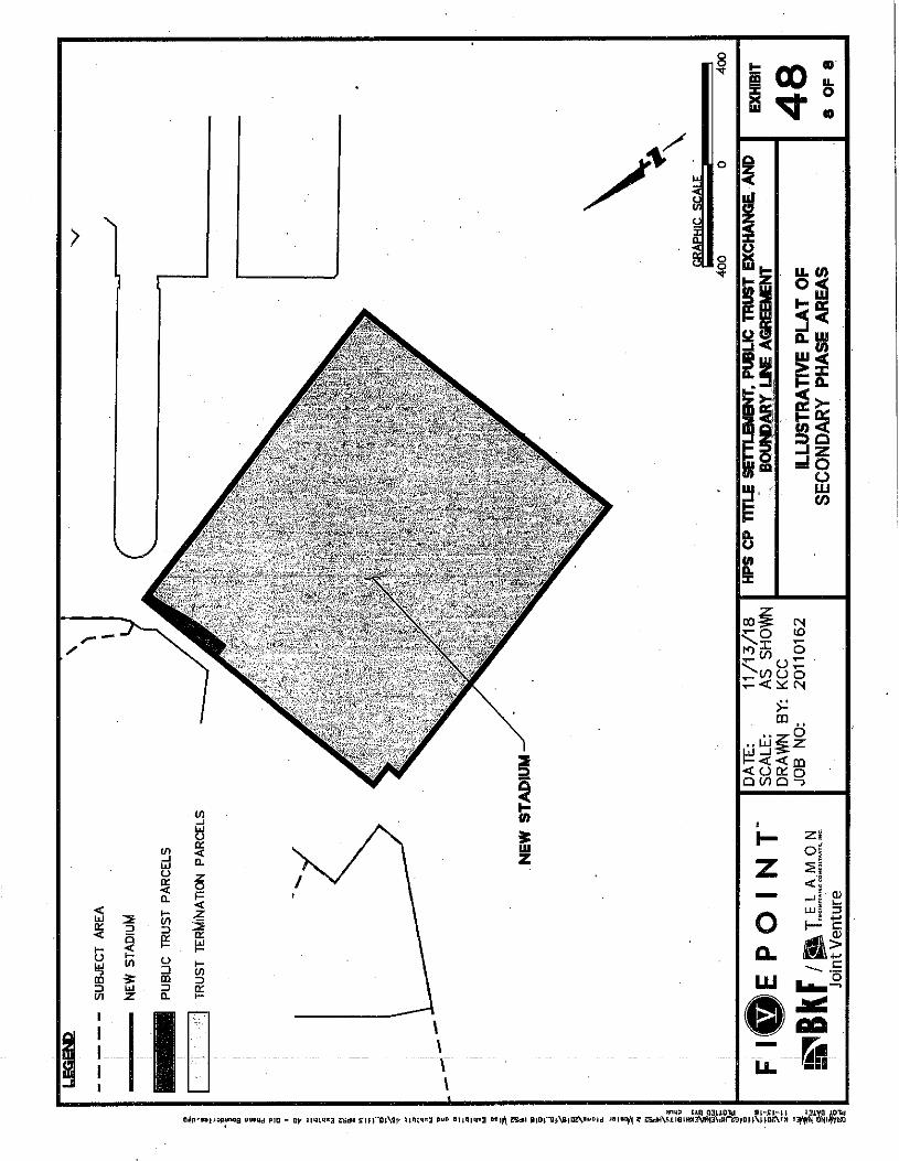
The Agreement depicts a final configuration of trust and non-trust lands that is nearly identical to the statutory map. It also provides for phased transactions between OCII and the Commission, transferring the land as parcels become available. The original configuration anticipated a new San Francisco 49ers stadium at Hunters Point. When the 49ers chose a different location for their stadium, OCII revised its land-use plan to eliminate the stadium and to add new uses. These include expanded residential, commercial, office, light manufacturing, and recreational uses. The revised land-use plan requires changes to the Agreement’s plats and diagrams.
The Agreement contemplated that several development approvals within the area, including detailed infrastructure plans, subdivision maps, and parcel maps, would be obtained after the Agreement became effective. Minor adjustments to the boundaries of the Public Trust or Trust Termination Parcels, as embodied in the Agreement’s exhibits, were anticipated, and a mechanism to accomplish adjustments was included in the Agreement.
Parcel Boundary Adjustment A Parcel Boundary Adjustment may change the boundary between Public Trust and non-trust lands. The Commission may approve a parcel boundary adjustment if it determines the configuration of Public Trust parcels and Trust Termination parcels after the adjustment would be consistent with the configuration shown on Exhibit B in all material respects (Exhibit 2 of the Exchange Agreement). If the Commission determines that the resulting configuration materially differs from Exhibit B, it may still approve the parcel boundary adjustment if it finds that the proposed configuration is substantially similar to the configuration shown in Section 25 of Chapter 203 and makes all other statutorily required findings about the proposed configuration.

STAFF REPORT NO. C73 (CONT’D)
-3-
Staff believes that the proposed parcel boundary adjustment is a material change, but that the proposed configuration is substantially similar to Section 25 of Chapter 203. Therefore, the Commission may approve the parcel boundary adjustment if it makes the required findings, which are as follows:
a. The portions of the trust lands or interests in lands to be exchanged out of the Public Trust have been filled and reclaimed, are cut off from access to the waters of San Francisco Bay and are no longer in fact tidelands or submerged lands or navigable waterways, are relatively useless for Public Trust purposes, and constitute a relatively small portion of the granted lands within the city.
b. The lands or interests in lands to be impressed with the Public Trust have a monetary value equal to or greater than the monetary value of the lands or interests in lands to be exchanged out of the Trust.
c. No substantial interference with Public Trust uses and purposes, including public rights of navigation and fishing, will ensue by virtue of the Exchange.
d. The lands or interests in lands impressed with the Public Trust will provide a significant benefit to the Public Trust and are useful for the particular Trust purposes authorized by Chapter 203.
e. The configuration of the Public Trust lands within the subject area upon completion of the Exchange is substantially similar to the configuration shown on the diagram in Section 25 of Chapter 203, includes all lands within the subject area that are presently below mean high tide, and consists of lands suitable to be impressed with the Public Trust.
f. The final layout of streets in the subject area will provide access to the Public Trust lands and will be consistent with the beneficial use of the Public Trust lands.
g. The final trust configuration maintains reasonable public pedestrian and vehicular access between the Hillside Open Space and the waterfront, and in addition, between the top of the Hillside Open Space and other areas of the city.
h. Streets and other transportation facilities located on Public Trust lands shall be designed to be compatible with the Public Trust and to serve primarily Public Trust purposes of access to shoreline improvements and shoreline circulation rather than serving nontrust purposes.
i. The Exchange otherwise complies with the requirements of Chapter 203. j. The Exchange is consistent with and furthers the purpose of the Public
Trust and Chapter 203. k. The Exchange is otherwise in the best interests of the statewide public.
The Agreement requires that all affected parties consent to a parcel boundary adjustment. The parties primarily affected by this proposal are OCII and the
STAFF REPORT NO. C73 (CONT’D)
-4-
State Lands Commission. The City and County of San Francisco may also be affected because the parcel boundary adjustment alters the location and extent of trust streets, which the City may come to own under the Agreement.
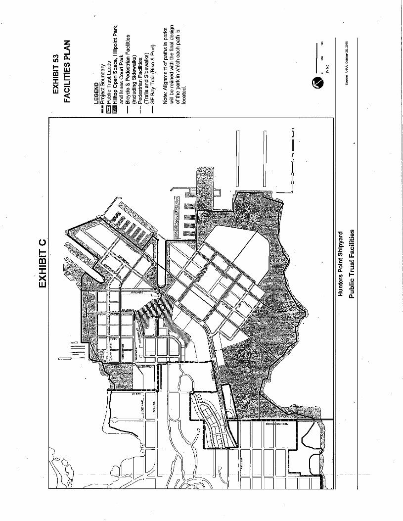
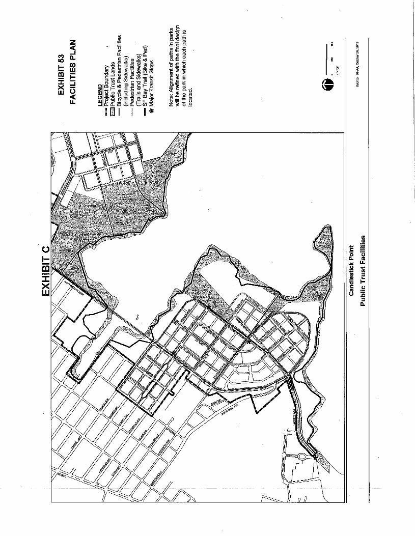
Facilities Plan To accommodate the revised land use plan, OCII requests that the Commission approve a new Facilities Plan (Exhibit 53 to the Agreement). The Agreement allows for material changes from the original Facilities Plan if the changes are consistent with the applicable requirements of Section 23 of Chapter 203 and approved by the Commission. The relevant requirements, in addition to the applicable findings listed above, are:
l. The streets and other transportation facilities located on trust lands are designed to be compatible with the Public Trust.
m. Direct vehicular and pedestrian access from the lower portions of the shipyard to the top of the Hillside Open Space area is provided.
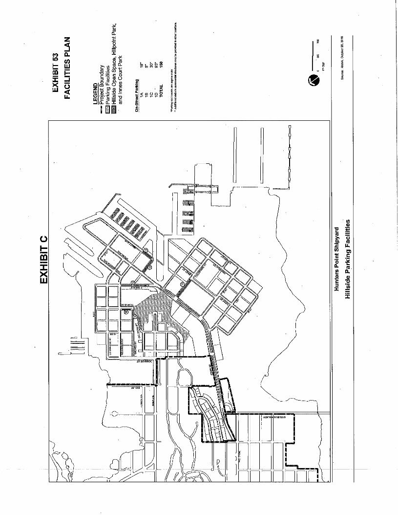
n. Adequate parking areas accessible to the public to support regional and statewide use of the Hillside Open Space shall be dedicated in an area adjacent to the lower portion of the Hillside Open Space.
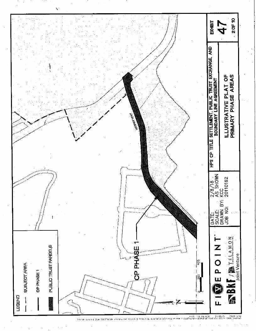
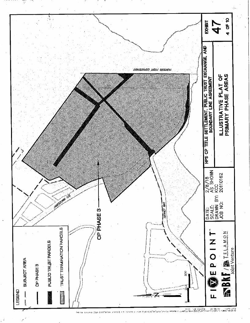
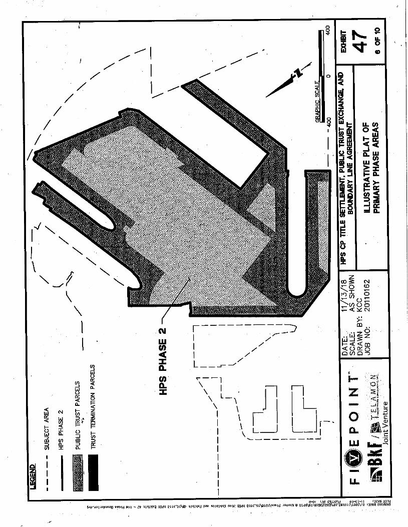
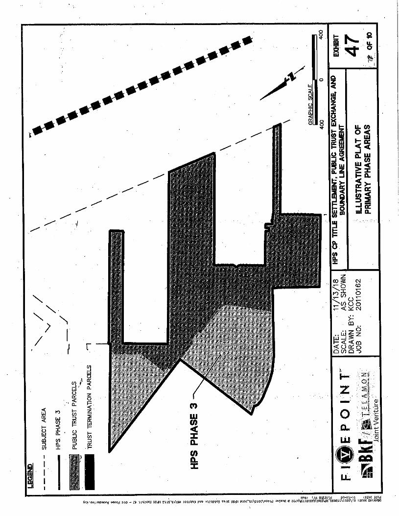
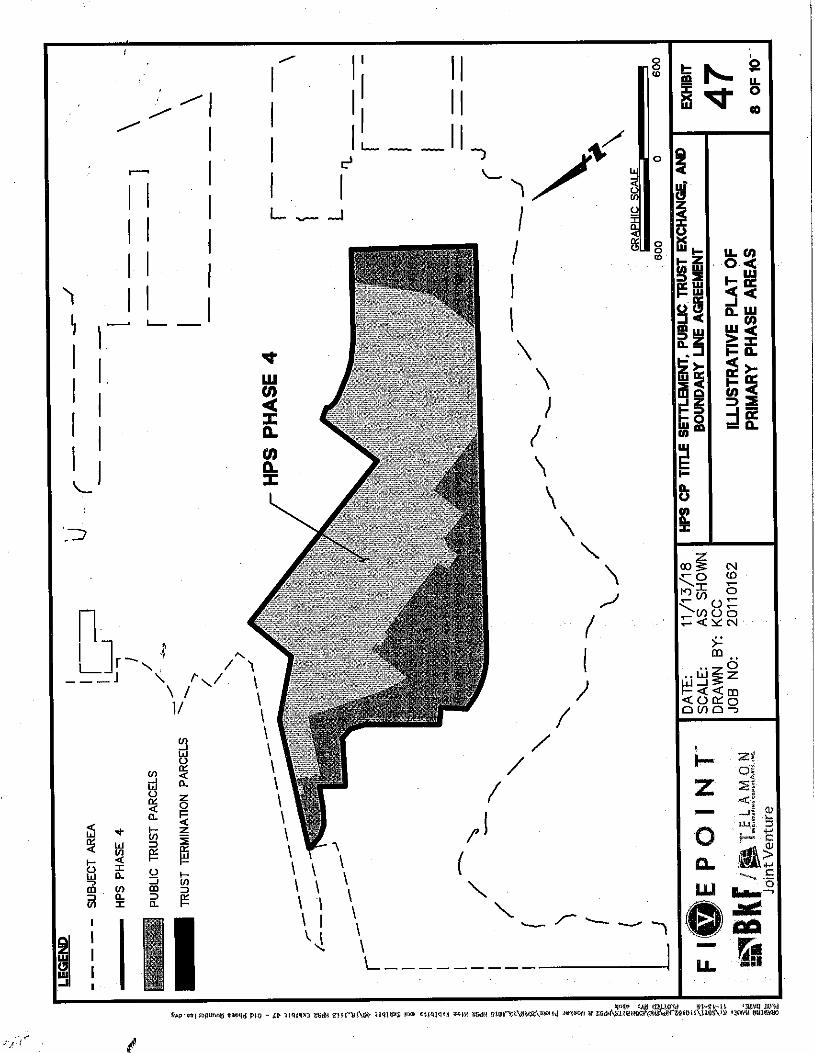
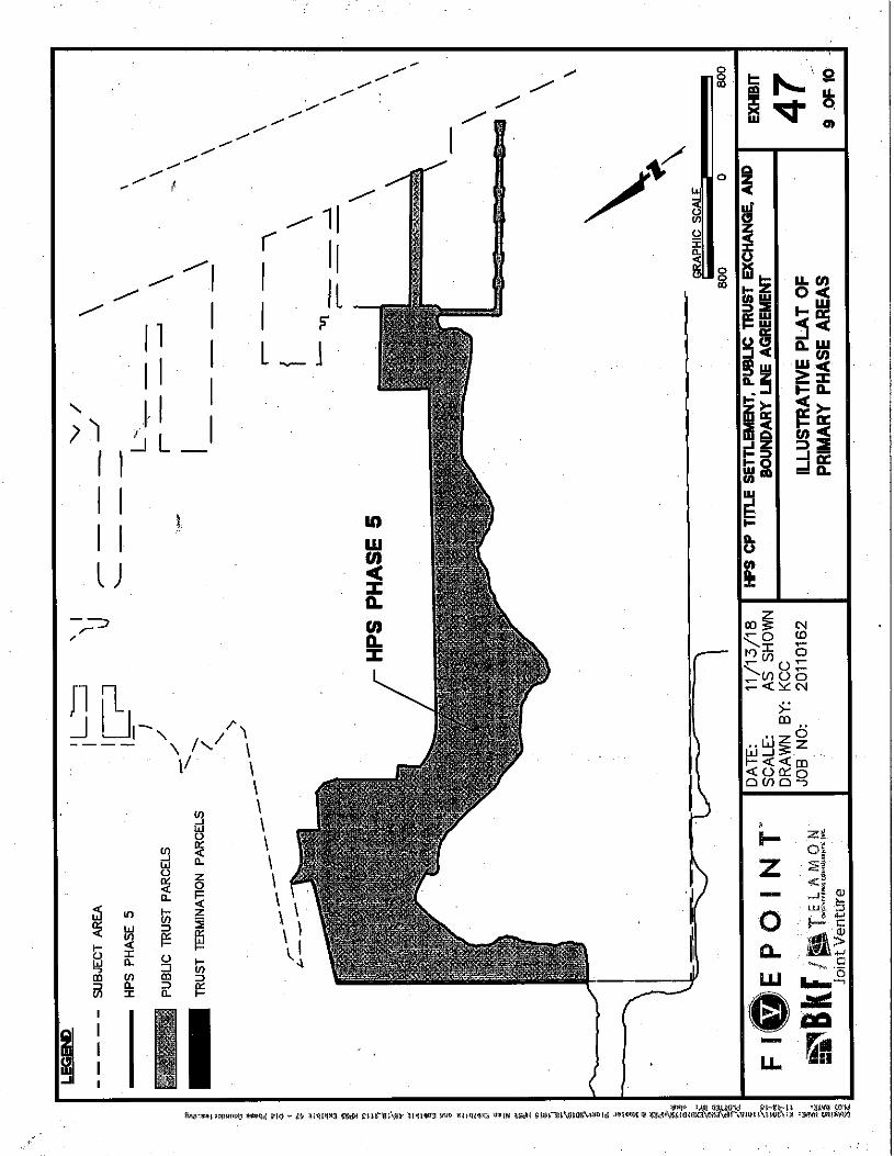
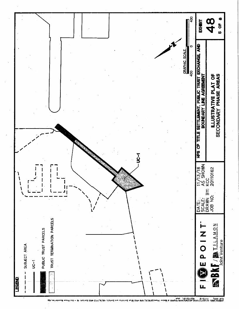
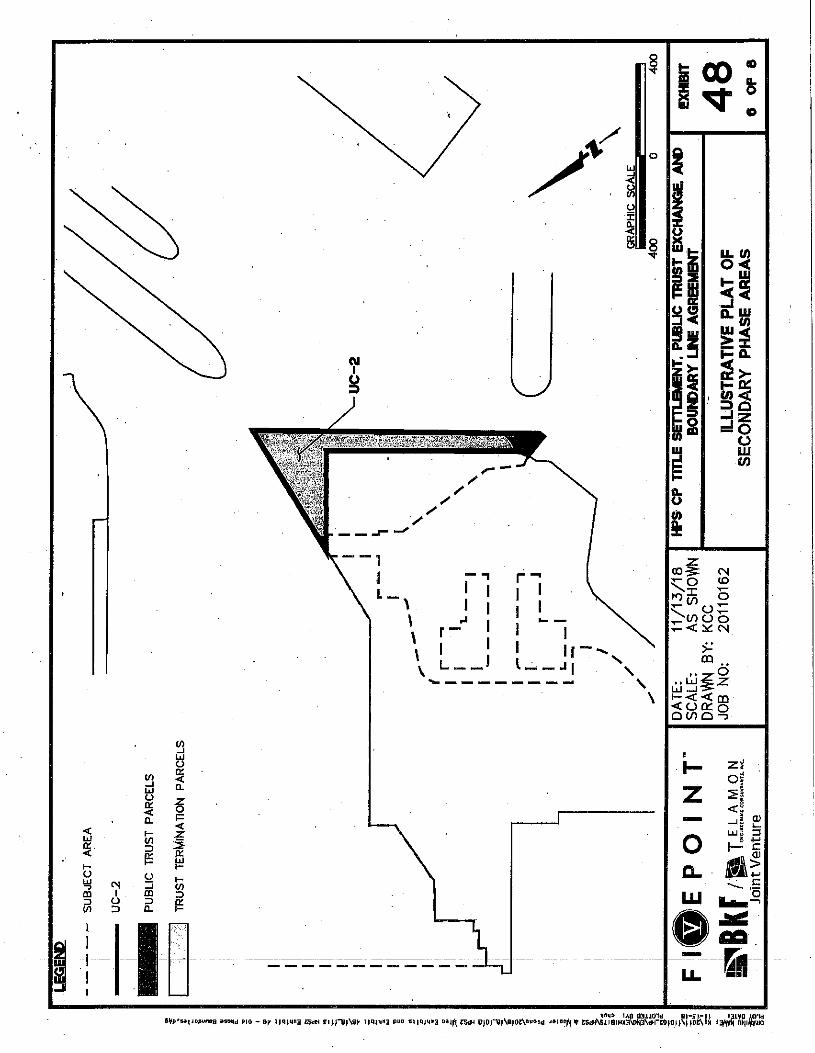
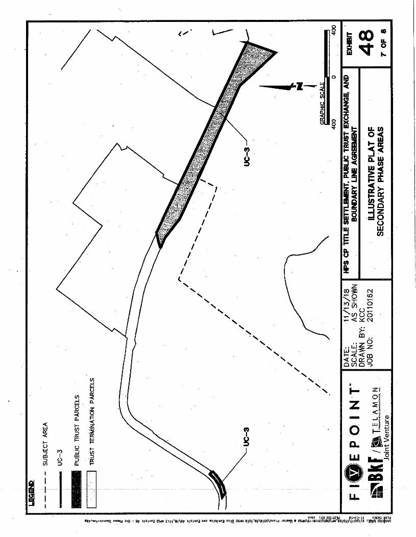
STAFF ANALYSIS AND RECOMMENDATION: In April 2011, the Commission made all the above findings for the Agreement, including the original Public Trust lands boundaries, phase areas, and Facilities Plan. The land reconfiguration is substantially similar to the previous configuration and within the same Agreement subject area. The most significant change, owing to the stadium being eliminated from the Hunters Point Shipyard development, removes trust land from the southeast portion of the Shipyard and adds trust land to the northwest “shoulder” of the Shipyard.
The primary areas proposed to be removed from the final trust configuration are open space lands along the southeast boundary of the “Warehouse District,” which are now planned to be recreational sports fields, and lands forming a rough triangle point at the eastern edge of the same district, pointing toward the mouth of the former drydock. Other lands to be removed from the trust configuration are the result of shifting the street grid.
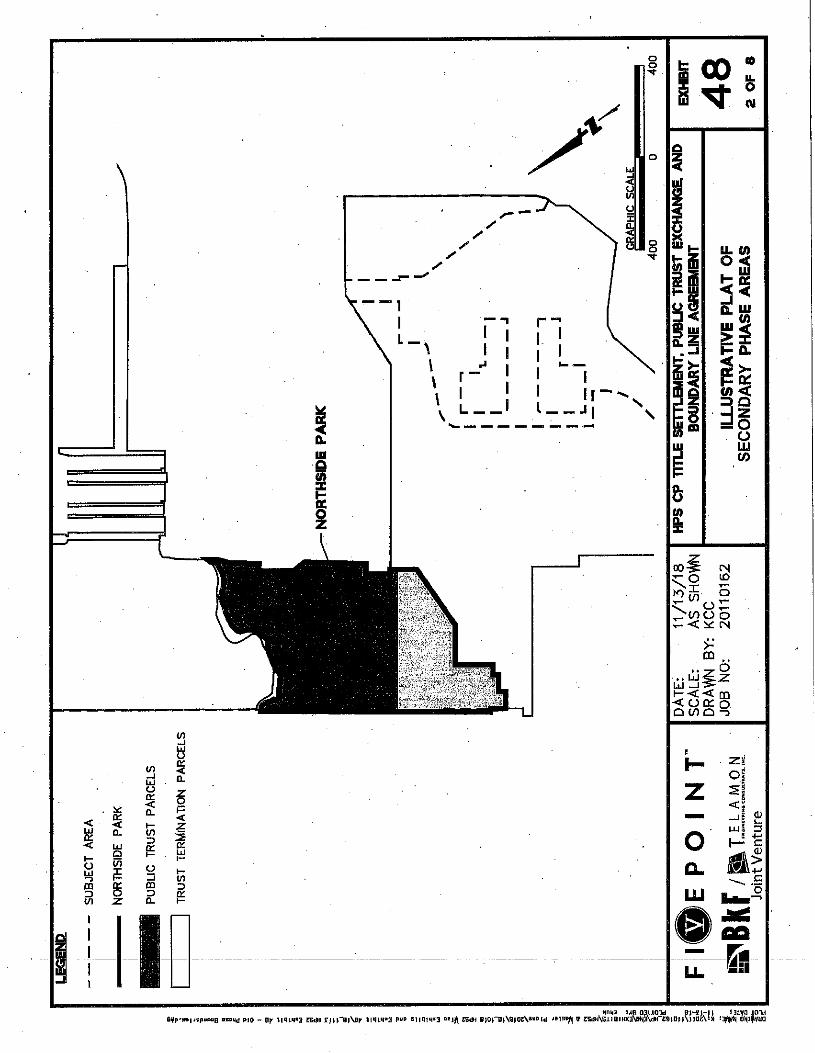
Most of the areas to be added to the Trust configuration consist of additional open space. The area between the original trust open space and the development boundary, and a portion of the Crisp Road frontage, is now proposed to be trust-consistent open space. Trust-consistent open space is also being extended to the development boundary within the “North Shoreline” district. Smaller pieces of trust land are newly-added or shifted rights-of-way and a small expansion to Northside Park.

STAFF REPORT NO. C73 (CONT’D)
-5-
The entire Shipyard shoreline and all submerged lands would remain within the Public Trust. The lands removed from the Public Trust under the reconfiguration have been filled and reclaimed, are cut off from navigable waters, appear to be no longer needed or required for the promotion of the Public Trust, and constitute a relatively small portion of the granted Public Trust lands within the city. No substantial interference with Public Trust uses and purposes, including public rights of navigation and fishing, will occur by virtue of the reconfiguration.
As provided in the Agreement, the Commission will review each closing phase for conformity with the phasing requirements in the Agreement. And before each closing, OCII must file a record of survey with the City and County of San Francisco that the Commission has reviewed and approved.
The layout of streets in the Shipyard remains largely the same as in the existing configuration, except that the large area expected to be occupied by a stadium now has a grid of streets, and some streets throughout the Shipyard have been marginally realigned. Staff views the street layout changes as insubstantial. Public street parking adjacent to the northeast shoreline has been added to the Trust. Street access to Public Trust lands is similar to or better than the existing plan.
The Facilities Plan lays out improvements and enhancements to Public Trust parcels through the development of open space areas, bike trails, walking and jogging paths, viewing areas of San Francisco Bay, visitor-serving facilities, and other trust consistent uses. Chapter 203 requires that streets and other transportation facilities on Public Trust parcels are compatible with the Public Trust and serve primarily Public Trust purposes of access to shoreline improvements and shoreline circulation, not serving nontrust purposes.
The modified Facilities Plan rearranges bike and pedestrian routes within Hunters Point, removing a route from Northside Park and adding several bike and pedestrian routes crossing the center of the project rather than around the perimeter of what was to be the stadium. The routes will connect with the Bay Trail north of Yosemite Slough. The Bay Trail route remains unchanged. Pedestrian routes were removed from Horne Street, B Street, and 13th Street, and added at the north end of the project perimeter. Structure and surface parking lots were removed and replaced with street parking. The total number of parking spots remains the same. Additional transit stops were added to the Candlestick Point site.
Staff reviewed the Public Trust street reconfiguration and the modified Facilities Plan and determined that the Agreement continues to: (a) provide access to Public Trust lands and be consistent with the beneficial use of those lands; (b)
STAFF REPORT NO. C73 (CONT’D)
-6-
provide for streets and transportation facilities located on the Public Trust parcels that are compatible with the Public Trust and serve primarily Public Trust purposes of access to shoreline improvements and shoreline circulation; (c) maintain reasonable public pedestrian and vehicular access between the Hillside Open Space and the waterfront, and between the top of the Hillside Open Space and other areas of the city; (d) provide direct vehicular and pedestrian access from the lower portions of the Shipyard Site to the top of the Hillside Open Space; and, (e) provide adequate parking areas adjacent to the lower portion of the Hillside Open Space that is accessible to the public to support regional and statewide use of the Hillside Open Space.
The City has not yet consented to the Parcel Boundary Adjustment, but consent is expected to be obtained soon. For this reason, staff recommends that the Commission’s approval be conditioned upon receipt by the Executive Officer of written consent from the City and County of San Francisco. After receiving consent, a memorandum commemorating the changes will be recorded and revised exhibits will replace the existing Exhibits 2, 4, 12, 47, 48, and 53 of the Agreement.
OTHER PERTINENT INFORMATION: 1. This proposed action is consistent with Strategy 1.2 of the Commission’s
Strategic Plan to provide that the current and future management of ungranted sovereign lands and resources and granted lands, including through strategic partnerships with trustee ports and harbor districts, are consistent with evolving Public Trust principles and values.
2. In June 2018, the Commission approved a revision to the Building Height
Restrictions at Hunters Point Shipyard (Item C84, June 21, 2018). This action was for the same reasons as the present proposal: changes made to the overall Hunters Point land-use plan.
3. The Trust Exchange Agreement includes protections for the public and the
Commission, including a requirement that no land will be impressed with the public trust until the Navy has made findings that it is safe for its intended purpose, and a specific indemnification of the State for any harms related to hazardous materials. Specifically, prior to the conveyance of Public Trust lands, federal and state environmental regulators, including the US Environmental Protection Agency and the California Department of Public Health, overseeing site cleanup and remediation at Hunters Point must review and concur that remediation has been completed. The Navy has committed to third party oversight to ensure the validity of data collected during the cleanup retesting process. The Commission and OCII must then approve the transfer. The Navy is
STAFF REPORT NO. C73 (CONT’D)
-7-
required to covenant that all required remediation has been completed. If additional remediation action is required, further cleanup will be the responsibility of the Navy. No finding regarding site cleanup and remediation is required for the subject action by the Commission.
4. An Environmental Impact Report (EIR), State Clearinghouse No. 2007082168, was prepared for the project by the San Francisco Planning Department/Office of Community Investment and Infrastructure and certified on June 3, 2010. On April 26, 2018, the San Francisco Planning Department/Office of Community Investment and Infrastructure approved an Addendum to the EIR. Staff has reviewed the EIR and Addendum.
EXHIBITS:
A. Location and Site Map B. Illustrative Plats of Revised Exchange Areas C. Modified Facilities Plan
RECOMMENDED ACTION: It is recommended that the Commission:
CEQA FINDING: Find that an Environmental Impact Report, State Clearinghouse No. 2007082168, was prepared by the San Francisco Planning Department/Office of Community Investment and Infrastructure and certified on June 3, 2010, and that an Addendum was approved on April 26, 2018, and that staff has reviewed and considered the information in the EIR and in the Addendum. Find that in its independent judgment, none of the events specified in Public Resources Code section 21166 or in section 15162 of the State CEQA Guidelines resulting in any new or substantially more severe significant impacts has occurred, and therefore, no additional CEQA analysis is required.
AUTHORIZATION: 1. Upon the Executive Officer’s receipt of written consent by the City
and County of San Francisco, find that the proposed configuration materially differs from Exhibit 2 of the Agreement but is substantially similar to the configuration in Section 25 of Chapter 203 and that;
a. The portions of the trust lands or interests in lands to be
exchanged out of the Public Trust have been filled and reclaimed, are cut off from access to the waters of San Francisco Bay and are no longer in fact tidelands or submerged lands or navigable waterways, are relatively useless for Public
STAFF REPORT NO. C73 (CONT’D)
-8-
Trust purposes, and constitute a relatively small portion of the granted lands within the city.
b. The lands or interests in lands to be impressed with the Public Trust have a monetary value equal to or greater than the monetary value of the lands or interests in lands to be exchanged out of the Trust.
c. No substantial interference with Public Trust uses and purposes, including public rights of navigation and fishing, will ensue by virtue of the Exchange.
d. The lands or interests in lands impressed with the Public Trust will provide a significant benefit to the Public Trust and are useful for the particular Trust purposes authorized by Chapter 203.
e. The configuration of the Public Trust lands within the subject area upon completion of the Exchange is substantially similar to the configuration shown on the diagram in Section 25 of Chapter 203, includes all lands within the subject area that are presently below mean high tide, and consists of lands suitable to be impressed with the Public Trust.
f. The final layout of streets in the subject area will provide access to the Public Trust lands and will be consistent with the beneficial use of the Public Trust lands.
g. The final trust configuration maintains reasonable public pedestrian and vehicular access between the Hillside Open Space and the waterfront, and in addition, between the top of the Hillside Open Space and other areas of the city.
h. Streets and other transportation facilities located on Public Trust lands shall be designed to be compatible with the Public Trust and to serve primarily Public Trust purposes of access to shoreline improvements and shoreline circulation rather than serving nontrust purposes.
i. The Exchange otherwise complies with the requirements of Chapter 203.
j. The Exchange is consistent with and furthers the purpose of the Public Trust and Chapter 203.
k. The Exchange is otherwise in the best interests of the statewide public.
2. Find that the modified Facilities Plan is a material deviation from the
Agreement but is still consistent with the applicable requirements of Section 23 of Chapter 203 for the following reasons:
STAFF REPORT NO. C73 (CONT’D)
-9-
a. The streets and other transportation facilities located on trust lands are designed to be compatible with the Public Trust.
b. Direct vehicular and pedestrian access from the lower portions of the shipyard to the top of the Hillside Open Space area is provided.
c. Adequate parking areas accessible to the public to support regional and statewide use of the Hillside Open Space shall be dedicated in an area adjacent to the lower portion of the Hillside Open Space.
3. Authorize the Executive Officer, on behalf of the Commission, to approve exhibits and to execute memoranda or other recordable instruments commemorating the Parcel Boundary Adjustment, revised Facilities Plan, and revised Building Height Limitations (previously approved by Commission action in June 2018) in substantially the form of exhibits on file in the Sacramento Office of the Commission.
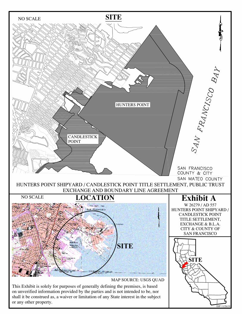
HUNTERS POINT
CANDLESTICKPOINT
W 26279 / AD 557HUNTERS POINT SHIPYARD /
CANDLESTICK POINTTITLE SETTLEMENT,EXCHANGE & B.L.A.CITY & COUNTY OF
SAN FRANCISCO
MAP SOURCE: USGS QUAD
HUNTERS POINT SHIPYARD / CANDLESTICK POINT TITLE SETTLEMENT, PUBLIC TRUSTEXCHANGE AND BOUNDARY LINE AGREEMENT
This Exhibit is solely for purposes of generally defining the premises, is basedon unverified information provided by the parties and is not intended to be, norshall it be construed as, a waiver or limitation of any State interest in the subjector any other property.
SITE
DJF 11/26/18
Exhibit ANO SCALE
NO SCALE SITE
LOCATION
SITE