Embed Size (px)
Citation preview
2010State of Transportation Planning
State of Transportation Planning 2010
Walking
State of Transportation Planning 2010
State of Transportation Planning
State of Transportation Planning
State of Transportation Planning 2010
State of
State of Transportation
State of Tra
Trans
Transportation Planning 2010
State of Transportation Planning 2010
State of Transportation Planning 2010
State of Transportation Planning
Transportation Planning
State of
portation
Planning
2010
StTraPlan
2010Public Tra
Evacuation PlanningFreight Transport
Automobile
Congestion Pricing
Public Transit
Bicycling
Public Transit
Walking
Travel Behavior
State of Transportation Planning 2010
2010
State of Transportation
Public Transit Planning State of Transportation Planning 2010
State
Travel Behavior
Walking
Land Use Impacts
Planning
Congestion Pricing
2010
Transportation Policy
Freight Trans2010
Freight TransportWalking2010Transportation Policy Public State of
Evacuation Planning
Congestion Pricing
Public Transit
Bicycling
Land Use Impacts
Automobile
2010
Bicycling20102010 2010
TransportTransit
Transportation Planning 2010Land Use Impacts
Walking Planning
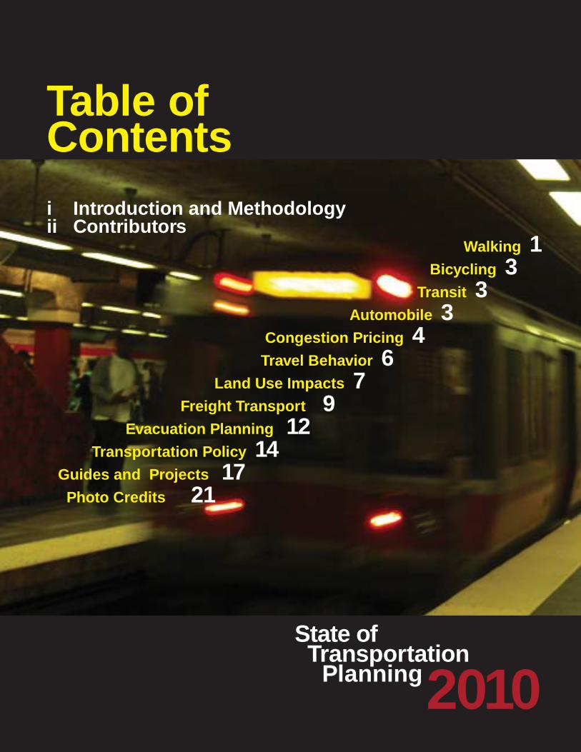
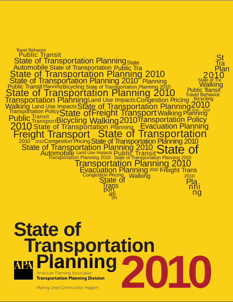
Table of Contents
Walking 1 Bicycling 3 Transit 3 Automobile 3 Congestion Pricing 4 Travel Behavior 6 Land Use Impacts 7 Freight Transport 9 Evacuation Planning 12 Transportation Policy 14 Guides and Projects 17 Photo Credits 21
i Introduction and Methodologyii Contributors
2010State of Transportation Planning
i
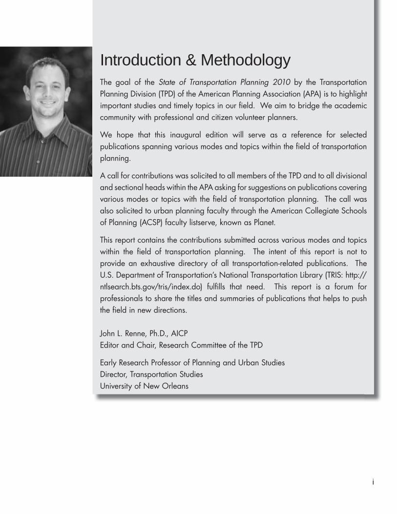
Introduction & MethodologyThe goal of the State of Transportation Planning 2010 by the Transportation Planning Division (TPD) of the American Planning Association (APA) is to highlight important studies and timely topics in our field. We aim to bridge the academic community with professional and citizen volunteer planners.
We hope that this inaugural edition will serve as a reference for selected publications spanning various modes and topics within the field of transportation planning.
A call for contributions was solicited to all members of the TPD and to all divisional and sectional heads within the APA asking for suggestions on publications covering various modes or topics with the field of transportation planning. The call was also solicited to urban planning faculty through the American Collegiate Schools of Planning (ACSP) faculty listserve, known as Planet.
This report contains the contributions submitted across various modes and topics within the field of transportation planning. The intent of this report is not to provide an exhaustive directory of all transportation-related publications. The U.S. Department of Transportation’s National Transportation Library (TRIS: http://ntlsearch.bts.gov/tris/index.do) fulfills that need. This report is a forum for professionals to share the titles and summaries of publications that helps to push the field in new directions.
John L. Renne, Ph.D., AICPEditor and Chair, Research Committee of the TPD
Early Research Professor of Planning and Urban StudiesDirector, Transportation StudiesUniversity of New Orleans
2010State of Transportation Planning
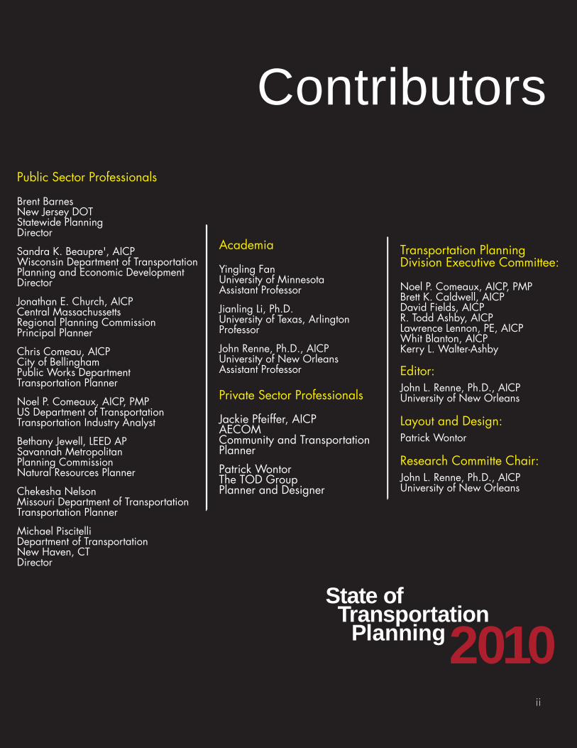
Contributors
ii
Public Sector Professionals
Brent BarnesNew Jersey DOTStatewide PlanningDirector
Sandra K. Beaupre', AICPWisconsin Department of Transportation Planning and Economic DevelopmentDirector
Jonathan E. Church, AICPCentral Massachussetts Regional Planning CommissionPrincipal Planner
Chris Comeau, AICPCity of Bellingham Public Works DepartmentTransportation Planner
Noel P. Comeaux, AICP, PMPUS Department of TransportationTransportation Industry Analyst
Bethany Jewell, LEED APSavannah MetropolitanPlanning CommissionNatural Resources Planner
Chekesha NelsonMissouri Department of TransportationTransportation Planner
Michael PiscitelliDepartment of TransportationNew Haven, CTDirector
Academia
Yingling FanUniversity of MinnesotaAssistant Professor
Jianling Li, Ph.D.University of Texas, ArlingtonProfessor
John Renne, Ph.D., AICPUniversity of New Orleans Assistant Professor
Private Sector Professionals
Jackie Pfeiffer, AICPAECOMCommunity and Transportation Planner
Patrick WontorThe TOD GroupPlanner and Designer
Transportation Planning Division Executive Committee:
Noel P. Comeaux, AICP, PMPBrett K. Caldwell, AICPDavid Fields, AICPR. Todd Ashby, AICPLawrence Lennon, PE, AICPWhit Blanton, AICPKerry L. Walter-Ashby
Editor:John L. Renne, Ph.D., AICPUniversity of New Orleans
Layout and Design:Patrick Wontor
Research Committe Chair:John L. Renne, Ph.D., AICPUniversity of New Orleans
1
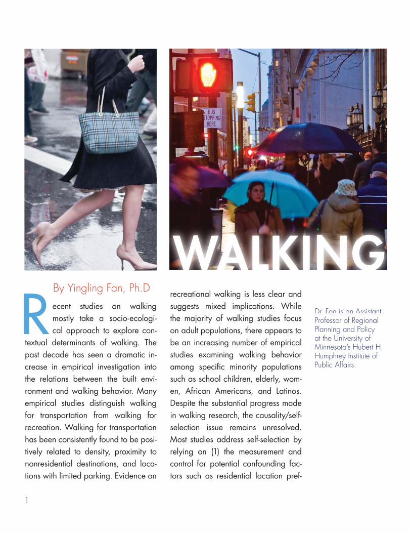
Dr. Fan is an Assistant Professor of Regional Planning and Policy at the University of Minnesota’s Hubert H. Humphrey Institute of Public Affairs.
RBy Yingling Fan, Ph.D
Dr. Fan is an Assistant
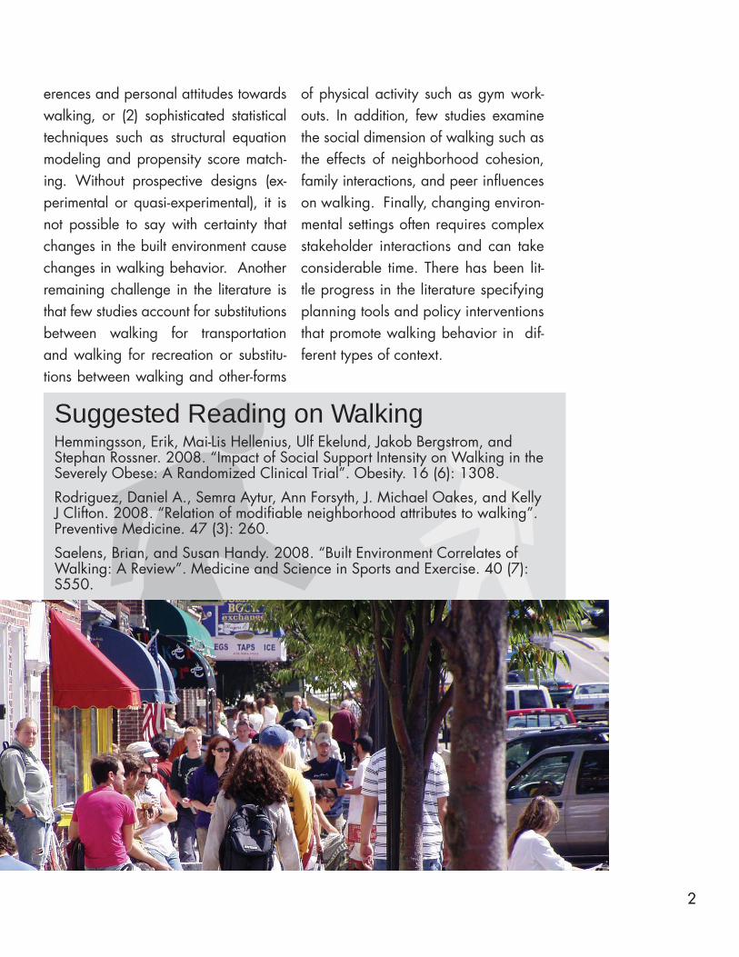
WALKING ecent studies on walking mostly take a socio-ecologi-cal approach to explore con-
textual determinants of walking. The past decade has seen a dramatic in-crease in empirical investigation into the relations between the built envi-ronment and walking behavior. Many empirical studies distinguish walking for transportation from walking for recreation. Walking for transportation has been consistently found to be posi-tively related to density, proximity to nonresidential destinations, and loca-tions with limited parking. Evidence on
recreational walking is less clear and suggests mixed implications. While the majority of walking studies focus on adult populations, there appears to be an increasing number of empirical studies examining walking behavior among specific minority populations such as school children, elderly, wom-en, African Americans, and Latinos. Despite the substantial progress made in walking research, the causality/self-selection issue remains unresolved. Most studies address self-selection by relying on (1) the measurement and control for potential confounding fac-tors such as residential location pref-
22
Suggested Reading on WalkingHemmingsson, Erik, Mai-Lis Hellenius, Ulf Ekelund, Jakob Bergstrom, and Stephan Rossner. 2008. “Impact of Social Support Intensity on Walking in the Severely Obese: A Randomized Clinical Trial”. Obesity. 16 (6): 1308.
Rodriguez, Daniel A., Semra Aytur, Ann Forsyth, J. Michael Oakes, and Kelly J Clifton. 2008. “Relation of modifiable neighborhood attributes to walking”. Preventive Medicine. 47 (3): 260.
Saelens, Brian, and Susan Handy. 2008. “Built Environment Correlates of Walking: A Review”. Medicine and Science in Sports and Exercise. 40 (7): S550.
erences and personal attitudes towards walking, or (2) sophisticated statistical techniques such as structural equation modeling and propensity score match-ing. Without prospective designs (ex-perimental or quasi-experimental), it is not possible to say with certainty that changes in the built environment cause changes in walking behavior. Another remaining challenge in the literature is that few studies account for substitutions between walking for transportation and walking for recreation or substitu-tions between walking and other-forms
of physical activity such as gym work-outs. In addition, few studies examine the social dimension of walking such as the effects of neighborhood cohesion, family interactions, and peer influences on walking. Finally, changing environ-mental settings often requires complex stakeholder interactions and can take considerable time. There has been lit-tle progress in the literature specifying planning tools and policy interventions that promote walking behavior in dif-ferent types of context.
o3
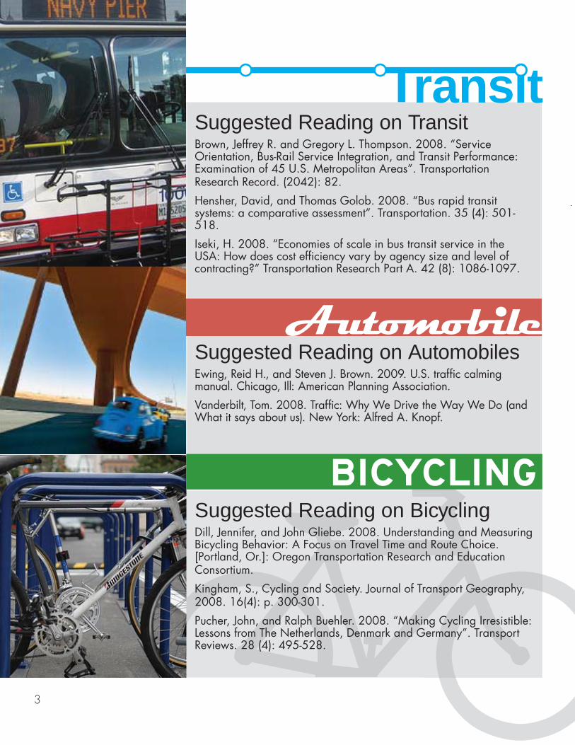
Suggested Reading on TransitBrown, Jeffrey R. and Gregory L. Thompson. 2008. “Service Orientation, Bus-Rail Service Integration, and Transit Performance: Examination of 45 U.S. Metropolitan Areas”. Transportation Research Record. (2042): 82.
Hensher, David, and Thomas Golob. 2008. “Bus rapid transit systems: a comparative assessment”. Transportation. 35 (4): 501-518.
Iseki, H. 2008. “Economies of scale in bus transit service in the USA: How does cost efficiency vary by agency size and level of contracting?” Transportation Research Part A. 42 (8): 1086-1097.
rans t
ooSuggested Reading on BicyclingDill, Jennifer, and John Gliebe. 2008. Understanding and Measuring Bicycling Behavior: A Focus on Travel Time and Route Choice. [Portland, Or.]: Oregon Transportation Research and Education Consortium.
Kingham, S., Cycling and Society. Journal of Transport Geography, 2008. 16(4): p. 300-301.
Pucher, John, and Ralph Buehler. 2008. “Making Cycling Irresistible: Lessons from The Netherlands, Denmark and Germany”. Transport Reviews. 28 (4): 495-528.
Automobile
BICYCLING
Suggested Reading on AutomobilesEwing, Reid H., and Steven J. Brown. 2009. U.S. traffic calming manual. Chicago, Ill: American Planning Association.
Vanderbilt, Tom. 2008. Traffic: Why We Drive the Way We Do (and What it says about us). New York: Alfred A. Knopf.
4
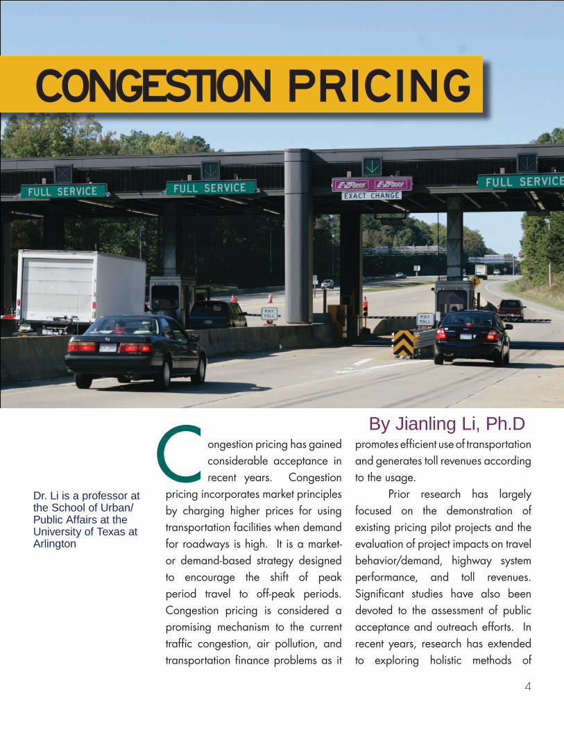
ongestion pricing has gained considerable acceptance in recent years. Congestion
pricing incorporates market principles by charging higher prices for using transportation facilities when demand for roadways is high. It is a market- or demand-based strategy designed to encourage the shift of peak period travel to off-peak periods. Congestion pricing is considered a promising mechanism to the current traffic congestion, air pollution, and transportation finance problems as it
promotes efficient use of transportation and generates toll revenues according to the usage. Prior research has largely focused on the demonstration of existing pricing pilot projects and the evaluation of project impacts on travel behavior/demand, highway system performance, and toll revenues. Significant studies have also been devoted to the assessment of public acceptance and outreach efforts. In recent years, research has extended to exploring holistic methods of
By Jianling Li, Ph.D
C
CONGESTION PRICING
Dr. Li is a professor at the School of Urban/Public Affairs at the University of Texas at Arlington
5
For more information about the current status of congestion pricing studies, visit the Federal Highway Administration’s web site at http://ops.fhwa.dot.gov/tolling_pricing/value_pricing/publications.htm.
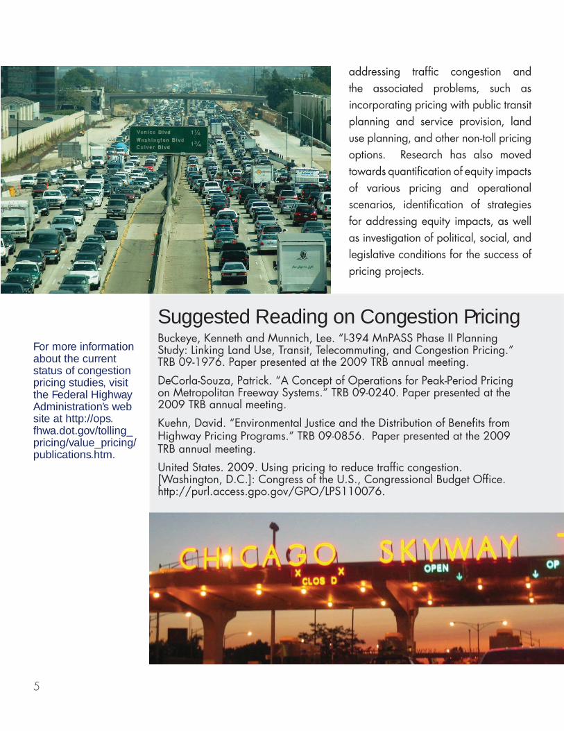
addressing traffic congestion and the associated problems, such as incorporating pricing with public transit planning and service provision, land use planning, and other non-toll pricing options. Research has also moved towards quantification of equity impacts of various pricing and operational scenarios, identification of strategies for addressing equity impacts, as well as investigation of political, social, and legislative conditions for the success of pricing projects.
Suggested Reading on Congestion PricingBuckeye, Kenneth and Munnich, Lee. “I-394 MnPASS Phase II Planning Study: Linking Land Use, Transit, Telecommuting, and Congestion Pricing.” TRB 09-1976. Paper presented at the 2009 TRB annual meeting.
DeCorla-Souza, Patrick. “A Concept of Operations for Peak-Period Pricing on Metropolitan Freeway Systems.” TRB 09-0240. Paper presented at the 2009 TRB annual meeting.
Kuehn, David. “Environmental Justice and the Distribution of Benefits from Highway Pricing Programs.” TRB 09-0856. Paper presented at the 2009 TRB annual meeting.
United States. 2009. Using pricing to reduce traffic congestion. [Washington, D.C.]: Congress of the U.S., Congressional Budget Office. http://purl.access.gpo.gov/GPO/LPS110076.
6
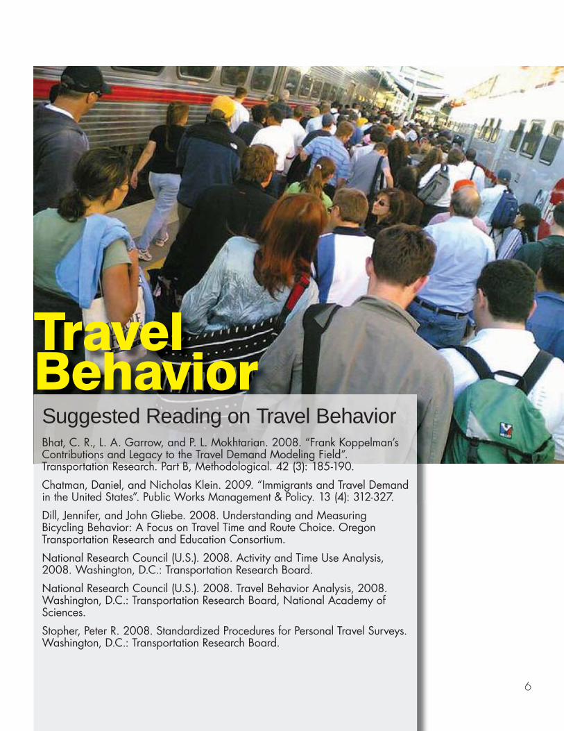
Travel BehaviorSuggested Reading on Travel BehaviorBhat, C. R., L. A. Garrow, and P. L. Mokhtarian. 2008. “Frank Koppelman’s Contributions and Legacy to the Travel Demand Modeling Field”. Transportation Research. Part B, Methodological. 42 (3): 185-190.
Chatman, Daniel, and Nicholas Klein. 2009. “Immigrants and Travel Demand in the United States”. Public Works Management & Policy. 13 (4): 312-327.
Dill, Jennifer, and John Gliebe. 2008. Understanding and Measuring Bicycling Behavior: A Focus on Travel Time and Route Choice. Oregon Transportation Research and Education Consortium.
National Research Council (U.S.). 2008. Activity and Time Use Analysis, 2008. Washington, D.C.: Transportation Research Board.
National Research Council (U.S.). 2008. Travel Behavior Analysis, 2008. Washington, D.C.: Transportation Research Board, National Academy of Sciences.
Stopher, Peter R. 2008. Standardized Procedures for Personal Travel Surveys. Washington, D.C.: Transportation Research Board.
7
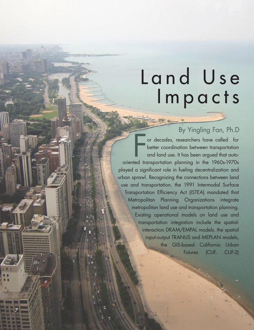
L a n d U s eI m p a c t s
By Yingling Fan, Ph.Dor decades, researchers have called for better coordination between transportation and land use. It has been argued that auto-
oriented transportation planning in the 1960s-1970s played a significant role in fueling decentralization and urban sprawl. Recognizing the connections between land
use and transportation, the 1991 Intermodal Surface Transportation Efficiency Act (ISTEA) mandated that
Metropolitan Planning Organizations integrate metropolitan land use and transportation planning.
Existing operational models on land use and transportation integration include the spatial-
interaction DRAM/EMPAL models, the spatial input-output TRANUS and MEPLAN models,
the GIS-based California Urban Futures (CUF, CUF-2)
F
8
Model, the MUSSA model, the CATLAS (and later METROSIM and NYMTC-LUM) model, and the UrbanSim model. Interested readers are referred to Miller, Kriger, and Hunt’s Transit Cooperative Research Project report on “Integrated Urban Models for Simulation of Transit and Land-Use Policies” in 1998. The recent smart growth movement also highlights the importance of integrating land use and transportation planning. There is a growing literature on the
travel reduction impact of mixed-use and transit-oriented developments. Another body of literature highlights the importance of using accessibility measures rather than mobility measures in assessing transportation systems. Accessibility measures take into account the geographic distribution of activities and destinations, which present a new means to integrate land use and transportation.
Suggested Reading on Land UseCurtis, Carey, Renne, John and Luca Bertolini. 2009. Transit Oriented Development: Making it happen. Surry, UK: Ashgate.
Ewing, R. H. 2008. Growing cooler: Evidence on urban development and climate change. Washington, D.C.: ULI.
Levinson, David M., and Kevin J. Krizek. 2008. Planning for place and plexus: metropolitan land use and transport. New York: Routledge.
Levinson, David M, et al. Access to destinations study report. 2008, Minnesota Department of Transportation, available at http://www.cts.umn.edu/access-study/
National Research Council (U.S.). 2009. Driving and the built environment the effects of compact development on motorized travel, energy use, and CO2 emissions. Washington, D.C.: Transportation Research Board.
9
Noel Comeaux, AICP, PMP is a Transportation Industry Analyst for the US Department of Transportation Maritime Administration.
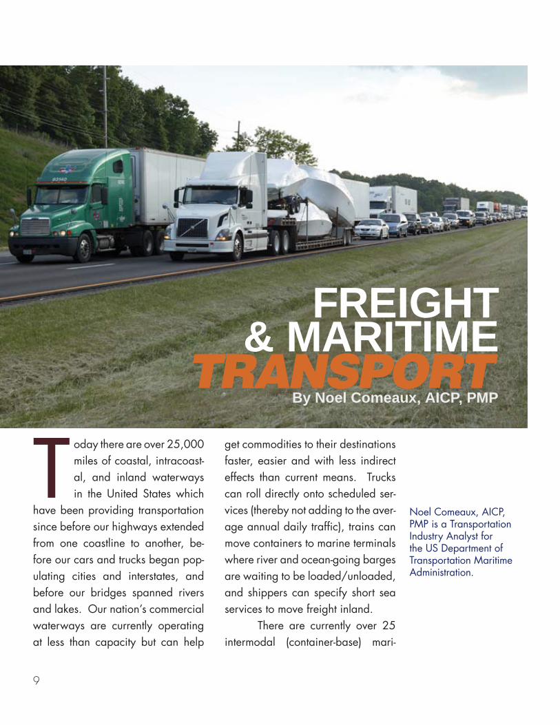
TRANSPORT FREIGHT
& MARITIMEBy Noel Comeaux, AICP, PMP
oday there are over 25,000 miles of coastal, intracoast-al, and inland waterways in the United States which
have been providing transportation since before our highways extended from one coastline to another, be-fore our cars and trucks began pop-ulating cities and interstates, and before our bridges spanned rivers and lakes. Our nation’s commercial waterways are currently operating at less than capacity but can help
get commodities to their destinations faster, easier and with less indirect effects than current means. Trucks can roll directly onto scheduled ser-vices (thereby not adding to the aver-age annual daily traffic), trains can move containers to marine terminals where river and ocean-going barges are waiting to be loaded/unloaded, and shippers can specify short sea services to move freight inland. There are currently over 25 intermodal (container-base) mari-
T
10
Suggested Reading on Freight TransportEuropean Union Short Sea Shipping: European Union Transport Initiatives to Achieve Sufficient Mobility in Order to Sustain Economic Growth; March 8, 2004. Prepared for U.S. Department of Transportation Maritime Administration (Office of Ports and Domestic Shipping).
Four Corridor Case Studies of Short-Sea Shipping Services – Short-Sea Shipping Business Case Analysis, August 15, 2006. Prepared by Global Insight in association with Reeves Associates for the Office of the Secretary/Maritime Administration in the U.S. Department of Transportation.
A Framework for Evaluating Marine Transportation System Condition and Performance (Final Report); April 27, 2007. Prepared by Cambridge Systematics, Inc. for the U.S. DOT Maritime Administration.
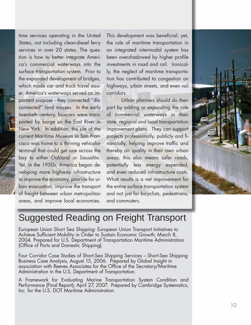
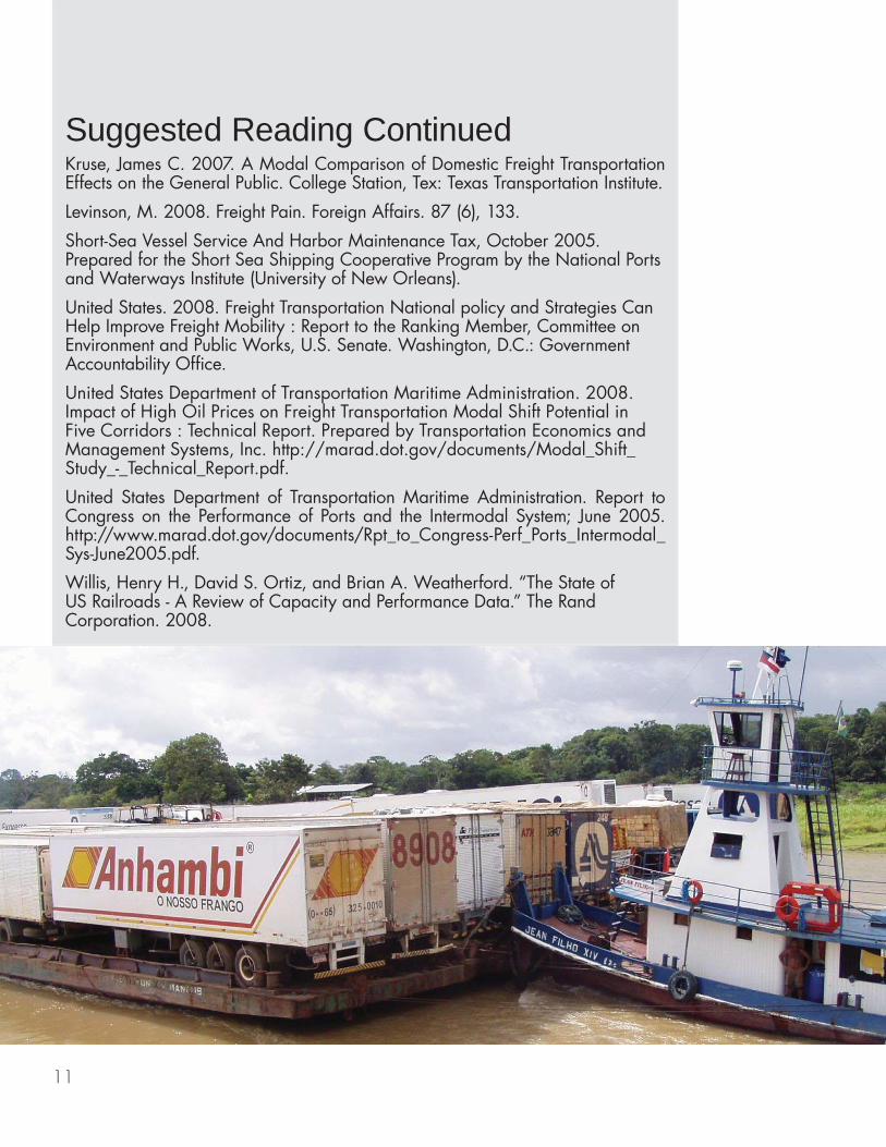
time services operating in the United States, not including clean-diesel ferry services in over 20 states. The ques-tion is how to better integrate Ameri-ca’s commercial waterways into the surface transportation system. Prior to the expanded development of bridges, which made car and truck travel easi-er, America’s waterways served an im-portant purpose - they connected “dis-connected” land masses. In the early twentieth century, boxcars were trans-ported by barge on the East River in New York. In addition, the site of the current Maritime Museum in San Fran-cisco was home to a thriving vehicular terminal that could get one across the bay to either Oakland or Sausalito. Yet, in the 1950s, America began de-veloping more highway infrastructure to improve the economy, provide for ur-ban evacuation, improve the transport of freight between urban metropolitan areas, and improve local economies.
This development was beneficial; yet, the role of maritime transportation in an integrated intermodal system has been overshadowed by higher profile investments in road and rail. Ironical-ly, the neglect of maritime transporta-tion has contributed to congestion on highways, urban streets, and even rail corridors. Urban planners should do their part by adding or expanding the role of commercial waterways in their state, regional and local transportation improvement plans. They can support projects professionally, publicly and fi-nancially, helping improve traffic and thereby air quality in their own urban areas; this also means safer roads, potentially less energy expended, and even reduced infrastructure costs. What results is a net improvement for the entire surface transportation system and not just for bicyclists, pedestrians, and commuters.
11
Suggested Reading ContinuedKruse, James C. 2007. A Modal Comparison of Domestic Freight Transportation Effects on the General Public. College Station, Tex: Texas Transportation Institute.
Levinson, M. 2008. Freight Pain. Foreign Affairs. 87 (6), 133.
Short-Sea Vessel Service And Harbor Maintenance Tax, October 2005. Prepared for the Short Sea Shipping Cooperative Program by the National Ports and Waterways Institute (University of New Orleans).
United States. 2008. Freight Transportation National policy and Strategies Can Help Improve Freight Mobility : Report to the Ranking Member, Committee on Environment and Public Works, U.S. Senate. Washington, D.C.: Government Accountability Office.
United States Department of Transportation Maritime Administration. 2008. Impact of High Oil Prices on Freight Transportation Modal Shift Potential in Five Corridors : Technical Report. Prepared by Transportation Economics and Management Systems, Inc. http://marad.dot.gov/documents/Modal_Shift_Study_-_Technical_Report.pdf.
United States Department of Transportation Maritime Administration. Report to Congress on the Performance of Ports and the Intermodal System; June 2005. http://www.marad.dot.gov/documents/Rpt_to_Congress-Perf_Ports_Intermodal_Sys-June2005.pdf.
Willis, Henry H., David S. Ortiz, and Brian A. Weatherford. “The State of US Railroads - A Review of Capacity and Performance Data.” The Rand Corporation. 2008.
12
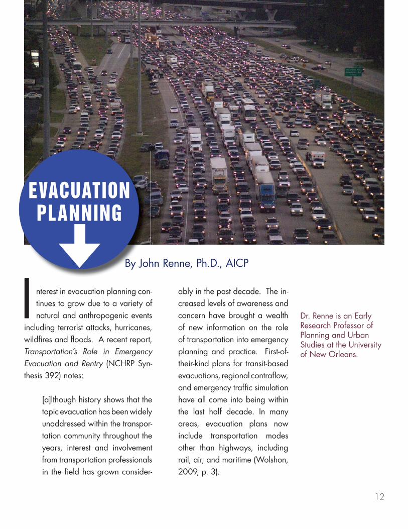
nterest in evacuation planning con-tinues to grow due to a variety of natural and anthropogenic events
including terrorist attacks, hurricanes, wildfires and floods. A recent report, Transportation’s Role in Emergency Evacuation and Rentry (NCHRP Syn-thesis 392) notes:
[a]lthough history shows that the topic evacuation has been widely unaddressed within the transpor-tation community throughout the years, interest and involvement from transportation professionals in the field has grown consider-
ably in the past decade. The in-creased levels of awareness and concern have brought a wealth of new information on the role of transportation into emergency planning and practice. First-of-their-kind plans for transit-based evacuations, regional contraflow, and emergency traffic simulation have all come into being within the last half decade. In many areas, evacuation plans now include transportation modes other than highways, including rail, air, and maritime (Wolshon, 2009, p. 3).
EVACUATIONPLANNING
By John Renne, Ph.D., AICP
Dr. Renne is an Early Research Professor of Planning and Urban Studies at the University of New Orleans.
I
13
Suggested Reading on Evacuation PlanningNational Research Council (U.S.). 2008. The Role of Transit in Emergency Evacuation. Washington, D.C.: Transportation Research Board. http://onlinepubs.trb.org/Onlinepubs/sr/sr294.pdf.
Renne, John, Sanchez, Thomas and Todd Litman. 2008. National Study on Carless and Special Needs Evacuation Planning. New Orleans, LA: University of New Orleans Transportation Center, Funded by the Federal Transit Administration. http://planning.uno.edu/docs/CarlessEvacuationPlanning.pdf.
United States. 2006. Report to Congress on Catastrophic Hurricane Evacuation Plan Evaluation. Washington, DC: United States Department of Transportation. http://www.fhwa.dot.gov/reports/hurricanevacuation/rtc_chep_eval.pdf.
Wolshon, P. B. 2009. Transportation’s Role in Emergency Evacuation and Reentry. Washington, D.C.: Transportation Research Board, National Research Council. http://onlinepubs.trb.org/onlinepubs/nchrp/nchrp_syn_392.pdf.
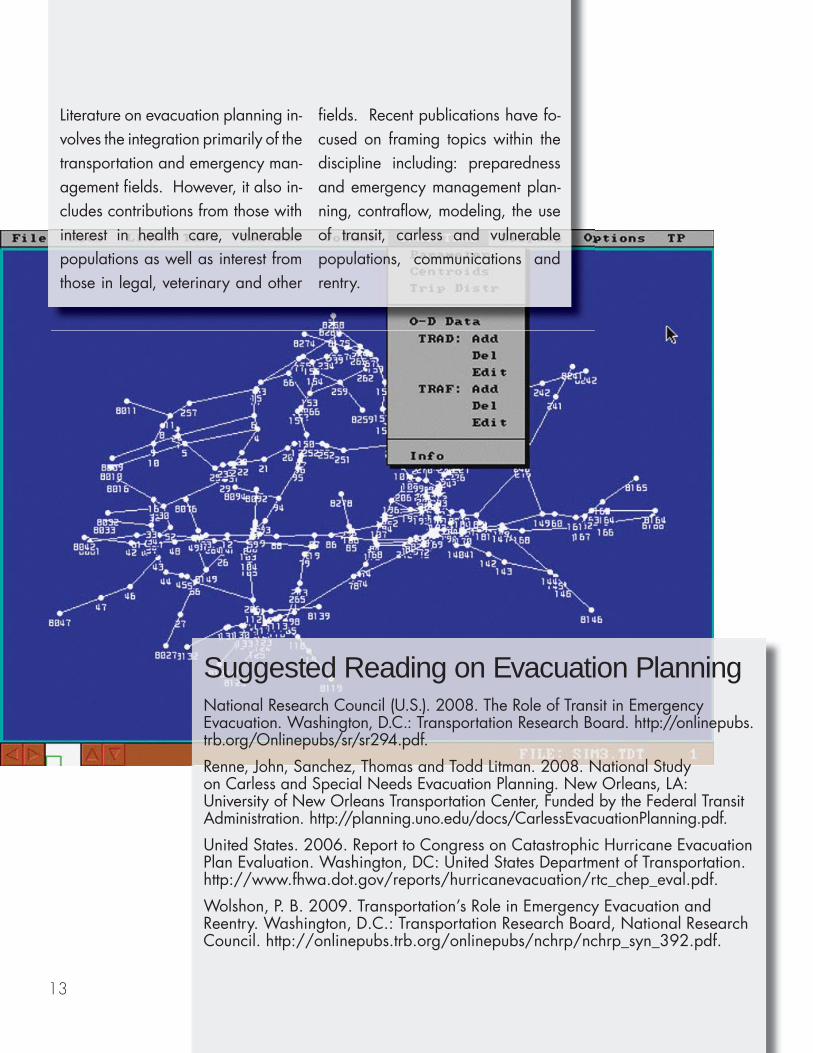
Literature on evacuation planning in-volves the integration primarily of the transportation and emergency man-agement fields. However, it also in-cludes contributions from those with interest in health care, vulnerable populations as well as interest from those in legal, veterinary and other
fields. Recent publications have fo-cused on framing topics within the discipline including: preparedness and emergency management plan-ning, contraflow, modeling, the use of transit, carless and vulnerable populations, communications and rentry.
14
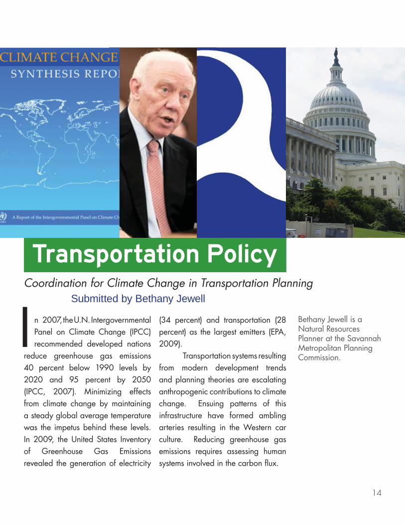
n 2007, the U.N. Intergovernmental Panel on Climate Change (IPCC) recommended developed nations
reduce greenhouse gas emissions 40 percent below 1990 levels by 2020 and 95 percent by 2050 (IPCC, 2007). Minimizing effects from climate change by maintaining a steady global average temperature was the impetus behind these levels. In 2009, the United States Inventory of Greenhouse Gas Emissions revealed the generation of electricity
(34 percent) and transportation (28 percent) as the largest emitters (EPA, 2009). Transportation systems resulting from modern development trends and planning theories are escalating anthropogenic contributions to climate change. Ensuing patterns of this infrastructure have formed ambling arteries resulting in the Western car culture. Reducing greenhouse gas emissions requires assessing human systems involved in the carbon flux.
Coordination for Climate Change in Transportation Planning Submitted by Bethany Jewell
ITransportation Policy
Bethany Jewell is a Natural Resources Planner at the Savannah Metropolitan Planning Commission.
15
Suggested Reading on Transportation PolicyAlexander, E.R. 2005. Institutional Transformation and Planning: From Institutionalization Theory to Institutional Design. Planning Theory. Vol.4: 209-223.
Borgerson, S. G. 2009. The national interest and the Law of the Sea. New York, NY: Council on Foreign Relations.
Cambridge Systematics, & Moving Cooler Steering Committee. 2009. Moving Cooler: An Analysis of Transportation Strategies for Reducing Greenhouse Gas Emissions. Washington, D.C.: Urban Land Institute.
Environmental Protection Agency. 2009. 2009 U.S. Greenhouse Gas Inventory Report. http://www.epa.gov/climatechange/emissions/
Ewing, Reid and Robert Cervero. 2001. Travel and the Built Environment: A Synthesis Transportation Research Record: Journal of the Transportation Research Board. Vol.1780 87-114.
Gallagher, Kelly Sims and Gustavo Collantes. 2008. Analysis of Policies to Reduce Oil Consumption and Greenhouse-Gas Emissions from the U.S. Transportation Sector. Discussion Paper 2008-06, Energy Technology Innovation Policy Research Group, Belfer Center for Science and International Affairs, Harvard Kennedy School: Cambridge, MA.
Questions over the ability to reach drastic reduction levels, such as the recently adopted California Global Warming Solutions Act (AB32) have been the focus of several case studies. Fundamental conclusions to these studies reveal that no “silver bullet” strategy yields success alone (Yang, McCollum, McCarthy and Leighty, 2008). Rather, a conglomeration of methods to reduce vehicle miles of travel through land use may prove fruitful. These include enhancements in alternative fuels,
higher efficiency standards and social marketing techniques through travel demand management (Alexander, 2005; Ewing and Cervero, 2001; Hensher, 2008; Rajan, 2006). Policies and tools from leading planning and policy researchers on the reduction of vehicle miles of travel indicate that a majority of measures require coordination among agencies of local and state governments for implementation success.
16
Suggested Reading ContinuedHensher, D.A. 2008. Climate Change, Enhanced Greenhouse Gas Emissions and Passenger Transport: What Can We Do to Make a Difference. Transportation Research Record: Journal of the Transportation Research Board. Vol.13: 95-111.
IPCC. 2007. Summary for Policymakers. Climate Change 2007: Mitigation, Contribution of Working Group III to the Fourth Assessment Report of the Intergovernmental Panel on Climate Change [B. Metz, O.R. Davidson, P.R. Bosch, R. Dave, L.A. Meyer (eds)], Cambridge University Press, Cambridge, United Kingdom and New York, NY, USA.
Lewis, M. 2010, January 21. Main Street Chases Transportation Money. Center for Public Integrity. http://www.publicintegrity.org/investigations/transportation_lobby/articles/entry/1911/
Miller, J. D. 2009. Infrastructure 2009: Pivot Point. Washington, D.C.: Urban Land Institute.
Oberstar, J. L. 2009. The Surface Transportation Authorization Act of 2009: A Blueprint for Investment and Reform. Washington, DC: U.S. House of Representatives, Committee on Transportation and Infrastructure. http://transportation.house.gov/Media/file/Highways/HPP/Surface%20Transportation%20Blueprint.pdf.
OECD. 2004. Communication Environmentally Sustainable Transport: The Role of Soft Measures. Organization for Economic Cooperation and Development: Paris, France.
Rajan, Sudhir Chella. 2006. Climate Change Dilemma: Technology, Social Change or both?: An Examination of Long-Term Transport Policy Choices in the United States. Energy Policy, Volume 34.
Yang, Christopher, David McCollum, Ryan McCarthy and Wayne Leighty. 2008. Meeting an 80% Reduction in Greenhouse Gas Emissions from Transportation by 2050: A Case Study in California. Institute of Transportation Studies, University of California–Davis. Transportation Research Board: Journal of the Transportation Research Board. Vol.14:147-156.
17
This section on projects and guides is a collection of
works submitted by industry professionals
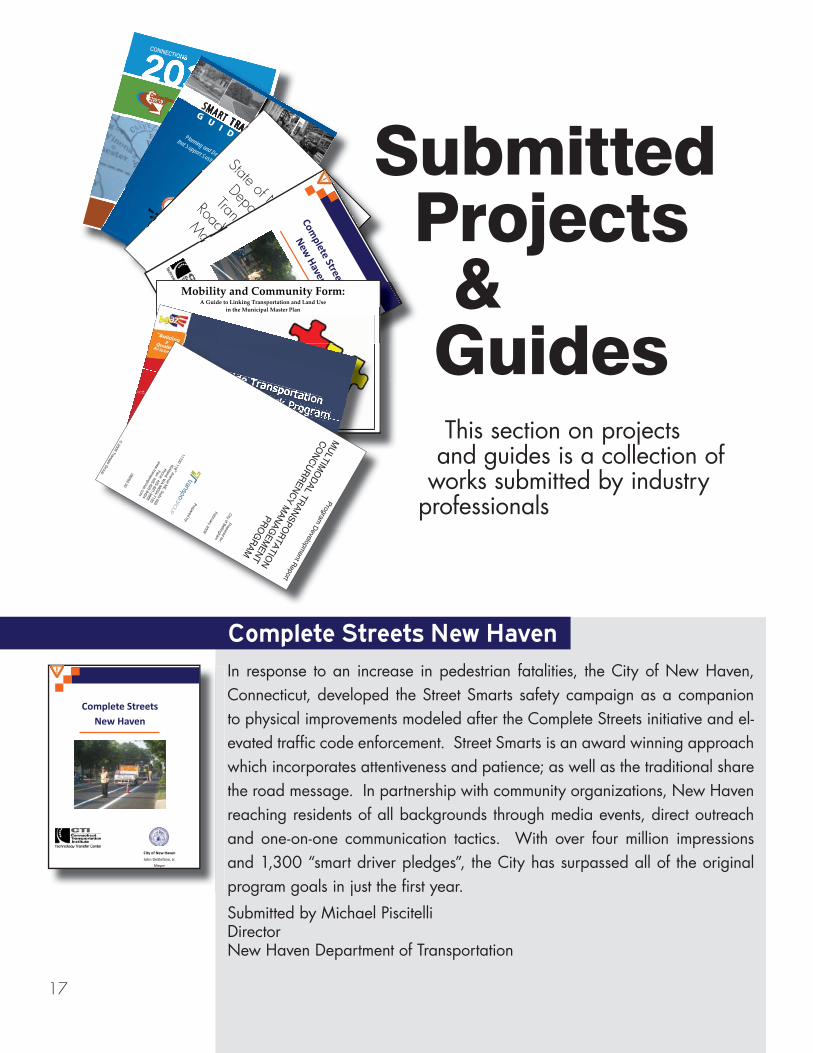
Complete Streets New Haven
In response to an increase in pedestrian fatalities, the City of New Haven, Connecticut, developed the Street Smarts safety campaign as a companion to physical improvements modeled after the Complete Streets initiative and el-evated traffic code enforcement. Street Smarts is an award winning approach which incorporates attentiveness and patience; as well as the traditional share the road message. In partnership with community organizations, New Haven reaching residents of all backgrounds through media events, direct outreach and one-on-one communication tactics. With over four million impressions and 1,300 “smart driver pledges”, the City has surpassed all of the original program goals in just the first year.
Submitted by Michael PiscitelliDirectorNew Haven Department of Transportation
Complete StreetsNew Haven
City of New Haven
John DeStefano, Jr.
Mayor
SMART TRANSPORTATION
GU
I DE B
OO
K
MARCH 2008
Planning and Designing Highways and Streets
that Support Sustainable and Livable Communities
MART TRANTRTRARAN
GU
I DEPlanning and Desig
that Support Sustain State of New Jersey
Department of
Transportation
Roadway Design
Manual 2008
State of NDepart
TranspRoadMa
f NparanspdMa
Complete
Streets
NewHaven
Cityof New
Haven
JohnDeStefano, Jr.
Mayor
Mobility and Community Form:A Guide to Linking Transportation and Land Use
in the Municipal Master Plan
October 2006
New Jersey Departmentof Transportation
in the Municipal Master Plan
Statewide Transportation
Planning Framework Program
Statewide Transportation
Planning Framework ProgramProject BriefingSeptember 2009
Project BriefingSeptember 2009
www.bqaz.gov
www.bqaz.gov
ta ew de T n por ationm
la n g r mew r P gr m
SSSttt ttteewidid T n po tatio
Statewide Transportation
StaStataatewtewtewewwtewwtewwwtewtewideidedeideideideideideididididi Tr Tr Tr T ansportation
Pla ni Fr mmeew rk P g am
PPlanning Framework Program
Planning Framewmewmewewmeewwwwworkorkorkorkrkrkkorkororooo Pr PrPP ogram
Planning Framework Program
Planning Framewwwwooroororkrkrkrkk PPrPrPrrogrog amroj c Briefing
September 2009
Project Bri finProject Briefing
Project BriefingSeptembe 2009
September 2009
September 2009
www.bqaz.gov
www.bqa .gov
www.bqaz.gov
www.bqaz.govProgram
Developm
ent Report
MU
LTIMO
DA
L TRA
NS
PO
RTA
TION
CO
NC
UR
RE
NC
Y M
ANA
GE
MEN
T
PR
OG
RAM
Prepared for:
City of Bellingham
February 2009
Prepared by: 11730 118
th Avenue NE, Suite 600
Kirkland, W
A 98034-7120
Phone: 425-821-3665
Fax: 425-825-8434
ww
w.transpogroup.com
08002.00 ©
2009 Transpo Group
Submitted Projects & Guides
1818
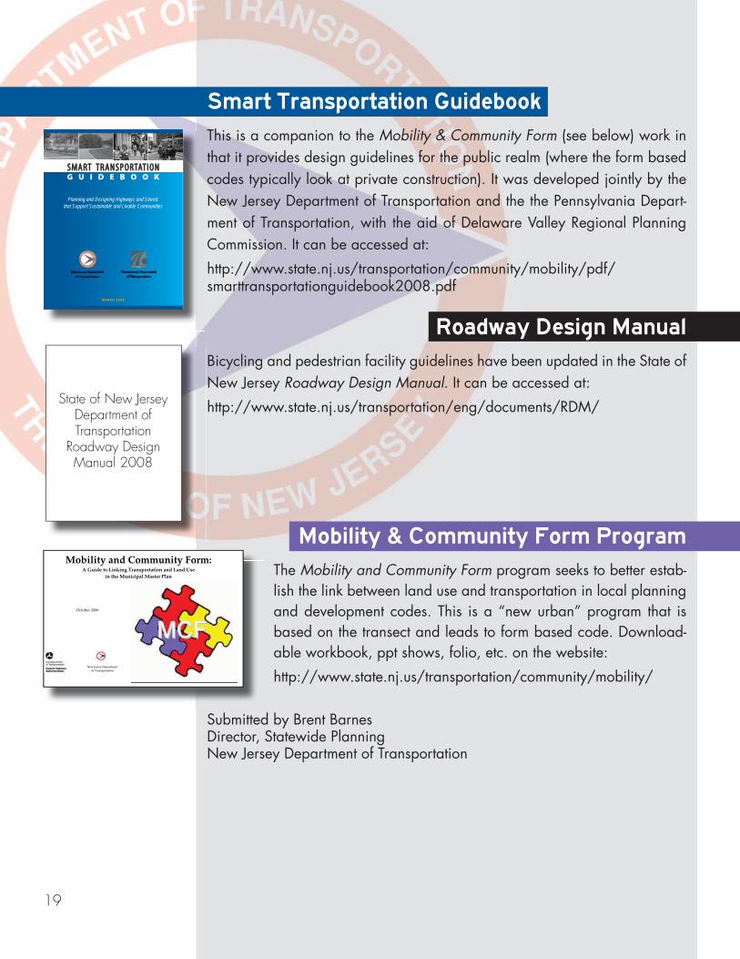
Program Development Report
MULTIMODAL TRANSPORTATION CONCURRENCY MANAGEMENT
PROGRAM
Prepared for: City of Bellingham
February 2009
Prepared by:
11730 118th Avenue NE, Suite 600 Kirkland, WA 98034-7120
Phone: 425-821-3665 Fax: 425-825-8434
www.transpogroup.com
08002.00
© 2009 Transpo Group
Multimodal Transportation Concurrency Management Program
Bellingham, Washington’s new systematic approach to multimodal transpor-tation concurrency regulations integrates land use and transportation goals, policies, development regulations, and funding mechanisms to ensure that ad-equate facilities are available for pedestrians, bicyclists, transit riders, and vehicle users. The new multimodal transportation concurrency regulations are consistent with comprehensive plan land use and transportation goals and policies and the long list of multimodal transportation projects needed to ac-commodate projected population growth. This innovative new approach is aimed toward achieving Bellingham’s long-term mode shift goals to reduce the percentage of trips made by single occupant vehicles while increasing the percentage of trips made by pedestrians, bicyclists, and transit riders. Find out more at:
http://www.cob.org/services/neighborhoods/community-planning/transportation/index.aspx#TCMO
Submitted by Chris ComeauTransportation PlannerBellingham, Washington, Public Works
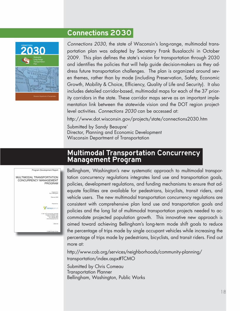
Connections 2030
Connections 2030, the state of Wisconsin’s long-range, multimodal trans-portation plan was adopted by Secretary Frank Busalacchi in October 2009. This plan defines the state’s vision for transportation through 2030 and identifies the policies that will help guide decision-makers as they ad-dress future transportation challenges. The plan is organized around sev-en themes, rather than by mode (including Preservation, Safety, Economic Growth, Mobility & Choice, Efficiency, Quality of Life and Security). It also includes detailed corridor-based, multimodal maps for each of the 37 prior-ity corridors in the state. These corridor maps serve as an important imple-mentation link between the statewide vision and the DOT region project-level activities. Connections 2030 can be accessed at:
http://www.dot.wisconsin.gov/projects/state/connections2030.htm
Submitted by Sandy Beaupre’Director, Planning and Economic DevelopmentWisconsin Department of Transportation
19
State of New JerseyDepartment of Transportation
Roadway Design Manual 2008
Roadway Design Manual
Bicycling and pedestrian facility guidelines have been updated in the State of New Jersey Roadway Design Manual. It can be accessed at:
http://www.state.nj.us/transportation/eng/documents/RDM/
Smart Transportation Guidebook
This is a companion to the Mobility & Community Form (see below) work in that it provides design guidelines for the public realm (where the form based codes typically look at private construction). It was developed jointly by the New Jersey Department of Transportation and the the Pennsylvania Depart-ment of Transportation, with the aid of Delaware Valley Regional Planning Commission. It can be accessed at:
http://www.state.nj.us/transportation/community/mobility/pdf/smarttransportationguidebook2008.pdf
SMART TRANSPORTATION G U I D E B O O K
MARCH 2008
Planning and Designing Highways and Streets that Support Sustainable and Livable Communities
Mobility & Community Form Program
The Mobility and Community Form program seeks to better estab-lish the link between land use and transportation in local planning and development codes. This is a “new urban” program that is based on the transect and leads to form based code. Download-able workbook, ppt shows, folio, etc. on the website:
http://www.state.nj.us/transportation/community/mobility/
Mobility and Community Form:A Guide to Linking Transportation and Land Use
in the Municipal Master Plan
October 2006
New Jersey Departmentof Transportation
Submitted by Brent BarnesDirector, Statewide PlanningNew Jersey Department of Transportation
20
Statewide TransportationPlanning Framework Program
Statewide TransportationPlanning Framework Program
Project Briefing
September 2009
Project Briefing
September 2009
www.bqaz.govwww.bqaz.gov
Building a Quality Arizona
The State Transportation Board allocated resources for an ambi-tious planning process to identify Arizona’s multimodal transporta-tion needs and a full range of options to meet these needs. It is the first statewide transportation planning effort in Arizona to address truly long-range needs (2030 and 2050); the first to consider all surface modes on an equal footing; the first to include city, county and state systems; and the first to fully integrate principles of Smart
Growth, environmental stewardship, responsible economic growth and tribal participation. The Team assembled a series of alternative future scenarios that were evaluated and prioritized to create a comprehensive multimodal framework recommendation for the entire state. More infor-mation can be found at:
www.bqaz.com
Submitted by Jaclyn PfeiferAECOM
Table of ContentsMadeline Brozen
Page 1 (from top to bottom)John Fraissinet: http://www.flickr.com/photos/jfraissi/3319928728/in/set-72157619031572664/http://www.flickr.com/photos/jfraissi/3613211538/in/set-72157609893788682/
Page 2http://www.pedbikeimages.org/DanBurden
page 3 (from top to bottom)Zolk: http://www.flickr.com/photos/zolk/61322422/Robotography: http://www.flickr.com/photos/robotography/543120335/Bikeportland.org
Page 4Washington Department of Transportation
page 5 (from top to bottom)Atwater Village Newbie: http://www.flickr.com/photos/atwatervillage/842866223/Wikimediia: http://commons.wikimedia.org/wiki/File:ChicagoSkyway1104.jpg
Page 6heather: http://www.flickr.com/photos/heather/20597898/
Page 7wallyg: http://www.flickr.com/photos/wallyg/170580613/
Page 8Mark Strozier: http://www.flickr.com/photos/r80o/62199526/in/set-1344737/
Page 9Virginia Department of Transportation
Page 10Board of Commissioners of the Port of New OrleansPage 11U.S. Department of Transportation, Maritime Administration
Page 12Wikimedia: http://upload.wikimedia.org/wikipedia/commons/2/2c/RitaHoustonEvacuation.jpg
Page 13Emergency Management Center at Oak Ridge National Laboratory: http://emc.ornl.gov/CSEP-Pweb/graphics/OREMS.gif
Page 14: (from left to right) IPCC: http://www.ipcc.ch/pdf/assessment-report/ar4/syr/ar4_syr_cover.pdfJames Oberstar: http://www.house.leg.state.mn.us/hinfo/images/2009/SW020609CongressmanOberstar%28TOMO%29.jpgUS DOT logo: http://dotlibrary.dot.gov/Historian/images/DOT%20SEAL-BLUE%20286.jpgCapitol: http://www.flickr.com/photos/dbaron/3734423379/
Page 15: Photoholic1: http://www.flickr.com/photos/lenbo/3189723989/
Photo C
redits2010
State of Transportation Planning
21