Embed Size (px)
Citation preview
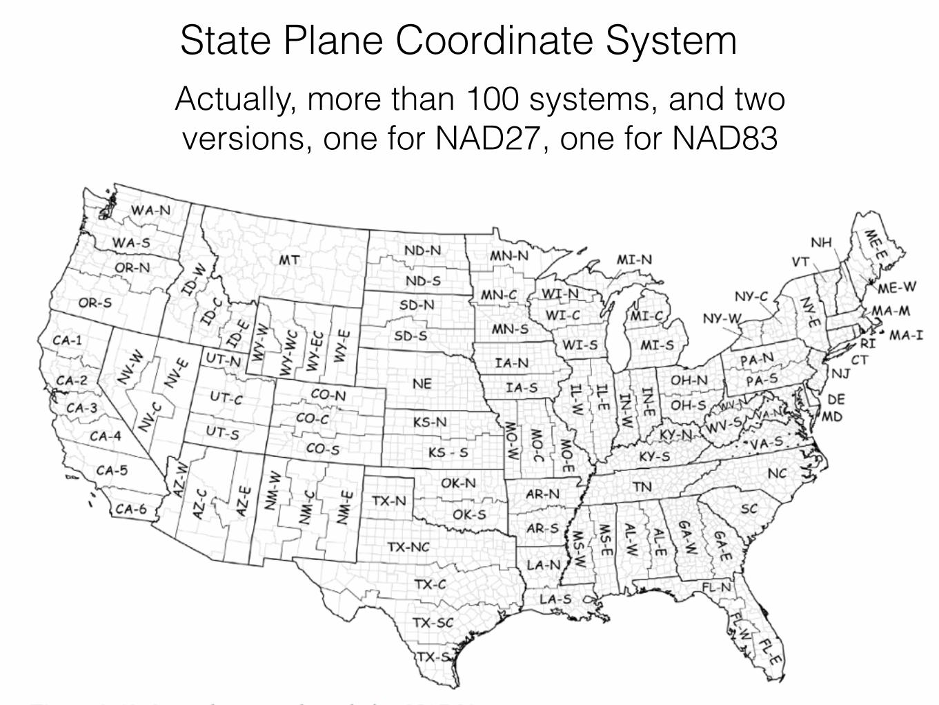
State Plane Coordinate SystemActually, more than 100 systems, and two versions, one for NAD27, one for NAD83
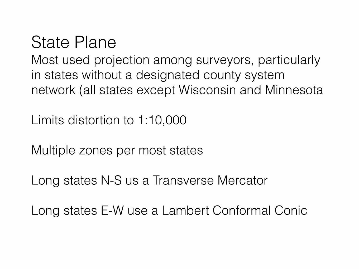
State Plane Most used projection among surveyors, particularly in states without a designated county system network (all states except Wisconsin and Minnesota
Limits distortion to 1:10,000
Multiple zones per most states
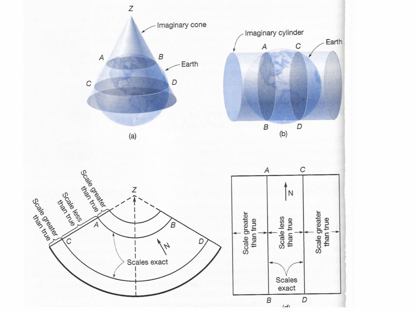
Long states N-S us a Transverse Mercator
Long states E-W use a Lambert Conformal Conic
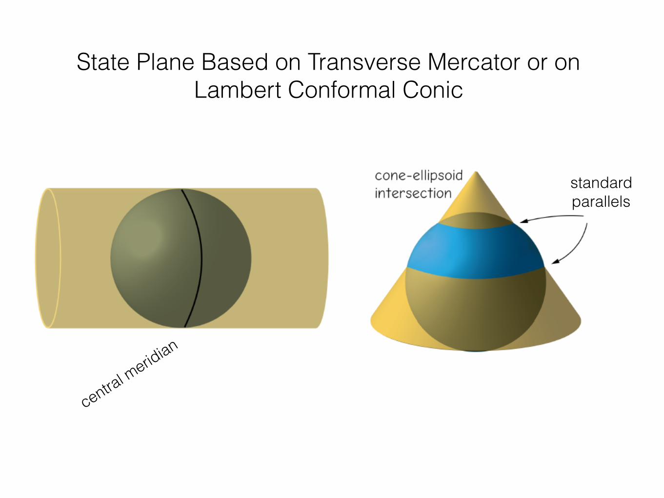
standard parallels
central meridian
State Plane Based on Transverse Mercator or on Lambert Conformal Conic
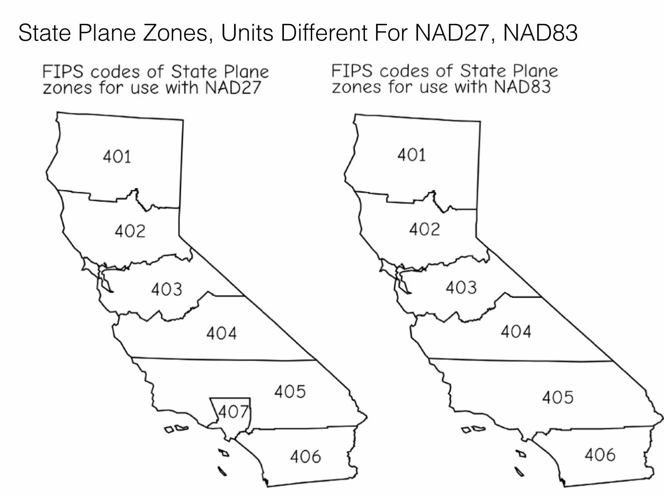
State Plane Zones, Units Different For NAD27, NAD83
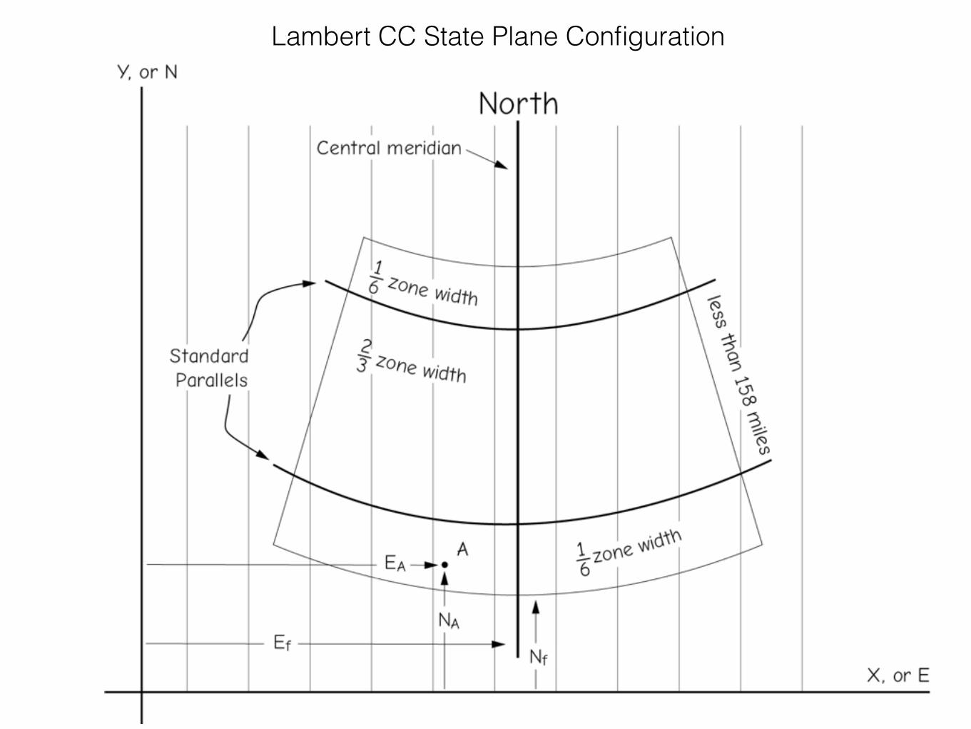
Lambert CC State Plane Configuration
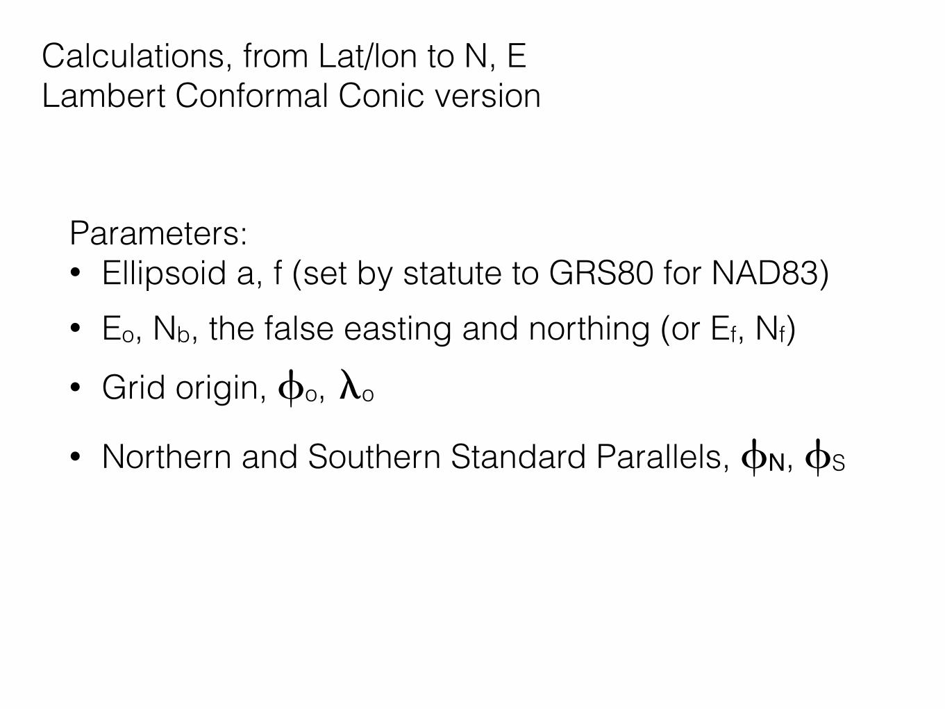
Calculations, from Lat/lon to N, E Lambert Conformal Conic version
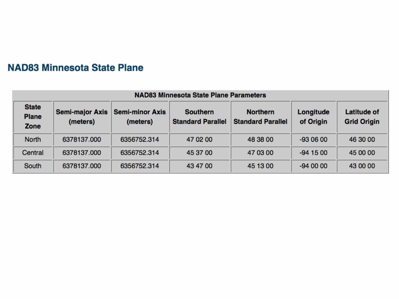
Parameters: • Ellipsoid a, f (set by statute to GRS80 for NAD83) • Eo, Nb, the false easting and northing (or Ef, Nf) • Grid origin, fo, lo
• Northern and Southern Standard Parallels, fN, fS
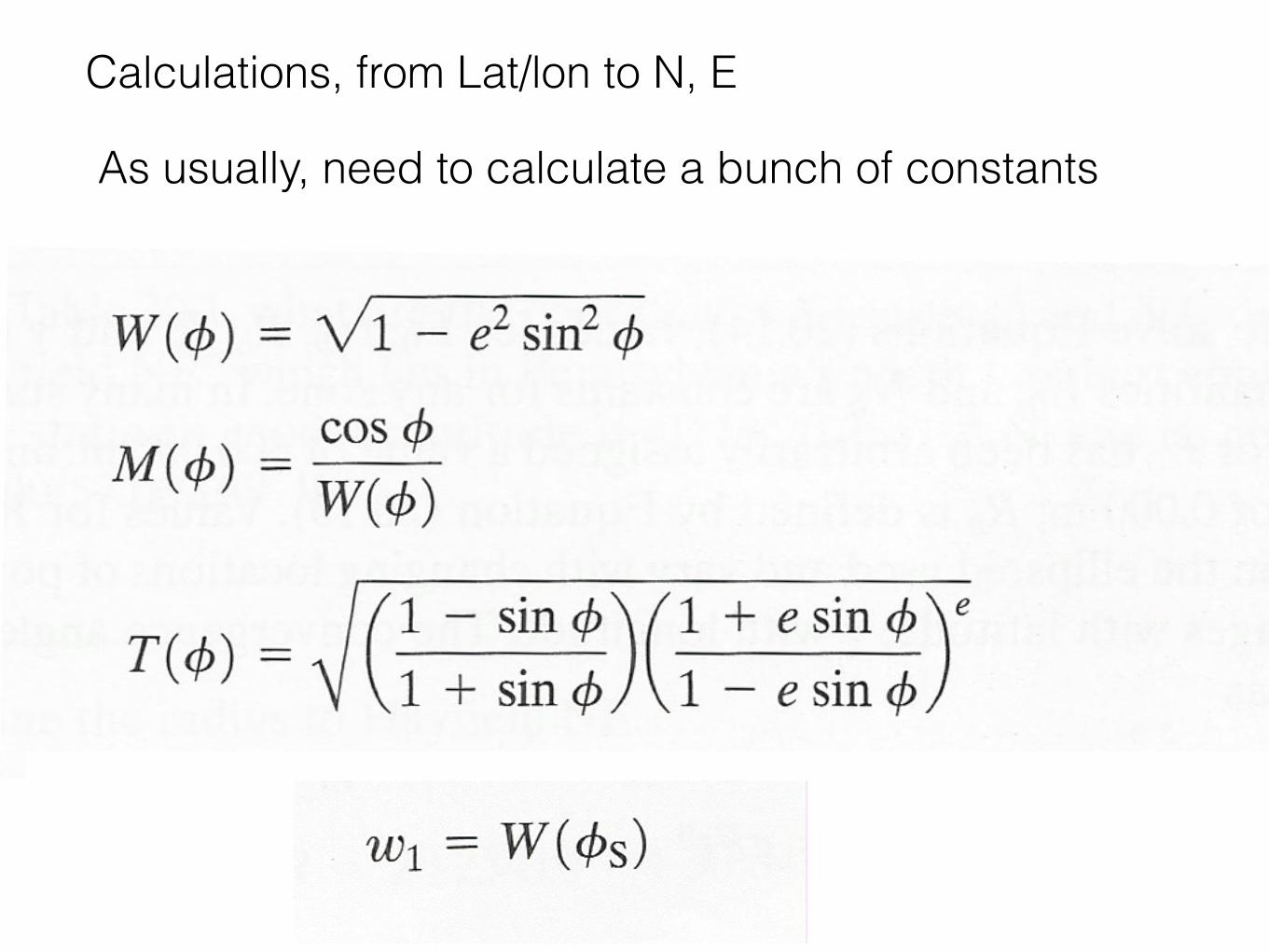
Calculations, from Lat/lon to N, E
As usually, need to calculate a bunch of constants
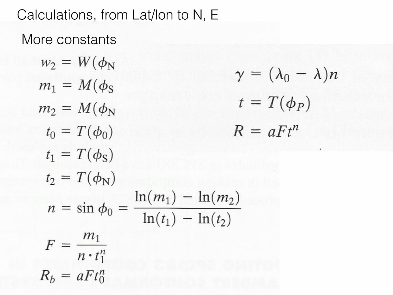
More constantsCalculations, from Lat/lon to N, E

More constantsCalculations, from Lat/lon to N, E
Finally, we can calculate E, N for a point P
This forward set of calculations, or a variant, in all coordinate conversion software
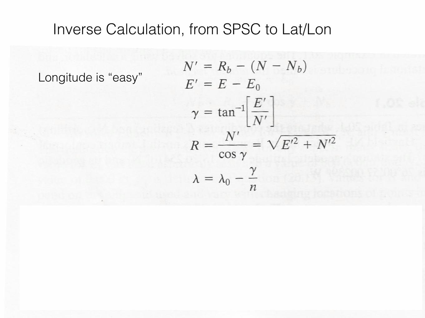
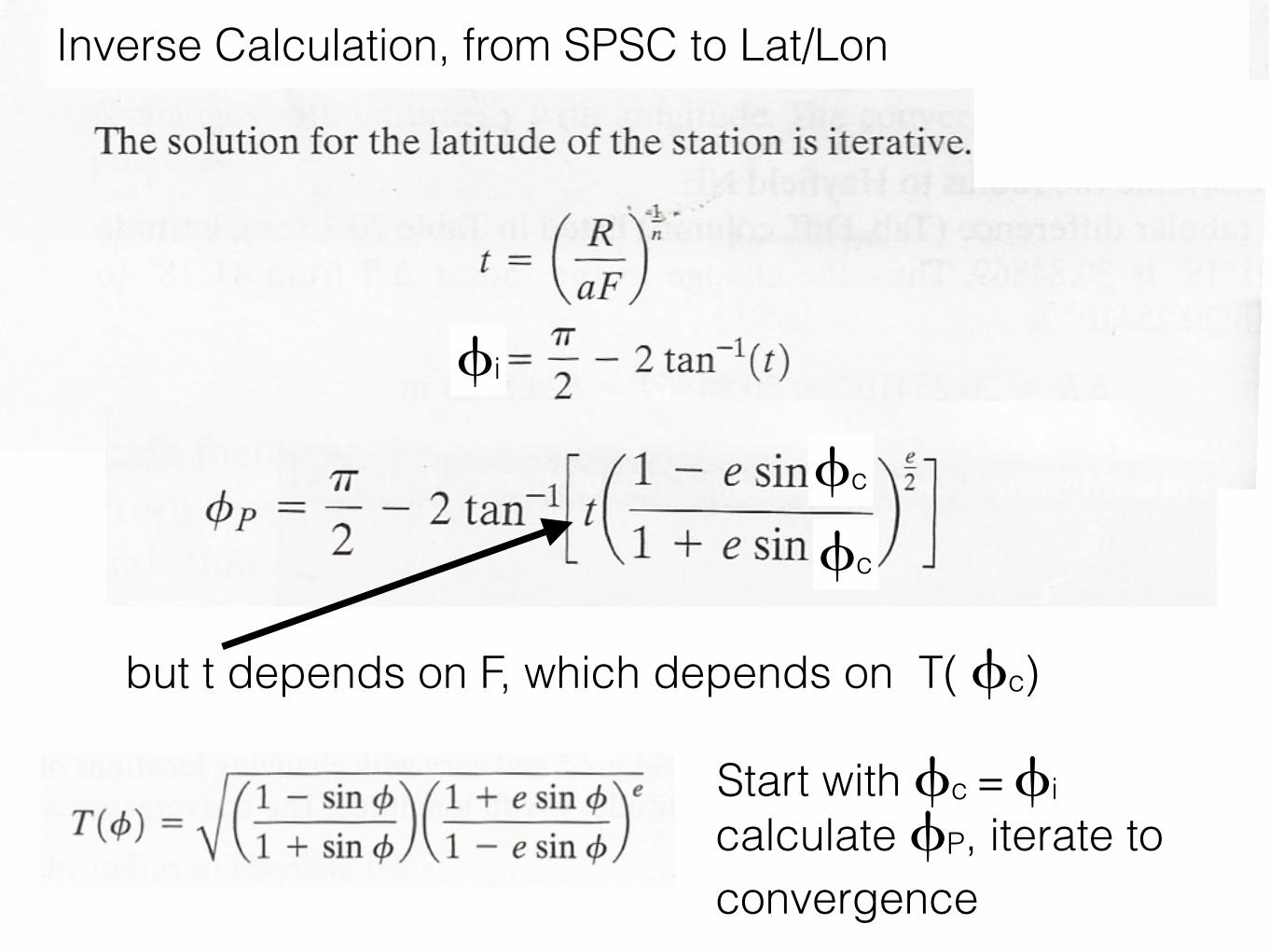
Inverse Calculation, from SPSC to Lat/Lon
Longitude is “easy”
Inverse Calculation, from SPSC to Lat/Lon
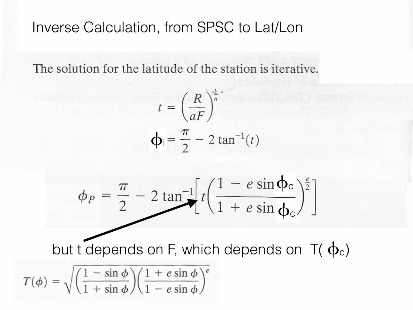
but t depends on F, which depends on T( fc)
fi
fc
fc
Inverse Calculation, from SPSC to Lat/Lon
but t depends on F, which depends on T( fc)
fi
fc
fc
Start with fc = ficalculate fP, iterate to convergence
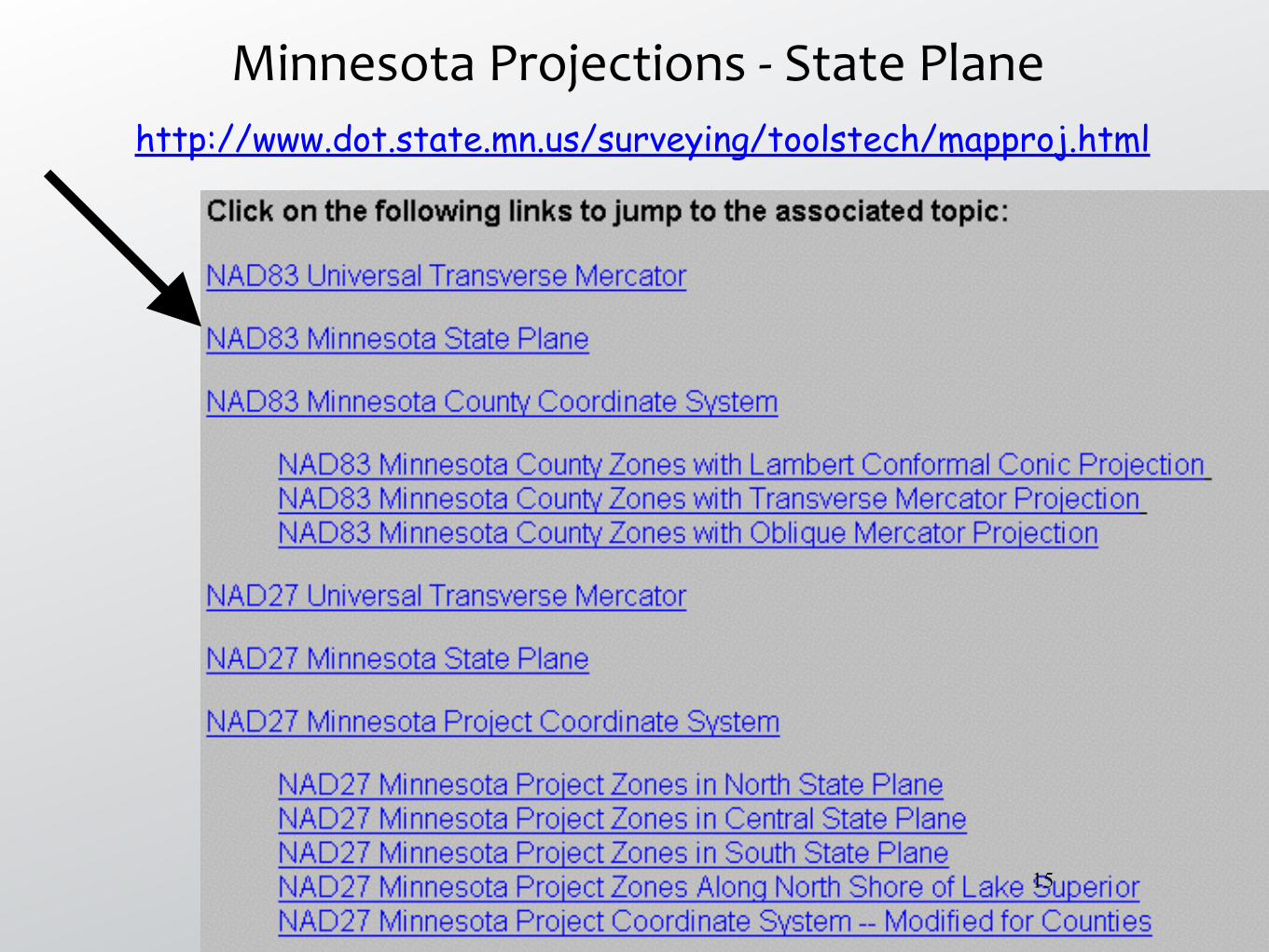
Minnesota Projections -‐ State Planehttp://www.dot.state.mn.us/surveying/toolstech/mapproj.html
15
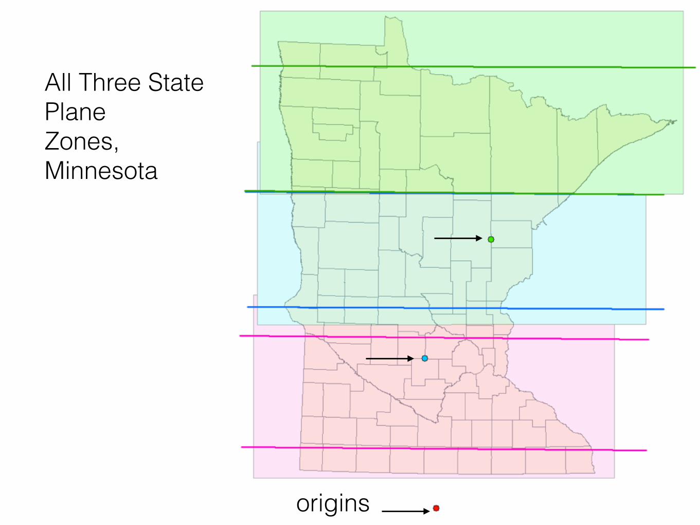
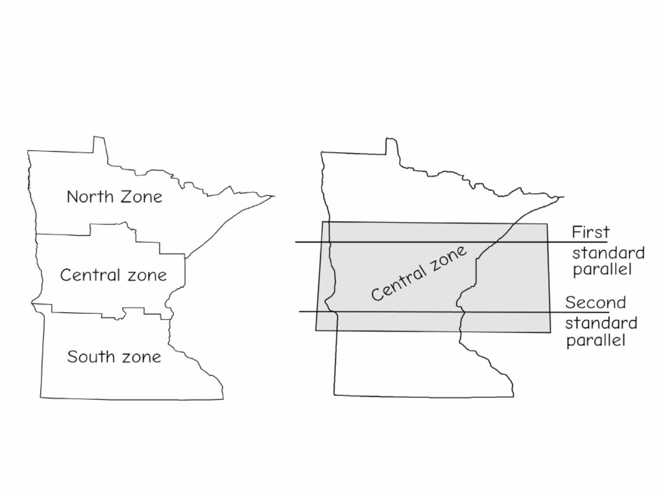
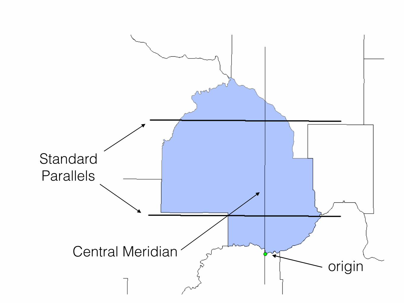
All Three State Plane Zones, Minnesota
origins
origin
Standard Parallels
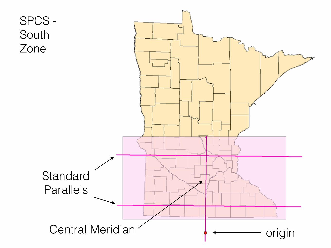
SPCS - South Zone
Central Meridian

origin
Standard Parallels
SPCS - Central Zone
Central Meridian
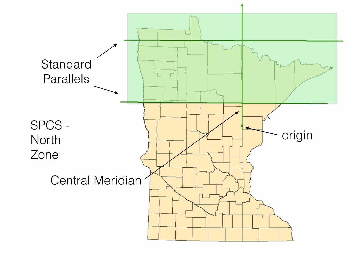
origin
Standard Parallels
SPCS - North Zone
Central Meridian
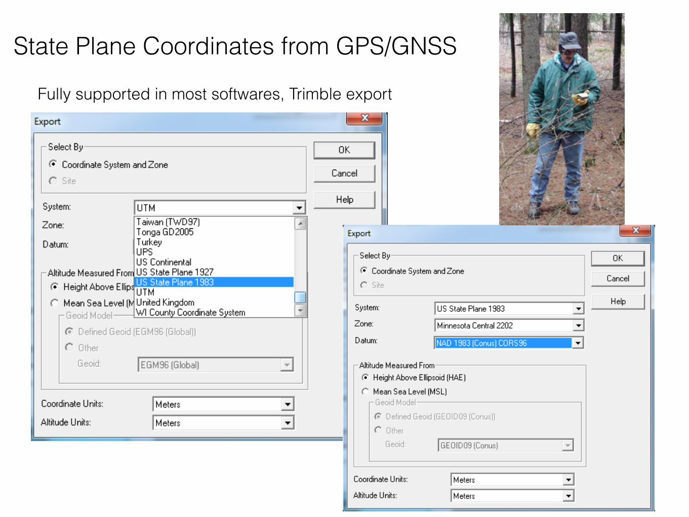
State Plane Coordinates from GPS/GNSS
Fully supported in most softwares, Trimble export
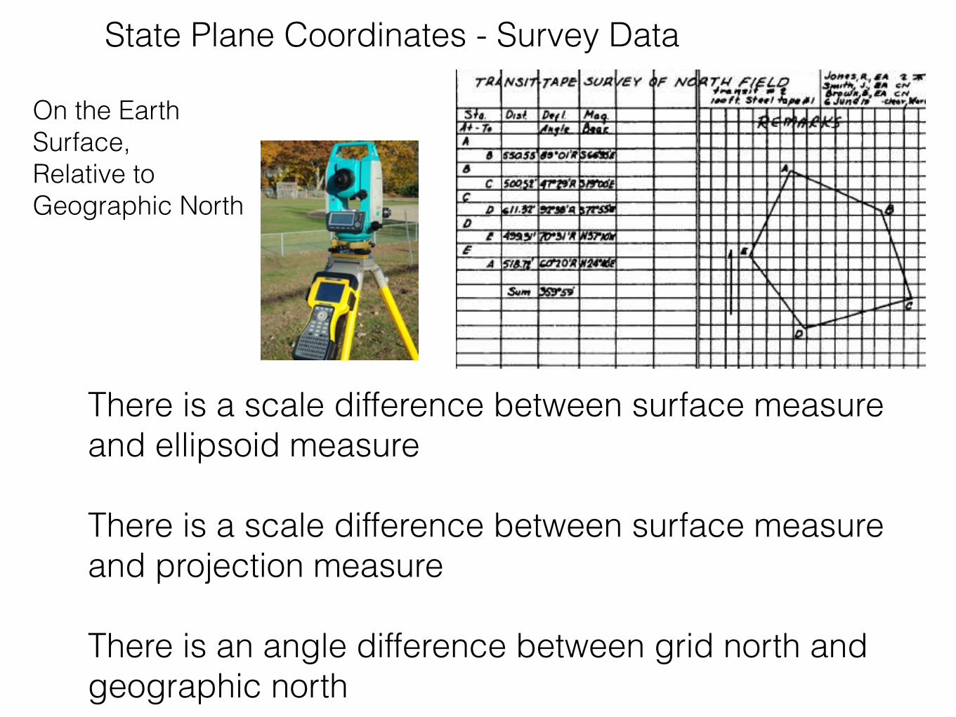
State Plane Coordinates - Survey Data
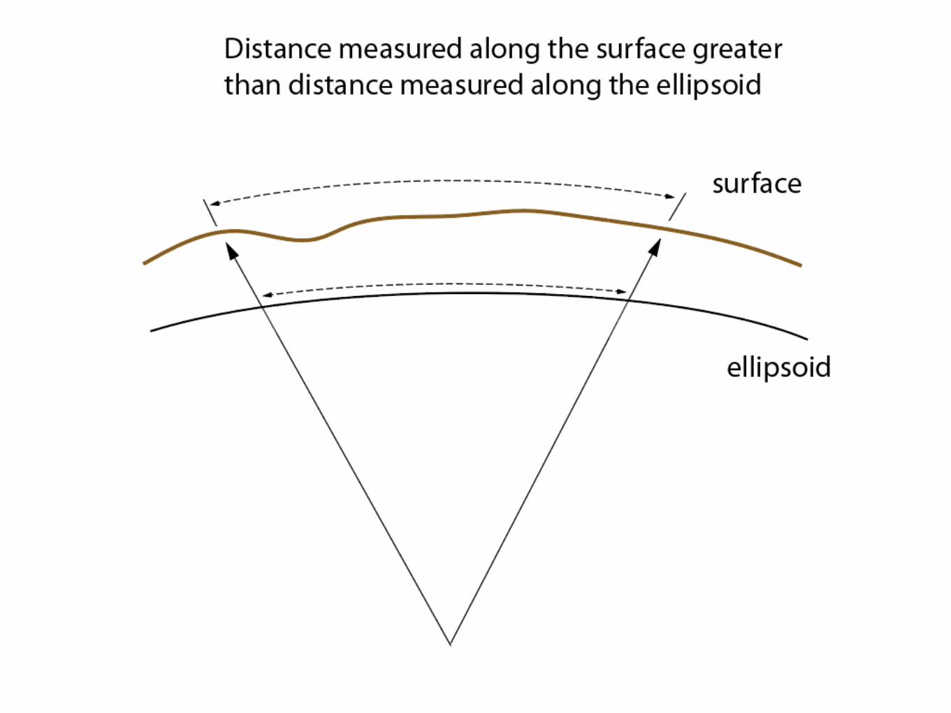
There is a scale difference between surface measure and ellipsoid measure
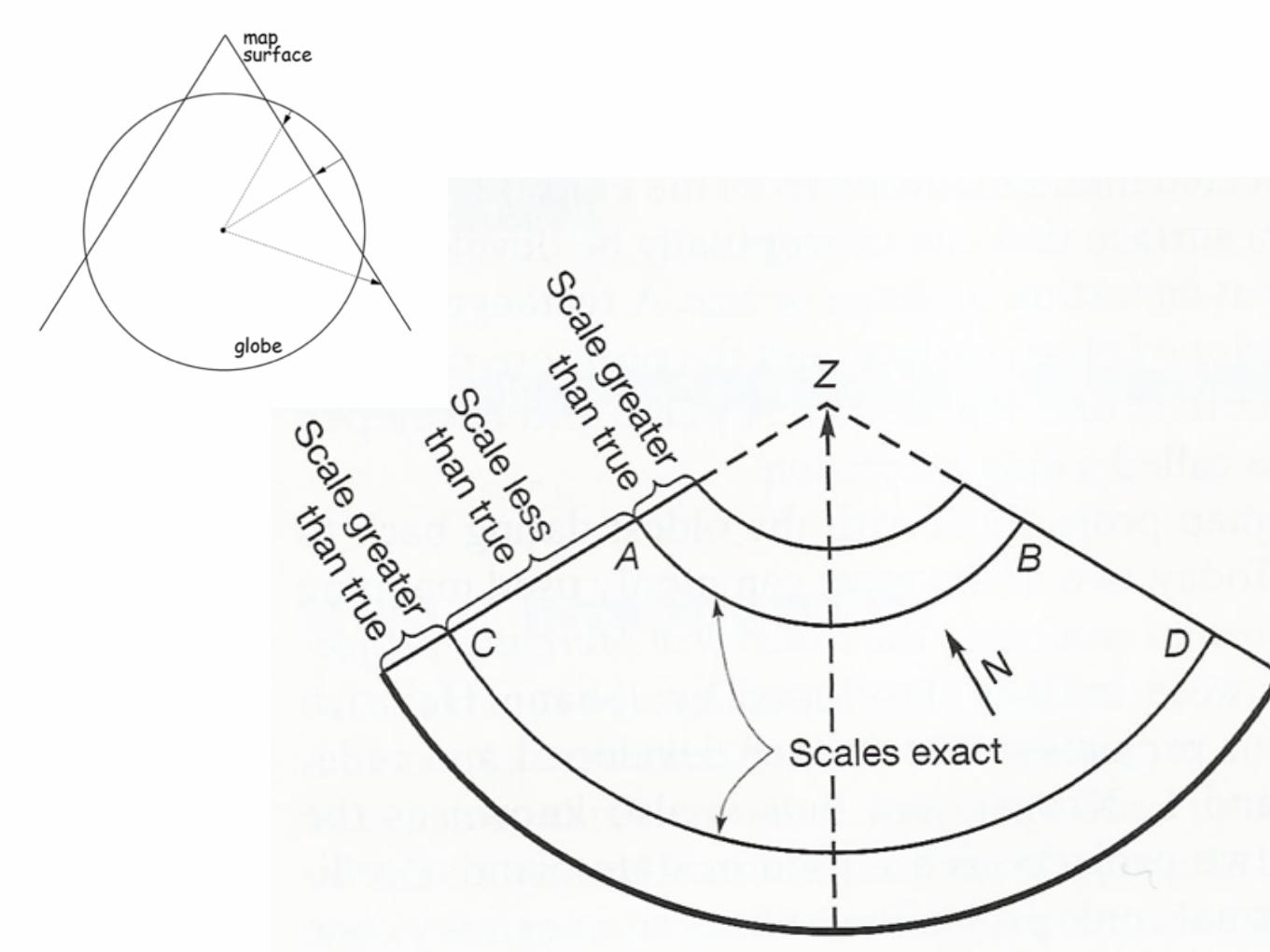
There is a scale difference between surface measure and projection measure
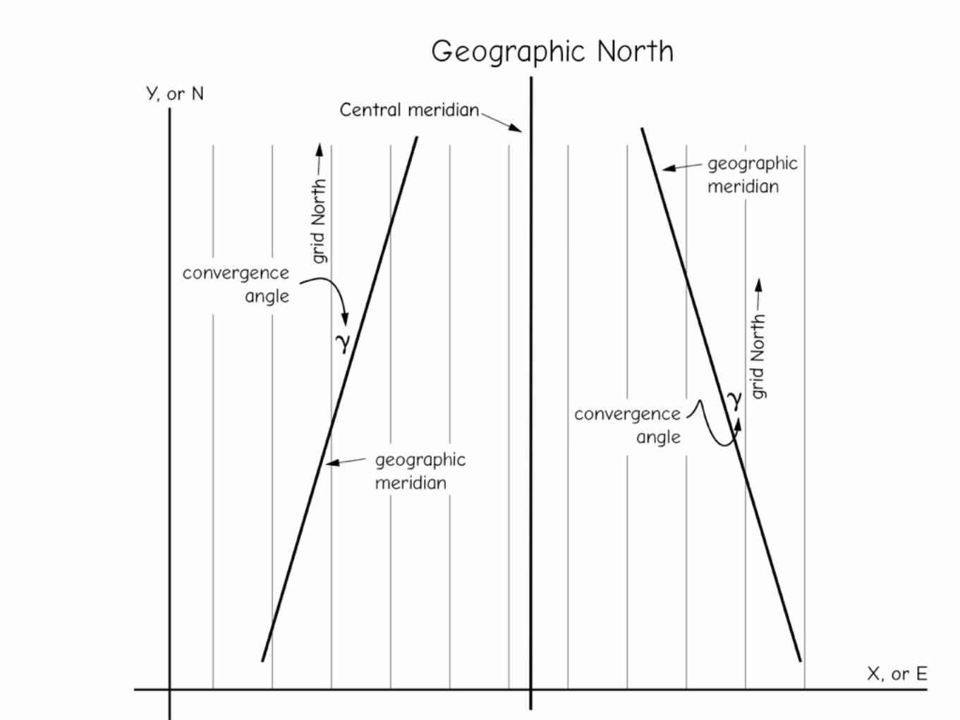
There is an angle difference between grid north and geographic north
On the Earth Surface, Relative to Geographic North
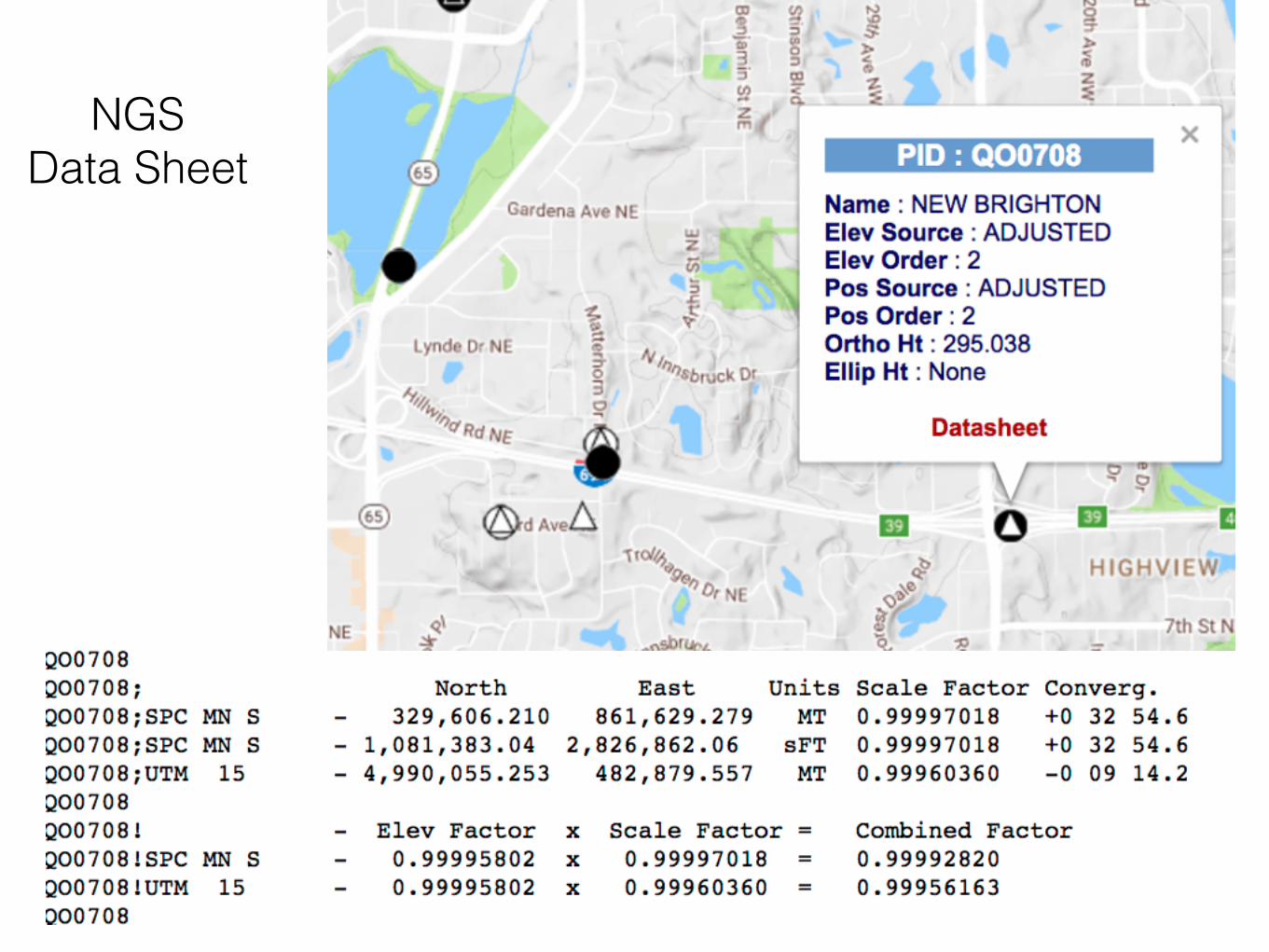
NGS Data Sheet

ArcGIS Project, All Versions of State Plane Supported
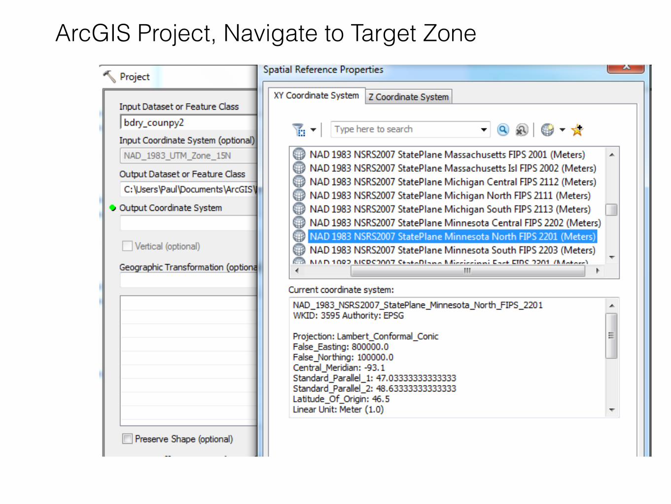
ArcGIS Project, Navigate to Target Zone

ArcGIS Project, What is this US Feet, International Feet?
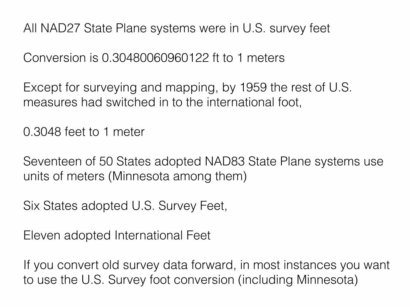
All NAD27 State Plane systems were in U.S. survey feet
Conversion is 0.30480060960122 ft to 1 meters
Except for surveying and mapping, by 1959 the rest of U.S. measures had switched in to the international foot,
0.3048 feet to 1 meter
Seventeen of 50 States adopted NAD83 State Plane systems use units of meters (Minnesota among them)
Six States adopted U.S. Survey Feet,
Eleven adopted International Feet
If you convert old survey data forward, in most instances you want to use the U.S. Survey foot conversion (including Minnesota)
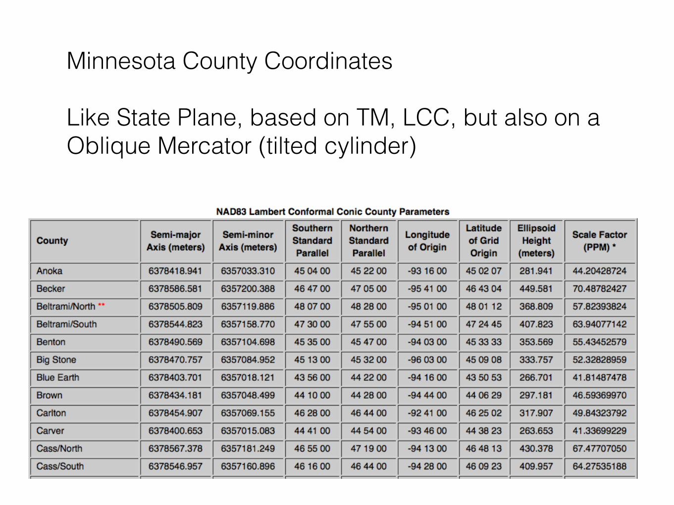
Minnesota County Coordinates
Like State Plane, based on TM, LCC, but also on a Oblique Mercator (tilted cylinder)
Standard Parallels
originCentral Meridian