Embed Size (px)
Citation preview
1
Statement of Common Ground
Between
St Helens Council and Highways England
Regarding
St Helens Borough Local Plan 2020-2035
May 2021
1. Introduction
1.1. This statement has been prepared by St Helens Council (the Council) and Highways England
to reflect the current position agreed by all parties with respect to:
• Highways England’s position regarding the policies set out in the submission draft of St
Helens Borough Local Plan 2020-2035 (the Plan) and their impacts upon the Strategic
Road Network (SRN), both cumulatively and individually.
• The process and work to be undertaken between the two parties during the Plan
period to address these issues and ensure delivery of the policies set out in the Plan.
1.2. It explains the cooperative work undertaken to date, outlines areas of agreement, as well as
those areas which remain outstanding, and sets out the approach to be adopted to address
those outstanding areas.
1.3. Highways England is in principle supportive of the Council’s proposals for additional
development as set out in the Plan and is confident that the policies and allocations
proposed (with agreed modifications) are sound in so far as they relate to the strategic road
network.
2. Background
2
2.1. The SRN within St Helens Borough comprises of sections of the M6 and M62 motorways,
together with access junctions as follows:
• M6 Junction 23 – junction with A580 (East Lancashire Road) and A49 (Lodge Lane)
• M62 Junction 7 – junction with A570 (St Helens Linkway), A57 (Warrington Road) and
A557 (Watkinson Way)
2.2. There are also several junctions on the SRN very close to the Borough boundary, including:
• M6 Junction 22 – junction with A49 (Winwick Link Road) and A579 (Winwick Lane)
• M6 Junction 24 – junction with A58 (Liverpool Road)
• M62 Junction 8 – junction with A5280 (Skyline Drive), A5281 (Burtonwood Road),
A5282 (Charon Way)
2.3. Other significant junctions on the SRN in the wider vicinity of St Helens include:
• M6 Junction 21a – interchange between M6 and M62
• M62 Junction 9 – junction with A49 (Winwick Road / Newton Road)
2.4. Both motorways are deemed to be of strategic national importance. Highways England
operates, maintains and improves the SRN on behalf of the Secretary of State for Transport.
The Council, as part of its duty to cooperate in producing the Plan, has consulted with
Highways England regarding the impacts the policy proposals would have on the safe and
reliable operation of the SRN.
Duty to Cooperate Statement (SD009)
2.5. In preparing the Plan, the Council has complied with the “Duty to Cooperate” set out in
national legislation. The St Helens Local Plan Duty to Cooperate Statement sets out how the
Council has complied with this Duty. It identifies 15 strategic matters subject to the Duty to
Cooperate.
2.6. It notes that “transport impacts arising from site allocations proposed at Preferred Options
stage have been addressed in the St Helens Local Plan Transport Impact Assessment,
undertaken in close cooperation with Highways England”. It notes that the Council and
Highways England, along with neighbouring authorities, have agreed to work together to
consider any cross-boundary infrastructure or other issues related to specific development
sites (particularly the proposed Bold Urban Extension and sites at Parkside). It notes that
the Infrastructure Delivery Plan confirms key transport infrastructure priorities, including
the improvement of J23 of the M6 and other key motorway junctions.
Transport Impact Assessment (TRA003) & Sustainable Transport Impact Assessment (TRA004)
2.7. As part of the preparation of the Plan, the Council commissioned a Transport Impact
Assessment and a Sustainable Transport Impact Assessment which assess the likely
transport implications and issues which may arise from the proposals set out in the Plan1.
The methodology and scope of the assessment was agreed through ongoing liaison with key
stakeholders, including the Council and Highways England.
2.8. As part of this assessment, a SATURN highways assignment model was developed to
identify traffic impacts of the Local Plan. Key junctions on the SRN within and surrounding
St Helens Borough are assessed using this model, including Junctions 7, 8 and 9 of the M62,
and junctions 22, 23 and 24 of the M6.
2.9. Overall, the assessment demonstrates that the proposals set out in the Plan along with
committed and assumed highway improvements contained within the Infrastructure
1 The Transport Impact Assessment is based on proposals at Preferred Options stage, rather than the Submission Draft of the Plan.
3
Delivery Plan are likely to largely mitigate for the impact of increased traffic as a result of
these site allocations. In addition to small scale mitigations at several sensitive junctions on
the local network, this assessment builds in the need for three larger scale strategic
interventions:
• Parkside Link Road
• M62 J7 Improvements
• M6 J23 Improvements
2.10. In addition to these, the Transport Impact Assessment recommends that further
consideration is given to the forecast operation of M62 J8, particularly in light of potential
cumulative impacts of future growth within Warrington Borough Council area.
Infrastructure Delivery Plan (SD013)
2.11. The Infrastructure Delivery Plan (IDP) sets out new or improved infrastructure required to
deliver the growth proposed in the Plan. The IDP identifies the costs, delivery agents and
means of funding for the strategic infrastructure required to support growth proposed in
the Local Plan and helps to demonstrate that the Plan is both robust and deliverable.
2.12. Table 2 of the IDP identifies pressure points within the highway system. Pressure points on
the Strategic Road Network include M6 Junction 23, and M62 Junctions 7 and 8.
2.13. The IDP notes that capacity studies have been carried out in recent years to review potential
improvements to M6 J23, M6 J22 and M62 J7. It lists several planned and proposed
infrastructure improvements to be delivered during the Plan period, including the following
upgrades affecting the SRN:
• M6 Smart Motorway Improvements, Junctions 21 to 26 – a committed scheme due to
be delivered by Highways England within the plan period.
• M6 Junction 22 improvements
• M6 Junction 23 improvements
• M62 Junction 7 improvements
• M62 Junction 8 improvements
• Bold Forest Garden Suburb Masterplanning.
2.14. A number of minor alterations to the Infrastructure Delivery Plan (October 2020) have been
agreed with Highways England, which will be picked up in a future review of the IDP. These
are noted in Section 3 below.
3. Key Matters in relation to St Helens Local Plan
Schedule of Changes
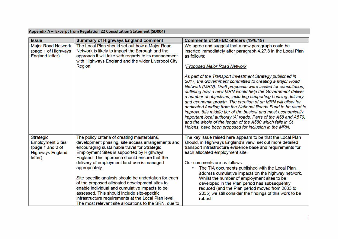
3.1. Engagement with Highways England following the 2019 Submission Draft Consultation is set
out within the March 2020 Regulation 22(C) Consultation Statement (SD004) published
alongside the Plan. Proposed modifications resulting from this engagement are set out in
the published Schedule of Changes (SD003) and attached in Appendix A. These
modifications are agreed by both parties to be acceptable and sufficient to resolve issues
raised during the consultation.
3.2. Subject to the modifications set out in the Schedule of Changes, both parties are confident
that the policies and allocations proposed within the Publication Draft of the Plan are sound
in so far as they relate to the strategic road network.
4
M6 J22
3.3. The Parkside East and West sites are proposed major employment allocations within the
Plan (7EA and 8EA), with Parkside East including potential to develop a Strategic Rail Freight
Interchange of national significance. To support the proposal, the Council has developed a
scheme to provide a link road connecting the A49 Newton-le-Willows to M6 Junction 22.
3.4. St Helens Council recommended planning permission for the road is granted subject to
conditions and Secretary of State approval in December 2019. A public inquiry in relation to
the site took place in January 2021. A decision is outstanding.
3.5. In October 2018, Liverpool City Region Combined Authority approved the Full Business Case
for the Parkside Link Road and agreed to make a conditional maximum capital grant award
of £23,790,786 to deliver the scheme, alongside contributions from the Council and private
sector, with a total scheme value of £39.81m excluding initial scheme development costs.
Policy LPA10 of the Plan makes provision of a ‘safe and convenient access from Junction 22
for Heavy Goods Vehicles and other vehicles’ a requirement for the delivery of the site.
3.6. Separately, the Local Plan Infrastructure Delivery Plan and Transport Impact Assessment
both identify future capacity constraints at M6 Junction 22 itself alongside the new link
road needed to directly accommodate the site. RIS2 (2020-25) includes the junction as a
pipeline scheme for potential future development in the next plan period (RIS3, 2025-30).
The Council, Highways England and neighbouring Wigan Council are working collaboratively
to identify funding for an improvement scheme at this junction in parallel to the Parkside
Link Road.
M6 Junction 23
3.7. Junction 23 of the M6 is a significant highway interchange between M6, A580 (East
Lancashire Road) and A49 (Lodge Lane). Before the coronavirus pandemic and associated
restrictions on travel, it already suffered from significant congestion, particularly impacting
businesses on the nearby Haydock Industrial Estate. It is also a noted accident hotspot
within St Helens Borough. The IDP notes the potential for mitigation at the junction to be
required in relation to sites 2EA, 3EA, 4EA, 5EA, 6EA, 1 HA and 2HA, as well as background
traffic growth modelled in the Transport Impact Assessment.
3.8. The junction is not identified as either a prioritised or pipeline scheme in Highways
England’s RIS2 programme.
3.9. An initial feasibility study was developed in 2019 by a working group partnership between St
Helens Council, Liverpool City Region, Highways England and Wigan Council (TRA007 and
TRA008). The feasibility study identifies a number of deliverable options for improvements
to this junction and makes a recommendation based on the initial assessments conducted.
However, this design option is outside current national standards2 and significant additional
work as part of scheme business case development is required to identify a preferred
solution. Opportunities to secure funding as part of the joint working arrangement for this
project are being investigated to secure delivery of an identified optimum intervention.
3.10. Moving forward, the Council and Highways England intend to convene a M6 Junction 23
joint taskforce (which will also seek involvement from Wigan Council and any relevant site
promoters) to drive forward development of design proposals at this junction and ensure
coordinated delivery in line with development phasing set out in the Local Plan. The
taskforce will also work to identify capital funding opportunities for the scheme, including
2 As set out in Highways England’s ‘Design Manual for Roads and Bridges’
5
Highways England’s 2021 Route Strategy Refresh and the Department for Transport’s Large
Local Majors programme. It is anticipated that the first meeting of this taskforce will
convene during early summer 2021.
3.11. The Local Plan identifies safeguarded land for employment use beyond the end of the Plan
period (2035) at Land North East of Junction 23 M6 (South of Haydock racecourse) (2ES). A
planning application submitted for this site has recently been subject to a Planning Appeal
on the grounds of non-determination, with public inquiry hearings in February 2021. The
proposal for the site includes realignment of A49 Lodge Lane, which work commissioned by
the Council has indicated would likely be included as part of any future significant
improvements at M6 Junction 23. However, as there is currently no agreed scheme for the
junction and further optioneering and business case development work will be required to
secure entry onto any funding programme, St Helens Council as Local Planning Authority
conclude that that no material weight can be attached to the realignment of the A49 at this
stage. This does not prejudice development of a future improvement scheme at Junction 23
but does recognise the importance of phasing of development in line with the Local Plan. A
decision from the Secretary of State is expected later in 2021.
3.12. The Council and Highways England have agreed to a future modification to the
Infrastructure Delivery Plan subsequent to adoption of the Local Plan as follows:
• Within the Infrastructure Delivery Schedule (Section 7), the Lead for the M6 Junction
23 scheme currently reads ‘Highways England’ and will be amended to read ‘St Helens
Council and Highways England’. St Helens Council will also be removed from the list of
‘Partners’ for the scheme accordingly.
• Within the Infrastructure Delivery Schedule (Section 7), the Anticipated Funding Source
for the M6 Junction 23 scheme currently reads ‘Highways England’ and will be
amended to read ‘TBC’ to reflect the role of the taskforce in identifying and securing
capital funding for the project.
Bold Garden Suburb
3.13. The Bold Garden Suburb site (4HA) is a key strategic allocation within the plan, with a
proposed overall capacity of almost 3,000 units3. The Council has commissioned a Transport
Review (TRA005) as the first stage of a broader master planning approach for the site.
3.14. The initial findings of the Transport Review identify junctions on the local transport network
which are expected to experience the greatest percentage impact in terms of traffic flow as a
result of the development, which require further assessment as part of the future
masterplanning process. However, there is also an opportunity to create new through
routes which will serve both the development and the wider highway network, to mitigate
the impact of development traffic and help to alleviate current congestion issues.
3.15. The Transport Review also concluded that the site would also unlock opportunities to
achieve a significant modal shift towards sustainable travel which would reduce the impact
of the development on the local highway network.
3.16. Highways England has provided initial comments on the Transport Review and the Council
will continue to engage with Highways England throughout the master planning process,
particularly in relation to any potential impact on the SRN.
3 Although only approximately 300 homes are planned to be brought forward during the Plan period, with development phased to late in the Plan period in order to accommodate site masterplanning processes.
6
M62 Junction 7
3.17. Junction 7 of the M62 connects the M62, A570 St Helens Linkway, A557 (in Halton Borough)
and the A57. Before the coronavirus pandemic and associated restrictions on travel,
queuing regularly occurred on all approaches to the junction during the PM peak and on the
M62 and A57 approaches during the AM peak.
3.18. The IDP notes the potential for mitigation at the junction to be required in relation to sites
4HA, 5HA, 9HA, 1EA and 10EA.
3.19. While the junction is not identified for development as part of the RIS programme (either as
prioritised or pipeline), Highways England conducted a capacity study in relation to this
junction in 2018 and engaged with the Council and neighbouring Halton Council as part of
this study. In line with the findings of the Local Plan Transport Impact Assessment, this
study found that existing congestion issues are forecast to worsen if unmitigated as a result
of Local Plan allocations and background traffic growth. Three options are identified, and a
preferred option selected.
3.20. Impacts on this junction, including cumulative impacts arising from development in
neighbouring areas and potential mitigation, will continue to be monitored, assessed and
developed between the parties moving forward, including as planning applications are
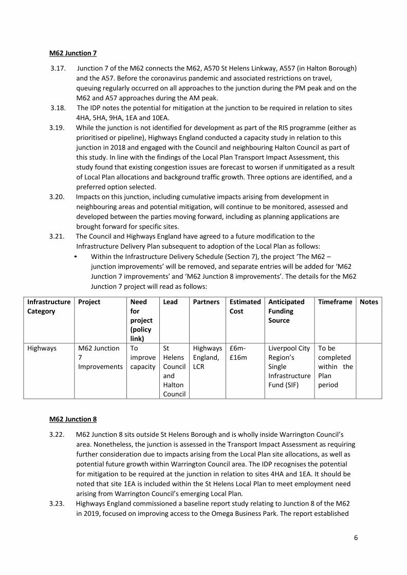
brought forward for specific sites.
3.21. The Council and Highways England have agreed to a future modification to the
Infrastructure Delivery Plan subsequent to adoption of the Local Plan as follows:
• Within the Infrastructure Delivery Schedule (Section 7), the project ‘The M62 –
junction improvements’ will be removed, and separate entries will be added for ‘M62
Junction 7 improvements’ and ‘M62 Junction 8 improvements’. The details for the M62
Junction 7 project will read as follows:
Infrastructure Category
Project Need for project (policy link)
Lead Partners Estimated Cost
Anticipated Funding Source
Timeframe Notes
Highways M62 Junction 7 Improvements
To improve capacity
St Helens Council and Halton Council
Highways England, LCR
£6m- £16m
Liverpool City Region’s Single Infrastructure Fund (SIF)
To be completed within the Plan period
M62 Junction 8
3.22. M62 Junction 8 sits outside St Helens Borough and is wholly inside Warrington Council’s
area. Nonetheless, the junction is assessed in the Transport Impact Assessment as requiring
further consideration due to impacts arising from the Local Plan site allocations, as well as
potential future growth within Warrington Council area. The IDP recognises the potential
for mitigation to be required at the junction in relation to sites 4HA and 1EA. It should be
noted that site 1EA is included within the St Helens Local Plan to meet employment need
arising from Warrington Council’s emerging Local Plan.
3.23. Highways England commissioned a baseline report study relating to Junction 8 of the M62
in 2019, focused on improving access to the Omega Business Park. The report established
7
an overview of current conditions at the junction and conducted initial assessment of
potential concept intervention options to address forthcoming issues and challenges
identified. The assessment indicates that the junction is currently operating within capacity
but is likely to operate at or just over absolute capacity in an assumed 2035 scenario based
on future committed development, local plan sites in both St Helens and Warrington and
background traffic growth. While the study identifies several workable options, it concludes
that further assessment is required to accurately identify the likely costs and impacts of
potential interventions. Further reappraisal of options may also be required based on the
outcome of the recent planning inquiry into the Omega South proposals and transport
infrastructure associated with this site.
3.24. The Council has entered into a Statement of Common Ground with Warrington Borough
Council (SD012), which includes agreement for the two councils to continue to work
together in liaison with Highways England to address any cumulative traffic impacts arising
from local plan allocations, particularly relating to the Omega site and M62 Junction 8.
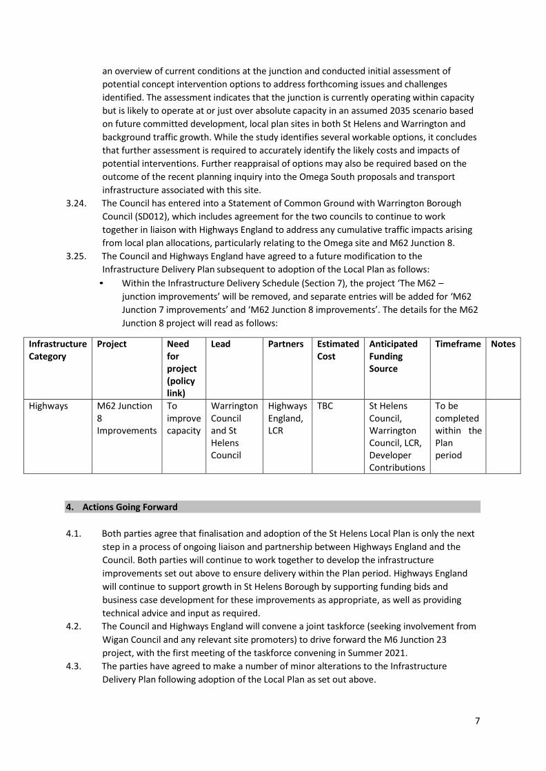
3.25. The Council and Highways England have agreed to a future modification to the
Infrastructure Delivery Plan subsequent to adoption of the Local Plan as follows:
• Within the Infrastructure Delivery Schedule (Section 7), the project ‘The M62 –
junction improvements’ will be removed, and separate entries will be added for ‘M62
Junction 7 improvements’ and ‘M62 Junction 8 improvements’. The details for the M62
Junction 8 project will read as follows:
Infrastructure Category
Project Need for project (policy link)
Lead Partners Estimated Cost
Anticipated Funding Source
Timeframe Notes
Highways M62 Junction 8 Improvements
To improve capacity
Warrington Council and St Helens Council
Highways England, LCR
TBC St Helens Council, Warrington Council, LCR, Developer Contributions
To be completed within the Plan period
4. Actions Going Forward
4.1. Both parties agree that finalisation and adoption of the St Helens Local Plan is only the next
step in a process of ongoing liaison and partnership between Highways England and the
Council. Both parties will continue to work together to develop the infrastructure
improvements set out above to ensure delivery within the Plan period. Highways England
will continue to support growth in St Helens Borough by supporting funding bids and
business case development for these improvements as appropriate, as well as providing
technical advice and input as required.
4.2. The Council and Highways England will convene a joint taskforce (seeking involvement from
Wigan Council and any relevant site promoters) to drive forward the M6 Junction 23
project, with the first meeting of the taskforce convening in Summer 2021.
4.3. The parties have agreed to make a number of minor alterations to the Infrastructure
Delivery Plan following adoption of the Local Plan as set out above.
ii
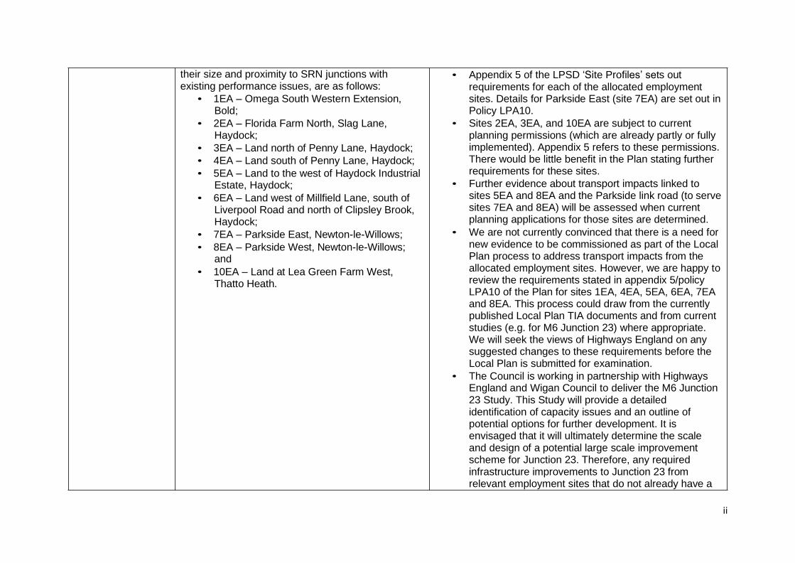
their size and proximity to SRN junctions with existing performance issues, are as follows:
• 1EA – Omega South Western Extension, Bold;
• 2EA – Florida Farm North, Slag Lane, Haydock;
• 3EA – Land north of Penny Lane, Haydock;
• 4EA – Land south of Penny Lane, Haydock;
• 5EA – Land to the west of Haydock Industrial Estate, Haydock;
• 6EA – Land west of Millfield Lane, south of Liverpool Road and north of Clipsley Brook, Haydock;
• 7EA – Parkside East, Newton-le-Willows;
• 8EA – Parkside West, Newton-le-Willows; and
• 10EA – Land at Lea Green Farm West, Thatto Heath.
• Appendix 5 of the LPSD ‘Site Profiles’ sets out requirements for each of the allocated employment sites. Details for Parkside East (site 7EA) are set out in Policy LPA10.
• Sites 2EA, 3EA, and 10EA are subject to current planning permissions (which are already partly or fully implemented). Appendix 5 refers to these permissions. There would be little benefit in the Plan stating further requirements for these sites.
• Further evidence about transport impacts linked to sites 5EA and 8EA and the Parkside link road (to serve sites 7EA and 8EA) will be assessed when current planning applications for those sites are determined.
• We are not currently convinced that there is a need for new evidence to be commissioned as part of the Local Plan process to address transport impacts from the allocated employment sites. However, we are happy to review the requirements stated in appendix 5/policy LPA10 of the Plan for sites 1EA, 4EA, 5EA, 6EA, 7EA and 8EA. This process could draw from the currently published Local Plan TIA documents and from current studies (e.g. for M6 Junction 23) where appropriate. We will seek the views of Highways England on any suggested changes to these requirements before the Local Plan is submitted for examination.
• The Council is working in partnership with Highways England and Wigan Council to deliver the M6 Junction 23 Study. This Study will provide a detailed identification of capacity issues and an outline of potential options for further development. It is envisaged that it will ultimately determine the scale and design of a potential large scale improvement scheme for Junction 23. Therefore, any required infrastructure improvements to Junction 23 from relevant employment sites that do not already have a
3
planning permission (4EA, 5EA and 6EA), will be informed by the findings of this Study.
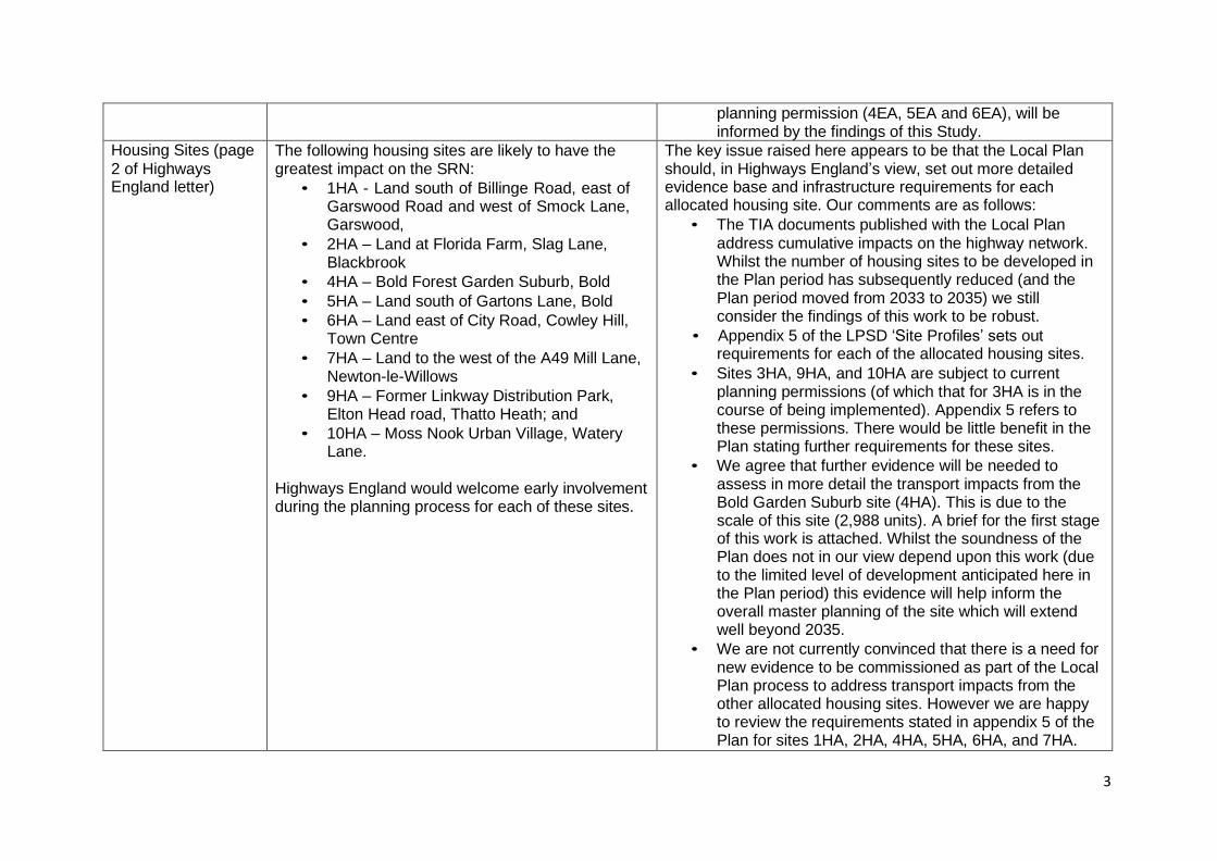
Housing Sites (page
2 of Highways England letter)
The following housing sites are likely to have the greatest impact on the SRN:
• 1HA - Land south of Billinge Road, east of Garswood Road and west of Smock Lane, Garswood,
• 2HA – Land at Florida Farm, Slag Lane, Blackbrook
• 4HA – Bold Forest Garden Suburb, Bold
• 5HA – Land south of Gartons Lane, Bold
• 6HA – Land east of City Road, Cowley Hill, Town Centre
• 7HA – Land to the west of the A49 Mill Lane, Newton-le-Willows
• 9HA – Former Linkway Distribution Park, Elton Head road, Thatto Heath; and
• 10HA – Moss Nook Urban Village, Watery Lane.
Highways England would welcome early involvement during the planning process for each of these sites.
The key issue raised here appears to be that the Local Plan should, in Highways England’s view, set out more detailed evidence base and infrastructure requirements for each allocated housing site. Our comments are as follows:
• The TIA documents published with the Local Plan address cumulative impacts on the highway network. Whilst the number of housing sites to be developed in the Plan period has subsequently reduced (and the Plan period moved from 2033 to 2035) we still consider the findings of this work to be robust.
• Appendix 5 of the LPSD ‘Site Profiles’ sets out requirements for each of the allocated housing sites.
• Sites 3HA, 9HA, and 10HA are subject to current planning permissions (of which that for 3HA is in the course of being implemented). Appendix 5 refers to these permissions. There would be little benefit in the Plan stating further requirements for these sites.
• We agree that further evidence will be needed to assess in more detail the transport impacts from the Bold Garden Suburb site (4HA). This is due to the scale of this site (2,988 units). A brief for the first stage of this work is attached. Whilst the soundness of the Plan does not in our view depend upon this work (due to the limited level of development anticipated here in the Plan period) this evidence will help inform the overall master planning of the site which will extend well beyond 2035.
• We are not currently convinced that there is a need for new evidence to be commissioned as part of the Local Plan process to address transport impacts from the other allocated housing sites. However we are happy to review the requirements stated in appendix 5 of the Plan for sites 1HA, 2HA, 4HA, 5HA, 6HA, and 7HA.
4
This process could draw from the currently published
TIA documents and from current studies (e.g. for M6 Junction 23) where appropriate. We will seek the views of Highways England on any suggested changes to these requirements before the Local Plan is submitted for examination.
Sustainability (page 3)
Policy LPA03 should set specific detail about how the local authority will guide development to be focussed in sustainable and accessible locations.
Disagree – the purpose of Policy LPA03 is to set out a basic set of principles. In practice, development will be guided towards sustainable locations through the restraint on development in the Green Belt and via the operation of Policy LPA07. This does not need to be spelt out in Policy LPA03. The approach taken is consistent with the requirement in the NPPF for development plans to be concise.
Sustainability (page 3)
The measures proposed to address sustainable transport accessibility for the proposed site allocations are light touch and place a strong emphasis on future documents such as the LCR LCWIP, Transport Assessments/Statements and
Travel Plans
Comment noted. We aim to address this as part of our review of the site requirements listed in appendix 5 (see earlier comments). We will also prepare an updated Infrastructure Delivery Plan before we submit the Plan for examination. We will seek the views of Highways England as part of this
process.
Transport and Travel Plans (pages 3 and 4)
The requirement for Travel Plans to be implemented for each development site should be set out in Policy LPA07 due to their inherent ability to mitigate the traffic impacts of development on both the local and strategic road network.
We agree that clause 4 of Policy LPA07 should address this and suggest the following wording: “4. To minimise air and noise pollution and carbon emissions, non-residential forms of development that would generate a significant amount of transport movement by employees or visitors must be supported by suitably formulated Travel Plans. Conditions and/or legal agreements will be used to ensure that Travel Plans submitted in such cases are fully implemented and monitored.”
Transport and Travel
Plans (page 4) Where development is projected to cause severe harm to the highway network, as set out in the NPPF, the Council must have and / or develop suitable testing mechanisms. However, no assessment criteria for analysing this impact are currently set out in the Draft Local Plan
We consider that the definition of “severe harm” would be
more appropriately addressed at a sub-regional or national level. When assessing the traffic impacts and severity of individual development proposals, the Council currently considers a range of factors, such as impact on road capacity, traffic safety, traffic routeing and design. The detailed transport impacts of individual development proposals will
5
continue to be assessed in this manner as specific proposals come forward. However, in principle, with the measures proposed within the Local Plan, the traffic impacts of the development proposed in the Local Plan are capable of being addressed to the extent that they would not be severe
Transport and Travel
Plans (page 4) The Local Plan should make it evidently clear to developers that any alterations to the SRN are taken as a last resort and, if required, should be clearly demonstrated through the following initial two stages: Avoidance and Off-Line improvements.
We agree that clause 6 of Policy LPA07 could be expanded and suggest the following wording:
“6. Direct access from new development on to the Strategic Road Network will only be permitted as a last resort, where agreed by Highways England and where the necessary levels of transport accessibility and safety could not be more suitably provided by other means”.
Highway Impact Assessment
Methodology (page 5)
There is a two-year difference between the transport evidence base and the proposed end-date of the Plan period. Using a 2017 base year in the TIA may underrepresent the current situation through not including two years of growth from 2017 to 2019.
The TIA was based on the proposed development and timeframes in the Local Plan Preferred Options and therefore models a larger amount of development than that proposed in the Publication Draft Plan. The TIA is therefore unlikely to under-represent the amount of growth to 2035. In addition we
plan to update the TIA every 5 years.
Key Strategic Road Network Junctions (pages 5 and 6 of Highways England letter)
The IDP should refer to M6 Smart Motorway Improvements J21a to 26 a committed infrastructure scheme.
The IDP should refer to M6 Junction 22 as a key junction requiring assessment for improvement considering its proximity to the Parkside developments and the provision of ‘safe access to J22 for HGVs’ is now a policy requirement for the delivery of Parkside. Junction 22 should be identified as a ‘pressure point’ within the highway system, as the proposed developments at Parkside East and West, alongside planned growth along the M6 corridor in the neighbouring District of Wigan, are likely to impact the junction.
We note these points and intend to prepare an updated version of the Infrastructure Delivery Plan before submitting the Plan to the Government. We will seek the views of Highways England as part of this process.
6
Transport modelling associated with M62 Junction
22 should be further interrogated to understand the impact of growth proposals associated with the proposed Parkside East and West development site allocations as well as the cumulative development impact along the M6 corridor associated with development in Wigan.
The IDP does not address the capacity of the existing infrastructure, nor does it set out any detail regarding the type or scale of interventions which may be required following the adoption of the Local Plan and build-out of subsequent developments. It also does not give any indicative timescales for delivery of required infrastructure.
SRN Junction Performance in Future Scenarios (page 6 and 7 of Highways England letter)
Various points made about the capacity of junctions on the SRN. The Transport Impact Assessment has highlighted that M62 Junction 8; M6 Junction 23; and M6 Junction 24 will exceed capacity by 2033. The inclusion of a comprehensive site-based analysis would provide a more robust evidence base.
See earlier comments set out above. As stated earlier we acknowledge the need to prepare further evidence to underpin the future master plan for Bold Garden Suburb and to update the IDP. However, we otherwise consider the transport evidence base for the Plan to be ‘proportionate’ and therefore compliant with the NPPF.