Embed Size (px)
Citation preview

PO
RT
LA
ND
-MILW
AU
KIE
LIGH
T R
AIL P
RO
JEC
T C
ON
CE
PT
UA
L DE
SIG
N R
EP
OR
T: PU
BLIC
DIS
CU
SS
ION
DR
AF
T
89
Each light rail station will be equipped with high quality signage, furnishings and equipment, including a shelter, bench, trash receptacle, TransitTracker and ticket vending machine. TriMet has increasingly standardized these elements to improve ease of use and to reduce capital and maintenance costs. Most of the furnishings will be consistent throughout the new alignment, and all will have a modern aesthetic that enhances the station areas and complements the furnishings throughout the light rail system. All of these station elements will be designed with similar materials and overall design character so that they appear to be a part of the same “family”.
Shelters: The shelters at most stations will be similar to the shelters currently on the I-205 portion of the Green Line. The shelters will be made of powder-coated metal and glass and will include wind screens where appropriate (Fig. 61).
The shelters at some stations may be modified to create an element of distinction and meet local design goals. These shelters will be designed in the Final Design phase of the project.
Benches: The benches throughout the alignment will be the same as those currently on the South Mall. The powder coated, strap metal bench is a high quality, contemporary design that is durable and easy to maintain (Fig. 62).
Trash receptacles: Trash receptacles throughout the alignment will be the same powder coated, metal receptacles currently used on the I-205 portion of the Green Line (Fig. 63).
Ticket vending machines: The ticket vending machines will be consistent with the machines currently used throughout the light rail system (Fig. 64).
Station identification signage: The powder coated, metal signage will be consistent with the signage used throughout the light rail system and will fit with the family of furnishings provided at each station (Fig. 65).
STATION FURNISHINGS, EQUIPMENT AND SIGNAGE
FIGURE 61: Light rail platform shelter
FIGURE 62: Light rail platform bench FIGURE 65: Light rail station identification signage
FIGURE 63: Light rail trash receptacle
FIGURE 64: Light rail ticket vending machine

90
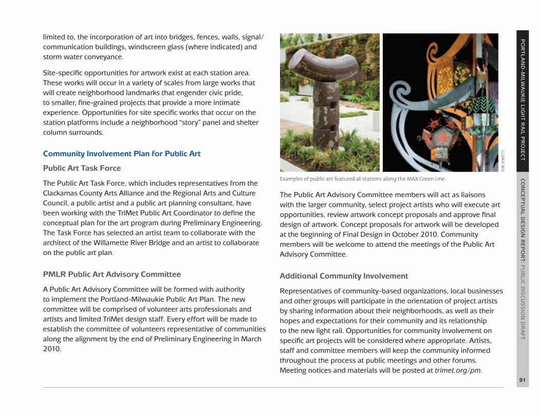
TriMet has a long history of engaging artists as designers and of integrating artwork into each of its capital projects. The agency’s public art policy, instituted in 1997, promotes transit use and community pride by integrating permanent and temporary art works into the public transit system that celebrate the contributions of public transportation and recognize cultural richness in the region. The agency will continue its commitment to public art with the PMLR project by working in collaboration with project partners, the Regional Arts and Culture Council, the Clackamas County Arts Alliance and the communities along the alignment.
The light rail system itself links the areas along the alignment to each other, and public art is a tool that can help link the system to each adjacent community. Public art, when skillfully and thoughtfully applied, can help promote urban design objectives by creating places where people want to be. Toward that end, the TriMet Public Art Program is using an “urban design-infused” approach to develop a public art plan that is unique to the alignment. Coordination with existing art plans or overlay districts, such as the Trolley Trail or Halprin District, is ongoing. The master planning efforts of several adjacent property owners, such as OHSU, the Portland Opera and OMSI, are also being taken into consideration.
Overarching Theme and Goals
The public art program can help fulfill the aspirations of the diverse station areas to express their individual identities. The draft public art plan metaphorically envisions the stations and station areas as a series of gardens and approaches the alignment as a “poetic utility.” Water is another emergent theme as the alignment crosses numerous bodies of water within the Willamette River basin. Project artists will consider these themes, research the social and natural geographies of the surrounding neighborhoods, and the attributes
of each station area as they develop concept proposals for artwork. In addition to the goals of inspiring civil discourse and expressing an individual artist’s unique aesthetic, artwork along the alignment should encourage connectivity, stewardship and sustainability. Artwork proposals will be thoroughly reviewed for structural and technical soundness and for any potential safety or security concerns.
Art Opportunities
Public art can inform both the journey and the destination. Within the light rail project, public art can consist of temporary projects as well as permanent works. In addition to free-standing sculpture, public art may also include sculptural storm water features, time-based media and ephemeral, habitat-friendly works. Art opportunities fall into two general categories: system-based and site-specific.
System-based art opportunities are projects that address the system’s continuity of design and support the identity of the new light rail line. The goal of this effort is to elevate the quality of the design. System-wide elements for consideration include, but are not
PUBLIC ART
Art is incorporated into railings at the Clackamas Town Center Transit Center.
TIm
JEw
ETT
PO
RT
LA
ND
-MILW
AU
KIE
LIGH
T R
AIL P
RO
JEC
T C
ON
CE
PT
UA
L DE
SIG
N R
EP
OR
T: PU
BLIC
DIS
CU
SS
ION
DR
AF
T
91
limited to, the incorporation of art into bridges, fences, walls, signal/communication buildings, windscreen glass (where indicated) and storm water conveyance.
Site-specific opportunities for artwork exist at each station area. These works will occur in a variety of scales from large works that will create neighborhood landmarks that engender civic pride, to smaller, fine-grained projects that provide a more intimate experience. Opportunities for site specific works that occur on the station platforms include a neighborhood “story” panel and shelter column surrounds.
Community Involvement Plan for Public Art
Public Art Task Force
The Public Art Task Force , which includes representatives from the Clackamas County Arts Alliance and the Regional Arts and Culture Council, a public artist and a public art planning consultant, have been working with the TriMet Public Art Coordinator to define the conceptual plan for the art program during Preliminary Engineering. The Task Force has selected an artist team to collaborate with the architect of the Willamette River Bridge and an artist to collaborate on the public art plan.
PMLR Public Art Advisory Committee
A Public Art Advisory Committee will be formed with authority to implement the Portland-Milwaukie Public Art Plan. The new committee will be comprised of volunteer arts professionals and artists and limited TriMet design staff. Every effort will be made to establish the committee of volunteers representative of communities along the alignment by the end of Preliminary Engineering in March 2010.
The Public Art Advisory Committee members will act as liaisons with the larger community, select project artists who will execute art opportunities, review artwork concept proposals and approve final design of artwork. Concept proposals for artwork will be developed at the beginning of Final Design in October 2010. Community members will be welcome to attend the meetings of the Public Art Advisory Committee.
Additional Community Involvement
Representatives of community-based organizations, local businesses and other groups will participate in the orientation of project artists by sharing information about their neighborhoods, as well as their hopes and expectations for their community and its relationship to the new light rail. Opportunities for community involvement on specific art projects will be considered where appropriate. Artists, staff and committee members will keep the community informed throughout the process at public meetings and other forums. Meeting notices and materials will be posted at trimet.org/pm.
Examples of public art featured at stations along the MAX Green Line.
TIm
JEw
ETT

92
Through its innovation and dedication, TriMet has become a recognized leader in constructing and operating environmentally friendly public transportation. The agency continually sets new standards for environmental excellence in the transit industry by implementing the following strategy to advance the sustainability of the region:
1. Provide quality transit service to improve regional livability and quality of life with better air quality, decreased traffic congestion and increased individual mobility for all;
2. Construct community- and earth-friendly projects by carefully selecting products, incorporating green design principles and analyzing the impact of its construction choices to limit the region’s ecological footprint; and
3. Incorporate sustainability into daily operations by continually examining ways to minimize social and environmental impacts and finding innovative solutions to common operations issues.
By providing high quality transit service, TriMet currently displaces more than 205,000 daily car trips. As a result, TriMet service directly eliminates more than four tons of smog-producing pollutants and more than 600 tons of greenhouse gas emissions each day. Furthermore, more than $8 billion in transit-oriented development has been invested along MAX light rail lines, thereby further reducing the pressure on our natural environment from sprawl, traffic congestion and associated air pollution.
During the construction of Interstate MAX light rail line, TriMet pioneered new practices that both protect the environment and save money. Innovative green construction practices, many applied to light rail for the first time, significantly reduced waste and recycling materials while saving $3 million in construction costs. TriMet
deepened its commitment to sustainability during the construction of the new Green Line MAX, which included green initiatives such as the reuse and reduction of materials; installation of energy efficient lighting; enhancement of storm water treatment; careful selection and planting of street trees and landscaping; and reduction of construction vehicle emissions.
PMLR Sustainable Initiatives
The PMLR project is building upon the sustainable strategies employed on the Interstate and Green Line MAX projects to be progressively more responsive to construction impacts on the environment and the City of Portland’s Climate Action Plan strategies. Through thoughtful engineering and consultations with local, state and federal agencies the project team is taking significant steps to minimize the project’s environmental footprint. Some of the key sustainable initiatives planned or under consideration for the PMLR project include:
• Minimize impacts to the Willamette River and Kellogg Creek: The structural and lighting designs for both bridges are focused in part on minimizing impacts on the waterways and helping protect threatened and endangered fish species.
• Make green enhancements to the Park Avenue station area: If funding is granted, the project will create a riparian forest habitat to the southwest of the station, provide a new ecosystem-based storm water treatment along McLoughlin Boulevard, and treat and manage storm water flows from the Trolley Trail and the Milwaukie Elks Club site. It will create an enhanced riparian forest between the station and the Trolley Trail and make sustainable enhancements to the Park & Ride.
SUSTAINABLE PRACTICES
PO
RT
LA
ND
-MILW
AU
KIE
LIGH
T R
AIL P
RO
JEC
T C
ON
CE
PT
UA
L DE
SIG
N R
EP
OR
T: PU
BLIC
DIS
CU
SS
ION
DR
AF
T
93
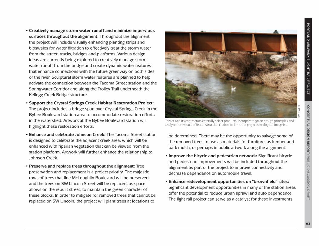
• Creatively manage storm water runoff and minimize impervious surfaces throughout the alignment: Throughout the alignment the project will include visually enhancing planting strips and bioswales for water filtration to effectively treat the storm water from the street, tracks, bridges and platforms. Various design ideas are currently being explored to creatively manage storm water runoff from the bridge and create dynamic water features that enhance connections with the future greenway on both sides of the river. Sculptural storm water features are planned to help activate the connection between the Tacoma Street station and the Springwater Corridor and along the Trolley Trail underneath the Kellogg Creek Bridge structure.
• Support the Crystal Springs Creek Habitat Restoration Project: The project includes a bridge span over Crystal Springs Creek in the Bybee Boulevard station area to accommodate restoration efforts in the watershed. Artwork at the Bybee Boulevard station will highlight these restoration efforts.
• Enhance and celebrate Johnson Creek: The Tacoma Street station is designed to celebrate the adjacent creek area, which will be enhanced with riparian vegetation that can be viewed from the station platform. Artwork will further enhance the relationship to Johnson Creek.
• Preserve and replace trees throughout the alignment: Tree preservation and replacement is a project priority. The majestic rows of trees that line McLoughlin Boulevard will be preserved, and the trees on SW Lincoln Street will be replaced, as space allows on the rebuilt street, to maintain the green character of these blocks. In order to mitigate for removed trees that cannot be replaced on SW Lincoln, the project will plant trees at locations to
be determined. There may be the opportunity to salvage some of the removed trees to use as materials for furniture, as lumber and bark mulch, or perhaps in public artwork along the alignment.
• Improve the bicycle and pedestrian network: Significant bicycle and pedestrian improvements will be included throughout the alignment as part of the project to improve connectivity and decrease dependence on automobile travel.
• Enhance redevelopment opportunities on “brownfield” sites: Significant development opportunities in many of the station areas offer the potential to reduce urban sprawl and auto dependence. The light rail project can serve as a catalyst for these investments.
TriMet and its contractors carefully select products, incorporate green design principles and analyze the impact of its construction choices to limit the project’s ecological footprint.
TIm
JEw
ETT

94
TRANSIT OPERATIONS
Key Considerations
Projected employment growth in Portland’s Central City, along with continued residential growth in Clackamas County and Southeast Portland, will create a need for more transit options between Clackamas County and downtown Portland. Introducing this new light rail line requires extensive coordination with other transit services. The key considerations for project transit operations are:
• Removing bus lines from congested routes over existing bridges
• Providing faster bus service and allowing new connections by utilizing the new Willamette River Bridge
• Maximizing transit efficiencies by coordinating bus and light rail service in the corridor
• Ensuring transit modes that simultaneously utilize the shared transitway of the new bridge operate efficiently and safely
Preliminary Bus Plan
When a new transit option becomes available in the same service area as existing transit options, efforts are made to reduce redundancies and inefficiencies. Although final decisions regarding transit adjustments will be made further into the project timeline, the following modifications may be expected:
Rerouting of buses in downtown Portland: The project commissioned a study of bus routing options between the Portland Mall at SW Jackson Street and SW 5th Avenue to the Harbor Drive
structure, and evaluated several criteria for routing alternatives, including travel time, reliability, traffic volume and circulation. The bus routing alternative chosen as the best option provides for outbound buses to travel south on SW 5th, then east on SW Lincoln to the Harbor Drive structure, and inbound buses to travel from the Harbor Drive structure west on SW Lincoln, north on SW 4th Avenue and west on SW Hall to SW 6th Avenue.
Rerouting of Ross Island Bridge bus lines to the new Willamette River Bridge: Bus lines 9-Powell/Broadway, 17-Holgate/NW 21st and 19-Woodstock/Glisan will be rerouted over the new Willamette River Bridge, thereby providing faster service for riders of these lines. This routing will also make possible service to the OHSU Schnitzer Campus at South Waterfront. Rerouting these lines will change their coverage close to the river, so the resulting change will be reviewed to determine whether other adjustments are needed for adequate coverage on both sides of the Ross Island Bridge.
Adjustment of bus lines that provide service along the light rail alignment: Bus lines that currently make stops along the Portland-Milwaukie light rail alignment may be reconfigured to avoid duplication of transit service. Additionally, limited stop bus service may be added to high capacity rider sites near, but not served by, future light rail service, such as the Milwaukie Park & Ride facility that opened in January 2010 at SE Milport and Main streets to serve bus riders.
Adjustment of bus service along the Eastside Streetcar alignment: Currently under construction, the Eastside Streetcar will stop near the Portland-Milwaukie alignment on the east side of the new Willamette River Bridge near OMSI. To the north, this streetcar
PRELIMINARY ENGINEERING RECOMMENDATIONS

PO
RT
LA
ND
-MILW
AU
KIE
LIGH
T R
AIL P
RO
JEC
T C
ON
CE
PT
UA
L DE
SIG
N R
EP
OR
T: PU
BLIC
DIS
CU
SS
ION
DR
AF
T
95
service will take people into downtown Portland over the Broadway Bridge and will follow the route of bus line 6-Martin Luther King, Jr. Blvd south of the Broadway Bridge on the east side of the river. Line 6 will therefore partially duplicate Eastside Streetcar service and may require route reconfiguration.
Shared Transitway of the Willamette River Bridge
The 1.3-mile shared transitway including the new Willamette River Bridge will be designed to accommodate light rail and three bus lines. Bus stops will be located on the island platforms but buses will access them from the side opposite the light rail tracks. From the bus stops, buses will merge into the shared transitway when they have a green signal. The bus fleet will not need retrofitting for operation in the shared transitway.
In the future, a separate project could add streetcars to a half-mile section of the transitway, allowing a streetcar line to cross the river on the new bridge. Light rail platforms at either end of the bridge (South Waterfront and OMSI) will be segregated from streetcar platforms. Adding streetcars will require building track junctions at both ends of the bridge, including power switches and railroad signal interlockings. Streetcars are already equipped with train-to-wayside communication but will need to have automatic train stop technology added to the fleet. The light rail trackway will allow the junctions to be added without degrading its track geometry.
During Preliminary Engineering, traffic volumes on the bridge (Table 1) were tested with a simulation model to verify that operation can occur without significant delays and to consider whether scheduling and other operational procedures have significant effects on the operation. A previous simulation model of the Portland Mall shared transitway found effective performance of this type of bus and train
line-of-sight operation for more than 90 buses per hour and up to 18 trains per hour running in the peak direction. The simulation model for the PMLR project included the OPRR at-grade crossing of the shared transitway just east of the OMSI station.
Should a transit vehicle break down on the bridge, it will be accessed similarly to the manner in which disabled vehicles are currently accessed in the system. The bridge will be able to accommodate TriMet and emergency response vehicles if necessary—a mountable curb system in the middle of the bridge will allow responder vehicles to move around a disabled vehicle. There will also be crossover tracks near the ends of the bridge so that trains can turn back on either side. If needed, both east-and west-bound trains will be able to run on a single track, but bus service would then have to be rerouted. If an alternate bridge is needed for buses due to interrupted MAX or streetcar service, the Ross Island Bridge would be the likely route.
Table 1: Weekday PM peak hour and off-peak transit vehicle volumes based on the 2030 passenger demand forecast
PEAK HOUR OFF-PEAK
MAX (trains per hour) 8 4
Bus (buses per hour)* 33 or 35 12 or 13.3
Streetcar (trains per hour)
6 6
Total (vehicles per hour)*
47 or 49 22 or 23.3
Average Headway (minutes between vehicles)
1.3 or 1.2 minutes 2.7 or 2.6 minutes
* Thenumberofbusesandtheaverageheadwayrangesdependingonwhethertheadditionalbusesto/fromtheMilwaukiePark&Rideareincluded.

96
Quiet Zones
A quiet zone is a section of a rail line that contains one or more consecutive public crossings at which locomotive horns are not routinely sounded. The PMLR project will modify rail crossings at grade through several intersections. Federal Railroad Administration (FRA) rules regarding freight train horns and quiet zones now apply to rapid transit at locations where a transit line shares a crossing with a freight line. These rules also provide exceptions where risk is minimized and enable communities to establish quiet zones by reducing the risk caused by lack of horns.
In this project, there are two groups of intersections where light rail would share crossings with freight trains: one group in Southeast Portland and one in Milwaukie.
In Southeast Portland, rail crossings at these intersections fall under the FRA train horn rules:
• SE 8th Avenue and SE Division Street• SE 9th Avenue and SE Division Street• SE Division Place• SE 11th Avenue and SE Clinton Street• SE 12th Avenue and SE Clinton Street
In Milwaukie, rail crossings of these roads fall under the FRA train horn rules:
• SE Mailwell Street• SE Harrison Street• SE Monroe Street• SE Washington Street• SE 21st Avenue and SE Adams Street
The project team, along with the cities of Portland and Milwaukie, the FRA, Union Pacific Railroad, ODOT and train horn consultants, is exploring the implementation of quiet zones and the application of train horn waivers to these crossings.
Portland and Milwaukie will apply for quiet zones for each of the crossings covered by FRA regulations within their respective jurisdictions. Local governments have two ways of creating a quiet zone:
1) show that the lack of the horn does not pose a significant safety risk, or
2) implement safety measures to reduce excess risk associated with no horn.
The City of Milwaukie will pursue the creation of quiet zones at light rail alignment intersection crossings.
Tho
ma
s N
Go

PO
RT
LA
ND
-MILW
AU
KIE
LIGH
T R
AIL P
RO
JEC
T C
ON
CE
PT
UA
L DE
SIG
N R
EP
OR
T: PU
BLIC
DIS
CU
SS
ION
DR
AF
T
97
Safety measures determined by the FRA are an effective substitute for the locomotive horn in the prevention of highway-rail casualties. Such measures that could be used at the cited crossings include four-quadrant gates, one-way streets with gates, gates with medians or traffic channelization devices, and permanent closure of streets at crossings.
The project has worked with the jurisdictions to design safety measures that should meet FRA requirements for the implementation of quiet zones.
In order to create crossings that meet FRA safety standards, the project design currently calls for closing SE Clinton Street between 11th and 12th avenues, and for consolidating three crossings into one at SE 8th Avenue and SE Division Street by closing SE 9th Avenue and SE Division Place.
For any crossing for which a quiet zone application is rejected, the project will seek a train horn waiver. This waiver would allow lower level sounds to be activated when light rail trains are approaching gated crossings. The FRA stipulates that rapid transit trains are not subject to the minimum and maximum decibel levels for train horn noise. For instance, light rail trains could use gongs instead of horns.
In the unlikely case that the project is unsuccessful in securing quiet zones or train horn waivers, the project would seek to minimize train horn by utilizing wayside horns. Wayside horns focus sound at the vehicles stopped at crossing gates and are stationary. Wayside noise significantly reduces the sound “footprint” in comparison to horns sounded from moving trains.
Union Pacific Railroad
The light rail project will run three miles of its alignment on the east side of the Willamette River adjacent to the UPRR. A series of discussions between the project and the UPRR have resulted in agreements that effect project design.
In general, the railroad requires that light rail tracks be located a minimum of 50 feet from the centerline of the UPRR trackway (to the curb line of the nearest light rail track) where light rail operates within a shared corridor on property owned by or acquired from the railroad.
A new pedestrian and bike bridge over the freight and light rail tracks at the Clinton Street station between 13th and 14th avenues meets the railroad’s required height of 23.5 feet from the top of the freight rail to the bottom of the bridge. This same height requirement will be met by the new pedestrian bridge over the freight tracks at SE Lafayette Street near the SE Rhine Street station.
The light rail project impacts the truck access from SE Schiller Street east of 17th Avenue from Union Pacific’s Brooklyn Yard in SE Portland. A truck egress point will be improved at SE Harold Street east of McLoughlin Boulevard, providing the freight traffic a direct access to McLoughlin Boulevard. The UPRR requires that the light rail line be grade-separated over this truck egress point. As a result, both the trackway and the future Harold Street station platform will be elevated.
From SE Harold Street to south of the Tacoma Street station, the light rail trackway remains 50 feet from the centerline of the UPRR mainline trackway, while at the same time retaining space to the west for the possible future widening of SE McLoughlin Boulevard.

98
South of the Willsburg Junction the UPRR mainline runs to the southeast and the Tillamook Branch line runs to the southwest. In the north Milwaukie industrial area, the light rail alignment moves to parallel the Tillamook Branch line, owned by the UPRR and operated by Portland and Western Railroad. Once on the Tillamook Branch, the light rail alignment will be 25 feet from the centerline of freight tracks. The UPRR accepts the decreased distance in this portion of the alignment provided a six-foot high safety wall separates the two rail lines. This safety wall is now a component of the project design and will be built 250-feet back from intersections to provide adequate sight distance. The light rail tracks must cross from the west side of the Tillamook Branch to the east side to serve the Milwaukie station. This is accomplished with an elevated structure near Willsburg Junction that comes back to grade at Mailwell Drive. The structure must meet freight clearance standards for safety and operability of the railroad.
TRAFFIC MANAGEMENT
Truck Access/Freight Mobility
The design of roadway and light rail crossings in SE Portland will serve freight needs for oversized routes and varying large truck configurations. Truck access and freight mobility along the alignment between OMSI and McLoughlin Boulevard will be accommodated as follows:
• SE 17th Avenue: The Brooklyn Truck Access Study informed the design of SE 17th Avenue to ensure that it retains its function as a freight route and serves as an emergency response route. Significant coordination with UPRR, ODOT, City of Portland and
TriMet resulted in a revised location for exiting trucks at Brooklyn Yard. Moving the existing egress from SE Schiller to SE Harold will relieve pressure on SE 17th Avenue and McLoughlin Boulevard intersections.
• SE 8th Avenue: A realigned SE 8th Avenue will accommodate WB-67 (53-foot) trailers.
• SE 11th and 12th Avenues: Improvements to SE 11th and 12th avenues (including closure of Clinton) will also accommodate WB-67 trucks.
• Truck clearances: Light rail catenary wires will be raised to approximately 21 feet to accommodate overheight vehicles between OMSI and the Clinton station and all along 17th Avenue.
• City of Milwaukie: Traffic impacts and mitigation at light rail crossings.
Capacity of Roadways
The roadway capacity at affected intersections is being analyzed using traffic software, such as VISSIM. Impacted intersections will be mitigated.
Signalization/Crossing Protection
Auto/light rail crossing protection will include signalized intersections and/or crossing gates, medians, loop detection and other typical crossing features. Pedestrian crossings will be treated with pedestrian warning signals.

PO
RT
LA
ND
-MILW
AU
KIE
LIGH
T R
AIL P
RO
JEC
T C
ON
CE
PT
UA
L DE
SIG
N R
EP
OR
T: PU
BLIC
DIS
CU
SS
ION
DR
AF
T
99
SAFETY AND SECURITY
CPTED Principles in Design
Crime Prevention Through Environmental Design (CPTED)
TriMet embraces the principles of Crime Prevention Through Environmental Design (CPTED). The goal of CPTED is to prevent crime through designing a physical environment that positively influences human behavior—people who regularly use the area perceive it as safe, and would-be offenders see the area as a highly risky place to commit crime.
CPTED is based on four principles:
Natural surveillance is a design concept intended to keep intruders easily observable by incorporating features that maximize visibility, such as doors and windows that look out on to streets and parking areas, pedestrian-friendly sidewalks and platforms, and adequate night time lighting.
Territorial reinforcement creates a sphere of influence that enables site users to develop a sense of control over the site while discouraging potential offenders. To achieve this, design elements such as landscape plantings, pavement designs and gateway treatments define property lines and distinguish public spaces from private spaces.
Natural access decreases opportunities for disruptions and crime by denying access to targets and creating a perception of risk for potential offenders. Entrances and gateways are designed to clearly indicate public routes and discourage access to private areas with structural elements.
Security cameras and adequate lighting are just two of the elements that promote safety at MAX stations.
TIm
JEw
ETT

100
Target hardening involves installing features that prohibit entry or access, such as window locks, interior door hinges and fencing.
CPTED Practices in the TriMet System
• TriMet evaluates platform designs early in the planning stages to incorporate crime prevention principles into each new project. CPTED strategies were employed in the design of the MAX Yellow and Green lines and on WES (Westside Express Service) Commuter Rail. TriMet also is updating several existing Blue and Red Line station areas to enhance sight lines, lighting and the sense of security.
• New stations are designed to maintain open sight lines by installing transparent windscreens and poles instead of walls, and by creating uncluttered station areas.
• Lighting is critical to creating a safe and welcoming space for riders. Well-lit stations, pedestrian walkways and Park & Ride facilities deter crime.
• To maximize enforcement at stations, Ticket vending machines are installed away from platforms when feasible, requiring riders to have a valid fare when on a platform. This allows security personnel to engage waiting individuals and enforce TriMet’s code.
• Closed-circuit television (CCTV) cameras are carefully sited at light rail stations and Park & Ride facilities to maximize the ability to identify individuals, which is critical to prosecuting crimes. In addition, CCTV also serves as a deterrent to criminal activity.
• Trees and shrubs are selected, sited and regularly maintained to not interfere with camera angles and to maximize visibility at stations and Park & Ride facilities. Landscaping also is being used to help define the boundaries of station areas.
• Public art is designed and sited to enhance the vitality and pride of each station and to discourage graffiti and other criminal behavior. TriMet strives to remove graffiti at MAX stations and transit centers within 24 hours of its appearance.
• Platform furniture such as benches, garbage cans and signage are designed to reduce hazards for transit customers and discourage hiding places for criminals.
• Bicycle parking (including bike lockers) has been redesigned to allow for better surveillance at transit centers.
Emergency Access and Response
The Fire, Life and Safety Committee for the project will serve as a liaison between the transit agency, fire jurisdictions and emergency response agencies. It will be comprised of local fire jurisdictions, local emergency response agencies, transit operations staff, safety, security, construction and design managers, transit management staff, and the general design consultant. The committee will review standards and safety-related designs and tests to verify fire-life-safety code and regulation compliance. In addition, the committee will address preparedness issues and review variances.
Key issues identified during Preliminary Engineering include:
• Access to bridges and elevated structures
• Firefighting response on structures
• Entry and access to multiple story parking structures
• Response procedures regarding how jurisdictions will work together for a coordinated response on the multi-modal bridge across the Willamette River
• Impacts to emergency response times along southbound SW Naito Parkway, due to addition of new signalized track crossing
PO
RT
LA
ND
-MILW
AU
KIE
LIGH
T R
AIL P
RO
JEC
T C
ON
CE
PT
UA
L DE
SIG
N R
EP
OR
T: PU
BLIC
DIS
CU
SS
ION
DR
AF
T
101
• Impacts to emergency response times from the Clinton station north, due to frequency of gate drops across SE 12th Avenue that will increase with the addition of light rail transit to the freight corridor
• Emergency response time impacts due to the addition of bus stops on the Bybee Boulevard structure over the UPRR tracks
As the project progresses through design, specific issues will be addressed down to a procedural level to ensure the best response possible during an emergency.
Specific response plans will have to be developed for the Harbor Avenue structure and the Willamette River Bridge, due to the multi-modal nature of the structures. Existing procedures regarding entry and exit routes for responding agencies, dependent on the type of emergency and the integration of transit vehicles as assistance during a response, need to be refined. New procedures may also be developed by the committee to address issues that are new to the system.
In the final design stages, the Fire, Life and Safety Committee will consider and address issues specific to jurisdictions along the project alignment. Onsite drills will be conducted to ensure that policies and procedures developed by the committee function as intended in the field. Adjustments to policies and procedures will be made as warranted, with action reports developed on any areas identified as needing refinement or revision.
Fare Enforcement Zones
TriMet has initiated a policy seeking to improve the physical design of platform areas so that areas where transit fares are required are clearly visible and distinguishable to support security initiatives. Fare
enforcement zones are important as they allow security personnel to initiate conversations and actions with individuals in enforcement areas to confirm fare payment as well as to investigate potentially negative behaviors. This policy will affect the physical design of platforms as it will seek to provide a clear portal and demarcation of the platform (fare enforcement area) from the surrounding public right-of-way. Balancing this initiative with the other elements on the platform as well as general urban design goals of visual clarity and minimizing visual “clutter” will be challenging. TriMet platforms have become increasingly standardized to improve customer understanding of use, reduce capital cost and reduce maintenance cost. This policy initiative will result in a need to fully revisit the platform organization but still result in a similar level of standardization. This work will be an important challenge addressed in Final Design.
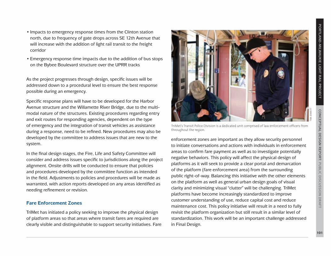
TriMet’s Transit Police Division is a dedicated unit comprised of law enforcement officers from throughout the region.
TIm
JEw
ETT

102
BICYCLE, PEDESTRIAN AND ADA ACCESSIBILITY
Transit ridership depends on integrating pedestrian, bike and mobility device access and facilities into station area designs. To this end, the project and local jurisdictions will make a number of improvements along the alignment that increase the livability of station areas for these users. Every station will meet, and often exceed, guidelines established in the Americans with Disabilities Act (ADA).
Accessibility and Pedestrian Improvements
Pedestrian access—which includes access by people using mobility devices—is paramount at every station. New crossings will be built along the project to connect communities to the new light rail line, as follows:
• The new Willamette River Bridge includes two 14-foot wide paths for pedestrians and cyclists
• A realigned pedestrian crossing over UPRR tracks at SE 14th Street supports the Clinton Street Station
• A rebuilt pedestrian/bike crossing over Powell Boulevard• A rebuilt pedestrian bridge over the UPRR at SE Rhine Street
provides a safer, more inviting connection between Fred Meyer’s corporate headquarters and the Rhine Street Station
• A new Kellogg Creek Bridge built by the project allows the City of Milwaukie to add a new pedestrian crossing in the future
• A new pedestrian crossing over Park Avenue providing access between the station and the Park & Ride facility is under consideration
• The project has identified a future pedestrian crossing to provide better connection to the future Harold Street Station and Reed College and the Sellwood-Moreland neighborhoods
At each station, pedestrian improvements are integral to the project’s design, and will include new curb ramps, crossings, lighting and widened sidewalks. The most significant improvements will be rebuilding all the sidewalks along SE 17th Avenue between Rhine and McLoughlin.
Bicycle Access to Stations and Bikeway Improvements
The project enhances the bicycle network by providing safe crossings of light rail, streetcar and freight rail tracks; new connections to and across the Willamette River; and access to light rail stations. Bicycle access and circulation improvements include:
• New bike and pedestrian connections between 1st Avenue and Naito Parkway on an extended Lincoln Street
Access and facilities for cyclists, pedestrians and persons in mobility devices will be integrated into every station.
Tho
ma
s N
Go

PO
RT
LA
ND
-MILW
AU
KIE
LIGH
T R
AIL P
RO
JEC
T C
ON
CE
PT
UA
L DE
SIG
N R
EP
OR
T: PU
BLIC
DIS
CU
SS
ION
DR
AF
T
103
• New bike lanes on the reconstructed portion of SW Naito Parkway, approximately 100 feet north and south of the SW Lincoln Street intersection
• Dedicated bike lanes through South Waterfront and OMSI stations• Improved bikeway crossings of light rail and streetcar tracks at east
and west portals of the Willamette River crossing. Bridge design and planning integrated with future greenway plans
• 14-foot bike/pedestrian paths in both directions on the Willamette River Bridge
• Improved connections from the Eastbank Esplanade and Springwater Corridor to the Clinton Street Bike Boulevard:- Improved crossing of SE 11th and 12th avenues- Right-of-way for a future bikeway between SE 12th Avenue and
Division Place• Improved crossing of SE Powell Boulevard at SE 17th Avenue• Overcrossings of Union Pacific Railroad tracks at SE 13th/14th and
SE Rhine Street with ADA ramps • New bike lanes on SE 17th Avenue• Alignment along McLoughlin Boulevard that preserves options for
a future multi-use path between Harold and Tacoma streets• Multi-use path connection from the Springwater Corridor to the
Tacoma Street station• Modified and new rail crossings at Harrison Street, Monroe Street,
and at 21st Avenue and Adams Street that accommodate planned bike facilities
• New bike lanes on SE 21st Avenue immediately around the Downtown Milwaukie/Lake Road station
• Kellogg Creek Bridge designed to accommodate a future local multi-use path connection
• Integration with 6-mile Trolley Trail at Park Avenue station
Key bicycle access improvements specific to each station area are discussed above in the Corridor and the Station Area Design Concepts section.
Bicycle Parking at Stations
The project is aspiring to provide bicycle parking well beyond the minimum code requirements. Subject to available funding and space, the project hopes to provide parking for more than 460 bicycles throughout the corridor; two-thirds of these spaces would provide security for long-term bicycle storage. The design of bicycle parking responds to the station environment. At stations in developed urban neighborhoods, parking will serve not only light rail passengers, but also residents and visitors to adjacent properties. At stations further from Portland City Center, parking facilities provide greater capacity and security for light rail passengers. In addition to cover from the weather, “hard” security measures include CCTV cameras, bike lockers, and gated enclosures with access restricted to smartcard holders. Security measures respond to the context of the station, level of activity and parking capacity. The goal is to provide bike parking for 5 to 30 percent of forecasted a.m. peak boardings with a greater ratio at stations where bicycling to transit has advantages over walking and/or driving (Table 2).
Bike parking is an important component of transit access and connections.
Tho
ma
s N
Go

104
STATION NUMBER OF BICYCLE SPACES
SHARE OF FORECASTED
A.M. PEAK RIDERSHIP
BICYCLE PARKING DESIGN GOALS
Lincoln 16 10%8 covered bike rack spaces under camera surveillance and 8 uncovered bike rack spaces.
South Waterfront 28 7%*14 covered bike rack spaces under camera surveillance and 14 uncovered bike rack spaces. Future secure bike parking with OHSU campus build-out.
OMSI 24 20%12 covered bike rack spaces under camera surveillance and 12 uncovered bike rack spaces.
Clinton St 36 20%18 covered bike rack spaces under camera surveillance and 18 uncovered bike rack spaces
Rhine St 16 10%8 bike locker and 8 uncovered bike rack spaces.
Holgate Blvd 28 15%12 bike locker, 8 covered, and 8 uncovered bike rack spaces.
Bybee Blvd 53 16%2 gated enclosures with racks for a total of 37 bicycles inside (access will be restricted to smartcard holders). Covered bike racks provide remaining 16 spaces.
Tacoma St 112 29%Large gated enclosure in Park & Ride garage with racks for 76 bicycles (access will be restricted to smartcard holders). Also, 12 bike locker, 12 covered and 12 covered bike rack spaces will be provided.
Downtown Milwaukie / Lake Rd 36 8%*
12 bike locker, 12 covered and 12 uncovered bike rack spaces provided by project. Space identified for secure bike parking (with space for 55 bicycles) as part of future TOD adjacent to station.
Park Ave 116 20%Large gated enclosure in Park & Ride garage with racks for 80 bicycles (access will be restricted to smartcard holders). Also, 12 bike locker, 12 covered and 12 uncovered bike rack spaces will be provided.
Total 463 16%
* Includes only bicycle parking provided by the PmLR project.
TaBLE 2: Conceptual bicycle parking capacity and design goals

PO
RT
LA
ND
-MILW
AU
KIE
LIGH
T R
AIL P
RO
JEC
T C
ON
CE
PT
UA
L DE
SIG
N R
EP
OR
T: PU
BLIC
DIS
CU
SS
ION
DR
AF
T
105
RIGHT-OF-WAY DISPLACEMENT AND RELOCATION
Whenever possible, the region selects rail alignments that avoid and/or minimize property acquisitions or other impacts on property owners. The Portland-Milwaukie Locally Preferred Alternative selected by the region is aimed at attracting the maximum number of riders possible in a growing corridor. This alignment will be built near a number of residential and employment sources, affecting a number of light industrial zones and other properties throughout the 7.3-mile project. TriMet also plans to expand its Ruby Junction Rail Maintenance Facility in Gresham to support the new light rail vehicles that will be purchased for this project. The expansion is planned to be undertaken in conjunction with the Columbia River Crossing Project, which includes a light rail extension from the Expo Center in Portland to the City of Vancouver.
TriMet and its project partners are strongly committed to supporting businesses through relocation efforts and ensuring the jobs of these businesses remain within the region. The project follows state and federal rules for acquisitions when purchasing private property and relocating the occupants. To the extent allowed by governing regulations, the project pays for relocation site searches, land, buildings, other improvements, moving expenses, utility reconnections at new locations and small remodel projects for re-establishment at the replacement location. TriMet also provides highly qualified contract staff to assist property owners in navigating the complicated rules governing property acquisition, and the agency is working in partnership with the Portland Development Commission to find locations to keep these jobs within the area. Additionally, TriMet is exploring a partnership with a local agency to provide expanded business support such as move staging, space planning and business plan development to further assist businesses affected by the construction of this new light rail line.
Schedule: After the FTA publishes the Final Environmental Impact Statement (May 2010) and issues its Record of Decision (July 2010), the process of acquiring impacted property begins. This process includes environmental studies of each subject parcel, third-party appraisal of each parcel’s market value and an outside review of these appraisals, followed by the presentation of an offer of just compensation to each property owner. It is expected that right-of-way acquisition will be completed in 2013.
UTILITY RELOCATION PLAN
The scope of required private and public utility relocations affects project costs, schedule and community impacts during construction. The number and complexity of the utility relocations drive the overall project schedule because they must be completed in advance of the alignment construction. In addition, the age of the utility systems and unforeseen underground conditions make the cost for this work, as well as the time to perform it, difficult to predict.
The project corridor currently has both aerial and underground utilities, including electrical services, telecommunications, water, sanitary, storm water, and natural gas services. The preliminary engineering efforts for the project have involved initial reviews of major utilities to identify locations where the alignment and existing major utilities may be in conflict. Specific utility impacts are typically identified during the advanced engineering phase of the project when a higher level of detailed engineering information is available. Therefore, the utility infrastructure and facility impacts identified to date represent typical conditions as well as any major conflicts that have been identified in available engineering documents.
The project will have both longitudinal and crossing impacts on utilities. A longitudinal impact occurs where there is conflict with a utility that is located along or parallel with the light rail alignment. A

106
crossing impact occurs when the light rail alignment intersects the utility’s facilities. The greatest potential impacts to the utilities are the longitudinal impacts, as this may require extensive relocation of a utility’s facilities outside of the light rail operating envelope. There is an increased potential for longitudinal impacts on major arterial roads such as SE 17th Avenue and SE McLoughlin Boulevard, because major roadways such as these are typically utility corridors. There is also an increased potential for a longitudinal impact to underground communications lines, typically fiber optic cable, along the Union Pacific Railroad right-of-way. Furthermore, overhead electrical and communication lines are under review for potential undergrounding at SE Harrison, SE Monroe, SE Washington, SE Adams and SE 21st streets, as requested by the City of Milwaukie.
There may be temporary utility service disruption during construction activities, but in general these impacts are short in duration and the conditions for service interruptions are often controlled by permits required by local jurisdictions. All affected utility owners would be contacted, and proper coordination would ensure minimum disturbance to system users. Typically, new facilities such as poles, ducts or utility lines are installed and then service is switched over, minimizing any disruption of service.
TriMet contractors will employ methods to minimize impacts on businesses and traffic during utility construction. Temporary road closures or other traffic control measures will be necessary to carry out the work.
The total cost of the project is currently estimated at $1.417 billion in year of expenditure dollars and including finance costs (Table 3). Regional partners will provide a 40 percent local share to fund the project and a 60 percent match from the Federal Transit Administration will be requested. The local share of $567 million will include contributions from the State of Oregon through bonds backed by the state lottery, Metro through bonds backed by the Metropolitan Transportation Improvement Program (MTIP), the cities of Portland and Milwaukie, Clackamas County, TriMet and in-kind contributions from land donations. This cost estimate and budget is based on Conceptual Engineering plans and will continue to be updated as the design progresses.
PROJECT BUDGET & FINANCING STRATEGY
TaBLE 3: Estimated project uses and sources
MILLIONS IN YEAR OF EXPENDITURE
USES
Design and construction $1,214.6
Interim finance $103.0
Net interest paid during construction $100.0
TOTAL $1,417.6
SOURCES
Federal New Starts funds $850.6
Local funding
State Lottery bonds $250.0
Net construction period finance cost on MTIP, State and local bonds.
$100.0
MTIP backed bonds $72.5
In-kind contributions $38.0
City of Portland $30.0
TriMet $30.0
Clackamas County $25.0
City of Milwaukie $5.0
Remaining $16.5
TOTAL LOCAL CONTRIBUTIONS $567.0
$1,417.6

PO
RT
LA
ND
-MILW
AU
KIE
LIGH
T R
AIL P
RO
JEC
T C
ON
CE
PT
UA
L DE
SIG
N R
EP
OR
T: PU
BLIC
DIS
CU
SS
ION
DR
AF
T
107
Table 4 summarizes the current schedule for the PMLR project.
This report will be distributed in February/March 2010 for jurisdictional, stakeholder and community review. It will be reviewed by various entities prior to the project advancing into the Final Design phase.
Shortly after the Final Environmental Impact Statement (FEIS) is completed and published by the Federal Transit Administration, the project will move into Final Design. Final Design is expected to begin in October 2010 and be completed in January 2012, and the Full Funding Grant Agreement is expected to be executed in June 2012. Construction is planned to begin in 2011 with utility relocations and Willamette River Bridge construction and the new light rail service is expected to commence in September 2015.
TaBLE 4: Project schedule
PORTLAND MILWAUKIE LIGHT RAIL PROJECT SCHEDULE
Approval to Begin Preliminary Engineering Phase March 2009
Preliminary Engineering Completed March 2010
Final Environmental Impact Statement Published May 2010
Final Design Oct 2010 – Jan 2012
Full Funding Grant Agreement Executed June 2012
Construction 2011–15
Light Rail Service Begins September 2015
PROJECT SCHEDULE

108
LIST OF APPENDICES
A number of reports, documents and plans have influenced the content of this Conceptual Design Report. These documents can be found on the project website (trimet.org/pm):
A. Portland-Milwaukie Light Rail Station Area Best Practices, Assessments and Recommendations (Metro: September 2009)
B. Public Meetings Log
C. Portland-Milwaukie Light Rail Project: Summary of Relevant Public and Private Planning Documents
D. Exhibit C: Post Locally Preferred Alternative (LPA) Recommendations (a memorandum from the City of Portland to TriMet)
E. A Memorandum of Understanding between TriMet and the City of Milwaukie
F. Portland-Milwaukie Light Rail Project Supplemental Draft Environmental Impact Statement (Metro: May 2008)
G. Portland-Milwaukie Light Rail Project: Willamette River Bridge Type Selection Process (TriMet: February 2009).
H. Portland-Milwaukie Light Rail Project Locally Preferred Alternative Report (Metro & TriMet: July 24, 2008)
PO
RT
LA
ND
-MILW
AU
KIE
LIGH
T R
AIL P
RO
JEC
T C
ON
CE
PT
UA
L DE
SIG
N R
EP
OR
T: PU
BLIC
DIS
CU
SS
ION
DR
AF
T
109
WILLAMETTE RIVER BRIDGE ADVISORY COMMITTEEVera Katz, Chair Former Mayor, City of
Portland David Knowles, Facilitator CH2M HillThomas Hacker THA Architecture Art Johnson KPFF Consulting EngineersSue Keil City of Portland Pat LaCrosse Oregon Museum of Science &
IndustryNeil McFarlane TriMetGuenevere Millius SRM Architecture &
Marketing, Inc.Michelle Poyourow Bicycle Transportation
AllianceRoss Roberts MetroRick Saito ZidellDavid Soderstrom Portland Opera BoardChuck Steinwandel Ross Island Sand and GravelMark Williams Oregon Health & Science
University Rick Williams Citizens Advisory Committee
ChairMike Zilis Walker & Macy
Former/alternate membersKarl Rohde Bicycle Transportation
AllianceBob Durgan Andersen ConstructionRichard Brandman Metro William Dann THA ArchitectsBrian Newman Oregon Health & Science
University
TECHNICAL STAFFTom Armstrong City of PortlandCharles Auch City of PortlandJoseph Auth Oregon Depart. of
TransportationMatt Baccitich TriMetJohn Baker TriMetRob Barnard TriMetSteve Barrett TriMetVicki Barron TriMetBobby Bartels TriMetSean Batty TriMetJanni Baugh TriMetAnn Becklund TriMetJane Beisell TriMetIsabella Bejarano Parsons BrinckerhoffApril Bertelson City of PortlandMatt Bihn MetroDan Blocher TriMetJohn Bloss TriMetJackie Blyn TriMetTeresa Boyle City of Portland Christine Bourdette Public Artist
Kristin Calhoun Regional Arts and Culture Council
Dan Caufield TriMetDave Chiara TriMetTim Collins MetroBritney Colton TriMetSimon Cooper TriMetLiz Crane TriMetTroy Doss City of Portland Ralph Drewfs Oregon Dept. of
TransportationLance Erz TriMetDeneen Everly TriMetJohn Fall TriMetAmy Fandrich TriMetJoyce Felton MetroNick Flagg TriMetCrista Gardner MetroRoger Geller City of PortlandDiane Goodwin TriMetStu Greenberger Portland Water Bureau John Griffiths TriMetRobin Grimwade Portland Parks & RecreationBob Hastings TriMetMichelle Healy Clackamas CountyThomas Heilig TriMetWendy Hemmen City of MilwaukieJoAnn Herrigel City of MilwaukiePaul Heydenrych Hatch Mott MacDonaldBrett Horner City of PortlandDan Johnson Clackamas CountySteve Katko CH2M HillRick Kindig TriMetCurtis Kolar TriMetJennifer Koozer TriMetNancy Kraushaar City of Oregon CityCalvin Lee TriMetTamara Lesh TriMetLora Lillard City of PortlandSteve Litchfield HNTBBuck Lorts TriMetKaitlin Lovell City of PortlandDana Lucero MetroJennifer Lyman TriMetKarl MacNair TriMetColin Maher TriMetKatie Mangle City of MilwaukieJames Mast Portland Development
CommissionTony Mendoza MetroBill Meyer TriMetDennis Mitchell Oregon Dept. of
TransportationBrian Monberg MetroLiz Moorhead City of PortlandSydney Nguyen TriMetDave Nunamaker City of PortlandDenyse McGriff Portland Development
Commission
Geraldene Moyle Portland Development Commission
Thomas Ngo TriMetYoung Park TriMetArt Pearce City of PortlandDenny Porter LTK Engineering ServicesMary Priester TriMetDavid Queener Clackamas CountyMark Raggett City of PortlandJoe Recker TriMetLeah Robbins TriMetScott Roberts MetroEllen Rogalin Clackamas CountyScott Robertson TriMetMike Rosen City of Portland DeeAnn Sandberg TriMetTad Savinar ConsultantPaige Schlupp TriMetJamie Snook MetroCheryl Snow Clackamas County Art
AllianceClaudia Steinberg TriMetPatrick Sweeney City of Portland Dave Tertadian TriMetMichelle Traver TriMetSemyon Treyger HNTBMark Turpel MetroDave Unsworth TriMetDenis Van Dyke TriMetCherri Warnke City of Portland Ron Weinman Clackamas CountyAlonzo Wertz TriMetMatt Wickstrom City of PortlandBridget Wieghart MetroKurt Wilkinson TriMetLinda Williams City of Portland John Willis CH2M HillLarry Wittkop LTK Engineering ServicesSteve Yeung City of Portland Ken Zatarain TriMet
CONCEPTUAL DESIGN REPORT CONSULTANTSFrancesca Gambetti Shiels Obletz Johnsen, Inc.Geena Min Diggy Dog Design
Additional graphics provided by:
Ankrom Moisan Associated ArchitectsCenter for Environmental StructureDonald MacDonald ArchitectsHatch Mott MacDonaldHNTBMayer/ReedNewlands & CompanyPIVOT ArchitectureZimmer Gunsul Frasca Architects

February 2010
710 NE Holladay StreetPortland, OR 97232trimet.org/pm
Available in other formats: trimet.org
503-238-7433 TTY 503-238-5811
Favor de llamar al 503-238-7433 si necesita ésta
información en español.