Embed Size (px)
Citation preview

1
Stratified Receiving Waters
Environmental Hydraulics
Receiving Water Types
SNV: Swedish EPA
• flowing water
• shallow lakes (depth < 12 – 15 m)
• deep lakes (depth > 12 – 15 m)
• estuaries
• open coastal areas
Stratified water bodies: mainly deep lakes and estuaries
2
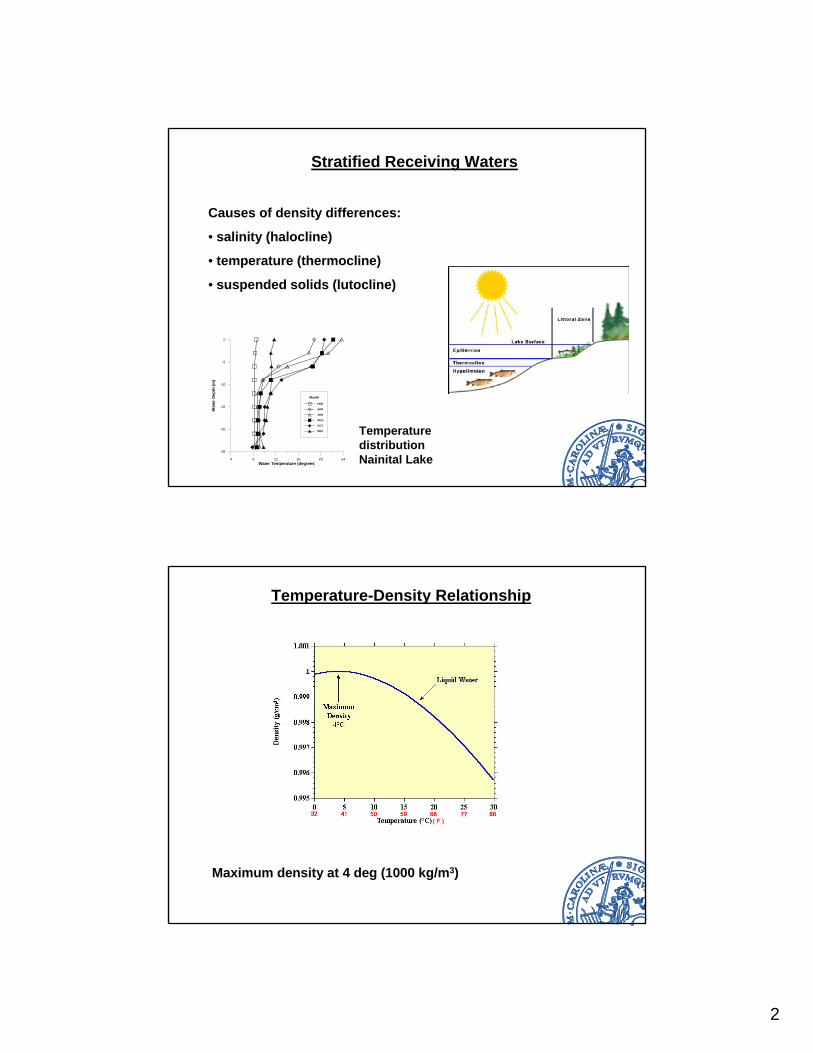
Stratified Receiving Waters
Causes of density differences:
• salinity (halocline)
• temperature (thermocline)
• suspended solids (lutocline)
4 8 12 16 20 24Water Temperature (degrees)
-25
-20
-15
-10
-5
0
Wat
er D
epth
(m)
Month
FEB
APR
JUN
AUG
OCT
DEC Temperature distribution Nainital Lake
Temperature-Density Relationship
Maximum density at 4 deg (1000 kg/m3)
3
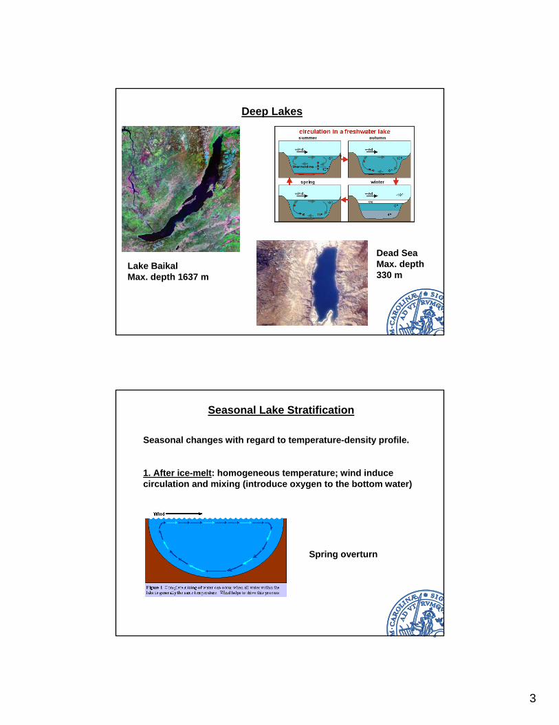
Deep Lakes
Lake BaikalMax. depth 1637 m
Dead SeaMax. depth 330 m
Seasonal Lake Stratification
Seasonal changes with regard to temperature-density profile.
1. After ice-melt: homogeneous temperature; wind induce circulation and mixing (introduce oxygen to the bottom water)
Spring overturn
4
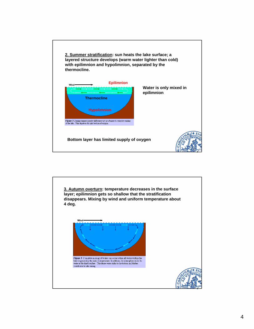
2. Summer stratification: sun heats the lake surface; a layered structure develops (warm water lighter than cold) with epilimnion and hypolimnion, separated by the thermocline.
Epilimnion
Hypolimnion
Thermocline
Water is only mixed in epilimnion
Bottom layer has limited supply of oxygen
3. Autumn overturn: temperature decreases in the surface layer; epilimnion gets so shallow that the stratification disappears. Mixing by wind and uniform temperature about 4 deg.
5
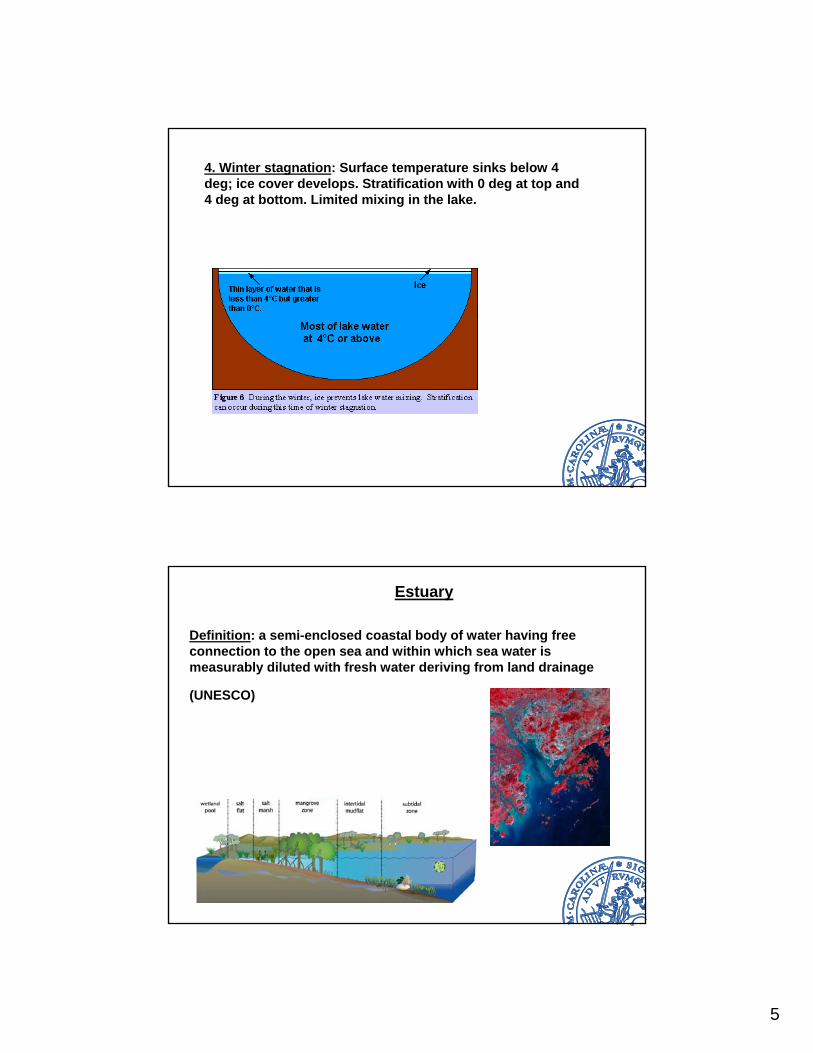
4. Winter stagnation: Surface temperature sinks below 4 deg; ice cover develops. Stratification with 0 deg at top and 4 deg at bottom. Limited mixing in the lake.
Estuary
Definition: a semi-enclosed coastal body of water having free connection to the open sea and within which sea water is measurably diluted with fresh water deriving from land drainage
(UNESCO)
6
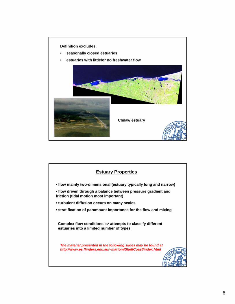
Definition excludes:
• seasonally closed estuaries
• estuaries with little/or no freshwater flow
Chilaw estuary
Estuary Properties
• flow mainly two-dimensional (estuary typically long and narrow)
• flow driven through a balance between pressure gradient and friction (tidal motion most important)
• turbulent diffusion occurs on many scales
• stratification of paramount importance for the flow and mixing
Complex flow conditions => attempts to classify different estuaries into a limited number of types
The material presented in the following slides may be found at http://www.es.flinders.edu.au/~mattom/ShelfCoast/index.html
7
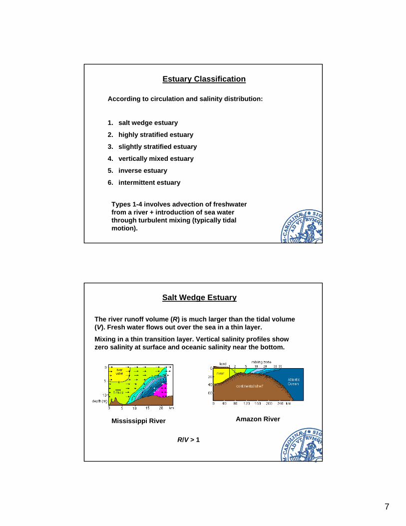
Estuary Classification
According to circulation and salinity distribution:
1. salt wedge estuary
2. highly stratified estuary
3. slightly stratified estuary
4. vertically mixed estuary
5. inverse estuary
6. intermittent estuary
Types 1-4 involves advection of freshwater from a river + introduction of sea water through turbulent mixing (typically tidal motion).
Salt Wedge Estuary
The river runoff volume (R) is much larger than the tidal volume (V). Fresh water flows out over the sea in a thin layer.
Mixing in a thin transition layer. Vertical salinity profiles show zero salinity at surface and oceanic salinity near the bottom.
Mississippi River Amazon River
R/V > 1
8
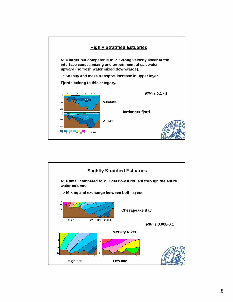
Highly Stratified Estuaries
R is larger but comparable to V. Strong velocity shear at the interface causes mixing and entrainment of salt water upward (no fresh water mixed downwards).
⇒ Salinity and mass transport increase in upper layer.
Fjords belong to this category.
Hardanger fjord
summer
winter
R/V is 0.1 - 1
Slightly Stratified Estuaries
R is small compared to V. Tidal flow turbulent through the entire water column.
=> Mixing and exchange between both layers.
Chesapeake Bay
Mersey River
High tide Low tide
R/V is 0.005-0.1
9
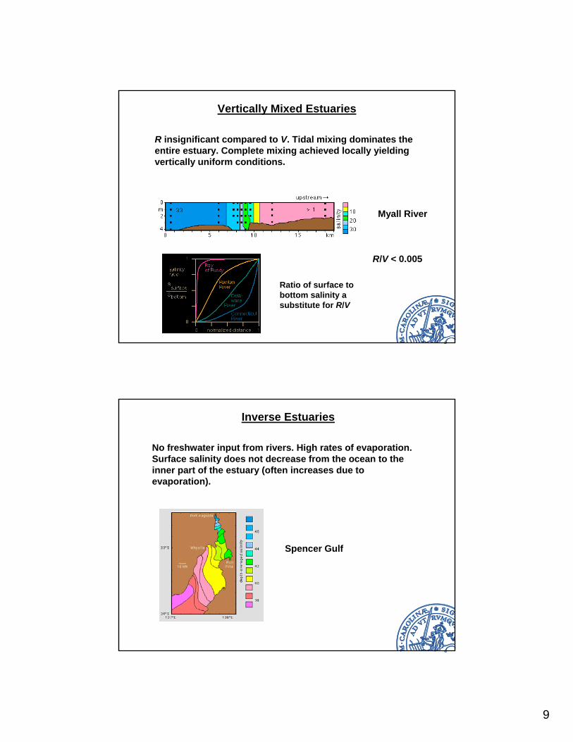
Vertically Mixed Estuaries
R insignificant compared to V. Tidal mixing dominates the entire estuary. Complete mixing achieved locally yielding vertically uniform conditions.
Myall River
Ratio of surface to bottom salinity a substitute for R/V
R/V < 0.005
Inverse Estuaries
No freshwater input from rivers. High rates of evaporation. Surface salinity does not decrease from the ocean to the inner part of the estuary (often increases due to evaporation).
Spencer Gulf
10
Intermittent Estuaries
The behavior of the estuary changes with time due to variation in river input. It can belong to different classes depending on the time of year.