Embed Size (px)
Citation preview
Designing for Aquatic Organism Passage at Road-Stream Crossings
2. Simple Stream Simulation Example
May 2011 2-1 USDA-Forest Service
Eastern Region-R9
Chippewa National Forest
Stream Simulation: A Simple Example
North Thompson Creek, CO
Paul T. Anderson U.S.D.A. Forest Service
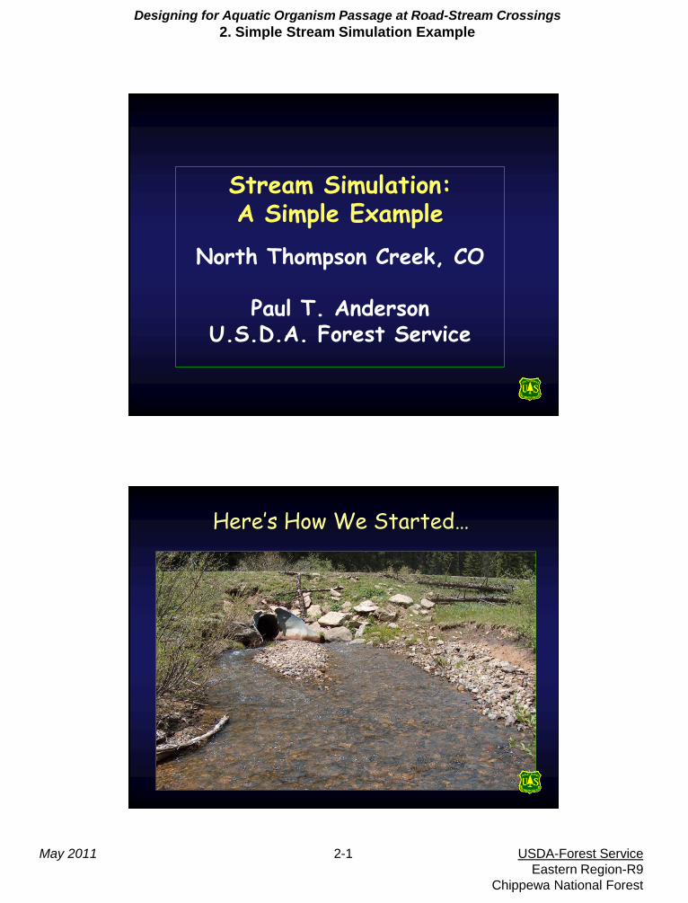
Here’s How We Started…
Designing for Aquatic Organism Passage at Road-Stream Crossings
2. Simple Stream Simulation Example
May 2011 2-2 USDA-Forest Service
Eastern Region-R9
Chippewa National Forest
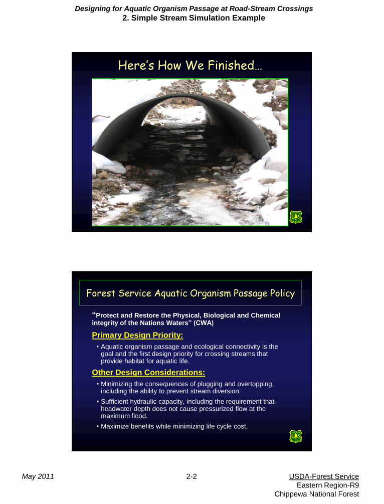
Here’s How We Finished…
Forest Service Aquatic Organism Passage Policy
“Protect and Restore the Physical, Biological and Chemical integrity of the Nations Waters” (CWA)
Primary Design Priority:
• Aquatic organism passage and ecological connectivity is the goal and the first design priority for crossing streams that provide habitat for aquatic life.
Other Design Considerations:
• Minimizing the consequences of plugging and overtopping, including the ability to prevent stream diversion.
• Sufficient hydraulic capacity, including the requirement that headwater depth does not cause pressurized flow at the maximum flood.
• Maximize benefits while minimizing life cycle cost.
Designing for Aquatic Organism Passage at Road-Stream Crossings
2. Simple Stream Simulation Example
May 2011 2-3 USDA-Forest Service
Eastern Region-R9
Chippewa National Forest
Basic Concepts
• Bankfull Flow: Bankfull flow describes the volume, width, depth
and elevation: where the water begins to spill on the flood plain.
The elevation of incipient flooding. It can also be thought of as
the streams physical expression of it’s natural size and power.
• Stream Simulation: Create a channel bed form, within a
structure, as similar as possible to the natural channel in both
structure and function. The simulated channel should present no
more of and obstacle to aquatic life than the adjacent natural
channel.
• Reference Reach: A natural stable channel section used as the
design template for stream simulation.
• 100 Year Flood: A backward looking estimate with Very High
Error. Does not account for Debris, Sediment, or Aquatic
Passage. At Best is an relative indicator or risk. Structure Life
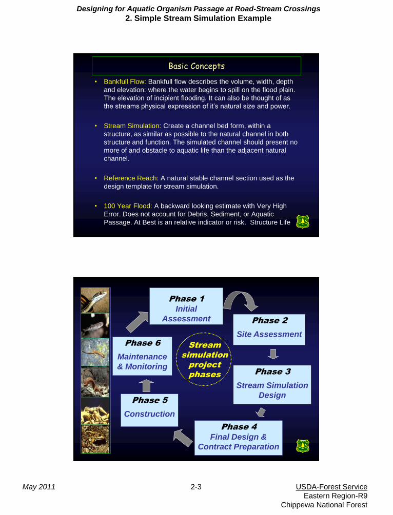
Phase 1
Initial
Assessment Phase 2
Site Assessment
Phase 3
Stream Simulation
Design
Phase 4
Final Design &
Contract Preparation
Phase 5
Construction
Phase 6
Maintenance
& Monitoring
Stream
simulation
project
phases
Designing for Aquatic Organism Passage at Road-Stream Crossings
2. Simple Stream Simulation Example
May 2011 2-4 USDA-Forest Service
Eastern Region-R9
Chippewa National Forest
Phase 1 - Initial Assessment
• Road Context
– System road, heavy oil/gas, timber, recreation use.
• Resource Values
– Brook trout, CO cutthroat trout, and others?
• Watershed-Scale Risk Factors
– Stable sandstone geology, basalt cap, beetle kill
• Site Risk Factors
– Debris, floodplain constriction, channel stability
Initial Assessment (cont.) – Suitability and Objectives
• Road to remain in place with similar
dimensions
• Stream simulation is applicable and
appropriate
• Accommodate some floodplain processes
• Be prepared for some headcut, expect debris
Designing for Aquatic Organism Passage at Road-Stream Crossings
2. Simple Stream Simulation Example
May 2011 2-5 USDA-Forest Service
Eastern Region-R9
Chippewa National Forest
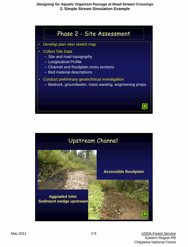
Phase 2 - Site Assessment
• Develop plan view sketch map
• Collect Site Data
– Site and road topography
– Longitudinal Profile
– Channel and floodplain cross sections
– Bed material descriptions
• Conduct preliminary geotechnical investigation
– Bedrock, groundwater, mass wasting, engineering props.
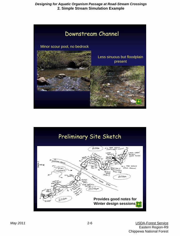
Upstream Channel
Aggraded inlet.
Sediment wedge upstream
Accessible floodplain
Designing for Aquatic Organism Passage at Road-Stream Crossings
2. Simple Stream Simulation Example
May 2011 2-6 USDA-Forest Service
Eastern Region-R9
Chippewa National Forest
Less sinuous but floodplain
present
Downstream Channel
Minor scour pool, no bedrock
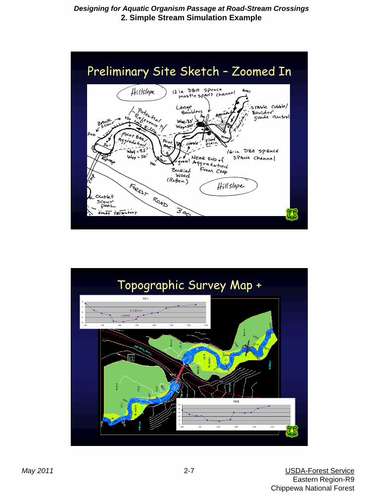
Preliminary Site Sketch
Provides good notes for
Winter design sessions.
Designing for Aquatic Organism Passage at Road-Stream Crossings
2. Simple Stream Simulation Example
May 2011 2-7 USDA-Forest Service
Eastern Region-R9
Chippewa National Forest
Preliminary Site Sketch – Zoomed In
Topographic Survey Map +
Designing for Aquatic Organism Passage at Road-Stream Crossings
2. Simple Stream Simulation Example
May 2011 2-8 USDA-Forest Service
Eastern Region-R9
Chippewa National Forest
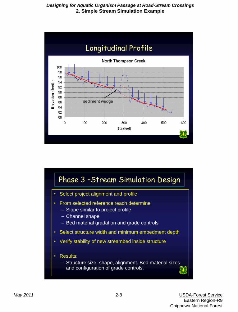
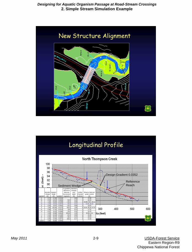
Longitudinal Profile
sediment wedge
Phase 3 –Stream Simulation Design
• Select project alignment and profile
• From selected reference reach determine
– Slope similar to project profile
– Channel shape
– Bed material gradation and grade controls
• Select structure width and minimum embedment depth
• Verify stability of new streambed inside structure
• Results:
– Structure size, shape, alignment. Bed material sizes and configuration of grade controls.
Designing for Aquatic Organism Passage at Road-Stream Crossings
2. Simple Stream Simulation Example
May 2011 2-9 USDA-Forest Service
Eastern Region-R9
Chippewa National Forest
New Structure Alignment
Headwalls considered to reduce
length but were too costly
Longitudinal Profile
Sediment Wedge
segment
elevation
change
(ft)
segment
length
(ft) gradient
% gradient
difference
betw een
successive
segments
maximum
residual
pool
depth
(ft)
number
of grade
controls
distance betw een
grade controls
(ft)
A 0.73 47.66 0.0154 0.65 2 47.66
B 0.59 20.94 0.0282 82.9 0.45 2 20.94
C 1.84 93.89 0.0196 -30.4 0.59 4 46.98, 30.8, 16.11
D 1.63 43.64 0.0374 90.4 0.31 3 13.49, 30.15
E 0.04 16.97 0.0025 -93.2 0.80 2 16.97
F 1.84 104.80 0.0175 592.4 1.09 4 16.64, 40.29, 47.87
G 0.36 17.31 0.0210 19.8 0.12 2 17.31
H 0.07 15.25 0.0046 -78.2 0.31 2 15.25
I 2.29 43.98 0.0520 1033.0 1.15 3 22.59, 21.4
J 0.46 25.38 0.0180 -65.3 0.59 2 25.38
K 0.30 32.32 0.0093 -48.2 0.47 2 32.32
L 0.35 12.90 0.0271 190.3 0.17 2 12.90
culvert 1.82 44.88 0.0405
Design Gradient 0.0352
Reference
Reach
Designing for Aquatic Organism Passage at Road-Stream Crossings
2. Simple Stream Simulation Example
May 2011 2-10 USDA-Forest Service
Eastern Region-R9
Chippewa National Forest
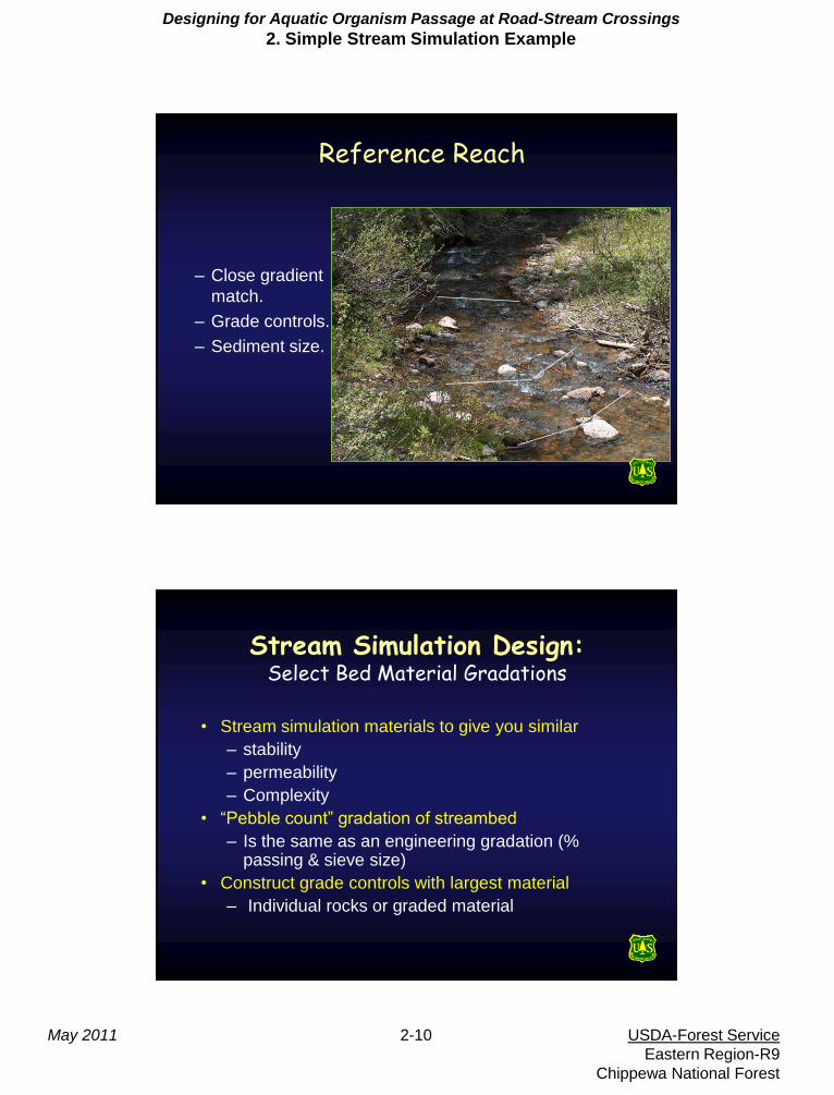
– Close gradient
match.
– Grade controls.
– Sediment size.
Reference Reach
Stream Simulation Design: Select Bed Material Gradations
• Stream simulation materials to give you similar
– stability
– permeability
– Complexity
• “Pebble count” gradation of streambed
– Is the same as an engineering gradation (% passing & sieve size)
• Construct grade controls with largest material
– Individual rocks or graded material
Designing for Aquatic Organism Passage at Road-Stream Crossings
2. Simple Stream Simulation Example
May 2011 2-11 USDA-Forest Service
Eastern Region-R9
Chippewa National Forest
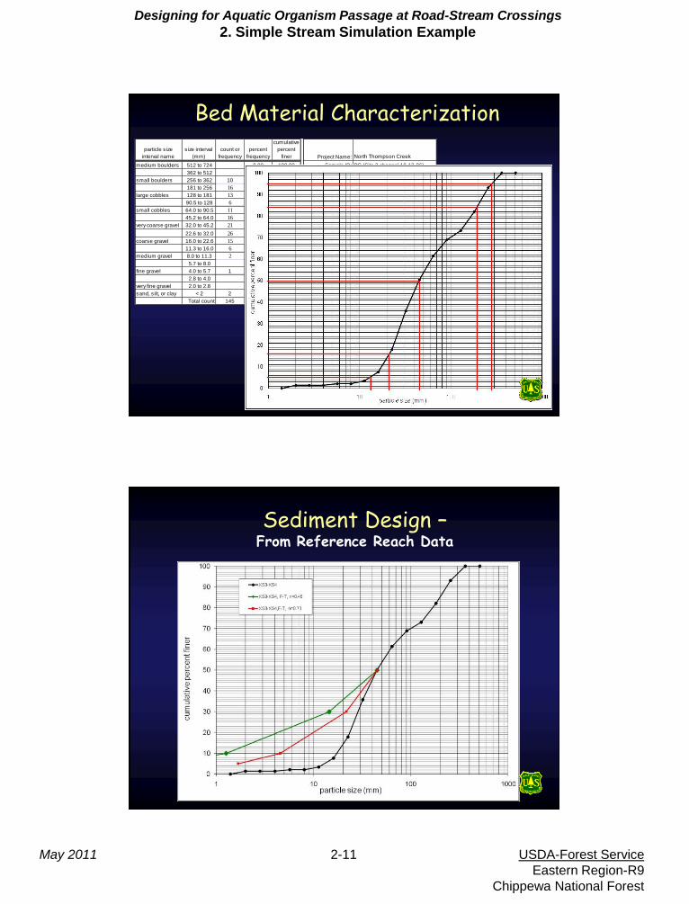
particle size
interval name
size interval
(mm)
count or
frequency
percent
frequency
cumulative
percent
finer Project Name: North Thompson Creek
medium boulders 512 to 724 0.00 100.00 Sample ID: PC (Site 2 channel,10-12-06)
362 to 512 0.00 100.00 Sample Date: 10/12/2006
small boulders 256 to 362 10 6.90 93.10 Sampler Name: Weinhold, Grove
181 to 256 16 11.03 82.07 Sample Location: Riffle b/t XS 3 and 4
large cobbles 128 to 181 13 8.97 73.10 Sample Method:
90.5 to 128 6 4.14 68.97
small cobbles 64.0 to 90.5 11 7.59 61.38
45.2 to 64.0 16 11.03 50.34
very coarse gravel 32.0 to 45.2 21 14.48 35.86 percentile particle size (mm)
22.6 to 32.0 26 17.93 17.93 d95 282
coarse gravel 16.0 to 22.6 15 10.34 7.59 d84 192
11.3 to 16.0 6 4.14 3.45 d50 45
medium gravel 8.0 to 11.3 2 1.38 2.07 d16 21
5.7 to 8.0 0.00 2.07 d5 13
fine gravel 4.0 to 5.7 1 0.69 1.38
2.8 to 4.0 0.00 1.38 % boulders 6.9
very fine gravel 2.0 to 2.8 0.00 1.38 % cobbles 31.7
sand, silt, or clay < 2 2 1.38 0.00 % gravels 60.0
Total count 145 100.00 % sands,silts,clays 1.4
sampling frame on transects
approximately 1 meter apart,
within active bed width.
Bed Material Characterization
Sediment Design – From Reference Reach Data
Designing for Aquatic Organism Passage at Road-Stream Crossings
2. Simple Stream Simulation Example
May 2011 2-12 USDA-Forest Service
Eastern Region-R9
Chippewa National Forest
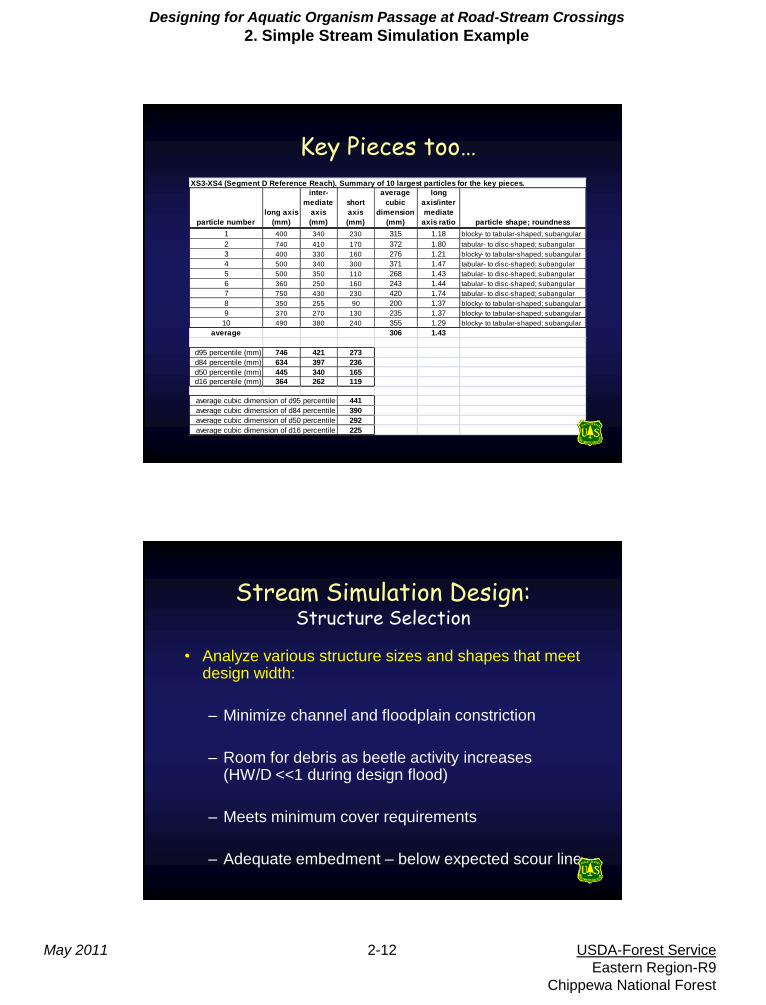
Key Pieces too… XS3-XS4 (Segment D Reference Reach). Summary of 10 largest particles for the key pieces.
particle number
long axis
(mm)
inter-
mediate
axis
(mm)
short
axis
(mm)
average
cubic
dimension
(mm)
long
axis/inter
mediate
axis ratio particle shape; roundness
1 400 340 230 315 1.18 blocky- to tabular-shaped; subangular
2 740 410 170 372 1.80 tabular- to disc-shaped; subangular
3 400 330 160 276 1.21 blocky- to tabular-shaped; subangular
4 500 340 300 371 1.47 tabular- to disc-shaped; subangular
5 500 350 110 268 1.43 tabular- to disc-shaped; subangular
6 360 250 160 243 1.44 tabular- to disc-shaped; subangular
7 750 430 230 420 1.74 tabular- to disc-shaped; subangular
8 350 255 90 200 1.37 blocky- to tabular-shaped; subangular
9 370 270 130 235 1.37 blocky- to tabular-shaped; subangular
10 490 380 240 355 1.29 blocky- to tabular-shaped; subangular
average 306 1.43
d95 percentile (mm) 746 421 273
d84 percentile (mm) 634 397 236
d50 percentile (mm) 445 340 165
d16 percentile (mm) 364 262 119
441
390
292
225
average cubic dimension of d95 percentile
average cubic dimension of d84 percentile
average cubic dimension of d16 percentile
average cubic dimension of d50 percentile
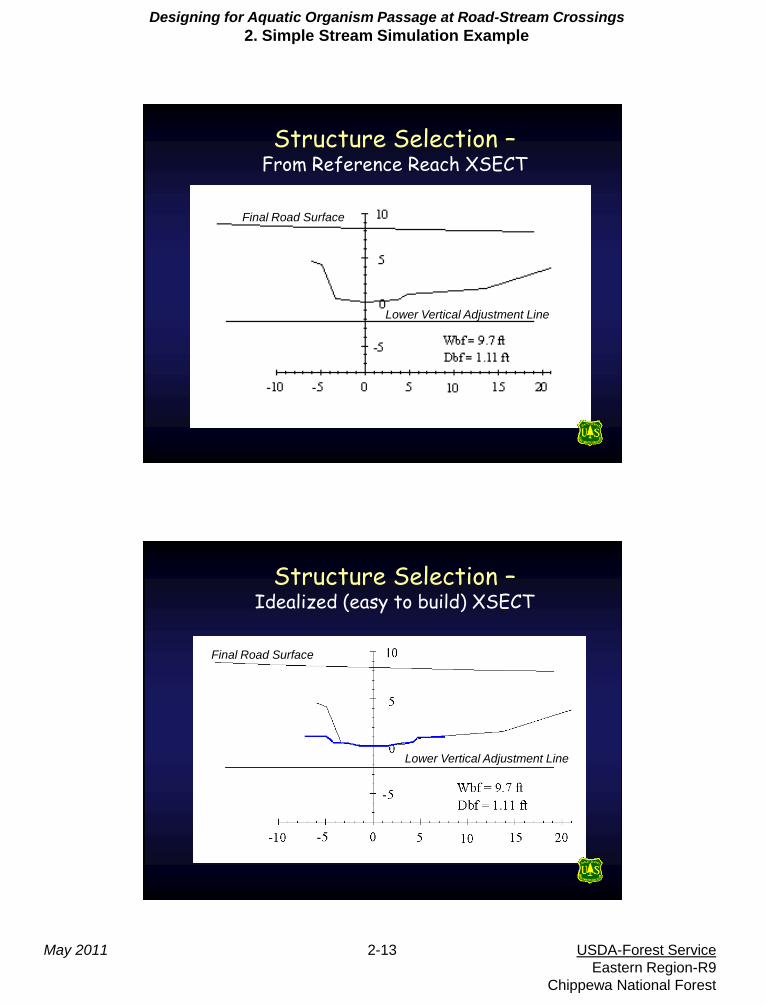
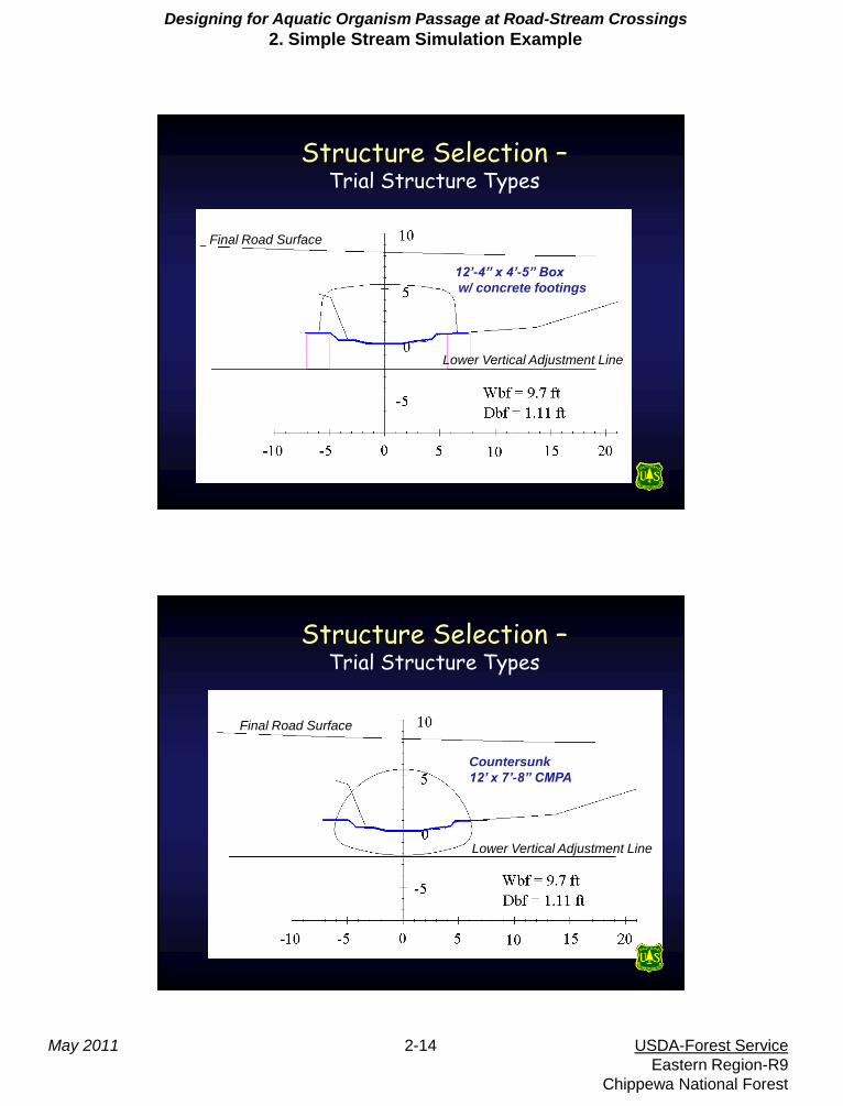
Stream Simulation Design: Structure Selection
• Analyze various structure sizes and shapes that meet design width:
– Minimize channel and floodplain constriction
– Room for debris as beetle activity increases (HW/D <<1 during design flood)
– Meets minimum cover requirements
– Adequate embedment – below expected scour line
Designing for Aquatic Organism Passage at Road-Stream Crossings
2. Simple Stream Simulation Example
May 2011 2-13 USDA-Forest Service
Eastern Region-R9
Chippewa National Forest
Structure Selection – From Reference Reach XSECT
Final Road Surface
Lower Vertical Adjustment Line
Structure Selection – Idealized (easy to build) XSECT
Final Road Surface
Lower Vertical Adjustment Line
Designing for Aquatic Organism Passage at Road-Stream Crossings
2. Simple Stream Simulation Example
May 2011 2-14 USDA-Forest Service
Eastern Region-R9
Chippewa National Forest
Structure Selection – Trial Structure Types
Final Road Surface
Lower Vertical Adjustment Line
12’-4” x 4’-5” Box
w/ concrete footings
Structure Selection – Trial Structure Types
Final Road Surface
Lower Vertical Adjustment Line
Countersunk
12’ x 7’-8” CMPA
Designing for Aquatic Organism Passage at Road-Stream Crossings
2. Simple Stream Simulation Example
May 2011 2-15 USDA-Forest Service
Eastern Region-R9
Chippewa National Forest
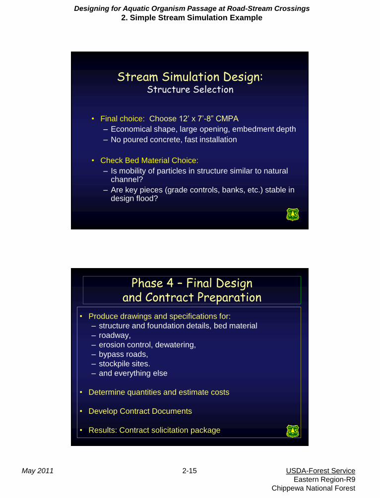
Stream Simulation Design: Structure Selection
• Final choice: Choose 12’ x 7’-8” CMPA
– Economical shape, large opening, embedment depth
– No poured concrete, fast installation
• Check Bed Material Choice:
– Is mobility of particles in structure similar to natural channel?
– Are key pieces (grade controls, banks, etc.) stable in design flood?
Phase 4 – Final Design and Contract Preparation
• Produce drawings and specifications for:
– structure and foundation details, bed material
– roadway,
– erosion control, dewatering,
– bypass roads,
– stockpile sites.
– and everything else
• Determine quantities and estimate costs
• Develop Contract Documents
• Results: Contract solicitation package
Designing for Aquatic Organism Passage at Road-Stream Crossings
2. Simple Stream Simulation Example
May 2011 2-16 USDA-Forest Service
Eastern Region-R9
Chippewa National Forest
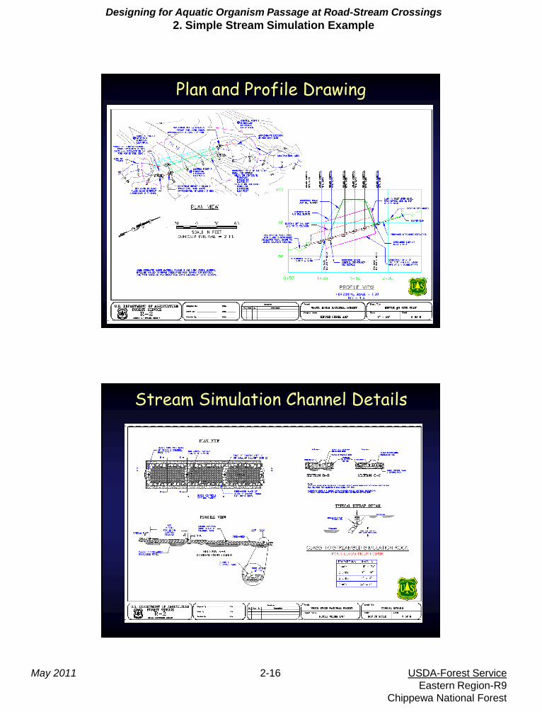
Site Plan, Profile, Survey Plan and Profile Drawing
Stream Simulation Channel Details
Designing for Aquatic Organism Passage at Road-Stream Crossings
2. Simple Stream Simulation Example
May 2011 2-17 USDA-Forest Service
Eastern Region-R9
Chippewa National Forest
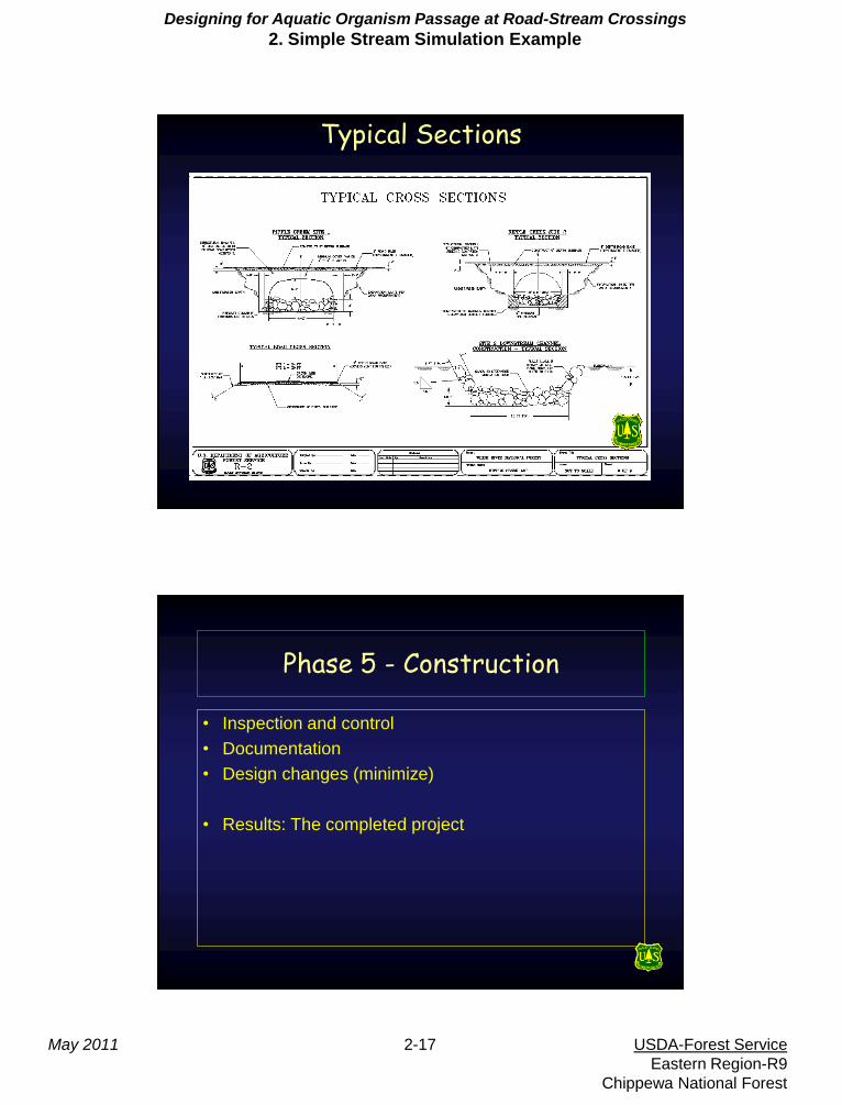
Typical Sections
Phase 5 - Construction
• Inspection and control
• Documentation
• Design changes (minimize)
• Results: The completed project
Designing for Aquatic Organism Passage at Road-Stream Crossings
2. Simple Stream Simulation Example
May 2011 2-18 USDA-Forest Service
Eastern Region-R9
Chippewa National Forest
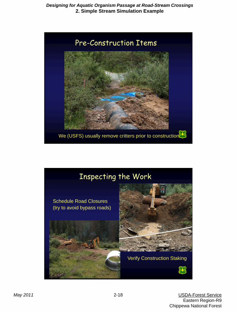
Pre-Construction Items
We (USFS) usually remove critters prior to construction
Inspecting the Work
Schedule Road Closures
(try to avoid bypass roads)
Verify Construction Staking
Designing for Aquatic Organism Passage at Road-Stream Crossings
2. Simple Stream Simulation Example
May 2011 2-19 USDA-Forest Service
Eastern Region-R9
Chippewa National Forest
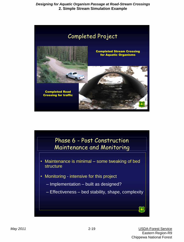
Completed Project
Completed Road
Crossing for traffic
Completed Stream Crossing
for Aquatic Organisms
Phase 6 - Post Construction Maintenance and Monitoring
• Maintenance is minimal – some tweaking of bed structure
• Monitoring - intensive for this project
– Implementation – built as designed?
– Effectiveness – bed stability, shape, complexity
Designing for Aquatic Organism Passage at Road-Stream Crossings
2. Simple Stream Simulation Example
May 2011 2-20 USDA-Forest Service
Eastern Region-R9
Chippewa National Forest
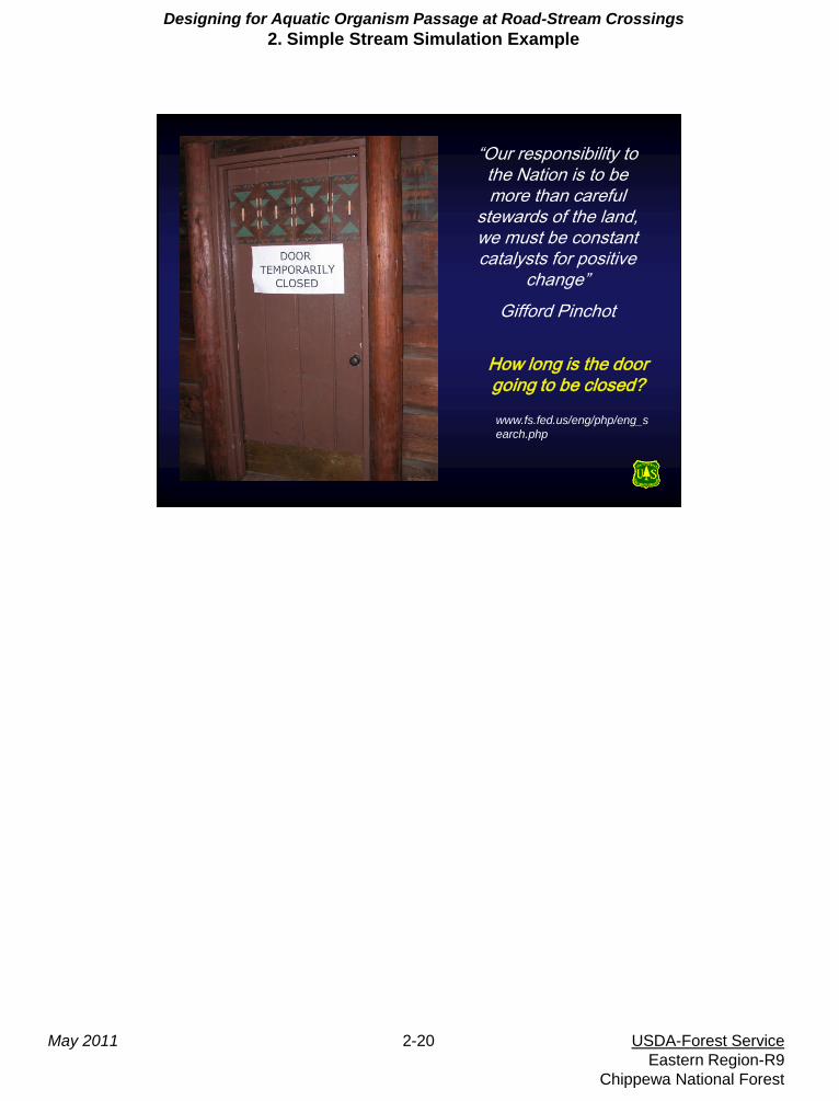
“Our responsibility to the Nation is to be more than careful
stewards of the land, we must be constant catalysts for positive
change”
Gifford Pinchot
How long is the door going to be closed?
www.fs.fed.us/eng/php/eng_s
earch.php