Embed Size (px)
Citation preview

Street & Addressing Tools for NG911 - Don’t Be Left Behind
Ed Farrell, Chris Klaube, Pat McDonald
NJ NENA Conference
Thursday, April 7th 2016
Harrah’s Casino Resort, Atlantic City
NJ Office of GIS, http://njgin.state.nj.us
https://njgin.state.nj.us/oit/gis/NJ_NJGINExplorer/docs/OGIS_NENA_2016.pdf
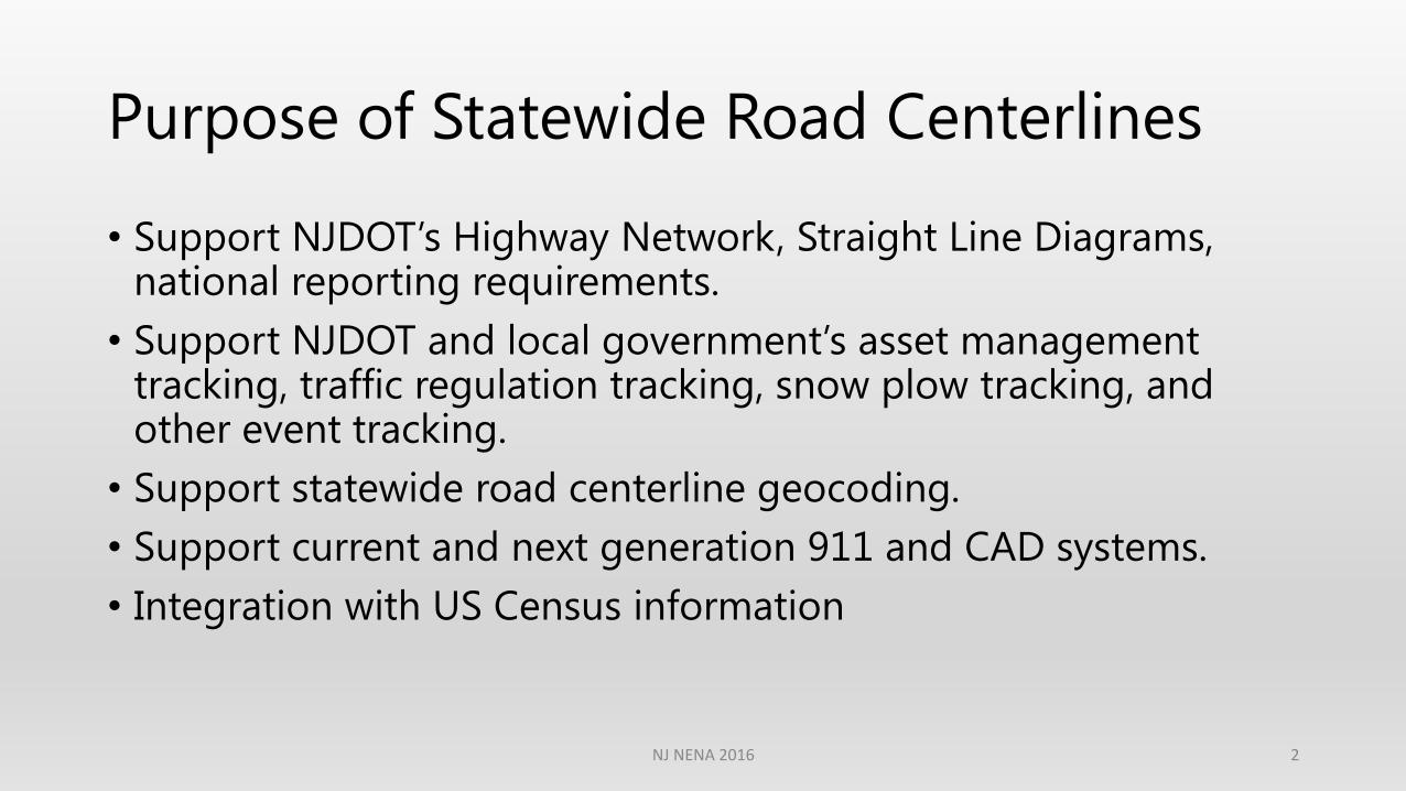
Purpose of Statewide Road Centerlines
• Support NJDOT’s Highway Network, Straight Line Diagrams, national reporting requirements.
• Support NJDOT and local government’s asset management tracking, traffic regulation tracking, snow plow tracking, and other event tracking.
• Support statewide road centerline geocoding.
• Support current and next generation 911 and CAD systems.
• Integration with US Census information
NJ NENA 2016 2
Purpose of Statewide Address Points
• Support current and next generation 9-1-1 and CAD systems.
• Allow municipal government to assign and manage addresses
• Integrate address data with various database systems
• Address based analysis
• Megan’s Law notifications
• Integration with US Census information
NJ NENA 2016 3
What is a Road?
A road in the NJ road data model consists of the following:
• Highways (Highway Authority Route, Interstate Route, US Route, State Route, County 500 Route, Other County Route)
• Local Public Roads
• Local Private Roads
• Alleys
• Parking lots that are also a named road
• Driveways/parking lot circulation for important facilities (schools, hospitals, government offices, shopping centers, office complexes…)
• Emergency access lanes/easements
NJ NENA 2016 4
Where did the road information come from?
• Originally generated from the NJDOT highway network
• Enhanced by NJDOT consultant based on updated aerial photography and US Census Bureau TIGER road centerline data
• Available road centerline data from local government sources
• Address ranges came from US Census Bureau TIGER road centerline data and local government sources
• Road Names came from US Census Bureau TIGER road centerline data, NJDOT Straight Line Diagrams, Municipal tax maps and MODIV Tax Assessor data, and local government sources and field observations
NJ NENA 2016 5
How is the road data maintained?
• NJDOT consultant gathers information from field observations and GPS
• NJOGIS adds or revises roads based on updated aerial photography
• User notification to NJOGIS
• Local government partners working together with us
• Adjacent state GIS agencies
NJ NENA 2016 6
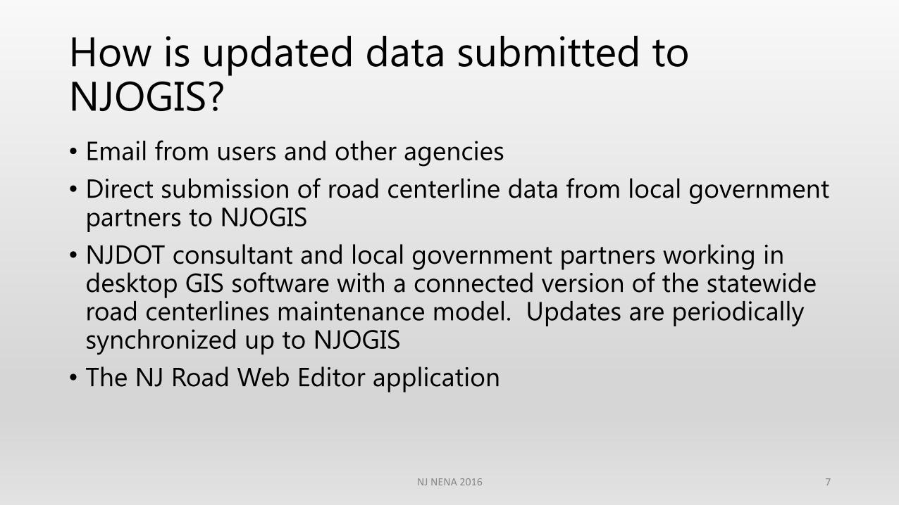
How is updated data submitted to NJOGIS?
• Email from users and other agencies
• Direct submission of road centerline data from local government partners to NJOGIS
• NJDOT consultant and local government partners working in desktop GIS software with a connected version of the statewide road centerlines maintenance model. Updates are periodically synchronized up to NJOGIS
• The NJ Road Web Editor application
NJ NENA 2016 7

Road Publication
• All approved edits will be published by OGIS on a monthly basis.
• The published roads data will be available for download from the NJGIN website.
• The published roads data can be imported into various CAD systems. OGIS also publishes a shapefile in Tritech (formerly Tiburon) format.
• The published roads data supports geocoding with multiple road names per road segment.
NJ NENA 2016 8
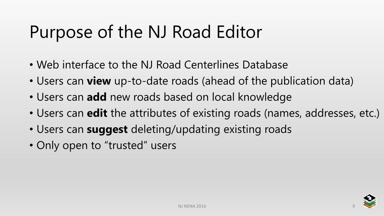
Purpose of the NJ Road Editor
• Web interface to the NJ Road Centerlines Database
• Users can view up-to-date roads (ahead of the publication data)
• Users can add new roads based on local knowledge
• Users can edit the attributes of existing roads (names, addresses, etc.)
• Users can suggest deleting/updating existing roads
• Only open to “trusted” users
NJ NENA 2016 9
Demonstration
1. Navigate to the NJ Road Editor application page
2. Sign in through MyNJ Portal
3. Take tour of the functionality
4. Start Editing
5. Add a new road
6. Suggest deleting an existing road
7. View current edits
8. Save edits
NJ NENA 2016 10
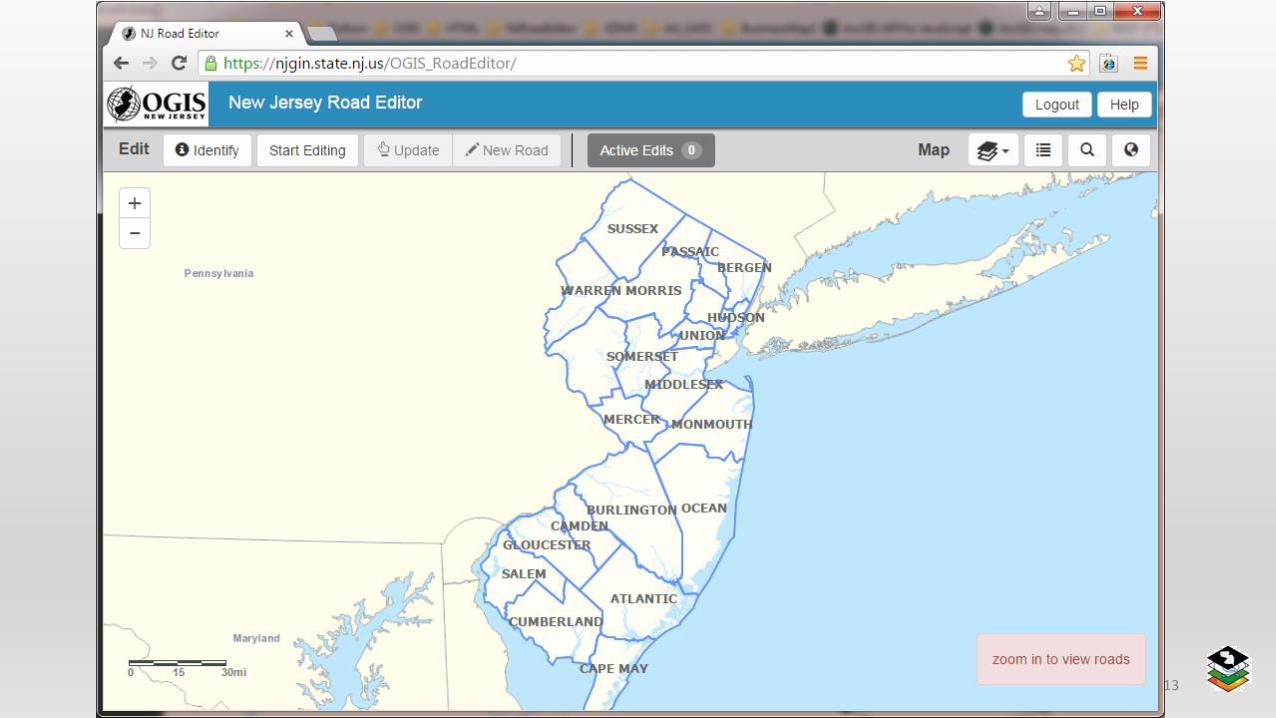
1. Navigate to the NJ Road Editor
You will be prompted to sign in through MyNJ Portal
NJ NENA 2016 11
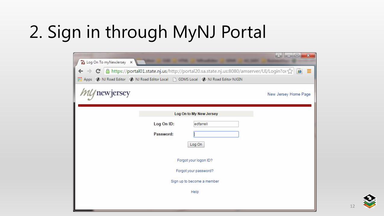
2. Sign in through MyNJ Portal
NJ NENA 2016 12
NJ NENA 2016 13
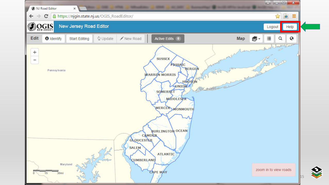
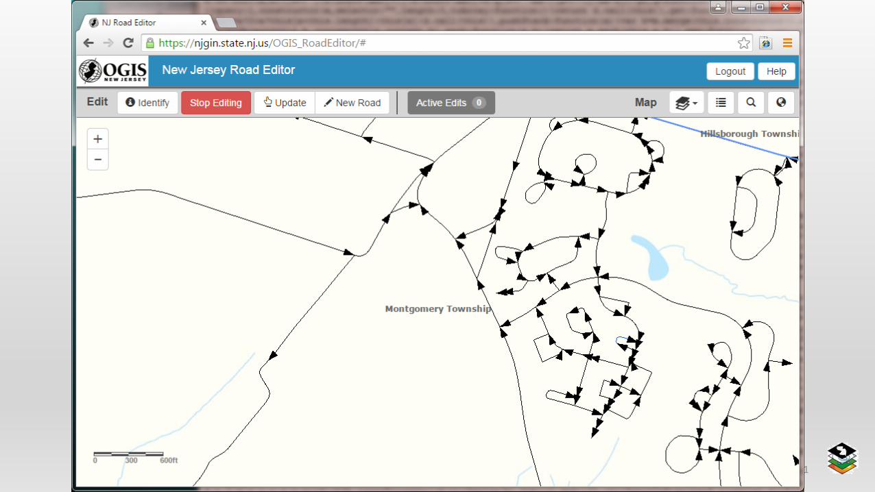
3. Take a Tour of the Functionality
NJ NENA 2016 14
NJ NENA 2016 15
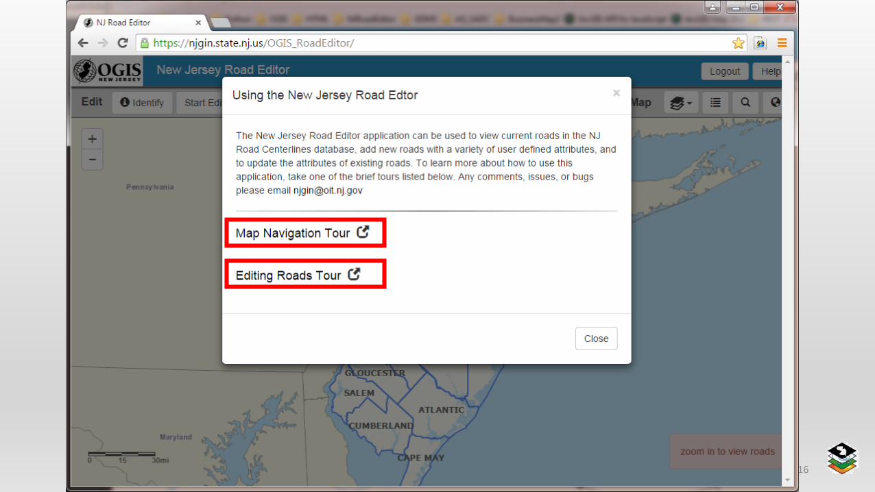
NJ NENA 2016 16
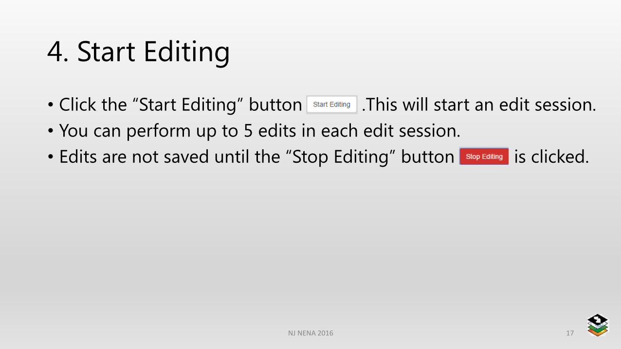
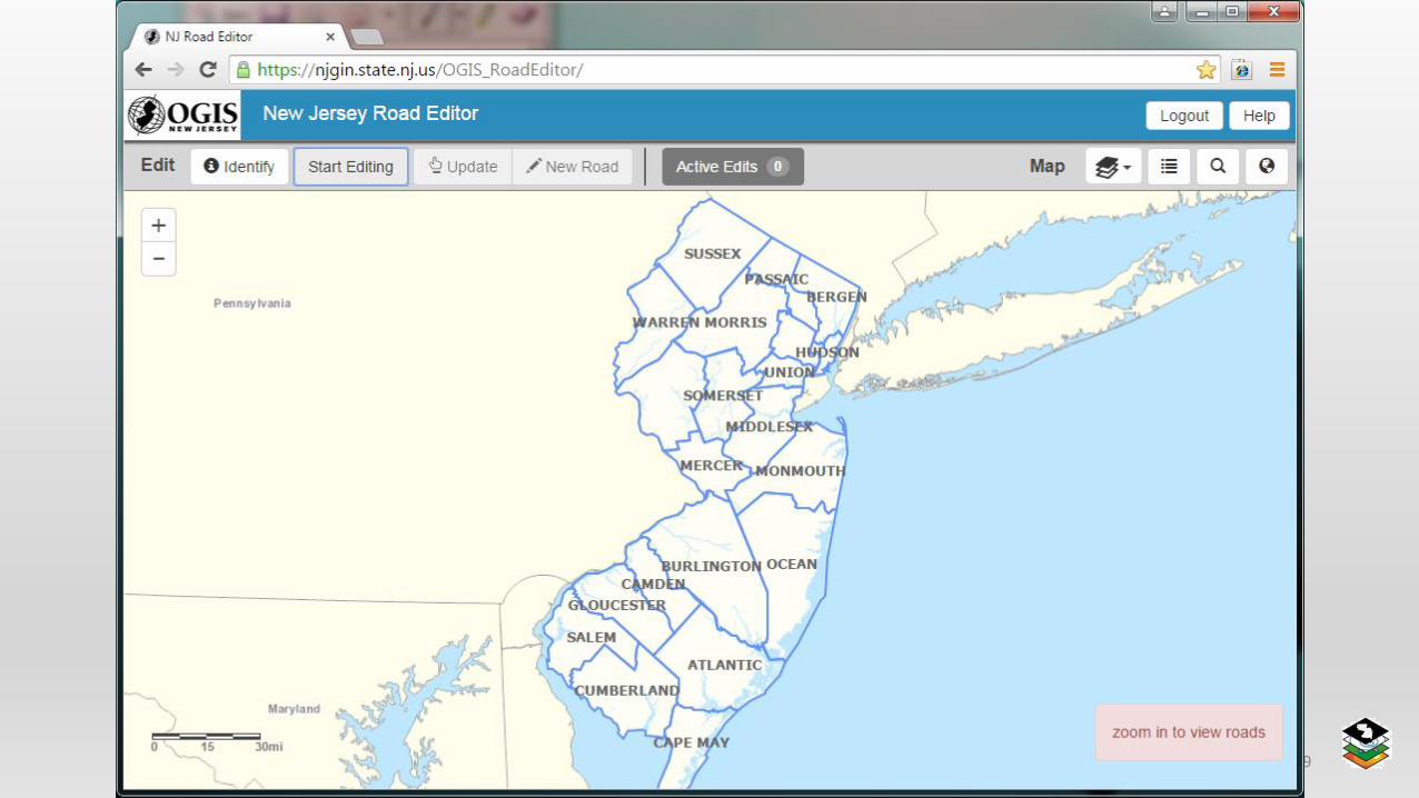
4. Start Editing
• Click the “Start Editing” button .This will start an edit session.
• You can perform up to 5 edits in each edit session.
• Edits are not saved until the “Stop Editing” button is clicked.
NJ NENA 2016 17

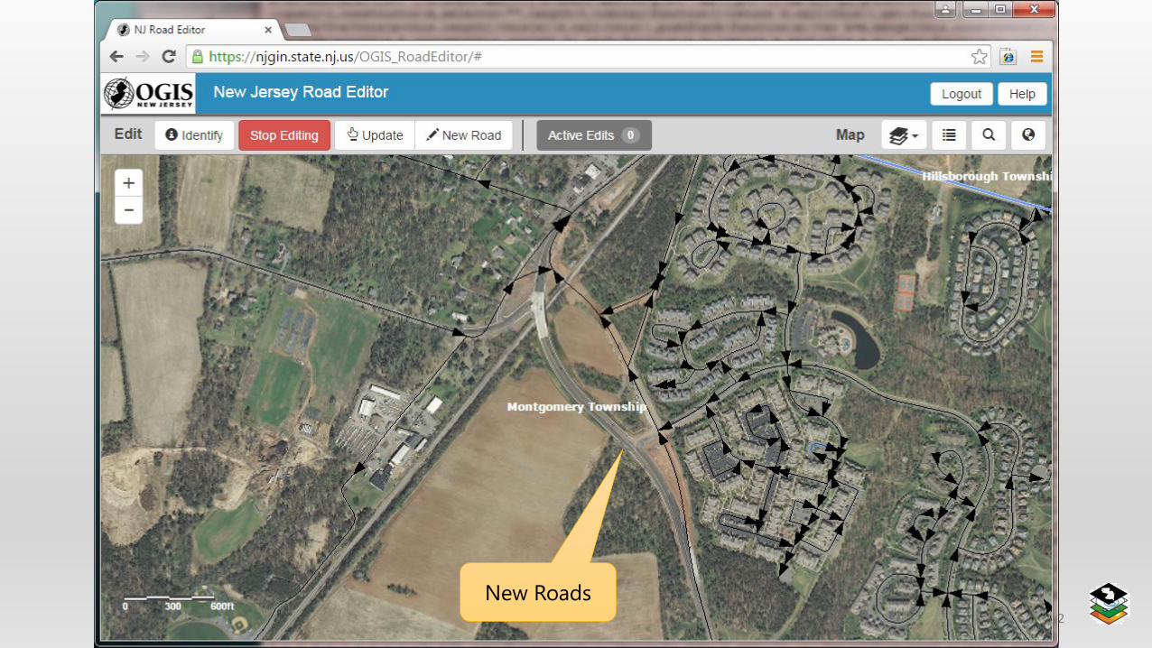
5. Add a New Road
NJ NENA 2016 18
NJ NENA 2016 19
NJ NENA 2016 20
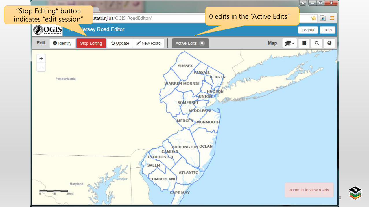
0 edits in the “Active Edits”“Stop Editing” button
indicates “edit session”
NJ NENA 2016 21
NJ NENA 2016 22
New Roads
NJ NENA 2016 23
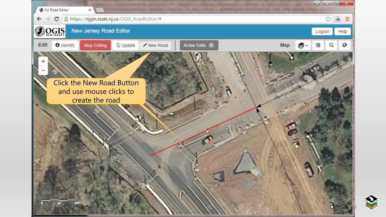
Click the New Road Button
and use mouse clicks to
create the road
NJ NENA 2016 24
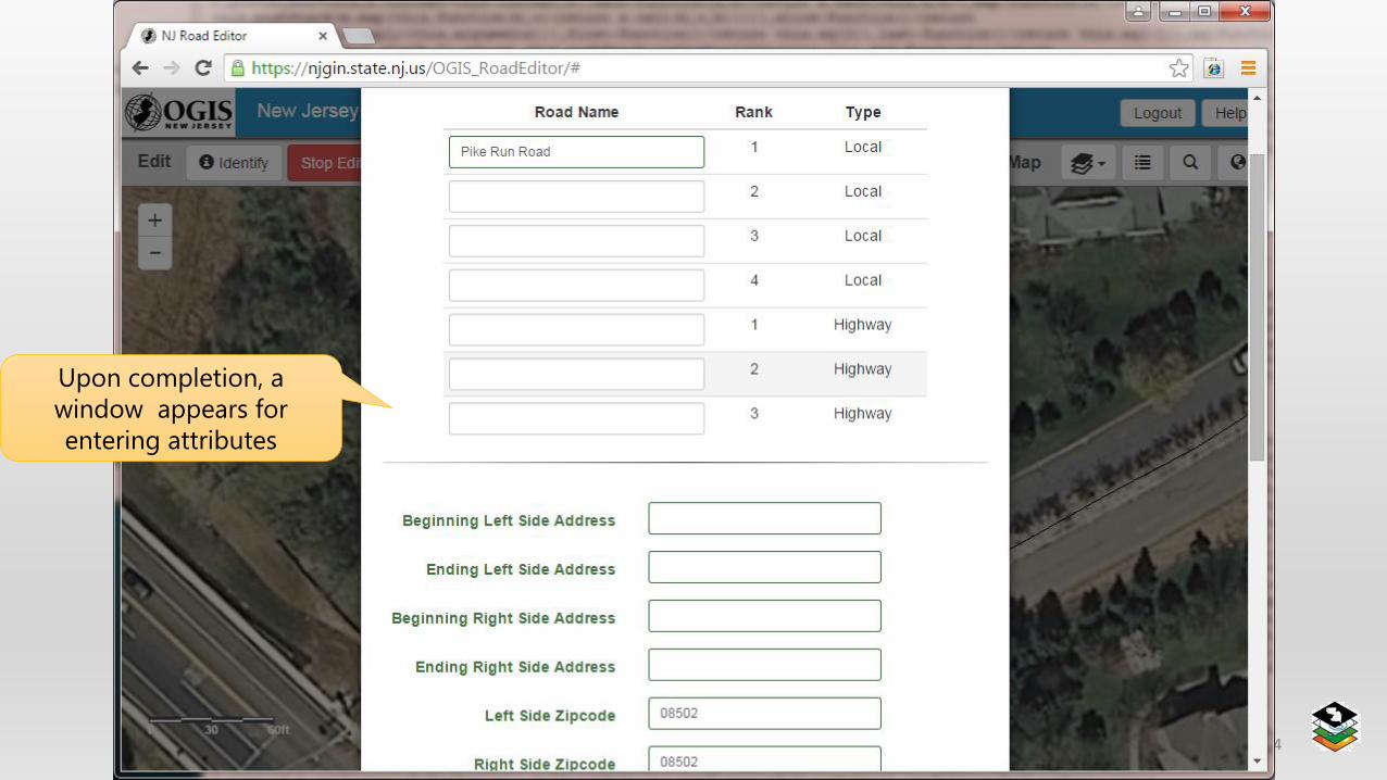
Upon completion, a
window appears for
entering attributes
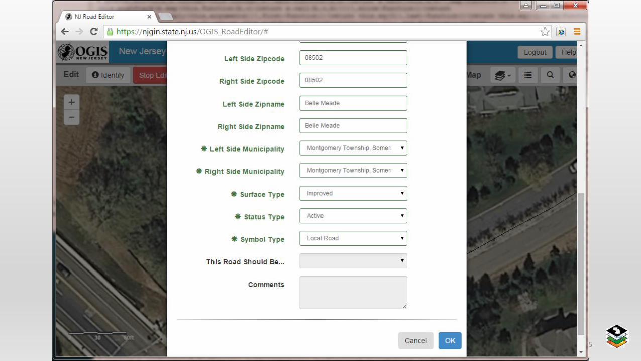
NJ NENA 2016 25
NJ NENA 2016 26
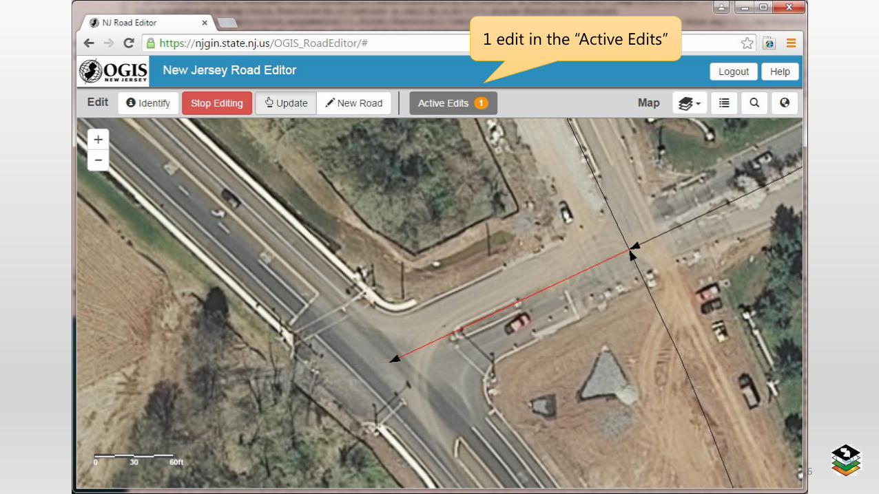
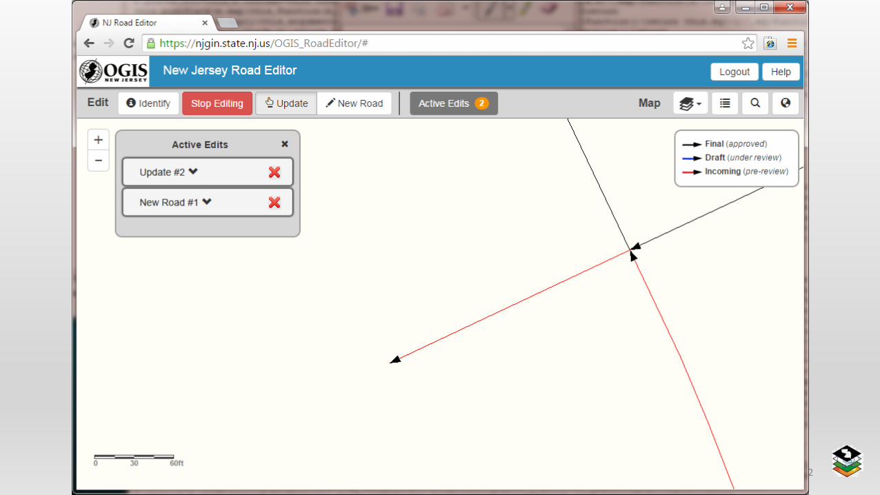
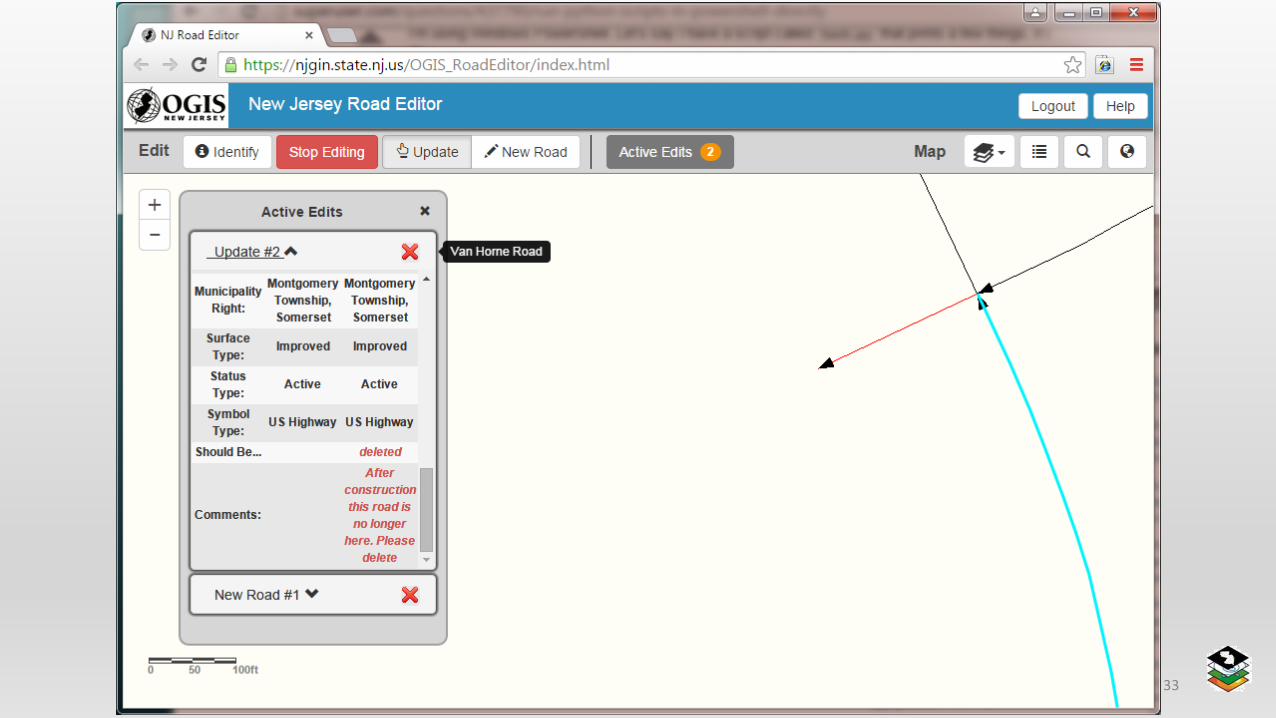
1 edit in the “Active Edits”
6. Suggest deleting an Existing Road
NJ NENA 2016 27
NJ NENA 2016 28
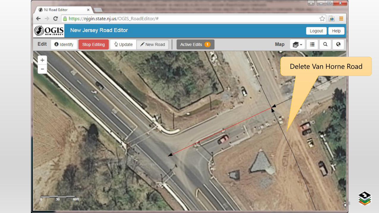
Delete Van Horne Road
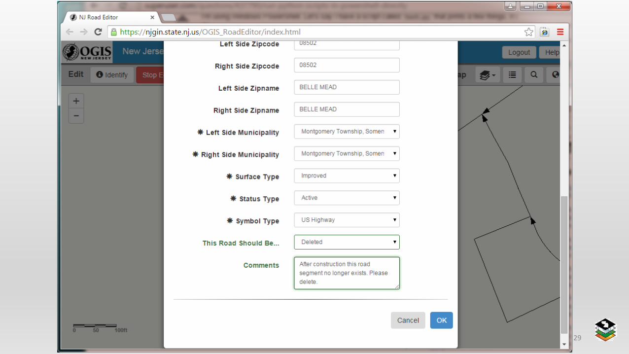
NJ NENA 2016 29

NJ NENA 2016 30
2 edits in the “Active Edits”
Both road segments are red, indicating
that they are flagged as “Incoming”
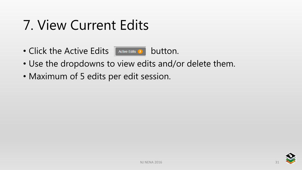
7. View Current Edits
• Click the Active Edits button.
• Use the dropdowns to view edits and/or delete them.
• Maximum of 5 edits per edit session.
NJ NENA 2016 31
NJ NENA 2016 32
NJ NENA 2016 33
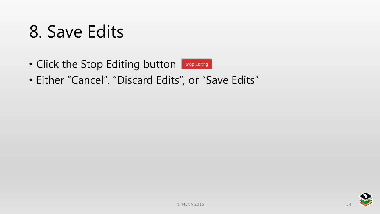
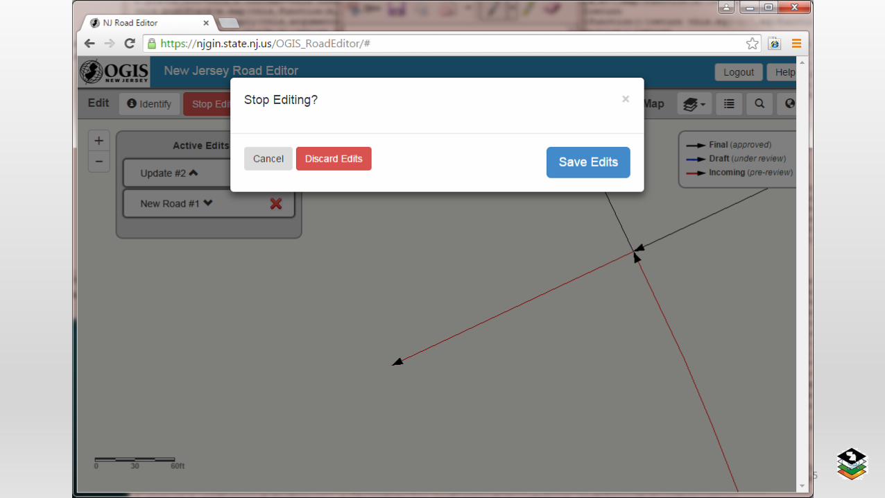
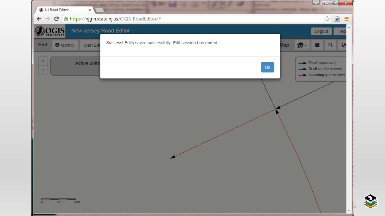
8. Save Edits
• Click the Stop Editing button
• Either “Cancel”, “Discard Edits”, or “Save Edits”
NJ NENA 2016 34
NJ NENA 2016 35
NJ NENA 2016 36
NJ NENA 2016 37
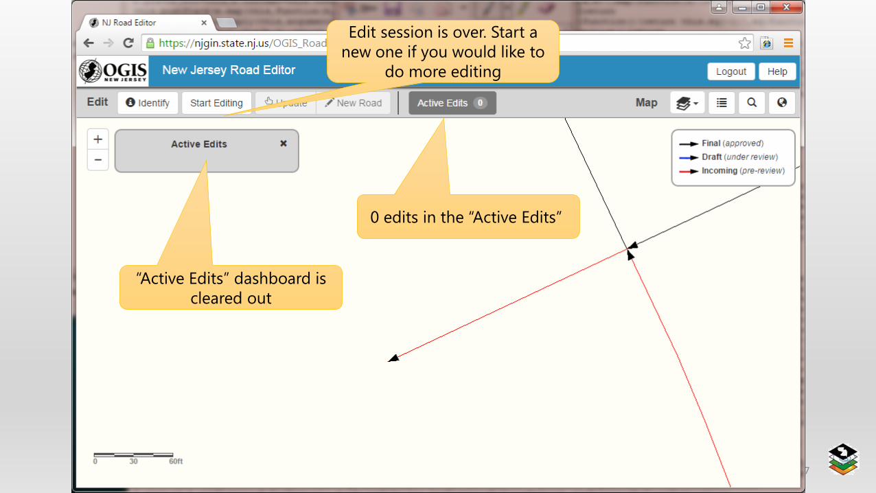
0 edits in the “Active Edits”
“Active Edits” dashboard is
cleared out
Edit session is over. Start a
new one if you would like to
do more editing
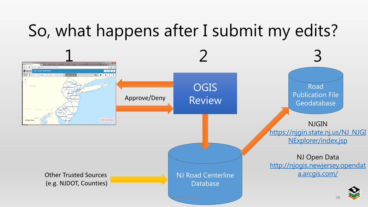
So, what happens after I submit my edits?
38
OGIS
Review
Road
Publication File
GeodatabaseApprove/Deny
NJ Road Centerline
Database
NJGIN
https://njgin.state.nj.us/NJ_NJGI
NExplorer/index.jsp
NJ Open Data
http://njogis.newjersey.opendat
a.arcgis.com/
1 2 3
Other Trusted Sources (e.g. NJDOT, Counties)
NJ NENA 2016
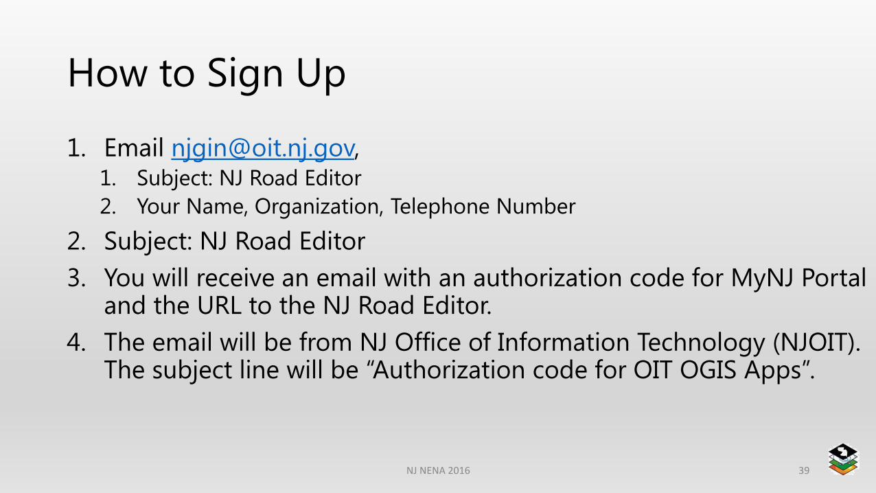
How to Sign Up
1. Email [email protected], 1. Subject: NJ Road Editor
2. Your Name, Organization, Telephone Number
2. Subject: NJ Road Editor
3. You will receive an email with an authorization code for MyNJ Portal and the URL to the NJ Road Editor.
4. The email will be from NJ Office of Information Technology (NJOIT). The subject line will be “Authorization code for OIT OGIS Apps”.
NJ NENA 2016 39

Places to get road data
• ArcGIS Server REST -http://geodata.state.nj.us/arcgis/rest/services/Features/Transportation/MapServer/0
• NJ OGIS ArcGIS Online -http://newjersey.maps.arcgis.com/home/item.html?id=a845e8b133e34c6eb4da0062bedb99dc
• NJ OGIS OpenData -http://njogis.newjersey.opendata.arcgis.com/datasets/a845e8b133e34c6eb4da0062bedb99dc_0
• Through you County/Municipal GIS Coordinator
• Email us and ask! [email protected]
NJ NENA 2016 40
41NJ NENA 2016
The bottom line
• Validating the location quickly
• Sending the correct responders as efficiently as possible
NJ NENA 2016 42
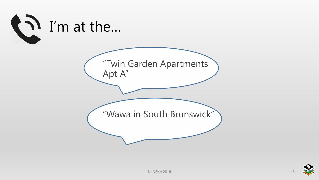
I’m at the…
NJ NENA 2016 43
“Twin Garden Apartments Apt A”
“Wawa in South Brunswick”
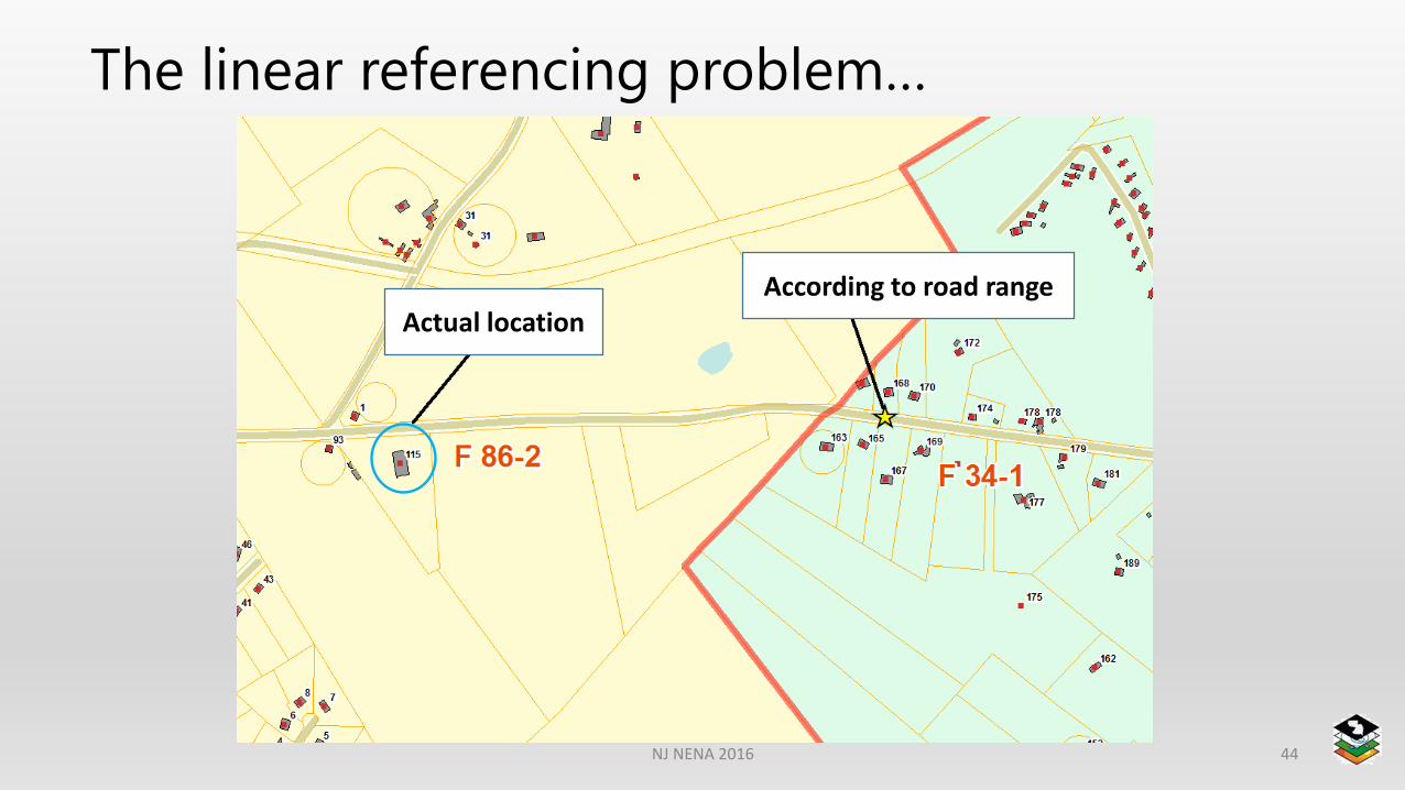
The linear referencing problem…
NJ NENA 2016 44
Actual locationAccording to road range
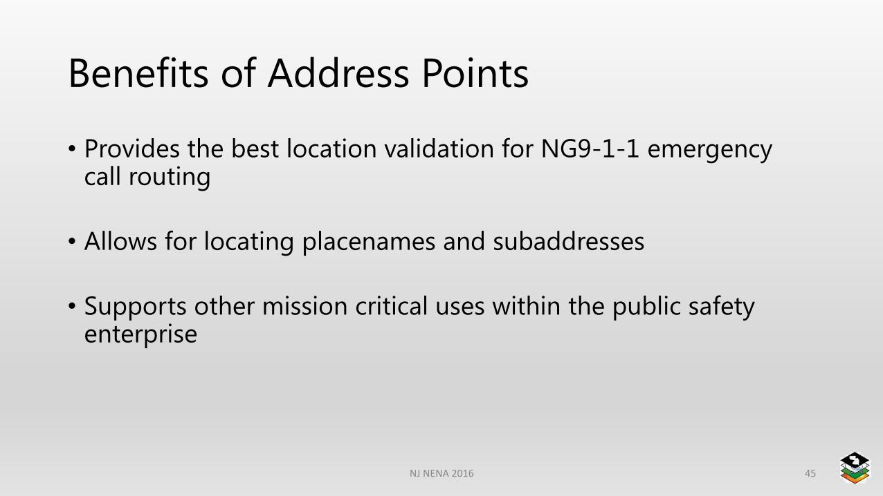
Benefits of Address Points
• Provides the best location validation for NG9-1-1 emergency call routing
• Allows for locating placenames and subaddresses
• Supports other mission critical uses within the public safety enterprise
NJ NENA 2016 45

Are you prepared?
NJ NENA 2016 46
Emergency Call Routing FunctionECRF
Road Centerlines Address Points & PlaceNamesEmergency Service Boundaries
-Law / Fire / EMS etc
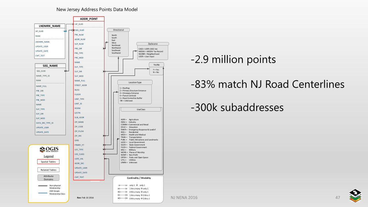
-2.9 million points
-83% match NJ Road Centerlines
-300k subaddresses
ADDR_POINT
LNDMRK_NAME
SEG_NAME
Directional
ZipSource
UseClass
LocationType
YesNo
New Jersey Address Points Data Model
AP_GUID
SEG_GUID
PRE_NUM
PRE_TYPE
ADDR_NUM
SUF_NUM
PRE_DIR
PRE_MOD
NAME
SUF_TYPE
SUF_DIR
SUF_MOD
NAME_FULL
STREET_ADDR
BLDG
UNIT_TYPE
FLOOR
UNIT_ID
ROOM
LOCTN
SUB_ADDR
ZIP_NAME
ZIP_CODE
UPDATE_USER
ZIP_PLUS4
ADDR_SRC
ZIP_SRC
LOC_TYPE
PRMRY_PT
GNIS
USPS_VAL
USE_CLASS
UPDATE_DATE
CMT_TEXT
AP_GUID
RANK
LNDMRK_NAME
UPDATE_USER
UPDATE_DATE
CMT_TEXT
SEG_GUID
NAME_TYPE_ID
NAME_FULL
PRE_DIR
PRE_TYPE
SUF_MOD
RANK
PRE_MOD
NAME
SUF_TYPE
SUF_DIR
UPDATE_USER
DATA_SRC_TYPE_ID
UPDATE_DATE
NorthSouthEastWestNortheastNorthwestSoutheastSouthwest
CASS = USPS CASS Val.MODIV = MODIV Tax RecordNGHBR = NeighborhoodUSER = User Input
AGRI = AgricultureINDU = IndustryCOMM = Commercial and RetailEDUC = EducationEMER = Emergency Response & LawEnfRESI = ResidentialMEDI = Health and MedicalTRAN = TransportationPUBL = Public Attractions and LandmarksLGOV = Local GovernmentSGOV = State GovernmentFGOV = Federal GovernmentMILI = MilitaryWORS = Places of WorshipNONP = Non Profit OPEN = Parks and Open SpaceUTIL = UtilitiesUNKN = Unknown
1 = Rooftop2 = Primary Structure Entrance3 = Driveway Entrance4 = Parcel Centroid5 = Road Centerline Buffer-99 = Unknown
Y = YesN = No
Spatial Tables
Related Tables
Attribute Domains
Non-physical Relationship
ESRI Simple
Relationship Class
Legend
only 1 only 1
1 thru many only 1
0 thru many only 1
1 thru many 0 thru 1
0 thru many 0 thru 1Rev: Feb 10 2016 NJ NENA 2016 47
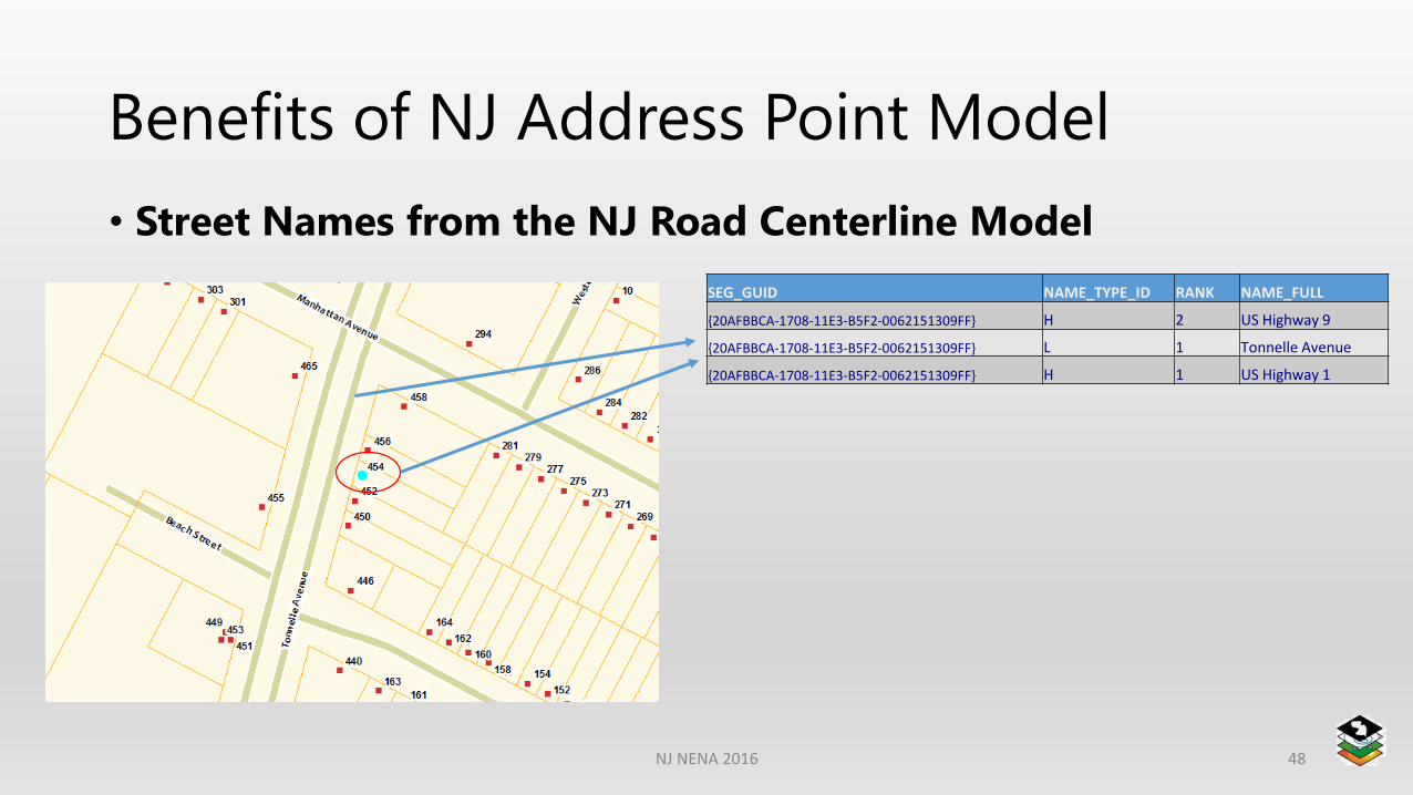
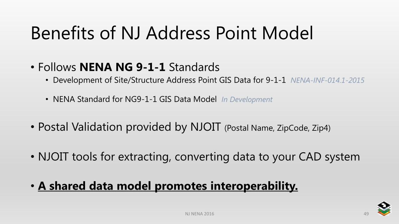
Benefits of NJ Address Point Model
• Street Names from the NJ Road Centerline Model
NJ NENA 2016 48
SEG_GUID NAME_TYPE_ID RANK NAME_FULL
{20AFBBCA-1708-11E3-B5F2-0062151309FF} H 2 US Highway 9
{20AFBBCA-1708-11E3-B5F2-0062151309FF} L 1 Tonnelle Avenue
{20AFBBCA-1708-11E3-B5F2-0062151309FF} H 1 US Highway 1
Benefits of NJ Address Point Model
• Follows NENA NG 9-1-1 Standards• Development of Site/Structure Address Point GIS Data for 9-1-1 NENA-INF-014.1-2015
• NENA Standard for NG9-1-1 GIS Data Model In Development
• Postal Validation provided by NJOIT (Postal Name, ZipCode, Zip4)
• NJOIT tools for extracting, converting data to your CAD system
• A shared data model promotes interoperability.
NJ NENA 2016 49

NJ NENA 2016 50
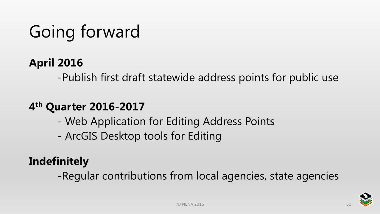
Going forward
April 2016
-Publish first draft statewide address points for public use
4th Quarter 2016-2017
- Web Application for Editing Address Points
- ArcGIS Desktop tools for Editing
Indefinitely
-Regular contributions from local agencies, state agencies
NJ NENA 2016 51
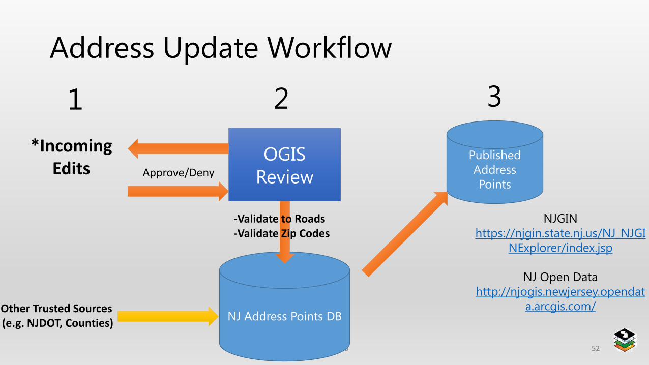
Address Update Workflow
NJ NENA 2016 5252
OGIS
Review
Published
Address
PointsApprove/Deny
NJ Address Points DB
NJGIN
https://njgin.state.nj.us/NJ_NJGI
NExplorer/index.jsp
NJ Open Data
http://njogis.newjersey.opendat
a.arcgis.com/
1 2 3
Other Trusted Sources (e.g. NJDOT, Counties)
*IncomingEdits
-Validate to Roads-Validate Zip Codes
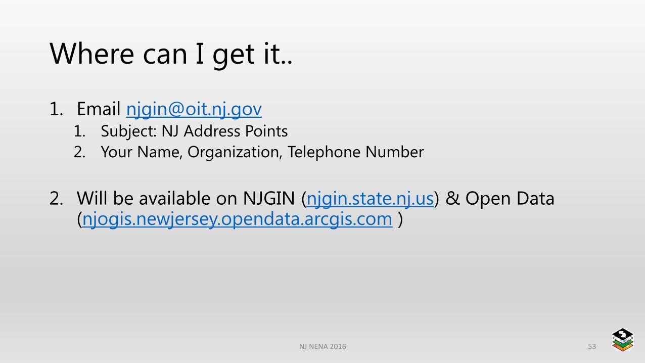
Where can I get it..
1. Email [email protected]. Subject: NJ Address Points
2. Your Name, Organization, Telephone Number
2. Will be available on NJGIN (njgin.state.nj.us) & Open Data (njogis.newjersey.opendata.arcgis.com )
NJ NENA 2016 53