Embed Size (px)
DESCRIPTION
Southwestern Atlantic Ocean Margin Workshop Montevideo, Uruguay 16-22 November 2008. Submarine Groundwater Discharge into the ocean off Mangueira Lagoon via 222 Rn and Ra isotopes: Preliminary findings and perspectives. Isaac R. Santos ; William Burnett - PowerPoint PPT Presentation
Citation preview
Submarine Groundwater Discharge into the ocean off Mangueira Lagoon via 222Rn and Ra isotopes:
Preliminary findings and perspectives
Isaac R. Santos; William BurnettDepartment of Oceanography, Florida State University, Tallahassee, FL, USA
Felipe Niencheski; Karina Attisano; Carlos Andrade; Idel MilaniDepartment of Chemistry, Fundação Universidade do Rio Grande, Rio Grande, Brazil
Southwestern Atlantic Ocean Margin WorkshopMontevideo, Uruguay16-22 November 2008
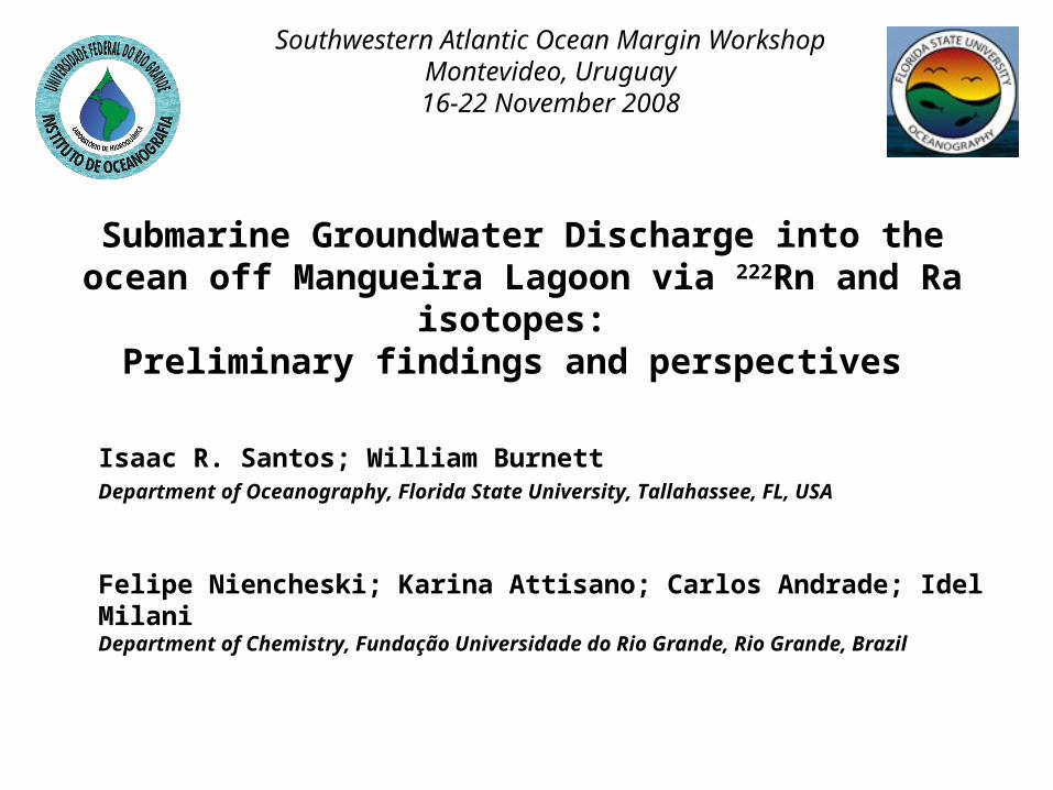
Outline
1) Area background
2) Tracing SGD via 222Rn and radium isotopes
3) Is the La Plata River Paleocanal a preferential SGD pathway?
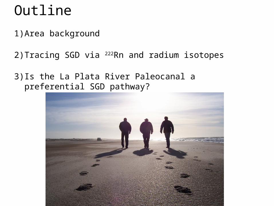
Patos
Mangueira
Mirim
Brazil- SGD Fe inputs ~10% of atmospheric Fe inputs into the entire South Atlantic (Windom et al., 2006)
Higher SGD than North of Patos Lagoon?
-Mangueira Lagoon level is higher than Patos Lagoon level-Lagoon closer to the ocean-Sediments more permeable (shell deposits)
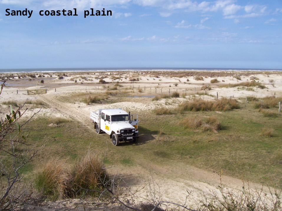
Sandy coastal plain
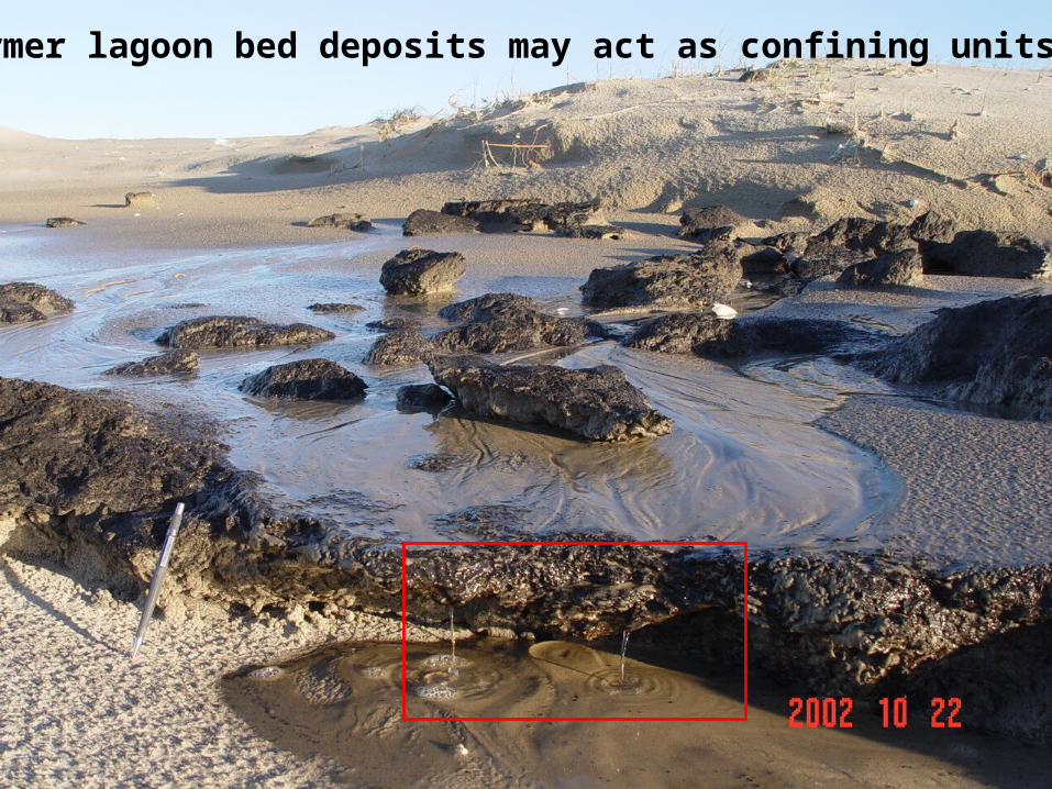
Former lagoon bed deposits may act as confining units
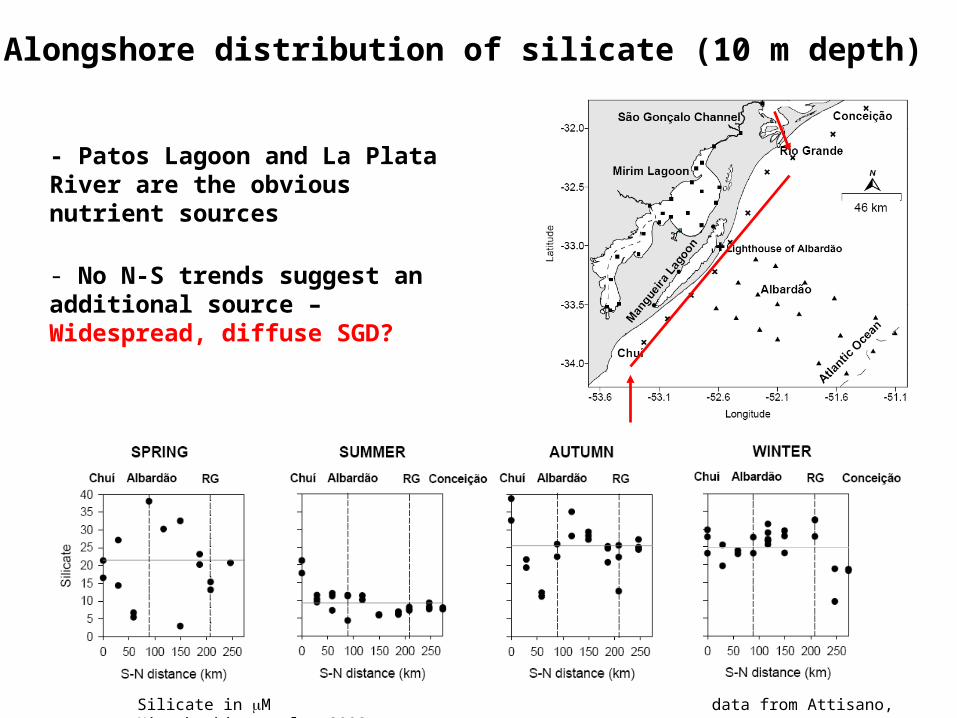
Alongshore distribution of silicate (10 m depth)
- Patos Lagoon and La Plata River are the obvious nutrient sources
- No N-S trends suggest an additional source – Widespread, diffuse SGD?
Silicate in M data from Attisano, Niencheski, et al., 2008
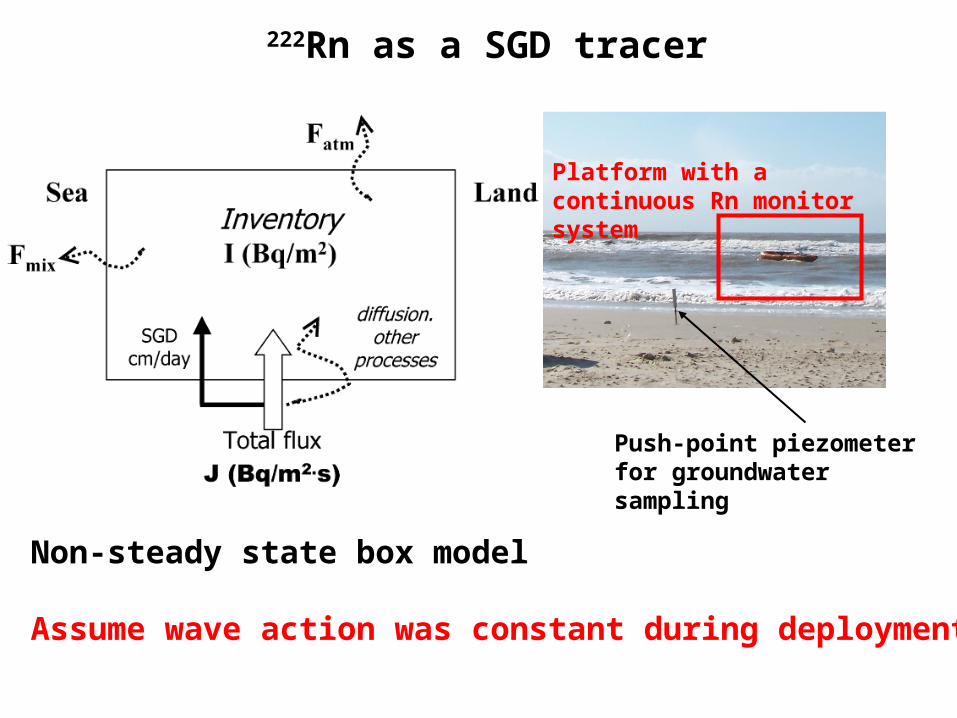
222Rn as a SGD tracer
Platform with a continuous Rn monitor system
Push-point piezometer for groundwater sampling
Non-steady state box model
Assume wave action was constant during deployment
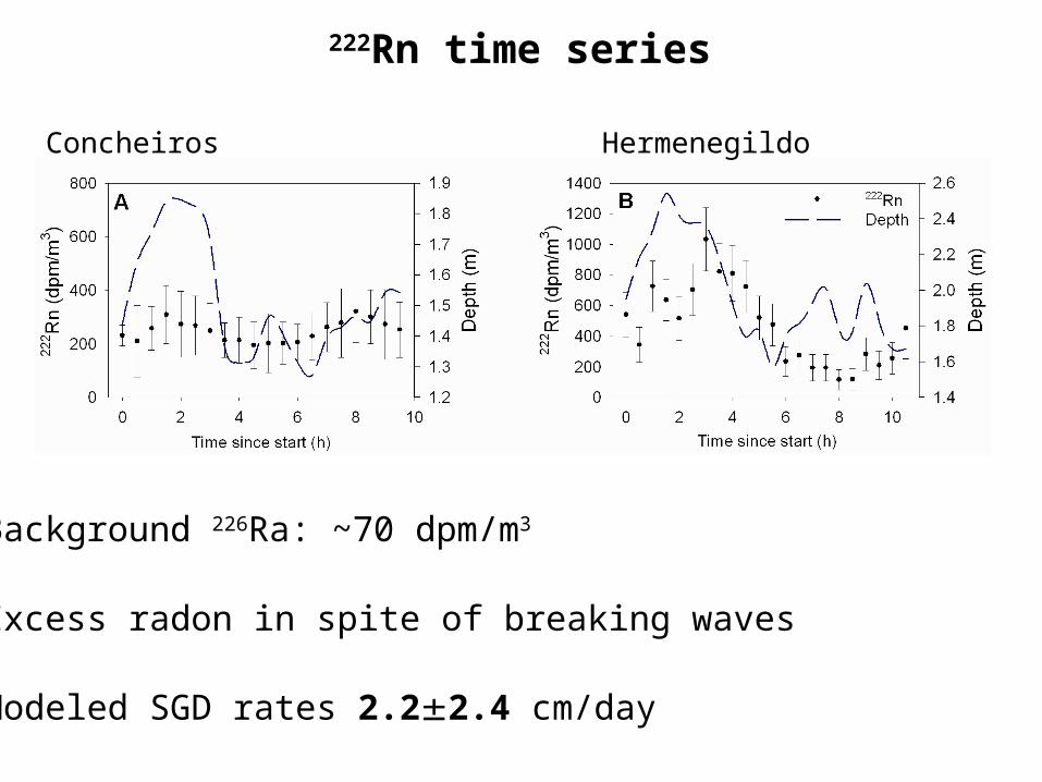
Concheiros Hermenegildo
222Rn time series
-Background 226Ra: ~70 dpm/m3
-Excess radon in spite of breaking waves
-Modeled SGD rates 2.22.4 cm/day
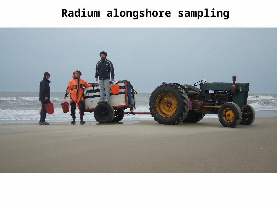
Radium alongshore sampling
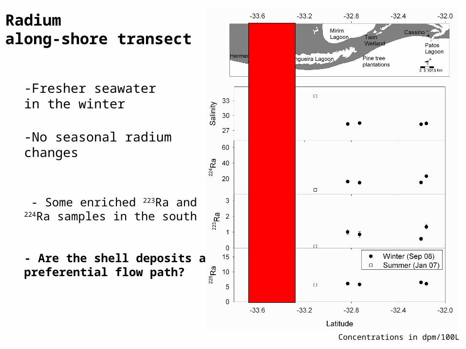
Radium along-shore transect
-Fresher seawater in the winter
-No seasonal radium changes
- Some enriched 223Ra and 224Ra samples in the south
- Are the shell deposits a preferential flow path?
Concentrations in dpm/100L
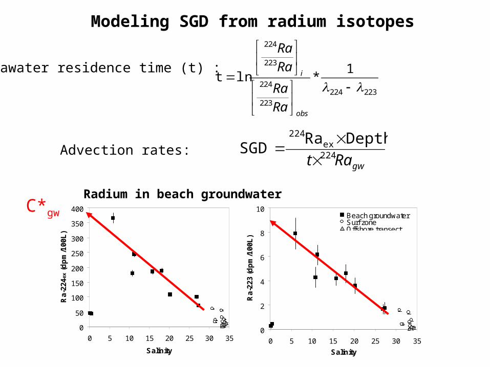
Seawater residence time (t) :
gwRat 224ex
224 DepthRaSGD
Advection rates:
Modeling SGD from radium isotopes
223224
223
224
223
224
1*ln t
obs
i
Ra
Ra
Ra
Ra
Radium in beach groundwater
0
50
100
150
200
250
300
350
400
0 5 10 15 20 25 30 35
Salinity
Ra
-22
4ex
(d
pm
/10
0L
)
0
2
4
6
8
10
0 5 10 15 20 25 30 35
Salinity
Ra
-22
3 (
dp
m/1
00
L)
Beach groundwaterSurf zoneOffshore transect
C*gw
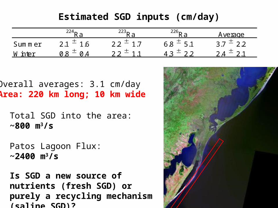
Estimated SGD inputs (cm/day)
Overall averages: 3.1 cm/dayArea: 220 km long; 10 km wide
Total SGD into the area: ~800 m3/s
Patos Lagoon Flux: ~2400 m3/s
Is SGD a new source of nutrients (fresh SGD) or purely a recycling mechanism (saline SGD)?
Summer 2.1 1.6 2.2 1.7 6.8 5.1 3.7 2.2Winter 0.8 0.4 2.2 1.1 4.3 2.2 2.4 2.1
223Ra 226Ra Average224Ra
0
5
10
15
20
0 30 60 90 120 150 180
Distance from shore (km)
Ra
-22
4 (d
pm
/10
0L
)
0.00
0.05
0.10
0.15
0.20
0.25
0.30
0 30 60 90 120 150 180
Distance from shore (km)
Ra-
223
(d
pm
/10
0L)
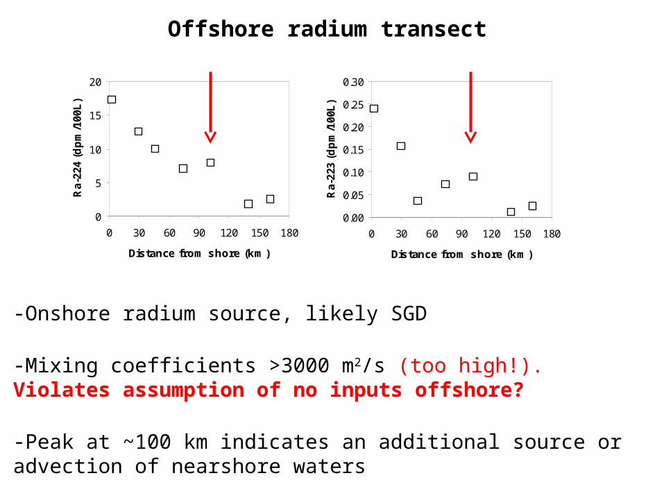
Offshore radium transect
-Onshore radium source, likely SGD
-Mixing coefficients >3000 m2/s (too high!). Violates assumption of no inputs offshore?
-Peak at ~100 km indicates an additional source or advection of nearshore waters

-85
-80
-75
-70
-65
-60
-55
-50
-45
-40
-35
-30
-25
-20
-15
Campos et al., 2007.
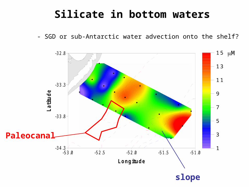
La Plata paleocanal
-70 km long
-20 km wide
- 30 m deep
-53.0 -52.5 -52.0 -51.5 -51.0
Longitude
-34.3
-33.8
-33.3
-32.8L
atit
ud
e
1
3
5
7
9
11
13
15
Silicate in bottom waters
- SGD or sub-Antarctic water advection onto the shelf?
Paleocanal
slope
M
Summary
1) Radium is the preferred SGD tracer as we cannot model how waves influence radon evasion
2) SGD is potentially a major source of water and nutrients to the Albardão area and the entire SWAOM margin
3) Shell deposits and the La Plata River Paleocanal may represent a preferential flow path for SGD