Embed Size (px)
Citation preview
Subsurface Utility Engineering (SUE) and 3D Underground Utility Data in
Microstation
The FDOT District 5 experience and the latest developments
Mark Pitchford, PSMCarlo Pilia, CEng
CARDNO
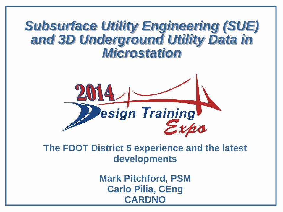
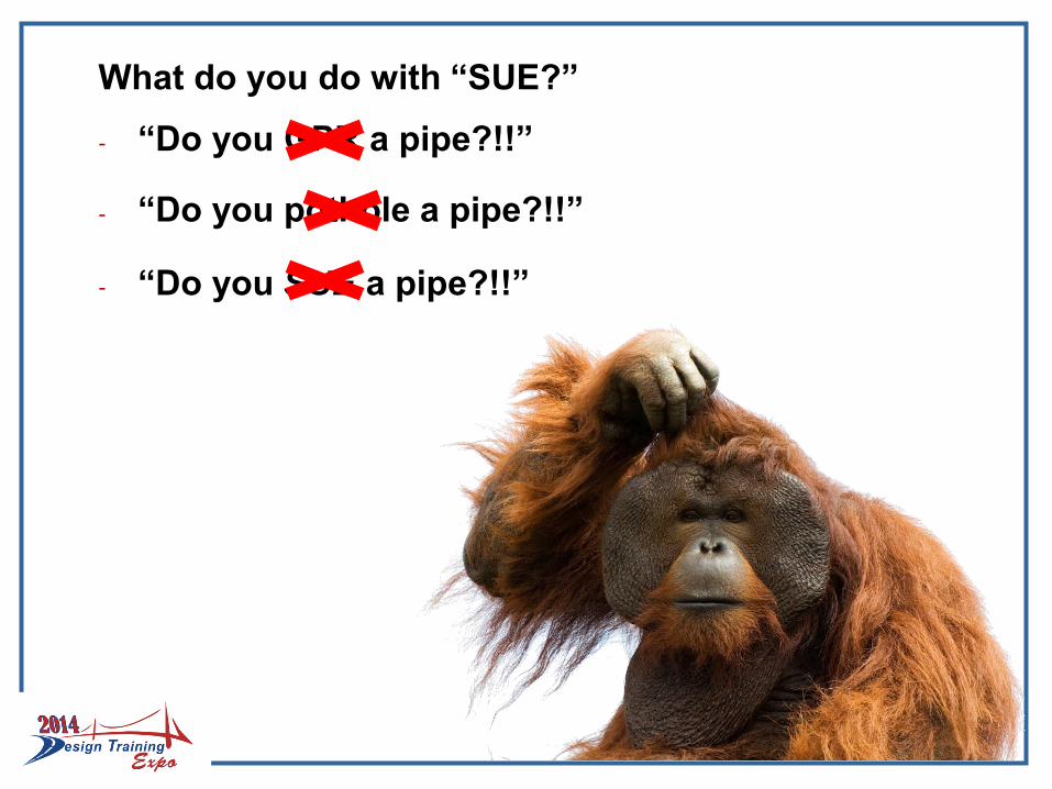
- Subsurface Utility EXCAVATION?
- Subsurface Utility EXPLORATION?
What is “SUE?”
- SUBSURFACE UTILITY ENGINEERING
Subsurface Utility Engineering:
A branch of engineering practice that involves managing certain risks associated with utility mapping and appropriate quality levels, utility coordination, utility relocation design and coordination, utility condition assessment, communication of utility data to concerned parties, utility relocation cost estimates, implementation of utility accommodation policies, and utility design.
(CI/ASCE 38-02)
What do you do with “SUE?”
- “Do you GPR a pipe?!!”
- “Do you pothole a pipe?!!”
- “Do you SUE a pipe?!!”
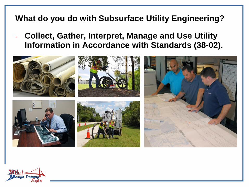
What do you do with Subsurface Utility Engineering?
- Collect, Gather, Interpret, Manage and Use Utility Information in Accordance with Standards (38-02).
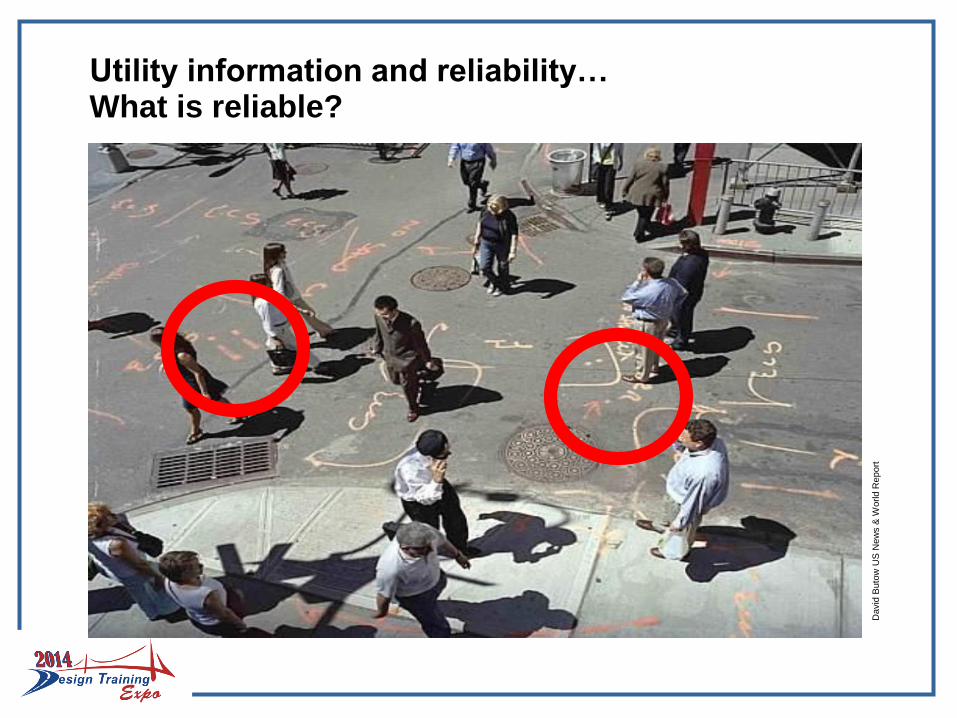
Utility information and reliability…What is reliable?
David
Buto
wU
S N
ew
s &
World R
eport
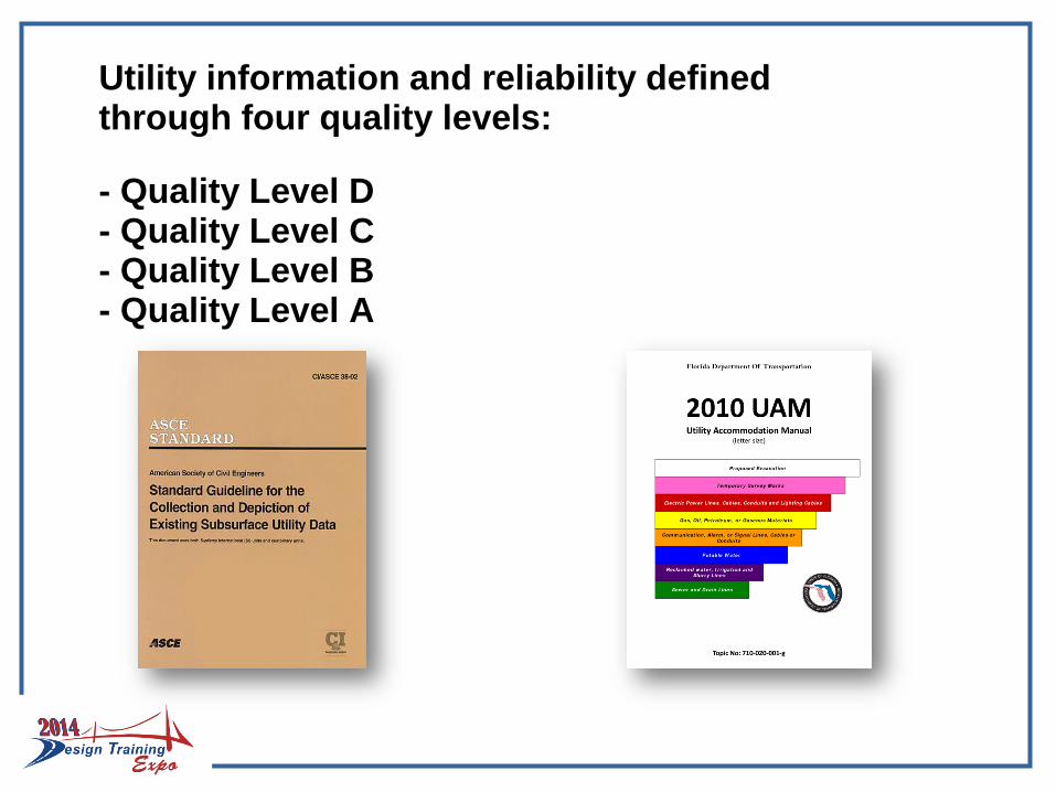
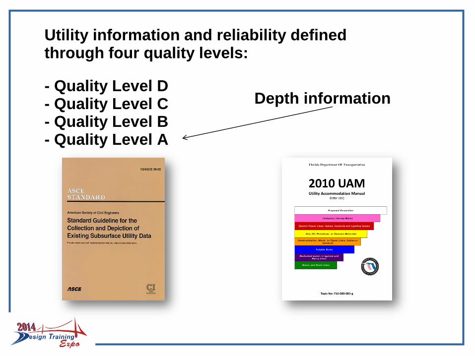
Utility information and reliability defined through four quality levels:
- Quality Level D- Quality Level C- Quality Level B- Quality Level A
Utility information and reliability defined through four quality levels:
- Quality Level D- Quality Level C- Quality Level B- Quality Level A
Depth information
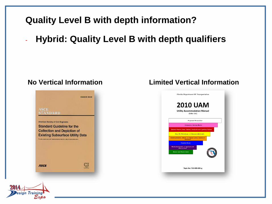
Quality Level B with depth information?
- Hybrid: Quality Level B with depth qualifiers
No Vertical Information Limited Vertical Information
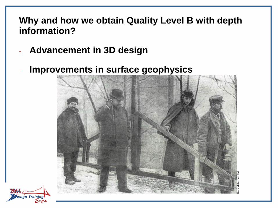
Why and how we obtain Quality Level B with depth information?
- Advancement in 3D design
- Improvements in surface geophysics
Radio
dete
ction
Ltd
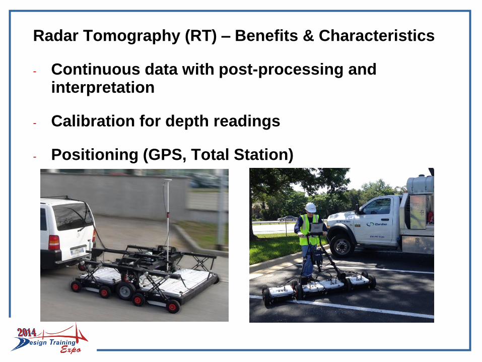
Radar Tomography (RT) – Benefits & Characteristics
- Continuous data with post-processing and interpretation
- Calibration for depth readings
- Positioning (GPS, Total Station)
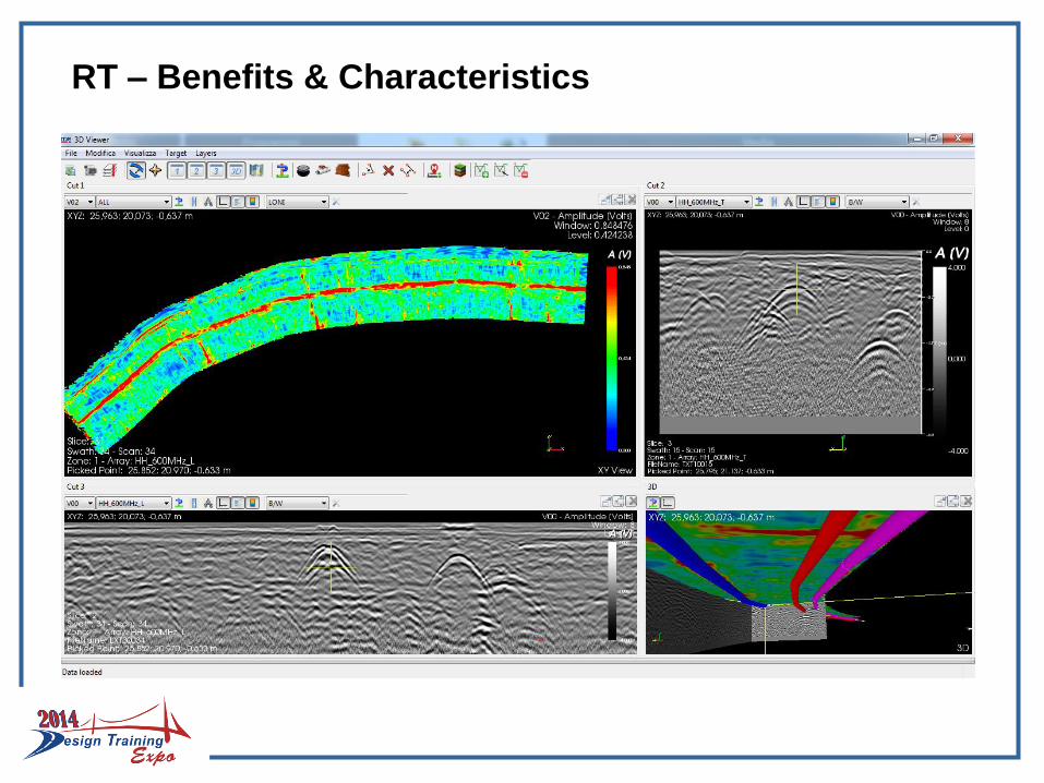
RT – Benefits & Characteristics
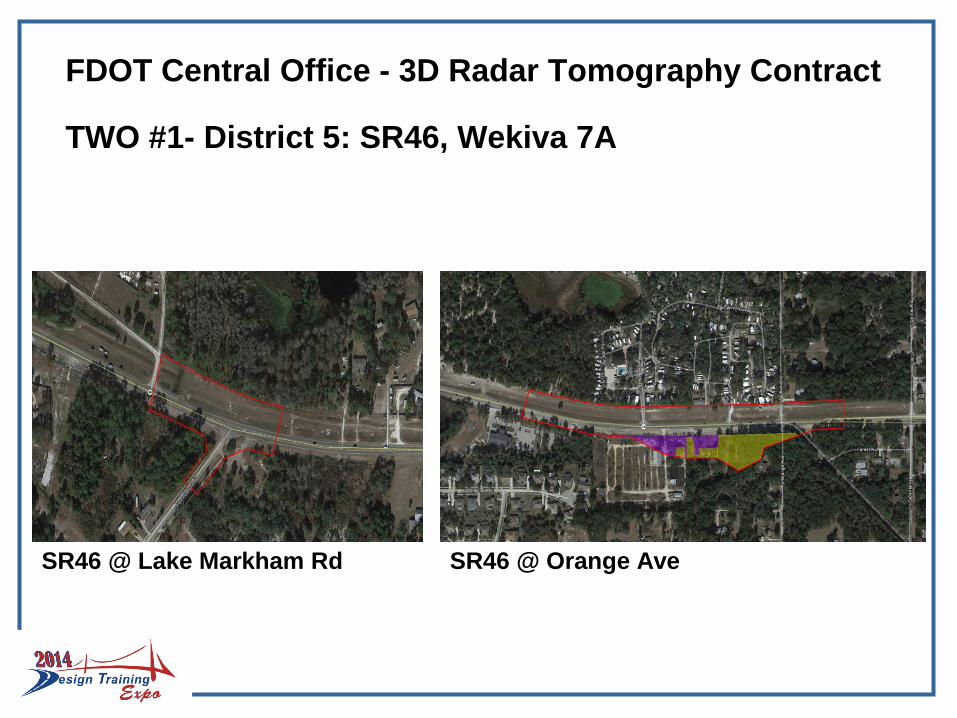
FDOT Central Office - 3D Radar Tomography Contract
TWO #1- District 5: SR46, Wekiva 7A
SR46 @ Lake Markham Rd SR46 @ Orange Ave
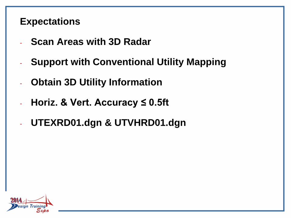
Expectations
- Scan Areas with 3D Radar
- Support with Conventional Utility Mapping
- Obtain 3D Utility Information
- Horiz. & Vert. Accuracy ≤ 0.5ft
- UTEXRD01.dgn & UTVHRD01.dgn
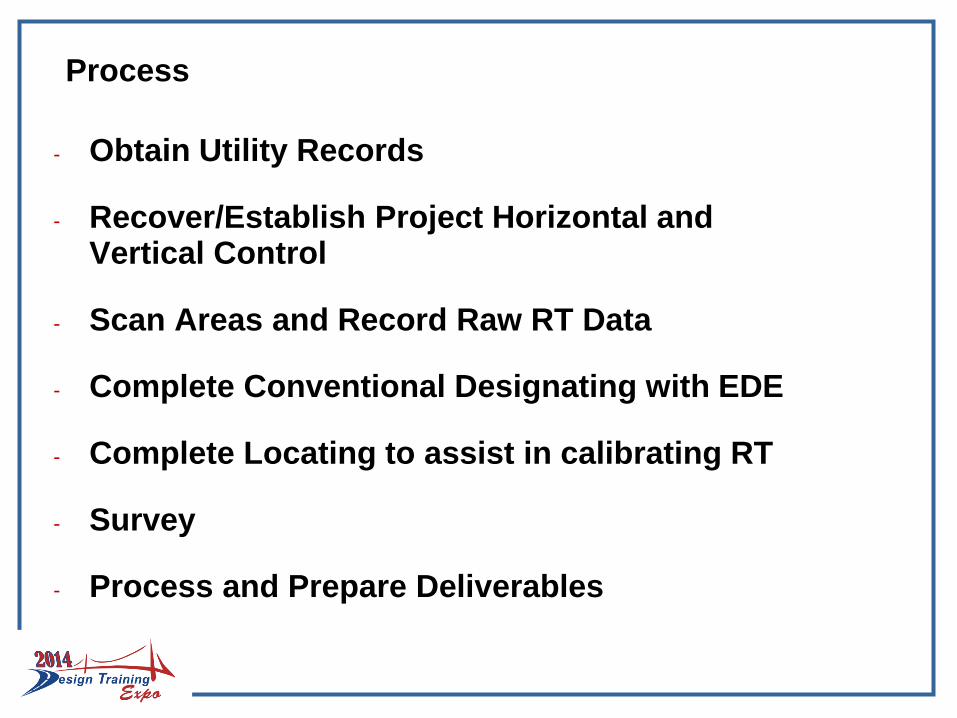
Process
- Obtain Utility Records
- Recover/Establish Project Horizontal and Vertical Control
- Scan Areas and Record Raw RT Data
- Complete Conventional Designating with EDE
- Complete Locating to assist in calibrating RT
- Survey
- Process and Prepare Deliverables
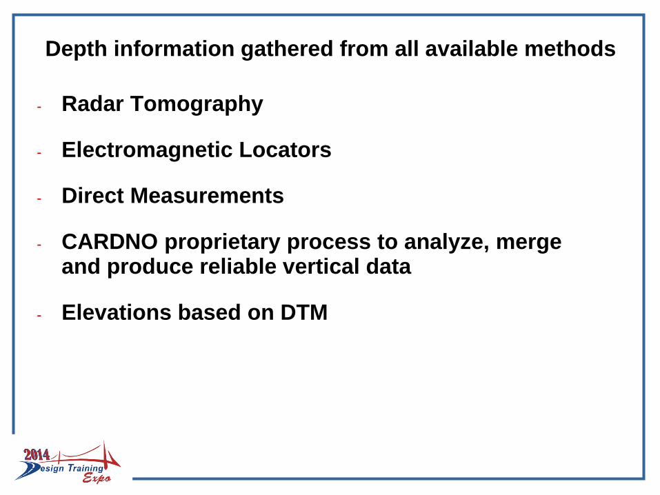
Depth information gathered from all available methods
- Radar Tomography
- Electromagnetic Locators
- Direct Measurements
- CARDNO proprietary process to analyze, merge and produce reliable vertical data
- Elevations based on DTM
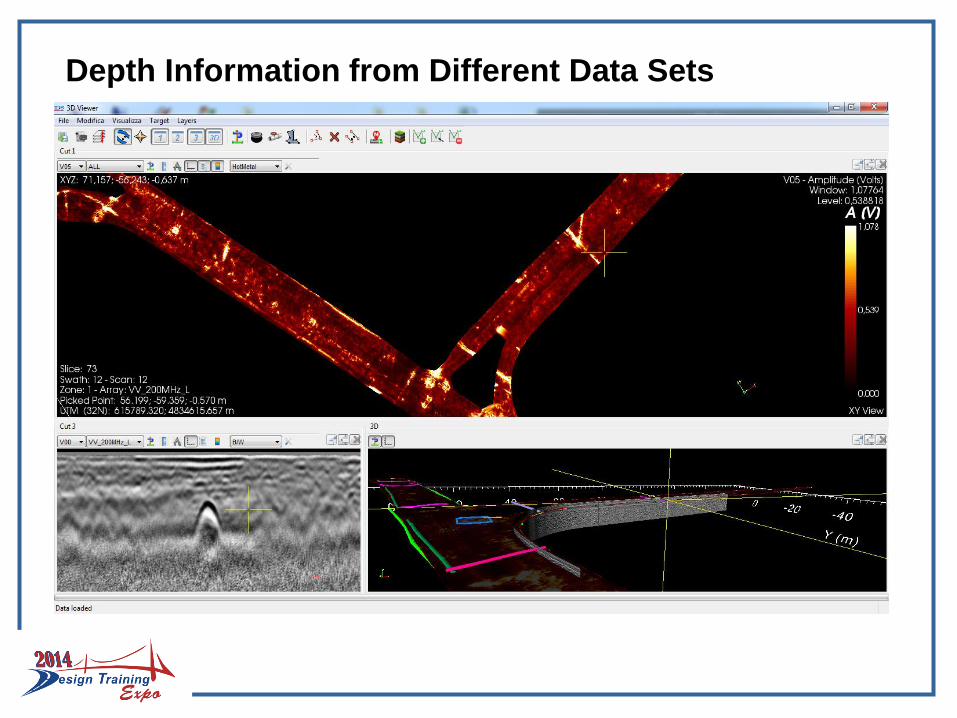
Depth Information from Different Data Sets
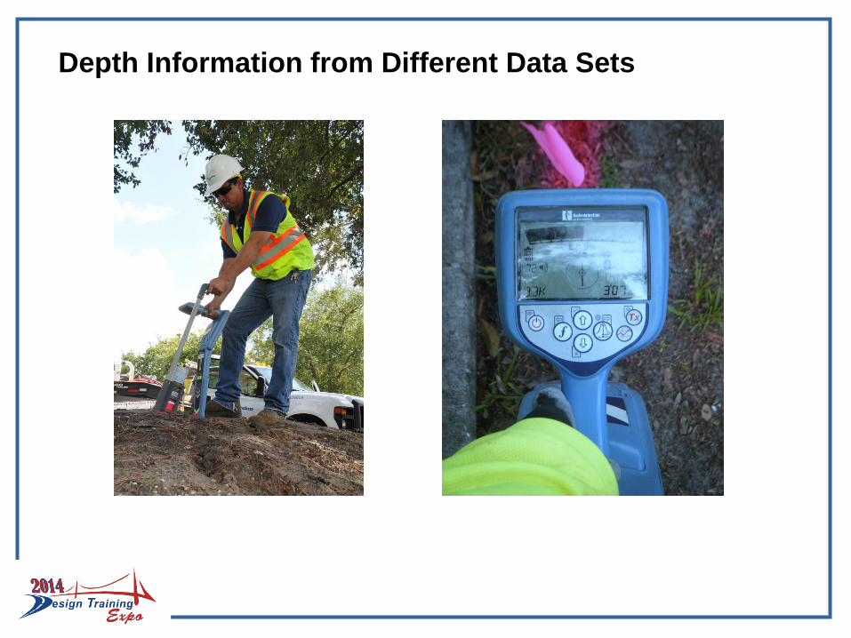
Depth Information from Different Data Sets
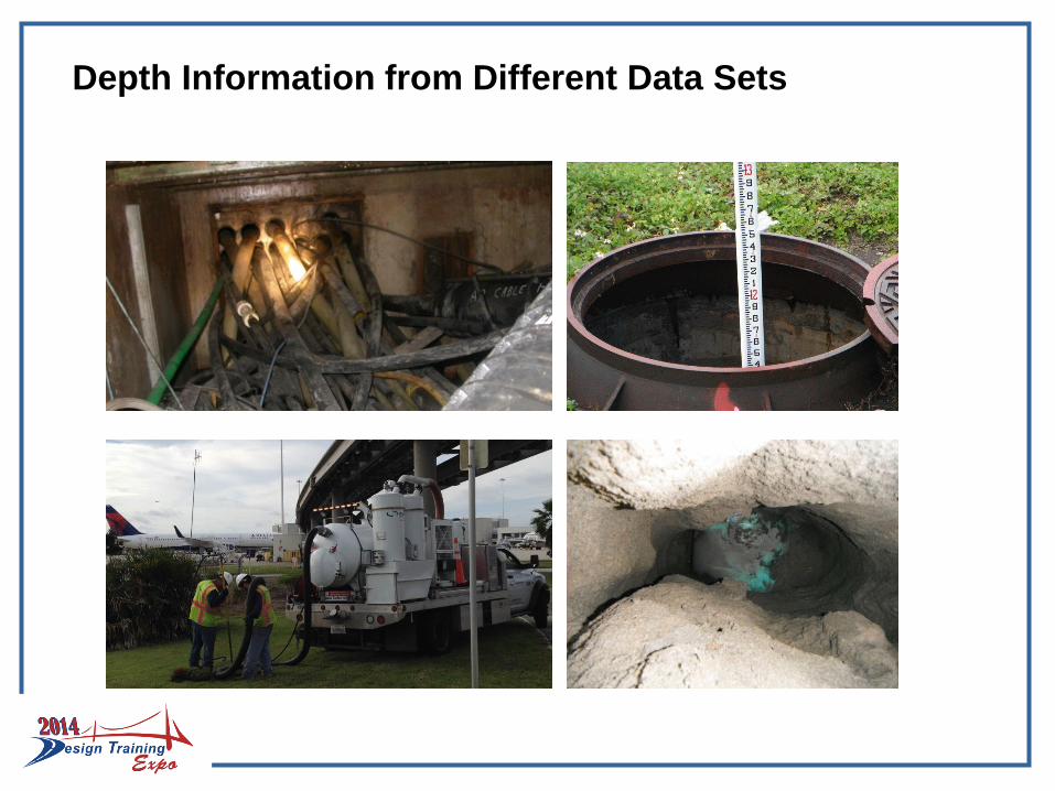
Depth Information from Different Data Sets
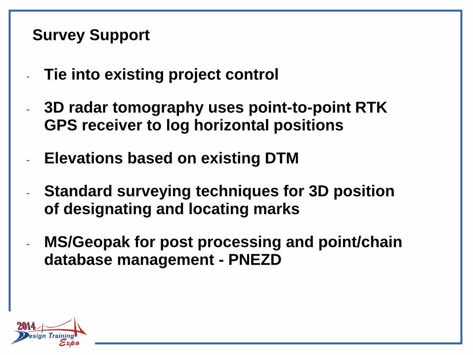
Survey Support
- Tie into existing project control
- 3D radar tomography uses point-to-point RTK GPS receiver to log horizontal positions
- Elevations based on existing DTM
- Standard surveying techniques for 3D position of designating and locating marks
- MS/Geopak for post processing and point/chain database management - PNEZD
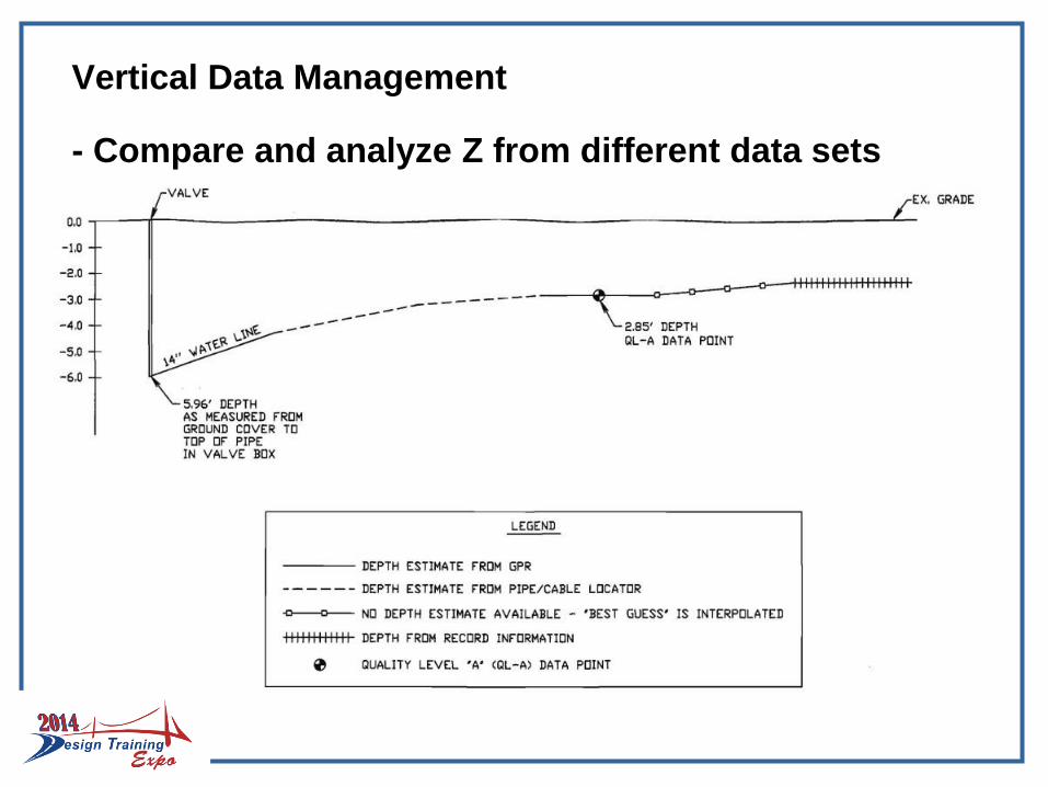
Vertical Data Management
- Compare and analyze Z from different data sets

Vertical Data Management
- Compare and analyze Z from different data sets
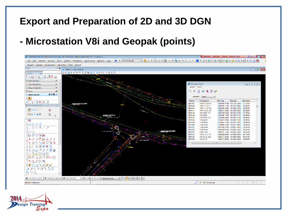
Export and Preparation of 2D and 3D DGN
- Microstation V8i and Geopak (points)
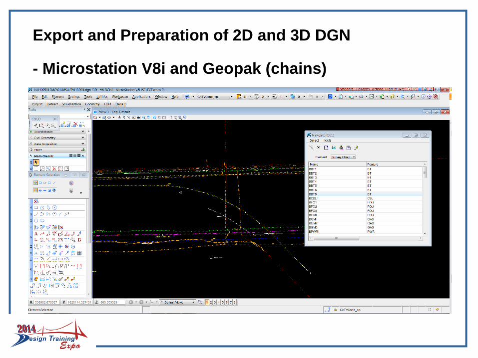
Export and Preparation of 2D and 3D DGN
- Microstation V8i and Geopak (chains)
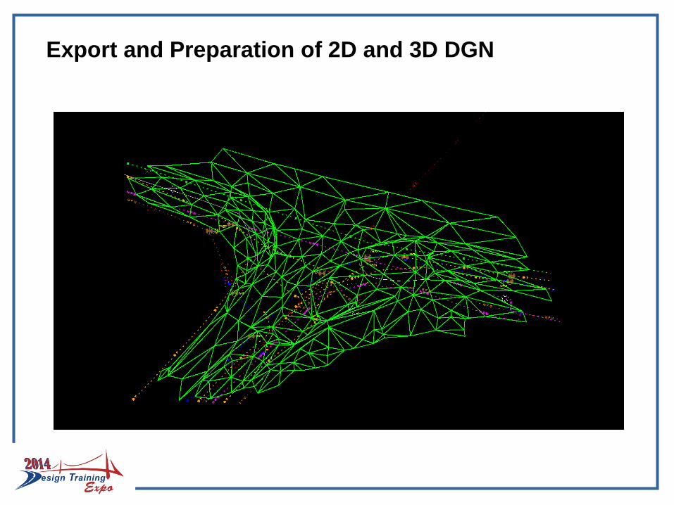
Export and Preparation of 2D and 3D DGN
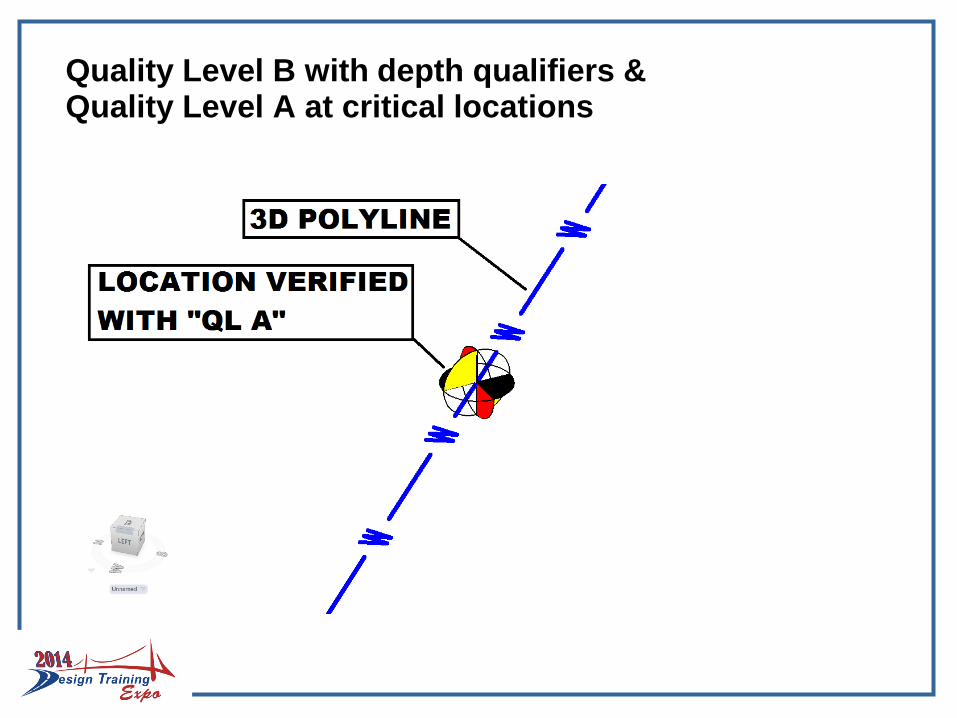
Quality Level B with depth qualifiers & Quality Level A at critical locations
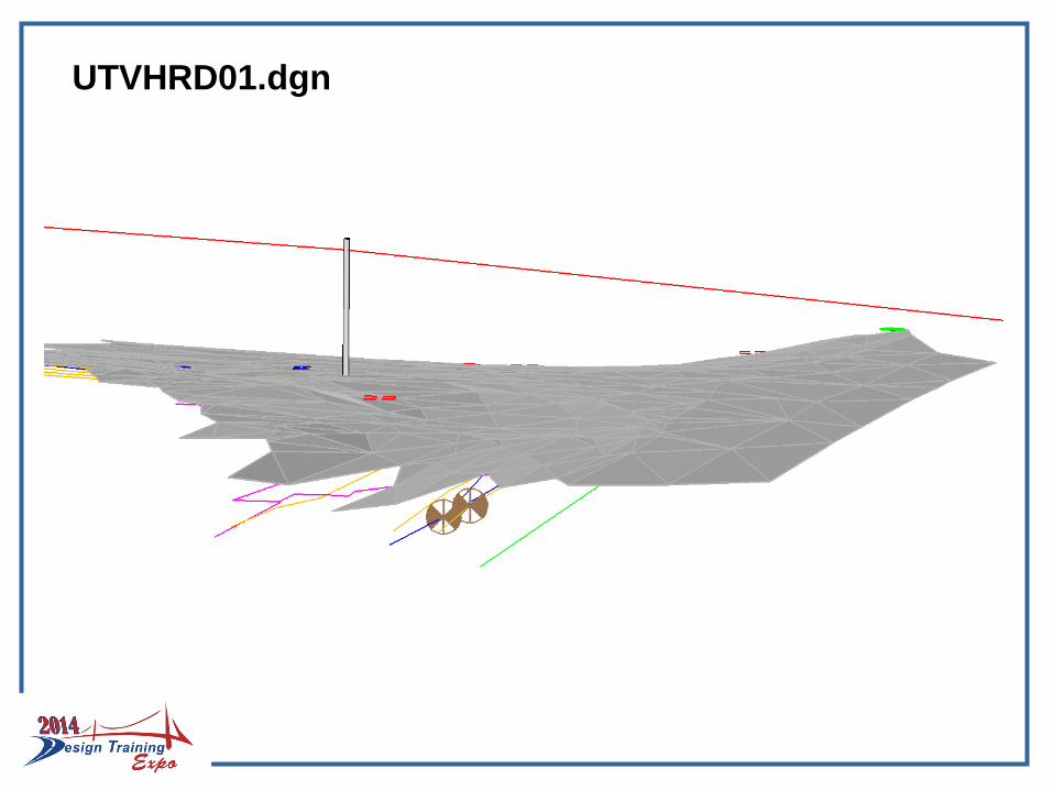
UTVHRD01.dgn
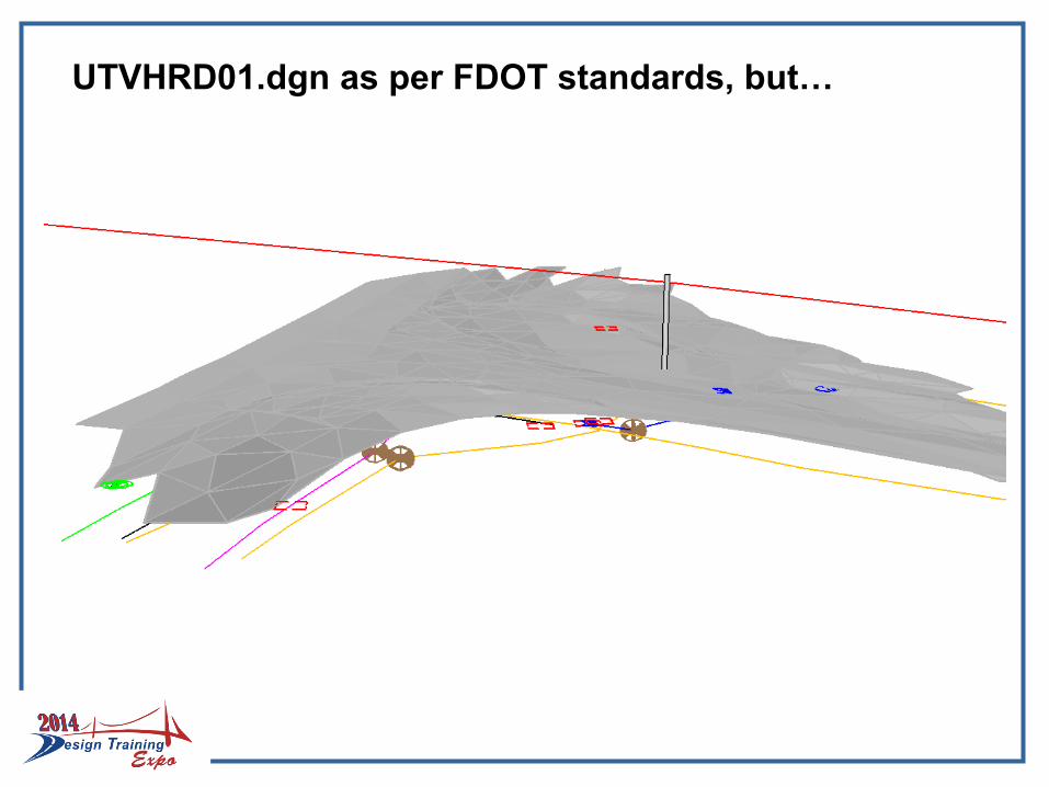
UTVHRD01.dgn as per FDOT standards, but…
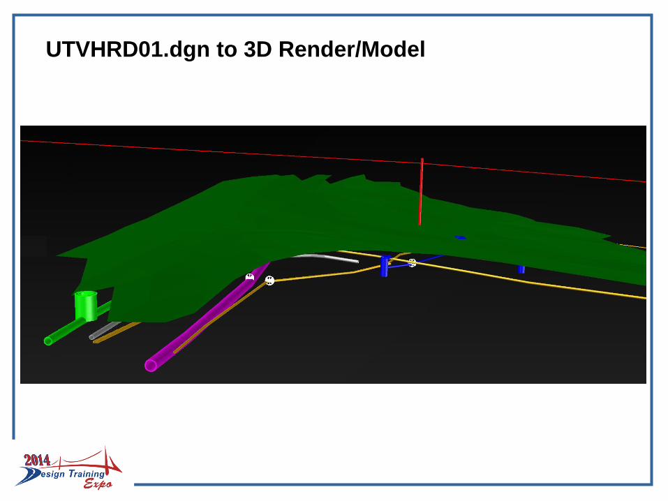
UTVHRD01.dgn to 3D Render/Model
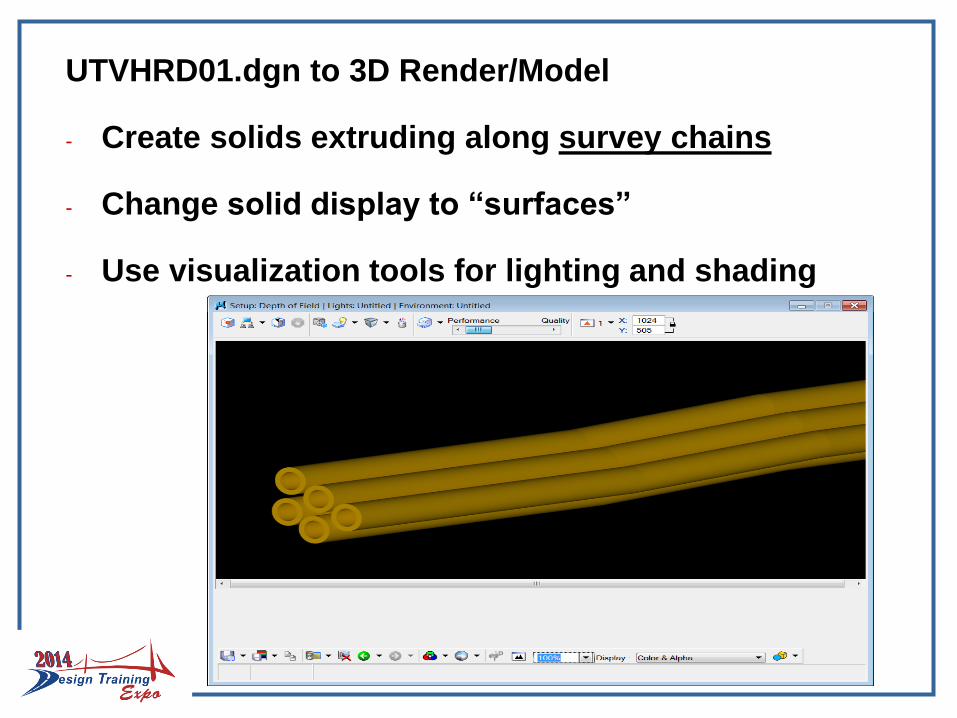
UTVHRD01.dgn to 3D Render/Model
- Create solids extruding along survey chains
- Change solid display to “surfaces”
- Use visualization tools for lighting and shading
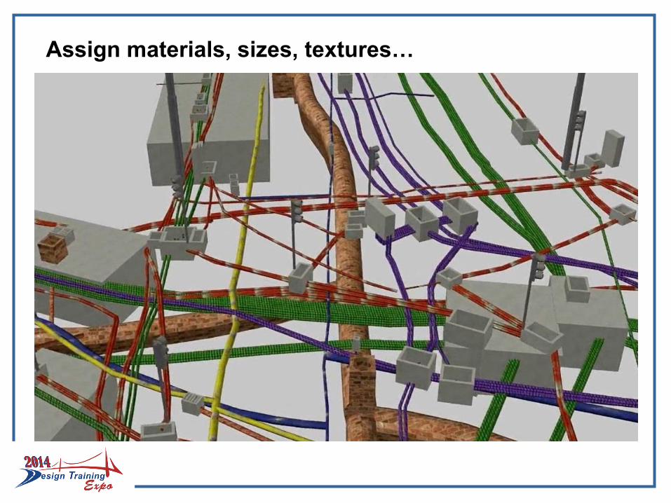
Assign materials, sizes, textures…
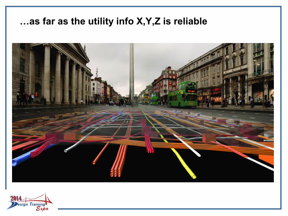
…as far as the utility info X,Y,Z is reliable
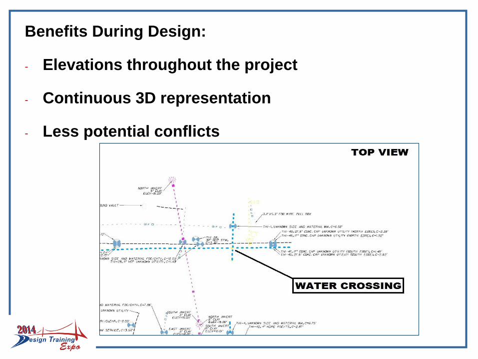
Benefits During Design:
- Elevations throughout the project
- Continuous 3D representation
- Less potential conflicts
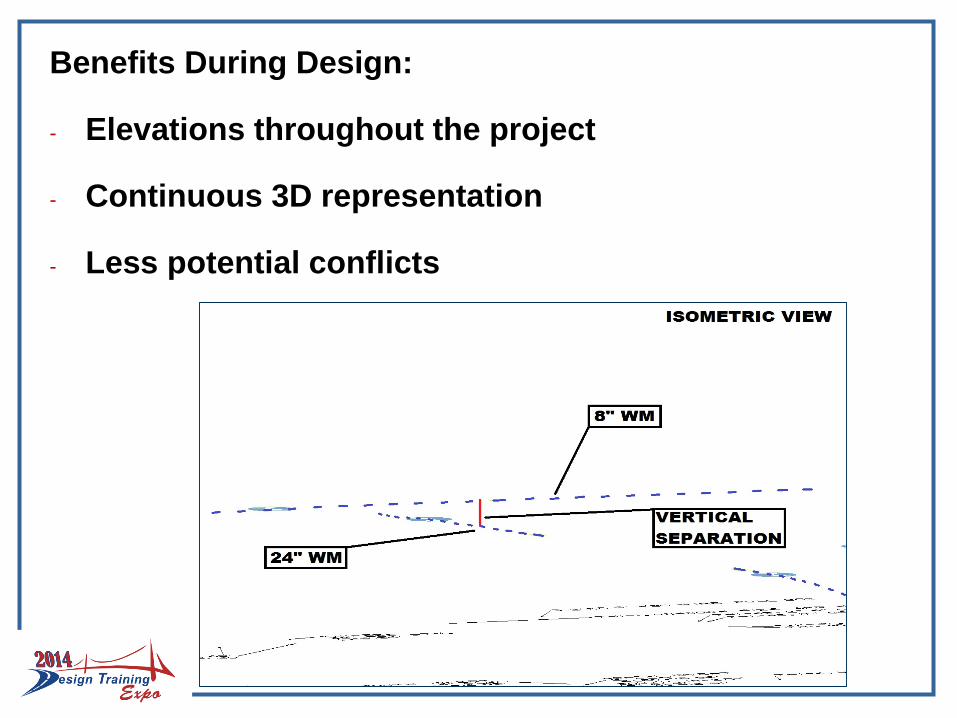
Benefits During Design:
- Elevations throughout the project
- Continuous 3D representation
- Less potential conflicts
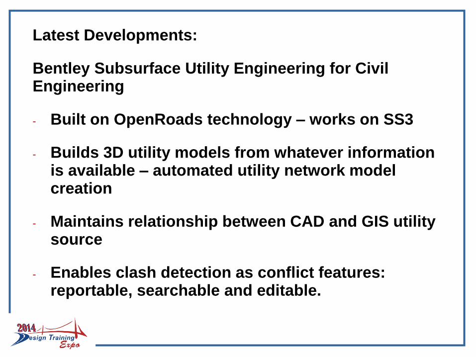
Latest Developments:
Bentley Subsurface Utility Engineering for Civil Engineering
- Built on OpenRoads technology – works on SS3
- Builds 3D utility models from whatever information is available – automated utility network model creation
- Maintains relationship between CAD and GIS utility source
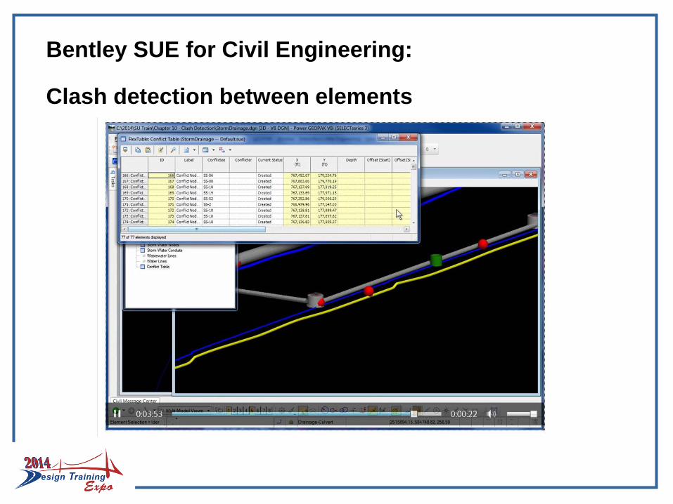
- Enables clash detection as conflict features: reportable, searchable and editable.
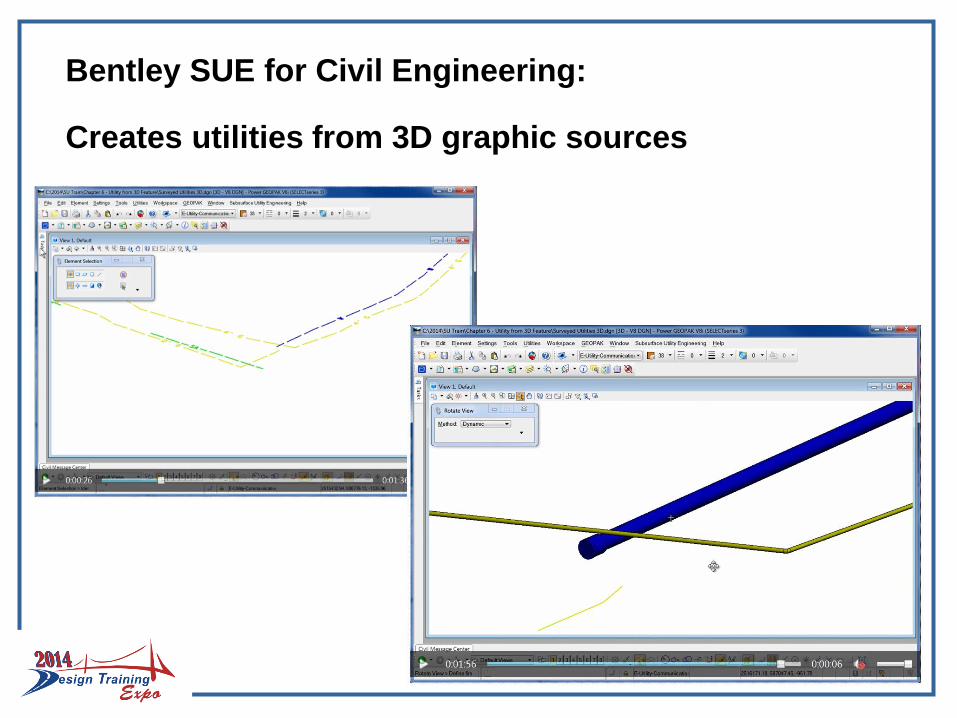
Bentley SUE for Civil Engineering:
Creates utilities from 3D graphic sources
Bentley SUE for Civil Engineering:
Clash detection between elements
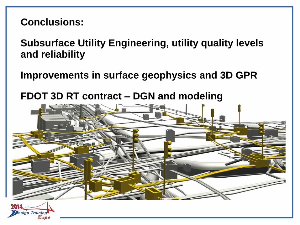
Conclusions:
Subsurface Utility Engineering, utility quality levels and reliability
Improvements in surface geophysics and 3D GPR
FDOT 3D RT contract – DGN and modeling
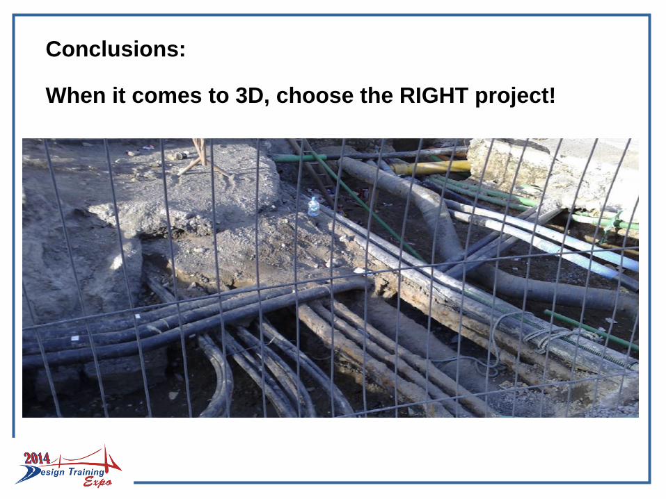
Conclusions:
When it comes to 3D, choose the RIGHT project!
Special Thanks:
FDOT Central Office
FDOT District 5
Cardno 3D TEAM(Daryl Thie, PLSMatt LaLuzerne, PSMAdam Berry, SI)
UndergroundImagingTechnology
THANK YOU !