Embed Size (px)
Citation preview
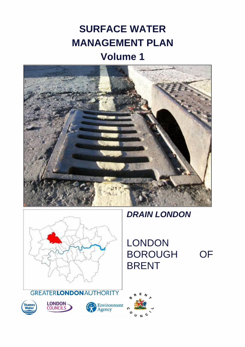
SURFACE WATER
MANAGEMENT PLAN
Volume 1
DRAIN LONDON
LONDON BOROUGH OF BRENT

Hyder Consulting (UK) Limited
2212959
Aston Cross Business Village 50 Rocky Lane Aston Birmingham B6 5RQ United Kingdom
Tel: +44 (0)121 345 9000
Fax: +44 (0)121 359 6674
www.hyderconsulting.com
DOCUMENT INFORMATION
Title Surface Water Management Plan
Owner Hyder Consulting (UK) Ltd
Version 02
Status Final
Project Number UA002334
File Name 5008-UA002334-BMR-02- LB Brent SWMP – Vol 1
REVISION HISTORY
Summary of Changes Completed By Date of Issue
Version
Incorporation of comments from GLA, Tier 1 and EA A McNally 12/10/2011 02
Preliminary SWMP report for Steering Group Review A McNally 08/06/2011 01
AUTHOR
Name Organisation and Role
A McNally Hyder Consulting (UK) Ltd, Consultant
C Gibson Hyder Consulting (UK) Ltd, Hydrologist
APPROVALS
Name Title Signature Date
L Foster PM Hyder Consulting (UK) Ltd 12/10/2011
E Harris PD Hyder Consulting (UK) Ltd 14/10/2011
DISTRIBUTION
Name Organisation and Role
P Calver Environment Agency
D Harding Thames Water Utilities Limited
H Patel London Borough of Brent
R Sharma Transport for London
K Reid Greater London Authority
RELATED DOCUMENTS
Doc Ref Document Title Author Date of Issue
Version
5008-UA002334-BMR-02- LB Brent SWMP – Vol 2
Brent SWMP – Appendices Aoife McNally 12/10/2011 02
This report has been prepared for the London Borough of Brent in accordance with the terms and conditions of appointment as part of the Drain London Tier 2 contract with the Greater London Authority dated October 2010. Hyder Consulting (UK) Limited (2212959) cannot accept any responsibility for any use of or reliance on the contents of this report by any third party.

Executive Summary
Page i
Executive Summary
This document forms the Surface Water Management Plan (SWMP) for the London Borough of
Brent which has been delivered as part of the Tier 2 package of works of the Drain London
Project. This document is a plan which outlines the preferred surface water management
strategy for the London Borough of Brent and includes consideration of flooding from sewers,
drains, groundwater and runoff from land, small watercourses and ditches that occurs as a
result of heavy rainfall.
The SWMP builds upon previous work undertaken at part of the Drain London Tier 1 package of
works and has been undertaken following a four phase approach; Phase 1 – Preparation;
Phase 2 – Risk Assessment; Phase 3 – Options; and Phase 4 – Implementation and Review.
Phase 1 - Preparation
Phase 1 builds upon work formerly undertaken during Tier 1 of the Drain London Project to
collect and review surface water data from key stakeholders and build partnerships between
stakeholders responsible for local flood risk management. As part of the Drain London project,
the London Borough of Brent has been grouped with the London Boroughs of Barnet and
Harrow to undertake Tier 2 of the project and work together to understand local flood risk.
The London Borough of Brent has begun the process to establish a broader partnership with
neighbouring London Boroughs in north west London, through the establishment of the West
London Strategic Flood Group, in order for these local authorities to pool best practice and
resources to enable each authority to discharge their responsibilities as Lead Local Flood
Authority (LLFA) under the Flood and Water Management Act (FWMA) 2010.
Phase 2 - Risk Assessment
As part of Phase 2 Risk Assessment, direct rainfall modelling has been undertaken across the
entire Borough for five specified return periods. The results of this modelling have been used to
identify Local Flood Risk Zones (LFRZs) where flooding affects houses, businesses and/or
infrastructure. Those areas identified to be at more significant risk have been delineated into
Critical Drainage Areas (CDAs) representing one or several LFRZs as well as the contributing
catchment area and features that influence the predicted flood extent. Within the London
Borough of Brent, 27 CDAs have been identified; these are shown in Figure 1. The chief
mechanisms for flooding in the London Borough of Brent can be broadly divided into the
following categories:
River Valleys - Across the study area, the areas particularly susceptible to overland
flow are formed by the river valleys of the River Brent and Wealdstone Brook, and /
or along narrow corridors associated with topographical valleys which represent the
routes of the ‘lost’ rivers of London including the Wembley Brook and other
unnamed surface water connections, including lost tributaries to the River
Westbourne.
Low Lying Areas - areas such as underpasses, subways and lowered roads
beneath railway lines are more susceptible to surface water flooding;
Railway Cuttings - several stretches of mainline railway track (in cuttings) are
susceptible to surface water flooding and, if flooded, will impact services into and
out of Euston and Marylebone Railway Stations from northwest London and
beyond;

Executive Summary
Page ii
Railway Embankments - discrete surface water flooding locations along the up-
stream side of the raised network rail embankment (running roughly west to east
through the Borough); and,
Sewer Flood Risk – areas where extensive and deep surface water flooding is
likely to be the influence of sewer flooding mechanisms alongside pluvial and
groundwater sources including the areas around Kenton, Maida Vale, North
Wembley and Willesden;
Fluvial Flood Risk – areas where extensive and deep surface water flooding is
likely to be the influence of fluvial flooding mechanisms (alongside pluvial,
groundwater and sewer flooding sources) including Kenton, Stonebridge,
Tokyngton, Wembley Park.
Analysis of the number of properties at risk of flooding has been undertaken for the rainfall
event with a 1 in 100 probability of occurrence in any given year (1% Annual Exceedance
Probability, AEP). A review of the results demonstrate that approximately 70,000 residential
properties and 8,000 non-residential properties in the London Borough of Brent could be at risk
of surface water flooding of greater than 0.1m depth during a 1% AEP rainfall event. Of those,
approximately 350 residential properties and 80 non-residential properties could be at risk of
flooding to a depth of greater than 0.5m during the same event.
Further subdivision of the areas is included within the report highlighting the CDAs showing to
be at the greatest risk of flooding in terms of the number of receptors at risk, however these are
not presented in the Executive Summary, as there is the potential for them to be misused in
comparisons with other London Boroughs CDAs to rank the areas at greatest risk. This should
be avoided as each of the Drain London Tier 2 groups undertook different approaches to
delineating the size and coverage of the CDAs based upon the guidelines for undertaking the
works.
Within the London Borough of Brent, the greatest number of receptors are at risk from surface
water flooding along the route of the urban valleys representing the ‘lost’ watercourses across
the Borough, which generally link closely with the sewerage network assets installed as part of
the West Middlesex Drainage Scheme in the 1930’s, which run through the area to join up with
the main Rivers crossing the Borough (Wealdstone Brook and the River Brent)
A number of CDAs within the London Borough of Brent are cross boundary, and as such will
need to be jointly managed to implement the potential options and manage surface water flood
risk in these areas.
Phase 3 - Options Assessment
There are a number of opportunities for measures to be implemented across the Borough to
tackle surface water flood risk. Ongoing maintenance of the drainage network and small scale
improvements are already undertaken as part of the operations of the Borough. In addition,
opportunities to raise community awareness of the risks and responsibilities for residents should
be sought, and London Borough of Brent may wish to consider the implementation of a
Communication Plan to assist with this.
It is important to recognise that flooding within the Borough is not confined to just the CDAs, and
therefore, throughout the Borough there are opportunities for generic measures to be
implemented through the Development Management Policy works including the potential
establishment of a policy position on issues including the widespread use of water conservation
measures such as water butts and rainwater harvesting technology, use of soakaways,

Executive Summary
Page iii
permeable paving and green roofs. In addition, there are Borough-wide opportunities to raise
community awareness.
For each of the CDAs identified within the Borough, site-specific measures have been identified
that could be considered to help alleviate surface water flooding. These measures were
subsequently short listed to identify a potential preferred option for each CDA.
Pluvial modelling undertaken as part of the SWMP has identified that flooding within the London
Borough of Brent is heavily influenced by existing and historic river valleys, and impacts a
number of regionally important infrastructure assets. To address local flood risk in the London
Borough of Brent it is recommended that, in the short to medium-term, Brent Borough Council:
Monitor the developing Drainage Capacity Study in the Wembley Development
area in conjunction with Thames Water to determine local drainage capacity,
connections and identify flood mitigation options through detailed modelling;
Undertake a feasibility study to re-green areas of the Borough to help attenuate
surface water downstream in the Brent catchment, identified as a potential ‘Quick
Win’ scheme;
Confirm the resilience of infrastructure to surface water flooding through engaging
with energy operators, TfL and Network Rail regarding the surface water flood risk
to key infrastructure including TfL red routes, key railway infrastructure (railway
cuttings and stations) identified to flood throughout the Borough respectively, and
confirming the drainage assumptions used within the SWMP pluvial modelling;
Contribute to discussions and opportunities to help reduce the surface water
elements within the areas that contribute to the Counter’s Creek Flood Alleviation
Scheme catchment, with TWUL, including seeking and promoting ‘pilot’ projects to
test and reduce the surface water contributions through promotion of source control
and other sustainable drainage measures, and;
Ensure that opportunities for flood storage and source control are prioritised
through any new development across the area, and seek opportunities for joint
funding of improvement schemes through any redevelopment / local businesses
Borough wide, it is recommended that the London Borough of Brent:
Improve the current process and protocols for flood risk management and drainage
and integrate these within the Council’s operations, to include improvements in
asset management, recording of flooding incidents, liaison with other functions
across the council
Initiate development forums with those planning to deliver all forms of development
within the borough to present the risks and the aspirations of the Borough. These
could be used to encourage the developers to achieve the items identified in the
potential planning policy section of the Action Plan. This is important to capture
new land that may come available subsequent to the Core Strategy.
Engage with residents regarding the flood risk in the Borough, to make them aware
of their responsibilities for property drainage (especially in the CDAs) and steps
that can be taken to improve flood resilience;
Provide an ‘Information Portal’ via the London Borough of Brent website, for local
flood risk information and measures that can be taken by residents to mitigate
surface water flooding to / around their property;

Executive Summary
Page iv
Prepare a Communication Plan to effectively communicate and raise awareness of
surface water flood risk to different audiences using a clearly defined process for
internal and external communication with stakeholders and the public; and,
Improve maintenance regimes, and target those areas identified to regular flood or
known to have blocked gullies.
Phase 4 - Implementation & Review
Phase 4 establishes a long-term Action Plan for London Borough of Brent to assist in their role
under the FWMA 2010 to lead in the management of surface water flood risk across the
Borough. The purpose of the Action Plan is to:
Outline the actions required to implement the preferred options identified in Phase
3;
Identify the partners or stakeholders responsible for implementing the action;
Provide an indication of the priority of the actions and a timescale for delivery; and,
Outline actions required to meet the requirements for London Borough of Brent as
LLFA under the FWMA 2010.
The SWMP Action Plan is a ‘living’ document, and as such, should be reviewed and updated
regularly, particularly following the occurrence of a surface water flood event, when additional
data or modelling becomes available, following the outcome of investment decisions by partners
and following any additional major development or changes in the catchment which may affect
the surface water flood risk.

Contents
Page v
CONTENTS
1 Executive Summary ............................................................................... i
1 Introduction ........................................................................................... 1
1.1 What is a Surface Water Management Plan? ....................................... 1
1.2 Background .......................................................................................... 1
1.3 Objectives ............................................................................................. 4
1.4 Study Area ............................................................................................ 5
1.5 Flooding Interactions .......................................................................... 11
1.6 Linkages with Other Plans .................................................................. 12
1.7 Existing Legislation ............................................................................. 15
1.8 Peer Review ....................................................................................... 18
2 Phase 1: Preparation .......................................................................... 19
2.1 Partnership ......................................................................................... 19
2.2 Data Collection ................................................................................... 21
2.3 Data Review ....................................................................................... 23
2.4 Asset Register .................................................................................... 25
2.5 Phase 1 Summary .............................................................................. 27
3 Phase 2: Risk Assessment ................................................................. 28
3.1 Intermediate Assessment ................................................................... 28
3.2 Risk Overview ..................................................................................... 29
3.3 Surface Water Flooding ...................................................................... 33
3.4 Ordinary Watercourse Flooding .......................................................... 38
3.5 Groundwater Flooding ........................................................................ 39
3.6 Sewer Flooding ................................................................................... 42
3.7 Other Influences ................................................................................. 44
3.8 Critical Drainage Areas ....................................................................... 45
3.9 Summary of Risk ................................................................................ 47
4 Phase 3: Options ................................................................................ 55
4.1 Objectives ........................................................................................... 55
4.2 Measures ............................................................................................ 55
4.3 Preferred Options ............................................................................... 56
4.4 Next Steps .......................................................................................... 60
4.5 Preferred Options Summary ............................................................... 63
4.6 Option Prioritisation ............................................................................ 66
5 Phase 4: Implementation and Review ................................................ 67
5.1 Introduction ......................................................................................... 67
5.2 Action Plan ......................................................................................... 68
5.3 Review Timeframe and Responsibilities ............................................. 85
5.4 Ongoing Monitoring ............................................................................ 86
6 References ......................................................................................... 87

Glossary
Page vi
Term Definition
Aquifer A source of groundwater comprising water bearing rock, sand or gravel capable of
yielding significant quantities of water.
AMP Asset Management Plan
Asset Management Plan A plan for managing water and sewerage company (WaSC) infrastructure and other
assets in order to deliver an agreed standard of service.
AStSWF Areas Susceptible to Surface Water Flooding
Catchment Flood Management
Plan
A high-level planning strategy through which the Environment Agency works with their
key decision makers within a river catchment to identify and agree policies to secure
the long-term sustainable management of flood risk.
CDA Critical Drainage Area
Critical Drainage Area A discrete geographic area (usually a hydrological catchment) where multiple and
interlinked sources of flood risk (surface water, groundwater, sewer, main river and/or
tidal) cause flooding in one or more Local Flood Risk Zones during severe weather
thereby affecting people, property or local infrastructure.
CFMP Catchment Flood Management Plan
CIRIA Construction Industry Research and Information Association
Civil Contingencies Act This Act delivers a single framework for civil protection in the UK. As part of the Act,
Local Resilience Forums must put into place emergency plans for a range of
circumstances including flooding.
CLG Government Department for Communities and Local Government
Climate Change Long term variations in global temperature and weather patterns caused by natural and
human actions.
Culvert A channel or pipe that carries water below the level of the ground.
Defra Department for Environment, Food and Rural Affairs
DEM Digital Elevation Model
DG5 Register A water-company held register of properties which have experienced sewer flooding
due to hydraulic overload, or properties which are 'at risk' of sewer flooding more
frequently than once in 20 years.
DTM Digital Terrain Model
EA Environment Agency
Indicative Flood Risk Areas Areas determined by the Environment Agency as indicatively having a significant flood
risk, based on guidance published by Defra and WAG and the use of certain national
datasets. These indicative areas are intended to provide a starting point for the
determination of Flood Risk Areas by LLFAs.
FCERM Flood and Coastal Erosion Risk Management -
FMfSW Flood Map for Surface Water
Flood defence Infrastructure used to protect an area against floods as floodwalls and embankments;
they are designed to a specific standard of protection (design standard).
Glossary
Page vii
Term Definition
Flood Forum A charity that provides support and advice to communities and individuals that have
been flooded or are at risk of flooding. It is a collective, authoritative voice that aims to
influence central and local government and all agencies that manage flood risk.
Flood Risk Area An area determined as having a significant risk of flooding in accordance with guidance
published by Defra and WAG.
Flood Risk Regulations (FRR) Transposition of the EU Floods Directive into UK law. The EU Floods Directive is a
piece of European Community (EC) legislation to specifically address flood risk by
prescribing a common framework for its measurement and management.
Floods and Water Management
Act
Part of the UK Government's response to Sir Michael Pitt's Report on the Summer
2007 floods, the aim of which is to clarify the legislative framework for managing
surface water flood risk in England.
Fluvial Flooding Flooding resulting from water levels exceeding the bank level of a main river
IDB Internal Drainage Board
IUD Integrated Urban Drainage
LB London Borough
LDF Local Development Framework
Local Flood Risk Zone (LFRZ) Local Flood Risk Zones are defined as discrete areas of flooding that do not exceed
the national criteria for a ‘Flood Risk Area’ but still affect houses, businesses or
infrastructure. A LFRZ is defined as the actual spatial extent of predicted flooding in a
single location
Lead Local Flood Authority
(LLFA)
Local Authority responsible for taking the lead on local flood risk management
LiDAR Light Detection and Ranging
Local Resilience Forum (LRF) A multi-agency forum, bringing together all the organisations that have a duty to
cooperate under the Civil Contingencies Act, and those involved in responding to
emergencies. They prepare emergency plans in a co-ordinated manner.
LPA Local Planning Authority
Main River A watercourse shown as such on the Main River Map, and for which the Environment
Agency has responsibilities and powers
NRD National Receptor Dataset – a collection of risk receptors produced by the Environment
Agency
Ordinary Watercourse All watercourses that are not designated Main River, and which are the responsibility of
Local Authorities or, where they exist, IDBs
Partner A person or organisation with responsibility for the decision or actions that need to be
taken.
PFRA Preliminary Flood Risk Assessment
Pitt Review Comprehensive independent review of the 2007 summer floods by Sir Michael Pitt,
which provided recommendations to improve flood risk management in England.

Glossary
Page viii
Term Definition
Pluvial Flooding Flooding from water flowing over the surface of the ground; often occurs when the soil
is saturated and natural drainage channels or artificial drainage systems have
insufficient capacity to cope with additional flow.
PPS25 Planning and Policy Statement 25: Development and Flood Risk
PA Policy Area
Policy Area One or more Critical Drainage Areas linked together to provide a planning policy tool
for the end users. Primarily defined on a hydrological basis, but can also accommodate
geological concerns where these significantly influence the implementation of SuDS
RBMP River Basin Management Plan
Resilience Measures Measures designed to reduce the impact of water that enters property and businesses;
could include measures such as raising electrical appliances.
Resistance Measures Measures designed to keep flood water out of properties and businesses; could include
flood guards for example.
Risk In flood risk management, risk is defined as a product of the probability or likelihood of
a flood occurring, and the consequence of the flood.
Risk Management Authority As defined by the Floods and Water Management Act
RMA Risk Management Authority
Sewer flooding Flooding caused by a blockage or overflowing in a sewer or urban drainage system.
SFRA Strategic Flood Risk Assessment
SMP Strategic Management Plan
Stakeholder A person or organisation affected by the problem or solution, or interested in the
problem or solution. They can be individuals or organisations, includes the public and
communities.
SuDS Sustainable Drainage Systems
Sustainable Drainage Systems Methods of management practices and control structures that are designed to drain
surface water in a more sustainable manner than some conventional techniques.
Surface water Rainwater (including snow and other precipitation) which is on the surface of the
ground (whether or not it is moving), and has not entered a watercourse, drainage
system or public sewer.
SWMP Surface Water Management Plan
TfL Transport for London
TWUL Thames Water Utilities Ltd
WaSC Water and Sewerage Company

1. Introduction
5008-UA002334-BMR-02-LB_Brent_SWMP - Vol 1 Page 1 of 97
12/10/2011
1 Introduction
1.1 What is a Surface Water Management Plan?
A Surface Water Management Plan (SWMP) is a plan which outlines the preferred surface
water management strategy in a given location. In this context surface water flooding describes
flooding from sewers, drains, groundwater, and runoff from land, small watercourses and
ditches that occurs as a result of heavy rainfall.
This SWMP study has been undertaken as part of the Drain London Project in consultation with
key local partners who are responsible for surface water management and drainage in the
London area – including Thames Water, the Environment Agency and Transport for London.
The Partners have worked together to understand the causes and effects of surface water
flooding and agree the most cost effective way of managing surface water flood risk for the long
term.
This document also establishes a long-term action plan to manage surface water and will
influence future capital investment, maintenance, public engagement and understanding, land-
use planning, emergency planning and future developments. Future iterations will be required to
help address the historical decisions and to help achieve stronger Water Quality drivers
associated with surface water management.
1.2 Background
In May 2007 the Mayor of London consulted on a draft Regional Flood Risk Appraisal (RFRA).
One of the key conclusions was that the threat of surface water flooding in London was poorly
understood. This was primarily because there were relatively few records of surface water
flooding and those that did exist were neither comprehensive nor consistent. Furthermore the
responsibility for managing flood risk is split between boroughs and other organisations such as
Transport for London, London Underground, Network Rail and relationships with the
Environment Agency and Thames Water and other sources of flood risk were unclear. To give
the issue even greater urgency it is widely expected that heavy storms will increase in frequency
with climate change.
The Greater London Authority, London Councils, Environment Agency and Thames Water
commissioned a scoping study to test these findings and found that this was an accurate
reflection of the situation. The conclusions were brought into sharp focus later in the summer of
2007 when heavy rainfall resulted in extensive surface water flooding in parts of the UK such as
Gloucestershire, Sheffield and Hull causing considerable damage and disruption. It was clear
that a similar rainfall event in London would have resulted in major disruption. The Pitt Review
examined the flooding of 2007 and made a range of recommendations for future flood
management, most of these have been enacted through the Flood and Water Management Act
2010 (FWMA).
DEFRA recognised the importance of addressing surface water flooding in London and fully
funded the Drain London project to produce Surface Water Management Plans (SWMPs) for
each London Borough. The Drain London project is broken down using a ‘tier’ based approach
as shown in Figure 1-1.

1. Introduction
5008-UA002334-BMR-02-LB_Brent_SWMP - Vol 1 Page 2 of 97
12/10/2011
Figure 1-1 Drain London Project ‘Tier’ Structure
Table 1-1 below further describes the activities undertaken in each of the Tiers. The
management groups are shown in Figure 1-2. This SWMP report is a direct output from Tier 2.
Tier Summary
Tier 1
A high level strategic investigation to group the 33 separate boroughs into a smaller number
of more manageable units for further study under Tiers 2 and 3.
Collection and collation of relevant information across all London Boroughs and strategic
stakeholders including the Environment Agency, Thames Water and Transport for London.
Development of a web based ‘Portal’ to provide data management, data storage and access
to the various data sets and information across the ‘Drain London Forum’ (DLF) participants
and to consultants engaged to deliver Tiers 2 and 3.
Develop technical framework documents and prioritisation tools to guide delivery of Tiers 2
and 3.
Tier 2
Delivery of 33 Borough-level intermediate Surface Water Management Plans (SWMPs)
within the management groups to define and map Local Flood Risk Zones, Critical Drainage
Areas and flood policy areas and produce an Action Plan for each borough.
Delivery of 33 Borough-level Preliminary Flood Risk Assessments to comply with the Flood
Risk Regulations 2009 requirements for Lead Local Flood Authorities (LLFAs).
Define a list of prioritised Critical Drainage Areas for potential further study or capital works
in Tier 3, using the prioritisation tool developed in Tier 1.
Tier 1
Subdivide London
Collate Strategic Data
Drain London Data Portal
Create Frameworks
Overall Management
Tier 2
London Borough Level SWMP
and PFRA
Identification of Projects for Tier 3
Tier 3
Detailed Investigation
Delivery of Projects

1. Introduction
5008-UA002334-BMR-02-LB_Brent_SWMP - Vol 1 Page 3 of 97
12/10/2011
Tier Summary
Tier 3
Further investigations into high priority Local Flood Risk Zones/Critical Drainage Areas to
further develop and prioritise mitigation options.
Delivery of demonstration projects of surface water flood mitigation solutions identified in
Tier 2 SWMPs.
Funding or co-funding within the London area for green roofs and other types of sustainable
urban drainage (SUDS).
Set up of at least 2 community flood plans in local communities at risk from flooding
Table 1-1 Summary of ‘Tier’ Activities
Through the subsequent enactment of the Flood Risk Regulations boroughs are also required to
produce Preliminary Flood Risk Assessments (PFRA). The Drain London project has been
adjusted to deliver both a PFRA and an SWMP for each London Borough. This will be a major
step in meeting borough requirements as set out in the FWMA. Another key aspect of the Act is
to ensure that boroughs work in partnership with other Lead Local Flood Risk Authorities
(LLFA). Drain London has assisted this by creating sub-regional partnerships as set out in
Figure 1-2.
Figure 1-2 Drain London sub-regional partnerships
This current round of SWMP development has been predominantly focused on delivering
improvements in understanding and awareness of the risks associated with surface water
flooding. However, the management of surface waters should not be wholly focussed on
quantity improvements as better and more sustainable approaches will help to deliver multiple
benefits, including the ability to help improve the health and quality of the water within the
watercourses.
1
2
3
4
5
6 7
8

1. Introduction
5008-UA002334-BMR-02-LB_Brent_SWMP - Vol 1 Page 4 of 97
12/10/2011
Further works are required to help redress the issues resulting from the development across
LBB and as such water quality improvements should feature high within the current Action Plan
and future iterations of the SWMP. Furthermore, specific studies should be commenced to help
deliver these requirements to help address additional drivers, such as the Water Framework
Directive.
1.3 Objectives
The objectives of the SWMP are to:
Develop a robust understanding of surface water flood risk in and around the study
area, taking into account the challenges of climate change, population and
demographic change and increasing urbanisation in London;
Identify, define and prioritise Critical Drainage Areas, including further definition of
existing local flood risk zones and mapping new areas of potential flood risk;
Make holistic and multifunctional recommendations for surface water management
which improve emergency and land use planning, and enable better flood risk and
drainage infrastructure investments;
Establish and consolidate partnerships between key drainage stakeholders to
facilitate a collaborative culture of data, skills, resource and learning sharing and
exchange, and closer coordination to utilise cross boundary working opportunities;
Undertake engagement with stakeholders to raise awareness of surface water
flooding, identify flood risks and assets, and agree mitigation measures and
actions;
Deliver outputs through a robust Action Plan and guidance that will help deliver
change on the ground rather than just reports and models, whereby partners and
stakeholders take ownership of their flood risk and commit to delivery and
maintenance of the recommended measures and actions;
Meet Borough specific objectives as recorded at the outset of the development of
the SWMP (further details below);
Facilitate discussions and report implications relating to wider issues falling outside
the remit of this Tier 2 work, but deemed important by partners and stakeholders
for effectively fulfilling their responsibilities and delivering future aspects of flood
risk management.
Borough specific aims and objectives were discussed at the various meetings held throughout
the development of the SWMP. These are summarised below:
Identify known flood risk hotspots, based upon historic flood incidents.
Identify high vulnerability areas, based upon regionally and locally important
assets.
Identify new areas of potential flood risk, based on strategic mapping of the area.
Develop a strategic-scale SWMP action plan for the London Borough of Brent
(LBB) including spatial and emergency planning recommendations.
Develop an action plan that is clear and easy for the LBB and other relevant
stakeholders to understand and implement.

1. Introduction
5008-UA002334-BMR-02-LB_Brent_SWMP - Vol 1 Page 5 of 97
12/10/2011
1.4 Study Area
The Brent SWMP study area covers approximately 4,310 hectares of North West London
(Figure 1-3). The study area includes the urban areas of Brondesbury Park, Kensal Rise,
Kenton, Kilburn, Kingsbury, Sudbury, Wembley and Willesden.
Figure 1-3 Location Plan Brent
Brent is bordered by the London Boroughs of Barnet, Camden, Westminster, Kensington and
Chelsea, Hammersmith and Fulham, Ealing and Harrow.
The study area falls within the Thames River Basin District and is served by one water only
company – Veolia Water Central Limited and one Water and Sewerage Company - Thames
Water Utilities Limited. The study area is served by the Environment Agency South East Region
and is part of the Thames Regional Flood and Coastal Committee. The LBB shares a member
with Barnet, Ealing, Harrow, Hillingdon and Hounslow on the Thames Region Flood and Coastal
Committee. The Environment Agency has proposed that the same Borough grouping should
form the West London Flood Risk Management Board (see Figure 2-1).
1.4.1 Topography & Land Use
Within the LBB there are several areas of high ground which range from 75 – 65 m AOD. These
ridges of high ground divide the borough up into two main river catchments. The River Brent
intersects the borough running from the north-east to south-west and the Wealdstone Brook
runs through the London Borough of Harrow to the north of the LBB down to its confluence with
the River Brent near the centre of the borough (Figure 1-4). There are several smaller
watercourses which form tributaries of the River Brent: Mitchell Brook and Wembley Brook. The
Grand Union Canal runs along the south-western boundary of the LBB with a connecting feeder
channel running from the Welsh Harp reservoir to the north-east of the borough.

1. Introduction
5008-UA002334-BMR-02-LB_Brent_SWMP - Vol 1 Page 6 of 97
12/10/2011
Figure 1-4 Topography Brent (A larger version of this figure is available in drawing
number 2202-UA002334-BMD-02)
The lower lying areas of the borough in the river valleys range from 37 – 22 m AOD along the
River Brent and to 40 – 33 m AOD along Wealdstone Brook. Approximately 93% (40km2) of the
LBB is urbanised. There are small pockets of open land with the largest being Fryent Country
Park to the north east of the borough (Figure 1-5).
Figure 1-5 Land Use Brent (A larger version of this figure is available in drawing
number 2203-UA002334-BMD-02)
There are several small deciduous woodland areas to the north east of the borough.

1. Introduction
5008-UA002334-BMR-02-LB_Brent_SWMP - Vol 1 Page 7 of 97
12/10/2011
1.4.2 Flood Risk overview
According to the Environment Agency‘s property count for their national Flood Map for Surface
Water (FMfSW) dataset, approximately 35,500 residential properties and 4,400 non residential
properties in LBB could be at risk of surface water flooding of greater than 0.1m depth during a
rainfall event with a 1 in 200 probability of occurrence in any given year (0.5% Annual
Exceedance Probability, AEP).
Furthermore of those, 12,600 residential properties and 4,400 non-residential properties are
estimated to be at risk of flooding to a depth of greater than 0.3m during the same modelled
rainfall event. Figure D-2 in Appendix D shows the FMfSW dataset.
Under United Kingdom Climate Projections 2009 (UKCP09), predictions for future rainfall in the
UK up to 2080 are that there could be around three times as many days in winter with heavy
rainfall (defined as more than 25mm in a day). It is plausible that the amount of rain in extreme
storms (with a 1 in 5 probability of occurrence in any given year (20% AEP) or rarer) could
increase locally by 40%.
Within the Thames River Basin District, if emissions follow a medium future scenario, UKCP09
projected changes by the 2050s relative to the recent past are:
Winter precipitation increases of approximately 15% (very likely to be between 2 &
32%);
Precipitation on the wettest day in winter up by approximately 15% (very unlikely to
be more than 31%);
Relative sea level at Sheerness very likely to increase between 10 and 40cm from
1990 levels (not including extra potential rises from polar ice sheet loss);
Peak river flows in a typical catchment likely to increase between 8 and 18%. The
risk of exceedance of the urban drainage system and surface water flooding in the
Borough is therefore likely to increase into the future unless steps are taken to
manage and mitigate this form of flooding.
1.4.3 Significant Infrastructure
There are a large number of critical infrastructure assets distributed throughout the London
Borough of Brent (Figure 1-6).

1. Introduction
5008-UA002334-BMR-02-LB_Brent_SWMP - Vol 1 Page 8 of 97
12/10/2011
Figure 1-6 Critical Infrastructure in Brent
These assets have been split into three sub-categories based on the Flood Vulnerability
Categories from the PPS25 guidance.
Category Description
Essential
Infrastructure
Essential transport infrastructure
Mass evacuation routes
Tube stations and entrances
Essential utility infrastructure
Electricity generating power stations, grids and sub stations (large
installations which generate and supply electricity to large areas of the
borough)
Highly
Vulnerable
Police stations, ambulance stations, fire station, command centres and
telecommunication installations
Emergency dispersal points
Installations requiring hazardous substances consent
More
Vulnerable
Hospitals
Health services
Educational establishments
Landfill, waste treatment & hazardous waste management facilities
Electricity installations (street level electricity supply control units)
Sewage treatment works
Prisons
Table 1-2 Definition of Infrastructure Sub-Categories

1. Introduction
5008-UA002334-BMR-02-LB_Brent_SWMP - Vol 1 Page 9 of 97
12/10/2011
Within the LBB there are the following critical infrastructure asset types.
Type Number Category
Essential Transport Infrastructure
(Main Roads & Railway)
25
Essential London Overground & Tube Stations 25
Essential Utility (Gas Pipeline) 1
Electricity Sub Stations 312
Emergency Services
(Ambulance, Fire and Police Stations)
24
Highly Vulnerable Hazardous Waste Consent Sites 6
Telecommunication Masts 48
Hospitals 11
More Vulnerable
Health Services
(GPs, Health Centre and Care Homes)
135
Educational Establishments 99
Hazardous Waste Disposal Sites 10
Electricity Installations 364
Table 1-3 Number of critical infrastructure assets within the LBB separated by sub-
category
1.4.4 Significant Future Development Plans
Based on the 2001 Census the population of Brent was 263,454. In 2006 the GLA re-estimated
the population of the borough to be approximately 278,500. There are approximately 108,000
households in the borough (LBB Core Strategy, 2010). By 2016/2017 the number of new homes
within the borough is set to increase by 11,200 according to the London Plan (2008) housing
capacity targets. As part of the London Plan the following areas were identified as potential
regeneration areas within the borough: Barnhill, Dudden Hill, Harlesden, Kensal Green, Kilburn,
Stonebridge, Welsh Harp and Wembley (Figure 1-6).

1. Introduction
5008-UA002334-BMR-02-LB_Brent_SWMP - Vol 1 Page 10 of 97
12/10/2011
Figure 1-7 Areas for regeneration in the London Borough of Brent
The Brent Core Strategy document outlines more specific key growth areas within the borough
along with the major urban areas (Figure 1-7).
Figure 1-8 Brent Core Strategy Key Spatial Development Strategy

1. Introduction
5008-UA002334-BMR-02-LB_Brent_SWMP - Vol 1 Page 11 of 97
12/10/2011
1.4.5 Interactions with Neighbouring Borough Councils
LBB is surrounded by a number of other borough councils as outlined in Section 1.4. The
River Brent cross connects into the neighbouring borough of Ealing so the flood risk posed by
this watercourse spreads beyond the LBB boundary. This provides scope for the development
of cross boundary solutions and partnership development between the LBB and the London
Borough of Ealing.
1.5 Flooding Interactions
Planning Policy Statement 25 (PPS25) (Communities and Local Government, 2010) provides
explanations on the different sources of flooding, and these explanations are provided below.
1.5.1 Sources of Flooding
Flooding From Rivers (Fluvial Flooding)
Watercourses flood when the amount of water in them exceeds the flow capacity of the watercourse channel. Where flood defences exist, they can be overtopped or breached during a severe event. Flooding can either develop gradually or rapidly, depending on the characteristics of the catchment. Land use, topography and the development can have a strong influence on flooding from watercourses. Flooding can also occur as a result or culverts and bridges becoming blocked with debris.
Flooding from Surface Water (Pluvial Flooding)
Intense rainfall, often of short duration, that is unable to soak into the ground or enter drainage systems can run quickly off land and result in local flooding. In developed areas, this flood water can become polluted with domestic sewage where foul sewers surcharge and overflow. Local topography and built form can have a strong influence on the direction and depth of flow. The design of development down to a micro-level can influence or exacerbate this. Flooding can be exacerbated if development increases the percentage of impervious area.
Groundwater Flooding
Groundwater flooding occurs when groundwater levels rise above ground levels (i.e. groundwater issues). Groundwater flooding is most likely to occur in low-lying areas underlain by permeable rocks (aquifers). Chalk is the most extensive source of groundwater flooding.
Sewer Flooding
In urban areas, rainwater is frequently drained into sewers. Flooding can occur when sewers are overwhelmed by heavy rainfall, and become blocked. Sewer flooding continues until the water drains away.
Flooding from Other Artificial Sources (i.e. reservoirs, canals, lakes and ponds)
Non-natural or artificial sources of flooding can include reservoirs, canals and lakes. Reservoir or canal flooding may occur as a result of the facility being overwhelmed and/or as a result of dam or bank failure.
Table 1-4 Sources of Flooding (Adapted from PPS25, Annex C)

1. Introduction
5008-UA002334-BMR-02-LB_Brent_SWMP - Vol 1 Page 12 of 97
12/10/2011
1.5.2 Surface Water Flooding
In the context of SWMPs, the technical guidanceii defines surface water flooding as:
Surface water runoff; runoff as a result of high intensity rainfall when water is
ponding or flowing over the ground surface before it enters the underground
drainage network or watercourse, or cannot enter it because the network is full to
capacity, thus causing flooding (known as pluvial flooding);
Flooding from groundwater where groundwater is defined as all water which is
below the surface of the ground and in direct contact with the ground or subsoil;
Sewer flooding; flooding which occurs when the capacity of underground systems
is exceeded due to heavy rainfall, resulting in flooding inside and outside of
buildings. Note that the normal discharge of sewers and drains through outfalls
may be impeded by high water levels in receiving waters as a result of wet weather
or tidal conditions;
Flooding from open-channel and culverted watercourses which receive most of
their flow from inside the urban area and perform an urban drainage function;
Overland flows from the urban/rural fringe entering the built-up area; and
Overland flows resulting from groundwater sources.
This report aims to consider surface water flooding issues in the LBB as above but it does not
address sewer flooding where it occurs as a result of operational issues, i.e. blockages and
equipment failure. It should also be noted that the compilation of all historical flooding within the
study area does include some flooding due to main rivers, further investigation of these
occurrences is outside the remit of this report.
1.6 Linkages with Other Plans
The increased focus on flood risk over recent years is an important element of adaptation to
climate change. The clarification of the role of London boroughs as Lead Local Flood Authorities
(LLFA) is welcomed. The work completed as part of the Drain London project links to several
existing documents:
1.6.1 Regional Flood Risk Appraisal (RFRA)
This is produced by the Greater London Authority and gives a regional overview of flooding from
all sources. The RFRA will be updated in 2012 to reflect the additional information on local
sources of flood risk (surface water, groundwater and ordinary watercourses) from Drain
London. This may also generate new policies that would be incorporated into the London Plan
when it is reviewed. The RFRA identifies one main river within the study area and describes the
associated flood risk.
River Brent - The River Brent and its various tributaries have suffered localised
flooding, particularly in the upstream catchments of Harrow and Barnet. The
Environment Agency has examined options to address this. These options should
be examined and recommendations incorporated into SFRAs and LDD policies and
form local policy objectives of reducing and storing surface water run-off. The Brent
flows through extensive park areas offering opportunities for some flood risk
management.
1. Introduction
5008-UA002334-BMR-02-LB_Brent_SWMP - Vol 1 Page 13 of 97
12/10/2011
The RFRA provides nineteen recommendations. More specifically the regional policies that
should be considered as part of this SWMP in the context of the entire study area are:
RFRA Regional Policies
Recommendation 5 - Developments all across London should reduce surface water discharge
in line with the Sustainable Drainage Hierarchy set out in Policy 5.13 of the draft replacement
London Plan.
Recommendation 6 - Regeneration and redevelopment of London’s fluvial river corridors offer a
crucial opportunity to reduce flood risk. SFRAs and policies should focus on making the most of
this opportunity through appropriate location, layout and design of development as set out in
PPS25 and the Thames CFMP. In particular opportunities should be sought to:
Set back of development from the river edge to enable sustainable and cost
effective flood risk management options.
Ensure that the buildings with residual flood risk are designed to be flood
compatible or flood resilient.
Use open spaces within developments which have a residual flood risk to act as
flood storage areas.
1.6.2 Thames Catchment Flood Management Plan (CFMP)
The Thames Catchment Flood Management Plan was published in 2008 by the Environment
Agency and sets out policies for the sustainable management of flood risk across the whole of
the Thames catchment over the long-term (50 to 100 years) taking climate change into account.
More detailed flood risk management strategies for individual rivers or sections of river may sit
under these.
The Plan emphasises the role of the floodplain as an important asset for the management of
flood risk, the crucial opportunities provided by new development and regeneration to manage
risk, and the need to re-create river corridors so that rivers can flow and flood more naturally.
This Plan will be periodically reviewed, approximately five years from when it was published, to
ensure that it continues to reflect any changes in the catchment. There are links to Drain
London where there are known interactions between surface water and fluvial flooding.
The River Brent is the main sub area within this Borough and it falls within the preferred policy
unit of Policy Option 4. This is defined as ‘taking further action to sustain the current level of
flood risk into the future (responding to the potential increases in risk from urban development,
land use change and climate change)’.
Urban areas such as those present in LBB are increasingly susceptible to rapid flooding from
intense rainfall events. Emergency response and flood awareness are particularly important.
Furthermore, urban flooding is likely to increase in the future as a result of:
Ageing drainage infrastructure;
More development covering previously permeable ground;
Increase in paving in existing developments e.g. patios and driveways; and
Climate change i.e. wetter winters and heavier summer rainfall.
1. Introduction
5008-UA002334-BMR-02-LB_Brent_SWMP - Vol 1 Page 14 of 97
12/10/2011
Specific CFMP actions for the Borough area are:
Long-term adaptation of the urban environment is required;
There are opportunities to reduce flood risk through redevelopment. In most areas
we need to change the character of the urban area in the floodplain through the
location, layout and design of re-development. It must be resilient and resistant to
flooding and result in a layout that recreates river corridors, therefore reducing the
consequence of flooding;
Identify and seek out opportunities to open up culverts and re-create river corridors
through redevelopment so that there is space for the river to flow more naturally
and space in the floodplain where water can be attenuated; and
Identify and seek out opportunities to build up flood defences as part of an overall
catchment plan for future redevelopment that is linked to the need to allow more
space for the river corridors.
1.6.3 Preliminary Flood Risk Assessment (PFRA)
These are required as part of the Flood Risk Regulations which implement the requirements of
the European Floods Directive. Drain London is producing one of these for each London
Borough (LLFA), to give an overview of all local sources of flood risk. In London, future
iterations of the PFRAs will benefit from an increased level of information relating to surface
water from the Drain London SWMPs. Boroughs will need to review the PFRA every 6 years.
1.6.4 Surface Water Management Plans (SWMP)
Drain London is producing one of these for each London Borough. They provide much improved
probabilistic 2-dimensional modelling and data on what has been made available at a national
scale by the Environment Agency. In addition they contain an Action Plan that has been
developed in conjunction with both the borough and relevant other Risk Management
Authorities.
This data and actions and associated policy interventions will need to feed directly into the
operational level of the borough across many departments, in particular into spatial and
emergency planning policies and designations and into the management of local authority
controlled land.
1.6.5 Strategic Flood Risk Assessments (SFRA)
Each local planning authority is required to produce a SFRA under Planning Policy
Statement 25 (PPS25). This provides an important tool to guide planning policies and land use
decisions. Current SFRAs have a strong emphasis on flooding from main rivers and the sea and
are relatively weak in evaluating flooding from other local sources including surface water,
groundwater and ordinary watercourses. The information from Drain London will improve this
understanding.

1. Introduction
5008-UA002334-BMR-02-LB_Brent_SWMP - Vol 1 Page 15 of 97
12/10/2011
1.6.6 Local Development Documents (LDD)
LDDs including the Development Planning Documents, Supplementary Planning Documents
and relevant Area Action Plans (AAPs) will need to reflect the results from Drain London. This
may include policies for the whole borough or for specific parts of boroughs, for example Critical
Drainage Areas. There may also be a need to review Area Action Plans where surface water
flood risk is a particular issue. The updated SFRA will assist with this as will the reviewed RFRA
and any updated London Plan policies. In producing Opportunity Area Planning Frameworks,
the GLA and boroughs will also examine surface water flood risk more closely.
1.6.7 Local Flood Risk Management Strategies
The Flood and Water Management Act 2010 (FWMA) requires each LLFA to produce a Local
Flood Risk Management Strategy (LFRMS). Whilst Drain London will not actually produce
these, the SWMPs, PFRAs and their associated risk maps will provide the necessary evidence
base to support the development of LFRMS. No new modelling is anticipated to produce these
strategies.
The schematic diagram below (Figure 1-9) illustrates how the CFMP, PFRA, SWMP and SFRA
link to and underpin the development of a Local Flood Risk Management Strategy.
1.7 Existing Legislation
1.7.1 Flood Risk Regulations 2009
The Flood Risk Regulations 2009 (FRR) transpose the European Floods Directive 2007/60/EC
into English and Welsh law. The Regulations bring together key partners to manage flood risk
from all sources and in doing so reduce the consequences of flooding on key receptors. Local
authorities are assigned responsibility for management of surface water flooding.
As part of the ongoing cycle of assessments, mapping and planning, the FRR required the
undertaking of a ‘Preliminary Flood Risk Assessment’ (PFRA). National guidance was published
by the Environment Agency initially as a ‘living draft’ in July 2010 which was subsequently
replaced by the final guidance issued in December 2010i. The requirements of FRR have also
Figure 1-9 Supporting studies used to develop a Local Flood Risk Management Strategy
LFRM Strategies
CFMP PFRA SWMP SFRA
Documents Delivered by
Drain London
RBMP

1. Introduction
5008-UA002334-BMR-02-LB_Brent_SWMP - Vol 1 Page 16 of 97
12/10/2011
been used to shape this report and to inform SWMP elements as appropriate within LBB’s
PFRA, produced by HCLii. The Regulations require three main types of assessment/plan:
Preliminary Flood Risk Assessments (maps and reports for Sea, Main River and
Reservoirs flooding) to be completed by Lead Local Flood Authorities and the
Environment Agency by the 22 December 2011. Flood Risk Areas, at potentially
significant risk of flooding, will also be identified. Maps and management plans will
be developed on the basis of these flood risk areas.
Flood Hazard Maps and Flood Risk Maps. The Environment Agency and Lead
Local Flood Authorities are required to produce Hazard and Risk maps for Sea,
Main River and Reservoir flooding as well as ‘other’ relevant sources by
22 December 2013.
Flood Risk Management Plans. The Environment Agency and Lead Local Flood
Authorities are required to produce Flood Risk Management Plans for Sea, Main
River and Reservoir flooding as well as ‘other’ relevant sources by
22 December 2015.
The PFRA, now complete, confirms that the majority of the London Borough of Brent, lies within
the London Indicative Flood Risk Area and as it is an area exhibiting significant issues, the
London Borough of Brent requires further more detailed, local investigation.
1.7.2 Flood and Water Management Act 2010
The Flood and Water Management Act 2010 (FWMA) presents a number of challenges for
policy makers and the flood and coastal risk management authorities identified to co-ordinate
and deliver local flood risk management (surface water, groundwater and flooding from ordinary
watercourses). ‘Upper Tier’ local authorities have been empowered to manage local flood risk
through new responsibilities for flooding from surface and groundwater.
The FWMA reinforces the need to manage flooding holistically and in a sustainable manner.
This has grown from the key principles within Making Space for Water (Defra, 2005) and was
further reinforced by the summer 2007 floods and the Pitt Review (Cabinet Office, 2008). It
implements several key recommendations of Sir Michael Pitt’s Review of the Summer 2007
floods, whilst also protecting water supplies to consumers and protecting community groups
from excessive charges for surface water drainage.
The FWMA must also be considered in the context of the EU Floods Directive, which was
transposed into law by the Flood Risk Regulations 2009 (the Regulations) on
10 December 2009. Figure 1-10 illustrates how this SWMP fits into the delivery of local flood
and coastal risk management, and where the responsibilities for this lie.

1. Introduction
5008-UA002334-BMR-02-LB_Brent_SWMP - Vol 1 Page 17 of 97
12/10/2011
1.7.3 Planning Policy Statement 25
Planning Policy Statement 25 (PPS25) requires that new development should not increase flood
risk; a SWMP will support this by informing the Local Planning Authority (LPA) of areas at risk of
surface water flooding and developing policy for new development.
Figure 1-10 Local Flood Risk and Coastal Management Responsibilities
Environment Agency (National Strategy)
Produce a National Strategy for FCERM as part of full strategic
overview role for all FCERM (Main river, ordinary watercourse,
sea water, surface run-off, groundwater, coastal erosion and flood
risk from reservoirs). Support lead local authorities and others
in FCERM by providing information and guidance on fulfilling their
roles.
Defra
Flood and Coastal Erosion Risk Policy
Lead Local Flood Authorities – Local Strategies
surface water, groundwater, ordinary
watercourses
Overview
Planning PFRAs SWMPs CFMPs SMPs
Delivery LLFAs - surface water
and groundwater
EA – Main River and
the Sea
Water companies, reservoir owners, highways
authorities
Third Party assets

1. Introduction
5008-UA002334-BMR-02-LB_Brent_SWMP - Vol 1 Page 18 of 97
12/10/2011
1.8 Peer Review
It is essential for the Drain London Project that SWMPs are consistent and comparable across
Greater London. This is to facilitate:
Fair, transparent and rapid allocation of funds to identified high priority flood risk
areas within London.
Collaborative working practices between stakeholders.
Building of local capability (Council officers and consultants doing work in the future
will be able to make use of outputs regardless of who produced them for each
Borough).
To ensure consistency and comparability between London Borough SWMPs
produced, a Peer Review process has been used. The process involved the four
consultant teams working on the Drain London SWMPs independently reviewing
each other’s work. This has assisted in the identification that all these outputs
result from a consistent technical approach and are of a high technical quality and
are communicated in the specified formats. The peer review report for this SWMP
is included in Appendix F (SWMP Report Volume 2).

2. Phase 1: Preparation
5008-UA002334-BMR-02-LB_Brent_SWMP - Vol 1 Page 19 of 97
12/10/2011
2 Phase 1: Preparation
2.1 Partnership
The formation of partnerships has an important role in the undertaking of a SWMP, and is
required under Defra’s SWMP guidance documentation. The SWMP guidance details the
identification of those partners/organisations that should be involved and what their roles and
responsibilities should be.
It recommends the formation of an engagement plan, which should include objectives for the
individual partners, and detail how and at what stages of the SWMP the engagement with
stakeholders should take place.
The Environment Agency has proposed Strategic Flood Risk Management Boards within
Greater London to coordinate local Flood Risk Management. LBB will form part of the West
London FRMP with the surrounding London Boroughs of Harrow, Barnet, Ealing, Hillingdon and
Hounslow.
Figure 2-1 Proposed London SFRMBs
The following sections describe the partners, their roles and responsibilities and their objectives
as required by the SWMP guidance.

2. Phase 1: Preparation
5008-UA002334-BMR-02-LB_Brent_SWMP - Vol 1 Page 20 of 97
12/10/2011
2.1.1 Partners
Partners are defined as those with responsibility for decisions or actions regarding surface water
management. In the LBB, these are:
London Borough of Brent (LBB) Thames Water (TWUL)
Environment Agency (EA) Transport for London (TfL)
2.1.2 Roles and Responsibilities
LBB, as the Lead Local Flood Authority has a number of specific responsibilities:
To lead and co-ordinate the delivery of the relevant Pitt Review recommendations.
To ensure a consistent approach in the management of current and future flood
risk issues in the borough.
To fulfil any new duties arising from the Floods and Water Management Act when
enacted.
To coordinate the delivery of actions arising from the EU Floods Directive and
FRR.
In conjunction with these, LBB and the other partner organisations have further responsibilities
to share relevant information and co-operate to facilitate the management of flood risk.
TWUL is the water and sewerage undertaker for the Thames Basin and has a statutory
obligation to supply water and wastewater services to its customers. TWUL currently has the
responsibility to effectually drain their area and maintain the sewerage networkiii.
The EA is a non-departmental public body and has responsibilities for protecting and enhancing
the environment as a whole (air, land and water) and contributing to the government’s aim of
achieving sustainable development in England and Wales. Following the Pitt review of the 2007
Floods and the Flood and Water Management Act 2010, the EA was given the strategic
overview role for the management of all types of flooding, including the management of surface
water.
2.1.3 Stakeholders
Stakeholders are defined as those affected by, or interested in, a problem or solution relating to
surface water management. In LBB, it is anticipated at this stage that the following additional
stakeholders are involved in, or will become involved in, the SWMP:
Flood Forums Highways Agency
Residents National Rail
Neighbouring Authorities
As the SWMP develops, it is possible that other stakeholders will be identified and become
involved; these organisations will be highlighted in future reports and outputs as required.

2. Phase 1: Preparation
5008-UA002334-BMR-02-LB_Brent_SWMP - Vol 1 Page 21 of 97
12/10/2011
2.1.4 Public Engagement
Some members of the public have valuable information to contribute to the SWMP and to help
improve the understanding and management of local flood risk within the study area. Public
engagement will provide significant benefits to local flood risk management including building
trust, gaining access to additional local knowledge and increasing the probability of stakeholder
acceptance of options and decisions proposed in future flood risk management plans.
However, it is also recognised that it is crucial to plan the level and timing of engagement with
communities predicted to be at risk of flooding from surface water, groundwater and ordinary
watercourses. This is to ensure that the potential for future management options and actions is
adequately understood and costed without raising expectations before solutions can reasonably
be implemented.
It is important to undertake some public engagement when formulating local flood risk
management plans (including LFRM Strategies) as this will help to inform future levels of public
engagement. It is recommended that LBB follow the guidelines outlined in the Environment
Agency’s “Building Trust with Communities” which provides a useful process of how to
communicate risk including the causes, probability and consequences to the general public and
professional forums such as local resilience forums.
2.2 Data Collection
The collection and collation of strategic level data was undertaken as part of the Tier 1 work and
disseminated to Tier 2 consultants by the GLA. Data was collected from each of the following
organisations:
London Borough of Brent Highways Agency
British Airports Authority London Underground
British Geological Survey Network Rail
British Waterways Thames Water
Environment Agency Transport for London
Greater London Authority
A comprehensive data set was passed onto Tier 2 consultants and in some cases additional
supplemental data was provided by individual organisations.

2. Phase 1: Preparation
5008-UA002334-BMR-02-LB_Brent_SWMP - Vol 1 Page 22 of 97
12/10/2011
A list of the data provided by stakeholders for Drain London is below.
Stakeholder Information Provided
Publicly Available Not Publicly Available
British Geological Society Susceptibility to ground water flooding
maps, permeability maps
British Waterways BW canals network
LBB Brent IUD (2008), Brent SFRA
(2007)
Ordinary watercourses, critical
infrastructure (fire stations, schools
etc), historical flooding locations,
transport infrastructure
London Fire Brigade Flood incident database
London Underground Pump site data, station flood risk
summary
Greater London Authority Administrative boundaries, OS
Mapping ,Master Maps, LiDAR,
London Plan data including proposed
regeneration and intensification areas
Highways Agency Asset data, flood hot spot locations
Environment Agency National Receptor Databases,
historical flood outlines, modelled flood
event outlines, flood affected
properties, main rivers, detailed river
network, groundwater flooding
incidents
Natural England SACs, SSSIs, SPAs, Ancient
woodland, LNRs, NNRs,
RAMSARs, woodland, agricultural
land classifications
National Health Service Health Trust Maps
Network Rail National Rail Network map
Thames Water Sewerage networks, asset information
Transport for London Main transport links within the Greater
London area
Table 2-1 Stakeholders contacted and the information provided
The documents and anecdotal evidence provided by LBB and a local resident, John Timms
MBE, provided the main sources of information on local flood risk used within this SWMP. The
Brent Integrated Urban Drainage (IUD) Study and Brent SFRA were completed within the last 5
years and have been reviewed and approved by the LBB and Environment Agency. This
suggested that these were reliable sources to use to establish the main local flood risk areas
within the Borough.

2. Phase 1: Preparation
5008-UA002334-BMR-02-LB_Brent_SWMP - Vol 1 Page 23 of 97
12/10/2011
Several meetings with LBB staff and a local resident (John Timms MBE) provided invaluable
information about the key flood risk areas within the Borough. Hyder undertook several site
visits to assess the potential causes/mechanisms of flooding in these areas.
2.3 Data Review
The SWMP guidance highlights the importance in understanding the quality of the data in order
to inform the later stages of the SWMP. Therefore, data incorporated into the data registers was
assigned a quality score between one and four based on a high level assessment:
1 Best Possible
2 Data with known deficiencies
3 Gross assumptions
4 Heroic assumptions
2.3.1 Data Use & Licensing
A number of datasets used in the preparation of this SWMP are subject to licensing agreements
and use restrictions.
The following national datasets provided by the Environment Agency are available to local
authorities and their consultants for emergency planning and strategic planning purposes:
Flood Map for Rivers and the Sea
Areas Susceptible to Surface Water Flooding
Flood Map for Surface Water
National Receptor Database
A number of the data sources used are publicly available documents, such as:
Strategic Flood Risk Assessments
Catchment Flood Management Plan
The use of some of the datasets made available for this SWMP has been restricted and is time
limited, licensed to LBB via the Greater London Authority for use under the Drain London
project, which includes the production of this SWMP. The restricted datasets include records of
property flooding held by the Council and by Thames Water Utilities Ltd, and data licensed by
the Environment Agency.
Necessary precautions must be taken to ensure that all information given to third parties is
treated as confidential. The information must not be used for anything other than the purpose
stated in the agreement. No information may be copied, reproduced or reduced to writing, other
than what is necessary for the purpose stated in the agreement.

2. Phase 1: Preparation
5008-UA002334-BMR-02-LB_Brent_SWMP - Vol 1 Page 24 of 97
12/10/2011
2.3.2 Key Datasets
The key datasets used to develop the SWMP are listed below:
Ordnance Survey 10k and 50k Mapping
Infoterra 1m LiDAR
Environment Agency Main River and Digital River Network
Thames Water Sewer Network
LBB Flood Incident Records and Hotspots
Other Stakeholder Flood Incident Records (London Fire Brigade, London
Underground, TfL and the Highways Agency)
Thames Water DG5 Database
Environment Agency National Receptor Database
Environment Agency Flood Maps
Environment Agency Flood Map for Surface Water and Areas Susceptible to
Surface Water
Environment Agency Groundwater Incidents
British Geological Society Susceptibility to Groundwater Flooding Map
Jacobs/JBAs Increased Potential to Groundwater Flooding Map
Drain London Surface Water Mapping (depth, velocity and hazard)
A detailed summary of the data used as part of the SWMP is outlined in Appendix
A

2. Phase 1: Preparation
5008-UA002334-BMR-02-LB_Brent_SWMP - Vol 1 Page 25 of 97
12/10/2011
2.4 Asset Register
Section 21 of the FWMA 2010 sets a duty on each London Borough (LLFA) to maintain a
register of structures or features, and a record of information about each of those structures or
features, which, in the opinion of the authority, are likely to have a significant effect on flood risk
in its area. From 6 April 2011, all LLFAs have a duty to maintain a register the legal
characteristics of the register and record are outlined below:
Register Record
a Must be made available for inspection at all
reasonable times.
Up to the LLFA to decide if they wish to make
it available for inspection
b Must contain a list of structures or features
which in the opinion of the authority, are likely
to have a significant effect on a local flood risk.
For each structure or feature listed on the
register, the record must contain information
about its ownership and state of repair.
c s.21 (2) of the Act allows for further regulations to be made about the content of the register and
record. There is currently no plan to provide such regulations therefore their content should be
decided on by the LLFA depending on what information will be useful to them.
d . There is no legal requirement to have a separate register and record although as indicated above,
only the register needs to be made available for public inspection.
Table 2-5 Legal aspects of the register and record
Defra have provided each LLFA with templates to demonstrate what information should be
contained in the asset register. Although these templates are not intended as a working tool,
they provide a good example of how an asset register might be structured.
Populating the asset register is outside the scope of the Drain London project and is the
responsibility of each London Borough. The expectation from Defra is that LLFAs (London
Boroughs) will utilise a risk-based approach to populate the register and record with those
structures or features considered the most significant first.
2.4.1 The Requirement
It is important to identify the primary requirements of a system. It needs to be:-
Practically based
Easily useable by non IT specialists
Easily updatable by non IT specialists
Focused on the primary requirements for having information available on asset
type, ownership and condition while at the same time making provision in the
design of the process for other useful functions such as providing data for hydraulic
models etc.

2. Phase 1: Preparation
5008-UA002334-BMR-02-LB_Brent_SWMP - Vol 1 Page 26 of 97
12/10/2011
2.4.2 A model asset register which could be developed for use by other London Boroughs
LBB does not currently have a well developed system for managing drainage assets in place.
Key elements of a practical asset management system are:-
Drainage professionals should be responsible for identifying the specification of the
process related to specific operational requirements.
The system should use well tried computer software packages such as
ArcMap/MapInfo and Microsoft Access.
The drainage asset system should integrate with the council’s overall GIS system.
External IT costs associated with putting together the asset register should be fairly
modest, approximately £5k, with an annual update fee of approximately £500.
The system should be easy to use so that new staff require minimal training.
The system should facilitate the recording of data such as information provided by
residents on non performing assets, information on works undertaken on a
particular asset and the preparation of maintenance routines etc all of which offer
benefits in terms of efficiency in surface water management, understanding of the
system, etc.
This system will continue to develop and will help the LBB to deliver better flood risk
management once the system is set up. Further modifications might be required to enable the
system to provide support for other uses further down the line but basically it already works.
The data collected on the system can be used to assist with the identification of risk. This will
enable maintenance efforts to be targeted on the assets where the greatest risk of failure is
found to exist. This is a fundamental requirement for effective surface water management. It is
recommended that the NWLFRMP identify a working solution, which could be based upon the
current register in place within the London Borough of Harrow, to the Asset Register to enable
the Partnership to help improve the awareness of gaps in ownership across the System.

2. Phase 1: Preparation
5008-UA002334-BMR-02-LB_Brent_SWMP - Vol 1 Page 27 of 97
12/10/2011
2.5 Phase 1 Summary
Phase 1 of the SWMP has:
Engaged key stakeholders including the Environment Agency and Thames Water,
and the London Boroughs of Barnet and Harrow, to discuss and agree on local
flood risk management within the London Borough of Brent in the future;
Established a local flood risk partnership working approach within the London
Borough of Brent for managing local flood risk in the future;
Established a sub-regional flood risk partnership structure for the London Boroughs
of Barnet, Brent, Ealing, Harrow, Hillingdon and Hounslow (along with other key
stakeholders), through the ‘North West London Strategic Flood Group’, to take
forward and manage flood risk in the future;
Collected and reviewed flood risk data and knowledge from key stakeholders and
partner organisations; and
Set out recommendations for the London Borough of Brent’s Asset Register, as
required under the FWMA 2010.

3. Phase 2: Risk Assessment
5008-UA002334-BMR-02-LB_Brent_SWMP - Vol 1 Page 28 of 97
12/10/2011
3 Phase 2: Risk Assessment
3.1 Intermediate Assessment
3.1.1 Aims
The aim of the Phase 2 Intermediate Risk Assessment is to identify the sources and
mechanisms of surface water flooding across the study area which will be achieved through an
intermediate assessment of pluvial flooding, sewer flooding, groundwater flooding and flooding
from ordinary watercourses along with the interactions with main rivers. The modelling outputs
will then be mapped using GIS software.
SWMPs can function at different geographical scales and therefore necessarily at differing
scales of detail. Table 3-1 defines the potential levels of assessment within a SWMP. This
SWMP has been prepared at the ‘Borough’ scale and fulfils the objectives of a second level
‘Intermediate Assessment’.
Level of Assessment Appropriate Scale Outputs
1. Strategic Assessment Greater London
Broad understanding of locations that are more
vulnerable to surface water flooding.
Prioritised list for further assessment.
Outline maps to inform spatial and emergency
planning.
2. Intermediate Assessment Borough wide
Identify flood hotspots which might require
further analysis through detailed assessment.
Identify immediate mitigation measures which
can be implemented.
Inform spatial and emergency planning.
3. Detailed Assessment Known flooding hotspots
Detailed assessment of cause and
consequences of flooding.
Use to understand the mechanisms and test
mitigation measures, through modelling of
surface and sub-surface drainage systems.
Table 3-1 SWMP Study Levels of Assessment (Defra 2010)
As shown above, the intermediate assessment is applicable across a large town, city or
borough. In the light of extensive and severe historical flooding and the results from the over-
arching national pluvial modelling suggest that there are ~ 35,500 properties at risk across the
Borough, it is appropriate to adopt this level of assessment to further quantify the risks.
The purpose of this intermediate assessment will be to further identify those parts of the
borough that are likely to be at greater risk of surface water flooding and require more detailed
assessment. The methodology used for this SWMP is summarised below. Further detail of the
methodology is provided in Appendix C (SWMP Report Volume 2).

3. Phase 2: Risk Assessment
5008-UA002334-BMR-02-LB_Brent_SWMP - Vol 1 Page 29 of 97
12/10/2011
A Direct Rainfall approach using TuFLOW software has been selected whereby
rainfall events of known probability are applied directly to the ground surface and is
routed overland to provide an indication of potential flow path directions and
velocities and areas where surface water will pond.
Two-dimensional pluvial modelling has been supported by hydraulic field
visits/surveys and consultation has been undertaken in conjunction with LBB staff
and EA staff.
The outputs from the pluvial modelling are verified (where possible) against historic
surface water flood records.
3.2 Risk Overview
3.2.1 Mapping Outputs
The mapping shown within this report is suitable to identify broad areas which are more likely to
be vulnerable to surface water flooding. This allows LBB and its partners to undertake more
detailed analysis in areas which are most vulnerable to surface water flooding.
In addition, the map can also be used as an evidence base to inform the spatial planning to
ensure that surface water flooding is appropriately considered when allocating land for housing
development. The map can be used to assist emergency planners in preparing their Multi-
Agency response plans.
Please note that these maps only show the predicted likelihood of surface water flooding for
defined areas. They focus on overland flow paths and surface water flooding at local
depressions, however they also simulate (less accurately) flooding from sewers, drains, small
watercourses and ditches). Due to the coarse nature of the source data used, these are not
detailed enough to account for precise addresses. Individual properties therefore may not
always face the same chance of flooding as the areas that surround them.
There may also be particular occasions when flooding occurs and the observed pattern of
flooding does not in reality match the predicted patterns shown on these maps. We have done
all we can to ensure that the maps reflect all the data we possess and have applied our expert
knowledge to create conclusions that are as reliable as possible. It is essential that anyone
using these maps fully understands the complexity of the data utilised in production of the maps,
is aware of the limitations described in Appendix C and Section 1-3 below and does not use the
maps in isolation.
The Greater London Authority, LBB and the Tier 1 and Tier 2 Drain London Consultants will not
be liable if the Drain London maps by their nature are not as accurate as might be desired or
are misused or misunderstood despite the warnings. For this reason we are not able to promise
that the maps will always be completely accurate or up to date.
3.2.2 Flooding Classification
Flood risk within LBB has been classified based on the source of flooding (surface water,
groundwater, fluvial/tidal and/or sewer) and scale (Local Flood Risk Zones (LFRZs), Critical
Drainage Areas (CDA), Policy Areas (PA) and Indicative Flood Risk Zones). These categories
are discussed in more detail below.

3. Phase 2: Risk Assessment
5008-UA002334-BMR-02-LB_Brent_SWMP - Vol 1 Page 30 of 97
12/10/2011
Source of Flood Risk
A range of classifications have been devised for use in the SWMP to identify the primary
source(s) of flood risk to areas throughout the Borough identified through the SWMP Phase 2
Risk Assessment to be at a greater risk of surface water flooding (Table 3-2). These
classifications have been used to inform the SWMP Action Plan (Section 3) as they also define
probable areas of flood mitigation and management responsibility.
Flood Source
Classification
Output from
Pluvial
Modelling
Output from
Groundwater Flood
Risk Assessment
EA Flood Map Zone 3 –
Areas not benefiting from
defences
DG5
Records
Only
Surface Water* X
Groundwater X
Fluvial/Tidal X
Sewer X
Surface Water and Groundwater
X X
Groundwater and
Fluvial/Tidal**
X X
Surface Water and
Sewer
X X
Surface Water and
Fluvial/Tidal
X*** X
Surface Water,
Groundwater and
Fluvial/Tidal**
X*** X X
Surface Water,
Groundwater and
Sewer
X X X
All Sources X X X
Table 3-2- SWMP Flooding Source Classification
Notes: * Surface Water = Surface Water and / or Ordinary Watercourse ** Areas where surface water and / or groundwater flooding are fully within the EA Zone 3 (areas not benefiting from defences) are highlighted as having a primary influence from Fluvial / Tidal flooding. *** Where pluvial modelling outputs demonstrate flooding significantly greater than Flood Zone 3, these areas should be classified as ‘pluvial flooding areas’.

3. Phase 2: Risk Assessment
5008-UA002334-BMR-02-LB_Brent_SWMP - Vol 1 Page 31 of 97
12/10/2011
Scale of Flood Risk
As part of the Drain London Project, the scale of flooding has been classified as follows, from
smallest to largest:
Local Flood Risk Zone (LFRZ, managed at the local scale)
Critical Drainage Area (CDA, containing one or more Local Flood Risk Zones –
managed at the local scale)
Policy Areas (PA, containing one or more Critical Drainage Areas and covering the
entire Borough)
Indicative Flood Risk Area (as defined by the Environment Agency/Defra Indicative
Flood Risk Areas – an area approximately covering the entire Greater London Area
and managed at a strategic scale)
Further information on the scale of flooding and flood risk management areas identified in LBB
are provided in Table 3-3.

3. Phase 2: Risk Assessment
5008-UA002334-BMR-02-LB_Brent_SWMP – Vol 1 Page 32 of 97
12/10/2011
Scale Definition Description LBB Specific Areas
Local Flood Risk Zone
(LFRZ)
“Discrete areas of flooding that affect houses, businesses or infrastructure”.
The LFRZ is defined as the actual spatial extent of predicted flooding in a single location. Related LFRZs can be grouped together as a CDA or left in isolation and considered within the larger Policy Areas.
Table text
Critical Drainage Area
(CDA)
“A discrete geographic area (usually a hydrological catchment) where multiple and interlinked sources of flood risk (surface water, groundwater, sewer, main river and/or tidal) cause flooding in one or more LFRZs during severe weather thereby affecting people, property or local infrastructure.”
CDA units are larger than LFRZs and denote an area or catchment where mitigation measures may be implemented to reduce flooding experienced in the flood risk zone. The CDA comprises the upstream ‘contributing’ catchment, the influencing drainage catchments, surface water catchments and, where appropriate, a downstream area if this can have an influence on the LFRZ. CDA units should be used for site specific detailed planning and capital works schemes and may contain one or more LFRZs. Note: CDAs have been given an identification number, based on the Drain London Sub-Regional Partnership Group Number, and have been defined across the group. Therefore, CDA numbers start at 001 for LBB.
Group2_034 – Group2_060
Policy Area (PA)
“A discrete area within an administrative area where appropriate planning policy can be applied to manage flood risk.”
Policy Areas contain one or more CDAs and cover the entire study area. Policy Areas are primarily based on hydrological catchments but may also accommodate geological concerns and other factors as appropriate. Policy areas may be used to provide guidance on general policy across the study area e.g. the use of soakaways in new development
Given the complex and interlinked surface water flooding within LBB, it has been agreed that only one Policy Area should be defined, covering the entire administrative area.
Indicative Flood Risk
Area
“Areas determined by the Environment Agency as indicatively having a significant flood risk, based on guidance published by Defra and WAG and the use of certain national datasets.”
Indicative Flood Risk Areas are defined by the Environment Agency/Defra primarily for the purposes of the preparation of PFRAs.
The Greater London Area has been identified as an Indicative Flood Risk Area, with 696,805 people at risk from surface water flooding deeper than 0.3 metres during the 0.5% AEP rainfall event (based on FMfSW outputs). Minor alterations to the IFRA were proposed within Barnet’s PFRA.
Table 3-3 SWMP Flood Risk Management Areas

3. Phase 2: Risk Assessment
5008-UA002334-BMR-02-LB_Brent_SWMP - Vol 1 Page 33 of 97
12/10/2011
3.3 Surface Water Flooding
3.3.1 Overview
Surface water runoff occurs as a result of high intensity rainfall causing water to pond or flow
over the ground surface before entering the underground drainage network or watercourse, or
when water cannot enter the network due to insufficient capacity.
In these conditions surface water builds up locally where ground terrain is flat and then would
travel following prevailing terrain gradients. Surface water flooding then occurs at locations
where surface water flow paths converge, at local dips in the ground and/or due to overland
obstructions.
This is the main mechanism of surface water flooding however it is exacerbated in many cases
by mistreatment or asset failures of the below ground infrastructure (including partial or full
blockages of gullies and/or within the combined sewers and the accumulation of fats, oils and
greases within the sewer networks).
Most of LBB is served by separate sewer systems, receiving foul water, rainwater from roofs
and from hard standing and sometimes highways. The sewers across the area were originally
designed by J.D.M. Watson in the 1920’s for draining foul flows only (for further details please
review Appendix B).
No single organisation has overall responsibility for surface water flooding with different aspects
of the drainage system falling to either The Highway Authority (in this case LBB), Thames
Water, riparian owners and Transport for London (red routes including the A40 and A406).
3.3.2 Local Reports of Historic Flooding
The LBB provided a flood incident log for the July 2007 event. The log provided a brief outline of
the locations affected and stated if properties were affected but no numbers were given. The
incident log suggests that the main cause of flooding was a combination of surface water runoff
and inadequate sewer capacity. Figure D-3 in Appendix D outlines the surface water flooding
incidents along with the 1 in 100 year rainfall event outputs modelled as part of the Drain
London project. Further information on how this output was generated is outlined in
Section 3.3.6. In many cases the historic flooding information provided is anecdotal and does
not include records of antecedent conditions giving rise to the flooding (therefore typically not
attributed to a flood source) or reference to a flood return period.
The Brent SFRA very briefly mentions surface water flood risk within the borough but does not
identify any risk areas. As the LBB July 2007 record was the only available surface water
incident dataset it was used to identify local flood risk zones within the Borough.
The speed of development since the 1930’s, gave way to the relatively easy,
however unsustainable solution of connecting more and more new paved areas
and roofs into the sewer system, which ultimately resulted in this legacy of a
misconnected system, leading to surface water and foul waters being mixed across
both systems, causing quality and quantity issues across the Borough.

3. Phase 2: Risk Assessment
5008-UA002334-BMR-02-LB_Brent_SWMP - Vol 1 Page 34 of 97
12/10/2011
There were a number of uncertainties regarding the quality of the data recorded in the LBB July
2007 dataset. In order to gain a full assessment of surface water flood risk across the borough
several other methods were used to identify key local flooding mechanisms.
As LLFA, the LBB is responsible for managing borough wide surface water flood risk. It is also
responsible for resolving flooding from the borough highway drainage system. The action plan
developed as part of this SWMP (section 5.1) has been designed to ensure that the LBB fulfils
their role as LLFA.
3.3.3 Environment Agency Areas Susceptible to Surface Water Flooding (AStSWF) Maps
The Environment Agency has produced the outputs of a simple surface water flood modelling at
a national scale. The modelling did not take into account underground sewerage and drainage
systems or smaller over ground drainage systems. No buildings were included and a single
rainfall event was applied. The model parameters used to produce the maps were:
1 in 200 year return period
240 minute storm duration
1km2 resolution
No allowance for underground pipe network
No allowance for infiltration
The AStSWF map gives three bandings indicating areas which are ‘less’, ‘intermediate’ and
‘more’ susceptible to surface water flooding. The map is not suitable for identifying individual
properties at risk of surface water flooding.
These maps were updated and republished in January 2009.
3.3.4 Environment Agency Flood Risk Map for Surface Water (FMfSW)
Following on from the release of the Areas Susceptible to Surface Water Flooding, The
Environment Agency updated the original mapping in order to produce the Flood Risk Maps for
Surface Water (FMfSW), which were released in October 2010. The existing maps were
updated to take account of buildings and the underground drainage system, and more storm
events were analysed. The model parameters used to create these new maps were:
External Publication Scale 1:25,000
1 in 30 and 1 in 200 year return periods
66 minute storm duration
5m2 resolution with country split into 5km squares
Adjustment of 12mm/hr to take into account underground drainage network
capacity
In rural areas, rainfall was reduced to 39% to represent infiltration
In urban areas, rainfall was reduced to 70% to represent infiltration

3. Phase 2: Risk Assessment
5008-UA002334-BMR-02-LB_Brent_SWMP - Vol 1 Page 35 of 97
12/10/2011
Global use of Mannings ‘n’ of 0.1 for rural and 0.03 urban areas
The new maps have two bandings of “deep” or “shallow” and are produced for both 30 year and
200 year return periods (Figure D-1 and D-2 in Appendix D – SWMP Report Volume 2).
Both the AStSWF and the FMfSW were used to validate the surface water modelling generated
as part of the Drain London Tier 2 project. The surface water modelling approach is outlined
below.
3.3.5 Drain London Surface Water Modelling
Overview
The pluvial modelling undertaken as part of the Drain London project aims to simulate the above
ground flood mechanism and includes for a limited capacity of the combined drainage system
(with no blockages) and infiltration. The outputs allow us to form an understanding of where the
main overland flow routes are and how and where pluvial flooding could occur.
The modelling undertaken has limitations which should be taken into account when interpreting
potential pluvial flooding (see further modelling details in Appendix C – SWMP Report
Volume 2). These maps should be seen on the scale they were produced and for the inclusion
of a set of London wide parameters to allow for similar results to be created. The main
limitations are described below:
The below ground drainage infrastructure, including the combined sewers, have
not been modelled and therefore their variable capacity has not been taken into
account (instead rainfall has been removed at a constant rate of 6.5 mm/hour
everywhere).
The modelled topography of the ground is based on a grid of points at a 5 m
distance between them and therefore any variations within these have not been
modelled.
Obstructions such as railway embankments have been modelled however culvert
crossings beneath them (unless clearly seen on OS maps) have not always been.
The permeability of the ground has been modelled to a certain extent however only
by allowing a limited number of soil categories.
The capacity of watercourses has not been modelled and therefore there is a
tendency of building up of surface water along the river floodplain.
Methodology
To ascertain a more accurate understanding of the surface water flood risk and hazard across
the LBB a 2-dimensional (2D) direct rainfall model was created using TUFLOW. TUFLOW is a
hydrodynamic modelling package which can be used for 2D overland flow modelling or as a 1D-
2D linked model where there is an interaction with the linear flow features.
TUFLOW utilises standard GIS packages to manage, manipulate and present input and output
data. In order to model surface water TUFLOW requires terrain data. This can be from a variety
of sources (GPS, LiDAR, photogrammetry etc) but the more detailed and accurate the source of
data, the more accurate and reliable the solution is likely to be. High resolution (1m) LiDAR data
was provided by Infoterra in two formats:

3. Phase 2: Risk Assessment
5008-UA002334-BMR-02-LB_Brent_SWMP - Vol 1 Page 36 of 97
12/10/2011
Digital Surface Model (DSM) which is unfiltered so buildings and raised objects are
maintained
Digital Terrain Model (DTM) which is filtered with buildings and raised objects
smoothed.
For the LBB surface water modelling the filtered DTM data was used as it removes interference
and distortion caused by buildings and trees.
Using the 2D approach a rainfall profile is applied to the DTM within a predefined model domain.
For the LBB the borough was divided into hydrological catchments to maximise efficiency and to
reduce model run times. Five separate model domains were created for the LBB (Figure 3-1):
Wealdstone Brook to the North of the Borough,
River Brent covering a majority of the Borough,
Silk Stream to the East of the Borough, and
Two further models (undertaken as part of Group 3 modelling works) to the South
East of the Borough.
Figure 3-1 Model Domain coverage of LBB
By using 2D direct rainfall models key overland flow routes were identified along with areas at
risk of significant ponding. The model was run for a range of return periods:

3. Phase 2: Risk Assessment
5008-UA002334-BMR-02-LB_Brent_SWMP - Vol 1 Page 37 of 97
12/10/2011
Modelled Return Period Suggested Use
3.33% AEP (1 in 30 chance of
occurring in any given year)
This layer will help to identify areas that could be prone to regular
flooding and could inform maintenance regimes.
1.33% AEP (1 in 75 chance of
occurring in any given year)
This layer could be used to help inform spatial planners of where
development may not be viable, as there is the potential for no
insurance coverage.
1% AEP (1 in 100 chance of
occurring in any given year)
In conjunction with the EA Flood Zone 3 mapping, this could be
used to inform emergency and spatial planning teams.
1% AEP (1 in 30 chance of
occurring in any given year) plus
30% climate change
This layer could be used to help inform spatial planners of the
potential long term sustainability of developments.
0.5% AEP (1 in 200 chance of
occurring in any given year)
This layer should be used by emergency planning teams when
formulating Multi Agency Flood Plans and emergency evacuation
plans from areas at risk of flooding.
Table 3-4 Modelled Return Periods and their possible uses.
A more detailed modelling summary is provided in Appendix C (SWMP Report Volume 2).
Summary of Results
As a result of the surface water modelling the following mechanisms of flooding were identified:
Ponding of flow in topographical depressions.
Ponding in areas as a result of poor drainage/soil infiltration.
Ponding upstream of structures with small underpasses/subways.
Overland flow along topographical lows and valley channels such as residential
streets, gardens and through property.
The surface water modelling was validated using the FMfSW shallow and deep outlines, historic
flood incidents and Hyder site visits to establish if there was a correlation between the mapped
areas identified at risk. There was a good match between the Drain London mapping, historic
flood incidents and the EA FMfSW.
The mapping did not correspond with all of the historic flood incidents, however it may be that
the source and location of the exact flood incident has not been accurately reported or recorded
in the past. The Drain London mapping identified clearer connections between areas of flooding
as well as showing flow velocity and hazard.
The hazard mapping produced should be treated with caution as inconsistencies in the LiDAR
surface received for the study, as a result of inconsistent processing, have resulted in areas
where there low depths of surface water are showing to be high hazard rating. The depth and
hazard mapped outputs for all five of the modelled return periods are illustrated in figure
numbers D-9 to D-18 in Appendix D.

3. Phase 2: Risk Assessment
5008-UA002334-BMR-02-LB_Brent_SWMP - Vol 1 Page 38 of 97
12/10/2011
3.4 Ordinary Watercourse Flooding
Introduction
All watercourses in England and Wales are classified as either ‘Main Rivers’ or ‘Ordinary
Watercourses’. The difference between the two classifications is based largely on the perceived
importance of a watercourse, and in particular its potential to cause significant and widespread
flooding.
The Water Resources Act (1991) defines a ‘Main River’ as “a watercourse shown as such on a
Main River Map”. The Environment Agency keeps and maintains information on the spatial
extent of the Main River designations. The FWMA defines any watercourse that is not a Main
River as an ordinary watercourse- being any river, ditch, stream, cut, sluice, dyke or non-public
sewer.
The Environment Agency has duties and powers in relation to Main Rivers. Local Authorities, or
in some cases Internal Drainage Boards, have powers and duties in relation to Ordinary
Watercourses.
Flooding from Ordinary Watercourses occurs when water levels in the stream or river channel
rise beyond the capacity of the channel, causing floodwater to spill over the banks of the
watercourse and into the adjacent land. The main reasons for water levels rising in Ordinary
Watercourses are:
Intense or prolonged rainfall causing flow to increase in watercourses, exceeding
the capacity of the channel. This can be exacerbated by wet antecedent (the
preceding time period) conditions and where there are significant contributions of
groundwater;
Constrictions/obstructions within the channel causing flood water to backup;
Blockage/obstructions of structures causing flood water to backup and overtop the
banks, and;
High water levels preventing discharge at the outlet of the Ordinary Watercourse
(often into a Main River).
Extent of Ordinary Watercourses
As LLFA, LBB is responsible for the maintenance and management of flood risk from three
unnamed ordinary watercourses in the Borough. There have been no flood risk studies
undertaken on any of the ordinary watercourses within the Borough.
Historical Records - Ordinary Watercourses
The North London SFRAiv mentions several fluvial flooding events within LBB however very little
information is provided about specific locations affected.
The Brent SFRA (2007)v listed several major flood events on the River Brent (1928, 1977, 1988,
1990 and 2000) and on the Wealdstone Brook (15 flood events between 1928 and 1981).
However both of these watercourses are Main River. No further information regarding the extent
of the flooding or the consequences were reported so it was difficult to determine if there was
any ordinary watercourse flooding in the LBB.

3. Phase 2: Risk Assessment
5008-UA002334-BMR-02-LB_Brent_SWMP - Vol 1 Page 39 of 97
12/10/2011
The Environment Agency Flood Map (Figure 3-2: drawing number 2207-UA002334-BMD-02) is
a national dataset which is comprised of mapping from multiple hydraulic models. The map is
split into two categories of risk Flood Zone 3 which outlines the area at risk of a 1 in 100 year
fluvial flood event and Flood Zone 2 which outlines the areas at risk of a 1 in 1000 year fluvial
flood event. The Flood Map outlines incorporate the historic fluvial event extents where
available.
Ordinary Watercourse Summary of Flood Risk
Ordinary watercourses have been included in the surface water flood modelling undertaken as
part of this study, further details of how these are included within Appendix C.
It is evident that due to the historic development and treatment of these watercourses, largely in
hiding the watercourses within culverts to achieve greater land available for development, a
moderate to high risk exists across the Borough in relation to flooding from ordinary
watercourses. This is further exacerbated due to the current climatic trends with more intense
storms, increasing levels of urban impermeability (speeding up the runoff from the area) and
pressure on maintenance budgets for all parties involved in flood risk management.
3.5 Groundwater Flooding
Groundwater flooding occurs as a result of water rising up from an underlying aquifer or from
water flowing from abnormal springs. This tends to occur after long periods of sustained heavy
rainfall, and the areas at most risk are often low-lying where the water table is more likely to be
at shallow depth. Groundwater flooding is known to occur in areas underlain by major aquifers,
although increasingly it is also associated with more localised floodplain sands and gravels.
Groundwater flooding tends to occur sporadically in both location and time, and tends to last
longer than fluvial, pluvial or sewer flooding. When groundwater flooding occurs, basements and
tunnels can flood, buried services may be damaged, and storm sewers may become ineffective,
exacerbating the risk of surface water flooding. Groundwater flooding can also lead to the
inundation of farmland, roads, commercial, residential and amenity areas.
It is also important to consider the impact of groundwater level conditions on other types of
flooding e.g. fluvial, pluvial and sewer. High groundwater level conditions may not lead to
widespread groundwater flooding. However, they have the potential to exacerbate the risk of
pluvial and fluvial flooding by reducing rainfall infiltration capacity, and to increase the risk of
sewer flooding through sewer/groundwater interactions.
Groundwater may become elevated by a number of means: (a) above average rainfall for a
number of months in Chalk outcrop areas; (b) shorter period of above average rainfall in
permeable superficial deposits, (c) permeable superficial deposits in hydraulic continuity with
high water levels in the river, (d) Interruption of groundwater flow paths; and (e) cessation of
groundwater abstraction causing groundwater rebound.
Groundwater flooding is responsibility of the LLFA.

3. Phase 2: Risk Assessment
5008-UA002334-BMR-02-LB_Brent_SWMP - Vol 1 Page 40 of 97
12/10/2011
3.5.1 Geology
The solid geology of LBB is underlain by a thick layer of London Clay. There are layers of gravel
deposits interlaced into the clay which could provide a pathway for groundwater surcharge.
Figure D-8 in Appendix D illustrates the borough wide geology.
3.5.2 Hydrogeology
The geology of the LBB area suggests that in a majority of areas groundwater recharge is
unlikely to occur. The areas adjacent to the watercourses in the borough may have an
increased likelihood of groundwater recharge due to the presence of alluvial substrate.
3.5.3 Potential Groundwater Flooding Mechanisms
There are three main mechanisms for groundwater flooding:
1 Prolonged rainfall that causes the water table to rise in unconfined aquifers, usually
when antecedent groundwater levels are high (most common in upper reaches of
chalk catchments within the UK).
2 Lateral flow through river banks (particularly raised embankments) into low lying
areas as river levels rise.
3 Blockage of groundwater flow routes (such as by a hard defence) which artificially
raises the water table.
As the LBB is predominantly underlain with a thick layer of London Clay the risk of groundwater
flooding from the first mechanism is likely to be very low.
The second mechanism of groundwater flooding is likely to pose a moderate risk to properties in
the LBB as there are several large watercourses within the borough. If groundwater flooding is
triggered in the surrounding alluvial deposits it is likely to affect properties with basements or
those that are not raised up above the floodplain.
The third mechanism of groundwater flooding occurs where the artificial ground is thick and
permeable which can create a perched water table. Flooding from this mechanism is unknown
in the LBB and has not been reported.
3.5.4 Evidence for Groundwater Flooding
The Environment Agency provided a groundwater flooding GIS dataset which documented all
reported groundwater incidents across London. The dataset shows a large number of incidents
across the LBB however a majority are reported as waterlogging/standing water in gardens
rather than groundwater flooding to property.
There is no particular correlation between the flooding incidents and a majority seem to be
individual instances of flooding. This makes it difficult to establish a link between the reported
groundwater incidents with any other historic flooding incident records (Figure 3-3: drawing
number 2211-UA002334-BMD-02).

3. Phase 2: Risk Assessment
5008-UA002334-BMR-02-LB_Brent_SWMP - Vol 1 Page 41 of 97
12/10/2011
3.5.5 Increased Potential Elevated Groundwater
As part of the Drain London project, a London wide map was commissioned to identify areas at
risk of increased elevated groundwater flooding. The Increased Potential for Elevated
Groundwater (iPEG) map was produced using four data sources:
British Geological Survey Groundwater Flood Susceptibility Map,
Jacobs Groundwater Emergence Maps (GEMs),
Jeremy Benn Associates (JBA) Groundwater Flood Map and
Environment Agency/Jacobs Thames Estuary 2100 (TE2100) groundwater hazard
maps.
The resulting iPEG map shows those areas within the LBB where there is an increased potential
for groundwater to rise sufficiently to interact with the ground surface or be within 2 m of the
ground surface. The iPEG map identifies the potential groundwater flooding in areas with
superficial permeable deposits (unconsolidated aquifers) and consolidated aquifers.
Based on this dataset a majority of the areas identified as having an increased potential
elevated groundwater correspond with the main river channels within the borough. Figure 3-3
illustrates the iPEG mapping for the LBB.
3.5.6 Infiltration SuDS Suitability
Based on the BGS maximum and minimum permeability datasets infiltration SuDS suitability
was analysed across LBB. The table below summarises the infiltration SuDS suitability
categories and the data classifications within each.
Infiltration SuDS
Suitability Minimum Permeability Superficial Deposits
Potentially Suitable High/very high High/very high (if they exist)
Potentially Unsuitable Low/very low Low/very low (if they exist)
Uncertain Low/very low or
High/very high
High/very high or
Low/very low
Table 3-6 Infiltration SuDS Suitability Summary
Within the LBB several areas were classified as potentially suitable for infiltration SuDS. The
main potentially suitable areas are within the River Brent corridor. Dollis Hill, Barn Hill, Blackbird
Hill, Cool Oak, Wembley Park and Tokyngton are all potentially suitable sites. A majority of the
borough falls within the potentially unsuitable category due to the underlying Clay geology.
Figure D-7 in Appendix D outlines the infiltration SuDS suitability across the LBB.
3.5.7 Groundwater Flood Risk Summary
The risk of groundwater flooding is low across a majority of the borough due to the thick London
Clay geology beneath the borough. The areas at highest risk of groundwater flooding within the
borough are those adjacent to watercourses. The surface geology in these areas is prone to
groundwater re-charge and lateral groundwater flow.
3. Phase 2: Risk Assessment
5008-UA002334-BMR-02-LB_Brent_SWMP - Vol 1 Page 42 of 97
12/10/2011
3.6 Sewer Flooding
3.6.1 Introduction
Sewer flooding is often caused by excess surface water entering the drainage network. Water
companies, in this case Thames Water, are obliged under the Water Industry Actvi to facilitate
drainage of surface water up to a 1 in 20 year return period event.
Asset Type Description
Foul The foul system is maintained and operated by TWUL.
Surface Water The surface water sewer system is maintained and operated by TWUL,
with connections from both TfL and LBB highways assets.
Combined The combined system is maintained and operated by TWUL.
Table 3-6 LBB Public Sewerage System
The sewerage system across the west of London was installed in the early 20th century and was
predominantly designed to accommodate green field run off. There was significant development
and expansion into this area in the 1930s which resulted in the West Middlesex Main Drainage
board installing a more substantial waste water system. The sewers were designed to cope with
significant population growth but an increase in surface water runoff was not factored in when
the system was developed (further details are presented in Appendix B).
It is understood that a large proportion of the surface water systems across the borough were
installed pre-1980. The expanding urban area within the borough has led to more impermeable
surface coverage. This has caused a significant increase in surface water runoff which results in
the surface water drainage system being overwhelmed on a more frequent basis.
Overflows from the foul sewers through gullies and manholes (where their covers are blown due
to the internal water pressure) into roads, footpaths, etc, can also occur during large storm
events. This type of sewer flooding is partially alleviated via overflow pipes that currently take
some of the excess flows from the system directly into the urban watercourses across LBB.
As LLFA, LBB is responsible for undertaking investigations into overflows from the drainage
system as a result of heavy rainfall events. Thames Water is responsible for overflows from the
drainage system as a result of blockage or poor maintenance and where the network capacity is
inadequate.
It is important to note that the mechanism of surface water flooding identified in Section 1.3
(surplus surface water not able to soak and/or enter into the surface water or combined sewers)
can be combined with overflows from the combined sewers themselves. If surface water is
The water quality issues that arise from the above discharging into the urban
watercourses are significant and as such should be addressed as part of the
developing Surface Water Management Plan framework. These represent
significant challenges across London to assist with achieving good ecological
status or potential for water bodies as part of the requirements laid down within the
EU Water Framework Directive.

3. Phase 2: Risk Assessment
5008-UA002334-BMR-02-LB_Brent_SWMP - Vol 1 Page 43 of 97
12/10/2011
unable to enter the system it is because it is already full or it is already overflowing, as a result
of the same storm event or a previous storm.
3.6.2 Thames Water Data
DG5 Register
TWUL maintains a register of flooding as a result of surcharging of the foul and combined sewer
network. This register records incidents of flooding locations and likely causes. Thames Water
has provided their DG5 database for the LBB area however the data was only provided with four
digit postcode references so it was difficult to establish specific areas at risk. The general areas
identified on the DG5 register are mapped in Figure D-6 in Appendix D.
The DG5 data shows that the southern area of Kenton (postcode HA3 0) to the north west of
the borough has the highest number of recorded sewer flooding incidents 51-100 records.
There are six other areas within the borough that also have a significant number of reported
sewer flooding incidents (21-50 records). Two are to the west of the borough near Wembley
(HA0 3 and HA9 8), two to the south of the borough in south Willesden (NW109 and NW102)
and two other post code areas NW9 7 and NW6 5. Based on the DG5 register the entire
borough has experienced sewer flooding at some point with no postcode regions registering no
recorded incidences. Two thirds of the borough has experienced less than 20 sewer flooding
incidents in each four digit postcode region.
Postcode Total Postcode Total Postcode Total Postcode Total Postcode Total
HA0 1 3 HA9 7 5 NW104 16 NW2 6 11 NW2 6 11
HA0 2 15 HA9 8 21 NW105 2 NW2 7 17
HA0 3 31 HA9 9 14 NW107 4 NW6 5 21
HA0 4 8 NW100 3 NW108 1 NW6 6 7
HA3 0 66 NW101 5 NW109 21 NW6 7 19
HA9 0 1 NW102 21 NW2 4 1 NW9 0 9
HA9 6 13 NW103 9 NW2 5 3 NW9 8 20
Table 3-7 Summary of DG5 Register (as of April 2011)
Based on the DG5 register the entire borough has experienced sewer flooding at some point.
Most of the borough has experienced less than 20 sewer flooding incidents in each four digit
postcode region. Once a property is identified on the water companies DG5 register, it typically
means that the water company can put funding in place to take properties off the DG5 register.
Sewer Network Location
TWUL also provided information on their drainage infrastructure including sewers, pumping
stations and outfalls. This information has been overlain onto CDAs to help identify opportunities
for collaboration to help reduce the risk across the area. Subject to their being sufficient cause,
TWUL is keen to work with Councils in order to mitigate flood risk issues and would assist in
undertaking combined studies to help provide greater benefits from potential mitigation options.
Figure D-5 in Appendix D shows the Thames Water sewer network serving LBB.

3. Phase 2: Risk Assessment
5008-UA002334-BMR-02-LB_Brent_SWMP - Vol 1 Page 44 of 97
12/10/2011
The majority of Brent is served by separate sewers which, in many cases as described in
Section 1.6.1, have been subject to a history of misconnections and inappropriate usage as the
area has been developed. In many instances, the potential level of service for the below ground
infrastructure has been further eroded through urban intensification, increasing impermeability
and cross-connections and, as such, it is likely that the sewers across the Borough have varying
standards of capacities, particularly in the north.
3.6.3 Sewer Flood Risk Summary
The risk of sewer flooding is shown to be high across the majority of the borough for a number
of historical reasons highlighted above, which include but are not limited to:
Misconnections Urban creep (paving front drives)
Cross connections Natural catchment - impermeable soils
Urban intensification Inappropriate use (fats, oils and greases)
Poor historical planning decisions Diversion of ‘natural’ watercourses into
the sewerage system
The below ground drainage systems often rely on gravity assisted dendritic systems, which
convey water in trunk sewers located at the lower end of the catchment. Failure of these trunk
sewers can have serious consequences, which are often exacerbated by topography, as water
from surcharged manholes will flow into low-lying urban areas. The risk is exacerbated in areas
towards the west and east of the borough, where similar issues contribute to the problems
experienced in these ‘lower-lying’ areas.
3.7 Other Influences
The Environment Agency has responsibility for managing and mitigating flood risk from
designated Main Rivers and flooding from this source has been further assessed as part of the
previously completed Level 1 and 2 SFRAs for the London Borough of Brent. There are a
number of Main Rivers that traverse LBB:
River Brent – the Brent runs generally from east to west through the centre of the
Borough and into the London Borough of Ealing. The River Brent is underlain by
London Clay with very limited permeability which can generate significant volumes
of rapid surface water during periods of heavy rainfall, before leaving the Borough.
The Environment Agency holds a model of the River Brent which was modified and
rerun for the “River Brent Modelling & Mapping Study” delivered in January 2011.
Wealdstone Brook – the Wealdstone Brook (and its tributary the Kenton Brook)
runs from north to south through the centre of the Borough from the London
Borough of Harrow and discharges into the River Brent to the east of Wembley
Stadium, in between Fourth Way and Hannah Close.
Mitchell Brook - flows from east to west from the Harlesdon area of Brent and joins
the River Brent in Tokyngton Park to the north of the junction of the A404 and
A406.
Wembley Brook - flows from west to east from Wembley and joins the River Brent
at Wembley Point within the Stonebridge Culverts running adjacent to the A406.
The Environment Agency historic fluvial flood outline maps are displayed in Figure
D-4 in Appendix D. The EA historic maps contain two flooding records for the River

3. Phase 2: Risk Assessment
5008-UA002334-BMR-02-LB_Brent_SWMP - Vol 1 Page 45 of 97
12/10/2011
Brent. The largest outline was recorded for the January 1977 event with flooding
extending into Tokyngton, Stonebridge and Alperton. The July 2007 event outline
is smaller and only flooded the river floodplain at Tokyngton.
Asset management and regular drainage system checks are important to ensure that effective
maintenance regimes are in place to ensure that assets and drainage components do not
contribute to flood risk within the borough.
3.8 Critical Drainage Areas
A Critical Drainage Area (CDA) is defined as “a discrete geographic area (usually a hydrological
catchment) where multiple and interlinked sources of flood risk (surface water, groundwater,
sewer, main river and/or tidal) cause flooding in one or more Local Flood Risk Zones (LFRZ)
during severe weather thereby affecting people, property or local infrastructure.”vii
A LFRZ is
defined as a discrete area of flooding that does not exceed the national criteria for a ‘Flood Risk
Area’ but still affects houses, businesses or infrastructure.
The CDA comprises of the upstream ‘contributing’ catchment and extends downstream of an
area where it has an impact on an LFRZ. The CDA incorporates influencing drainage
catchments as well as surface water catchments. The CDA accounts for the following factors:
Significant underground linkages: Underpasses, rail/road tunnels, large diameter
surface water/sewer/combined pipelines and culverted watercourses.
Cross boundary linkages: CDA extents should not be curtailed by political
boundaries.
Incorporate the hydraulic catchment contributing to the LFRZ and the areas
available for flood mitigation options.
Should only be defined on a local scale – ideally as individual tributaries of surface
water flow paths.
Significant infrastructure: Main road (access to hospitals or evacuation route), rail
routes, rail stations (national and underground), main hospitals and schools.
The LBB CDAs have been derived by assessing areas of significant interaction between the
100yr mapped depth and hazard outputs with critical infrastructure and property (EA National
Receptor Data). Where areas of significant surface water flooding was shown to be affecting
property and/or critical infrastructure a CDA was drawn using the underlying topography and the
drainage network.
Twenty-seven CDAs were defined in the LBB within each CDA one or more LFRZs were
identified (drawing number 1201-UA002334-BMD-02 in the Executive Summary). Furthermore,
the categories were sub-divided to identify the presence of basements and area deprivation to
provide a fuller picture of the potential risks and ability of an area to prepare and recover from
an event. Table 3-8 describes this process further:

3. Phase 2: Risk Assessment
5008-UA002334-BMR-02-LB_Brent_SWMP - Vol 1 Page 46 of 97
12/10/2011
Category Description
Households All residential dwellings
Caravans, mobile homes and park homes intended for permanent
residential use
Student halls of residence, residential care homes, children’s homes,
social services
homes and hostels
Deprived Households Those households falling into the lowest 20% of ranks by the Office of
National Statistics’ Indices of Multiple Deprivation.
Non-Deprived Households Those households not falling into the lowest 20% of ranks by the Office
of National Statistics’ Indices of Multiple Deprivation.
Basements All basement properties, dwellings and vulnerable below ground
structures (where identified in existing dataset including those provided
by Thames Water and Environment Agency’s National Receptor
Database).
Table 3-8 Household and Basement Sub-Categories.
The 1 in 100 year mapping was validated using historical flood incident data compiled by the
LBB and also the Environment Agency FMfSW 1 in 200 year shallow and deep outlines. There
is a good correlation between the EA FMfSW and the Drain London mapping. The mapping did
not correspond with all of the historic flood incidents, however it must be noted that, historically,
the source and exact location of the flood incident have not been accurately reported.
The model has not taken into account any known issues or engineering adaptations o the
underground drainage network, undertaken since the incidents occurred and as such, it may be
that the previously recorded flood incidents were compounded by other issues which the current
model cannot represent.
Appendix E contains the details of each of the 27 CDAs, with the following sections, presenting
a summary of the data corresponding to these defined areas. It is important to note that in
several areas the model is showing extensive ponding upstream of drainage assets, in most
cases this may not be a realistic representation of what would happen in an actual event, due to
the presence of significant below ground infrastructure. Where necessary and evident from site
visits/aerial photography, above ground openings and passages through road and rail
embankments have been incorporated into the model.
In several locations there are no visible above ground connections however the TWUL sewer
network shows that there are underground connections, these have not be modelled as part of
this study. Although these are highlighted within the LBB CDAs, the developing options have
not wholly focussed upon aiming to fully resolve these issues, other than to review the potential
for the flooding to occur.
Additionally, the presence of the ponding does help to highlight the value of the particular assets
that cross these linear barriers and the potential risks if the asset is not maintained or if it fails.

3. Phase 2: Risk Assessment
5008-UA002334-BMR-02-LB_Brent_SWMP - Vol 1 Page 47 of 97
12/10/2011
3.9 Summary of Risk
3.9.1 Overview of Surface Water Flooding in Brent
The following conclusions are taken from the Phase 2 Risk Assessment, which has involved
pluvial modelling combined with site visits and review of historical flood records provided by the
Council, Thames Water and the Environment Agency:
Across the study area, the areas particularly susceptible to overland flow are
formed by the river valleys of the Wealdstone Brook and River Brent. Other low
lying areas that are present throughout the study area such as underpasses,
subways and lowered roads beneath railway lines are also at risk;
The outputs from the intermediate level 2D pluvial modelling, alongside historic
records, revealed that several stretches of the main line (Wembley Stadium),
Jubilee line (between Queensbury & Kingsbury), London Overground (Brondesbury
Park, Queens Park, Kensal Rise & Kensal Green) and Bakerloo line (Kensal
Green, Kilburn Park and Queens Park) are susceptible to surface water flooding
and, if flooded, will impact services into and out of London;
The outputs from the intermediate level 2D pluvial modelling revealed discrete
surface water flooding locations along the up-stream side of sections of raised rail
embankment; and
The outputs from the intermediate level 2D pluvial modelling revealed that several
areas within the Main River Valleys are susceptible to surface water flooding as
well as fluvial flooding.
There are two areas where surface water flooding is likely to be the caused by pluvial, sewer
and groundwater flooding:
Kenton – The pluvial modelling indicates that this area is at risk of significant
flooding during the 1% AEP rainfall event with approximately 240 properties falling
within the modelled extent. Additionally the DG5 sewer flooding database records
over 51 properties at risk of sewer flooding in this vicinity. It is also an area
identified as having an increased potential for elevated groundwater and parts of
the area are believed to interact with the local Main River (Wealdstone Brook), and;
Northwick Park and Preston Road- The pluvial modelling indicates that this area is
susceptible to significant flooding in the 1% AEP rainfall event with approximately
220 properties falling within the modelled extent, Additionally the DG5 sewer
flooding database records 21+ properties at risk of sewer flooding in this vicinity.
The area to the South of Preston Road has been identified as having an increased
potential for elevated groundwater.
The Problem
The issue for the LBB and similarly for most of the London Boroughs is that a majority of the
Borough is urbanised meaning there is little natural space for water to flow naturally through its
catchment. Large volumes of water generated from storm events, due to both the natural and
man-made impermeability of the Borough are all contained within the two main systems (as
there is very little infiltration potential across the Borough):

3. Phase 2: Risk Assessment
5008-UA002334-BMR-02-LB_Brent_SWMP - Vol 1 Page 48 of 97
12/10/2011
The watercourses – which have largely been constrained by development and are
either contained within canalised straight open sections or put into culverts and
hidden away to secure additional land for development; and
The below ground sewerage network, which as highlighted above has had its
potential capacity eroded away.
Each of these systems is by and large unable to take any additional flows (bearing in mind the
foul system was designed for a population greater than that residing in the areas) and as such
the historical development decisions and increasing need for development represents a
CRITICAL risk to the current and future level of flood risk experienced across the LBB,
particularly bearing in mind the climatic trends towards more intense storms.
This problem is not restricted to the LBB, the problem is further exacerbated in adjacent
‘downstream’ boroughs, where the surface water volumes from the upper boroughs such as
Barnet contributes to the flooding issues within the Boroughs nearer the River Thames.
3.9.2 Risk to Existing Properties and Infrastructure
As part of the Phase 2 assessment, a quantitative assessment of the number of properties at
risk of flooding has been undertaken for each CDA and for the Borough as a whole. The 1%
AEP rainfall event has been used to inform this assessment, as specified in the Drain London
Data and Modelling Framework.
The Borough-wide quantitative assessment is provided in Table 3-9. Table 3-9 provides a
summary of the flooded properties for each identified CDA within LBB alongside information on
the various property categories used, and methodology for defining these. The property count
has been calculated for infrastructure, households and commercial/industrial properties for the
1% AEP rainfall event.

3. Phase 2: Risk Assessment
5008-UA002334-BMR-02-LB_Brent_SWMP - Vol 1 Page 49 of 97
12/10/2011
Property Type Sub Category No. of Properties
flooded <0.1m
No. of Properties
flooded >0.5m
Infrastructure
Essential Infrastructure 215 7
Highly Vulnerable 54
More Vulnerable 434 3
Other Infrastructure
Households
Deprived (All) 19091 55
Deprived (Basements) 1107
Non-Deprived (All) 47173 298
Non-Deprived (Basements) 1025
Commercial/
Industrial
Commercial/Industrial (All) 7843 85
Commercial/Industrial
Basements
Other
Table 3-9 – Borough-Wide Summary of Flood Risk
Due to the large number of CDAs identified within LBB it was necessary to prioritise the CDAs
to allow for the identification of those at higher risk than others. Each CDA was initially
prioritised based on the number of properties (residential and commercial) and the amount of
critical infrastructure at risk (Table 3-10). The larger the number affected the higher the CDA on
the prioritisation list. This initial list did not take into account areas with historic flood records.
The prioritisation list was adjusted to take into account areas of known flood risk. Where one or
more historic incidents have been recorded within a CDA, these CDAs were moved to the top of
the prioritisation list. In some cases, a CDA that has several incidents has been moved higher
up the list than a CDA with no incidents and a larger number of properties/infrastructure assets
within the surface water mapped outline.
Table 3-10 below outlines the initial priority and the revised priority based on areas of known
flood risk, number of property and critical infrastructure at risk in the 1 in 100 year surface water
mapping.

3. Phase 2: Risk Assessment
5008-UA002334-BMR-02-LB_Brent_SWMP - Vol 1 Page 50 of 97
12/10/2011
CDA_ID Location Area
(Km²)
No. of
Historic
Incidents
Initial
Priority
Revised
Priority
Group2_037 Northwick Park 3.38 4 4 1
Group2_034 Belvedere Way 2.55 4 5 2
Group2_049 Dudden Hill 2.46 3 2 3
Group2_054 Forty Bridge 1.31 3 15 4
Group2_047 Church End 2.65 1 1 5
Group2_038 Barham Park 1.58 1 3 6
Group2_059 Capitol Way Commercial area 1.47 1 7 7
Group2_055 Wembley Stadium 1.36 1 9 8
Group2_035 Winchester Avenue 0.70 1 13 9
Group2_056 Harrow Road 0.43 1 22 10
Group2_044 Tokyngton 0.55 1 23 11
Group2_048 Neasden 0.95 0 6 12
Group2_052 Review Road 0.64 0 8 13
Group2_058 Willesden Junction Station 0.19 0 10 14
Group2_045 Brentfield A404 0.64 0 11 15
Group2_046 Stonebridge 0.57 0 12 16
Group2_039 King Edward VII Park 0.43 0 14 17
Group2_041 Alperton 0.79 0 16 18
Group2_040 A4089 1.21 0 17 19
Group2_042 North Circular 1.46 0 18 20
Group2_043 Park Royal 1.54 0 19 21
Group2_053 Tudor Gardens 0.80 0 20 22
Group2_051 The Circle 0.24 0 21 23
Group2_060 Roe Green Park/Fryent Country
Park
1.55 0 24 24
Group2_050 A4088 0.41 0 25 25
Group2_036 Preston sports ground 0.63 0 26 26
Group2_057 Monks Park North 0.24 0 27 27
Table 3-7 CDA Prioritisation

3. Phase 2: Risk Assessment
5008-UA002334-BMR-02-LB_Brent_SWMP - Vol 1 Page 51 of 97
12/10/2011
In Appendix E (SWMP Report Volume 2), mitigation options are considered for each of the
CDAs. It should be noted that although the historic incidents were used to prioritise sites the
mapping did not always coincide with the incident locations. Therefore, in some cases the
preferred options developed for a CDA may not focus on resolving the cause of a historic flood
incident if the source and location of the incident is unclear. Where this is the case the preferred
options have been developed to mitigate the main areas of surface water risk identified by the
mapping.

3. Phase 2: Risk Assessment
5008-UA002334-BMR-02-LB_Brent_SWMP - Vol 1 Page 52 of 97
12/10/2011
The table below outlines the number of properties the Drain London modelling has identified as being at risk of surface water flooding. The table is divided into the different asset types and outlines the assets at risk from deep (>0.5m) surface water flooding.
CDA ID Scheme
Location
Moderation Infrastructure Households Commercial / Industrial
Validation Primary Secondary
Essential Highly
Vulnerable
More
Vulnerable
Non-
Deprived
(All)
Non-
Deprived
(Basements)
Deprived
(All)
Deprived
(Basements) All
Basements
Only
All
>
0.5m
Deep
All
>
0.5m
Deep
All
>
0.5m
Deep
All
>
0.5m
Deep
All
>
0.5m
Deep
All
>
0.5m
Deep
All
>
0.5m
Deep
All
>
0.5m
Deep
All
>
0.5m
Deep
Group2_037 Northwick
Park Regionally Important
Infrastructure Health and
Safety 4 0 7 0 11 0 219 47 0 0 0 0 0 0 87 4 0 0
FMfSW and historic
incidents
Group2_034 Belvedere
Way H & S Deliverability 4 0 0 0 4 0 242 28 0 0 0 0 0 0 37 2 0 0
FMfSW and historic
incidents
Group2_049 Dudden Hill H & S None 8 0 0 0 8 0 548 70 1 0 94 0 0 0 72 3 0 0 FMfSW and
historic incidents
Group2_054 Forty
Bridge H & S None 2 0 0 0 4 0 108 2 0 0 19 0 0 0 30 0 0 0
FMfSW and historic
incidents
Group2_047 Church End Regionally Important
Infrastructure Health and
Safety 6 0 2 0 19 0 63 0 0 0 576 2 0 0 83 3 0 0
FMfSW and historic
incidents
Group2_038 Barham
Park H & S None 6 0 0 0 6 0 352 75 0 0 0 0 0 0 68 2 0 0
FMfSW and historic
incidents
Group2_059 Capitol Way Commercial
area None None 2 0 1 0 11 0 211 0 0 0 0 0 0 0 39 0 0 0
FMfSW and historic
incidents
Group2_055 Wembley Stadium
Regionally Important Infrastructure
None 4 0 0 0 3 0 167 1 0 0 0 0 0 0 91 6 0 0 FMfSW and
historic incidents
Group2_035 Winchester
Av H & S None 0 0 0 0 3 0 126 23 0 0 0 0 0 0 15 5 0 0
FMfSW and historic
incidents

3. Phase 2: Risk Assessment
5008-UA002334-BMR-02-LB_Brent_SWMP - Vol 1 Page 53 of 97
12/10/2011
CDA ID Scheme
Location
Moderation Infrastructure Households Commercial / Industrial
Validation Primary Secondary
Essential Highly
Vulnerable
More
Vulnerable
Non-
Deprived
(All)
Non-
Deprived
(Basements)
Deprived
(All)
Deprived
(Basements) All
Basements
Only
All
>
0.5m
Deep
All
>
0.5m
Deep
All
>
0.5m
Deep
All
>
0.5m
Deep
All
>
0.5m
Deep
All
>
0.5m
Deep
All
>
0.5m
Deep
All
>
0.5m
Deep
All
>
0.5m
Deep
Group2_056 Harrow
Road Regionally Important
Infrastructure None 1 0 0 0 2 0 69 0 0 0 0 0 0 0 14 0 0 0
FMfSW and historic
incidents
Group2_044 Tokyngton Regionally Important
Infrastructure None 1 0 2 0 1 0 69 0 0 0 0 0 0 0 11 0 0 0
FMfSW and historic
incidents
Group2_048 Neasden Regionally Important
Infrastructure Health and
Safety 6 0 1 0 6 0 52 0 2 0 189 41 0 0 79 11 0 0 FMfSW
Group2_052 Review Road
Regionally Important Infrastructure
Health and Safety
1 0 2 0 2 0 181 19 0 0 0 0 0 0 18 0 0 0 FMfSW
Group2_058 Willesden Junction Station
Regionally Important Infrastructure
None 4 0 0 0 4 0 0 0 0 0 165 0 0 0 35 0 0 0 FMfSW
Group2_045 Brentfield
A404 Regionally Important
Infrastructure None 2 0 2 0 7 0 0 3 0 0 141 0 0 0 11 0 0 0 FMfSW
Group2_046 Stonebridge Regionally Important
Infrastructure None 3 0 0 0 2 0 0 0 0 0 136 0 0 0 25 1 0 0 FMfSW
Group2_039 King
Edward VII Park
None None 2 0 0 0 1 0 123 0 0 0 0 0 0 0 2 0 0 0 FMfSW
Group2_041 Alperton Regionally Important
Infrastructure None 3 0 0 0 3 0 49 3 0 0 0 0 0 0 44 18 0 0 FMfSW
Group2_040 A4089 Regionally Important
Infrastructure Health and
Safety 4 0 2 0 6 0 93 0 0 0 64 10 0 0 58 4 0 0 FMfSW
Group2_042 North
Circular Regionally Important
Infrastructure None 5 0 0 0 5 0 53 0 0 0 0 0 0 0 56 0 0 0 FMfSW
Group2_043 Park Royal None None 0 0 1 0 4 0 12 0 0 0 10 0 0 0 52 3 0 0 FMfSW
Group2_053 Tudor
Gardens H & S None 1 0 0 0 1 0 98 4 0 0 0 0 0 0 11 0 0 0 FMfSW
Group2_051 The Circle H & S None 0 0 0 0 0 0 71 0 0 0 0 0 0 0 7 0 0 0 FMfSW

3. Phase 2: Risk Assessment
5008-UA002334-BMR-02-LB_Brent_SWMP - Vol 1 Page 54 of 97
12/10/2011
CDA ID Scheme
Location
Moderation Infrastructure Households Commercial / Industrial
Validation Primary Secondary
Essential Highly
Vulnerable
More
Vulnerable
Non-
Deprived
(All)
Non-
Deprived
(Basements)
Deprived
(All)
Deprived
(Basements) All
Basements
Only
All
>
0.5m
Deep
All
>
0.5m
Deep
All
>
0.5m
Deep
All
>
0.5m
Deep
All
>
0.5m
Deep
All
>
0.5m
Deep
All
>
0.5m
Deep
All
>
0.5m
Deep
All
>
0.5m
Deep
Group2_060
Roe Green Park / Fryent
Country Park
Regionally Important Infrastructure
None 2 0 1 0 1 0 68 0 0 0 0 0 0 0 19 0 0 0 FMfSW
Group2_050 A4088 Regionally Important
Infrastructure None 2 0 1 0 1 0 35 0 0 0 14 0 0 0 12 0 0 0 FMfSW
Group2_036 Preston sports ground
Health and Safety None 2 0 0 0 2 0 31 4 0 0 0 0 0 0 4 1 0 0 FMfSW
Group2_057 Monks Park
North None None 0 0 0 0 1 0 12 0 0 0 0 0 0 0 3 0 0 0 FMfSW
Table 3-8 CDA Summary Risk Table
Note: The summary of risk table is populated by calculating the total number of units from each sub-category that are affected by surface water flooding
from a 1% AEP rainfall event. The infrastructure and household sub-categories are described in Table 1-2.

4. Phase 3: Options
5008-UA002334-BMR-02-LB_Brent_SWMP Vol 1 Page 55 of 97
12/10/2011
4 Phase 3: Options
As part of the LBB SWMP a range of options were assessed for each of the CDAs listed in
Table 3-10. Appendix E outlines the option assessment process for each CDA in more detail.
4.1 Objectives
The purpose of Phase 3 is to identify a range of structural and non-structural measures for
alleviating flood risk and assess them to eliminate those that are not feasible or cost beneficial.
The remaining options are then developed and tested against their relative effectiveness,
benefits and costs. The target level of flood protection has been set at 1 in 75 years to align
solutions with the likely level of insurance cover available to the general public.
To maintain continuity within the report and to reflect the flooding mechanisms within the
Borough the option identification has taken place on an area-by-area (site-by-site) basis
following the process established in Phase 2. Therefore, the options assessment undertaken
as part of the SWMP assesses and short-lists the measures for each CDA and identifies any
non-standard measures available.
Phase 3 delivers a high level option assessment for each of the Critical Drainage Areas
(CDAs) identified in Phase 2. No monetised flood damages have been calculated and flood
mitigation costs have been determined using engineering judgement and high level estimates
(CIRIA SUDS Manual 2007, EA FRM Estimating Guide 2010 and SPONS Price Book 2006)
but have not undergone detailed analysis.
Costs are not whole life costs and they exclude operational and maintenance costs. They
should be treated at an order of magnitude level of accuracy. The options assessment
presented here follows that described in the Defra SWMP Guidance but is focussed on
highlighting areas for further detailed analysis and immediate ‘quick win’ actions. Further
detailed analysis may occur for high priority Critical Drainage Areas as defined by the
Prioritisation Matrix (Table 3-11 and 4-2) the next Tier (Tier 3) of the Drain London project.
Any mitigation solutions across LBB need to address the performance of the below ground
infrastructure and its potential to exacerbate flooding across the Borough, as well as critical
infrastructure flooding.
4.2 Measures
The nature of flooding from local sources within London is by its nature widespread and
without a significant investment of money it will be impossible to solve all of them in one
attempt and in the near future. For this reason, preferred options that are being promoted
within Appendix E are to influence planning policy with the aim of reducing run-off rates and
increasing community resilience.
In relation to the CDAs, some local options have been chosen based upon those areas that
are worst affected and for which historical flood information exists and where future flooding is
shown to be a major risk area by the outputs of the Drain London modelling. Even within these
areas, the scale of flooding is too diverse to be solved universally and cost-effectively. As a
result, options rely on the localised implementation of smaller schemes and some pilot
projects that aim to alleviate flooding for the worst affected properties across a broader

4. Phase 3: Options
5008-UA002334-BMR-02-LB_Brent_SWMP Vol 1 Page 56 of 97
12/10/2011
spectrum of flood events in an area and demonstrate the effectiveness of the proposed
measures for future work.
A range of measures have been proposed to mitigate flood risk within the CDAs. Where
possible and economical the use of sustainable drainage systems (SuDS) and surface water
reduction strategies have been promoted over hard infrastructure alternatives such as the
upgrading of existing sewers. The key constraints associated with the implementation of all of
the options are space, cost and stakeholder/public acceptability.
Accordingly, the engineering options proposed within this report have been designed to be
accommodated within the urban environment. Each option has been placed into one of three
categories: Source, Pathway and Receptor. Further descriptions and details of each of these
potential measures can be found in Appendix E.
4.3 Preferred Options
4.3.1 Brent Wide Preferred Options
As part of this phase of work Policy Areas have been defined across the Borough within which
appropriate planning policies should be applied to manage flood risk. The LBB is
predominantly covered by the River Brent and Counters Creek Policy Areas. The policy areas
cover the entire Borough and are not limited to the CDA extents or borough boundaries. The
reason for the inclusion of these areas is to highlight the fact that even if an area does
not fall within a CDA it does not mean that surface water discharge from these areas
can be uncontrolled, merely that the need for considering direct options for the area are
not so critical.
A number of Borough-wide options and policies have been identified that the Council and
relevant stakeholders may consider adopting as part of their responsibility as LLFA for local
flood risk management, with further details presented in Section 5.
Avoidance
A - Ongoing Improvements to Maintenance of Drainage Network - The management and
maintenance of urban drainage network in LBB is the responsibility of a number of
organisations:
LBB – highway drainage including gully pots, non-main river channel and culvert
maintenance including flood defence structures such as trash screens, bypass
channels, wet/dry storage ponds, flood storage areas;
Thames Water - main foul and surface public sewers;
Environment Agency - flood risk management assets including culverts, raised
defences, trash screens, Main River channel;
TfL – highway drainage along the ‘Red Routes’; and
Network Rail - railway track drainage.
Effective cleansing of gully pots is fundamental to the drainage across the Borough and LBB
operate a regular maintenance regime for gully cleansing.
Gully pots are fundamental to integrated urban drainage as during intense precipitation
events, surface water runoff is routed off roadways and other hard-standing into gully pots and

4. Phase 3: Options
5008-UA002334-BMR-02-LB_Brent_SWMP Vol 1 Page 57 of 97
12/10/2011
then into the public sewer system or in some case either highway drain or culverts. In
essence, gully pots are a critical link in the performance of the overall drainage network.
Table 4-1 provides a summary of the identified drainage maintenance issues in the LBB.
Level of Service LBB’s Highways Department maintenance cycle is on a risk based
rolling cycle of maintenance.
Development Pressure
and Urban Creep
The conversion of front gardens to paved areas for car parking is
prevalent across the Borough. This increase in impermeability
results in cumulative impact and pressure on the drainage system,
having to cope with greater volumes of water.
Blocked Gullies Several locations across the Borough have reported regular flooding
due to blocked gullies, resulting from insufficient capacity within
TWUL network and high sediment levels in runoff from across the
Borough.
Data Collation
Weaknesses
Improvement in all stakeholders’ data management systems is
required to help understand the situation better and to further
improve the levels of risk across the Borough.
Table 4-1 Summary of Identified Drainage Maintenance Issues across LBB
B – Planning & Development Policies - It should be acknowledged that the CDAs only
account for a small portion of the areas that could be affected by surface water flooding. The
CDAs are the areas where the impact of surface water flooding is expected to be greatest but
it is recommended that LBB implement policies which will reduce the flood risk from
surface water flooding throughout the borough and promote Best Management
Practises to the implementations of SuDS and the reduction of runoff volumes.
Further details of the potential policies are included in Section 5.2.2. The potential policies
help to achieve the ‘twin-track’ approach for adapting the urban environment promoted by this
SWMP, namely:
Short term Development Management based policies to influence current and future
development; and
Longer term Adaptation based policies to help achieve the Urban Water Vision for LBB
through recreating the natural watercourses within the urban area to provide more space for
water along it’s pathways, through creating an extended network of linked corridors, building
on those promoted within the London Plan and its Blue Ribbon Network

4. Phase 3: Options
5008-UA002334-BMR-02-LB_Brent_SWMP Vol 1 Page 58 of 97
12/10/2011
Figure 4-1 GLA – London Plan – Blue Ribbon Network (2009)
C – Resilience and Resistance – This element should also be promoted to help the
communities prepare and live with flooding into the future. This element incorporates items
under the planning policy development in that prevention is the best form of defence and as
such strong policies should be instigated that avoid developing in areas of present and future
flood risk, as well as adapting the future developments, businesses, infrastructure and
communities to be more resilient to flooding.
Awareness
A ‘quick win’ action that should be implemented in the short-term is to increase awareness of
flooding within communities at risk, and across the Borough as a whole. This could be
achieved through a number of measures including:
Website improvements
Newsletters
The aim of this action is to raise the risks and consequences of surface water flooding
amongst local communities and, through this, encourage residents to take up measures to
combat flooding, such as installation of water butts to capture roof runoff, consideration to the
extent and materials used when replacing permeable areas with hard standing areas within
their property e.g. through the installation of driveways and patios.
Assistance
A ‘quick win’ action that should be implemented in the short-term is to increase assistance of
flooding within communities at risk, and across the Borough as a whole. This could be
achieved through a number of measures including:

4. Phase 3: Options
5008-UA002334-BMR-02-LB_Brent_SWMP Vol 1 Page 59 of 97
12/10/2011
Provision of support to Community Flood Groups and Plan development;
Provision of improved communications to help communities prepare, live and
recover quickly to events;
Building capacity and links within the LLFA and leading stakeholders to help with
delivering more sustainable surface water management across the borough; and
Maintaining closer links to enable quicker recovery of businesses and
communities
Alleviation - CDA Level Preferred Options
Benefits
For the purpose of the Drain London Prioritisation Matrix, it is necessary to determine the
benefits of each preferred option. The potential benefits of the scheme are measured using an
estimated percentage of units removed from the predicted floodplain (eliminated) or where
flood frequency is reduced (mitigated). This percentage has been determined by calculating
the number of units within the LFRZ that the particular scheme has been designed to mitigate,
as a percentage of the number of units within the CDA as a whole.
The input is restricted to multiples of five percent. It should be noted that the information within
this table is purely for input into the Drain London Prioritisation Matrix and should be treated as
such. Further modelling would be required to determine more accurately the potential benefits
of the suggested schemes. An estimated cost for the preferred flood mitigation option for each
identified CDA has been calculated based on standard unit costs provided as part of Tier 1 of
the Drain London Project to mitigate the 1 in 75 year (1.3% AEP) event.
Costs
No monetised damages have been calculated, and flood mitigation costs have been
determined using engineering judgement, but have not undergone detailed analysis. The
following standard assumptions have been applied, as determined in the Drain London
Prioritisation Matrix Guidance. The costs are a guide as to the potential capital costs for
implementation of the scheme only. As a result, costs have been provided as cost bands,
reflecting the strategic nature of the SWMP study and options identification:
Costs do not include provisions for consultancy, design, supervision, planning
process, permits, environmental assessment or optimum bias.
No provision is made for weather (e.g. winter working).
No provision is made for access constraints
No provision made for land acquisition components.
No operational or maintenance costs are included.
No provision is made for disposal of materials (e.g. for flood storage or soakaway
clearance).
Optioneering Approach
For each of the CDAs identified within LBB, a standard set of mitigation measures were
compiled based on the Defra SWMP guidance. Each set of measures was assessed for its
applicability and its effectiveness to mitigate flood risk on a CDA level. Appendix E
summarises this option appraisal stage and includes a justification for each of the options

4. Phase 3: Options
5008-UA002334-BMR-02-LB_Brent_SWMP Vol 1 Page 60 of 97
12/10/2011
discounted and those taken forward as preferred options. It should be noted that no additional
modelling has been undertaken as part of this SWMP.
Several of the mitigation measures assessed were likely to be more effective if they were
applied on a borough wide scale and so these have been included in LBB Action Plan outlined
in Section 5.1 of this report.
The options, however pursued within the urbanised area tend to follow the alteration to the
pathway and are generally, at the lower cost scale of the options available for pursuit across
LBB. This is predominantly, due to the urbanised nature of Brent, the limited opportunities
within the green open spaces and the fragmented ownership of land within the Borough,
making options that re-mould the urban environment to one that is greener by design harder to
undertake, without significant and strong policy drivers or regeneration opportunities.
Discounted Option Discussion – Increasing the below ground drainage capacity
Options which would involve significant investment such as sewer separation have not been
taken forward as preferred options. Although sewer separation would help to reduce and in
some cases eliminate flood risk within the LBB it would need to be implemented on a large
scale to be most effective. The Brent IUD study identified that flood risk in north Brent was
exacerbated by system wide rather than localised issues.
A Borough wide scheme would incur excessive costs and would require cross-collaboration
between a large number of stakeholders. These works would also be incredibly disruptive in
such a heavily urbanised Borough. These more costly options need to be given more thought
as they would help to address quantity and quality issues caused by the current system and
the identified prevalence of mis- and cross connections.
A phased approach of implementation may be more appropriate but an in-depth discussion
between the appropriate stakeholders would be required to identify where to start a network
improvement programme. The selection of potential options for further examination has been
focussed on reducing the risks of flooding being experienced across these CDAs, rather than
attempting to eliminate the risks of flooding in the 1.33% AEP (1 in 75 chance of occurring in
any given year) across most of the CDAs.
4.4 Next Steps
Taking into account the nature of the surface water flooding in LBB, the options identified
through the Phase 3 Options Assessment, and requirements under the FWMA and FRR, it is
considered that LBB should prioritise the following actions, as explained further in Section 5 in
the short to medium-term:
Identify and record all forms of flooding events across the borough, using the
Drain London Template identified and supplied, so as to help improve the
knowledge of events and their consequences in the future;
Identify and record surface water assets onto the LBB Asset Register, prioritising
those areas that are known to regularly flood and are therefore likely to require
maintenance or upgrading in the short-term;

4. Phase 3: Options
5008-UA002334-BMR-02-LB_Brent_SWMP Vol 1 Page 61 of 97
12/10/2011
Review the drainage, environment, water quality and flood risk management
policies in light of the findings of the SWMP to identify where further
policies/items would benefit LBB in achieving their duties as the LLFA.
Initiate development forums with those planning to deliver all forms of
development within the borough to present the risks and the aspirations of the
Borough. These could be used to encourage the developers to achieve the items
identified in the potential planning policy section of the Action Plan. This is
important to capture new land that may come available subsequent to the Core
Strategy.
Consider the provision of an ‘Information Portal’ via LBB’s website, for local flood
risk information and measures that can be taken by residents to mitigate surface
water flooding to/around their property. This could be developed in conjunction
with the North West London Flood Group and include:
A list of appropriate property-level flood risk resilience measures that could be
installed in a property;
A list of ‘approved’ suppliers for providing local services, such as repaving of
driveways;
A link to websites/information sources providing further information;
An update on work being undertaken in the Borough by the Council and/or other
Stakeholders to address surface water flood risk; and,
A calendar showing when gullies are to be cleaned in given areas, to encourage
residents to ensure that cars are not parked over gullies/access is not blocked
during these times.
Prepare a Communication Plan to effectively communicate and raise awareness
of surface water flood risk to different audiences using a clearly defined process
for internal and external communication with stakeholders and the public.
Undertake further drainage capacity studies for the CDAs identified in the
report/Action Plan to determine the drainage capacity and potential for future
improvements such as the provision of additional storage within the network. The
study could consider the following:
Identifying and recording surface water assets, including type, location and
condition, as required for preparation of the Asset Register;
Determining the condition and capacity of gullies and carrier pipes;
Determining the connections to Thames Water surface sewers and assets
Undertaking CCTV surveys of those areas which experience regular surcharging
and flooding;
Clearing those gullies or pipes identified as blocked during investigations (as part
of annual maintenance routine); and,
Determining upgrade requirements and costs for the local drainage infrastructure
and seek funding opportunities to implement these.
Consider undertaking a feasibility study to assess the potential for flood storage
in the public open spaces across the Borough;
Use the findings of the SWMP to review the priority areas that are currently
targeted for gully cleansing and maintenance and amend if necessary.

4. Phase 3: Options
5008-UA002334-BMR-02-LB_Brent_SWMP Vol 1 Page 62 of 97
12/10/2011
Collate and review information on Ordinary Watercourses in the Borough to gain
an improved understanding of surface water flooding in the vicinity of these
watercourses as well as ownership and maintenance responsibility for each
watercourse.

4. Phase 3: Options
5008-UA002334-BMR-02-LB_Brent_SWMP Vol 1 Page 63 of 97
12/10/2011
4.5 Preferred Options Summary
Below is a table summarising the perceived benefit of the preferred options outlined in Appendix E. The benefits have been derived subjectively by
assessing the area(s) at risk and the measure(s) proposed. In a majority of cases the preferred options are derived to mitigate flood risk to key
property/assets rather than completely eliminate flood risk across the CDA. To gain a more accurate assessment of the benefits each option would
provide further modelling would be required. No additional option modelling has been undertaken as part of this SWMP.
CDA ID Scheme
Location
Scheme
Category
Infrastructure Households Commercial/
Industrial Capital
Cost
Band
Essential Highly Vulnerable More Vulnerable Non-Deprived (All) Deprived (All) All
Eliminated
(%)
Mitigated
(%)
Eliminated
(%)
Mitigated
(%)
Eliminated
(%)
Mitigated
(%)
Eliminated
(%)
Mitigated
(%)
Eliminated
(%)
Mitigated
(%)
Eliminated
(%)
Mitigated
(%)
Group2_037
Northwick Park
Other or combination of above
25
15 15 20 35 40
10 15 501k-1m
Group2_034
Belvedere Way
Other or combination of above
40
15 25 25
5 15 501k-1m
Group2_049
Dudden Hill Other or combination of above
10
10 50 20 50 20
10
251k-500k
Group2_054
Forty Bridge Other or combination of above
25
25 10 15
10 10 51k-100k
Group2_047
Church End Other or combination of above
10
10
10
10
10
101k-250k
Group2_038
Barham Park
Other or combination of above
25
15
35
20 <25k
Group2_059
Capitol Way Commercial area
Other or combination of above
10
20 100
25 51k-100k
Group2_055
Wembley Stadium
Source control, attenuation and super SuDS
25 25
5 5 101k-250k

4. Phase 3: Options
5008-UA002334-BMR-02-LB_Brent_SWMP Vol 1 Page 64 of 97
12/10/2011
CDA ID Scheme
Location
Scheme
Category
Infrastructure Households Commercial/
Industrial Capital
Cost
Band
Essential Highly Vulnerable More Vulnerable Non-Deprived (All) Deprived (All) All
Eliminated
(%)
Mitigated
(%)
Eliminated
(%)
Mitigated
(%)
Eliminated
(%)
Mitigated
(%)
Eliminated
(%)
Mitigated
(%)
Eliminated
(%)
Mitigated
(%)
Eliminated
(%)
Mitigated
(%)
Group2_035
Winchester Avenue
Other or combination of above
5
15 30
20 15 25
101k-250k
Group2_056
Harrow Road
Other or combination of above
25
25 20 15
10 35 26k-50k
Group2_044
Tokyngton Other or combination of above
20
10
<25k
Group2_048
Willesden Junction
Other or combination of above
10
10
10
10
10
101k-250k
Group2_052
Review Road
Other or combination of above
25
5 35
5 <25k
Group2_058
Willesden Junction Station
Source control, attenuation and super SuDS
100
20
26k-50k
Group2_045
Brentfield A404
Other or combination of above
100
80
26k-50k
Group2_046
Stonebridge Other or combination of above
10
10 100
26k-50k
Group2_039
King Edward VII Park
Other or combination of above
50
25 15
101k-250k
Group2_041
Alperton Other or combination of above
100
10
10
100
101k-250k
Group2_040
A4089 Preferential/ Designated Overland flow routes
25
25
15
15
10
10 <25k
Group2_042
North Circular
Other or combination of
20
<25k

4. Phase 3: Options
5008-UA002334-BMR-02-LB_Brent_SWMP Vol 1 Page 65 of 97
12/10/2011
CDA ID Scheme
Location
Scheme
Category
Infrastructure Households Commercial/
Industrial Capital
Cost
Band
Essential Highly Vulnerable More Vulnerable Non-Deprived (All) Deprived (All) All
Eliminated
(%)
Mitigated
(%)
Eliminated
(%)
Mitigated
(%)
Eliminated
(%)
Mitigated
(%)
Eliminated
(%)
Mitigated
(%)
Eliminated
(%)
Mitigated
(%)
Eliminated
(%)
Mitigated
(%)
above
Group2_043
Park Royal Source control, attenuation and super SuDS
20 <25k
Group2_053
Tudor Gardens
Other or combination of above
50
25
10 26k-50k
Group2_051
The Circle Source control, attenuation and super SuDS
25
<25k
Group2_060
Roe Green Park/Fryent Country Park
Other or combination of above
60
95
10 101k-250k
Group2_050
A4088 Preferential/ Designated Overland flow routes
20
<25k
Group2_036
Preston sports ground
Source control, attenuation and super SuDS
50
25 20 15
20 25 25
101k-250k
Group2_057
Monks Park North
Other or combination of above
50 20 5
35 25 51k-100k
Table 4-2 Perceived Benefit of the Preferred Options for LBB

4. Phase 3: Options
5008-UA002334-BMR-02-LB_Brent_SWMP Vol 1 Page 66 of 97
12/10/2011
4.6 Option Prioritisation
The Prioritisation Matrix (Table 3-11 and 4-2) was developed out of the need for a robust,
simple and transparent methodology to prioritise the allocation of funding for surface water
management schemes across the 33 London Boroughs by the Drain London Programme
Board. As such, the prioritisation should be understood in the high-level decision-making
context it was designed for. It is not intended to constitute a detailed cost-benefit analysis of
individual surface water flood alleviation schemes.

5. Phase 4: Implementation and Review
5008-UA002334-BMR-02-LB_Brent_SWMP Vol 1 Page 67 of 97
12/10/2011
5 Phase 4: Implementation and Review
5.1 Introduction
There is an increasing recognition that surface water management should be undertaken in a
safe and ecologically sustainable manner. Surface water has traditionally been regarded as a
nuisance, causing economic damage and social upheaval. The surface water management plan
process should assist with developing a more sustainable approach to managing risk within the
urban environment. This is in line with the aspirations for LBB, including the water vision. This
vision identifies that there is no easy solution following over 90 years of intense development,
leading us to a twin track approach towards the Action Plan as shown in Figure 5-1.
Figure 5-1 Action Plan Twin Track Approach to surface water management
Many urban communities are aiming to adopt a more integrated land and drainage approach to
surface water management at a variety of scales from singular developments to catchment wide
approaches. The overwhelming evidence shows that there are substantial social, economic and
environmental benefits to be had from driving communities and our urban environments to a
more sustainable approach.

5. Phase 4: Implementation and Review
5008-UA002334-BMR-02-LB_Brent_SWMP Vol 1 Page 68 of 97
12/10/2011
The plan should help us to achieve a better way of managing surface water that helps to
achieve multiple objectives, such as protecting vital water resources, improving water quality
and delivering sustainable solutions to help reduce on-going maintenance costs.
The greatest challenge that faces the stakeholders is finding an effective method to reduce both
the volume of surface water entering the below ground system and to the amount of surface
water pollution. Methods currently used to manage surface water largely fail to address the
underlying problem of the impermeable nature of urban environments.
In this context, the surface water management train is incorporated into the wider remit that the
term “green infrastructure” allows. It includes a wide array of practices at multiple scales to
manage and treat surface water, maintain and restore the natural hydrology and ecological
function by infiltration, evapotranspiration, capture and reuse of surface water, and the
establishment of natural vegetative and habitat features.
On a catchment scale, green infrastructure will lead to the preservation and restoration of
natural landscape features, such as floodplains and wetlands, in this case, termed ‘blue
corridors’, coupled with policies that require re-design of infill development to reduce the overall
imperviousness across the catchment. On a local or development scale, green infrastructure
consists of site-based specific practices and runoff reduction techniques.
These local practices essentially result in runoff reduction through the re-establishment of
habitat areas with significant utilisation of soils, vegetation and engineered media rather than
traditional hard landscaped approaches common across LBB. Some examples include green
roofs, trees and tree boxes, permeable paving, rain gardens, vegetated swales and protection
and enhancement of riparian buffers and blue corridors.
5.2 Action Plan
The LBB action plan has been developed to resolve the issues identified in Section 3 of this
report and Appendix E (SWMP Report Volume 2). The actions within the plan have been
divided into seven sub categories (Table 5-1) to allow for easier implementation and
assessment by the LBB and key stakeholders.
Action Type Definition
Floods and Water Management Act
(FWMA) and Flood Risk
Regulations (FRR) Actions
These are actions that LBB as LLFA must undertake in order to
comply with the FWMA and FRR.
Policy Action Actions to incorporate into future spatial planning and/or
development controls.
Communication Actions Actions to communicate risk internally/ externally.
Actions to improve flood risk related partnerships.
As identified in the vision for Surface Water Management in LBB (Appendix B), it is
now time to undertake and plan for a shift in the way water is perceived in our urban
environments. Our traditional approaches of hiding the problem away and removing
water from an urban area quickly is no longer sustainable.

5. Phase 4: Implementation and Review
5008-UA002334-BMR-02-LB_Brent_SWMP Vol 1 Page 69 of 97
12/10/2011
Action Type Definition
Financial and Resourcing Actions Actions to secure funding internally/externally to support works or
additional resources to deliver actions.
Investigation/Feasibility/Design
Actions
Actions to instigate further area investigations and to outline future
planning aspirations within LBB.
Asset Management Actions Actions to build on the established maintenance and capital works
programs to manage, mitigate and defend flood risk in the
Borough..
Water Quality Actions to deliver water quality improvements across LBB.
Table 5-1 Action Plan sub categories
The action plan is generally split into two key themes listed below, both of these are aimed at
achieving the overall vision for LBB to restore a more natural and organised approach to surface
water management, with an aim to remove pollution at source rather than removing it from
within the below ground drainage infrastructure. The plan includes specific and generic actions
which apply across LBB and are collated within the spreadsheet presented in Appendix I.
The structural source, pathway and receptor control options are techniques that
can reduce the quantity, and improve the quality, of surface waters at or near
source. These actions, once taken forward, will result in the
mitigation/management or further investigation of local flood risk issues identified
on a Local Flood Risk Zone (LFRZ) basis.
Generic non-structural actions address aspects of the FWMA or FRR and the
broader role of LBB as Lead Local Flood Authority (LLFA) in its widest sense and
the actions required to integrate overall water environmental requirements through
techniques that help change human behaviours to reduce pollutant loads entering
the surface water systems (pollution prevention).
These non-structural source controls include community education, council management,
operations and maintenance activities, and land use and site planning. The main advantages of
using non-structural source controls are:
longer term sustainability;
cost-effective solutions;
preference for polluter pays and prevention;
reducing the long term and ongoing operation or maintenance liability (compared
with structural controls); and
effective use of all resources - including the wider “Big Society” aspirations.
5.2.1 Floods and Water Management Act Actions
The FWMA gives LLFAs new powers to help manage local flood risk in a more strategic way
whilst also placing a duty on key partners to co-operate and support the LLFA. A key
requirement on the LLFA is the duty to produce a local flood risk management strategy. Actions
from FWMA are ongoing, and there are no deadlines placed on them.

5. Phase 4: Implementation and Review
5008-UA002334-BMR-02-LB_Brent_SWMP Vol 1 Page 70 of 97
12/10/2011
Appendix I lists the actions required, including the timescales and who is responsible for
implementation, to help LBB comply with the FWMA and the specific tasks necessary to meet
them. Where required, further details are given in the sections below.
Local Flood Risk Management (LFRM) Strategies
The FWMA states that a LFRM strategy must contain certain information based on the draft
guidance produced by the Local Government Association (LGA) in February 2011viii
, this
strategy will specify the following:
1 The risk management authorities in the LLFA area and what flood and coastal erosion
risk management functions they may exercise in relation to the area. It will be important
for the local strategy to identify any special arrangements agreed in the area where
functions normally carried out by one authority are done by another.
2 The objectives for managing local flood risk. These should be relevant to the
circumstances of the local area and reflect the level of local risk. The Regulations have a
narrow scope focussing on identifying and addressing ‘significant’ flood risk. The scope of
the LFRM strategy is not specified in FWMA and can be much wider to reflect the local
circumstances.
3 The measures proposed to achieve the objectives.
4 How and when the measures are expected to be implemented.
5 The costs and benefits of those measures and how they are to be paid for.
6 The assessment of local flood risk for the purpose of the strategy. In the first instance, it is
likely that the LLFA will use the findings from the PFRA and any other studies that are
available, such as Catchment Flood Management Plans and Strategic Flood Risk
Assessments. The strategy can identify gaps in understanding of the local flood risk and
specify what actions need to be taken to close these gaps.
7 How and when the strategy is to be reviewed. A review cycle is not specified, so it is up to
the LLFA to decide what is appropriate. It may be advisable to link it to the cycles for the
FRR outputs.
8 How the strategy contributes to the achievement of wider environmental objectives.
The LFRM strategy must consider a full range of measures, including resilience and other
approaches which minimise the impact of flooding. It must also interact with the proposed
National Flood and Coastal Erosion Risk Management strategyix whilst maintaining distinct
objectives relevant to the local community. Consultation on this finished in February 2011.
The national strategy sets out long-term objectives for flood and coastal erosion risk
management and how these will be achieved. In guiding the LFRM strategy, the national
strategy aims to improve the communities who are at greatest risk. The national strategy
document states that it should also aim to encourage more effective risk management by
enabling people, communities, business and the public sector to work together to:
Ensure a clear understanding of national and local flood and coastal erosion risks
in order to effectively prioritise investment in risk management;
Make clear and consistent risk management plans so that communities and
businesses can make informed decisions;
Encourage innovative management of flood and coastal erosion risks taking
account of the needs of communities and the environment;

5. Phase 4: Implementation and Review
5008-UA002334-BMR-02-LB_Brent_SWMP Vol 1 Page 71 of 97
12/10/2011
Support communities in their response to flood warnings whilst also ensuring that
emergency responses to flood incidents are effective;
Assisting communities with rapid and effective recovery post flooding.
The LLFA has a duty to maintain and monitor the LFRM strategy.
Flood Incident Register
The LLFA has a duty to investigate flooding incidents and in doing so identify the responsible
risk management authority, noting any actions that have been completed, or are intended, in
relation to the incident. Additionally, in the future, the LLFA will be required to publish results of
any investigation and, therefore, the actions identified relate to setting up a protocol for the
collection and management of this information.
The Drain London programme of works has commenced this task through the collation of a wide
range of information, to produce a factual LBB Wide Flood Incident Register. This work should
be carried on by LBB to ensure that robust and detailed records are maintained so that future
iterations of the PFRA and SWMP have increasing levels of information available to determine
the risk of local flooding better across the Borough.
Asset Register
The LLFA has a duty to maintain a register of structures and features considered to have a
significant effect on local flood risk. The LBB should work with flood risk management
authorities and other London Boroughs in order to define criteria for determining significance on
a local level. As a minimum, the asset register needs to record the ownership and state of repair
of each identified asset. As with the incident register, the asset register should be made
available for inspection and, therefore, a framework for the collection and management of the
data should be set up. LBB should ensure that they are aware of any regulations regarding the
content as set out in the future by the Secretary of State.
The Drain London programme of works has commenced this task through the delivery of a
potential register for use and its associated guidance. The LLFA should identify if this system
meets with the internal processes in terms of information control, data management and format
and, if appropriate, commence the delivery of an Asset Register by April 2012.
SuDS Approving Body (SAB)
A SAB will be responsible for approving, adopting and maintaining drainage plans and SuDS
schemes that meet the proposed National Standards for sustainable drainage. Although the
LLFA is the default SAB, there is scope for appointing another organisation to take on this role if
appropriate.
At present, this activity has not been commenced as part of the FWMA and as such LBB should
start to prepare for its commencement (likely to be post April 2012), on receipt of the likely
guidance for the SAB.
Non-Performance Bond
The SAB can request a non-performance bond from the applicant which will be refunded
following satisfactory construction of the SuDS. The FWMA states that in requiring a non-
performance bond, a SAB must specify a value which does not exceed the best estimate of the
maximum likely cost of work required to ensure that the drainage system meets with the
approved proposals.

5. Phase 4: Implementation and Review
5008-UA002334-BMR-02-LB_Brent_SWMP Vol 1 Page 72 of 97
12/10/2011
In future, guidance may be issued concerning what amounts may be required by way of non-
performance bonds; SAB must have regard to the guidance and should keep up to date with
any future changes.
5.2.2 Policy Actions
The co-ordinated management of development across boroughs offers the potential to achieve
widespread benefits in the control of surface water. Boroughs have reached different stages in
the preparation of their Local Development Frameworks but most have an adopted or well-
advanced spatial strategy for their area. However, this Surface Water Management Plan may
still influence the preparation of more detailed Development Management Policies and Area
Action Plans and in so doing help to achieve a consistent approach to the reduction of surface
water runoff.
Although beyond the scope of Local Development Frameworks, the potential to influence
Building Control practices across the boroughs may also deliver tangible benefits in terms of
surface water management.
Borough Wide Policy Areas Planning Policies
As local planning authorities the boroughs the boroughs have responsibility to implement the
provisions of PPS 25 both through their Local Development Frameworks and their Development
Management decisions. Strategic Flood Risk Assessments form part of the evidence base for all
Local Development Frameworks and these should provide detailed and up-to-date flooding
information, in addition to the EA flood maps, for the application of the sequential test in site
allocations and planning decisions. The aim of PPS25 is to steer development to the lowest
flood risk areas. Where new development is exceptionally necessary in such areas, policy aims
to make it safe without increasing flood risk elsewhere and where possible, reducing flood risk
overall.
LBBs policies should require development proposals to incorporate wider surface water
management measures, or to contribute to planned improvements where appropriate, where the
proposal would be located:
In areas of Medium or High flood hazard (as identified within the Drain London
outputs); or
Along fundamental surface water flow paths; or
In locations of historical flooding; or
Greater than 0.5ha in size.
Policies should also make it clear that site specific Flood Risk Assessments, in accordance with
PPS 25, will be required to identify the appropriate surface water management measures to be
incorporated into the proposed development. To assist in achieving the overall surface water
vision for the Borough, the following key policy is recommended to help allow spatial planners to
begin to mould the urban area towards a more natural, sustainable and ultimately more cost
effective approach to surface water management:
A specific river corridor management policy to provide multiple benefits, including flood defence,
recreation, amenity, biodiversity and creating spaces where people want to live, though the
restoration of green and blue corridors. This will enhance watercourse corridors by setting back

5. Phase 4: Implementation and Review
5008-UA002334-BMR-02-LB_Brent_SWMP Vol 1 Page 73 of 97
12/10/2011
development from all forms of urban watercourse, de-culverting watercourses as well as linking
with the aspirations of the All London Green Grid and the Blue Ribbon Network;
Other potential Development Management Policies Document (DMPD) or Supplementary
Planning Document (SPD) provisions to help achieve more sustainable surface water drainage
for new developments across LBB. Recommendations for polices to be included in these
documents, which should be implemented to all developments greater than 1ha is size or are
shown to be at risk of flooding from any source, are given below:
Agreement across London for the specification of runoff rates from new developments stating
that development on both new (greenfield) and previously developed (brownfield) sites must
achieve surface water runoff at or below present greenfield runoff rates;
The need for a Planning Brief in any part of the CDA or policy area to address specific site
constraints;
Development must be safe from flooding over its whole lifetime, including for the impacts of
climate change, and should use all opportunities to reduce flood risk overall;
Green Infrastructure within development should protect existing floodplains and provide an
opportunity for linking habitats and creating environmental highways through the integration of
SuDS through urban areas;
SuDS should be used to control the rate and volume of runoff. Pollution controls should be
incorporated within them to protect and improve watercourse quality. Typical SuDS methods are
described in Section 4;
All developments exceeding 0.5 hectares must include source control and/or natural surface
water storage options within the site boundary; and design for greenfield run off rates;
Development proposals for surface water must be entirely separated from foul drainage;
New developments should demonstrate that during events that exceed the design capacity of
the surface water drainage system excess water is safely stored or conveyed from the site
without adverse impacts;
Until such time as the SAB requirements are in place, the long term management and
responsibility for the maintenance of any new SuDS systems must be agreed with the council
(until such time as the SuDS Approval Body is in place) prior to the granting of planning
permission;
All development pre commencement of construction must submit and be approved by Brent
Drainage Section (LLFA) detailed drainage design including storage calculations for the
attenuated flows and flow restriction methods. (However this will not negate other planning
requirements, for example to achieve inclusive access to new development);
All new properties within a fluvial flood zone or local flood risk zone should have a finished floor
level at least 0.3m above surrounding ground levels and be fitted with flood resilience measures
up to 0.5m above finished floor level. (However this will not negate other planning requirements,
for example to achieve inclusive access to new development);
There are approximately 2,000 properties in LBB with basements. Following further review of
these, post Drain London and these are deemed to be at risk, they should be fitted with

5. Phase 4: Implementation and Review
5008-UA002334-BMR-02-LB_Brent_SWMP Vol 1 Page 74 of 97
12/10/2011
resilience measures and their use controlled, i.e. used for storage rather than living
accommodation;
As it is recommended that, where possible, surface runoff for the extreme events should be
contained within roads to protect properties, so amendments to emergency plans to incorporate
temporary road closures will be required, particularly with regard to the passage of emergency
vehicles;
The Borough must also provide as part of this element:
Guidelines on the provision of onsite storage including the AEP event and
necessary freeboard;
Guidelines on the need for strategic mitigation measures, particularly in identified
regeneration areas, required to contribute to managing surface water flood risk on
a wider scale, and;
Guidance on what is classed as permitted development within a CDA or policy area
and any deviation from national guidance via local development orders for
example.
LBB may also in line with the aspirations of improving the water quality within our urban
watercourses and to help improve the ecological potential as defined within the UK Water
Framework Directive, wish to consider the inclusion of the following policy for the emerging
SuDS Approval Body partnership to approve, to manage the pollutant loads generated from
proposed development applications:
Best Management Practices (BMP) are required to be demonstrated for all
development applications within the London Borough of Brent. The following load-
reduction targets must be achieved when assessing the post-developed sites
SuDS treatment train (comparison of unmitigated developed scenario versus
developed mitigated scenario):
- 80% reduction in Total Suspended Sediment (TSS);
- 45% reduction in Total Nitrogen (TN);
- 60% reduction in Total Phosphorus (TP); and
- 90% reduction in litter (sized 5mm or greater).
Specific Additional Policy Area – Cross Boundary
Counter’s Creek Policy Area – Although predominantly covering Drain London Group 3, the
Counter’s Creek Policy Area includes a large part of the south of LBB. In addition to Brent, the
policy area includes parts of the Boroughs of Barnet, Camden, Ealing, Hounslow and
Westminster and the entire Boroughs of Hammersmith and Fulham and Kensington and
Chelsea. The extent of the policy area is shown in the figure below.

5. Phase 4: Implementation and Review
5008-UA002334-BMR-02-LB_Brent_SWMP Vol 1 Page 75 of 97
12/10/2011
Figure 5-2 TWUL’s sewerage catchment – Counter’s Creek Flood Alleviation Scheme
The recommended actions for this policy area are detailed in full in the Group 3 Action Plan, but
a summary is given below.
The policy area is prone to flooding for the following main reasons:
A predominance of basement properties
High levels of impermeability across the policy area
A combined sewer system
Specific actions to reduce the flood risk in the Counter’s Creek Policy Area include:
Investigations to reduce the contributions of surface water through the sub-surface
network through the restoration of a fully separated network and a move towards
the management of surface water above ground, particularly in the upper parts of
the catchment within the Boroughs of Barnet, Brent, Camden and Ealing*².
Upgrading sewer networks – TWUL are currently investigating this option, but this
will take time to undertake*².
Campaign to amend planning and building control regulations.
Pilot studies to improve basement, and community, resilience.
Pilot studies to retro-fit existing properties, where possible, with green roofs,
permeable paving and water re-use technologies.
The overall aim of policies is to ensure that the installation and management of surface water
measures in development proposals are capable of reducing the level of surface water flooding
to surrounding areas. This should be made clear in the reasoned justification to the policies and
this Surface Water Management Plan used as the supporting component of the evidence base.
For the avoidance of doubt, the above policy provisions should take into account the predicted
effects of climate change.

5. Phase 4: Implementation and Review
5008-UA002334-BMR-02-LB_Brent_SWMP Vol 1 Page 76 of 97
12/10/2011
*² Please note that there will be limited ability for TWUL to participate in these items at
this stage due to the way that TWUL are funded to deliver flooding solutions and
improvements across their network.
5.2.3 Communication Actions
LBB are not alone in managing Local Flood Risk throughout the area and as such consideration
should be given on how best to encourage the collaboration of a number of organisations to
deliver flood risk improvements. The communications and engagement activities undertaken in
the development of this SWMP were designed to consolidate the partnership that was
previously established as part of the Drain London Tier 1 works. In future, these messages
should be further disseminated and developed to address the issues and concerns of two
distinct audiences:
The public, including the resident population and businesses
The leading stakeholders, including elected officials, administrative, professional
staff from across all the functions of the relevant organisations, in particular LBB,
EA and TWUL.
Social Change, Education and Awareness
Increased education and awareness on flood risk including a wider appreciation of the
consequences of flooding could significantly improve resilience to flooding in the long term. This
may be achieved through such measures as establishing local flood action groups, flood
wardens and local community flood resistance and resilience plans, and is particularly relevant
to the Government’s localism agenda to empower communities to take control of matters that
affect them.
Increasing public understanding of local flood risk, including surface water management, is a
primary role of the LLFA. A programme of education and raising awareness on local flood risk
issues is required to enable effective management of surface and ground water flooding.
Not all surface and ground water flood risk can be mitigated by physical measures. LBB has a
primary role in empowering communities to adapt to the impact of future flood risk by helping
them to become more resistant and resilient to the consequences of flooding.
Promoted Actions for Communication
The Partnership to develop a comprehensive Communications Plan to identify the
key SWMP and LLFA messages for the two key audiences:
For the General Public:
Improve current communications and run campaigns to deliver surface water
management improvements;
Review, and where appropriate update, the content on various websites and other
supporting media, to increase public knowledge of river, watercourse, catchment
and surface water flooding issues including water quality requirements and good
practice examples;
Undertake public campaigns, through council mailings such as Council Tax bills
and posters to point the residents to the supported website, containing the most up

5. Phase 4: Implementation and Review
5008-UA002334-BMR-02-LB_Brent_SWMP Vol 1 Page 77 of 97
12/10/2011
to date information on when and who to call for support, advice etc and how to
prepare for an event;
LBB to support existing Local Flood Action Groups and to identify other areas that
may require similar groups to help increase the resilience of a local community to
flood events. LBB to identify the need for, and to assist in, the development of
Community Resilience Plans.
Campaign - Educate the residents on flood risk, surface water management and
general duties, including the communication of the difficult message of ‘personal’
responsibility, impacts on others and good practice such as looking after
watercourses, consideration of how much surface water runoff they generate.
Communications - Work co-operatively with the partners to develop key and
consistent messages for surface water management. This could then be developed
into an organised series of publications or news releases to help improve
understanding of the issues facing the local community.
Campaign – LBB and the partners, to encourage, and if appropriate, assist in the
development of a London wide education programme in order to improve public
awareness of surface water management, through the development and hosting of
activities that will inform and develop an educational program in schools to highlight
the issues and develop necessary social change.
For Leading Stakeholders:
Communications - LBB to present to the lead members of each LBB Directorate on
the value, risk and links to LBB’s implementation of the SWMP and developed
Action Plan, to encourage and increase the potential for all departments to be
conversant in surface water flood risk and the need for collaborative working to
help reduce the current and predicted future levels. To include, as a minimum:
Emergency Planning and Business Continuity – Assisting in the transfer of knowledge and
to enable better and safer preparation of responses to such events
Regeneration, Planning, Development and Building Control - A key department as
involvement of Spatial Planning will deliver the vision.
Highways and Transportation (including Drainage) – Knowledge of key assets, historical
events and the potential to influence local flood risk management
Parks and Environment – Involvement is required to help ensure opportunities for
improvements are captured and included.
Elected Members – Buy in is crucial, regular briefings to lead member required to help improve
the potential to deliver the Action Plan
Communications - Delegated officers (involved with the SWMP development) from
within the major stakeholders should be encouraged to educate and encourage
involvement in the SWMP of the relevant Leads in their organisations, so that the
Actions and the level of involvement are understood and can be delivered with full
support.
Communications - Development of methods to communicate the messages and
requirements of developers, through the setting up of Developer Forums or delivery

5. Phase 4: Implementation and Review
5008-UA002334-BMR-02-LB_Brent_SWMP Vol 1 Page 78 of 97
12/10/2011
of guidance documents for developers detailing the minimum expectations for
development in the area.
5.2.4 Financial & Resourcing Actions
Defra currently has little or no funding available for schemes to improve surface water flooding
and small scale schemes will need to be resourced through community actions, most probably
through Local Flood Action Groups. These schemes could look to the partners of the group to
contribute skills and time to investigate and prepare solutions without the need for financial
contributions. When funds are needed to implement schemes these may come from
collaborations with other groups to deliver multiple benefits.
Currently, Defra, through the EA, do make funds available for schemes that provide benefits
from flooding of watercourses. This is part of the annual Flood Defence Grant in Aid (FDGiA)
and needs to be identified by the Boroughs through their medium term plans submitted to the
EA. From the 1st April 2012, a new ‘outcome measures’ funding approach will be implemented
for all capital maintenance and defence projects. This new funding approach will allow
Boroughs to apply for FDGiAs to mitigate flood risk from all sources. As a minimum each
scheme must demonstrate that the expected whole-life benefits will exceed the whole life costs.
Funding will be allocated if a scheme falls within one or more of the four categories listed below:
All benefits arising as a result of the investment, less those valued under the other
outcome measures (Outcome Measure 1)
Households moved from one category of flood risk to a lower category (Outcome
Measure 2)
Households better protected against coastal erosion (Outcome Measure 3)
Statutory environmental obligations met through flood and coastal erosion risk
management (Outcome Measure 4)x.
At a local level, each Regional Flood and Coastal Defence Committee has the power to raise
funds through a local levy. This levy can be used at the discretion of the committee and is likely
in the future to be made available to help deliver some surface water schemes.
Promoted Actions for Finance & Resourcing
In summary, the emerging items that require action are:
Secure Central Government finding into the correct department - Identifying
the importance of the delivery of Local Flood Risk Management within the Borough
to help enable the use of funding received from Defra or other organisations, which
should be ring fenced within the Borough LLFA team budgets to ensure it is used
for flood risk management.
Undertake Cross Directorate discussions to identify internal opportunities for
development/scheme to maximise benefit to communities/Borough Council - Within
the Borough it is important that each Directorate recognises the multiple benefits
that can be achieved by working together to deliver their program and impacts that
the Borough has on the urban environment and flood risk. Therefore a value
management exercise should be promoted across all directorates to help identify
the capital and maintenance programs of work to identify potential for cross-
collaboration to mutually beneficial solutions. This cross funding and resource
support can be allocated to help the LLFA implement their duties in the future to

5. Phase 4: Implementation and Review
5008-UA002334-BMR-02-LB_Brent_SWMP Vol 1 Page 79 of 97
12/10/2011
drive through the Vision to remodel the urban environment and deliver real flood
risk improvements to the local community.
Identify opportunities for securing funding from additional sources - The
Borough should work with stakeholders to identify opportunities that exist for
achieving funding support and develop an approach to streamlining the process.
The Partnership should identify a potential funding plan for the delivery of schemes
in the future. This should focus on the opportunities that exist, ranging from
European funds, Defra’s Outcome Measure Based Funding policies, Community
and Business contributions, S106. Developer contributions and Community
Infrastructure Levy or identifying a business model that focuses on the beneficiary
pays for the risk reduction across the Borough.
Investigate alternative funding requirements -The Partnership should
investigate and, if appropriate, develop an Impermeable Area tax to restore the
natural environments in the Borough, providing opportunities to retrofit
impermeable areas. Consideration must be given to the ability of customers to pay
an additional tax and how it will be used specifically to develop surface water and
flood risk management improvements.
Investigate opportunities to encourage domestic level surface water
management - The Partnership should investigate and, if appropriate, develop an
incentive to encourage residents to store water at source, through the
implementation of grants for source control measures, including rainwater
harvesting to help reduce the volume and slow down the rate of surface water
contribution to flood risk across the area.
Review current skills and technical resources available - Resources, both
financial and human, to implement the actions will come from a range of
organisations and will need to be managed and lead by the Borough. The Borough
should undertake an internal exercise to identify the resource requirements
required to deliver compliance with the FRR and the FWMA into the future. This
investigation should also undertake a gap analysis of the skills required to provide
evidence to develop an ‘upskilling’ training program.
5.2.5 Investigation/Feasibility/Design Actions
CDA Specific Actions
Adopting the ‘Source, Pathway and Receptor’ model, the CDA specific actions look to provide
potential solutions that help reduce the main risks in each LFRZ. Please note that, by and large,
the solutions proposed are aimed at removing the more frequent ‘nuisance’ flooding of
properties and to reduce the impacts of the larger scale events. Opportunities across the LBB
are limited for installation and inclusion of additional engineered infrastructure to manage
surface water, due to the highly urbanised environment, however areas to the north of LBB
present opportunities for reducing and/or slowing the flow and volume from rainfall events from
arriving in the urban area.
Source measures, on a ‘property-by-property’ basis, will provide limited benefit without
collective application. In 5.2.2, the use of green roofs, water butts and rain harvesting has been
recommended as a specific policy across LBB. At this stage, we have not included their
implementation within CDAs as part of specific options derived, as their application,
maintenance and on-going monitoring will require a broader policy position to be taken before

5. Phase 4: Implementation and Review
5008-UA002334-BMR-02-LB_Brent_SWMP Vol 1 Page 80 of 97
12/10/2011
they can provide a meaningful local measure. Their uptake, however, even on an individual
basis should never be hindered, if the willingness is there.
Pathway measures, including the use of road side rain gardens / land management options,
increased maintenance, detention ponds, ponds and wetlands are all considered to offer
significant benefit. In some areas they offer ‘quick win’ solutions, particularly where land is
owned by LBB or where Highway Maintenance programmes facilitate opportunities.
Investigations of culvert capacity, particularly under road and rail infrastructure, are key in
ensuring the risk identified in the modelling is truly representative. There are also opportunities
to review existing storage capacity in some areas.
Receptor measures, such as the use of resistance and resilience and de-mountable barriers
offer significant opportunity to limit the impact of flooding on built assets. At present, we have
generally not promoted them across the CDAs as their appropriateness is dependent on a
range of other factors, including that of exposure to historical flooding and frequency. As such
we recommend that investigations should occur only in areas that have experienced regular
flooding.
Water Quality Considerations
It is evident that the greatest change in pollutant loads discharged to waterways from urban
areas occurs during the more frequent storm events. Reducing runoff volumes from these storm
events will assist in reducing pollutant loads.
Urban and peri-urban surface waters present a diverse management challenge in terms of
quantity, quality and the aquatic ecosystem health. LBB should adopt a multiple and integrated
objective approach, which should equally consider and adapt solutions that:
Restore the natural and pre-development surface storm water systems, and
Minimise the impacts of new developments
Due to the impacts of urbanisation detailed in previous chapters, there are no simple solutions
that are appropriate for the management of all urban surface water systems. It is important for
an integrated approach to be adopted that considers and helps to deliver improvements to:
The health of our ecosystems, both in terms of the aquatic and terrestrial
environments;
Manage the quantity of surface water resulting from urbanisation;
Protect the health and safety of the public;
Help to maintain the economic viability of our communities;
Public open space for recreational opportunities;
Social considerations; and
Aesthetic values including odour and visual pollution.
Surface water runoff from the urban environment can have a significant impact on water quality,
especially where the flood waters interact with the sewer network. The elements are highlighted
and identified within Table 5-2, however the biggest challenge still remains in reaching a
common agreement on the environmental, social and economic goals for the environment, in
spite of the fact that effective and efficient systems are essential to ensure that the quality of life
for all LBB population can be sustained now and into the future.

5. Phase 4: Implementation and Review
5008-UA002334-BMR-02-LB_Brent_SWMP Vol 1 Page 81 of 97
12/10/2011
The watercourses within LBB have been identified within the Thames River Basin Management
Plan (RBMP) as identified in the Table below:
Waterbody ID & Name Hydro
morphological
Designation
Current
Overall
Potential
Status
Objective
(Overall)
Justification for
missing 2015
Protected Area
Designation
GB106039023590 Brent
(below Silk Stream down to
the Thames)
Heavily Modified Poor Good by 2027 Technically
unfeasible
Bathing Water
Directive;
Freshwater Fish
Directive
GB106039022940
Wealdstone Brook Heavily Modified Moderate Good by 2027
Disproportionately
expensive;
Technically
unfeasible
Freshwater Fish
Directive
Table 5-2 Thames River Basin Management Plan – Water body Status in LBB
As identified, within the RBMP, it is important to set a vision and policies for the area that are
focussed on helping achieve the requirements of the water bodies achieving ‘good’ ecological
status by 2027, such as providing space for flooding and reducing pollution entering the
watercourse from urban drainage.
Table 5-3 summarises the main sources of pollution likely to affect watercourses as a result of
surface water flooding and suggestions for mitigating this risk.

5. Phase 4: Implementation and Review
5008-UA002334-BMR-02-LB_Brent_SWMP Vol 1 Page 82 of 97
12/10/2011
Source of Pollution Modelling Outputs Mitigation Suggestions Partnership
Responsible
Direct runoff into water courses from rural & open space areas
Surface runoff from rural & open space areas drain through the urban areas, entering the sewer & urban watercourse network heading south towards the River Thames.
Promotion of Codes of Good Practice, identification of potential nuisance flooding from open spaces and recognition of designation as Nitrate Vulnerable Zones.
EA
Land owners
LBB
Direct runoff into watercourses from residential areas
Surface water drains along roads and between buildings to the low lying watercourses.
Implementation of filtering SuDS schemes to trap pollutants along key drainage paths and along the banks of watercourses.
LBB
TfL
TWUL
Developers
Foul Water Sewers Several locations have extreme system pressure on the network due to cross connections and misconnections of the past. This results in flooding occurring at several locations resulting in overland flow to the lower topography.
Where all other sustainable measures have been investigated and utilised as far as possible it may be necessary to assess the short term potential to reconnect a number of emergency overflows in critical areas, in consultation with the EA and TWUL. There were 35 present on the Mogden system as designed, of which approximately 30 have been sealed in the past to help achieve other water and environmental drivers. These have further exacerbated the pressure on the below ground assets further downstream
EA
LBB
TWUL
Surface Water Sewers Several locations have surface water sewers that outfall directly to the watercourse, having collected drainage across large urban areas.
Implementation of filtering SuDS schemes to trap pollutants on a property or street scale, before the water enters the sewer network.
Developers
LBB
TWUL
Cross Connections Several locations are known to have dual manholes whose links were originally sealed, however these seals may have eroded over time or been removed to prevent flooding.
Investigate the prevalence of these dual manholes and model the impact of re-sealing the foul and surface systems at these upper parts of the catchment to reduce pressure on the downstream below ground assets. Review the impacts on the surface water system.
LBB
TWUL
Runoff from Industrial Estates
Surface water flows around Industrial Estates and downstream through the urban areas into various urban watercourses.
Retrofitting of filtering SuDS schemes to trap pollutants on a property or street scale, before the water enters the drainage network.
Landowners/ Businesses
LBB
Developers
Table 5-3 Water Quality Investigation Actions
If a detailed cost-benefit assessment is undertaken during any future SWMP stages, damages
to environmental assets resulting from the surface water flooding will require quantification
within the damage calculations. They have not been included within the high level Annual
Average Damage (AAD) calculations within this report.

5. Phase 4: Implementation and Review
5008-UA002334-BMR-02-LB_Brent_SWMP Vol 1 Page 83 of 97
12/10/2011
Promoted Actions for Water Quality
In summary, the emerging items that require action are:
An investigation to understand the potential for retrofitting source control measures
across the range of urban environments (residential, industrial, highways) to assist
in improving the water quality of the receiving watercourses
An investigation of the potential to ease flood risk in the short term and help evolve
a more sustainable approach to capital investment across the area. The
investigation should include reviewing and potentially re-instating several of the key
overflows on the trunk main system in the area. This should be undertaken in
consultation with the Environment Agency and TWUL to deliver an appropriate
response that will not compromise the health of the receiving watercourse. It is
important to note at this stage, that the system has discharged large volumes of
unscreened and untreated sewage onto the surface, which travels overland to the
lowest point, usually an open watercourse (i.e. manholes flooding public open
spaces or highways in a number of locations across the Borough). This potential
‘pressure release valve’ could be the implementation of a new overflow chamber
that once triggered will pass screened sewage into the adjacent watercourse and
not via an overland flow route. Note – this is only suggested as a short term
measure to help reduce the risk of flooding along the Trunk Main sewers
An investigation into the prevalence of ‘Dual Manholes’ across Group 2.
Historically, the systems within a dual manhole were kept separate through a seal
within the chamber, however, over time these seals have either eroded away or
been removed and have not been replaced. This allows flows to pass
indiscriminately between the two separate systems resulting in storm response
issues in the Foul Trunk system in the Mogden and Beckton WwTW catchments.
Following the investigation and dependent on the scale, targeted improvements
could be made to reinstate the seals, in consultation with the EA, TWUL and LBB
to ensure that flood risk is not passed on to others, along the surface water system
and urban watercourses.
5.2.6 Asset Management
Ownership
Watercourses
For the purposes of this assessment, the following criteria have been used:
Riparian landowners have certain rights and responsibilities which are established
in common law and can be viewed in a publication by the Environment Agency
called ‘Living on the Edge’.
Riparian landowners will include:
LBB where a watercourse is in the highway
Network Rail where watercourses pass beneath or alongside their assets
LUL where watercourses pass beneath or alongside their assets
LBB are the Land Drainage Authority and have permissive powers to inspect
ordinary watercourses, maintain flood defences and ensure riparian landowners
fulfil their duties.

5. Phase 4: Implementation and Review
5008-UA002334-BMR-02-LB_Brent_SWMP Vol 1 Page 84 of 97
12/10/2011
The EA have permissive powers to maintain and improve main rivers; they are not
obliged to carry out maintenance or construction of new works on main rivers.
Where the authorities listed above are riparian owners consent for any works must
be sought from the EA.
Sewers
TWUL are responsible for maintaining the condition and capacity of all their assets
regardless of the ownership of the land above them.
Other Structures
For the purposes of the action plan, the following assumptions have been made:
LBB own all non trunk roads and adjacent footways and green strips
TfL own all trunk roads and red routes as shown on the TfL Road Network (TLRN)
map (available at www.tfl.gov.uk). Locations where TfL pumped drainage is known
to exist is identified separately to TfL road crossings.
Where a railway line is used by main line trains and LUL or London Overground,
Network Rail is the owner
London Overground and London Underground have been listed as asset owners
although it is recognised that ultimately they are part of TfL
Promoted Actions for Asset Management
Asset Register
Under the FWMA LBB has a duty to maintain a register of assets. Further details on this are
given in Section 5.2.1 (FWMA duties).
Identification of ‘Critical’ Assets
The Drain London modelling was inspected for each identified CDA; where areas of deeper
flooding were highlighted, a review of the surrounding assets was carried out to identify:
Structures on ordinary watercourses and main rivers
Surface Water Sewers
Non flood risk management structures
The assets identified at this stage should be reviewed to identify their appropriateness to be
included within the Asset Register (assets that are likely to have a significant effect on flood
risk). Additionally, it is worth noting at this stage that a further review should be undertaken to
identify the assets that are currently shown to be at a lower risk of flooding, and these should be
investigated as water could potentially escape from these to exacerbate the downstream
situation.
Non Flood Risk Management Structures
Non flood risk management structures are those structures which, whilst not constructed with
the specific intention of managing flood risk, have an observed or predicted impact on flood
flows. Structures may include:
Road underpasses conveying flows from one side of an embankment to the other,
Pedestrian subways acting as flow routes,

5. Phase 4: Implementation and Review
5008-UA002334-BMR-02-LB_Brent_SWMP Vol 1 Page 85 of 97
12/10/2011
Railway tunnels and bridges.
Designation of Third Party Assets
Where surface water models have highlighted that a particular asset may be critical in terms of
surface water flooding, a third party owner should be aware that LBB has the power to officially
designate this under the FWMA. Once an asset has been designated, the owner must seek
consent from the authority to alter, remove or replace it.
Maintenance of Assets
It is recommended that there is a collated effort from all parties to understand the location of and
status of their assets across LBB, to assist in the derivation of ‘Critical’ Assets. Historically, the
maintenance of asset records has been a low priority within organisations and issues still
remain with the transfer of responsibilities and identification of asset ownership.
As such, the partnership should identify spatially, their ownership so that a gap analysis can be
undertaken to identify assets where no ownership is claimed and undertake exercises to ensure
that these assets are included in the future, to avoid potential difficulties in the future for the
partnership. Additionally, the process for divestment of below ground infrastructure, between
stakeholders, should be clearly followed and recorded.
5.3 Review Timeframe and Responsibilities
The Action Plan timescales are included in the master Action Plan and are presented in
Appendix I. The Actions should be reviewed in line with the review timetable and progress
tracked as part of the LLFA Partnership meetings, which should be held on a regular basis. It is
suggested that the Partnership meet more regularly in the first year to embed the concepts of
partnership, working together and tracking progress against changing guidance within the
legislation.
Key items, particularly those that affect adjacent Boroughs, should be discussed and agreed
with adjacent Borough Partnerships. In particular, LBB should present the key items that affect
the emerging North West London Flood Risk Management Partnership at those meetings and
identify opportunities for joint working and identify the potential for cumulative impacts and
potential solutions derived to achieve multiple objectives.
The Action Plan identifies the relevant internal departments and external partnerships that
should be consulted and asked to participate when addressing an action. After an action has
been addressed, it is recommended that the responsible department (responsible for completing
the action) review the Action Plan and update it to reflect any issues (communication or
stakeholder participation) which arose during the completion of an action and whether or not
additional actions are required.
It is recommended that the Action Plan is reviewed and updated on a quarterly basis to reflect
any necessary amendments. In order to capture the works undertaken by the Council and other
stakeholders, it is recommended that the Action Plan review should not be greater than an
annual basis. For clarity it is noted that the FWMA places immediate or in some cases imminent
new responsibilities on Lead Local Flood Authorities, of which LBH is one. The main actions
required are contained in the Action Plan but are also summarised below:

5. Phase 4: Implementation and Review
5008-UA002334-BMR-02-LB_Brent_SWMP Vol 1 Page 86 of 97
12/10/2011
5.4 Ongoing Monitoring
The partnership arrangements established as part of the SWMP process (i.e., LBB, EA and
TWUL working in collaboration) should continue beyond the completion of the SWMP in order to
discuss implementation of the proposed actions, review opportunities for operational efficiency
and review any legislative changes, proposed by the formation of the LLFA Group for LBB and
the over-arching area partnership being promoted as part of the emerging North West London
Flood Risk Management Partnership.
The SWMP and its Action Plan should be reviewed and updated once every six years as a
minimum; however there may be circumstances which might trigger a review and/or an update
of the action plan in the interim, for example:
Occurrence of a surface water flood event;
Additional data or modelling becoming available, which may alter the
understanding of risk within the study area;
Outcome of investment decisions by partners is different to the preferred option,
which may require a revision to the action plan, and;
Additional (major) development or other changes in the catchment which may
affect the surface water flood risk.
The Action Plan is a live document to be updated and amended on a regular basis, so it can
form the basis of the FRR 2009 ‘Local Flood Risk Management Strategy/Plan’, required by
December 2015.

6. References
5008-UA002334-BMR-02-LB_Brent_SWMP Vol 1 Page 87 of 97
12/10/2011
6 References
i Environment Agency (2010) Preliminary Flood Risk Assessment (PFRA) Final Guidance. GEHO1210BTGH-E-E
ii London Borough of Brent – Preliminary Flood Risk Assessment – Preliminary Assessment Report, Hyder
Consulting (May 2011)
iii Water Industry Act 1991
iv Mouchel (2008), North London SFRA, Environment Agency
v Jacobs (2007), LBB Strategic Flood Risk Assessment
vi Water Industry Act 1991
vii Drain London Forum Technical Note – DLF-T2-TechNote-Definitions-SWF+CDA-20110304_v3.pdf
viii Environment Agency Guidance, available at http://learning.environment-
agency.gov.uk/courses/FCRM/capacity/legal/responsibility_206.html. Accessed May 2011.
ix EA/DEFRA (2011) –National Flood and Coastal Erosion Risk Management Strategy for England,
Environment Agency, Bristol.
x DEFRA (2011) – Flood and Coastal Resilience Partnership Funding. Available from:
http://archive.defra.gov.uk/environment/flooding/funding/documents/flood-coastal-resilience-policy-
statement.pdf. Accessed August 2011