Embed Size (px)
Citation preview
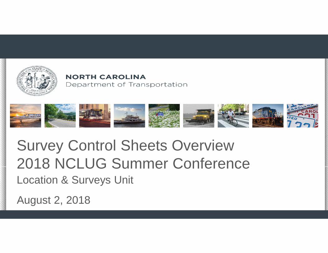
Survey Control Sheets Overview2018 NCLUG Summer ConferenceLocation & Surveys Unit
August 2, 2018

Introduction To NCDOT Plan Changes
• NCDOT Responsibilities (Chapter 89C)
• Issues raised by NCBEES & Surveying Industry Leaders concerning NCDOT plans
• New Legislation/Response (HB 501)
• Overview of Individual Sheets (C, D, E,R/W)
• Property Ties (located on R/W sheets)
2
3
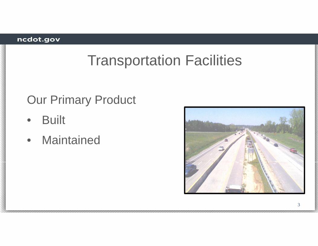
Transportation Facilities
Our Primary Product
• Built
• Maintained

4
Plan Sheets/ CADD Files Used By
•Geotech, Hydro, Biologists, etc.
•Tax Offices/GIS Departments
•City Planners
•Private Land Developers
•Other Engineers•Surveyors
•Attorneys
Our Other Products

5
• Not Just Engineering Plans
anymore
• Now Considered as
Documentation of Property
Purchases
• And Record of Destroyed Property Monumentation
Our Other Products

6
Chapter 89C. Engineering and Land Surveying § 89C-2. Declarations; prohibitionsIn order to safeguard life, health, and property, and to promote the public welfare, the practice of engineering and the practice of land surveying in this State are hereby declared to be subject to regulation in the public interest. It shall be unlawful for any person to practice or to offer to practice engineering or land surveying in this State, as defined in the provisions of this Chapter, or to use in connection with the person's name or otherwise assume or advertise any title or description tending to convey the impression that the person is either a professional engineer or a professional land surveyor, unless the person has been duly licensed. …
7
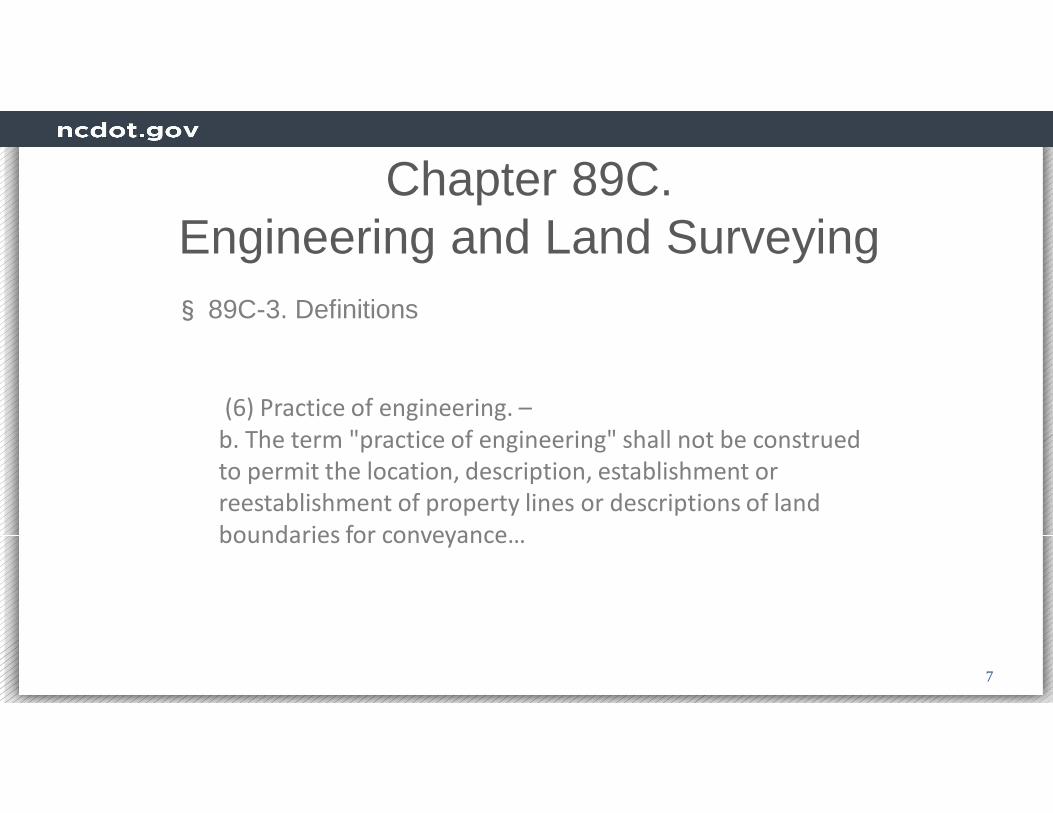
Chapter 89C. Engineering and Land Surveying
(6) Practice of engineering. –
b. The term "practice of engineering" shall not be construed
to permit the location, description, establishment or
reestablishment of property lines or descriptions of land
boundaries for conveyance…
§ 89C-3. Definitions

8
Chapter 89C. Engineering and Land Surveying
(7) Practice of land surveying. –1. Locating, relocating, establishing, laying out, or retracing any
property line, easement, or boundary of any tract of land; 2. Locating, relocating, establishing, or laying out the alignment or
elevation of any of the fixed works embraced within the practice of professional engineering;
3. Making any survey for the subdivision of any tract of land, including the topography, alignment and grades of streets and incidental drainage within the subdivision, and the preparation and perpetuation of maps, record plats, field note records, and property descriptions that represent these surveys;
§ 89C-3. Definitions

9
Chapter 89C. Engineering and Land Surveying
(7) Practice of land surveying. cont.4. Determining, by the use of the principles of land surveying, the position for
any survey monument or reference point, or setting, resetting, or replacing
any survey monument or reference point;
5. Determining the configuration or contour of the earth's surface or the
position of fixed objects on the earth's surface by measuring lines and
angles and applying the principles of mathematics or photogrammetry;
§ 89C-3. Definitions.

10
§ 89C-4. State Board of Examiners for Engineers and Surveyors; appointment; terms. A State Board of Examiners for Engineers and Surveyors, whose
duty it is to administer the provisions of this Chapter, is created.
The Board shall consist of four licensed professional engineers,
three licensed professional land surveyors and two public
members, who are neither professional engineers nor
professional land surveyors. ..
Chapter 89C. Engineering and Land Surveying

11
Chapter 89C. Engineering and Land Surveying
§ 89C-19. Public works; requirements where public safety involved. This State and its political subdivisions such as counties, cities, towns, or other political entities or legally constituted boards,… or officials, or employees of these entities shall not engage in the practice of engineering or land surveying involving either public or private property where the safety of the public is directly involved without the project being under the responsible charge of a professional engineer for engineering projects, or a professional land surveyor for land surveying projects, as provided for the practice of the respective professions by this Chapter.

12
Chapter 89C. Engineering and Land Surveying
§ 89C-19. Public works; requirements where public safety involved cont.Nothing in this section shall be construed to prohibit inspection, maintenance and service work done by employees of the State of North Carolina, any political subdivision of the State, or any municipality including construction, installation, servicing, and maintenance by regular full-time employees of, secondary roads and drawings incidental to work on secondary roads, streets, street lighting, traffic-control signals,…

13
NCBEES & Surveying Industry Leaders Issues concerning NCDOT plans
1. Lack of public availability of plans for NCDOT land acquisition.
2. Lack of metadata on plans, including coordinate system,
control points set, and closures.
3. Complexity of plans (readability, alignments).
4. Lack of consistency in locating, documenting, and
representing property boundaries.
5. Complexity of right of way deeds, based on station/offset.
6. Chain of responsible charge for the PLS doing
survey/mapping work.
7. Proper monumentation of the right of way (not part of the
committee discussion but as a result of conversation with
NCBEES).

14
Plan to Resolve IssuesAs a result of STRONG inquiries by NC Board of Examiners for Engineers and Land Surveyors (NCBEES) and the Survey Industry Leaders (NC Society of Surveyors), NCDOT formed a Survey Plans Committee:
Representatives from:
• Divisions• Right Of Way• Preconstruction• Design-Build• Attorney General’s Office• NCBELS (non-voting)
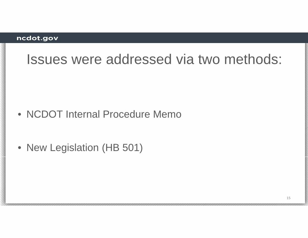
Issues were addressed via two methods:
• NCDOT Internal Procedure Memo
• New Legislation (HB 501)
15

Chief Engineer’s Memo
16
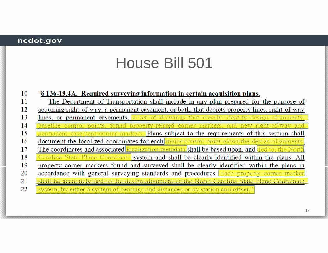
House Bill 501
17

18
Comments On Property
The NCDOT Surveyor’s Role is to establish the property line between Public and Privateownership, and to document:
• Location of Right Of Way (Bought or Borrowed)
• Evidence of Property Ownership we have used or destroyed
IT IS NOT OUR BUSINESS TO DETERMINE THE LOCATION OF PRIVATE PROPERTY LINES

19
Comments On PropertyProperty Overlap
A B
New R/W
Existing R/W

20
Comments On Property
A B
New R/W
Existing R/W
Why Don’t We Put In Property Corners?
XExisting EIP
Who does B sue?
Survey Control Sheets
• History of Control Sheets
• Overview of Individual Sheets
• Property Ties
21

Survey Control Sheets History
• 2003 Introduction
• 2010 Addition of R/W Tables
• 2017 Addition of R/W sheets
22

Survey Control SheetsControl Sheets Breakdown
• “C” Series (Survey Control and Existing Centerlines)
• “D” Series (Design Alignment Cardinal Stations)
• “E” Series (R/W and Easement Tables)
• “RW” Series (Modified Plan Sheets for Clarity)
• * Note: All Sheets will appear directly behind the Design Plan Sheets as a set.
23

“C” Series Sheets
• Survey Control and Existing Centerlines• Delivered with Full Surveys• Produced using …
– MicroStation
– “C” series border cell
– SurveyTable.ma– Other applications
24

CLEAR AND LEGIBLE

26

“D” Series Sheets
• Design Alignment Cardinal Stations• Coordinates for Cardinal Station• Produced using …
– MicroStation
– “D” series border cell
– RWTable.ma application for table
27

28
All Design Alignments With
Coordinates on Cardinal
Stations (PC, PT, etc.)

“E” Series Sheets
• R/W and Easement Tables• Signed and Sealed by PLS• Produced using …
– MicroStation
– “E” series border cell & Surveyors Seal
– RWTable.ma application– Surveyors Attestation from NCMAP-Loc
29
Signed and Sealed
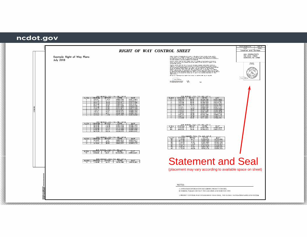
Statement and Seal(placement may vary according to available space on sheet)

31

“RW” Series Sheets
• Modified Plan Sheets for Clarity• Property Ties Now on RW Sheets• Produced from original plan sheets using
MicroStation filters and cell library • Each sheet matches area covered by
corresponding plan sheet (i.e. 4 = RW4)32
Signed and Sealed


Possible cell replacement to reflect Rebar and Cap

RW Sheets will always show Rebar and Cap set.

36
Map or Report of Survey
Table shows monuments
replaced or reset along with
the type of monument.

Property Ties
• Now located on R/W Sheets• Using information on “D” sheets, coordinates can
be easily computed.
37

**All Property Ties NOW Shown on RW Sheets - NOT On Plan Sheets

Easily Compute Coordinates For Any Property Corner
Start with cardinal station coordinate from D Sheet
Traverse along alignment to tie line point
Traverse along tie line (dashed line) to EIP to determine coordinates
Survey Control Sheets Review
• NCDOT Responsibilities (Chapter 89C)
• New Legislation/Response (HB 501)
• Overview of Individual Sheets (C, D, E,R/W)
• Property Ties (located on R/W sheets)
40

Questions/Discussion
41


![Goodbye Summer! Ukulele Jam Sheets - Meetupfiles.meetup.com/1821363/GoodBye To Summer Jam.pdfGoodbye Summer!Ukulele Jam Sheets. ... Chh chh-chh, uh (same chords as verse) In the [C]](https://img.pdfslide.net/doc/110x75/5ad3e06d7f8b9a665f8e560e/goodbye-summer-ukulele-jam-sheets-to-summer-jampdfgoodbye-summerukulele-jam.jpg)