Embed Size (px)
Citation preview

Susan Holdsworth (EPA) and Gary Rowe (USGS) October 27, 2015
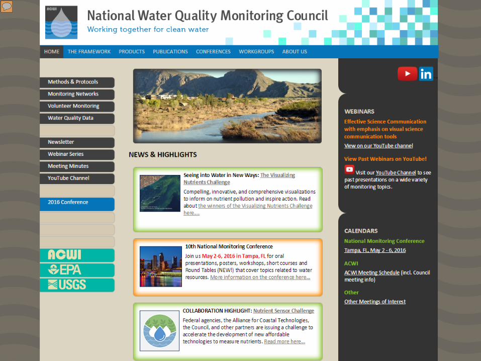
Bring together diverse expertise-- our membership and the broader community collecting and using water quality data
Develop collaborative, comparable, and cost-effective approaches for monitoring and assessing the Nation’s waters– our workgroups’ mission and project objectives
Support successful management and sustainability of our waters– our intended outcome

Federal Agencies ◦ USEPA, USGS, NOAA, USDA (NRCS, USFS), USFWS, NPS, TVA,
and USCOE States and Tribes ◦ States representing USEPA Regions 1-10 (current states include NH,
NJ, VA, SC, MN, OK, IA, UT, CA, OR) ◦ National Tribal Council (Fond du Lack Band of Lake Superior
Chippewa) Other Interests ◦ Professional Organizations: ACWA, NACWA, NALMS, AASG, WEF,
NCASI, ◦ Interstate Organizations: ORSANCO, Great Lakes region, Gulf of
Mexico Alliance ◦ Academia: ASLO, CUAHSI

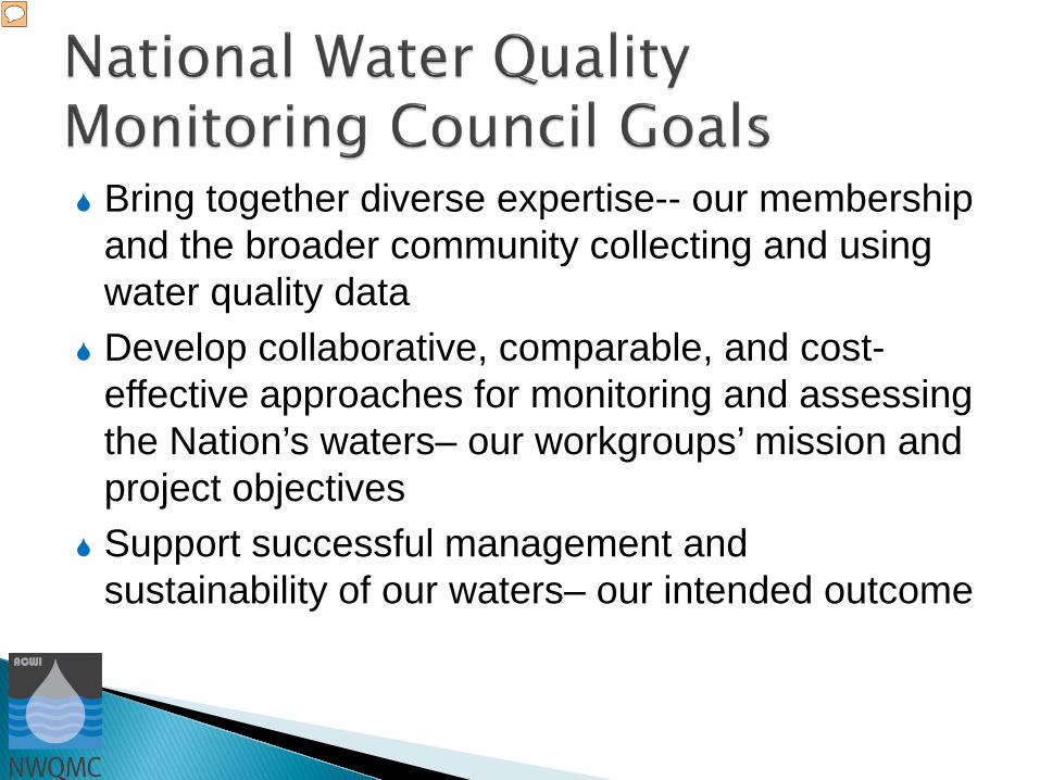
Methods and Data Comparability Board • Dan Sullivan (USGS), April Dupre (USEPA)
o Aquatic Sensor Workgroup • Dan Sullivan (USGS), Chuck Dvorsky (TCEQ)
Water Information Strategies Workgroup • Mary Skopec (IA DNR), second co-chair vacant
o Water Quality Portal Team • Charles Kovatch (USEPA), Jim Kreft (USGS)
National Network of Reference Watersheds • Mike McHale, Bill Wilber (both USGS)
National Monitoring Network for Coastal Waters • Hugh Sullivan (USEPA), Dennis Apeti (NOAA)
Collaboration and Outreach (C&O) Workgroup • Danielle Donkersloot (NJ DEP), Candice Hopkins (USGS)
Conference Planning Committee • Alice Mayio (USEPA), Jeff Schloss (NALMS), Callie Oberlin (USGS)
Volunteer Monitoring and Citizen Science Workgroup • Danielle Donkersloot (NJ DEP), Alice Mayio (USEPA), Barb Horn

National Monitoring Conference (held biennially) Water Quality Portal National Environmental Methods Index Statistical Methods option for NEMI Coordination with volunteer monitoring groups,
and State, Regional and Tribal Councils, National Network of Reference Watersheds National Monitoring Network for Coastal Waters Newsletter and webinars Fact Sheets, Technical Reports and White Papers
on Monitoring Issues
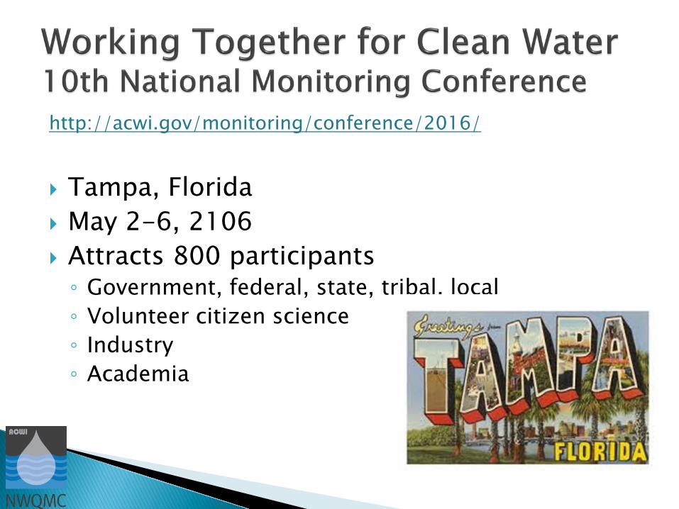
http://acwi.gov/monitoring/conference/2016/
Tampa, Florida May 2-6, 2106 Attracts 800 participants ◦ Government, federal, state, tribal, local ◦ Volunteer citizen science ◦ Industry ◦ Academia

Designs for the 21st Century Connecting Coastal to Freshwater Ecosystems Innovations in Monitoring and Assessment Identifying and Assessing Emerging Risks Effectiveness of Management Actions Managing, Sharing, Communicating, and
Mining Data Building Collaborations Assessing Trends in Water Resources
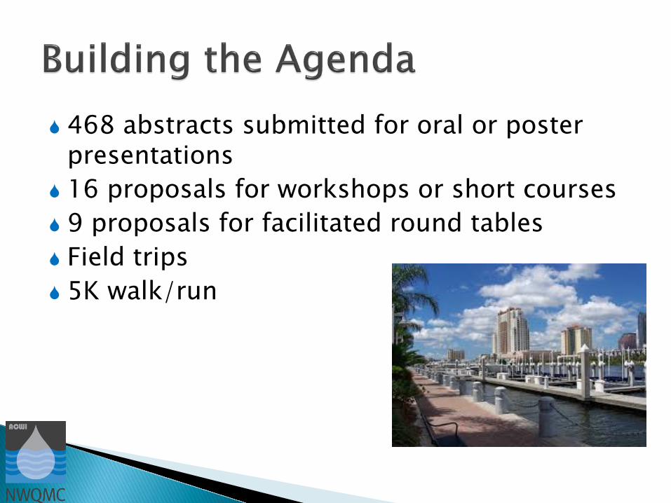
468 abstracts submitted for oral or poster presentations
16 proposals for workshops or short courses 9 proposals for facilitated round tables Field trips 5K walk/run

The Council is currently accepting nominations for: Elizabeth J. Fellows Award ◦ Outstanding achievement ◦ Exemplary service ◦ Distinguished leadership
Barry A. Long Award ◦ Exceptional perserverance ◦ Positive spirit ◦ Significant contributions
Vision Award for a council or group Nominations due: January 31, 2016
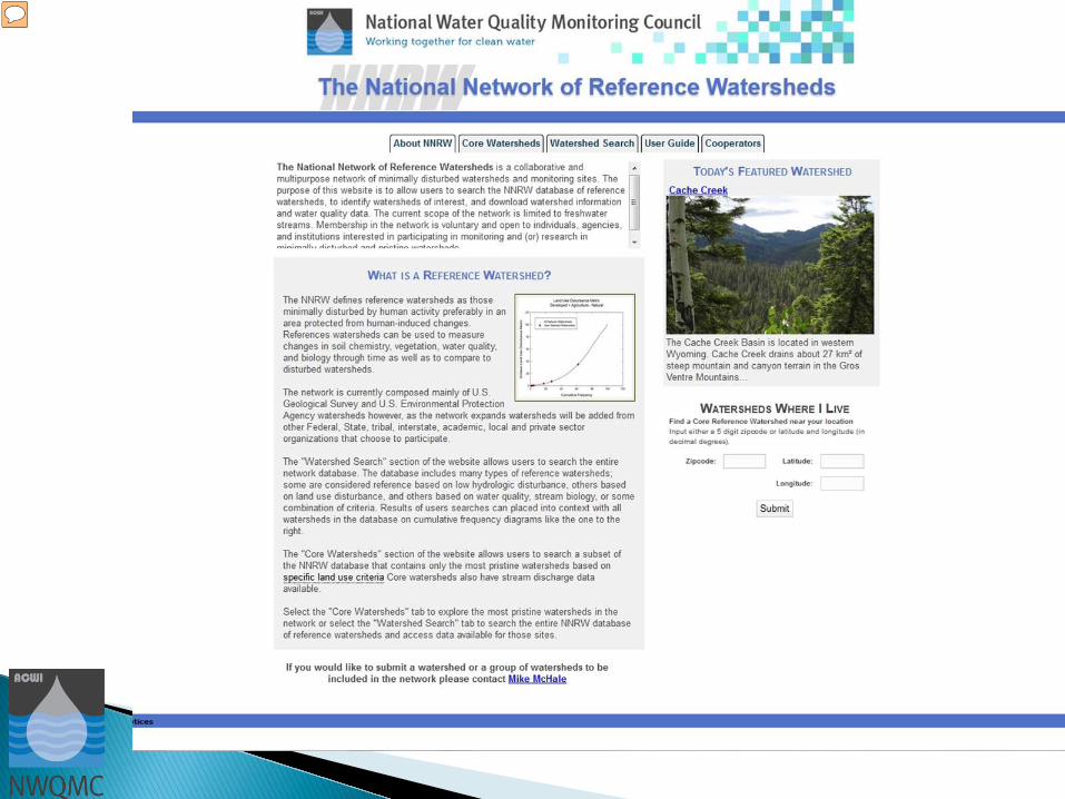
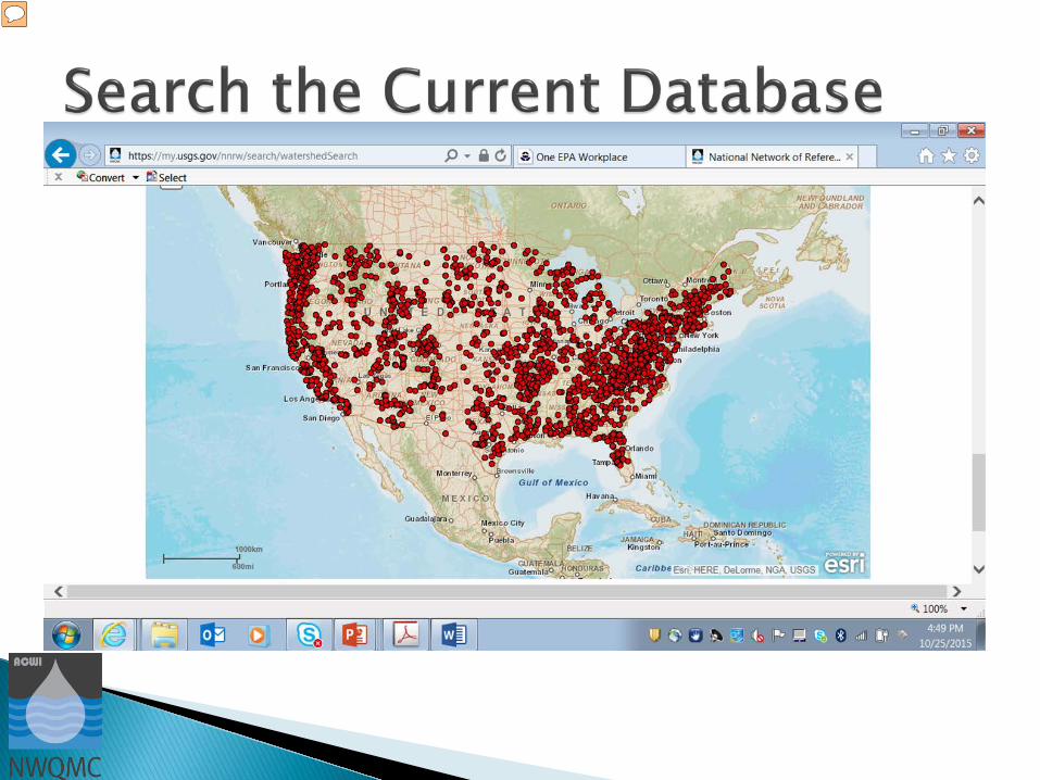
Assist with establishing “background” conditions for select hydrologic variables and water-quality
Provide access to data and information of documented quality for minimally or least disturbed watersheds
Increase the efficiency of monitoring through opportunities to leverage existing reference sites, networks, and financial resources


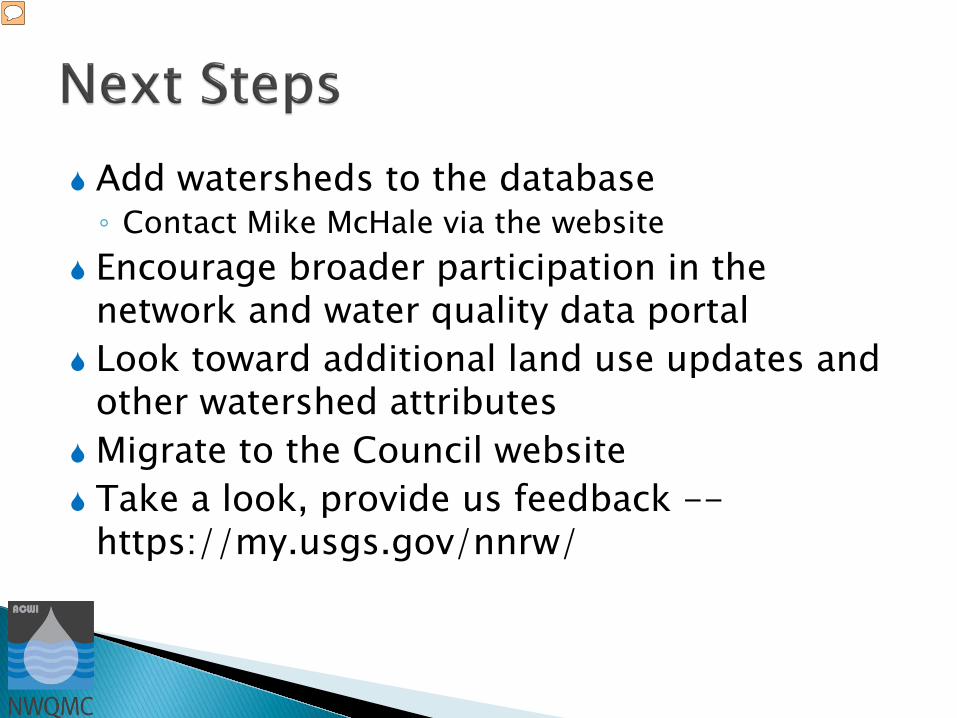
Add watersheds to the database ◦ Contact Mike McHale via the website
Encourage broader participation in the network and water quality data portal
Look toward additional land use updates and other watershed attributes
Migrate to the Council website Take a look, provide us feedback --
https://my.usgs.gov/nnrw/
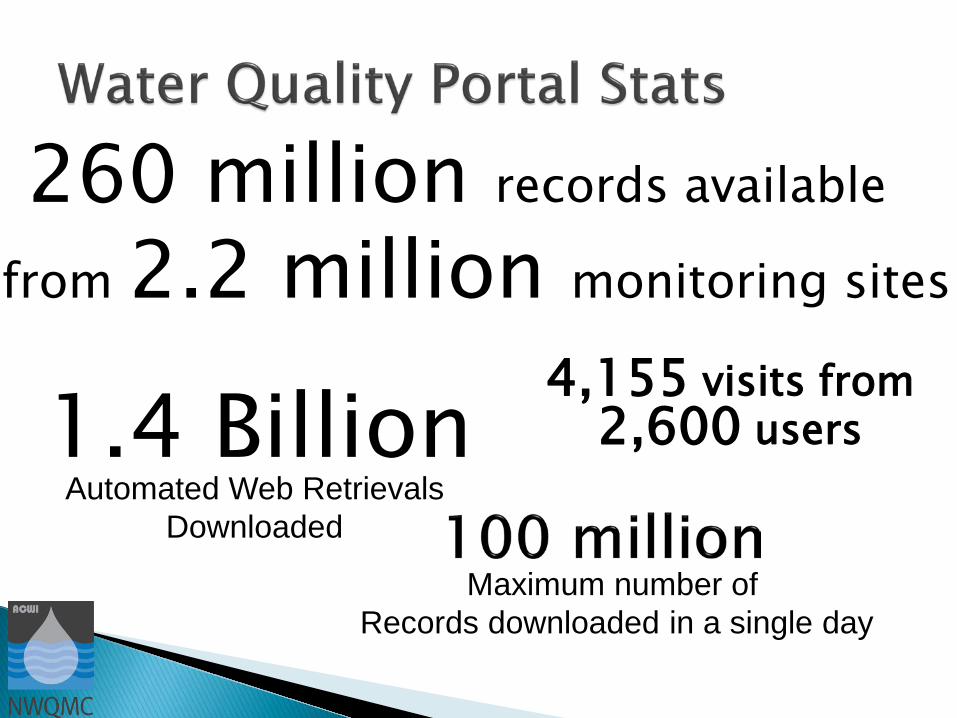
Automated Web Retrievals Downloaded
1.4 Billion 4,155 visits from 2,600 users
Maximum number of Records downloaded in a single day
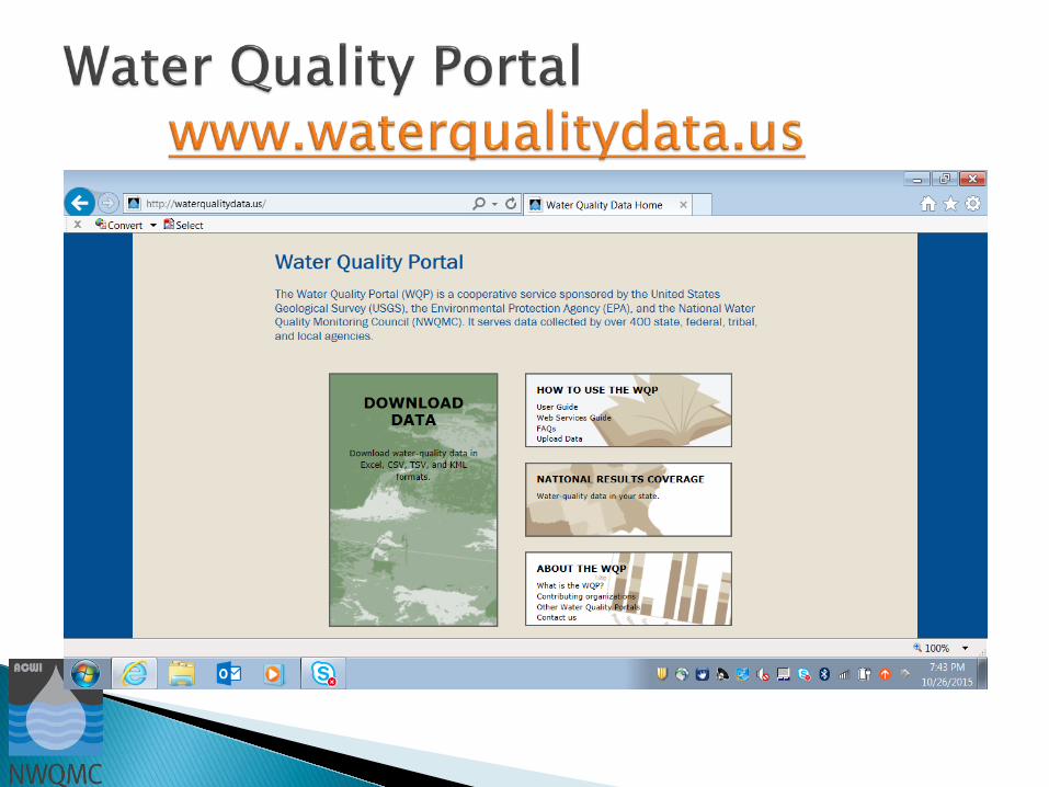
260 million records available
from 2.2 million monitoring sites
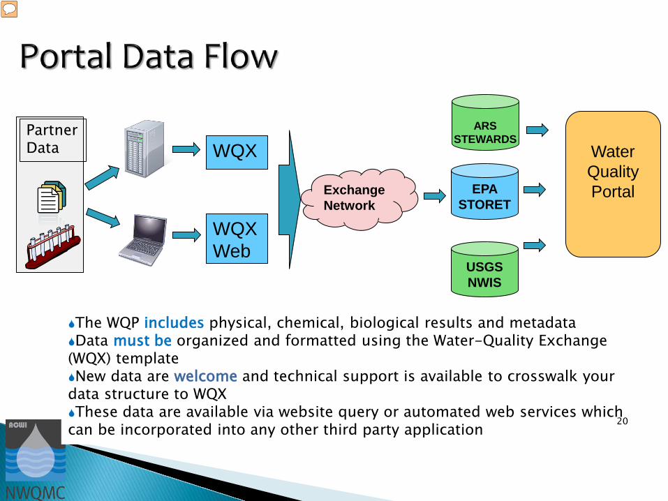
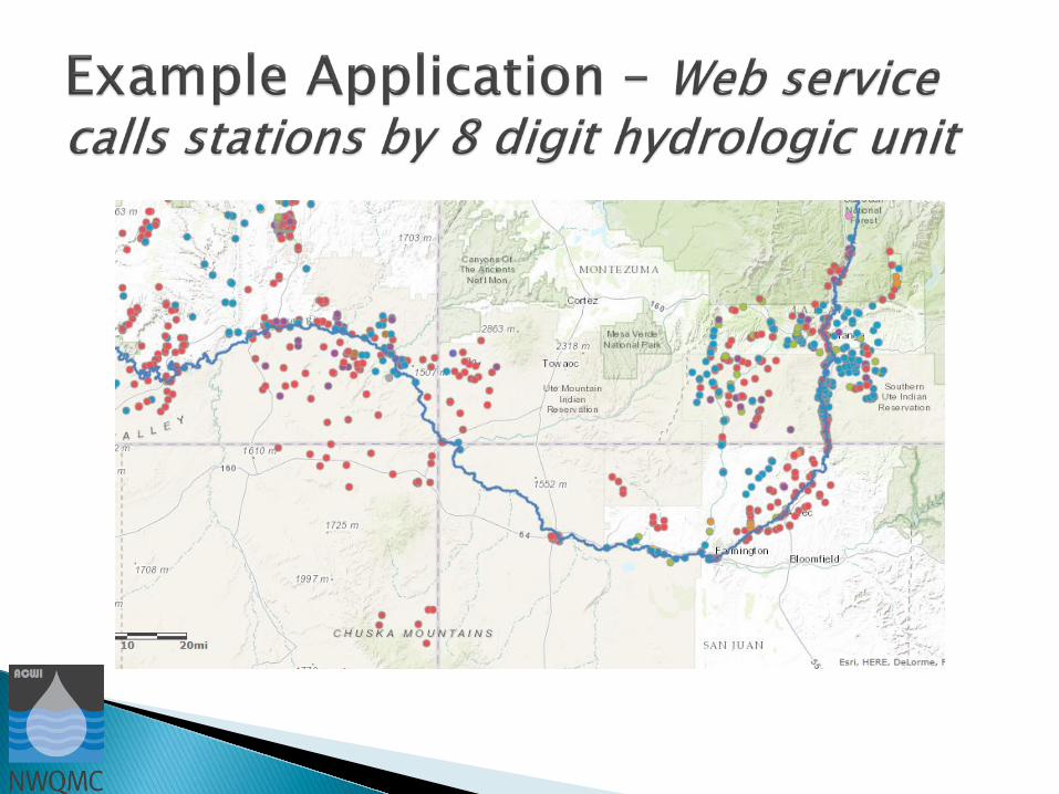
The WQP includes physical, chemical, biological results and metadata Data must be organized and formatted using the Water-Quality Exchange (WQX) template New data are welcome and technical support is available to crosswalk your data structure to WQX These data are available via website query or automated web services which can be incorporated into any other third party application 20
WQX
WQX Web
Exchange Network
EPA STORET
Partner Data
USGS NWIS
Water Quality Portal
ARS STEWARDS


Strategy
Status
Outreach
Data Display
Data Quantity and Quality
System Performance
Internal
Current Customers
New Customers & Internal Growth
Shareholders
USEPA Co-Chair: Susan Holdsworth: [email protected]
USGS Co-Chair: Gary Rowe [email protected]
Council Executive Secretary: Candice Hopkins [email protected]
Council website: http://acwi.gov/monitoring/
Water Quality Portal: http://www.waterqualitydata.us/
Council Workgroup websites: http://acwi.gov/monitoring/workgroups/