Embed Size (px)
Citation preview

1
TAMU-CC UAS Program
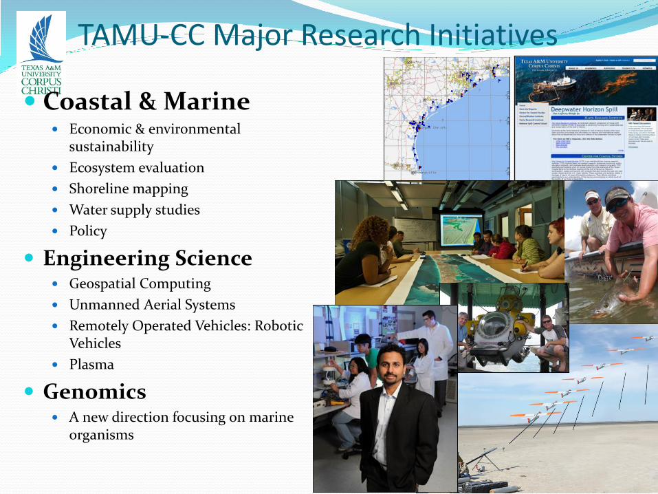
TAMU-CC Major Research Initiatives
Coastal & Marine Economic & environmental
sustainability
Ecosystem evaluation
Shoreline mapping
Water supply studies
Policy
Engineering Science Geospatial Computing
Unmanned Aerial Systems
Remotely Operated Vehicles: Robotic Vehicles
Plasma
Genomics A new direction focusing on marine
organisms
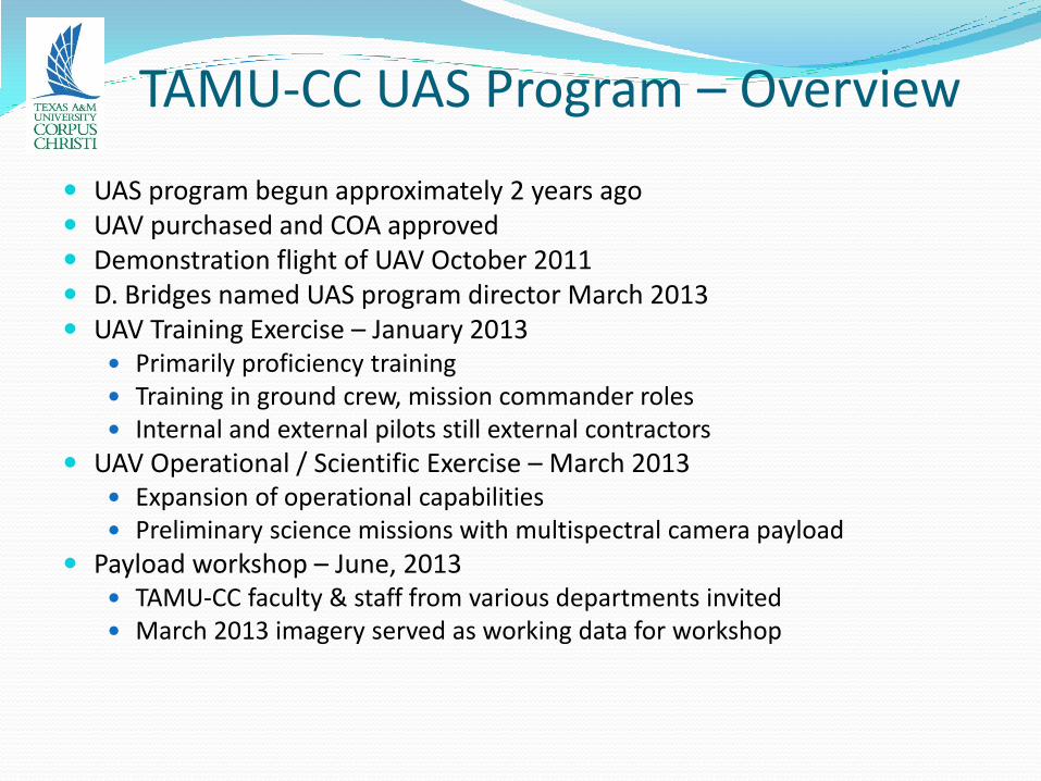
TAMU-CC UAS Program – Overview
UAS program begun approximately 2 years ago UAV purchased and COA approved Demonstration flight of UAV October 2011 D. Bridges named UAS program director March 2013 UAV Training Exercise – January 2013
Primarily proficiency training Training in ground crew, mission commander roles Internal and external pilots still external contractors
UAV Operational / Scientific Exercise – March 2013 Expansion of operational capabilities Preliminary science missions with multispectral camera payload
Payload workshop – June, 2013 TAMU-CC faculty & staff from various departments invited March 2013 imagery served as working data for workshop

TAMU-CC UAS Program – UAV
American Aerospace Advisors, Inc. RS-16 UAV
Wingspan 12' 11"
MGTW 85 lbs
Endurance 12-16 hrs
Ceiling 15,000'
Max Speed 65 kts
Payload Envelope 6 x 6 x 20.5"
Payload Capacity 25 lbs
Payload Power 100 watts
Launch Pneumatic Catapult
Recovery Belly Land
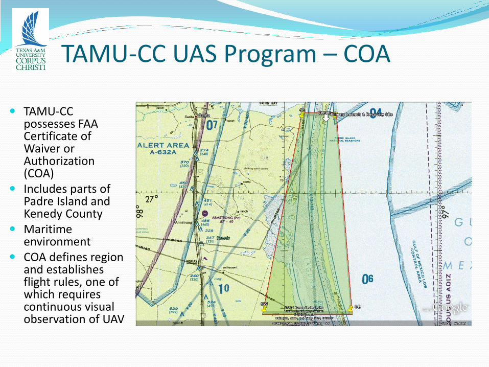
TAMU-CC UAS Program – COA
TAMU-CC possesses FAA Certificate of Waiver or Authorization (COA)
Includes parts of Padre Island and Kenedy County
Maritime environment
COA defines region and establishes flight rules, one of which requires continuous visual observation of UAV
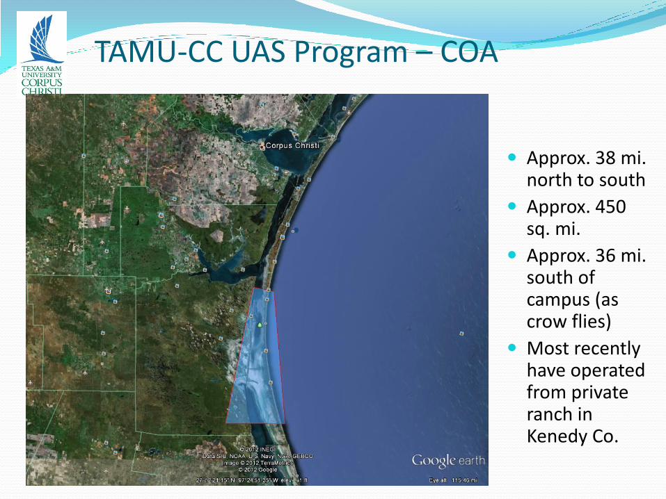
TAMU-CC UAS Program – COA
Approx. 38 mi. north to south
Approx. 450 sq. mi.
Approx. 36 mi. south of campus (as crow flies)
Most recently have operated from private ranch in Kenedy Co.
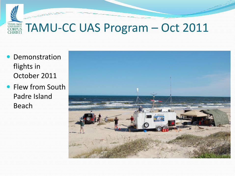
TAMU-CC UAS Program – Oct 2011
Demonstration flights in October 2011
Flew from South Padre Island Beach
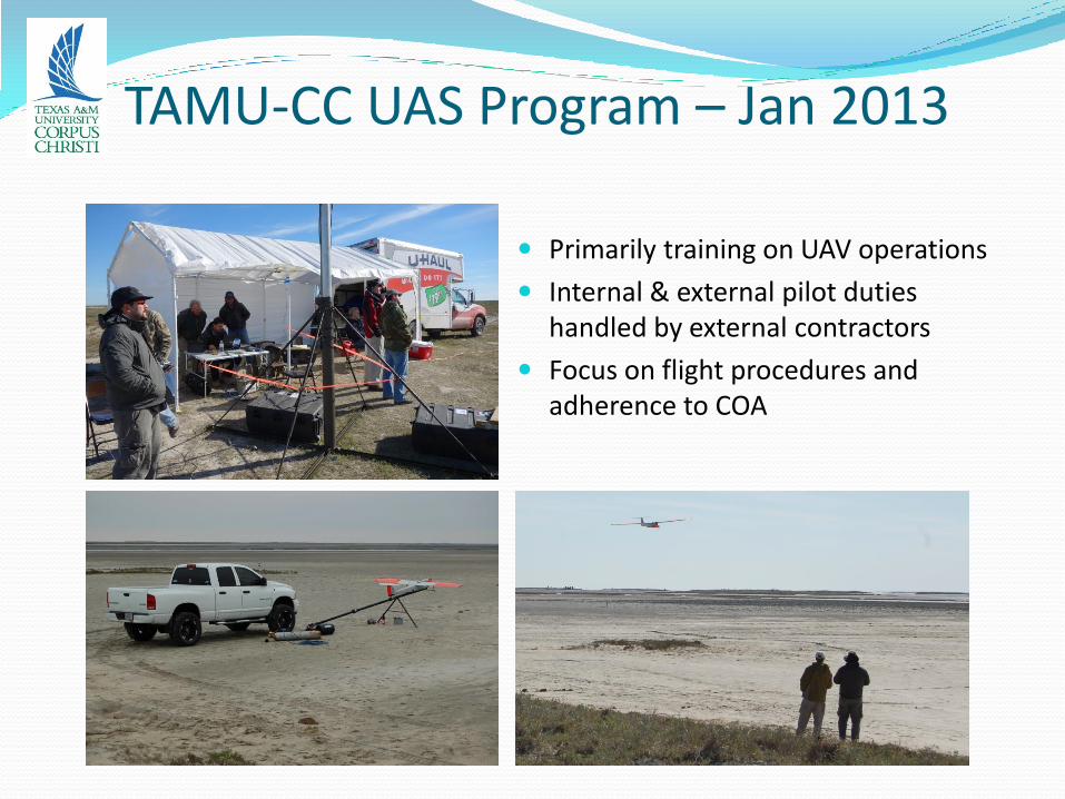
TAMU-CC UAS Program – Jan 2013
Primarily training on UAV operations
Internal & external pilot duties handled by external contractors
Focus on flight procedures and adherence to COA
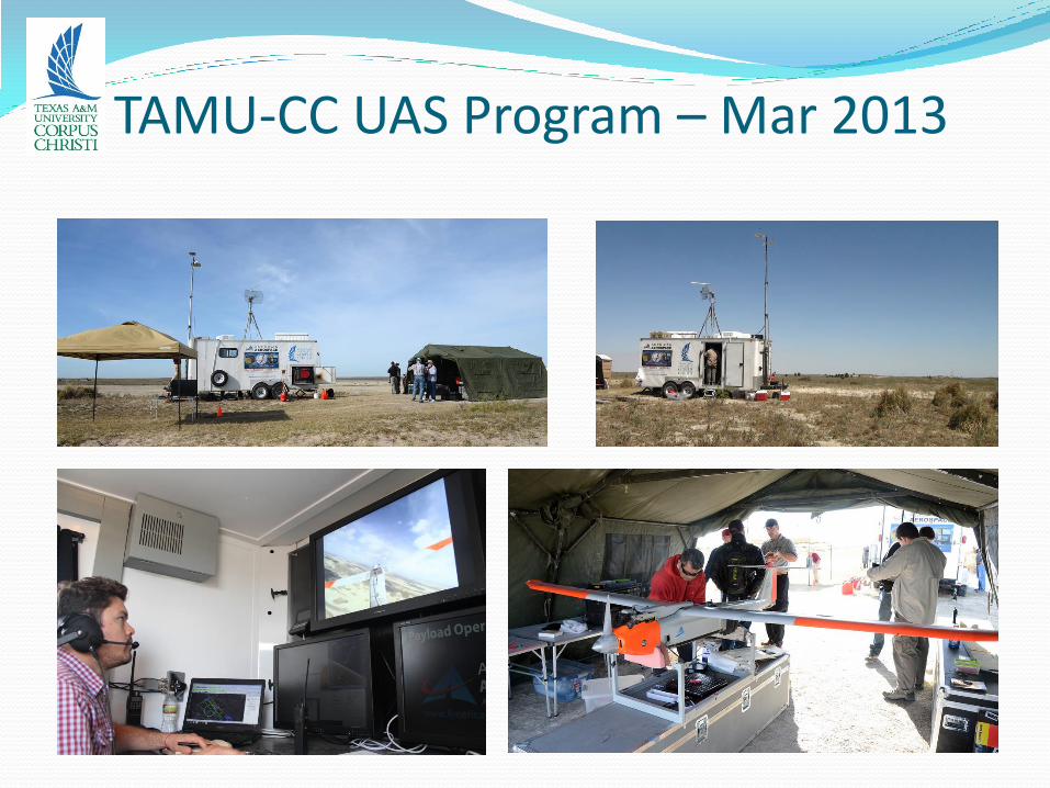
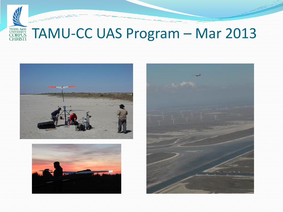
TAMU-CC UAS Program – Mar 2013
Primary purposes: to expand operational capabilities and to conduct scientific image data acquisition
Operational capabilities Airborne observer (use of chase plane)
Hand-off from one ground control station (GCS) to another
Expansion of range to enable Gulf overflights
Pre-dawn launch
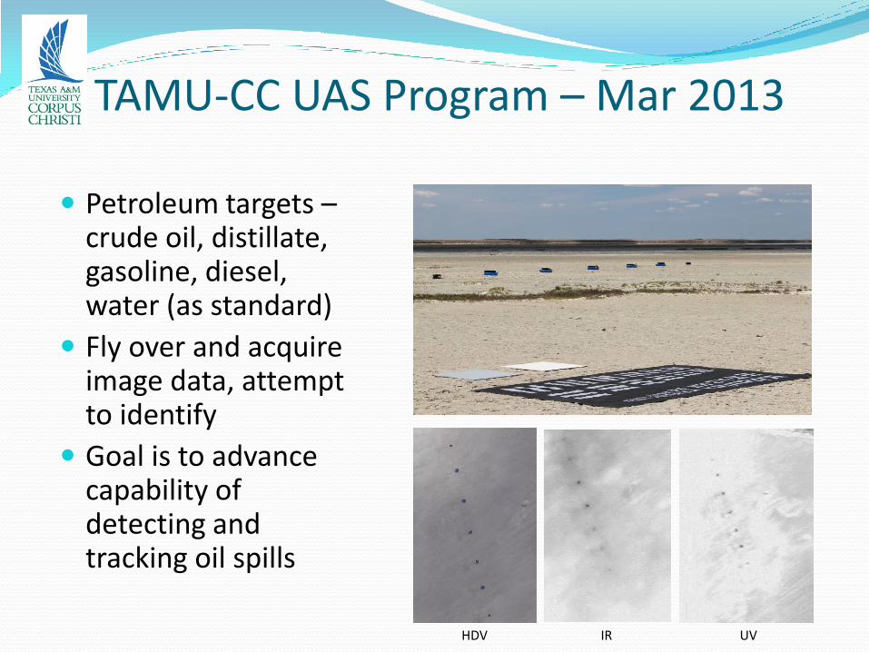
Scientific missions Use of multi-spectral camera payload (high-definition video,
infrared, ultraviolet)
Acquire images of petroleum products, sea grass, cattle, land-water interface, shore-bird habitat for use by various researchers

TAMU-CC UAS Program – Mar 2013
Multi-spectral camera payload
On-board computer tags each image with time and location using on-board GPS and inertial navigation system (INS)
TAMU-CC UAS Program – Mar 2013
TAMU-CC UAS Program – Mar 2013
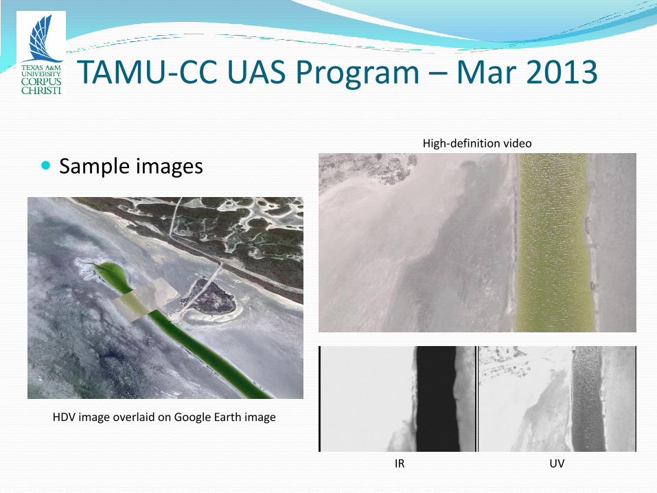
TAMU-CC UAS Program – Mar 2013
Sample images High-definition video
IR UV
HDV image overlaid on Google Earth image
TAMU-CC UAS Program – Mar 2013
Petroleum targets – crude oil, distillate, gasoline, diesel, water (as standard)
Fly over and acquire image data, attempt to identify
Goal is to advance capability of detecting and tracking oil spills
IR UV HDV
TAMU-CC UAS Program – Current and Future Plans
Beginning planning for next exercise, date TBD
Effort to develop capabilities in sensor development, will target (to degree possible) sensors that will assist in “sense and avoid”
Development of 3-course UAS curriculum track for undergraduates
TAMU-CC UAS Program – Opportunities for Collaboration
UAV and payload capabilities known
Geography / terrain of COA known
Can acquire image data; other payloads ?
Limited extent of COA suggests development of sensors, technologies, methods now that can be applied elsewhere when limitations are lifted
Funding – some questions still to be answered concerning allowed funding sources (in context of interpretation of what constitutes “commercial use,” which is forbidden)
In some circumstances, may be able to provide sample image data acquired while exercising UAV capabilities (“free data”)
Contact Dr. David Bridges, [email protected]
The Lone Star UAS Center of Excellence
Congress mandated that the FAA select 6 test sites for UAS development; specifically, integration of UAS into national airspace (NAS)
Primary issue with UAS: they lack “sense and avoid” capability
Manned aircraft avoid collisions by seeing other aircraft and turning out of the way (“see and avoid”)
Goal of test sites is to develop sense and avoid technologies for UAS and to develop policies and procedures that will allow their integration and safe use alongside manned aircraft
FAA issued a “Screening Information Request” (SIR), their form of an RFP
The Lone Star UAS Center of Excellence
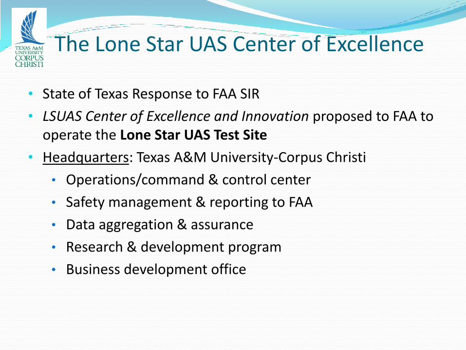
• State of Texas Response to FAA SIR
• LSUAS Center of Excellence and Innovation proposed to FAA to operate the Lone Star UAS Test Site
• Headquarters: Texas A&M University-Corpus Christi
• Operations/command & control center
• Safety management & reporting to FAA
• Data aggregation & assurance
• Research & development program
• Business development office
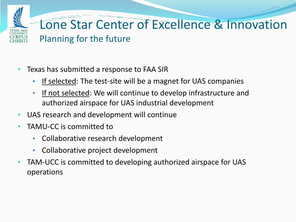
Lone Star Center of Excellence & Innovation Planning for the future
• Texas has submitted a response to FAA SIR
• If selected: The test-site will be a magnet for UAS companies
• If not selected: We will continue to develop infrastructure and authorized airspace for UAS industrial development
• UAS research and development will continue
• TAMU-CC is committed to
• Collaborative research development
• Collaborative project development
• TAM-UCC is committed to developing authorized airspace for UAS operations