Embed Size (px)
Citation preview
Teesside Archaeological Society Bulletin 21, 2017
1
First World War
RECORDING
PROJECT
OUR THANKS TO THE HERITAGE LOTTERY FUND, FOR FUNDING THIS PROJECT
Teesside Archaeological Society Bulletin 21, 2017
2
Recording The Legacy Of The Tees Valley In The First World War
Dave Errickson Chair, Teesside Archaeological Society
It is well known that during the First World War much of the war effort was
happening in continental Europe. However, what is often underestimated is the
amount of effort that was undertaken on home soil.
In the North East alone there was a considerable amount of strengthening with
regards to defending the area. For example, land was requisitioned for training the
home guard, houses were requisitioned for barracks, and airfields and mobile gun batteries were created. In fact,
over 250 pieces of land in the Tees Valley area (Middlesbrough, Redcar and Cleveland, Stockton, and Hartlepool)
were known to have been utilised for this very effort.
The War Office was a department within the British Government that was responsible for the administration of the
British Army. As a part of their administrative duty, the War Office (now the Ministry of Defence) held lists of these
buildings detailing their location and their use throughout the First World War. Recently, these buildings have been
released to the public.
Although these buildings have now been released, the status of many of these buildings is currently unknown, and
in some cases may not still remain. Yet, it is critical to appreciate the impact of these historical landmarks in a time
of an ever-changing landscape. Therefore, what is left must be documented. As a result, Teesside Archaeological
Society has acquired funding from the Heritage Lottery Fund to document all the buildings and sites associated with
the home front legacy within the First World War in the Tees Valley area.
The Project
The overall aim of this project is to determine the current state of buildings that were extant during the First World
War and understand their involvement throughout this period. This will give an everlasting legacy to the Home
Front in the Tees Valley area, even if it is through the means of written and photographic documentation long after
these bastions of excellence have been modified or demolished.
Recording this heritage allows individuals to visualise these buildings from across the world. This project is also
attempting to broaden outreach ‘internationally’ by using social media and online resources. Hopefully by doing so,
this can inspire, specifically the younger generation, but also educate people about a history that must not be
forgotten.
The results of this project will be published through the production of a booklet. It is intended that the booklet will
include a short summary of each building accompanied by a photograph and any additional relevant information.
We intend to create a series of guided walks which can be found in the events section of this bulletin and a blog
which can be found on the Teesside Archaeological Society website.
Recorded sites
The project has only just begun, yet we have already had two excellently attended workshops. Furthermore,
volunteers have started to document these buildings and areas of land. The following are a few examples of sites
that have been documented by our volunteers.
The Legacy
It is now the 100 -year anniversary of the First World War. A few months into this project and it has already become
apparent that many of these buildings no longer exist, or important areas of land have been redeveloped. This
means that the physical evidence has been lost. Our past is entwined with this period of history and the war effort
should always be remembered. This project gives us a platform that allows us to create lasting memories, but also
allows us to document the importance of the Tees Valley in the war effort.
Teesside Archaeological Society Bulletin 21, 2017
3
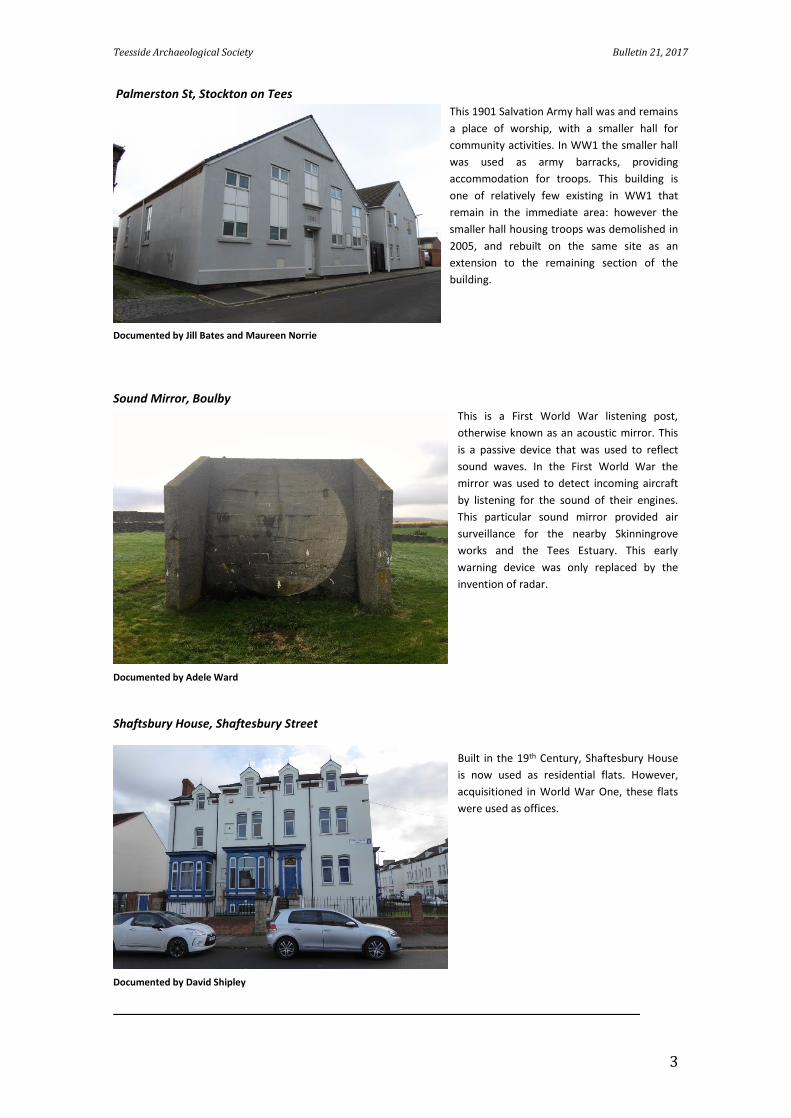
Palmerston St, Stockton on Tees
This 1901 Salvation Army hall was and remains
a place of worship, with a smaller hall for
community activities. In WW1 the smaller hall
was used as army barracks, providing
accommodation for troops. This building is
one of relatively few existing in WW1 that
remain in the immediate area: however the
smaller hall housing troops was demolished in
2005, and rebuilt on the same site as an
extension to the remaining section of the
building.
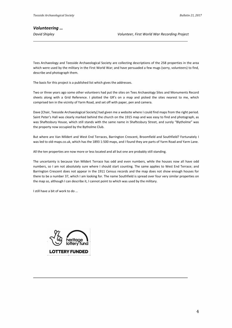
Sound Mirror, Boulby
This is a First World War listening post,
otherwise known as an acoustic mirror. This
is a passive device that was used to reflect
sound waves. In the First World War the
mirror was used to detect incoming aircraft
by listening for the sound of their engines.
This particular sound mirror provided air
surveillance for the nearby Skinningrove
works and the Tees Estuary. This early
warning device was only replaced by the
invention of radar.
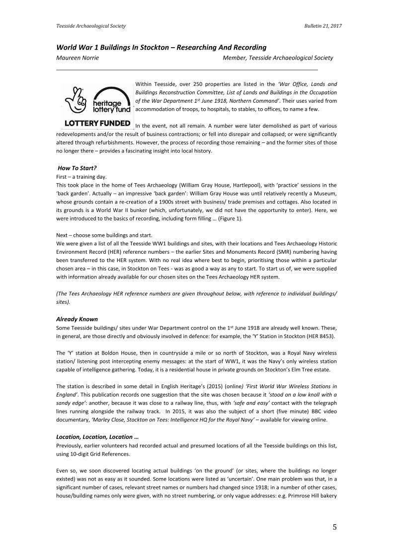
Shaftsbury House, Shaftesbury Street
Built in the 19th Century, Shaftesbury House
is now used as residential flats. However,
acquisitioned in World War One, these flats
were used as offices.
Documented by Jill Bates and Maureen Norrie
Documented by Adele Ward
Documented by David Shipley
Teesside Archaeological Society Bulletin 21, 2017
4
Volunteering …
David Shipley Volunteer, First World War Recording Project
Tees Archaeology and Teesside Archaeological Society are collecting descriptions of the 258 properties in the area
which were used by the military in the First World War; and have persuaded a few mugs (sorry, volunteers) to find,
describe and photograph them.
The basis for this project is a published list which gives the addresses.
Two or three years ago some other volunteers had put the sites on Tees Archaeology Sites and Monuments Record
sheets along with a Grid Reference. I plotted the GR’s on a map and picked the sites nearest to me, which
comprised ten in the vicinity of Yarm Road, and set off with paper, pen and camera.
Dave [Chair, Teesside Archaeological Society] had given me a website where I could find maps from the right period.
Saint Peter’s Hall was clearly marked behind the church on the 1915 map and was easy to find and photograph, as
was Shaftesbury House, which still stands with the same name in Shaftesbury Street, and surely “Blytholme” was
the property now occupied by the Bytholme Club.
But where are Van Mildert and West End Terraces, Barrington Crescent, Broomfield and Southfield? Fortunately I
was led to old-maps.co.uk, which has the 1893 1:500 maps, and I found they are parts of Yarm Road and Yarm Lane.
All the ten properties are now more or less located and all but one are probably still standing.
The uncertainty is because Van Mildert Terrace has odd and even numbers, while the houses now all have odd
numbers, so I am not absolutely sure where I should start counting. The same applies to West End Terrace; and
Barrington Crescent does not appear in the 1911 Census records and the map does not show enough houses for
there to be a number 37, which I am looking for. The name Southfield is spread over four very similar properties on
the map so, although I can describe it, I cannot point to which was used by the military.
I still have a bit of work to do …
Teesside Archaeological Society Bulletin 21, 2017
5
World War 1 Buildings In Stockton – Researching And Recording
Maureen Norrie Member, Teesside Archaeological Society
Within Teesside, over 250 properties are listed in the ‘War Office, Lands and
Buildings Reconstruction Committee, List of Lands and Buildings in the Occupation
of the War Department 1st June 1918, Northern Command’. Their uses varied from
accommodation of troops, to hospitals, to stables, to offices, to name a few.
In the event, not all remain. A number were later demolished as part of various
redevelopments and/or the result of business contractions; or fell into disrepair and collapsed; or were significantly
altered through refurbishments. However, the process of recording those remaining – and the former sites of those
no longer there – provides a fascinating insight into local history.
How To Start?
First – a training day.
This took place in the home of Tees Archaeology (William Gray House, Hartlepool), with ‘practice’ sessions in the
‘back garden’. Actually – an impressive ‘back garden’: William Gray House was until relatively recently a Museum,
whose grounds contain a re-creation of a 1900s street with business/ trade premises and cottages. Also located in
its grounds is a World War II bunker (which, unfortunately, we did not have the opportunity to enter). Here, we
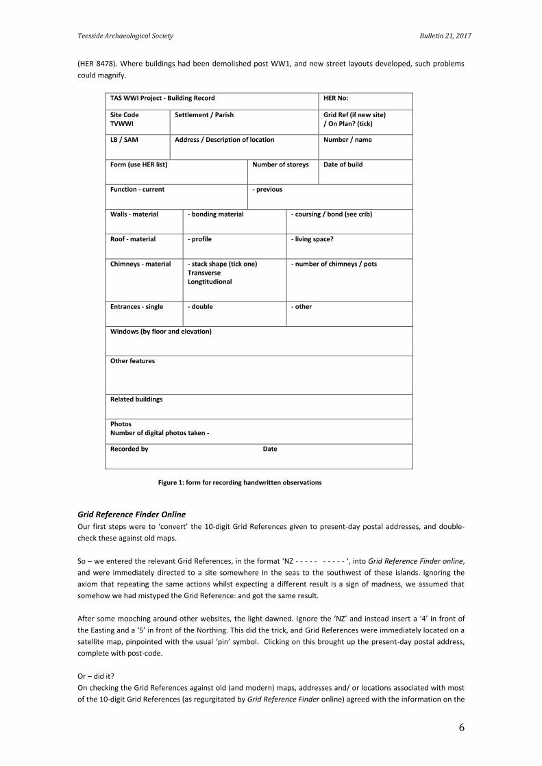
were introduced to the basics of recording, including form filling … (Figure 1).
Next – choose some buildings and start.
We were given a list of all the Teesside WW1 buildings and sites, with their locations and Tees Archaeology Historic
Environment Record (HER) reference numbers – the earlier Sites and Monuments Record (SMR) numbering having
been transferred to the HER system. With no real idea where best to begin, prioritising those within a particular
chosen area – in this case, in Stockton on Tees - was as good a way as any to start. To start us of, we were supplied
with information already available for our chosen sites on the Tees Archaeology HER system.
(The Tees Archaeology HER reference numbers are given throughout below, with reference to individual buildings/
sites).
Already Known
Some Teesside buildings/ sites under War Department control on the 1st June 1918 are already well known. These,
in general, are those directly and obviously involved in defence: for example, the ‘Y’ Station in Stockton (HER 8453).
The ‘Y’ station at Boldon House, then in countryside a mile or so north of Stockton, was a Royal Navy wireless
station/ listening post intercepting enemy messages: at the start of WW1, it was the Navy’s only wireless station
capable of intelligence gathering. Today, it is a residential house in private grounds on Stockton’s Elm Tree estate.
The station is described in some detail in English Heritage’s (2015) (online) ‘First World War Wireless Stations in
England’. This publication records one suggestion that the site was chosen because it ‘stood on a low knoll with a
sandy edge’: another, because it was close to a railway line, thus, with ‘safe and easy’ contact with the telegraph
lines running alongside the railway track. In 2015, it was also the subject of a short (five minute) BBC video
documentary, ‘Marley Close, Stockton on Tees: Intelligence HQ for the Royal Navy’ – available for viewing online.
Location, Location, Location …
Previously, earlier volunteers had recorded actual and presumed locations of all the Teesside buildings on this list,
using 10-digit Grid References.
Even so, we soon discovered locating actual buildings ‘on the ground’ (or sites, where the buildings no longer
existed) was not as easy as it sounded. Some locations were listed as ‘uncertain’. One main problem was that, in a
significant number of cases, relevant street names or numbers had changed since 1918; in a number of other cases,
house/building names only were given, with no street numbering, or only vague addresses: e.g. Primrose Hill bakery
Teesside Archaeological Society Bulletin 21, 2017
6
(HER 8478). Where buildings had been demolished post WW1, and new street layouts developed, such problems
could magnify.
TAS WWI Project - Building Record HER No:
Site Code TVWWI
Settlement / Parish Grid Ref (if new site) / On Plan? (tick)
LB / SAM Address / Description of location Number / name
Form (use HER list) Number of storeys Date of build
Function - current - previous
Walls - material - bonding material - coursing / bond (see crib)
Roof - material - profile - living space?
Chimneys - material - stack shape (tick one) Transverse Longtitudional Longitudinal
- number of chimneys / pots
Entrances - single - double - other
Windows (by floor and elevation)
Other features
Related buildings
Photos Number of digital photos taken -
Recorded by Date
Figure 1: form for recording handwritten observations
Grid Reference Finder Online
Our first steps were to ‘convert’ the 10-digit Grid References given to present-day postal addresses, and double-
check these against old maps.
So – we entered the relevant Grid References, in the format ‘NZ - - - - - - - - - - ‘, into Grid Reference Finder online,
and were immediately directed to a site somewhere in the seas to the southwest of these islands. Ignoring the
axiom that repeating the same actions whilst expecting a different result is a sign of madness, we assumed that
somehow we had mistyped the Grid Reference: and got the same result.
After some mooching around other websites, the light dawned. Ignore the ‘NZ’ and instead insert a ‘4’ in front of
the Easting and a ‘5’ in front of the Northing. This did the trick, and Grid References were immediately located on a
satellite map, pinpointed with the usual ‘pin’ symbol. Clicking on this brought up the present-day postal address,
complete with post-code.
Or – did it?
On checking the Grid References against old (and modern) maps, addresses and/ or locations associated with most
of the 10-digit Grid References (as regurgitated by Grid Reference Finder online) agreed with the information on the
Teesside Archaeological Society Bulletin 21, 2017
7
maps. A few discrepancies, however, appeared, wherein addresses produced by Grid Reference Finder related to
the house or building next door or across the street. Where the location of the building in question was given on the
relevant forms as ‘uncertain’ or ‘unknown’, this rendered a 10-digit Grid Reference, accurate to within 10 meters,
irrelevant: nevertheless, a 10-digit Grid Reference (with which we either agreed or did not agree) was included.
Old Maps – The Online Repository Of Historic Maps [Online]
This is perhaps the single most important tool. Through viewing a selection of old OS maps and town plans, dating
from the 19th Century to late 20th Century, the locations of buildings or sites can be checked; and, in many albeit not
all cases, modern names and numbers of old addresses/ street names confirmed. In a number of cases, where
house and building names only (i.e. no street numbering) where given, enough information to allow their locations
to be accurately determined could be found; e.g. the now-demolished Temperance Hall (HER 8430) – address given
as simply ‘Dovecote Street’ - was clearly marked on the corner of Dovecot St/ Prince Regent St, Stockton on Tees,
on old maps.
Changes and developments in the buildings and surrounding areas can – to an extent – be charted over time. The
obvious limitations are that the old maps do not cover building ground plans at every stage of their history.
Depending on the location, a specific building may appear on a map at one point in time; but the next available map
of a suitable scale may be decades later, by which time major changes – or a series of changes - may have occurred.
Another issue is that defensive sites were routinely omitted from Ordnance Survey maps until very recently. Thus,
no map (at least, available to us) shows the Thornaby WWI aerodrome site. Although the name of the site where
the WW1 aerodrome was situated in Thornaby is available from a number of online sources (and known locally as
Foggins Field), this was a local, not official, name; hence, not shown on any maps, new or old. A chance remark
recorded in a 2016 Thornaby Town Council (Environment Committee) meeting was our first clue to its whereabouts:
now, Foggins Allotments, behind Thornaby Road – and seemingly not on the site of the later Thornaby WW2
airfield.
The Old Maps available online range in scale, from County Series 1:10,560 to Town plans 1:500 (plus an outlier of
1:25,000). Of these, a scale of up to 1:2500 gave generally adequate detail. However, the full range is not available
for every time scale given. Rather, there are maps of specific scales for specific dates: for example, a 1873-1895
map of scale 1:2500, 1893 scale 1:500, 1915-1918 scale 1:2500, 1951 scale 1:1250, and so on.
The Old Maps website does have its idiosyncrasies. One is that the best way to search for available maps is to enter
the relevant postcode, rather than the present day address (which at times brings up a slightly different selection of
maps). For this reason, getting at least an approximate postcode, perhaps via the Grid Reference finder (above) is a
useful precursor.
Another is that maximum resolution of maps is only available to paying subscribers; and, every now and again, one
click too many on the ‘zoom’ function (for us non-paying users) blanked out the map, with a clearly modern
diagrammatic map appearing. At this point, the ‘back’ button on the computer did not help much: the best option
was to start over again and enter a new search for the address. This happened quite frequently – presumably not a
problem for paying subscribers.
The choice of map to be viewed is made through the ‘available map’ selection at the left hand side of the page. It
was not always easy to remember which map we’d just clicked on: the choice was highlighted, but – if the cursor
was accidentally moved over the list – the highlighting altered and was not always obvious. So – some frustrations
and initial confusion: but once this issue was recognised, solved by writing down the choice of map.
Despite these issues, this is a most helpful tool. In addition to street names and layout, the scales available generally
allow the ground plans of the buildings to be appreciated, along with changes to these, and to the surrounding
areas, over the years.
Aerial Photographs
Aerial photography (Google Earth; and Britain from Above (online)) provided useful information, not easily visible
from ground level on individual sites. This proved helpful in recording general information about the exteriors of the
buildings we could locate.
Teesside Archaeological Society Bulletin 21, 2017
8
It also suggested possible locations. One example is the site of the former WW1 Prisoner of War (POW) Camp at
Port Clarence (HER 8442). Although the exact location is not known from documentary evidence, Google Earth
aerial photography shows what appear to be longitudinal foundations (of Nissan huts????) running parallel to the
A1046 road, between it and the River Tees, across the road from High Clarence Primary School (albeit out of view of
the school behind an embankment).
At the time, Port Clarence was an established community; and our information was supplemented by the ‘1914-
1918 International Encyclopedia of the First World War: Prisoners of War and Internees, Great Britain’ (Panayi P,
2016) (online). From this we learnt the POW Camp was one of several ‘working’ camps set up from 1917 onwards,
supplied by Stobs Camp, a military POW camp near Hawick in Scotland. As such, this represents a ‘later’ phase of
internment camps. In the early stages of the war, around three-quarters of German internees in Britain were
civilians, not combatants; and Britain had initially no clear
plan as to how to deal with them. Enemy aliens were
generally subject, from the outset, to curfews and/or
internment: and, In course of time, various internment
camps were set up, some for civilians, others for military
or as hospitals. From the end of 1917, substantial
numbers of German troops were captured in battle. By
this stage, two thirds of German internees in Britain,
49,818 out of 79,329 individuals, were combatants.
Repatriation began July 1919 and was ‘complete’ by April
1020.
Picture Stockton Archive
Particularly where locations of old buildings (or their sites)
was pre-recorded as ‘uncertain’, a resource for
investigating Stockton sites was ‘Picture Stockton Archive:
a Pictorial History of Stockton on Tees’. This is a Stockton
Borough Council website, hosting photographs and
associated comments about various old buildings, along
with related discussion forums. The site is not easy to
navigate: best results were generally obtained by simply
Googling ‘particular old address, picture archive Stockton’.
Most of the comments and discussions on the site relate to times within living memory, i.e. mainly beginning in the
1940s and 1950s: a salutatory lesson to record information when we can about the past. However, some photos
and attached comments do relate to earlier decades. Thus, they are mainly of peripheral reference to the state of
play in 1918: but, do give an insight to the later history of the buildings.
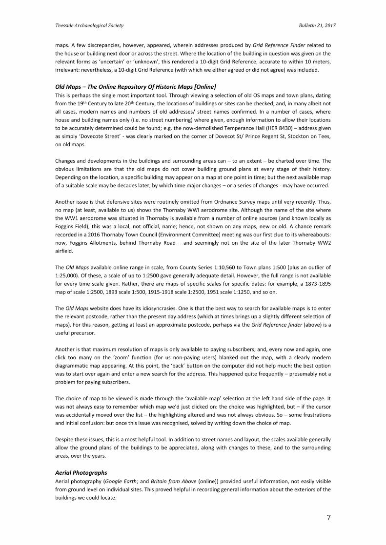
Nonetheless, the site did help directly in identifying some possible sites. For instance, a photo on the website
showing a shop sign with the name of old Stockton bakers ‘Ralph Spark and Sons’ on a Durham Road shop front,
recently revealed when a superimposed sign had been removed or had fallen off, gives a possible location for
‘Primrose Hill Bakery’ (HER 8478) (Figure 2). Additional unconfirmed comments on the site, suggesting this was
opened as an outlet of Spark’s expanded bakery business sometime between 1911-1917, added to our optimism.
Similarly, the website contained references to (mid-20th Century) stables for ‘milk horses’ (horses pulling carts
carrying milk) among a complex of buildings owned by the Co-Operative, sited off Dixon Street, accessed either via
Bakery Street or via California Street. As such, this is considered one of two possible addresses found for the 1918
‘Dixon Street Stables’ (HER 8447; another possibility was also suggested from old maps).
Confusions …
Admittedly, confusions and contradictions appeared regarding some sites. For instance: 17 Mill Street (HER 8469) –
recorded as used for ‘stores’.
Figure 2: Old signage, Sparks Bakery, Durham Road, Stockton (Photo, M. Norrie)
Teesside Archaeological Society Bulletin 21, 2017
9
The problem: Old Maps show two ‘Mill Streets’. One was in central Stockton, later renamed ‘Mill Street West’. On
the Old Maps, numbering is shown for ‘Mill Street West’, but not on the earlier maps of ‘Mill Street’ (although
judging from the location the numbering may not have altered). Here, no.17 appears as a twice-average size (for
the location) site on a street corner: this building, and surrounding housing, no longer exists. The other ‘Mill Street’
is in Norton: a street consisting of two-bedroomed residential terraced housing. This seems too small for use as
‘stores’ and in any case is away from most local ‘War Department’ properties, several of which were in the vicinity
of the ‘Stockton’ Mill Street. However, Mill St, Norton, does still exist.
The Grid Reference given by earlier volunteers applies to the ‘Stockton’ Mill St, albeit with the rider that the actual
location is ‘uncertain’; and, given its proximity to the majority of local War Department-controlled buildings, this
would seem to be the more likely site. However, different sources place the WW1 ‘Mill Street’ in, respectively,
‘Norton’ and ‘Stockton’ – adding to confusion.
Actually Doing It
And so we started to do the actual on-the-ground ‘recording’. With more experience at this point, we would
perhaps have done more research first: but enthusiasm won out …
Forms To Fill …
The training day introduced us to the actual format of recording the buildings, using ‘tick box’ forms with
handwritten observations. Standard terminology as used in the ‘Building Archaeology Research Database’ (BARD) is
used to describe features such as roof profile, chimneys, brickwork. A crib sheet was provided, complete with
annotated diagrams and photographs of relevant features – necessary to beginners such as us. Later, we
downloaded a more extensive ‘illustrated glossary’ of key building features from ‘Tree ring services’ [online].
One section of recording World War 1 sites/buildings
refers to brickwork patterns. Not having looked much
at brickwork patterns previously, this proved
fascinating: not least, noting differences in buildings of
different eras. However, in the ‘buildings’ we’d chosen
to start with, there unfortunately wasn’t much to
‘practise’ on.
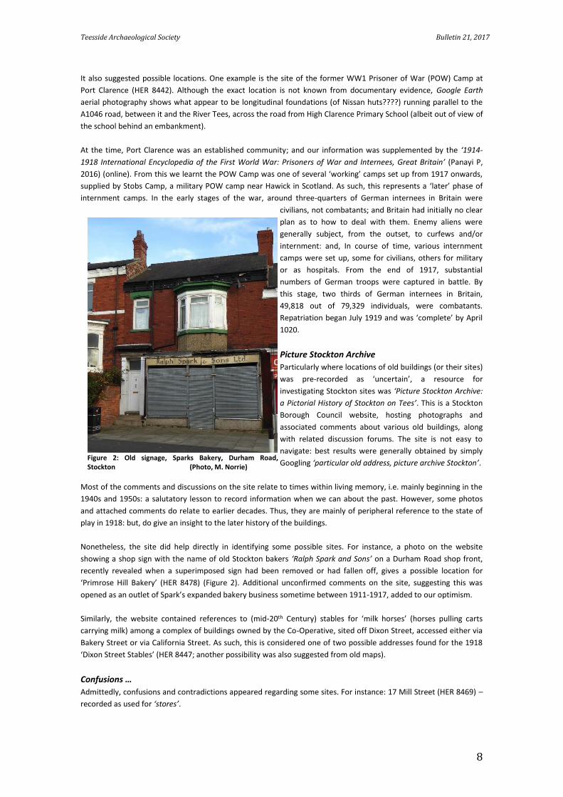
Four of our six original ‘chosen’ buildings no longer
existed. In one of these, however – Brunswick
Methodist Chapel (HER 896), Dovecot St, built in 1823,
used in 1918 for accommodation of troops – a remnant
of the west wall still stands: Flemish Bond, a brickwork
style popular from the late 17th Century with, in each
row, alternate headers and stretchers. The low
perimeter walls of its side courtyards also remain,
supplemented by a new front perimeter wall to the
site.
Of our remaining buildings, the external walls of the Salvation Army premises on Palmerston St (HER 8427) were
rendered throughout. The site we had identified, from the Picture Archive Stockton website, as a ‘likely possible’
Durham Road site of Primrose Hill Bakery (HER 8478), had brick external walls, 5 rows of stretchers to 1 row of
header – this was constructed around the late 19th to early 20th Century.
Photos …
We took digital photographs of the exteriors of the buildings, and where relevant, of the present-day sites on which
they had stood. How much was visible, varied. In the Durham Road premises (possible ‘Primrose Hill Bakery’),
security metal shutters cover much of the front of the building, and locked alley gates prevent public access to the
rear of the buildings. Nonetheless, we took some photographs from the best vantage points we could find – which,
in one case, was through the metal mesh on an alley gate. In the case of the Salvation Army premises, however,
Figure 3: portion of remaining wall, Brunswick Methodist Chapel, showing Flemish Bond brickwork (HER 896)
Teesside Archaeological Society Bulletin 21, 2017
10
local redevelopment had largely cleared much of the area beside it, so that it was highly visible (and open to
photography) from a distance.
[Our] Health And Safety …
Part of the original ‘training’ included legal aspects – e.g. where we could take photos from (public land) – and
advice on keeping safe.
Put simply, wandering around whilst obviously looking at buildings, taking notes, and pointing cameras at them, can
easily raise suspicions among local residents and business owners. The degree of ‘danger’, or at least aggression,
associated with such suspicions can vary widely, generally depending on the specific locality involved. So – we were
handed ‘official’ ‘volunteer badges’ and advised to, if possible, work in at least pairs.
However, our particular pair had, if anything, a very
different experience. While taking photographs, a woman
walking her dog appeared at our shoulders and asked
what we were doing. We told her; and this sparked an
immediate reaction. It transpired she had lived locally all
her life, and had recently completed a degree in history,
concentrating on local history. She then – entirely
unprompted – took us on a half hour tour of the local
area, pointing out features we would not otherwise have
noticed, sharing her knowledge. Among these was Bute
Street, in the Dovecot St area of Stockton: one of the
oldest residential terraced streets surviving in Stockton,
preserved pretty much as it always was (apart from
satellite dishes) and with original cobbling in the street.
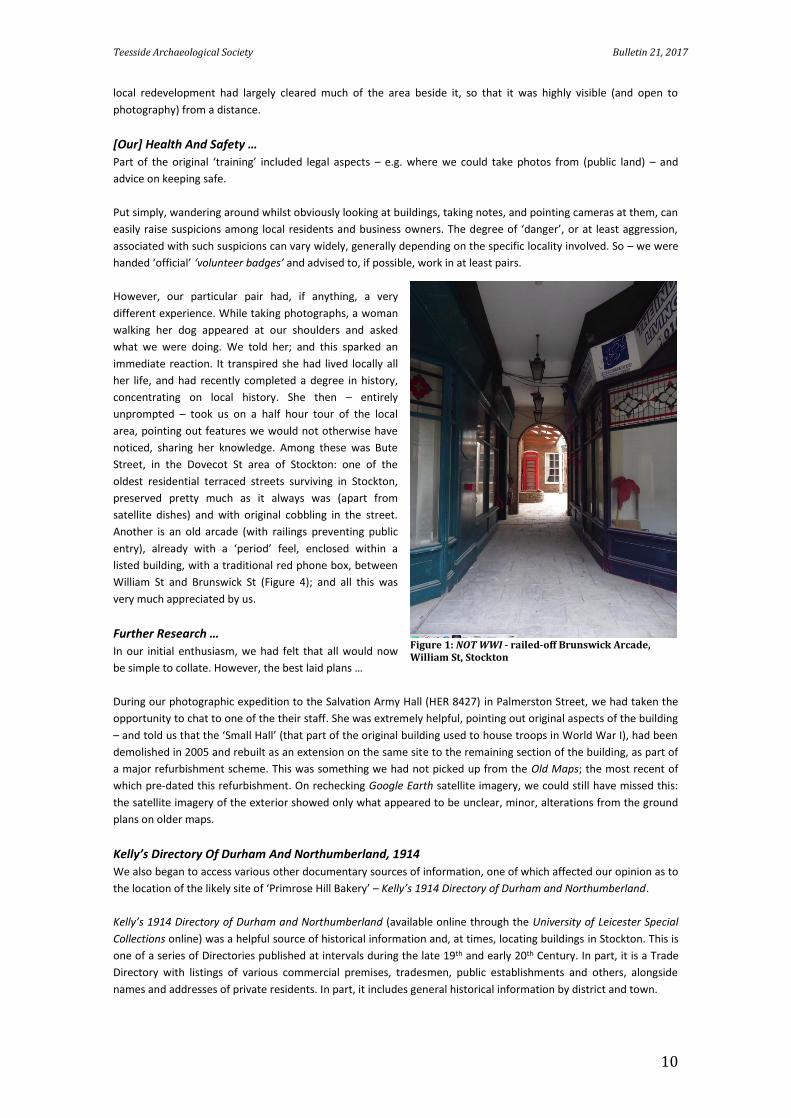
Another is an old arcade (with railings preventing public
entry), already with a ‘period’ feel, enclosed within a
listed building, with a traditional red phone box, between
William St and Brunswick St (Figure 4); and all this was
very much appreciated by us.
Further Research …
In our initial enthusiasm, we had felt that all would now
be simple to collate. However, the best laid plans …
During our photographic expedition to the Salvation Army Hall (HER 8427) in Palmerston Street, we had taken the
opportunity to chat to one of the their staff. She was extremely helpful, pointing out original aspects of the building
– and told us that the ‘Small Hall’ (that part of the original building used to house troops in World War I), had been
demolished in 2005 and rebuilt as an extension on the same site to the remaining section of the building, as part of
a major refurbishment scheme. This was something we had not picked up from the Old Maps; the most recent of
which pre-dated this refurbishment. On rechecking Google Earth satellite imagery, we could still have missed this:
the satellite imagery of the exterior showed only what appeared to be unclear, minor, alterations from the ground
plans on older maps.
Kelly’s Directory Of Durham And Northumberland, 1914
We also began to access various other documentary sources of information, one of which affected our opinion as to
the location of the likely site of ‘Primrose Hill Bakery’ – Kelly’s 1914 Directory of Durham and Northumberland.
Kelly’s 1914 Directory of Durham and Northumberland (available online through the University of Leicester Special
Collections online) was a helpful source of historical information and, at times, locating buildings in Stockton. This is
one of a series of Directories published at intervals during the late 19th and early 20th Century. In part, it is a Trade
Directory with listings of various commercial premises, tradesmen, public establishments and others, alongside
names and addresses of private residents. In part, it includes general historical information by district and town.
Figure 1: NOT WWI - railed-off Brunswick Arcade, William St, Stockton
Teesside Archaeological Society Bulletin 21, 2017
11
We searched it in an attempt to confirm (or
otherwise) our suspicions that Primrose Hill
Bakery (HER 8478) may have been the Durham
Road shop with the recently revealed ‘Ralph
Spark & Sons’ signage. Local knowledge is
important here, as we could not actually find an
online source obviously giving the ‘boundaries’
of the Primrose Hill area of Stockton. However,
using local knowledge, it is an area including the
east side of Durham Road, Stockton, between its
junctions with Bishopton Avenue (north) and
Bishopton Road (south) and the housing to the
east of this: i.e. east of the old ‘ward boundary’
running along the centre of Durham Road in pre-
late 20th Century maps.
Indeed, Kelly’s 1914 Directory of Durham lists
thirteen bakeries in Stockton: only one of which
is close to the Primrose Hill area. However, this
was not the Durham Road shop, but another
outlet of the then-expanding Ralph Spark and
Sons Bakery chain – and, strictly speaking,
located about a hundred metres outside the
Primrose Hill area, on Newtown Avenue. This
site is about only two hundred metres from the
Durham Road Bakery; and, as the comments on
Picture Archive Stockton website suggesting
Spark’s Durham Road premises (located firmly
within the Primrose Hill area) were opened
between 1911-1917 are unconfirmed, we are
currently considering both sites as possible
locations.
The Directory also gave contextual information
regarding some sites. One building used for
‘accommodation of troops’ was Brunswick
Methodist (HER 896) on Dovecot St, between
William St and Brunswick Street. Here, Kelly’s
1914 Directory lists a total of 31 ‘places of
worship’ – 30 Christian, one Jewish – in
Stockton. Of these, 11 (i.e. over one third) are
Methodist (‘Primitive Methodist’, ‘Wesleyan’,
‘Welsh Wesleyan’, and ‘United Methodist’),
together suggesting particular strength of
Methodism in early 20th Century Stockton: most
likely relating to John Wesley’s preaching in the
surrounding regions.
UK Census Information
Census information proved useful, both in
helping to locate buildings whose location is
recorded as ‘uncertain’, and in providing
contextual information.
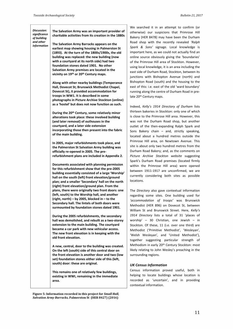
Discussion: significance of building and other information
The Salvation Army was an important provider of charitable activities from its creation in the 1880s The Salvation Army Barracks appears on the earliest map showing housing in Palmerston St (1893). At the turn of the 1800s/1900s, the old building was replaced: the new building (now with a courtyard at its north side) had two foundation stones dated 1901. No other Salvation Army premises are located in the vicinity on 19th or 20th Century maps. Along with other nearby buildings (Temperance Hall, Dovecot St; Brunswick Methodist Chapel, Dovecot St), it provided accommodation for troops in WW1. It is described in some photographs in Picture Archive Stockton (online) as a ‘hostel’ but does not now function as such. During the 20th Century, some relatively minor alterations took place: these involved building (and later removal) of outhouses in the courtyard, and a later side extension incorporating those then present into the fabric of the main building. In 2005, major refurbishments took place, and the Palmerston St Salvation Army building was officially re-opened in 2005. The pre-refurbishment plans are included in Appendix 2. Documents associated with planning permission for this refurbishment show that the pre-2005 building essentially consisted of a large ‘Worship’ hall on the south (left) front elevation/ground plan; and a smaller ‘Secondary’ hall on the north (right) front elevation/ground plan. From the plans, there were originally two front doors: one (left, south) to the Worship hall, and another (right, north) – by 2005, blocked in – to the Secondary hall. The lintels of both doors were surmounted by foundation stones dated 1901. During the 2005 refurbishments, the secondary hall was demolished, and rebuilt as a two-storey extension to the main building. The courtyard became a car park with new vehicular access. The new front elevation is in keeping with the old front elevation. A new, central, door to the building was created. On the left (south) side of this central door on the front elevation is another door and two (low set) foundation stones either side of this (left, south) door: these are original. This remains one of relatively few buildings, existing in WWI, remaining in the immediate area.
Figure 5: Information recorded in this project for Small Hall, Salvation Army Barracks, Palmerston St (HER 8427) (2016)
Teesside Archaeological Society Bulletin 21, 2017
12
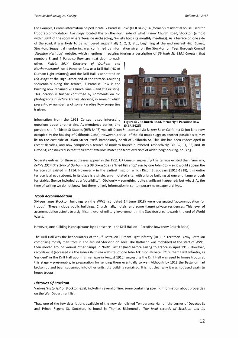
For example, Census information helped locate ‘7 Paradise Row’ (HER 8425): a (former?) residential house used for
troop accommodation. Old maps located this on the north side of what is now Church Road, Stockton (almost
within sight of the room where Teesside Archaeology Society holds its monthly meetings). As a terrace on one side
of the road, it was likely to be numbered sequentially 1, 2, 3, etc., beginning at the end nearest High Street,
Stockton. Sequential numbering was confirmed by information given on the Stockton on Tees Borough Council
‘Stockton Heritage’ website, which mentions in passing (during a description of 39 High St: 1891 Census), that
numbers 3 and 4 Paradise Row are next door to each
other. Kelly’s 1914 Directory of Durham and
Northumberland lists 1 Paradise Row as a Drill Hall (HQ of
Durham Light Infantry); and the Drill Hall is annotated on
Old Maps at the High Street end of the terrace. Counting
sequentially along the terrace, 7 Paradise Row is the
building now renamed 78 Church Lane – and still existing.
This location is further confirmed by comments on old
photographs in Picture Archive Stockton, in some of which
present-day numbering of some Paradise Row properties
is given.
Information from the 1911 Census raises interesting
questions about another site. As mentioned earlier, one
possible site for Dixon St Stables (HER 8447) was off Dixon St, accessed via Bakery St or California St (on land now
occupied by the housing of California Close). However, perusal of the old maps suggests another possible site may
lie on the east side of Dixon Street itself, immediately north of California St. This site has been redeveloped in
recent decades, and now comprises a terrace of modern houses numbered, respectively, 30, 32, 34, 36, and 38
Dixon St; constructed so that their front exteriors match the front exteriors of older, neighbouring, housing.
Separate entries for these addresses appear in the 1911 UK Census, suggesting this terrace existed then. Similarly,
Kelly’s 1914 Directory of Durham lists 38 Dixon St as a ‘fried fish shop’ run by one John Cox – so it would appear the
terrace still existed in 1914. However – in the earliest map on which Dixon St appears (1915-1918), this entire
terrace is already absent. In its place is a single, un-annotated site, with a large building at one end: large enough
for stables (hence included as a ‘possibility’). Obviously – something quite significant happened: but what? At the
time of writing we do not know: but there is likely information in contemporary newspaper archives.
Troop Accommodation
Sixteen large Stockton buildings on the WW1 list (dated 1st June 1918) were designated ‘accommodation for
troops’. These include public buildings, Church halls, hotels, and some (large) private residences. This level of
accommodation attests to a significant level of military involvement in the Stockton area towards the end of World
War 1.
However, one building is conspicuous by its absence – the Drill Hall on 1 Paradise Row (now Church Road).
The Drill Hall was the headquarters of the 5th Battalion Durham Light Infantry (DLI)– a Territorial Army Battalion
comprising mostly men from in and around Stockton on Tees. The Battalion was mobilised at the start of WW1,
then moved around various other camps in North East England before sailing to France in April 1915. However,
records exist (accessed via the Genes Reunited website) of one John Atkinson, Private, 5th Durham Light Infantry, as
‘resident’ in the Drill Hall upon his marriage in August 1915, suggesting the Drill Hall was used to house troops at
this stage – presumably, in preparation for sending them eventually to war. Although by 1918 the Battalion had
broken up and been subsumed into other units, the building remained. It is not clear why it was not used again to
house troops.
Histories Of Stockton
Various ‘Histories’ of Stockton exist, including several online: some containing specific information about properties
on the War Department list.
Thus, one of the few descriptions available of the now demolished Temperance Hall on the corner of Dovecot St
and Prince Regent St, Stockton, is found in Thomas Richmond’s ‘The local records of Stockton and its
Figure 6: 78 Church Road, formerly 7 Paradise Row (HER 8425)
Teesside Archaeological Society Bulletin 21, 2017
13
neighbourhood; or, a register of memorable events’ (1868). This describes the opening of the building attended by
‘around 600 persons’, as combined Temperance Hall and Working Men’s Club, in April 1865, and continues:
‘The interior of the hall measures 60 feet by ???. A small gallery at the north end will accommodate about
100 persons. The platform is at the south end of the hall, to which there is a neat arched entrance from the
ante-rooms behind, consisting of the retiring rooms, club rooms, a house for the keeper [caretaker], &c’
[Richard T, 1868]
(Another publication is Tees Archaeology’s publication ‘The Buildings of Stockton on Tees’ (Robin Daniels, 2014).
There is a small overlap with the War Department list of buildings, and the publication is freely available online).
Planning Permissions
Perhaps surprisingly, planning permission applications can also shed light on the WW1 properties.
As mentioned above, our attention was drawn to the 2005 refurbishment of the Salvation Army Hall in Palmerston
St (HER 8427) – refurbishment that included demolition of the part of the building uses to house troops in WWI,
and its rebuilding as an extension of the remaining building. In recent years Stockton Borough Council has put
planning permission applications, complete with relevant documentation and plans, online. A search of this site
(entering the names of relevant streets) brought up the planning permission documentation for the Salvation Army
Barracks, complete with pre-refurbishment plans of the ‘small’ or subsidiary hall, as it existed pre-2005 – thus,
adding to our knowledge of the building.
What Next?
Our volunteering experience in recording WW1 buildings is in its infancy, but already we are becoming aware of
how many no longer exist.
Several properties disappeared as part of 20th Century redevelopments. For example, the Temperance Hall (HER
8430), on the corner of Dovecot St/ Prince Regent St in Stockton, was demolished in a late 1960s/early 1970s major
road widening/ rerouting scheme, in which Prince Regent St was changed from a relatively narrow cul-de-sac to a
wide ‘through’ road, diverting traffic from Stockton High Street. Along with it, the adjacent property, 41 Dovecot St,
and most of the properties on the west side of Prince Regent St, were also demolished at this time. The restaurant
currently on this corner now occupies the sites of 41 Dovecot Street and 35 Brunswick Street, and part of the site of
the Temperance Hall; part of the Temperance Hall site now lies under the pavement and road in Prince Regent
Street.
Others were affected by business changes. One of the
possible sites for Dixon Street Stables (HER 8447) was
within a complex of warehouses between Dixon St,
California St, Palmerston St, and Dovecot St, owned by
the Co-Operative. These disappeared in their entirety in
the mid-late 20th Century; later replaced by residential
housing. Similarly, the Stockton Gas Works (HER 4252)
no longer exists: the site is currently partly occupied by
housing, partly open space.
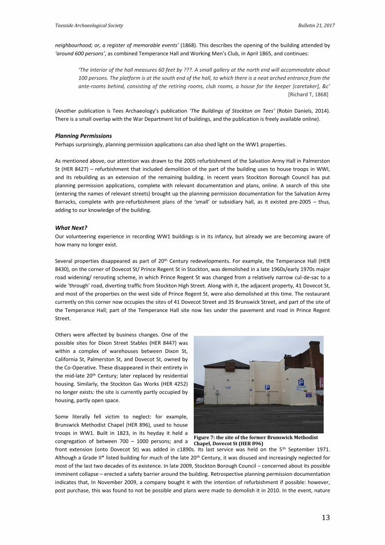
Some literally fell victim to neglect: for example,
Brunswick Methodist Chapel (HER 896), used to house
troops in WW1. Built in 1823, in its heyday it held a
congregation of between 700 – 1000 persons; and a
front extension (onto Dovecot St) was added in c1890s. Its last service was held on the 5th September 1971.
Although a Grade II* listed building for much of the late 20th Century, it was disused and increasingly neglected for
most of the last two decades of its existence. In late 2009, Stockton Borough Council – concerned about its possible
imminent collapse – erected a safety barrier around the building. Retrospective planning permission documentation
indicates that, In November 2009, a company bought it with the intention of refurbishment if possible: however,
post purchase, this was found to not be possible and plans were made to demolish it in 2010. In the event, nature
Figure 7: the site of the former Brunswick Methodist Chapel, Dovecot St (HER 896)
Teesside Archaeological Society Bulletin 21, 2017
14
intervened: it partially collapsed in December 2009 under the weight of snow and was demolished (with
retrospective planning permission granted for this) in December 2009. Today, the site is an open-air car park.
Some have survived. For example, Shaftesbury House, in Shaftesbury Street (HER 8460) remains – because an on-
going use has been found for it as residential accomodation; whilst Stonyroyd, Oxbridge Lane (HER 8429) remained
a hotel until very recently.
And some are in danger: for example, 7 Paradise Row (HER 8425) (now, 78 Church Road). This is part of an imposing
terrace of large buildings (mid-late 1800s), built on the site of an old ropery, originally providing homes for affluent
Stockton citizens. By the early 1900s, they were less used as single-family (plus servants) accommodation: some
were combined to form the Trevelyan Hotel, for instance. Kelly’s 1914 Directory of Durham and Northumberland
lists ‘private residents’ next door either side of 7 Paradise Row; but not in No. 7 itself. Although, like the other
houses in its terrace, 7 Paradise Row survived the 1930s widening of Church Road, it is now unoccupied and unused.
Refurbishment would be (presumably) possible, but costs money: for example, a nearby property on this terrace
was recently refurbished by its private owner at a cost of approximately one million pounds, into luxury office
space.
Conclusion:
There is relatively little time left in which to record still-surviving Teesside buildings used by the War Department
during World War One. Many have already disappeared; some are in sufficiently good condition to last (hopefully)
for many more years to come.
Between these extremes are many in various stages of disrepair, and living memory no longer stretches back to the
1914-1918 war. We are already largely beyond the stage when written or pictorial information can be
supplemented by informally given oral traditions. The more information we can gather now, and the more
complete our recording, the greater the likelihood that the historical significance of these buildings, and those
connected with them in any form, will be remembered.
Sources:
BBC ‘Marley Close, Stockton on Tees: Intelligence HQ for the Royal Navy’ (online)
English Heritage (2015) ‘First World War Wireless Stations in England’ (available online)
Forces War Records (2016) Unit History: Durham Light Infantry (online)
Genes Reunited (online) at http://www.genesreunited.co.uk/boards/board/ancestors/thread/892839
Google Earth (online)
Grid Reference Finder (online)
Kelly’s 1914 Directory of Durham and Northumberland (available online, through University of Leicester Special
Collections)
Old Maps – The Online Repository Of Historic Maps (online)
Panayi P (2016) ‘Prisoners of War and Internees, Great Britain’ in 1914-1918 International Encyclopedia of the First
World War (online)
Richmond T (1868) The local records of Stockton and its neighbourhood; or, a register of memorable events
(available online)
Stockton on Tees Borough Council: Picture Archive Stockton (online)
Stockton on Tees Borough Council: Planning permission: view and comment on a planning application (online)
Stockton on Tees Borough Council: ‘Stockton Heritage’: 39 High St: 1891 Census (online)
The National Archives UK 1911 Census (online)
Tree Ring Services: An internet-accessible Building Archaeological Research Database (BARD) (online)