Embed Size (px)
Citation preview
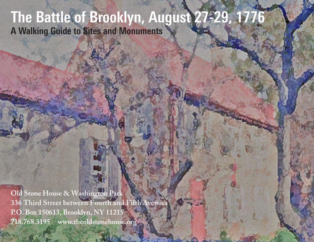
Old Stone House & Washington Park336 Third Street between Fourth and Fifth AvenuesP.O. Box 150613, Brooklyn, NY 11215718.768.3195 www.theoldstonehouse.org
The Battle of Brooklyn, August 27-29, 1776 A Walking Guide to Sites and Monuments
i
Using This Guide
CreditsText: Marilyn H. PettitContemporary maps and graphic design: Peter Joseph with Marilyn H. PettitPublished 2012 Old Stone House of Brooklyn
The author gratefully acknowledges the fol-lowing institutional libraries and archives: New York Public Library; New York University Elmer Holmes Bobst Library; Brooklyn Public Library/Brooklyn Daily Eagle on-line; Seymour B. Durst Old York Library, City University Graduate Cen-ter; Brooklyn College, City University of New York; Brooklyn Historical Society Library; Inter-net resources. We are also grateful to the following individuals for the use of their personal materials: Joseph McCarthy, Rick Schwab.
This guide is offered as a means through which visi-tors may experience the 1776 Battle of Brooklyn as it developed in the fields, orchards, creeks, and country lanes that later became nearly invisible in Brooklyn’s densely inhabited nineteenth and twentieth century urban expansion.
It is intended to be much more than a requiem for the dead and wounded of the battle. Land use evolves over time, and Brooklyn offers a prism through which visitors may consider nearly four centuries of the chang-ing uses of an island’s natural resources, four centuries of European settlement, rampant industrial and com-mercial development, and urbanization that both uti-lized and disguised its physical features. Visitors can still glimpse portions of the Brooklyn that used to be, from its geophysical shaping by the last glacial retreat to the forested, oyster-rich island of the Native Americans, to its settlement by land-hungry Europeans, post-Civil War industrialization, immigration, and city-building. Among our present-day factories, shops and houses, the war for American independence commenced all around Brooklyn’s streets and parks and underneath its houses. The implications of that war reach out to us from a past that, growing ever more remote, still gives meaning to the present day, and the relics of that struggle for a re-public are worthy of remembrance.
The Old Stone House, erected 1699 and rebuilt in 1934, was central to the Battle of Brooklyn. It is easily accessible by bicycle, by car, and by New York City sub-way lines and buses, including the B63 bus and the F, G and ) trains. This guide covers all recognized Bat-tle of Brooklyn sites, which are scattered throughout 72 square miles of the borough and refers the visitor to as-sociated sites and views including unmarked sites. The visitor may begin at any site or street corner and view the sites in any order or skip sites that are unmarked at the present time. The street address or intersection for each site is noted, along with the closest subway stops and bus routes, with suggestions for nearby attractions.
Transportation ResourcesWalking: Due to the immense area of the battlefield and the
long distances between some of the sites, a walking tour of all sites is not very practical. Nearby sites and other attractions which are within walking distance (although here, too, distances might be too great for some walkers) are listed for each site. Point-to-point tran-sit/walking directions are available from www.hopstop.com.
Car: Curbside parking is problematic in the extreme at some locations, easier in others, and easier in general on weekends and holidays.
Subway and Bus: New York City Transit maps for subways and buses: www.mta.info/nyct/maps. Printed copies of official MTA bus and subway maps may be obtained from the token booth at most subway stations or by calling MTA Customer Assistance at 718-330-3322, 9 AM to 5 PM, weekdays. Bicycles may be carried on subway trains but not on buses.
Water Taxi and Ferry: New York Water Taxi www.nywatertaxi.com provides cross-harbor service from Wall Street to Red Hook/Ikea, Brooklyn. Bicycles are permitted on watertaxis, and sever-al sites are accessible by bicycle from Red Hook. NY Waterway www.nywaterway.com/RoutesSchedules.aspx operates ferry services from Wall Street/Pier 11 and East 34 Street/Midtown to Brook-lyn Bridge Park/DUMBO and Atlantic Avenue/Brooklyn Bridge Park. Bicycles are permitted on ferries (extra charge).
Bicycle: Downloadable NYC Cycling Maps are available from the NYC Dept. of City Planning: home2.nyc.gov/html/dcp/html/bike/cwbm.shtml#maps or www.nyc.gov/bikes. A printed version of The New York City Cycling Map is available free at many bicycle shops or by mail by calling 311 (NYC residents) or 212-720-3667 (others).
Other good resources are www.nycbikemaps.com/ or www.ride-thecity.com/, where point to point directions (and a downloadable iPhone app of the same) are also available.
Tours: New York City hop-on, hop-off tour buses (fee) provide access to some of the sites. For a fairly comprehensive listing see: www.nytours.us/tours. A number of private tour guides conduct guided tours by appointment. For information contact The Old Stone House, 718-768-3195 or [email protected].
The following sites are in geographic proximity and can be visited together.
Sites 1, 21 (The British Landing at Gravesend, Mile-stone Park, New Utrecht Liberty Pole)
Sites 11, 12 (The Red Lion Inn,* Battle Hill in Green-Wood Cemetery)
Sites 13, 15, 25 (Flatbush Pass/Battle Pass, Mount Prospect, Lefferts Homestead)
Sites 16, 22, 24 (Litchfield Villa, Old First Re-formed Church and Maryland 400 Monument in Prospect Park)
Sites 17, 18, 19 (The Old Stone House, Third Av-enue reputed burial ground, Gowanus Canal)
Sites 2, 6, 8 (Red Hook Lane, Cobble Hill Fort, Fort Defiance/Red Hook Waterfront)
Sites 3, 4, 23 (Fort Putnam/present-day Fort Greene, Brooklyn Navy Yard)
Sites 5, 10, 20 (Old Fort Greene,* Cornell-Pierre-pont House*/flagpole at Brooklyn Heights Promenade, Fulton Ferry Landing)
* indicates an unmarked site.
ii
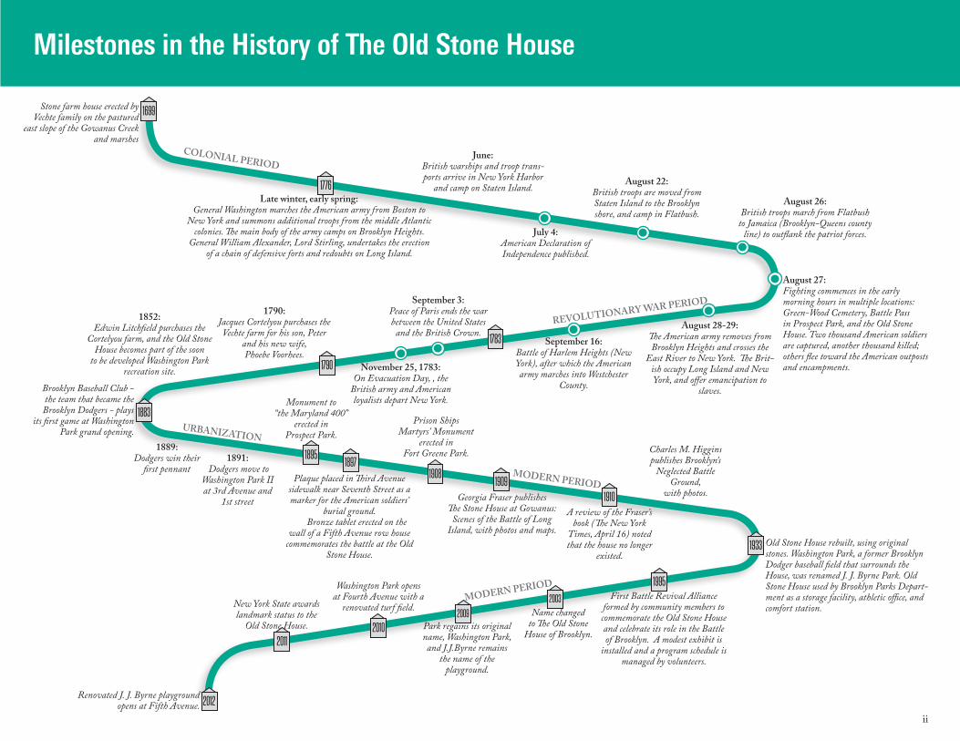
Milestones in the History of The Old Stone House
Stone farm house erected by Vechte family on the pastured
east slope of the Gowanus Creek and marshes
Late winter, early spring: General Washington marches the American army from Boston to
New York and summons additional troops from the middle Atlantic colonies. The main body of the army camps on Brooklyn Heights.
General William Alexander, Lord Stirling, undertakes the erection of a chain of defensive forts and redoubts on Long Island.
COLONIAL PERIOD
REVOLUTIONARY WAR PERIOD
MODERN PERIOD
URBANIZATION
MODERN PERIOD
June: British warships and troop trans-ports arrive in New York Harbor
and camp on Staten Island.
July 4: American Declaration of Independence published.
August 22: British troops are moved from Staten Island to the Brooklyn shore, and camp in Flatbush.
August 26: British troops march from Flatbush
to Jamaica (Brooklyn-Queens county line) to outflank the patriot forces.
August 27: Fighting commences in the early morning hours in multiple locations: Green-Wood Cemetery, Battle Pass in Prospect Park, and the Old Stone House. Two thousand American soldiers are captured, another thousand killed; others flee toward the American outposts and encampments.
August 28-29: The American army removes from Brooklyn Heights and crosses the
East River to New York. The Brit-ish occupy Long Island and New York, and offer emancipation to
slaves.
September 16: Battle of Harlem Heights (New York), after which the American army marches into Westchester
County.
September 3:Peace of Paris ends the war between the United States
and the British Crown.
November 25, 1783:On Evacuation Day, , the
British army and American loyalists depart New York.Monument to
“the Maryland 400” erected in
Prospect Park.
Plaque placed in Third Avenue sidewalk near Seventh Street as a marker for the American soldiers’
burial ground. Bronze tablet erected on the
wall of a Fifth Avenue row house commemorates the battle at the Old
Stone House.
Prison Ships Martyrs’ Monument
erected in Fort Greene Park.
Georgia Fraser publishes The Stone House at Gowanus:
Scenes of the Battle of Long Island, with photos and maps.
A review of the Fraser’s book (The New York
Times, April 16) noted that the house no longer
existed.
Charles M. Higgins publishes Brooklyn’s
Neglected Battle Ground,
with photos.
1891: Dodgers move to
Washington Park II at 3rd Avenue and
1st street
1889:Dodgers win their
first pennant
Brooklyn Baseball Club - the team that became the Brooklyn Dodgers - plays
its first game at Washington Park grand opening.
1852: Edwin Litchfield purchases the
Cortelyou farm, and the Old Stone House becomes part of the soon
to be developed Washington Park recreation site.
1790: Jacques Cortelyou purchases the Vechte farm for his son, Peter
and his new wife, Phoebe Voorhees.
Old Stone House rebuilt, using original stones. Washington Park, a former Brooklyn Dodger baseball field that surrounds the House, was renamed J. J. Byrne Park. Old Stone House used by Brooklyn Parks Depart-ment as a storage facility, athletic office, and comfort station.
First Battle Revival Alliance formed by community members to commemorate the Old Stone House and celebrate its role in the Battle of Brooklyn. A modest exhibit is
installed and a program schedule is managed by volunteers.
Name changed to The Old Stone
House of Brooklyn.Park regains its original name, Washington Park, and J.J.Byrne remains
the name of the playground.
1699
1776
1895
1883
1933
1995
2009
20112010
2012
2003
19081909
1910
1897
1783
1790
Washington Park opens at Fourth Avenue with a
renovated turf field.New York State awards landmark status to the
Old Stone House.
Renovated J. J. Byrne playground opens at Fifth Avenue.
iii
Preface: An Introduction to the Battle of Brooklyn
1776 – A Year of Decision as The American Colonies Declare Independence And Prepare For War
The die is now cast; the colonies must either submit or triumph.... we must not retreat.
King George III to Lord North, 1774 The enemy have now landed on Long Island, and the hour is fast approaching in which the honor and success of this army, and the safety of our bleeding country, will depend. Remember, officers and soldiers, that you are freemen, fighting for the blessings of liberty, and slavery will be your portion, if you do not acquit yourselves like men.
General George Washington to American troops, August 25, 1776
We are not so many, but I think we are enough to prevent (the British) advancing farther over the Continent than this millpond.
General William Alexander, Lord Stirling, to American troops, August 27, 1776
The “shot heard ’round the world” was fired in 1775
at Concord Bridge, Massachusetts, and a bloody battle at Bunker Hill in the late winter of 1776 impelled Brit-ish forces to depart from Boston Harbor toward refuge and refitting off Nova Scotia. There Great Britain as-sembled a massive invasion fleet and army, its goal to crush the disobedient and unruly American rebels by first dividing, then conquering, the colonies. As inva-sion was being planned and deployed, and as New York became its certain target, American colonial represen-tatives sitting in assembly at Philadelphia published the Declaration of Independence that dissolved colo-nial allegiance to the British Crown. This bold revolu-tionary claim to self-government, July 4, 1776, estab-lished the first republican nation-state of the western hemisphere, the United States of America.
Brooklyn, the southern-most portion of Long Is-
land, became the landing place of the largest land army ever assembled by Great Britain, which brought a seasoned fighting force to a provincial colony known to possess loyal subjects of the Crown in abundance. Brooklyn’s peaceful farms and streams became the bat-tlefield for the first military engagement of the new-ly-minted “United States of America” as troops of the mother country, supplemented with hired troops from Continental Europe, invaded the rebellious colonies.
But instead of token resistance, the British army
encountered forts and earthwork redoubts mounted with cannon and protected by abatises, rows of sharp-ened tree trunks. It faced an American citizen army from most of the thirteen new states, including local militia companies from Kings and Queens Counties, all commanded by determined Virginian General George Washington. The invaders met ferocious re-sistance, and there was fierce and bloody fighting on the hills of Green-Wood Cemetery and Prospect Park, on the slopes of Prospect Heights and Park Slope, on today’s busy streets that were once dirt roads lead-ing to the East River ferry landing. There was battle along the shores of the marshy Gowanus Creek, now
an obsolete industrial canal, and around a stone farm-house erected in 1699, the Old General. The sight and sound of campfires, horses and mules, creaking wag-ons loaded with cannon and balls, the marching feet of soldiers from Great Britain and the German states of Hesse-Cassel, Hanau, and Brunswick resounded throughout Brooklyn. Fire and smoke from muskets and cannon mingled with the smoke of burning hay-stacks and grain stores and drifted from Gravesend to Flatlands, from Flatbush to Fort Greene, from Mid-wood and Park Slope to Red Hook, from Prospect Heights to Brooklyn Heights. Attack and retreat, re-group, fire again as the dead and wounded fell. Many Americans were captured. The sound of revolutionary warfare thundered on August 27th as invaders were re-sisted, and war raged all over the present-day borough of Brooklyn, county of Kings, in what was then the colony, now the state, of New York.
The outcome was a victory for British forces that killed or captured 2,000 American fighting men and proceeded to occupy Brooklyn and New York City for the duration of the Revolutionary War. The British, however, signally failed to capture Washington and the far smaller American army, which withdrew across the East River to Manhattan. From Manhattan the army marched north to Harlem Heights in upper Manhat-tan, then removed to White Plains on the mainland in Westchester County. The enormity of the Battle of Brooklyn, and the numbers of American, British, and Hessian troops involved, set the tone of the struggle for the survival of the new republic. At Brooklyn, it looked to be a fight to the death, for which reason it was said that
“The Declaration of Independence was signed in ink at Philadelphia… and signed in blood at Brooklyn ….”
The American Revolutionary land war continued outside of Brooklyn and reached a turning point in
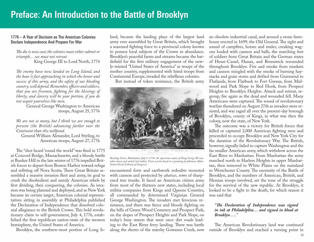
Bowling Green, Manhattan, July 9, 1776: the equestrian statue of King George III was taken down and melted into bullets. From a print based on a painting by Johannes Adam Simon Oertel (Library of Congress).
iv
1777 with the surrender of British General Burgoyne’s army at Saratoga, New York, which then brought open French support for the American cause. The land war effectively ended in October of 1781 when Earl Cornwallis, caught between the American and French armies on land and the French fleet at sea, reluctantly surrendered a large British army at Yorktown, Virginia. The British occupied Brooklyn and New York City, following the Battle of Brooklyn, until they sailed from New York Harbor on Evacuation Day, November 25, 1783, under the terms of the Treaty of Paris.
A Citizen-Army And The Road to Independence: Brooklyn, 1776
The Battle of Brooklyn (Battle of Long Island) was the first military engagement of the U.S. Revolutionary War after adoption of the Declaration of Independence in July of 1776. The British army had not succeeded in quelling armed rebellion and resistance in Massachu-setts Bay, and Fort Ticonderoga had been captured by American military action in 1775, a strategic move that prevented control of the Hudson River Valley by the British. The British Houses of Commons and Lords of that period numbered about the same as the pres-ent U.S. Congress, 500, all men, and a majority in both houses voted for military action, not accommodation. King George III’s ministers proceeded to declare as “rebels” the members of the Continental Congress at Philadelphia, who faced death if captured, which elic-ited Benjamin Franklin’s famously wry comment that members of the Continental Congress must hang ei-ther together or separately. Continental warfare in the eighteenth century required summer weather and open ground, and a massive British invasion army gathered at Halifax to attack New York by land and sea in the spring and summer of 1776, its goal to sever the crucial connection between northern and southern colonies.
General Washington marched the army from Boston in the late winter of 1776 as a British attack at New York became more probable, and ordered additional troops from the middle states—Pennsylvania, New Jersey, Del-aware, and Maryland—posted in Manhattan, on Gov-ernor’s Island, and at newly-fortified positions between Brooklyn Heights and the Flatbush Pass, the boundary between the townships of Brooklyn and Flatbush. The military units consisted of troops in handsome uniforms as well as volunteer militia companies in fringed hunt-ing and farming shirts who had mustered and drilled on their local village greens, and brought their own mus-kets and knives with them. Washington had observed at Bunker Hill that citizen-soldiers, though unprepared for Continental warfare in the open, fought fiercely and doggedly from behind trees and modest walls, and to this end erected a crescent line of fortifications that pro-tected the main body of the army on Brooklyn Heights. The line of forts and redoubts began on a rising bluff above today’s Brooklyn Navy Yard and crossed the main
colonial roads, then angled off along the western bank of the Gowanus marshes, then to Red Hook, a peninsu-la that jutted out into New York Harbor. Governor’s Is-land and the tip of Manhattan Island were also fortified, on guard against the warships of the island nation that ruled the waves, the empire on which the sun never set.
The American citizen-army included some of Brit-ish parentage and some from generations of colonial American families, along with Native Americans, new-comers from Europe and the Caribbean, and African-Americans, who were reliably reported in most, if not all, regiments. The army included many women who accompanied as cooks, laundresses, and nurses for the sick and wounded. The soldiers included farmers, cattle drovers, fishermen, blacksmiths, saddle-makers, millers, shopkeepers, and booksellers. Most had never traveled far from their homes, and knew their posts only in general terms as “York Island” and “Long Is-land.” While Washington planned resistance to inva-sion and his generals supervised the erection of the Brooklyn forts, militant “committees of safety” in vil-lages and communities seized British military stores and stockpiled weapons and gunpowder as they waited breathlessly for the oncoming battle that depended on Brooklyn’s landscape.
A Brooklyn Geography LessonLong Island and Manhattan Island were formed
some 12,500 years ago by the retreating Wisconsin glacier in what is commonly known as “the last ice age” of the Pleistocene period, during which a great ice sheet slowly melted and withdrew toward the North Pole. The moving glacier left a ragged coastline on the northeast coast of North America, forming Long Island and Cape Cod, both dotted with kettle holes and draped with smooth outwash plains. The glacier dragged massive boulders in its grip, dropping them randomly as the grinding ice slowly retreated northward, and these rocky deposits can readily be seen in Prospect Park and Central Park.
The glacier left Long Island, of which Brooklyn is the southern-most portion, with a moraine for a skel-etal backbone, a central ridge of hills that extends the 100-mile length of the island, with flattened plains on either side of the ridge. Dutch colonists named these
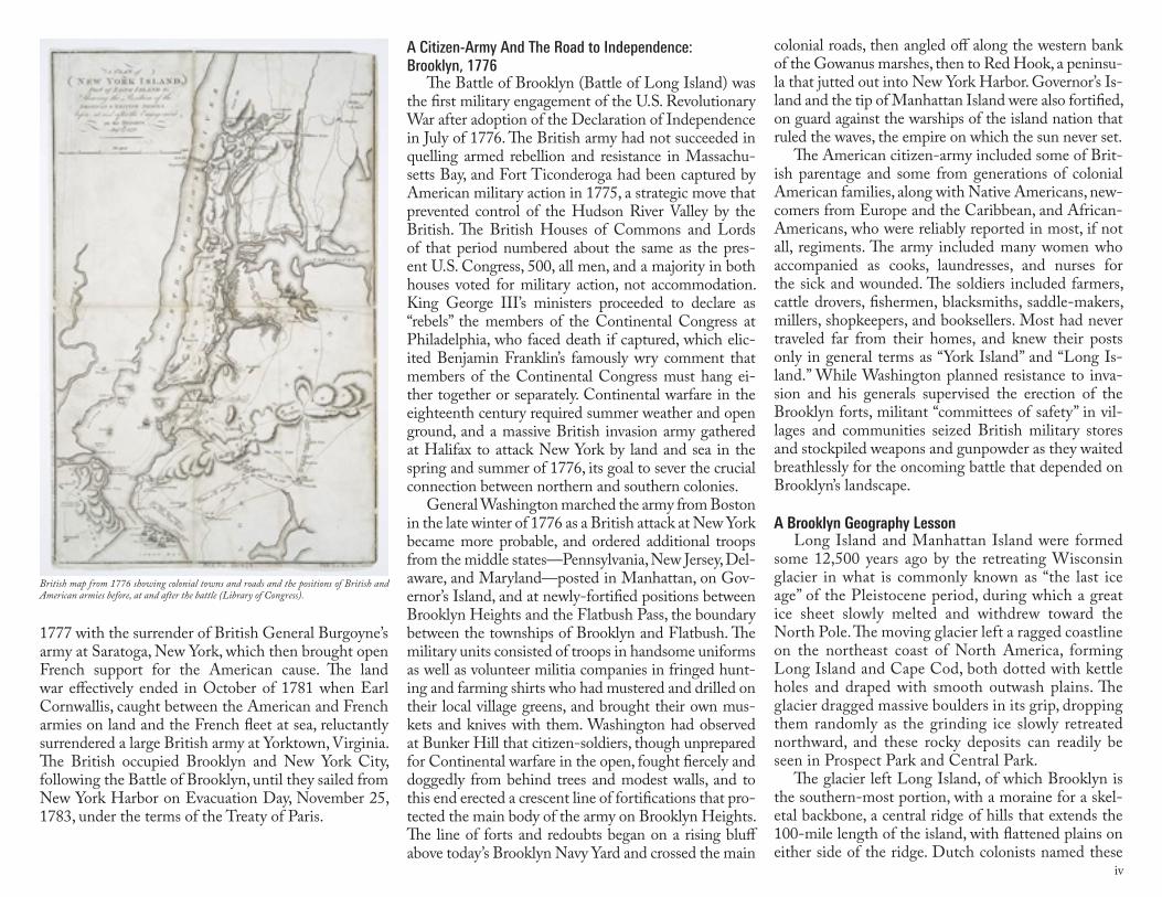
British map from 1776 showing colonial towns and roads and the positions of British and American armies before, at and after the battle (Library of Congress).
v
plains “Flatbush,” “Flatlands,” and “Bushwick,” and greatly valued the woodlands for their trees and game and the plains for farming and pasturage. The Dutch, scarce of forests in their home country, gladly built their houses from Long Island trees, which made the Vechte farmhouse at Gowanus (The Old Stone House) unusual because it was built of stone.
The western slope of Brooklyn’s high ground was marked by brooks and creeks that flowed downhill into the Gowanus marshlands, the deep-water New York harbor, the Wallabout Bay, and the East River, all affected by tidal ebb and flow. The still-visible ridge in present-day Green-Wood Cemetery and Prospect Park gave southwestern Long Island one continuous geographic area from a height of 130-150 feet down a steep slope to wetlands, then rose westward to the Red Hook waterfront, with the Gowanus Creek, now a canal, as its midpoint. The Wallabout Bay, today’s Brooklyn Navy Yard, almost touches the Gowanus
Canal lying less than two miles distant, so near to each other that British engineers considered, during the oc-cupation of Long Island and New York City from1776 to 1783, connecting them by canal.
The colonial coastline lay below Brooklyn’s Third Avenue; the Gowanus Creek was a mile-wide span of wetlands, with watery inlets, saltwater marshes, and dammed-up ponds for grinding mills operated by tidal action. Red Hook was a sandy, oyster-rich peninsula that the tides covered as far as Beach Street on the south and Conover Street on the west. Much of what can be seen now of the Gowanus Bay and Red Hook is engineered landfill and wharfage from nineteenth cen-tury commercial construction and twentieth century “urban planning.” Brooklyn Heights descended sharply from Clover Hill down to the harbor that lapped at present-day Furman Street, and the Wallabout was a broad wetlands, with a shoreline road that led from the Brooklyn ferry to the village of Flushing on Long Is-land, now part of the borough of Queens.
The hills provided the English townships on their island of “Nassau” with natural boundaries and road-ways through the hills that received the names “Bed-ford Pass,” “Flatbush Pass,” and “Jamaica Pass.” The farm roads and passes through the hills had been laid out over Indian trails, and English proprietorship as of 1664 recognized those same boundaries and roads on newly re-named “Long Island.” The Jamaica Road ran through the Bedford Pass between Brooklyn and the Long Island Atlantic shore; the Brooklyn-Flatbush road ran between the two townships; the Gowanus road, a wandering high water lane, ran between the Gowanus Bay and the Brooklyn Ferry road; the New Utrecht Road ran between Gravesend Bay and Brook-lyn Ferry; the Porte or Post Road angled off from the Flatbush Road and connected to Red Hook Lane just above the reach of the Gowanus Creek; and Red Hook Lane led to Governor’s Island and the harbor.
Red Hook Lane originated at the Dutch Reformed Church, located in the middle of the Brooklyn-Flat-bush Road in today’s Fulton Mall in downtown Brook-lyn, and ran to the intersection of present-day Atlan-tic Avenue and Court Street, then continued south to the Erie Basin and the Red Hook waterfront, today’s Court Street. British Crown commissioners mapped
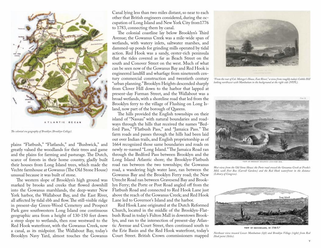
The colonial era geography of Brooklyn (Brooklyn College).
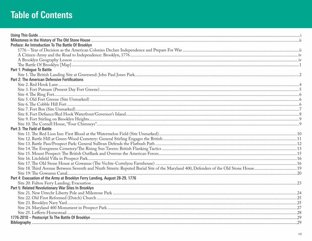
West view from the Old Stone House: the Porte road crossed the Gowanus Creek at Freeke’s Mill, with Fort Box (Carroll Gardens) and the Red Hook waterfront in the distance (Library of Congress).
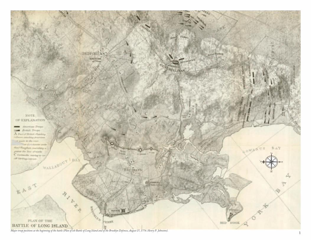
Northeast view toward Lower Manhattan (left) and Brooklyn Village (right) from Red Hook point (Stiles).
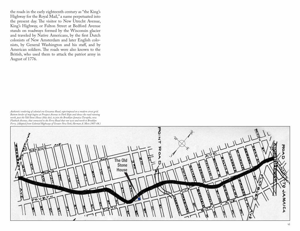
“From the rear of Col. Metzger’s House, East River,” a view from roughly today’s Cobble Hill looking northwest with Manhattan in the background at the right side (NYPL).
vi
the roads in the early eighteenth century as “the King’s Highway for the Royal Mail,” a name perpetuated into the present day. The visitor to New Utrecht Avenue, King’s Highway, or Fulton Street at Bedford Avenue stands on roadways formed by the Wisconsin glacier and traveled by Native Americans, by the first Dutch colonists of New Amsterdam and later English colo-nists, by General Washington and his staff, and by American soldiers. The roads were also known to the British, who used them to attack the patriot army in August of 1776.
Authentic rendering of colonial era Gowanus Road, superimposed on a modern street grid. Bottom border of map begins at Prospect Avenue in Park Slope and shows the road running north, past the Old Stone House (blue dot), to join the Brooklyn-Jamaica Turnpike, now Flatbush Avenue, that connected to the Ferry Road that ran west and north to Brooklyn Ferry. (Adapted from Colonial Highways of Greater New York, Herman A. Metz 1907-08.)
The Old Stone House
vii
Table of Contents
Using This Guide .....................................................................................................................................................................................................................................................................iMilestones in the History of The Old Stone House ...............................................................................................................................................................................................iiPreface: An Introduction To The Battle Of Brooklyn 1776 – Year of Decision as the American Colonies Declare Independence and Prepare For War ...........................................................................................................ii A Citizen-Army and the Road to Independence: Brooklyn, 1776 .......................................................................................................................................................... iv A Brooklyn Geography Lesson ............................................................................................................................................................................................................... iv The Battle Of Brooklyn [Map] ...................................................................................................................................................................................................................................1Part 1: Prologue To Battle Site 1. The British Landing Site at Gravesend: John Paul Jones Park .......................................................................................................................................................2 Part 2: The American Defensive Fortifications Site 2. Red Hook Lane .............................................................................................................................................................................................................................4 Site 3. Fort Putnam (Present Day Fort Greene) .......................................................................................................................................................................................5 Site 4. The Ring Fort .................................................................................................................................................................................................................................6 Site 5. Old Fort Greene (Site Unmarked) ................................................................................................................................................................................................6 Site 6. The Cobble Hill Fort .....................................................................................................................................................................................................................6 Site 7. Fort Box (Site Unmarked) .............................................................................................................................................................................................................7 Site 8. Fort Defiance/Red Hook Waterfront/Governor’s Island ...............................................................................................................................................................8 Site 9. Fort Stirling on Brooklyn Heights .................................................................................................................................................................................................9 Site 10. The Cornell House, “Four Chimneys” ..........................................................................................................................................................................................9Part 3: The Field of Battle Site 11. The Red Lion Inn: First Blood at the Watermelon Field (Site Unmarked)...............................................................................................................................10 Site 12. Battle Hill at Green-Wood Cemetery: General Stirling Engages the British ...........................................................................................................................11 Site 13. Battle Pass/Prospect Park: General Sullivan Defends the Flatbush Path ..................................................................................................................................12 Site 14. The Evergreens Cemetery/The Rising Sun Tavern: British Flanking Tactics ............................................................................................................................13 Site 15. Mount Prospect: The British Outflank and Overrun the American Forces ...............................................................................................................................15 Site 16. Litchfield Villa in Prospect Park ................................................................................................................................................................................................16 Site 17. The Old Stone House at Gowanus (The Vechte-Cortelyou Farmhouse) ..................................................................................................................................16 Site 18. Third Avenue Between Seventh and Ninth Streets: Reputed Burial Site of the Maryland 400, Defenders of the Old Stone House .......................................19 Site 19: The Gowanus Canal ...................................................................................................................................................................................................................20Part 4: Evacuation of the Army at Brooklyn Ferry Landing, August 28-29, 1776 Site 20. Fulton Ferry Landing; Evacuation .............................................................................................................................................................................................23Part 5: Related Revolutionary War Sites In Brooklyn Site 21. New Utrecht Liberty Pole and Milestone Park .........................................................................................................................................................................24 Site 22. Old First Reformed (Dutch) Church ........................................................................................................................................................................................25 Site 23. Brooklyn Navy Yard ...................................................................................................................................................................................................................25 Site 24. Maryland 400 Monument in Prospect Park ..............................................................................................................................................................................27 Site 25. Lefferts Homestead ...................................................................................................................................................................................................................281776-2010 – Postscript To The Battle Of Brooklyn ..............................................................................................................................................................................................................29Bibliography .........................................................................................................................................................................................................................................................................29
1Major troop positions at the beginning of the battle (Plan of teh Battle of Long Island and of the Brooklyn Defenses, August 27, 1776. Henry P. Johnston).
2
LINDEN BLVD
FLATBUSH AV
OC
EA
N P
KW
Y
OC
EA
N A
V
EASTERN PKWY
ATLANTIC AV
FULTON ST
BAY P
KWY
GO
WAN
US
EXPW
Y
MYRTLE AV
BROADWAY
BUSHWICK AV
KIN
GS
HW
Y
BR
OO
KLY
N Q
UEENS EXPWY
PE
NN
SY
LVANIA AV
FOURT
H AV
AREA OF THIS MAP
BROOKLYNBROOKLYN
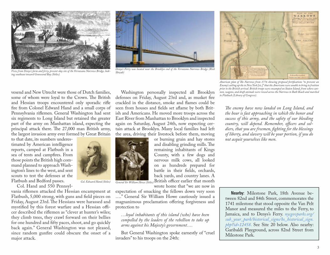
it meets the Shore Road at 101st Street and affords a grand view of the Narrows, Lower New York Bay, and, on a clear day, Sandy Hook. A 1916 plaque, set into a boulder and funded by the Long Island chapter of the NSDAR, commemorates “the first resistance made to British arms in New York State, August, 1776.” Nearby is a 1980 flagpole honoring John Paul Jones as “father of the U.S. Navy” who fought and sank the H.M.S. Serapis off the coast of Yorkshire in 1779. A World War I monument is also nearby.
Inside Fort Hamilton are the Harbor Defense Museum, www.harbordefensemuseum.com, and buildings regis-tered on the National Register of Historic Sites. The museum has collections of U.S. Army weapons, uni-forms, and accoutrements from 18th century to pres-ent, military themed art and historical items from Fort Hamilton, and exhibitions on the Battle of Brooklyn and World War II. The Narrows and Sandy Hook can easily be viewed from high ground in Fort Hamilton.
What Happened Here: A massive British fleet and invasion army anchored in New York Harbor in the summer months of 1776, bivouacking on Staten Island as nervous Long Island and New York residents, fearful for their crops and their commerce, began to remove
John Paul Jones Park
Fort Hamilton/ Harbor Defense Museum
Location: Brooklyn shore from Fort Hamilton Mili-tary Reservation to Coney Island on the westernmost tip of Brooklyn, east and west of the Brooklyn stan-chion of the Verrazano-Narrows Bridge. Site is marked at John Paul Jones Park, 4th Avenue at 101st Street. Fort Hamilton, home of the North Atlantic Division of the U.S. Army Corps of Engineers, is open to visi-tors through the 101st Street and 7th Avenue Gates; its Harbor Defense Museum is open Monday-Friday, 10-4, Saturday 10-2. Careful directions to Fort Ham-ilton are located on its website: www.nad.usace.army.mil/fh.htm.
Subway: ) to 95th Street/4th Avenue; approxi-mately 20 min. walk to the end of 4th Avenue at 101st Street. Bicycle: overpasses with ramps or stairs to the bike-friendly shore trail are located in Bay Ridge and Gravesend Bay. Note that the Verrazano Bridge does not permit bicycles or pedestrians.
John Paul Jones Park: this little jewel of a park sits just outside the west gate of Fort Hamilton, below the steady roar of the Brooklyn stanchion of the Verrazano Bridge. It is located at the end of Fourth Avenue where
horses, grain stores, children, and thousands of head of cattle to safer quarters inland, some even taken by boat across Long Island Sound to Connecticut. The invad-ers numbered 27,000, more than half of whom were hired troops from European principalities. General Washington had marched the American army from Boston to New York and by April was preparing to de-fend miles and miles of shoreline on two islands with fewer than 10,000 troops, many of whom were ill and unfit for duty. American riflemen harassed the Brit-ish, Hessian, and Waldecker troops and mariners from New Jersey’s Bergen Neck, and a small band of patriots hauled 12-pound cannon to Denys’s Ferry, now near or within the Fort Hamilton military reservation, from which point on July 4 they fired on HMS Asia, one of many British warships prowling the Harbor, the Nar-rows, and coastal waters.
The British began moving troops, horse and cannons from Staten Island to the Brooklyn shore on Thursday, August 22nd, 1776, landing men at Denys’s Ferry and along the beachfront to the east, now known chiefly by their community names as Bay Ridge, Fort Hamil-ton, and Bath Beach. The waterfront properties of Gra-
Site 1. The British Landing Site at Gravesend/John Paul Jones Park
Part 1: Prologue to Battle
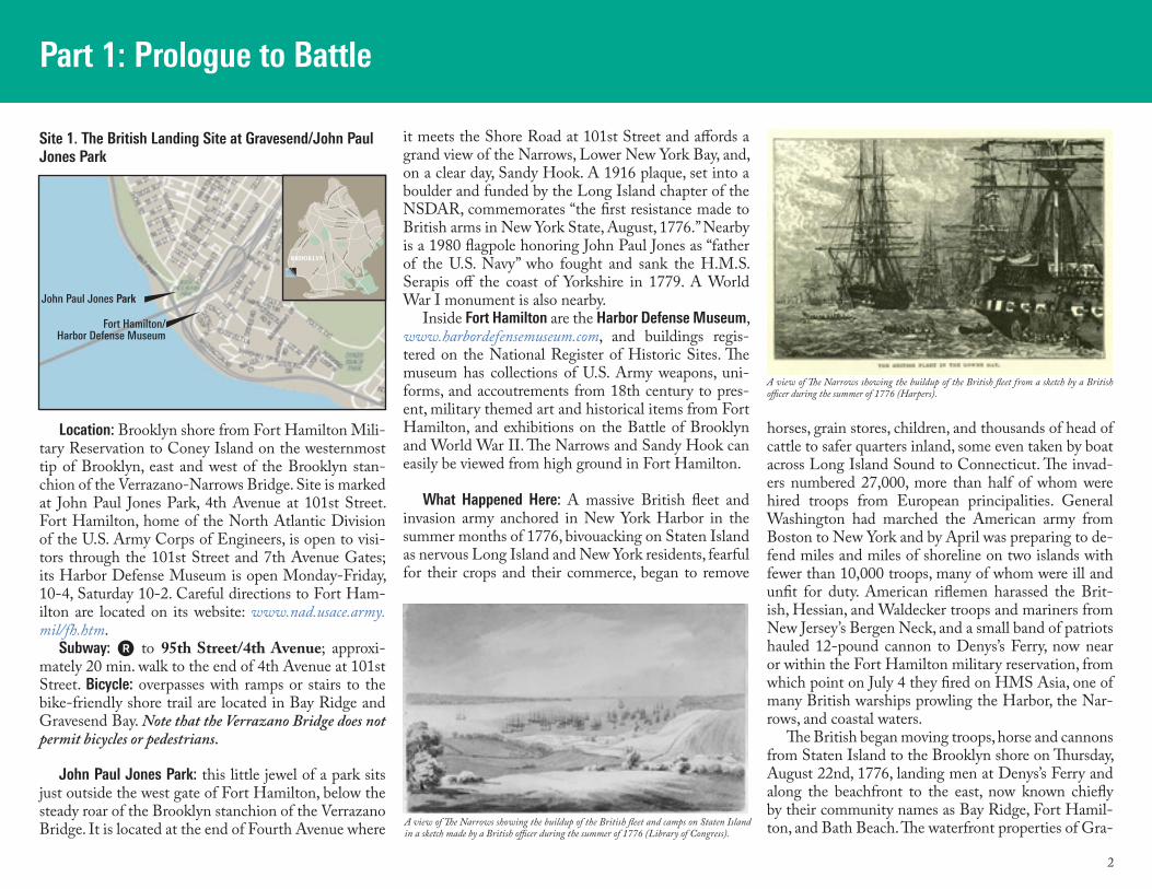
A view of The Narrows showing the buildup of the British fleet and camps on Staten Island in a sketch made by a British officer during the summer of 1776 (Library of Congress).
A view of The Narrows showing the buildup of the British fleet from a sketch by a British officer during the summer of 1776 (Harpers).
3
Washington personally inspected all Brooklyn defenses on Friday, August 23rd and, as musket fire crackled in the distance, smoke and flames could be seen from houses and fields set aflame by both Brit-ish and Americans. He moved more troops across the East River from Manhattan to Brooklyn and inspected again on Saturday, August 24th, now expecting cer-tain attack at Brooklyn. Many local families had left the area, driving their livestock before them, moving
or burning grain and hay stores and disabling grinding mills. The remaining inhabitants of Kings County, with a few dogs and nervous milk cows, all looked on as hundreds prepared for battle in their fields, orchards, back yards, and country lanes. A British officer earlier that month wrote home that “we are now in
expectation of smacking the fellows down very soon ….” General Sir William Howe cautiously issued a magnanimous proclamation offering forgiveness and protection to
…loyal inhabitants of this island (who) have been compelled by the leaders of the rebellion to take up arms against his Majesty’s government…. But General Washington spoke earnestly of “cruel
invaders” to his troops on the 24th:
vesend and New Utrecht were those of Dutch families, some of whom were loyal to the Crown. The British and Hessian troops encountered only sporadic rifle fire from Colonel Edward Hand and a small corps of Pennsylvania riflemen. General Washington had sent six regiments to Long Island but retained the greater part of the army on Manhattan island, expecting the principal attack there. The 27,000 man British army, the largest invasion army ever formed by Great Britain to that date, its numbers underes-timated by American intelligence reports, camped at Flatbush in a sea of tents and campfires. From those points the British high com-mand planned to approach Wash-ington’s lines to the west, and sent scouts to test the defenses at the Flatbush and Bedford passes.
Col. Hand and 550 Pennsyl-vania riflemen attacked the Hessian encampment at Flatbush, 5,000 strong, with guns and field pieces on Friday, August 23rd. The Hessians were harassed and mystified by this forest warfare and a Hessian offi-cer described the riflemen as “clever at hunter’s wiles; they climb trees, they crawl forward on their bellies for one hundred and fifty paces, shoot, and go quickly back again.” General Washington was not pleased, since random gunfire could obscure the onset of a major attack.
The enemy have now landed on Long Island, and the hour is fast approaching in which the honor and success of this army, and the safety of our bleeding country, will depend. Remember, officers and sol-diers, that you are freemen, fighting for the blessings of liberty, and slavery will be your portion, if you do not acquit yourselves like men.
Nearby: Milestone Park, 18th Avenue be-tween 82nd and 84th Street, commemorates the 1741 milestone that stood opposite the Van Pelt Manor and measured the miles to the Ferry, to Jamaica, and to Denys’s Ferry. nycgovparks.org/sub_your_park/historical_signs/hs_historical_sign.php?id=12458. See Site 20 below. Also nearby: Garibaldi Playground, across 82nd Street from Milestone Park.
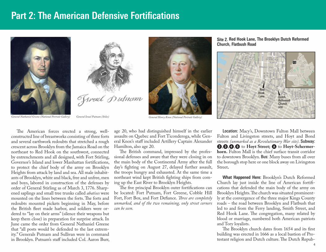
American plan of The Narrows from 1776 showing proposed fortifications “to prevent an Enemy’s sailing up the to New York [sic.]” that the Americans were unable to bring to fruition prior to the British arrival. British troops were encamped on Staten Island, from where can-non, wagons, and draft animals were rowed across the Narrows to Bath Beach and marched to Flatbush (Library of Congress).
Denys’s Ferry was located near the Brooklyn end of the Verrazono Narrows Bridge (Rick Shwab)
General Sir William Howe (Stiles)Col. Edward Hand (Stiles)
View from Denys’s farm and ferry, present-day site of the Verrazano Narrows Bridge, look-ing southeast toward Gravesend Bay (Stiles).
4
Part 2: The American Defensive Fortifications
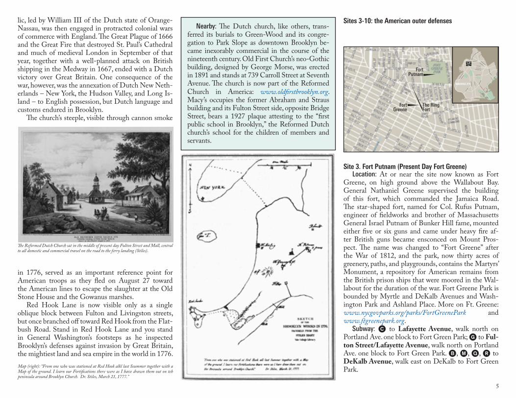
The American forces erected a strong, well- constructed line of breastworks consisting of three forts and several earthwork redoubts that stretched a rough crescent across Brooklyn from the Jamaica Road on the northeast to Red Hook on the southwest, connected by entrenchments and all designed, with Fort Stirling, Governor’s Island and lower Manhattan fortifications, to protect the chief body of the army on Brooklyn Heights from attack by land and sea. All male inhabit-ants of Brooklyn, white and black, free and unfree, men and boys, labored in construction of the defenses by order of General Stirling as of March 3, 1776. Sharp-ened saplings and small tree trunks called abatises were mounted on the lines between the forts. The forts and redoubts mounted pickets beginning in May, before the British fleet made harbor, and soldiers were or-dered to “lay on their arms” (silence their weapons but keep them close) in preparation for surprise attack. In June came the order from General Nathaniel Greene that “all posts would be defended to the last extrem-ity.” Generals Putnam and Sullivan were in command in Brooklyn. Putnam’s staff included Col. Aaron Burr,
age 20, who had distinguished himself in the earlier assaults on Quebec and Fort Ticonderoga, while Gen-eral Knox’s staff included Artillery Captain Alexander Hamilton, also age 20.
The British command, impressed by the profes-sional defenses and aware that they were closing in on the main body of the Continental Army after the full day’s fighting on August 27, delayed further assault, the troops hungry and exhausted. At the same time a northeast wind kept British fighting ships from com-ing up the East River to Brooklyn Heights.
The five principal Brooklyn outer fortifications can be located: Fort Putnam, Fort Greene, Cobble Hill Fort, Fort Box, and Fort Defiance. Three are completely unmarked, and of the two remaining, only street corners can be seen.
Location: Macy’s, Downtown Fulton Mall between Fulton and Livingston streets, and Hoyt and Bond streets (unmarked as a Revolutionary War site). Subway: 2,3,4,5 to Hoyt Street; A to Hoyt-Schermer-horn. Fulton Mall is the chief surface transit corridor to downtown Brooklyn. Bus: Many buses from all over the borough stop here or one block away on Livingston Street.
What Happened Here: Brooklyn’s Dutch Reformed Church lay just inside the line of American fortifi-cations that defended the main body of the army on Brooklyn Heights. The church was situated prominent-ly at the convergence of the three major Kings County roads – the road between Brooklyn and Flatbush that led to and from the Ferry landing, Smith Street, and Red Hook Lane. The congregation, many related by blood or marriage, numbered both American patriots and Tory loyalists.
The Brooklyn church dates from 1654 and its first building was erected in 1666 as a local bastion of Pro-testant religion and Dutch culture. The Dutch Repub-
LINDEN BLVD
FLATBUSH AV
OC
EA
N P
KW
Y
OC
EA
N A
V
EASTERN PKWY
ATLANTIC AV
FULTON ST
BAY P
KWY
GO
WAN
US
EXPW
Y
MYRTLE AV
BROADWAY
BUSHWICK AV
KIN
GS
HW
Y
BR
OO
KLY
N Q
UEENS EXPWY
PE
NN
SY
LVANIA AV
FOURT
H AV
AREA OF THIS MAP
BROOKLYNBROOKLYN
RedHookLane Dutch
ReformedChurchsite
Site 2. Red Hook Lane, The Brooklyn Dutch Reformed Church, Flatbush Road
General Israel Putnam (Stiles)General Nathaniel Greene (National Portrait Gallery) General Henry Knox (National Portrait Gallery)
5
lic, led by William III of the Dutch state of Orange-Nassau, was then engaged in protracted colonial wars of commerce with England. The Great Plague of 1666 and the Great Fire that destroyed St. Paul’s Cathedral and much of medieval London in September of that year, together with a well-planned attack on British shipping in the Medway in 1667, ended with a Dutch victory over Great Britain. One consequence of the war, however, was the annexation of Dutch New Neth-erlands – New York, the Hudson Valley, and Long Is-land – to English possession, but Dutch language and customs endured in Brooklyn.
The church’s steeple, visible through cannon smoke
in 1776, served as an important reference point for American troops as they fled on August 27 toward the American lines to escape the slaughter at the Old Stone House and the Gowanus marshes.
Red Hook Lane is now visible only as a single oblique block between Fulton and Livingston streets, but once branched off toward Red Hook from the Flat-bush Road. Stand in Red Hook Lane and you stand in General Washington’s footsteps as he inspected Brooklyn’s defenses against invasion by Great Britain, the mightiest land and sea empire in the world in 1776.
Nearby: The Dutch church, like others, trans-ferred its burials to Green-Wood and its congre-gation to Park Slope as downtown Brooklyn be-came inexorably commercial in the course of the nineteenth century. Old First Church’s neo-Gothic building, designed by George Morse, was erected in 1891 and stands at 739 Carroll Street at Seventh Avenue. The church is now part of the Reformed Church in America: www.oldfirstbrooklyn.org. Macy’s occupies the former Abraham and Straus building and its Fulton Street side, opposite Bridge Street, bears a 1927 plaque attesting to the “first public school in Brooklyn,” the Reformed Dutch church’s school for the children of members and servants.
Site 3. Fort Putnam (Present Day Fort Greene)Location: At or near the site now known as Fort
Greene, on high ground above the Wallabout Bay. General Nathaniel Greene supervised the building of this fort, which commanded the Jamaica Road. The star-shaped fort, named for Col. Rufus Putnam, engineer of fieldworks and brother of Massachusetts General Israel Putnam of Bunker Hill fame, mounted either five or six guns and came under heavy fire af-ter British guns became ensconced on Mount Pros-pect. The name was changed to “Fort Greene” after the War of 1812, and the park, now thirty acres of greenery, paths, and playgrounds, contains the Martyrs’ Monument, a repository for American remains from the British prison ships that were moored in the Wal-labout for the duration of the war. Fort Greene Park is bounded by Myrtle and DeKalb Avenues and Wash-ington Park and Ashland Place. More on Ft. Greene: www.nycgovparks.org/parks/FortGreenePark and www.ftgreenepark.org.
Subway: C to Lafayette Avenue, walk north on Portland Ave. one block to Fort Green Park; G to Ful-ton Street/Lafayette Avenue, walk north on Portland Ave. one block to Fort Green Park. B, M, Q, ) to DeKalb Avenue, walk east on DeKalb to Fort Green Park.
Sites 3-10: the American outer defenses
LINDEN BLVD
FLATBUSH AV
OC
EA
N P
KW
Y
OC
EA
N A
V
EASTERN PKWY
ATLANTIC AV
FULTON ST
BAY P
KWY
GO
WAN
US
EXPW
Y
MYRTLE AV
BROADWAY
BUSHWICK AV
KIN
GS
HW
Y
BR
OO
KLY
N Q
UEENS EXPWY
PE
NN
SY
LVANIA AV
FOURT
H AV
AREA OF THIS MAP
BROOKLYNBROOKLYN
FortPutnam
FortGreene
The RingFort
The Reformed Dutch Church sat in the middle of present day Fulton Street and Mall, central to all domestic and commercial travel on the road to the ferry landing (Stiles).
Map (right): “From one who was stationed at Red Hook alkl last Ssummer together with a Map of the ground. I learn our Fortifications there were as I have drawn them out on teh peninsula around Brooklyn Church. Dr. Stiles, March 21, 1777.”
6
Site 4. The Ring FortLocation: At or near the corner of DeKalb and Hud-
son Avenues (site unmarked). Directions: Same as for Fort Putnam, above. This
busy intersection is close by the Flatbush Avenue Ex-tension that leads to the Manhattan Bridge, which has a biking/walking path.
What Happened Here: An entrenchment led from Fort Putnam (now Fort Greene Park) downhill to this fortification that sat close to the waters of the East River’s Wallabout Bay, today’s Brooklyn Navy Yard, and with Fort Putnam guarded the roads from Jamaica and Flatbush. This earthworks or redoubt was marked on contemporary maps but no image or drawing of it ex-ists. The site itself is marked by an undated wall plaque inside the corner entrance to Long Island University. The bas-relief plaque shows an image of Washington on horseback with five men, only two of whom are in uniform, bestride a felled tree and a cannon.
Site 5. Old Fort GreeneLocation: Approximately corner Flatbush Avenue
between Schermerhorn and State Streets (site un-marked).
Subway: 2, 4, 5 to Nevins Street; A, G to Hoyt-Schermerhorn; 2, 4, 5, B, D, M, Q, ) to Atlantic Avenue/Pacific Street.
What Happened Here: No army could approach the Wallabout or Brooklyn Ferry except by the Brooklyn-Flatbush Road, where a third fort stood guard. Fort Greene in 1776 was not the grand Fort Greene Park of today but a star-shaped fort that mounted six guns on
the Brooklyn-Flatbush Road at approximately the cor-ner where State and Schermerhorn Streets and Third and Flatbush Avenues converge. That fort was named for its builder, General Nathanael Greene of Rhode Island, the army’s quartermaster-general, later to dis-tinguish himself in the field both as a commander and military strategist. A contemporary source located this fort halfway between Fort Putnam and the millpond on the Gowanus, nearly at the head of the Gowanus Creek.
Site 6. The Cobble Hill Fort (Also Known as Corkscrew Fort, Spiral Fort, Ponkiesburgh Fort, Smith’s Barbette)
Location: Corner of Atlantic Avenue and Court Street (see map next page). Bronze plaque on the Court Street side of former bank building.
Subway: 2,3,4,5 to Borough Hall; walk four blocks on Court Street in same direction as traffic to Atlantic Avenue. F, G to Bergen Street, walk uphill one block to Court Street, turn right three blocks to At-lantic Avenue.
What Happened Here: This fortification stood on high ground about three-quarters of a mile southwest of Fort Greene, from which it commanded Red Hook Lane and the northern slopes of the Gowanus creek and marshes with three or four cannon and a sweeping 360° view of South Brooklyn, New York Harbor, and the East River. This fort signaled with two guns the landing of the Brit-ish on Long Island, and Washington reportedly viewed
Nearby: The Brooklyn Navy Yard (¾ mile north, downhill), Fort Greene Park (two blocks uphill on DeKalb Ave.), the buildings of Long Island University, the Brooklyn and Cumberland Hospital complex, and the venue for Brooklyn’s cheesecake gift to the world, Junior’s Restaurant. Note also Fleet Street and Place, once the site of a nineteenth century country estate.
Nearby: Brooklyn Academy of Music, the Mark Morris Dance Company and other compo-nents of the BAM cultural district; the Italianate 1917 Baptist Temple; the 1929 Williamsburg Bank Building, now residences but containing one of Brooklyn’s two landmarked interiors; the Atlantic Center shopping mall and, underneath it, the hub for most of Brooklyn’s subway lines as well as the Long Island Railroad station; and the Atlantic Yards, sited for future development and a basketball stadium. Lafayette Avenue Presbyte-rian Church, was an abolitionist “temple” during the Civil War.
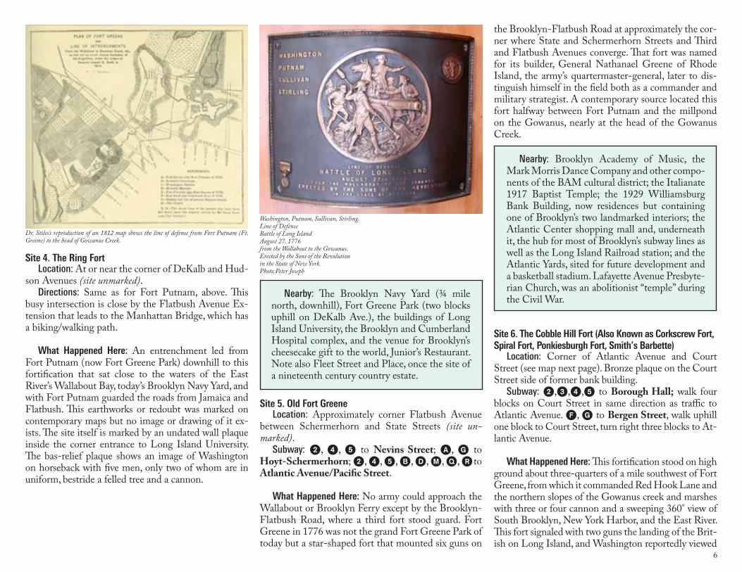
Dr. Stiles’s reproduction of an 1812 map shows the line of defense from Fort Putnam (Ft. Greene) to the head of Gowanus Creek.
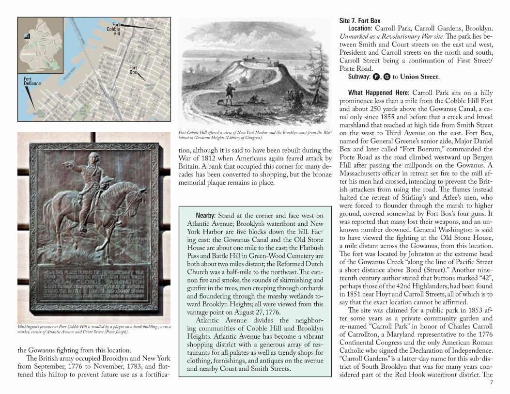
Washington, Putnam, Sullivan, Stirling. Line of Defense Battle of Long IslandAugust 27, 1776from the Wallabout to the Gowanus.Erected by the Sons of the Revolution in the State of New York.Photo:Peter Joseph
7
the Gowanus fighting from this location. The British army occupied Brooklyn and New York
from September, 1776 to November, 1783, and flat-tened this hilltop to prevent future use as a fortifica-
tion, although it is said to have been rebuilt during the War of 1812 when Americans again feared attack by Britain. A bank that occupied this corner for many de-cades has been converted to shopping, but the bronze memorial plaque remains in place.
Site 7. Fort Box Location: Carroll Park, Carroll Gardens, Brooklyn.
Unmarked as a Revolutionary War site. The park lies be-tween Smith and Court streets on the east and west, President and Carroll streets on the north and south, Carroll Street being a continuation of First Street/Porte Road.
Subway: F, G to Union Street.
What Happened Here: Carroll Park sits on a hilly prominence less than a mile from the Cobble Hill Fort and about 250 yards above the Gowanus Canal, a ca-nal only since 1855 and before that a creek and broad marshland that reached at high tide from Smith Street on the west to Third Avenue on the east. Fort Box, named for General Greene’s senior aide, Major Daniel Box and later called “Fort Boerum,” commanded the Porte Road as the road climbed westward up Bergen Hill after passing the millponds on the Gowanus. A Massachusetts officer in retreat set fire to the mill af-ter his men had crossed, intending to prevent the Brit-ish attackers from using the road. The flames instead halted the retreat of Stirling’s and Atlee’s men, who were forced to flounder through the marsh to higher ground, covered somewhat by Fort Box’s four guns. It was reported that many lost their weapons, and an un-known number drowned. General Washington is said to have viewed the fighting at the Old Stone House, a mile distant across the Gowanus, from this location. The fort was located by Johnston at the extreme head of the Gowanus Creek “along the line of Pacific Street a short distance above Bond (Street).” Another nine-teenth century author stated that buttons marked “42”, perhaps those of the 42nd Highlanders, had been found in 1851 near Hoyt and Carroll Streets, all of which is to say that the exact location cannot be affirmed.
The site was claimed for a public park in 1853 af-ter some years as a private community garden and re-named “Carroll Park” in honor of Charles Carroll of Carrollton, a Maryland representative to the 1776 Continental Congress and the only American Roman Catholic who signed the Declaration of Independence. “Carroll Gardens” is a latter-day name for this sub-dis-trict of South Brooklyn that was for many years con-sidered part of the Red Hook waterfront district. The
Nearby: Stand at the corner and face west on Atlantic Avenue; Brooklyn’s waterfront and New York Harbor are five blocks down the hill. Fac-ing east: the Gowanus Canal and the Old Stone House are about one mile to the east; the Flatbush Pass and Battle Hill in Green-Wood Cemetery are both about two miles distant; the Reformed Dutch Church was a half-mile to the northeast. The can-non fire and smoke, the sounds of skirmishing and gunfire in the trees, men creeping through orchards and floundering through the marshy wetlands to-ward Brooklyn Heights; all were viewed from this vantage point on August 27, 1776.
Atlantic Avenue divides the neighbor-ing communities of Cobble Hill and Brooklyn Heights. Atlantic Avenue has become a vibrant shopping district with a generous array of res-taurants for all palates as well as trendy shops for clothing, furnishings, and antiques on the avenue and nearby Court and Smith Streets.
LINDEN BLVD
FLATBUSH AV
OC
EA
N P
KW
Y
OC
EA
N A
V
EASTERN PKWY
ATLANTIC AV
FULTON ST
BAY P
KWY
GO
WAN
US
EXPW
Y
MYRTLE AV
BROADWAY
BUSHWICK AV
KIN
GS
HW
Y
BR
OO
KLY
N Q
UEENS EXPWY
PE
NN
SY
LVANIA AV
FOURT
H AV
AREA OF THIS MAP
BROOKLYNBROOKLYN
FortCobble
Hill
FortBox
Fort Defiance
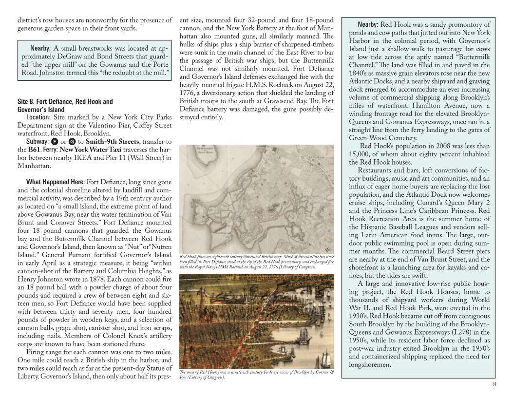
Washington’s presence at Fort Cobble Hill is recalled by a plaque on a bank building , now a market, corner of Atlantic Avenue and Court Street (Peter Joseph).
Fort Cobble Hill offered a view of New York Harbor and the Brooklyn coast from the Wal-labout to Gowanus Heights (Library of Congress).
8
district’s row houses are noteworthy for the presence of generous garden space in their front yards.
Site 8. Fort Defiance, Red Hook and Governor’s Island
Location: Site marked by a New York City Parks Department sign at the Valentino Pier, Coffey Street waterfront, Red Hook, Brooklyn.
Subway: F or G to Smith-9th Streets, transfer to the B61. Ferry: New York Water Taxi traverses the har-bor between nearby IKEA and Pier 11 (Wall Street) in Manhattan.
What Happened Here: Fort Defiance, long since gone
and the colonial shoreline altered by landfill and com-mercial activity, was described by a 19th century author as located on “a small island, the extreme point of land above Gowanus Bay, near the water termination of Van Brunt and Conover Streets.” Fort Defiance mounted four 18 pound cannons that guarded the Gowanus bay and the Buttermilk Channel between Red Hook and Governor’s Island, then known as “Nut” or“Nutten Island.” General Putnam fortified Governor’s Island in early April as a strategic measure, it being “within cannon-shot of the Battery and Columbia Heights,” as Henry Johnston wrote in 1878. Each cannon could fire an 18 pound ball with a powder charge of about four pounds and required a crew of between eight and six-teen men, so Fort Defiance would have been supplied with between thirty and seventy men, four hundred pounds of powder in wooden kegs, and a selection of cannon balls, grape shot, canister shot, and iron scraps, including nails. Members of Colonel Knox’s artillery corps are known to have been stationed there.
Firing range for each cannon was one to two miles. One mile could reach a British ship in the harbor, and two miles could reach as far as the present-day Statue of Liberty. Governor’s Island, then only about half its pres-
ent size, mounted four 32-pound and four 18-pound cannon, and the New York Battery at the foot of Man-hattan also mounted guns, all similarly manned. The hulks of ships plus a ship barrier of sharpened timbers were sunk in the main channel of the East River to bar the passage of British war ships, but the Buttermilk Channel was not similarly mounted. Fort Defiance and Governor’s Island defenses exchanged fire with the heavily-manned frigate H.M.S. Roebuck on August 22, 1776, a diversionary action that shielded the landing of British troops to the south at Gravesend Bay. The Fort Defiance battery was damaged, the guns possibly de-stroyed entirely.
Nearby: Red Hook was a sandy promontory of ponds and cow paths that jutted out into New York Harbor in the colonial period, with Governor’s Island just a shallow walk to pasturage for cows at low tide across the aptly named “Buttermilk Channel.” The land was filled in and paved in the 1840’s as massive grain elevators rose near the new Atlantic Docks, and a nearby shipyard and graving dock emerged to accommodate an ever increasing volume of commercial shipping along Brooklyn’s miles of waterfront. Hamilton Avenue, now a winding frontage road for the elevated Brooklyn-Queens and Gowanus Expressways, once ran in a straight line from the ferry landing to the gates of Green-Wood Cemetery.
Red Hook’s population in 2008 was less than 15,000, of whom about eighty percent inhabited the Red Hook houses.
Restaurants and bars, loft conversions of fac-tory buildings, music and art communities, and an influx of eager home buyers are replacing the lost population, and the Atlantic Dock now welcomes cruise ships, including Cunard’s Queen Mary 2 and the Princess Line’s Caribbean Princess. Red Hook Recreation Area is the summer home of the Hispanic Baseball Leagues and vendors sell-ing Latin American food items. The large, out-door public swimming pool is open during sum-mer months. The commercial Beard Street piers are nearby at the end of Van Brunt Street, and the shorefront is a launching area for kayaks and ca-noes, but the tides are swift.
A large and innovative low-rise public hous-ing project, the Red Hook Houses, home to thousands of shipyard workers during World War II, and Red Hook Park, were erected in the 1930’s. Red Hook became cut off from contiguous South Brooklyn by the building of the Brooklyn-Queens and Gowanus Expressways (I 278) in the 1950’s, while its resident labor force declined as post-war industry exited Brooklyn in the 1950’s and containerized shipping replaced the need for longshoremen.
Nearby: A small breastworks was located at ap-proximately DeGraw and Bond Streets that guard-ed “the upper mill” on the Gowanus and the Porte Road. Johnston termed this “the redoubt at the mill.”
The area of Red Hook from a nineteenth century birds eye view of Brooklyn by Currier & Ives (Library of Congress).
Red Hook from an eighteenth century illustrated British map. Much of the coastline has since been filled in. Fort Defiance stood at the tip of the Red Hook promontory, and exchanged fire with the Royal Navy’s HMS Roebuck on August 22, 1776 (Library of Congress).
9
Chimneys,” the house occupied by General George Washington as headquarters during the Battle of Long Island in which the council of war was held August 28, 1776 when it was decided to with-draw the American army from Long Island. www.nycgovparks.org/sub_your_park/historical_signs/hs_historical_sign.php?id=136
Nearby: Harry Chapin Park, Columbia Heights at Middagh Street, named for the songster/hu-manitarian (1942-1981) who grew up in Brooklyn Heights.
Pierrepont sold off the land in lots that favored the construction of row houses, churches, and as-sembly rooms, not unlike any English country town of the same period. The intersection of Pier-repont Place and Columbia Heights, surrounded by gracious row houses and sumptuous apartment buildings, is rich in Brooklyn’s history. The names of early Brooklyn Heights landowners are remem-bered in street names: Middagh, Hicks, Remsen, Joralemon, and Livingston, while Revolutionary heroes and later landowners are remembered in others: Washington, Adams, Jay, Sands, and Pier-repont. Abraham Lincoln’s carriage rolled down Pierrepont Street to the waterfront in 1864 while on a visit to New York City and Mayor Seth Low’s former mansion still presides over the Promenade, which extends from Remsen to Orange streets. The home of Henry Evelyn Pierrepont, a supporter of the Brooklyn Bridge, stood where now sits the Pier-repont Playground. The house and extensive lands of Philip Livingston lay south of Hicks Street, and the estate’s kitchen garden is remembered in the street name “Garden Place.” Livingston, scion of the Hudson Valley Livingstons, was absent as a delegate to the Continental Congress at Phila-delphia and had only days before signed the Dec-laration of Independence. On nearby streets lived twentieth century authors Arthur Miller, Norman Mailer, Norman Rosten, Carson McCullers,W. H. Auden, Richard Wright and Truman Capote.
the Brooklyn Heights Promenade marks the location of the fort, which later housed Hessian troops during the occupation of the city by the British from Septem-ber, 1776 to 1783. A British fort, “Fort Brooklyn,” was erected nearby in 1780 and stood until c. 1825. Note that the name of the fort is often misspelled as “Ster-ling.” The marker was funded and placed by the Fort Greene Chapter, NSDAR, and a generous Parks De-partment sitting area affords visitors a great view of lower Manhattan and New York Harbor.
Site 10. The Cornell House, “Four Chimneys”
Location: Same as Fort Stirling, above. A plaque and flagpole stand at the Montague Street entrance to the Brooklyn Heights Promenade, although this was not the actual location of the house.
What Happened Here: The Cornell House was com-mandeered as headquarters by General Washington and his staff in 1776. Hezekiah Beers Pierrepont later purchased the house in 1804 and in time possessed all of the waterfront and land from Love Lane to Rem-sen Street. The Pierreponts and other Brooklyn fami-lies entertained Lafayette during his visit to the United States, during which celebrations were recounted first-hand accounts by military men of the evacuation of the American Army from the ferry landing on the night of August 29, 1776. The plaque on the Promenade reads:
This tablet marks the land upon which stood ‘Four
LINDEN BLVD
FLATBUSH AV
OC
EA
N P
KW
Y
OC
EA
N A
V
EASTERN PKWY
ATLANTIC AV
FULTON ST
BAY P
KWY
GO
WAN
US
EXPW
Y
MYRTLE AV
BROADWAY
BUSHWICK AV
KIN
GS
HW
Y
BR
OO
KLY
N Q
UEENS EXPWY
PE
NN
SY
LVANIA AV
FOURT
H AV
AREA OF THIS MAP
BROOKLYNBROOKLYN
FortStirling
TheCornellHouse
Site 9. Fort Stirling on Brooklyn Heights
Location: Brooklyn Heights. Subway: 2,3 to Clark Street; elevator to street; walk west on Clark Street to Columbia Heights; 4,5,) to Borough Hall; walk west on Montague or Pierrepont streets to Colum-bia Heights; A, C to High Street; exit at the rear of the train, walk west on Cranberry Street to Columbia Heights, turn left, walk to Pierrepont Street, turn right. Bus: many buses terminate at Boro Hall, Joralemon and Court Streets. Walk west to the Promenade. Bicycle: must be walked on the Brooklyn Heights Promenade.
What Happened Here: Brooklyn Heights, known to the Canarsie Indians as “Ihpetonga,” (high sandy bank) and to colonial Brooklynites as “Clover Hill,” rises uphill from the Brooklyn ferry landing and curves southeast-erly toward Flatbush. The verdant hillside was dotted with farms and estates in 1776, its country lanes leading to the Ferry Road. Fort Stirling, the first of the redoubts to be constructed as of March, 1776, and named for General William Alexander, Lord Stirling, stood at the highest point on the Heights to fire on British cruisers in the East River, approximately between the point at which Columbia and Clark Streets meet. The fort, also known as “Fort Half-Moon,” mounted four cannon ca-pable of reaching as far as Maiden Lane’s “Fly Market,” only a mile or so across the East River in Manhattan. General Washington’s headquarters were nearby.
A 1924 plaque near the Clark Street entrance to
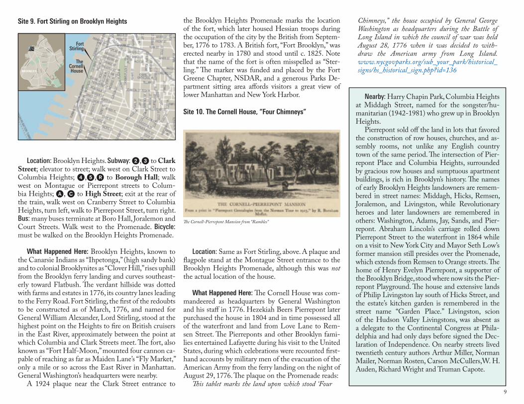
The Cornell-Pierrepont Mansion from “Rambles”
10
Part 3: The Field of Battle
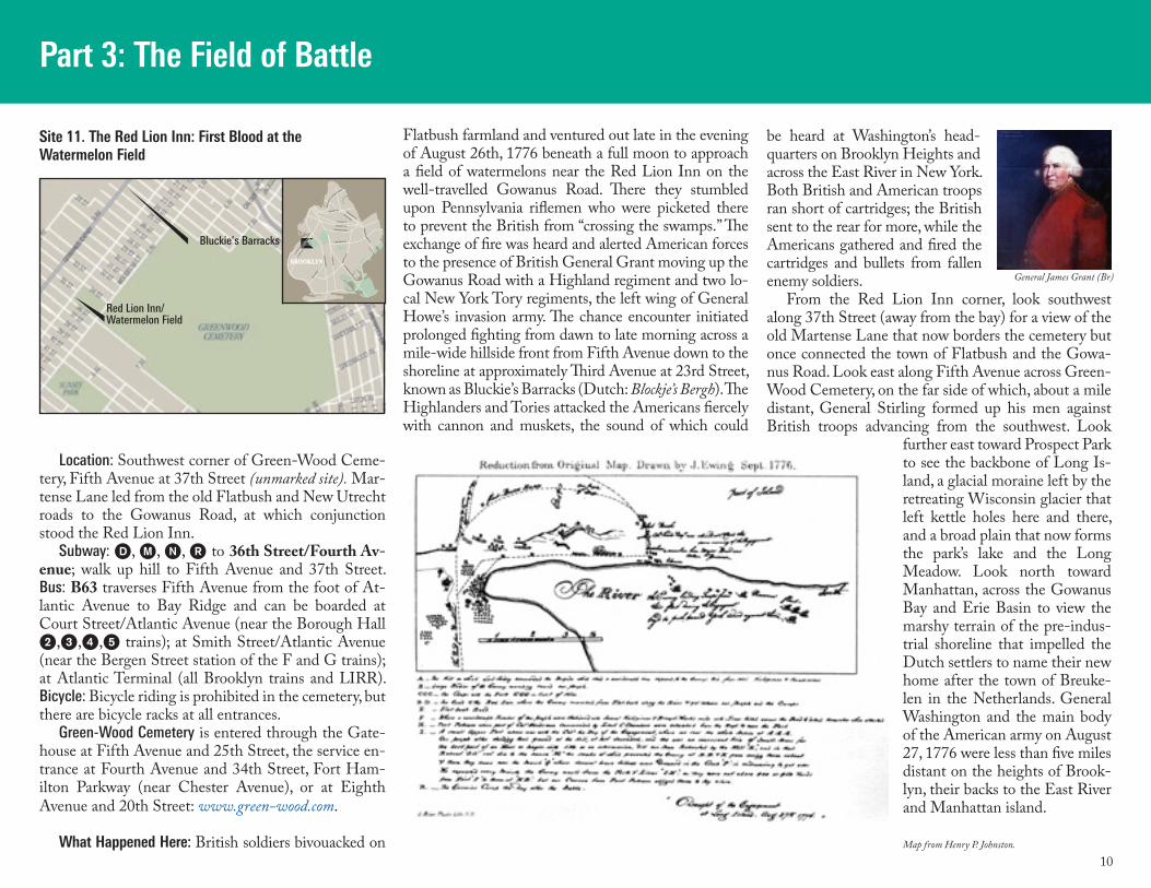
Location: Southwest corner of Green-Wood Ceme-tery, Fifth Avenue at 37th Street (unmarked site). Mar-tense Lane led from the old Flatbush and New Utrecht roads to the Gowanus Road, at which conjunction stood the Red Lion Inn.
Subway: D, M, (, ) to 36th Street/Fourth Av-enue; walk up hill to Fifth Avenue and 37th Street. Bus: B63 traverses Fifth Avenue from the foot of At-lantic Avenue to Bay Ridge and can be boarded at Court Street/Atlantic Avenue (near the Borough Hall 2,3,4,5 trains); at Smith Street/Atlantic Avenue (near the Bergen Street station of the F and G trains); at Atlantic Terminal (all Brooklyn trains and LIRR). Bicycle: Bicycle riding is prohibited in the cemetery, but there are bicycle racks at all entrances.
Green-Wood Cemetery is entered through the Gate-house at Fifth Avenue and 25th Street, the service en-trance at Fourth Avenue and 34th Street, Fort Ham-ilton Parkway (near Chester Avenue), or at Eighth Avenue and 20th Street: www.green-wood.com.
What Happened Here: British soldiers bivouacked on
Flatbush farmland and ventured out late in the evening of August 26th, 1776 beneath a full moon to approach a field of watermelons near the Red Lion Inn on the well-travelled Gowanus Road. There they stumbled upon Pennsylvania riflemen who were picketed there to prevent the British from “crossing the swamps.” The exchange of fire was heard and alerted American forces to the presence of British General Grant moving up the Gowanus Road with a Highland regiment and two lo-cal New York Tory regiments, the left wing of General Howe’s invasion army. The chance encounter initiated prolonged fighting from dawn to late morning across a mile-wide hillside front from Fifth Avenue down to the shoreline at approximately Third Avenue at 23rd Street, known as Bluckie’s Barracks (Dutch: Blockje’s Bergh). The Highlanders and Tories attacked the Americans fiercely with cannon and muskets, the sound of which could
Site 11. The Red Lion Inn: First Blood at the Watermelon Field
be heard at Washington’s head-quarters on Brooklyn Heights and across the East River in New York. Both British and American troops ran short of cartridges; the British sent to the rear for more, while the Americans gathered and fired the cartridges and bullets from fallen enemy soldiers.
From the Red Lion Inn corner, look southwest along 37th Street (away from the bay) for a view of the old Martense Lane that now borders the cemetery but once connected the town of Flatbush and the Gowa-nus Road. Look east along Fifth Avenue across Green-Wood Cemetery, on the far side of which, about a mile distant, General Stirling formed up his men against British troops advancing from the southwest. Look
further east toward Prospect Park to see the backbone of Long Is-land, a glacial moraine left by the retreating Wisconsin glacier that left kettle holes here and there, and a broad plain that now forms the park’s lake and the Long Meadow. Look north toward Manhattan, across the Gowanus Bay and Erie Basin to view the marshy terrain of the pre-indus-trial shoreline that impelled the Dutch settlers to name their new home after the town of Breuke-len in the Netherlands. General Washington and the main body of the American army on August 27, 1776 were less than five miles distant on the heights of Brook-lyn, their backs to the East River and Manhattan island.
GO
WAN
US
EXP
WY
FOURT
H AV
LINDEN BLVD
FLATBUSH AV
OC
EA
N P
KW
Y
OC
EA
N A
V
EASTERN PKWY
ATLANTIC AV
FULTON ST
BAY P
KWY
MYRTLE AV
BROADWAY
BUSHWICK AV
KIN
GS
HW
Y
BR
OO
KLY
N Q
UEENS EXPWY
PE
NN
SY
LVANIA AV AREA OF
THIS MAP
BROOKLYNBROOKLYN
Bluckie’s Barracks
Red Lion Inn/ Watermelon Field
General James Grant (Br)
Map from Henry P. Johnston.
11
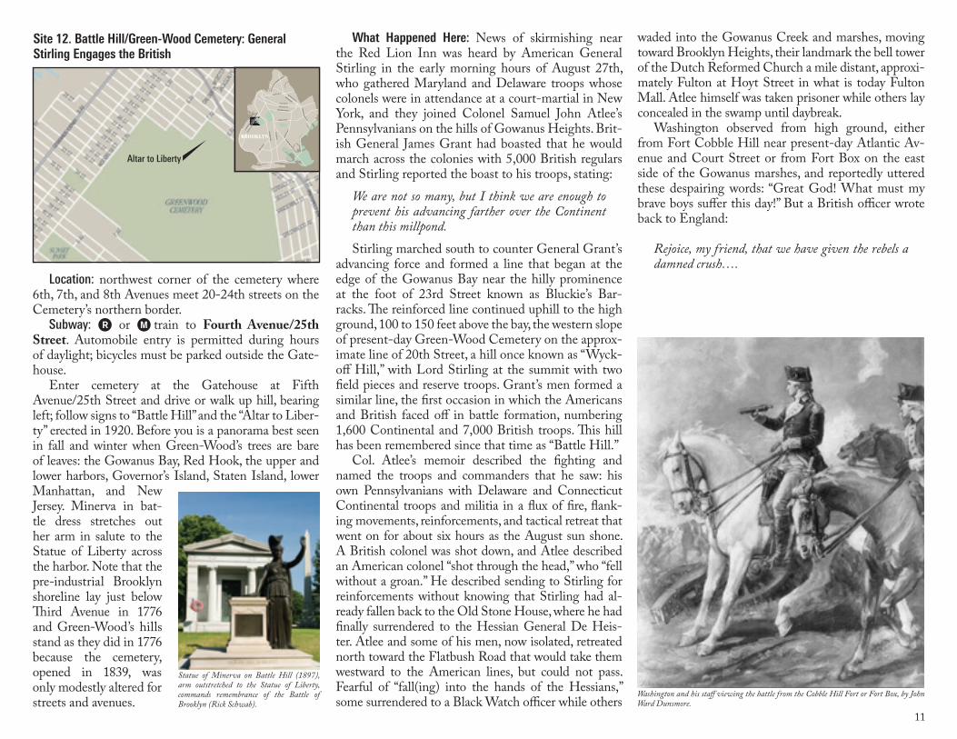
Location: northwest corner of the cemetery where 6th, 7th, and 8th Avenues meet 20-24th streets on the Cemetery’s northern border.
Subway: ) or M train to Fourth Avenue/25th Street. Automobile entry is permitted during hours of daylight; bicycles must be parked outside the Gate-house.
Enter cemetery at the Gatehouse at Fifth Avenue/25th Street and drive or walk up hill, bearing left; follow signs to “Battle Hill” and the “Altar to Liber-ty” erected in 1920. Before you is a panorama best seen in fall and winter when Green-Wood’s trees are bare of leaves: the Gowanus Bay, Red Hook, the upper and lower harbors, Governor’s Island, Staten Island, lower Manhattan, and New Jersey. Minerva in bat-tle dress stretches out her arm in salute to the Statue of Liberty across the harbor. Note that the pre-industrial Brooklyn shoreline lay just below Third Avenue in 1776 and Green-Wood’s hills stand as they did in 1776 because the cemetery, opened in 1839, was only modestly altered for streets and avenues.
Site 12. Battle Hill/Green-Wood Cemetery: General Stirling Engages the British
What Happened Here: News of skirmishing near the Red Lion Inn was heard by American General Stirling in the early morning hours of August 27th, who gathered Maryland and Delaware troops whose colonels were in attendance at a court-martial in New York, and they joined Colonel Samuel John Atlee’s Pennsylvanians on the hills of Gowanus Heights. Brit-ish General James Grant had boasted that he would march across the colonies with 5,000 British regulars and Stirling reported the boast to his troops, stating:
We are not so many, but I think we are enough to prevent his advancing farther over the Continent than this millpond. Stirling marched south to counter General Grant’s
advancing force and formed a line that began at the edge of the Gowanus Bay near the hilly prominence at the foot of 23rd Street known as Bluckie’s Bar-racks. The reinforced line continued uphill to the high ground, 100 to 150 feet above the bay, the western slope of present-day Green-Wood Cemetery on the approx-imate line of 20th Street, a hill once known as “Wyck-off Hill,” with Lord Stirling at the summit with two field pieces and reserve troops. Grant’s men formed a similar line, the first occasion in which the Americans and British faced off in battle formation, numbering 1,600 Continental and 7,000 British troops. This hill has been remembered since that time as “Battle Hill.”
Col. Atlee’s memoir described the fighting and named the troops and commanders that he saw: his own Pennsylvanians with Delaware and Connecticut Continental troops and militia in a flux of fire, flank-ing movements, reinforcements, and tactical retreat that went on for about six hours as the August sun shone. A British colonel was shot down, and Atlee described an American colonel “shot through the head,” who “fell without a groan.” He described sending to Stirling for reinforcements without knowing that Stirling had al-ready fallen back to the Old Stone House, where he had finally surrendered to the Hessian General De Heis-ter. Atlee and some of his men, now isolated, retreated north toward the Flatbush Road that would take them westward to the American lines, but could not pass. Fearful of “fall(ing) into the hands of the Hessians,” some surrendered to a Black Watch officer while others
waded into the Gowanus Creek and marshes, moving toward Brooklyn Heights, their landmark the bell tower of the Dutch Reformed Church a mile distant, approxi-mately Fulton at Hoyt Street in what is today Fulton Mall. Atlee himself was taken prisoner while others lay concealed in the swamp until daybreak.
Washington observed from high ground, either from Fort Cobble Hill near present-day Atlantic Av-enue and Court Street or from Fort Box on the east side of the Gowanus marshes, and reportedly uttered these despairing words: “Great God! What must my brave boys suffer this day!” But a British officer wrote back to England:
Rejoice, my friend, that we have given the rebels a damned crush….
GO
WAN
US
EXP
WY
FOURT
H AV
LINDEN BLVD
FLATBUSH AV
OC
EA
N P
KW
Y
OC
EA
N A
V
EASTERN PKWY
ATLANTIC AV
FULTON ST
BAY P
KWY
MYRTLE AV
BROADWAY
BUSHWICK AV
KIN
GS
HW
Y
BR
OO
KLY
N Q
UEENS EXPWY
PE
NN
SY
LVANIA AV AREA OF
THIS MAP
BROOKLYNBROOKLYN
Altar to Liberty
Washington and his staff viewing the battle from the Cobble Hill Fort or Fort Box, by John Ward Dunsmore.
Statue of Minerva on Battle Hill (1897), arm outstretched to the Statue of Liberty, commands remembrance of the Battle of Brooklyn (Rick Schwab).
12
self became prisoner to the Hessians, who found on his person his orders from General Washington that numbered the total size of the Patriot army.
The construction of Prospect Park between 1866 and 1869 turned up musket balls and bones along the Flatbush Road that had been the boundary between the townships of Flatbush and Brooklyn since 1686. The Porte Road, the sole avenue of retreat from the Flatbush Pass, branched off from the Brooklyn and Flatbush Road at today’s First Street and led down-hill to a junction with the Gowanus Road, then crossed the Gowanus millponds to continue up Bergen Hill and the road that connected to Brooklyn and the fer-ry landing on the East River. In a lush valley on the Flatbush road sat Valley Grove Inn, a way-station, and a partially-excavated hillock on the east side of East Drive is thought to be the remains of the earthworks that guarded the road. As the American Centennial year of 1876 approached, Prospect Park Commission-ers reported their intentions to mark the battle sites for future generations. The Dongan Oak and two other markers indicate the old road through the pass, the line of defense, and Valley Grove Cottage, but the redoubt was probably disturbed by Prospect Park construction and never clearly marked. Other signage was reportedly erected in the early years of the twentieth century but has not survived.
The township of Flatbush lay east and south of to-day’s Prospect Park, its central feature the Flatbush Re-formed Dutch Church www.flatbushchurch.org at the
Location: Battle Pass is located just off Flatbush Av-enue along the northern side of Prosect Park.
Subway: 2, 3 to Grand Army Plaza; 4, B, Q to 7th Avenue. Bus: B41, B69 to Grand Army Plaza. Bicycle: consult Prospect Park map at www.prospect-park.org/visit/plan/map. Walking or biking distance from Grand Army Plaza: about ¾ mile.
Enter the park at Grand Army Plaza; walk through the Eagle columns and after passing the Stranahan statue, bear left onto the East Drive. Follow the East Drive downhill as it descends the east side of Long Meadow. You are traversing the old Brooklyn and Flatbush Road, a portion of the King’s Highway that marked the border between the townships of Brooklyn and Flatbush. The terrain of Prospect Park today will give you an idea of the terrain at the time of the battle. As you descend the hill, on your left is Valley Grove, now called “Nellie’s Lawn;” uphill and on your right is “Sullivan’s Hill.” Note the marker for Valley Grove Inn set into a boulder beneath an oak tree, left, and behind the marker is an unmarked hillock thought to be the remains of a redoubt fort. The marker for the Ameri-can line of defense is 175 yards downhill, right. A mas-sive white oak tree had marked the boundary between Brooklyn and Flatbush since 1686, and General Sul-livan’s men felled the tree to slow the British advance. The marker for the Dongan Oak stands at the bottom of the hill, left (on the right if you enter from Flatbush
Site 13. Battle Pass/Prospect Park: General Sullivan Defends the Flatbush Path
Avenue). Watch for red tail hawks overhead.
What Happened Here: General John Sullivan sent 400 of his 1200 men to Stir-ling for the engagement with General Grant’s forces on the Shore Road, keeping only 800 men to guard the heavily wooded Flatbush Pass with a hastily thrown-up earth-works and two cannon. The massive white oak bound-ary tree, Dongan’s Oak, was cut down to lie across the road, but only two miles distant, encamped at Flatbush and readying for full-scale assault on the Pass, was de Heister with thousands of Hessians and Highlanders. Both Grant and De Heister’s forward assaults were feints, designed to engage the American forces on two fronts, thereby masking the movements of the main body of the British army, which had marched to Jamai-ca by night in order to approach from the east. This far larger force came up behind Sullivan, at which time he and his men turned to fight, leaving the Flatbush Pass defended by two cannon and a body of riflemen. The American defenders of the Pass were routed, and many fell in a shocking massacre, shot and bayoneted, while a few others fled toward the Porte Road, pursued by rifle and cannon fire. Sullivan’s men were cut down by a force vastly superior in numbers, and Sullivan him-
LINDEN BLVD
FLATBUSH AV
OC
EA
N P
KW
Y
OC
EA
N A
V
EASTERN PKWY
ATLANTIC AV
FULTON ST
BAY P
KWY
GO
WAN
US
EXPW
Y
MYRTLE AV
BROADWAY
BUSHWICK AV
KIN
GS
HW
Y
BR
OO
KLY
N Q
UEENS EXPWY
PE
NN
SY
LVANIA AV
FOURT
H AV
AREA OF THIS MAP
BROOKLYNBROOKLYN
Battle PassGeneral John Sullivan(Library of Congress)
Valley Grove Cottage, a wayside inn on the Flatbush-Brooklyn road, near the gap in the hills now the East Drive in Prospect Park (Brooklyn Museum).
A nineteenth century image of Battle Pass, the gap in the hills through which stage coaches ran from Brooklyn to Flatbush. Battle Pass/Flatbush Pass is now on Prospect Park’s East Drive. (Stiles)
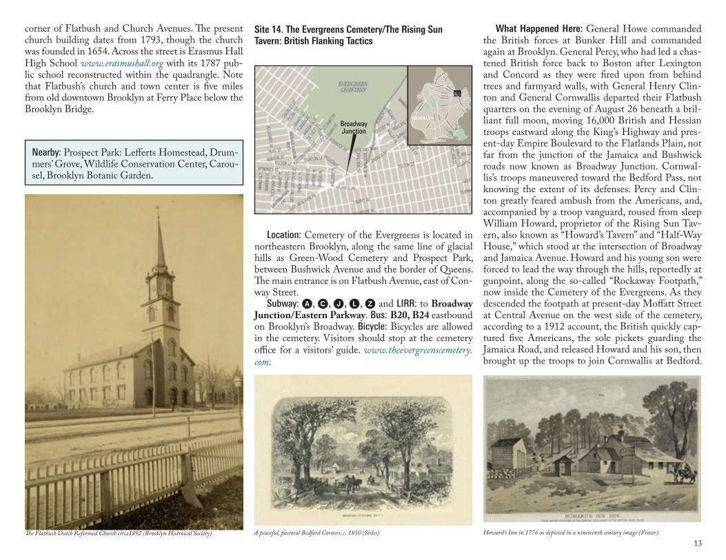
13
Nearby: Prospect Park: Lefferts Homestead, Drum-mers’ Grove, Wildlife Conservation Center, Carou-sel, Brooklyn Botanic Garden.
Location: Cemetery of the Evergreens is located in northeastern Brooklyn, along the same line of glacial hills as Green-Wood Cemetery and Prospect Park, between Bushwick Avenue and the border of Queens. The main entrance is on Flatbush Avenue, east of Con-way Street.
Subway: A, C, J, L, Z and LIRR: to Broadway Junction/Eastern Parkway. Bus: B20, B24 eastbound on Brooklyn’s Broadway. Bicycle: Bicycles are allowed in the cemetery. Visitors should stop at the cemetery office for a visitors’ guide. www.theevergreenscemetery.com.
Site 14. The Evergreens Cemetery/The Rising Sun Tavern: British Flanking Tactics
corner of Flatbush and Church Avenues. The present church building dates from 1793, though the church was founded in 1654. Across the street is Erasmus Hall High School www.erasmushall.org with its 1787 pub-lic school reconstructed within the quadrangle. Note that Flatbush’s church and town center is five miles from old downtown Brooklyn at Ferry Place below the Brooklyn Bridge. LINDEN BLVD
FLATBUSH AV
OC
EA
N P
KW
Y
OC
EA
N A
V
EASTERN PKWY
ATLANTIC AV
FULTON ST
BAY P
KWY
GO
WAN
US
EXPW
Y
MYRTLE AV
BROADWAY
BUSHWICK AV
KIN
GS
HW
Y
BR
OO
KLY
N Q
UEENS EXPWY
PE
NN
SY
LVANIA AV
FOURT
H AV
AREA OF THIS MAP
BROOKLYNBROOKLYN
BroadwayJunction
What Happened Here: General Howe commanded the British forces at Bunker Hill and commanded again at Brooklyn. General Percy, who had led a chas-tened British force back to Boston after Lexington and Concord as they were fired upon from behind trees and farmyard walls, with General Henry Clin-ton and General Cornwallis departed their Flatbush quarters on the evening of August 26 beneath a bril-liant full moon, moving 16,000 British and Hessian troops eastward along the King’s Highway and pres-ent-day Empire Boulevard to the Flatlands Plain, not far from the junction of the Jamaica and Bushwick roads now known as Broadway Junction. Cornwal-lis’s troops maneuvered toward the Bedford Pass, not knowing the extent of its defenses. Percy and Clin-ton greatly feared ambush from the Americans, and, accompanied by a troop vanguard, roused from sleep William Howard, proprietor of the Rising Sun Tav-ern, also known as “Howard’s Tavern” and “Half-Way House,” which stood at the intersection of Broadway and Jamaica Avenue. Howard and his young son were forced to lead the way through the hills, reportedly at gunpoint, along the so-called “Rockaway Footpath,” now inside the Cemetery of the Evergreens. As they descended the footpath at present-day Moffatt Street at Central Avenue on the west side of the cemetery, according to a 1912 account, the British quickly cap-tured five Americans, the sole pickets guarding the Jamaica Road, and released Howard and his son, then brought up the troops to join Cornwallis at Bedford.
The Flatbush Dutch Reformed Church circa1892 (Brooklyn Histroical Society). A peaceful, pastoral Bedford Corners, c. 1850 (Stiles). Howard’s Inn in 1776 as depicted in a nineteenth century image (Fraser).
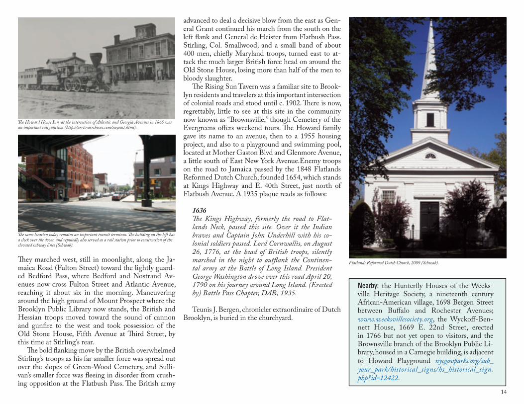
14
They marched west, still in moonlight, along the Ja-maica Road (Fulton Street) toward the lightly guard-ed Bedford Pass, where Bedford and Nostrand Av-enues now cross Fulton Street and Atlantic Avenue, reaching it about six in the morning. Maneuvering around the high ground of Mount Prospect where the Brooklyn Public Library now stands, the British and Hessian troops moved toward the sound of cannon and gunfire to the west and took possession of the Old Stone House, Fifth Avenue at Third Street, by this time at Stirling’s rear.
The bold flanking move by the British overwhelmed Stirling’s troops as his far smaller force was spread out over the slopes of Green-Wood Cemetery, and Sulli-van’s smaller force was fleeing in disorder from crush-ing opposition at the Flatbush Pass. The British army
advanced to deal a decisive blow from the east as Gen-eral Grant continued his march from the south on the left flank and General de Heister from Flatbush Pass. Stirling, Col. Smallwood, and a small band of about 400 men, chiefly Maryland troops, turned east to at-tack the much larger British force head on around the Old Stone House, losing more than half of the men to bloody slaughter.
The Rising Sun Tavern was a familiar site to Brook-lyn residents and travelers at this important intersection of colonial roads and stood until c. 1902. There is now, regrettably, little to see at this site in the community now known as “Brownsville,” though Cemetery of the Evergreens offers weekend tours. The Howard family gave its name to an avenue, then to a 1955 housing project, and also to a playground and swimming pool, located at Mother Gaston Blvd and Glenmore Avenue, a little south of East New York Avenue.Enemy troops on the road to Jamaica passed by the 1848 Flatlands Reformed Dutch Church, founded 1654, which stands at Kings Highway and E. 40th Street, just north of Flatbush Avenue. A 1935 plaque reads as follows:
1636The Kings Highway, formerly the road to Flat-lands Neck, passed this site. Over it the Indian braves and Captain John Underhill with his co-lonial soldiers passed. Lord Cornwallis, on August 26, 1776, at the head of British troops, silently marched in the night to outflank the Continen-tal army at the Battle of Long Island. President George Washington drove over this road April 20, 1790 on his journey around Long Island. (Erected by) Battle Pass Chapter, DAR, 1935. Teunis J. Bergen, chronicler extraordinaire of Dutch
Brooklyn, is buried in the churchyard.
Nearby: the Hunterfly Houses of the Weeks-ville Heritage Society, a nineteenth century African-American village, 1698 Bergen Street between Buffalo and Rochester Avenues; www.weeksvillesociety.org, the Wyckoff-Ben-nett House, 1669 E. 22nd Street, erected in 1766 but not yet open to visitors, and the Brownsville branch of the Brooklyn Public Li-brary, housed in a Carnegie building, is adjacent to Howard Playground nycgovparks.org/sub_your_park/historical_signs/hs_historical_sign.php?id=12422.
The Howard House Inn at the intersection of Atlantic and Georgia Avenues in 1865 was an important rail junction (http://arrts-arrchives.com/enyeast.html).
Flatlands Reformed Dutch Church, 2009 (Schwab).
The same location today remains an important transit terminus. The building on the left has a clock over the dooor, and reputedly also served as a rail station prior to construction of the elevated subway lines (Schwab).
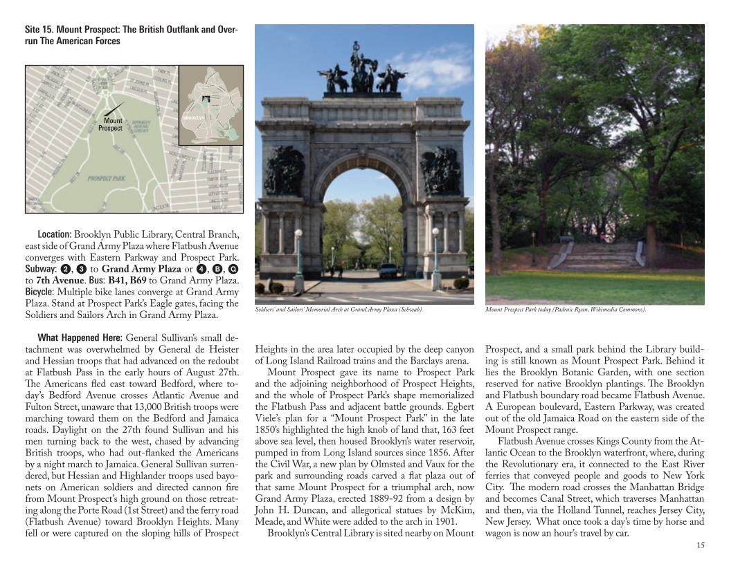
15
Heights in the area later occupied by the deep canyon of Long Island Railroad trains and the Barclays arena.
Mount Prospect gave its name to Prospect Park and the adjoining neighborhood of Prospect Heights, and the whole of Prospect Park’s shape memorialized the Flatbush Pass and adjacent battle grounds. Egbert Viele’s plan for a “Mount Prospect Park” in the late 1850’s highlighted the high knob of land that, 163 feet above sea level, then housed Brooklyn’s water reservoir, pumped in from Long Island sources since 1856. After the Civil War, a new plan by Olmsted and Vaux for the park and surrounding roads carved a flat plaza out of that same Mount Prospect for a triumphal arch, now Grand Army Plaza, erected 1889-92 from a design by John H. Duncan, and allegorical statues by McKim, Meade, and White were added to the arch in 1901.
Brooklyn’s Central Library is sited nearby on Mount
Location: Brooklyn Public Library, Central Branch, east side of Grand Army Plaza where Flatbush Avenue converges with Eastern Parkway and Prospect Park. Subway: 2, 3 to Grand Army Plaza or 4, B, Q to 7th Avenue. Bus: B41, B69 to Grand Army Plaza. Bicycle: Multiple bike lanes converge at Grand Army Plaza. Stand at Prospect Park’s Eagle gates, facing the Soldiers and Sailors Arch in Grand Army Plaza.
What Happened Here: General Sullivan’s small de-tachment was overwhelmed by General de Heister and Hessian troops that had advanced on the redoubt at Flatbush Pass in the early hours of August 27th. The Americans fled east toward Bedford, where to-day’s Bedford Avenue crosses Atlantic Avenue and Fulton Street, unaware that 13,000 British troops were marching toward them on the Bedford and Jamaica roads. Daylight on the 27th found Sullivan and his men turning back to the west, chased by advancing British troops, who had out-flanked the Americans by a night march to Jamaica. General Sullivan surren-dered, but Hessian and Highlander troops used bayo-nets on American soldiers and directed cannon fire from Mount Prospect’s high ground on those retreat-ing along the Porte Road (1st Street) and the ferry road (Flatbush Avenue) toward Brooklyn Heights. Many fell or were captured on the sloping hills of Prospect
Site 15. Mount Prospect: The British Outflank and Over-run The American Forces
LINDEN BLVD
FLATBUSH AV
OC
EA
N P
KW
Y
OC
EA
N A
V
EASTERN PKWY
ATLANTIC AV
FULTON ST
BAY P
KWY
GO
WAN
US
EXPW
Y
MYRTLE AV
BROADWAY
BUSHWICK AV
KIN
GS
HW
Y
BR
OO
KLY
N Q
UEENS EXPWY
PE
NN
SY
LVANIA AV
FOURT
H AV
AREA OF THIS MAP
BROOKLYNBROOKLYNMountProspect
Prospect, and a small park behind the Library build-ing is still known as Mount Prospect Park. Behind it lies the Brooklyn Botanic Garden, with one section reserved for native Brooklyn plantings. The Brooklyn and Flatbush boundary road became Flatbush Avenue. A European boulevard, Eastern Parkway, was created out of the old Jamaica Road on the eastern side of the Mount Prospect range.
Flatbush Avenue crosses Kings County from the At-lantic Ocean to the Brooklyn waterfront, where, during the Revolutionary era, it connected to the East River ferries that conveyed people and goods to New York City. The modern road crosses the Manhattan Bridge and becomes Canal Street, which traverses Manhattan and then, via the Holland Tunnel, reaches Jersey City, New Jersey. What once took a day’s time by horse and wagon is now an hour’s travel by car.
Soldiers’ and Sailors’ Memorial Arch at Grand Army Plaza (Schwab). Mount Prospect Park today (Padraic Ryan, Wikimedia Commons).
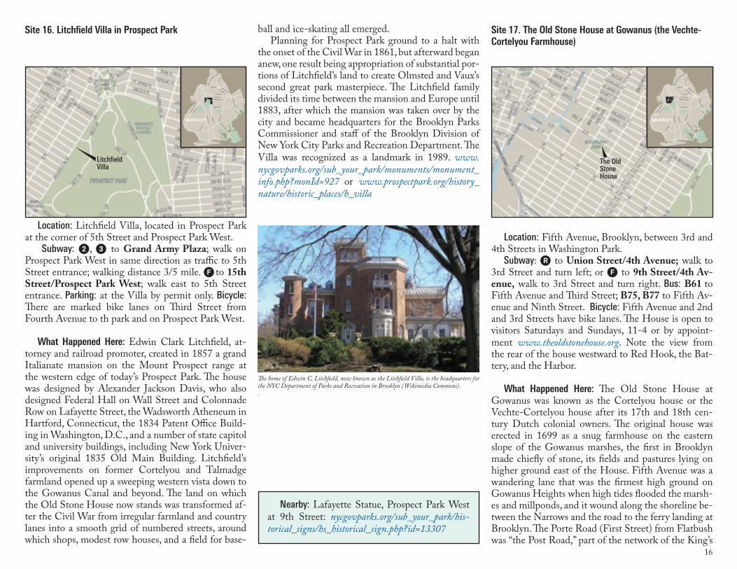
16
ball and ice-skating all emerged. Planning for Prospect Park ground to a halt with
the onset of the Civil War in 1861, but afterward began anew, one result being appropriation of substantial por-tions of Litchfield’s land to create Olmsted and Vaux’s second great park masterpiece. The Litchfield family divided its time between the mansion and Europe until 1883, after which the mansion was taken over by the city and became headquarters for the Brooklyn Parks Commissioner and staff of the Brooklyn Division of New York City Parks and Recreation Department. The Villa was recognized as a landmark in 1989. www.nycgovparks.org/sub_your_park/monuments/monument_info.php?monId=927 or www.prospectpark.org/history_nature/historic_places/h_villa
Nearby: Lafayette Statue, Prospect Park West at 9th Street: nycgovparks.org/sub_your_park/his-torical_signs/hs_historical_sign.php?id=13307
Location: Fifth Avenue, Brooklyn, between 3rd and 4th Streets in Washington Park.
Subway: ) to Union Street/4th Avenue; walk to 3rd Street and turn left; or F to 9th Street/4th Av-enue, walk to 3rd Street and turn right. Bus: B61 to Fifth Avenue and Third Street; B75, B77 to Fifth Av-enue and Ninth Street. Bicycle: Fifth Avenue and 2nd and 3rd Streets have bike lanes. The House is open to visitors Saturdays and Sundays, 11-4 or by appoint-ment www.theoldstonehouse.org. Note the view from the rear of the house westward to Red Hook, the Bat-tery, and the Harbor.
What Happened Here: The Old Stone House at Gowanus was known as the Cortelyou house or the Vechte-Cortelyou house after its 17th and 18th cen-tury Dutch colonial owners. The original house was erected in 1699 as a snug farmhouse on the eastern slope of the Gowanus marshes, the first in Brooklyn made chiefly of stone, its fields and pastures lying on higher ground east of the House. Fifth Avenue was a wandering lane that was the firmest high ground on Gowanus Heights when high tides flooded the marsh-es and millponds, and it wound along the shoreline be-tween the Narrows and the road to the ferry landing at Brooklyn. The Porte Road (First Street) from Flatbush was “the Post Road,” part of the network of the King’s
Site 17. The Old Stone House at Gowanus (the Vechte-Cortelyou Farmhouse)
LINDEN BLVD
FLATBUSH AV
OC
EA
N P
KW
Y
OC
EA
N A
V
EASTERN PKWY
ATLANTIC AV
FULTON ST
BAY P
KWY
GO
WAN
US
EXPW
Y
MYRTLE AV
BROADWAY
BUSHWICK AV
KIN
GS
HW
Y
BR
OO
KLY
N Q
UEENS EXPWY
PE
NN
SY
LVANIA AV
FOURT
H AV
AREA OF THIS MAP
BROOKLYNBROOKLYN
The OldStoneHouse
Location: Litchfield Villa, located in Prospect Park at the corner of 5th Street and Prospect Park West.
Subway: 2, 3 to Grand Army Plaza; walk on Prospect Park West in same direction as traffic to 5th Street entrance; walking distance 3/5 mile. F to 15th Street/Prospect Park West; walk east to 5th Street entrance. Parking: at the Villa by permit only. Bicycle: There are marked bike lanes on Third Street from Fourth Avenue to th park and on Prospect Park West.
What Happened Here: Edwin Clark Litchfield, at-torney and railroad promoter, created in 1857 a grand Italianate mansion on the Mount Prospect range at the western edge of today’s Prospect Park. The house was designed by Alexander Jackson Davis, who also designed Federal Hall on Wall Street and Colonnade Row on Lafayette Street, the Wadsworth Atheneum in Hartford, Connecticut, the 1834 Patent Office Build-ing in Washington, D.C., and a number of state capitol and university buildings, including New York Univer-sity’s original 1835 Old Main Building. Litchfield’s improvements on former Cortelyou and Talmadge farmland opened up a sweeping western vista down to the Gowanus Canal and beyond. The land on which the Old Stone House now stands was transformed af-ter the Civil War from irregular farmland and country lanes into a smooth grid of numbered streets, around which shops, modest row houses, and a field for base-
Site 16. Litchfield Villa in Prospect Park
LINDEN BLVD
FLATBUSH AV
OC
EA
N P
KW
Y
OC
EA
N A
V
EASTERN PKWY
ATLANTIC AV
FULTON ST
BAY P
KWY
GO
WAN
US
EXPW
Y
MYRTLE AV
BROADWAY
BUSHWICK AV
KIN
GS
HW
Y
BR
OO
KLY
N Q
UEENS EXPWY
PE
NN
SY
LVANIA AV
FOURT
H AV
AREA OF THIS MAP
BROOKLYNBROOKLYN
LitchfieldVilla
The home of Edwin C. Litchfield, now known as the Litchfield Villa, is the headquarters for the NYC Department of Parks and Recreation in Brooklyn (Wikimedia Commons)..
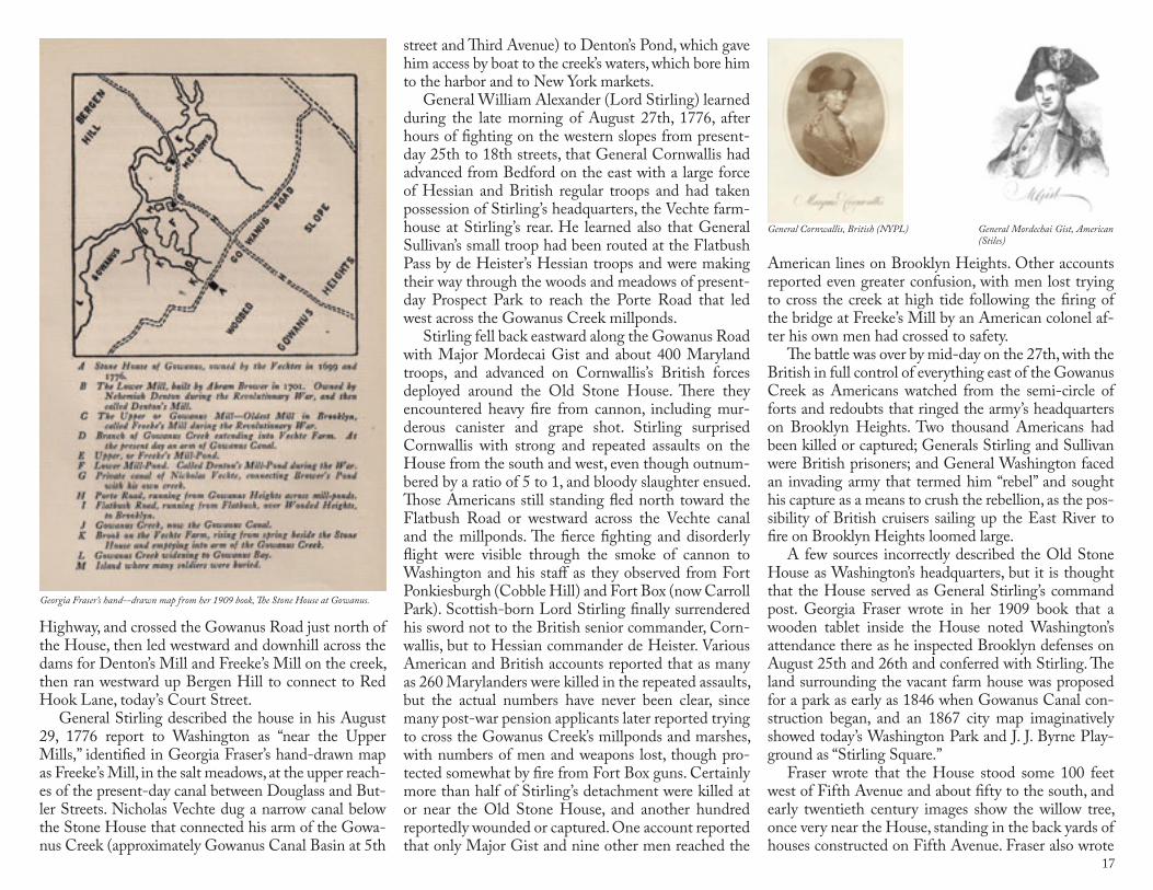
17
street and Third Avenue) to Denton’s Pond, which gave him access by boat to the creek’s waters, which bore him to the harbor and to New York markets.
General William Alexander (Lord Stirling) learned during the late morning of August 27th, 1776, after hours of fighting on the western slopes from present-day 25th to 18th streets, that General Cornwallis had advanced from Bedford on the east with a large force of Hessian and British regular troops and had taken possession of Stirling’s headquarters, the Vechte farm-house at Stirling’s rear. He learned also that General Sullivan’s small troop had been routed at the Flatbush Pass by de Heister’s Hessian troops and were making their way through the woods and meadows of present-day Prospect Park to reach the Porte Road that led west across the Gowanus Creek millponds.
Stirling fell back eastward along the Gowanus Road with Major Mordecai Gist and about 400 Maryland troops, and advanced on Cornwallis’s British forces deployed around the Old Stone House. There they encountered heavy fire from cannon, including mur-derous canister and grape shot. Stirling surprised Cornwallis with strong and repeated assaults on the House from the south and west, even though outnum-bered by a ratio of 5 to 1, and bloody slaughter ensued. Those Americans still standing fled north toward the Flatbush Road or westward across the Vechte canal and the millponds. The fierce fighting and disorderly flight were visible through the smoke of cannon to Washington and his staff as they observed from Fort Ponkiesburgh (Cobble Hill) and Fort Box (now Carroll Park). Scottish-born Lord Stirling finally surrendered his sword not to the British senior commander, Corn-wallis, but to Hessian commander de Heister. Various American and British accounts reported that as many as 260 Marylanders were killed in the repeated assaults, but the actual numbers have never been clear, since many post-war pension applicants later reported trying to cross the Gowanus Creek’s millponds and marshes, with numbers of men and weapons lost, though pro-tected somewhat by fire from Fort Box guns. Certainly more than half of Stirling’s detachment were killed at or near the Old Stone House, and another hundred reportedly wounded or captured. One account reported that only Major Gist and nine other men reached the
American lines on Brooklyn Heights. Other accounts reported even greater confusion, with men lost trying to cross the creek at high tide following the firing of the bridge at Freeke’s Mill by an American colonel af-ter his own men had crossed to safety.
The battle was over by mid-day on the 27th, with the British in full control of everything east of the Gowanus Creek as Americans watched from the semi-circle of forts and redoubts that ringed the army’s headquarters on Brooklyn Heights. Two thousand Americans had been killed or captured; Generals Stirling and Sullivan were British prisoners; and General Washington faced an invading army that termed him “rebel” and sought his capture as a means to crush the rebellion, as the pos-sibility of British cruisers sailing up the East River to fire on Brooklyn Heights loomed large.
A few sources incorrectly described the Old Stone House as Washington’s headquarters, but it is thought that the House served as General Stirling’s command post. Georgia Fraser wrote in her 1909 book that a wooden tablet inside the House noted Washington’s attendance there as he inspected Brooklyn defenses on August 25th and 26th and conferred with Stirling. The land surrounding the vacant farm house was proposed for a park as early as 1846 when Gowanus Canal con-struction began, and an 1867 city map imaginatively showed today’s Washington Park and J. J. Byrne Play-ground as “Stirling Square.”
Fraser wrote that the House stood some 100 feet west of Fifth Avenue and about fifty to the south, and early twentieth century images show the willow tree, once very near the House, standing in the back yards of houses constructed on Fifth Avenue. Fraser also wrote
Highway, and crossed the Gowanus Road just north of the House, then led westward and downhill across the dams for Denton’s Mill and Freeke’s Mill on the creek, then ran westward up Bergen Hill to connect to Red Hook Lane, today’s Court Street.
General Stirling described the house in his August 29, 1776 report to Washington as “near the Upper Mills,” identified in Georgia Fraser’s hand-drawn map as Freeke’s Mill, in the salt meadows, at the upper reach-es of the present-day canal between Douglass and But-ler Streets. Nicholas Vechte dug a narrow canal below the Stone House that connected his arm of the Gowa-nus Creek (approximately Gowanus Canal Basin at 5th
General Mordechai Gist, American (Stiles)
General Cornwallis, British (NYPL)
Georgia Fraser’s hand--drawn map from her 1909 book, The Stone House at Gowanus.
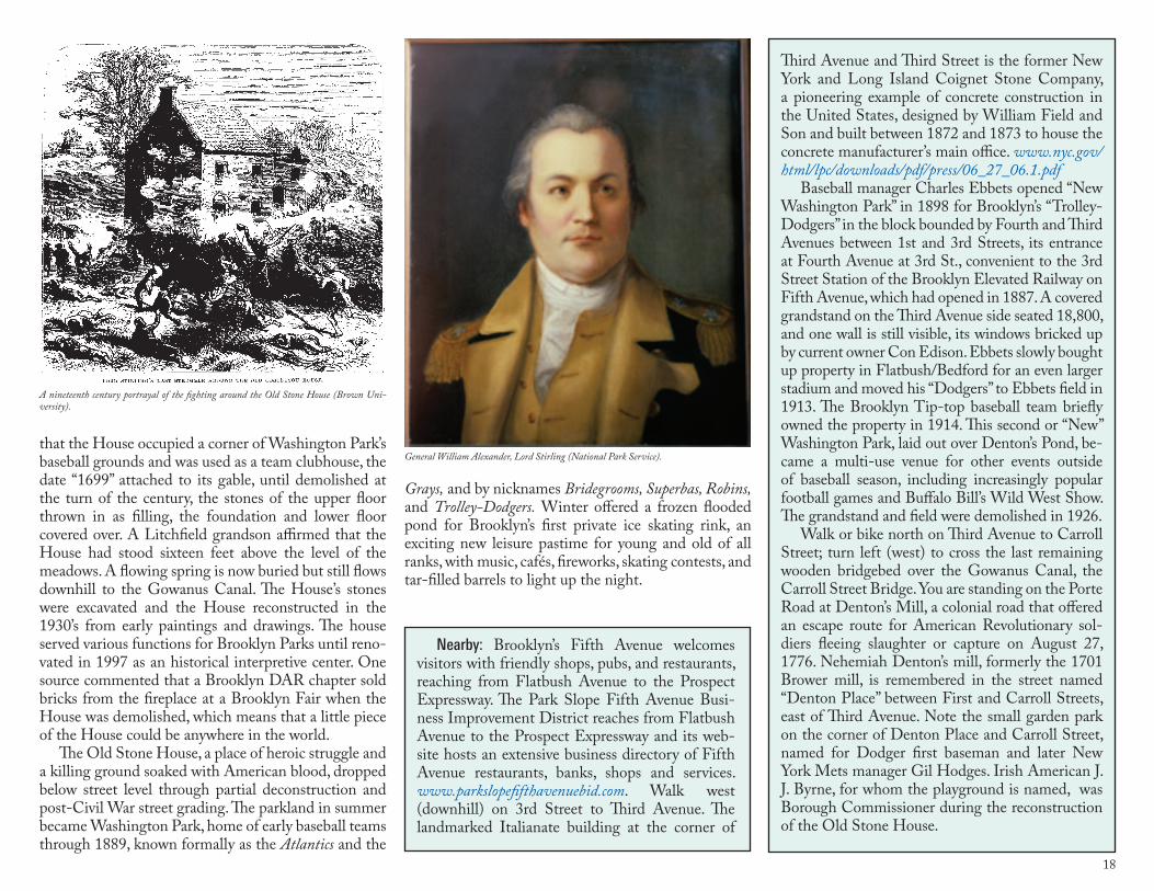
18
Nearby: Brooklyn’s Fifth Avenue welcomes visitors with friendly shops, pubs, and restaurants, reaching from Flatbush Avenue to the Prospect Expressway. The Park Slope Fifth Avenue Busi-ness Improvement District reaches from Flatbush Avenue to the Prospect Expressway and its web-site hosts an extensive business directory of Fifth Avenue restaurants, banks, shops and services. www.parkslopefifthavenuebid.com. Walk west (downhill) on 3rd Street to Third Avenue. The landmarked Italianate building at the corner of
that the House occupied a corner of Washington Park’s baseball grounds and was used as a team clubhouse, the date “1699” attached to its gable, until demolished at the turn of the century, the stones of the upper floor thrown in as filling, the foundation and lower floor covered over. A Litchfield grandson affirmed that the House had stood sixteen feet above the level of the meadows. A flowing spring is now buried but still flows downhill to the Gowanus Canal. The House’s stones were excavated and the House reconstructed in the 1930’s from early paintings and drawings. The house served various functions for Brooklyn Parks until reno-vated in 1997 as an historical interpretive center. One source commented that a Brooklyn DAR chapter sold bricks from the fireplace at a Brooklyn Fair when the House was demolished, which means that a little piece of the House could be anywhere in the world.
The Old Stone House, a place of heroic struggle and a killing ground soaked with American blood, dropped below street level through partial deconstruction and post-Civil War street grading. The parkland in summer became Washington Park, home of early baseball teams through 1889, known formally as the Atlantics and the
Grays, and by nicknames Bridegrooms, Superbas, Robins, and Trolley-Dodgers. Winter offered a frozen flooded pond for Brooklyn’s first private ice skating rink, an exciting new leisure pastime for young and old of all ranks, with music, cafés, fireworks, skating contests, and tar-filled barrels to light up the night.
Third Avenue and Third Street is the former New York and Long Island Coignet Stone Company, a pioneering example of concrete construction in the United States, designed by William Field and Son and built between 1872 and 1873 to house the concrete manufacturer’s main office. www.nyc.gov/html/lpc/downloads/pdf/press/06_27_06.1.pdf
Baseball manager Charles Ebbets opened “New Washington Park” in 1898 for Brooklyn’s “Trolley-Dodgers” in the block bounded by Fourth and Third Avenues between 1st and 3rd Streets, its entrance at Fourth Avenue at 3rd St., convenient to the 3rd Street Station of the Brooklyn Elevated Railway on Fifth Avenue, which had opened in 1887. A covered grandstand on the Third Avenue side seated 18,800, and one wall is still visible, its windows bricked up by current owner Con Edison. Ebbets slowly bought up property in Flatbush/Bedford for an even larger stadium and moved his “Dodgers” to Ebbets field in 1913. The Brooklyn Tip-top baseball team briefly owned the property in 1914. This second or “New” Washington Park, laid out over Denton’s Pond, be-came a multi-use venue for other events outside of baseball season, including increasingly popular football games and Buffalo Bill’s Wild West Show. The grandstand and field were demolished in 1926.
Walk or bike north on Third Avenue to Carroll Street; turn left (west) to cross the last remaining wooden bridgebed over the Gowanus Canal, the Carroll Street Bridge. You are standing on the Porte Road at Denton’s Mill, a colonial road that offered an escape route for American Revolutionary sol-diers fleeing slaughter or capture on August 27, 1776. Nehemiah Denton’s mill, formerly the 1701 Brower mill, is remembered in the street named “Denton Place” between First and Carroll Streets, east of Third Avenue. Note the small garden park on the corner of Denton Place and Carroll Street, named for Dodger first baseman and later New York Mets manager Gil Hodges. Irish American J. J. Byrne, for whom the playground is named, was Borough Commissioner during the reconstruction of the Old Stone House.
A nineteenth century portrayal of the fighting around the Old Stone House (Brown Uni-versity).
General William Alexander, Lord Stirling (National Park Service).

19
Location: 431 Third Avenue, Brooklyn, between 7th and 8th streets, east side of street (site unmarked). Sub-way: F, M, ) to Fourth Avenue/9th Street; walk downhill to Third Avenue; turn right to mid-block ad-dresses 431-433. Bicycle: There are bike lanes on 9th Street and Fifth Avenue.
What Happened Here: This location was reportedly a hill, or “island” or mound or promontory that stood above the high-water mark of the Gowanus marshes. Near this location were six burial trenches later re-ported as reaching from the back of the lot at 431-433 Third Avenue, diagonally uphill (southwest) toward 9th Street, now blocks of houses and busy streets, perhaps passing near or beneath what is now the Michael A. Rawley American Legion Post on 9th Street. These trenches were said to be the burial place of some 250 American soldiers who died at or near the Old Stone House on August 27, 1776. The exact number of inter-ments was never determined by American sources, and the number could well have included British and Hes-sian dead as well, if the location is accurate. John Van Brunt’s 1896 letter to Teunis G. Bergen complained about the often-visited “island burial place” that had become “overgrown with weeds and the fence dilapi-dated.” Van Brunt’s father had purchased the farm lying on rising ground between Third and Fourth Avenues
18. Third Avenue Between Seventh and Ninth Streets: Reputed Burial Site of the Maryland 400, Defenders of the Old Stone House
and between 7th and 9th streets from the heirs and legatees of John and Peter Staats in 1786, “where [had been] buried Nicholas Vechte and Teunis Tiebout, aged about 100 years,” afterward re-interred in Green-Wood Cemetery. Van Brunt wrote that his father and brother Adriance “held that island sacred and never suffered the plough or the axe to desecrate the ground. It was the humble mausoleum for soldiers killed in battle & always kept so.” He also recalled a former “Negro bury-ing ground” that lay along the property line between that farm and the Denys farm to the south.
A bronze tablet was erected on a Fifth Avenue house near the Old Stone House in 1897, and the buri-al trenches on Third Avenue were also marked at this time. Henry Wildhack, Jr., son of the 1905 property’s owner, wrote to Borough Historian Fr. James Kelly in 1957 that he “well remember[ed] the then seemingly burial trenches…[and] also remember[ed] the burial stone between sidewalk and curb” of copper letters set into a composition block:
This is Ye Burial Place of ye 250 Maryland soldiers who fell in ye combat at ye Cortelyou House in ye Battle of Long Island on ye 27th Day of August 1776.
Young Wildhack was pictured with the stone me-morial in an undated news photo. He wrote that his father filled in the location 6 to 10 feet deep for use as a coal yard, and he and boyhood friends often rum-maged for bones and buttons at the site. He affirmed that burial remains would be found 100 feet back from the Third Avenue curb and down 15 to 18 feet. The me-morial block placed in the street disappeared at some point in the past during street repairs or construction.
Respectful treatment of the American dead from the Old Stone House was never established with cer-tainty by contemporary sources. British, Hessian, and American dead may well have been buried all together where they fell - in Prospect Park, on Green-Wood’s hills, at Mount Prospect and Prospect Heights, and along the banks of the Gowanus Creek and millponds, including the Third Avenue site. Gertrude Lefferts Vanderbilt stated in her 1881 Social History of Flatbush that bodies lay in the streets of Flatbush for many days after the fighting was over, and Georgia Fraser’s 1909 hand-drawn map indicated a site near Denton’s mill-
LINDEN BLVD
FLATBUSH AV
OC
EA
N P
KW
Y
OC
EA
N A
V
EASTERN PKWY
ATLANTIC AV
FULTON ST
BAY P
KWY
GO
WAN
US
EXPW
Y
MYRTLE AV
BROADWAY
BUSHWICK AV
KIN
GS
HW
Y
BR
OO
KLY
N Q
UEENS EXPWY
PE
NN
SY
LVANIA AV
FOURT
H AV
AREA OF THIS MAP
BROOKLYNBROOKLYN
Marylanders Burial Site
As the neighborhood grew around the Old Stone House in the second half of the nineteenth century, the swampy land around the house lent itself to recreational use. From top to bot-tom, the park served as a baseball stadium for the team that eventually became the Brooklyn Dodgers, a venue for Buffalo Bill ’s Wild West Show and as a skating rink which was at times combined with the summer sport of baseball.
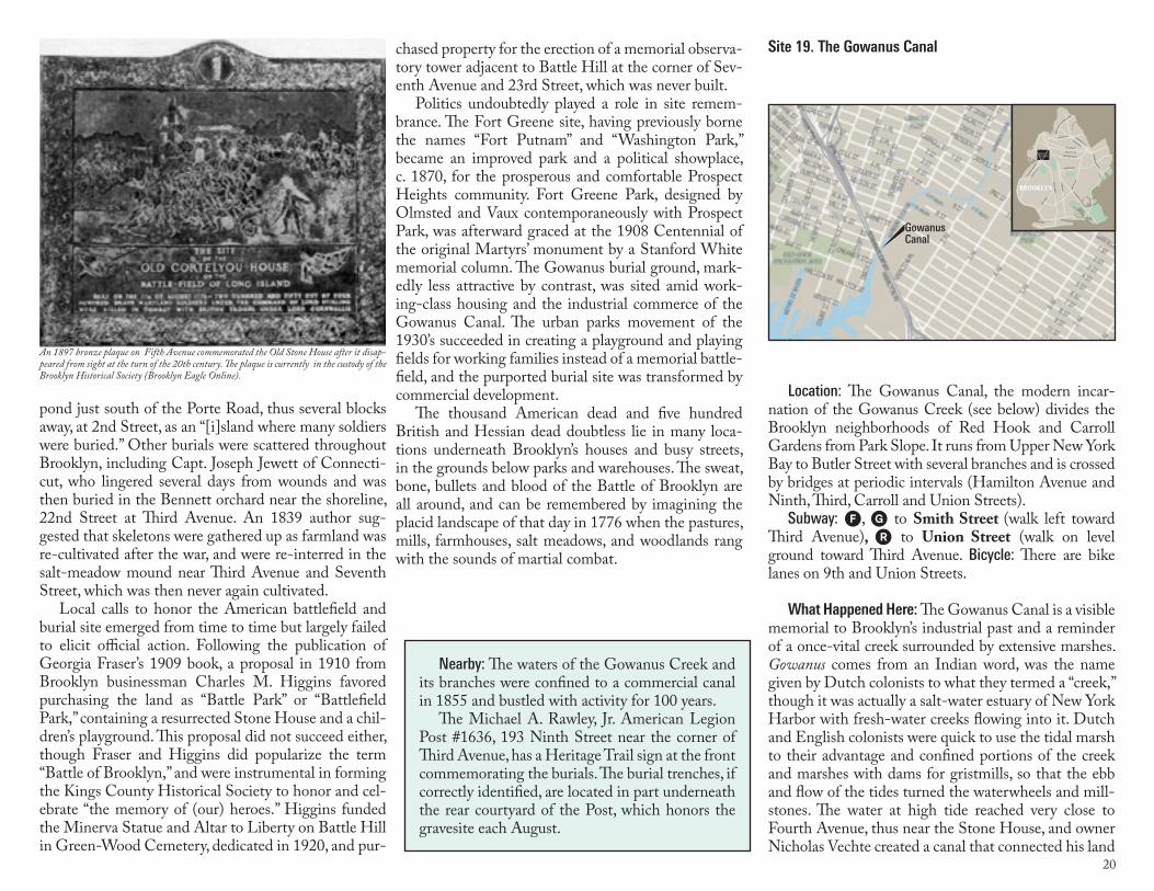
20
chased property for the erection of a memorial observa-tory tower adjacent to Battle Hill at the corner of Sev-enth Avenue and 23rd Street, which was never built.
Politics undoubtedly played a role in site remem-brance. The Fort Greene site, having previously borne the names “Fort Putnam” and “Washington Park,” became an improved park and a political showplace, c. 1870, for the prosperous and comfortable Prospect Heights community. Fort Greene Park, designed by Olmsted and Vaux contemporaneously with Prospect Park, was afterward graced at the 1908 Centennial of the original Martyrs’ monument by a Stanford White memorial column. The Gowanus burial ground, mark-edly less attractive by contrast, was sited amid work-ing-class housing and the industrial commerce of the Gowanus Canal. The urban parks movement of the 1930’s succeeded in creating a playground and playing fields for working families instead of a memorial battle-field, and the purported burial site was transformed by commercial development.
The thousand American dead and five hundred British and Hessian dead doubtless lie in many loca-tions underneath Brooklyn’s houses and busy streets, in the grounds below parks and warehouses. The sweat, bone, bullets and blood of the Battle of Brooklyn are all around, and can be remembered by imagining the placid landscape of that day in 1776 when the pastures, mills, farmhouses, salt meadows, and woodlands rang with the sounds of martial combat.
Nearby: The waters of the Gowanus Creek and its branches were confined to a commercial canal in 1855 and bustled with activity for 100 years.
The Michael A. Rawley, Jr. American Legion Post #1636, 193 Ninth Street near the corner of Third Avenue, has a Heritage Trail sign at the front commemorating the burials. The burial trenches, if correctly identified, are located in part underneath the rear courtyard of the Post, which honors the gravesite each August.
Location: The Gowanus Canal, the modern incar-nation of the Gowanus Creek (see below) divides the Brooklyn neighborhoods of Red Hook and Carroll Gardens from Park Slope. It runs from Upper New York Bay to Butler Street with several branches and is crossed by bridges at periodic intervals (Hamilton Avenue and Ninth, Third, Carroll and Union Streets).
Subway: F, G to Smith Street (walk left toward Third Avenue), ) to Union Street (walk on level ground toward Third Avenue. Bicycle: There are bike lanes on 9th and Union Streets.
What Happened Here: The Gowanus Canal is a visible memorial to Brooklyn’s industrial past and a reminder of a once-vital creek surrounded by extensive marshes. Gowanus comes from an Indian word, was the name given by Dutch colonists to what they termed a “creek,” though it was actually a salt-water estuary of New York Harbor with fresh-water creeks flowing into it. Dutch and English colonists were quick to use the tidal marsh to their advantage and confined portions of the creek and marshes with dams for gristmills, so that the ebb and flow of the tides turned the waterwheels and mill-stones. The water at high tide reached very close to Fourth Avenue, thus near the Stone House, and owner Nicholas Vechte created a canal that connected his land
Site 19. The Gowanus Canal
LINDEN BLVD
FLATBUSH AV
OC
EA
N P
KW
Y
OC
EA
N A
V
EASTERN PKWY
ATLANTIC AV
FULTON ST
BAY P
KWY
GO
WAN
US
EXPW
Y
MYRTLE AV
BROADWAY
BUSHWICK AV
KIN
GS
HW
Y
BR
OO
KLY
N Q
UEENS EXPWY
PE
NN
SY
LVANIA AV
FOURT
H AV
AREA OF THIS MAP
BROOKLYNBROOKLYN
GowanusCanal
pond just south of the Porte Road, thus several blocks away, at 2nd Street, as an “[i]sland where many soldiers were buried.” Other burials were scattered throughout Brooklyn, including Capt. Joseph Jewett of Connecti-cut, who lingered several days from wounds and was then buried in the Bennett orchard near the shoreline, 22nd Street at Third Avenue. An 1839 author sug-gested that skeletons were gathered up as farmland was re-cultivated after the war, and were re-interred in the salt-meadow mound near Third Avenue and Seventh Street, which was then never again cultivated.
Local calls to honor the American battlefield and burial site emerged from time to time but largely failed to elicit official action. Following the publication of Georgia Fraser’s 1909 book, a proposal in 1910 from Brooklyn businessman Charles M. Higgins favored purchasing the land as “Battle Park” or “Battlefield Park,” containing a resurrected Stone House and a chil-dren’s playground. This proposal did not succeed either, though Fraser and Higgins did popularize the term “Battle of Brooklyn,” and were instrumental in forming the Kings County Historical Society to honor and cel-ebrate “the memory of (our) heroes.” Higgins funded the Minerva Statue and Altar to Liberty on Battle Hill in Green-Wood Cemetery, dedicated in 1920, and pur-
An 1897 bronze plaque on Fifth Avenue commemorated the Old Stone House after it disap-peared from sight at the turn of the 20th century. The plaque is currently in the custody of the Brooklyn Historical Society (Brooklyn Eagle Online).
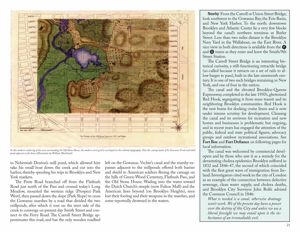
21
to Nehemiah Denton’s mill pond, which allowed him take his small boat down the creek and out into the harbor, thereby speeding his trips to Brooklyn and New York markets.
The Porte Road branched off from the Flatbush Road just north of the Pass and crossed today’s Long Meadow, mounted the western ridge (Prospect Park West), then passed down the slope (Park Slope) to cross the Gowanus marshes by a road that divided the two millponds, after which it rose on the west side of the creek to converge on present day Smith Street and con-nect to the Ferry Road. The Carroll Street Bridge ap-proximates this road, and has the only wooden roadbed
Nearby: From the Carroll or Union Street Bridge; look southwest to the Gowanus Bay, the Erie Basin, and New York Harbor. To the north: downtown Brooklyn and Atlantic Center lie a very few blocks beyond the canal’s northern terminus at Butler Street. Less than two miles distant is the Brooklyn Navy Yard in the Wallabout, on the East River. A nice view in both directions is available from the F and G trains as they enter and leave the Smith/9th Street Station.
The Carroll Street Bridge is an interesting his-torical curiosity, a still-functioning retractile bridge (so-called because it retracts on a set of rails to al-low barges to pass), built in the late nineteenth cen-tury. It is one of two such bridges remaining in New York, and one of four in the nation.
The canal and the elevated Brooklyn-Queens Expressway, completed in the late 1950’s, ghettoized Red Hook, segregating it from mass transit and its neighboring Brooklyn communities. Red Hook is the new home for docking cruise liners and is now under intense scrutiny for development. Cleaning the canal and its environs for recreation and new homes and businesses is problematic but ongoing, and in recent years has engaged the attention of the public, federal and state political figures, advocacy groups and outdoor recreational associations. See Fort Box and Fort Defiance on following pages for local information.
The canal was welcomed by commercial devel-opers and by those who saw it as a remedy for the devastating cholera epidemics Brooklyn suffered in 1832 and 1846-47, the second of which coincided with the first great wave of immigration from Ire-land. Investigators cited work in the city of London as an example of the connection between defective sewerage, clean water supply, and cholera deaths, and Brooklyn City Surveyor John Rolfe advised the Common Council in 1846:
What is needed is a canal, otherwise drainage won’t work. We of the present day have a power over the destiny of this City and unless we use a liberal foresight we may entail upon it the in-heritance of an irremediable evil.
left on the Gowanus. Vechte’s canal and the marshy ex-panses adjacent to the millponds offered both barrier and shield to American soldiers fleeing the carnage on the hills of Green-Wood Cemetery, Flatbush Pass, and the Old Stone House. Wading into the water toward the Dutch Church’s steeple (now Fulton Mall) and the American lines beyond (on Brooklyn Heights), men lost their footing and their weapons in the marshes, and some reportedly drowned in the waters.
In this modern rendering of the area surrounding the Old Stone House, the modern street grid is overlayed on the colonial topography. Note the swamp lands of he Gowanus Creek and tidal pond adjacent to the house (Illustration by William MacIntosh).
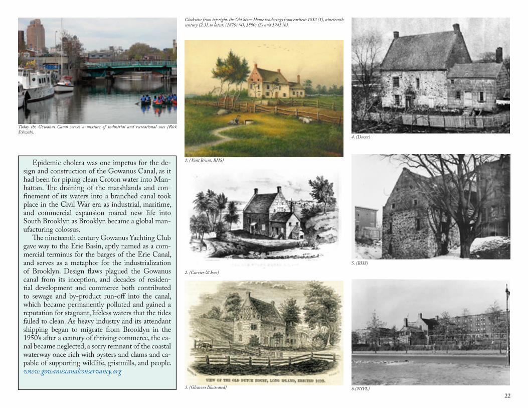
22
Epidemic cholera was one impetus for the de-sign and construction of the Gowanus Canal, as it had been for piping clean Croton water into Man-hattan. The draining of the marshlands and con-finement of its waters into a branched canal took place in the Civil War era as industrial, maritime, and commercial expansion roared new life into South Brooklyn as Brooklyn became a global man-ufacturing colossus.
The nineteenth century Gowanus Yachting Club gave way to the Erie Basin, aptly named as a com-mercial terminus for the barges of the Erie Canal, and serves as a metaphor for the industrialization of Brooklyn. Design flaws plagued the Gowanus canal from its inception, and decades of residen-tial development and commerce both contributed to sewage and by-product run-off into the canal, which became permanently polluted and gained a reputation for stagnant, lifeless waters that the tides failed to clean. As heavy industry and its attendant shipping began to migrate from Brooklyn in the 1950’s after a century of thriving commerce, the ca-nal became neglected, a sorry remnant of the coastal waterway once rich with oysters and clams and ca-pable of supporting wildlife, gristmills, and people. www.gowanuscanalconservancy.org
Clockwise from top right: the Old Stone House renderings from earliest: 1853 (1), nineteenth century (2,3), to latest: (1870s (4), 1890s (5) and 1941 (6).
Today the Gowanus Canal serves a mixture of industrial and recreational uses (Rick Schwab).
1. (Vant Brunt, BHS)
4. (Dover)
2. (Currier & Ives)
5. (BHS)
3. (Gleasons Illustrated) 6.(NYPL)
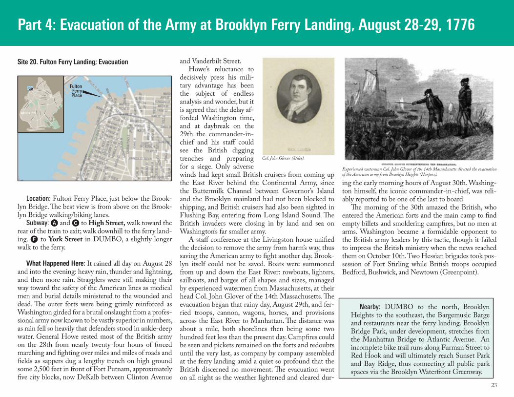
23
Part 4: Evacuation of the Army at Brooklyn Ferry Landing, August 28-29, 1776
Location: Fulton Ferry Place, just below the Brook-lyn Bridge. The best view is from above on the Brook-lyn Bridge walking/biking lanes.
Subway: A and C to High Street, walk toward the rear of the train to exit; walk downhill to the ferry land-ing. F to York Street in DUMBO, a slightly longer walk to the ferry.
What Happened Here: It rained all day on August 28 and into the evening: heavy rain, thunder and lightning, and then more rain. Stragglers were still making their way toward the safety of the American lines as medical men and burial details ministered to the wounded and dead. The outer forts were being grimly reinforced as Washington girded for a brutal onslaught from a profes-sional army now known to be vastly superior in numbers, as rain fell so heavily that defenders stood in ankle-deep water. General Howe rested most of the British army on the 28th from nearly twenty-four hours of forced marching and fighting over miles and miles of roads and fields as sappers dug a lengthy trench on high ground some 2,500 feet in front of Fort Putnam, approximately five city blocks, now DeKalb between Clinton Avenue
and Vanderbilt Street. Howe’s reluctance to
decisively press his mili-tary advantage has been the subject of endless analysis and wonder, but it is agreed that the delay af-forded Washington time, and at daybreak on the 29th the commander-in-chief and his staff could see the British digging trenches and preparing for a siege. Only adverse winds had kept small British cruisers from coming up the East River behind the Continental Army, since the Buttermilk Channel between Governor’s Island and the Brooklyn mainland had not been blocked to shipping, and British cruisers had also been sighted in Flushing Bay, entering from Long Island Sound. The British invaders were closing in by land and sea on Washington’s far smaller army.
A staff conference at the Livingston house unified the decision to remove the army from harm’s way, thus saving the American army to fight another day. Brook-lyn itself could not be saved. Boats were summoned from up and down the East River: rowboats, lighters, sailboats, and barges of all shapes and sizes, managed by experienced watermen from Massachusetts, at their head Col. John Glover of the 14th Massachusetts. The evacuation began that rainy day, August 29th, and fer-ried troops, cannon, wagons, horses, and provisions across the East River to Manhattan. The distance was about a mile, both shorelines then being some two hundred feet less than the present day. Campfires could be seen and pickets remained on the forts and redoubts until the very last, as company by company assembled at the ferry landing amid a quiet so profound that the British discerned no movement. The evacuation went on all night as the weather lightened and cleared dur-
ing the early morning hours of August 30th. Washing-ton himself, the iconic commander-in-chief, was reli-ably reported to be one of the last to board.
The morning of the 30th amazed the British, who entered the American forts and the main camp to find empty billets and smoldering campfires, but no men at arms. Washington became a formidable opponent to the British army leaders by this tactic, though it failed to impress the British ministry when the news reached them on October 10th. Two Hessian brigades took pos-session of Fort Stirling while British troops occupied Bedford, Bushwick, and Newtown (Greenpoint).
Nearby: DUMBO to the north, Brooklyn Heights to the southeast, the Bargemusic Barge and restaurants near the ferry landing. Brooklyn Bridge Park, under development, stretches from the Manhattan Bridge to Atlantic Avenue. An incomplete bike trail runs along Furman Street to Red Hook and will ultimately reach Sunset Park and Bay Ridge, thus connecting all public park spaces via the Brooklyn Waterfront Greenway.
LINDEN BLVD
FLATBUSH AV
OC
EA
N P
KW
Y
OC
EA
N A
V
EASTERN PKWY
ATLANTIC AV
FULTON ST
BAY P
KWY
GO
WAN
US
EXPW
Y
MYRTLE AV
BROADWAY
BUSHWICK AV
KIN
GS
HW
Y
BR
OO
KLY
N Q
UEENS EXPWY
PE
NN
SY
LVANIA AV
FOURT
H AV
AREA OF THIS MAP
BROOKLYNBROOKLYN
FultonFerryPlace
Site 20. Fulton Ferry Landing; Evacuation
Col. John Glover (Stiles).
Experienced waterman Col. John Glover of the 14th Massachusetts directed the evacuation of the American army from Brooklyn Heights (Harpers).
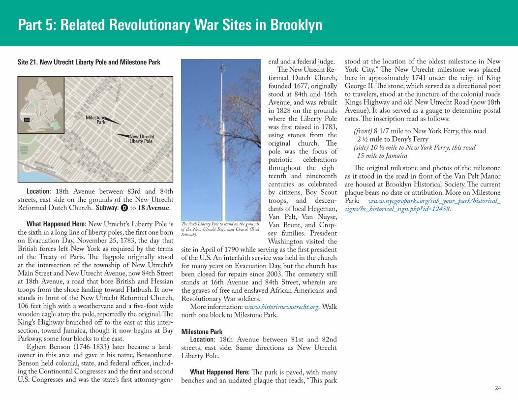
24
Part 5: Related Revolutionary War Sites in Brooklyn
Location: 18th Avenue between 83rd and 84th streets, east side on the grounds of the New Utrecht Reformed Dutch Church. Subway: D to 18 Avenue.
What Happened Here: New Utrecht’s Liberty Pole is the sixth in a long line of liberty poles, the first one born on Evacuation Day, November 25, 1783, the day that British forces left New York as required by the terms of the Treaty of Paris. The flagpole originally stood at the intersection of the township of New Utrecht’s Main Street and New Utrecht Avenue, now 84th Street at 18th Avenue, a road that bore British and Hessian troops from the shore landing toward Flatbush. It now stands in front of the New Utrecht Reformed Church, 106 feet high with a weathervane and a five-foot wide wooden eagle atop the pole, reportedly the original. The King’s Highway branched off to the east at this inter-section, toward Jamaica, though it now begins at Bay Parkway, some four blocks to the east.
Egbert Benson (1746-1833) later became a land-owner in this area and gave it his name, Bensonhurst. Benson held colonial, state, and federal offices, includ-ing the Continental Congresses and the first and second U.S. Congresses and was the state’s first attorney-gen-
eral and a federal judge. The New Utrecht Re-
formed Dutch Church, founded 1677, originally stood at 84th and 16th Avenue, and was rebuilt in 1828 on the grounds where the Liberty Pole was first raised in 1783, using stones from the original church. The pole was the focus of patriotic celebrations throughout the eigh-teenth and nineteenth centuries as celebrated by citizens, Boy Scout troops, and descen-dants of local Hegeman, Van Pelt, Van Nuyse, Van Brunt, and Crop-sey families. President Washington visited the
site in April of 1790 while serving as the first president of the U.S. An interfaith service was held in the church for many years on Evacuation Day, but the church has been closed for repairs since 2003. The cemetery still stands at 16th Avenue and 84th Street, wherein are the graves of free and enslaved African Americans and Revolutionary War soldiers.
More information: www.historicnewutrecht.org. Walk north one block to Milestone Park.
Milestone ParkLocation: 18th Avenue between 81st and 82nd
streets, east side. Same directions as New Utrecht Liberty Pole.
What Happened Here: The park is paved, with many benches and an undated plaque that reads, “This park
stood at the location of the oldest milestone in New York City.” The New Utrecht milestone was placed here in approximately 1741 under the reign of King George II. The stone, which served as a directional post to travelers, stood at the juncture of the colonial roads Kings Highway and old New Utrecht Road (now 18th Avenue). It also served as a gauge to determine postal rates. The inscription read as follows:
(front) 8 1/7 mile to New York Ferry, this road 2 ½ mile to Deny’s Ferry(side) 10 ½ mile to New York Ferry, this road 15 mile to Jamaica
The original milestone and photos of the milestone as it stood in the road in front of the Van Pelt Manor are housed at Brooklyn Historical Society. The current plaque bears no date or attribution. More on Milestone Park: www.nycgovparks.org/sub_your_park/historical_signs/hs_historical_sign.php?id=12458.
Site 21. New Utrecht Liberty Pole and Milestone Park
LINDEN BLVD
FLATBUSH AV
OC
EA
N P
KW
Y
OC
EA
N A
V
EASTERN PKWY
ATLANTIC AV
FULTON ST
BAY P
KWY
GO
WAN
US
EXPW
Y
MYRTLE AV
BROADWAY
BUSHWICK AV
KIN
GS
HW
Y
BR
OO
KLY
N Q
UEENS EXPWY
PE
NN
SY
LVANIA AV
FOURT
H AV
AREA OF THIS MAP
BROOKLYNBROOKLYN
MilestonePark
New UtrechtLiberty Pole
The sixth Liberty Pole to stand on the grounds of the New Utrecht Reformed Church (Rick Schwab).
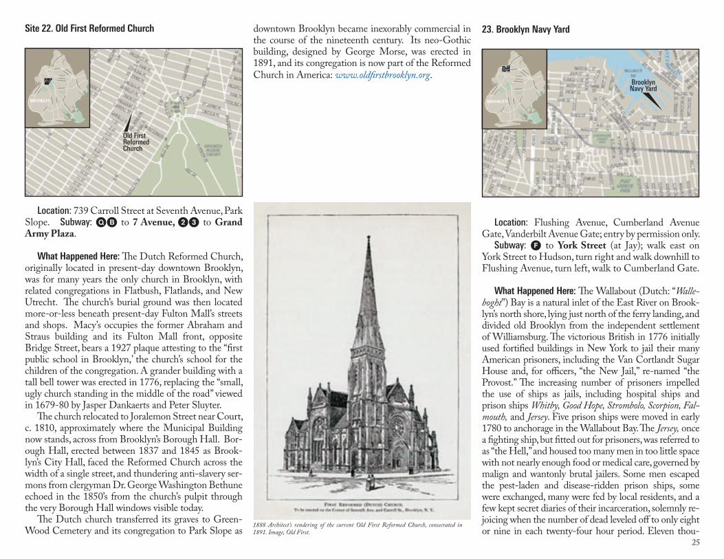
25
Location: 739 Carroll Street at Seventh Avenue, Park Slope. Subway: QB to 7 Avenue, 23 to Grand Army Plaza.
What Happened Here: The Dutch Reformed Church, originally located in present-day downtown Brooklyn, was for many years the only church in Brooklyn, with related congregations in Flatbush, Flatlands, and New Utrecht. The church’s burial ground was then located more-or-less beneath present-day Fulton Mall’s streets and shops. Macy’s occupies the former Abraham and Straus building and its Fulton Mall front, opposite Bridge Street, bears a 1927 plaque attesting to the “first public school in Brooklyn,’ the church’s school for the children of the congregation. A grander building with a tall bell tower was erected in 1776, replacing the “small, ugly church standing in the middle of the road” viewed in 1679-80 by Jasper Dankaerts and Peter Sluyter.
The church relocated to Joralemon Street near Court, c. 1810, approximately where the Municipal Building now stands, across from Brooklyn’s Borough Hall. Bor-ough Hall, erected between 1837 and 1845 as Brook-lyn’s City Hall, faced the Reformed Church across the width of a single street, and thundering anti-slavery ser-mons from clergyman Dr. George Washington Bethune echoed in the 1850’s from the church’s pulpit through the very Borough Hall windows visible today.
The Dutch church transferred its graves to Green-Wood Cemetery and its congregation to Park Slope as
Site 22. Old First Reformed Church
LINDEN BLVD
FLATBUSH AV
OC
EA
N P
KW
Y
OC
EA
N A
V
EASTERN PKWY
ATLANTIC AV
FULTON ST
BAY P
KWY
GO
WAN
US
EXPW
Y
MYRTLE AV
BROADWAY
BUSHWICK AV
KIN
GS
HW
Y
BR
OO
KLY
N Q
UEENS EXPWY
PE
NN
SY
LVANIA AV
FOURT
H AV
AREA OF THIS MAP
BROOKLYNBROOKLYN
Old FirstReformedChurch
downtown Brooklyn became inexorably commercial in the course of the nineteenth century. Its neo-Gothic building, designed by George Morse, was erected in 1891, and its congregation is now part of the Reformed Church in America: www.oldfirstbrooklyn.org.
Location: Flushing Avenue, Cumberland Avenue Gate, Vanderbilt Avenue Gate; entry by permission only.
Subway: F to York Street (at Jay); walk east on York Street to Hudson, turn right and walk downhill to Flushing Avenue, turn left, walk to Cumberland Gate.
What Happened Here: The Wallabout (Dutch: “Walle-boght”) Bay is a natural inlet of the East River on Brook-lyn’s north shore, lying just north of the ferry landing, and divided old Brooklyn from the independent settlement of Williamsburg. The victorious British in 1776 initially used fortified buildings in New York to jail their many American prisoners, including the Van Cortlandt Sugar House and, for officers, “the New Jail,” re-named “the Provost.” The increasing number of prisoners impelled the use of ships as jails, including hospital ships and prison ships Whitby, Good Hope, Strombolo, Scorpion, Fal-mouth, and Jersey. Five prison ships were moved in early 1780 to anchorage in the Wallabout Bay. The Jersey, once a fighting ship, but fitted out for prisoners, was referred to as “the Hell,” and housed too many men in too little space with not nearly enough food or medical care, governed by malign and wantonly brutal jailers. Some men escaped the pest-laden and disease-ridden prison ships, some were exchanged, many were fed by local residents, and a few kept secret diaries of their incarceration, solemnly re-joicing when the number of dead leveled off to only eight or nine in each twenty-four hour period. Eleven thou-
23. Brooklyn Navy Yard
LINDEN BLVD
FLATBUSH AV
OC
EA
N P
KW
Y
OC
EA
N A
V
EASTERN PKWY
ATLANTIC AV
FULTON ST
BAY P
KWY
GO
WAN
US
EXPW
Y
MYRTLE AV
BROADWAY
BUSHWICK AV
KIN
GS
HW
Y
BR
OO
KLYN Q
UEENS EXPWY
PE
NN
SY
LVANIA AV
FOURT
H AV
AREA OF THIS MAP
BROOKLYNBROOKLYN
BrooklynNavy Yard
1888 Architect’s rendering of the current Old First Reformed Church, consecrated in 1891. Image, Old First.
26
sand men died miserable deaths on board the ships and were buried in shallow graves in the marshy sands nearby, where their bones became exposed by the tides. Some re-turned home as exchanged prisoners, recalling after many years the agonizing memories of starving, sickly, ragged, desperate men. Others enrolled in the British Royal Navy to escape certain death, and Philip Freneau’s 1781 poem, The British Prison Ship, roused the public to a frenzy, but inquiries by General Washington, by Congress, and by local residents failed to improve conditions until peace negotiations in 1782 formally recognized American cap-
tives as prisoners of war. Their respite, though, came only with death or at the evacuation of the British on Novem-ber 25, 1783.
The Tammany Society, a New York City Jeffersonian political party, used the sad, exposed bones as a rhetori-cal tool against their political opposition, the Federalists, and indignantly gathered up the bones from the shore in 1808 and re-deposited them, with high ceremony and solemn speeches, into a common ossuary at the corner of York Street and Hudson Avenue. These same bones were moved up the hill in 1908 to a grander monument and mausoleum in Fort Greene Park. The Fort Greene mausoleum was given a Stanford White-designed col-umn, 145 feet tall that was the tallest structure in Brook-lyn at the time. It could be seen from New York City, from the Statue of Liberty and from ships entering the harbor, from the Brooklyn Bridge, and from Battle Hill in Green-Wood Cemetery.
The actual number of dead was never decisively de-termined because the records of the living and dead prisoners, of military and naval men, were poorly kept, and in any case, intact skeletons were rare and the vol-ume of bones could not be determined. Recent scholar-ship from Edwin G. Burrows indicates that the 11,000 dead in the prison ships is accurate, and that the likely total of American soldiers who died in battle or as pris-oners in Brooklyn and New York City between 1776 and 1783 numbered 18,000.
The Jersey slowly sank into the mud of the Wal-
labout as Brooklyn’s shoreline properties changed hands and developed in the lively post-war economy. Presidents Adams and Jefferson both interested them-selves in a vigorous U.S. Navy, and the United States Navy Yard at Brooklyn commenced ship-building and ship-fitting operations in 1806 as Great Britain con-tinued war-like depredations on U.S. shipping that led to the War of 1812. Among the ships later built and launched at the Brooklyn Navy Yard were the U.S.S. Arizona, which sank at her berth in 1941 at Pearl Har-bor, Hawaii, and the U.S.S. Missouri, on which General Douglas Mac Arthur accepted surrender from the Japa-nese military high command in 1945. The Navy Yard employed as many as 50,000 men and women during World War II, and surrounding streets buzzed with the activities of a wartime labor force. The Navy Yard was decommissioned as a military base in 1966 and the site, purchased by the City of New York, is now under in-tensive development as an industrial park www.brook-lynnavyyard.org. Building 92, the Yard’s museum and exhibition space, is open to the public www.bldg92.org/.
Nearby: Commodore Barry Park in the shadow of the Brooklyn-Queens Expressway, was once known as “City Park.” The Brooklyn-Queens Ex-pressway and the ramps of the Manhattan and Brooklyn Bridges now separate the Navy Yard from old downtown Brooklyn, but they were intimately connected from Dutch colonial period, c. 1630, un-til the construction of the Brooklyn Bridge, which opened in 1883. Flushing Avenue was the main road between the villages of Brooklyn and Flushing in Queens, and Sands Street once led between the village and the Navy Yard’s west gate. The surround-ing areas contained grand houses for ship owners and modest houses for a diverse cohort of labor-
The Brooklyn Navy Yard, decommissioned as a military base in 1966, is under develop-ment as an industrial and commercial center that also includes a history museum (Rick Schwab).
The first martyr’s monument, constructed near the Brooklyn Navy Yard (left), and the current monument in Fort Greene Park. The crypt where the remains are interred is behind the black door half way up the steps to the monument (Stiles/Peter Joseph).
The Wallabout Bay and mud flats (East River), c. 1776, with the locations of the British prison ships; site is now the Brooklyn Navy Yard (Stiles).
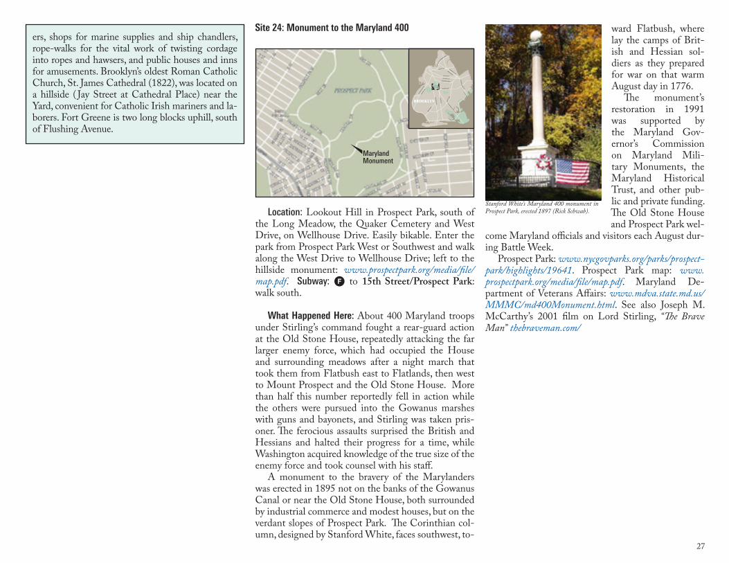
27
ward Flatbush, where lay the camps of Brit-ish and Hessian sol-diers as they prepared for war on that warm August day in 1776.
The monument’s restoration in 1991 was supported by the Maryland Gov-ernor’s Commission on Maryland Mili-tary Monuments, the Maryland Historical Trust, and other pub-lic and private funding. The Old Stone House and Prospect Park wel-
come Maryland officials and visitors each August dur-ing Battle Week.
Prospect Park: www.nycgovparks.org/parks/prospect-park/highlights/19641. Prospect Park map: www.prospectpark.org/media/file/map.pdf. Maryland De-partment of Veterans Affairs: www.mdva.state.md.us/MMMC/md400Monument.html. See also Joseph M. McCarthy’s 2001 film on Lord Stirling, “The Brave Man” thebraveman.com/
Location: Lookout Hill in Prospect Park, south of the Long Meadow, the Quaker Cemetery and West Drive, on Wellhouse Drive. Easily bikable. Enter the park from Prospect Park West or Southwest and walk along the West Drive to Wellhouse Drive; left to the hillside monument: www.prospectpark.org/media/file/map.pdf. Subway: F to 15th Street/Prospect Park: walk south.
What Happened Here: About 400 Maryland troops under Stirling’s command fought a rear-guard action at the Old Stone House, repeatedly attacking the far larger enemy force, which had occupied the House and surrounding meadows after a night march that took them from Flatbush east to Flatlands, then west to Mount Prospect and the Old Stone House. More than half this number reportedly fell in action while the others were pursued into the Gowanus marshes with guns and bayonets, and Stirling was taken pris-oner. The ferocious assaults surprised the British and Hessians and halted their progress for a time, while Washington acquired knowledge of the true size of the enemy force and took counsel with his staff.
A monument to the bravery of the Marylanders was erected in 1895 not on the banks of the Gowanus Canal or near the Old Stone House, both surrounded by industrial commerce and modest houses, but on the verdant slopes of Prospect Park. The Corinthian col-umn, designed by Stanford White, faces southwest, to-
Site 24: Monument to the Maryland 400
LINDEN BLVD
FLATBUSH AV
OC
EA
N P
KW
Y
OC
EA
N A
V
EASTERN PKWY
ATLANTIC AV
FULTON ST
BAY P
KWY
GO
WAN
US
EXPW
Y
MYRTLE AV
BROADWAY
BUSHWICK AV
KIN
GS
HW
Y
BR
OO
KLY
N Q
UEENS EXPWY
PE
NN
SY
LVANIA AV
FOURT
H AV
AREA OF THIS MAP
BROOKLYNBROOKLYN
Maryland Monument
ers, shops for marine supplies and ship chandlers, rope-walks for the vital work of twisting cordage into ropes and hawsers, and public houses and inns for amusements. Brooklyn’s oldest Roman Catholic Church, St. James Cathedral (1822), was located on a hillside ( Jay Street at Cathedral Place) near the Yard, convenient for Catholic Irish mariners and la-borers. Fort Greene is two long blocks uphill, south of Flushing Avenue.
Stanford White’s Maryland 400 monument in Prospect Park, erected 1897 (Rick Schwab).
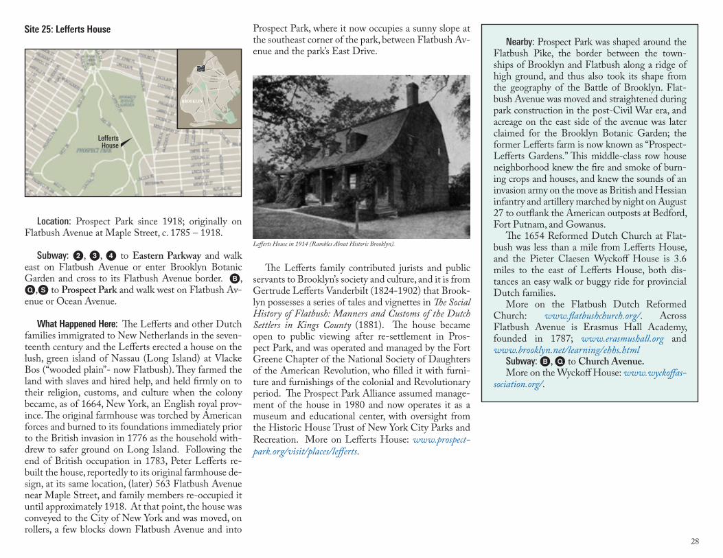
28
Location: Prospect Park since 1918; originally on Flatbush Avenue at Maple Street, c. 1785 – 1918.
Subway: 2, 3, 4 to Eastern Parkway and walk east on Flatbush Avenue or enter Brooklyn Botanic Garden and cross to its Flatbush Avenue border. B, Q,S to Prospect Park and walk west on Flatbush Av-enue or Ocean Avenue.
What Happened Here: The Lefferts and other Dutch families immigrated to New Netherlands in the seven-teenth century and the Lefferts erected a house on the lush, green island of Nassau (Long Island) at Vlacke Bos (“wooded plain”- now Flatbush). They farmed the land with slaves and hired help, and held firmly on to their religion, customs, and culture when the colony became, as of 1664, New York, an English royal prov-ince. The original farmhouse was torched by American forces and burned to its foundations immediately prior to the British invasion in 1776 as the household with-drew to safer ground on Long Island. Following the end of British occupation in 1783, Peter Lefferts re-built the house, reportedly to its original farmhouse de-sign, at its same location, (later) 563 Flatbush Avenue near Maple Street, and family members re-occupied it until approximately 1918. At that point, the house was conveyed to the City of New York and was moved, on rollers, a few blocks down Flatbush Avenue and into
Site 25: Lefferts House Prospect Park, where it now occupies a sunny slope at the southeast corner of the park, between Flatbush Av-enue and the park’s East Drive.
The Lefferts family contributed jurists and public servants to Brooklyn’s society and culture, and it is from Gertrude Lefferts Vanderbilt (1824-1902) that Brook-lyn possesses a series of tales and vignettes in The Social History of Flatbush: Manners and Customs of the Dutch Settlers in Kings County (1881). The house became open to public viewing after re-settlement in Pros-pect Park, and was operated and managed by the Fort Greene Chapter of the National Society of Daughters of the American Revolution, who filled it with furni-ture and furnishings of the colonial and Revolutionary period. The Prospect Park Alliance assumed manage-ment of the house in 1980 and now operates it as a museum and educational center, with oversight from the Historic House Trust of New York City Parks and Recreation. More on Lefferts House: www.prospect-park.org/visit/places/lefferts.
Nearby: Prospect Park was shaped around the Flatbush Pike, the border between the town-ships of Brooklyn and Flatbush along a ridge of high ground, and thus also took its shape from the geography of the Battle of Brooklyn. Flat-bush Avenue was moved and straightened during park construction in the post-Civil War era, and acreage on the east side of the avenue was later claimed for the Brooklyn Botanic Garden; the former Lefferts farm is now known as “Prospect-Lefferts Gardens.” This middle-class row house neighborhood knew the fire and smoke of burn-ing crops and houses, and knew the sounds of an invasion army on the move as British and Hessian infantry and artillery marched by night on August 27 to outflank the American outposts at Bedford, Fort Putnam, and Gowanus.
The 1654 Reformed Dutch Church at Flat-bush was less than a mile from Lefferts House, and the Pieter Claesen Wyckoff House is 3.6 miles to the east of Lefferts House, both dis-tances an easy walk or buggy ride for provincial Dutch families.
More on the Flatbush Dutch Reformed Church: www.flatbushchurch.org/. Across Flatbush Avenue is Erasmus Hall Academy, founded in 1787; www.erasmushall.org and www.brooklyn.net/learning/ehhs.html
Subway: B, Q to Church Avenue.More on the Wyckoff House: www.wyckoffas-
sociation.org/.
LINDEN BLVD
FLATBUSH AV
OC
EA
N P
KW
Y
OC
EA
N A
V
EASTERN PKWY
ATLANTIC AV
FULTON ST
BAY P
KWY
GO
WAN
US
EXPW
Y
MYRTLE AV
BROADWAY
BUSHWICK AV
KIN
GS
HW
Y
BR
OO
KLYN Q
UEENS EXPWY
PE
NN
SY
LVANIA AV
FOURT
H AV
AREA OF THIS MAP
BROOKLYNBROOKLYN
LeffertsHouse
Lefferts House in 1914 (Rambles About Historic Brooklyn).
29
1776-2010 – Postscript to the Battle of Brooklyn
Brooklyn became a chartered village in 1816 and a chartered city in 1832, and, following the annexa-tion of Williamsburg and Bushwick in 1855, became the third largest city in the U.S. The other contiguous towns of Kings County—Gravesend, New Utrecht, Flatlands, and Flatbush—all gradually merged into a united Brooklyn that itself merged with New York City in 1898. The port city of Brooklyn was not a remote college town or rural village with a united culture of remembrance that conserved its connections to its co-lonial and Revolutionary past. Commerce and immi-gration instead transformed Brooklyn into a colossus of shipping and industrial competition and offered an adopted homeland for vast numbers of Europeans and Asians as well as a destination for African Americans from other states, all of whom valued American free-doms but whose cultural baggage connected them to their home countries and states, not to the American Revolution’s physical evidence that was no longer vis-ible. Scattered groups with family, church, or cultural ties to old Brooklyn or to the Revolutionary War did remember, and some grateful newcomers who pros-pered in Brooklyn also prized the disappearing sites, and to all these is owed a debt of gratitude for memori-als, plaques and site preservation.
A very few houses and sites from the Colonial and Revolutionary Periods did survive in Brooklyn, and a few monuments memorialize wartime sacrifice, though their original meanings are often obscured by their ready integration into everyday life. Prospect Park was laid out in its present shape to preserve the integrity and remembrance of the Flatbush Turnpike and Pass, and Fort Greene Park memorialized the prison ship dead, but both now exist as lush green spaces that offer respite and recreation to a mixed and immensely di-verse population. The reality of a rural and war-scarred landscape has become more and more remote as popu-lation density and diversity have increased.
Unequivocal victories are easily remembered and celebrated, while retreats and battles lost, as was the
Battle of Brooklyn, are often relegated to historical footnotes. Most nineteenth century historians and li-terati were New Englanders who celebrated their local cultural values and their local history as universal ex-periences, including the bloody victory at Bunker Hill and Paul Revere’s heroic ride. Abigail Adams wrote that the loss of Brooklyn was an opportunity to stiffen the collective American back—“WE WILL NOT BE DEFEATED”—but there was little else to celebrate about disaster and defeat at Brooklyn, though Wash-ington’s genius in keeping his army more-or-less intact and undefeated came to be recognized. But the thou-sands of soldiers and seamen who died or became pris-oners in Brooklyn and New York were ill-spared from the next military campaigns and never made it home for the next harvest or the next planting season.
Too, nineteenth-century historians assigned blame to General Israel Putnam for the defeat, though the tale of a patriot army of 8,000 to 10,000 resisting an in-vasion force of 27,000 should have been an unabashed celebration of national unity. Washington carefully and clearly never blamed Putnam. However, the loss of Long Island, richly laden with grain and cattle, land-owners’ farms and families disturbed, the social order subverted by English and Hessian soldiers who em-ployed Brooklyn slaves and encouraged them to seek asylum and freedom under English rule, undoubtedly affected the ways in which the Battle of Brooklyn was remembered by succeeding generations.
The Old Stone House strives to remember the Bat-tle of Brooklyn and memorialize it as the first battle of a seven-year war that led to the republic of today, a war resisted by local people on home ground and fought in concert with fellow Americans against an invading imperial power. We hope that visitors will make use of this guide as a window on the battle sites, and in viewing, that visitors will remember the American pa-triots, the Revolutionary mind-set, and the Brooklyn that once existed and contributed to the cause. You can still see much of that Brooklyn on foot and bicycle. We
welcome your support of the Old Stone House, its role in preserving and promoting the history of the Battle of Brooklyn, and its more than three centuries of life in Brooklyn.
BibliographyBurrows, Edwin G., Forgotten Patriots: the Untold Story
of American Prisoners during the Revolutionary War (2008)
Armbruster, Eugene, The Wallabout Prison-Ships, 1776-1783 (1920)
Armbruster, Eugene, Guide Book, to the Noted Places on Long Island, Historical and otherwise (1925)
Atlee, Samuel John. “Col. Atlee’s Journal of the Battle of Long Island, August 26, 1776.” Pennsylvania Magazine of History and Biography, 2d Ser., 1 (1879), pp. 509-516.
Gallagher, John J., The Battle of Brooklyn, 1776 (1995)Higgins, Charles M., Brooklyn’s Neglected Battle Ground
(1910)Johnston, Henry P., The Campaign of 1776 Around New
York and Brooklyn (Brooklyn, 1878)Parry, William, Life at the Old Stone House: A History of
a Farm and its Occupants (2000)Richman, Jeffrey I., Brooklyn’s Green-Wood Cemetery
(1998)Schecter, Barnet, The Battle for New York: The City at the
Heart of the American Revolution (2002). Stiles, Henry R., A History of the City of Brooklyn (1867)Vanderbilt, Gertrude Lefferts, The Social History of
Flatbush: Manners and Customs of the Dutch Settlers in Kings County (1881).