Embed Size (px)
Citation preview
Regularly practice preventative engine maintenance and keep your engine well-tuned to prevent fuel and oil leaks.
If you change your boat engine oil, use a closed system (such as a portable oil-change pump) available at marine supplies stores and always have an oil absorbent handy.
Oil absorbents are the least expensive method boaters can use to control oily dis-charges. Oil absorbents (available at most marine supply stores) absorb oil while repelling water. Use oil absorbent for oil drips under the engine and in the bilge and to remove oil sheen on the water. These absorbents can also be used while fueling your boat or when filling a portable tank.
If you have an extremely oily bilge, consider using a bilge pumpout service that properly disposes of the wastewater. If the bilge and/or engine compartment still needs significant cleaning after bilge pumpout, use a steam cleaning service.
Check the absorbents often and dispose of them when saturated as hazardous waste at a marina or at your County Household Hazardous Waste Collection Center. Report all oil and chemical spills by calling the National Response Center (800) 424-8802, the California Office of Emergency Re-sponse (800) OILS911, and the marina office.
Visit www.BoatingCleanandGreen.com for more information
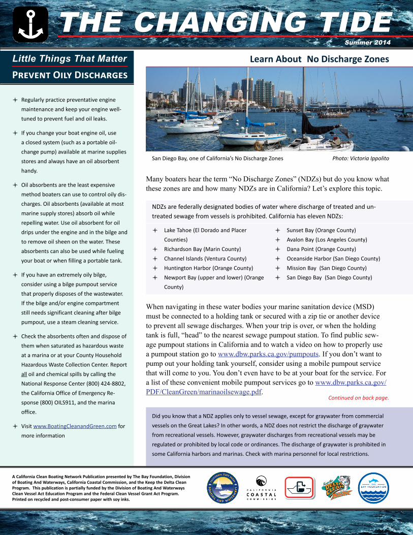
Many boaters hear the term “No Discharge Zones” (NDZs) but do you know what these zones are and how many NDZs are in California? Let’s explore this topic.
Lake Tahoe (El Dorado and Placer Counties)Richardson Bay (Marin County)Channel Islands (Ventura County)Huntington Harbor (Orange County)Newport Bay (upper and lower) (Orange County)
Sunset Bay (Orange County)Avalon Bay (Los Angeles County)Dana Point (Orange County)Oceanside Harbor (San Diego County)Mission Bay (San Diego County)San Diego Bay (San Diego County)
When navigating in these water bodies your marine sanitation device (MSD) must be connected to a holding tank or secured with a zip tie or another device to prevent all sewage discharges. When your trip is over, or when the holding tank is full, “head” to the nearest sewage pumpout station. To find public sew-age pumpout stations in California and to watch a video on how to properly use a pumpout station go to www.dbw.parks.ca.gov/pumpouts. If you don’t want to pump out your holding tank yourself, consider using a mobile pumpout service that will come to you. You don’t even have to be at your boat for the service. For a list of these convenient mobile pumpout services go to www.dbw.parks.ca.gov/PDF/CleanGreen/marinaoilsewage.pdf.
Did you know that a NDZ applies only to vessel sewage, except for graywater from commercial vessels on the Great Lakes? In other words, a NDZ does not restrict the discharge of graywater from recreational vessels. However, graywater discharges from recreational vessels may be regulated or prohibited by local code or ordinances. The discharge of graywater is prohibited in some California harbors and marinas. Check with marina personnel for local restrictions.
Continued on back page.
NDZs are federally designated bodies of water where discharge of treated and un-treated sewage from vessels is prohibited. California has eleven NDZs:
San Diego Bay, one of California’s No Discharge Zones Photo: Victoria Ippolito
Little Things That Matter
Prevent Oily DischargesLearn About No Discharge Zones
A California Clean Boating Network Publication presented by The Bay Foundation, Division of Boating And Waterways, California Coastal Commission, and the Keep the Delta Clean Program. This publication is partially funded by the Division of Boating And Waterways Clean Vessel Act Education Program and the Federal Clean Vessel Grant Act Program. Printed on recycled and post-consumer paper with soy inks.
The Changing Tide THE CHANGING TIDESummer 2014
Visitors to Ventura County can enjoy 43 miles of coastline, 7.5 miles of which are public beaches and 411 acres of which are state beach parks. Additionally, Channel Islands National Park, located only a few miles off the Ventura County coast, is one of only four designated national marine sanctuaries. Composed of five islands, they are easily accessible by both Ventura Harbor and Channel Islands Harbor for day or extended trips.
Destination Series:
Ventura County
Known as the “Gateway to Channel Islands National Park,” Ventura County has made it even more accessible for recre-ational boaters to enjoy this national marine sanctuary. After much anticipation, both the Ventura Harbor public launch ramp and the Channel Islands Harbor launch ramp re-opened in June 2014.
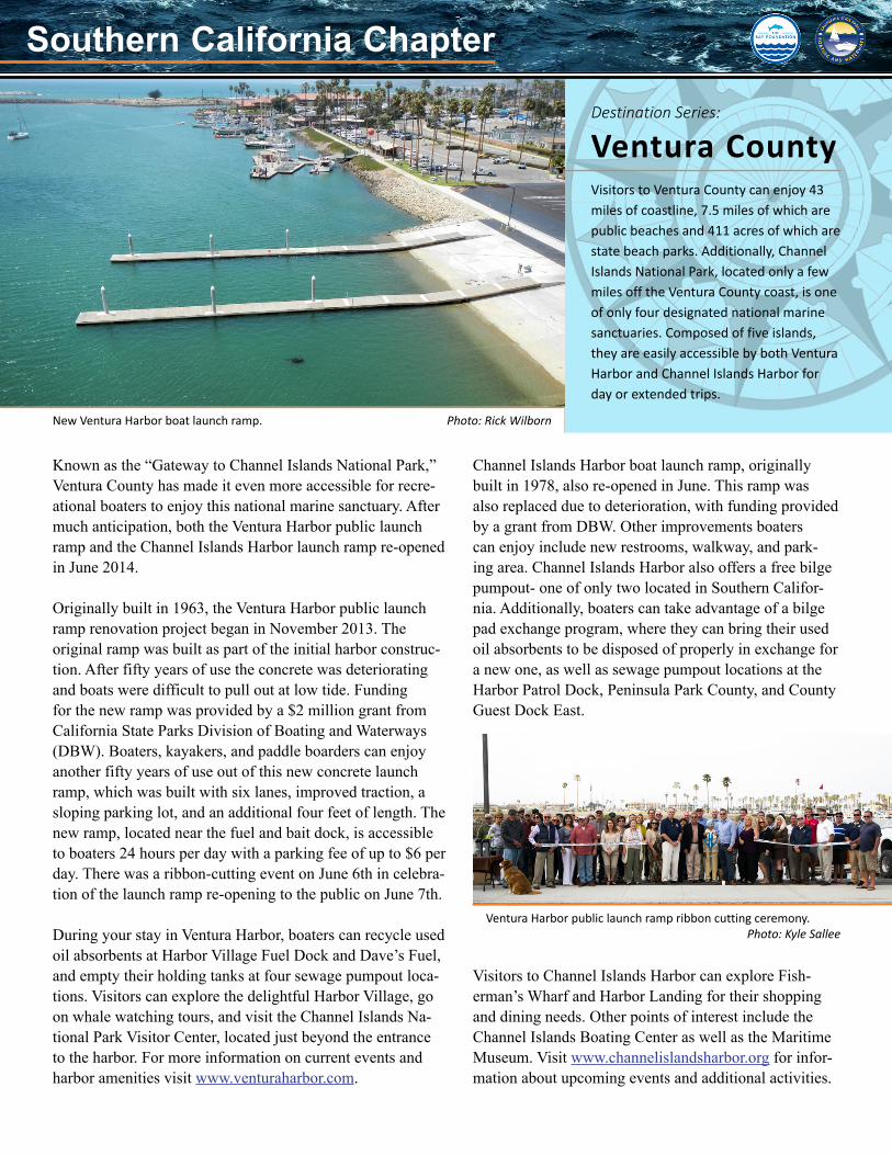
Originally built in 1963, the Ventura Harbor public launch ramp renovation project began in November 2013. The original ramp was built as part of the initial harbor construc-tion. After fifty years of use the concrete was deteriorating and boats were difficult to pull out at low tide. Funding for the new ramp was provided by a $2 million grant from California State Parks Division of Boating and Waterways (DBW). Boaters, kayakers, and paddle boarders can enjoy another fifty years of use out of this new concrete launch ramp, which was built with six lanes, improved traction, a sloping parking lot, and an additional four feet of length. The new ramp, located near the fuel and bait dock, is accessible to boaters 24 hours per day with a parking fee of up to $6 per day. There was a ribbon-cutting event on June 6th in celebra-tion of the launch ramp re-opening to the public on June 7th.
During your stay in Ventura Harbor, boaters can recycle used oil absorbents at Harbor Village Fuel Dock and Dave’s Fuel, and empty their holding tanks at four sewage pumpout loca-tions. Visitors can explore the delightful Harbor Village, go on whale watching tours, and visit the Channel Islands Na-tional Park Visitor Center, located just beyond the entrance to the harbor. For more information on current events and harbor amenities visit www.venturaharbor.com.
Channel Islands Harbor boat launch ramp, originally built in 1978, also re-opened in June. This ramp was also replaced due to deterioration, with funding provided by a grant from DBW. Other improvements boaters can enjoy include new restrooms, walkway, and park-ing area. Channel Islands Harbor also offers a free bilge pumpout- one of only two located in Southern Califor-nia. Additionally, boaters can take advantage of a bilge pad exchange program, where they can bring their used oil absorbents to be disposed of properly in exchange for a new one, as well as sewage pumpout locations at the Harbor Patrol Dock, Peninsula Park County, and County Guest Dock East.
Visitors to Channel Islands Harbor can explore Fish-erman’s Wharf and Harbor Landing for their shopping and dining needs. Other points of interest include the Channel Islands Boating Center as well as the Maritime Museum. Visit www.channelislandsharbor.org for infor-mation about upcoming events and additional activities.
Ventura Harbor public launch ramp ribbon cutting ceremony.Photo: Kyle Sallee
New Ventura Harbor boat launch ramp. Photo: Rick Wilborn
Southern California Chapter Southern California Chapter
The Bay Foundation Receives Used Oil Grant
Boaters in Southern California will have another FREE environmental resource at their disposal thanks to The Bay Foundation, who was award-ed a highly sought after Used Oil Competitive Grant from CalRecycle. Among other things, the grant will allow The Bay Foundation to install four absorbent pad exchange programs and a bilge pumpout station in Southern California.
Want more information about this Program? Contact Victoria Ippolito at (213) 620-2271 or [email protected].
The Bay Foundation sought funds to meet the specific need of controlling oily bilge water discharges from boats in harbors that are lacking a convenient oil absorbent disposal collection site and oil absorbent distribution service, in addition to proper treatment of oil contaminated bilge water, and increased outreach. Statewide and local programs that educate boaters about the sources and solutions to boat gener-ated pollution are most effective when coupled with improved pollution prevention services.
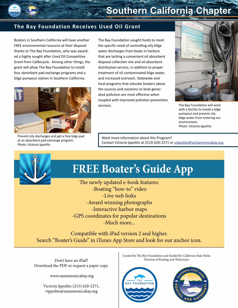
Prevent oily discharges and get a free bilge pad at an absorbent pad exchange program.Photo: Victoria Ippolito
FREE Boater’s Guide AppThe newly updated e-book features:
-Boating “how-to” video-Live web links
-Award winning photographs-Interactive harbor maps
-GPS coordinates for popular destinations-Much more...
Compatible with iPad version 2 and higher. Search “Boater’s Guide” in iTunes App Store and look for our anchor icon.
Don’t have an iPad? Download the PDF or request a paper copy.
www.santamonicabay.org
Victoria Ippolito (213) 620-2271, [email protected]
Created by The Bay Foundation and funded by California State Parks Division of Boating and Waterways
The Bay Foundation will work with a facility to install a bilge pumpout and prevent oily bilge water from entering our environment.Photo: Victoria Ippolito
Southern California Chapter Southern California Chapter
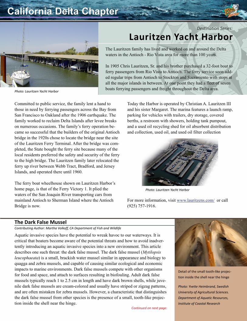
The Lauritzen family has lived and worked on and around the Delta waters in the Antioch - Rio Vista area for more than 100 years.
In 1905 Chris Lauritzen, Sr. and his brother purchased a 32-foot boat to ferry passengers from Rio Vista to Antioch. The ferry service soon add-ed regular trips from Antioch to Stockton and Sacramento with stops at all the major islands in between. At one point they had a fleet of seven boats ferrying passengers and freight throughout the Delta area.
Destination Series:
Lauritzen Yacht Harbor
Committed to public service, the family lent a hand to those in need by ferrying passengers across the Bay from San Francisco to Oakland after the 1906 earthquake. The family worked to reclaim Delta Islands after levee breaks on numerous occasions. The family’s ferry operation be-came so successful that the builders of the original Antioch bridge in the 1920s chose to locate the bridge near the site of the Lauritzen Ferry Terminal. After the bridge was com-pleted, the State bought the ferry site because many of the local residents preferred the safety and security of the ferry to the high bridge. The Lauritzen family later relocated the ferry up river between Webb Tract, Bradford, and Jersey Islands, and operated there until 1960.
The ferry boat wheelhouse shown on Lauritzen Harbor’s home page, is that of the Ferry Victory 1. It plied the waters of the San Joaquin River transporting cars from mainland Antioch to Sherman Island where the Antioch Bridge is now.
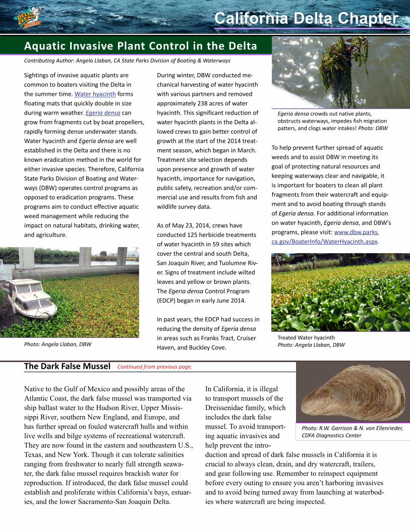
Today the Harbor is operated by Christian A. Lauritzen III and his sister Margaret. The marina features a launch ramp, parking for vehicles with trailers, dry storage, covered berths, a restroom with showers, holding tank pumpout, and a used oil recycling shed for oil absorbent distribution and collection, used oil, and used oil filter collection
For more information, visit www.lauritzens.com/ or call (925) 757-1916.
Aquatic invasive species have the potential to wreak havoc to our waterways. It is critical that boaters become aware of the potential threats and how to avoid inadver-tently introducing an aquatic invasive species into a new environment. This article describes one such threat: the dark false mussel. The dark false mussel (Mytilopsis leucophaeata) is a small, brackish water mussel similar in appearance and biology to quagga and zebra mussels, and capable of causing similar ecological and economic impacts to marine environments. Dark false mussels compete with other organisms for food and space, and attach to surfaces resulting in biofouling. Adult dark false mussels typically reach 1 to 2.5 cm in length and have dark brown shells, while juve-nile dark false mussels are cream-colored and usually have striped or zigzag patterns, and are often mistaken for zebra mussels. However, a characteristic that distinguishes the dark false mussel from other species is the presence of a small, tooth-like projec-tion inside the shell near the hinge.
The Dark False MusselContributing Author: Martha Volkoff, CA Department of Fish and Wildlife
Detail of the small tooth-like projec-tion inside the shell near the hinge
Photo: Yvette Heimbrand, Swedish University of Agricultural Sciences. Department of Aquatic Resources, Institute of Coastal Research
Continued on next page.
Photo: Lauritzen Yacht Harbor
Photo: Lauritzen Yacht Harbor
California Delta ChapterCalifornia Delta Chapter
Aquatic Invasive Plant Control in the Delta
In California, it is illegal to transport mussels of the Dreissenidae family, which includes the dark false mussel. To avoid transport-ing aquatic invasives and help prevent the intro-duction and spread of dark false mussels in California it is crucial to always clean, drain, and dry watercraft, trailers, and gear following use. Remember to reinspect equipment before every outing to ensure you aren’t harboring invasives and to avoid being turned away from launching at waterbod-ies where watercraft are being inspected.
Sightings of invasive aquatic plants are common to boaters visiting the Delta in the summer time. Water hyacinth forms floating mats that quickly double in size during warm weather. Egeria densa can grow from fragments cut by boat propellers, rapidly forming dense underwater stands. Water hyacinth and Egeria densa are well established in the Delta and there is no known eradication method in the world for either invasive species. Therefore, California State Parks Division of Boating and Water-ways (DBW) operates control programs as opposed to eradication programs. These programs aim to conduct effective aquatic weed management while reducing the impact on natural habitats, drinking water, and agriculture.
Native to the Gulf of Mexico and possibly areas of the Atlantic Coast, the dark false mussel was transported via ship ballast water to the Hudson River, Upper Missis-sippi River, southern New England, and Europe, and has further spread on fouled watercraft hulls and within live wells and bilge systems of recreational watercraft. They are now found in the eastern and southeastern U.S., Texas, and New York. Though it can tolerate salinities ranging from freshwater to nearly full strength seawa-ter, the dark false mussel requires brackish water for reproduction. If introduced, the dark false mussel could establish and proliferate within California’s bays, estuar-ies, and the lower Sacramento-San Joaquin Delta.
The Dark False Mussel Continued from previous page.
To help prevent further spread of aquatic weeds and to assist DBW in meeting its goal of protecting natural resources and keeping waterways clear and navigable, it is important for boaters to clean all plant fragments from their watercraft and equip-ment and to avoid boating through stands of Egeria densa. For additional information on water hyacinth, Egeria densa, and DBW’s programs, please visit: www.dbw.parks.ca.gov/BoaterInfo/WaterHyacinth.aspx.
Contributing Author: Angela Llaban, CA State Parks Division of Boating & Waterways
During winter, DBW conducted me-chanical harvesting of water hyacinth with various partners and removed approximately 238 acres of water hyacinth. This significant reduction of water hyacinth plants in the Delta al-lowed crews to gain better control of growth at the start of the 2014 treat-ment season, which began in March. Treatment site selection depends upon presence and growth of water hyacinth, importance for navigation, public safety, recreation and/or com-mercial use and results from fish and wildlife survey data.
As of May 23, 2014, crews have conducted 125 herbicide treatments of water hyacinth in 59 sites which cover the central and south Delta, San Joaquin River, and Tuolumne Riv-er. Signs of treatment include wilted leaves and yellow or brown plants. The Egeria densa Control Program (EDCP) began in early June 2014.
In past years, the EDCP had success in reducing the density of Egeria densa in areas such as Franks Tract, Cruiser Haven, and Buckley Cove.
Treated Water hyacinth Photo: Angela Llaban, DBWPhoto: Angela Llaban, DBW
Egeria densa crowds out native plants, obstructs waterways, impedes fish migration patters, and clogs water intakes! Photo: DBW
California Delta ChapterCalifornia Delta Chapter
Photo: R.W. Garrison & N. von Ellenrieder, CDFA Diagnostics Center
Contributing Authors:Gary Stern Deputy Harbormaster and Scott Grindy Harbor Master, Oyster Point Marina and Pillar Point Harbor, San Mateo County Harbor District.
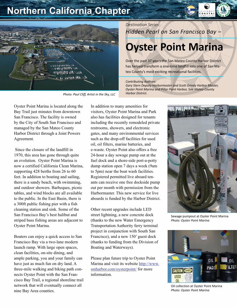
Oyster Point Marina is located along the Bay Trail just minutes from downtown San Francisco. The facility is owned by the City of South San Francisco and managed by the San Mateo County Harbor District through a Joint Powers Agreement.
Since the closure of the landfill in 1970, this area has gone through quite an evolution. Oyster Point Marina is now a certified California Clean Marina, supporting 428 berths from 26 to 60 feet. In addition to boating and sailing, there is a sandy beach, with swimming, and outdoor showers. Barbeques, picnic tables, and wind blocks are all available to the public. In the East Basin, there is a 300ft public fishing pier with a fish cleaning station and sink. Some of the San Francisco Bay’s best halibut and striped bass fishing areas are adjacent to Oyster Point Marina.
Boaters can enjoy a quick access to San Francisco Bay via a two-lane modern launch ramp. With large open spaces, clean facilities, on-site dining, and ample parking, you and your family can have just as much fun on dry land. A three-mile walking and biking path con-nects Oyster Point with the San Fran-cisco Bay Trail, a regional shoreline trail network that will eventually connect all nine Bay Area counties.
Hidden Pearl on San Francisco Bay –
Oyster Point MarinaOver the past 37 years the San Mateo County Harbor District has helped transform a one-time landfill into one of San Ma-teo County’s most exciting recreational facilities.
Photo: Paul Cliff, Artist in the Sky, LLC
Sewage pumpout at Oyster Point MarinaPhoto: Oyster Point Marina
Oil collection at Oyster Point MarinaPhoto: Oyster Point Marina
In addition to many amenities for visitors, Oyster Point Marina and Park also has facilities designed for tenants including the recently remodeled private restrooms, showers, and electronic gates, and many environmental services such as the drop-off facilities for used oil, oil filters, marine batteries, and e-waste. Oyster Point also offers a free 24-hour a day sewage pump out at the fuel dock and a shore-side port-a-potty dump station open 7 days a week (9am to 5pm) near the boat wash facilities. Registered permitted live aboard ten-ants can receive one free dockside pump out per month with permission from the Harbormaster. This new service for live aboards is funded by the Harbor District.
Other recent upgrades include LED street lightning, a new concrete dock (thanks to the new Water Emergency Transportation Authority ferry terminal project in conjunction with South San Francisco), and a new 150’ guest dock (thanks to funding from the Division of Boating and Waterways).
Please plan future trip to Oyster Point Marina and visit its website http://www.smharbor.com/oysterpoint/ for more information.
Destination Series:
Northern California ChapterNorthern California Chapter
Got Monofilament Fishing Line?
Check the New Updated San Francisco Bay Clean Boating Map
New features include:Facilities currently designated as Clean MarinasBoat launch rampsEel grass beds, Special Closure and State Marine Conservation areas, and State Marine Reserves.
The map continues to include:Locations of marinas and yacht clubs and their pollution prevention services including: used oil and used oil filter collection, sewage and bilge pumpouts, oil absorbent distribution and collec-tion, and marine battery collection services in the 9 Bay Area CountiesInformation about the Bay Area mobile boat-to-boat services Counties’ household hazardous waste collection centers and the marine patrol contact informa-tion, andHelpful information about clean and safe boat-ing practices.
•••
•
•
•
•
Published by the San Francisco Department of the Environment (City and County), the California Divi-sion of Boating and Waterways and the California Coastal Commission’s Boating Clean and Green Program with funding from CalRecycle.
Folded Dimensions: 8 ½ ” X 3 ¾”; Extended Dimen-sions: 25 ¼ ” X 32 ½ ”
You can display this publication at the marina, harbor, or yacht club offices, informational kiosks, bulletin boards, park’s visitor centers, and marine supply stores.
To order copies of this map, call or email Vivian Matuk at (415) 904-6905; [email protected].
Monofilament fishing line is not biode-gradable and when left in the environ-ment, may pose a serious hazard to wildlife, which can become entangled in discarded line and suffer severe injury such as loss of limbs or even death from gangrenous infection or strangulation. Fishing line discarded in our waterways is also both a safety issue due to the risk of fouling boat propellers, and it is also a serious problem around boat ramps and fishing areas. Even when we dispose the line in trash bins it still goes to a landfill which can create the same hazards for wildlife, unless it is cut into small pieces.
One solution to the problem is to have recycling containers available to boat-ers and fishermen to properly discard
of their used line. The California Divi-sion of Boating and Waterways and the California Coastal Commission’s Boating Clean and Green Program, the Keep the Delta Clean and the BoatUS Foundation have placed 207 fishing line recycling containers at many locations throughout the State. Please check the list of line recycling container locations by visit-ing www.BoatingCleanAndGreen.com (Quick hits: Monofilament Fishing Line Program), or view our map at http://goo.gl/maps/5zF5F.
If you are not near any of these recycling locations, please mail your used mono-filament fishing line to Berkley Recycling Collection Center at 1900 18th street, Spirit Lake, Iowa 51360-1099.
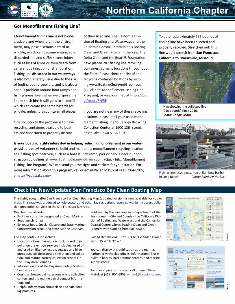
To date, approximately 955 pounds of fishing line have been collected and properly recycled. Stretched out, this line would stretch from San Francisco, California to Owensville, Missouri.
Is your boating facility interested in helping reducing monofilament in our water-ways? It is easy! Volunteer to build and maintain a monofilament recycling location at a fishing spot near you, such as a boat launch ramp, pier or park. Check our con-struction guidelines at www.BoatingCleanAndGreen.com (Quick hits: Monofilament Fishing Line Program). We can send you the signs and stickers for your station. For more information about this program, call or email Vivian Matuk at (415) 904-6905; [email protected].
Map showing the collected line(950 pounds) since 2010.Photo: Google Maps
Fishing line recycling station at Rainbow Harbor in Long Beach Photo: Rainbow Harbor
The highly sought after San Francisco Bay Clean Boating Map (updated version) is now available for you to order. This map was produced to help boaters and other Bay recreational users conveniently access pollu-tion prevention services in the San Francisco Bay Area.
Fron
tBa
ck
Northern California ChapterNorthern California Chapter

Continued from front page.
The Bay Foundation320 W. 4th Street, Suite 200Los Angeles, CA 90013
Changing Tide Staff:
Southern California Chapter
The Bay Foundation
www.santamonicabay.org
Grace Lee P [email protected] P (213) 576-6757
Delta Chapter
Contra Costa County
www.keepthedeltaclean.org
Dan Jordan P [email protected] P (925) 313-2023
Northern California Chapter
Division of Boating And Waterways, California Coastal Commission
www.dbw.parks.ca.gov, www.coastal.ca.gov
Vivian Matuk P [email protected] P (415) 904-6905
A California Clean Boating Network Publication presented by The Bay Foundation, Division of Boating And Waterways, California Coastal Commission, and the Keep the Delta Clean Program. This publication is partially funded by the Division of Boating And Waterways Clean Vessel Act Education Program and the Federal Clean Vessel Grant Act Program. Printed on recycled and post-consumer paper with soy inks.
The Changing Tide newsletter is a great resource for you to get California’s latest clean boating information. Help to reduce our carbon footprint and the amount of trash added to the waste stream by going paperless.
To go paperless, contact Victoria Ippolito [email protected] or 213-620- 2271
Choose phosphate-free, biodegradable soaps. These products can easily be found in any grocery store or marine supply store. You may also want to check the following websites to find not only phosphate-free, biodegrad-able soaps but also less toxic, less volatile, and superior biodegradable products: http://epa.gov/dfe/index.htmwww.SFApproved.orgwww.ecologo.org/enwww.greenseal.org/GreenBusiness/Standards.aspx
Use shore-side sinks, laundry and showers whenever possible. If not available, save showers, laundry, and dishwashing for home.
Use as little cleaning product as pos-sible. This will save you money and cut ocean pollution!
Encourage boaters to conserve water and use water-saving devices such as low–flow showerheads.
Rinse and scrub your boat with fresh-water after each trip.
FINALLY, always check with marina managers or harbormasters for local ordinances.
Learn About No Discharge Zones
It is important to remember that in order to ensure clean boating practices and to help reduce the amount of graywater that flows into our rivers and ocean, we suggest the following recommendations:
Remember: Discharging raw sewage into any of California’s lakes, rivers, reservoirs, or coastal waters within three miles of shore is prohibited within U.S. navigable waters. State law also prohibits dumping any treated or untreated human waste in a marina, yacht harbor, fresh water lake, reservoir, or fresh water impoundment, No Discharge Zones, rivers that don’t support interstate traffic, and water sanctuaries.
Learn more about environmental laws at: www.dbw.parks.ca.gov/PDF/CleanGreen/EnvironmentalLawsBro-chure.pdf.
Richardson Bay, one of the California No Discharge Zones Photo: Juan Ochoa
The Changing Tide THE CHANGING TIDESummer 2014