Embed Size (px)
Citation preview
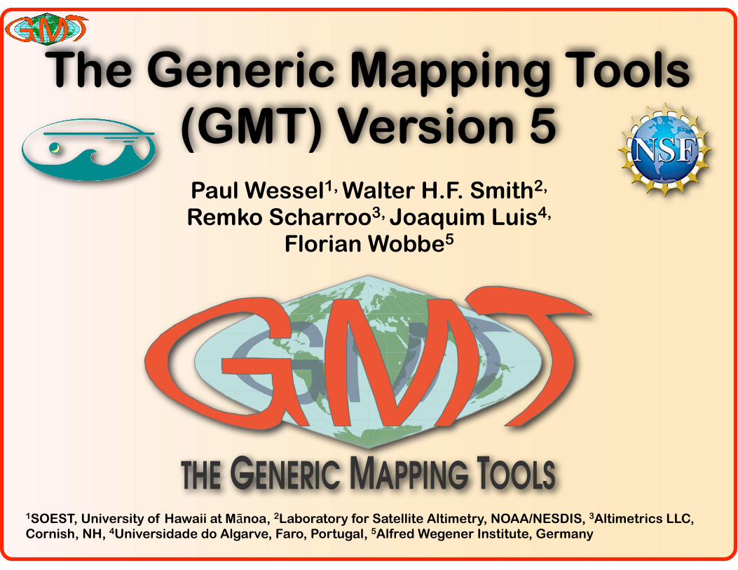
The Generic Mapping Tools (GMT) Version 5
Paul Wessel1, Walter H.F. Smith2,
Remko Scharroo3, Joaquim Luis4,
Florian Wobbe5
THE GENERIC MAPPING TOOLS1SOEST, University of Hawaii at Mānoa, 2Laboratory for Satellite Altimetry, NOAA/NESDIS, 3Altimetrics LLC, Cornish, NH, 4Universidade do Algarve, Faro, Portugal, 5Alfred Wegener Institute, Germany

GMT Podcasts
2
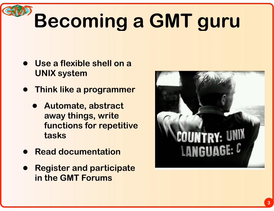
Becoming a GMT guru
• Use a flexible shell on a UNIX system
• Think like a programmer
• Automate, abstract away things, write functions for repetitive tasks
• Read documentation
• Register and participate in the GMT Forums
3
GMT Versatility
4
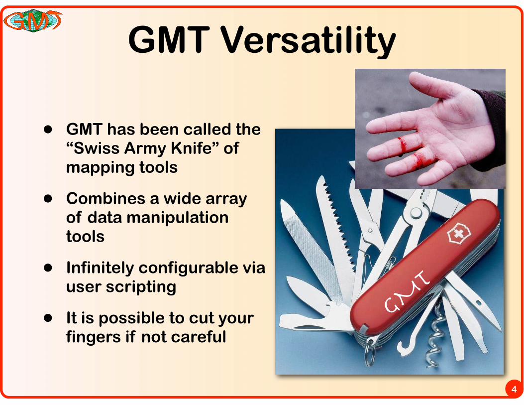
• GMT has been called the “Swiss Army Knife” of mapping tools
• Combines a wide array of data manipulation tools
• Infinitely configurable via user scripting
• It is possible to cut your fingers if not careful
GMT
News for developers
5
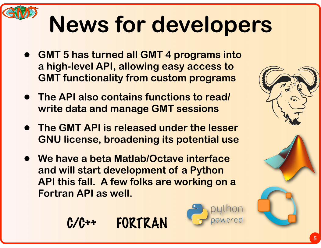
• GMT 5 has turned all GMT 4 programs into a high-level API, allowing easy access to GMT functionality from custom programs
• The API also contains functions to read/write data and manage GMT sessions
• The GMT API is released under the lesser GNU license, broadening its potential use
• We have a beta Matlab/Octave interface and will start development of a Python API this fall. A few folks are working on a Fortran API as well.
C/C++ FORTRAN
The GMT Octopus
6
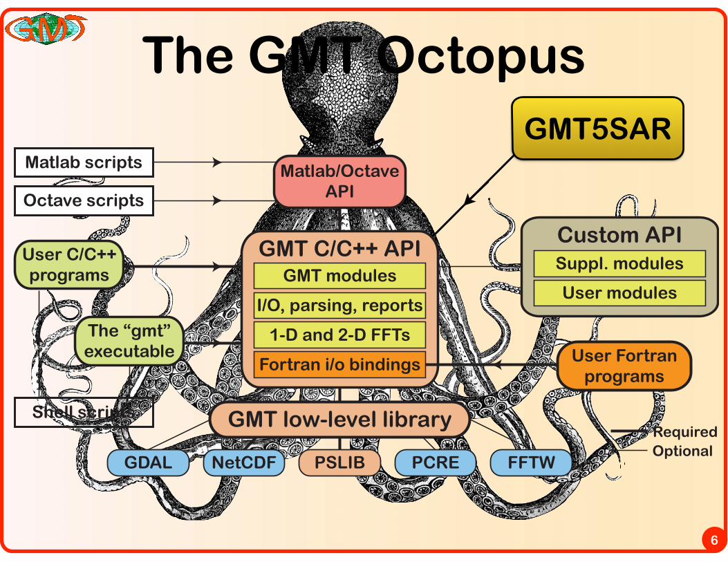
GMT C/C++ APIGMT modules
I/O, parsing, reports
1-D and 2-D FFTs
Fortran i/o bindings
The “gmt”executable
Matlab/OctaveAPI
Matlab scripts
NetCDF PCREGDAL PSLIB FFTW
Shell scripts
Octave scripts
RequiredOptional
% Initialize the GMT/Matlab session:gmt (‘create’);% Load in a (x y z) ASCII table:data = load (‘my_data_table.txt’);% Perform spatial median in GMT and return result as a Nx3 matrixD = gmt (‘blockmedian -R10/90/-30/60 -I2’, data);% Grid matrix D using GMT’s surface module and return a grid GG = gmt (‘surface -R -I2 -T0.2 -N1000’, D);% Make a basic contour plot of the grid G in Matlabcontour (G.x, G.y, G.z);% Make a nice contour map in GMT, overlaying land areas in gray:gmt (‘pscoast -R -JM6i -Ggray -P -Ba -O > map.ps’);gmt (‘grdcontour -J -K -C2 -A10 -V >> map.ps’, G);% Terminate the GMT session:gmt (‘destroy’);
a)
b)
Custom API
User modules
Suppl. modules
GMT low-level library
User C/C++programs
User Fortranprograms
GMT5SAR
New features for users
7
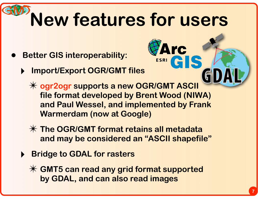
• Better GIS interoperability:
‣ Import/Export OGR/GMT files
✴ ogr2ogr supports a new OGR/GMT ASCII file format developed by Brent Wood (NIWA) and Paul Wessel, and implemented by Frank Warmerdam (now at Google)
✴ The OGR/GMT format retains all metadata and may be considered an “ASCII shapefile”
‣ Bridge to GDAL for rasters
✴ GMT5 can read any grid format supported by GDAL, and can also read images
New features for users
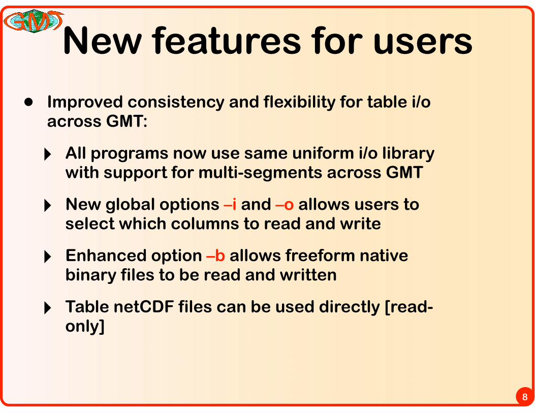
8
• Improved consistency and flexibility for table i/o across GMT:
‣ All programs now use same uniform i/o library with support for multi-segments across GMT
‣ New global options –i and –o allows users to select which columns to read and write
‣ Enhanced option –b allows freeform native binary files to be read and written
‣ Table netCDF files can be used directly [read-only]

New features for users
9
• Several new tools and many new options:
‣ PDF transparency
‣ Automatic annotation selection
‣ Run-time choice of FFT algorithms
‣ Run-time choice of triangulation algorithms
‣ 3-D perspective view available in all programs
‣ New enhanced macro language for custom symbols with multiple variables

GMT 4 vs GMT 5• Redesigned from programs to API modules
• I/O done via standard GMT library functions
• Modules in shared library called via gmt executable
• Interactive documentation (RST)
• Redesign many default parameter names and option syntax
• Support for faster FFTs (OS X Accelerate, FFTW)
• NetCDF 4 with deflation and chunking, PCRE expressions
10
• “classic” mode install links to gmt with names like psxy, blockmean,...
• GMT parameter GMT_COMPATIBILITY = 4 allows for old syntax
• A few new programs, plus many promoted up from supplements
• Lots of new options to many of the programs
• Stronger GDAL integration throughout, plus new OGR/GMT vector format
• Wiki for issue tracking and feature requests
System view
User view
Running a GMT module
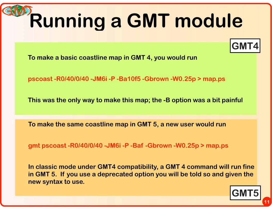
To make a basic coastline map in GMT 4, you would run
pscoast -R0/40/0/40 -JM6i -P -Ba10f5 -Gbrown -W0.25p > map.ps
This was the only way to make this map; the -B option was a bit painful
11
To make the same coastline map in GMT 5, a new user would run
gmt pscoast -R0/40/0/40 -JM6i -P -Baf -Gbrown -W0.25p > map.ps
In classic mode under GMT4 compatibility, a GMT 4 command will run fine in GMT 5. If you use a deprecated option you will be told so and given the new syntax to use.
GMT4
GMT5
GMT common options
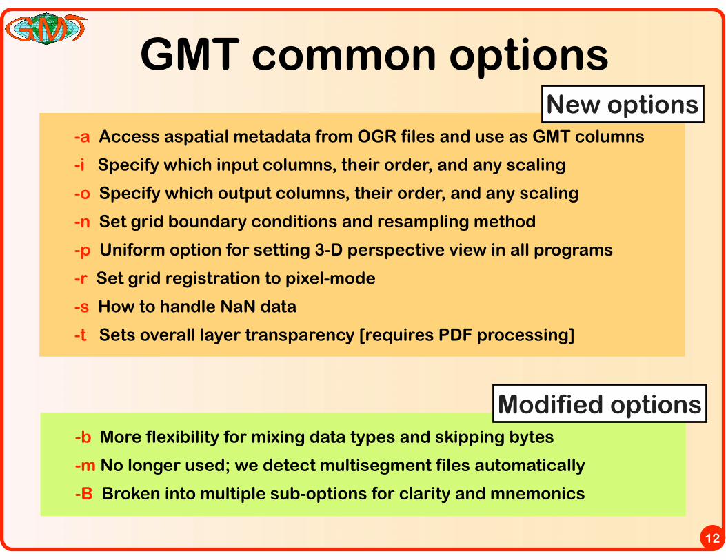
-a Access aspatial metadata from OGR files and use as GMT columns
-i Specify which input columns, their order, and any scaling
-o Specify which output columns, their order, and any scaling
-n Set grid boundary conditions and resampling method
-p Uniform option for setting 3-D perspective view in all programs
-r Set grid registration to pixel-mode
-s How to handle NaN data
-t Sets overall layer transparency [requires PDF processing]
12
-b More flexibility for mixing data types and skipping bytes
-m No longer used; we detect multisegment files automatically
-B Broken into multiple sub-options for clarity and mnemonics
New options
Modified options
Revised -B option
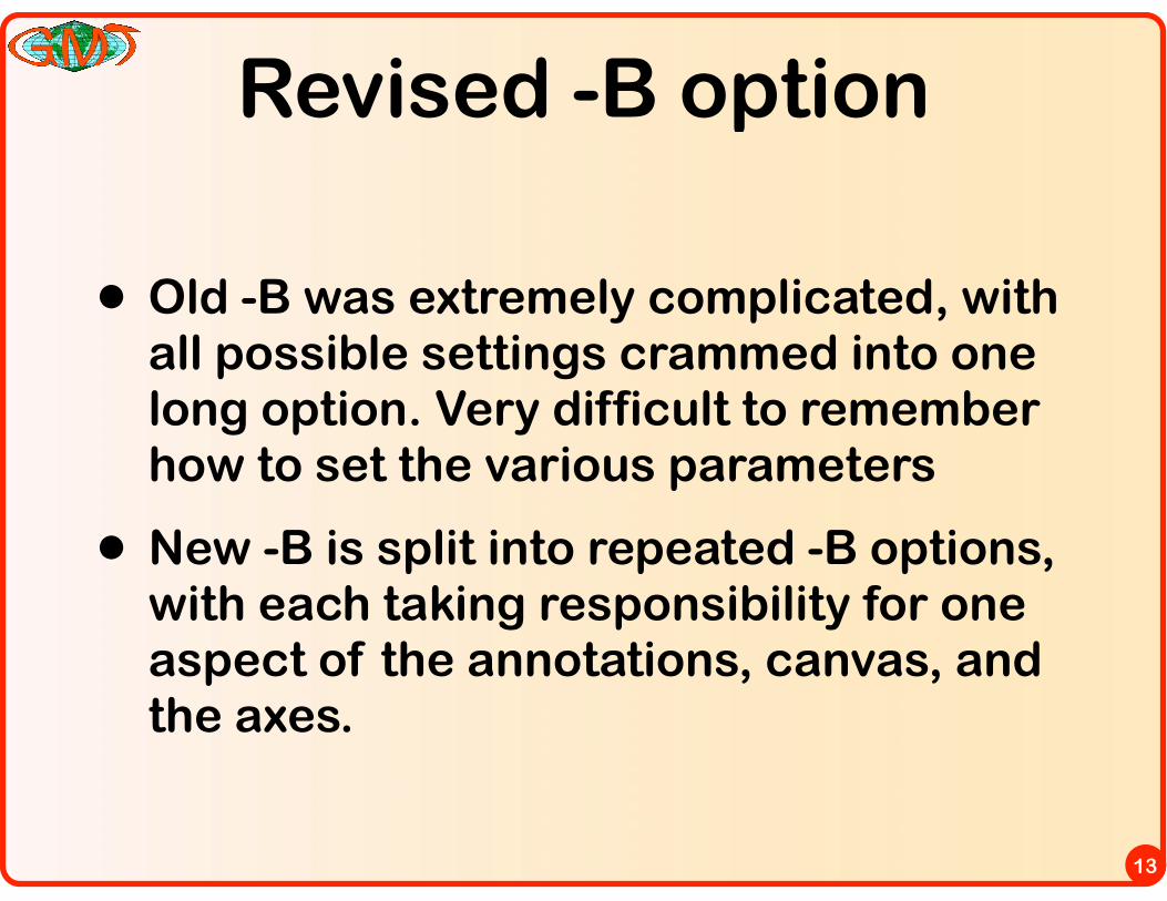
• Old -B was extremely complicated, with all possible settings crammed into one long option. Very difficult to remember how to set the various parameters
• New -B is split into repeated -B options, with each taking responsibility for one aspect of the annotations, canvas, and the axes.
13
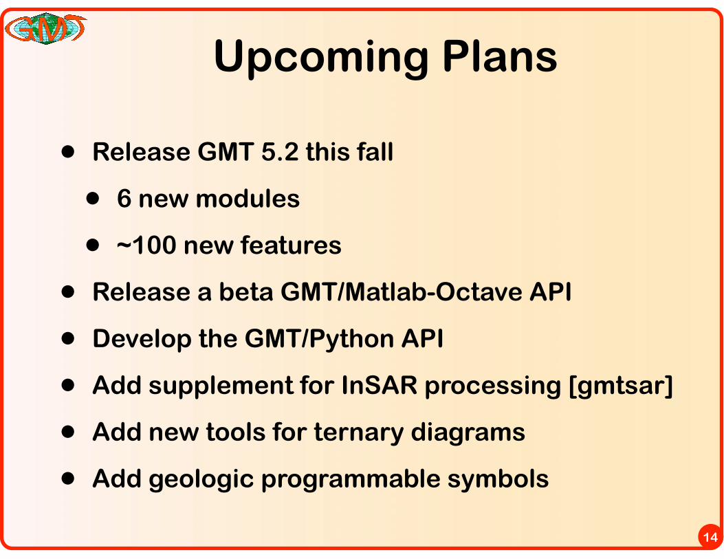
Upcoming Plans
• Release GMT 5.2 this fall
• 6 new modules
• ~100 new features
• Release a beta GMT/Matlab-Octave API
• Develop the GMT/Python API
• Add supplement for InSAR processing [gmtsar]
• Add new tools for ternary diagrams
• Add geologic programmable symbols
14
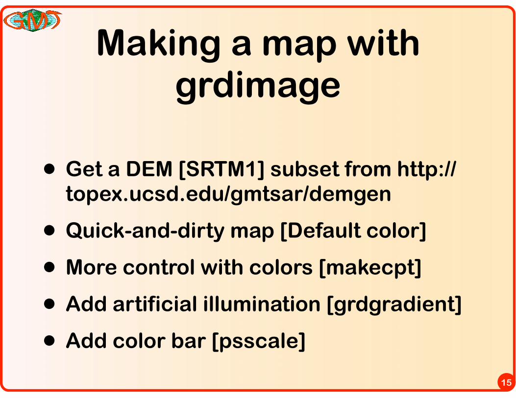
Making a map with grdimage
• Get a DEM [SRTM1] subset from http://topex.ucsd.edu/gmtsar/demgen
• Quick-and-dirty map [Default color]
• More control with colors [makecpt]
• Add artificial illumination [grdgradient]
• Add color bar [psscale]
15