Embed Size (px)
Citation preview

The Geography of the Middle East
Feb. 26th, 2013
The Wall Street Journal – Saturday Essay
“Geography Strikes Back”
September 7th, 2012 – Robert Kaplan
1.What does the article suggest you
consult to help understand world
conflict?
2.What countries does the article cite as
examples and what geographic
features?
3.What does the article say about the
strategic nature of geography?
4.List TWO historic events the author
uses to reference?
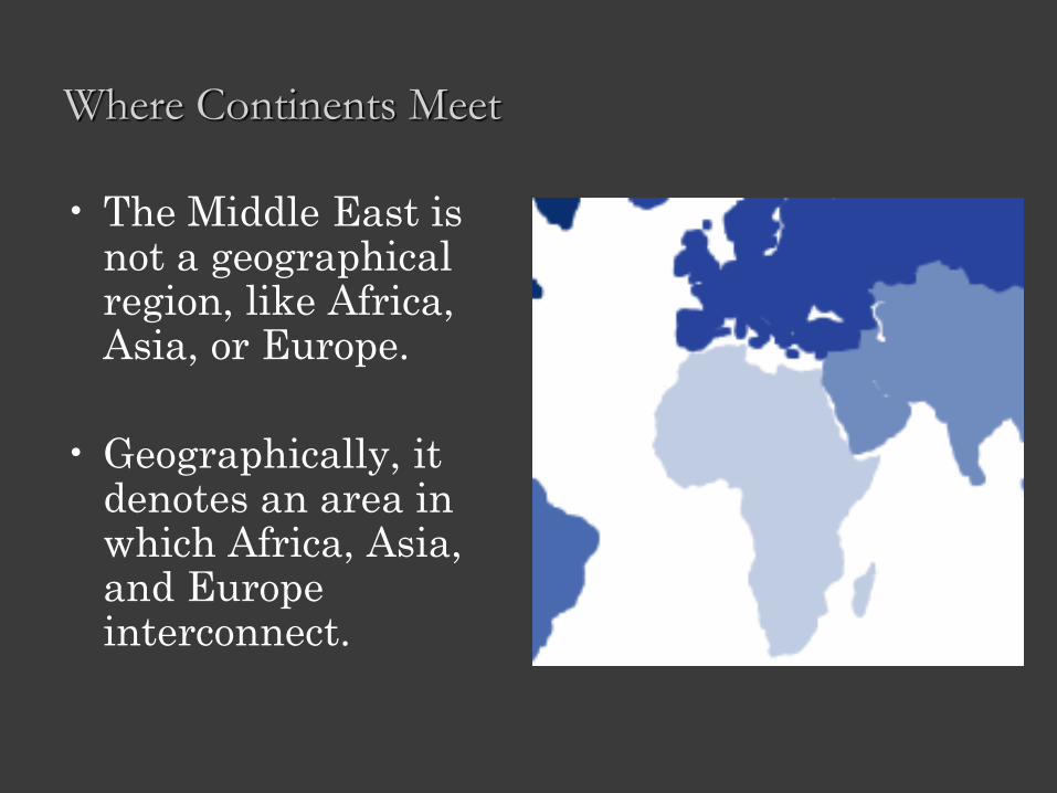
Where Continents Meet
• The Middle East is not a geographical region, like Africa, Asia, or Europe.
• Geographically, it denotes an area in which Africa, Asia, and Europe interconnect.
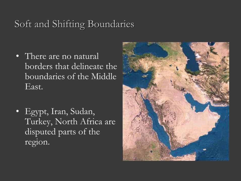
Soft and Shifting Boundaries
• There are no natural borders that delineate the boundaries of the Middle East.
• Egypt, Iran, Sudan, Turkey, North Africa are disputed parts of the region.
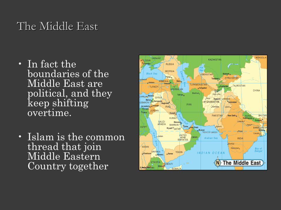
The Middle East
• In fact the boundaries of the Middle East are political, and they keep shifting overtime.
• Islam is the common thread that join Middle Eastern Country together
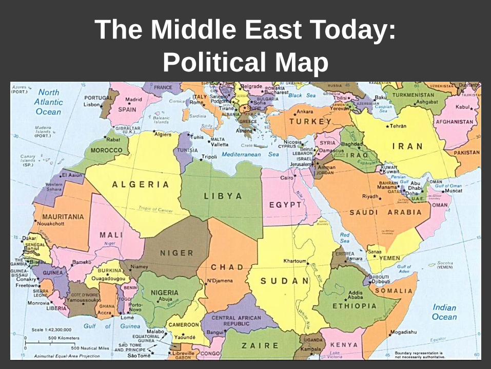
The Middle East Today:
Political Map
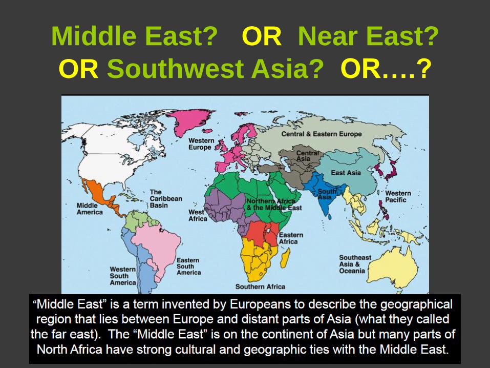
Middle East? OR Near East?
OR Southwest Asia? OR….?
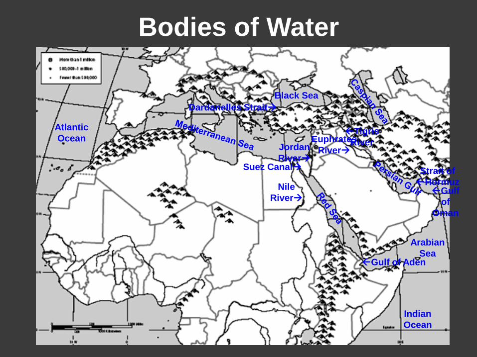
Bodies of Water
Tigris
River
Nile
River
Euphrates
River Jordan
River
Arabian
Sea
Indian
Ocean
Black Sea
Gulf of Aden
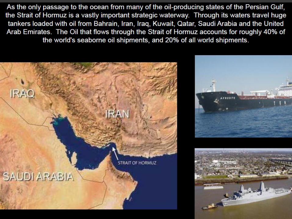
Strait of
Hormuz
Suez Canal
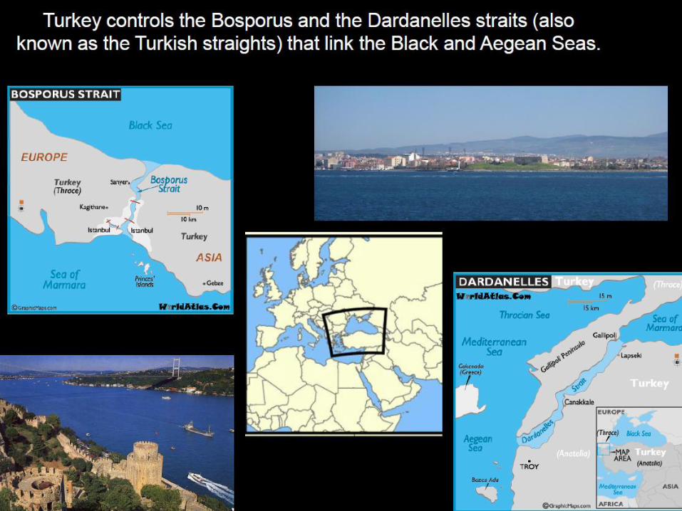
Dardanelles Strait
Atlantic
Ocean
Gulf
of
Oman
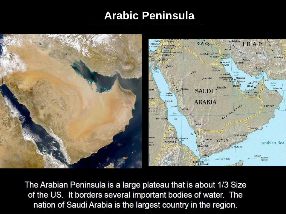
Arabic Peninsula
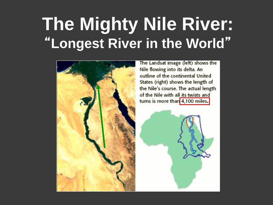
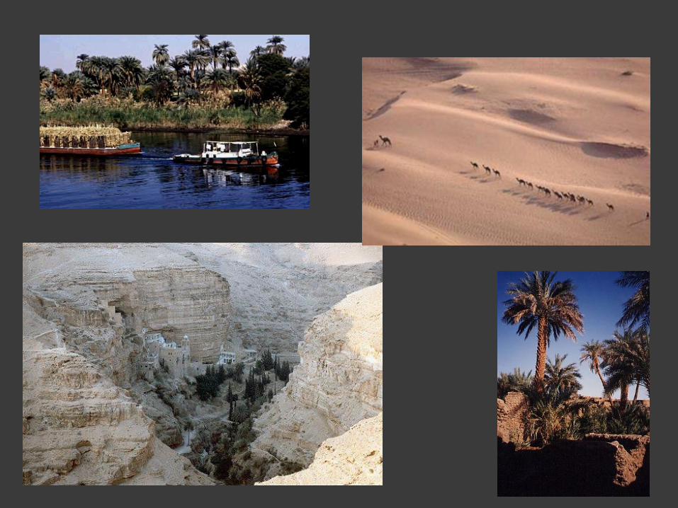
The Mighty Nile River: “Longest River in the World”
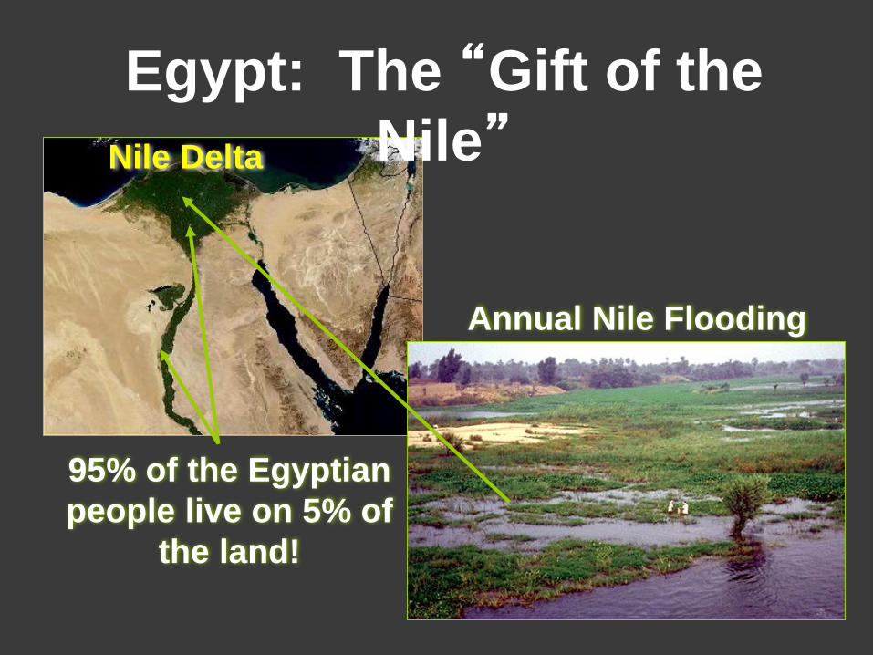
Annual Nile Flooding
Nile Delta
95% of the Egyptian
people live on 5% of
the land!
Egypt: The “Gift of the
Nile”
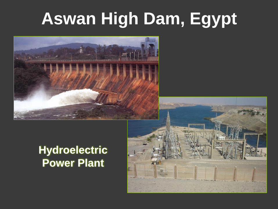
Aswan High Dam, Egypt
Hydroelectric
Power Plant
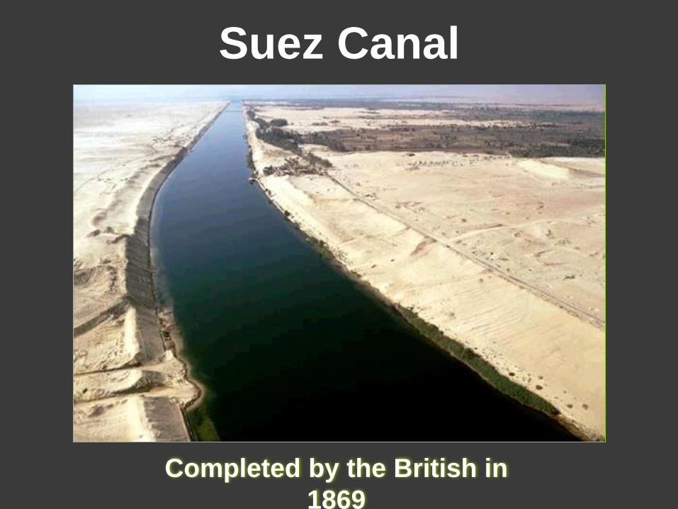
Suez Canal
Completed by the British in
1869
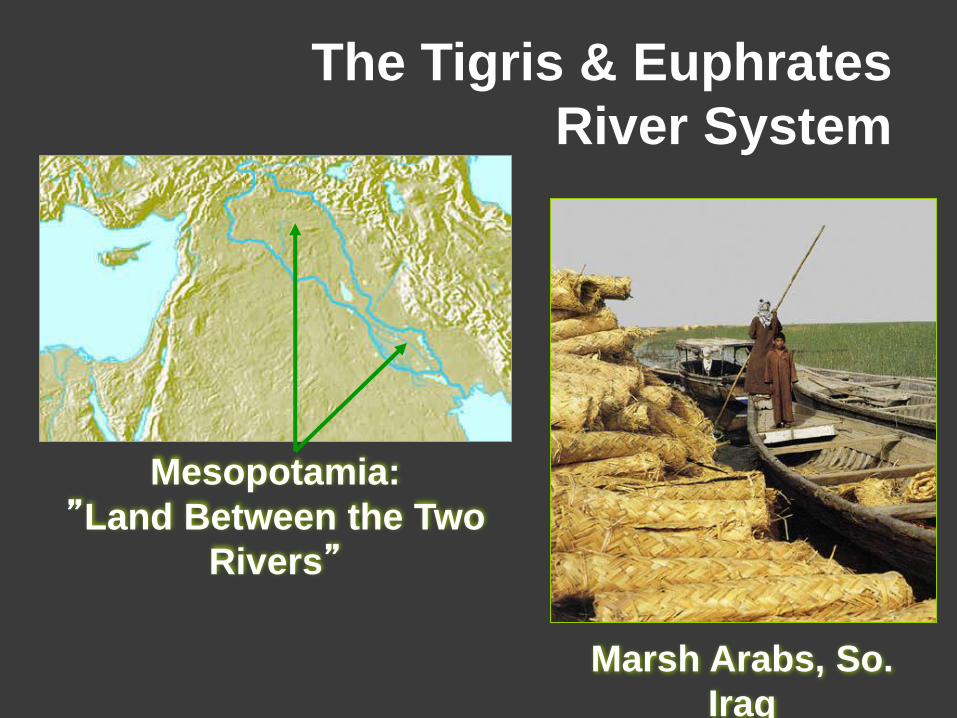
The Tigris & Euphrates
River System
Mesopotamia:
”Land Between the Two
Rivers”
Marsh Arabs, So.
Iraq
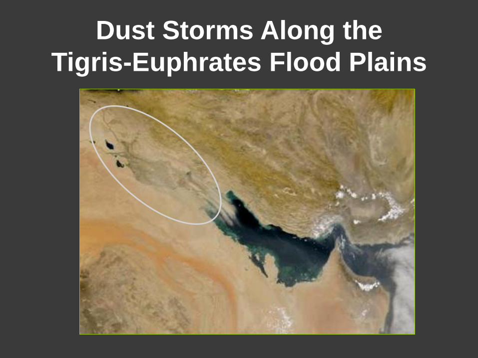
Dust Storms Along the
Tigris-Euphrates Flood Plains
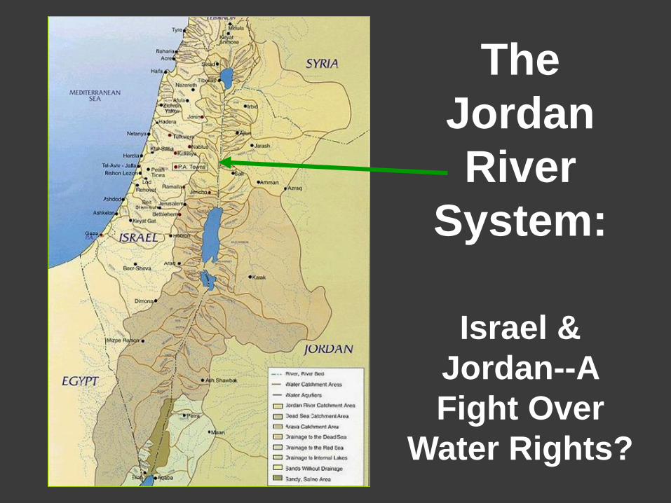
The
Jordan
River
System:
Israel &
Jordan--A
Fight Over
Water Rights?
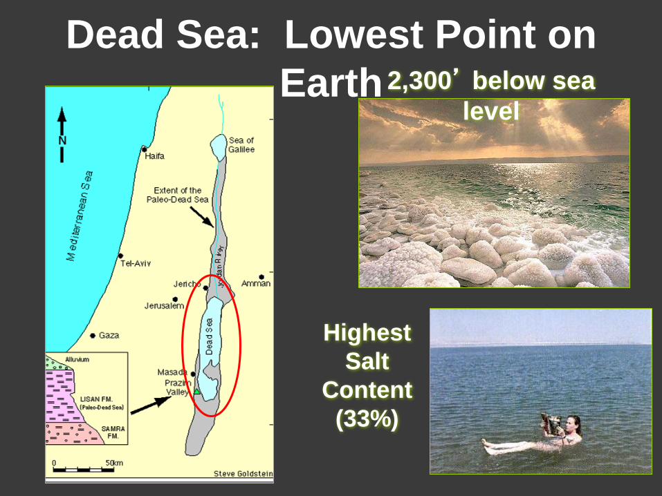
Highest
Salt
Content
(33%)
2,300’ below sea
level
Dead Sea: Lowest Point on
Earth
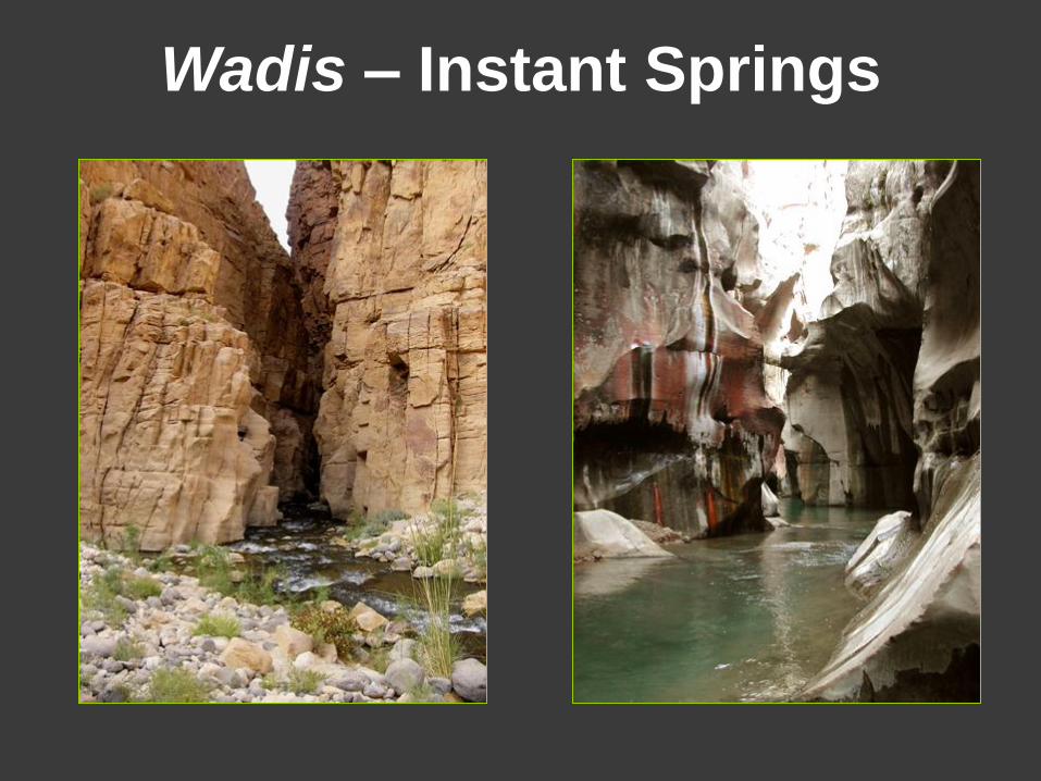
Wadis – Instant Springs
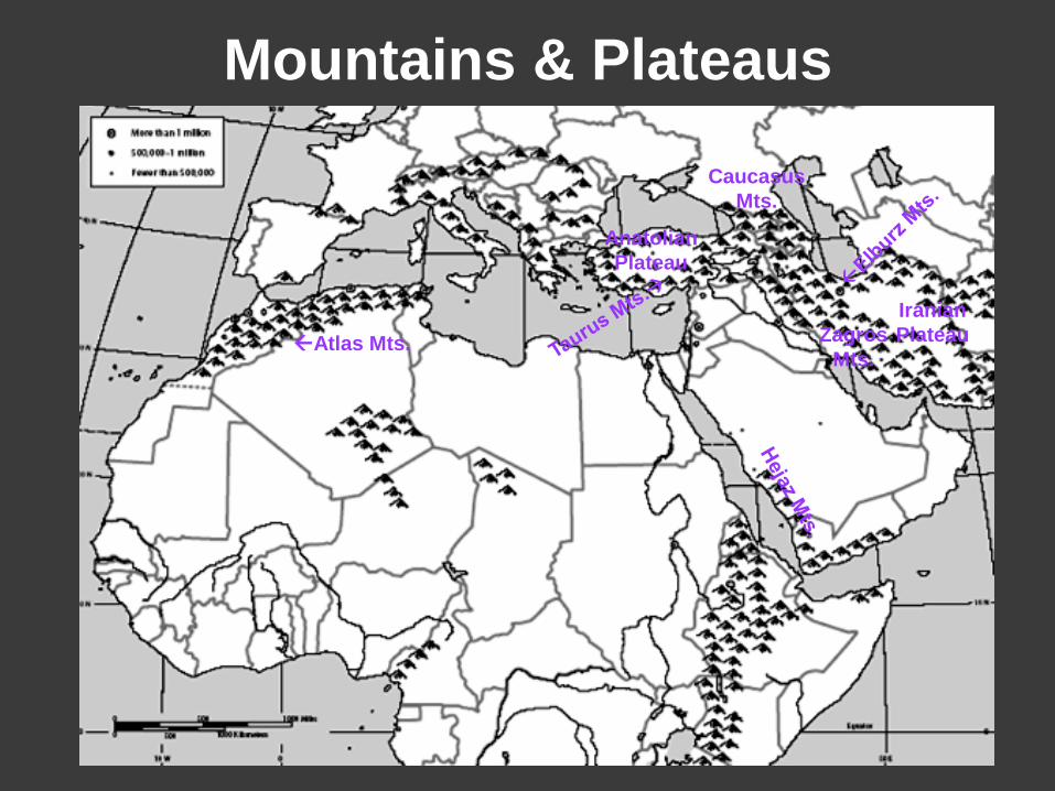
Mountains & Plateaus
Atlas Mts. Zagros
Mts.
Iranian
Plateau
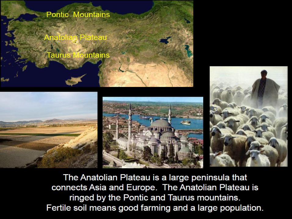
Anatolian
Plateau
Caucasus
Mts.

Mountain Ranges in Mid-East
Elburz Mts., Iran Zagros Mts., Iran
Lebanese Mts. Taurus Mts., Turkey
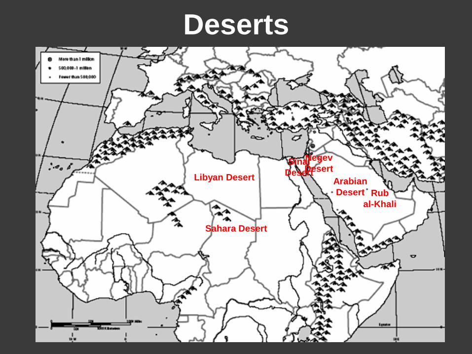
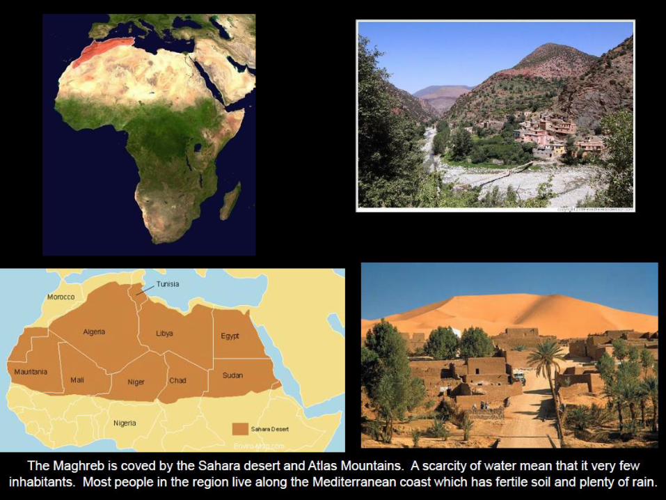
Deserts
Sahara Desert
Arabian
Desert
Negev
Desert Sinai
Desert Libyan Desert
Rub
al-Khali
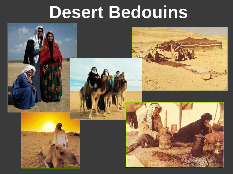
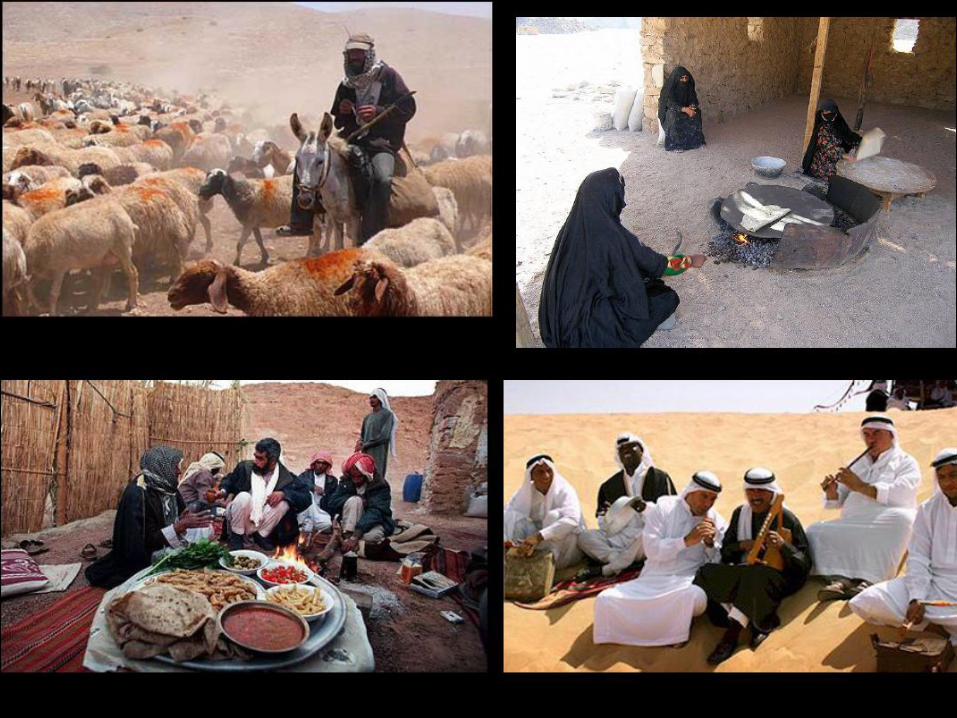
Desert Bedouins
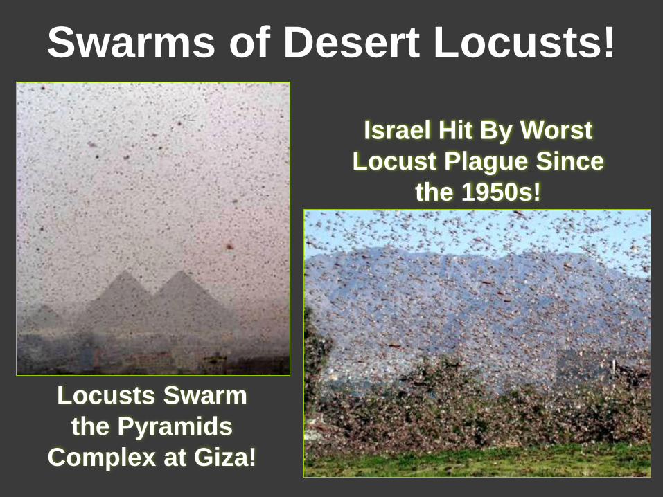
Swarms of Desert Locusts!
Locusts Swarm
the Pyramids
Complex at Giza!
Israel Hit By Worst
Locust Plague Since
the 1950s!
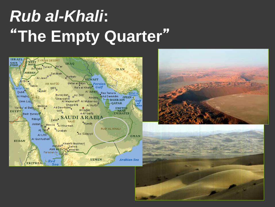
Rub al-Khali:
“The Empty Quarter”
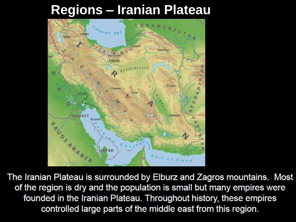
Regions – Iranian Plateau

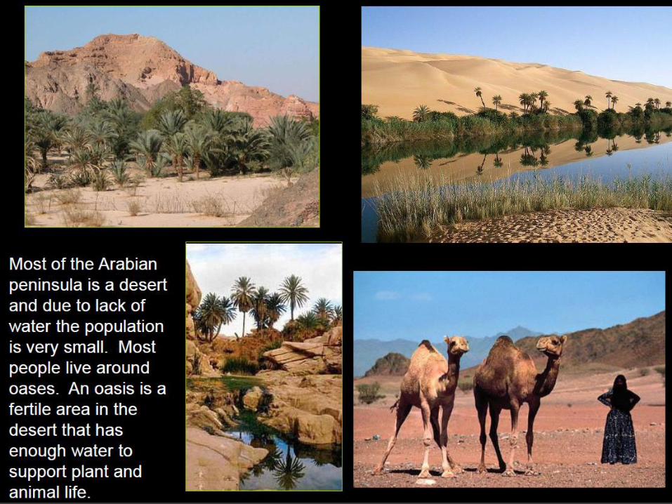
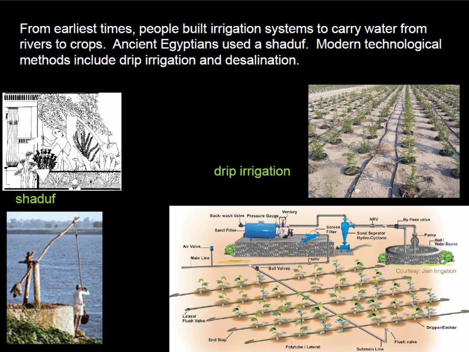
Desert Oasis: Water at a
Premium!
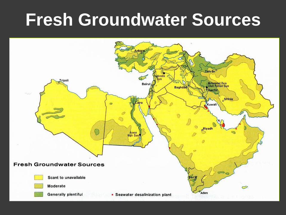
Fresh Groundwater Sources
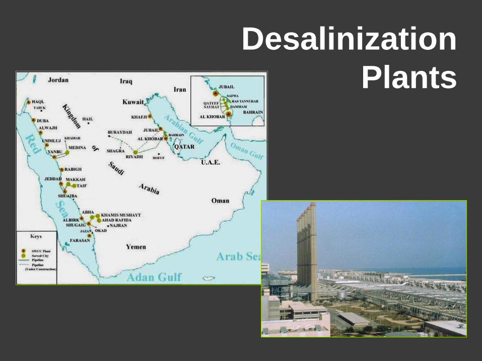
Desalinization
Plants
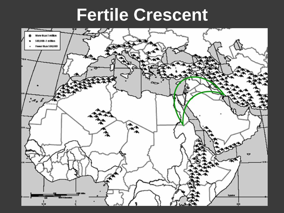
Fertile Crescent
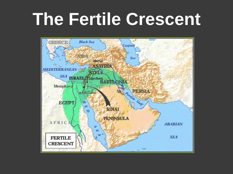
The Fertile Crescent
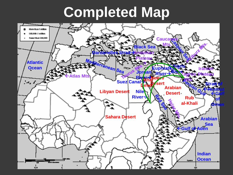
Completed Map
Tigris
River
Nile
River
Euphrates
River Jordan
River
Arabian
Sea
Indian
Ocean
Black Sea
Gulf of Aden
Strait of
Hormuz
Suez Canal
Dardanelles Strait
Atlantic
Ocean
Gulf
of
Oman
Arabian
Desert
Negev
Desert Sinai
Desert
Rub
al-Khali
Atlas Mts. Zagros
Mts.
Iranian
Plateau
Anatolian
Plateau
Caucasus
Mts.
Sahara Desert
Libyan Desert
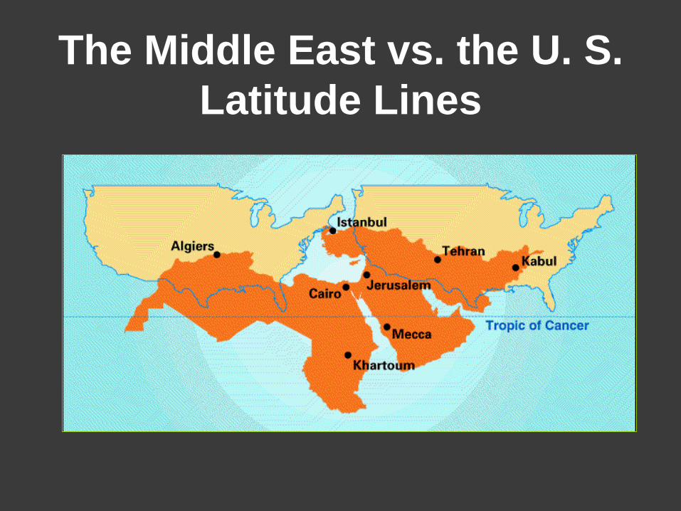
The Middle East vs. the U. S.
Latitude Lines
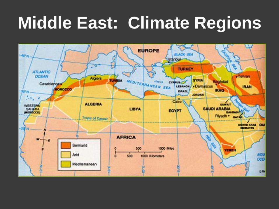
Middle East: Climate Regions
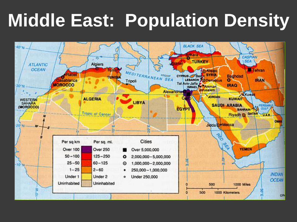
Middle East: Population Density
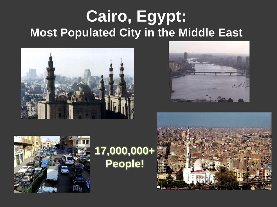
Cairo, Egypt: Most Populated City in the Middle East
17,000,000+
People!
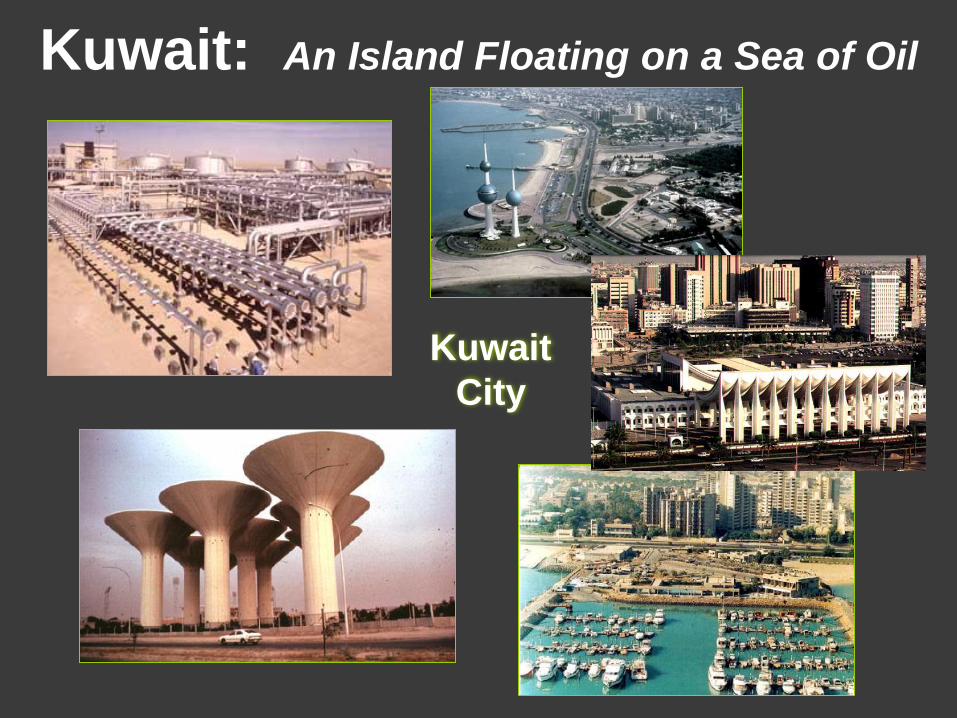
Kuwait: An Island Floating on a Sea of Oil
Kuwait
City
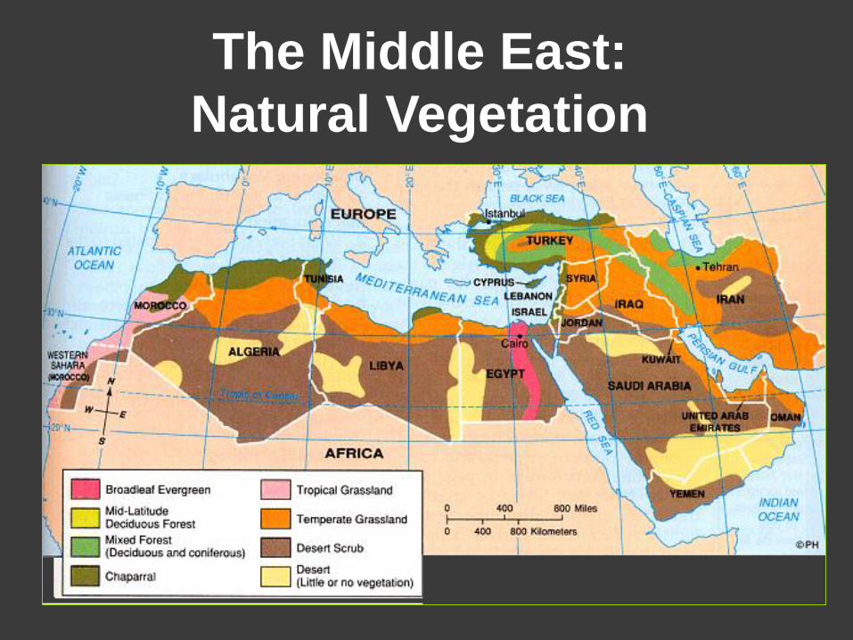
The Middle East:
Natural Vegetation
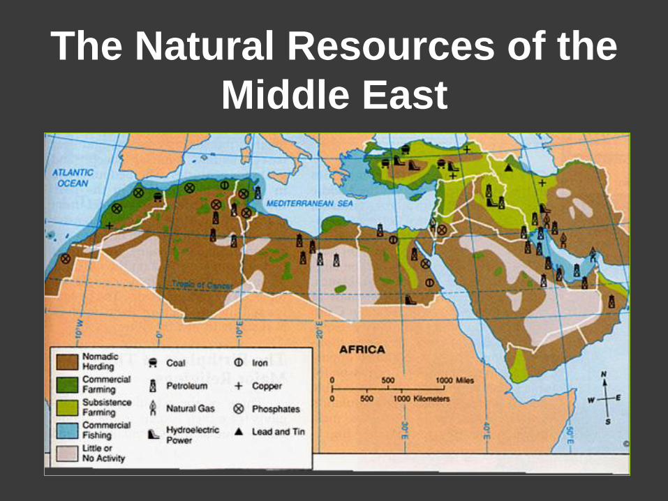
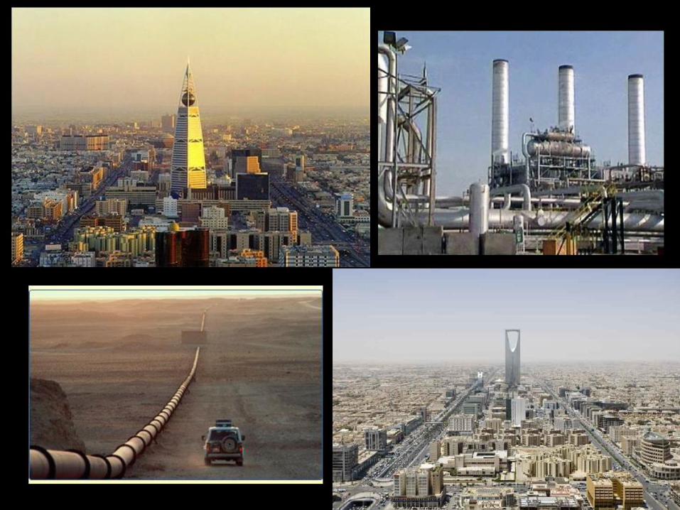
The Natural Resources of the
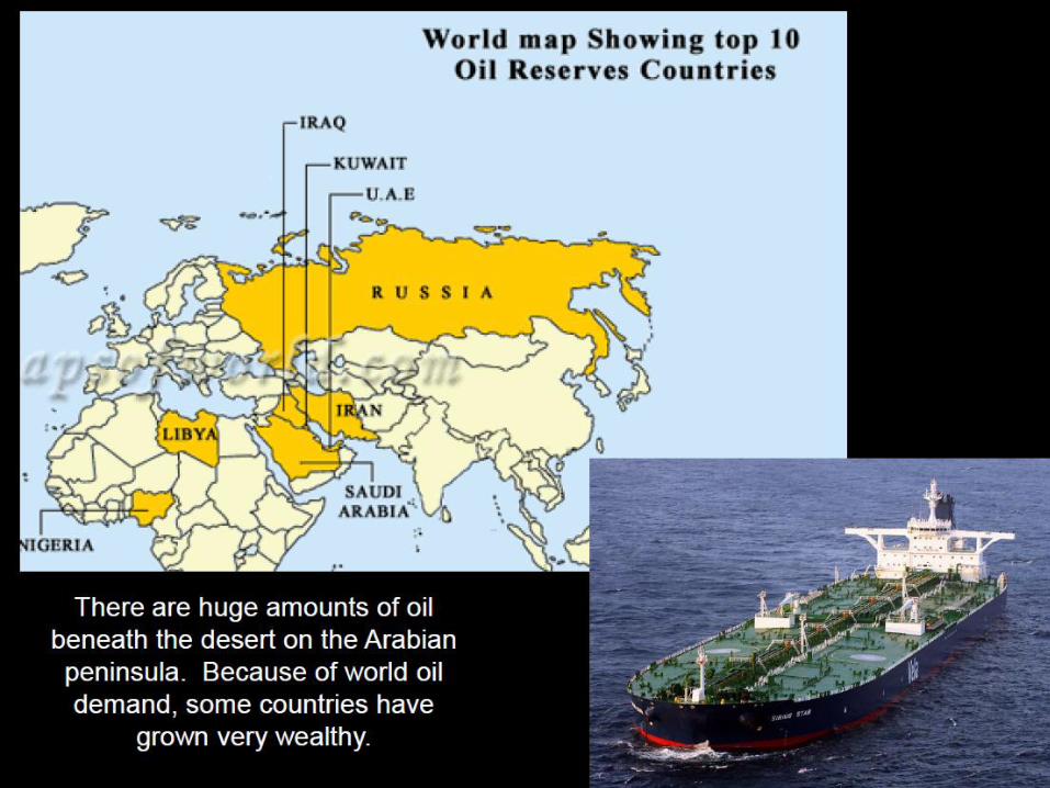
Middle East
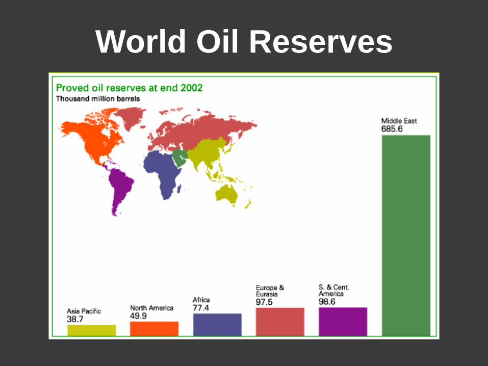
World Oil Reserves
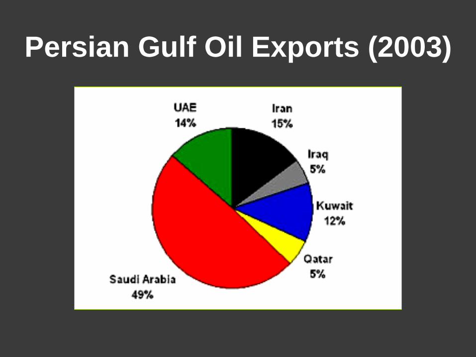
Persian Gulf Oil Exports (2003)

Saudi Oil Fields & Refineries

Leading U. S. Oil Suppliers
The U. S. imports 30% of its oil needs from the
Middle East.