Embed Size (px)
Citation preview
1
710
2
1
9
2
501
15
501
7
1
5
10
3
712
8
24
17 24
9
463000
463000
464000
464000
465000
465000
466000
466000
467000
467000
1 4100
0
1 4100
0
1 4200
0
1 4200
0
1 4300
0
1 4300
0
1 4400
0
1 4400
0
Bradley CP
Bentworth CP
Lasham CP
Herriard CP
Wield CP
Ellisfield CP
Preston Candover CP
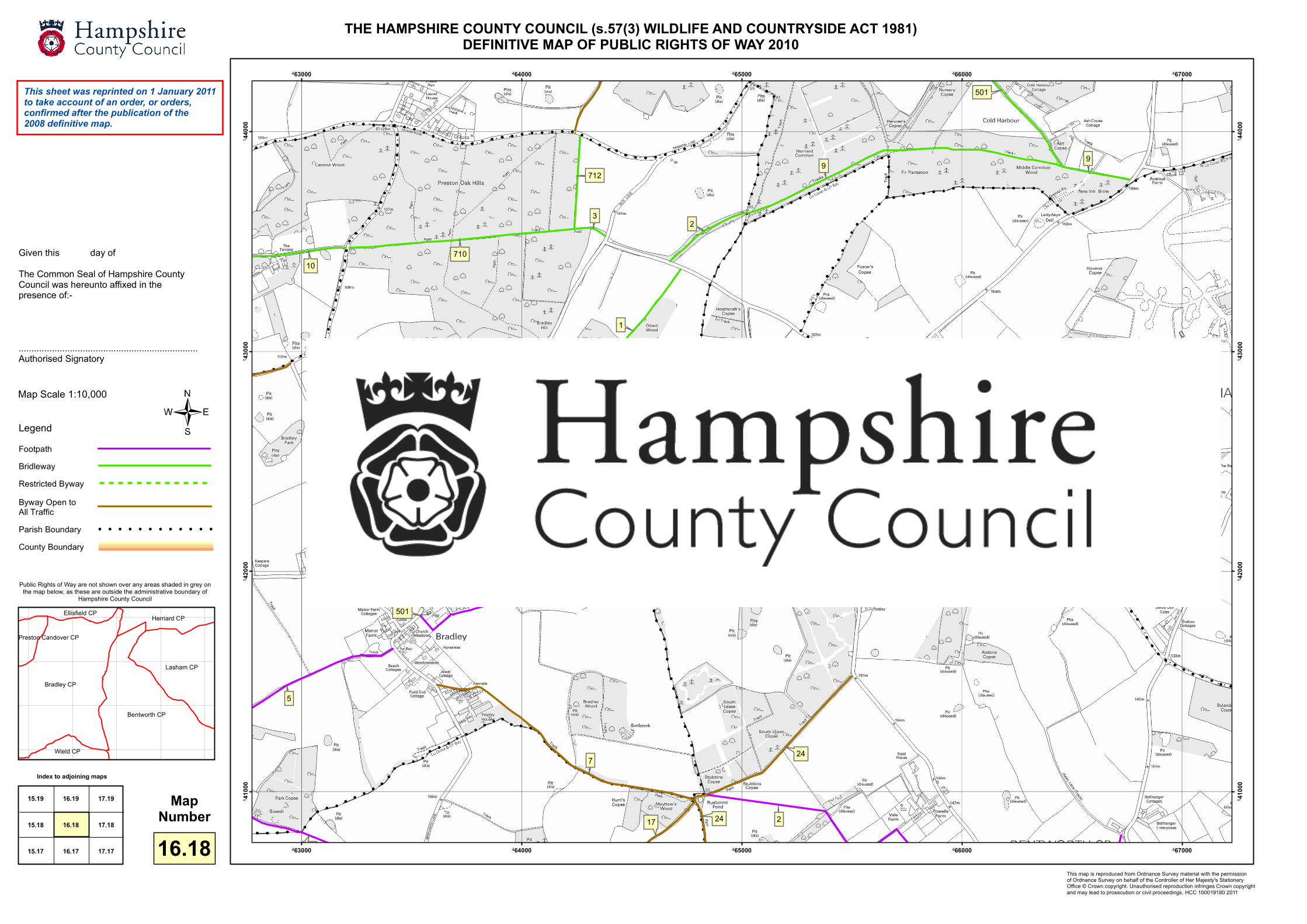
MapNumber
16.18
17.19
17.18
17.17
16.19
16.18
16.17
15.19
15.18
15.17
Index to adjoining maps
THE HAMPSHIRE COUNTY COUNCIL (s.57(3) WILDLIFE AND COUNTRYSIDE ACT 1981)DEFINITIVE MAP OF PUBLIC RIGHTS OF WAY 2010
Given this day of The Common Seal of Hampshire CountyCouncil was hereunto affixed in the presence of:-
......................................................................Authorised Signatory
This map is reproduced from Ordnance Survey material with the permission of Ordnance Survey on behalf of the Controller of Her Majesty's Stationery Office © Crown copyright. Unauthorised reproduction infringes Crown copyright and may lead to prosecution or civil proceedings. HCC 100019180 2011
Public Rights of Way are not shown over any areas shaded in grey onthe map below, as these are outside the administrative boundary of
Hampshire County Council
Map Scale 1:10,000
FootpathBridlewayRestricted BywayByway Open to All TrafficParish BoundaryCounty Boundary
Legend
This sheet was reprinted on 1 January 2011to take account of an order, or orders,confirmed after the publication of the2008 definitive map.