Embed Size (px)
Citation preview

THE HISTORICAL INFLUENCE OF RAILROADS ON URBAN DEVELOPMENT AND FUTURE ECONOMIC POTENTIAL IN SAN LUIS OBISPO
A Professional Report
presented to
the Faculty of California Polytechnic State University,
San Luis Obispo
In Partial Fulfillment
of the Requirements for the Degree
Master of City and Regional Planning/Master of Science in Engineering
(Transportation Planning Specialization)
by
Adrianna L. Jordan
August 2011

Page ii
© 2011 Adrianna L. Jordan
ALL RIGHTS RESERVED

Page iii
Committee Membership The Historical Influence of Railroads on Urban Development and Future Economic Potential in San Luis Obispo Adrianna L. Jordan August 2011 Hemalata Dandekar, Ph.D. Advisor or Committee Chair Cornelius Nuworsoo, Ph.D. Committee Member Claire Clark Committee Member

Page iv
Abstract
The Historical Influence of Railroads on Urban Development and Future Economic Potential in San Luis Obispo Adrianna L. Jordan
Today the sound of a train passing through San Luis Obispo may be intermittent and faint, but
persistent nonetheless, a reminder that the railroad (displaced eventually by the automobile and
accompanying expansion of highways and road systems, and later by air connectivity) was a
significant force in the development of the City of San Luis Obispo. The sound of railroads
evokes a sentimental reminder of the past, but the railroad’s continued presence in the city,
cutting through its urban fabric, raises intriguing questions as to what constructive role it can
play in the evolving city economy. Can the railroad make a contribution to the new economy of
the 21st Century? And if so, how? These questions are worth considering beyond nostalgia for a
railroad-dominated past as we become more concerned, nationally and especially so in the State
of California, about living sustainably. The aspiration to create communities that reduce
dependence and expenditure on the automobile and the petroleum based economy that it
represents has surfaced as an important goal, one that might enable us to live within our resource
base. In this emerging context of heightened concern about integrating sustainability into current
development, what role will, and might, the railroad play in shaping future developments and
influencing land use? This work explores these questions by tracing the intertwined histories of
transportation and land use in the City of San Luis Obispo from the 18th century Spanish mission
era to the 19th century railroad era to the present-day automobile and air travel era.
Although the heyday of rail as an economic driver in the city has come and gone, San Luis
Obispo’s Railroad District, with the award-winning Railroad District Plan for its place-making

Page v
guide, is poised for continued revitalization. Public and commercial entities such as the Amtrak
Station, the Railroad Museum, the Park Hotel building and its restaurants, and the Railroad
Square Channel Commercial Building anchor the district and serve as pulse points of activity for
locals and tourists alike. In addition, the Railroad District’s excellent pedestrian and bicycle
connectivity helps to link it with the rest of the city and channels people to it.
Given the present concern over greenhouse gas (GHG) emissions from motor vehicles, rising
fuel costs, shortages of oil, and the centralized land-use patterns popular in New Urbanism and
required by SB 375, it is possible that the railroad, or some other form of fixed rail public
transportation might once again become a preferred mode of long-distance transport to the major
metropolitan areas south and north of the city and beyond.
Keywords: railroads, city development, urban fabric, land use.

Page vi
Acknowledgements
I am enormously thankful for the patience, encouragement, guidance, and critical feedback of
Dr. Hemalata Dandekar. Without her unwavering support throughout the last two years, I am not
sure if I would have graduated at all.
In addition, I am extremely grateful to Claire Clark at the City of San Luis Obispo for her
economic insight; Dr. Cornelius Nuworsoo for his advice, direction, and the opportunity to do
research; Arnold Jonas of the San Luis Obispo Railroad Museum for his thoughtful comments
and depth of historic railroad knowledge; Dr. Kelly Main for her support and friendship; and all
of the anonymous individuals who agreed to be interviewed as stakeholders for this project.

Page vii
Table of Contents Page
List of Tables ix
List of Figures x
1. The Regional Economy of San Luis Obispo Before and After the Railroad 1
1.1. Introduction 1
1.2. Pre-Railroads 2
1.3. Regional Connections 3
1.4. The Narrow Gauge Rail Connection to the Coast 5
1.5. Expansion of the Regional Economy by the Pacific Coast Railway 10
1.6. Financing and Routing the Southern Pacific Railroad 13
1.7. The Southern Pacific Connection to San Francisco and Los Angeles 16
2. The Demise of the Railroads 22
2.1. A Brief Timeline of Important Dates 23
2.2. Pre-World War I 23
2.3. World War I to World War II 27
2.4. The Post-War Period 30
3. City Fabric 33
3.1. Historic Shifts in the Street Grid 33
3.2. The City’s Residential Expansion 35
3.3. City Plats, Street Configurations, and the Southern Pacific 40
4. Historic Tourism, Economic Development, and the Railroad 44
4.1. The Southern Pacific and Tourism 44
4.2. Traders and Businesses 49
5. Chinatown and the Chinese Contribution to the Railroad 56
6. Shifting Nature of the Relationship between the City and the Railroad 65

Page viii
6.1. Farmers and the Railroad 65
6.2. City Form 67
6.3. Notable Commercial Buildings Related to the Railroad 68
6.4. Housing 72
7. Reflection on the Railroads 87
7.1. Transportation Eras in San Luis Obispo 87
7.2. The Influence of the Airport on Land Use and Development 90
7.3. The Union Pacific’s Continued Influence on Land Use in the City 92
7.4. The Rise of the Southern Pacific as a Freight Railroad 92
7.5. The Future of Passenger Rail in the City of San Luis Obispo 93
7.6. Sustainability and the Railroad 95
8. A Conceptual Plan for the Future Role of Railroads in the City of San Luis Obispo 99
8.1. Tourism in Today’s City of San Luis Obispo 99
8.2. The Railroad District Revitalization Plan 102
8.3. Potential for Economic Growth 103
8.4. Future Economic and Tourism Growth 107
8.5. Connectivity 110
8.6. Case Studies 112
8.7. The Railroad History Tour 115
9. Conclusion 117
10. References 119

Page ix
List of Tables Page
Table 8.1. Railroad District Case Studies 113

Page x
List of Figures Page
Figure 1.1: Map of the Town of San Luis Obispo: “Blocks, Subdivisions and Present Ownerships 1872” 3 Figure 1.2: Cave Landing aka “Mallagh’s Wharf” 4 Figure 1.3: 30-inch gauge Horse Rail Road and 36-inch Narrow Gauge Railroad at Avila 6 Figure 1.4: PCRR track remnants at present-day Port San Luis 7 Figure 1.5: Pacific Coast Railway Terminal in San Luis Obispo 8 Figure 1.6: Port Harford with the Hotel Marre 9 Figure 1.7: Extent of the Pacific Coast Railway as of 1915 10 Figure 1.8: Stenner Creek Railroad Trestle 17 Figure 1.9: 1926 Sanborn Map with Roundhouse at Upper Right Corner 18 Figure 1.10: Historic Aerial Showing Roundhouse and Southern Pacific Railyards in Lower Right Corner 18 Figure 1.11: Southern Pacific 1895 Freight Warehouse 20 Figure 1.12: Southern Pacific Turntable 20 Figure 2.1: San Luis Obispo Railroad District Public Art Listing Important Dates 22 Figure 2.2: San Luis Lighthouse Station 24 Figure 2.3: The Present-Day Layout of the Union Pacific Railyard 26 Figure 2.4: The Southern Pacific Transportation Company Building 27 Figure 2.5: American World War II Propaganda Encouraging Citizens Not to Drive Alone 29 Figure 3.1: Shift in the city’s grid at High Street 33 Figure 3.2: Street shadow patterns in a Jeffersonian Grid (left) and a Spanish Grid (right) 34 Figure 3.3: 1874-1891 Land Annexations Around the Proposed Right of Way of the Southern Pacific Railroad 35 Figure 3.4: 1887 – Deleissigues Addition (block 5). Labeled Nos. 2/5/11 on left map. 37
Page xi
Figure 3.5: 1887 – Loomis Tract. Labeled No. 4 on upper map. 38 Figure 3.6: 1887 – McBride Tract. Labeled No. 6 on left map. 39 Figure 3.7: 1887 – Buena Vista Addition. Labeled Nos. 3/9 on left map. 40 Figure 3.8: Original Johnson Avenue Railroad Bridge Undercrossing shown just before It was replaced with a wider undercrossing in 1958 42 Figures 3.9 and 3.10: The Loomis Tract (1887) and the Loomis and Osgood Re- subdivision (1894) 43 Figure 4.1: The Ramona Hotel with convenient horsecar to the railway station 44 Figure 4.2: The interior of a suite at the Ramona Hotel 45 Figure 4.3: Current photograph of the Ramona Hotel Depot on the Dallidet Adobe Grounds 47 Figure 4.4: Ramona Hotel Depot in original location adjacent to the Southern Pacific Tracks 47 Figure 4.5: The original Andrews Hotel 48 Figure 4.6: An 1887 advertisement about local economic resources 52 Figure 4.7: The back of the Channel Commercial building as it looks today 53 Figure 5.1: Iron Road Pioneers (2003) 56 Figure 5.2: Mee Heng Low Chop Suey Shop 59 Figure 5.3: Chong’s Hand Made Candies 59 Figure 5.4: Looking east down Palm Street in turn of the century Chinatown 60 Figure 5.5: Looking west down Palm Street in turn of the century Chinatown 60 Figure 5.6: The Ah Louis Store as it looks today 61 Figure 6.1: Farmers Alliance Building in Paso Robles 65 Figure 6.2: Cast-iron Sinsheimer Bros. storefront 69 Figure 6.3: The Call/Parkview Hotel at 1703 Santa Barbara Street 70
Page xii
Figure 6.4: The Del Monte Grocery at 1901 Santa Barbara Street 71 Figure 6.5: Hotel Park / The Glen Dell Hotel 71 Figure 6.6: Location of railroad worker housing in 1904 72 Figure 6.7: Location of railroad worker housing in 1914 74 Figure 6.8: Two examples of “Imperial Addition” homes that typically housed railroad workers and their families 75 Figure 6.9: Three homes identified as potential contributors to the possible expansion of the Railroad District east of the railroad. 76 Figure 6.10: Notable homes related to the railroads 77 Figure 6.11: Typical railroad worker housing in San Luis Obispo 79 Figure 6.12: Martha Dunlap House at 1511 Morro Street 79 Figure 6.13: Stanton/Lewin House at 752 Buchon Street 80 Figure 6.14: Troutsdale House at 779 Buchon Street 81 Figure 6.15: Erickson House at 687 Islay Street 82 Figure 6.16: Manderscheid House at 963 Broad Street 83 Figure 6.17: Willett House at 670 Islay Street 83 Figure 6.18: Galewski House at 1725 Santa Barbara Street 84 Figure 6.19: 1117 Marsh Street 84 Figure 6.20: 1129 Marsh Street 85 Figure 6.21: 1135 Marsh Street 85 Figure 6.22: 1141 Marsh Street 86 Figure 6.23: Good example of a “shotgun” house at 2276 Lawton Street 86 Figure 7.1: Map of the San Luis Obispo Street Railway 88 Figure 7.2: Aviation safety map of the southern portion of the City of San Luis Obispo 91

Page xiii
Figure 7.3: Amtrak Coast Starlight Locomotive and Superliner Cars in San Luis Obispo 95 Figure 8.1: The Jennifer Street Bridge in the Railroad District 100 Figure 8.2: The Historic Freighthouse Building that will House the Railroad Museum 100 Figure 8.3: The San Luis Obispo County Historical Museum 101 Figure 8.4: New public art at Port San Luis highlighting the Pacific Coast Railway 102 Figure 8.5: An Example of the Railroad Vernacular Architectural Style in the Railroad District 103 Figure 8.6: Opportunities and Constraints Map 104 Figure 8.7: The upscale Sanitarium Bed & Breakfast 107 Figure 8.8: The Site of the Demolished Southern Pacific Steam Locomotive Roundhouse 108 Figure 8.9: Old Sears Warehouse in the Railroad District 109 Figure 8.10: Existing Short-Term Bicycle Parking in the Railroad District 109 Figures 8.11 and 8.12: Two examples of “kiddie trains” 111 Figure 8.13: Proposed Tourist Routes 116

Page 1
Chapter 1: The Regional Economy of San Luis Obispo Before and After the Railroad
1.1 Introduction
The aspiration to create communities that reduce dependence and expenditure on the automobile
and the petroleum based economy that it represents has surfaced as an important goal, one that
might enable us to live within our resource base. In this emerging context of heightened concern
about integrating sustainability into current development, what role will, and might, the railroad
play in shaping future developments and influencing land use? Can the railroad make a
contribution to the new economy of the 21st Century? And if so how? This work traces the
intertwined histories of transportation and land use in the City of San Luis Obispo from the 18th
century Spanish mission era to the 19th century railroad era to the present-day automobile and
air travel era. The study also identifies potential for the railroad legacy to continue to contribute
to the economy of San Luis Obispo.
Prior to the railroads, San Luis Obispo was a small mission town surrounded by cattle ranches
with few prospects for attracting business investment. One of the major obstacles was the town’s
physical isolation – with the Santa Lucia mountain range effectively cutting it off from reliable
overland communication with San Francisco, the town originally turned toward the ocean as the
primary means of interregional transportation and connectivity to a larger economy and
commerce. The development of a rail link served to break this isolation. This chapter establishes
the link between the railroads and the growth of the regional economy of San Luis Obispo.

Page 2
1.2 Pre-Railroads
San Luis Obispo emerged as a small town centered on a mission established in 1772 by the
Franciscan Fathers. An1872 map of the City of San Luis Obispo (Figure 1.1) reveals that the
Catholic Mission Church’s orchards and lands around Broad, Chorro, and Monterey streets are a
dominant part of the town, and encircled by individual land holdings. Set in the rich farming
lands of what is now referred to as the Central Coast region, the City of San Luis Obispo was a
regional hub of activity adding value to production in the immediate hinterland. However, due
to challenging geography, it remained isolated from the rest of the state until advances in
transportation technology rendered it a staging ground for people and freight movement between
Los Angeles and San Francisco. The Santa Lucia Mountains and the steep Cuesta Grade to the
north of the town and the rugged Irish Hills to the south of the town made it extremely difficult
to reach the City of San Luis Obispo via an overland route for close to 100 years. Therefore, the
Pacific Coast Railway linking the town to the coast and to the south, and later, the Southern
Pacific Railroad connecting to San Francisco and Los Angeles, served as transportation catalysts,
significantly reshaping the morphology of the city.

Page 3
Figure 1.1: Map of the Town of San Luis Obispo: “Blocks, Subdivisions and Present Ownerships 1872” Courtesy of the History Center of San Luis Obispo County.
1.3 Regional Connections The main way to transport people and goods to the Central Coast region was by horseback,
stagecoach, or wagon. Roads heading north to San Francisco were of relatively poor quality until
the development of Old Stagecoach Road in 1876. Served by six relay stations between the City
of San Luis Obispo and Soledad (Atascadero News, 1916), the road was built with Chinese labor
and cost approximately $20,000. It remained in service until the modern route for Highway 101
was laid out in 1915 (Miossi, n.d.).

Page 4
Competing with the overland routes, Cave Landing was founded in 1855 by Barkley Clements
and Charles T. Rommie at Avila Beach approximately one mile south of the present town of
Avila (Figure 1.2) with a small wharf, warehouse, and derrick (Five Cities Times-Press-
Recorder, 1989). This facilitated an increase in transportation via steamships, which plied up and
down the coast from Seattle to San Diego. At the time, the main economic base for the San Luis
Obispo area was cattle and cattle products such as hides were typically shipped out of the county
via wharfs such as Cave Landing.
Figure 1.2: Cave Landing aka “Mallagh’s Wharf” Photo Courtesy of the San Luis Obispo County History Center A local cattle ranch called the Huer Huero ranch was occupied starting around 1839 by José
Mariano Bonilla who served as a scribe to Governor Figueroa. Shortly thereafter, the ranch was
raided twice by the Tulare Indians, and in one of the raids Bonilla’s brother was killed.
Discouraged by events, Bonilla sold the land to Francis Branch in 1847 in exchange for 253
cattle. By 1856 the ranch was owned by Captain David P. Mallagh (Nicholson, 1980). Disastrous
droughts between 1862 and1864 caused the majority of old ranchero farms to go bankrupt, and

Page 5
most of the ranchers were bought out by dairymen. Towards the end of the drought period, in
1864 Cave Landing was purchased, improved, and commercialized by Mallagh. At this time, the
majority of goods arriving at Cave Landing originated in San Francisco and included building
materials such as redwood and iron, coal, linens, and general household merchandise. Local
exports reflected the ranching and agricultural focus of the community and commonly included
asphalt and bitumen, ore, hides, tallow, grains, beans, sheep, cattle, hogs, and most notably, dairy
products (Nicholson, 1980).
In 1865, Edgar Willis Steele and his brothers, dairy farmers who owned the Pescadero Ranch in
San Mateo County, purchased 45,000 acres in the Edna Valley for $1.10 per acre and introduced
the modern dairy industry to San Luis Obispo County. In 1866, Edgar Steele bought portions of
Corral de Piedra, El Pismo, Bolsa de Chamisal, and Arroyo Grande ranchos. The Steele family
specialized in cheese and operated five dairy farms, each with 150 head of dairy cattle. By 1870
San Francisco’s Commercial Herald, the standard commercial and credit reporter for the West,
valued the Steele’s holdings at $150 million.
1.4 The Narrow Gauge Rail Connection to the Coast In 1869 John Harford founded the People’s Wharf at Avila to compete with Cave Landing.
Unfortunately, the downfall of both Cave Landing and the People’s Wharf was their exposed
location in water that was too shallow to seriously cater to the needs of the steamers that were
plying the Pacific coast. However, by 1873, after seeking a more sheltered location, Harford
purchased one and one-quarter miles of waterfront property from the Avila family and built a
new wharf named Port Harford in the lee, wind-protected side of Point San Luis. This area, from

Page 6
the mouth of San Luis Creek to the site of the present-day Port San Luis Pier, was graded for a
railroad right-of-way (Parsons, 1995).The wharf reached 540 feet out from the rocky shore to
water averaging fifteen feet deep. Using light 15-pound steel rail, he built a 30-inch gauge
railroad connecting the wharf to the mouth of the San Luis Creek, making it one of the first
narrow gauge railroads in the state (Best, 1964) (Figure 1.3). In 1874 San Francisco Financier
Charles Goodall purchased all of Harford’s facilities for $30,000 and founded the San Luis
Obispo and Santa Maria Valley Railroad. That same year, Avila was subdivided and established
as a town.
Figure 1.3: 30-inch gauge Horse Rail Road and 36-inch Narrow Gauge Railroad at Avila Map Courtesy of Best (1964).
Up until 1876 the railroad was horse-powered. Flat cars were loaded with goods from the
steamships and “then driven up an incline to a tunnel at which point the horses were unhitched
and the railroad cars rolled down the easterly incline to the town of Avila and Harford’s
warehouse” (Parsons, 1995). After three years of using this labor-intensive horsepower to move
Page 7
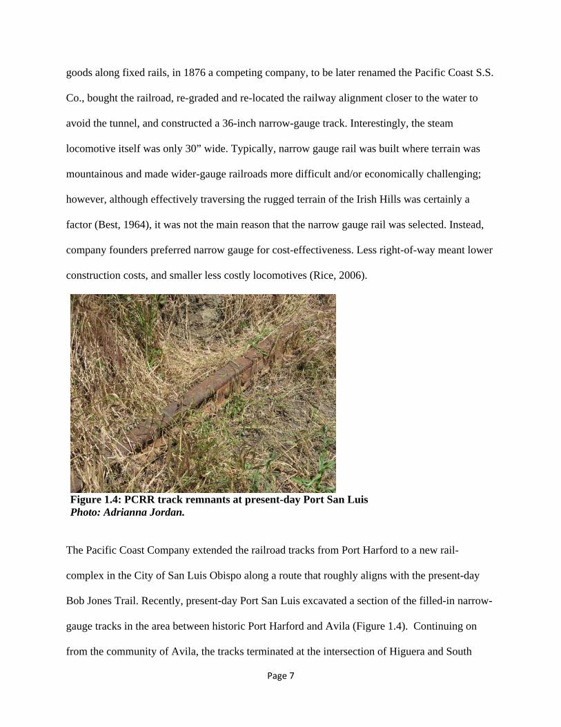
goods along fixed rails, in 1876 a competing company, to be later renamed the Pacific Coast S.S.
Co., bought the railroad, re-graded and re-located the railway alignment closer to the water to
avoid the tunnel, and constructed a 36-inch narrow-gauge track. Interestingly, the steam
locomotive itself was only 30” wide. Typically, narrow gauge rail was built where terrain was
mountainous and made wider-gauge railroads more difficult and/or economically challenging;
however, although effectively traversing the rugged terrain of the Irish Hills was certainly a
factor (Best, 1964), it was not the main reason that the narrow gauge rail was selected. Instead,
company founders preferred narrow gauge for cost-effectiveness. Less right-of-way meant lower
construction costs, and smaller less costly locomotives (Rice, 2006).
Figure 1.4: PCRR track remnants at present-day Port San Luis Photo: Adrianna Jordan.
The Pacific Coast Company extended the railroad tracks from Port Harford to a new rail-
complex in the City of San Luis Obispo along a route that roughly aligns with the present-day
Bob Jones Trail. Recently, present-day Port San Luis excavated a section of the filled-in narrow-
gauge tracks in the area between historic Port Harford and Avila (Figure 1.4). Continuing on
from the community of Avila, the tracks terminated at the intersection of Higuera and South

Page 8
Streets in San Luis Obispo at a rail complex consisting of a passenger terminal, a locomotive
turn table, rail freight yards, and lumber yards (Figure 1.5). The rail yard, related warehouses,
and lumber yards were located east of Higuera Street between High Street and Beebee Street,
and the passenger depot was on the southeast corner of Higuera and South.
Figure 1.5: Pacific Coast Railway Terminal in San Luis Obispo Figure Courtesy of Best (1964).

Page 9
The December 1999 Public Hearing Draft of the Mid-Higuera Street Enhancement Plan explains
that one of the original buildings in the rail complex was a long warehouse erected in 1876 for
Schwartz, Harford & Company for the purpose of loading “beans and other commodities on the
rail cars for shipment to the Port. This warehouse was later owned by Loomis and Sons, and was
commonly referred to as the ‘Loomis Building’.” This site is now occupied by the Pacific Coast
Center office and shopping complex and is listed on the National Register of Historic Places as
the “Pacific Coast Company Grain Warehouse”. According to former City of San Luis Obispo
Senior Planner and railroad enthusiast Jeff Hook, the foundation of this complex is constructed
of brick from the original Pacific Coast Railway passenger terminal, and although most of the
original metal and framing is gone, the form and contours of that terminal are reflected in the
center’s “railroad vernacular” architecture.
Figure 1.6: Port Harford with the Hotel Marre Photo Courtesy of Best (1964).

Page 10
The establishment of the first narrow-gauge railroad in 1876 between Port Harford (present-day
Port San Luis) (Figure 1.6) and the City of San Luis Obispo opened up the land-locked economy
of this region to trans-shipment of regional products by sea, north to San Francisco. This narrow
gauge rail, however, was fated to become obsolete.
1.5 Expansion of the Regional Economy by the Pacific Coast Railway
Figure 1.7: Extent of the Pacific Coast Railway as of 1915 Map Courtesy of Westcott and Johnson (1998).

Page 11
In 1878 a storm destroyed the People’s Wharf at Avila and the Point Sal Landing near
Guadalupe, which gave the more sheltered Port Harford a short-lived local shipping monopoly.
Then, in 1882, the railway operator of the narrow-gauge rail from the port to the interior cities
merged with the Pacific Steamship Company and was re-christened the Pacific Coast Railway.
Gradually, the railroad was extended from Port Harford to Arroyo Grande, Nipomo, Santa
Maria, Los Alamos, and finally to Los Olivos increasing the length of the Pacific Coastal
Railway line to 76 miles (Figure 1.7). By the late 1880’s, Port Harford was handling over 400
ships per year. This coincided with the beginning of oil exploration in the Santa Maria Valley in
1888 leading to large-scale oil discovery and extraction operations in the Orcutt Oil Field located
in the Solomon Hills south of the City of Santa Maria around the dawn of the 20th century
(County of Santa Barbara, 2005). By 1904, there were 22 oil wells in production. The
burgeoning local oil industry necessitated the ordering of special tank cars to allow local
petroleum products to be shipped to Port Harford on the narrow-gauge Pacific Coast Railway for
trans-shipment via oil tankers to ports throughout the world (Parsons, 1995).
Concurrent to the discovery of oil in the Santa Maria Valley, the cultivation of sugar beets as a
commodity crop also gained traction in the region. Located between Santa Maria and Guadalupe,
the company town of Betteravia was founded in 1898 with the sole purpose of processing sugar
beets. Then, in 1906 the Pacific Coast Railway opened an electrified line to haul sugar beets
that…
…ran westward from Santa Maria to a ranch, about 4 [sic] miles from the depot… The
PC [sic] completed the additional 4 [sic] miles to extend the branch to Guadalupe early in
1909. Best (1864) gives the date of the first passenger run from Santa Maria to

Page 12
Guadalupe as April 17, 1909. By 1909, the PC [sic] had built another electric locomotive,
E-2 to handle freight. This 0-4-4-0 headed the first train into Guadalupe, pulling three
coaches loaded with passengers. A week later, E-1 and combination coach #300 took
over this interurban service, while E-2 returned to hauling sugar beets” (Westcott and
Johnson, 1998).
Although its primary cargo was sugar beets, it also hauled passengers in box cars with wooden
benches. This was California’s smallest electric passenger operation, “boasting on its roster but a
single steel center entrance electric passenger car purchased in 1912” (Rice, 2006).
According to Best (1964), another new branch opened in June 1909. The electric was
extended south from a point about halfway between Santa Maria and Guadalupe to the
Union sugar factory at Betteravia. Previously, cars of sugar beets from this area had gone
into Santa Maria, then south to Union, where they were switched off to the sugar factory.
This new electrified branch shortened the haul for beets, and the branch from the
mainline to Betteravia built in 1898 was soon abandoned (Westcott and Johnson, 1998).
The first efforts to link San Luis Obispo to other regions for trade purposes started off with local
entrepreneurial investors financing and constructing the basic infrastructure such as a port, a
stagecoach road, or a rail right-of-way. Once the basic infrastructure was in place, outsiders from
San Francisco with access to large amounts of capital showed up in town to strike deals. For
instance, following John Harford’s grading of the rail right-of-way for Port Harford in the early
1870s, San Francisco businessmen quickly took notice:
Harford’s success attracted the attention of investors up and down the Pacific Coast.
Despite a statewide depression, which had arrested the supply of investment capital in

Page 13
San Francisco, businessmen were on the lookout for “good buys” in Central and Southern
California. William W. Chapman, William W. Stowe, and Henry B. Tichenor formed a
syndicate called the San Luis Obispo Railroad on January 30, 1873…The group proposed
to build a steam rail line running from the terminus of Captain Harford’s horse-drawn
line at the mouth of San Luis Creek and the town of San Luis Obispo (Krieger, 1989).
Although a lack of readily available capital delayed the project for a year, construction of the
railway was authorized on March 2, 1874. Soon after, Harford sold his wharf and horse-drawn
railway to Goodall and his partners for $30,000. In August of 1876 the railway started to make
runs between the City of San Luis Obispo and Avila and became profitable the same year.
1.6 Financing and Routing the Southern Pacific Railroad
In contrast to the Pacific Coast Railway, most of the financing of the Southern Pacific from its
inception was provided by wealthy San Francisco businessmen. Seeing an opportunity to expand
San Luis Obispo’s ability to trade with other regions, local businessmen took notice of the
overland rail line and did their best to attract the railroad to their city by forming a Board of
Trade to lobby the Southern Pacific. “By the end of 1887, the finance committee of the Board of
Trade announced that contributions amounted to $3,296, and they had spent $2,684, all for the
promotion of the county” (Nicholson, 1980). Despite the Board’s efforts, very little news of the
Southern Pacific’s extension trickled through town in 1887. The only pieces of information came
from reporters who had interviewed Southern Pacific executives. According to the interviews,
the executives were trying to complete the rail “as soon as possible”. Additional hope arrived in
the form of right-of-way property sales between local ranchers and the Southern Pacific.

Page 14
In a June 1888 interview, Charles Crocker was quoted as saying that the Southern Pacific would
“assume operations [between Templeton and Santa Barbara] sometime this fall or winter” and
added that he expected the Cuesta Grade tunnels to be the first priority. (Nicholson, 1980).
Several months later, R.E. Jack, Isaac Goldtree, and J.P. Andrews were contacted by the
Southern Pacific to obtain land for a depot and machine shops in addition to a rail right-of-way
through the City of San Luis Obispo.
Although most of the large land owners in town were eager to provide right-of-way for the rail
and viewed it as a way to increase their land value, smaller land owners felt more ambivalent
about the prospect, or even openly opposed it since it often times meant physically cutting their
land in half and destroying existing residential and commercial structures. Nonetheless, in 1889 a
total of 55 contracts for lot sales had been acquired. Despite this, some of the more prominent
citizens in the community, among them J.P. Andrews, remained noncommittal about routing the
Southern Pacific through town; or they held on to their properties hoping that the railroad would
eventually break down and buy the land for as much as four times what is was worth, and
therefore appeared to put their own interests in front of the good of the community. In Andrews’
case, he was holding out because he preferred the railroad to be routed along Stenner Creek.
Edwin Goodall, president of the company who owned the Ramona Hotel, summed up the
reluctance of a few of the property owners when he stated:
“There is an old and generally accepted maxim that self protection is the first law of
nature. I think it is unreasonable for one property holder to expect another to voluntarily
make sacrifices; in other words to ruin his own property for the benefit of his neighbor or

Page 15
the public… I am not sufficiently patriotic or philanthropic to ruin my property for the
benefit of others” (Nicholson, 1980).
Due primarily to the highly influential and vocal minority who opposed the railway on the east
side of San Luis Obispo, a delegation was sent to San Francisco to meet with the Southern
Pacific in hopes that they would convince them to route the railway along the western edge of
town instead.
Following months of silence after the requested route change, R.E. Jack traveled to San
Francisco and eventually succeeded in securing a meeting with Crocker. Crocker reminded him
that the Southern Pacific was investing 1.5 million dollars in the rail line and that the citizens of
the City of San Luis Obispo were only offering $30,000 in rail right-of-way in return. In
addition, Crocker refused to budge on the issue of the rail right-of-way arguing that the eastern
route was the most feasible route. The squabbling over the route location among the businessmen
of the City of San Luis Obispo had added to the delay in getting the Southern Pacific to town. It
was not until October of 1890 when a contract was finally signed between representatives of the
railroad and representatives of the town to complete the rail route into San Luis Obispo. In
December 1890, it became apparent that San Luis Obispo needed $20,000 “more than it could
raise locally in order to complete purchase of railroad right-of-way land” (Nicholson, 1980).
Negotiations were entered into with the San Jose Board of Trade to provide the additional
necessary financing. For San Jose, $20,000 was a drop in the bucket for eventually getting in
return a direct through-route to the City of San Luis Obispo and ultimately, Los Angeles.
Page 16
By February 1891 almost all the require right-of-way was secured; then, in December of 1891, a
call for bids on the construction of the Cuesta Grade tunnels was published in the San Francisco
papers. By 1892, construction on the line had again started up in San Luis Obispo County.
1.7 The Southern Pacific Connection to San Francisco and Los Angeles
Although the City of San Luis Obispo prospered as a regional economic hub by virtue of the
Pacific Coast Railway, it was still relatively isolated from the rest of the state. It lacked a rail
connection to San Francisco in the north and Los Angeles in the south. The Southern Pacific
Railroad terminated at Santa Margarita north of the City of San Luis Obispo for years, as it was
both costly and dangerous to construct the tracks across the Cuesta Grade. Finally, on May 5th,
1894, following extensive lobbying by local prominent businessmen such as Isaac Goldtree and
J.P. Andrews, and after deals to secure local financial backing were struck, the City of San Luis
Obispo was connected to San Francisco via rail. Getting the train over the Cuesta Grade was an
enormous feat of 19th century engineering. Both the backside of the grade and the Stenner Creek
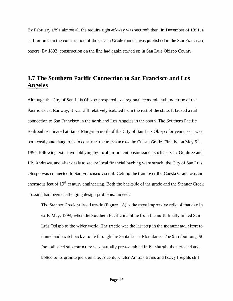
crossing had been challenging design problems. Indeed:
The Stenner Creek railroad trestle (Figure 1.8) is the most impressive relic of that day in
early May, 1894, when the Southern Pacific mainline from the north finally linked San
Luis Obispo to the wider world. The trestle was the last step in the monumental effort to
tunnel and switchback a route through the Santa Lucia Mountains. The 935 foot long, 90
foot tall steel superstructure was partially preassembled in Pittsburgh, then erected and
bolted to its granite piers on site. A century later Amtrak trains and heavy freights still

Page 17
cross its seemingly skinny girders every day (retrieved from
http://www.heritageshared.org/docs/livinglandtour3.html, 2011).
Figure 1.8: Stenner Creek Railroad Trestle Photo Courtesy of the San Luis Obispo County History Center
Unlike the Pacific Coast Railway, the Southern Pacific Railroad was a standard gauge railroad
with the regulation size 56 ½” width. This gave the Southern Pacific a significant advantage over
the Pacific Coast Railway in terms of goods movement. There was no need to off-load freight to
move it to a cross-country rail route heading east out of California.

Page 18
Figure 1.9: 1926 Sanborn Map with Roundhouse at Upper Right Corner Map Courtesy of the San Luis Obispo County Historic Society
Figure 1.10: Historic Aerial Showing Roundhouse and Southern Pacific Railyards in Lower Right Corner Photo Courtesy of the San Luis Obispo County History Center
Page 19
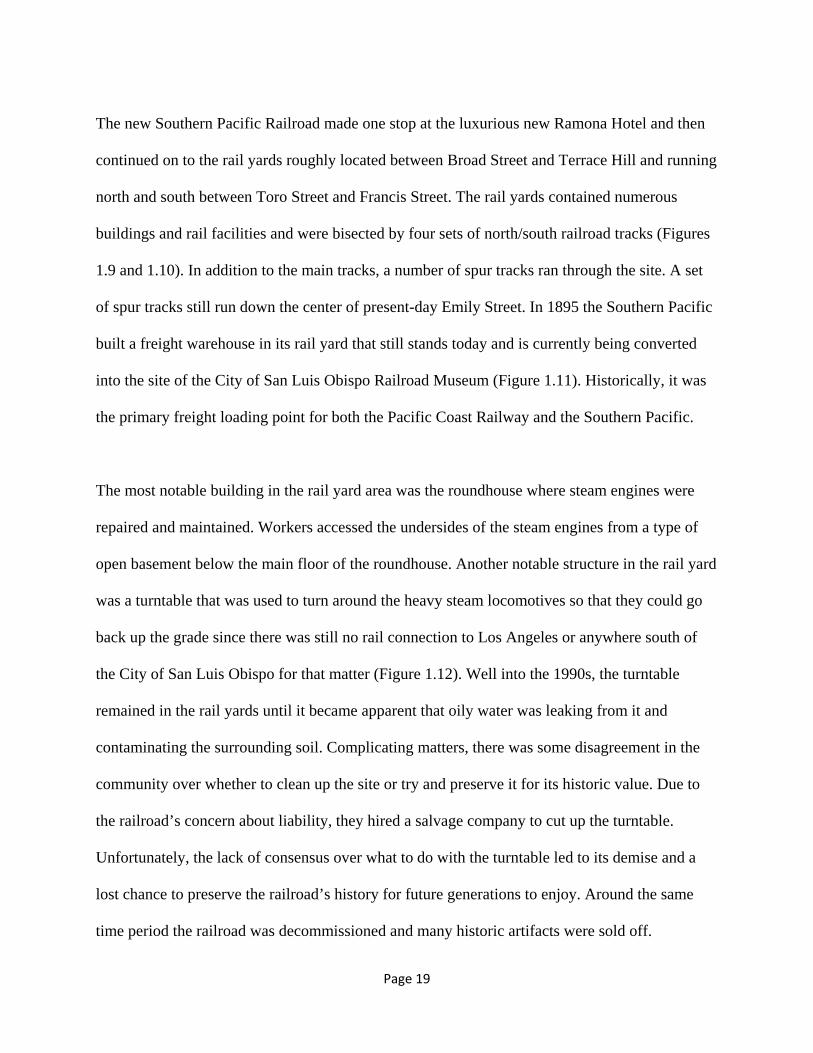
The new Southern Pacific Railroad made one stop at the luxurious new Ramona Hotel and then
continued on to the rail yards roughly located between Broad Street and Terrace Hill and running
north and south between Toro Street and Francis Street. The rail yards contained numerous
buildings and rail facilities and were bisected by four sets of north/south railroad tracks (Figures
1.9 and 1.10). In addition to the main tracks, a number of spur tracks ran through the site. A set
of spur tracks still run down the center of present-day Emily Street. In 1895 the Southern Pacific
built a freight warehouse in its rail yard that still stands today and is currently being converted
into the site of the City of San Luis Obispo Railroad Museum (Figure 1.11). Historically, it was
the primary freight loading point for both the Pacific Coast Railway and the Southern Pacific.
The most notable building in the rail yard area was the roundhouse where steam engines were
repaired and maintained. Workers accessed the undersides of the steam engines from a type of
open basement below the main floor of the roundhouse. Another notable structure in the rail yard
was a turntable that was used to turn around the heavy steam locomotives so that they could go
back up the grade since there was still no rail connection to Los Angeles or anywhere south of
the City of San Luis Obispo for that matter (Figure 1.12). Well into the 1990s, the turntable
remained in the rail yards until it became apparent that oily water was leaking from it and
contaminating the surrounding soil. Complicating matters, there was some disagreement in the
community over whether to clean up the site or try and preserve it for its historic value. Due to
the railroad’s concern about liability, they hired a salvage company to cut up the turntable.
Unfortunately, the lack of consensus over what to do with the turntable led to its demise and a
lost chance to preserve the railroad’s history for future generations to enjoy. Around the same
time period the railroad was decommissioned and many historic artifacts were sold off.

Page 20
Figure 1.11: Southern Pacific 1895 Freight Warehouse Photo: Adrianna Jordan.
Figure 1.12: Southern Pacific Turntable Photo Courtesy of the San Luis Obispo County History Center

Page 21
Although the vast majority of townspeople in San Luis Obispo welcomed the Southern Pacific,
not everyone in turn-of-the-century California appreciated its existence. In 1901, a writer named
Frank Norris published a muckraking novel about the Mussel Slough Tragedy titled “The
Octopus” which was a euphemism for the Southern Pacific Railroad that was coined by the San
Francisco Chronicle in 1895. The Mussel Slough Tragedy referred to a mass shooting that
occurred near Hanford, California when settlers refused to vacate their improved land so that the
Southern Pacific sell it for the value of the improvements. In contrast, Myron Angel wrote a
“boosterific” history of the county in 1883 in anticipation of the Southern Pacific’s arrival.
Regardless of positive or negative public opinion, the Southern Pacific remained a very
profitable business. By 1904 it had a monthly payroll in the City of San Luis Obispo of over
$20,000, and its well-kept facilities had grown to include immense coal-bunkers, railroad shops,
the roundhouse, office, warehouses, and other buildings (Source: 1904 San Luis Obispo Fire
Department Souvenir).
Unfortunately, the heyday of both of the Pacific Coast Railway and the Southern Pacific was
relatively short-lived as automobile transportation gained traction as the preferred mode of
transporting people and freight in the 20th century. Chapter 2 explores the demise of the railroads
due to advancing technologies, cultural shifts, and economics.

Page 22
Chapter 2: The Demise of the Railroads
The global economy and changing choices for transportation transformed the local railroad
industry and eventually led to its demise. Due to its physical limitations, the Pacific Coast
Railway was ultimately most vulnerable to the advent of the automobile, refrigerated trucks, and
the national economy, and experienced a relatively fast decline when compared to the Southern
Pacific which held on for decades longer until passenger travel was moved to Amtrak and
ownership of the Southern Pacific was transferred to the Union Pacific.
Figure 2.1: San Luis Obispo Railroad District Public Art Listing Important Dates in Railroad Evolution Photo: Adrianna Jordan.

Page 23
2.1 A Brief Timeline of Important Dates The artwork in front of the Railroad Museum (Figure 2.1) identifies some benchmark times in railroad evolution including: 1874 – Pacific Coast Railway is founded between Avila and San Luis Obispo 1894 – Southern Pacific Railroad connects San Francisco and San Luis Obispo 1901 – Southern Pacific Railroad connects Los Angeles and San Luis Obispo 1940 – Demise of the Pacific Coast Railway; water tower built for Southern Pacific in rail yard
2.2 Pre-World War I
The Pacific Coast Railway and Port Harford played a major role in diversifying the economy of
the City of San Luis Obispo and stimulated commerce and trade in the hinterland by enabling
trade with a much larger region. Although there was access to San Francisco via the Cuesta
Grade stagecoach road starting in the mid-1800s, it was impossible to transport large-scale
materials on it and it was often muddy in the rainy season. Port Harford’s status as an
international port-of-entry meant that passengers and goods from as far away as the Pacific Rim
and Europe disembarked daily at the port throughout the 1880s and 1890s. Capitalizing on the
constant stream of visitors, the Ocean Hotel (later re-named the Hotel Marre) was built at the
base of Harford Wharf in 1882. Unfortunately, seven years later in 1889 a near-disaster almost
occurred at the port when the steam ship Queen of the Pacific sank in 22 feet of water within 500
feet of the pier. Luckily, because the ship was in shallow water, no lives were lost. In response to
the incident, the Point San Luis Lighthouse Station (Figure 2.2) was constructed only one year
later in 1889.

Page 24
Figure 2.2: San Luis Lighthouse Station Courtesy of Lighthouse News (2011).
The arrival of the Southern Pacific in 1894 marked the beginning of a slow decline for the
Pacific Coast Railway. The Southern Pacific Railroad offered lower freight rates from the City of
San Luis Obispo than from other areas in Northern California so that it could compete with (and
undercut) the Pacific Coast Railway. Additionally, all-railroad freight routes such as the
Southern Pacific’s tracks may have been viewed as a more reliable form of transportation since
they were not as dependent on good weather as the steam ship route. Nonetheless, the Pacific
Coast Railway and Port Harford moved forward with facility improvements.
Around the turn of the century the Pacific Coast Railway constructed two sets of spur tracks to
Bishop’s Peak in San Luis Obispo so that it could transport stone from a rock quarry to the

Page 25
construction site of the breakwater at Port Harford. The quarry was founded by Dr. G.B. Nichols
who purchased land on the southwestern slope of Bishop’s Peak. “A large pulley was placed at
the quarry and a heavy, flexible cable fed through the pulley. The cable ends were each attached
to a small railroad car. One car was loaded with stone and rolled down the slope, thereby pulling
the other railroad car up the hill to the quarry for loading – no power required!” (Parsons, 1995)
Due to meager congressional appropriations, this transport method was abandoned and the
quarry eventually failed as a business (San Luis Obispo Morning Tribune, 1905). Despite the
additional improvements, by the early 1900s Port Harford had lost most of its general shipping
business and focused almost exclusively on exporting petroleum, which arrived via the 1906
Union Oil pipeline from Coalinga, in Fresno County, California. A couple years later, in 1908
the US Navy’s “Great White Fleet” anchored in San Luis Bay en route to complete its 1907-1909
circumnavigation of the globe in an effort to demonstrate the United State’s blue water prowess.
In response, the Pacific Coast Railway ran special excursion trains to Avila to bring in spectators
(Krieger, 1989).
In an attempt to become more competitive, the Pacific Coast Railway created a spur line to the
Southern Pacific Railroad Depot along what is now South Street to facilitate the direct transfer of
goods and passengers in either direction. “However, by 1913 only a single daily mixed train
(passenger and freight) ran between the Port and San Luis Obispo” (Rice, 2006).
During this same period, many of the Southern Pacific’s important structures were constructed
(Figure 2.3), and between 1906 and 1926 both a Signal Repair shop and the Southern Pacific’s
Transportation Company Building were built. The Signal Repair shop was located across from

Page 26
the present-day depot, and the Transportation Company building (located near the “Railroad
Square” call-out in Figure 2.4) is still used today by Union Pacific but is in a state of minor
neglect.
Figure 2.3: The Present-Day Layout of the Union Pacific Railyard Map Courtesy of the City of San Luis Obispo Railroad District Plan (1998).

Page 27
Figure 2.4: The Southern Pacific Transportation Company Building Photo: Adrianna Jordan.
2.3 World War I to World War II As the automobile gained popularity as the de facto transportation mode of choice for
community members who could afford it during the “Roaring ‘20s”, it became apparent that
local roads were woefully inadequate to handle the new form of transportation. Therefore, in the
1920s, a series of operational improvements were made to the Cuesta Grade Road, and additional
road linkages to the south of the City of San Luis Obispo were also improved. Unfortunately,
these improvements had the downside of chipping away more of the railroad’s customer base as
people chose to drive rather than take the train.
As the city of San Luis Obispo headed into the 1930s, the Great Depression hit. Suddenly, most
families could not afford to travel for leisure, regardless of the mode of travel. The rail industry
suffered as a result. “As revenues declined passenger service all but disappeared, freight
schedules became infrequent and trackage was reduced. Further, the physical plant and rolling
stock not only was rapidly becoming obsolete but was worn out after years of deferred service”
(Rice 2006). However, the necessity to move troops and the changing economic realities of the

Page 28
forthcoming war would provide a brief respite for at least the Southern Pacific, even if by this
time it was too late for the Pacific Coast Railway.
During World War II, passenger traffic on the Southern Pacific reached all-time record highs. In
1940 up to 10 passenger trains per day were stopping in the City of San Luis Obispo. Partly this
is due to the fact that most local troops were transported by train to San Miguel before
continuing on to Camp Roberts which was established that same year specifically to train troops
for World War II combat. Additionally, during the war years, gas and rubber were rationed and
therefore people were more likely to take the train for long-distance travel than to take their
personal automobiles. Furthermore, train travel and car sharing were seen as more patriotic
forms of transportation than the single-family automobile (Figure 2.5). Flush with revenue, the
Southern Pacific continued to make improvements to its facilities in the City of San Luis Obispo
first adding a water tower in 1940, and then in 1942 building the “Spanish Colonial” style
Passenger Depot which is still in use today as the Amtrak Station.

Page 29
Figure 2.5: American World War II Propaganda Encouraging Citizens Not to Drive Alone Courtesy of US National Archives (2011). Despite the nationwide record numbers of rail riders, ridership on the Pacific Coast Railway
continued to suffer. In the early 1930s, ironically aided by the Pacific Coast Railway which
carried road building materials shipped in via Port San Luis, the legendary Pacific Coast
Highway and Highway 101 were completed through San Luis Obispo County. The new access to
the coast meant that it was now easier to get to Avila via automobile than via train. This was the
final death knell for the Pacific Coast Railway. By1940 the Pacific Coast Railway was suffering
from a $1 million deficit. “On December 20, 1941 the Pacific Coast Railway received
government authorization to abandon its remaining trackage... The railway’s last whistle sounded
when on February 28, 1942 the ten miles of line between San Luis Obispo and the Port was sold
to the Port San Luis Transportation Company” headed by Elton Tognazzini for a sum of
$17,265. That company ceased operations on October 29, 1942 (Rice, 2006). Meanwhile, the

Page 30
train equipment was sold to A. Feher and Sons (with exception to the train coaches destroyed
during the 1935 filming of Diamond Jim Brady). A mere decade later most remnants of the
Pacific Coast Railway had completely disappeared.
The Port itself fared better than its Pacific Coast Railway counterpart, and by World War II it
was the largest crude oil shipping port in the world. Due to its strategic vulnerability, the Port
was provided with naval protection during both wars. “From 1917 to 1918 a full company of
infantry was stationed at the Union Oil Tank Farm operation in San Luis Obispo, while units of
the Coast Artillery guarded the Point San Luis-Point Buchon area. Artillery and cavalry units
also patrolled the cliffs and beaches during the panic-stricken days following the attack on Pearl
Harbor. Between 90 and 300 men reinforced the Coast Guard detachment at the lighthouse, from
1941 to 1943” (Krieger, 1989).
2.4 The Postwar Period
During and after the war, the Southern Pacific set out to improve its capital rolling stock and
spent most of the mid to late 1940s replacing its steam locomotives with diesel electric
locomotives. Engine 4449 was one of the last streamline steam engines based in the City of San
Luis Obispo and remained in operation through the 1940s. After it was decommissioned, it ended
up in Portland, Oregon. On rare occasions, it is still operated for special events. The last steam
locomotive in operation on the Coast Route was decommissioned in 1956.

Page 31
As goods movement declined at Port San Luis through the post-war period, it became known
more for fishing and recreation. In 1954, county residents voted to create the Port San Luis
Harbor District which bought Tognazzini’s property and the pier in 1964. The purpose of
creating the Harbor District was to fix up the aging facilities and increase ocean-driven
commerce. Unfortunately, oil leaking from the pipeline that Unocal had built years earlier had
been slowly seeping into the harbor. Finally, in the late 1990s, Unocal transported 6,750
truckloads of contaminated material to the Bakersfield Landfill in Kern County and replaced it
with sand from the Guadalupe Dunes. The half mile wide excavation necessitated the razing and
redevelopment of the oceanfront portion of the beach community. It also enabled construction of
the new vacation homes, shops, and restaurants that now front the ocean and are billed as a
regional tourist attraction.
At roughly the same time that Unocal began its clean-up of Avila Beach; the financially troubled
Southern Pacific Railroad was merged with, and took the name of, Union Pacific Railroad in
1995. This acquisition had actually been started back in 1901; however, a divestiture was ordered
in 1913. By the time that the merger occurred, daily passenger trains in the City of San Luis
Obispo had dwindled to six total trains and had been operated by Amtrak since 1971. Currently,
the six daily passenger trains include two southbound Pacific Surfliner trains, two northbound
Pacific Surfliner trains, one Coast Starlight southbound train, and one Coast Starlight northbound
train. Through the years, neglect has taken its toll on the passenger rail facilities and although it
took approximately 10 hours in the 1950s to make the trip between Oakland, California and Los
Angeles, California, it now takes 12 hours to complete the trip.

Page 32
The decline of the railroads in general can be correlated to the rise of the automobile as the
preferred mode of travel. This decline follows the creation of the interstate freeway system
which revolutionized the geography of central places throughout the nation. The automobile
brought with it personal freedom for individuals and families to chose when, how, and where to
travel. The mobility it gave to Americans and the way of life the automobile represented was the
envy of the world, and emerging and established nations sought to emulate the American ideal.
By the 1980’s, passenger rail traffic stopping in the City of San Luis Obispo had decreased to
insignificance, even though Caltrans records show an increase in overall Surfliner ridership
during the same period (California Department of Transportation, 2008), resulting in a decline of
neighborhoods surrounding the station. The area’s gradual slide into obscurity attracted the city’s
attention in the 1990’s and a major effort was undertaken to create new opportunities for
reinvestment in sites adjacent to, and near, the rail tracks.
Indubitably, the automobile had dire consequences for the railroad industry and reshaped the way
that people traveled and shipped freight. Chapter 3 explores how the advent of the railroad
literally reshaped the layout of land in the City of San Luis Obispo, and how newer forms of
transportation learned to co-exist with the railroads once safety issues were resolved through
alterations in the city form.

Page 33
Chapter 3: City Fabric The railroads’ heyday and the impact it left on the landscape of the city, as well as the railroad’s
significant influence on land use, safety, and social stratification are explored in this chapter.
3.1 Historic Shifts in the Street Grid
Figure 3.1: Shift in the city’s grid at High Street. Graphic: Adrianna Jordan.
Before the first train whistle was ever heard in San Luis Obispo the city’s street grid had already
undergone a number of changes that owed more to the societal customs and politics of various
eras than to topographic necessity. When the original mission town was plotted under Spanish
rule in 1772, the street axis was designed according to the Spanish Grid which is rotated
approximately 26 degrees off of the north/south axis (Figure 3.1). This orientation provides
access on every street to both light and heat in the winter. In the summer, the streets receive
shade and shadows for the majority of the day except for two brief periods in mid-morning and

Page 34
mid-afternoon (Knowles, 1999). The pattern of sunlight and shadow in the downtown is also
advantageous for commercial development because it allows developers to build taller buildings
without casting the sidewalks and streets in shadows. In contrast, the newer end of the city,
located just south of High Street and plotted in the years after the U.S. took over control of
California in 1847, was designed along a straight north/south and east/west axis in accordance
with a Jeffersonian Grid. “Jefferson's plan, set down in the Land Ordinance of 1785, reflected the
rational spirit of the time and not the implications of natural topography. Discarding the
traditional surveying concept of ‘metes and bounds’ (which took natural features of the land into
account), he designed a strict grid system.” (US Gen Net, 2011). Unfortunately, unlike the
Spanish Grid, the Jeffersonian Grid creates large shadows on streets in the winter and provides
less shade in the summer (Figure 3.2). Newer subdivisions plotted using the Jeffersonian Grid
include Weil’s Addition (1887), Southside Addition (1891), Norton Addition (1901), and Bonita
Terrace (1951).
Figure 3.2: Street shadow patterns in a Jeffersonian Grid (left) and a Spanish Grid (right) Courtesy of US Gen Net (2011).

Page 35
3.2 The City’s Residential Expansion
The arrival of the railroad, in particular the Southern Pacific, helped open up new residential
areas in the City of San Luis Obispo. Residential tracts developed between 1874 and 1894 are
noted and located on the map (Figure 3.3), and illustrate the ring growth that occurred around the
city core in this period. The map of land annexations between 1874 and 1891 clearly illustrates a
pattern of land speculation adjacent to and overlapping the Southern Pacific railroad track right-
of-way, and a general shift in new residential development towards the eastern and southern
limits of the city.
The land annexations are coded by number on the map and correspond to the chronology list
below:
1. Phillips Addition (1874)
2. Deleissigues Tract (1876)
3. Buena Vista Tract (1885)
4. Loomis Tract (1887)
5. Deleissigues Subdivision (1887)
6. McBride Tract (1887),
7. Homestead Tract (1887)
8. Hathway Addition (1887)
9. Buena Vista Addition (1887)
10. Fairview Addition (1887)
11. Deleissigues Addition (Block 5) (1887)
12. Central Addition (1888)
13. Maymont Addition (1889)
14. Scwartz Addition (1889)
15. South Side Addition (1891)
16. Imperial Addition (1891)
Figure 3.3: 1874-1891 Land Annexations Around the Proposed Right of Way of the Southern Pacific Railroad
Graphic: Adrianna Jordan; basemap courtesy of the City of San Luis Obispo

Page 36
Most of the Pacific Coast and Southern Pacific railroad workers living in the City of San Luis
Obispo at the turn of the century who could afford it chose to locate their families in downtown
San Luis Obispo. Echoing modern real-estate patterns, the older neighborhoods on the Spanish
Grid had a much higher prevalence of occupancy by railroad managers, conductors, and
engineers – especially if they were also at a higher elevation than the railroad tracks. Meanwhile,
the newer subdivisions on the south end of town closer to the railroad tracks were typically
occupied by working or middle class railroad families.
Overall, the majority of the new subdivisions annexed by the city between 1874 and 1891
attracted mostly working class railroad workers. However, turn-of-the-century telephone
directories that list occupations and addresses, as well as the general size of plots of land within
the subdivisions reveal that the Deleissigues Addition was solidly middle class in composition
(Figures 3.4). In addition, the Loomis Tract and McBride Tract were popular with both middle
and working class families, most likely because they were within walking distance of both the
downtown and the Southern Pacific rail yard and service facilities.

Page 37
Figure 3.4: 1887 – Deleissigues Addition (block 5). Labeled Nos. 2/5/11 on left map. Graphic: Adrianna Jordan; basemaps courtesy of the City of San Luis Obispo

Page 38
Figure 3.5: 1887 – Loomis Tract. Labeled No. 4 on upper map. Graphic: Adrianna Jordan; basemaps courtesy of the City of San Luis Obispo

Page 39
Figure 3.6: 1887 – McBride Tract. Labeled No. 6 on left map. Graphic: Adrianna Jordan; basemaps courtesy of the City of San Luis Obispo Based on the professional occupations settled in the neighborhood by 1904, as well as the layout,
large parcel size, and elevation of the subdivision above the soot and noise of the railroad yards,
the Buena Vista Addition (Figure 3.7) was most likely upper middle class in nature and by far,
the nicest of the newly annexed areas of the city.

Page 40
Figure 3.7: 1887 – Buena Vista Addition. Labeled Nos. 3/9 on left map. Graphic: Adrianna Jordan; basemaps courtesy of the City of San Luis Obispo
Much like the Buena Vista Addition, the majority of the subdivisions in the city were approved
in 1887. That same year, the mainline of the Pacific Coast Railway reached Los Olivos in Santa
Barbara County, marking the farthest geographical extent of the railroad. This was the peak
period of the Pacific Coast Railway, at the time the dominant means of moving people and goods
throughout the Central Coast region.
3.3 City Plats, Street Configurations, and the Southern Pacific
In addition to spurring the development of brand new subdivisions, the Southern Pacific also
destroyed and reconfigured the existing fabric of the city by barreling straight through existing
and up-and-coming neighborhoods, and cutting off streets and other access routes, essentially
splitting the city in half.

Page 41
The Central Addition provides one example of the dramatic effect that the railroad right-of-way
had on the existing configuration of land in the city. The Central Addition had to be completely
re-platted when the Southern Pacific routed the railroad directly through it, effectively cutting the
eastern end of the city in half and creating dangerous at-grade crossings for people living on the
“wrong” eastern side of the tracks.
One the original at-grade crossings was located at Osos Street. According to the 1921 Pacific
Reporter, around 5:30 pm on the evening of November 20, 1917, a local resident named Harry
Green was walking his bicycle across the tracks at Osos when he was struck by a “gondola” car
(an open-top type of rolling stock that is used for carrying loose bulk materials) and killed on his
way to his home on the east side from his workplace on the west side of town (Pacific Reporter,
1921). Decades later, a local story claims that two World War II GIs who were home on leave
were driving with their girlfriends across the railroad on Osos Street when their car stalled and
they were hit and killed by a train. Following this incident, most of the remaining at-grade
crossings, including Osos Street, were permanently closed. Despite significant advances in the
safety of the city’s railroad crossings over the last 50 years, the decisions made by the railroad’s
financiers in the 19th century continue to create controversy and impact the local transportation
infrastructure. On July 19th, 2011, “the San Luis Obispo City Council unanimously approved
changes to the lane configuration on Johnson Avenue near the Union Pacific Railroad bridge”
over the objections of former Mayor Dave Romero who believes that moving the left-turn lane
up to the light will create gridlock (Cornejo, 2011).

Page 42
Figure 3.8: Original Johnson Avenue Railroad Bridge Undercrossing shown just before it was replaced with a wider undercrossing in 1958. Photo Courtesy of San Luis Obispo County History Center. Although the safety of getting between the west side and east side of town has increased
substantially with the elimination of the most dangerous at-grade crossings, and the creation of
under-passes such as the Johnson Avenue bridge (Figure 3.8) and over-passes such as the
Jennifer Street Bridge, the demarcation of what is considered close to downtown (west) and what
is not, (east) of the railroad continues to linger today. The railroad affected the Loomis Tract
parcel configurations in the present-day blocks between Upham, Morro, Osos, and Leff,
transforming them from the original grid plan (Figures 3.9 and 3.10). Today this reconfiguration
lends an unpredictability and charm to the city fabric in that area of town and helps to attract new
residents to the district.

Page 43
Figures 3.9 and 3.10: The Loomis Tract (1887) and the Loomis and Osgood Re-subdivision (1894) Graphic: Adrianna Jordan; basemaps courtesy of the City of San Luis Obispo
The railroads’ influence on the urban form of the city was pervasive and shaped almost every
land use decision around the turn of the 20th century. The next chapter explores the railroads’
influence in more detail, delving into its effect on tourism and local infrastructure improvements
such as the creation of a public transportation system, sewer system, and street lights. In
addition, the next chapter’s discussion also covers the local commercial industries that were
reliant on the railroad to ship their products both nationally and abroad.

Page 44
Chapter 4: Historic Tourism, Economic Development, and the Railroad Chapter 3 deals with the mark that the railroads’ heyday left on the landscape of the city and how
the railroads not only influenced the expansion of the city, but also land use and social
stratification within the city. This chapter provides more specific examples of how the railroad
influenced economic development such as the development of the Ramona Hotel and the
Andrews Hotel which turned San Luis Obispo into a vacation destination. In addition, this
chapter illustrates how the railroad facilitated the shifting of the locus of the county’s economic
activity from the town of Cambria to the City of San Luis Obispo.
4.1 The Southern Pacific and Tourism
Figure 4.1: The Ramona Hotel with convenient horsecar to the railway station Photo Courtesy of Best (1964).
Page 45
Figure 4.2: The interior of a suite at the Ramona Hotel Photo Courtesy of Franks (2004).
The arrival of the railroad created an instant tourism industry in the City of San Luis Obispo. The
full-service Ramona Hotel and the Central Addition subdivision in which it was located were
speculative developments based solely on the Southern Pacific’s arrival. In fact, on the day that
the Southern Pacific finally arrived in San Luis Obispo, a massive celebration was held at the
hotel and included “a giant barbeque serving $330 worth of meat and food” (Krieger, 1989). The
200-room Ramona Hotel (Figure 4.1) was located close to the Southern Pacific tracks on a city
block bounded by Higuera, Johnson, Marsh, and Essex (present-day Pepper Street).
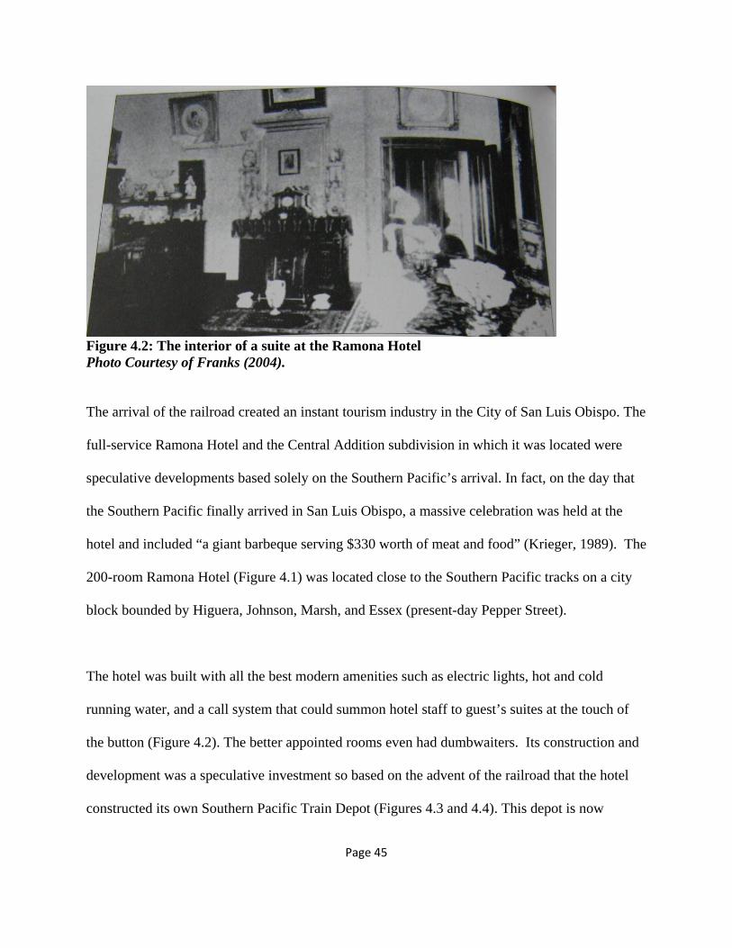
The hotel was built with all the best modern amenities such as electric lights, hot and cold
running water, and a call system that could summon hotel staff to guest’s suites at the touch of
the button (Figure 4.2). The better appointed rooms even had dumbwaiters. Its construction and
development was a speculative investment so based on the advent of the railroad that the hotel
constructed its own Southern Pacific Train Depot (Figures 4.3 and 4.4). This depot is now

Page 46
preserved and available for viewing at the Dallidet Adobe Gardens in the City of San Luis
Obispo1. The Historical Marker at the depot provides some insight on the relationship of the
railroad and tourism, noting as follows:
In March of 1896, the Southern Pacific Railroad officially declared that the Ramona
Hotel will be an eating station for passengers heading north and south. “It is expected
that within a few days tickets can be purchased from the Ramona station and baggage
checked from the same point. The station building has been completed several days...so
that the station may present an attractive appearance to strangers.” San Luis Obispo
Morning Tribune 1896). Trains which did not include a dining car stopped to allow
passengers a meal at the Ramona Hotel. A street railway running on Marsh Street to the
rear of the hotel connected the street car line to the new depot” (The Historic Marker
Database, 2011).
The street car was horse drawn and designed to allow the horses to be hitched to either end,
eliminating the need for a turn-around at either end of the route.
1 The Ramona Depot was all that remained after the 1905 fire that destroyed the Ramona Hotel. It was donated to the Dallidet Gardens by Life Members of the San Luis Obispo County Historical Society Robert and Elizabeth Leitcher. See The Historical Marker Database, http://www.hmdb.org/marker.asp?marker=38457

Page 47
Figure 4.3: Current photograph of the Ramona Hotel Depot on the Dallidet Adobe Grounds Photo: Adrianna Jordan.
Figure 4.4: Ramona Hotel Depot in original location adjacent to the Southern Pacific tracks Photo Courtesy of Franks (2004).
In direct competition with the Ramona Hotel, the 112-room Andrews Hotel (Figure 4.5) was
built nearby at the corner of Monterey and Osos Streets. Constructed in 1886, it was designed to
cater to upscale travelers and featured 26 suites, 86 single rooms, and 16 bathrooms. Much like
the Ramona, it had state-of-the-art amenities such as electric lights, hot and cold running water,
and “a system of electric bells connected between the hotel office and all 144 rooms, as a

Page 48
safeguard against both fire and burglary” (Nicholson, 1980). Tragically, despite its modern
safeguards, the hotel was destroyed twice by fire. The first time it burned down seven months
after it opened. The re-built hotel was destroyed in 1905.
Figure 4.5: The original Andrews Hotel Photo Courtesy of Franks (2004).
Around the time that the grand tourist hotels were opening, the first Southern Pacific Passenger
Rail Depot was built in the mid-1890s between Santa Rosa and Osos Streets. Tourists who
disembarked at the station were greeted by uniformed porters. The original depot remained in
service until the new depot was built in the 1940s, and was eventually demolished in the early
1970s.
In 1943, a new passenger depot was built for the Southern Pacific at 1011 Railroad Avenue.
Standing just north of the old depot the new depot was a Mission Revival style building.
The 157-by-33 foot stuccoed building had a broadly pitched red-tile roof, brick chimney,
and a two-story central section with tall, arched windows. Thick wooden columns
supported the walkway overhangs and square tile details adorned the base of the roofline.
A 1942 Telegram-Tribune article reported that “the new station will have stucco interior

Page 49
walls, tile floors, decorative ceiling timber trusses, and retiring rooms will be modern in
appointments and all public facilities will be of generous proportions” (Franks, 2004).
4.2 Traders and Businesses
Before the railroad came to San Luis Obispo, the town, although a cultural and religious hub,
consisted of little more than the mission with dusty ranches surrounding it. Until 1870, the center
of Central Coast economic activity was actually 40 miles north in the town of Cambria, known
as “Slabtown” due to the use of rough-hewn wood slabs in building construction. In the mid
1800s Cambria’s shipping industry was larger than the City of San Luis Obispo’s, and Cambria’s
economy was driven by the exporting of cinnabar, lumber, grains, and cattle products. A few
miles north of Cambria, San Simeon was also in the shipping business thanks to George Hearst:
In 1878 Hearst constructed a 1,000-foot wharf with a narrow-gauge, horse-drawn railroad
to facilitate the loading and unloading of the coastal packet steamers. During the wharf’s
first year of operation it shipped butter, tallow, beef hides, wheat, barley, oats, dried
seaweed, and abalone from the Chinese harvesters along the remote coast, and 169 flasks
of mercury from the cinnabar mining operations in the Santa Lucias. Mercury prices were
down so this was well below the production and shipping figures for 1866 through 1876
(Krieger, 1989).
Faced with cutthroat ocean shipping competition to the north, it was a life or death situation for
the City of San Luis Obispo’s burgeoning economy to attract the railroad so that they could
capture the advantage of an overland shipping route. At the time, the Southern Pacific was
considering running their route along the coast through Morro Bay and by-passing San Luis
Obispo altogether.

Page 50
In order to convince the railroad to build the tracks through the city, local businessmen cut
strategic deals with men from the San Francisco Bay Area such as Charles Crocker. Crocker was
a land developer and a member of the “Big four”, a group of businessmen who were closely
involved with the building of the Southern Pacific. By 1886 “Crocker had already begun a game
of hardball with the business community in the county seat of San Luis Obispo. The railroad was
scheduled to turn west toward Morro Bay, following the route later taken by State Highway 41.
References had appeared in the San Luis Obispo Tribune suggesting that ‘Crocker, being the last
town before ascending the grade to Morro Bay, will very likely have machine shops and
workshops of the Southern Pacific Railroad’” (Krieger, 1989). At the time, Crocker had named
one of his real-estate investments (now known as Templeton) after himself. The name was later
changed to the name of Crocker’s son because of the unpopularity of Crocker within the local
community due to his railroad and land dealings.
Despite Crocker’s influence, and due in large part to extensive lobbying by Tribune Editor
Myron Angel, the executives of the Southern Pacific eventually did decide to route the railroad
through San Luis Obispo via Santa Margarita and the Cuesta Grade. Also playing a role in this
decision were the various economic incentives such as free land for the rail right-of-way and
infrastructure improvements such as a streetcar line that linked the rail depot to the rest of town.
These incentives were provided to the railroad by the business community of the City of San
Luis Obispo.

Page 51
In 1887, action was taken to create a street car system for public transportation in the city.
Concurrently, a petition was filed to install electric street lights. A couple of months later, a
Board of Trade was formed to promote immigration and land sales. The promotions undertaken
by the board included the creation of literature touting the resources of the county (Figure 4.6),
and an exhibition about local resources at a theater. Ironically and perhaps anticipating a
symbiotic relationship, even the Pacific Coast Railway was involved with indirectly courting the
Southern Pacific by offering to ship materials used for county promotional purposes free of
charge. Overall, the board “published 25,000 brochures, sponsored 10,000 or more copies of the
San Francisco Journal of Commerce with feature articles about San Luis Obispo, paid for 36,000
copies of the Tribune, distributed 25,000 copies of a thirty-eight page booklet, and sent an
exhibition of products to various fairs” (Nicholson, 1980).

Page 52
Figure 4.6: An 1887 advertisement about local economic resources Figure Courtesy of Nicholson (1980).
Unfortunately, despite all of the lobbying efforts, after the Southern Pacific railroad reached
Santa Margarita in 1889, it remained stuck there for six years because of economic uncertainty.
“The Panic of 1893 had frozen investment capital, and the Southern California land boom of the
1880s had resulted in a great deal of over-speculation” (Krieger, 1989). Railroad investors and
their capital all but disappeared until the economy improved in the mid 1890s and the railroad
finally reached the City of San Luis Obispo.
Page 53
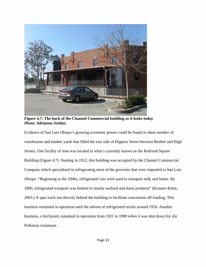
Figure 4.7: The back of the Channel Commercial building as it looks today Photo: Adrianna Jordan. Evidence of San Luis Obispo’s growing economic power could be found in sheer number of
warehouses and lumber yards that filled the east side of Higuera Street between Beebee and High
Streets. One facility of note was located in what’s currently known as the Railroad Square
Building (Figure 4.7). Starting in 1912, this building was occupied by the Channel Commercial
Company which specialized in refrigerating most of the groceries that were imported to San Luis
Obispo. “Beginning in the 1840s, refrigerated cars were used to transport milk and butter. By
1860, refrigerated transport was limited to mostly seafood and dairy products” (Krasner-Khait,
2003.) A spur track ran directly behind the building to facilitate convenient off-loading. This
business remained in operation until the advent of refrigerated trucks around 1950. Another
business, a brickyard, remained in operation from 1921 to 1980 when it was shut down for Air
Pollution violations.

Page 54
In addition to providing a means for private businesses to conduct trade beyond the local area,
the railroads also created a multitude of jobs for local citizens since both the Pacific Coast and
the Southern Pacific railroads located their division headquarters and maintenance yards in San
Luis Obispo. Possible railroad occupations included agents, brakemen, car inspectors, clerks,
conductors, engineers, firemen, machinists, foremen, managers, switchmen, telegraph operators,
and yardmen. Regardless of whether the job was working class or middle class, it was steady
employment and helped raised the standard of living for the community, as well as increase local
buying power.
The railroad’s presence in the City of San Luis Obispo also had a positive effect on the
neighboring communities of Arroyo Grande and Santa Maria. The cheap form of goods
movement fueled agricultural and commercial development and shipped millions of tons of
grains, beans, pears, and dairy products off to previously inaccessible markets.
During World War I, the strategic location of the County of San Luis Obispo’s agricultural land
in proximity to the Southern Pacific route helped drive the local economy at a time when the
overall worldwide economy was faltering. Prices for agricultural commodities soared in the face
of European shortages and local farmers were able to reap high profit margins on goods such as
grains and beans. In particular, dried navy beans became a sought-after commodity for the U.S.
Military during the war and Central Coast farmers grew millions of beans for export. Due to this:
Virtually all of the Pacific Coast Railway warehouses added bean-cleaning towers. These
devices sifted off dirt and stones from the picked beans through a series of sieves. The
price of cleaned navy beans, which was subsidized under war emergency measures, rose

Page 55
from 11½ cents to nearly 30 cents a pound. Previously untilled pastureland [sic] was
quickly turned to bean production […] The war left many farmers unbelievably rich.
However, many of them lost their newfound wealth when the government abruptly cut
off the magnificently high subsidized prices in December 1918. (Krieger, 1989).”
Although the Southern Pacific was the favored railroad for most goods and passengers, The
Pacific Coast Railway continued to maintain a niche client base and non-perishable items that
did not require speedy transport such as beans, some types of produce, and seed continued to be
primarily shipped via the Pacific Coast Railway and steamers until after World War I. Therefore,
most of the navy beans grown by local farmers were shipped around the world via Port Harford.
Given impending food shortages worldwide, the Central Coast’s continued agriculturally-driven
economy could secure the region’s self-sufficiency well into the future.
This chapter shows how the tourism industry got started with significant help from the city’s
location along the Southern Pacific railroad tracks. In addition, it provides a detailed overview of
how the city’s economic fortunes benefitted from the presence of the railroads. The next chapter
covers lesser known aspects of the local economy such as the Chinese contribution to the
railroads, road building, and many other jobs that were deemed “undesirable” by the majority of
the population due to their back-breaking nature and low pay.

Page 56
Chapter 5: Chinatown and the Chinese Contribution to the Railroad The importance of the Chinese contribution to the region’s roads, railroads, and other public
works projects cannot be overstated as they kept the local economic engines churning due to
their reliability and willingness to work for lower wages than their American counterparts.
Figure 5.1: Iron Road Pioneers (2003) Photo: Adrianna Jordan.
Chinatown, roughly considered the area between Chorro, Mill, Morro, and Monterey streets,
flourished in the City of San Luis Obispo after Chinese immigrants came over to California to
work on the various rail projects. Although most people knew the neighborhood as “Chinatown”,
the actual residents who lived there referred to it as Tong Yun Fow, or “Chinese People’s City”
(Heritage Shared, 1998). Most Chinese were employed as contract laborers and took on the
heaviest and toughest work related to building the rail lines; in return, they were typically paid
one dollar a day plus board. In fact, the reason that the Chinese were able to find rail related jobs
was because the work was so back-breaking and so poorly paid that there were not enough

Page 57
Americans willing to do it; therefore, much like the agricultural industry relies on Mexicans for
labor today, it was necessary for the railroads to import their workforce. The Iron Road Pioneers
sculpture located in the historic San Luis Obispo Railroad District pays homage to the Chinese
contribution to the construction of the railroads (Figure 5.1).
“Between 1870 and 1900, Chinatown’s population varied from two to four hundred, peaking in
the early1890s, when one out of every ten residents of San Luis Obispo was Chinese” (Heritage
Shared, 1998). The undisputed leaders of the Chinese community were Wong On (Ah Louis) and
Gin Sai Yuen (Quong Chung). Ah Louis “came to the county in 1869 and worked as a cook for
the French Hotel. Within the next few years, on the advice of Captain John Harford, he began
working as a labor contractor” (Krieger, 1989) for the narrow-gauge rail being built between San
Luis Obispo, Avila, and Los Alamos. According to local legend, Ah Louis also got his moniker
from Harford because it was easier to pronounce than his given name. “Ah” is a kind of Chinese
nickname or greeting used in place of the full name for a friend or family member, and “Louis”
originally started off as “Luis”. Harford was a kind of friend of Ah Louis so he would
affectionately refer to him as “Ah Luis”, which is sort of like jokingly saying “Mister San Luis
Obispo”. However, contrary to local legend, according to an interview given by Ah Louis in
1934 to Chester Newton Hess, Ah Louis is quoted as saying, “Ah Louis not my real name. Ah
Louis name given me by John Morgan, owner of general merchandise store in Corvallis,
Oregon” (Hess, 1934).
Ah Louis also ran a merchandise store that catered to the local Chinese population and doubled
as a kind of recruitment office for railroad laborers. Although it started out in a different

Page 58
building, Ah Louis built a larger two-storey stuccoed structure with an iron rail balcony for the
store in 1885:
“The main room on the lower floor was designed and furnished with shelving, drawers,
counters, etc. for a store, another good-sized room for storage of goods, another for a
private room and office and a hallway across the building in the rear. The upstairs is
divided into six rooms for sleeping apartments. The partitions are of alternate strips of
dark and light redwood, oiled, and varnished, giving a very pleasant effect” (Nicholson,
1980).
The building was added to the National Register of Historic Places on March 26th, 2008. Other
stores in Chinatown included the Mee Heng Low chop suey shop (Figure 5.2), the Shanghai
Low, Chong’s Hand Made Candies building (Figure 5.3), gambling dens, laundries, and various
tenements (Figures 5.4 and 5.5).

Page 59
Figure 5.2: Mee Heng Low Chop Suey Shop Photo: Adrianna Jordan
Figure 5.3: Chong’s Hand Made Candies Photo: Adrianna Jordan

Page 60
Figure 5.4: Looking east down Palm Street in turn of the century Chinatown. Photo Courtesy San Luis Obispo History Center.
Figure 5.5: Looking west down Palm Street in turn of the century Chinatown. Photo Courtesy San Luis Obispo History Center.

Page 61
Using money he earned as a contractor, Ah Louis bred large work horses, bought fast race
horses, and “later started the first brickyard in the county and was involved in the early seed
industry. A well-respected member of the community, he died in 1936 at the age of 98” (Krieger,
1989); however, his legacy lives on in his direct descendents who continue to play a prominent
role in the community and still own the store (Figure 5.4). In fact, his youngest son, Howard
Louis continued to operate the store until the 1990s, and recently passed away in 2008 at the age
of 100. Currently, the building is owned by Ah Louis’ great-grandson Dr. William Watson.
Figure 5.6: The Ah Louis Store as it looks today. Courtesy of Heritage Shared (2011).
Although the Chinese were primarily responsible for the construction of the Pacific Coast
Railway, according to research conducted by local historian Loren Nicholson, they were used
only sparingly to build the Southern Pacific line in San Luis Obispo County:

Page 62
In May 1886, the Tribune reported “1,500 Chinese coolies” were at work laying track
south of Soledad. After the line reached Templeton, a long delay in construction
occurred, but in October 1888, work started again, and the Tribune announced that “150
Chinamen, 100 white laborers, and 50 bridge carpenters” were at work. The next month,
November 1888, the newspaper again reported “long lines of Chinamen” stretched along
the ravine, “their shovels flying in the air with monotonous regularity” (Nicholson,
1980).
By the end of 1888, work had again stopped on the railroad, and Chinese immigrants had to find
other ways to make a living. Other types of jobs available to them included mining for cinnabar
in Cambria, harvesting seaweed and abalone along the Central Coast, laundering clothing,
cooking in restaurant and hotel kitchens, building county roads, and laboring in the agricultural
fields of San Miguel and Guadalupe.
Despite the earlier Chinese involvement, when the railroad again started up construction in the
early 1890s, the Chinese were no longer employed by the Southern Pacific. According to
Nicholson, by 1893 Southern Pacific’s Chief Engineer William Hood was concerned “about the
labor problems the company had been experiencing along the gap. ‘There are now from 1,000 to
1,200 men down there at work,’ Hood was quoted as saying, ‘but there are changes all the time,
and we have to keep sending down new gangs. Not a Chinaman has yet been employed – except
as a cook – but the work has to be done, and we may have yet to employ Chinese laborers’”
(Nicholson, 1980). Despite Hood’s claim that no Chinese were working on building the rail line
over the Cuesta Grade, local historian Dan Krieger disagrees and believes that 2,000 Chinese

Page 63
workers dug seven tunnels through Cuesta Grade for the Southern Pacific segment located
between Santa Margarita and San Luis Obispo.
Around 1894, a new federal law was passed that required the Chinese to obtain certificates of
residency until penalty of deportation. Ah Louis quickly took on the responsibility for ensuring
that all of his countrymen were properly registered within the appropriate time period. This new
registration law operated as a supplement to the already draconian Chinese Exclusion Act of
1882 which allowed the U.S. to ban Chinese immigration. It was meant to stay in effect for
approximately 10 years but did not actually get repealed until the Magnuson Act of 1943.
Between jobs, the Chinese community used the City of San Luis Obispo as a home base. Despite
the fact that they were a substantial portion of the community, no Chinese are present in the 1904
telephone directory. Speculating on this, the reason no Chinese were in the directory could very
well be because they typically lived in shared tenements with communal public telephones, or by
1904 they may have already moved on since the building of the railroad tracks in the area was
complete.
By 1950, due to prohibitions on new immigration, an aging immigrant community, and the after-
effects of the Great Depression, the Chinese population of the City of San Luis Obispo had
dwindled to only 50 individuals.
The Chinese were just one of many population groups associated with the railroads, and the next
chapter unfurls the complicated relationship between farmers and the railroad in the late 19th

Page 64
century. In addition, the chapter delves into detail on how the expanded freight movement
offered by the railroads permanently changed the way buildings were constructed in the city.

Page 65
Chapter 6: Shifting Nature of the Relationship between the City and the Railroad Most of the farmers in the area had a complicated relationship with the railroad in the late 19th
century. Although they depended on the railroads for their livelihood, farmers, much like the
Chinese in the previous chapter, were exploited by the rail business. This chapter examines how
the farmers were exploited by the railroads and what the farmers did about it in response.
Additionally, this chapter also discusses the way that the railroads influenced architectural styles
in the city.
Figure 6.1: Farmers Alliance Building in Paso Robles. Courtesy of Heritage Shared (2011).
6.1 Farmers and the Railroad In the late 19th century the railroad was the primary means of marketing and transporting crops
from farms to markets and therefore farmers were completely dependent on the railroad. In
addition, farmers’ profits also depended on the amount charged by the railroad for transportation,

Page 66
storage, milling, and marketing. The railroads were keenly aware of the farmers’ position and
kept their fees so high that often farmers had trouble paying their mortgage – even when crop
yields were good. In response to the inherent inequality between the railroad and the farmers, the
Farmers Alliance group was formed by U.S. farmers to strengthen their economic power.
The Farmers Alliance was strongly associated with the People’s Party. One of the platforms of
the People’s Party was that “all excess railroad and corporate lands would be reclaimed by the
government and held for actual settlers”. This platform was important because the first
Transcontinental Railroad, completed in 1869, was financed in part by a grant of bonds and gifts
of public land by the U.S. Government that could, in turn, be sold to the public. “Congress
provided land grants consisting of ten alternating square miles of land on either side of its
proposed right-of-way to the transcontinental railroads as incentives for each mile of track
actually laid… The long-awaited release of this land for private ownership created a land boom
in northern and eastern San Luis Obispo County.” (San Luis Obispo County History Center,
2010). Often, the railroads engaged in a form of price gouging, setting the price per acre at one
level, waiting for settlers to make improvements on said land before the land deed was formally
exchanged, and then turning around and trying to sell it to the settler for ten times the original
stated price. Due to the fact that many of the prospective land owners were farmers, this further
entrenched the position of the Farmers’ Alliance.
The Farmers’ Alliance organization reached its apex in the 1880s and then declined in response
to retaliation from the railroads and commodities brokers. The historic Farmers Alliance building
(Figure 6.1) in Paso Robles “may be the last building in the United States still bearing the words

Page 67
Farmers Alliance” (Retrieved from: http://www.heritageshared.org/docs/livinglandtour1.html,
2011).
6.2 San Luis Obispo City Form The previous section described how the railroads were able to directly influence local land use.
This next section shows how the railroads indirectly influenced land use, urban design, and
architecture. In particular, the arrival of the railroads also meant the arrival of new building
materials that would forever change the architectural character of the city.
Three major factors influenced the city’s form throughout its history. Initially, the mission was
the first factor and created a focal point for the town. In turn, the town grew up around the
mission according to a centralized Spanish grid. During this period, the primary mode of travel
around the town was walking.
The second factor was the introduction of the railroad to the City of San Luis Obispo
community. The railroad shifted new residential development in the city to the east along the
railroad right-of-way and also to the north and south in a linear pattern along the tracks. Around
this time, the city decided to provide public transportation between the new subdivisions near the
railroad tracks and the old Mission core. Following the same linear patterned development, a
horse-drawn street car line was secured by Willard Kimbell in 1887 and operated on a fixed
route along Monterey, Higuera, and Osos streets. Kimbell’s House at 690 Islay Street was built
around 1902 and is still standing.

Page 68
The third factor to influence the city’s growth was the founding of Cal Poly in the early 20th
century. By this time, cars were starting to become commonplace and some of the last
subdivisions incorporated by the city are located northeast of the original mission center between
Santa Rosa and California Streets adjacent to the Cal Poly campus. Cal Poly’s enrollment tripled
after the GI Bill and in the first five post-war years the city grew by almost 50%. The housing
market could not keep up and a 20% gap was created between the number of households and the
number of dwelling units. Although Cal Poly’s recent dormitory construction has helped with the
housing shortage, the gap is not closed yet and working families are often left competing with
college students for rental housing that can run an average of $1,500 per month for a two-
bedroom house or apartment.
6.3 Notable Commercial Buildings Related to the Railroad
The arrival of the railroad from San Francisco in 1894 was welcomed by local architects and
builders because it made more exotic construction materials available. This meant that heavier,
previously prohibitively expensive or altogether unattainable materials such as cast-iron and steel
could now be used to construct commercial and residential buildings in the city. Despite this,
most lumber destined for construction uses continued to be shipped via steamship and the Pacific
Coast Railway. Prior to this turning point, most structures were constructed of adobe mud brick,
stone, and sparing use of locally foraged woods such as pine and oak. Now, merchants could
advertise their prosperity by designing decorated cast-iron storefronts such as the Sinsheimer
Brothers storefront at 849 Monterey Street (Figure 6.2). “The facade, including its columns, was
fabricated at the City Iron Works of San Francisco” and shipped in sections to San Luis Obispo
(History in San Luis Obispo County, 2001).

Page 69
Figure 6.2: Cast-iron Sinsheimer Bros. storefront. Photo: Adrianna Jordan.
A number of notable commercial buildings were constructed in direct response to the Southern
Pacific’s arrival in the City of San Luis Obispo. The Call/Parkview Hotel aka “The
Establishment”, located at 1703 Santa Barbara Street (Figure 6.3) was built around 1886 and
operated as a hotel and boarding house. The Tribune Republic Building, located at 1763 Santa
Barbara Street was built in 1873. It is the oldest wooden commercial structure in San Luis
Obispo, and has been occupied by a newspaper, hotel annex, rooming house, and residential
apartments. The Del Monte Grocery at 1901 Santa Barbara Street (Figure 6.4) was built in 1922
in false-front style. Although it started as a barber shop serving locally living railroad workers, it
later became a grocery, and has been operating as a restaurant since 1981. The three-story Glen

Page 70
Dell hotel at 1815 Osos Street (Figure 6.5) was constructed in 1906 for railroad engineer James
Reidy and his wife, Dora, and operated as both a boarding house and a hotel. In 1920, it became
“the Axtell Hotel, and in 1938, the Hotel Park. By the early 1980s, the structure had fallen into
disrepair and was closed. In 1984, the historic hotel received a $1 million renovation. The upper
floors were converted into 21 low-cost apartments, and the ground level into retail space for
restaurants and shops” (Franks, 2004). Another railroad era boarding house was the California
Renaissance-style Allen House built at the turn of the century at 1443 Osos Street and known as
“The Foundation”. Yet another boarding house was the Duff House at 1717 Santa Barbara Street.
Built in 1901 in Queen Anne style for the Duff family, it was later sold to the Parson family who
converted it into rental apartments for railroad workers until 1956 when it began to primarily
cater to college students.
Figure 6.3: The Call/Parkview Hotel at 1703 Santa Barbara Street Photo: Adrianna Jordan.

Page 71
Figure 6.4: The Del Monte Grocery at 1901 Santa Barbara Street Photo: Adrianna Jordan.
Figure 6.5: Hotel Park / The Glen Dell Hotel Photo: Adrianna Jordan.

Page 72
6.4 Housing
Figure 6.6: Location of railroad worker housing in 1904. Graphic: Adrianna Jordan.
The advent of the Pacific Coast Railway in the city, and the subsequent arrival and dominance of
commerce by the Southern Pacific, impacts the fabric of the city by substantially moving the
city’s center of gravity away from the Mission core. Telephone directories from the turn of the
century provide some clues about this shift. A rough sketch of the locations of railroad worker
housing helps delineate shifts in city morphology during the period when the Pacific Coast
Railway was dominant, and then after the Southern Pacific’s arrival. Figure 6.6 is a map of the

Page 73
City of San Luis Obispo illustrating where railroad workers were noted as living according to the
1904 city directory. It reveals that most of the railroad workers still lived in downtown San Luis
Obispo with a very high concentration of lower-skilled workers living at the Laughery boarding
house located at the corner of Higuera and Morro Streets. The boarders had European surnames
such as Carter, Dixon, Hall, Hoogendyk, Kennedy, Lewis, Lynch, McComis, Phillips, and
Schaumleffle reflecting who was migrating to this area and finding work on the railroad.
Predictably, a cluster of managers and train conductors (included in the “Train Personnel”
category) is found on the better location of Buchon Street. This street attracted higher income
residents precisely because of its slightly higher elevation and distance away from the soot and
grime created by the coal-powered steam engines. In contrast, the map reveals that most of the
railroad engineers (also included in the “Train Personnel” category) lived along a two-block
stretch of Islay Street between Morro and Santa Rosa Streets.
In contrast to the 1904 map, the 1914 map (Figure 6.7) illustrates a tangible shift in railroad
worker housing from the downtown to the eastern edge of town near the tracks of the Southern
Pacific Railroad. It also reveals that, by 1914, the vast majority of workers in the city worked for
the Southern Pacific Railroad instead of the Pacific Coast Railway. It is also apparent that while
the majority of Southern Pacific workers clustered near the tracks and each other, the workers of
the Pacific Coast Railway were quite dispersed throughout the west side of the city.

Page 74
Figure 6.7: Location of railroad worker housing in 1914. Graphic: Adrianna Jordan.
New worker housing for the Southern Pacific railroad shifted the city’s growth towards the
southeast of town in new subdivisions such as The Imperial Addition. It was a “Royal
Subdivision” first mapped in 1894 and streets took after European and Asian monarchs with
names such as Humbart, Victoria, George, Alphonse, Frederick, Mutsuhito, and Alexander (now
Woodbridge). One of the streets was also named after the Chinese emperor Kuang Su/Kuang
Hsii but the street name was changed in the mid-20th century to “Lawrence” due to suspected
anti-Chinese sentiments. The location was convenient because of its proximity to the Southern
Pacific roundhouse where steam engines were maintained and turned around on the locomotive

Page 75
turntable for their journey back up the grade. Eventually, the neighborhood became known as
“Little Italy” due to the high percentage of Italian railroad workers living there. Like many of the
working class dwellings in the city, most of the houses in the neighborhood were “railroad
vernacular” kit-houses (Figure 6.8).
797 Caudill
2502 Victoria Figure 6.8: Two examples of “Imperial Addition” homes that typically housed railroad workers and their families. Photos: Adrianna Jordan.
In contrast, more middle class workers moved into the higher elevation neighborhood sited in the
shadow of Terrace Hill between the Southern Pacific Railroad tracks and Johnson Avenue on
streets such as Ella, George, and Swayzey. This neighborhood is now known as the East Railroad

Page 76
District/Brook Street Area and a number of railroad vernacular homes (Figure 6.9) have been
cited for their historic contributions to the area. Notable homes related to the railroads are
highlighted in Figure 6.10.
2006 Swazey - contributing
2027 Swazey – contributing
2033 Swazey – contributing Figure 6.9: Three homes identified as potential contributors to the possible expansion of the Railroad District east of the railroad. Photos: Adrianna Jordan.

Page 77
Figure 6.10: Notable homes related to the railroads. Graphic: Adrianna Jordan. In addition to shifting the city’s center away from the Mission, the Southern Pacific Railroad also
attracted many new families to the city. Although the 1890s was a period of stagnant population
growth for San Luis Obispo due to the economic depression, nearly 200 homes were built in the
city in a span of 18 months between 1902 and 1904 and rented to workers for approximately $10
per month (San Luis Obispo Fire Department, 1904). In response to all the new development,
street paving began in 1908 and continued into the 1920s, and a sewer system and new
streetlamps were installed around the same time period.

Page 78
The neighborhoods surrounding the Southern Pacific tracks continued to thrive through World
War II when passenger rail traffic in the City of San Luis Obispo reached record numbers.
However, after the war, the steam locomotives were gradually replaced by more efficient diesel
engines that required less maintenance, and most of the local railroad workers found themselves
out of a job. As the railroad’s demand for workers diminished, the formerly thriving Imperial
Addition neighborhood gradually turned into an industrial and warehouse area.
According to the book “San Luis Obispo: A History of Architecture”, seven main architectural
styles were used in the construction of homes and businesses. These styles include Adobe,
California Renaissance, Spanish (Colonial), Contemporary Clapboard, Classical, Chicagoan, and
Early American Commercial. Other popular styles for railroad-worker housing included
California Bungalow, Mission Revival, Shotgun, and Cape Cod Saltbox. Whereas the Adobe,
Spanish, and Mission styles were local to the area prior to the advent of the railroads, the other
styles required access to railroad-transported goods. The typical construction of homes owned by
railroad employees varied according to income, but most were simple bungalow kit homes
ordered from Sears, Roebuck, and Company and built out of pre-cut redwood imported from
places such as Santa Cruz and Redwood City (Figure 6.11). For those who could afford it,
architects also designed many of the homes from this period and builder Harry Elmer Lyman
was particularly active in the years between 1908 and 1928, constructing over 100 structures in
and around the Railroad District, and especially along Upham Street. He favored 1,000 square
foot California Bungalow style homes with porches. Nine of Lyman’s properties are now on the
city’s Master List of Historic Resources and four are on its contributing list. A notable example

Page 79
of his work is the Martha Dunlap House built circa 1916/1917 at 1511 Morro Street (Figure
6.12).
Figure 6.11: Typical railroad worker housing in San Luis Obispo. Photo: Adrianna Jordan.
Figure 6.12: Martha Dunlap House at 1511 Morro Street. Photo: Adrianna Jordan. Many well-known San Luis Obispo landmark homes have ties back to the railroad era. The
Stanton/Lewin House at 752 Buchon Street (Figure 6.13) was constructed around 1902 by
Edward Stanton who was an officer of the narrow-guage Pacific Coast Railroad. His wife, Irene

Page 80
Josephine Dana, was the daughter of Captain Charles William Dana, widely considered one of
the main founders of the San Luis Obispo community. The home is notable for its bellcast roof,
circular turrets, wrap-around porch, and stained glass windows.
Figure 6.13: Stanton/Lewin House at 752 Buchon Street Photo: Adrianna Jordan. The Carpenter Gothic Revival-style Troutsdale House at 779 Buchon Street (Figure 6.14) was
constructed around 1904 by H.S. Troutsdale, a brakeman for the Pacific Coast Railroad. After
changing ownership, it later housed local businessman J.P. Andrews when he moved in at the
age of 90 to live with his daughter until his death in 1914.

Page 81
Figure 6.14: Troutsdale House at 779 Buchon Street Photo: Adrianna Jordan. The Queen Anne-style Erickson House at 687 Islay Street (Figure 6.15) was constructed in the
mid-1890s by Charles Erickson who was a contractor for the Southern Pacific Railroad from
1893-1906 and who was heavily involved with the construction of the Cuesta Grade tunnels. The
home is notable for its turret, ornate peridment with “fish-scale” shingles, turned wood, and
“keyhole” balcony.

Page 82
Figure 6.15: Erickson House at 687 Islay Street Photo: Adrianna Jordan.
The Jack House at 536 Marsh Street was constructed in 1882 by banker Robert Edgar Jack who
made much of his fortune in land speculation tied directly to the advent of the Southern Pacific
Railroad. He later became mayor of the City of San Luis Obispo from 1890 to 1893.
The Manderscheid House at 963 Broad Street (Figure 6.16) was built in 1891 and by 1914 it was
owned by a Pacific Coast Railway condutor Richard Manderscheid. Additionally, the home
located at 850 Buchon Street was owned around 1914 by Elmer Clark of the Pacific Coast
Railway and mayor of the City of San Luis Obispo between 1908 and 1909.

Page 83
Figure 6.16: Manderscheid House at 963 Broad Street Photo: Adrianna Jordan.
Figure 6.17: Willett House at 670 Islay Street Photo: Adrianna Jordan.
The Willett House at 670 Islay Street (Figure 6.17) was constructed in the 1880s and serves as an
excellent example of the modest “railroad vernacular” style that was typically occupied by
railroad workers and their families. Yet another good example of the “railroad vernacular” style
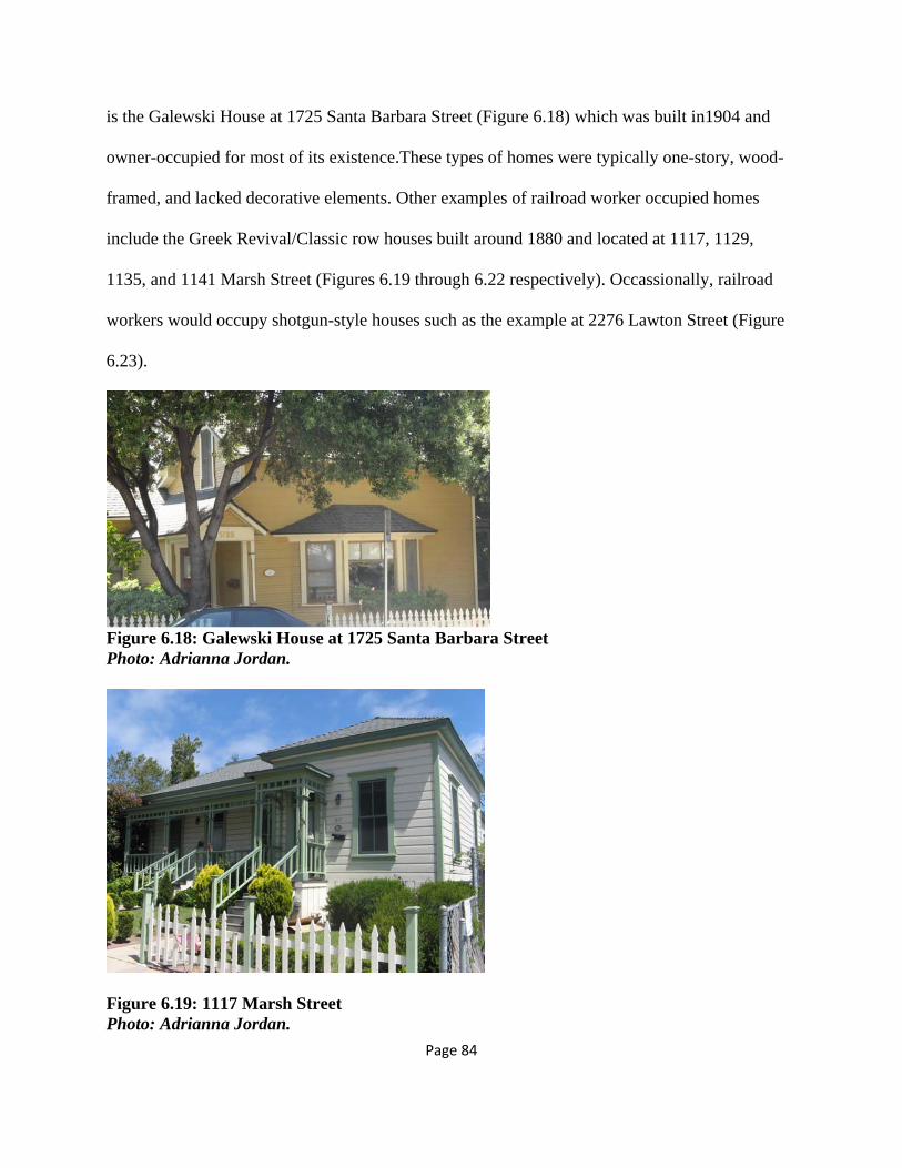
Page 84
is the Galewski House at 1725 Santa Barbara Street (Figure 6.18) which was built in1904 and
owner-occupied for most of its existence.These types of homes were typically one-story, wood-
framed, and lacked decorative elements. Other examples of railroad worker occupied homes
include the Greek Revival/Classic row houses built around 1880 and located at 1117, 1129,
1135, and 1141 Marsh Street (Figures 6.19 through 6.22 respectively). Occassionally, railroad
workers would occupy shotgun-style houses such as the example at 2276 Lawton Street (Figure
6.23).
Figure 6.18: Galewski House at 1725 Santa Barbara Street Photo: Adrianna Jordan.
Figure 6.19: 1117 Marsh Street Photo: Adrianna Jordan.

Page 85
Figure 6.20: 1129 Marsh Street Photo: Adrianna Jordan.
Figure 6.21: 1135 Marsh Street Photo: Adrianna Jordan.

Page 86
Figure 6.22: 1141 Marsh Street Photo: Adrianna Jordan.
Figure 6.23: Good example of a “shotgun” house at 2276 Lawton Street Photo: Adrianna Jordan.
This chapter shows how influential the railroad exports (agricultural products) and imports
(building materials) were on the population and character of the City of San Luis Obispo.
Chapter 7 takes a look at how the method of importing and exporting goods and people has
changed in the 20th century and debates whether the railroad can survive as a viable
transportation option in the 21st century.

Page 87
Chapter 7: Reflection on the Railroads The previous chapter concentrates on the railroad’s influence during the late 19th century and
how it permeated almost all aspects of everyday life for the citizens of the City of San Luis
Obispo. Earlier chapters touch on the unwanted environmental impacts of the railroad on the
early City of San Luis Obispo. Chapter 7 examines the role of the railroad in today’s society and
speculate on what the extent of its influence will be as we move through the 21st century and
consider re-embracing rail as a sustainable transportation solution.
7.1 Transportation Eras in San Luis Obispo The history of modern transportation can be broken up into four distinct periods of time1. The
first period of time is referred to as the “Walking-Horsecar Era” and lasted from 1800 to 1890.
Characterized by towns and cities that grew in an organic circular manner and were traversed by
foot, the Walking-Horsecar era ended around the time that the Southern Pacific arrived in the
City of San Luis Obispo.
The second period in modern transportation is referred to as the “Streetcar Era” and lasted from
approximately 1890 to 1920. It correlated with the height of railroad activity in the City of San
Luis Obispo. In response to the linear tracks of the railroads and streetcars, most American towns
and cities grew in spoke pattern during this time. In fact, the City of San Luis Obispo’s own
streetcar line (Figure 7.1), founded in 1887 by George P. Bell, began operations during this time
and connected up to the Southern Pacific railroad at the Ramona Hotel terminal. Unfortunately,
1 References for official transportation era names and dates retrieved on May 8th, 2011 from:
http://people.hofstra.edu/geotrans/eng/ch6en/conc6en/evolurbformna.html

Page 88
this period was short-lived due to the advent of the automobile and the third era of modern
transportation and by 1901 the streetcar line was already out of business (San Luis Obispo
History Center, n.d.).
Figure 7.1: Map of the San Luis Obispo Street Railway. Map courtesy of the San Luis Obispo History Center.

Page 89
Starting around 1920 and lasting until the second World War, the “Automobile Era” was marked
by the rise of the car and the demise of public transportation, in particular, “fixed rail” public
transportation such as streetcars and the railroads were most directly affected. In 1941, following
in the footsteps of the streetcar line decades before, the Pacific Coast Railway itself became
defunct. The great advantage of the automobile was that it opened up large areas of land that
were previously undevelopable because there was no reliable form of transportation available to
reach them. The downside of this was that demand for the fixed route systems diminished as the
local population dispersed across a wider area. By the end of the “Automobile Era”, the only
fixed route transportation system in the City of San Luis Obispo to survive was the Southern
Pacific Railroad.
The final stage in the evolution of modern transportation took place during the post-war era and
is commonly known as the “Freeway Era”. This era was especially hard on the railroads; the
freeways enabled the automobile to replace the low-cost long-distance travel that the railroads
typically provided to their passengers. Due to declining revenues, essentially all railway
passenger service in the United States was taken over by the federally owned Amtrak
Corporation immediately following its formation in 1971. Up until this point, the Southern
Pacific had been running the Coast Daylight train between Los Angeles and San Francisco. After
Amtrak’s consolidation of passenger rail service, the Coast Daylight was replaced by the Coast
Starlight which continues to run between Seattle and Los Angeles but has longer run times than
the Daylight between Los Angeles and San Francisco and is less reliable. Due to increasing
commuter pressure to have a faster, more reliable route with better station stop times, the Coast
Daylight is scheduled to resume service between Los Angeles and San Francisco around 2012.

Page 90
The Freeway Era is well-known for its booming suburbs that leap-frog across wide swaths of
undeveloped land. It also signaled a slight return to the linear configuration of urban
communities because most of the suburbs were located in a straight line from the core urban
center along the freeway. In the case of the City of San Luis Obispo, open space preservationists
were relatively successful in preventing excessive sprawl, although elements of sprawl are
detectable in the new southern suburbs of San Luis Obispo along South Broad Street and South
Higuera Street and west along Los Osos Valley Road; however, to a certain extent some sprawl
is inevitable as cities struggle to balance population growth and land conservation.
7.2 The Influence of the Airport on Land Use and Development
Arguably, a sub-era in the evolution of the City of San Luis Obispo could be considered the “Era
of Flight”. Although planes have existed since the Streetcar Era, the regional airport in San Luis
Obispo was not constructed until 1940. Passenger service did not begin until 1946, and a control
tower was not constructed until 1988. Much like the Southern Pacific, the San Luis Obispo
County Airport had a huge influence on land use in the city. Since its construction, almost all of
the new residential and commercial development has been located in the southern portion of the
city, relatively close to the airport. Additionally, due to Federal Aviation Administration
regulations, there is a large area of land in the county just outside of the city limits where
development is restricted because it is in the direct flight path of the airplanes. This swath of land
is prominently noticeable in the aviation safety map for the southern portion of the City of San
Luis Obispo (Figure 7.2).

Page 91
Figure 7.2: Aviation safety map of the southern portion of the City of San Luis Obispo. Courtesy of the San Luis Obispo Airport Land Use Plan (2011).
The flight path safety areas extend northwest in a diagonal band from the San Luis Obispo
County Airport, eventually crossing Tank Farm Road which was the site of a lightning strike in
1926 that ignited a fire resulting in ground contamination from leaking oil tanks on both the
north and south sides of Tank Farm Road. This severe contamination stymied development in the
area long before the airport further limited development of the land; however, Chevron is
currently taking steps to remediate the contamination and hopes to eventually build an office
park on the site (City of San Luis Obispo, 2009).

Page 92
7.3 The Union Pacific’s Continued Influence on Land Use in the
City
Much like the restrictions on development around the airport, certain historical restrictions
persist on the development of the land around the Union Pacific railroad tracks. For instance, the
Union Pacific owns a 100 foot right-of-way (50 feet on each side) centered over their tracks
through the City of San Luis Obispo. Anyone who enters the right-of-way is considered to be
trespassing on Union Pacific property and can receive a ticket with a hefty fine if caught by
Union Pacific Police. Obviously, this right-of-way issue has created land use conflicts in terms of
the bicycle path that runs adjacent to the tracks, as well as public uses such as exhibition spur
tracks associated with the forthcoming Railroad Museum.
7.4 The Rise of the Southern Pacific as a Freight Railroad
Although the Southern Pacific railroad started out carrying both freight and people, following the
transfer of passenger services in 1971, it concentrated exclusively on shipping freight. However,
the railroad could not easily compete with the geographic flexibility of the trucking industry, and
by the late 1980s, the Southern Pacific was in a state of financial insolvency. Due to this
financial instability, the Southern Pacific was taken over by Rio Grande Industries in 1988, but
continued to retain the brand name Southern Pacific for the rail route through the City of San
Luis Obispo. Following further financial troubles, the Southern Pacific was acquired by the
Union Pacific in 1996. It was during the following year in 1997 that the historic locomotive
turntable was demolished in the City of San Luis Obispo. It is worth speculating that the fresh
acquisition by Union Pacific was playing a substantial role in the dismantling of various

Page 93
Southern Pacific artifacts that had remained in the San Luis Obispo rail yard through the 1990s.
It is good business practice to “clean up” remnants of the acquired business if there is a
possibility that the remnants could create environmental issues; therefore, this may have been the
reasoning behind the Union Pacific’s dismantling of much of the remaining rail yard.
Today, Union Pacific hauls a variety of freight types. The Union Pacific California business mix
is: 49% intermodal, 17% agricultural products, 15% industrial, 10% cars, 7% chemical, and 2%
energy-related (Union Pacific, 2010).
7.5 The Future of Passenger Rail in the City of San Luis Obispo
As previously mentioned, the Coast Daylight is scheduled to resume service around 2012. When
the original Coast Daylight was taken over by Amtrak in 1971 it took approximately 10 hours to
travel from San Francisco to Los Angeles; however, due to the Union Pacific’s track monopoly
and lack of up-to-date track maintenance, when the Coast Daylight starts back up again it will
take approximately 12 hours to run between San Francisco and Los Angeles. Obstacles that
increase the running time for the new train include a lack of “sidings” along the route and
antiquated switching mechanisms.
Railroad “sidings” are the parallel tracks that a train can pull into to wait for a train running in
the opposite direction (that has the right-of-way on the track) to pass by. If there are not enough
sidings, that can substantially increase delays; this is especially true if the train running in the
opposite direction is already behind schedule. Caltrans is working with the Union Pacific to fund

Page 94
and build new sidings along the San Luis Obispo to Los Angeles route such as the under-
development “Ortega” siding which is located in Summerland, California just east of Santa
Barbara and the “Seacliff” siding just west of Carpinteria, California. In addition, although
automated track switching mechanisms exist, they are so prohibitively expensive that the Union
Pacific cannot afford to replace their antiquated manual track switching devices with automatic
track switching devices. Unfortunately, using old technology also increases track delays.
The new Coast Daylight cannot run without acquiring the appropriate rolling stock. For its
existing Surfliner route, Amtrak uses an EMD F59PHI diesel locomotive or as a backup a GE
P32-8WH (Dash8) diesel locomotives and “California” cars which are a variant of the Superliner
train cars. In addition, for its Coast Starlight route, Amtrak uses GE P42DC AMD-103 Genesis
series locomotives or GE P32-8 (Dash 8) locomotives as a back-up, and uses the Superliner cars
(Figure 7.3) to carry passengers. Furthermore, efforts are being made to secure new rolling stock
for the revived Coast Daylight train. In addition, it was announced on May 2, 2011 in the San
Luis Obispo Tribune that the Pacific Surfliner would also be replacing the single-level cars with
nine new double-decker cars by 2017 thanks to a grant from the Federal Railroad
Administration.

Page 95
Figure 7.3: Amtrak Coast Starlight Locomotive and Superliner Cars in San Luis Obispo Photo Courtesy of Wikipedia Coast Starlight (n.d.)
Eventually, through track and other operational upgrades, the new Coast Daylight trains will be
able to complete their trips in eight hours. At the moment, one train per day in each direction is
planned to run two hours earlier than the Coast Starlight so that each train will arrive at its
destination around 7 pm (Monterey Peninsula Information, 2011).
7.6 Sustainability and the Railroad
Although in recent decades the railroad’s competitive strength against more modern forms of
transportation such as cars, trucks, and planes has diminished, it is now poised to make a
comeback in light of concerns about climate change and the future of oil. Unlike cars or trucks
which have a limited capacity, railroads can typically transport very large numbers of people or
freight using relatively little energy. In addition, unlike planes, trains do not require an

Page 96
increasingly expensive and scarce fuel such as jet fuel to operate because modern trains can run
using either diesel fuel or electric locomotion.
The great disadvantages that trains have continue to be their limited geographic reach, their fixed
routes, and their low speed. Although there is very little that can be done about the former, the
California High Speed Rail will address the speed issue by competing directly with cars and
planes since it is expected to reach speeds up to 220 miles per hour when it is finished sometime
around 2026 (Cox and Vranich, 2008). Even though the City of San Luis Obispo is not located
along the proposed route for the new high speed train, regional transportation will still be shaped
by its presence through Amtrak buses that will most likely make runs out to the proposed
Hanford high speed rail stop in the Central Valley thus connecting the city with the high speed
rail. However, it stands to be seen whether ridership on Amtrak buses and trains will increase or
decrease due to the new train. If the new train merely pulls people off of the slower coast trains
without increasing state rail ridership overall, then the ridership through the City of San Luis
Obispo could actually decrease. Yet, if the new train attracts new riders that never previously
considered taking the train then activity at the San Luis Obispo station could actually increase.
Much of the speculation about ridership ultimately hinges on the price of gasoline. If prices
continue to rise, the bottom line is that more people will ride the train. The first segment of line
is proposed in the Central Valley because of the high volume of population that regularly
commutes into the large cities from the valley.
Recently, the Union Pacific began to re-brand itself as a kind of “green” transportation option
and they tout an impressive number of facts about the environmental advantages of using trains

Page 97
for hauling freight instead of trucks. Among them, one double-stacked train removes a
staggering 280 trucks from the roads, trains are nearly four times more fuel efficient than trucks,
trains emit 1/3 the amount of Green House Gases (GHGs) of trucks on a ton-mile basis, and
finally, trucks emit two to three times the amount of Nitrous Oxide (NOx) as trains on a ton-mile
basis (Union Pacific, 2010).
Obviously, trains are just as much of a sustainable option for passengers as they are for freight.
In 2007, the Amtrak Surfliner carried 2,685,194 passengers, or 136.1 passengers per mile and
eliminated almost two million inter-city car trips (California Department of Transportation,
2008). In turn, the elimination of these car trips leads to large-scale reductions in GHG emissions
including carbon dioxide, methane, nitrous oxide, and ozone.
The positions of Amtrak and the Union Pacific are further strengthened by recent California
legislation including Assembly Bill (AB) 32 and Senate Bill (SB) 375. AB 32 deals directly with
climate change and it mandates a reduction in Green House Gases (GHGs) to 1990 levels by
2020. SB 375 is intended as an implementation tool for AB 32 and requires communities to
prepare Sustainable Community Strategies (SCS) documents that show a balance and nexus
between land use and transportation. The centralized nature of railroads will likely elevate their
profile as part of the strategy to better connect land use and transportation and subsequently
lower GHGs by reducing car and truck trips through increased passenger rail and freight rail use.
The role that railroads can play in the future as they re-create their public image as a “green”
form of transportation benefitting the environment is exciting. Chapter 8 continues the discussion

Page 98
of branding the experience of the railroad but concentrates on branding as it relates to tourism
rather than sustainability; however, it also highlights sustainable modes of transportation that are
new to the Railroad District and easily accessible to tourists and locals alike.

Page 99
Chapter 8: A Conceptual Plan for the Future Role of Railroads in the City of San Luis Obispo The prior chapter demonstrates that railroad companies are savvy enough to re-market
themselves as sustainable transportation providers. This last chapter provides an overview of the
creative development tools available to help energize efforts to re-market the historic Railroad
District as a tourist destination. The chapter also includes a discussion of how other locations
with similar amenities have reached their full potential as niche railroad tourist towns.
8.1 Tourism in Today’s City of San Luis Obispo Scenically situated between the ocean and the mountains, the City of San Luis Obispo has few of
the type of urban tourist attractions that typically make hub cities economically successful, yet it
remains a regional tourist destination stemming from the time period of the luxurious Ramona
Hotel. There are no major parks and no major public cultural facilities, with possible exception
to the Christopher Cohen Performing Arts Center. Nonetheless, the mild climate, scenic beauty,
Pacific Ocean, historic mission, local wineries, and quaint downtown make it a popular regional
weekend destination. Adding to these assets, the City of San Luis Obipo benefits from a railroad
yard in remarkably good condition. Therefore, it would be beneficial to market the historical
transportation assets as a cornerstone of the tourism-based local economy.

Page 100
Figure 8.1: The Jennifer Street Bridge in the Railroad District Photo: Adrianna Jordan. The ongoing revitalization of the railroad district (Figure 8.1) is a key component in the
preservation of the city’s historic resources, and in the quest to increase visitors to the area. The
development of the Railroad Museum (Figure 8.2) is anticipated to provide the district with a
cultural hub and greatly increase niche tourism due to a new influx in railroad-enthusiast related
and educational-group related tourism. In addition, in order to channel visitors between the
downtown and the railroad district, it is advisable to strengthen physical links between the
Railroad Museum and the County Historical Museum (Figure 8.3). If a tourist is interested in
visiting one of these places they may benefit from visiting the other one as well because both
museums showcase local history.
Figure 8.2: The Historic Freighthouse Building that will House the Railroad Museum Photo: Adrianna Jordan.

Page 101
Figure 8.3: The San Luis Obispo County Historical Museum Photo: Adrianna Jordan.
Certain civic organizations such as Heritage Shared have been quite active in publishing tourist
guides detailing historic walking or biking tours including a tour focusing the railroad.1
Additional tour ideas to connect the downtown and the Railroad District include the potential for
a bicycle tour focusing on sustainable businesses which could start in the Railroad District at a
bicycle rental facility.
In addition to creating linkages between the downtown and the Railroad District, a fully
integrated City of San Luis Obispo railroad history tourist circuit would not be complete without
a connection to Port San Luis and the historic Harford Pier and remnants of the Pacific Coast
Railway. Possibly, the uncompleted Bob Jones Trail could serve as the main pedestrian and
bicycle connection between the city and the pier and perhaps a tour guide could be created for
this area pointing out Pacific Coast Railway historic resources. Port San Luis has recently
1 Most of the Heritage Shared guides were published by Bruce Collier and Dick Miller. Barbara Machalo and Astrid
Gallagher are the contacts for the group at (805) 549-9283 and (805) 549-9283, respectively.

Page 102
undergone a much-needed revitalization effort and now boasts extensive educational signage as
well as new public art that highlights the importance of the railroad to the region (Figure 8.4).
Figure 8.4: New public art at Port San Luis highlighting the Pacific Coast Railway Photo: Adrianna Jordan.
8.2 The Railroad District Revitalization Plan Adopted in 1998, the Railroad District Revitalization Plan, which won an award from the
American Planning Association (APA) in the “small cities” category, has been very successful in
its implementation. In the time that has elapsed between the adoption of the plan and today, the
Jennifer Street Pedestrian and Bicycle Bridge has been constructed and now links the Terrace
Hill neighborhood to the downtown; the memorial sculpture to the Chinese railroad workers was
erected; the Park Hotel has been restored; surface vehicular parking has been increased, bicycle
racks have been installed, the Railroad Safety Trail was developed, the Railroad Museum moves
closer to its grand opening, and the Coast Daylight route prepares to resume service. In addition
to providing a kind of blueprint for long-term development of the area, the plan also emphasized
the preservation of the area’s architectural character. The success of the architectural design
guidelines is on display in district buildings such as the Iron Horse Station built by Rarig
Construction in 1998 (Figure 8.5).

Page 103
Figure 8.5: An Example of the Railroad Vernacular Architectural Style in the Railroad District Photo: Adrianna Jordan. The Railroad District Revitalization Plan “Opportunities and Constraints” section refers to
“underused” street and railroad frontage adjacent to Santa Barbara between High and South
Streets. This creates an unappealing landscape for pedestrians because buildings are set far back
from the street, parking lots are located in the front or sides of shops, and there are numerous
curb cuts. The recapturing of this “underused” street frontage through the creation of shared rear
parking lots, elimination of curb cuts, and the development of new commercial pads with “build
to” or “maximum” front setbacks could act as an energizing catalyst for expanding the district,
creating a walkable area, and linking it to adjacent neighborhoods. Additionally, according to the
city’s old Opportunities and Constraints map from 1998, there is a concern regarding noise and
lighting sensitivity for the residential neighborhoods north of the Railroad District and any future
developments, especially those oriented towards tourists, will need to address this issue in a
sensitive manner.
8.3 Potential for Economic Growth The potential for tourism and green industry-oriented economic growth in the Railroad District is
well-documented in both the city’s award-winning Railroad District Historic Plan and the

Page 104
Railroad Museum Master Plan. In addition, as part of the research for this project, a detailed
updated SWOT (Strengths, Weaknesses, Opportunities, and Constraints) analysis was conducted
and the results were graphically rendered on an “Opportunities and Constraints” map (Figure
8.6). Prior to this effort, the last SWOT analysis had been conducted in 1998 as part of the
Railroad District Historic Plan, and over the last 15 years extensive physical, economical, and
political changes have occurred which necessitated the creation of a new SWOT analysis.
Figure 8.6: Opportunities and Constraints Map Graphic: Adrianna Jordan.
A summary of the Railroad District strengths, weaknesses, opportunities, and threats is as follows:

Page 105
STRENGTHS
Well-preserved historic rail yard resources such as the art deco Amtrak Station (1942), Southern Pacific water tower (1940), Southern Pacific Transportation/REA Express Building (early 1900s), and the Railroad Museum/Southern Pacific freight warehouse building (1895).
Well-preserved historic architecture within the Railroad District: Park Hotel (1906), Railroad Square Building (1912), Alano Club Building (1912), Call/Parkview Hotel (~1886), Duff House (1901), Galewski House (1904), Tribune-Republic Building (1873), Del Monte Grocery (1922).
Designated City of San Luis Obispo Parking District with ample public parking.
Jennifer Street Bridge connects Railroad District to residential neighborhoods across the railroad tracks.
Public art (Chinese Railroad Worker Memorial).
Well-integrated with bicycle infrastructure and circulation (Railroad Safety Trail and specialized bicycle signal at intersection of Santa Barbara and Amtrak parking lot).
District is well-landscaped.
Multi-modal transit hub for the city (Amtrak trains and buses, Greyhound buses, SLO Transit buses, RTA buses).
Central Coast Railroad Festival.
Railroad Museum.
New coffee shop (Sally Loo’s) just opened up around the corner from the Amtrak Station.
Well-established Café Roma restaurant across from the train station.
Railroad District affords scenic views of the surrounding landscape.
Good District branding and signage.
WEAKNESSES
Vacant storefronts/lack of businesses to attract tourists (Park Hotel, Railroad Square).
No decent all-ages lodging in the vicinity of the Amtrak Station. The existing Hostel caters primarily to young adults.

Page 106
Alano Club is an incompatible use for the Railroad District.
Visible evidence of soil contamination near the roundhouse foundations.
Lack of historic signage in the District makes it difficult for visitors to decipher the area’s historic resources.
The area between the Amtrak Station and the Railroad Museum lacks sufficient street furniture and in particular – benches.
There are maintenance issues with some existing streetscaping. For instance, the brick paving under the bench at the corner of Osos Street and Santa Barbara is being destroyed by tree roots.
Some historic buildings in the District are becoming dilapidated.
Osos Street between Santa Barbara and the railroad right-of-way lacks appropriate pedestrian-scaled street lighting.
OPPORTUNITIES
Railroad District is easily accessible by car, foot, bicycle, train, or bus, and is located in the center of the City of San Luis Obispo.
Amtrak station is serviced by both the Coast Starlight and the Pacific Surfliner passenger trains. Additionally, the Coast Daylight will resume passenger service between San Francisco and Los Angeles in 2011.
Potential to extend Monterey Street tourist trolley loop from the Mission down to the Amtrak Station and the Railroad Museum.
Restored Roundhouse could serve as a small business incubator for the city.
District should capitalize on existing bicycle circulation by creating a “bike station” with bicycle rentals in the District.
THREATS
Current economic conditions/lack of funding opportunities.
Union Pacific Railroad does not appear to be interested in preserving its history in the San Luis Obispo area.
Transient encampments along rail right-of-way.
Railroad District is not very well-integrated with the historic downtown area.
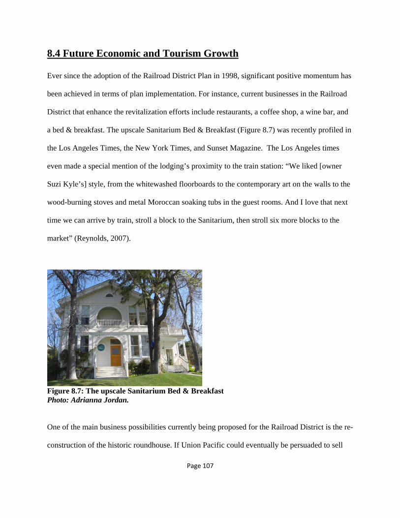
Page 107
8.4 Future Economic and Tourism Growth Ever since the adoption of the Railroad District Plan in 1998, significant positive momentum has
been achieved in terms of plan implementation. For instance, current businesses in the Railroad
District that enhance the revitalization efforts include restaurants, a coffee shop, a wine bar, and
a bed & breakfast. The upscale Sanitarium Bed & Breakfast (Figure 8.7) was recently profiled in
the Los Angeles Times, the New York Times, and Sunset Magazine. The Los Angeles times
even made a special mention of the lodging’s proximity to the train station: “We liked [owner
Suzi Kyle’s] style, from the whitewashed floorboards to the contemporary art on the walls to the
wood-burning stoves and metal Moroccan soaking tubs in the guest rooms. And I love that next
time we can arrive by train, stroll a block to the Sanitarium, then stroll six more blocks to the
market” (Reynolds, 2007).
Figure 8.7: The upscale Sanitarium Bed & Breakfast Photo: Adrianna Jordan.
One of the main business possibilities currently being proposed for the Railroad District is the re-
construction of the historic roundhouse. If Union Pacific could eventually be persuaded to sell

Page 108
the land (Figure 8.8) for a reasonable price, a reconstructed roundhouse could serve as a great
space for innovative businesses in much the same way as the old Channel Commercial building
houses small businesses today.
Figure 8.8: The Site of the Demolished Southern Pacific Steam Locomotive Roundhouse Photo: Adrianna Jordan. Architectural components of the reconstructed roundhouse could also be open to the public for
educational and railroad enthusiast tour groups, and portions of the structure could be used for
the storage of Railroad Museum rolling stock. Additional land uses that could do well in the
district include the adaptive re-use of old warehouses (Figure 8.9) into artists’ live/work lofts, a
model train store, the conversion of the Union Pacific security force office structure into a
coffee/magazine shop, or a bicycle rentals shop (Figure 8.10). Also, although a successful Bed &
Breakfast already exists in the Railroad District, it is high-end and therefore unaffordable for the
average family. Given that the Railroad Museum anticipates that middle-class families across
California will take their children to the museum, there may be an untapped niche for a mid-
market family-oriented Bed & Breakfast in the Railroad District at the corner of Santa Barbara
and Upham.

Page 109
In addition to commercial enterprises, the district will attract and keep tourists coming back if it
mandates a healthy public art program. Possible means of including public art in the district
could be to commission 3rd, 4th, 5th year, and graduate Cal Poly students studying in artistic fields
to design street furniture such as bicycle racks and information kiosks that double as public art
that capitalizes on the theme of the railroad.
Figure 8.9: Old Sears Warehouse in the Railroad District Photo: Adrianna Jordan.
Figure 8.10: Existing Short-Term Bicycle Parking in the Railroad District Photo: Adrianna Jordan.
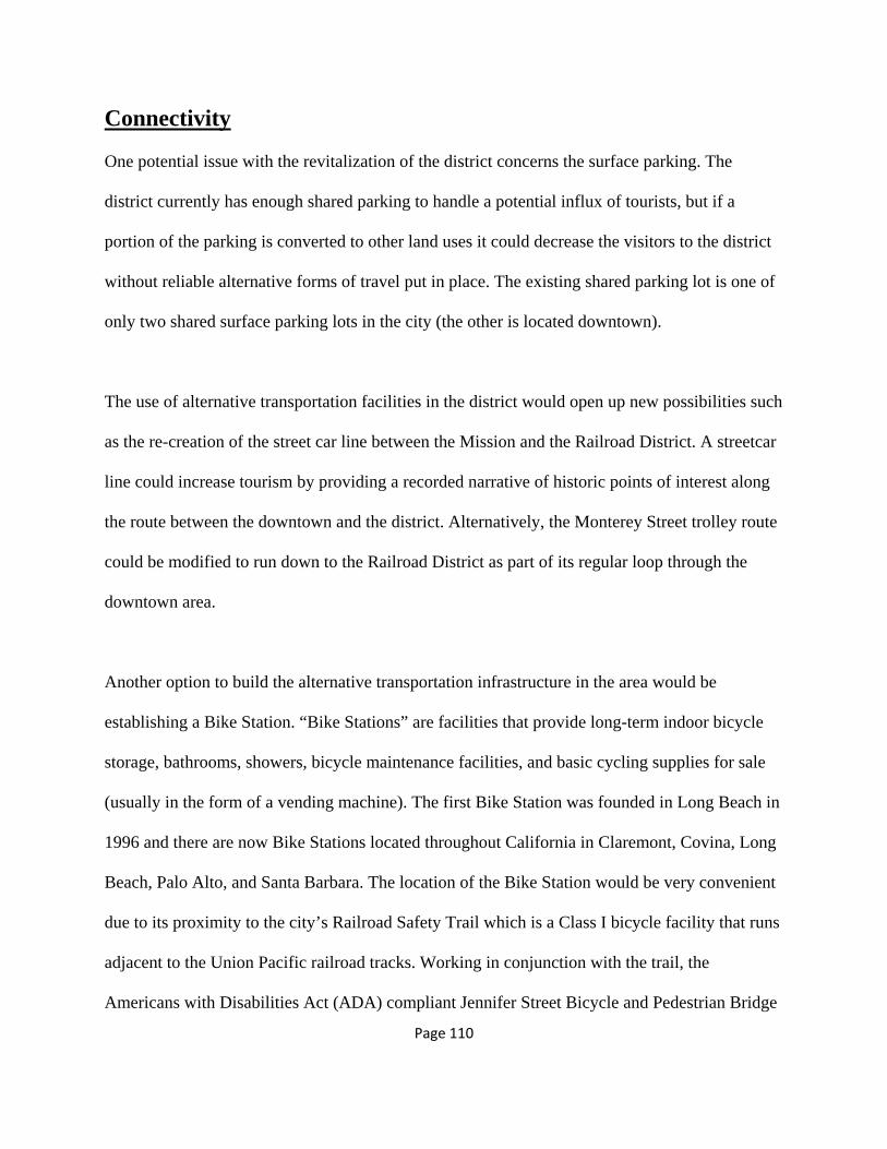
Page 110
Connectivity One potential issue with the revitalization of the district concerns the surface parking. The
district currently has enough shared parking to handle a potential influx of tourists, but if a
portion of the parking is converted to other land uses it could decrease the visitors to the district
without reliable alternative forms of travel put in place. The existing shared parking lot is one of
only two shared surface parking lots in the city (the other is located downtown).
The use of alternative transportation facilities in the district would open up new possibilities such
as the re-creation of the street car line between the Mission and the Railroad District. A streetcar
line could increase tourism by providing a recorded narrative of historic points of interest along
the route between the downtown and the district. Alternatively, the Monterey Street trolley route
could be modified to run down to the Railroad District as part of its regular loop through the
downtown area.
Another option to build the alternative transportation infrastructure in the area would be
establishing a Bike Station. “Bike Stations” are facilities that provide long-term indoor bicycle
storage, bathrooms, showers, bicycle maintenance facilities, and basic cycling supplies for sale
(usually in the form of a vending machine). The first Bike Station was founded in Long Beach in
1996 and there are now Bike Stations located throughout California in Claremont, Covina, Long
Beach, Palo Alto, and Santa Barbara. The location of the Bike Station would be very convenient
due to its proximity to the city’s Railroad Safety Trail which is a Class I bicycle facility that runs
adjacent to the Union Pacific railroad tracks. Working in conjunction with the trail, the
Americans with Disabilities Act (ADA) compliant Jennifer Street Bicycle and Pedestrian Bridge

Page 111
provides connectivity between downtown San Luis Obispo and the Terrace Hill residential
neighborhoods located above the Union Pacific railroad tracks.
Additionally, Fun Ride has recently opened up in the Railroad District. Fun Ride is a car-sharing
organization that allows members to pay a yearly fee to have access to cars that are strategically
positioned around the City of San Luis Obipo. When a member checks out a car they pay for it
on an hourly basis and the car insurance is included in the hourly fee.
Yet another use that might do well in the district, or might be a good attraction to have at
Thursday’s weekly downtown Farmers’ Market is a “kiddie train” (Figures 8.11 and 8.12). A
“kiddie train” at the market could act as a kind of advertisement for the district and the Railroad
Museum, and perhaps it could even make special runs back and forth between the downtown and
the museum.
Figures 8.11 and 8.12: Two examples of “kiddie trains” Courtesy of Fun City Amusements (2011) and BMI Gaming (2011).
In the past, there was once a route created by the Chamber of Commerce called the Path of
History Walking Tour. Although no longer maintained, it could be an option to connect the

Page 112
district to the former Path of History Walking Tour which is two miles long and takes
approximately two hours to walk. It previously followed a green line through the city that used
signage to highlight the Chamber’s program and the Historical Society’s Information. Despite
the fact that the green line does not exist anywhere, the Chamber’s Path of History Walking Tour
still appears on the visitslo.com website and in the Chamber’s Visitor Guide.
According to the City’s 1998 Opportunities and Constraints map, additional options for
increasing connectivity within the Railroad District include possible pedestrian and cyclist
connections over the Union Pacific Railroad at Penny Lane and at Lawrence Street, and a
possible east-west street connection at Bishop Street. Finally, according to the same map,
connectivity would be improved if street circulation was altered and traffic volumes more
appropriately managed on Santa Barbara Street.
Case Studies An important component of developing a plan for increasing growth and tourism in the railroad
district was to review case studies of other notable railroad districts around the United States
and to discover what types of development, infrastructure, and urban design worked best at
increasing tourism. The results of the case study research are listed in Table 8.1.

Page 113
Table 8.1: Railroad District Case Studies
Location Pop. Size (2000 census)
District Name Date of Revitalization
Main Attraction
Misc. Info
Ann Arbor, MI
114,024 n/a 1970 Gandy Dancer Restaurant (in former depot)
Original brick streets
Ashland, OR
19,522 Historic Railroad District
1999 Railroad Museum, Art Galleries
Restaurants
Chicago, IL 2.8 million
Beverly/Morgan Historic Railroad District
1995 Commuter Rail Stations
n/a
Clovis, NM 37,213 Historic Railroad District
proposed Farmers’ Market, historic locomotive
Historic residential buildings
Flagstaff, AZ
60,222 Historic Downtown/Railroad District
Currently undergoing revitalization
Historic depot/visitor’s center
n/a
Grapevine, TX
42,101 Cotton Belt Historic Railroad District
1992 Historic depot/museum
Blacksmith’s shop, Farmers’ Market
Jamestown, CA
3,017 Railtown 1897 State Historic Park
1992 Preserved Sierra Railway and locomotive and rolling stock
locomotive roundhouse, machine shop, and movie paraphernalia
Pittsburgh, PA
334,563 Station Square 1976 Restaurants, entertainment, and hotel in historic buildings
“waltzing waters fireworks” fountain
Richmond, IN
39,124 Railroad Station Historic District
1987 Pennsylvania Railroad Station
Architecturally significant 19th & 20th century

Page 114
buildings
Sacramento, CA
407,018 Old Sacramento 1976 (museum) California State Railroad Museum
Historic locomotives
Santa Rosa, CA
161,496 Railroad Square Historic District
1979 Shopping, restaurants, & entertainment
n/a
Sheridan, WY
15,804 Historic Railroad District
2004 Sheridan Inn Architecturally significant 19th & 20th buildings
Springfield, MA
154,082 Downtown Railroad District
1983 Transportation/ Architectural significance
n/a
Surprisingly, the success of the various districts appears to have very little to do with the
population of the area, as the case study city size varies widely from 3,000 to three million
people. Looking more closely at the towns that are similar in size to San Luis Obispo, a pattern
emerges with respect to the scope of the revitalization that these towns pursued. In particular,
most of the medium-sized towns such as Ashland, Clovis, Flagstaff, and Grapevine concentrated
on a themed catalyst project such as a display of railroad artifacts and memorabilia. Some
districts then expanded on this by encouraging tourist-serving commercial enterprises centered
on the catalyst project such as art galleries and restaurants. Researching the case studies also
unveiled excellent examples of the adaptive re-use of buildings constructed in the Railroad
Vernacular style such as in Old Sacramento and Ashland, although in some historically wealthier
areas east of the Mississippi the railroad buildings made use of the more distinguished heavy
masonry style iconic to H.H. Richardson’s architecture and therefore coined “Richardsonian”.

Page 115
The old depot building in Ann Arbor Michigan is one example of a Richardsonian railroad
structure and now houses the popular Gandy Dancer restaurant.
The Railroad History Tour As first mentioned in the beginning of this chapter, one of the primary strategies for encouraging
more tourism in the Railroad District will be to create movement between the downtown and the
district and, more particularly, between the County Historic Museum and the Railroad Museum.
A major way of facilitating this movement is to design a tour route between the two destinations
that highlights points of history along the way. Given that people of all ages and physical
abilities will want to visit the museums and their respective districts, three versions of the route
have been designed based on the various modes of transportation available. The proposed tour
route is shown in Figure 8.13:

Page 116
Figure 8.13: Proposed Tourist Routes Map: Adrianna Jordan.

Page 117
Chapter 9: Conclusion The railroads have played an integral role in shaping both the fate and the physical landscape of
the City of San Luis Obispo over the last 150 years. Although the heyday of rail as an economic
driver in the city has come and gone, San Luis Obispo’s Railroad District, with the award-
winning Railroad District Plan for its place-making guide, is poised for continued revitalization.
Public and commercial entities such as the Amtrak Station, the Railroad Museum, the Park Hotel
building and its restaurants, and the Railroad Square Channel Commercial Building anchor the
district and serve as pulse points of activity for locals and tourists alike. In addition, the Railroad
District’s excellent pedestrian and bicycle connectivity helps to link it with the rest of the city
and channels people to it.
Given the present concern over greenhouse gas (GHG) emissions from motor vehicles, rising
fuel costs, shortages of oil, and the centralized land-use patterns popular in New Urbanism and
required by SB 375, it is possible that the railroad, or some other form of fixed rail public
transportation might once again become a preferred mode of long-distance transport to the major
metropolitan areas south and north of the city and beyond. If California does succeed in
investing in a high speed train between San Francisco and Los Angeles, perhaps a connection
into that corridor might be worked out.

Page 118
In the 21st century there is a potential for both passenger and freight traffic to experience some
shifts away from gasoline-powered modes of transport1. If and when that happens, the Railroad
District in the City of San Luis Obispo may be in an excellent position to benefit from it.
However, if it does not, given the growth of the city towards the airport in the south, the district’s
increasingly central location will create opportunities for both tourism-led, and innovative,
and/or light-industrial economic growth. In the Railroad District, the charm and nostalgic
connection to the history and architectural fabric of the past, as well as its strategic location for
growing knowledge-based industries of the future, seems promising and worthy of investment.
1 Passenger train service to the city of San Luis Obispo has increased in the past two decades from one through train daily in each direction between Los Angeles and Seattle (Coast Starlight) to include a regional train from Los Angeles to San Luis Obispo, and a train in each direction between San Diego and San Luis Obispo. "From 2000 to 2006 total ridership on both train services increased from 94,500 to 109,469 (15.8%). During this time, ridership on the Coast Starlight fell 24,000 (43.6%) from 55,000 to 31,000 due to track outages in Northern California, and track problems in Oregon and Washington. Ridership on the Pacific Surfliner increased 100%, from 39,000 to over 78,000, due in part to the addition of a second train in 2004" (San Luis Obispo Council of Governments, 2010).

Page 119
References
Atascadero News (1916). The Old Stage Road. Atascadero, CA: Atascadero News.
Best, G. M. (1964). Ships and Narrow Gauge Rails: The Story of the Pacific Coast Company. Berkeley, CA: Howell-North.
BMI Gaming (2011). Union Pacific Train Kiddie Amusement Ride. Retrieved from http://www.bmigaming.com/games-kiddie-rides-mall-trains.htm
California Department of Transportation (2008). California State Rail Plan 2007-08 to 2017-18 (2008). Sacramento: Author.
Cambria Chamber of Commerce (2010). A Brief History of Cambria. Retrieved from http://www.cambriachamber.org/history.php
City of San Luis Obispo (2001). Mid-Higuera Street Enhancement Plan. Retrieved from http://www.slocity.org/communitydevelopment/download/Mid-HigueraPlan.pdf
City of San Luis Obispo (2009). Planning Commission Staff Report Item #1. Retrieved from http://www.slocity.org/communitydevelopment/plancom/Staff%20Reports/0729091.pdf
City of San Luis Obispo (1998). Railroad District Plan. San Luis Obispo: Community Development Department. Retrieved from http://www.sanluisobispo.com/2011/07/20/1689026/changes-to-lanes-on-johnson-avenue.html
Cornejo, A.M. (2011). Changes to lanes on Johnson Avenue in SLO are approved. San Luis Obispo Tribune.
County San Luis Obispo (2011). County of San Luis Obispo Airport Land Use Plan. San Luis Obispo County Planning and Building.
County of Santa Barbara Planning and Development Energy Division (2005). Brief Oil and Gas History of Santa Barbara County. Retrieved from http://www.countyofsb.org/energy/information/history.asp
Cox, W. and Vranich, J. (2008). The California High Speed Rail Proposal: A Due Diligence Report. Los Angeles: Reason Foundation.
Davis, E.A. (1914). Davis’ Commercial Encyclopedia of the Pacific Southwest: California, Nevada, Utah and Arizona. Oakland: Ellis A. Davis.
Franks, J. (2004). San Luis Obispo: A History in Architecture. San Francisco: Arcadia Publishing.

Page 120
Fun City Amusements (2011). Trackless Train. Retrieved from http://www.funcityusa.net/mechanical_rides/Mechanical-Bigl---8.jpg
Haggard, K.& Scholl E. (2008). A Brief Architectural History of San Luis Obispo County. San Luis Obispo, CA: Central Coast Publishing.
Heritage Shared (1998). Chinese San Luis Obispo. Retrieved from http://www.heritageshared.org/docs/chinese.html
Heritage Shared (2011). Living on the Land Tour. Retrieved from http://www.heritageshared.org/docs/livinglandtour1.html
Heritage Shared (2011). Random Image Photo Gallery. Retrieved from http://www.heritageshared.org/docs/gallery/ahlouisstore_front.html
Hess, C.N. (1934). What California Means to its Oldest Living Chinese: 1934 Interview with Ah Louis. Westways, 26 (3). Retrieved from: http://historyinslocounty.org/Oldest%20Living%20Chinese.htm
The Historical Marker Database (2011). The Ramona Hotel Depot. Retrieved from http://www.hmdb.org/marker.asp?marker=38457
History in San Luis Obispo County (2001). The Sinsheimer Bros. Store. Retrieved from http://historyinslocounty.org/Sinsheimer%20Brothers%20Store.htm
Hubbard, J. (1989). Early History Sailed Around Cave Landing. Five Cities Times-Press-Recorder.
Knowles, R. (1999). The Solar Envelope. University of Southern California. Retrieved from http://www-bcf.usc.edu/~rknowles/sol_env/sol_env.html#anchor 474313
Krasner-Khait, B. (2003). The Impact of Refrigeration. History Magazine, February/March. Retrieved from http://www.history-magazine.com/refrig.html
Krieger, D. (1989). Looking Backward into the Middle Kingdom: San Luis Obispo County. Northridge, CA: Windsor Publications.
Krieger, D. (1998). War Comes to the Middle Kingdom, 1939-1942. Los Osos, CA: EZ Nature Books.
Landwehr, L. (2001). The Sinsheimer Bros. Store. History in San Luis Obispo County. Retrieved from http://historyinslocounty.org/Sinsheimer%20Brothers%20Store.htm
Miossi, H. (n.d.). Singular Crossing – the Historic Dimensions of Cuesta Pass.

Page 121
Monterey Peninsula Information (2011). Salinas Commuter Service and the Coast Daylight. Retrieved from http://www.montereypeninsula.info/delmonte/caltraindaylight.html
Nicholson, L. (1980). Rails Across the Ranchos. Fresno, CA: Valley Publishers.
Pacific Reporter 199 (1921). St. Paul: West Publishing
Parsons, G. L. (1995). Port San Luis: Trials and Tribulations 1855 to 1995. San Luis Obispo, CA: Author.
Reynolds, C. (2007). In the Market for Local Color. Los Angeles Times. Retrieved from http://www.latimes.com/travel/la-trw-slo27may27,0,2960446.story
Rice, W. (2006). San Luis Obispo’s Other Railroad. SLO County Journal.
San Luis Obispo Council of Governments (2010). Maximizing System Efficiency – Transportation Demand Management/Transportation System Management (TDM/TSM). San Luis Obispo, CA: Author.
San Luis Obispo County History Center (n.d.). San Luis Obispo Street Railway System.
San Luis Obispo County History Center (2010). The Farmers’ Alliance and Industrial Union museum exhibit booklet.
San Luis Obispo Fire Department (1904). Souvenir of San Luis Obispo. San Luis Obispo, CA: Tigner.
San Luis Obispo Morning Tribune (1905). Obituary of Dr. G. B. Nichols. San Luis Obispo Tribune.
San Luis Obispo Railroad Museum (n.d.). Master Plan for the San Luis Obispo Railroad Museum. San Luis Obispo: Author.
South County Historical Society, Arroyo Grande, CA. Retrieved from: http://www.southcountyhistory.org/
State of California Department of Fish and Game (2009). Pismo Creek/Edna Area Watershed Management Plan. Arroyo Grande, CA: Author.
Union Pacific (2010). Caltrans Briefing. Roseville, CA: Union Pacific.
US Gen Net (2011). Township and Range. Retrieved from http://www.usgennet.org/usa/ok/county/muskogee/cemeteries/trro.html
Page 122
US National Archives (2011). Retrieved from http://www.archives.gov/exhibits/powers_of_persuasion/use_it_up/images_html/ride_with_hitler.html
Westcott, K.E. and Johnson, C.H. (1998). The Pacific Coast Railway: Central California’s Premier Narrow Gauge. Los Altos, CA: Benchmark Publications Ltd.
Wikipedia Amtrak. (n.d.) Retrieved May 13, 2011 from http://en.wikipedia.org/wiki/Amtrak
Wikipedia Coast Starlight. (n.d.) Retrieved May 13, 2011 from http://en.wikipedia.org/wiki/Coast_Starlight