Embed Size (px)
Citation preview
THE HONG KONG INSTITUTE OF SURVEYORS
LAND SURVEYING DIVISION
RESEARCH REPORT
2017
Pilot Study on the Land Survey Law and Regulations among “Belt
and Road” Countries
Principal Investigator : Sr Dr Conrad Tang
Sri Lanka cadastral system reported by Dr Homindra Divithure
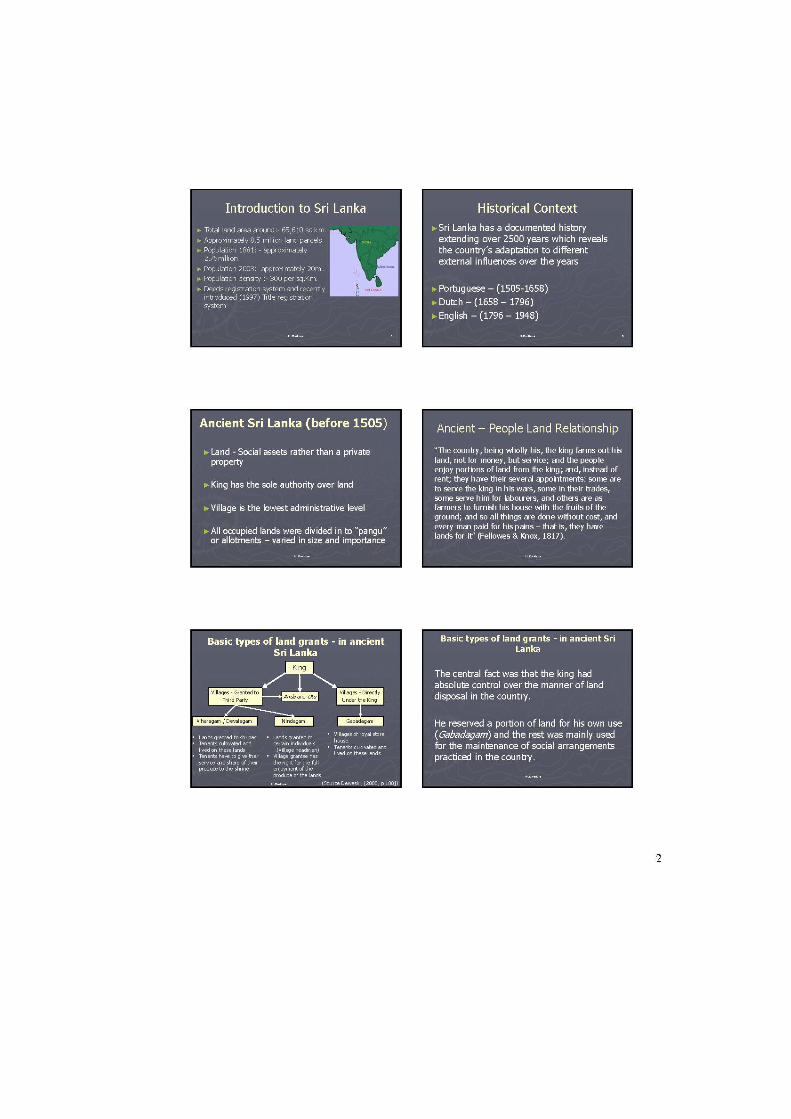
1. PROJECT BACKGROUND
The scheme of Belt and Road is China’s national strategy on the connectivity and cooperation
among involved countries. Facilities connectivity is one of the five key major goals of the
Belt and Road initiatives. Many of Belt and Road countries are emerging markets and
developing countries. Infrastructure development will form the first phase of the Belt and
Road Initiative. Land surveying technology and services in supporting infrastructure
development is indispensable in construction projects. Hong Kong equips world-class
architectural, surveying and engineering services companies to provide a full range of
services in the Belt and Road initiatives.
Observing survey laws and following relevant regulations are the fundamental rules for land
surveying professional services and business. And, cadastre varies from country to country.
Giving the opportunities of exploring the surveying markets in the OBOR countries,
immediately there is a lack of information on the survey law and regulations among these
jurisdictions. In addition, there is no conceptual framework to structurally illustrate
jurisdictional legal and institutional land survey requirements for the purpose of business
among Belt and Road countries. To deliver land survey services outside Hong Kong, local
land survey professionals need to have the knowledge on relevant law and regulations in
advance. Most of involved Belt and Road countries are developing countries and many of
them do not use English or Chinese as their official language. There are industrial needs to
gain some referenceable “Need-to-Know” information on different land survey law and
regulations among Belt and Road countries.
In 2018, the Hong Kong Institute of Surveyors received a project budget of two million Hong
Kong dollars from the Professional Services Advancement Support Scheme Secretariat of the
Hong Kong SAR Government. And, the project included Kazakhstan, Pakistan and Sri Lanka
as the target visiting countries with Peoples Republic of China as the hub of the project. In
this report, the cadastral system information to the three visiting countries as well as their
current cadastral survey operation and its professional and personnel system are the aims of
study.
Dr Homindra Divithure, Senior Lecturer of the Department of Surveying and Geodesy, Faculty
of Geomatics, Sabaragamuwa University of Sri Lanka (Email: [email protected]),
provides a detailed introduction to the cadastral system and surveying profession in the country.
As proposed in the HKIS PASS project, Dr Homindra Divithure would present the findings on
the cadastral development issues of Sir Lanka to the members of HKIS in Hong Kong. During
the period of 2019 and 2020, Hong Kong, like the rest of the world, is affected by COVID19.
The written report is recorded below. And, Dr Divithure appeared on the HKIS Workshop on
Web “Sharing of the Latest Market Requirements: Practicing Qualification, Procedure,
Applications, Market Opportunities in Belt and Road Countries: China, Sri Lanka, Pakistan
and Kazakhstan” on 5 September 2020. His PowerPoint presentation is attached in Appendix
1.
2. CADASTRAL SYSTEM AND SURVEYING PROFESSION IN SRI LANKA
Sri Lanka has two types of cadastral system operating in the country and is in the process of
cadastral system migration from deeds registration to titles registration. The deeds system,
which was introduced in 1863, is well established, and the titles registration system, which
introduction is on-going, was initiated in 1998.
There is no universally accepted or unique cadastral system in the world. Every country has its
own cadastral system (Williamson, 1985), (Steudler & Kaufmann, 2002). Both the deeds
registration system and the cadastral surveying system in Sri Lanka are the direct results of the
twofold land policy of British Ceylon (1796 – 1948). Although both systems have long been
in place, they are not able to address the present land administration needs of the country. The
deeds registration system has several drawbacks, such as low efficiency and ineffectiveness.
On the other hand, the cadastral system fails because of incomplete land ownership information.
In 1998, the Sri Lankan government introduced the land titles registration and cadastral survey
programme as a remedy for the above problems. Unfortunately, the programme has not lived
up to the expectations since its inception. Now, the well-established deeds system is incapable
of catering for the land administration needs, while the land titles registration programme is
hampered by insufficient progress (Divithure & Tang, 2013).
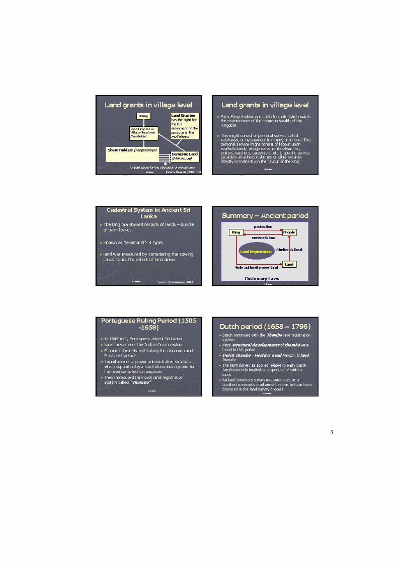
2.1 Deeds based cadastral system
The deeds based cadastral system is well established in Sri Lanka. The British introduced it to
Sri Lanka under the provisions of the Documents Registration Ordinance No.8 of 1863, with
land registration and cadastre as two separate operating entities. Two government departments
administer the two entities separately. The Survey Department is responsible for cadastre and
the Registrar Generals Department for land registration. However, the systematic coverage of
private land ownership information is absent in this system. The Survey Department maintains
a series of plans on different scales demarcating government land ownership, but does not have
sufficient land ownership information on private lands. The Registrar Generals Department
administers land transactions by registering deeds. The only reason for land surveys in this land
transaction process is to verify the land extents. Private land surveyors are involving in these
land surveys, which are not connected to the national coordinate system. These land survey
records are not maintained centrally and are kept with the individual surveyors (Thavalingam,
2003). This cadastral system was the result of the twofold land administration policy of British
Ceylon: one concerning government land management and the other concerning the
establishment of a secure system of land transactions.
2.2 State land and cadastral surveys
The British (1796 – 1948) mainly focused on government land administration issues in the later
part of their rule in Sri Lanka. Considering the availability of government land, they
hypothetically divided the country into three parts: (1) developed areas (villages); (2) highly
populated areas (towns); and (3) undeveloped areas (forest lands). Each category was treated
separately for land surveying (Divithure, 2014).
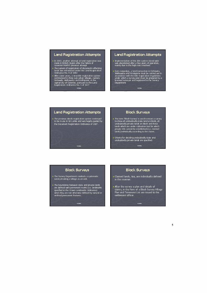
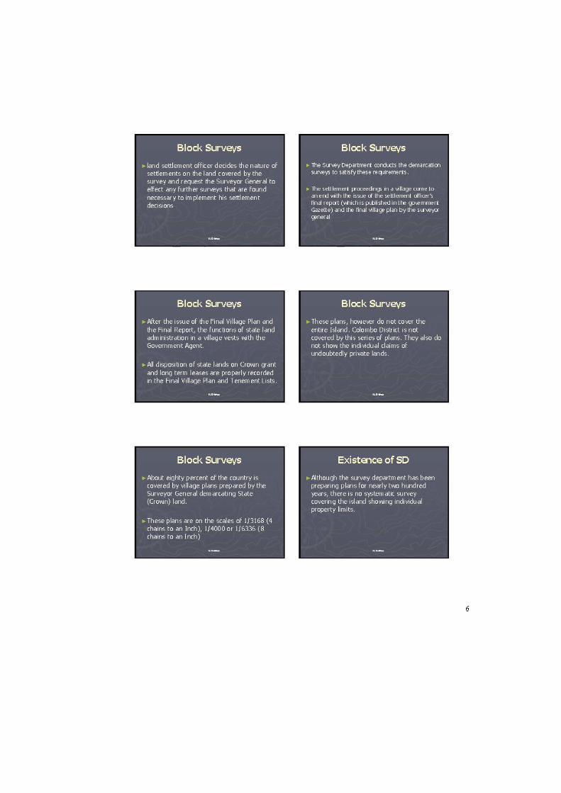
For the first category, village plans were prepared with villages as the smallest administrative
unit. This programme was started in early 1897 and called “Block Surveys” and later
“Mapping-Out Surveys”. Block Surveys helped prepare systematic village plans separating
private and crown (state) lands. Village headmen and land surveyors determined village
boundaries. Land surveyors surveyed topographical features and administrative boundaries.
They also surveyed cultivated lands in "blocks" without showing the internal boundaries
between the claims of private owners. The Survey Department prepared a separate Village Plan
showing each village. The plan was called Final Village Plan (FVP) after investigation,
verification and amendment of claims between the government and private parties. The Land
Settlement Department handled land investigations and claims in this process. The Survey
Department archived the original FVP and handed over copies to the respective Government
Agent, the permanent officer responsible for government land administration in an area (King,
1952). These plans are still used by the Survey Department. Subsequent subdivisions of
government lands are properly recorded and original plans are altered accordingly. These plans
are archived by the Survey Department and also in the Land Ledgers of the Divisional
Secretaries (300 in Sri Lanka) (Thavalingam, 2003). Most of these plans are connected to the
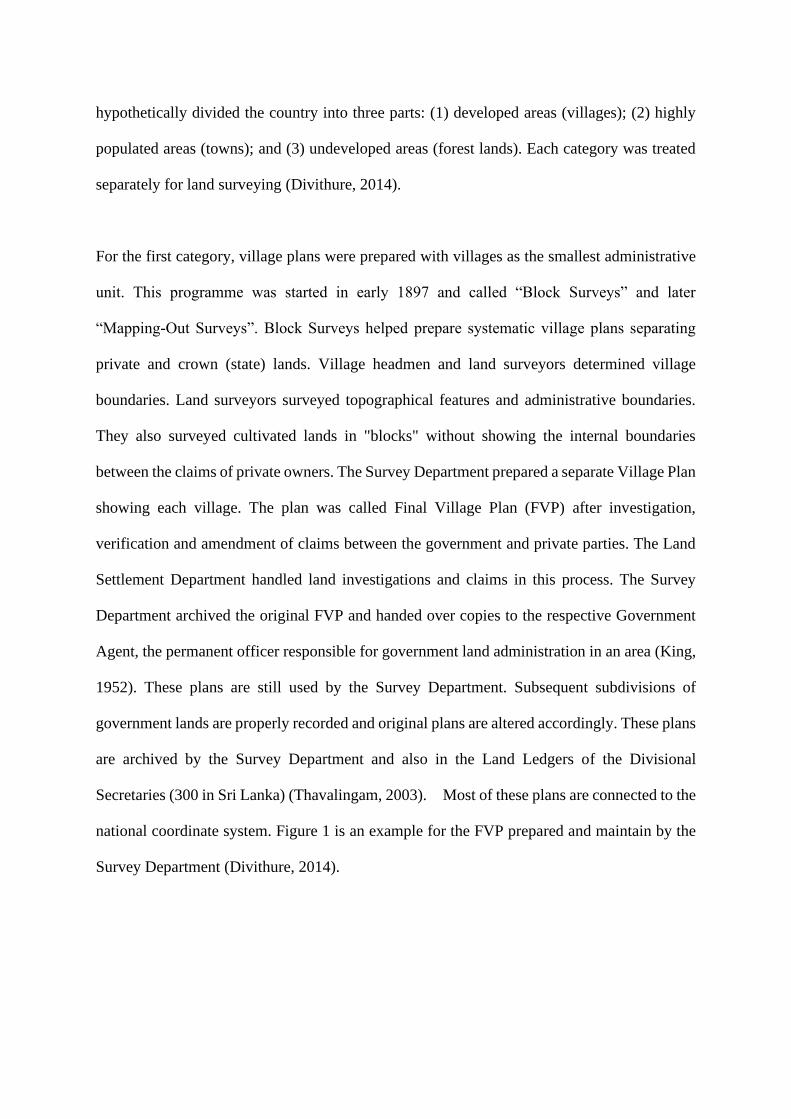
national coordinate system. Figure 1 is an example for the FVP prepared and maintain by the
Survey Department (Divithure, 2014).
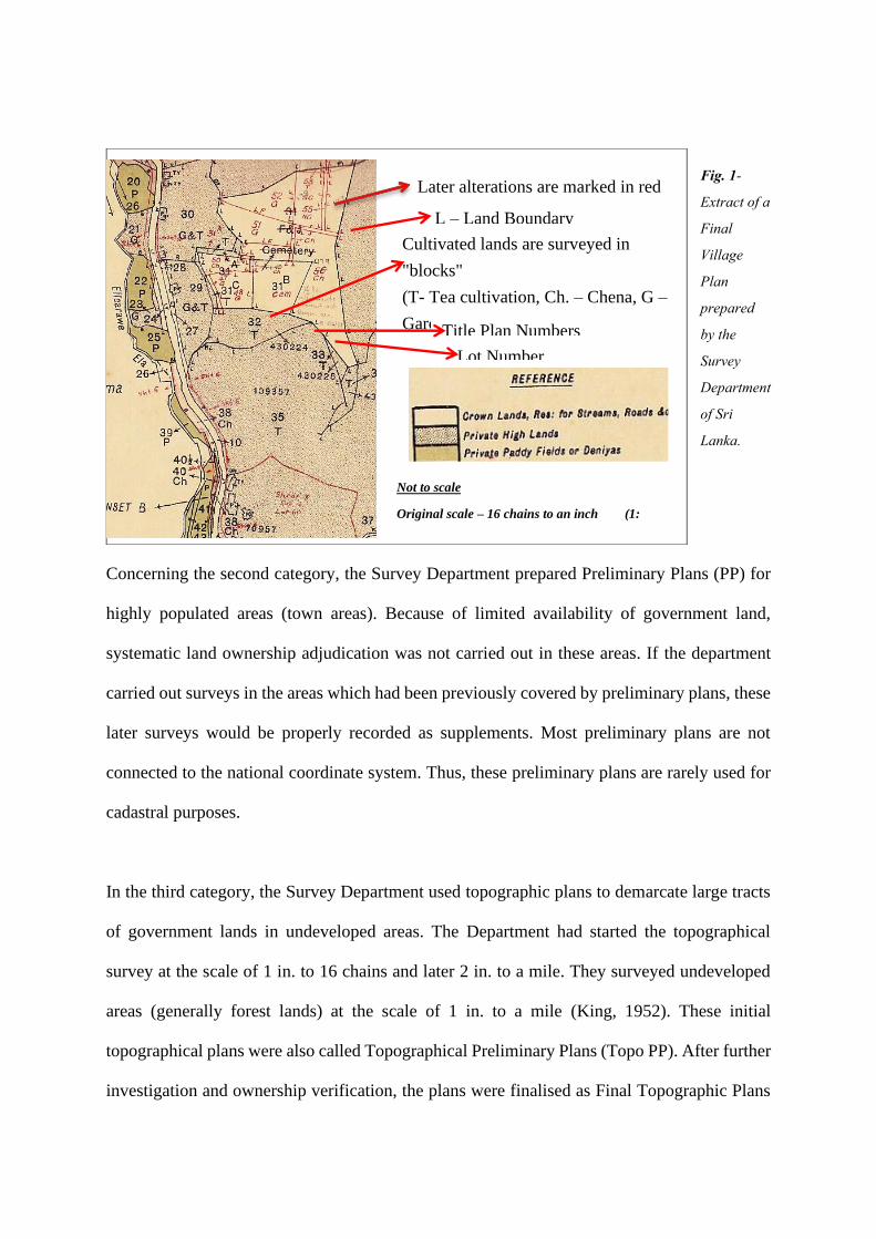
Fig. 1-
Extract of a
Final
Village
Plan
prepared
by the
Survey
Department
of Sri
Lanka.
Concerning the second category, the Survey Department prepared Preliminary Plans (PP) for
highly populated areas (town areas). Because of limited availability of government land,
systematic land ownership adjudication was not carried out in these areas. If the department
carried out surveys in the areas which had been previously covered by preliminary plans, these
later surveys would be properly recorded as supplements. Most preliminary plans are not
connected to the national coordinate system. Thus, these preliminary plans are rarely used for
cadastral purposes.
In the third category, the Survey Department used topographic plans to demarcate large tracts
of government lands in undeveloped areas. The Department had started the topographical
survey at the scale of 1 in. to 16 chains and later 2 in. to a mile. They surveyed undeveloped
areas (generally forest lands) at the scale of 1 in. to a mile (King, 1952). These initial
topographical plans were also called Topographical Preliminary Plans (Topo PP). After further
investigation and ownership verification, the plans were finalised as Final Topographic Plans
Later alterations are marked in red
L – Land Boundary
Monuments Cultivated lands are surveyed in
"blocks"
(T- Tea cultivation, Ch. – Chena, G –
Garden, P – Paddy etc... ) Title Plan Numbers
Lot Number
Not to scale
Original scale – 16 chains to an inch (1:
12672)
(FTP). These were connected to the national coordinate system and the alterations were marked
in as supplements. Figure 2 is an example for the FTP prepared and maintain by the Survey
Department.
Apart from the above three major types, the Survey Department prepared other cadastral maps
and plans within more than 200 years of their existence, all of which were prepared for
government lands, in support of various government policies. The department however, do not
have systematic coverage of private land ownership information.
Fig. 2-Extract of a Final Topographical Plan prepared by the Survey Department of Sri Lanka.
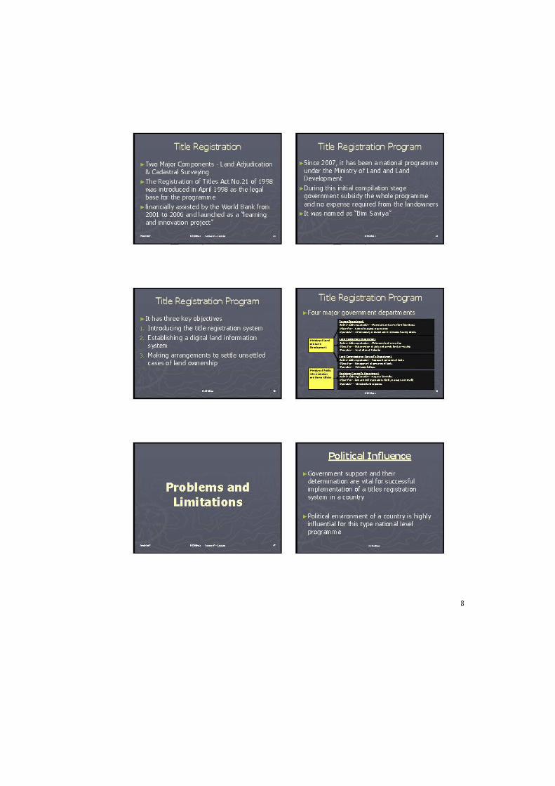
2.3 Cadastral surveys under the land titles registration programme
There were several attempts made by the British to introduce title registration system in the
period of their occupation in Sri Lanka (1796–1948), albeit unsuccessful. In 1998 the title
registration programme was introduced to Sri Lanka. The Registration of Titles Act No.21 of
1998 was introduced in April 1998 as the legal base for the programme, which was financially
assisted by the World Bank from 2001 to 2006 and launched as a “learning and innovation
Later surveys are
indicated as alterations.
These supplementary
plans are maintained
separately.
Adjacent FVP number to
FTP
Not to scale
Original scale – 16
chains to an inch(1:
12672)
project” (World Bank, 2007). Since 2007, it has been a national programme under the Ministry
of Land and Land Development. During this initial compilation stage government subsidy, the
whole programme and no expense required from the landowners. The programme was named
“Bim Saviya” (Land Strength) and having three key objectives: (1) introducing the title
registration system; (2) establishing a digital land information system; and (3) making
arrangements to settle unsettled cases of land ownership (“Bim Saviya Objectives”, 2010).
The Survey Act No.17 of 2002 plays a prominent role in land titles registration in Sri Lanka.
All the cadastral surveys are legally guided by this act, which authorises the Surveyor General
to regulate land surveys, especially cadastral surveys, and provides sufficient legal base for
establishment of the Land Survey Council to regulate the professional conduct of land
surveyors (Survey Act, 2002). All these cadastral surveys are connected to the national survey
control system (GN 99). Minor controls are undertaken by using Global Navigational Satellite
Systems (GNSS) and Electromagnetic Distance Measurement (EDM) techniques. The Survey
Department guidelines for the third order control traverses are adopted for these minor controls.
Detailed surveys are mainly undertaken by using the Total Station instruments (EDM technique)
with accuracy not less than 1:10,000 (Survey Department Sri Lanka, 2003). The efforts to
introduce air survey and remote sensing methods were unsuccessful due to the dense vegetation
of the selected areas at the initial stage of the title registration programme (Divithure, 2014).
The Survey Department carries out cadastral surveys systematically. Surveyors survey all the
land parcels in a village/block and prepare a cadastral map. The land parcels claimed by more
than one party or having undefined boundaries are surveyed according to the claims after
receiving letters of consent from individual parties. Surveyors only survey the outer boundaries
of land parcels with boundary disputes. These are treated as single land parcels on the cadastral
map. Remarks are made to identify disputed land parcels. All the state lands are shown on the
cadastral map. The land parcels claimed by different government agencies are shown separately
on the map (Survey Department Sri Lanka, 2003).
The Survey Department prepare cadastral maps to show all land parcels in one village to the
scale of 1:2000 in the digital format. The maps are numbered with six digits with the first two
identifying the district and the next four the village in the district. The cadastral plan for each
land parcel is prepared in the digital format by field surveyors who measure the land extent in
hectares up to four decimal places (Survey Department Sri Lanka, 2003).
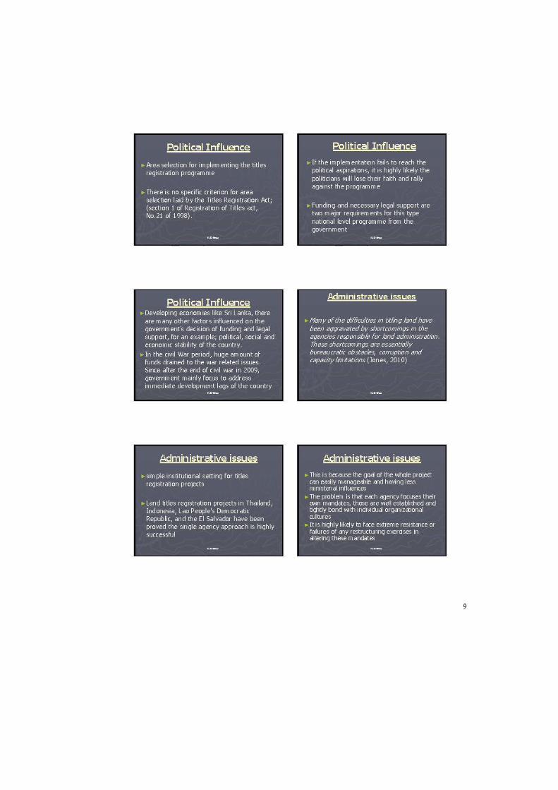
2.4 Inadequate progress of the land titles registration programme
Inadequate progress has been made and severely affected the programme since its inception,
even when it was funded and guided by the World Bank. The completion report of the World
Bank highlighted the issue of the programme’s unsatisfactory progress. For example, until
2006, there had been only 5228 title certificates issued and 22637 land parcels registered, of
which 14676 were of state land. Moreover, most of the land parcels already had clear titles and
the security of land tenure came under the deeds registration system. Land parcels with unclear
titles, for example, those with boundary disputes, were not properly addressed by the titles
registration programme. Some critical factors of this low performance were identified in the
World Banks report as: (1) inconsistence political support for the programme; (2) inability to
define and put in place the legal, regulatory and institutional framework in consistence with
the large scale land titling programme;(3) insufficient capacity building to support a broad
national programme of land titles registration; and (4) unbalanced efforts given to the land
adjudication and the cadastral surveying activities(World Bank, 2007).
Although the title registration system represents a significant improvement on the rudimentary
deeds registration system, it still leaves a lot to be desired in terms of implementation and
maintenance (Williamson et al., 2010). The costs of the title registration are readily
ascertainable and available to see and criticise, but, its opportunities and benefits are mostly
hidden and not available for the public scrutiny. Undoubtedly, introduction of the title
registration system is expensive and its success will require perseverance and determination of
the government (West, 1969). As land is a politically sensitive issue, decisions on land
registration are highly political (Larsson, 1991). Fortunately, despite the implementation
failures and initial problems mentioned above, the Sri Lankan government is still in a
favourable position for implementation of the land title registration programme. Thus, it is
important to make every effort to reduce the visible cost of registration through making the
process more efficient and economical (West, 1969).
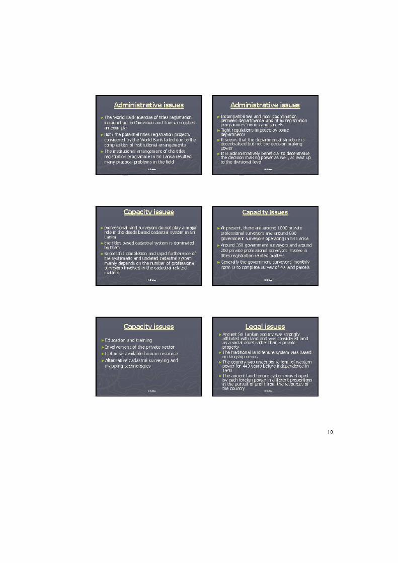
2.5 Survey profession in Sri Lanka
Although professional surveyors do not play a major role in the deeds-based cadastral system
in Sri Lanka, the title-based cadastral system is dominated by them. Successful completion and
rapid furtherance of the systematic and updated cadastral system depends mainly on the number
of professional surveyors involved in the cadastral related matters. Sustainable and long-term
human resource enhancement is a mainstream component of a cadastral reform project
(Steudler, Rajabifard & Williamson, 2004; Enemark & Williamson, 2004; Rajabifard &
Williamson, 2004). At present, there are around 985 private professional surveyors and around
800 government surveyors operating in Sri Lanka (Survey Department, 2019). When
comparing these figures with the total number of land parcels and the incomplete cadastre of
the country, it can be seen that there is an urgent need for increasing the number of professional
surveyors in the cadastral surveys in Sri Lanka.
2.6 Survey education
When considering the historical context of land surveying profession in Sri Lanka, there are
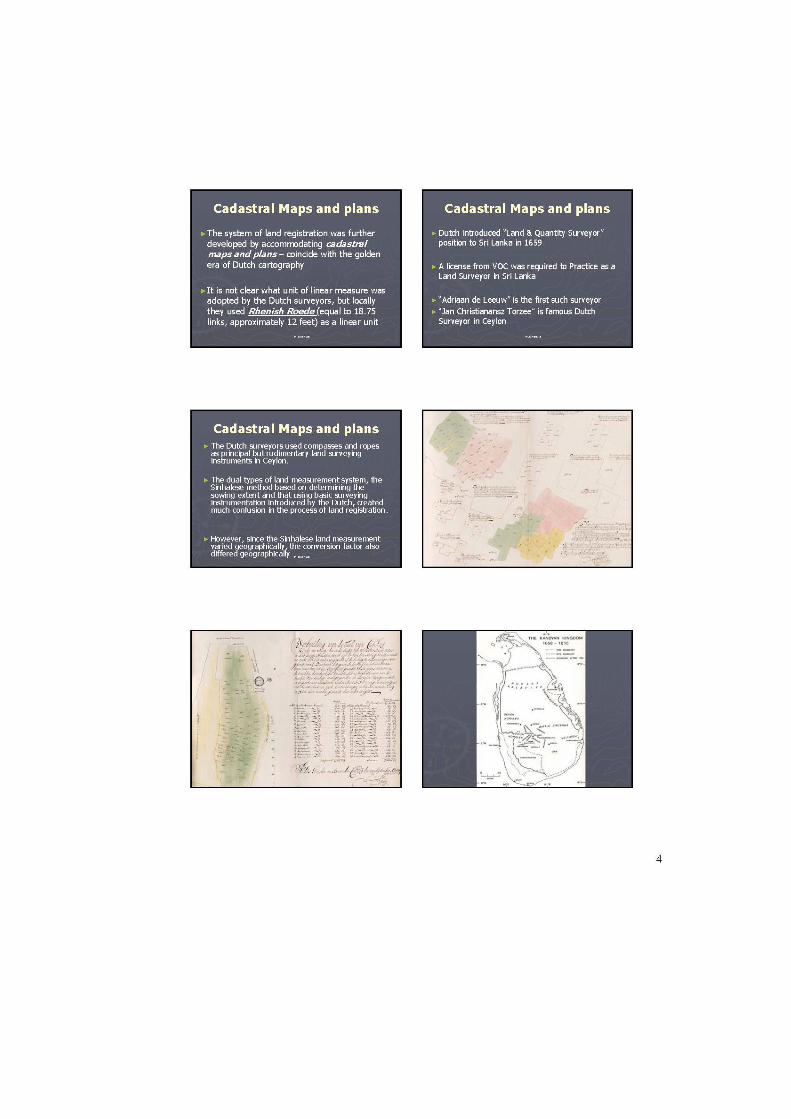
evidences for land surveyors’ involvement in surveying activities at the latter part of the Dutch
occupation in the country. Dutch land surveyors, and local people trained under the Dutch
surveyors, were involved in land surveying activities. The licence from the Dutch East India
Company (VOC) was needed to conduct land surveys in Sri Lanka. Dutch administration
sanctioned the resolution in 29th April, 1745, a set of rules for surveyors, for measuring lands.
Under the Dutch, the cadastral surveys gradually spread throughout the maritime provinces of
the country (Brohier, 1937).
The English, after the Dutch, further developed the surveying profession in Sri Lanka. “The
British influence has been deep, deeper even than in India” (Jennings, 1949, p.25). The British
administration used maps and plans (based on cadastral surveys) to implement their land
policies in Sri Lanka. These had largely been ignored by their predecessors. They established
the Survey Department, the oldest government department in the country to date, by a
proclamation dated 2 August, 1800. British Surveyors and the trained surveyors available in
the country were involved land surveying activities in these early days of British Ceylon. The
only way to get professional training in this period was to train under the senior surveyors.
There are evidences that. G. Snider, the superintendent of surveys in Colombo District,
conducted private tuitions for land surveying and mathematics in this early period of British
Ceylon. However, British citizens were recruited for all the positions of senior surveyors and
assistant surveyors for nearly eighty years after the establishment of the Survey Department.
Surveyor General W.C.S. Ingles in 1896 introduced a training program for land surveyors
under the Department. Local people who followed the above training programme was able to
join the Survey Department as apprentice surveyors or they could pass the licensing exam
conducted by the Surveyor General and work as a private professional surveyor. Around in
1908, the people who successfully completed the courses conducted by the Technical College,
Maradana, directly joined the Survey Department as apprentice surveyors. However, this
method of requirement was abandoned in 1910 and the Department took the full responsibility
of conducting survey training programmes. In 1924, the Department established their
surveying school in Diyatalawa. In 1967, the surveyor training school was upgraded and named
as the Institute of Surveying and Mapping, with the help of United Nations Development
Programme (UNDP). Passing the General Certificate of Education (Ordinary Level) - GCE
O/L - and successfully completing the surveying and levelling course conducted by a Technical
College were considered as the basic requirements for applying to the Surveying and Mapping
Institute. The Institute was later upgraded as a Diploma awarding Institute first and later as a
Degree awarding Institute (Survey Department, 2010).
A year before the commencement of the titles registration programme, in 1997, BSc Surveying
Sciences degree programme was introduced for first time in to the University system in Sri
Lanka. The degree programme was started in Sabaragamuwa University, functioning under the
Ministry of Higher Education in Sri Lanka. Since then, the programme has produced nearly 50
graduates annually. To date, the university has produced around 850 surveying graduates. In
year 2005, the Survey department upgraded their recruitment criteria to the degree level by
allowing these graduates to join with the Department.
2.7 Institutions in Surveying Profession
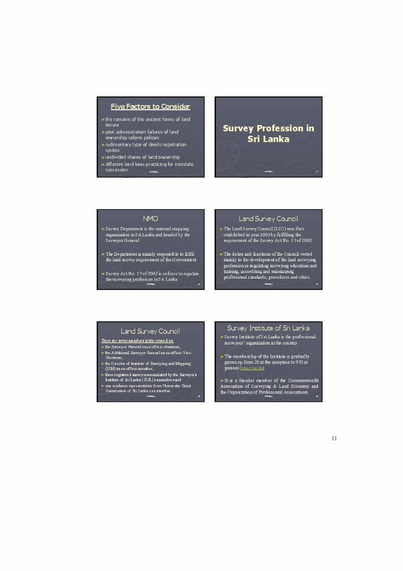
Survey Department is the national mapping organization in Sri Lanka and headed by the
Surveyor General. Around 1889, Surveyor General established licensing criteria for private
professional surveyors, facilitating the Land Registration Ordinance no. 15 of 1889. The legal
acceptance of the private practice by surveying professional was established with this new
initiative. This Ordinance was later amended and altered in several occasions and named as
Surveyors Ordinance. The Ordinance was last amended in 1956 (Surveyors Ordinance No. 28
of 1956) and was cancelled with the introduction of the Survey Act No. 17 of 2002. Since then,
this Act is in force to regulate the surveying profession in Sri Lanka.
The Land Survey Council (LSC) was first established in year 2003 by fulfilling the requirement
of the Survey Act No. 17 of 2002. There are seven members in the council as; the Surveyor
General as ex-officio chairmen, the Additional Surveyor General as ex-officio Vice-Chairman,
the Director of Institute of Surveying and Mapping (ISM) as ex-officio member, three
registered surveyors nominated by the Surveyors Institute of Sri Lanka (SISL) as members and
one academic representative from University Grant Commission of Sri Lanka as a member.
The duties and functions of the Council vested mainly to the development of the land surveying
profession in regulating surveying education and training, accrediting and maintaining
professional standards, procedures and ethics.
Survey Institute of Sri Lanka is the professional surveyors’ organization in the country. The
Ceylon Licensed Surveyors Association, presently known as Surveyors Institute of Sri Lanka
(SISL), was established in year 1926 as a voluntary group focusing to achieve common goals
of the profession. Registered licensed surveyors can become a member of the SISL. The
membership of the Institute is gradually grown up from 20 at the inception to 970 at present
(The Surveyors Institute of Sri Lanka, 2020). It is a founder member of the Commonwealth
Association of Surveying & Land Economy and the Organization of Professional Associations
(OPA). It is also a permanent member of the International Federation of Surveyors (FIG)
2.7.2 Problems in the Profession
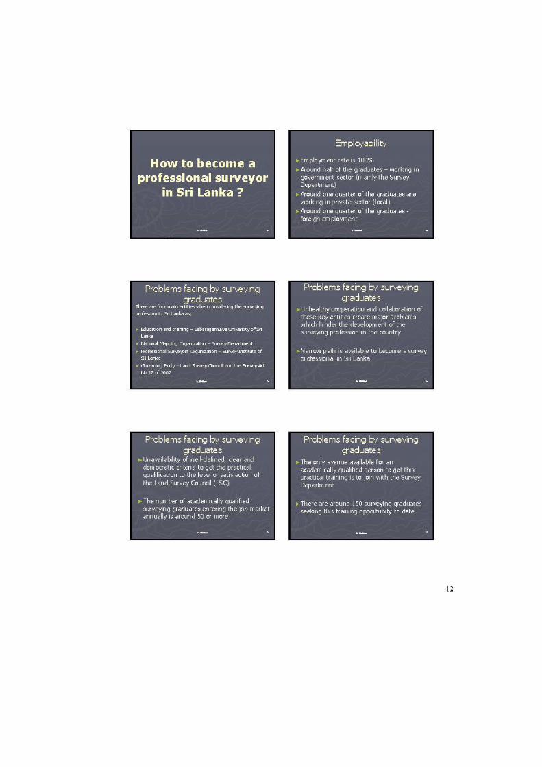
There are four main entities when considering the surveying profession in Sri Lanka as;
Education and training – Sabaragamuwa University of Sri Lanka
National Mapping Organization – Survey Department
Professional Surveyors Organization – Survey Institute of Sri Lanka
Governing Body – Land Survey Council and the Survey Act No 17 of 2002
Unhealthy cooperation and collaboration of these key entities create major problems which
hinder the development of the surveying profession in the country, and can be summarised as
follows;
Even though increasing the number of land survey professionals is important for introduction
and the smooth functionality of the new land title registration programme, a narrow path is
available to become a surveying professional in Sri Lanka. A person registered with the Land
Survey Council and obtaining an annual license from the Council is considered as a
professionally qualified land surveyor in Sri Lanka. Two main qualifications are considered to
register with the Land Survey Council according to the Survey Act No.17 of 2002 as academic
and practical. Unavailability of well-defined, clear and democratic criteria to get the practical
qualification to the level of satisfaction of the LSC is badly influence the development of
surveying profession.
There is no clear procedure and criteria available to train surveying graduates to the level
requested by the Land Survey Council. The number of academically qualified surveying
graduates entering the job market annually is around 50. After two more years it will increase
up to 100 surveying graduates annually. The only avenue available for an academically
qualified person to get this practical training is to join with the Survey Department. There are
around 150 surveying graduates seeking this training opportunity to date. The Department is
not willing to absorb that umber of cadre to the Department due to funds and resources
limitations.
From the other side of the story, the Surveyor Institute of Sri Lanka only accepts the
academically and professionally qualified persons as their members (cooperate). To date there
are two categories of such qualified persons available as; a). Government surveyors working
in the Survey Department of Sri Lanka and b), Retired government surveyors worked in the
Survey Department of Sri Lanka. Both this category of people can obtain their registration and
annual license from the Land Survey Council and the membership from the Survey Institute.
The accumulated result of all the above-mentioned consequences are academically qualified
surveyors in the surveying industry doing land surveys but not having professional acceptance
(legally and from the professional organization). With this negligence of absorbing
academically qualified surveying graduates to the profession, many of them seek overseas job
opportunities. Sri Lanka provides entry level surveyors for international job market but fails to
absorb their portion in to the surveying industry. The situation is further exaggerated with the
vacuum of the qualified surveying professionals created by the land title registration program
in Sri Lanka.
2.8 Conclusion
The incomplete coverage of cadastral information, particularly concerning private land
ownership, and the rudimentary deeds registration system are prominent in the cadastral system
of Sri Lanka. A new land registration and cadastral survey programme was introduced recently
by addressing these development lags in the cadastral system. The inadequate progress is most
attributed and severely affected for the successfulness of the programme since its inception.
In the present context, Surveying profession was first introduced by the Dutch in Sri Lanka.
Both the surveying education and the surveying profession were gradually evolved under the
British Ceylon and having their great influence. Unhealthy cooperation and collaboration of
four main entities of the surveying profession - Education and training, National Mapping
Organization, Professional Surveyors Organization, Governing Body - create major problems
which hinder the development of the profession in Sri Lanka.
References
Bim Saviya Objectives. (2010). Retrieved May 2, 2011, from Bim Saviya website,
http://www.bimsaviya.gov.lk/web/
Brohier, R. L. (1937). Land tenure, registration and survey in Dutch times. Journal of. the
Dutch Burgher Union of Ceylon, 27(1), 5-16.
Divithure, H. (2014). A framework for cadatral system migration from deeds registration to titles
registration. (Doctoral dissertation, Hong Kong Polytechnic University). Retrieved from
https://theses.lib.polyu.edu.hk/bitstream/200/7457/1/b2747074x.pdf
Divithure, H. and Tang, C., (2013). Cadastral system migration from deeds registration to titles
registration: case study of Sri Lanka. Survey review, 45 (330), 220–228.
https://www.tandfonline.com/doi/full/10.1179/1752270612Y.0000000020
Enemark, S., & Williamson, I. (2004).Capacity building in land administration-A conceptual
approach.Survey Review, 37(294), 639-650.
Jennings, W. I. (1949).The Dominion of Ceylon. Pacific Affairs, 22(1), pp. 21-33.
King, G. B. (1952). Mapping out of crown lands in Ceylon. Survey Review, 11(84), 242-247.
Larsson, G. (1991). Land registration and cadastral systems: Tools for land information and
management. Harlow, Essex, England: Longman Scientific and Technical.
Rajabifard, A., & Williamson, I. P. (2004, February).SDI development and capacity building. Paper
presented at the Seventh GSDI conference, Bangalore, India.
Steudler, D., & Kaufmann, J. (Eds.). (2002). Benchmarking cadastral systems. Denmark:
International Federation of Surveyors (FIG). Retrieved from
http://www.fig.net/pub/compub/FIG2002-BenchmarkingCadastralSystems.pdf
Steudler, D., Rajabifard, A., & Williamson, I. P. (2004).Evaluation of land administration systems.
Land Use Policy, 21(4), 371-380.
Survey Act No.17 of 2002, Legislative Enactments of Ceylon: Govt. Press.
Survey Department of Sri Lanka. (2003). Departmental survey regulations - cadastral surveying and
mapping for registration of title - chapter XXI.(Survey Regulations). Colombo, Sri Lanka:
Surveyor General - Survey Department of Sri Lanka.
Survey Department of Sri Lanka. (2010). Siyawas Gamanaka Abhiman. Colombo, Sri Lanka:
Surveyor General - Survey Department of Sri Lanka.
Survey Department of Sri Lanka. (2019). List of registered surveyors in Sri Lanka. Retrieved August
10, 2019, from http://www.survey.gov.lk/home/images/stories/List_of_Registered_Surveyors.pdf
Surveyors Ordinance No.28 of 1956, Legislative Enactments of Ceylon: Govt. Press.
Thavalingam, K. (2003). Cadastral template - country data - Sri Lanka. Retrieved 11/20, 2010, from
http://www.fig.net/cadastraltemplate/countrydata/lk.htm
The surveyors Institute of Sri Lanka. (2020). About the Institute. Retrieved August 10, 2020,
from http://sisl.lk/about-us/
West, H. W. (1969). The role of land registration in developing countries. Chartered Surveyor, 102(5),
211-221.
Williamson, I. P. (1985). Cadastres and land information systems in common law jurisdictions.
Survey Review, 28(217), 114-129.
Williamson, I., Enemark, S., Wallace, J., & Rajabifard, A. (1st Ed.).(2010). Land administration for
sustainable development. Redlands, California: ESRI Press Academic.
World Bank. (2007). Implementation completion and results report (IDA-34960) on a credit in the
amount of SLR 3.9 million (US$ 5.0 million equivalent) to the government of Sri Lanka for a
land titling and related services project. (IMPLEMENTATION COMPLETION AND RESULTS
REPORT No. ICR0000190). Sustainable Development, Unit South Asia Region: The World
Bank. Retrieved from http://www-
wds.worldbank.org/external/default/WDSContentServer/WDSP/IB/2007/05/03/000020953_200705031
40236/Rendered/PDF/ICR0000190.pdf
Dr Homindra Divithure made a presentation of the Sri Lanka system in the Workshop of
introduction and comparison to the cadastral law and operation between the project countries
on the web broadcasting event in November 2020. The presentation information are attached
as Appendix 1.
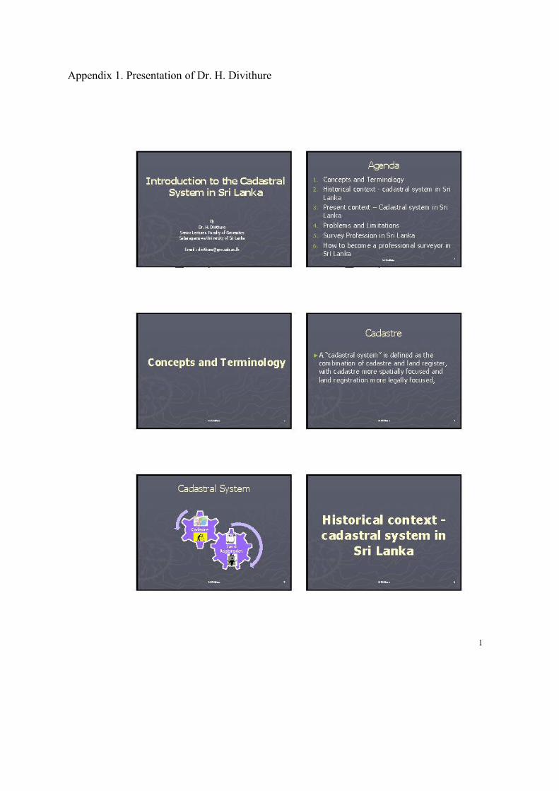
Appendix 1. Presentation of Dr. H. Divithure