Embed Size (px)
Citation preview
7m Environment KJ Agency
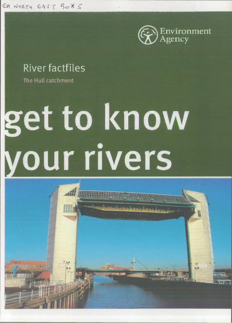
River factfilesThe Hull catchment
et to kn ow our rivers
We are the Environment Agency. It’s our job to look after your environment and make it a better place - foryou, and for future generations.
Your environm<xyD ‘ and the grounc Government arenvironment cl Inform ation Services Unit
----------------------------------------------------------------__________________________________ u : - t - . . . u _
—g your environmentThe Environme a better place.
En v i r o n m e n t A g e n c y
Please return or renew this item by the due date
e water you drink business, e makingyour
D u e D a te
Published by:
Environment Agency Rivers House 21 Park Square South
Leeds LSI 2QG Tel: 08708 506 506Email: [email protected] www.environment-agency.gov.uk
© Environment Agency
All rights reserved. This document may be reproduced with prior permission of the Environment Agency.
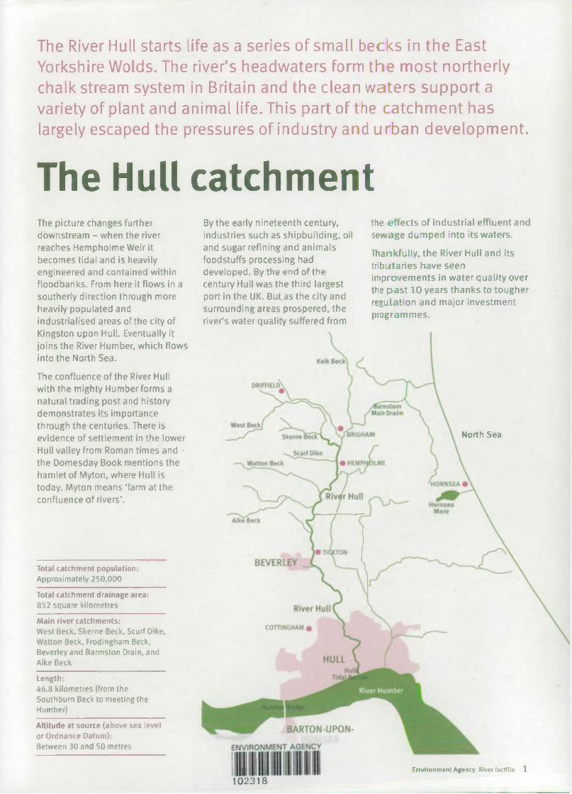
The River Hull starts life as a series of small becks in the East Yorkshire Wolds. The river’s headwaters form the most northerly chalk stream system in Britain and the clean waters support a variety of plant and animal life. This part of the catchment has largely escaped the pressures of industry and urban development.
The Hull catchmentThe picture changes further downstream - when the river reaches Hempholme Weir it becomes tidal and is heavily engineered and contained within floodbanks. From here it flows in a southerly direction through more heavily populated and industrialised areas of the city of Kingston upon Hull. Eventually it joins the River Humber, which flows into the North Sea.
The confluence of the River Hull with the mighty Humber forms a natural trading post and history demonstrates its importance through the centuries. There is evidence of settlement in the lower Hull valley from Roman times and • the Domesday Book mentions the hamlet of Myton, where Hull is today. Myton means ‘farm at the confluence of rivers’.
Total catchment population:Approximately 250,000
Total catchment drainage area:852 square kilometres
Main river catchments:West Beck, Skerne Beck, Scurf Dike, Watton Beck, Frodingham Beck, Beverley and Barmston Drain, and Aike Beck
Length:46.8 kilometres (from the Southburn Beck to meeting the Humber)
Altitude at source (above sea level or Ordnance Datum):Between 30 and 50 metres
By the early nineteenth century, industries such as shipbuilding, oil and sugar refining and animals foodstuffs processing had developed. By the end of the century Hull was the third largest port in the UK. But as the city and surrounding areas prospered, the river’s water quality suffered from
the effects of industrial effluent and sewage dumped into its waters.
Thankfully, the River Hull and its tributaries have seen improvements in water quality over the past 10 years thanks to tougher regulation and major investment programmes.
North Sea
Environment Agency River factfile 1
102318
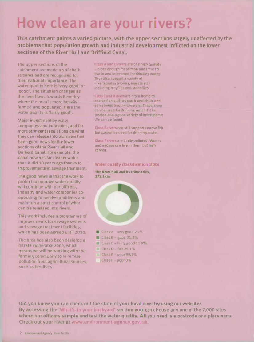
How clean are your rivers?This catchment paints a varied picture, with the upper sections largely unaffected by the problems that population growth and industrial development inflicted on the lower sections of the River Hull and Driffield Canal.
The upper sections of the catchment are made up of chalk streams and are recognised for their national importance. The water quality here is ‘very good’ or ‘good’. The situation changes as the river flows towards Beverley where the area is more hedviiy farmed and populated. Here the water quality is ‘fairly good’.
Major investment by water companies and industries, and far more stringent regulations on what they can release into our rivers has been good news for the lower sections of the River Hull and Driffield Canal. For example, the canal now has far cleaner water than it did 10 years ago thanks to improvements in sewage treatment.
The good news is that the work to protect or improve water quality will continue with our officers, industry and water companies cooperating to resolve problems and maintain a strict control of what can be released into rivers.
This work includes a programme of improvements for sewage systems and sewage treatment facilities, which has been agreed until 2010.
The area has also been declared a nitrate vulnerable zone, which means we will be working with the farming community to minimise pollution from agricultural sources, such as fertiliser.
Class A and B rivers are of a high quality - clean enough for salmon and trout to live in and to be used for drinking water. They also support a variety of invertebrates (worms, insects etc) including mayflies and stoneflies.
Class C and D rivers are often home to coarse fish such as roach and chub and sometimes trout in L waters. These rivers can be used for drinking water if it is treated and a good variety of invertebrate life can be found.
Class E rivers can still support coarse fish but cannot be used for drinking water.
Class F rivers are badly polluted. Worms and midges can live in them but fish cannot.
Water quality classification 2004
Th e River Hull and its trib u ta rie s, 272.1km
Class A - very good 2.7%
Class B - good 21.2%
Class C - fairly good 11.9%
Class D - fair 25.1%
Class E - poor 39.1%
Class F - poor 0%
Did you know you can check out the state of your local river by using our website?By accessing the ‘ What’s in your backyard’ section you can choose any one of the 7,000 sites where our officers sample and test the water quality. All you need is a postcode or a place name. Check out your river at www.environment-agency.gov.uk.
2 Environment Agency River faotfile
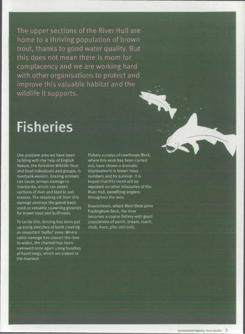
The upper sections of the River Hull are home to a thriving population of brown trout, thanks to good water quality. But this does not mean there is room for complacency and we are working hard with other organisations to protect and improve this valuable habitat and the wildlife it supports. ,
FisheriesOne problem area we have been tackling with the help of English Nature, the Yorkshire Wildlife Trust and local individuals and groups, is riverbank erosion. Grazing animals can cause serious damage to riverbanks, which can widen sections of river and lead to soil erosion. The resulting silt from this damage destroys the gravel beds used as valuable spawning grounds for brown trout and bullheads.
To tackle this, fencing has been put up along stretches of bank creating an important ‘buffer’ zone. Where cattle damage has caused the river to widen, the channel has been narrowed once again using bundles of hazel twigs, which are staked to the riverbed.
Fishery surveys of Lowthorpe Beck, where this work has been carried out, have shown a dramatic improvement in brown trout numbers and fry survival. It is hoped that this trend will be repeated on other tributaries of the River Hull, benefiting anglers throughout the area.
Downstream, where West Beck joins Frodingham Beck, the river becomes a coarse fishery with good populations of perch, bream, roach, chub, dace, pike and eels.
Wildlife and conservation
Rare and protected species, in clu din g otters, water voles and brook lam preys, are to be found in this river catchment and work is taking place to protect them and their habitats. In the last century, around 17 species of plants and anim als became extinct in the UK, emphasising the need to care for our native species and the areas in which they live.
The Hull catchment is home to many sites of national and international importance for wildlife. The countryside offers a range of habitats from chalk streams, wet grassland and fen to wet woodland and reed beds. Most of the upper sections above Hempholme Weir are designated as Sites of Special Scientific Interest and are of national importance for their aquatic life.
We continue to work with many other organisations to protect and improve habitats and the wildlife they attract.
Water crowfoot grows in parts of the Hull headwaters and is a characteristic plant species in chalk rivers.
Helped by a network of boxes established by the Environment Agency and the Wildlife and Conservation Partnership along the catchment, Barn owls are now found in good numbers in the upper Hull.
Water voles are found in the upper reaches of the River Hull, as well as many of the tributaries and side drains.
A small but increasing population of otters inhabit the river.
Reed buntings are seen all along the catchment, especially where there is marshy vegetation.
Kingfishers are a frequent sight along the upper River Hull with several pairs known to nest at Tophill Low.
Brown trout are found in the headwaters.
Bullheads are quite common in the upper sections of the river, such as at Elmswell Beck.
4 Environment Agency River factfile

Pollution watchdogPollution prevention and control is a vital part of our work. We are responsible for regulating many industrial processes to make sure they are not damaging the environment.
Major investment by industry over the past couple of decades, as well as much tougher limits on discharges to air, land and water, have all had benefits for the environment.
This work and investment is continuing throughout the Hull catchment and will hopefully bring about further improvements in water quality and a reduction in pollution incidents.
But the work doesn’t stop at big industrial processes - other businesses and the farming
community also need to be pollution aware. We work with all these sectors to highlight the simple ways they can help protect the environment and even save money at the same time.
Slurry and fertilisers can have a devastating effect on water quality, wildlife and fish stocks. Every year we have to deal with damaging incidents caused by inadequate storage facilities or poor working practices.
Some of these are caused by the collapse of lagoon walls, leading to
the release of slurry, which runs across land into watercourses and can wipe out fish stocks for miles downstream. Overfull slurry stores can also cause problems if heavy rainfall gets into them and they overflow.
Thankfully the picture is not all doom and gloom as very simple steps can prevent problems and we are working with farming organisations in a bid to wipe out bad practise and reduce damaging incidents.
Investing in the environment case studyA major investment programme at a Hull company has been good news for river water quality in the area.
Croda Universal Ltd at Oak Road in the city decided to embark on £500,000 improvement programme after concerns about the effectiveness of an existing effluent treatment plant on the site.
The company worked closely with us in upgrading the plant improve the treatment of its trade effluent before it was rele into the river.
towas released
The result has been a fall in the amounts of substances released into the river, including ammonia. This in turn has had benefits for water quality in the area.
You can find out more about our regulatory role and powers, as well as details of industry discharges, on our website at www.environment-agency.gov.uk. Find out what’s being emitted from industrial sites in your area, including into controlled waters. Go to ‘What’s in Your Backyard’ click ‘search for other topics’ and click on ‘pollution inventory’.
Environment Agency River factfile 5
Watching the wasteEvery year more than 400 million tonnes of waste is produced in England and Wales, with about 25 million tonnes of this from households. All this waste has to be safely handled and disposed of.
The great bulk of waste at the moment is disposed of in landfills. When it breaks down it produces a liquid called leachate, as well as methane gas. Landfill site operators have to make sure this liquid doesn’t escape into groundwater or rivers by lining their sites with impermeable barriers.
We regulate the movement and disposal of waste through a system of licences. We also work with landfill site operators and other businesses to make sure that deposited waste does not pose a risk to the environment.
Working together to protect the River Hull case studyA team effort has brought about a scheme to protect the River Hull from a major pollution incident.
During autumn 2000 a wharf on the river, next to a waste management facility, started to collapse prompting fears that waste oil stored on the site could enter the river, leading to an environmental disaster.
Our officers realised urgent action was needed. They persuaded the waste site operator to empty the tanks nearest the river and use tanks at the other side of the site, which had bunds, or protective walls, around them. The site operator also agreed to stop using a laboratory and offices located close to the river.
The next step was to trace the owner of the wharf in a bid to put things right.
As a result a partnership was set up between Hull City Council, the Environment Agency, Waste Oil Services and Rix Petroleum to investigate the wharf problem and fund the work to put it right. The joint effort will help protect the River Hull from a pollution incident and flood risk to the surrounding population.
Water sourceWater is essential to life and we have a duty to make sure our water resources are used properly. To do this, our officers closely monitor water in the environment. Abstraction licences are issued to regulate who can take water from the environment and the amount that can be taken over a period of time.
On the chalk outcrop in the upper sections of the catchment there are relatively few streams and rivers because the chalk is highly permeable.
Most of the rain soaks into the ground where the chalk acts as a natural filter. This makes the area
an excellent source of high quality water, with abstraction for public water supply and agriculture being the major uses of water resources in the catchment.
A particular concern in the River Hull catchment is the issue of water abstraction and its effect on water
quality. Water is taken from rivers or streams and from underground supplies, using wells or boreholes.
The needs of the people abstracting the water and of the environment have to be balanced and for this reason we will continue to monitor the situation closely.
6 Environment Agency River factfile
What’s under your feet?
Cretaceous chalks were deposited between 85 and 95 million years ago and are the oldest rocks in the Hull catchment and form the Yorkshire Wolds.
Holderness Plain was laid down in the Tertiary period between 65 and 1.8 million years ago and consists mostly of boulder clay and marine silts.
Environment Agency River factflle
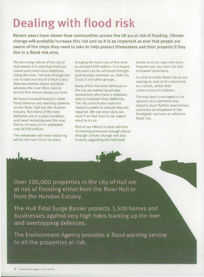
Dealing with flood riskRecent years have shown how communities across the UK are at risk of flooding. Climate change will probably increase this risk and so it is as important as ever that people are aware of the steps they need to take to help protect themselves and their property if they live in a flood risk area.
The low-lying nature of the city of Hull means it is vital that there are sound and continuous defences along the river. The river through the city is tidal and much of Hull is less than two metres above sea level - whereas the river often rises to almost five metres above sea level.
We have invested heavily in both flood defence and warning systems on the River Hull and the Humber Estuary. But many of the river defences are in a poor condition and need replacing over the next five to 10 years at an estimated cost of £50 million.
The remainder will need replacing within the next 10 to 50 years
bringing the total cost of the work to around £200 million. It is hoped this work can be achieved through partnerships between us, Hull City Council and other groups.
Many of the riverside defences in the city are owned by private landowners who have a statutory duty to maintain their defences.The city council also have the statutory power to ensure they are repaired. We can also carry out work if we feel there is an urgent need to do so.
Part of our efforts to deal with the increasing pressures brought about through climate change will also include upgrading the Hull tidal
barrier so it can cope with more frequent use, sea level rise and increased storminess.
In a bid to tackle flood risk we are starting to look at the catchment as a whole, rather than communities in isolation.
The way land is managed in the uplands of a catchment has impacts much further downstream, and every development in the floodplain can have an effect on flood risk.
Over 100,000 properties in the city of Hull are at risk of flooding either from the River Hull or from the Humber Estuary.
The Hull Tidal Surge Barrier protects 1,500 homes and businesses against very high tides backing up the river and overtopping defences.
The Environment Agency provides a flood warning service to all the properties at risk.
8 Environment Agency River factfile
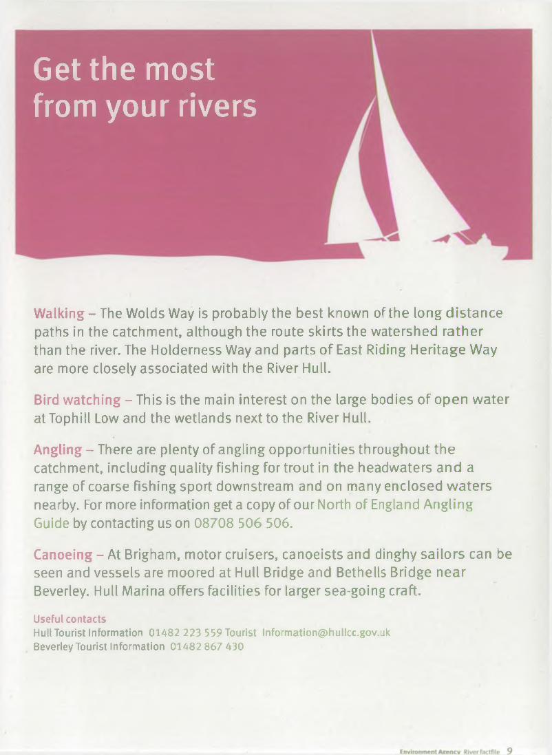
Get the most from your rivers
Walking - The Wolds Way is probably the best known of the long distance paths in the catchment, although the route skirts the watershed rather than the river. The Holderness Way and parts of East Riding Heritage W ay are more closely associated with the River Hull.
Bird watching - This is the main interest on the large bodies of op en w ater at Tophill Low and the wetlands next to the River Hull.
Angling - There are plenty of angling opportunities throughout the catchment, including quality fishing for trout in the headwaters and a range of coarse fishing sport downstream and on many enclosed w a ters nearby. For more information get a copy of our North of England Angling Guide by contacting us on 08708 506 506.
Canoeing - At Brigham, motor cruisers, canoeists and dinghy sailors can be seen and vessels are moored at Hull Bridge and Bethells Bridge near Beverley. Hull Marina offers facilities for larger sea-going craft.
Useful contactsHull Tourist Information 01482 223 559 Tourist [email protected] Beverley Tourist Information 01482 867 430
Would you like to find out more about us or about your environment?
Then call us on -08708 506 506 (Mon-Fri 8-6)
j or visit our websitewww.environment-agency.gov.uk
incident hotline 0800 80 70 60 (24hrs) floodline 0845 988 1188
A Envir°"ment first: This publication is printed on paper made from ■ ^ 100 per cent p reviou sly used waste. By-products from making the
pulp and paper are used for com p ostin g and fertiliser, for making cement and for generating energy.
GENE0506BKSL-E-P