Embed Size (px)
Citation preview
The Hydro-Estimator and The Hydro-Estimator and Hydro-Nowcaster: Hydro-Nowcaster:
Satellite-Based Flash Satellite-Based Flash Flood Forecasting ToolsFlood Forecasting Tools
Robert J. KuligowskiRobert J. KuligowskiNOAA/NESDIS Center for SaTellite Applications and Research NOAA/NESDIS Center for SaTellite Applications and Research
(STAR)(STAR)Camp Springs, MD USACamp Springs, MD USA
with special appreciation towith special appreciation toRod ScofieldRod Scofield (1942-2006) (1942-2006)
who pioneered much of this workwho pioneered much of this work
International Workshop on Flash Flood ForecastingInternational Workshop on Flash Flood Forecasting14 March 200614 March 2006
OutlineOutline
The Hydro-Estimator (HE)The Hydro-Estimator (HE) The Hydro-Nowcaster (HN)The Hydro-Nowcaster (HN) Future WorkFuture Work Where to Get the DataWhere to Get the Data International CollaborationInternational Collaboration
The Hydro-Estimator The Hydro-Estimator (HE): Introduction(HE): Introduction
The HE is NESDIS’ operational algorithm The HE is NESDIS’ operational algorithm for estimating rainfall rate from infrared for estimating rainfall rate from infrared (IR) window (~11 (IR) window (~11 µm) brightness µm) brightness temperaturestemperatures..
Real-time estimates are produced Real-time estimates are produced globally (60globally (60°°S to 60S to 60°°N) at the spatial and N) at the spatial and temporal resolution of the available temporal resolution of the available geostationary satellite datageostationary satellite data– 4-5 km resolution generally every 15-30 4-5 km resolution generally every 15-30
minutes, depending on location.minutes, depending on location.
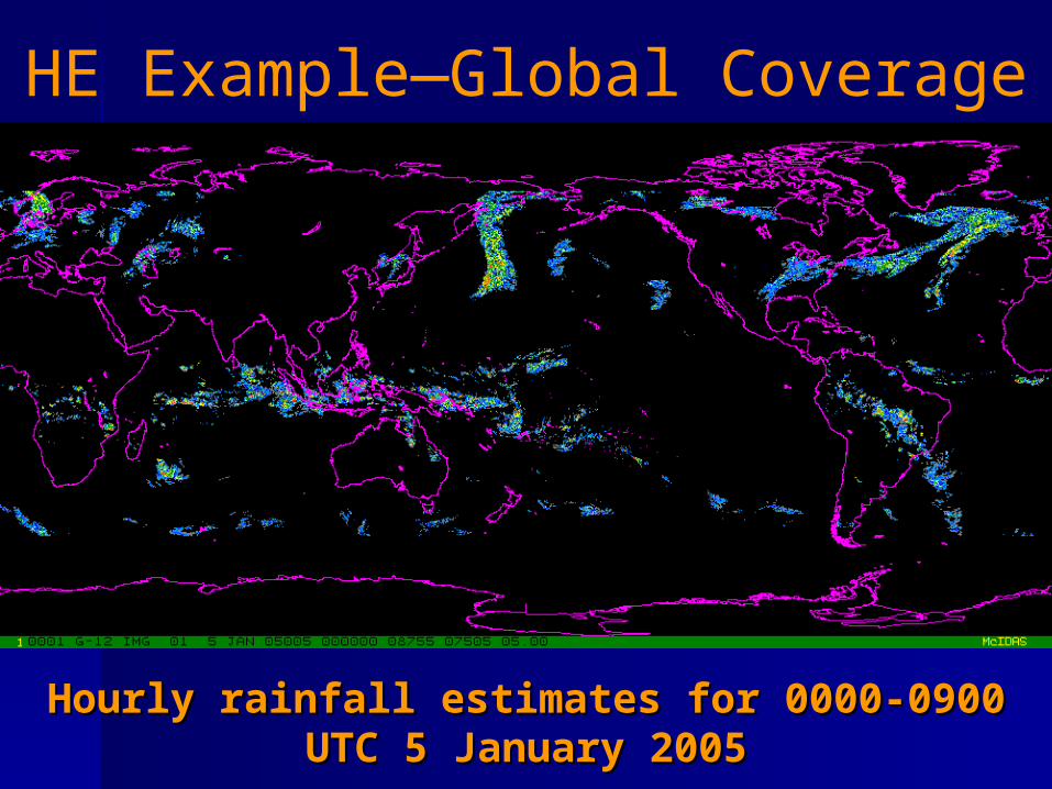
Hourly rainfall estimates for 0000-0900 UTC Hourly rainfall estimates for 0000-0900 UTC 5 January 20055 January 2005
HE Example—Global Coverage
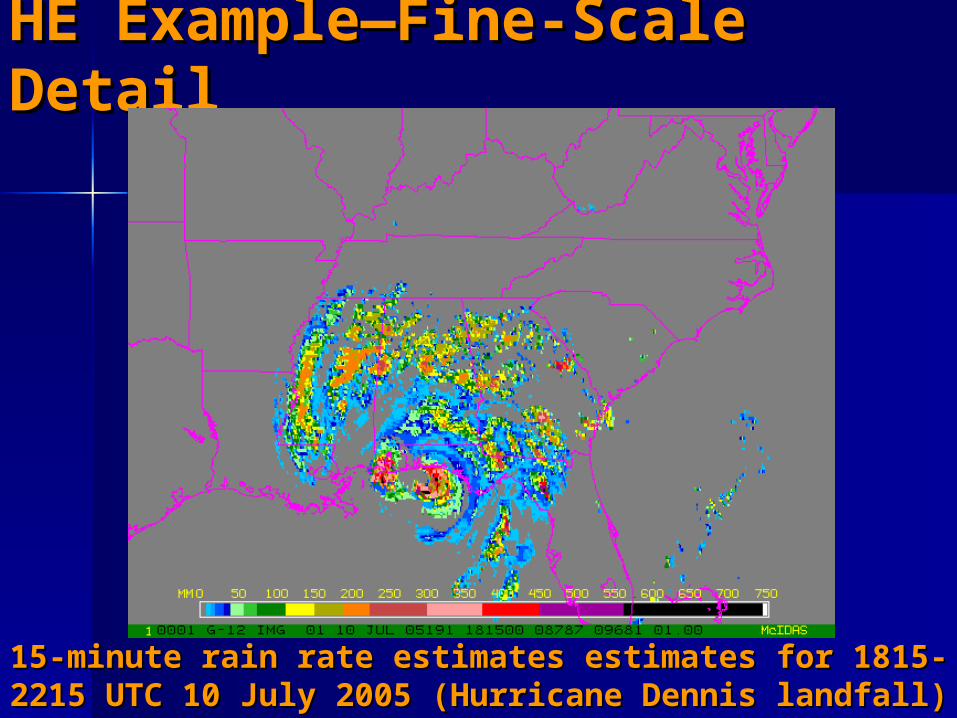
HE Example—Fine-Scale HE Example—Fine-Scale DetailDetail
15-minute rain rate estimates estimates for 1815-15-minute rain rate estimates estimates for 1815-2215 UTC 10 July 2005 (Hurricane Dennis landfall)2215 UTC 10 July 2005 (Hurricane Dennis landfall)
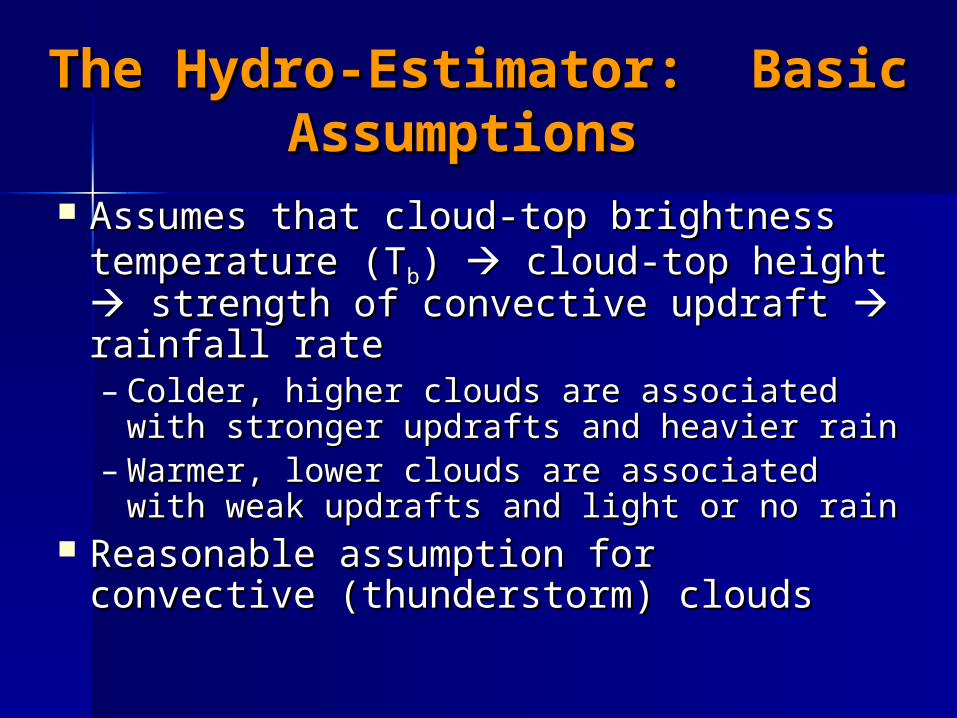
The Hydro-Estimator: Basic The Hydro-Estimator: Basic AssumptionsAssumptions
Assumes that cloud-top brightness Assumes that cloud-top brightness temperature (Ttemperature (Tbb) ) cloud-top height cloud-top height strength of convective updraft strength of convective updraft rainfall rate rainfall rate – Colder, higher clouds are associated Colder, higher clouds are associated
with stronger updrafts and heavier rainwith stronger updrafts and heavier rain– Warmer, lower clouds are associated Warmer, lower clouds are associated
with weak updrafts and light or no rainwith weak updrafts and light or no rain Reasonable assumption for Reasonable assumption for
convective (thunderstorm) cloudsconvective (thunderstorm) clouds
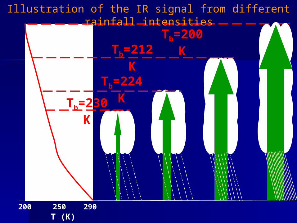
200 250 290T (K)
Tb=230 K
Tb=224 K
Tb=212 KTb=200 K
Illustration of the IR signal from different rainfall intensities
290200 250T (K)
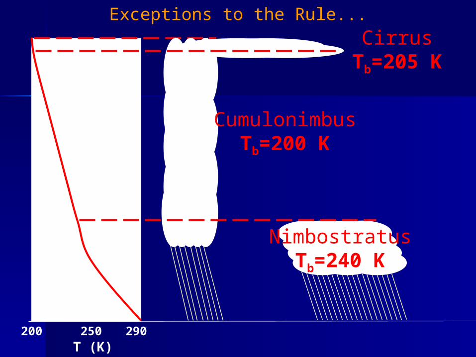
CumulonimbusTb=200 K
NimbostratusTb=240 K
CirrusTb=205 K
Exceptions to the Rule...
The Hydro-Estimator: Rain/No The Hydro-Estimator: Rain/No Rain DifferentiationRain Differentiation
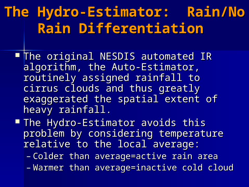
The original NESDIS automated IR The original NESDIS automated IR algorithm, the Auto-Estimator, algorithm, the Auto-Estimator, routinely assigned rainfall to cirrus routinely assigned rainfall to cirrus clouds and thus greatly exaggerated clouds and thus greatly exaggerated the spatial extent of heavy rainfall.the spatial extent of heavy rainfall.
The Hydro-Estimator avoids this The Hydro-Estimator avoids this problem by considering temperature problem by considering temperature relative to the local average:relative to the local average:– Colder than average=active rain areaColder than average=active rain area– Warmer than average=inactive cold cloudWarmer than average=inactive cold cloud
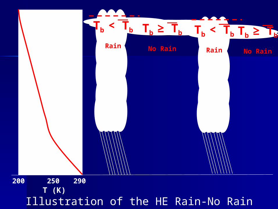
Illustration of the HE Rain-No Rain Differentiation
290200 250T (K)
Tb < Tb
Rain
Tb ≥ Tb
No Rain
Tb < Tb
Rain
Tb ≥ Tb
No Rain
H-E Rainfall RatesH-E Rainfall Rates Initial rain rates are a function of both TInitial rain rates are a function of both Tbb
and its value relative to surrounding meanand its value relative to surrounding mean Adjustments using numerical weather Adjustments using numerical weather
prediction model data, including:prediction model data, including:– Precipitable water to enhance rainfall in Precipitable water to enhance rainfall in
regions of high moisture availabilityregions of high moisture availability– Relative humidity to reduce precipitation in Relative humidity to reduce precipitation in
arid regions where raindrops evaporate before arid regions where raindrops evaporate before reaching the groundreaching the ground
– Wind fields interfaced with digital topography Wind fields interfaced with digital topography to determine orographic effects where wind to determine orographic effects where wind blows:blows:
up slope (moistening and enhancement of rain) or up slope (moistening and enhancement of rain) or down slope (drying and reduction of rain)down slope (drying and reduction of rain)
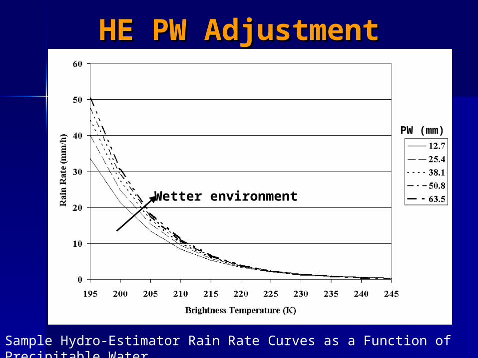
HE PW AdjustmentHE PW Adjustment
Sample Hydro-Estimator Rain Rate Curves as a Function of Precipitable Water
PW (mm)
Wetter environment

The Hydro-Nowcaster: The Hydro-Nowcaster: IntroductionIntroduction
The Hydro-Nowcaster (HN) is an The Hydro-Nowcaster (HN) is an algorithm for producing 0-3 h algorithm for producing 0-3 h nowcasts of precipitation based on nowcasts of precipitation based on extrapolated Hydro-Estimator extrapolated Hydro-Estimator estimates of rainfall rate.estimates of rainfall rate.
Both advection and growth/decay Both advection and growth/decay are considered.are considered.
How the Nowcaster How the Nowcaster Works—ExtrapolationWorks—Extrapolation
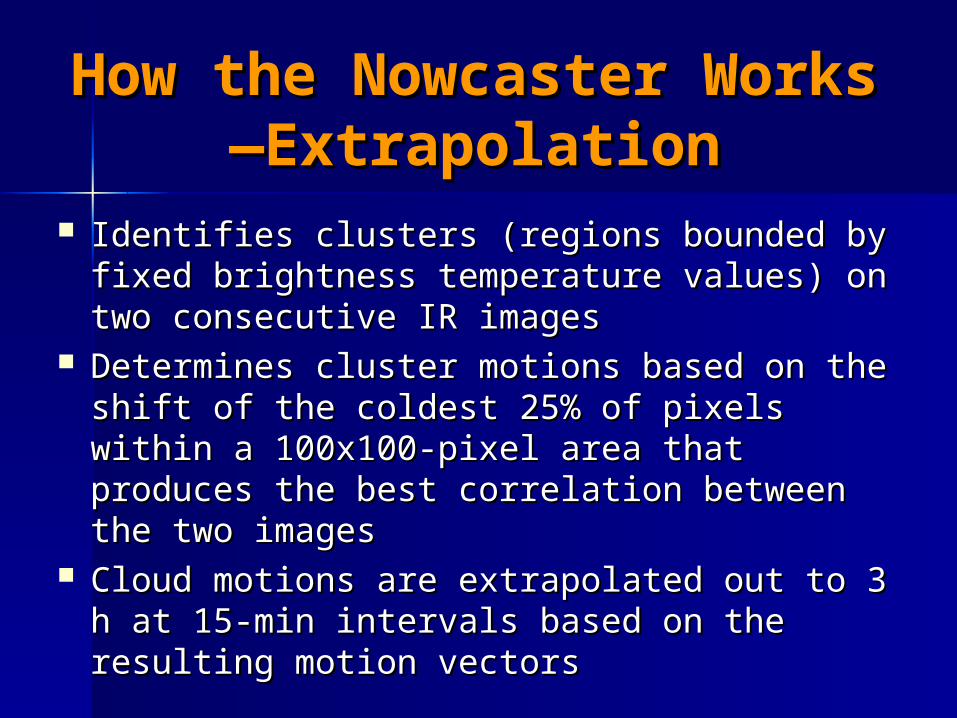
Identifies clusters (regions bounded by Identifies clusters (regions bounded by fixed brightness temperature values) on fixed brightness temperature values) on two consecutive IR imagestwo consecutive IR images
Determines cluster motions based on the Determines cluster motions based on the shift of the coldest 25% of pixels within a shift of the coldest 25% of pixels within a 100x100-pixel area that produces the best 100x100-pixel area that produces the best correlation between the two imagescorrelation between the two images
Cloud motions are extrapolated out to 3 h Cloud motions are extrapolated out to 3 h at 15-min intervals based on the resulting at 15-min intervals based on the resulting motion vectorsmotion vectors
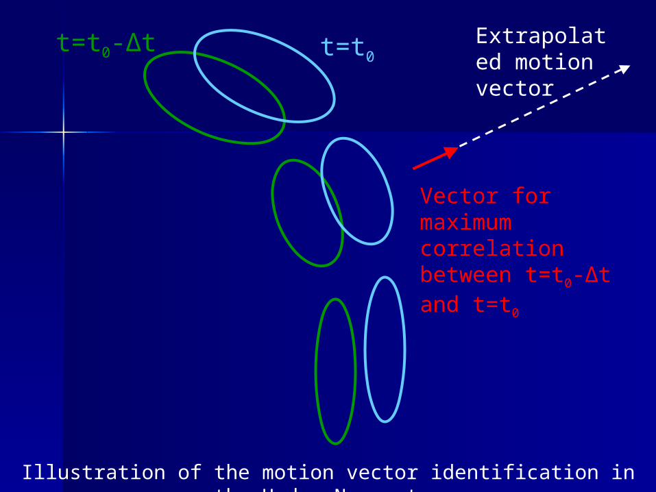
t=t0-Δt t=t0
Vector for maximum correlation between t=t0-Δt and t=t0
Extrapolated motion vector
Illustration of the motion vector identification in the Hydro-Nowcaster
How the Nowcaster How the Nowcaster Works—Growth/DecayWorks—Growth/Decay
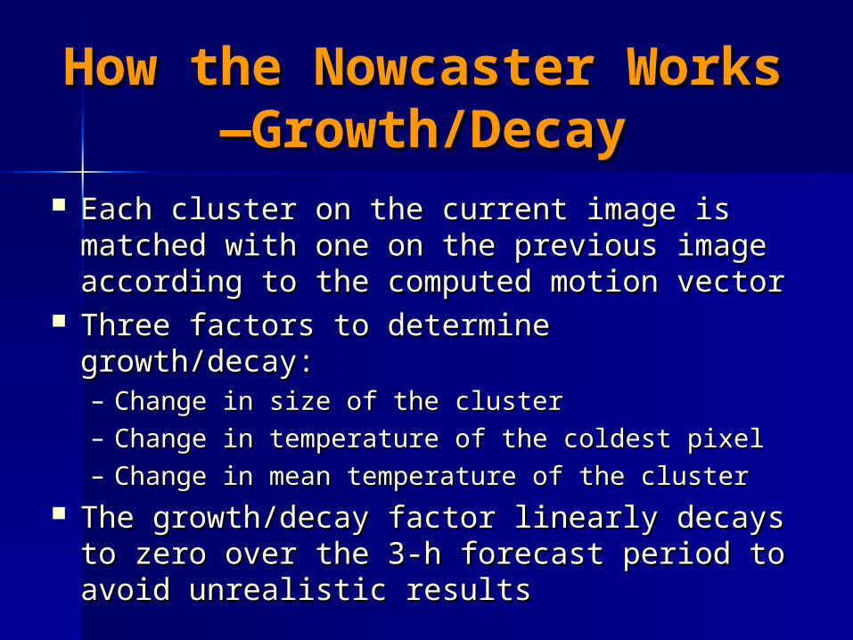
Each cluster on the current image is Each cluster on the current image is matched with one on the previous image matched with one on the previous image according to the computed motion vectoraccording to the computed motion vector
Three factors to determine growth/decay:Three factors to determine growth/decay:– Change in size of the clusterChange in size of the cluster– Change in temperature of the coldest pixelChange in temperature of the coldest pixel– Change in mean temperature of the clusterChange in mean temperature of the cluster
The growth/decay factor linearly decays to The growth/decay factor linearly decays to zero over the 3-h forecast period to avoid zero over the 3-h forecast period to avoid unrealistic resultsunrealistic results
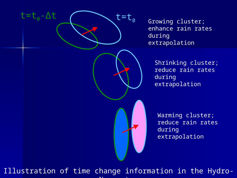
Illustration of time change information in the Hydro-Nowcaster
t=t0-Δt t=t0 Growing cluster; enhance rain rates during extrapolation
Shrinking cluster; reduce rain rates during extrapolation
Warming cluster; reduce rain rates during extrapolation
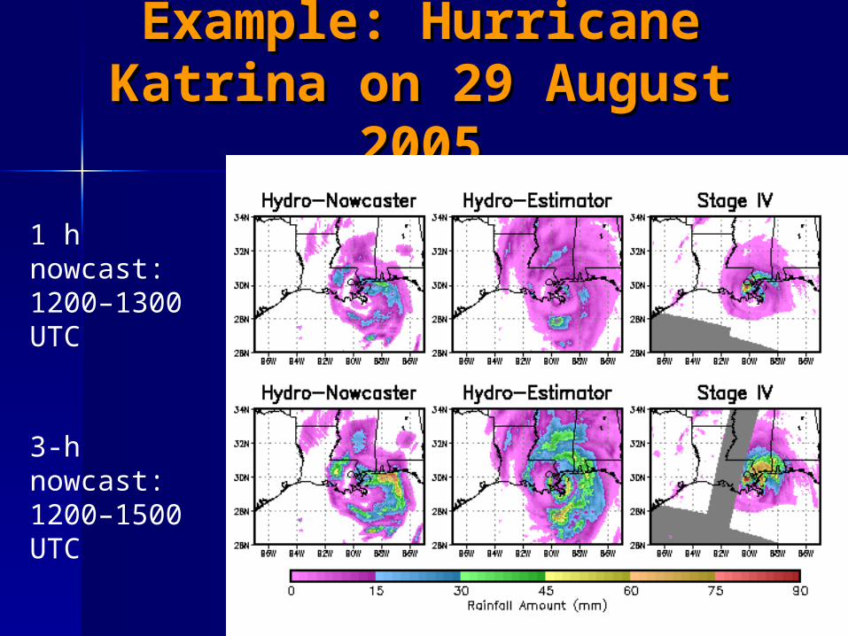
Example: Hurricane Example: Hurricane Katrina on 29 August Katrina on 29 August
20052005
1 h nowcast:1200–1300 UTC
3-h nowcast: 1200–1500 UTC
Future WorkFuture Work The Hydro-Estimator is currently being The Hydro-Estimator is currently being
recalibrated to address weaknesses, recalibrated to address weaknesses, particularly underestimation of heavy particularly underestimation of heavy rainfall from warm cloudsrainfall from warm clouds
Hydro-Nowcaster improvements are Hydro-Nowcaster improvements are planned:planned:– Improve the scheme for depicting cloud Improve the scheme for depicting cloud
growth and decay—currently empiricalgrowth and decay—currently empirical– Develop an advection scheme for circular Develop an advection scheme for circular
storms—motion vectors for multiple lags?storms—motion vectors for multiple lags?– Account for the effects of orography on Account for the effects of orography on
nowcasts of rainfallnowcasts of rainfall
Additional PlansAdditional Plans
Beginning collaboration between City Beginning collaboration between City College of New York, NOAA/National College of New York, NOAA/National Weather Service, and NESDIS to Weather Service, and NESDIS to evaluate and test multiple nowcasting evaluate and test multiple nowcasting frameworks (HN, TITAN, RDT) over the frameworks (HN, TITAN, RDT) over the New York City metropolitan area.New York City metropolitan area.
Focus is on NYC, but results will be Focus is on NYC, but results will be considered in operational satellite-considered in operational satellite-based nowcasting development in the based nowcasting development in the US.US.
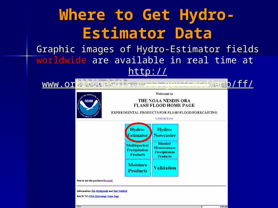
Where to Get Hydro-Where to Get Hydro-Estimator DataEstimator Data
Graphic images of Hydro-Estimator fields Graphic images of Hydro-Estimator fields worldwideworldwide are available in real time at are available in real time at http://
www.orbit.nesdis.noaa.gov/smcd/emb/ff/
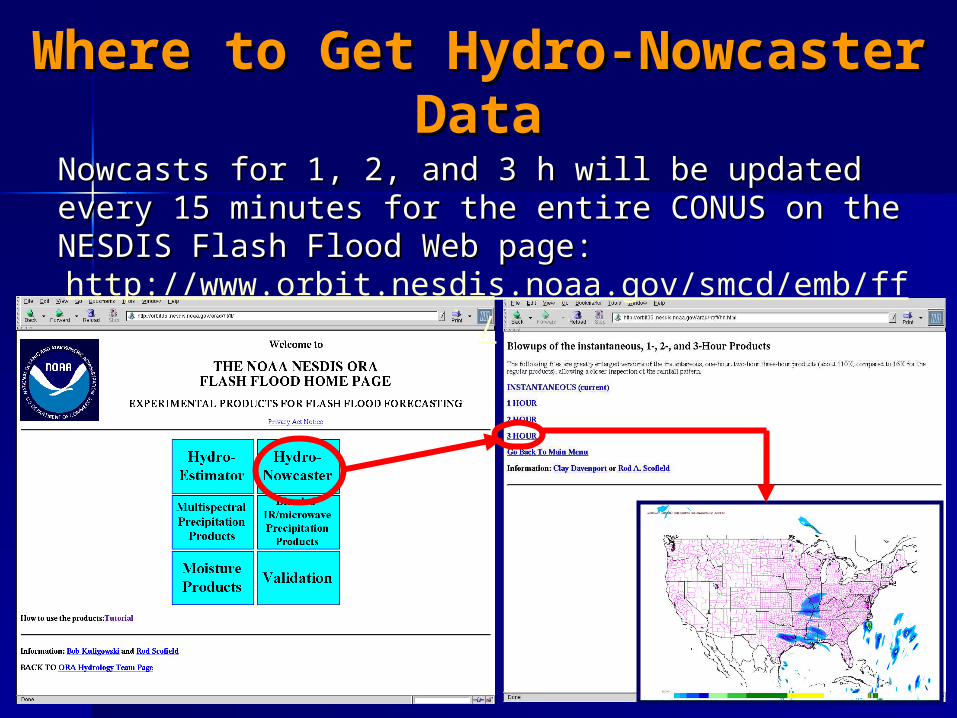
Where to Get Hydro-Nowcaster Where to Get Hydro-Nowcaster DataData
Nowcasts for 1, 2, and 3 h will be updated every 15 Nowcasts for 1, 2, and 3 h will be updated every 15 minutes for the entire CONUS on the NESDIS Flash minutes for the entire CONUS on the NESDIS Flash Flood Web page:Flood Web page:
http://www.orbit.nesdis.noaa.gov/smcd/emb/ff/
International International CollaborationCollaboration
The Instituto MeteorolThe Instituto Meteorolóógical Nacional in gical Nacional in Costa Rica is running the Hydro-Estimator in Costa Rica is running the Hydro-Estimator in real time as input to the Central American real time as input to the Central American Flash Flood Guidance (CAFFG) system, which Flash Flood Guidance (CAFFG) system, which supports 7 Central American countries.supports 7 Central American countries.
The ComisiThe Comisióón Nacional del Agua in Mexico is n Nacional del Agua in Mexico is also running the Hydro-Estimator in real time also running the Hydro-Estimator in real time for forecaster support.for forecaster support.
The Hydro-Estimator and Hydro-Nowcaster The Hydro-Estimator and Hydro-Nowcaster source code can be made available to source code can be made available to interested parties—contact me at interested parties—contact me at [email protected]@noaa.gov

Questions?Questions?