Embed Size (px)
Citation preview
27.05.2015
FIG Working Week 2015 1
The Importance of Integration Solutions in Spatial Data
Applications
Dr. Emin BANK
Representative of NETCAD
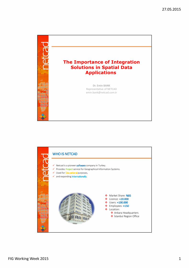
WHO IS NETCADWHO IS NETCADWHO IS NETCADWHO IS NETCAD
� Netcad is a pioneer softwaresoftwaresoftwaresoftware company in Turkey.
� Provides ProjectProjectProjectProject service for Geographical Information Systems.
� Used for Educational Educational Educational Educational purposes,
� and expanding InternationallyInternationallyInternationallyInternationally.
� Market Share: %85%85%85%85� Licence: +2+2+2+20.0000.0000.0000.000� Users: +1+1+1+100.00000.00000.00000.000� Employees: ++++150150150150� Location:
� Ankara Headquarters� İstanbul Region Office
27.05.2015
FIG Working Week 2015 2
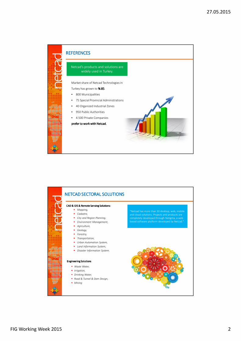
REFERENCESREFERENCESREFERENCESREFERENCES
Netcad’s products and solutions are widely used in Turkey.
Market share of Netcad Technologies in
Turkey has grown to %%%% 88885555.
• 800 Municipalities
• 75 Special Provincial Administrations
• 40 Organized Industrial Zones
• 950 Public Authorities
• 4.500 Private Companies
prefer prefer prefer prefer to work with to work with to work with to work with NetcadNetcadNetcadNetcad....
CAD & GIS & Remote Sensing Solutions:CAD & GIS & Remote Sensing Solutions:CAD & GIS & Remote Sensing Solutions:CAD & GIS & Remote Sensing Solutions:
� Mapping,
� Cadastre,
� City and Region Planning,
� Environment Management,
� Agriculture,
� Geology,
� Forestry,
� Transportation,
� Urban Automation System,
� Land Information System,
� Disaster Information System.
NETCAD SECTORAL SOLUTIONSNETCAD SECTORAL SOLUTIONSNETCAD SECTORAL SOLUTIONSNETCAD SECTORAL SOLUTIONS
“Netcad has more than 30 desktop, web, mobile
and cloud solutions. Projects and products are
completely developed through Netigma, a web
based software platform developed by Netcad."
Engineering SolutionsEngineering SolutionsEngineering SolutionsEngineering Solutions
� Waste Water,
� Irrigation,
� Drinking Water,
� Road & Tunnel & Dam Design,
� Mining
27.05.2015
FIG Working Week 2015 3
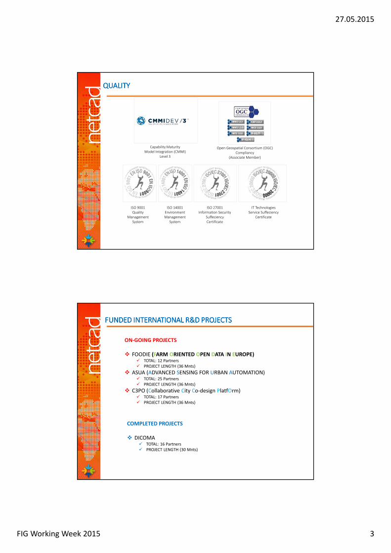
Capability Maturity Model Integration (CMMI)
Level 3
Open Geospatial Consortium (OGC) Compliancy
(Associate Member)
ISO 9001 Quality
Management System
ISO 14001 Environment Management
System
ISO 27001 Information Security
SuffeciencyCertificate
IT Technologies Service Suffeciency
Certificate
QUALITYQUALITYQUALITYQUALITY
FUNDED FUNDED FUNDED FUNDED INTERNATIONAL INTERNATIONAL INTERNATIONAL INTERNATIONAL R&D PROJECTSR&D PROJECTSR&D PROJECTSR&D PROJECTS
ON-GOING PROJECTS
� FOODIE (FARM ORIENTED OPEN DATA IN EUROPE)� TOTAL: 12 Partners
� PROJECT LENGTH (36 Mnts)
� ASUA (ADVANCED SENSING FOR URBAN AUTOMATION)� TOTAL: 25 Partners
� PROJECT LENGTH (36 Mnts)
� C3PO (Collaborative City Co-design PlatfOrm)� TOTAL: 17 Partners
� PROJECT LENGTH (36 Mnts)
COMPLETED PROJECTS
� DICOMA� TOTAL: 16 Partners
� PROJECT LENGTH (30 Mnts)
27.05.2015
FIG Working Week 2015 4
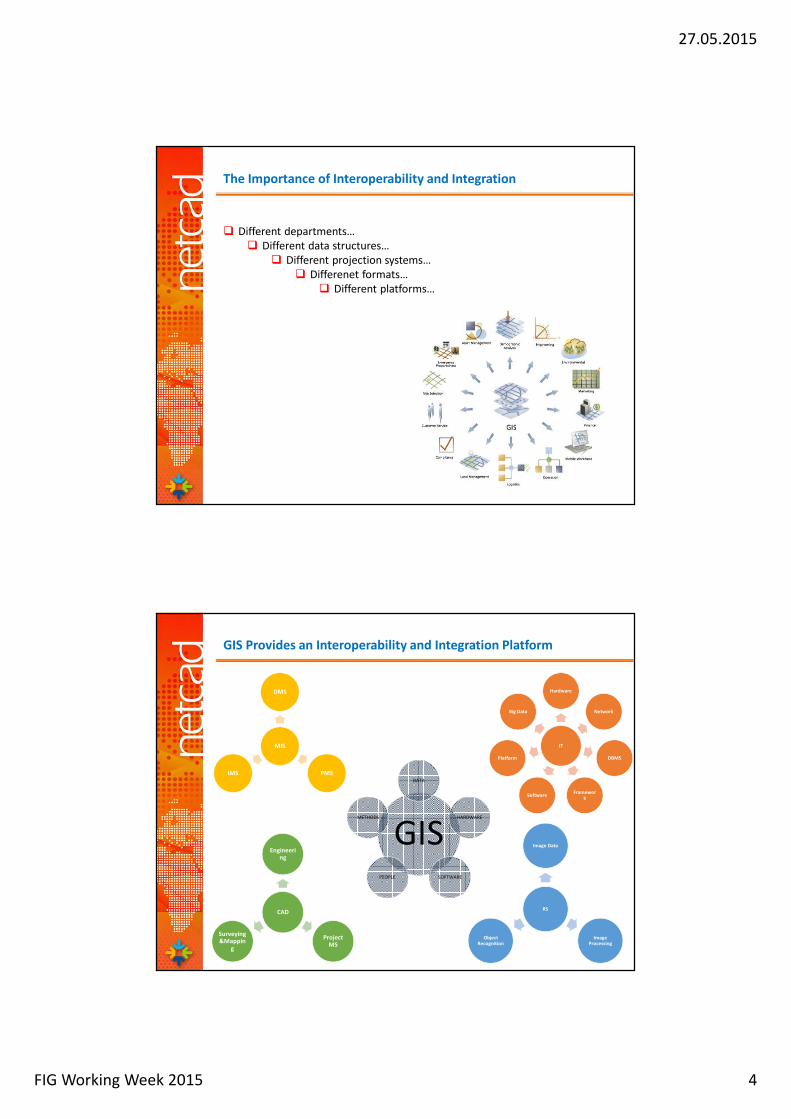
The Importance of Interoperability and Integration
� Different departments…
� Different data structures…
� Different projection systems…
� Differenet formats…
� Different platforms…
GIS Provides an Interoperability and Integration Platform
GIS
DATA
HARDWARE
SOFTWAREPEOPLE
METHODS
CAD
Engineering
Project MS
Surveying&Mappin
g
RS
Image Data
Image Processing
Object Recognition
IT
Hardware
Network
DBMS
Framework
Software
Platform
Big Data
MIS
DMS
PMSIMS

27.05.2015
FIG Working Week 2015 5
Through GIS…
� Reach all the data fast and easily
� Extended query and analysis opportunity
� Realize the reporting process simply
� The inclusive thematic mapping
� Through sharing all the data via web
SPATIAL-DATA-BASED PROJECTS…
%20CAD
%20MIS
%60GIS
%70CAD
%15MIS
%15GIS
%40CAD
%20MIS
%40GIS
%20CAD
%10MIS
%70GIS%30CAD
%30MIS
%40GIS
27.05.2015
FIG Working Week 2015 6
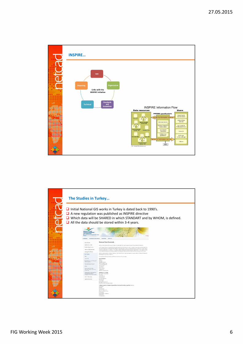
INSPIRE…
The Studies in Turkey…
� Initial National GIS works in Turkey is dated back to 1990’s.
� A new regulation was published as INSPIRE directive
� Which data will be SHARED in which STANDART and by WHOM, is defined.
� All the data should be stored within 3-4 years.
27.05.2015
FIG Working Week 2015 7
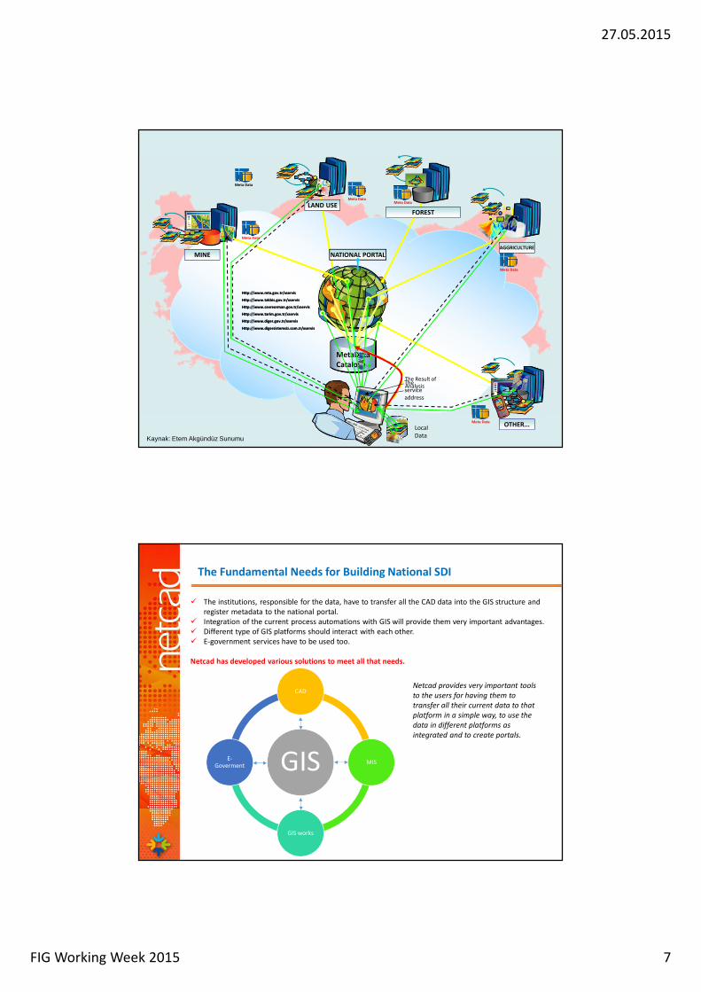
MetaData
Cataloğu
NATIONAL PORTAL
LAND USE
MINEAGGRICULTURE
OTHER...Local
Data
The
service
address
Http://www.takbis.gov.tr/xservis
Http://www.cevreorman.gov.tr/xservis
Http://www.tarim.gov.tr/xservis
The Result of
Analysis
Http://www.mta.gov.tr/xservis
FOREST
Http://www.diger.gov.tr/xservis
Http://www.digersistemsiz.com.tr/xservis
Http://www.takbis.gov.tr/xservis
Http://www.mta.gov.tr/xservis
Http://www.tarim.gov.tr/xservis
Http://www.diger.gov.tr/xservis
Http://www.digersistemsiz.com.tr/xservis
Http://www.cevreorman.gov.tr/xservis
Meta Data
Meta Data
Meta DataMeta Data
Meta Data
Meta Data
Kaynak: Etem Akgündüz Sunumu
The Fundamental Needs for Building National SDI
� The institutions, responsible for the data, have to transfer all the CAD data into the GIS structure and
register metadata to the national portal.
� Integration of the current process automations with GIS will provide them very important advantages.
� Different type of GIS platforms should interact with each other.
� E-government services have to be used too.
Netcad has developed various solutions to meet all that needs.
GIS
CAD
MIS
GIS works
E-Goverment
Netcad provides very important tools
to the users for having them to
transfer all their current data to that
platform in a simple way, to use the
data in different platforms as
integrated and to create portals.
27.05.2015
FIG Working Week 2015 8
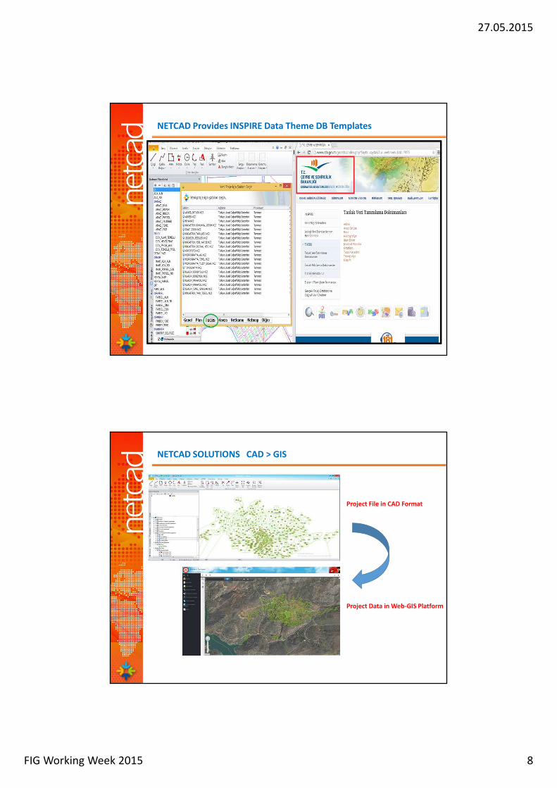
NETCAD Provides INSPIRE Data Theme DB Templates
Project File in CAD Format
Project Data in Web-GIS Platform
NETCAD SOLUTIONS CAD > GIS
27.05.2015
FIG Working Week 2015 9
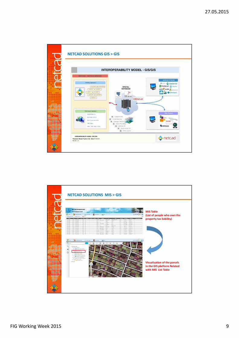
NETCAD SOLUTIONS GIS > GIS
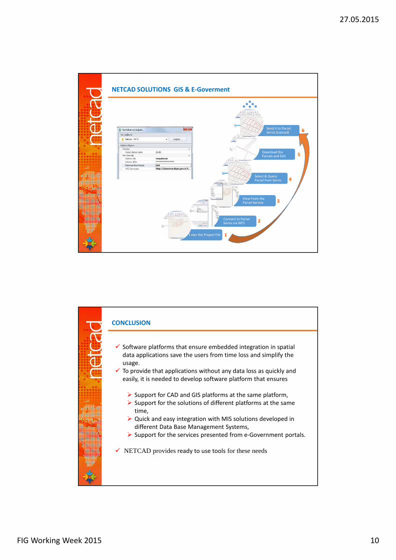
MIS Table
(List of people who own the
property tax liability)
Visualization of the parcels
in the GIS platform Related
with MIS List Table
NETCAD SOLUTIONS MIS > GIS
27.05.2015
FIG Working Week 2015 10
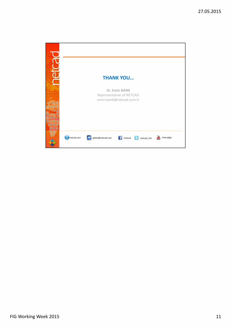
Enter the Project File
Connect to ParcelServis via WFS
View From the Parcel Service
Select & Query Parsel from Servis
Download theParcels and Edit
Send it to ParcelServis (Upload)
NETCAD SOLUTIONS GIS & E-Goverment
CONCLUSION
� Software platforms that ensure embedded integration in spatial
data applications save the users from time loss and simplify the
usage.
� To provide that applications without any data loss as quickly and
easily, it is needed to develop software platform that ensures
� Support for CAD and GIS platforms at the same platform,
� Support for the solutions of different platforms at the same
time,
� Quick and easy integration with MIS solutions developed in
different Data Base Management Systems,
� Support for the services presented from e-Government portals.
� NETCAD provides ready to use tools for these needs
27.05.2015
FIG Working Week 2015 11
THANK YOU…
Dr. Emin BANK
Representative of NETCAD
netcad.com [email protected] /netcad /netcad_intl /netcadgis
![Spatial Data Infrastructure (SDI) “[Spatial Data Infrastructure] provides a basis for spatial data discovery, evaluation, and application for users and](https://img.pdfslide.net/doc/110x75/56649d5f5503460f94a3f713/spatial-data-infrastructure-sdi-spatial-data-infrastructure-provides.jpg)


![Optimizing parameters for similarity-based spatial matching · Spatial data matching [LM04] is a branch of data matching where the data being match-ed is spatial. Spatial data has](https://img.pdfslide.net/doc/110x75/5d67a0f788c993660d8b7631/optimizing-parameters-for-similarity-based-spatial-spatial-data-matching-lm04.jpg)