Embed Size (px)
Citation preview
The INA Volume 26. No.1 Spring 1999
3
10
12
19
20
21
22
23
Looking for Ships: The 1998 Central Azores Shipwreck Survey Kevin Crisman
The 1998 INA-Egypt Surveys Douglas Haldane
Sailing a Paleolithic Raft Robert G. Bednarik
Profile: Jerome L. Hall
Just Released: When Horses Walked on Water
Chinese export porcelain from the wreck of the Sydney Cove (1797) by Mark Staniforth and Mike Nash Reviewed by Cheryl Ward
News and Notes
In Memoriam: Billings Ruddock
MEMBERSHIP Institute of Nautical Archaeology
P.O. Drawer HG College Station, TX 77841-5137
Learn firsthand of the latest discoveries in nautical archaeology. Members receive the INA Quarterly and other benefits (see INA Quarterly 25.1,27).
Researcher (students only) ..... $25 Seafarer .................. $40-99 Surveyor .............. $100-249 Diver ................... $250-499 Restorer ................ $500-999 Curator ........... $1,000-$2,499 Excavator ........... $2,500-4,999 Archaeologist ...... $5,000-9,999 Navigator .......... $10,000-24,999 Anchor .......... $25,000 and over
Checks in U.S. currency should be made payable to INA. The portion of any donation in excess of $10.00 is a tax-deductible, charitable contribution.
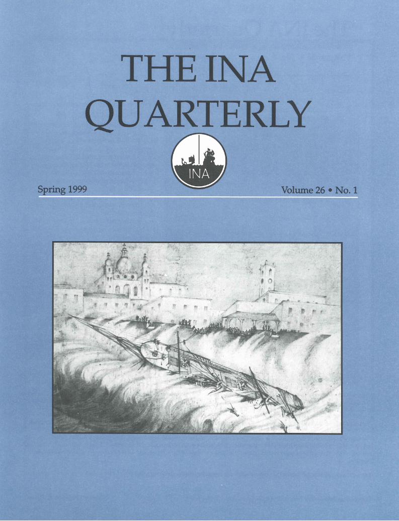
On the cover: Many ships were lost at Faial in the central Azores, where INA has been conducting archaeological surveys. In this pencil sketch, "Going Ashore at Fayal, Azores" by S. Gough (M6740), North Star, a bark, is depicted foundering in view of the town on 18th January 1858. Courtesy Peabody Essex Museum, Salem, Massachusetts.
© April 1999 by the Institute of Nautical Archaeology. All rights reserved.
INA welcomes requests to reprint INA Quarterly articles and illustrations. Please address all requests and submissions to the Editor, INA Quarterly, P.o. Drawer HG, College Station, TX 77841-5137; tel (409) 845-6694, fax (409) 847-9260, e-mail [email protected] Article should be submitted in hard copy and on a 3.25 diskette (Macintosh, DOS, or Wmdows format acceptable) along with all artwork.
The Home Page for INA and the Texas A&M University Nautical Archaeology Program on the WorldWideWeb is http://nautarch.tamu.edu
The Institute of Nautical Archaeology is a non-profit scientific and educational organization, incorporated in 1972. Since 1976, INA has been affiliated with Texas A&M University, where INA faculty teach in the Nautical Archaeology Program of the Department of Anthropology. The opinions expressed in Quarterly articles are those of the authors, and do not necessarily reflect the views of the Institute.
The editorship of the INA Quarterly is supported by the Anna C. & Oliver C. Colburn Fund.
The INA Quarterly was formerly the INA Newsletter (vols. 1-18). Editor: Christine A. Powell
Looking for Ships: The 1998 Central Azores Shipwreck Survey
Kevin Crisman
A Reconnaissance of the Central Azores
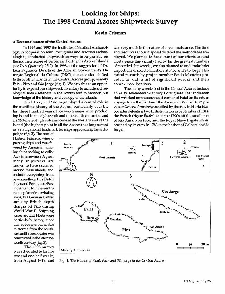
In 1996 and 1997 the Institute of Nautical Archaeology, in cooperation with Portuguese and Azorian archaeologists, conducted shipwreck surveys in Angra Bay on the southern shore of Terceira in Portugal's Azores Islands (see INA Quarterly 25:2). In 1998, at the suggestion of Dr. Luiz Fagundes Duarte of the Azorian Government's Direc<;ao Regional da Cultura (DRC), our attention shifted to three other islands in the Central Azores group, namely Faial, Pico and Sao Jorge (fig. 1). We saw this as an opportunity to expand our shipwreck inventory to include archaeological sites elsewhere in the Azores and to broaden our knowledge of the history and geology of the islands.
Faial, Pico, and Sao Jorge played a central role in the maritime history of the Azores, particularly over the last three hundred years. Pico was a major wine-producing island in the eighteenth and nineteenth centuries, and a 2,350-meter-high volcanic cone at the western end of the island (the highest point in all the Azores) has long served as a navigational landmark for ships approac..hing the archi
North America
1
was very much in the nature of a reconnaissance. The time and resources at our disposal dictated the methods we employed. We planned to focus most of our efforts around Horta, since this vicinity had by far the greatest numbers of recorded shipwrecks; we also planned to undertake brief inspections of selected harbors at Pico and Sao Jorge. Historical research by project member Paulo Monteiro provided us with a list of significant wrecks and their approximate locations.
The many wrecks lost in the Central Azores include an early seventeenth-century Portuguese East Indiaman that wrecked off the southeast comer of Faial on its return voyage from the Far East; the American War of 1812 privateer General Annstrong, scuttled by its crew in Horta Harbor after defeating two British attacks in September of 1814; the French frigate Etoile lost in the 1790s off the small port of Sao Amaro on Pico; and the Royal Navy frigate Pallas, scuttled by its crew in 1783 in the harbor of Calheta on Sao Jorge.
• o 2
~~~1 o Terceira
Azores
pelago (fig. 2). The port of Horta on Faial sold wine to passing ships and was favored by American whaling ships seeking to enlist Azorian crewmen. A great many shipwrecks are known to have occurred around these islands, and include everything from seventeenth-century Dutch fluyts and Portuguese East Indiaman, to nineteenthcentury American whaling
North Atlantic Central Azores Sao Miguel ~
ships, to a German U-Boat sunk by British depth charges off Pico during World War II. Shipping losses around Horta were particularly heavy, since this harbor was vulnerable to storms from the southeast until a breakwater was constructed in the late nineteenth century (fig. 3).
The 1998 survey was scheduled to last for two and one-half weeks,
N
@ 3
Map by K. Crisman
from August 1-19, and Fig. 1. The Islands of Faial, Pica, and Sao Jorge in the Central Azores.
3
o 10 20 km.
INA Quarterly 26.1
Experience at Angra demonstrated that sonar was likely to be the best tool for searching large areas of sea bottom. We had at our disposal a new Marine Sonic Technology, Ltd. 300 KHz Sea Scan PC sonar donated by INA Director Martin Wilcox, and INA research associate Brett Phaneuf was able to alter his busy summer schedule in order to join us for the second week of the project and operate the sonar unit. Other elements of our survey included diver inspections of selected areas of the sea bottom to collect information on geology, sediment accumulations, and currents, as well as interviews with local historians, fishermen, and divers.
Sponsors of the 1998 project included INA, DRC, and the Centro Nacional de Arqueologia Nautica e Sub aquatic a (CNANS) in Lisbon. The Instituto Portugues de Arqueologia (IP A), also in Lisbon, issued the permit for the survey. I served as INA's project director, Paulo Monteiro coordinated project logistics and the DRC-
Fig. 2. The volcanic cone of Pico, seen from Horta.
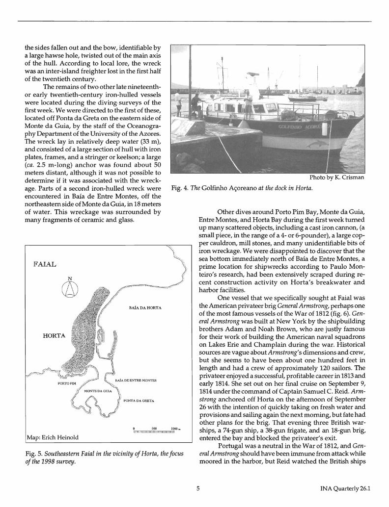
CNANS team, and my longtime friend and colleague Arthur Cohn of the Lake Champlain Maritime Museum supervised diving safety. Funding was provided by DRC and by a generous grant to the Azores project provided by Mrs. Sylvia Baird. Our research vessel in 1998 was a seaworthy World War II-era steel-hulled craft called GoIfinho Aforeano ("Azorian Dolphin"), leased by the DRC (fig. 4).
The 1998 Project
Only three weeks before the start of our project, Faial was shaken by a massive earthquake that flattened hous-
Fig. 3. The harbor of Horta, with Monte da Guia.
INA Quarterly 26.1
es across the island and killed or injured many residents. For a time we questioned whether it would be possible to carry out the survey as planned, but Paulo Monteiro reported that the effects of the quake were mostly concentrated in the northeastern part of the island, not in Horta, and we therefore decided to go ahead with the project. The INA team, consisting of Crisman, Cohn, and Nautical Archaeology Program student Erich Heinold, flew to Faial on August 1, where we joined our six Portuguese colleagues, as well as the GoIfinho Aforeano with its crew of two. Evidence of the earthquake was visible in cracked and buckled walls arolUld Horta, and when we checked into
4
our hotel workmen were busy plastering a multitude of small cracks in the walls and ceilings. Two small aftershocks shook the island during the project, each time in the wee hours of the morning; the Azorian members of our team were all instantly awakened by the rumbling, but the seismically-oblivious INA crew slept through both events.
We formally began operations on August 3. The first week was devoted to diver surveys of the sea bottom around the southeastern corner of Faial, particularly around Horta, the smaller bay of Porto Pim, and the volcanic cone of Monte da Guia (fig. 5). The first dive on the first day, in the bay of Porto Pim, revealed the shattered remains of an iron-hulled vessel approximately 100 meters in length. The wreck was situated parallel to the shore, in about 8 meters of water, at the interface of the rocky slope of Monte da Guia and the flat sand bottom of the bay. It was in a badly broken-up condition, with
the sides fallen out and the bow, identifiable by a large hawse hole, twisted out of the main axis of the hull. According to local lore, the wreck was an inter-island freighter lost in the first half of the twentieth century.
The remains of two other late nineteenthor early twentieth-century iron-hulled vessels were located during the diving- surveys of the first week. We were directed to the first of these, located off Ponta da Greta on the eastern side of Monte da Guia, by the staff of the Oceanography Department of the University of the Azores. The wreck lay in relatively deep water (33 m), and consisted of a large section of hull with iron plates, frames, and a stringer or keelson; a large (ca. 2.5 m-long) anchor was found about 50 meters distant, although it was not possible to determine if it was associated with the wreckage. Parts of a second iron-hulled wreck were encountered in Baia de Entre Montes, off the northeastern side of Monte da Guia, in 18 meters of water. This wreckage was surrounded by many fragments of ceramic and glass.
FAIAL
N
© BAiA DA HORTA
HORTA
Map: Erich Heinold
Photo by K. Crisman
Fig. 4. The Golfinho Ac;oreano at the dock in Horta.
Other dives around Porto Pim Bay, Monte da Guia, Entre Montes, and Horta Bay during the first week turned up many scattered objects, including a cast iron cannon, (a small piece, in the range of a 4- or 6-pounder), a large copper cauldron, mill stones, and many unidentifiable bits of iron wreckage. We were disappointed to discover that the sea bottom immediately north of Baia de Entre Montes, a prime location for shipwrecks according to Paulo Monteiro's research, had been extensively scraped during recent construction activity on Horta's breakwater and harbor facilities.
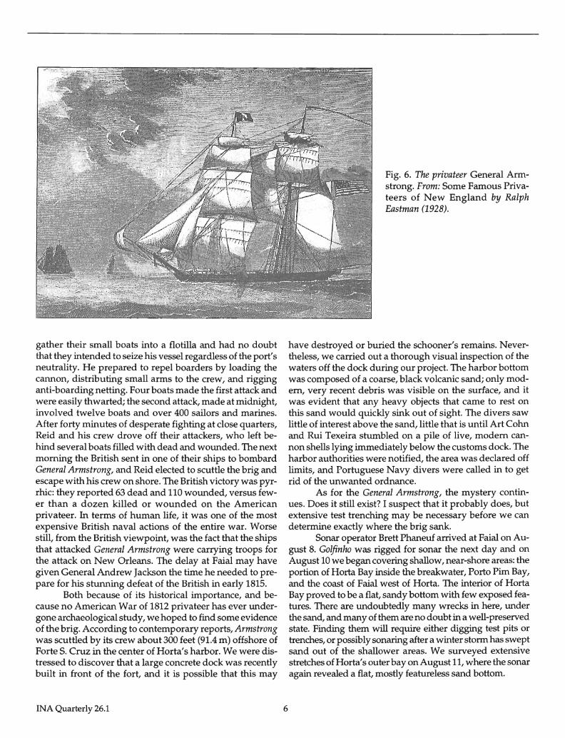
One vessel that we specifically sought at Faial was the American privateer brig General Armstrong, perhaps one of the most famous vessels of the War of 1812 (fig. 6). General Armstrong was built at New York by the shipbuilding brothers Adam and Noah Brown, who are justly famous for their work of building the American naval squadrons on Lakes Erie and Champlain during the war. Historical sources are vague about Armstrong's dimensions and crew, but she seems to have been about one hundred feet in length and had a crew of approximately 120 sailors. The privateer enjoyed a successful, profitable career in 1813 and early 1814. She set out on her final cruise on September 9, 1814 under the command of Captain Samuel C. Reid. Armstrong anchored off Horta on the afternoon of September 26 with the intention of quickly taking on fresh water and provisions and sailing again the next morning, but fate had other plans for the brig. That evening three British warships, a 74-gun ship, a 38-gun frigate, and an 18-gun brig, entered the bay and blocked the privateer's exit.
Fig. 5. Southeastern Faial in the vicinity of Horta, the focus of the 1998 survey.
Portugal was a neutral in the War of 1812, and General Armstrong should have been immune from attack while moored in the harbor, but Reid watched the British ships
5 INA Quarterly 26.1
gather their small boats into a flotilla and had no doubt that they intended to seize his vessel regardless of the port's neutrality. He prepared to repel boarders by loading the cannon, distributing small arms to the crew, and rigging anti-boarding netting. Four boats made the first attack and were easily thwarted; the second attack, made at midnight, involved twelve boats and over 400 sailors and marines. After forty minutes of desperate fighting at close quarters, Reid and his crew drove off their attackers, who left behind several boats filled with dead and wounded. The next morning the British sent in one of their ships to bombard General Armstrong, and Reid elected to scuttle the brig and escape with his crew on shore. The British victory was pyrrhic: they reported 63 dead and 110 wounded, versus fewer than a dozen killed or wounded on the American privateer. In terms of human life, it was one of the most expensive British naval actions of the entire war. Worse still, from the British viewpoint, was the fact that the ships that attacked General Armstrong were carrying troops for the attack on New Orleans. The delay at Faial may have given General Andrew Jackson the time he needed to prepare for his stunning defeat of the British in early 1815.
Both because of its historical importance, and because no American War of 1812 privateer has ever undergone archaeological study, we hoped to find some evidence of the brig. According to contemporary reports, Armstrong was scuttled by its crew about 300 feet (91.4 m) offshore of Forte S. Cruz in the center of Horta's harbor. We were distressed to discover that a large concrete dock was recently built in front of the fort, and it is possible that this may
INA Quarterly 26.1 6
Fig. 6. The privateer General Armstrong. From: Some Famous Privateers of New England by Ralph Eastman (1928).
have destroyed or buried the schooner's remains. Nevertheless, we carried out a thorough visual inspection of the waters off the dock during our project. The harbor bottom was composed of a coarse, black volcanic sand; only modem, very recent debris was visible on the surface, and it was evident that any heavy objects that came to rest on this sand would quickly sink out of sight. The divers saw little of interest above the sand, little that is until Art Cohn and Rui Texeira stumbled on a pile of live, modem cannon shells lying immediately below the customs dock. The harbor authorities were notified, the area was declared off limits, and Portuguese Navy divers were called in to get rid of the unwanted ordnance.
As for the General Armstrong, the mystery continues. Does it still exist? I suspect that it probably does, but extensive test trenching may be necessary before we can determine exactly where the brig sank.
Sonar operator Brett Phaneuf arrived at Faial on August 8. Golfinho was rigged for sonar the next day and on August 10 we began covering shallow, near-shore areas: the portion of Horta Bay inside the breakwater, Porto Pim Bay, and the coast of Faial west of Horta. The interior of Horta Bay proved to be a flat, sandy bottom with few exposed features. There are undoubtedly many wrecks in here, under the sand, and many of them are no doubt in a well-preserved state. Finding them will require either digging test pits or trenches, or possibly sonaring after a winter storm has swept sand out of the shallower areas. We surveyed extensive stretches of Horta's outer bay on August II, where the sonar again revealed a flat, mostly featureless sand bottom.
During the remaining time of the project we conducted a series of reconnaissance dives on the coasts of Pica and Sao Jorge. On the north shore of Pica, at the small port of Sao Amaro, we searched for the late eighteenth century French frigate Etoile, and at Velas, on the south coast of Sao Jorge, we looked for a number of wrecks reported in historic records. At both locations we were treated to the sight of some spectacular geology: heaps of massive, sea-rounded boulders, lava flows twisted into bizarre shapes by sudden cooling in sea water, and vertical cliffs that drop off abruptly into the immense depths between Pica and Sao Jorge. These dives were a volcanologist's dream, but proved frustrating for us archaeologists, since finding wrecks in this rugged topography would require much more diving time than we had available to us.
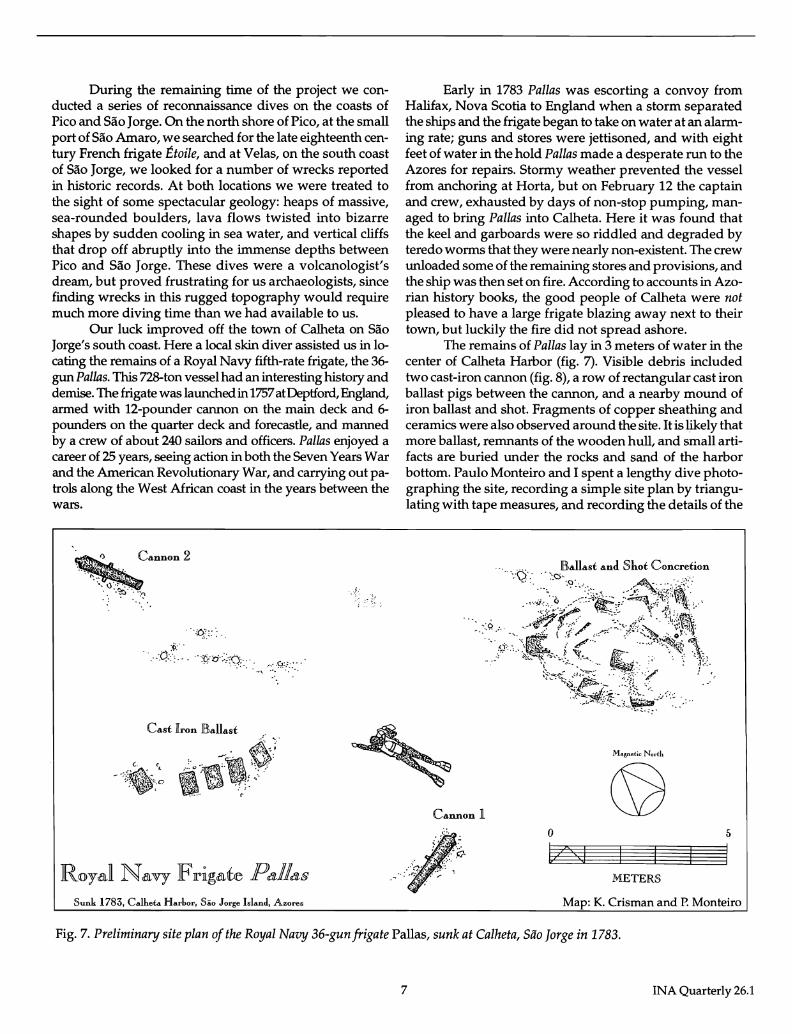
Our luck improved off the town of Calheta on Sao Jorge's south coast. Here a local skin diver assisted us in locating the remains of a Royal Navy fifth-rate frigate, the 36-gun Pallas. This 728-ton vessel had an interesting history and demise. The frigate was launched in 1757 at Deptford, England, armed with 12-pounder cannon on the main deck and 6-pounders on the quarter deck and forecastle, and manned by a crew of about 240 sailors and officers. Pallas enjoyed a career of 25 years, seeing action in both the Seven Years War and the American Revolutionary War, and carrying out patrols along the West African coast in the years between the wars.
Cannon 2
. /:
... '.6~,:: ..
... p/ ... ····tfb·~:;..:O;··· ... , .. :::Y.':'::: ..
Sunk 1783, Calheta Harbor, Silo Jorge Island, Azores
Early in 1783 Pallas was escorting a convoy from Halifax, Nova Scotia to England when a storm separated the ships and the frigate began to take on water at an alarming rate; guns and stores were jettisoned, and with eight feet of water in the hold Pallas made a desperate run to the Azores for repairs. Stormy weather prevented the vessel from anchoring at Horta, but on February 12 the captain and crew, exhausted by days of non-stop pumping, managed to bring Pallas into Calheta. Here it was found that the keel and garboards were so riddled and degraded by teredo worms that they were nearly non-existent. The crew unloaded some of the remaining stores and provisions, and the ship was then set on fire. According to accounts in Azorian history books, the good people of Calheta were not pleased to have a large frigate blazing away next to their town, but luckily the fire did not spread ashore.
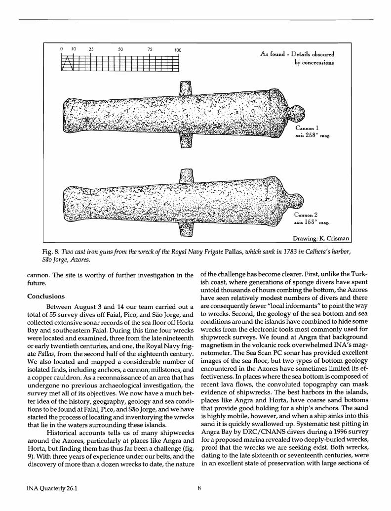
The remains of Pallas lay in 3 meters of water in the center of Calheta Harbor (fig. 7). Visible debris included two cast-iron cannon (fig. 8), a row of rectangular cast iron ballast pigs between the cannon, and a nearby mound of iron ballast and shot. Fragments of copper sheathing and ceramics were also observed around the site. It is likely that more ballast, remnants of the wooden hull, and small artifacts are buried under the rocks and sand of the harbor bottom. Paulo Monteiro and I spent a lengthy dive photographing the site, recording a simple site plan by triangulating with tape measures, and recording the details of the
Magnetic North
Cannon 1
o 5
L,z's,',j METERS
Map: K. Crisman and P. Monteiro
Fig. 7. Preliminary site plan of the Royal Navy 36-gun frigate Pallas, sunk at Calheta, Siio Jorge in 1783.
7 INA Quarterly 26.1
o 10 25 50 75 100
VMIIIIIIIIIIIIIIIIII As found - Details obscured
by con cress ions
axis 258 0 mAg.
""is 15;) 0 nl"g.
Drawin : K. Crisman
Fig. 8. Two cast iron guns from the wreck of the Royal Navy Frigate Pallas, which sank in 1783 in Calheta's harbor, Silo Jorge, Azores.
cannon. The site is worthy of further investigation in the future.
Conclusions
Between August 3 and 14 our team carried out a total of 55 survey dives off Faial, Pico, and Sao Jorge, and collected extensive sonar records of the sea floor off Horta Bay and southeastern Faial. During this time four wrecks were located and examined, three from the late nineteenth or early twentieth centuries, and one, the Royal Navy frigate Pallas, from the second half of the eighteenth century. We also located and mapped a considerable number of isolated finds, including anchors, a cannon, millstones, and a copper cauldron. As a reconnaissance of an area that has undergone no previous archaeological investigation, the survey met all of its objectives. We now have a much better idea of the history, geography, geology and sea conditions to be found at Faial, Pico, and Sao Jorge, and we have started the process of locating and inventorying the wrecks that lie in the waters surrounding these islands.
Historical accounts tells us of many shipwrecks around the Azores, particularly at places like Angra and Horta, but finding them has thus far been a challenge (fig. 9). With three years of experience under our belts, and the discovery of more than a dozen wrecks to date, the nature
INA Quarterly 26.1
of the challenge has become clearer. First, unlike the Turkish coast, where generations of sponge divers have spent untold thousands of hours combing the bottom, the Azores have seen relatively modest numbers of divers and there are consequently fewer "local informants" to point the way to wrecks. Second, the geology of the sea bottom and sea conditions around the islands have combined to hide some wrecks from the electronic tools most commonly used for shipwreck surveys. We found at Angra that background magnetism in the volcanic rock overwhelmed INA's magnetometer. The Sea Scan PC sonar has provided excellent images of the sea floor, but two types of bottom geology encountered in the Azores have sometimes limited its effectiveness. In places where the sea bottom is composed of recent lava flows, the convoluted topography can mask evidence of shipwrecks. The best harbors in the islands, places like Angra and Horta, have coarse sand bottoms that provide good holding for a ship's anchors. The sand is highly mobile, however, and when a ship sinks into this sand it is quickly swallowed up. Systematic test pitting in Angra Bay by DRCjCNANS divers during a 1996 survey for a proposed marina revealed two deeply-buried wrecks, proof that the wrecks we are seeking exist. Both wrecks, dating to the late sixteenth or seventeenth centuries, were in an excellent state of preservation with large sections of
8
intact timber structure, as we would expect from wrecks sealed and protected beneath the sand. Finding wrecks like these will take persistence and effort, but the reward will be really spectacular archaeological sites.
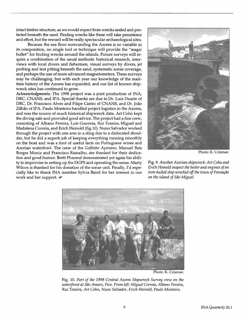
Because the sea floor surrounding the Azores is so variable in its composition, no single tool or technique will provide the "magic bullet" for finding wrecks around the islands. Future surveys will require a combination of the usual methods: historical research, interviews with local divers and fishermen, visual surveys by divers, jet probing and test pitting beneath the sand, systematic sonar coverage, and perhaps the use of more advanced magnetometers. These surveys may be challenging, but with each year our knowledge of the maritime history of the Azores has expanded, and our list of known shipwreck sites has continued to grow. Acknowledgments: The 1998 project was a joint production of INA, ORC, CNANS, and IP A. Special thanks are due to Dr. Luiz Duarte of ORC, Dr. Francisco Alves and Filipe Castro of CNANS, and Dr. J03.0 ZilM.o of IP A. Paulo Monteiro handled project logistics in the Azores, and was the source of much historical shipwreck data. Art Cohn kept the diving safe and provided good advice. The project had a fine crew, consisting of Albano Pereira, Luis Gouveia, Rui Texeira, Miguel and Madalena Correia, and Erich Heinold (fig.lO). Nuno Salvador worked through the project with one arm in a sling due to a dislocated shoulder, but he did a superb job of keeping everything running smoothly on the boat and was a font of useful facts on Portuguese wines and Azorian waterfowl. The crew of the Golfinho Aroreano, Manuel Reis Borges Moniz and Francisco Ramalho, are thanked for their dedication and good humor. Brett Phaneuf demonstrated yet again his ability to improvise in setting up the DGPS and operating the sonar. Marty Wilcox is thanked for his donation of the sonar unit. Finally, I'd especially like to thank INA member Sylvia Baird for her interest in our work and her support. <S9'
Photo: K. Crisman
Fig. 9. Another Azorian shipwreck: Art Cohn and Erich Heinold inspect the boiler and engines of an iron-hulled ship wrecked off the town of Povoap'io on the island of Sao Miguel.
Fig. 10. Part of the 1998 Central Azores Shipwreck Survey crew on the waterfront at Sao Amaro, Pico. From left: Miguel Correia, Albano Pereira, Rui Texeira, Art Cohn, Nuno Salvador, Erich Heinold, Paulo Monteiro.
9 INA Quarterly 26.1
The 1998 INA-Egypt Surveys
Douglas Haldane
The Institute of Nautical Archaeology conducts operations in many parts of the world, but in recent years has been particularly active in Turkey, Texas and Egypt. INA-Egypt Director Douglas Haldane reports here on recent activities there.
Hierakonpolis Expedition
From the 20th-31st of March, 1998, INA-Egypt performed a magnetometer survey in front of the early dynastic funerary enclosure or "Fort" at Hierakonpolis, which was Egypt's first capital, ancient Nekhen. The survey was part of the 1998 season of the Hierakonpolis Expedition directed by Dr. Renee Friedman from the University of California at Berkeley, supervised by the Egyptian Supreme Council of Antiquities (SCA). The survey was made possible thanks to funding by Clive Cussler.
The original impetus for the Hierakonpolis survey came from the 1991 discovery of 12 boats, in parallellozenge-shaped mudbrick structures in front of the Shunet ez Zebib at Abydos. The Fort at Hierakonpolis and the Shunet ez Zebib are contemporaneous funerary structures built by King Khasekhemwy (c. 2660-2649 BCE), the last pharaoh of the second dynasty. Khasekhemwy may have used Hierakonpolis as his administrative center while Abydos (the traditional burial place of Early Dynastic kings) functioned as his religious center. Dr. Friedman invited INAEgypt to investigate the possibility of funerary boats at Hierakonpolis on the strength of the Abydos discovery and the role of Hierakonpolis as an important Pre-Dynastic center.
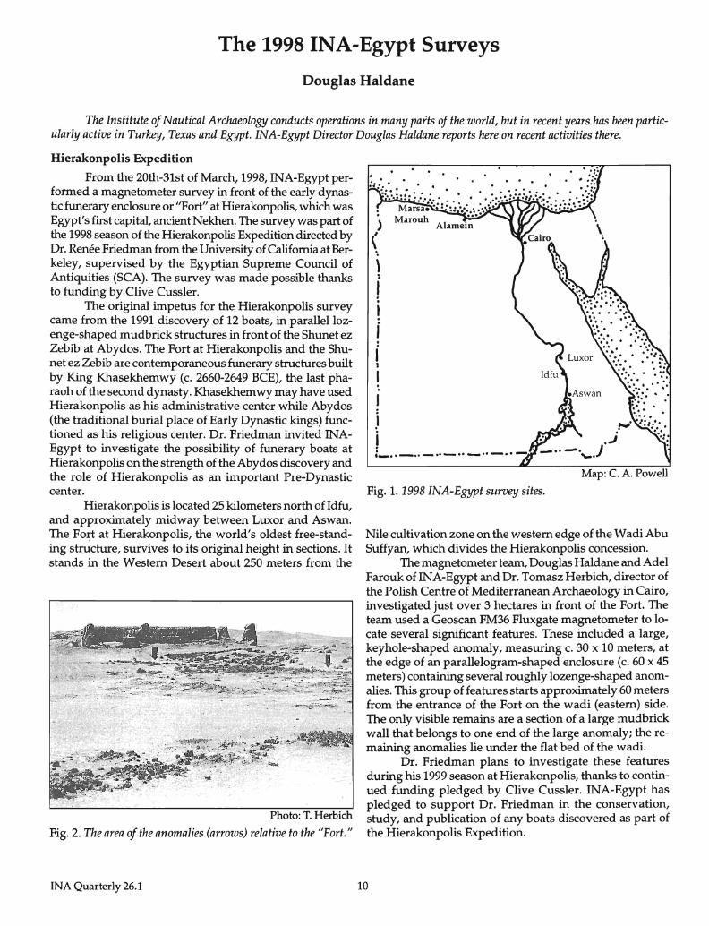
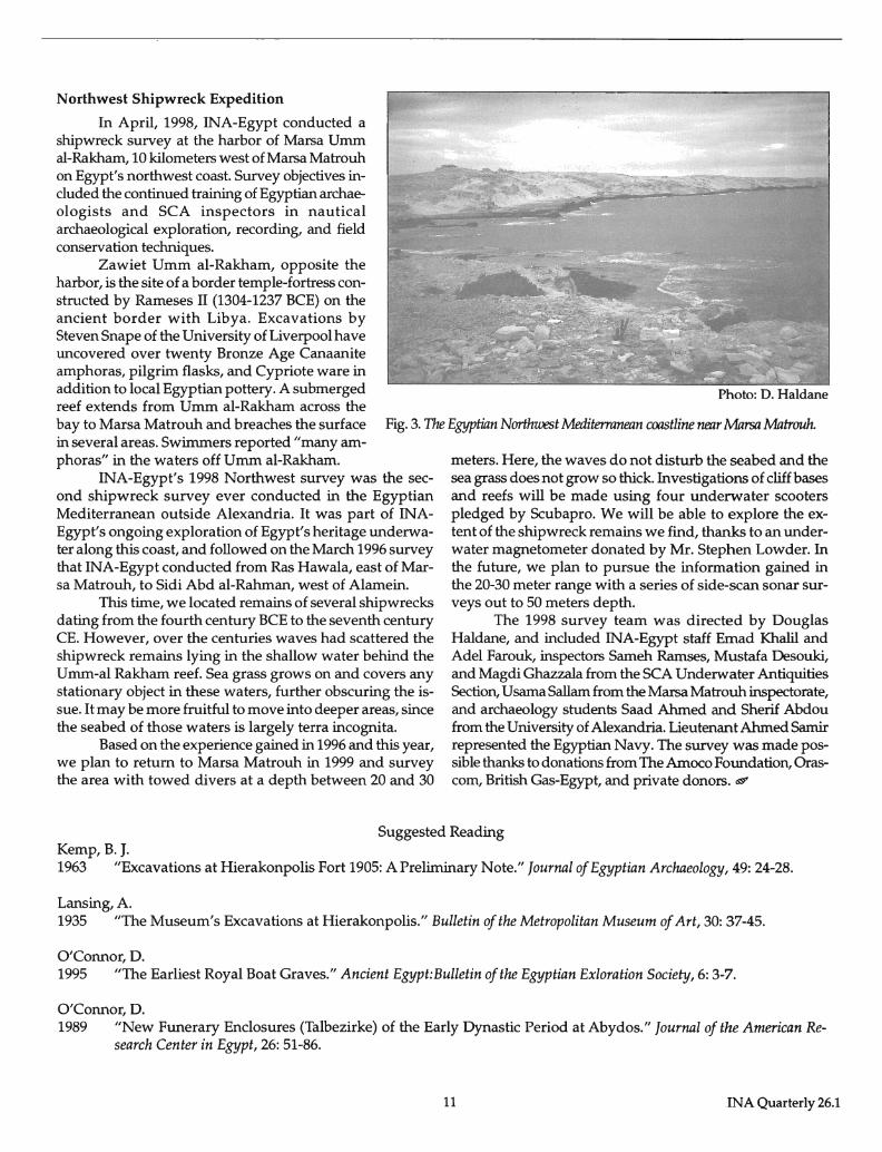
Hierakonpolis is located 25 kilometers north of Idfu, and approximately midway between Luxor and Aswan. The Fort at Hierakonpolis, the world's oldest free-standing structure, survives to its original height in sections. It stands in the Western Desert about 250 meters from the
Photo: T. Herbich
Fig. 2. The area of the anomalies (arrows) relative to the "Fort."
INA Quarterly 26.1
) (
\ ;
I . .
~ I t_ .. - .. -··_··--··-··-
Fig. 1. 1998 INA-Egypt survey sites. Map: C. A. Powell
Nile cultivation zone on the western edge of the Wadi Abu Suffyan, which divides the Hierakonpolis concession.
The magnetometer team, Douglas Haldane and Adel Farouk of INA-Egypt and Dr. Tomasz Herbich, director of the Polish Centre of Mediterranean Archaeology in Cairo, investigated just over 3 hectares in front of the Fort. The team used a Geoscan FM36 Fluxgate magnetometer to locate several significant features. These included a large, keyhole-shaped anomaly, measuring c. 30 x 10 meters, at the edge of an parallelogram-shaped enclosure (c. 60 x 45 meters) containing several roughly lozenge-shaped anomalies. This group of features starts approximately 60 meters from the entrance of the Fort on the wadi (eastern) side. The only visible remains are a section of a large mudbrick wall that belongs to one end of the large anomaly; the remaining anomalies lie under the flat bed of the wadi.
Dr. Friedman plans to investigate these features during his 1999 season at Hierakonpolis, thanks to continued funding pledged by Clive Cussler. INA-Egypt has pledged to support Dr. Friedman in the conservation, study, and publication of any boats discovered as part of the Hierakonpolis Expedition.
10
Northwest Shipwreck Expedition
In April, 1998, INA-Egypt conducted a shipwreck survey at the harbor of Marsa Umm al-Rakham, 10 kilometers west of Marsa Matrouh on Egypt's northwest coast. Survey objectives included the continued training of Egyptian archaeologists and SCA inspectors in nautical archaeological exploration, recording, and field conservation techniques.
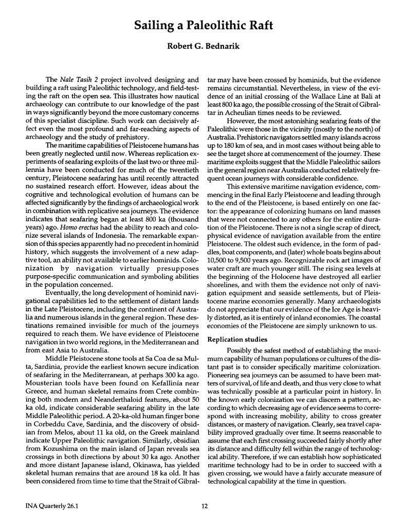
Zawiet Umm al-Rakham, opposite the harbor, is the site of a border temple-fortress constructed by Rameses II (1304-1237 BCE) on the ancient border with Libya. Excavations by Steven Snape of the University of Liverpool have uncovered over twenty Bronze Age Canaanite amphoras, pilgrim flasks, and Cypriote ware in addition to local Egyptian pottery. A submerged reef extends from Umm al-Rakham across the
Photo: D. Haldane
bay to Marsa Matrouh and breaches the surface in several areas. Swimmers reported "many amphoras" in the waters off Umm al-Rakham.
Fig. 3. The Egyptian Northwest Mediterranean coastline near Marsa Matrouh.
INA-Egypt's 1998 Northwest survey was the second shipwreck survey ever conducted in the Egyptian Mediterranean outside Alexandria. It was part of INAEgypt's ongoing exploration of Egypt's heritage underwater along this coast, and followed on the March 1996 survey that INA-Egypt conducted from Ras Hawala, east of Marsa Matrouh, to Sidi Abd aI-Rahman, west of Alamein.
This time, we located remains of several shipwrecks dating from the fourth century BCE to the seventh century CEo However, over the centuries waves had scattered the shipwreck remains lying in the shallow water behind the Umm-al Rakham reef. Sea grass grows on and covers any stationary object in these waters, further obscuring the issue. It may be more fruitful to move into deeper areas, since the seabed of those waters is largely terra incognita.
Based on the experience gained in 1996 and this year, we plan to return to Marsa Matrouh in 1999 and survey the area with towed divers at a depth between 20 and 30
meters. Here, the waves do not disturb the seabed and the sea grass does not grow so thick. Investigations of cliff bases and reefs will be made using four underwater scooters pledged by Scubapro. We will be able to explore the extent of the shipwreck remains we find, thanks to an underwater magnetometer donated by Mr. Stephen Lowder. In the future, we plan to pursue the information gained in the 20-30 meter range with a series of side-scan sonar surveys out to 50 meters depth.
The 1998 survey team was directed by Douglas Haldane, and included INA-Egypt staff Emad Khalil and Adel Farouk, inspectors Sameh Ramses, Mustafa Desouki, and Magdi Ghazzala from the SCA Underwater Antiquities Section, Usama Sallam from the Marsa Matrouh inspectorate, and archaeology students Saad Ahmed and Sherif Abdou from the University of Alexandria. Lieutenant Ahmed Samir represented the Egyptian Navy. The survey was made possible thanks to donations from The Amoco Foundation, Orascom, British Gas-Egypt, and private donors. <¢?
Suggested Reading Kemp, B. J. 1963 "Excavations at Hierakonpolis Fort 1905: A Preliminary Note." Journal of Egyptian Archaeology, 49: 24-28.
Lansing, A. 1935 "The Museum's Excavations at Hierakonpolis." Bulletin of the Metropolitan Museum of Art, 30: 37-45.
O'Connor, D. 1995 "The Earliest Royal Boat Graves." Ancient Egypt:Bulletin of the Egyptian Exloration Society, 6: 3-7.
O'Connor, D. 1989 "New Funerary Enclosures (Talbezirke) of the Early Dynastic Period at Abydos." Journal of the American Re
search Center in Egypt, 26: 51-86.
11 INA Quarterly 26.1
Sailing a Paleolithic Raft
Robert G. Bednarik
The Nale Tasih 2 project involved designing and building a raft using Paleolithic technology, and field-testing the raft on the open sea. This illustrates how nautical archaeology can contribute to our knowledge of the past in ways significantly beyond the more customary concerns of this specialist discipline. Such work can decisively affect even the most profound and far-reaching aspects of archaeology and the study of prehistory.
The maritime capabilities of Pleistocene humans has been greatly neglected until now. Whereas replication experiments of seafaring exploits of the last two or three millennia have been conducted for much of the twentieth century, Pleistocene seafaring has until recently attracted no sustained research effort. However, ideas about the cognitive and technological evolution of humans can be affected significantly by the findings of archaeological work in combination with replicative sea journeys. The evidence indicates that seafaring began at least 800 ka (thousand years) ago. Homo erectus had the ability to reach and colonize several islands of Indonesia. The remarkable expansion of this species apparently had no precedent in hominid history, which suggests the involvement of a new adaptive tool, an ability not available to earlier hominids. Colonization by navigation virtually presupposes purpose-specific communication and symboling abilities in the population concerned.
Eventually, the long development of hominid navigational capabilities led to the settlement of distant lands in the Late Pleistocene, including the continent of Australia and numerous islands in the general region. These destinations remained invisible for much of the journeys required to reach them. We have evidence of Pleistocene navigation in two world regions, in the Mediterranean and from east Asia to Australia.
Middle Pleistocene stone tools at Sa Coa de sa Multa, Sardinia, provide the earliest known secure indication of seafaring in the Mediterranean, at perhaps 300 ka ago. Mousterian tools have been found on Kefallinia near Greece, and human skeletal remains from Crete combining both modern and Neanderthaloid features, about 50 ka old, indicate considerable seafaring ability in the late Middle Paleolithic period. A 20-ka-old human finger bone in Corbeddu Cave, Sardinia, and the discovery of obsidian from Melos, about 11 ka old, on the Greek mainland indicate Upper Paleolithic navigation. Similarly, obsidian from Kozushima on the main island of Japan reveals sea crossings in both directions by about 30 ka ago. Another and more distant Japanese island, Okinawa, has yielded skeletal human remains that are around 18 ka old. It has been considered from time to time that the Strait of Gibral-
INA Quarterly 26.1
tar may have been crossed by hominids, but the evidence remains circumstantial. Nevertheless, in view of the evidence of an initial crossing of the Wallace Line at Bali at least 800 ka ago, the possible crossing of the Strait of Gibraltar in Acheulian times needs to be reviewed.
However, the most astonishing seafaring feats of the Paleolithic were those in the vicinity (mostly to the north) of Australia. Prehistoric navigators settled many islands across up to 180 km of sea, and in most cases without being able to see the target shore at commencement of the journey. These maritime exploits suggest that the Middle Paleolithic sailors in the general region near Australia conducted relatively frequent ocean journeys with considerable confidence.
This extensive maritime navigation evidence, commencing in the final Early Pleistocene and leading through to the end of the Pleistocene, is based entirely on one factor: the appearance of colonizing humans on land masses that were not connected to any others for the entire duration of the Pleistocene. There is not a single scrap of direct, physical evidence of navigation available from the entire Pleistocene. The oldest such evidence, in the form of paddles, boat components, and (later) whole boats begins about 10,500 to 9,500 years ago. Recognizable rock art images of water craft are much younger still. The rising sea levels at the beginning of the Holocene have destroyed all earlier shorelines, and with them the evidence not only of navigation equipment and seaside settlements, but of Pleistocene marine economies generally. Many archaeologists do not appreciate that our evidence of the Ice Age is heavily distorted, as it is entirely of inland economies. The coastal economies of the Pleistocene are simply unknown to us.
Replication studies
Possibly the safest method of establishing the maximum capability of human populations or cultures of the distant past is to consider specifically maritime colonization. Pioneering sea journeys can be assumed to have been matters of survival, of life and death, and thus very close to what was technically possible at a particular point in history. In the known early colonization we can discern a pattern, according to which decreasing age of evidence seems to correspond with increasing mobility, ability to cross greater distances, or mastery of navigation. Clearly, sea travel capability improved gradually over time. It seems reasonable to assume that each first crossing succeeded fairly shortly after its distance and difficulty fell within the range of technological ability. Therefore, if we can establish how sophisticated maritime technology had to be in order to succeed with a given crossing, we would have a fairly accurate measure of technological capability at the time in question.
12
This procedure is similar to estimating the former size of an ocean gap in the distant past by determining the types of animal species that managed to cross it. Many land mammals cross seawater, but only up to a given distance (conditions other than distance may also affect this). For instance, pigs and deer are good swimmers and travel in herds, which is important in the case of establishing a new population. They might swim up to 10, perhaps even 15 km. Hippos can swim farther, but no land mammal comes anywhere near elephants, which manage 50 km sea distance. In the case of Lombok Strait, between Bali and Lombok (Wallace'S Line), elephants were the only large land mammals to cross, which tells us that the distance was probably never less than 25 km.
Perhaps one of the best ways to determine the technological capability of a culture is to measure, somehow, the geographical distances it was capable of spaning. What renders this method particularly robust and reliable is that maritime colonization may well be the only major archaeological phenomenon over which taphonomy (the deterioration and destruction of archaeological evidence over time) has only limited influence. Although it is true that the occupation evidence in any region is itself subject to normal taphonomy, and must be subjected to taphonomic logic. Stone tools have a very short taphonomic lag time, they establish human presence on an island, and as a working hypothesis we can assume that archaeologists would sooner or later detect this presence.
There is, however, one problem with this method: our knowledge of primitive watercraft and their performance, and of the many other factors determining human ability to cross the sea, is severely limited. No comprehensive experiments have ever taken place to determine the best vessel design, materials, and size, or any other optimal conditions for sea crossings on Paleolithic vessels. Without acquiring this knowledge in a systematic fashion, any effort to determine maximum technological capacities by these means would be futile. In 1996, therefore, I decided to secure such data by starting a project to investigate Pleistocene navigation.We would build a series of individually designed rafts with stone tools, test them, and sail them across specific sea barriers (see INA Quarterly 25.3, pp.7-15).
The first two rafts were built as Middle Paleolithic vessels, using Middle Paleolithic stone tool replicas, with the purpose of determining whether the rafts would be capable of reaching Australia from Indonesia. Nale Tasih 1 was a IS-tonne, 23-m vessel built near the southern tip of Rote, a small island southwest of Timor. This vessel was taken for sea trials in March 1998, with a crew of eleven. A number of design shortcomings and material defects became apparent. Unfavourable winds and conditions, caused by the EI Nino phenomenon, led to the abandonment of the attempt to sail the raft to Australia.
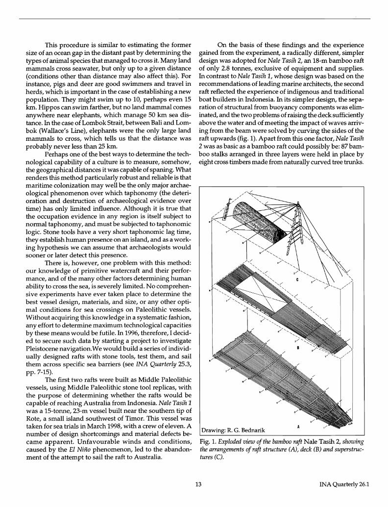
On the basis of these findings and the experience gained from the experiment, a radically different, simpler design was adopted for Nale Tasih 2, an 18-m bamboo raft of only 2.8 tonnes, exclusive of equipment and supplies. In contrast to Nale Tasih 1, whose design was based on the recommendations of leading marine architects, the second raft reflected the experience of indigenous and traditional boat builders in Indonesia. In its simpler design, the separation of structural from buoyancy components was eliminated, and the two problems of raising the deck sufficiently above the water and of meeting the impact of waves arriving from the beam were solved by curving the sides of the raft upwards (fig. 1). Apart from this one factor, Nale Tasih 2 was as basic as a bamboo raft could possibly be: 87 bamboo stalks arranged in three layers were held in place by eight cross timbers made from naturally curved tree trunks.
Drawing: R. G. Bednarik
Fig. 1. Exploded view of the bamboo raft Nale Tasih 2, showing the arrangements of raft structure (A), deck (B) and superstructures (C).
13 INA Quarterly 26.1
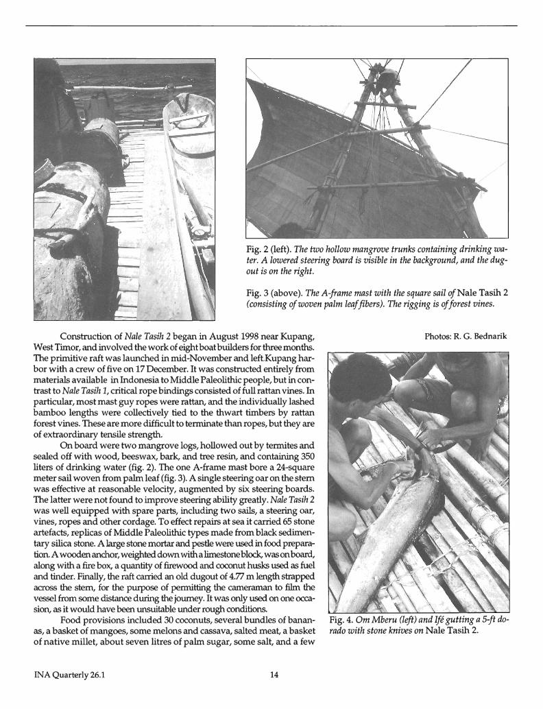
Fig. 2 (left). The two hollow mangrove trunks containing drinking water. A lowered steering board is visible in the background, and the dugout is on the right.
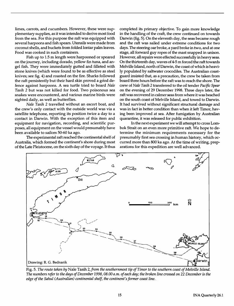
Fig. 3 (above). The A-frame mast with the square sail ofNale Tasih 2 (consisting of woven palm leaf fibers). The rigging is of forest vines.
Construction of Nale Tasih 2 began in August 1998 near Kupang, West Timor, and involved the work of eight boat builders for three months. The primitive raft was launched in mid-November and leftKupang harbor with a crew of five on 17 December. It was constructed entirely from materials available in Indonesia to Middle Paleolithic people, but in contrast to Nale Tasih 1, critical rope bindings consisted of full rattan vines. In particular, most mast guy ropes were rattan, and the individually lashed bamboo lengths were collectively tied to the thwart timbers by rattan forest vines. These are more difficult to terminate than ropes, but they are of extraordinary tensile strength.
On board were two mangrove logs, hollowed out by termites and sealed off with wood, beeswax, bark, and tree resin, and containing 350 liters of drinking water (fig. 2). The one A-frame mast bore a 24-square meter sail woven from palm leaf (fig. 3). A single steering oar on the stem was effective at reasonable velocity, augmented by six steering boards. The latter were not found to improve steering ability greatly. Nale Tasih 2 was well equipped with spare parts, including two sails, a steering oar, vines, ropes and other cordage. To effect repairs at sea it carried 65 stone artefacts, replicas of Middle Paleolithic types made from black sedimentary silica stone. A large stone mortar and pestle were used in food preparation. A wooden anchor, weighted down with a llmestone block, was on board, along with a fire box, a quantity of firewood and coconut husks used as fuel and tinder. Finally, the raft carried an old dugout of 4.77 m length strapped across the stem, for the purpose of permitting the cameraman to film the vessel from some distance during the journey. It was only used on one occasion, as it would have been unsuitable under rough conditions.
Food provisions included 30 coconuts, several bundles of bananas, a basket of mangoes, some melons and cassava, salted meat, a basket of native millet, about seven litres of palm sugar, some salt, and a few
INA Quarterly 26.1 14
Photos: R. G. Bednarik
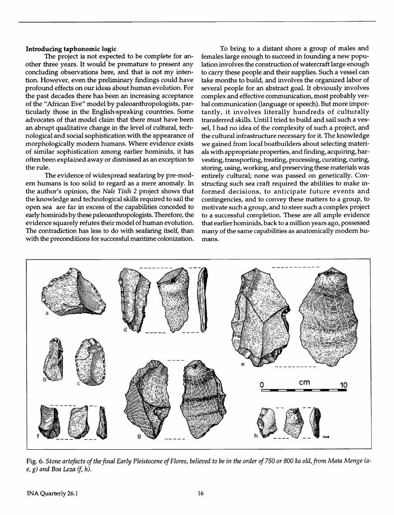
Fig. 4. Om Mberu (left) and Ife gutting a 5-ft dorado with stone knives on Nale Tasih 2.
limes, carrots, and cucumbers. However, these were supplementary supplies, as it was intended to derive most food from the sea. For this purpose the raft was equipped with several harpoons and fish spears. Utensils were made from coconut shells, and buckets from folded lontar palm leaves. Food was cooked in such containers.
Fish up to 1.5 m length were harpooned or speared on the journey, including dorado, yellow fin tuna, and angel fish. They were immediately gutted and filleted with stone knives (which were found to be as effective as steel knives; see fig. 4) and roasted on the fire. Sharks followed the raft persistently but their hard skin proved a gdod defence against harpoons. A sea turtle tried to board Nale Tasih 2 but was not killed for food. Two poisonous sea snakes were encountered, and various marine birds were sighted daily, as well as butterflies.
Nale Tasih 2 travelled without an escort boat, and the crew's only contact with the outside world was via a satellite telephone, reporting its position twice a day to a contact in Darwin. With the exception of this item and equipment for navigation, recording, and scientific purposes, all equipment on the vessel would presumably have been available to sailors 50-60 ka ago.
The experimental raft reached the continental shelf of Australia, which formed the continent's shore during most of the Late Pleistocene, on the sixth day of the voyage. It thus
a.
;'> ···~:·:::·:········ .... l~"'-'~21 C"-l_// (/ ---- ---- ~ ~ r---. / 23 24 .. ",-,;,.~."".:.:: .......... "",
22' ___ •••• ••• 25
completed its primary objective. To gain more knowledge in the handling of the craft, the crew continued on towards Darwin (fig. 5). On the eleventh day, the seas became rough and the raft was sailed under extreme conditions for two days. The steering oar broke, a yard broke in two, and at one stage, all forward guy ropes of the mast snapped in unison. However, all repairs were effected successfully in heavy seas. On the thirteenth day, waves of 4-5 m forced the raft towards Melville Island, north of Darwin, the coast of which is heavily populated by saltwater crocodiles. The Australian coastguard insisted that, as a precaution, the crew be taken from board three hours before the raft was to reach the shore. The crew of Nale Tasih 2 transferred to the oil tender Pacific Spear on the evening of 29 December 1998. Three days later, the raft was recovered in calmer seas from where it was beached on the south coast of Melville Island, and towed to Darwin. It had survived without significant structural damage and was in fact in better condition than when it left Timor, having been improved at sea. After fumigation by Australian quarantine, it was released for public exhibition.
In the next experiment we will attempt to cross Lombok Strait on an even more primitive raft. We hope to determine the minimum requirements necessary for the presumably first sea crossing in human history, which occurred more than 800 ka ago. At the time of writing, preparations for this expedition are well advanced.
-0-O _________ 10~O=======2~OO km N
" .---- ......... . / . ----. •.•• 26
/ - .. ~ •••••••••• 27
(-~ . ----.~ .................... . { -. •••• ••• 28 \ -. ' ..
} -...... . ./ --..:.::: • .'.... 29
~ . .'~ ........ -.. ----.
Drawing: R. G. Bednarik
Fig. 5. The route taken by Nale Tasih 2,from the southernmost tip of Timor to the southern coast of Melville Island. The numbers refer to the days of December 1998, 08.00 a.m. of each day; the broken line crossed on 22 December is the edge of the Sahul (Australian) continental shelf, the continent's former coast line ..
15 INA Quarterly 26.1
Introducing taphonomic logic The project is not expected to be complete for an
other three years. It would be premature to present any concluding observations here, and that is not my intention. However, even the preliminary findings could have profound effects on our ideas about human evolution. For the past decades there has been an increasing acceptance of the "African Eve" model by paleoanthropologists, particularly those in the English-speaking countries. Some advocates of that model claim that there must have been an abrupt qualitative change in the level of cultural, technological and social sophistication with the appearance of morphologically modem humans. Where evidence exists of similar sophistication among earlier hominids, it has often been explained away or dismissed as an exception to the rule.
The evidence of widespread seafaring by pre-modem humans is too solid to regard as a mere anomaly. In the author's opinion, the Nale Tisih 2 project shows that the know ledge and technological skills required to sail the open sea are far in excess of the capabilities conceded to early hominids by these paleoanthropologists. Therefore, the evidence squarely refutes their model of human evolution. The contradiction has less to do with seafaring itself, than with the preconditions for successful maritime colonization.
To bring to a distant shore a group of males and females large enough to succeed in founding a new population involves the construction of watercraft large enough to carry these people and their supplies. Such a vessel can take months to build, and involves the organized labor of several people for an abstract goal. It obviously involves complex and effective communication, most probably verbal communication (language or speech). But more importantly, it involves literally hundreds of culturally transferred skills. Until I tried to build and sail such a vessel, I had no idea of the complexity of such a project, and the cultural infrastructure necessary for it. The knowledge we gained from local boatbuilders about selecting materials with appropriate properties, and finding, acquiring, harvesting, transporting, treating, processing, curating, curing, storing, using, working, and preserving these materials was entirely cultural; none was passed on genetically. Constructing such sea craft required the abilities to make informed decisions, to anticipate future events and contingencies, and to convey these matters to a group, to motivate such a group, and to steer such a complex project to a successful completion. These are all ample evidence that earlier hominids, back to a million years ago, possessed many of the same capabilities as anatomically modem humans.
o em 10 - -
, .. "., :~:f
.~
i:
__ AGa
Fig. 6. Stone artefacts of the final Early Pleistocene of Flores, believed to be in the order of 750 or 800 lea old, from Mata Menge (ae, g) and Boa Leza if, h).
INA Quarterly 26.1 16
MIDDLE PLEISTOCENE
W N iii z o
5 :J 0. o 0.
z .. ::e :J ::t:
-TIME-
o
PRESENT Fig. 7. The principles of taphonomic logic, C showing the predicted survival characteristics
of a cumulatively increasing corpus of material evidence of a specific phenomenon category: A = present time, B = historical commencement of the activity thought to result in the find category in question, D = taphonomic threshold, a = produced instances of find category, f3 = surviving instances of find category as determined by taphonomic factors. The area below a thus represents the total quantity of find category produced, the area below f3 the total quantity of surviving specimens. To understand the principles it is essential to appreciate why f3 curve behaves relative to as depicted in time.
Drawing: R. G. Bednarik
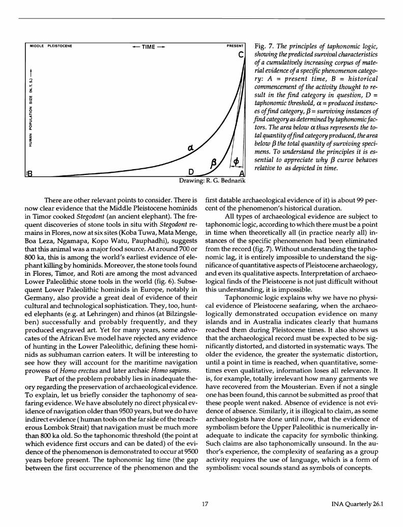
There are other relevant points to consider. There is now clear evidence that the Middle Pleistocene hominids in Timor cooked 5tegodont (an ancient elephant). The frequent discoveries of stone tools in situ with Stegodont remains in Flores, now at six sites (Koba Tuwa, Mata Menge, Boa Leza, Ngamapa, Kopo Watu, Pauphadhi), suggests that this animal was a major food source. At around 700 or 800 ka, this is among the world's earliest evidence of elephant killing by hominids. Moreover, the stone tools found in Flores, Timor, and Roti are among the most advanced Lower Paleolithic stone tools in the world (fig. 6). Subsequent Lower Paleolithic hominids in Europe, notably in Germany, also provide a great deal of evidence of their cultural and technological sophistication. They, too, hunted elephants (e.g. at Lehringen) and rhinos (at Bilzingsleben) successfully and probably frequently, and they produced engraved art. Yet for many years, some advocates of the African Eve model have rejected any evidence of hunting in the Lower Paleolithic, defining these hominids as subhuman carrion eaters. It will be interesting to see how they will account for the maritime navigation prowess of Homo erectus and later archaic Homo sapiens.
Part of the problem probably lies in inadequate theory regarding the preservation of archaeological evidence. To explain, let us briefly consider the taphonomy of seafaring evidence. We have absolutely no direct physical evidence of navigation older than 9500 years, but we do have indirect evidence ( human tools on the far side of the treacherous Lombok Strait) that navigation must be much more than 800 ka old. So the taphonomic threshold (the point at which evidence first occurs and can be dated) of the evidence of the phenomenon is demonstrated to occur at 9500 years before present. The taphonomic lag time (the gap between the first occurrence of the phenomenon and the
first datable archaeological evidence of it) is about 99 percent of the phenomenon's historical duration.
All types of archaeological evidence are subject to taphonomic logic, according to which there must be a point in time when theoretically all (in practice nearly all) instances of the specific phenomenon had been eliminated from the record (fig. 7). Without understanding the taphonomic lag, it is entirely impossible to understand the significance of quantitative aspects of Pleistocene archaeology, and even its qualitative aspects. Interpretation of archaeological finds of the Pleistocene is not just difficult without this understanding, it is impossible.
Taphonomic logic explains why we have no physical evidence of Pleistocene seafaring, when the archaeologically demonstrated occupation evidence on many islands and in Australia indicates clearly that humans reached them during Pleistocene times. It also shows us that the archaeological record must be expected to be significantly distorted, and distorted in systematic ways. The older the evidence, the greater the systematic distortion, until a point in time is reached, when quantitative, sometimes even qualitative, information loses all relevance. It is, for example, totally irrelevant how many garments we have recovered from the Mousterian. Even if not a single one has been found, this cannot be submitted as proof that these people went naked. Absence of evidence is not evidence of absence. Similarly, it is illogical to claim, as some archaeologists have done until now, that the evidence of symbolism before the Upper Paleolithic is numerically inadequate to indicate the capacity for symbolic thinking. Such claims are also taphonomic ally unsound. In the author's experience, the complexity of seafaring as a group activity requires the use of language, which is a form of symbolism: vocal sounds stand as symbols of concepts.
17 INA Quarterly 26.1
Conclusion
All of this shows the importance of learning about the circumstances under which Pleistocene navigation occurred. Such knowledge can help us establish realistic upper limits of what humans were capable of, technologically, culturally, cognitively and intellectually, at a given point in time. It may well be a more reliable measure of sophistication than any other to which archaeology has access. This source of information tells us that hominids were vastly more sophisticated than some advocates of orthodox archaeology would have us believe.
Due to the taphonomic lag, the traditional reliance on preserved artifacts can only measure the minimum capabilities of a culture, not its actual achievements. Replicative experiments have demonstrated beyond reasonable doubt that hominids had mimimum capabilities very significantly in excess of what many authorities have conceded. Specifically, "primitive" humans possessed the considerable skills necessary to build the functional equivalent of Nale Tasih 2.
Acknowledgments: The most important data collected on the Nale Tasih 2 expedition were only made possible by the courage of the crew, and their willingness to risk life and limb in the process. For this, I thank Bob, Peter, He and Om Mberu from the bottom of my heart. I regard them as heroes of science. lowe special gratitude to Peter Rogers, for his heroic act, and to Bob Hobman, whose sheer persistence and dedication made this work possible. Finally, I thank Silvia Schliekelmann, without whom the Nale Tasih expeditions would not have been.
Robert G. Bednarik, who is the Director, International Institute of Replicative Archaeology can be reached at: P.O. Box 216, Caulfield South, Vic. 3162, Australia, e-mail [email protected] cS9'
Suggested Readings
Bednarik, Robert G. 1994 "A taphonomy of palaeoart." Antiquity 68, 68-74.
1997a "The initial peopling of Wallacea and Sahul." Anthropos 92, 355-367.
1997b "The origins of navigation and language." The Artefact 20, 16-56.
1998 "An experiment in Pleistocene seafaring." International Journal of Nautical Archaeology 27(2).
Sondaar, P. Y., G. D. van den Bergh, B. Mubroto, F. Aziz, J. de Vos and U. L. Batu 1994 "Middle Pleistocene faunal turnover and colonization of Flores (Indonesia) by Homo erectus." Comptes Rendus
de l'Academie des Sciences, Paris 319,1255-1262.
Sondaar, P. Y., R. Elburg, G. Klein Hofmeijer, F. Martini, M. Sanges, A. Spaan and H. de Visser 1995 "The human colonization of Sardinia: a Late-Pleistocene human fossil from Corbeddu Cave." Comptes Rendus
de l'Academie des Sciences, Paris 320,145-150.
New Exhibit Honors Turkish History The Commander Tower (Komutan Kulesi) at Bodrum
Castle, Turkey, will be the home of a new exhibit of the Bodrum Museum of Underwater Archaeology opening in August, 1999. The tower has been restored to its condition during the First World War, when it housed Lt. Ibrahim Nezihi. Documents and photographs donated by Nezihi's daughter and stepson or provided by the Turkish General Staff illustrate the critical period in Turkish history from 1914 to 1922 through his career and those of several of his compatriots who served at Bodrum Castle.
INA Quarterly 26.1
The new exhibit celebrates the many heroes who led Turkey to emerge from its Ottoman past as a modem state. On 26 May, 1915, Ibrahim Nezihi and fifty soldiers armed only with swords and rifles defeated a far superior French force from the cruiser Dupleix (accompanied by a British warship), which was attempting to attack boats that had taken shelter in Bodrum Harbor. In 1922, Nezihi fell during the struggles that led to the liberation of his homeland from foreign occupation and the proclamation of the Turkish Republic. cS9'
18
Profile Jerome L. Hall
Executive Director of the Institute of Nautical Archaeology
Dr. Jerome Lynn Hall was born near the sea at La Jolla, California, but he received his undergraduate education well inland, at Abilene Christian University in Texas. He soon returned to his maritime roots, however, as a marine biology laboratory instructor and divemaster during six summers in Sonora, Mexico. Jerome earned an MS in Ocean Sciences at Nova-Southeastern University while teaching marine biology and related courses in the Dade County Public Schools of Florida.
In the field, Jerome's sense of humor and his ability to see the best side of every situation and person has often been the catalyst for bringing people together into cohesive units. Besides his work for INA, Dr. Hall has plenty to keep his weekends busy! Jerome is a board member of MERI, Marine Environmental Research Institute, a society that studies and reports on the current status of coral reefs. He is coordinating the final publication of the Sea of Galilee boat,
and is writing both scholarly and popular books on the Monte Cristi shipwreck. Dr. Hall has been granted familial permission to write a biography of the late Peter Throckmorton, who introduced him (and, many years earlier, INA Founder George Bass) to the importance of underwater archaeology. It is fitting, then, that someone in INA write about Throckmorton who, in a sense, was the "grandfather" of INA.
Jerome began his association with INA in 1987, when as a graduate assistant in the Texas A&M University Nautical Archaeology Program he helped conserve artifacts from the Molasses Reef Shipwreck excavated by INA in the Turks and Caicos Islands. Since then he has had unprecedented experience on INA projects, having worked on the Bronze Age shipwreck excavation at Uluburun in Turkey, the Columbus Caravels Project at st. Ann's Bay in Jamaica, and both the Tantura
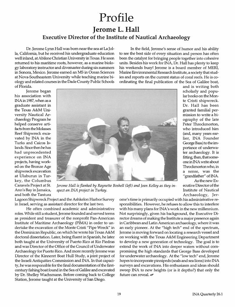
Jerome Hall is flanked by Raynette Boshell (left) and Jean Kelley as they inspect an INA project in Turkey.
As the new Executive Director of the Institute of Nautical
Lagoon Shipwreck Project and the Ashkelon Harbor Survey in Israel, serving as assistant director for the last two.
He often combined academic and administrative roles. While still a student, Jerome founded and served terms as president and treasurer of the nonprofit Pan-American Institute of Maritime Archaeology (PIMA) in order to undertake the excavation of the Monte Cristi "Pipe Wreck" in the Dominican Republic, on which he wrote his Texas A&M doctoral dissertation. Later, being fluent in Spanish, he later both taught at the University of Puerto Rico at Rio Piedras and was Director of the Office of the Council of Underwater Archaeology for Puerto Rico. And more recently Jerome was Director of the Kinneret Boat Hull Study, a joint project of the Israeli Antiquities Commission and INA. In that capacity, he was responsible for the final documentation of the firstcentury fishing boat found in the Sea of Galilee and excavated by Dr. Shelley Wachsmann. Before coming back to College Station, Jerome taught at the University of San Diego.
Archaeology, Jerorne's time is primarily occupied with his administrative responsibilities. However, he refuses to allow this to interfere with his many plans for INA's work in the new millennium. Not surprisingly, given his background, the Executive Director dreams of making the Institute a major presence again in Caribbean and Latin American archaeology, where it was an early pioneer. At the "high tech" end of the spectrum, Jerome is moving forward on locating a research vessel and on working with the Texas A&M Engineering Department to develop a new generation of technology. The goal is to extend the work of INA into deeper waters without compromising the high standards that George Bass developed for underwater archaeology. At the "low tech" end, Jerome hopes to incorporate pinnipeds (seals and sea lions) into INA surveys and excavations. His enthusiasm and ideas should sweep INA to new heights (or is it depths?) that only the future can reveal. ~
19 INA Quarterly 26.1
Just Released by Christine Powell
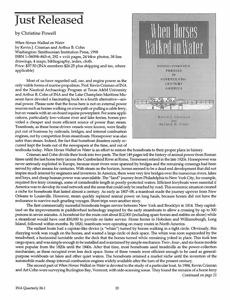
When Horses Walked on Water by Kevin J. Crisman and Arthur B. Cohn Washington: Smithsonian Institution Press, 1998 ISBN 1-56098-843-6, 292 + xviii pages, 24 b&w photos, 38 line drawings, 4 maps, bibliography, index, cloth. Price: $37.50 (INA members $26.25 plus shipping and tax, where applicable)
Most of us have regarded sail, oar, and engine power as the only viable forms of marine propulsion. Prof. Kevin Crisman of INA and the Nautical Archaeology Program at Texas A&M University and Arthur B. Cohn of INA and the Lake Champlain Maritime Museum have devoted a fascinating book to a fourth alternative-animal power. Please note that the focus here is not on external power sources such as horses walking on a towpath or pulling a cable ferry, but on vessels with an on-board equine powerplant. For some applications, particularly low-volume river and lake ferries, horses provided a cheaper and more efficient source of power than steam. Teamboats, as these horse-driven vessels were known, were finally put out of business by railroads, bridges, and internal combustion engines, not by competition from steamboats. Horsepower was also safer than steam. Indeed, the fact that horseboat disasters rarely oc-curred kept the boats out of the newspapers at the time, and out of
HORSE-POWERED
FERRIES
in NINETEENTH-
CENTURY
AMERICA
KEVIN J. CRISMAN and
ARTHUR B. COHN
textbooks today. When Horses Walked on Water is an effort to restore the horseboats to their proper place in history. Crisman and Cohn divide their book into two parts. The first 149 pages tell the history of animal power from Roman
times until the last horse ferry (across the Cumberland River at Rome, Tennessee) retired in the late 1920s. Horsepower was never seriously exploited in Europe, because most rivers were spanned by bridges and the remaining crossings had been served by other means for centuries. With steam on the horizon, horses seemed to be a dead end development that did not inspire much interest by engineers and inventors. In America, there were very few bridges over the numerous rivers, lakes and bays, and cheap human power was unavailable. The "land" journey from Philadelphia to New York City, for example, required five ferry crossings, some of considerable length in poorly-protected waters. Efficient ferryboats were essential if America was to develop its road network and the areas that could only be reached by road. This economic situation created a niche for horseboats that lasted almost a century. As early as 1807-D8, a teamboat made the journey upriver from New Orleans to Louisville. However, steam quickly replaced animal power on long hauls, because horses did not have the endurance to survive such grueling voyages. Short trips were another story.
The first commercially sucessful horseboats began service between New York and Brooklyn in 1814. They capitalized on the improvements in paddlewheel technology inspired by the early steamboats to allow a crossing by up to 300 persons in seven minutes. A horseboat for the route cost about $12,000 (including spare horses and stables on shore) while a steamboat would have cost $30,000 to provide no faster service. Horse ferries to Hoboken and Williamsburgh, Long Island, followed within months. By 1820, teamboats were operating on many routes in North America.
The earliest boats had a capstan-like device (a "whim") turned by horses walking in a tight circle. Obviously, this dizzying work was rough on the horses, and wasted a large circle of deck space. The whim was soon superceded by the treadwheel, a horizontal turntable under the deck that the horses turned while remaining yoked in place. This took less cargo space, and was simple enough to be installed and maintained by simple mechanics. Two-, four-, and six-horse models were popular from the 1820s until the 1840s. After that time, most horseboats used treadmills as the power-collection mechanism, as these occupied even less deck space. Some of these vessels were efficient enough to be used as generalpurpose workboats on lakes and other quiet waters. The horseboats retained a market niche until the invention of the automobile made cheap internal-combustion engines widely available after the tum of the present century.
The second part of When Horses Walked on Water is devoted to the study of a particular boat. In 1984, Kevin Crisman and Art Cohn were surveying Burlington Bay, Vermont, with side-scanning sonar. They found the remains of a horse ferry
Continued on page 21
INA Quarterly 26.1 20
Review by Cheryl Ward
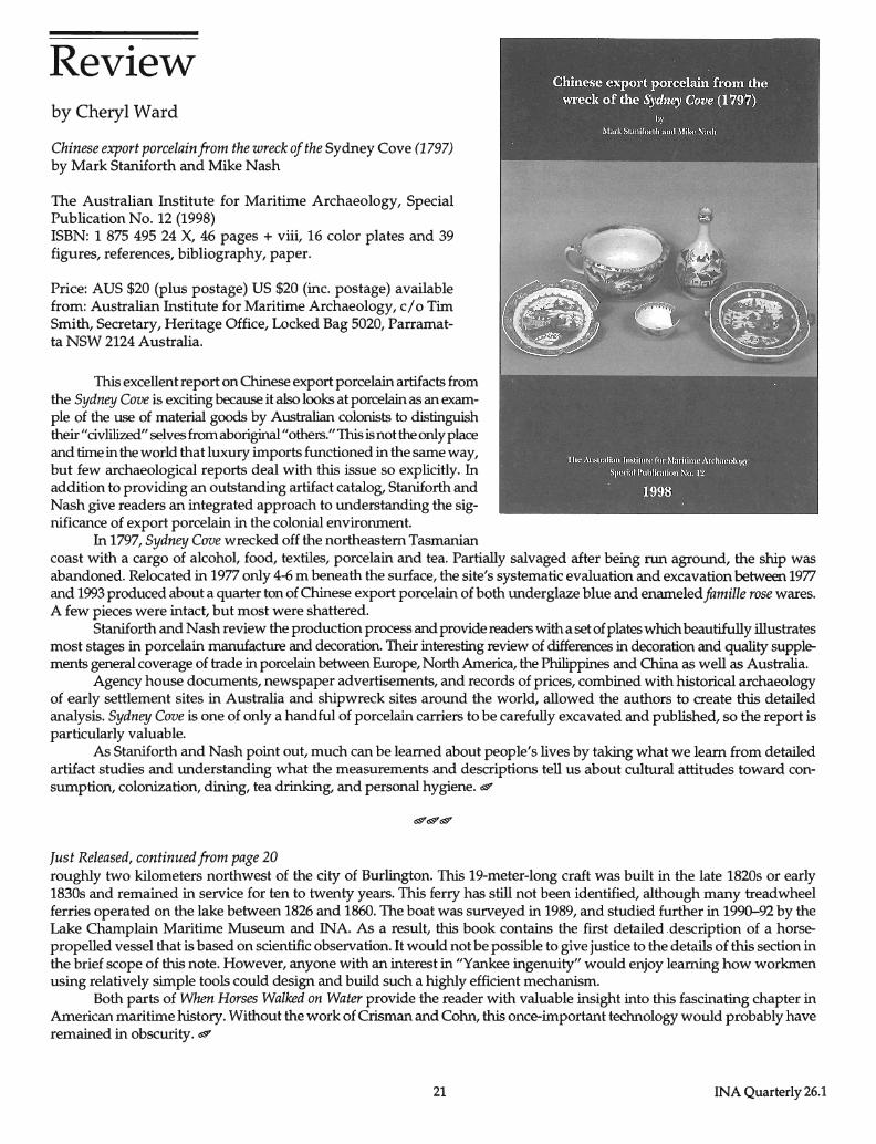
Chinese export porcelain from the wreck of the Sydney Cove (1797) by Mark Staniforth and Mike Nash
The Australian Institute for Maritime Archaeology, Special Publication No. 12 (1998) ISBN: 1 875 495 24 X, 46 pages + viii, 16 color plates and 39 figures, references, bibliography, paper.
Price: AUS $20 (plus postage) US $20 (inc. postage) available from: Australian Institute for Maritime Archaeology, c/o Tim Smith, Secretary, Heritage Office, Locked Bag 5020, Parramatta NSW 2124 Australia.
This excellent report on Chinese export porcelain artifacts from the Sydney Cove is exciting because it also looks at porcelain as an example of the use of material goods by Australian colonists to distinguish their" civlilized" selves from aboriginal" others." This is not the only place and time in the world that luxury imports functioned in the same way, but few archaeological reports deal with this issue so explicitly. In addition to providing an outstanding artifact catalog, Staniforth and Nash give readers an integrated approach to understanding the significance of export porcelain in the colonial environment.
In 1797, Sydney Cove wrecked off the northeastern Tasmanian coast with a cargo of alcohol, food, textiles, porcelain and tea. Partially salvaged after being run aground, the ship was abandoned. Relocated in 1977 only 4-6 m beneath the surface, the site's systematic evaluation and excavation between 1977 and 1993 produced about a quarter ton of Chinese export porcelain of both underglaze blue and enameled famille rose wares. A few pieces were intact, but most were shattered.
Staniforth and Nash review the production process and provide readers with a set of plates which beautifully illustrates most stages in porcelain manufacture and decoration. Their interesting review of differences in decoration and quality supplements general coverage of trade in porcelain between Europe, North America, the Philippines and China as well as Australia.
Agency house documents, newspaper advertisements, and records of prices, combined with historical archaeology of early settlement sites in Australia and shipwreck sites around the world, allowed the authors to create this detailed analysis. Sydney Cove is one of only a handful of porcelain carriers to be carefully excavated and published, so the report is particularly valuable.
As Staniforth and Nash point out, much can be learned about people's lives by taking what we learn from detailed artifact studies and understanding what the measurements and descriptions tell us about cultural attitudes toward consumption, colonization, dining, tea drinking, and personal hygiene. d
Just Released, continued from page 20 roughly two kilometers northwest of the city of Burlington. This 19-meter-Iong craft was built in the late 1820s or early 1830s and remained in service for ten to twenty years. This ferry has still not been identified, although many treadwheel ferries operated on the lake between 1826 and 1860. The boat was surveyed in 1989, and studied further in 199~92 by the Lake Champlain Maritime Museum and INA. As a result, this book contains the first detailed description of a horsepropelled vessel that is based on scientific observation. It would not be possible to give justice to the details of this section in the brief scope of this note. However, anyone with an interest in "Yankee ingenuity" would enjoy learning how workmen using relatively simple tools could design and build such a highly efficient mechanism.
Both parts of When Horses Walked on Water provide the reader with valuable insight into this fascinating chapter in American maritime history. Without the work of Crisman and Cohn, this once-important technology would probably have remained in obscurity. d
21 INA Quarterly 26.1
News & Notes SHA Honors George Bass
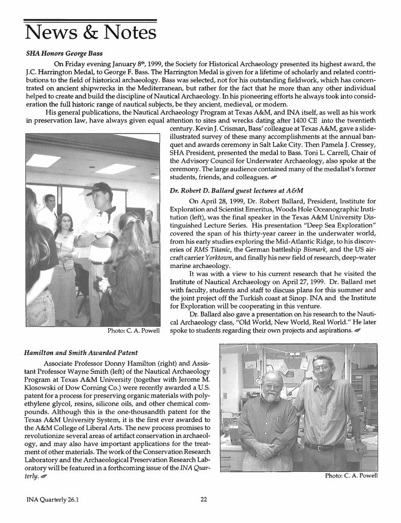
On Friday evening January 8th, 1999, the Society for Historical Archaeology presented its highest award, the J.e. Harrington Medal, to George F. Bass. The Harrington Medal is given for a lifetime of scholarly and related contributions to the field of historical archaeology. Bass was selected, not for his outstanding fieldwork, which has concentrated on ancient shipwrecks in the Mediterranean, but rather for the fact that he more than any other individual helped to create and build the discipline of Nautical Archaeology. In his pioneering efforts he always took into consideration the full historic range of nautical subjects, be they ancient, medieval, or modem.
His general publications, the Nautical Archaeology Program at Texas A&M, and INA itself, as well as his work in preservation law, have always given equal attention to sites and wrecks dating after 1400 CE into the twentieth
Hamilton and Smith Awarded Patent
century. Kevin J. Crisman, Bass' colleague at Texas A&M, gave a slideillustrated survey of these many accomplishments at the annual banquet and awards ceremony in Salt Lake City. Then Pamela J. Cressey, SHA President, presented the medal to Bass. Toni L. Carrell, Chair of the Advisory Council for Underwater Archaeology, also spoke at the ceremony. The large audience contained many of the medalist's former students, friends, and colleagues. <S'!?
Dr. Robert D. Ballard guest lectures at A&M
On April 28, 1999, Dr. Robert Ballard, President, Institute for Exploration and Scientist Emeritus, Woods Hole Oceanographic Institution (left), was the final speaker in the Texas A&M University Distinguished Lecture Series. His presentation "Deep Sea Exploration" covered the span of his thirty-year career in the underwater world, from his early studies exploring the Mid-Atlantic Ridge, to his discoveries of RMS Titanic, the German battleship Bismark, and the US aircraft carrier Yorktown, and finally his new field of research, deep-water marine archaeology.
It was with a view to his current research that he visited the Institute of Nautical Archaeology on April 27, 1999. Dr. Ballard met with faculty, students and staff to discuss plans for this summer and the joint project off the Turkish coast at Sinop. INA and the Institute for Exploration will be cooperating in this venture.
Dr. Ballard also gave a presentation on his research to the Nautical Archaeology class, "Old World, New World, Real World." He later spoke to students regarding their own projects and aspirations. <S'!?
Associate Professor Donny Hamilton (right) and Assistant Professor Wayne Smith (left) of the Nautical Archaeology Program at Texas A&M University (together with Jerome M. Klosowski of Dow Coming Co.) were recently awarded a U.S. patent for a process for preserving organic materials with polyethylene glycol, resins, silicone oils, and other chemical compounds. Although this is the one-thousandth patent for the Texas A&M University System, it is the first ever awarded to the A&M College of Liberal Arts. The new process promises to revolutionize several areas of artifact conservation in archaeology, and may also have important applications for the treatment of other materials. The work of the Conservation Research Laboratory and the Archaeological Preservation Research Laboratory will be featured in a forthcoming issue of the INA Quarterly. <S'!?
INA Quarterly 26.1 22
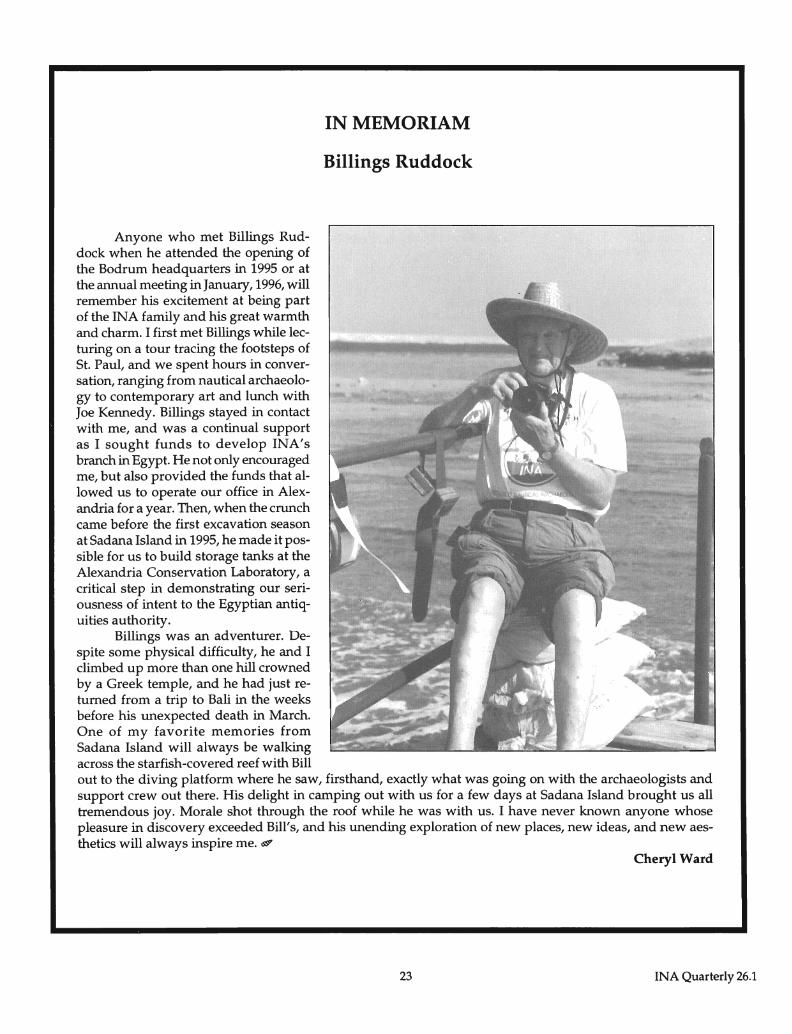
Anyone who met Billings Ruddock when he attended the opening of the Bodrum headquarters in 1995 or at the annual meeting in January, 1996, will remember his excitement at being part of the INA family and his great warmth and charm. I first met Billings while lecturing on a tour tracing the footsteps of St. Paul, and we spent hours in conversation, ranging from nautical archaeology to contemporary art and lunch with Joe Kennedy. Billings stayed in contact with me, and was a continual support as I sought funds to develop INA's branch in Egypt. He not only encouraged me, but also provided the funds that allowed us to operate our office in Alexandria for a year. Then, when the crunch came before the first excavation season at Sadana Island in 1995, he made it possible for us to build storage tanks at the Alexandria Conservation Laboratory, a critical step in demonstrating our seriousness of intent to the Egyptian antiquities authority.
Billings was an adventurer. Despite some physical difficulty, he and I climbed up more than one hill crowned by a Greek temple, and he had just returned from a trip to Bali in the weeks before his unexpected death in March. One of my favorite memories from Sad ana Island will always be walking across the starfish-covered reef with Bill
IN MEMORIAM
Billings Ruddock
out to the diving platform where he saw, firsthand, exactly what was going on with the archaeologists and support crew out there. His delight in camping out with us for a few days at Sadana Island brought us all tremendous joy. Morale shot through the roof while he was with us. I have never known anyone whose pleasure in discovery exceeded Bill's, and his unending exploration of new places, new ideas, and new aesthetics will always inspire me. ~
Cheryl Ward
23 INA Quarterly 26.1
INSTITUTE OF NAUTICAL ARCHAEOLOGY
George F. Bass, Founder and Archaeological Director
Jerome L. Hall, Executive Director
William L. Allen John H. Baird George F. Bass Edward O. Boshell, Jr.,
Vice Chairman and Treasurer RayM. Bowen John A. Brock Elizabeth L. Bruni Gregory M. Cook, Chairman Harlan Crow Frank Darden John De Lapa
Allan Campbell, M.D.
OFFICERS - ADMINISTRATION Donald A. Frey, Vice President Cemal M. Pulak, Vice President
BOARD OF DIRECTORS Claude Duthuit Daniel Fallon Danielle J. Feeney Donald G. Geddes ill (Emeritus) Woodrow Jones, Jr. Harry C. Kahn II (Emeritus) Michael L. Katzev Jack w. Kelley MustafaKor; Sally R. Lancaster Robert E. Lorton Frederick R. Mayer
ASSOCIATE DIRECTORS Bill Klein, M.D.
FACULTY George F. Bass
Dana F. McGinnis
James A. Goold, Secretary and Counsel Claudia LeDoux, Assistant Secretary
William A. McKenzie Alex G. Nason George E. Robb, Jr. L. Francis Rooney Ayhan Sicimoglu Ray H. Siegfried II William T. Sturgis Robert L. Walker LewO. Ward PeterM. Way Garry A. Weber George o. Yamini
Murad Sunalp, M.D.
George T. & Gladys H. Abell Professor of Nautical Archaeology / George O. Yamini Family Professor of Liberal Arts Kevin J. Crisman, Nautical Archaeology Faculty Fellow Donny L. Hamilton, Frederick R. Mayer Faculty Fellow
Frederick M. Hocker, Sara W. & George o. Yamini Associate Professor Cemal M. Pulak, Frederick R. Mayer Faculty Fellow of Nautical Archaeology
C. Wayne Smith, Assistant Professor /Director of the Archaeological Preservation Research Laboratory J. Richard Steffy, Sara W. & George o. Yamini Professor of Nautical Archaeology, Emeritus
Frederick H. van Doorninck, Jr., Frederick R. Mayer Professor of Nautical Archaeology, Emeritus Shelley Wachsmann, Meadows Assistant Professor of Biblical Archaeology
J. Barto Arnold, M.A., Texas Operations
STAFF
Selma Agar Birgiil Akbiiliit Esra Altmamt G6ksu Mustafa Babaclk William H. Charlton, Jr., M.A. Michelle Chmelar Marion Feildel Tuba Ekmekr;i AdelFarouk Jana Gober Jane Haldane Kathy Hall Emad Khalil Sheila D. Matthews, M.A. G6khan Ozagach, Ph.D. Robin CM. Piercy Candace D. Pierson Serna Pulak, M.A. Patricia M. Sibella, Ph.D. Giilser SinaCi MuratTIlev Giine~ Ya~ar
Cheryl Ward, Assistant Professor
AREA DIRECTORS Douglas Haldane, M.A., INA Egypt
RESEARCH ASSOCIATES
Dan Davis Jeremy Green Margaret E. Leshikar-Denton, Ph.D. Robert S. Neyland, Ph.D. Ralph K. Pedersen, M.A. Brett A. Phaneuf Donald Rosencrantz
ADJUNCT PROFESSORS
Arthur Cohn, J.D. David Gibbins, Ph.D. Faith D. Hentschel, Ph.D. Fredrik T. Hiebert, Ph.D. Carolyn G. Koehler, Ph.D. William M. Murray, Ph.D. David 1. Owen, Ph.D. Gordon P. Watts, Jr., M.A.
GRADUATE FELLOWS
Mr. and Mrs. Ray H. Siegfried II Graduate Fellow: Matthew Harpster
Marion M. Cook Graduate Fellow: Oscar Blasingame and Erich Heinhold
Tufan U. Turanh, Turkish Headquarters
SUPPORTING INSTITUTIONS
Australian Institute of Maritime Archaeology Boston University Brown University Bryn Mawr College University of California, Berkeley University of Cincinnati Cornell University Corning Museum of Glass Departmento de Arqueologia Subacuatica de
la 1.N.A.H., Mexico University of Maryland, Baltimore County New York University, Institute of Fine Arts University of North Carolina, Chapel Hill Partners for Livable Places University Museum, University of Pennsylvania Texas A&M Research Foundation Texas A&M University University of Texas at Austin
QUARTERLY EDITOR Christine A. Powell