Embed Size (px)
Citation preview

The Jordan River Basin
Georges ComairGeorges ComairProf. Daene McKinneyProf. Daene McKinney The University of Texas at AustinThe University of Texas at Austin
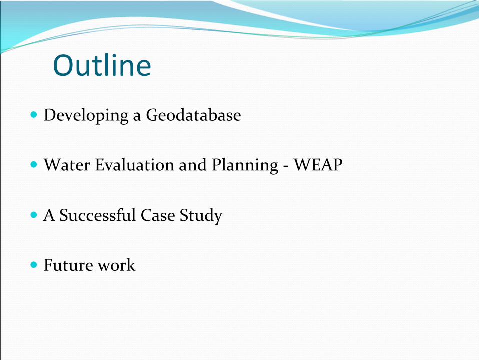
Outline
Developing a Geodatabase
Water Evaluation and Planning ‐
WEAP
A Successful Case Study
Future work
The development of a watershed‐scale database
Increase data exchange related to the management of hydrological information systems
Access to: climatology, water availability, water uses, hydraulic infrastructures and watershed properties
Promoting multi‐national cooperation
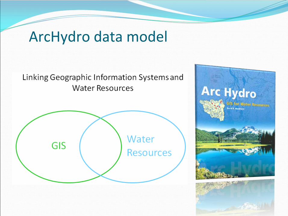
ArcHydro data model
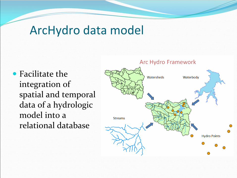
ArcHydro data model
Facilitate the integration of spatial and temporal
data of a hydrologic model into a
relational database
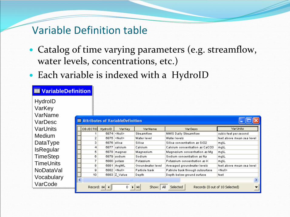
Variable Definition table
Catalog of time varying parameters (e.g. streamflow,
water levels, concentrations, etc.)
Each variable is indexed with a HydroID
VariableDefinition
HydroIDVarKeyVarNameVarDescVarUnitsMediumDataTypeIsRegularTimeStepTimeUnitsNoDataValVocabularyVarCode
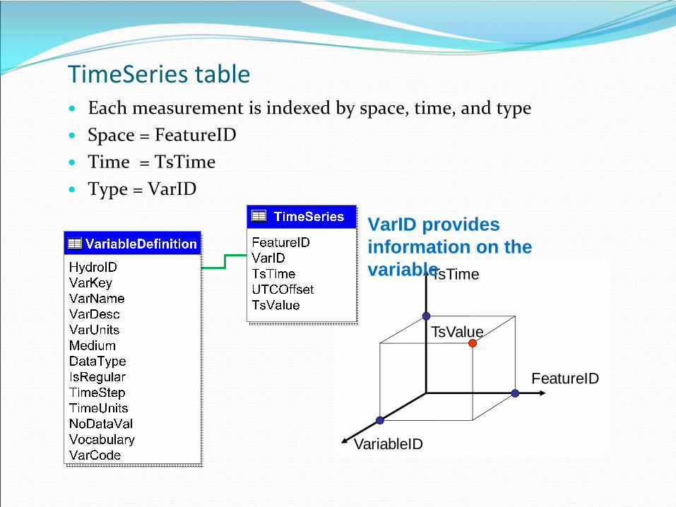
TsTime
FeatureID
VariableID
TsValue
TimeSeries
table
Each measurement is indexed by space, time, and type
Space = FeatureID
Time = TsTime
Type = VarID
VarID provides information on the variable
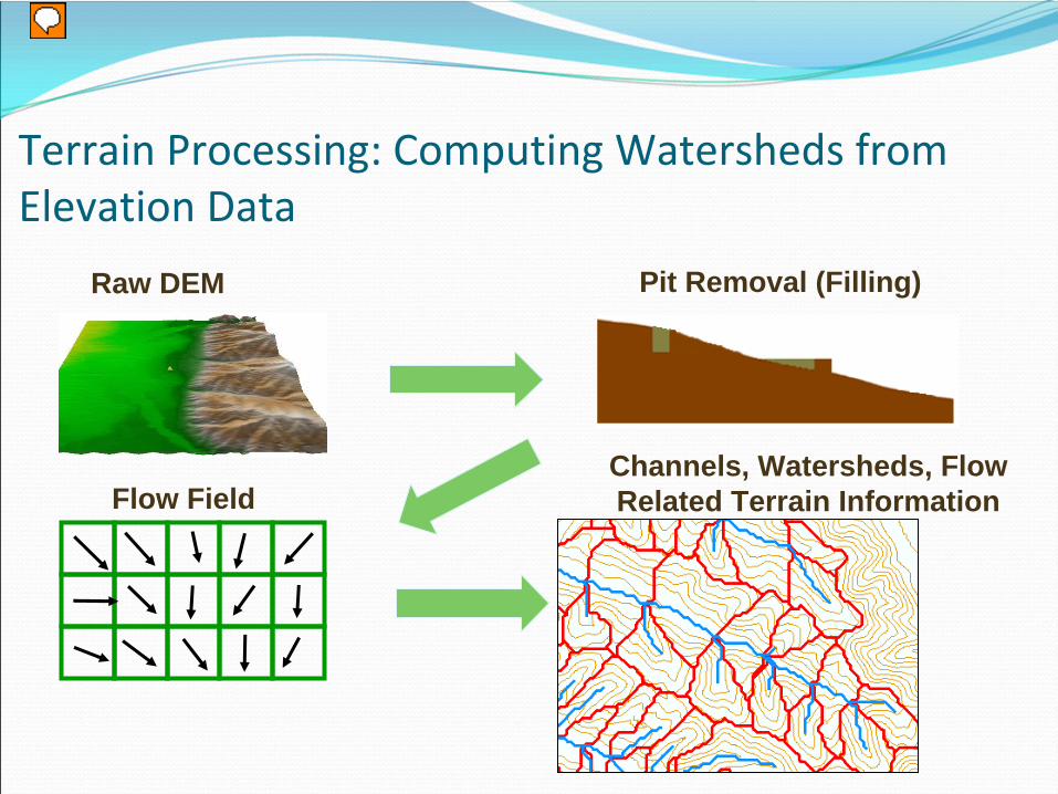
Terrain Processing: Computing Watersheds from Elevation Data
Raw DEM Pit Removal (Filling)
Flow FieldChannels, Watersheds, Flow Related Terrain Information
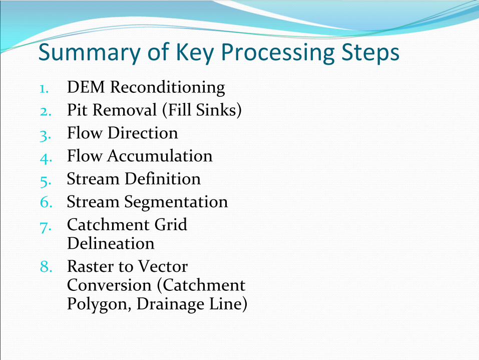
Summary of Key Processing Steps1.
DEM Reconditioning
2.
Pit Removal (Fill Sinks)3.
Flow Direction
4.
Flow Accumulation5.
Stream Definition
6.
Stream Segmentation7.
Catchment Grid
Delineation8.
Raster to Vector
Conversion (Catchment Polygon, Drainage Line)
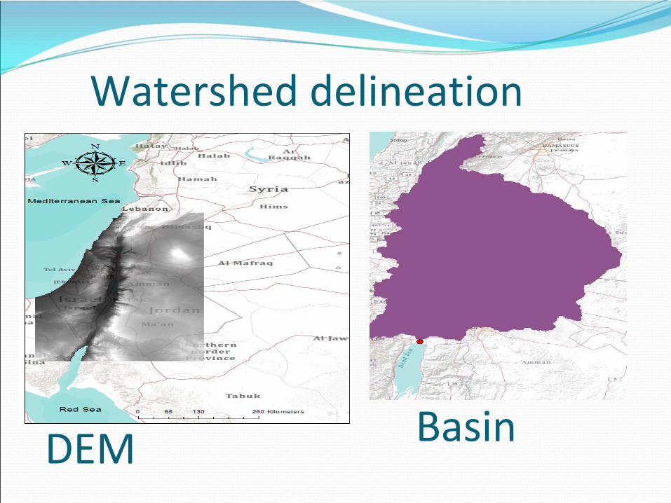
Watershed delineation
DEM Basin
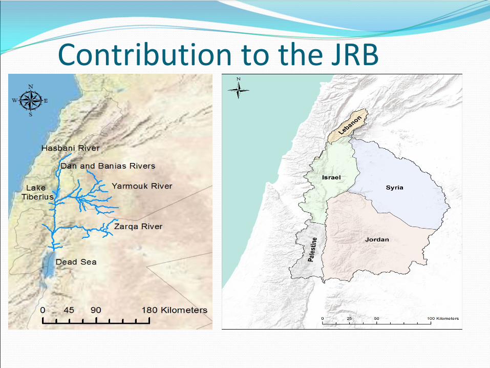
Contribution to the JRB
Work done in the JRB
Collecting the hydrologic information from the co‐
Riparians
Raster network technique: large region are divided
into subregions
Drainage area
Average precipitation
ET
Run‐off calculations
Time series records collection
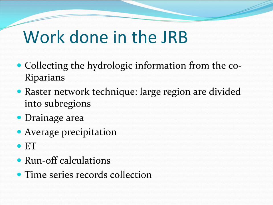
Connecting Geodatabase to Models
Improve water management
Identify water management scenarios
and modeling using WEAP
Tools to read data from the Geodatabase
and input
into WEAP
Mexico/USA case study : The Rio Grande Basin
Shared between USA and Mexico
Watershed area of 557,722 km2
Treaty of 1906 & 1944 governs water allocation in the basin
Severe drought 1992‐2003
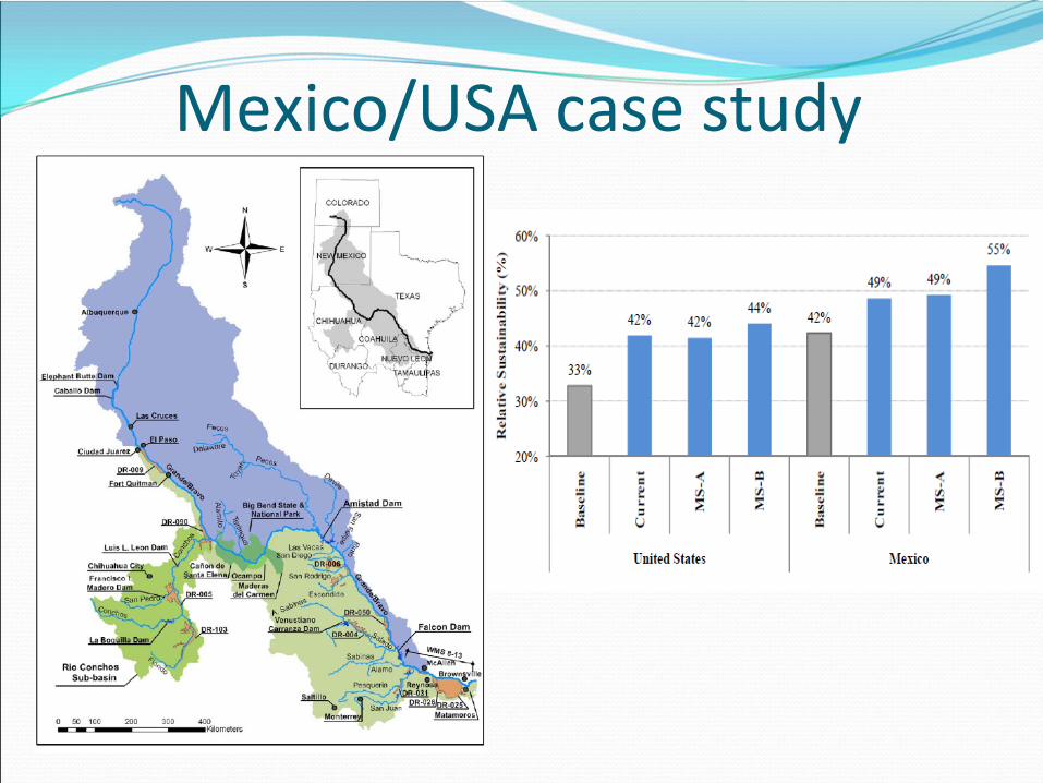
Mexico/USA case study
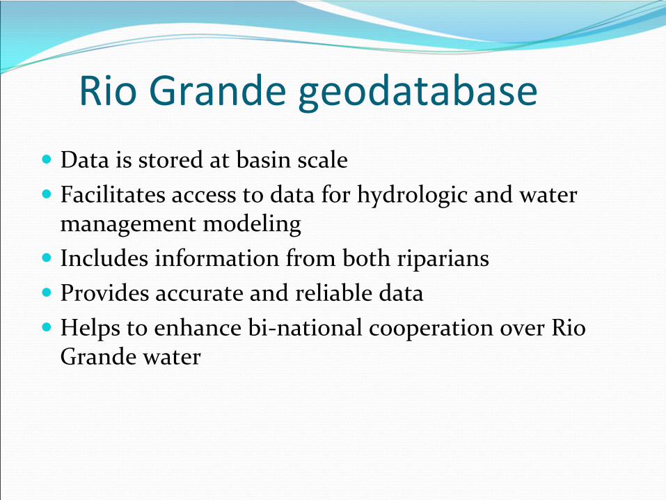
Rio Grande geodatabase
Data is stored at basin scale
Facilitates access to data for hydrologic and water management modeling
Includes information from both riparians
Provides accurate and reliable data
Helps to enhance bi‐national cooperation over Rio Grande water

The use of GIS database
Facilitates the analysis of various scenarios to aid water resource management in the basin
Allows easy sharing of geographic and historical information among various agencies
Enables implementation of the treaties signed between the USA and Mexico
Can be used along with WEAP to identify optimum water management scenarios
Future work
World Water Consortium‐World Water Online
Make the Geodatabase
available to the public
Water management model for Lebanon