Embed Size (px)
Citation preview
R Roca et al, MT Overview, Toulouse, June 2010
The Megha-Tropiques Mission
Rémy Roca and the French MT science team
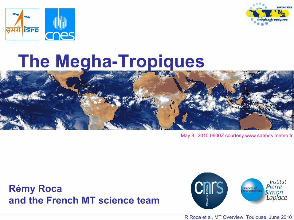
May 8,, 2010 0600Z courtesy www.satmos.meteo.fr

R Roca et al, MT Overview, Toulouse, June 2010
OverviewThe Megha-Tropiques mission
Indo-french mission realized by
The Indian Space Research Organisation et the
Centre National d’Etudes Spatiales
Dedicated to the
Water and energy cycle in the Tropics
Low inclinaition on the equator (20°);
865 km height
High repetetivity of the measurements
Launch foreseen in early 2011
WEB site http://megha-tropiques.ipsl.polytechnique.fr
R Roca et al, MT Overview, Toulouse, June 2010
Atmospheric energy budget in the intertropical zone and at system scale (radiation, latent heat, …)
Life cycle of Mesoscale Convective Complexes in the Tropics (over Oceans and Continents)
Monitoring and assimilation for Cyclones, Monsoons, Mesoscale Convective Systems forecasting.
Contribution to climate monitoring :
Radiative budget (complementary to CERES)
Precipitation (enhanced sampling in the tropics; link to the GPM program)
Water vapour (enhanced sampling in the tropics),
Scientific objectivesThe Megha-Tropiques mission

R Roca et al, MT Overview, Toulouse, June 2010
The Megha-Tropiques missionPayloads (1/2) Source: N. Karouche, CNES
•MADRAS : microwave imager for precipitation : channels at 18, 23, 37, 89 and 157 GHz, H and V polarisations. (conical swath, <10 km to 40 km)
Source: N. Karouche, CNES

R Roca et al, MT Overview, Toulouse, June 2010
SAPHIR : microwave sounder for water vapour sounding : 6 channels in the WV absoption band at 183.31 GHz. (cross track, 10 km)
•ScaRaB : wide band instrument for inferring longwave and shortwage outgoing fluxes at the top of the atmosphere (cross track scanning, 40 km resolution at nadir)
GPS RO: water vapor profile …
GEOSTATIONARY DATA•Cloud mask for the MW algo•Quicklook for interpreting MT data•Basic inputs for MCS tracking algorithm •Basic inputs for Level 4 rainfall (radiation) products
Payloads (2/2)The Megha-Tropiques mission
Source: N. Karouche, CNES

R Roca et al, MT Overview, Toulouse, June 2010
Orbit (1/2)The Megha-Tropiques mission

R Roca et al, MT Overview, Toulouse, June 2010
Orbit (2/2)
1 orbit
Half day
Mean number of overpasses per day
Latit
ude
5 63 4
MADRAS sampling over 20°S-20°nMin 3 per day Max 5 per day
The Megha-Tropiques mission

R Roca et al, MT Overview, Toulouse, June 2010
Life cycle of Mesoscale Convective SystemsSimulation of orbit with MADRAS/MT

R Roca et al, MT Overview, Toulouse, June 2010
The Megha-Tropiques data & products
Instantaneous scale « LEVEL 2 »
*Profile of rainfall, surface rainfall, convective/stratiform flagBRAIN Algorithm using mainly MADRASPoster by N Viltard et al (presented by PE Kirstetter)
*Profile of relative humidity using mainly SAPHIRPoster by Brogniez, Aires et al (presented by F Marquisseau)
*TOA broad band flux SW, LWSEL/SANN algorithmPoster by O Chomette et al.
ScaRaB/GERB Simultaneous SW co-location

R Roca et al, MT Overview, Toulouse, June 2010
The Megha-Tropiques data & products
Agregated scale « Level 3 +»Combination of instruments
*Accumulated surface rainfall 1° 1 day And associated error estimationTAPEER Algorithm using BRAIN and GEOPoster by P Chambon et al.
•Composite life cycle of MCS TOOCAN algorithm using BRAIN and GEO Poster by T Fiolleau et R. Roca
*TOA broad band flux SW, LW monthly meanPoster by O Chomette et al.
EPSAT-GPCP GSMAP
TMPA TAPEER-BRAIN
Niamey AMMA 2006, filtered 3-5 days
R Roca et al, MT Overview, Toulouse, June 2010
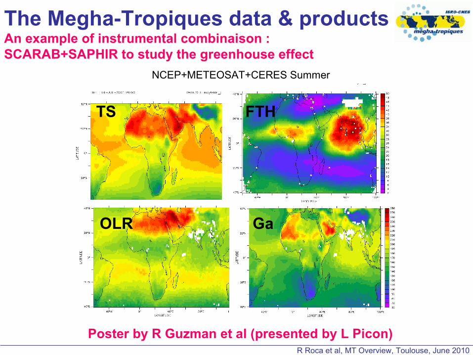
The Megha-Tropiques data & productsAn example of instrumental combinaison : SCARAB+SAPHIR to study the greenhouse effect
TS FTH
GaOLR
NCEP+METEOSAT+CERES Summer
Poster by R Guzman et al (presented by L Picon)

R Roca et al, MT Overview, Toulouse, June 2010
The Megha-Tropiques missionOperational use and CAL/VAL activities
Talk by M Plu et al.
METEO-France has two main on going operational activities with MT
DATA assimilation all over the Tropics Towards all weather assim of radiances
Cyclones forecasting activitiesMW data used for ARPEGE-Réunion forecast model initialisation Anticipated use of NRT data for forecasting
Talk by F Karbou et al.
The MT CAL/VAL program is large with main efforts in West Africa, India, Brazil !
Would require a talk by itself ! By then ask M Gosset / me

R Roca et al, MT Overview, Toulouse, June 2010
The Megha-Tropiques missionOperational use and CAL/VAL activities
Talk by M Plu et al.
METEO-France has two main on going operational activities with MT
DATA assimilation all over the Tropics Towards all weather assim of radiances
Cyclones forecasting activitiesMW data used for ARPEGE-Réunion forecast model initialisation Anticipated use of NRT data for forecasting
Talk by F Karbou et al.

R Roca et al, MT Overview, Toulouse, June 2010MeghaTropiques Validation - Gosset PMM oct 2009
14
1 dual pol radar (100 km range- attenuation)-
MRR - profiler disdrometersRain gages
MIT C-Band radar(250 km range)
Meteorological radars -> need of a super site for dedicated campaigns.
2 radars : 1 long range, 1 shorter range attenuated but POLARIMETRIC
2 frequencies - dual Doppler capacity
Complementary instruments for validation of QPE and profiles + hydrometeors information :.

R Roca et al, MT Overview, Toulouse, June 2010
MeghaTropiques Validation - Gosset PMM oct 2009
2010combined : airborne + ground measurement
Airborne validation campaign : hydrometeors type, size distribution and DENSITY
Bouniol et al, 2009
Ice density from airborne AMMA data (rasta+probes)
Stratiform zone : ice particules density
0
200
400
600
800
1000
convectif 10->20 20->30 30->40 40->50distance from convective zones (km)
density (
kg.m
-3)
R Roca et al, MT Overview, Toulouse, June 2010
SummaryThe Megha-Tropiques mission
http://meghatropiques.ipsl.polytechnique.fr
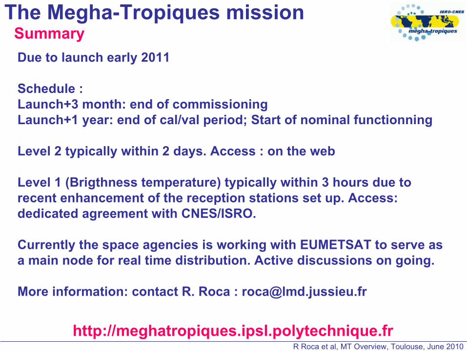
Due to launch early 2011
Schedule :Launch+3 month: end of commissioningLaunch+1 year: end of cal/val period; Start of nominal functionning
Level 2 typically within 2 days. Access : on the web
Level 1 (Brigthness temperature) typically within 3 hours due to recent enhancement of the reception stations set up. Access: dedicated agreement with CNES/ISRO.
Currently the space agencies is working with EUMETSAT to serve as a main node for real time distribution. Active discussions on going.
More information: contact R. Roca : [email protected]

R Roca et al, MT Overview, Toulouse, June 2010
Thank you !
The Megha-Tropiques mission