Embed Size (px)
Citation preview

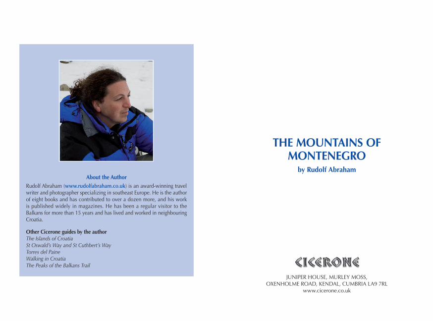
THE MOUNTAINS OF MONTENEGRO
THE MOUNTAINS OF MONTENEGRO
by Rudolf AbrahamAbout the Author
Rudolf Abraham (www.rudolfabraham.co.uk) is an award-winning travel writer and photographer specializing in southeast Europe. He is the author of eight books and has contributed to over a dozen more, and his work is published widely in magazines. He has been a regular visitor to the Balkans for more than 15 years and has lived and worked in neighbouring Croatia.
Other Cicerone guides by the authorThe Islands of CroatiaSt Oswald’s Way and St Cuthbert’s WayTorres del PaineWalking in CroatiaThe Peaks of the Balkans Trail
JUNIPER HOUSE, MURLEY MOSS, OXENHOLME ROAD, KENDAL, CUMBRIA LA9 7RL
www.cicerone.co.uk

© Rudolf Abraham 2007, 2015Second edition 2015ISBN: 978 1 85284 731 9Reprinted 2019 (with updates)First edition 2007Printed by KHL Printing, SingaporeA catalogue record for this book is available from the British Library.Author photo by Ivana JovićAll other photographs by Rudolf Abraham
za Ivanu
Front cover: Zupci (‘teeth’) and Bandijerna, seen from the pass below Bobotov kuk in Durmitor national park (Route 6)
CONTENTSRoute summary table . . . . . . . . . . . . . . . . . . . . . . . . . . . . . . . . . . . . . . . . . . . . 9Map key . . . . . . . . . . . . . . . . . . . . . . . . . . . . . . . . . . . . . . . . . . . . . . . . . . . . . 11Overview map . . . . . . . . . . . . . . . . . . . . . . . . . . . . . . . . . . . . . . . . . . . . . 12–13
INTRODUCTION . . . . . . . . . . . . . . . . . . . . . . . . . . . . . . . . . . . . . . . . . . . . . 15Geography . . . . . . . . . . . . . . . . . . . . . . . . . . . . . . . . . . . . . . . . . . . . . . . . . . . 17Geology . . . . . . . . . . . . . . . . . . . . . . . . . . . . . . . . . . . . . . . . . . . . . . . . . . . . . 20Climate . . . . . . . . . . . . . . . . . . . . . . . . . . . . . . . . . . . . . . . . . . . . . . . . . . . . . . 22Vegetation and wildlife . . . . . . . . . . . . . . . . . . . . . . . . . . . . . . . . . . . . . . . . . . 24History . . . . . . . . . . . . . . . . . . . . . . . . . . . . . . . . . . . . . . . . . . . . . . . . . . . . . . 28Culture . . . . . . . . . . . . . . . . . . . . . . . . . . . . . . . . . . . . . . . . . . . . . . . . . . . . . . 30Food and drink . . . . . . . . . . . . . . . . . . . . . . . . . . . . . . . . . . . . . . . . . . . . . . . . 33Language . . . . . . . . . . . . . . . . . . . . . . . . . . . . . . . . . . . . . . . . . . . . . . . . . . . . 33Getting to Montenegro . . . . . . . . . . . . . . . . . . . . . . . . . . . . . . . . . . . . . . . . . . 34Local transport . . . . . . . . . . . . . . . . . . . . . . . . . . . . . . . . . . . . . . . . . . . . . . . . 37Accommodation . . . . . . . . . . . . . . . . . . . . . . . . . . . . . . . . . . . . . . . . . . . . . . . 39Money . . . . . . . . . . . . . . . . . . . . . . . . . . . . . . . . . . . . . . . . . . . . . . . . . . . . . . 39Staying in touch . . . . . . . . . . . . . . . . . . . . . . . . . . . . . . . . . . . . . . . . . . . . . . . 41Walking in Montenegro . . . . . . . . . . . . . . . . . . . . . . . . . . . . . . . . . . . . . . . . . 41What to take . . . . . . . . . . . . . . . . . . . . . . . . . . . . . . . . . . . . . . . . . . . . . . . . . . 44Maps . . . . . . . . . . . . . . . . . . . . . . . . . . . . . . . . . . . . . . . . . . . . . . . . . . . . . . . 46Trail markings . . . . . . . . . . . . . . . . . . . . . . . . . . . . . . . . . . . . . . . . . . . . . . . . . 50National parks . . . . . . . . . . . . . . . . . . . . . . . . . . . . . . . . . . . . . . . . . . . . . . . . 51Safety in the mountains . . . . . . . . . . . . . . . . . . . . . . . . . . . . . . . . . . . . . . . . . 51Using this guide . . . . . . . . . . . . . . . . . . . . . . . . . . . . . . . . . . . . . . . . . . . . . . . 53
ORJEN . . . . . . . . . . . . . . . . . . . . . . . . . . . . . . . . . . . . . . . . . . . . . . . . . . . . . . 58Route 1 Subra . . . . . . . . . . . . . . . . . . . . . . . . . . . . . . . . . . . . . . . . . . . . . . 59Stage 1 Kameno – Vratlo hut . . . . . . . . . . . . . . . . . . . . . . . . . . . . . . . . . . . 63Stage 2 Vratlo hut – Subra (return) . . . . . . . . . . . . . . . . . . . . . . . . . . . . . . . 64Stage 3 Vratlo hut – Kabao (return) . . . . . . . . . . . . . . . . . . . . . . . . . . . . . . 66Stage 4 Vratlo hut – Kameno . . . . . . . . . . . . . . . . . . . . . . . . . . . . . . . . . . . 67Route 2 Zubački kabao . . . . . . . . . . . . . . . . . . . . . . . . . . . . . . . . . . . . . . . 68Further Possibilities . . . . . . . . . . . . . . . . . . . . . . . . . . . . . . . . . . . . . . . . . . . . . 70
LOVĆEN . . . . . . . . . . . . . . . . . . . . . . . . . . . . . . . . . . . . . . . . . . . . . . . . . . . . . 71Route 3 Jezerski vrh . . . . . . . . . . . . . . . . . . . . . . . . . . . . . . . . . . . . . . . . . . 74Route 4 Kotor fortress . . . . . . . . . . . . . . . . . . . . . . . . . . . . . . . . . . . . . . . . 78
AcknowledgementsFor this second edition, thanks to Emma and Ben Heywood in Virpazar, Hayley Wright in Herceg Novi, Olga Turković at Kula Damjanova in Plav, and Rado Jovanović. For the first edition: thanks to Ivan Laković and Jelena Lazarović for providing me with my first opportunity to visit the Ropojana Valley; members of PDS Lazarevac for sharing their knowledge of the Grbaja Valley; Jelena Ćalić for answering some final queries on the Serbian language section; Rade Pavlović for providing keys to Radnički hut in Prokletije; and Pero Rakočević for sharing his wonderful knowledge and enthusiasm for the mountains of Montenegro.
Last but not least, thanks are due to my wife, Ivana, who read through the text, corrected the language section, accompanied me on many of my trips to Montenegro, and – infinitely more challenging – lived with the first edition of this book over the two to three years in which it came together.

LAKE SKADAR . . . . . . . . . . . . . . . . . . . . . . . . . . . . . . . . . . . . . . . . . . . . . . . . 80Route 5 Rumija . . . . . . . . . . . . . . . . . . . . . . . . . . . . . . . . . . . . . . . . . . . . . 81Further Possibilities . . . . . . . . . . . . . . . . . . . . . . . . . . . . . . . . . . . . . . . . . . . . . 85
DURMITOR . . . . . . . . . . . . . . . . . . . . . . . . . . . . . . . . . . . . . . . . . . . . . . . . . . 86Route 6 Central Durmitor . . . . . . . . . . . . . . . . . . . . . . . . . . . . . . . . . . . . . 90Stage 1 Žabljak – Lokvice . . . . . . . . . . . . . . . . . . . . . . . . . . . . . . . . . . . . . 93Stage 2 Lokvice – Terzin bogaz (return) . . . . . . . . . . . . . . . . . . . . . . . . . . . 96Stage 3 Lokvice – Bobotov kuk (return) . . . . . . . . . . . . . . . . . . . . . . . . . . 101Stage 4 Lokvice – Minin bogaz (return) . . . . . . . . . . . . . . . . . . . . . . . . . . 106Stage 5 Lokvice – Ledena pećina (return) . . . . . . . . . . . . . . . . . . . . . . . . . 108Stage 6 Lokvice – Samar (return) . . . . . . . . . . . . . . . . . . . . . . . . . . . . . . . 110Stage 7 Lokvice – Žabljak . . . . . . . . . . . . . . . . . . . . . . . . . . . . . . . . . . . . 112
Route 7 Durmitor Circuit (via Škrčko jezero) . . . . . . . . . . . . . . . . . . . . . . 113Stage 1 Lokvice – Škrčko jezero . . . . . . . . . . . . . . . . . . . . . . . . . . . . . . . . 114Stage 2 Škrčko jezero – Jablan jezero . . . . . . . . . . . . . . . . . . . . . . . . . . . 119Stage 3 Jablan jezero – Žabljak . . . . . . . . . . . . . . . . . . . . . . . . . . . . . . . . 122Route 8 Durmitor Circuit (via Velika Struga) . . . . . . . . . . . . . . . . . . . . . . 123Stage 1 Lokvice – Donja Ališnica . . . . . . . . . . . . . . . . . . . . . . . . . . . . . . . 123Stage 2 Donja Ališnica Žabljak . . . . . . . . . . . . . . . . . . . . . . . . . . . . . . . . 125Day walks from Žabljak . . . . . . . . . . . . . . . . . . . . . . . . . . . . . . . . . . . . . . . . 126
BJELASICA . . . . . . . . . . . . . . . . . . . . . . . . . . . . . . . . . . . . . . . . . . . . . . . . . . 128Route 9 Biogradsko jezero . . . . . . . . . . . . . . . . . . . . . . . . . . . . . . . . . . . . 129Route 10 Biogradska gora . . . . . . . . . . . . . . . . . . . . . . . . . . . . . . . . . . . . . 130Stage 1 Biogradsko jezero – Pešića jezero . . . . . . . . . . . . . . . . . . . . . . . . 135Stage 2 Pešića jezero – Trešnjevik . . . . . . . . . . . . . . . . . . . . . . . . . . . . . . 138Further Possibilities . . . . . . . . . . . . . . . . . . . . . . . . . . . . . . . . . . . . . . . . . . . . 142
KOMOVI . . . . . . . . . . . . . . . . . . . . . . . . . . . . . . . . . . . . . . . . . . . . . . . . . . . 143Route 11 Komovi . . . . . . . . . . . . . . . . . . . . . . . . . . . . . . . . . . . . . . . . . . . . 145Stage 1 Trešnjevik – Štavna . . . . . . . . . . . . . . . . . . . . . . . . . . . . . . . . . . . 147Stage 2 Štavna – Kom Vasojevićki (return) . . . . . . . . . . . . . . . . . . . . . . . . 151Stage 3 Štavna – Kom Ljevoriječki (return) . . . . . . . . . . . . . . . . . . . . . . . . 152Stage 4 Štavna – Trešnjevik . . . . . . . . . . . . . . . . . . . . . . . . . . . . . . . . . . . 154Further Possibilities . . . . . . . . . . . . . . . . . . . . . . . . . . . . . . . . . . . . . . . . . . . . 155
KUČKA KRAJINA (ŽIJEVO) . . . . . . . . . . . . . . . . . . . . . . . . . . . . . . . . . . . . . 156Route 12 Kučka Krajina . . . . . . . . . . . . . . . . . . . . . . . . . . . . . . . . . . . . . . . 157Stage 1 Veruša – Bukumirsko jezero . . . . . . . . . . . . . . . . . . . . . . . . . . . . 160Stage 2 Bukumirsko jezero – nameless pass (return) . . . . . . . . . . . . . . . . 162
Stage 3 Bukumirsko jezero – Štitan (return) . . . . . . . . . . . . . . . . . . . . . . . 164Stage 4 Bukumirsko jezero – Maglić (return) . . . . . . . . . . . . . . . . . . . . . . 167Stage 5 Bukumirsko jezero – Veruša . . . . . . . . . . . . . . . . . . . . . . . . . . . . 168Further Possibilities . . . . . . . . . . . . . . . . . . . . . . . . . . . . . . . . . . . . . . . . . . . . 170
VISITOR . . . . . . . . . . . . . . . . . . . . . . . . . . . . . . . . . . . . . . . . . . . . . . . . . . . . 171Route 13 Visitor from Plav . . . . . . . . . . . . . . . . . . . . . . . . . . . . . . . . . . . . . 172Further Possibilities . . . . . . . . . . . . . . . . . . . . . . . . . . . . . . . . . . . . . . . . . . . . 176
PROKLETIJE . . . . . . . . . . . . . . . . . . . . . . . . . . . . . . . . . . . . . . . . . . . . . . . . . 177Route 14 Volušnica . . . . . . . . . . . . . . . . . . . . . . . . . . . . . . . . . . . . . . . . . . 186Route 15 Krošnja and Karanfili . . . . . . . . . . . . . . . . . . . . . . . . . . . . . . . . . 189Route 16 Kotao . . . . . . . . . . . . . . . . . . . . . . . . . . . . . . . . . . . . . . . . . . . . . 193Route 17 Ropojana valley and jezero . . . . . . . . . . . . . . . . . . . . . . . . . . . . . 195Further Possibilities . . . . . . . . . . . . . . . . . . . . . . . . . . . . . . . . . . . . . . . . . . . . 198
Appendix A Mountain areas, long-distance routes and major peaks . . . . . 200Appendix B Further reading . . . . . . . . . . . . . . . . . . . . . . . . . . . . . . . . . . . 208Appendix C Useful contacts . . . . . . . . . . . . . . . . . . . . . . . . . . . . . . . . . . . 212Appendix D Language notes and glossary . . . . . . . . . . . . . . . . . . . . . . . . 217Appendix E History of Montenegro . . . . . . . . . . . . . . . . . . . . . . . . . . . . . 235
Kučka krajina and Bukumirsko jezero (Route 12)

9
Route summaRy table
ROU
TE S
UM
MA
RY T
ABL
E
No
Rout
e tit
leD
urat
ion
Ratin
gTo
tal a
scen
t/de
scen
tM
axim
um a
ltitu
deN
eare
st c
entr
ePa
ge
ORJ
EN
1Su
bra
2-3
days
Mod
erat
e14
25m
/142
5m16
75m
(Sub
ra)
Kam
eno
(from
H
erce
g N
ovi)
59
2Zu
bačk
i Kab
ao1-
2 da
ysea
sy-m
oder
ate
885m
/885
m18
94m
(Zub
ački
ka
bao)
Vrba
nj (f
rom
H
erce
g N
ovi)
66
LOVĆ
EN
3Je
zers
ki v
rh3h
rs
30m
ins
easy
560m
/400
m16
75m
(Jez
ersk
i vrh
)Bu
kovi
ca (f
rom
Ko
tor o
r Cet
inje
)72
4Ko
tor f
ortre
ss1h
45
min
sve
ry e
asy
280m
/280
m28
0m (S
v Iv
an
Fortr
ess)
Koto
r76
LAKE
SKA
DAR
5Ru
mija
1 da
ym
oder
ate
590m
/590
m15
94m
Virp
azar
/Sta
ri Ba
r79
DU
RMIT
OR
6Ce
ntra
l Dur
mito
r4-
7 da
ysm
oder
ate-
diffi
cult
4253
m/4
253m
2523
m (B
obot
ov
kuk)
Žabl
jak
88
7D
urm
itor C
ircui
t (v
ia Š
krčk
o je
zero
)3-
4 da
ysm
oder
ate
1745
m/2
065m
2409
m (B
andi
jern
a)Ža
blja
k11
3
8D
urm
itor C
ircui
t (v
ia V
elik
a St
ruga
)2
days
mod
erat
e78
0m/1
130m
2274
m (V
elik
a St
ruga
)Ža
blja
k12
3WarningMountain walking in remote areas can be dangerous and carry a risk of personal injury or death. It should be undertaken only by those with a full understanding of the risks and with the training and/or experience to evaluate them. Whilst every care and effort has been taken in the preparation of this guide, the user should be aware that conditions can be highly variable and can change quickly, thus materially affecting the seriousness of a mountain walk.
Therefore, except for any liability which cannot be excluded by law, neither Cicerone nor the author accept liability for damage of any nature (including damage to property, personal injury or death) arising directly or indirectly from the information in this book.
For the Mountain Rescue Service (GSS) in Montenegro, contact www.gss-cg.me, in English, or tel: 064 333 88 68 or 063 466 466.
Although travel within Montenegro is perfectly safe, visitors are strongly advised against straying over the border into neighbouring countries (with the exception of those itineraries detailed within this guide). In particular, there is a danger of landmines in Bosnia-Hercegovina, certain areas of Croatia, the border areas between Kosovo and Montenegro, and possibly over the Albanian border.
Updates to this GuideWhile every effort is made by our authors to ensure the accuracy of guidebooks as they go to print, changes can occur during the lifetime of an edition. Any updates that we know of for this guide will be on the Cicerone website (www.cicerone.co.uk/731/updates), so please check before planning your trip. We also advise that you check information about such things as transport, accommodation and shops locally. Even rights of way can be altered over time. We are always grateful for information about any discrepancies between a guidebook and the facts on the ground, sent by email to [email protected] or by post to Cicerone, Juniper House, Murley Moss, Oxenholme Road, Kendal LA9 7RL.
Register your book: To sign up to receive free updates, special offers and GPX files where available, register your book at www.cicerone.co.uk.

10
the mountains of montenegRo
11
map key N
oRo
ute
title
Dur
atio
nRa
ting
Tota
l asc
ent/
desc
ent
Max
imum
alti
tude
Nea
rest
cen
tre
Page
BJEL
ASIC
A
9Bi
ogra
dsko
jeze
ro1h
rve
ry e
asy
0m/0
m10
99m
(Bio
grad
sko
jeze
ro)
Moj
kova
c12
9
10Bi
ogra
dsko
gor
a2
days
easy
1405
m/9
20m
2139
m (C
rna
glav
a)M
ojko
vac/
Kola
šin13
4
KOM
OVI
11Ko
mov
i4
days
mod
erat
e-di
fficu
lt16
35m
/163
5m24
69m
(Kom
Lj
evor
iječk
i)Ko
lašin
/An
drije
vica
145
KUČK
A KR
AJIN
A (Ž
IJEVO
)
12Ku
čka
Kraj
ina
4-5
days
mod
erat
e23
10m
/231
0m21
65m
(Štit
an)
Veru
sa (f
rom
Ko
lašin
)15
6
VISI
TOR
13Vi
sitor
from
Pla
v1
day
mod
erat
e13
90m
/139
0m22
11m
Plav
172
PRO
KLET
IJE
14Vo
lušn
ica
4hrs
easy
-mod
erat
e72
1m/7
21m
1879
m (V
oluš
nica
)G
usin
je18
4
15Kr
ošnj
a an
d Ka
ranfi
li4h
rs
30m
ins
mod
erat
e80
0m/8
00m
1960
m (K
rošn
ja)
Gus
inje
187
16Ko
tao
2hrs
45
min
sdi
fficu
lt47
0m/4
70m
1670
m (K
otao
)G
usin
je19
1
17Ro
poja
na v
alle
y an
d je
zero
4hrs
easy
310m
/310
m13
00m
(sad
dle
abov
e la
ke)
Vusa
nje
(from
G
usin
je)
193 Map Key
Contour Key
0-200m 200-400m 400-600m 600-800m 800-1000m 1000-1200m1200-1400m
road unsealed road or farm track main route (various colours)
other path
alternative route (various colours)
national boundary river seasonal river lake or tarn mountain hut or shelter katun other building pass
peak (altitude in metres) cave or sinkhole
telecommunications tower spring direction of route
route start/finish points
2400m and above2200-2400m2000-2200m 1800-2000m 1600-1800m 1400-1600m

12
the mountains of montenegRo
13
oveRview map
Tara Canyon
Routes
6-8
Route 13
Route 12
Route 11
Loca
tio
n o
f ro
ute
s
Routes
1–2
Routes
9–10
Routes
14-17
Routes
3-4
Vir
paz
ar
to
Du
bro
vnik
z
LA
KE
S
KA
DA
R
N
VIS
ITO
R
Route
5
LA
KE
S
KA
DA
RTara Canyon
Routes
6-8
Route 13
Route 12
Route 11
Loca
tio
n o
f ro
ute
s
Routes
1–2
Routes
9–10
Routes
14-17
Routes
3-4
Vir
paz
ar
to
Du
bro
vnik
z
LA
KE
S
KA
DA
R
N
VIS
ITO
R
Route
5
LA
KE
S
KA
DA
R

14
the mountains of montenegRo
15
Few parts of Europe are so little known as the countries lying between the Danube and the northern frontier of Greece.
Sir J Gardner Wilkinson, Dalmatia and Montenegro (London, 1848)
‘Ljepši od Alpa’ – ‘more beautiful than the Alps’. This description of Montenegro’s mountains was given to me by a Croatian climber, in the most congenial setting of a wedding, just over the Slovenian border. And it was these words, together with a post-card of improbably sheer-sided peaks in Durmitor, the country’s best-known mountain area, which first drew me to Montenegro, while living in Zagreb between 1999 and 2001.
Montenegro (or more correctly Crna gora, ‘black mountain’) lies on the southern Adriatic coast, sand-wiched between Croatia, Bosnia-Hercegovina, Serbia and Albania; and within its borders are some of the wildest, most spectacular, and least visited mountains in Europe.
So I wrote in the introduction to the first edition of this guide, back in 2006. And remarkably, with the exception of Durmitor National Park which in recent years has seen a healthy surge in visitor numbers, the last part of that sentence remains just as true now, as I write material for a new edition in 2015, as it did then. It’s true that Montenegro’s popular-ity as a travel destination has grown
The ridge on Međed, Durmitor (Route 6) INTRODUCTION
The small town of Virpazar, gateway to Lake Skadar National Park (Route 5)

5958
the mountains of montenegRo
Orjen is a limestone massif wedged against Montenegro’s border with Bosnia-Hercegovina and Croatia. It is a harsh, desiccated area, and its appearance shares more in com-mon with the mountains running along the Croatian coast than with the mountains of inland Montenegro. Despite its waterless appearance, however, this area receives the high-est rainfall in Europe (an average of
ROUTE 1
Subra
Start/Finish KamenoRating Moderate (some straightforward scrambling on Subra,
and some deeply fissured limestone pavement, or lapiez, to cross).
Duration 2–3 days. With an early bus from Herceg Novi, you should have plenty of time to reach Vratlo hut and to climb either Subra (Stage 2) or Kabao (Stage 3) the same day.
Maps Guide and map (1:31,250) to the Orjen Massif (Mountaineering Club Subra, 2006 ), or Mountain Orjen Trail Hiking Guide and Map (1:40,000) (Mountaineering Club Subra, 2012). The older edition is by far the clearer of the two.
Water There is a well at Vratlo hut, but this is padlocked when the hut is closed. There are a couple of wells nearby, but these really belong to local cottages in the area; there is also a seasonal spring on the route up Subra (tricky to get to, see Stage 2). Therefore, unless you are certain that the hut will not be locked at the time of your visit, you should bring as much water as possible from the coast or Kameno.
Transport Buses for Kruševice leave Herceg Novi’s bus station at 8am and 2.15pm (Mon–Fri only, no service at weekends); the journey as far as Kameno takes about 20mins, fare 80c (buy ticket from driver). Buses returning to Herceg Novi pass through Kameno at 5.45pm.
Huts and camping There are two functioning huts on Orjen: the newly-refurbished Vratlo hut (Planinarski dom za Vratlo) and Orjen Saddle hut (Planinarski dom Orjen sedlo). Contact Subra Mountaineering Association in Herceg Novi (see Herceg Novi’, below) regarding opening times – usually weekends during summer – otherwise, particularly outside the summer months, you will find them locked. There is another hut at Vrbanj, but this has been closed since the war. There are plenty of flat areas for camping near (and just beyond) Vratlo hut.
4500mm–5000mm per year). The highest peak of the massif is Zubački kabao (1894m), however it is an area south of this, around Subra (1675m) which is the most interesting (and eas-ily accessible) for walking. The two routes described here (Routes 1 and 2) take in some impressive limestone scenery and karst formations, which more than make up for the sections of road walking involved in each.
The Dobraštica ridge (Route 1)
ORJEN

60
the mountains of montenegRo Route 1 – subRa
61
1kmN
Orj
en (R
ou
tes
1–2)
Ro
ute
1
Ro
ute
2
1kmN
Orj
en (R
ou
tes
1–2)
Ro
ute
1
Ro
ute
2
62
the mountains of montenegRo
63
Route 1 – subRa
HERCEG NOVIPracticalities: The bus station is on the main coast road, a few minutes’ walk from the old town (stari grad). Banks and ATMs on the main square (Trg Nikole Ðurkovića). An excellent local tour operator is Black Mountain (www.montenegroholiday.com; info@ montenegroholiday.com), run by a British couple who have been based in Herceg Novi for years and run out-door adventure and cultural trips all over Montenegro.
Accommodation and restaurants: There are plently of hotels and private rooms in Herceg Novi. Try the excellent value Apartments Mediterano (www.facebook.com/ApartmentsMediterano), a hostel in all but name. Hotel Borići, on the road up to Subra (see Stage 1) is open during the summer months. The author’s favourite place to eat in Herceg Novi is Pod Lozom, just off the main part of Trg Nikole Ðurkovića.
Supplies: Plenty of shops; try the supermarket on the main square.
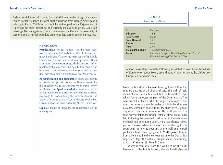
STAGE 1
Kameno – Vratlo hut
From the bus stop in Kameno turn right and follow the road up past the small shop and café. The wall of rock ahead of you is not Subra itself, but the Dobraštica ridge which forms the outer ramparts of the Orjen massif. The obvious cleft at the E end of this ridge is Vratlo pass. The road soon ascends through a series of hairpin bends (there are a few unmarked shortcuts, for the sharp-eyed). Ignore any side roads and continue for 1hr until you reach a road on your left to the Borići Hotel, at about 800m. Turn left, following the unsealed road round to the right from the hotel and continuing uphill. A marked shortcut takes you off the road where it swings round to the right; you soon begin following sections of the well-engineered packhorse track. This zigzags up to Vratlo pass (1175m), from where a trail to the left leads up onto the Dobraštica ridge (see Stage 3). Continue straight ahead, descending to reach Vratlo hut (1150m) in 5mins.
Water is available from the well behind the hut. However, if the hut is locked, the well will also be
Start KamenoDistance 14kmTotal Ascent 600mTotal Descent 25mRating easyTime 2hrsMaximum altitude 1175m (Vratlo pass)Maps Guide and map (1:31,250) to the Orjen Massif
(Mountaineering Club Subra, 2006)
A short, easy stage, initially following an asphalted road from the village of Kameno for about 10km, ascending to Vratlo hut along the old Austro-Hungarian packhorse route.
A short, straightforward route to Subra (1675m) from the village of Kameno (which is easily reached by local public transport from Herceg Novi), plus a side trip to Kabao. While Subra is not the highest peak of the Orjen massif, it is perhaps the most interesting, and certainly the easiest to get to. Good trail markings. This area gets very hot in the summer, but there is the possibility of vast amounts of rainfall from late autumn to late spring, so come prepared.

64
the mountains of montenegRo
65
Route 1 – subRa
padlocked, in which case the nearest water is from a well by one of the summer cottages, about 20mins along the onward route from the hut (see Stage 2). The best spots for camping are a little further along the trail towards Subra (Stage 2). Don’t pitch a tent in any of the walled enclo-sures, where locals grow crops.
STAGE 2Vratlo hut – Subra (return)
Start/Finish Vratlo hutDistance 6kmTotal Ascent 575mTotal Descent 575mRating moderateTime 3hrs 45mins (return)Maximum altitude 1675m (Subra)Maps Guide and map (1:31,250) to the Orjen Massif
(Mountaineering Club Subra, 2006)
Follow the trail NE from Vratlo hut, descending and turning left (NW) on a trail marked ‘Subra, Odljevo, Vrbanj’, etc. The trail meanders through limestone polja (good camping 5–10mins from Vratlo hut), passing a few summer cottages, a track on the right to Zubački kabao (the highest peak on Orjen), and a route on the left (unmarked) to Odljevo, with Subra ahead of you. There is a well with water by one of the cottages in this area, if you are short of water.4
A little over 30mins from Vratlo hut, you ascend to an area of deeply fissured limestone pavement (lapiez). Cross this (care needed), passing some deep sinkholes (Dragova jama and Nikolina jama) and ascending again
An interesting route, passing through impressive limestone scenery. It involves some straightforward scrambling, and there is some deeply fissured limestone pavement (lapiez) to cross.
See ‘Further Possibilities’
The route to SubraApproaching Vratlo pass

66
the mountains of montenegRo Route 1 – subRa
67
through scattered deciduous woodland and over rocky slopes, hugging the cliff on your right. The path veers right along a shelf, before rounding a bluff with spectacu-lar views of Lovćen on the right. Pass a somewhat precar-ious trail to a seasonal spring on your right, then ascend the last 20mins to the summit of Subra (1675m). Views from the summit are expansive, with the twin peaks of Lovćen to the E and Zubački kabao to the N.
Descend to Vratlo hut following the same route (1hr 20mins).
STAGE 3Vratlo hut – Kabao (return)
Follow the path from Vratlo hut to Vratlo pass, then take the trail on the right marked ‘K. kabao’. It’s a steep 40mins to the top of Kabao (1376m), with a short, slightly exposed section at the beginning, then up through decid-uous trees and around boulder fields.
Descend by the same route.
Start Vratlo hutDistance 2kmTotal Ascent 225mTotal Descent 225mRating easy-moderateTime 1hr (return)Maximum altitude 1376m (Kabao)Maps Guide and map (1:31,250) to the Orjen Massif
(Mountaineering Club Subra, 2006)
You will almost certainly have enough time to undertake this very short climb after arriving from, or before descending to, Kameno. Carry full packs up the trail a little way rather than leaving them on the pass, if you are not staying in Vratlo hut. There is some easy scrambling. It can also be extended to form a longer, circular route (see ‘Extension’ below). The route is sometimes marked ‘Kamenski kabao’.
ExtensionYou could extend this stage by following the clear but unmarked route along the Dobraštica ridge as far as Odljevo (1571m); allow an extra 40mins each way. From Odljevo, it would also be possible to descend to the main Vratlo hut-Subra trail, and so turn this into a circular route (allow 1hr 20mins from Odljevo to Vratlo hut).
STAGE 4Vratlo hut – Kameno
Start Vratlo hutDistance 14kmTotal Ascent 25mTotal Descent 600mRating easyTime 1hr 30minsMaximum altitude 1175m (Vratlo pass)Maps Guide and map (1:31,250) to the Orjen Massif
(Mountaineering Club Subra, 2006)
View from Kabao

68
the mountains of montenegRo Route 2 – Zubački kabao
69
Descend from Vratlo hut to Kameno by the same route (1hr 30mins).
ROUTE 2Zubački Kabao
HERCEG NOVI Practicalities: The bus station is on the main coast road, a few minutes’ walk from the old town (stari grad). Banks and ATMs on the main square (Trg Nikole Ðurkovića). An excellent local tour operator is Black Mountain (www.montenegroholiday.com; [email protected]), run by a British cou-ple who have been based in Herceg Novi for years and run outdoor adventure and cultural trips all over Montenegro.
View from the summit of Subra
Start/Finish VrbanjDistance 23kmTotal Ascent 885mTotal Descent 885mRating easy-moderateDuration 6hrs; 1–2 daysMaximum altitude 1894m (Zubački kabao)Maps Guide and map (1:31,250) to the Orjen Massif
(Mountaineering Club Subra, 2006), or Mountain Orjen Trail Hiking Guide and Map (1:40,000) (Mountaineering Club Subra, 2012). The older edition is by far the clearer of the two.
Water There is a spring near the Orjen sedlo hut. However, bring enough water with you from Herceg Novi for the whole day – it gets very hot in the summer.
Transport Buses for Kruševice, on the road from Herceg Novi to Trebinje, leave Herceg Novi’s bus station at 8am and 2.15pm (Mon-Fri only, no service at weekends). From Kruševice you will need to walk or hitch (prospects unlikely) the final 7km or so to Vrbanj (allow 1hr 30mins). If walking from Kruševice to Vrbanj, you are unlikely to get back in time for the last bus back to Herceg Novi, which (at the time of writing) leaves Kruševice at about 5.15pm – check time with driver on your way up to be certain (‘Kad ide zadni bus za Herceg Novi danas?’).
Huts and camping There is a small unstaffed shelter on the road below the summit of Orjen (Planinarski dom Orjen sedlo); contact Subra Mountaineering Association in Herceg Novi (see ‘Herceg Novi’, below). There is also a hut at Vrbanj; however, this has been closed since the war.
A short, straightforward excursion to the highest peak on Orjen, Zubački kabao (1894m). Effectively this is a road walk, followed by short climb to the rocky summit. It can be accomplished either in a long day from Herceg Novi, providing you can get transport the additional 23km from Kruševice (accessible by bus from Herceg Novi) to Vrbanj, or can be spread over two days, with a night at a shelter or a bivouac in between. This area gets very hot in the summer, but there is the possibility of very heavy of rainfall from late autumn to late spring, so come prepared.