Embed Size (px)
Citation preview
THE NATIONAL FLOOD INSURANCE PROGRAM THE NATIONAL FLOOD INSURANCE PROGRAM
A voluntary program based on a mutual agreement between the Federal government, the state and the local community:In exchange for adopting and enforcing a floodplain management ordinance, Federally- backed flood insurance is made available to property owners throughout the community.

NFIP GoalsNFIP Goals
• Reduce the loss of life and property caused by flooding
• Reduce rising disaster relief costs caused by flooding
• Reduce the reliance on flood disaster relief dollars by providing an alternate means of protection for an individuals home
Accomplishing NFIP GoalsAccomplishing NFIP Goals
• Publish maps to identify high-risk areas• Inform and educate the public to raise
awareness of flooding risks• Make federally-backed flood insurance
coverage available to property owners• Mitigate repetitive loss properties
Accomplishing NFIP Goals
• Discourage floodplain development and its risks through education and regulation
• Require new and substantially improved structures to be elevated to the flood protection elevation
• Prohibit new development within floodways
Federal Role
• Risk identification (Map Production)• Establish minimum development/building
protection standards• Provide affordable flood insurance coverage• Inform and educate the public• Provide technical assistance
State Role
• Establish additional development standards• Promulgate effective regulations• Provide technical assistance and data• Evaluate and document community/agency
floodplain management activities• Inform and educate the public
Local Role
• Adopt local floodplain management regulations that meet Federal/State laws
• Regulate development by permitting and inspecting construction activities
• Maintain records of floodplain development and mapping activities
• Inform and educate the public
Special Flood Hazard Area
SFHA’s are the darkly shaded areas on a Flood Hazard Boundary Map or a Flood Insurance Rate Map. SFHA’s represent the area of the base flood.
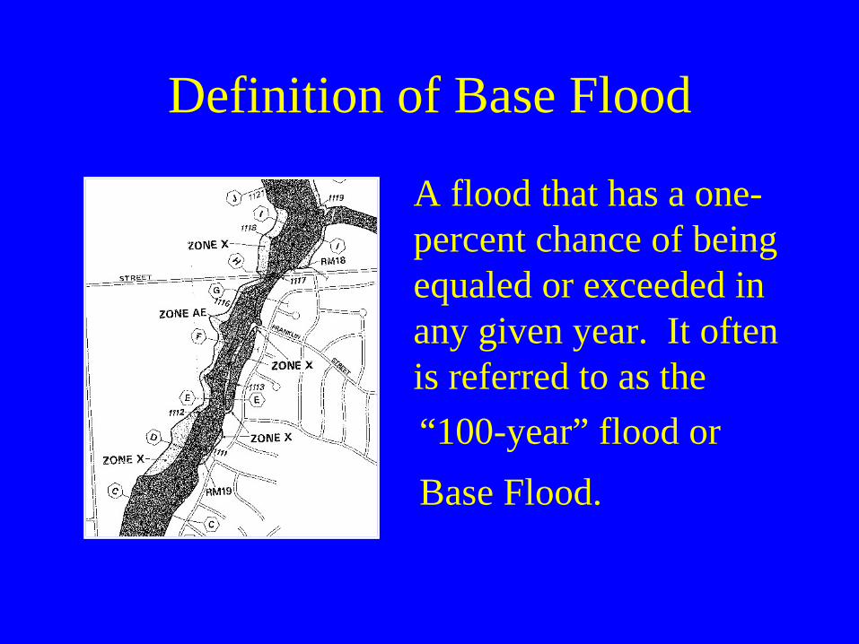
Definition of Base Flood
A flood that has a one- percent chance of being equaled or exceeded in any given year. It often is referred to as the “100-year” flood or Base Flood.
Definition of Floodway
The channel of a river or other watercourse and those portions of the floodplain adjoining the channel required to carry the regional flood discharge.
Definition of Flood Fringe
That portion of the floodplain outside of the floodway which is covered by flood water during the regional flood. The term “floodfringe” is generally associated with standing water rather than flowing water.
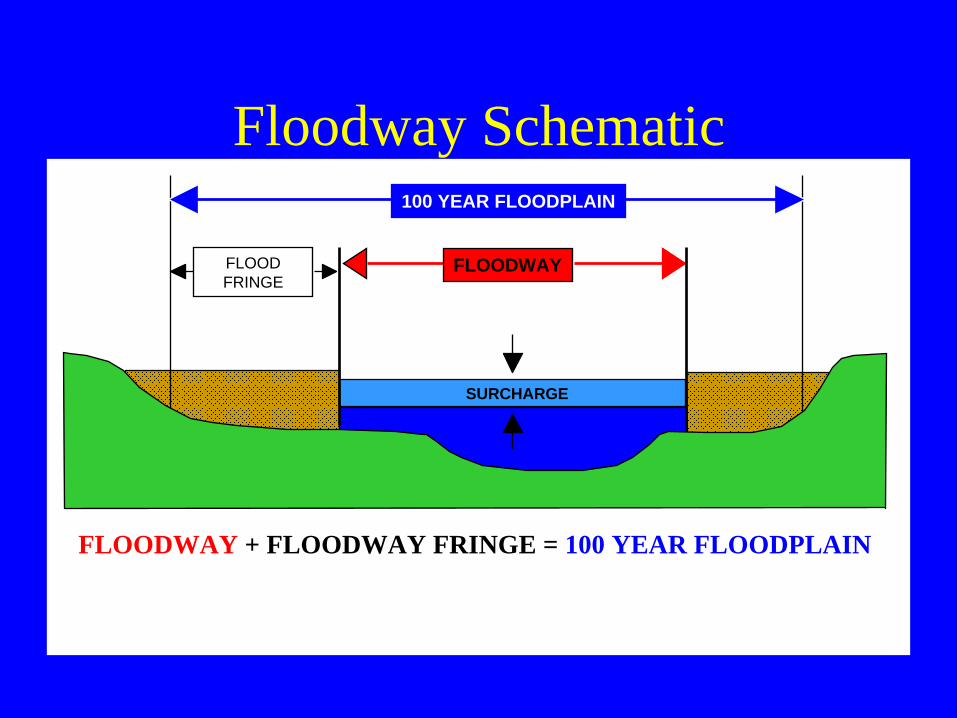
Floodway Schematic100 YEAR FLOODPLAIN
SURCHARGE
FLOODFRINGE
FLOODWAY + FLOODWAY FRINGE = 100 YEAR FLOODPLAIN
FLOODWAY
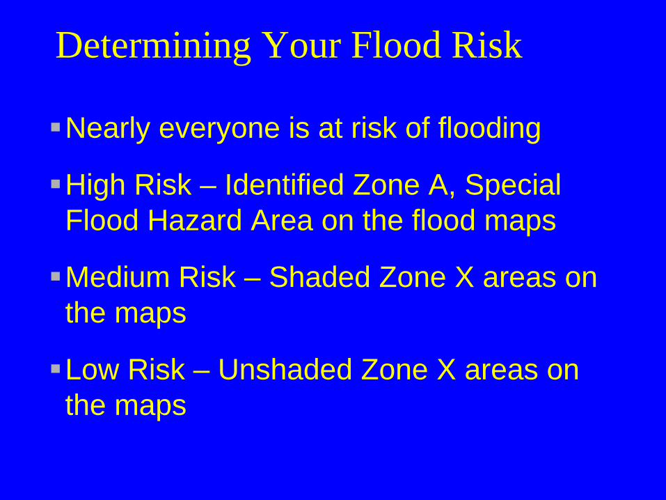
Determining Your Flood Risk
Nearly everyone is at risk of flooding
High Risk – Identified Zone A, Special Flood Hazard Area on the flood maps
Medium Risk – Shaded Zone X areas on the maps
Low Risk – Unshaded Zone X areas on the maps
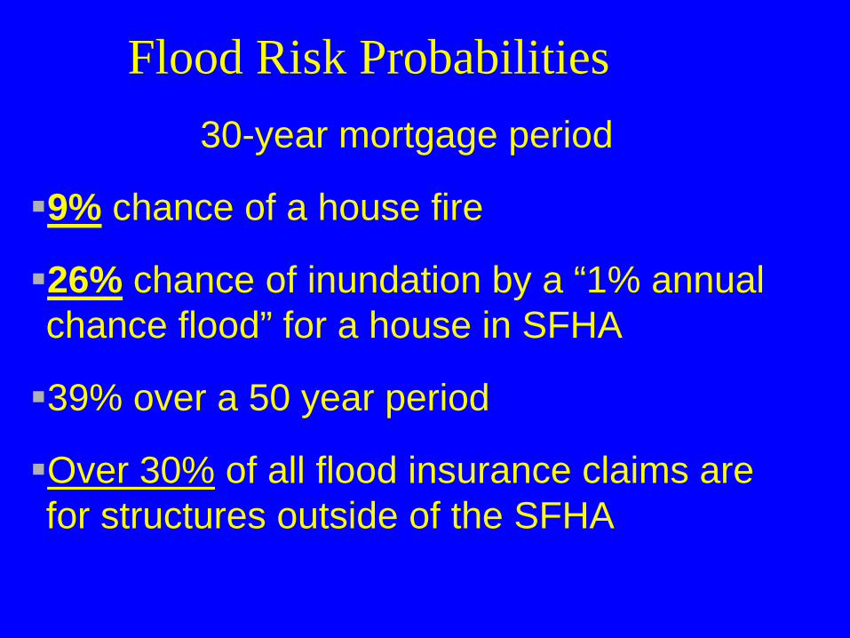
Flood Risk Probabilities30-year mortgage period
9% chance of a house fire
26% chance of inundation by a “1% annual chance flood” for a house in SFHA
39% over a 50 year period
Over 30% of all flood insurance claims are for structures outside of the SFHA
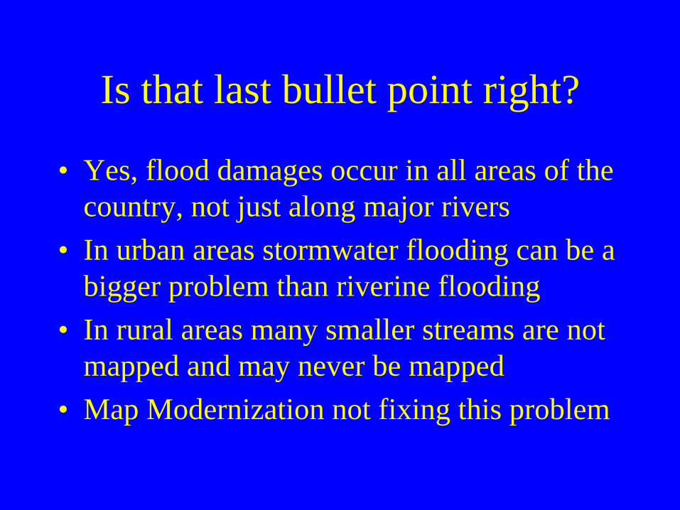
Is that last bullet point right?
• Yes, flood damages occur in all areas of the country, not just along major rivers
• In urban areas stormwater flooding can be a bigger problem than riverine flooding
• In rural areas many smaller streams are not mapped and may never be mapped
• Map Modernization not fixing this problem
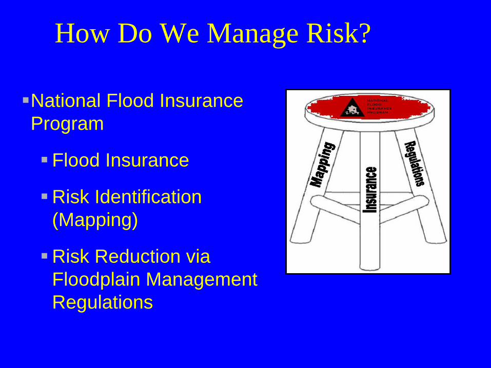
How Do We Manage Risk?
National Flood Insurance Program
Flood Insurance
Risk Identification (Mapping)
Risk Reduction via Floodplain Management Regulations
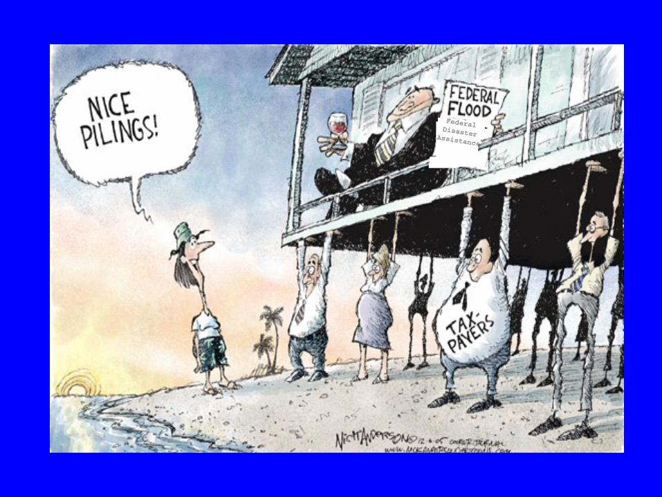
Why create the NFIP?Federal Disaster Assistance
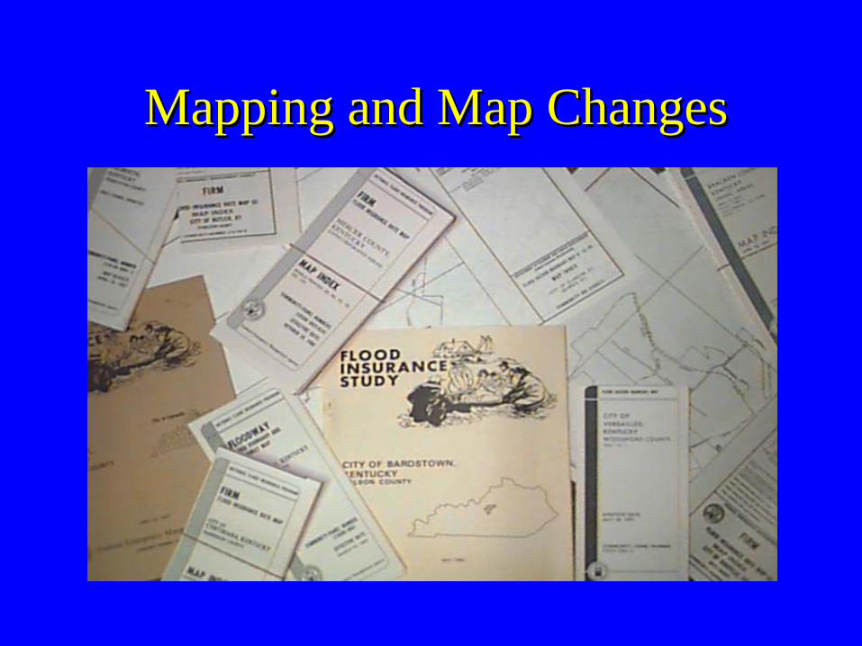
Mapping and Map ChangesMapping and Map Changes
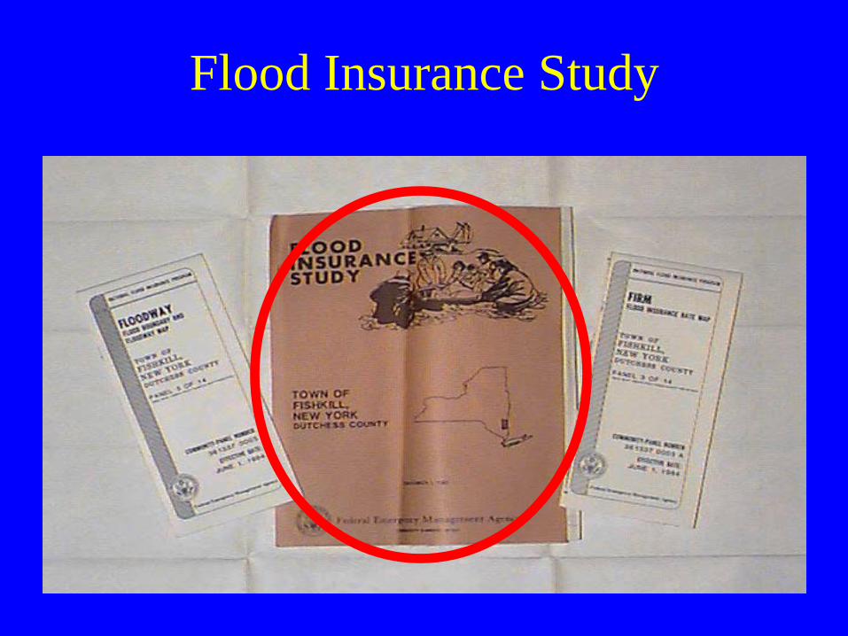
Flood Insurance Study
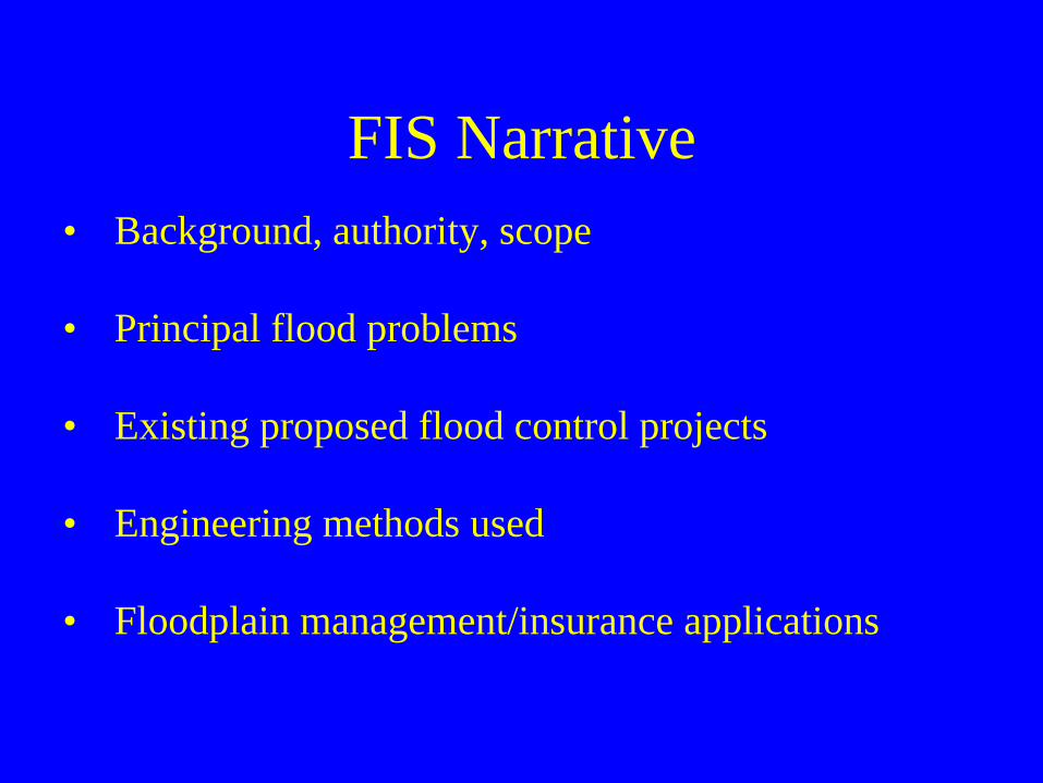
FIS Narrative• Background, authority, scope
• Principal flood problems
• Existing proposed flood control projects
• Engineering methods used
• Floodplain management/insurance applications
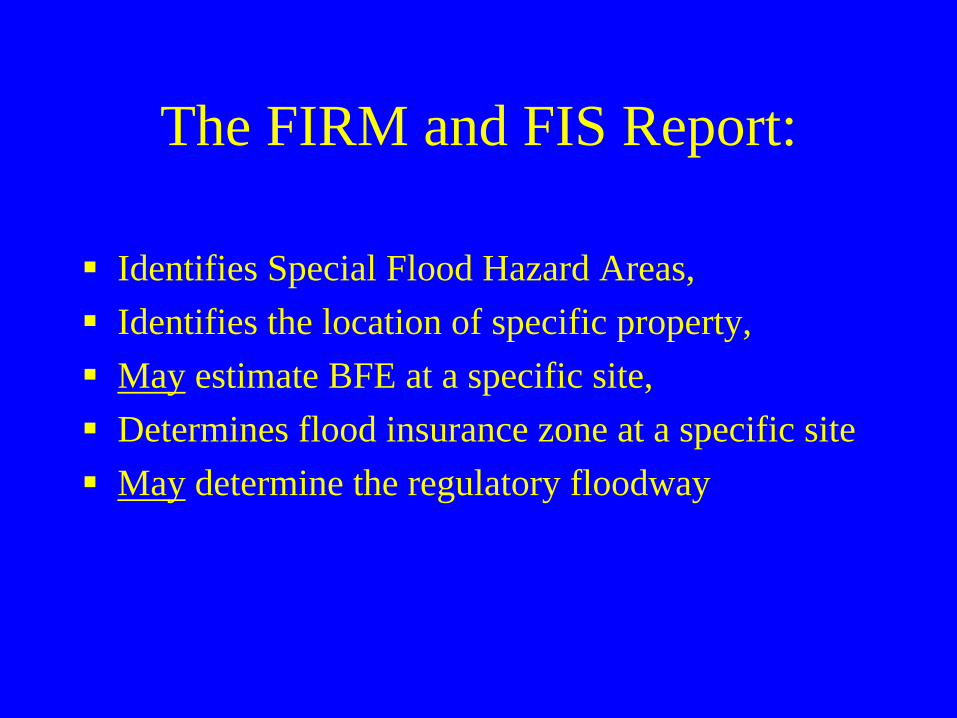
The FIRM and FIS Report:
Identifies Special Flood Hazard Areas,Identifies the location of specific property,May estimate BFE at a specific site,Determines flood insurance zone at a specific site May determine the regulatory floodway
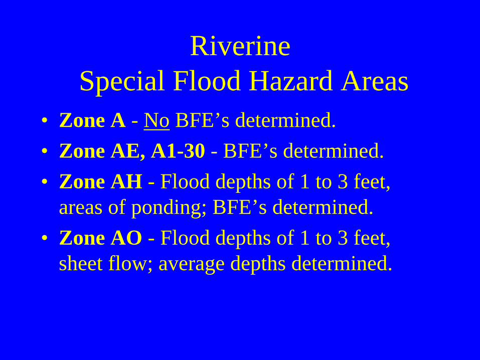
Riverine Special Flood Hazard Areas
• Zone A - No BFE’s determined.• Zone AE, A1-30 - BFE’s determined.• Zone AH - Flood depths of 1 to 3 feet,
areas of ponding; BFE’s determined.• Zone AO - Flood depths of 1 to 3 feet,
sheet flow; average depths determined.
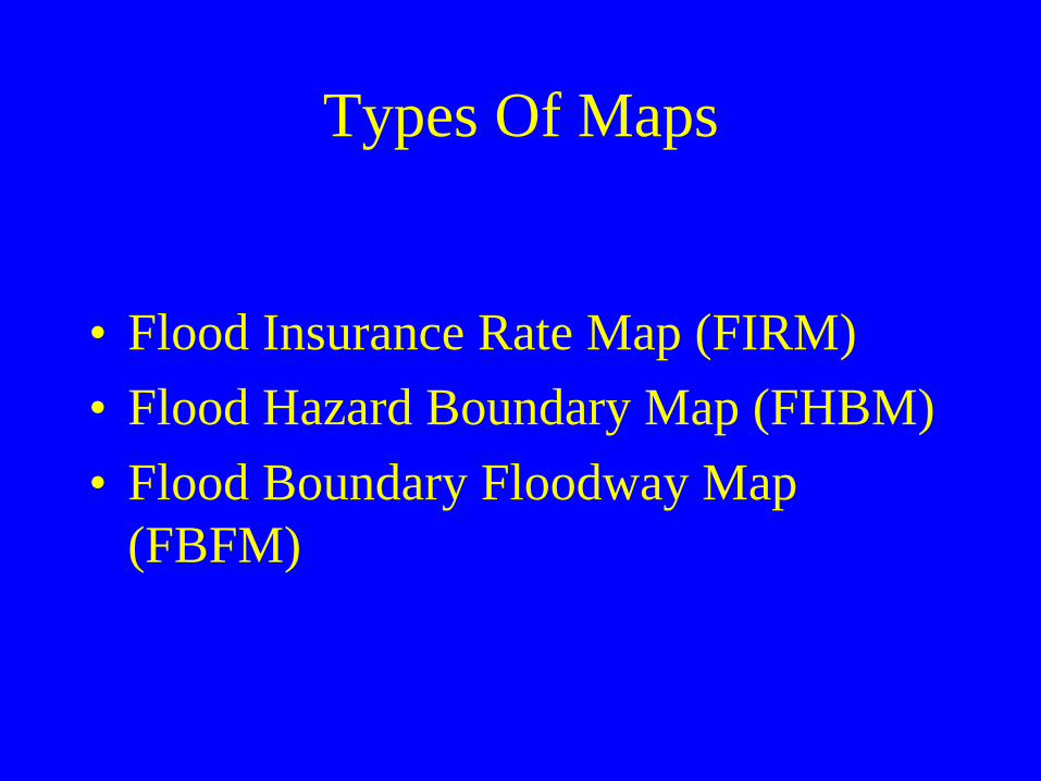
Types Of Maps
• Flood Insurance Rate Map (FIRM)• Flood Hazard Boundary Map (FHBM)• Flood Boundary Floodway Map
(FBFM)
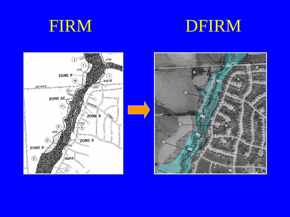
FIRM DFIRM
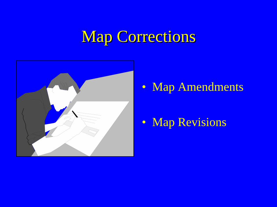
Map CorrectionsMap Corrections
• Map Amendments
• Map Revisions
LOMALOMA
• Pre-existing structures or land that are mistakenly included within the SFHA
• Applicant must provide a property survey• Only reviewed by FEMA• Issued by FEMA as a Letter of Map
Amendment (LOMA)• Fee: $ 0
Map RevisionsMap Revisions
• For development within the SFHA• Map Revisions are used for physical
changes to watercourses and floodplains• Revisions are also used to incorporate better
technical data• Issued by FEMA as either a Physical Map
Revision or a Letter of Map Revision
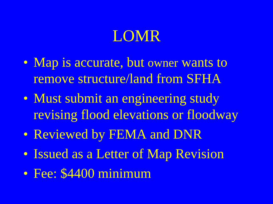
LOMR• Map is accurate, but owner wants to
remove structure/land from SFHA• Must submit an engineering study
revising flood elevations or floodway• Reviewed by FEMA and DNR• Issued as a Letter of Map Revision • Fee: $4400 minimum
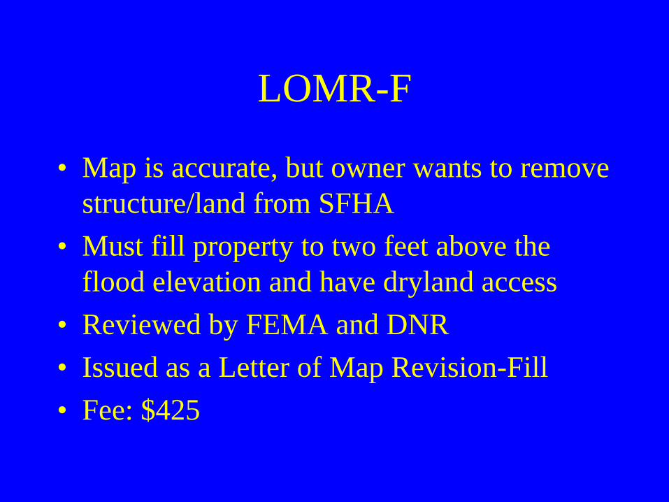
LOMR-F
• Map is accurate, but owner wants to remove structure/land from SFHA
• Must fill property to two feet above the flood elevation and have dryland access
• Reviewed by FEMA and DNR• Issued as a Letter of Map Revision-Fill• Fee: $425
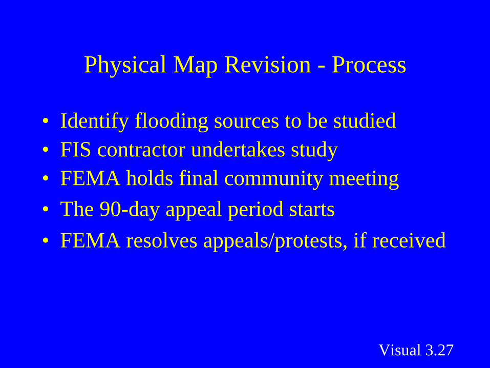
Physical Map Revision - Process
• Identify flooding sources to be studied• FIS contractor undertakes study • FEMA holds final community meeting • The 90-day appeal period starts• FEMA resolves appeals/protests, if received
Visual 3.27
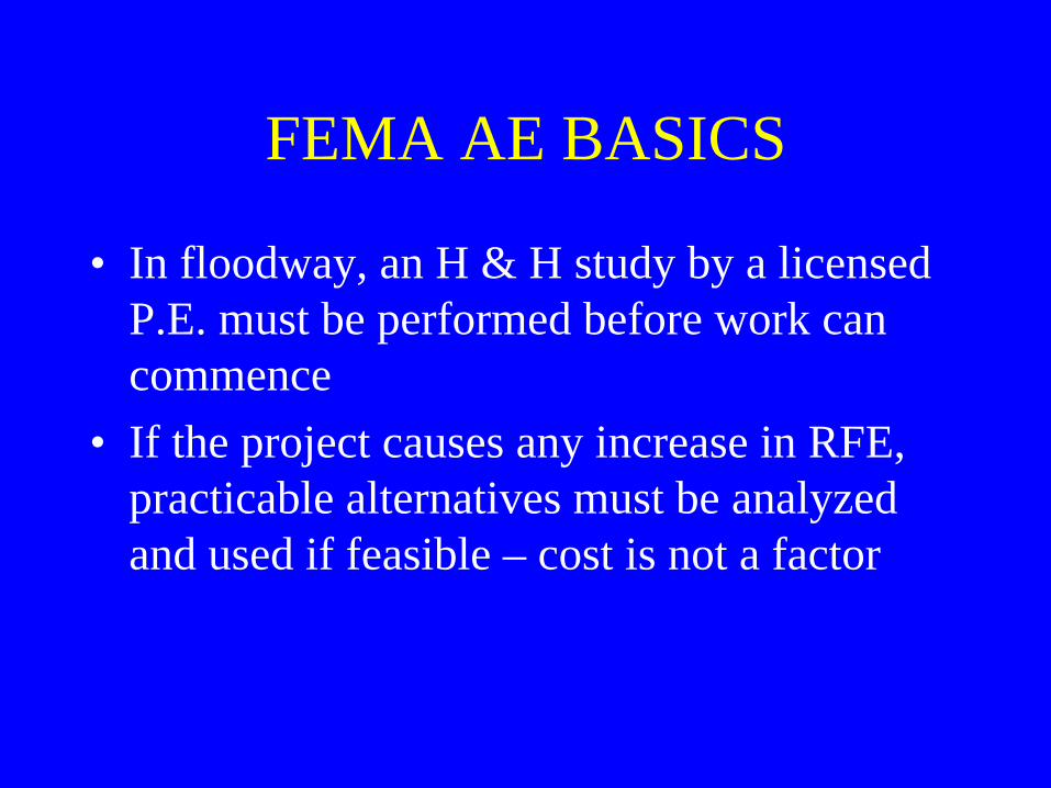
FEMA AE BASICS
• In floodway, an H & H study by a licensed P.E. must be performed before work can commence
• If the project causes any increase in RFE, practicable alternatives must be analyzed and used if feasible – cost is not a factor

FEMA AE BASICS
• Practicable alternatives analysis would be submitted as part of CLOMR process
• When completed, LOMR data must be adopted by community
• All affected property owners must be notified of any RFE increase
• For increases, flood easements must still be obtained before project can proceed
02/04/2011 34
FEMA Concerns• Participating communities must
submit data for projects that raise or lower the RFE in AE zones
• This is critical for properly applying floodplain management standards and for insurance rating
• This includes structures, roads, bridges, fill, storage, subdivisions
02/04/2011 35
FEMA Concerns
• Option is to apply for a CLOMR – Conditional Letter of Map Revision
• Requires alternative analysis, community concurrence, no insurable structures impacted, notify adjacent owners
02/04/2011 36
FEMA Zone A Basics • Need FEMA approval for:• Projects of 5 acres/50 lots • Projects that alter mapped area,
ie. changes in flow or flood heights due to new/replacement bridges, culverts, dams, fill, etc.
• If fill or structures are proposed, must keep a record of all increases to assure that the total increase does not exceed one foot
• No insurable structures can be impacted
LOMC Requirements
• AE Zone - floodway change:• Crossings with BFE increase – either
redesign project or obtain easements and complete alternatives analysis for LOMR
• Crossings with BFE decrease or no change – need CLOMR before permit issued; LOMR in 6 months
• Community responsible for LOMC
LOMC Requirements
• AE Zone – no floodway change:• Crossings with BFE increase - either
redesign project or obtain easements and complete alternatives analysis for CLOMR
• Crossings with BFE decrease or no change – complete no-rise certificate; no CLOMR required
LOMC Requirements
• A Zone – if not exempt, submit h & h data to develop a floodway on effective FIRM
• If not in floodway, no LOMR needed, submit data in 6 months
• If in floodway, does project cause an elevation increase?
LOMC Summary
• In AE zones, LOMC needed when:• New data is produced and used for
development or for map update• When new study revises existing effective
data• When physical changes are made in
floodplain (eg. channelization, stream realignment, new dam)

CLOMR Process
• Alternatives analysis – must consider feasible alternatives
• What is “feasible”? Similar to variance standards? (no practicable alternative, unnecessarily burdensome)
• Project costs alone cannot justify BFE increases
CLOMR Process
• Review process in Executive Order 11988 – federal directive to avoid floodplain impacts when undertaking agency projects
• If a project must be sited in a floodplain, agency must design or modify its action to minimize potential harm and explain why this action is necessary
CLOMR Process
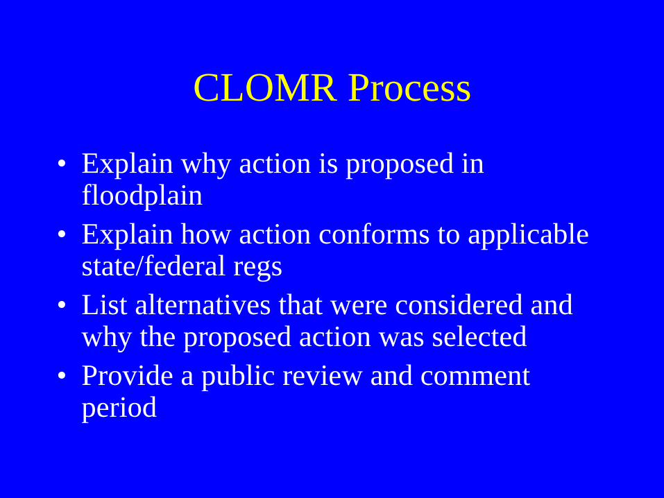
• Explain why action is proposed in floodplain
• Explain how action conforms to applicable state/federal regs
• List alternatives that were considered and why the proposed action was selected
• Provide a public review and comment period
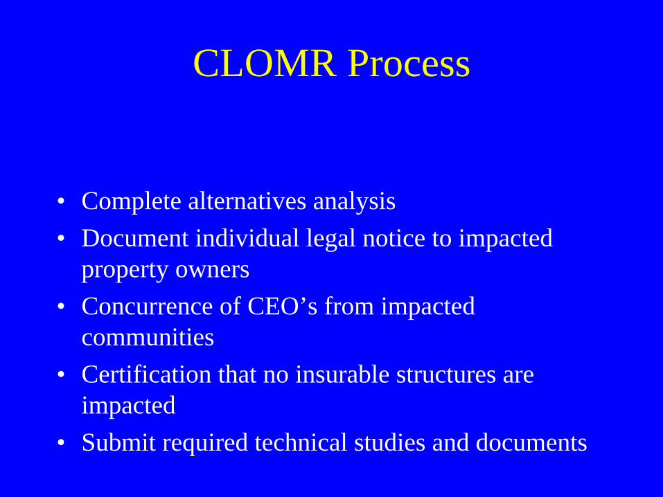
CLOMR Process
• Complete alternatives analysis• Document individual legal notice to impacted
property owners• Concurrence of CEO’s from impacted
communities• Certification that no insurable structures are
impacted• Submit required technical studies and documents
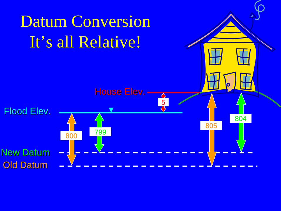
Datum Conversion It’s all Relative!
Old DatumOld DatumNew DatumNew Datum
Flood Elev.Flood Elev.
800800805805
799799
804804
House Elev.House Elev.55
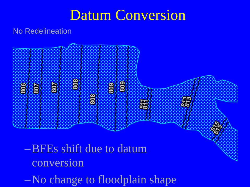
Datum Conversion
–BFEs shift due to datum conversion
–No change to floodplain shape
No Redelineation

Datum Conversion
–Conversion causes shift–Floodplain change due
to redelineation
With Redelineation

What happened to my LOMCs?• All LOMCs addressed in
the Summary of Map Actions (SOMA)– Four categories
• Incorporated• Not Incorporated
(validated)• Superseded• Redetermined
– Local officials need to be sure to review the prelim SOMA for completeness

Regulations
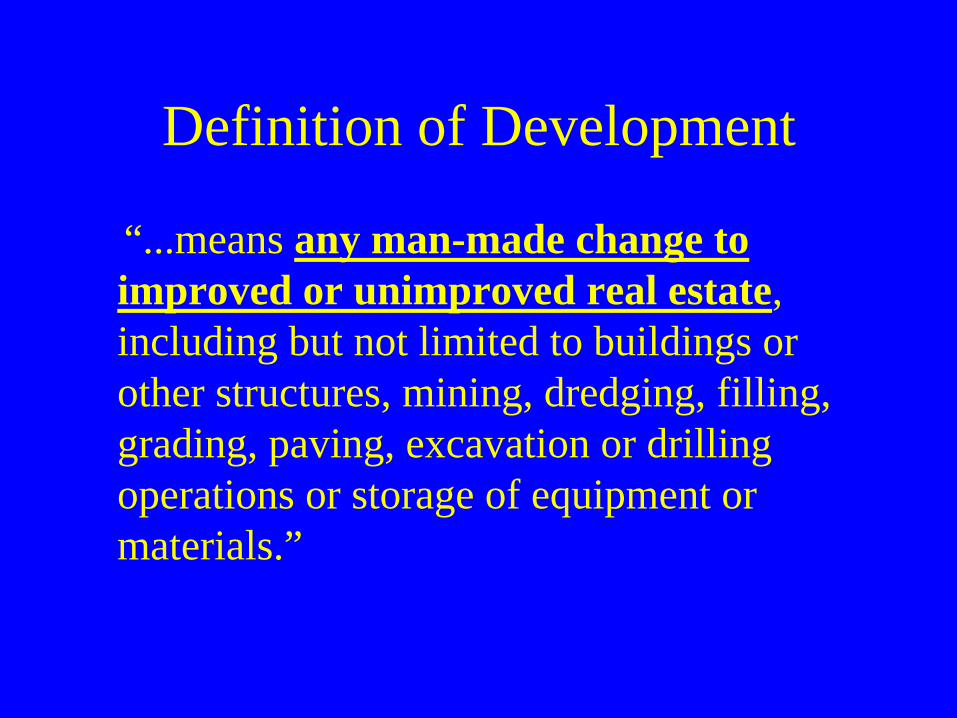
Definition of Development
“...means any man-made change to improved or unimproved real estate, including but not limited to buildings or other structures, mining, dredging, filling, grading, paving, excavation or drilling operations or storage of equipment or materials.”
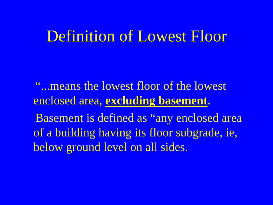
Definition of Lowest Floor
“...means the lowest floor of the lowest enclosed area, excluding basement. Basement is defined as “any enclosed area
of a building having its floor subgrade, ie, below ground level on all sides.
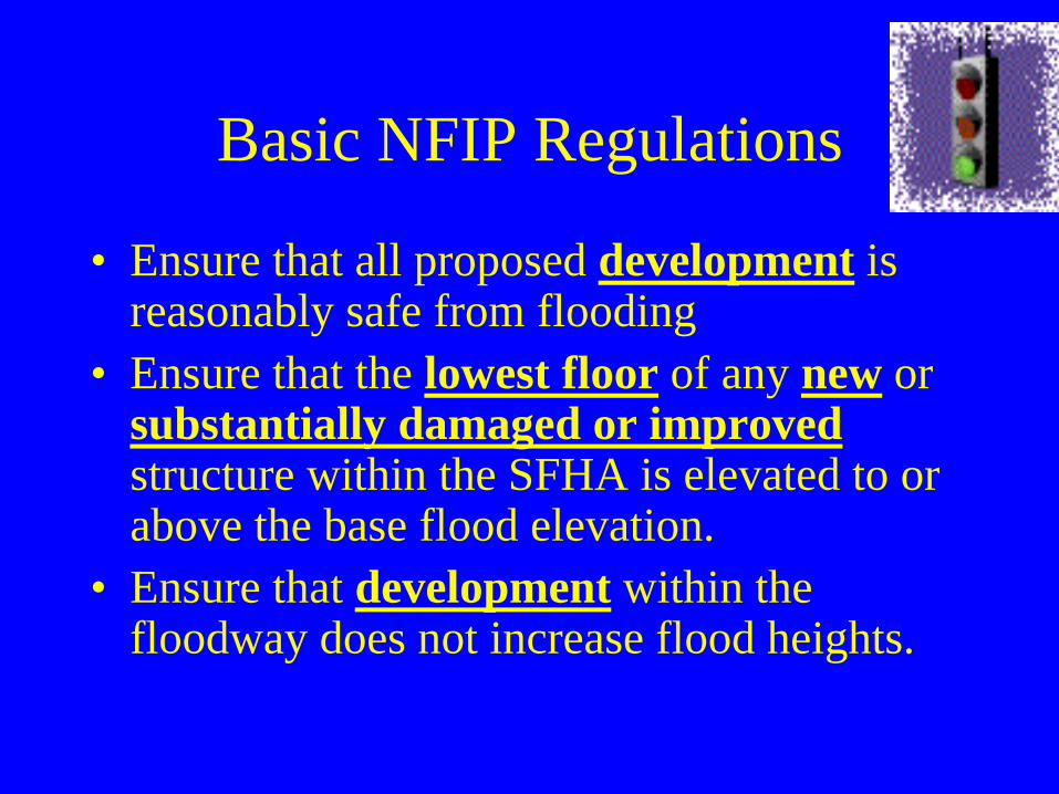
Basic NFIP Regulations
• Ensure that all proposed development is reasonably safe from flooding
• Ensure that the lowest floor of any new or substantially damaged or improved structure within the SFHA is elevated to or above the base flood elevation.
• Ensure that development within the floodway does not increase flood heights.
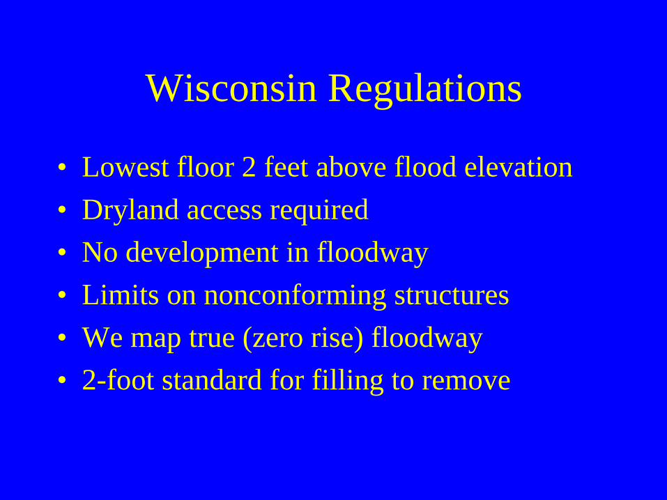
Wisconsin Regulations
• Lowest floor 2 feet above flood elevation• Dryland access required• No development in floodway• Limits on nonconforming structures• We map true (zero rise) floodway• 2-foot standard for filling to remove

Flood Insurance Basics• Homeowners insurance does not cover flooding• Anyone in a participating community can buy
flood insurance• Available to homeowners, business owners,
renters, condo unit owners, and condo associations• Sold by insurance agents or through the NFIP• Claims are paid regardless of disaster declaration• No payback requirement
When is Flood Insurance Mandatory?
• As a condition of any Federal grants or other financial assistance to repair or construct insurable structures within the SFHA including certain forms of flood disaster aide.
• As a condition of any mortgage from a federally- backed (VA, FHA), federally-insured or regulated lender for the repair, purchase or construction of insurable structures within the SFHA.
Insurance Policy Types
• SFIP (Standard Flood Insurance Policy)– Typical policy issued for SFHA structures
• PRP (Preferred Risk Policy)– Issued for structures outside the SFHA– Rates as low as $119 per year– PRP zones cannot be grandfathered
Effects of Map Changes on Flood Insurance
• –Lower risk to higher risk (“Grandfathering”)
• –Higher risk to lower risk (“Conversion”)
• –Vertical Datum
Eligible Structure• Walls And Roof• Principally Above Ground• Manufactured Home
– Foundation– Anchored– UtilitiesNo structures over water
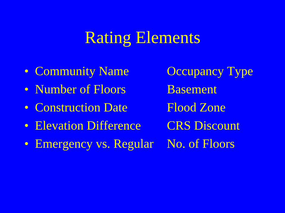
Rating Elements
• Community Name Occupancy Type• Number of Floors Basement• Construction Date Flood Zone• Elevation Difference CRS Discount• Emergency vs. Regular No. of Floors
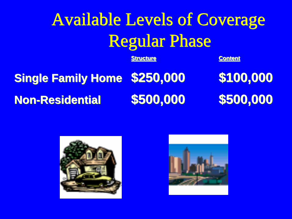
Available Levels of CoverageRegular Phase
Available Levels of CoverageRegular Phase
Structure Content
Single Family Home $250,000 $100,000Non-Residential $500,000 $500,000
Structure Content
Single Family Home $250,000 $100,000Non-Residential $500,000 $500,000

Building / Contents Coverage• Contents Coverage NOT Automatic• Emphasis Usually On Building Coverage• Basement coverage limited to mechanicals• Groundwater/sewer back-up not covered

Cost Comparison
• Single family structure, no basement, post-FIRM, Zone AE
• Coverage: Structure $100,000 Contents $50,000
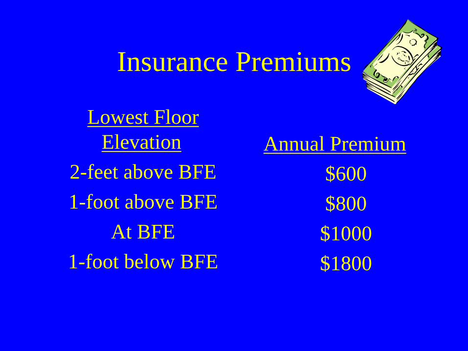
Insurance Premiums
Lowest Floor Elevation
2-feet above BFE 1-foot above BFE
At BFE 1-foot below BFE
Annual Premium $600 $800 $1000 $1800
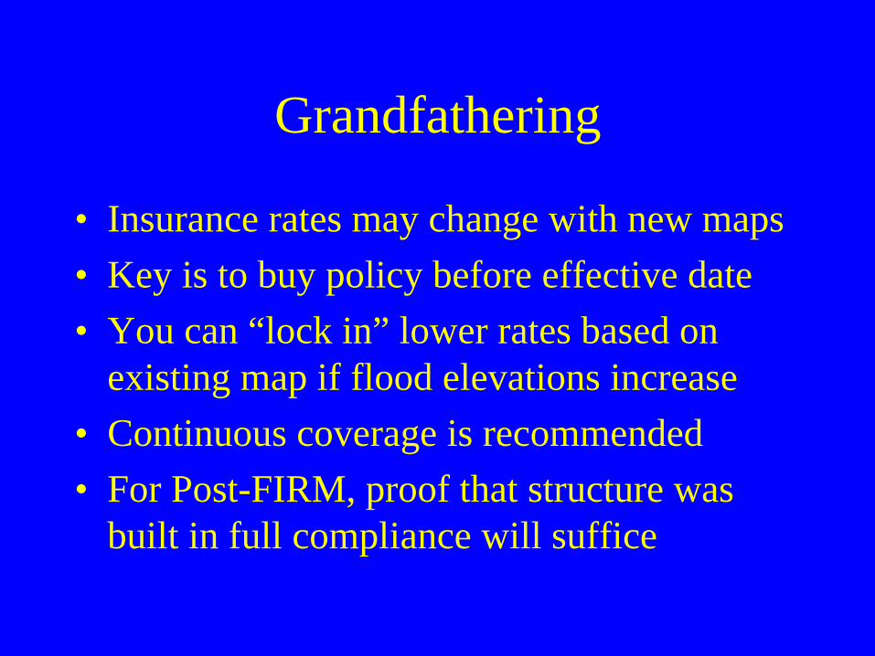
Grandfathering
• Insurance rates may change with new maps• Key is to buy policy before effective date• You can “lock in” lower rates based on
existing map if flood elevations increase• Continuous coverage is recommended• For Post-FIRM, proof that structure was
built in full compliance will suffice
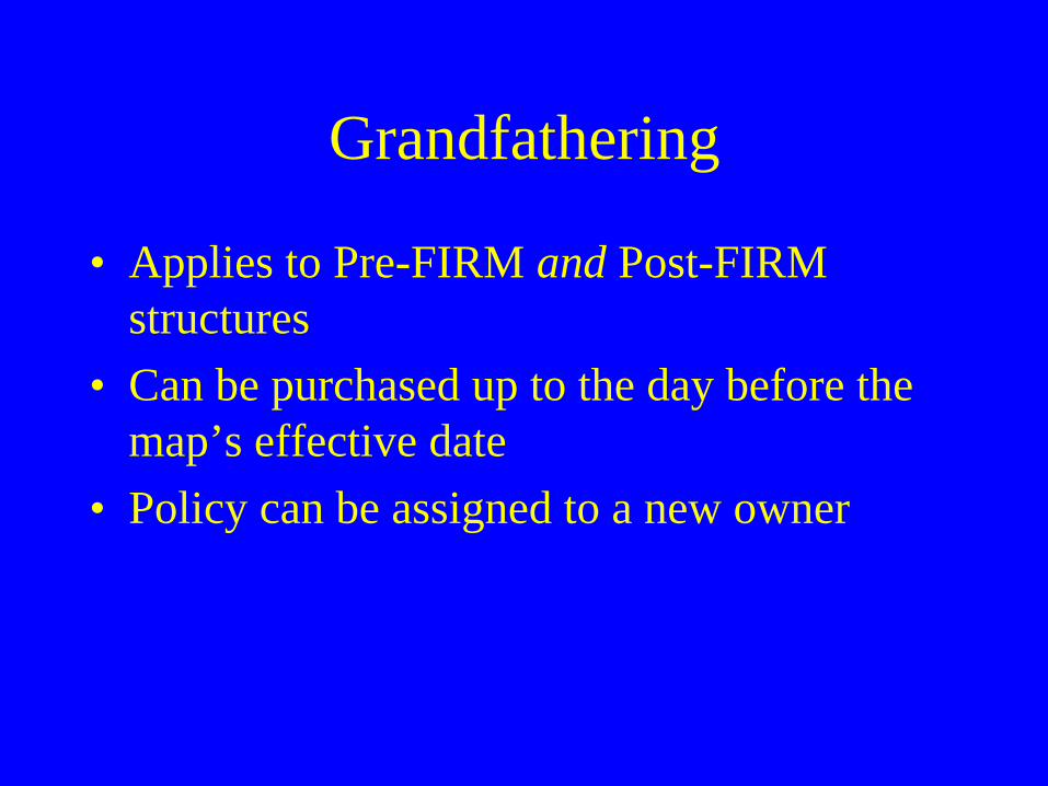
Grandfathering
• Applies to Pre-FIRM and Post-FIRM structures
• Can be purchased up to the day before the map’s effective date
• Policy can be assigned to a new owner

ZONE AE
Not Grandfathered:•$2,074 SFIP (AE Zone)•$6,222 in 3 years
Not Grandfathered:•$2,074 SFIP (AE Zone)•$6,222 in 3 years
Grandfathered:•$ 326 PRP (1st year)•$1,208 SFIP-X (yr 2-3)•$2,742 in 3 years
Grandfathered:•$ 326 PRP (1st year)•$1,208 SFIP-X (yr 2-3)•$2,742 in 3 years
Zone AE 2008
*$200K/$80K Building/Contents May 2008Grandfather Rules
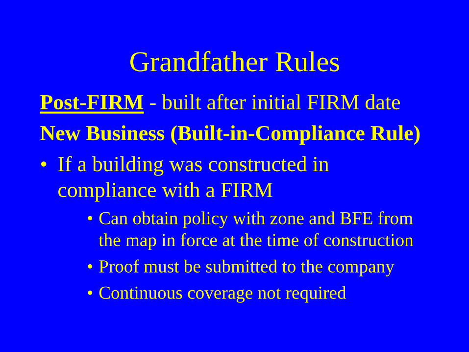
Grandfather RulesPost-FIRM - built after initial FIRM dateNew Business (Built-in-Compliance Rule)• If a building was constructed in
compliance with a FIRM• Can obtain policy with zone and BFE from
the map in force at the time of construction • Proof must be submitted to the company• Continuous coverage not required
Proof Required
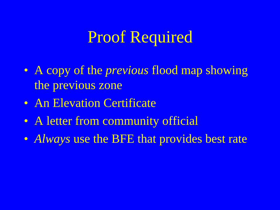
• A copy of the previous flood map showing the previous zone
• An Elevation Certificate• A letter from community official• Always use the BFE that provides best rate

Post-FIRM: Old BFE vs. Current
“Locked” Old BFE (+1):• $ 707 SFIP • $2,121 in 3 years
• Current BFE (-1):• $ 5,224 SFIP• $15,672 in 3 years

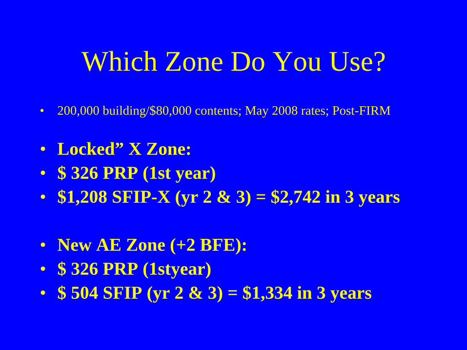
Which Zone Do You Use?• 200,000 building/$80,000 contents; May 2008 rates; Post-FIRM
• “Locked” X Zone:• $ 326 PRP (1st year)• $1,208 SFIP-X (yr 2 & 3) = $2,742 in 3 years
• New AE Zone (+0 BFE):• $ 326 PRP (1st year)• $1,246 SFIP (yr 2 & 3) = $2,818 in 3 years
Which Zone Do You Use?• 200,000 building/$80,000 contents; May 2008 rates; Post-FIRM
• Locked” X Zone:• $ 326 PRP (1st year)• $1,208 SFIP-X (yr 2 & 3) = $2,742 in 3 years
• New AE Zone (+2 BFE):• $ 326 PRP (1styear)• $ 504 SFIP (yr 2 & 3) = $1,334 in 3 years
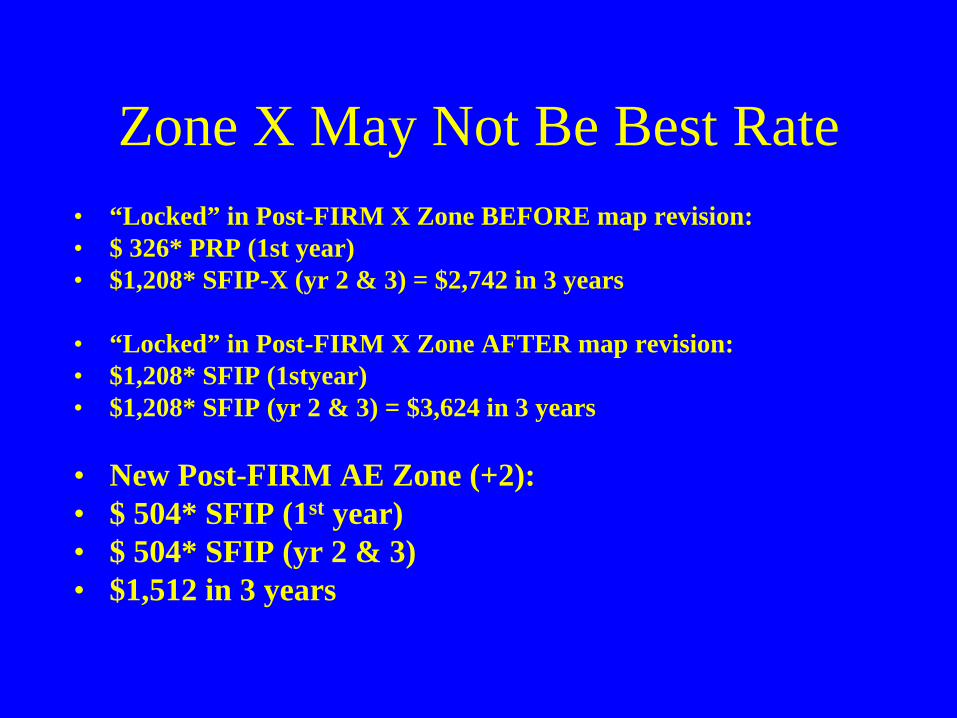
Zone X May Not Be Best Rate• “Locked” in Post-FIRM X Zone BEFORE map revision:• $ 326* PRP (1st year)• $1,208* SFIP-X (yr 2 & 3) = $2,742 in 3 years
• “Locked” in Post-FIRM X Zone AFTER map revision:• $1,208* SFIP (1styear)• $1,208* SFIP (yr 2 & 3) = $3,624 in 3 years
• New Post-FIRM AE Zone (+2):• $ 504* SFIP (1st year)• $ 504* SFIP (yr 2 & 3)• $1,512 in 3 years
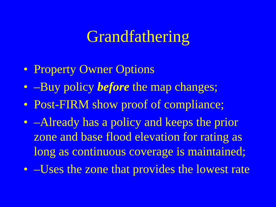
Grandfathering
• Property Owner Options• –Buy policy before the map changes;• Post-FIRM show proof of compliance; • –Already has a policy and keeps the prior
zone and base flood elevation for rating as long as continuous coverage is maintained;
• –Uses the zone that provides the lowest rate

PrePre--FIRMFIRM HouseHouse
$887/YR VS $887/YR VS $887/YR ($26,610) ($26,610) ($26,610)
$535/YR VS $3,036.50/YR VS $21,583/YR ($16,050) ($91,095) ($647,490)
PostPost--FIRMFIRM HouseHouse
Flood Insurance Costs for 30Flood Insurance Costs for 30--Year LoanYear Loan+1 FT
-10 FT-1 FT
+1 FT -1 FT-10 FT
Includes federal policy fee and ICC premium
Building ($75,000) and contents ($20,000)
Single family, one floor, no basement Z AE $500 d d tibl
Flood Hazard Determinations
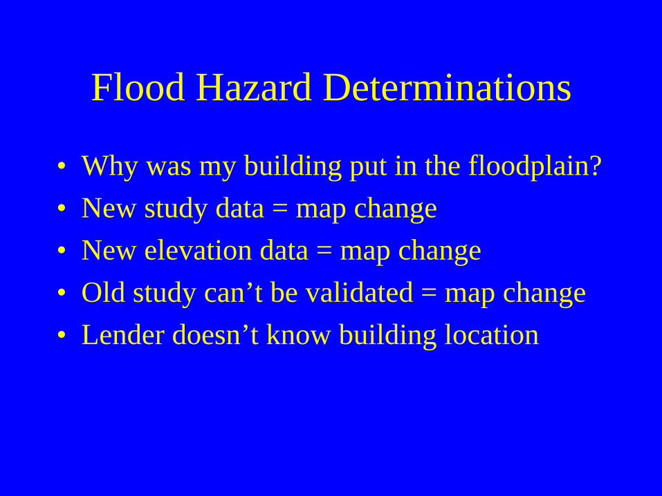
• Why was my building put in the floodplain?• New study data = map change• New elevation data = map change• Old study can’t be validated = map change• Lender doesn’t know building location
Common Problems
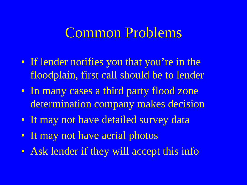
• If lender notifies you that you’re in the floodplain, first call should be to lender
• In many cases a third party flood zone determination company makes decision
• It may not have detailed survey data• It may not have aerial photos• Ask lender if they will accept this info
Strategies to Consider
LOMA Out As Shown• Used when new survey data is not needed to
show that the structure in not in SFHA• Must submit FEMA MT-EZ form, effective
FIRM panel, plat map or deed and tax assessors map
• Other data showing location of structure on lot may be required
Strategies to Consider
• If owner obtains a determination showing property out of the floodplain and lender still requires insurance, contact FEMA for LODR (Letter of Determination Review)
• Must be agreed upon by both parties• FEMA reviews info that lender used• Issues a decision on flood zone location
Strategies to Consider
• If this doesn’t work, next step is a LOMA• Owner will need an elevation certificate
prepared by Registered Land Surveyor• Submitted to and evaluated by FEMA• If map in error, FEMA will issue LOMA
which removes insurance requirement• Lender can still require flood insurance
Insurance Resources
• Flood Insurance Information www.FloodSmart.govwww.fema.gov/library/index.jsp• Flood Mapping www.msc.fema.govwww.dnr.state.wi.us/org/water/wm/dsfm/flood/
mapping.htm• FEMA Map Assistance Center • 877-FEMA-MAP (336-2627)
QUESTIONS???