Embed Size (px)
Citation preview
1
The Old Boar’s Head Middleton An investigation of foundations March 2016
Middleton Archaeological Society
Contact; Cliff Ivers, Chairman
07740 351814 [email protected]
2
Contents 1. Summary ......................................................................................................................................... 3
2. Introduction .................................................................................................................................... 3
3. Objectives........................................................................................................................................ 4
4. Methodology ................................................................................................................................... 5
5. Results ............................................................................................................................................. 5
6. Conclusion ....................................................................................................................................... 7
Appendix One Scale Plans ....................................................................................................................... 8
Appendix Two Photographs .................................................................................................................. 11
Appendix Three Finds ........................................................................................................................... 15
3
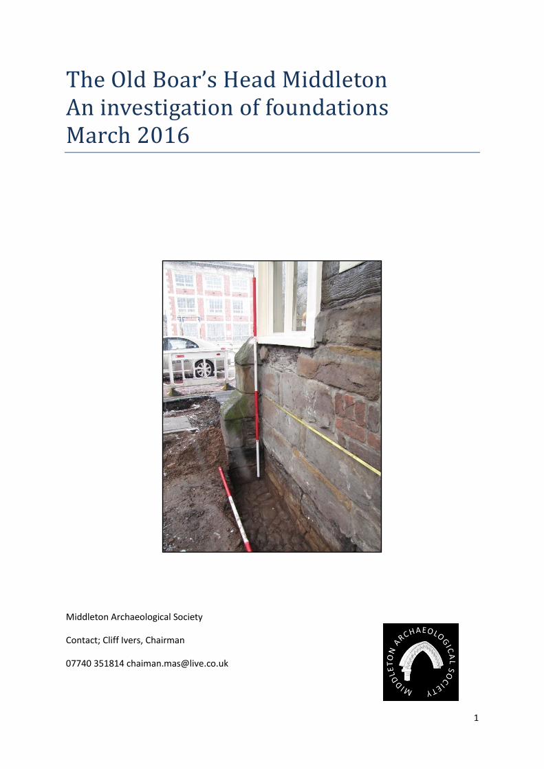
1. Summary 1.1. Middleton Archaeological Society (MAS) is based at the Old Boar’s Head public house.
Society members were given brief access to the pavement outside the pub during the
replacement of brick sets with stone flags. The replacement work was organised by
Rochdale Borough Council (RBC) and funded by the Heritage Lottery Township Fund.
The access was over two days in February 2016 and was marked by heavy snowfall on the
first day. RBC’s contractors had strict deadlines to lay the new pavement but were helpful in
facilitating safe access to the exposed earthworks.
1.2. The investigation presented the society with a unique opportunity to record the
foundations and old pavement surfaces which had been covered up by previous pavements
and road developments. The building is a combination of at least two early 17th century
constructions and it is hoped that the foundations will indicate some phasing of
development.
1.3. The society are planning a full measured survey of the building; being able to record the
lower levels of the front wall will help facilitate this.
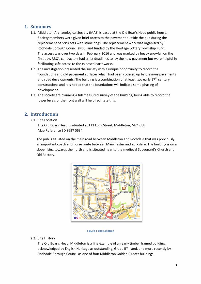
2. Introduction 2.1. Site Location
The Old Boars Head is situated at 111 Long Street, Middleton, M24 6UE.
Map Reference SD 8697 0634
The pub is situated on the main road between Middleton and Rochdale that was previously
an important coach and horse route between Manchester and Yorkshire. The building is on a
slope rising towards the north and is situated near to the medieval St Leonard’s Church and
Old Rectory.
Figure 1 Site Location
2.2. Site History
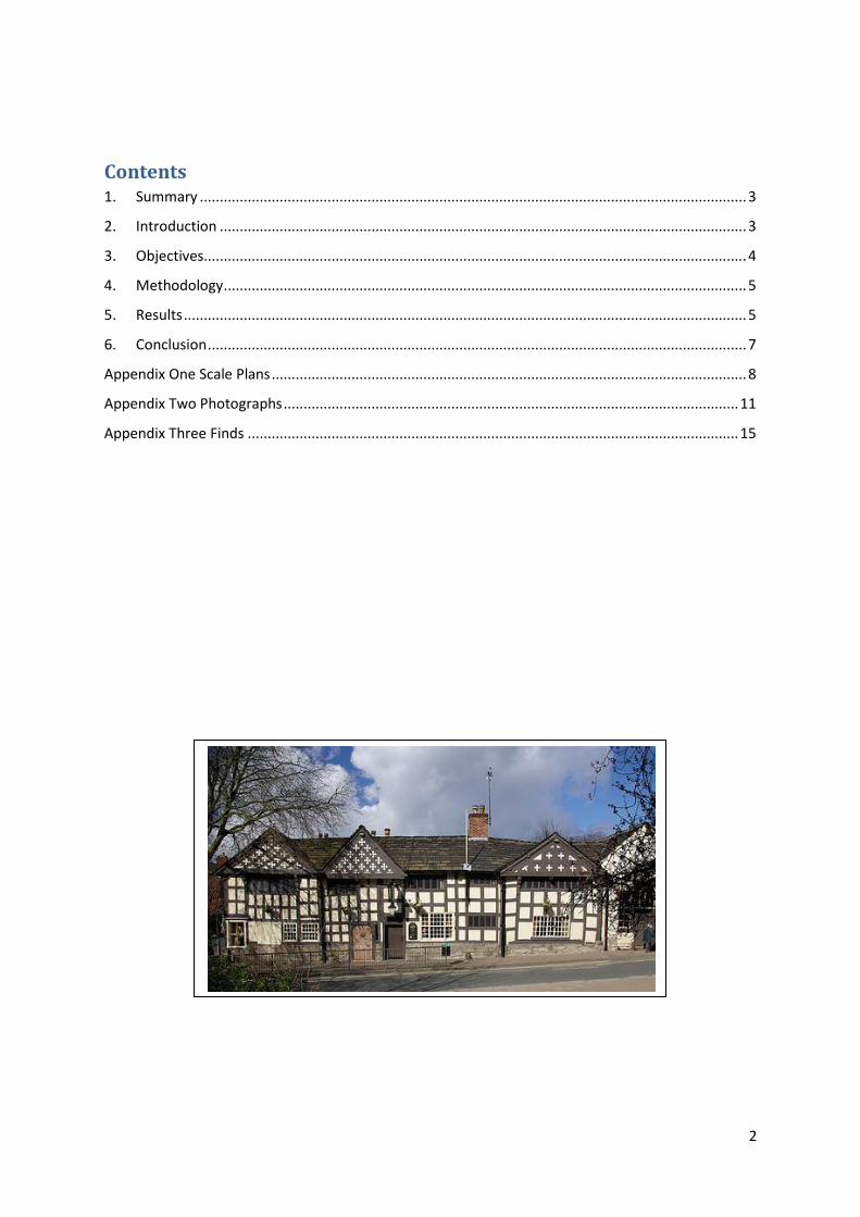
The Old Boar’s Head, Middleton is a fine example of an early timber framed building,
acknowledged by English Heritage as outstanding, Grade II* listed, and more recently by
Rochdale Borough Council as one of four Middleton Golden Cluster buildings.
4
MAS recently arranged a dendrochronology analysis1 of a selection of the pubs timbers.
This identified two separate construction phases of the frames, 1622 and 1654, the
northern three bays of the building being the oldest.
The box type timber frames sit on a stone wall approximately 1m above pavement level.
With the exception of a brick built extension to the north of the building (Sessions room),
there are 5 timber bays identified.
Due to continuous modification over the years, it is unclear whether the original form was
two hall type structures or three or more small workers’ cottages that were joined together
as the site developed. There are remnants of two inglenook fireplaces and four front doors.
The three gables have a quatrefoil (four leaf) decoration, the gable nearest Durnford Street
being filled with wattle and daub. The middle gable is a later addition, there to enhance the
building’s look.
The building was part of the Middleton Glebe (property and land donated by the lord of the
manor to support the parish church). Recently discovered documents have identified that it
was an Inn in the 1630’s. MAS members are in the process of transcribing 17th Century
probate inventories for the innkeepers. These documents will define the room names and
functions as well as demonstrating the growth of the building.
In the 1820’s the Inn became a post house for the Royal Mail and a stopping point for the
Manchester/Rochdale express coach service. A Sessions Room was built in the early 19th
century and held petty sessions of the Middleton Court until about 1852.
In 1888, the Rector of Middleton sold the building to Middleton Corporation who went on
to demolish some outbuildings and develop Durnford Street. At this time, the Inn had
accommodation for two travellers and stabling for their horses. In 1911, the council decided
to demolish the Old Boar’s Head to build a new town hall but, thanks to a massive protest
from lovers of the building they changed their minds. In 1980, Tudor Taverns took the lease
of the pub from the landlord, Paddy Hannelly, but were refused permission to remove
internal walls and make the pub open plan. RMBC carried out essential repairs in 1983.
Three years later, local brewery J W Lees took over the lease from the council and
undertook a massive restoration. In 1986 GMAU investigated wall paintings and graffiti in
an upstairs room of the pub2.
3. Objectives 3.1. Due to the confines of time and because of the poor weather conditions it was decided to
excavate two small trenches along the base of the building, one at the southern corner and
one to the north of the main door. This would coincide with the two phases of timber frame
construction identified in the dendrochronology report.
3.2. We planned to look for earlier surfaces in the trenches and draw sections and elevations of
the exposed areas.
3.3. We also planned to take levels of the various features using a dumpy level and measuring
staff.
1 Arnold & Howard NTRDL http://middletonas.com/wp-content/uploads/2016/02/Boars-Head-final.pdf
2 J Perry and M Ward, GMA Journal 1986, p137
5
4. Methodology 4.1. On arrival at the site it was found that the contractors had removed the old brick sets and
the surface was mostly a sandy soil mix. It was decided that recording of stratigraphy and
context would not be necessary for the investigation.
4.2. Two trenches (T1 &T2) were excavated using spades and trowels. The stone walls are
supported by stone buttresses which are designed to take the downward stresses of the
timber corner post. It was decided to place the trenches next to these.
4.3. Scale drawn sections of the building walls were taken above T1 and T2
4.4. Elevation plans of T1 and T2 were drawn using a planning frame.
4.5. Levels were taken of the trench features and the top of the wall using the pub front
doorstep as a reference. No OS benchmarks were identified near the pub.
4.6. Colour photographs were taken using a digital camera.
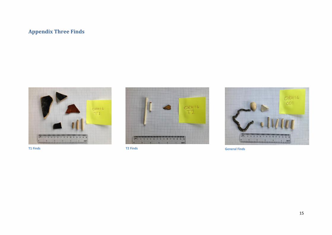
4.7. Finds were bagged into three categories T1,T2 and 001 using the site code OBH16
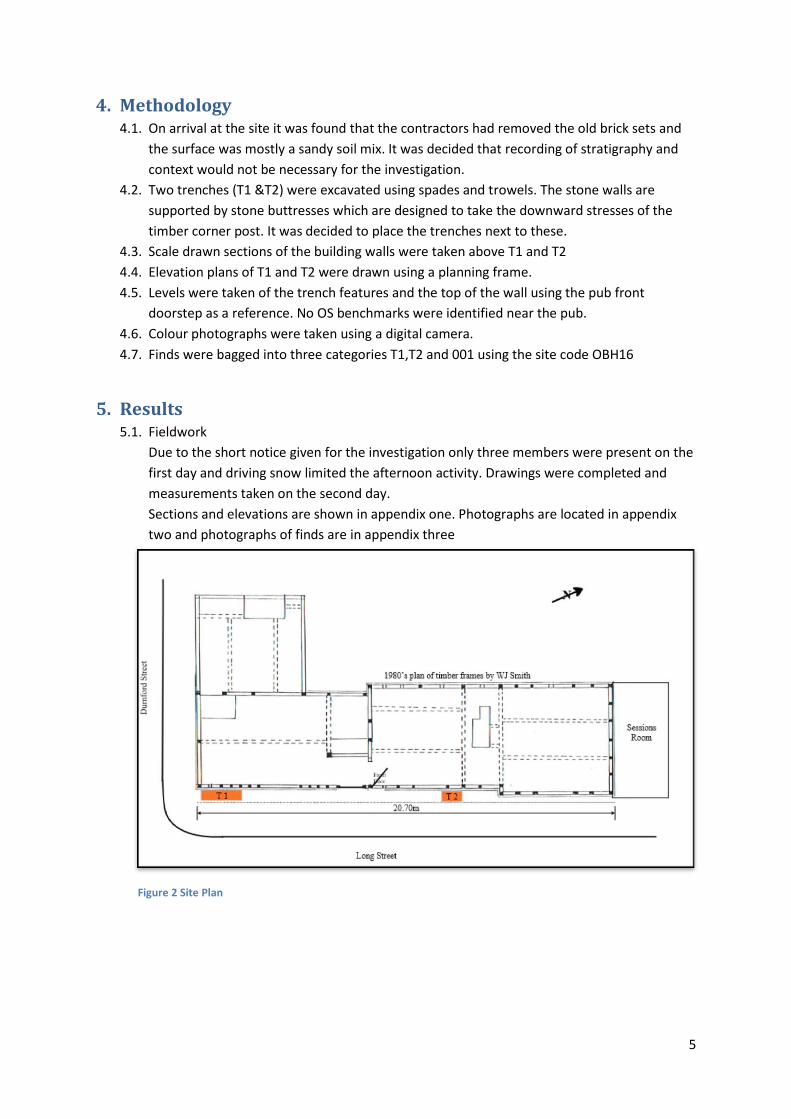
5. Results 5.1. Fieldwork
Due to the short notice given for the investigation only three members were present on the
first day and driving snow limited the afternoon activity. Drawings were completed and
measurements taken on the second day.
Sections and elevations are shown in appendix one. Photographs are located in appendix
two and photographs of finds are in appendix three
Figure 2 Site Plan
6
5.2. The Trenches
Trench Locations are as per the site plan above.
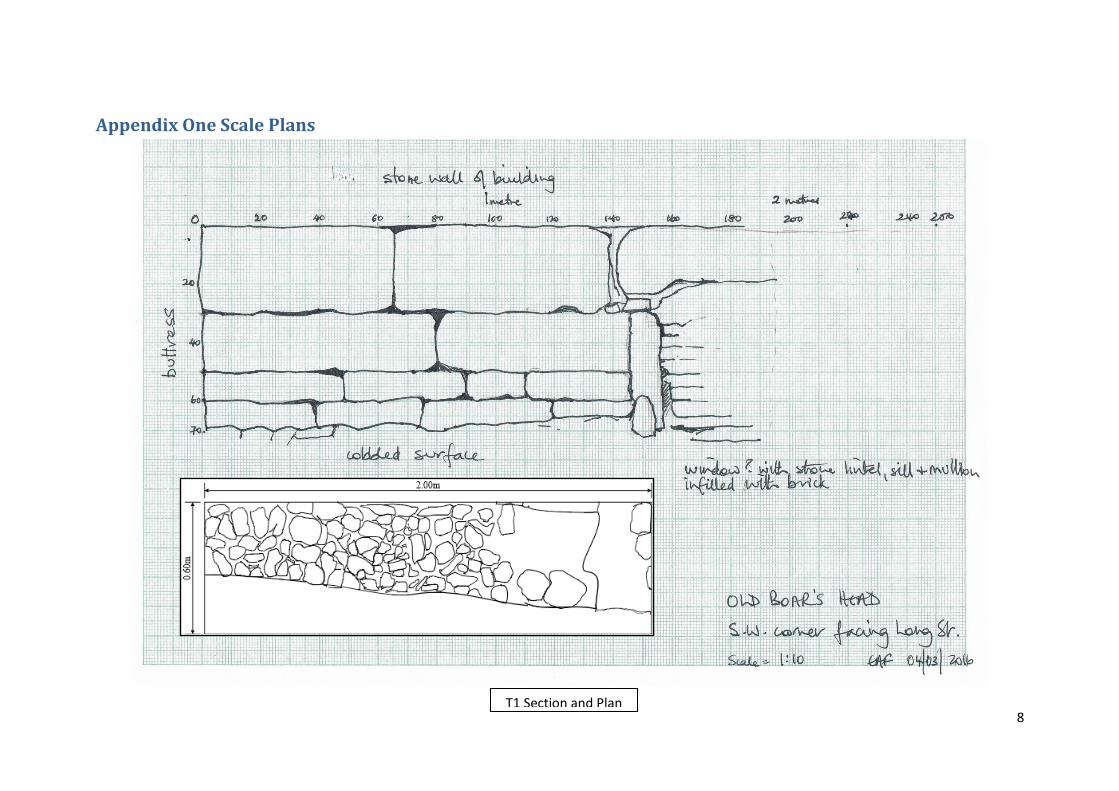
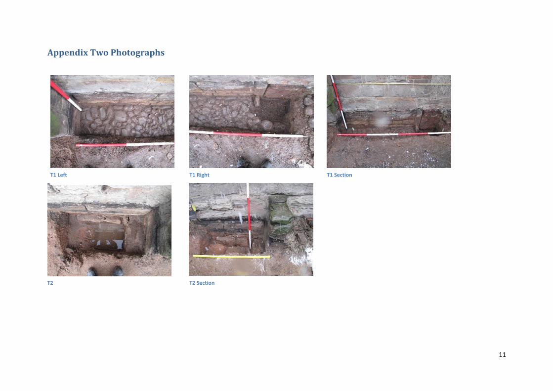
5.2.1. T1 was 2m by 0.5m and located against the southern corner buttress and the pub wall.
A cobbled surface was located at 0.76m depth3 sloping away from the pub wall. The
cobbles were placed against the foundation and buttress signifying they were laid at
later date than the building. The cobbled surface was broken at the northern side of
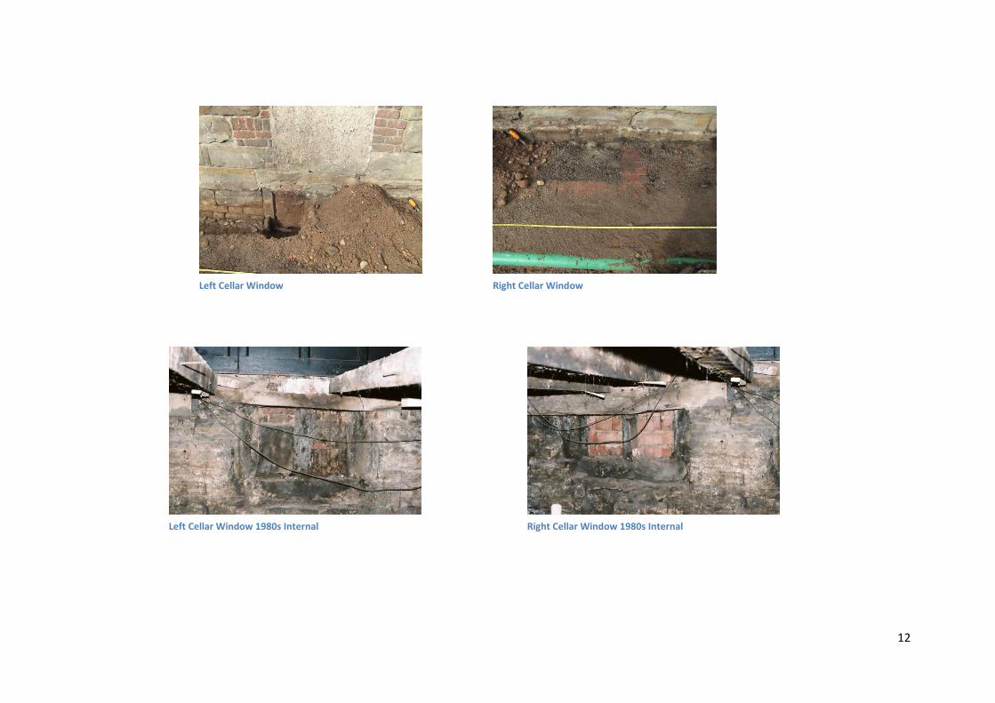
the trench by edging stones for the cellar window light.
The exposed wall consisted of various sized sandstone blocks with a square finished
face and sides ranging from 200 by 600mm to 300 by 800mm with a mortared joint
ranging from 10 to 20mm in thickness. The excavation identified that the wall sits on
another wall of which two layers of loosely laid rough stone with an average size of 100
by 400mm were visible. The wall continued below the bottom of the trench and is
believed to be the depth of the cellar.
At 1.4m along from the southern corner of the trench, a carved stone lintel frame with
central mullion was identified representing a cellar window (1). The window had been
infilled with handmade brick and mortar. The window light at the old pavement level
had been infilled with a cinder and sand mix.
Another identical cellar window (2) was identified at 3.0m along from the southern
edge. This window had been infilled with machine made bricks and had a brick edging
at the old pavement level with an inner dimension of 850 by 500mm. Again, this area
was infilled with a cinder and sand mix.
The wall above cellar window 1 appears to have had a doorway at some time that has
been infilled. It was noted that this doorway and step would have obstructed the
window light.
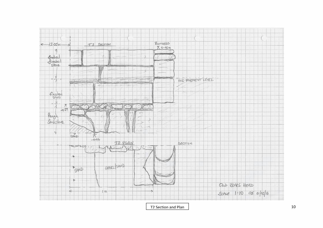
5.2.2. T2 was 1.0m by 0.5m. The trench was dug to a depth of 0.46m but failed to locate a
cobbled surface. The southern side of the trench was filled with a sloping sand infill
whilst the northern side had a gravelly sand infill. The exposed wall was in a much
better condition than the wall above and was of finished sandstone similar to the wall
above T1. Again the finished stone was of variable sizes and was laid upon small pieces
of rough sandstone of 100mm thickness at a depth of 290mm. Larger pieces of rough
sandstone were below this and appeared to sit on natural. These stones were slightly
wider than the wall and appeared to be a foundation.
5.2.3. The area under the main door of the pub was cleaned but not excavated. It was noted
there was a 600mm horizontal gap in the foundation wall that had been infilled with
soil and sand.
5.2.4. The remainder of the foundation along the front of the pub was cleaned by trowel to
allow photographs to be taken.
5.2.5. A small number of artefacts were collected and labelled as T1,T2 and 001 (other
areas). Most of the finds were provisionally dated to the 19th or 20th century.
Photographs are in appendix three.
3 Depths are relative to the front step of the pub
7
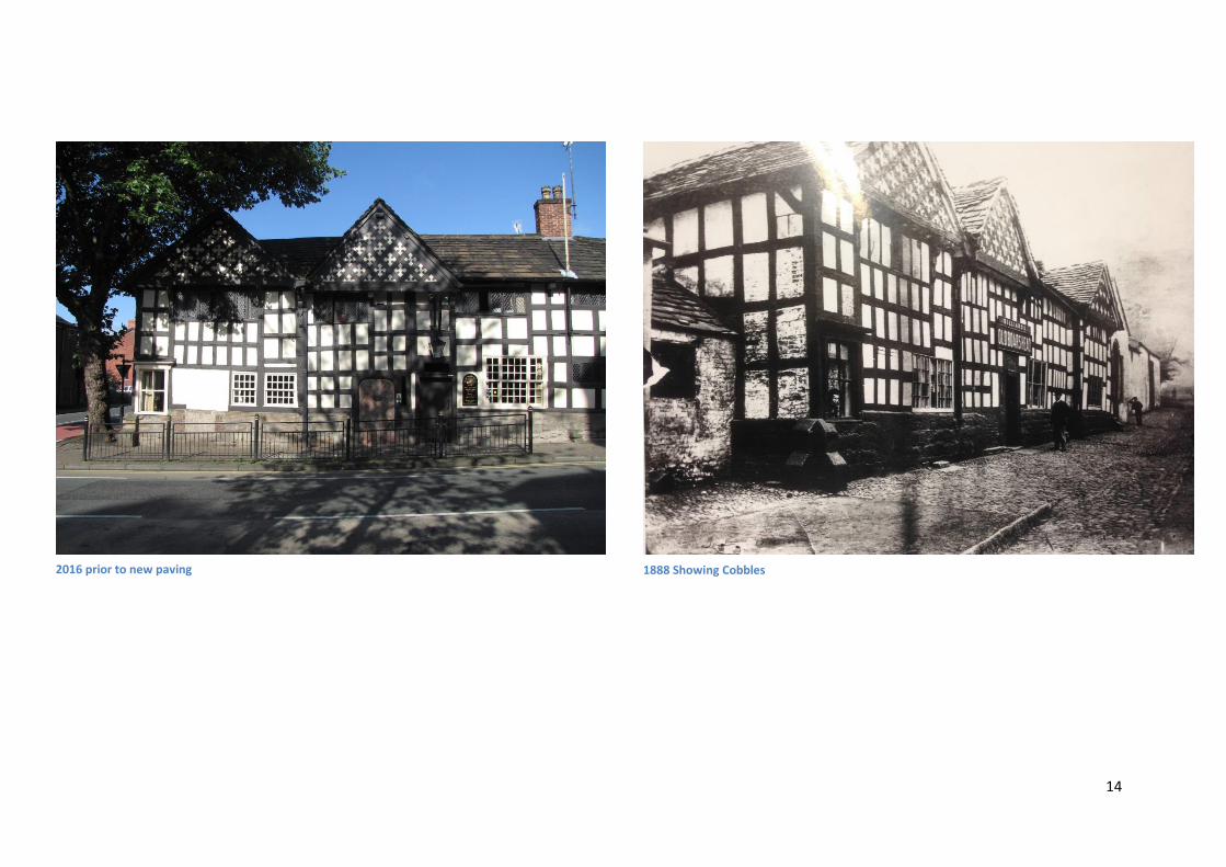
6. Conclusion 6.1. The investigation located an early cobbled pavement in Trench one which appears to be the
one seen in the 1888 photograph in Appendix Two. The cobbles were found to have been
robbed in the area of Trench two. The cobbles were butt against the pub wall suggesting
they were laid later although it was not possible to date the surface.
6.2. Two stone cellar windows with a central mullion were found built into the pub wall at
pavement level suggesting that the cellar was built at the time of construction of the
southern end of the building.
6.3. Photographs of the inside of the cellar taken in the 1980’s are in Appendix Two and confirm
that the windows were bricked up using machined brick (window 2) and handmade brick
(window 1) It is noted in the 1888 photograph that only one window light (window 2) is
present.
6.4. The foundations of Trench two were different to those in Trench one and appeared to
consist of large wide stones with a small stone levelling layer on top. There is no cellar at
this point so a difference in the construction of the foundations would be expected.
6.5. There is a gap in the foundation wall under the pub door. This could either confirm two
phases of building or may be due to some of the stones having been taken. It should be
noted that bay three of the timber frame finishes on the left jamb of the pub door and it is
most likely that the two timber building phases joined in this position.
6.6. The exposed walls highlighted the poor condition of the stone above. This is most probably
due to exposure to the elements and traffic pollution. As a follow up to this investigation,
MAS will try to complete a scale drawing of the front stone wall in order to demonstrate its
original appearance.
6.7. The northern bay of the building and its foundation extends 300mm onto the pavement but
the stonework and timber appears to be of the same date as bay two and three. We must
assume that this extension is to improve the appearance of the building; perhaps to suggest
it has a hall or wing.
The society would like to thank the members who helped out on this investigation despite
appalling weather conditions; Martin Burroughs, Liz Fairweather, Robert Howard, Robert
Huddart, Cliff Ivers and Geoff Wellens.
8
Appendix One Scale Plans
T1 Section and Plan
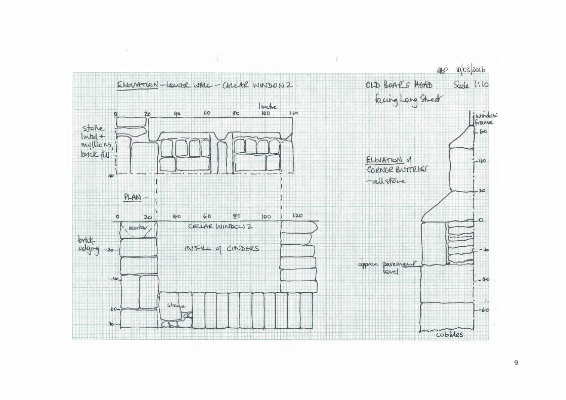
9
10
T2 Section and Plan
11
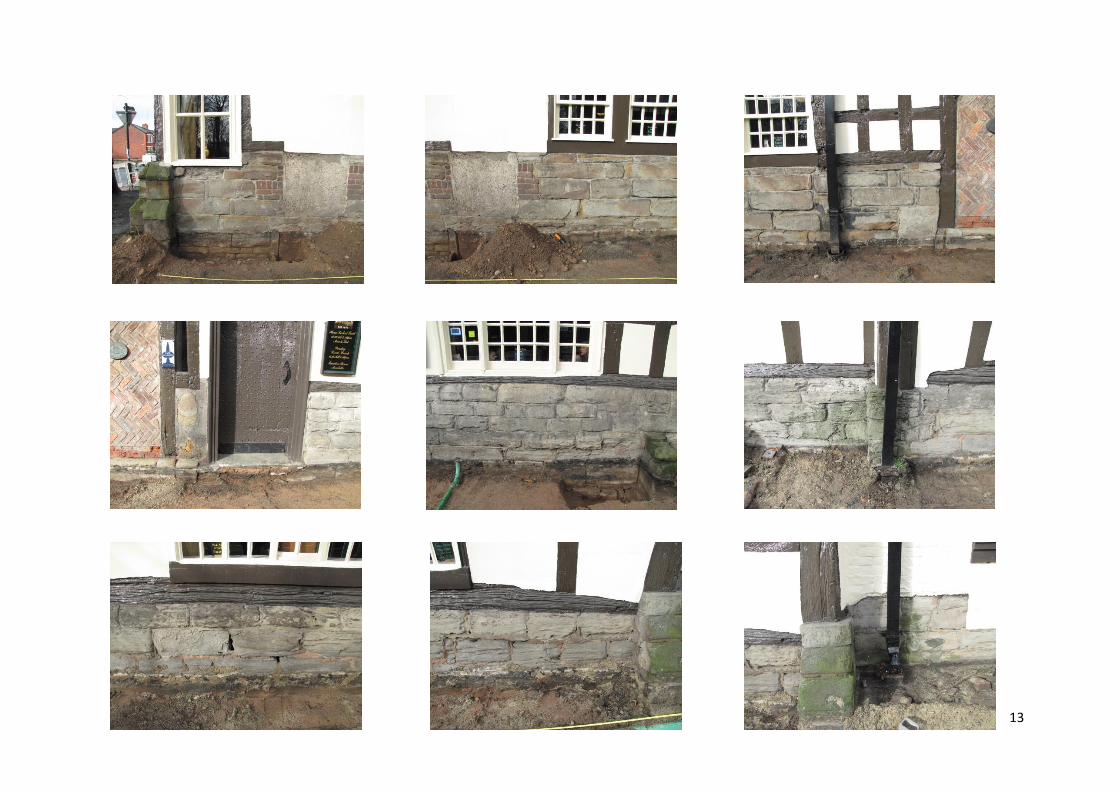
Appendix Two Photographs
T1 Left T1 Right T1 Section
T2 T2 Section
12
Left Cellar Window Right Cellar Window
Left Cellar Window 1980s Internal Right Cellar Window 1980s Internal
13
14
2016 prior to new paving 1888 Showing Cobbles
15
Appendix Three Finds
T1 Finds T2 Finds General Finds