Embed Size (px)
Citation preview
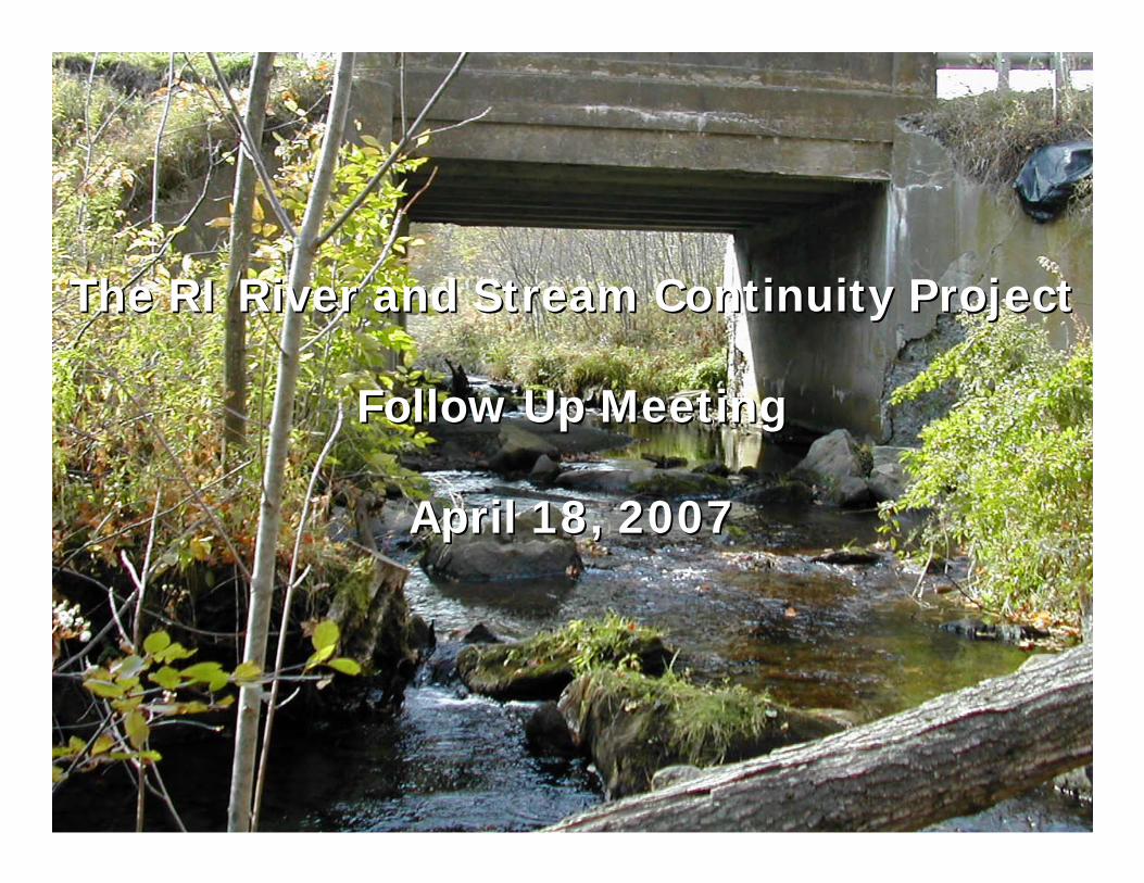
The RI River and Stream Continuity ProjectThe RI River and Stream Continuity Project
Follow Up MeetingFollow Up Meeting
April 18, 2007April 18, 2007
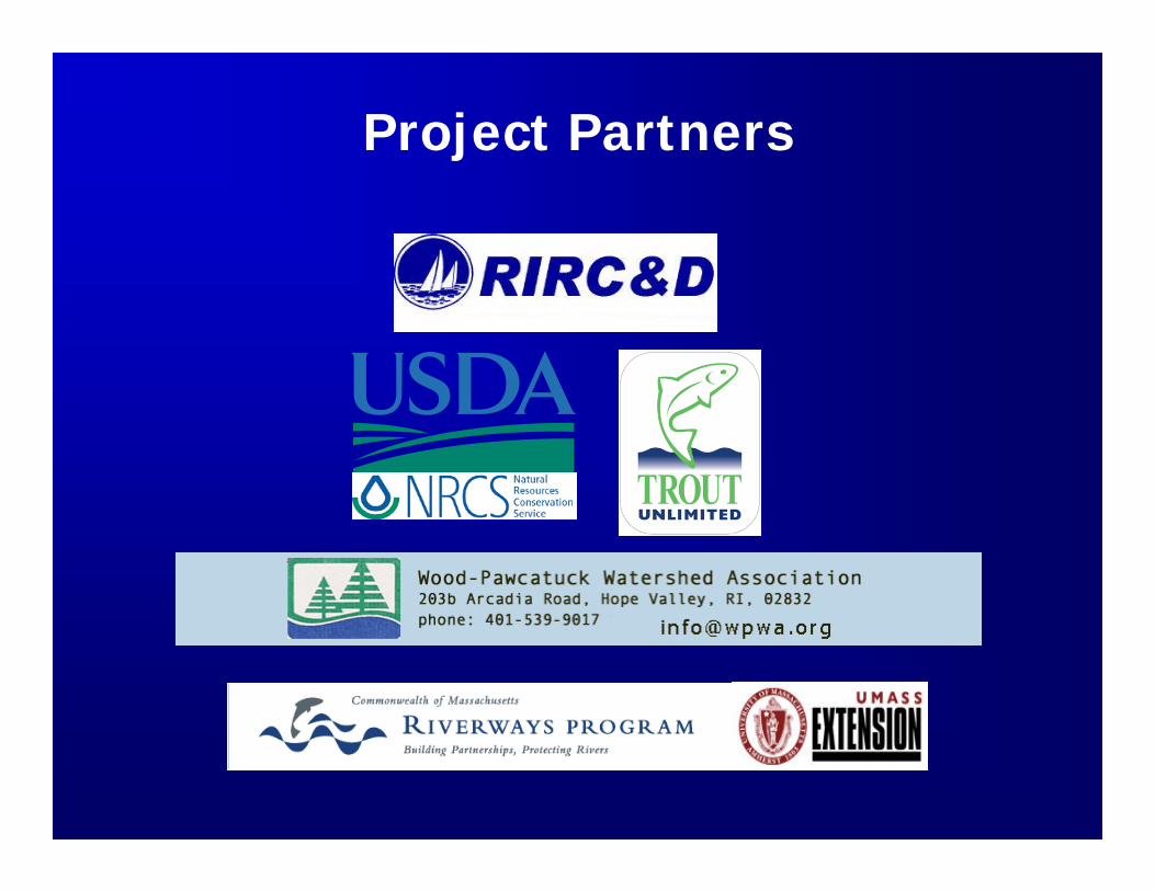
Project Partners
Purpose of the MeetingPurpose of the Meeting
•• To present methods to evaluate culverts as To present methods to evaluate culverts as potential barriers.potential barriers.
•• To demonstrate how data collection of To demonstrate how data collection of stream crossings can be performed by stream crossings can be performed by different watershed groups.different watershed groups.
•• To obtain feedback from other groups, To obtain feedback from other groups, organizations, and individuals on the organizations, and individuals on the project.project.
•• To identify other partners interested in To identify other partners interested in making this a statewide effort.making this a statewide effort.
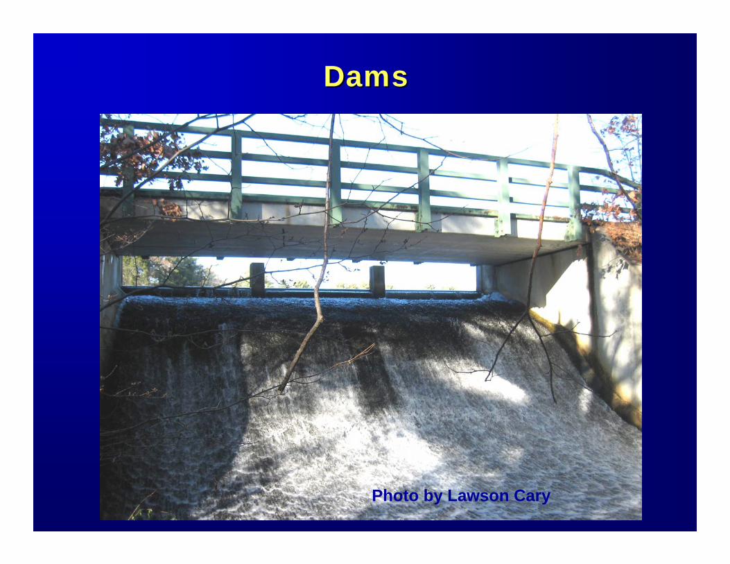
DamsDams
Photo by Lawson Cary
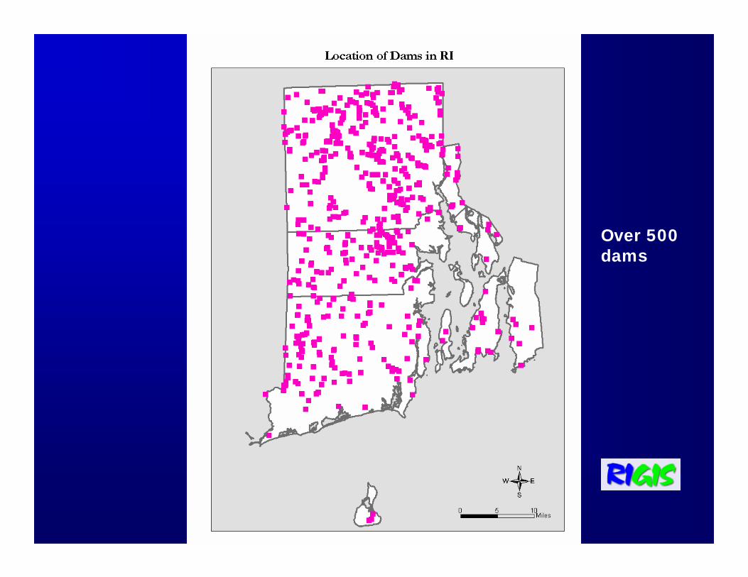
Over 500 dams
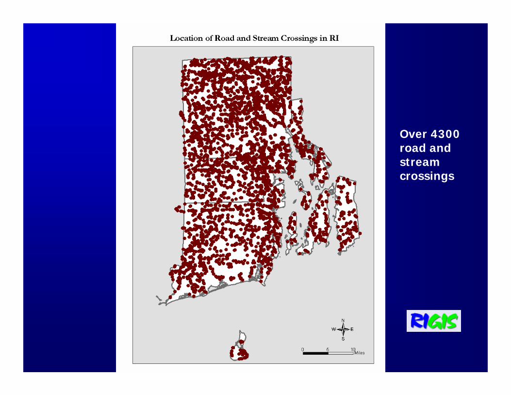
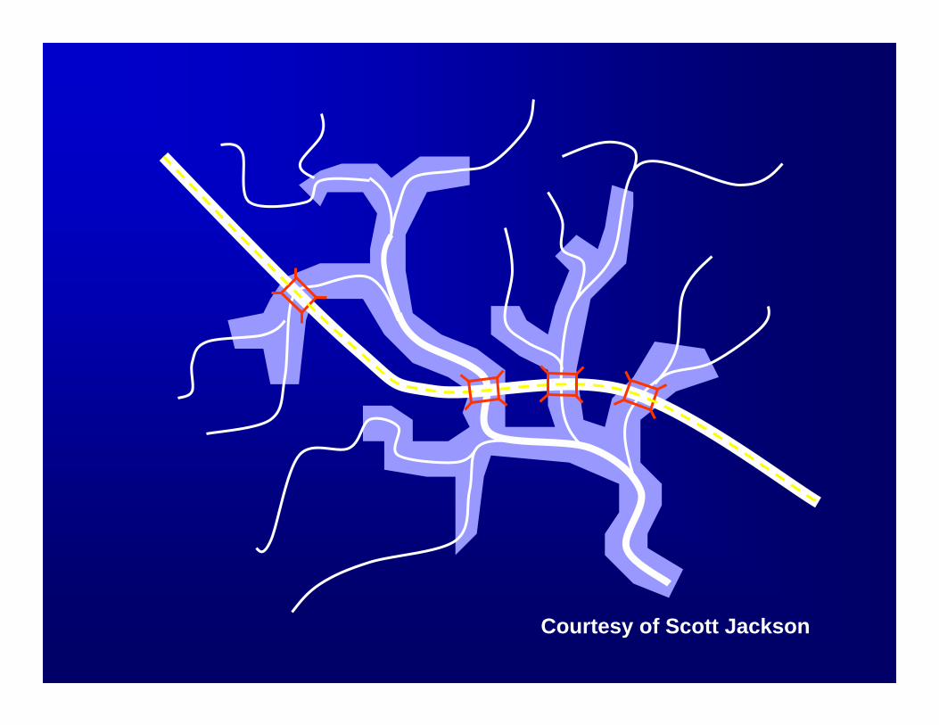
Over 4300 road and stream crossings
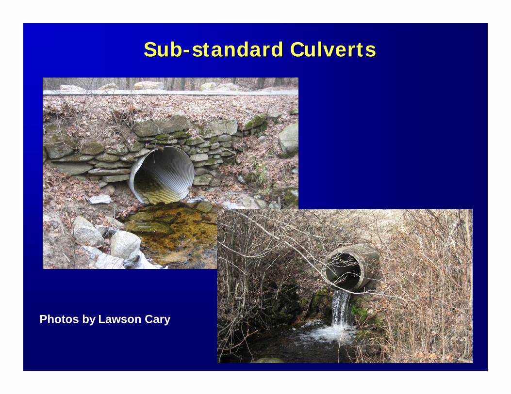
SubSub--standard Culvertsstandard Culverts
Photos by Lawson Cary
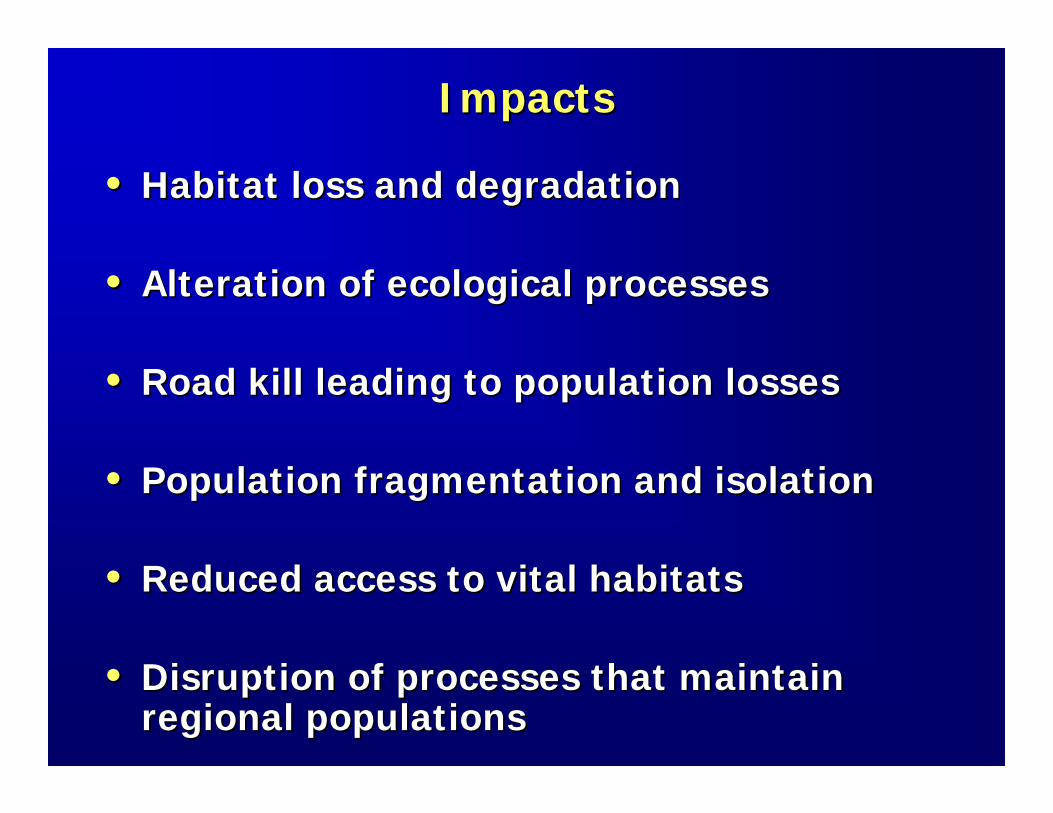
ImpactsImpacts
•• Habitat loss and degradationHabitat loss and degradation
•• Alteration of ecological processesAlteration of ecological processes
•• Road kill leading to population lossesRoad kill leading to population losses
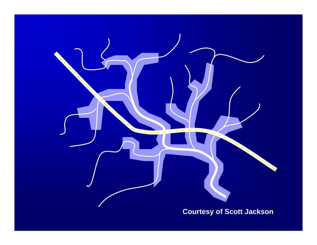
•• Population fragmentation and isolationPopulation fragmentation and isolation
•• Reduced access to vital habitatsReduced access to vital habitats
•• Disruption of processes that maintain Disruption of processes that maintain regional populationsregional populations
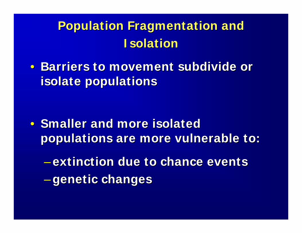
Population Fragmentation and Population Fragmentation and IsolationIsolation
•• Barriers to movement subdivide or Barriers to movement subdivide or isolate populationsisolate populations
•• Smaller and more isolated Smaller and more isolated populations are more vulnerable to:populations are more vulnerable to:
–– extinction due to chance eventsextinction due to chance events–– genetic changesgenetic changes

Courtesy of Scott Jackson
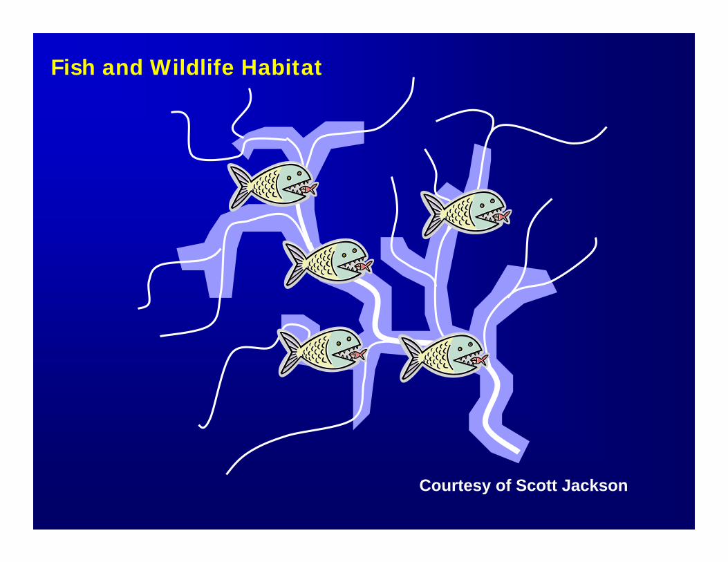
Fish and Wildlife Habitat
Courtesy of Scott Jackson
Courtesy of Scott Jackson
Courtesy of Scott Jackson
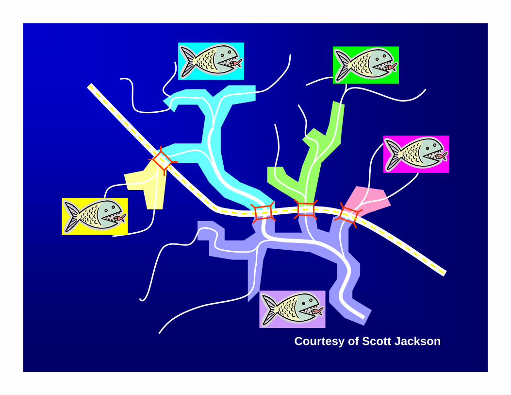
Courtesy of Scott Jackson
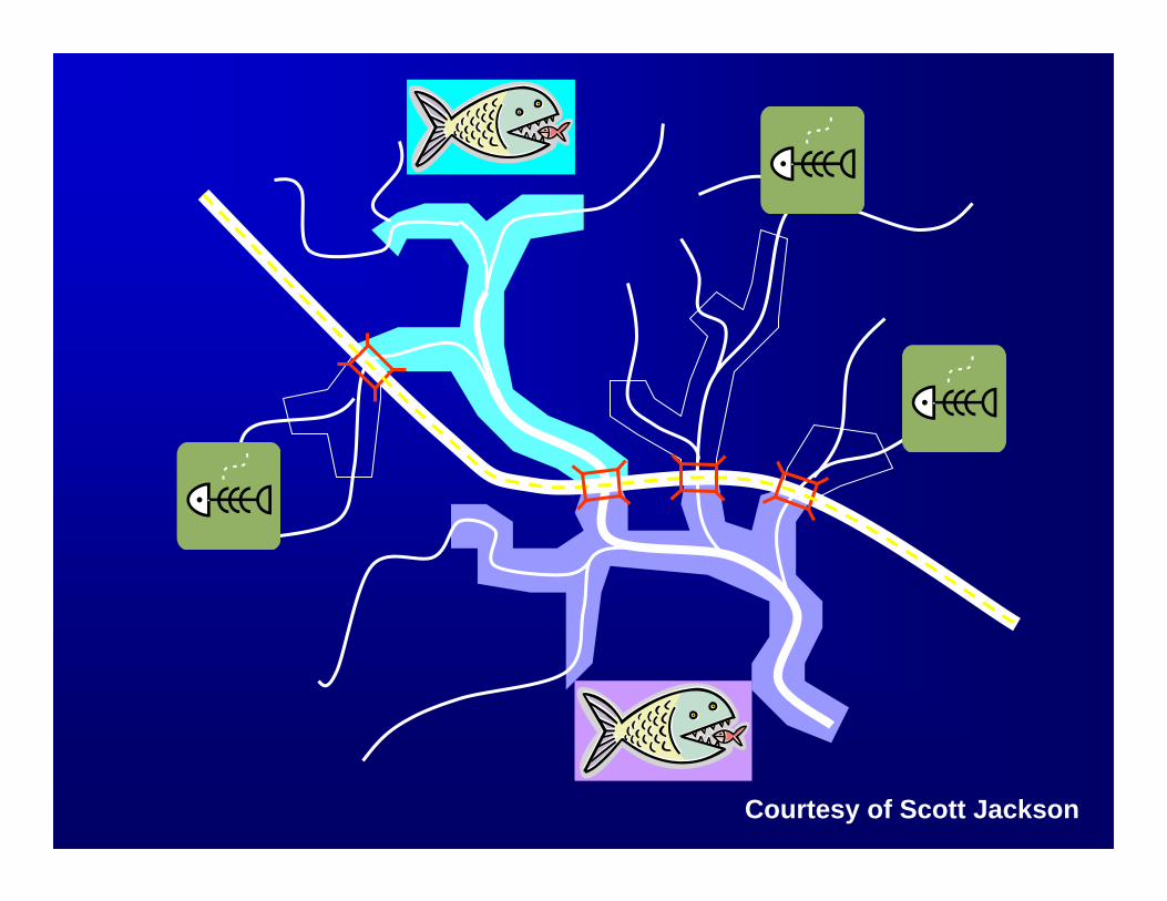
Courtesy of Scott Jackson

SubSub--standard Culvertsstandard Culverts
Photos by Lawson Cary
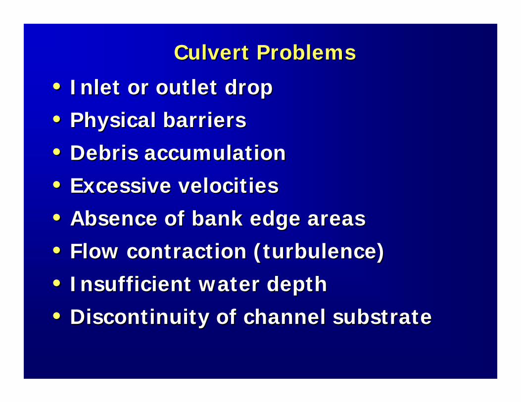
Culvert ProblemsCulvert Problems
•• Inlet or outlet dropInlet or outlet drop
•• Physical barriersPhysical barriers
•• Debris accumulationDebris accumulation
•• Excessive velocitiesExcessive velocities
•• Absence of bank edge areasAbsence of bank edge areas
•• Flow contraction (turbulence)Flow contraction (turbulence)
•• Insufficient water depthInsufficient water depth
•• Discontinuity of channel substrateDiscontinuity of channel substrate
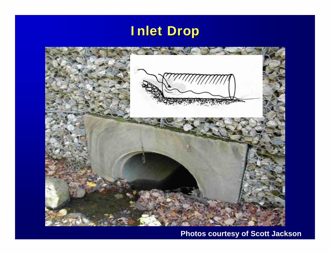
Inlet DropInlet Drop
Photos courtesy of Scott Jackson
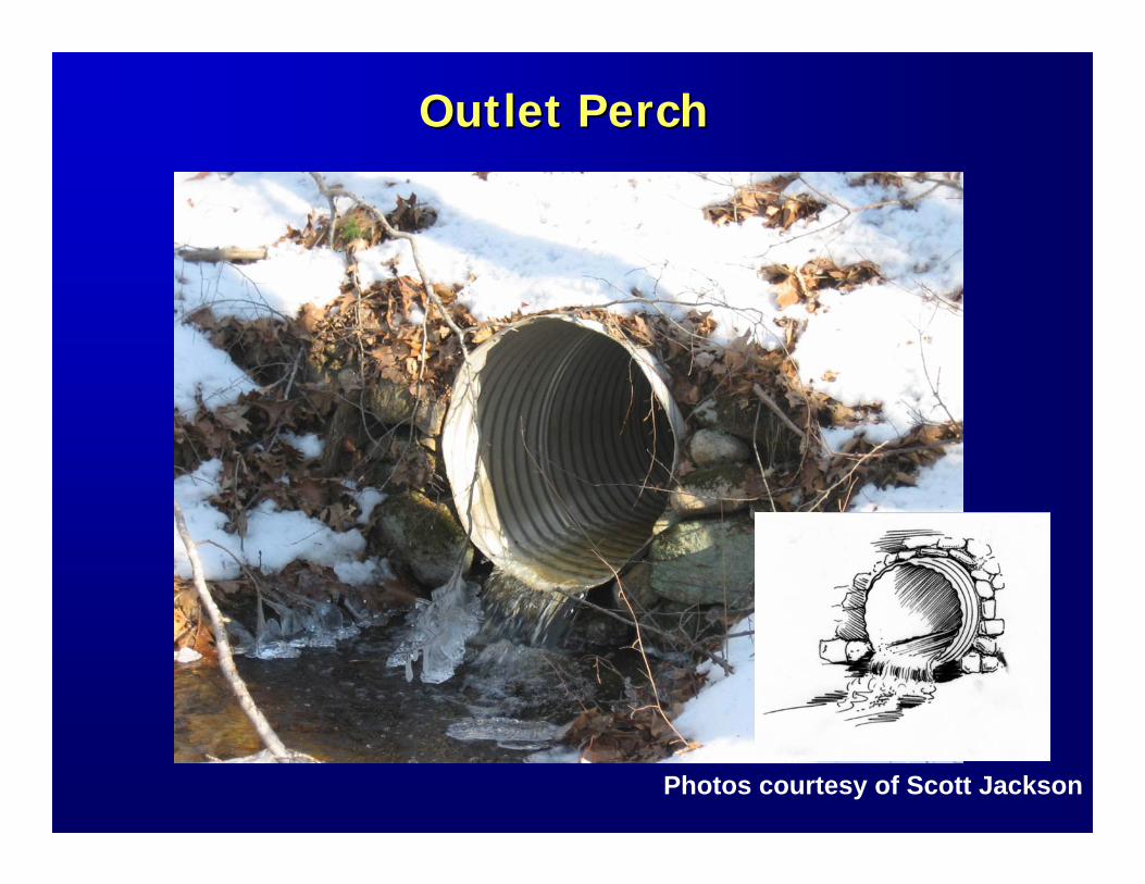
Outlet PerchOutlet Perch
Photos courtesy of Scott Jackson
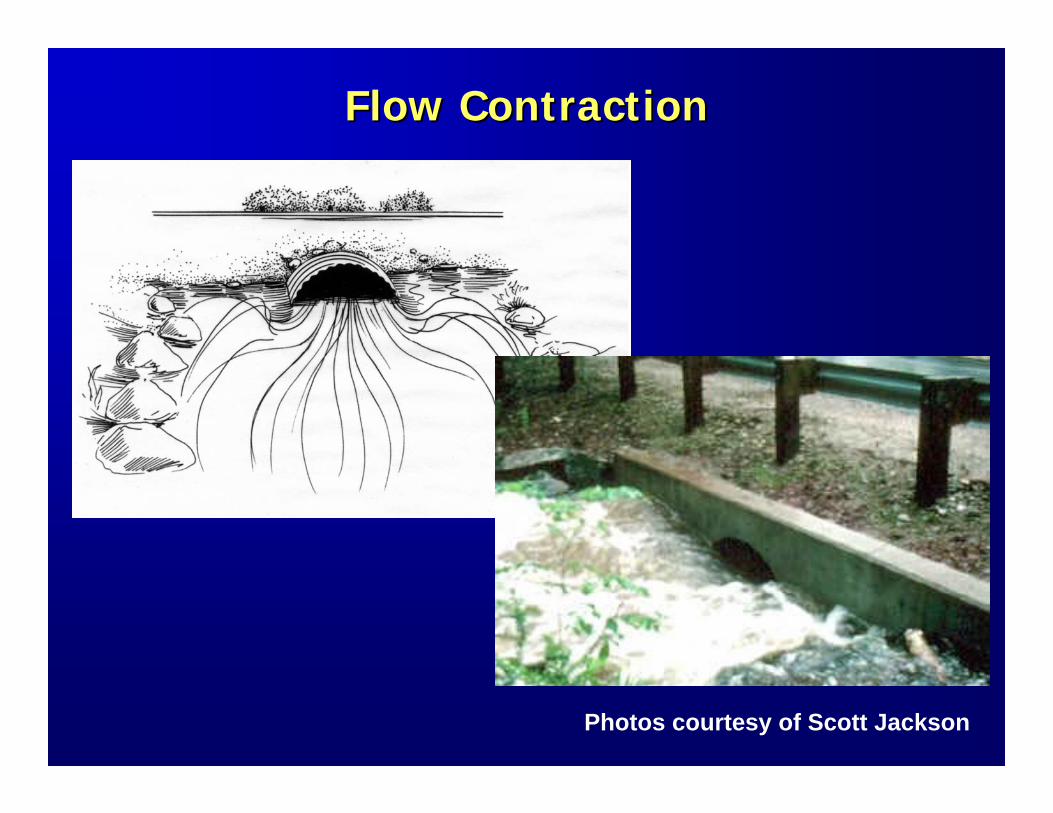
Flow ContractionFlow Contraction
Photos courtesy of Scott Jackson
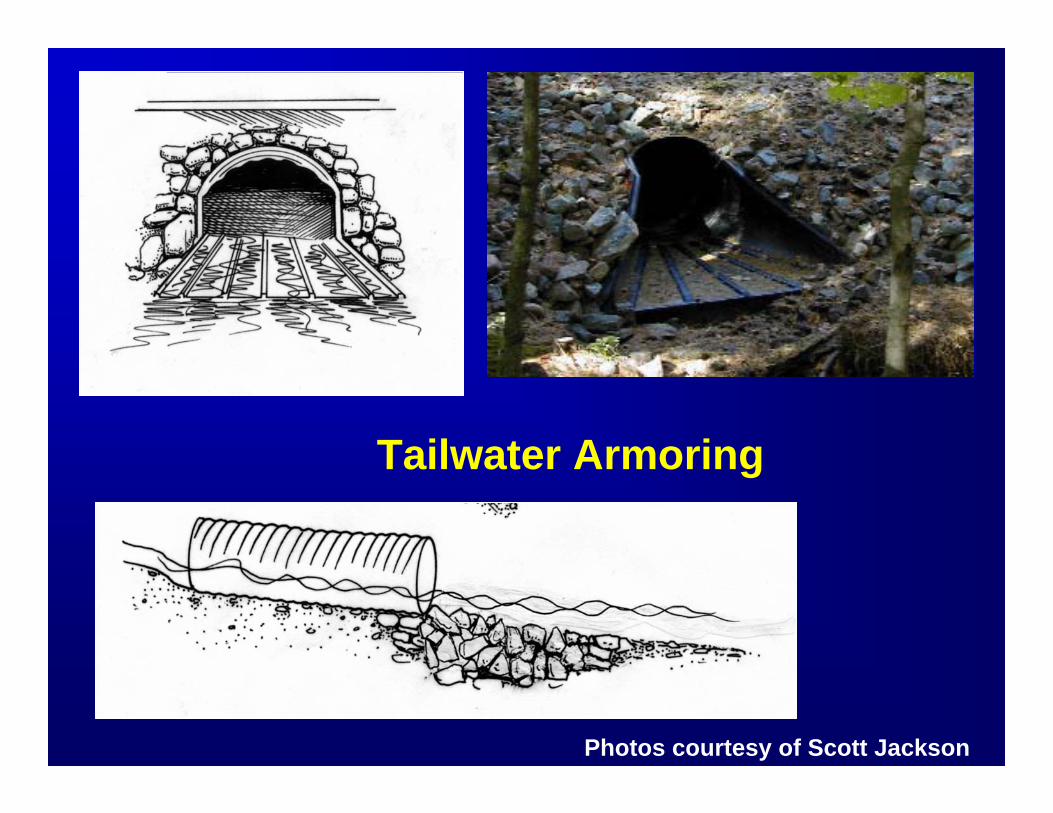
Tailwater Armoring
Photos courtesy of Scott Jackson
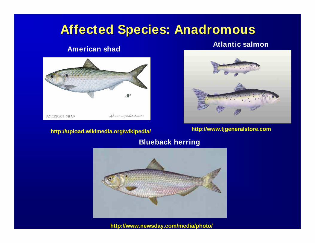
Affected Species: Affected Species: AnadromousAnadromousAtlantic salmon
Blueback herring
American shad
http://www.tjgeneralstore.com
http://www.newsday.com/media/photo/
http://upload.wikimedia.org/wikipedia/
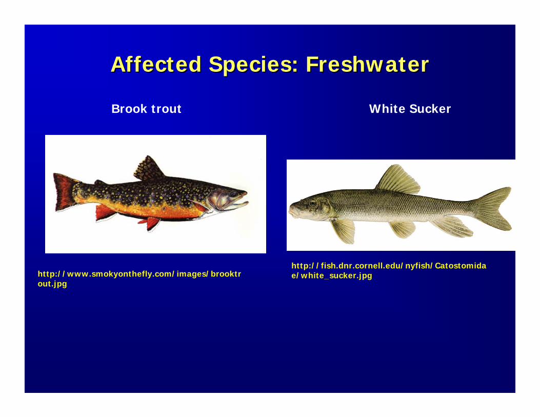
Affected Species: FreshwaterAffected Species: Freshwater
http://fish.dnr.cornell.edu/nyfish/Catostomidae/white_sucker.jpghttp://www.smokyonthefly.com/images/brooktr
out.jpg
Brook trout White Sucker
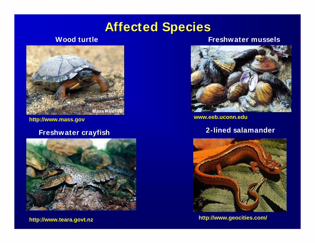
Affected SpeciesAffected SpeciesWood turtle
Freshwater crayfish
Freshwater mussels
2-lined salamanderhttp://www.mass.gov
http://www.teara.govt.nz
www.eeb.uconn.edu
http://www.geocities.com/
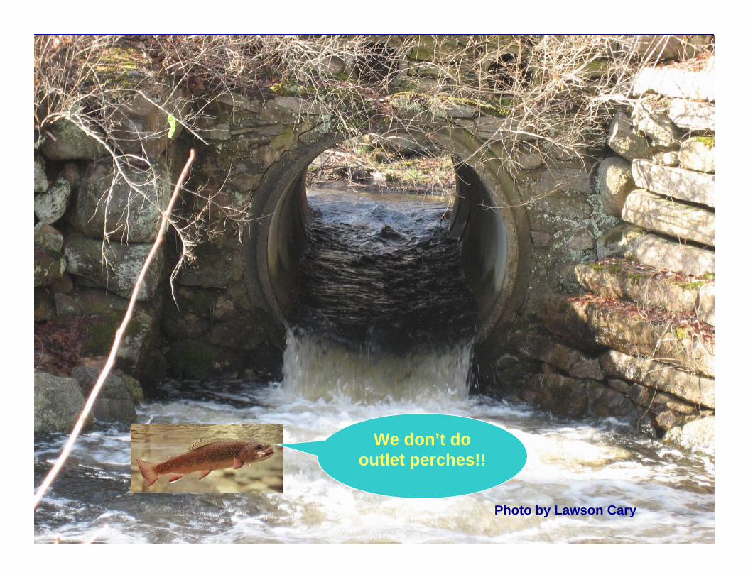
We don’t do outlet perches!!
Photo by Lawson Cary
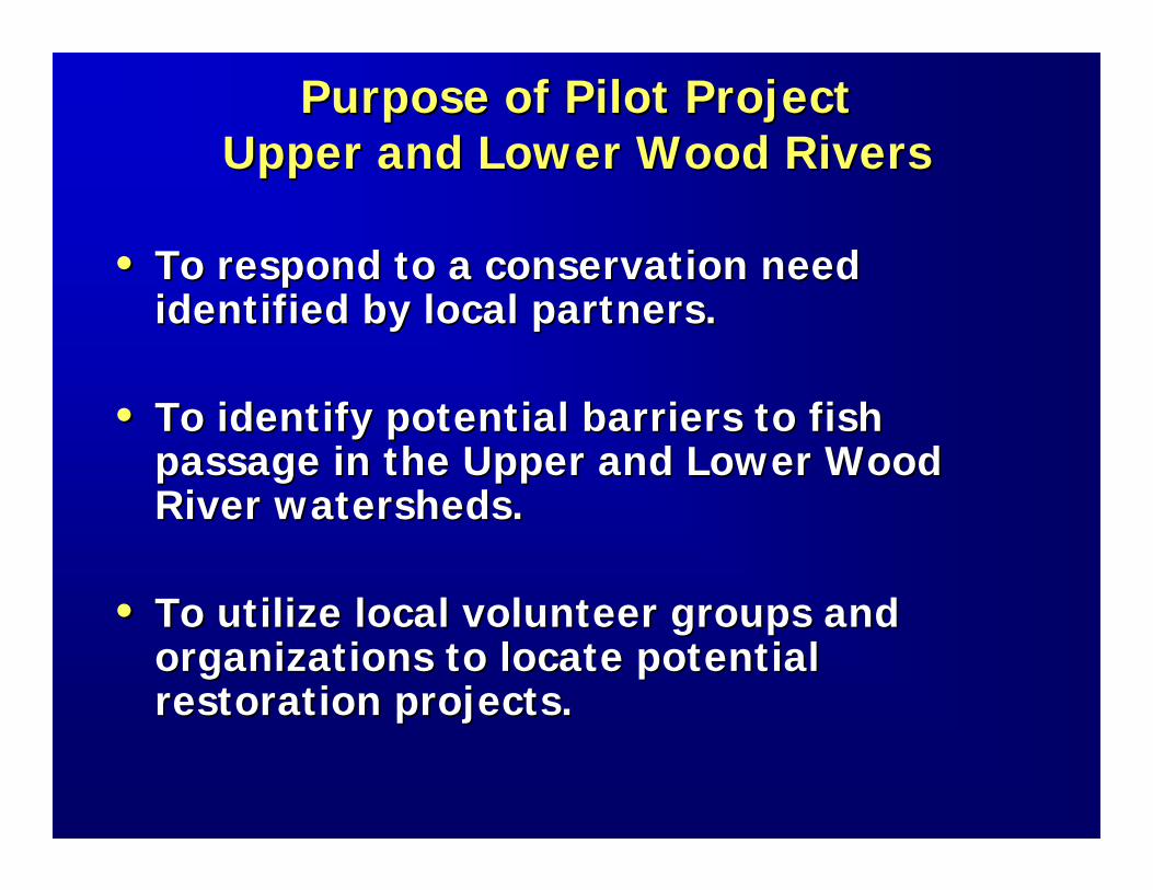
Purpose of Pilot ProjectPurpose of Pilot ProjectUpper and Lower Wood RiversUpper and Lower Wood Rivers
•• To respond to a conservation need To respond to a conservation need identified by local partners.identified by local partners.
•• To identify potential barriers to fish To identify potential barriers to fish passage in the Upper and Lower Wood passage in the Upper and Lower Wood River watersheds.River watersheds.
•• To utilize local volunteer groups and To utilize local volunteer groups and organizations to locate potential organizations to locate potential restoration projects.restoration projects.
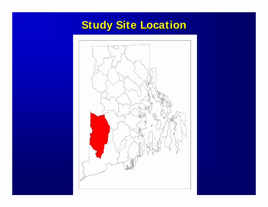
Study Site LocationStudy Site Location
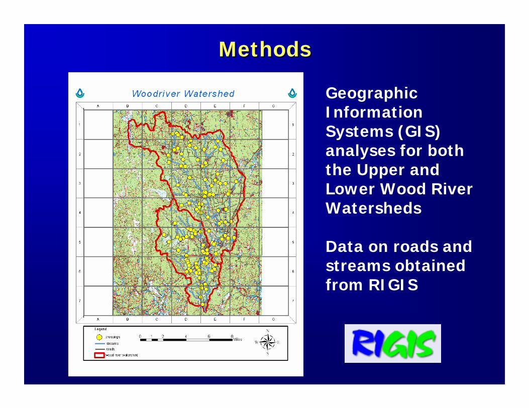
MethodsMethods
Geographic Information Systems (GIS) analyses for both the Upper and Lower Wood River Watersheds
Data on roads and streams obtained from RIGIS
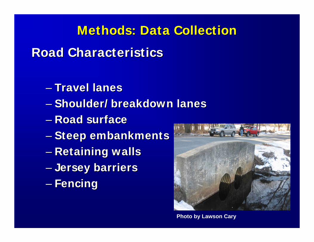
Methods: Data CollectionMethods: Data Collection
Road CharacteristicsRoad Characteristics
–– Travel lanesTravel lanes–– Shoulder/breakdown lanesShoulder/breakdown lanes–– Road surfaceRoad surface–– Steep embankmentsSteep embankments–– Retaining wallsRetaining walls–– Jersey barriersJersey barriers–– FencingFencing
Photo by Lawson Cary
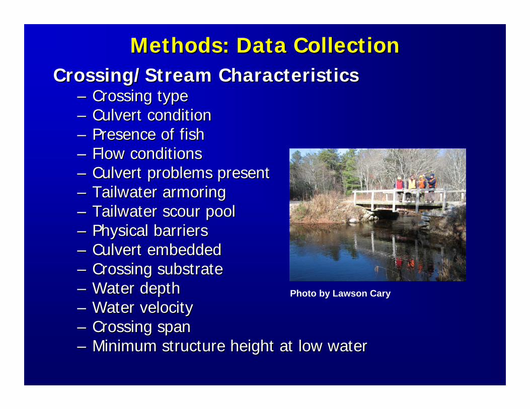
Methods: Data CollectionMethods: Data CollectionCrossing/Stream CharacteristicsCrossing/Stream Characteristics
–– Crossing typeCrossing type–– Culvert conditionCulvert condition–– Presence of fishPresence of fish–– Flow conditionsFlow conditions–– Culvert problems presentCulvert problems present–– TailwaterTailwater armoringarmoring–– TailwaterTailwater scour poolscour pool–– Physical barriersPhysical barriers–– Culvert embeddedCulvert embedded–– Crossing substrateCrossing substrate–– Water depthWater depth–– Water velocityWater velocity–– Crossing spanCrossing span–– Minimum structure height at low waterMinimum structure height at low water
Photo by Lawson Cary
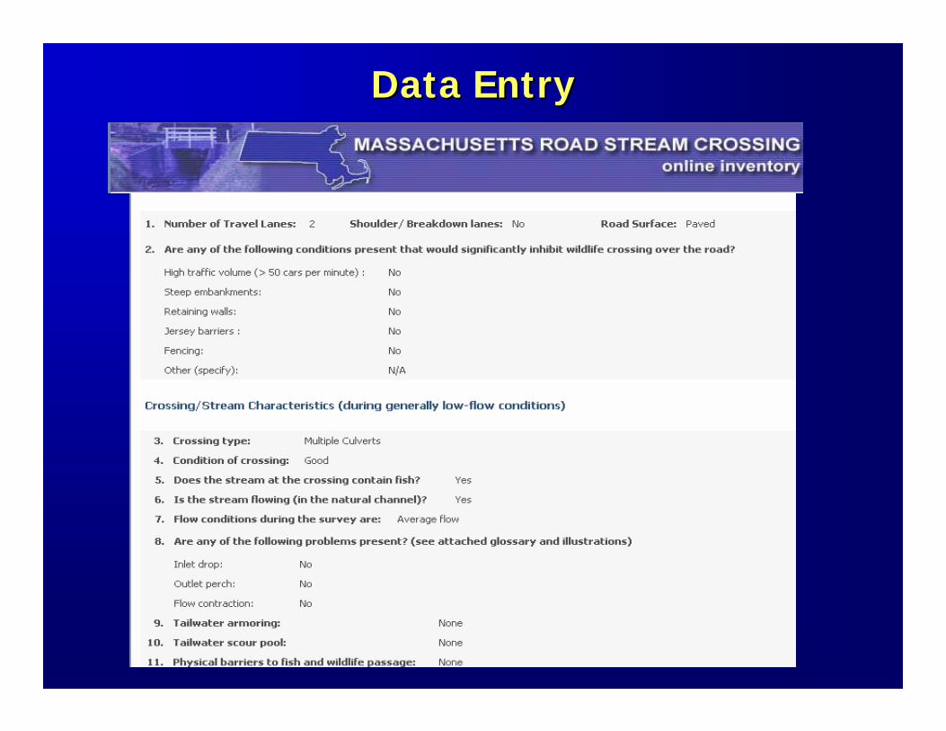
Data EntryData Entry
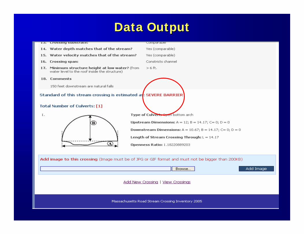
Data OutputData Output
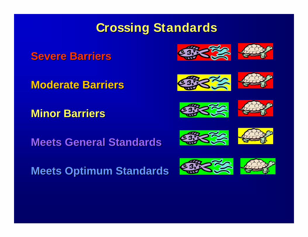
Crossing StandardsCrossing Standards
Severe Barriers Severe Barriers
Moderate BarriersModerate Barriers
Minor BarriersMinor Barriers
Meets General StandardsMeets General Standards
Meets Optimum StandardsMeets Optimum Standards
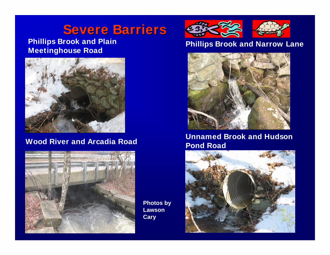
Severe BarriersSevere BarriersPhillips Brook and Plain Meetinghouse Road
Phillips Brook and Narrow Lane
Wood River and Arcadia RoadUnnamed Brook and Hudson Pond Road
Photos by LawsonCary
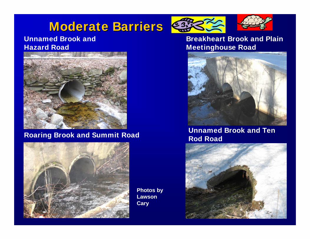
Moderate BarriersModerate BarriersUnnamed Brook and Hazard Road
Breakheart Brook and Plain Meetinghouse Road
Roaring Brook and Summit RoadUnnamed Brook and Ten Rod Road
Photos by LawsonCary
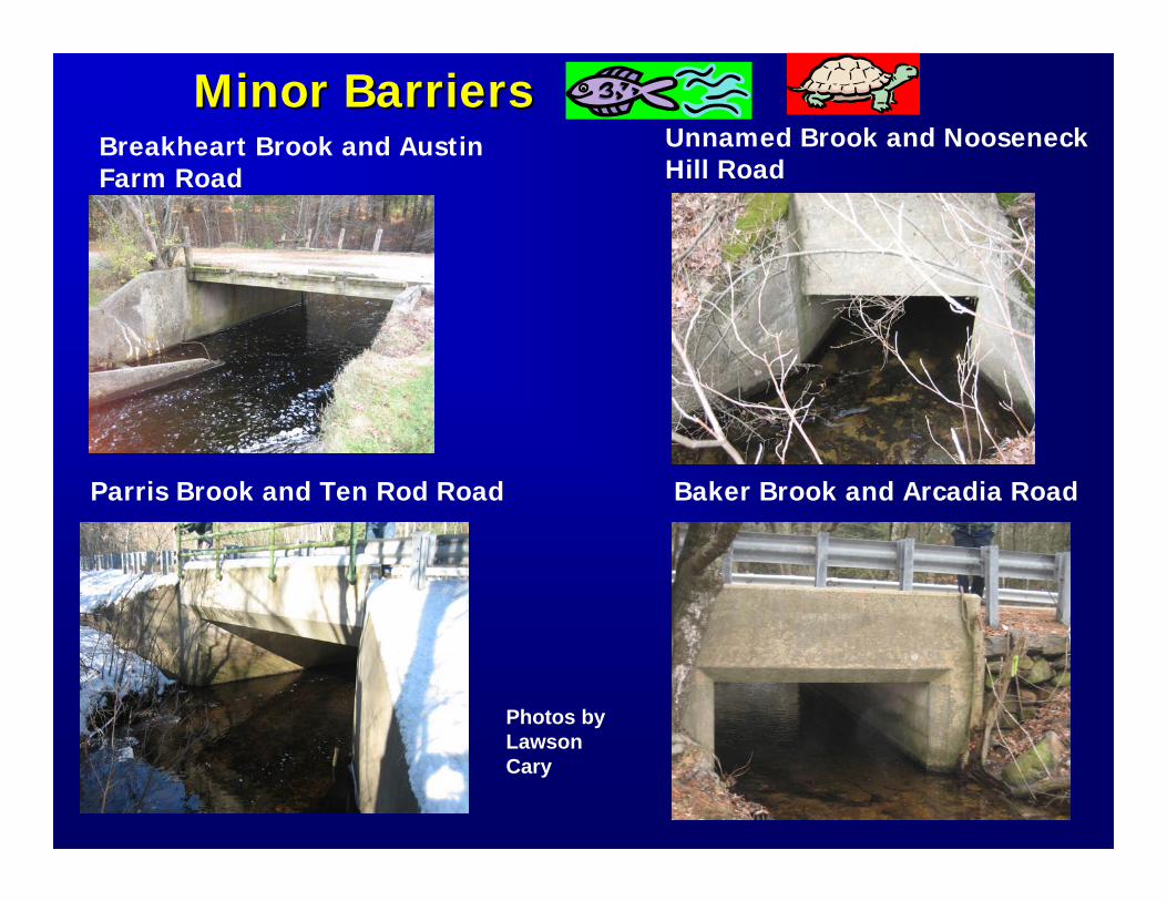
Minor BarriersMinor BarriersBreakheart Brook and Austin Farm Road
Parris Brook and Ten Rod Road
Unnamed Brook and NooseneckHill Road
Baker Brook and Arcadia Road
Photos by LawsonCary
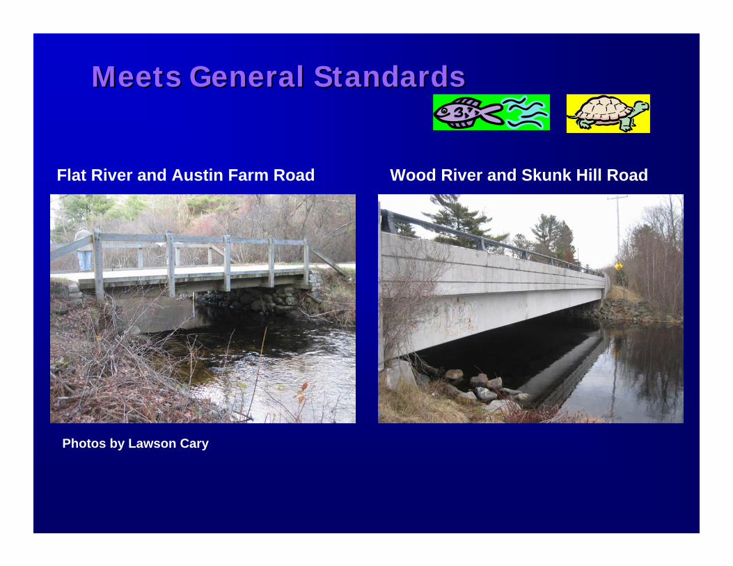
Meets General StandardsMeets General Standards
Flat River and Austin Farm Road Wood River and Skunk Hill Road
Photos by Lawson Cary
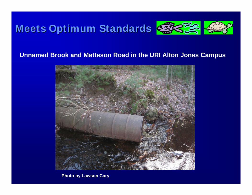
Meets Optimum StandardsMeets Optimum Standards
Unnamed Brook and Matteson Road in the URI Alton Jones Campus
Photo by Lawson Cary
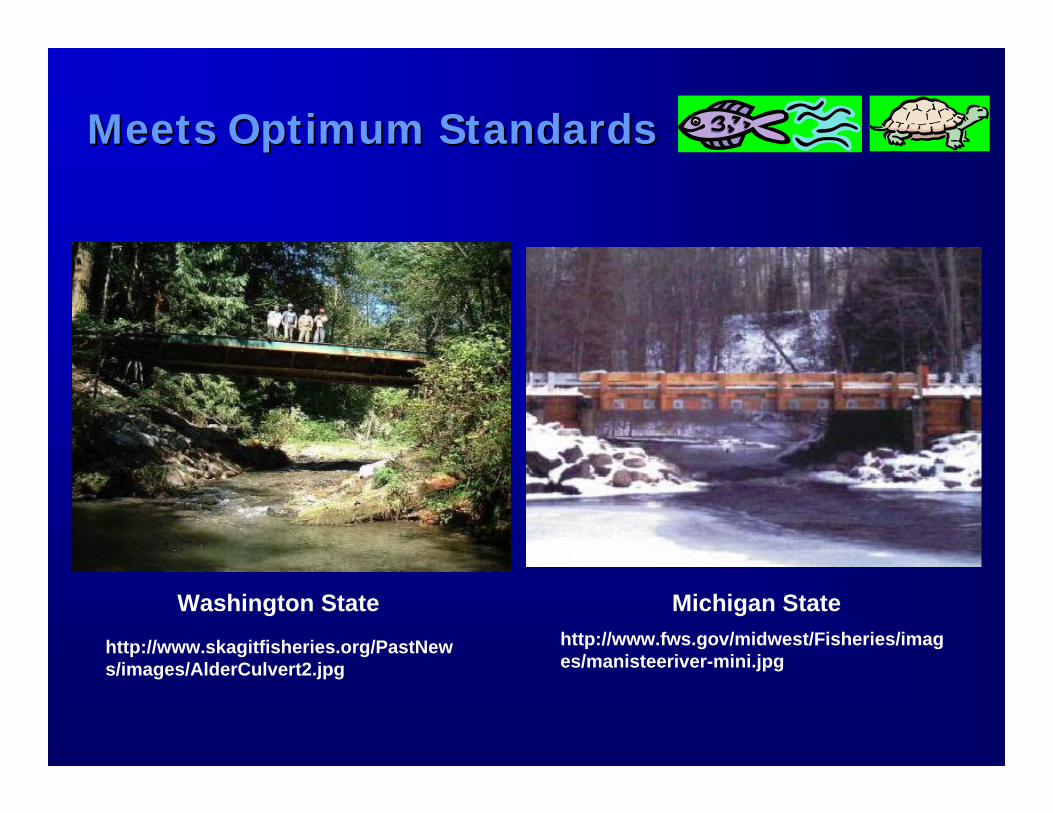
Meets Optimum StandardsMeets Optimum Standards
Washington State Michigan Statehttp://www.fws.gov/midwest/Fisheries/images/manisteeriver-mini.jpg
http://www.skagitfisheries.org/PastNews/images/AlderCulvert2.jpg
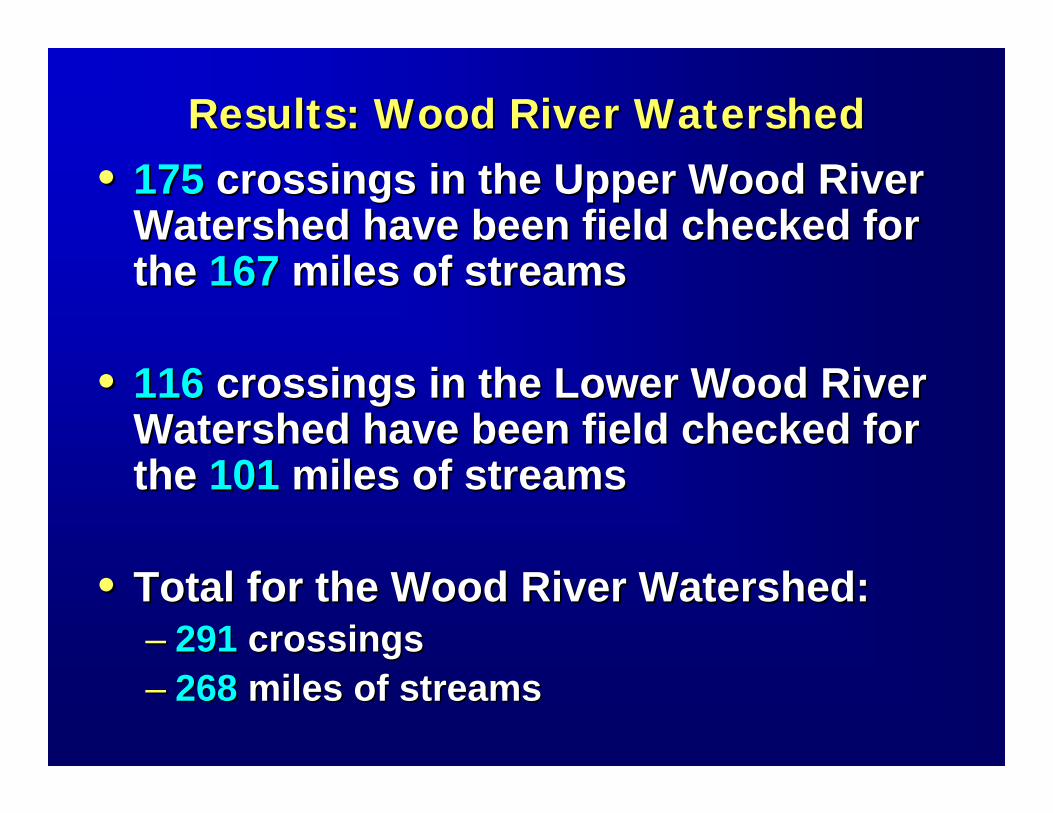
Results: Wood River WatershedResults: Wood River Watershed•• 175 175 crossings in the Upper Wood River crossings in the Upper Wood River
Watershed have been field checked for Watershed have been field checked for the the 167167 miles of streamsmiles of streams
•• 116116 crossings in the Lower Wood River crossings in the Lower Wood River Watershed have been field checked for Watershed have been field checked for the the 101101 miles of streamsmiles of streams
•• Total for the Wood River Watershed:Total for the Wood River Watershed:–– 291291 crossingscrossings–– 268268 miles of streamsmiles of streams
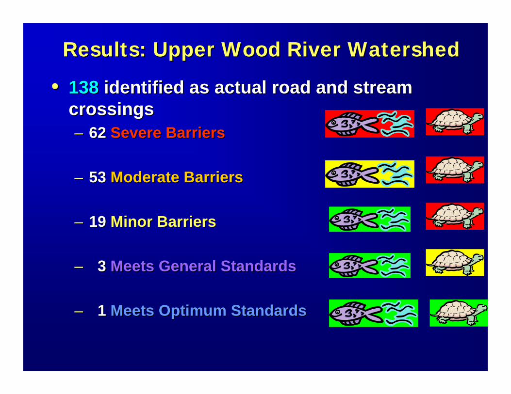
Results: Upper Wood River WatershedResults: Upper Wood River Watershed
•• 138138 identified as actual road and stream identified as actual road and stream crossingscrossings–– 62 62 Severe BarriersSevere Barriers
–– 53 53 Moderate BarriersModerate Barriers
–– 19 19 Minor BarriersMinor Barriers
–– 3 3 Meets General StandardsMeets General Standards
–– 1 1 Meets Optimum StandardsMeets Optimum Standards
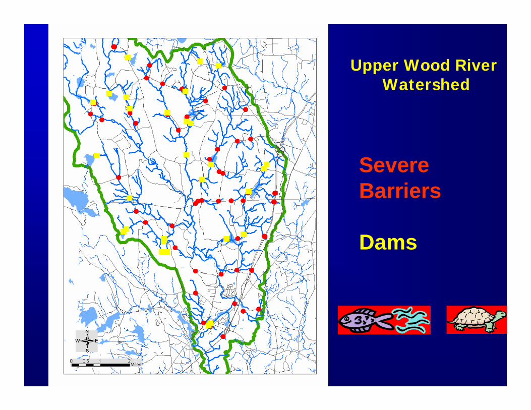
Severe Barriers
Dams
Upper Wood River Watershed
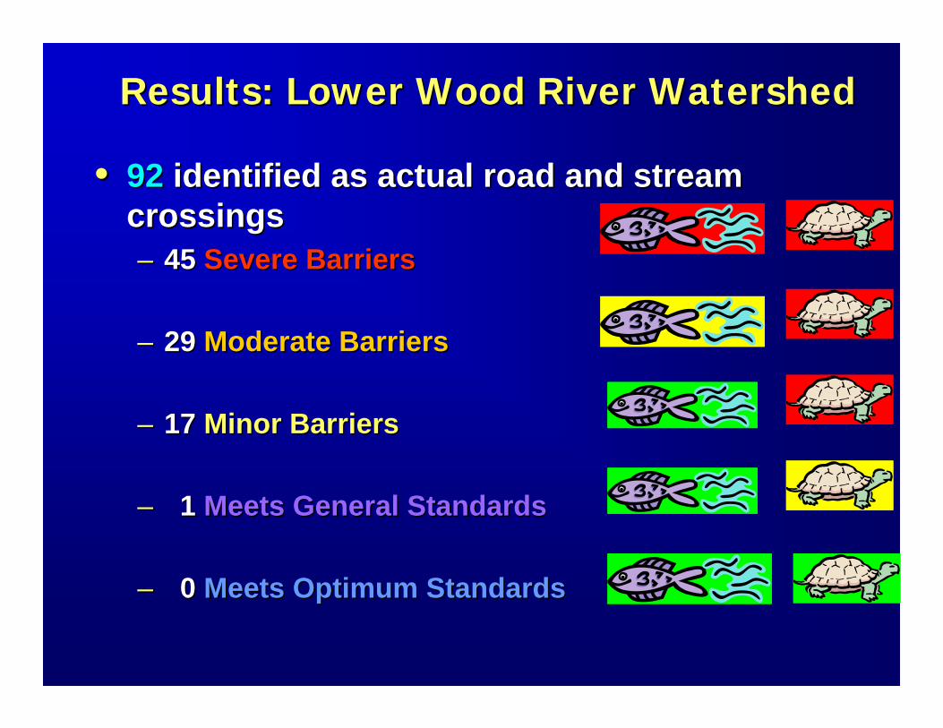
Results: Lower Wood River WatershedResults: Lower Wood River Watershed
•• 9292 identified as actual road and stream identified as actual road and stream crossingscrossings–– 45 45 Severe BarriersSevere Barriers
–– 29 29 Moderate BarriersModerate Barriers
–– 17 17 Minor BarriersMinor Barriers
–– 1 1 Meets General StandardsMeets General Standards
–– 0 0 Meets Optimum StandardsMeets Optimum Standards
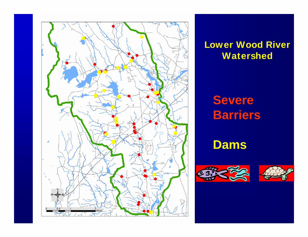
Severe Barriers
Dams
Lower Wood River Watershed
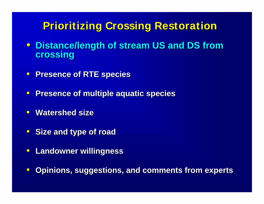
Prioritizing Crossing RestorationPrioritizing Crossing Restoration
•• Distance/length of stream US and DS from Distance/length of stream US and DS from crossingcrossing
•• Presence of RTE species Presence of RTE species
•• Presence of multiple aquatic speciesPresence of multiple aquatic species
•• Watershed sizeWatershed size
•• Size and type of roadSize and type of road
•• Landowner willingnessLandowner willingness
•• Opinions, suggestions, and comments from expertsOpinions, suggestions, and comments from experts
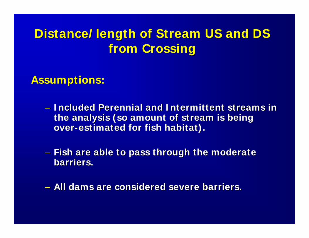
Distance/length of Stream US and DS Distance/length of Stream US and DS from Crossingfrom Crossing
Assumptions:Assumptions:
–– Included Perennial and Intermittent streams in Included Perennial and Intermittent streams in the analysis (so amount of stream is being the analysis (so amount of stream is being overover--estimated for fish habitat).estimated for fish habitat).
–– Fish are able to pass through the moderate Fish are able to pass through the moderate barriers.barriers.
–– All dams are considered severe barriers.All dams are considered severe barriers.
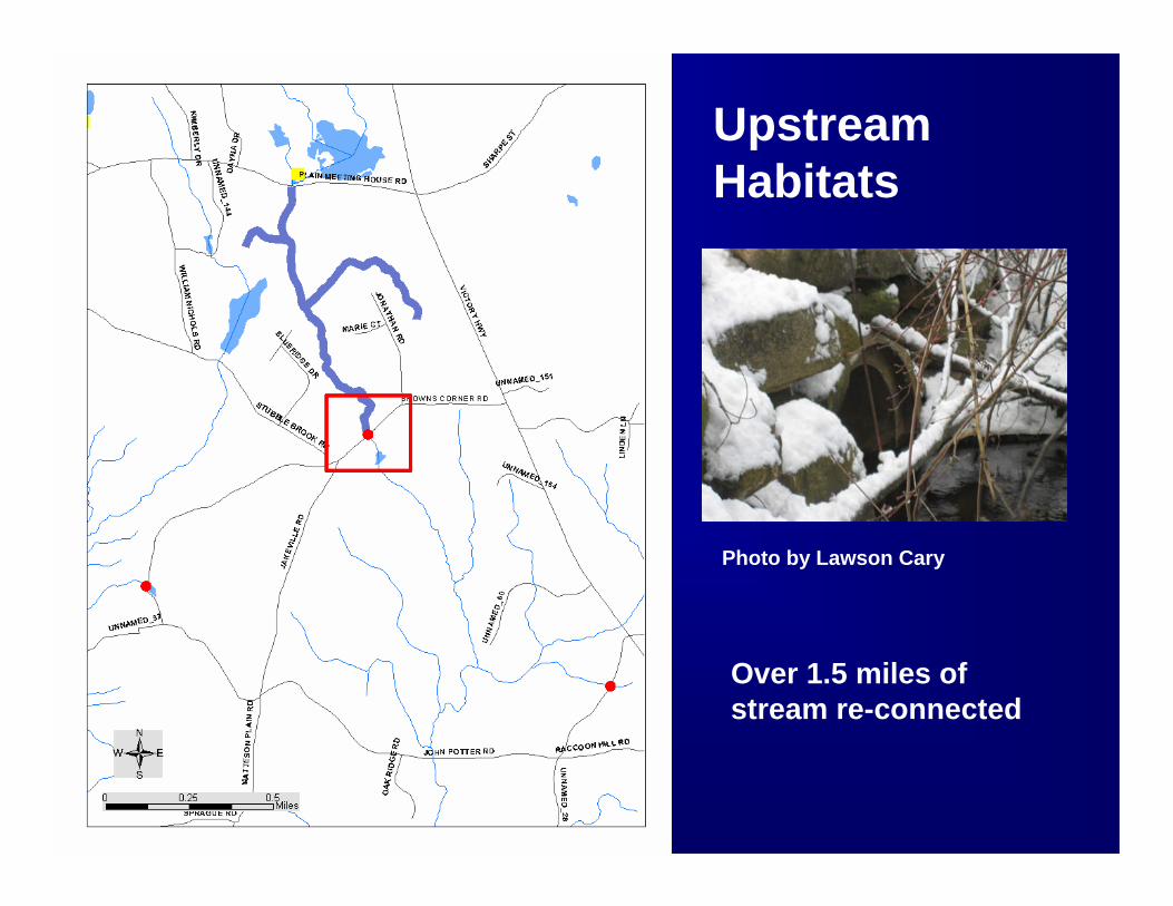
Upstream Habitats
Over 1.5 miles of stream re-connected
Photo by Lawson Cary
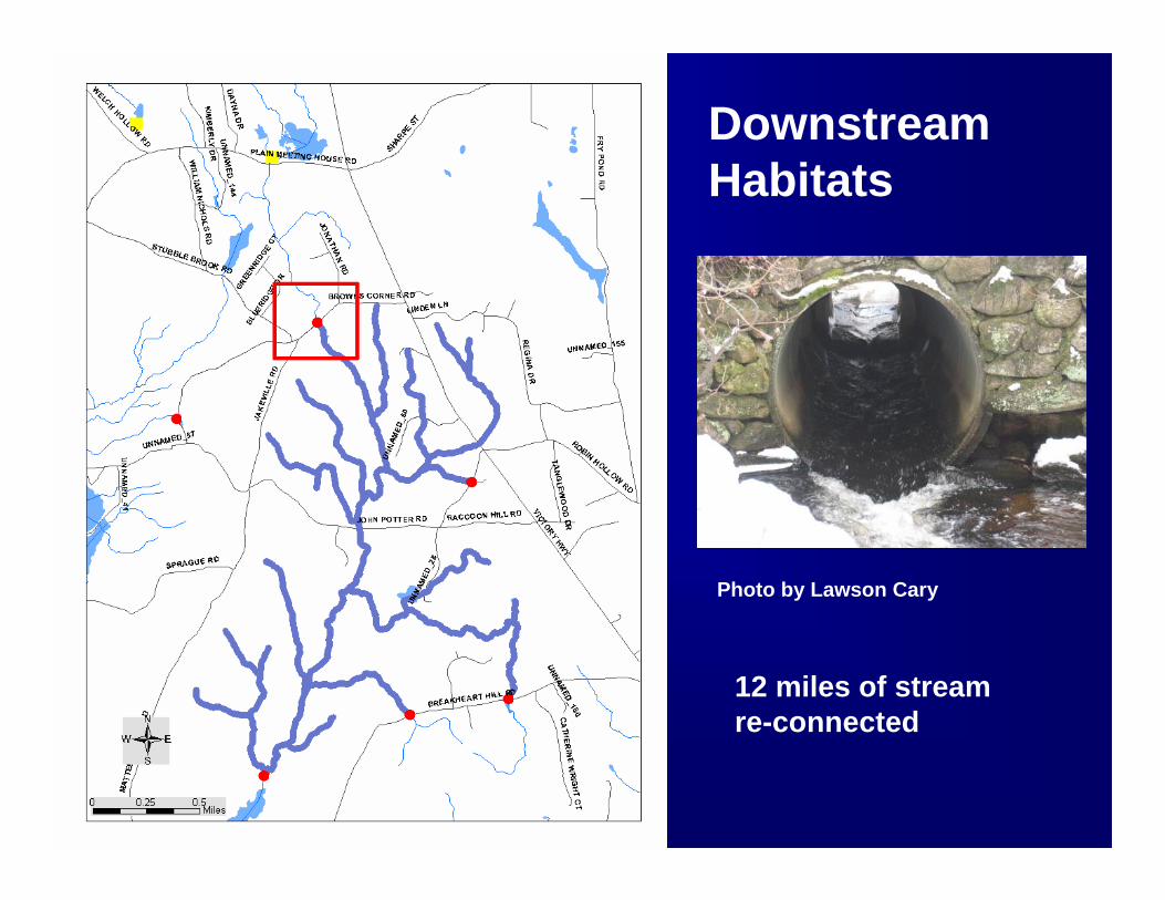
Downstream Habitats
12 miles of stream re-connected
Photo by Lawson Cary
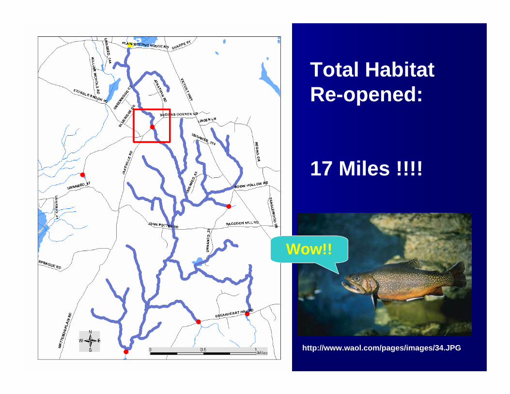
Total Habitat Re-opened:
17 Miles !!!!
http://www.waol.com/pages/images/34.JPG
Wow!!
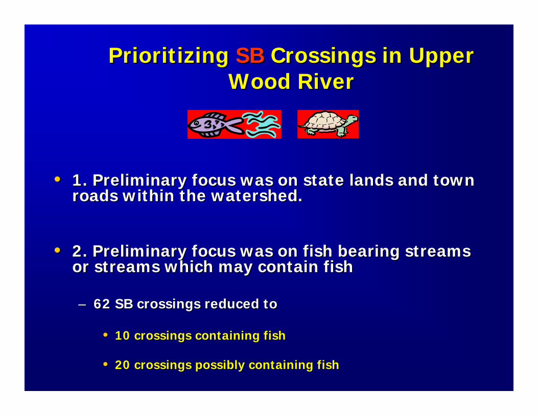
Prioritizing Prioritizing SBSB Crossings in Upper Crossings in Upper Wood RiverWood River
•• 1. Preliminary focus was on state lands and town 1. Preliminary focus was on state lands and town roads within the watershed. roads within the watershed.
•• 2. Preliminary focus was on fish bearing streams 2. Preliminary focus was on fish bearing streams or streams which may contain fishor streams which may contain fish
–– 62 SB crossings reduced to 62 SB crossings reduced to
•• 10 crossings containing fish10 crossings containing fish
•• 20 crossings possibly containing fish20 crossings possibly containing fish
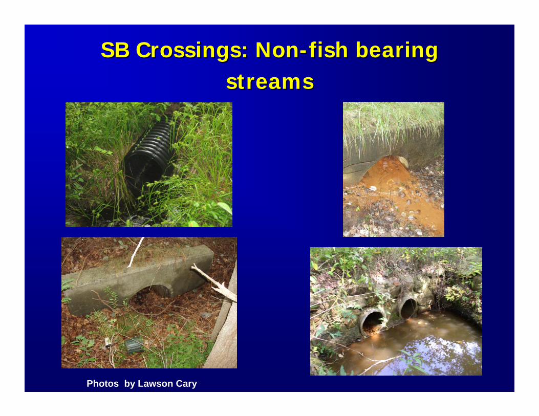
SB Crossings: NonSB Crossings: Non--fish bearing fish bearing streamsstreams
Photos by Lawson Cary
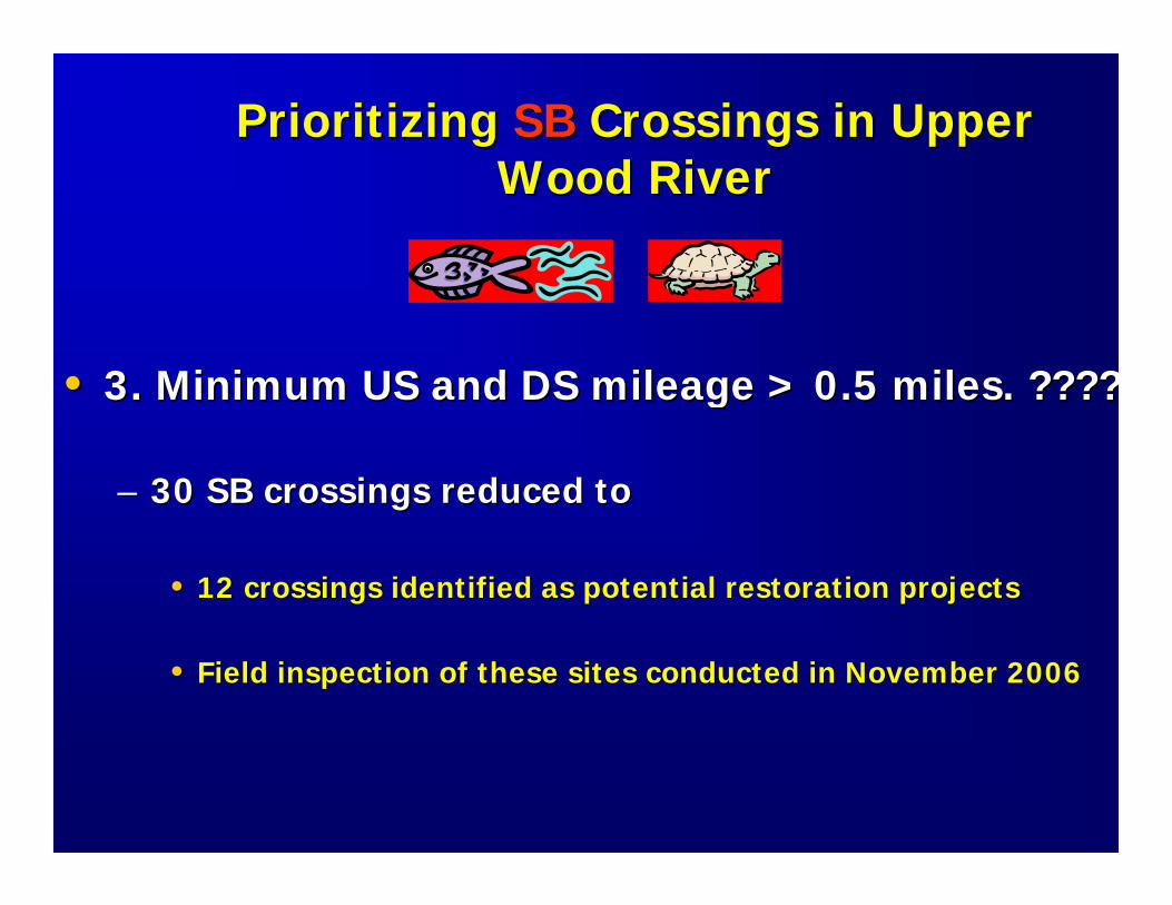
Prioritizing Prioritizing SBSB Crossings in Upper Crossings in Upper Wood RiverWood River
•• 3. Minimum US and DS mileage > 0.5 miles. ????3. Minimum US and DS mileage > 0.5 miles. ????
–– 30 SB crossings reduced to30 SB crossings reduced to
•• 12 crossings identified as potential restoration projects 12 crossings identified as potential restoration projects
•• Field inspection of these sites conducted in November 2006Field inspection of these sites conducted in November 2006
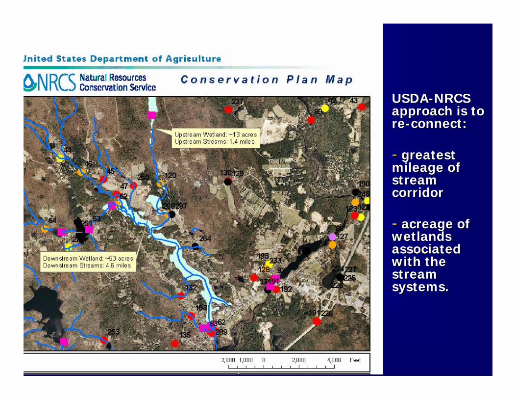
USDAUSDA--NRCS NRCS approach is to approach is to rere--connect:connect:
-- greatest greatest mileage of mileage of stream stream corridor corridor
-- acreage of acreage of wetlands wetlands associated associated with the with the stream stream systems.systems.
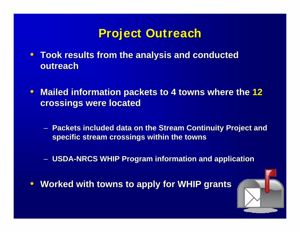
Project OutreachProject Outreach
•• Took results from the analysis and conducted Took results from the analysis and conducted outreach outreach
•• Mailed information packets to 4 towns where the Mailed information packets to 4 towns where the 1212crossings were located crossings were located
–– Packets included data on the Stream Continuity Project and Packets included data on the Stream Continuity Project and specific stream crossings within the townsspecific stream crossings within the towns
–– USDAUSDA--NRCS WHIP Program information and application NRCS WHIP Program information and application
•• Worked with towns to apply for WHIP grantsWorked with towns to apply for WHIP grants
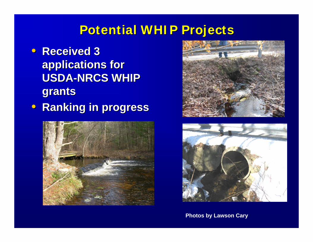
Potential WHIP ProjectsPotential WHIP Projects
•• Received 3 Received 3 applications for applications for USDAUSDA--NRCS WHIP NRCS WHIP grantsgrants
•• Ranking in progressRanking in progress
Photos by Lawson Cary
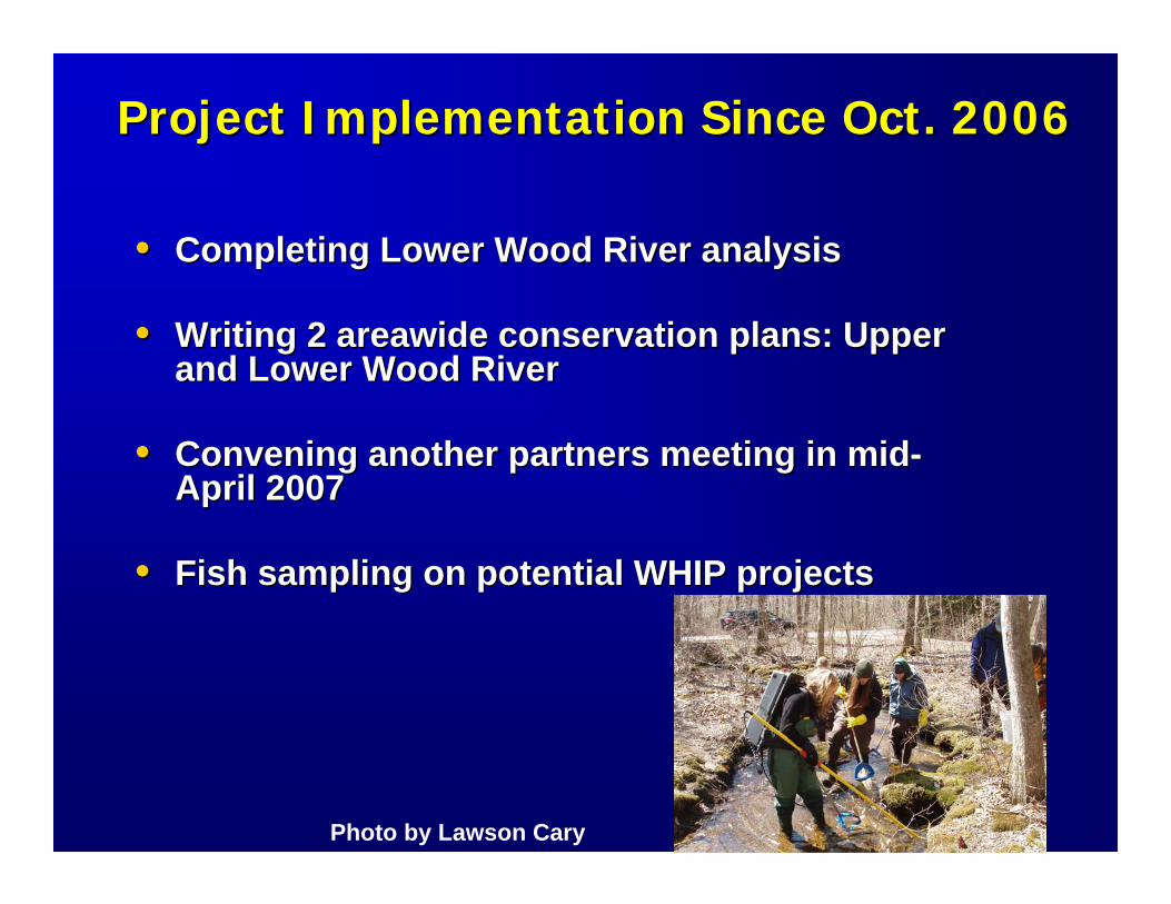
Project Implementation Since Oct. 2006Project Implementation Since Oct. 2006
•• Completing Lower Wood River analysisCompleting Lower Wood River analysis
•• Writing 2 Writing 2 areawideareawide conservation plans: Upper conservation plans: Upper and Lower Wood Riverand Lower Wood River
•• Convening another partners meeting in midConvening another partners meeting in mid--April 2007April 2007
•• Fish sampling on potential WHIP projectsFish sampling on potential WHIP projects
Photo by Lawson Cary
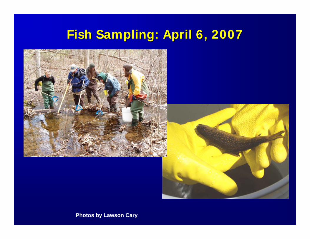
Fish Sampling: April 6, 2007Fish Sampling: April 6, 2007
Photos by Lawson Cary
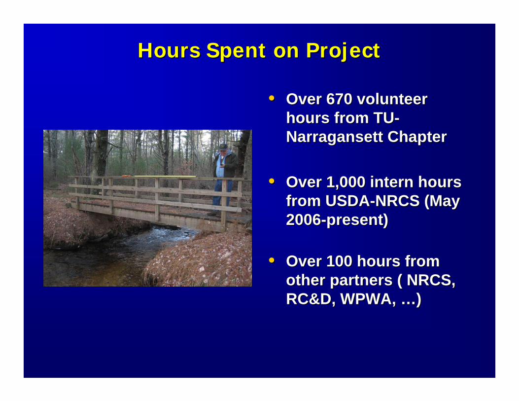
Hours Spent on ProjectHours Spent on Project
•• Over 670 volunteer Over 670 volunteer hours from TUhours from TU--Narragansett ChapterNarragansett Chapter
•• Over 1,000 intern hours Over 1,000 intern hours from USDAfrom USDA--NRCS (May NRCS (May 20062006--present)present)
•• Over 100 hours from Over 100 hours from other partners ( NRCS, other partners ( NRCS, RC&D, WPWA, RC&D, WPWA, ……))
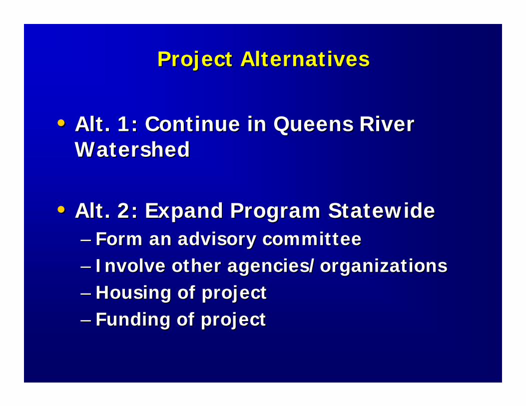
Project AlternativesProject Alternatives
•• Alt. 1: Continue in Queens River Alt. 1: Continue in Queens River WatershedWatershed
•• Alt. 2: Expand Program StatewideAlt. 2: Expand Program Statewide–– Form an advisory committeeForm an advisory committee–– Involve other agencies/organizationsInvolve other agencies/organizations–– Housing of projectHousing of project–– Funding of projectFunding of project
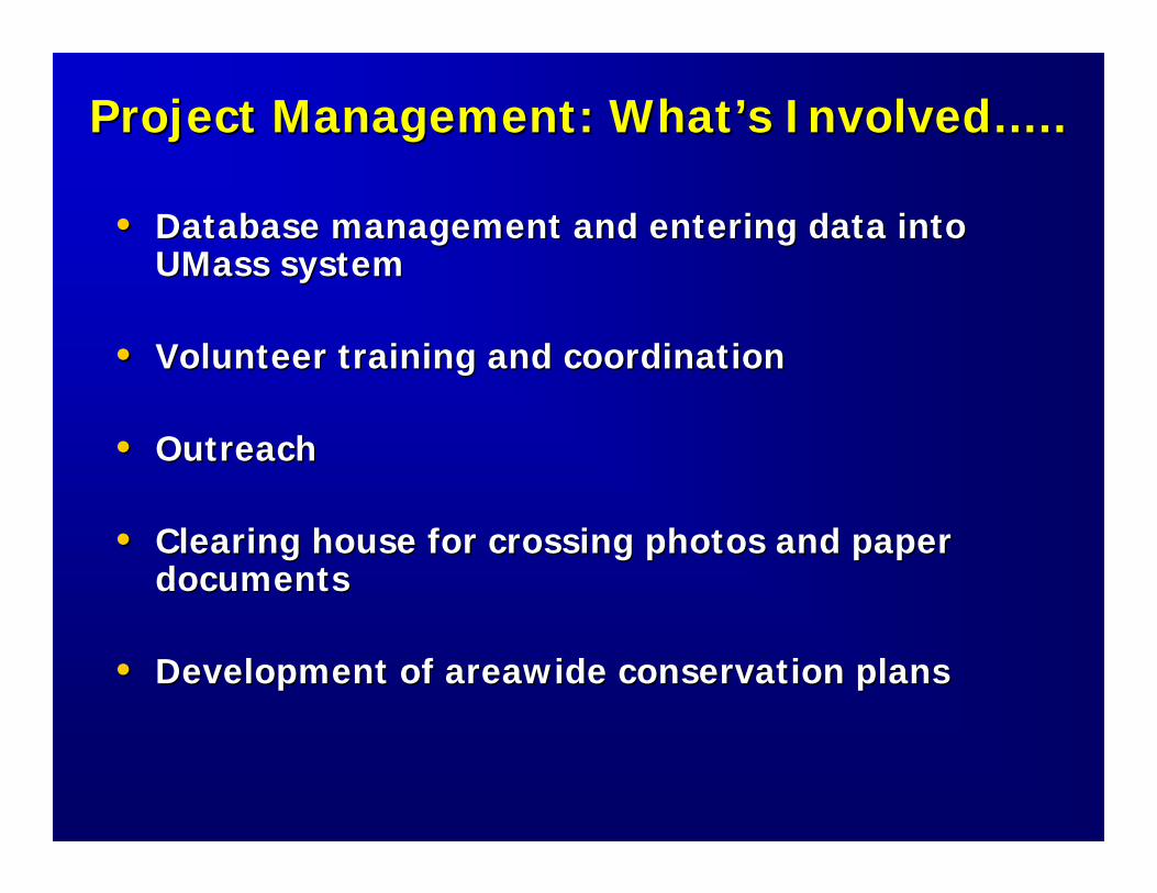
Project Management: WhatProject Management: What’’s Involveds Involved……....
•• Database management and entering data into Database management and entering data into UMassUMass systemsystem
•• Volunteer training and coordinationVolunteer training and coordination
•• OutreachOutreach
•• Clearing house for crossing photos and paper Clearing house for crossing photos and paper documentsdocuments
•• Development of Development of areawideareawide conservation plansconservation plans
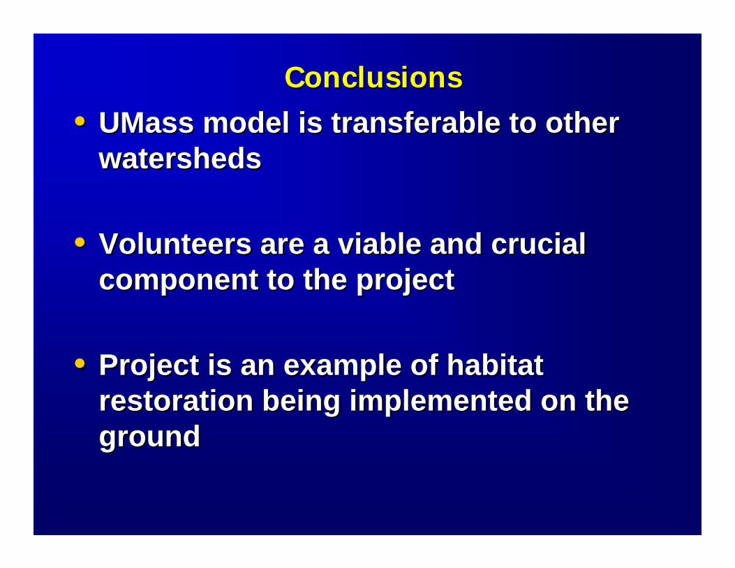
ConclusionsConclusions•• UMassUMass model is transferable to other model is transferable to other
watershedswatersheds
•• Volunteers are a viable and crucial Volunteers are a viable and crucial component to the projectcomponent to the project
•• Project is an example of habitat Project is an example of habitat restoration being implemented on the restoration being implemented on the groundground

Additional InformationAdditional Information
http://www.streamcontinuity.org/http://www.streamcontinuity.org/
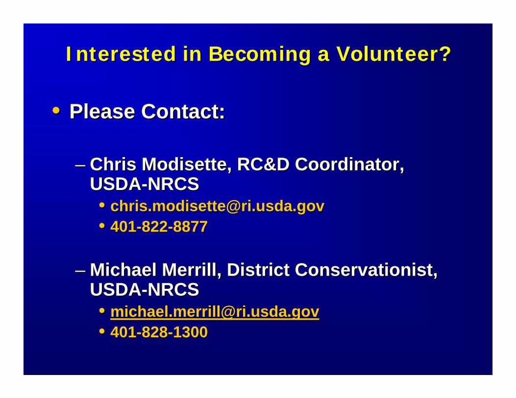
Interested in Becoming a Volunteer?Interested in Becoming a Volunteer?
•• Please Contact:Please Contact:
–– Chris Modisette, RC&D Coordinator, Chris Modisette, RC&D Coordinator, USDAUSDA--NRCSNRCS•• [email protected]@ri.usda.gov•• 401401--822822--88778877
–– Michael Merrill, District Conservationist, Michael Merrill, District Conservationist, USDAUSDA--NRCSNRCS•• [email protected]@ri.usda.gov•• 401401--828828--13001300
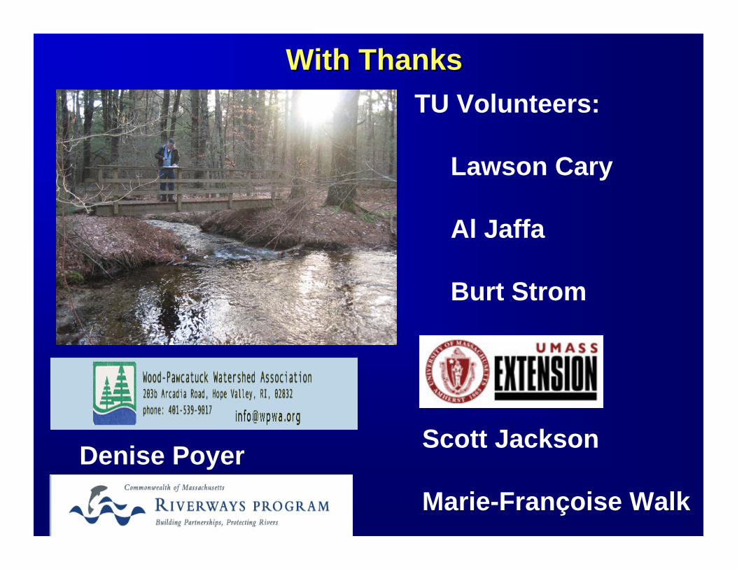
With ThanksWith ThanksTU Volunteers:
Lawson Cary
Al Jaffa
Burt Strom
Scott Jackson
Marie-Françoise Walk
Denise Poyer
Thank you!
May I answer any questions?
http://www.the-digital-picture.com/Images/Pic/2004-04-30_14-16-49.jpg
Next StepsNext Steps
•• Are there any additional factors we Are there any additional factors we should be considering when should be considering when prioritizing and ranking the stream prioritizing and ranking the stream crossings?crossings?
•• Who is interested in partnering in Who is interested in partnering in this project? What resources can this project? What resources can your organization provide?your organization provide?
•• Where do we go next?Where do we go next?