Embed Size (px)
Citation preview
Page 1
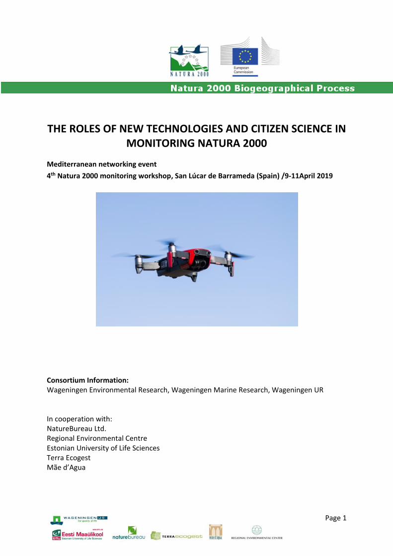
THE ROLES OF NEW TECHNOLOGIES AND CITIZEN SCIENCE IN MONITORING NATURA 2000
Mediterranean networking event
4th Natura 2000 monitoring workshop, San Lúcar de Barrameda (Spain) /9-11April 2019
Consortium Information: Wageningen Environmental Research, Wageningen Marine Research, Wageningen UR In cooperation with: NatureBureau Ltd. Regional Environmental Centre Estonian University of Life Sciences Terra Ecogest Mãe d’Agua
Support for the Natura 2000 Biogeographical Process - ENV.D.3/SER/2017/0010 - The roles of new technologies and citizen science in monitoring Natura 2000. Networking event. San Lúcar de Barrameda (Spain), April 2019
Page 2
Prepared by Terra Ecogest
Authors Carlos Sunyer (Biogeographical Process, Terra Ecogest) Theo vander Sluis (Biogeographical Process, WENR) Sander Mücher (Wageningen Environmental Research) Anne Schmidt (Biogeographical Process, WENR) Kristijan Čivić (Eurosite) Ellen Meulman (BIJ12)
Version final
Date 7 October
Reviewed by Carlos Sunyer, Theo van der Sluis,
Acknowledgments
We would like to thank the organisation team, special thanks to Kristijan Čivić (Eurosite) and Ricardo Díaz-Delgado (Estación Biológica de Doñana), who made this networking event possible.
Recommended citation
Sunyer, C., Van der Sluis, T.; Müncher, S.; Schmidt, A.; Čivić, K.; Meulman, E.2019. ‘The roles of new technologies and citizen science in monitoring Natura 2000’. Networking event in Support of the Natura 2000 Biogeographical Process. San Lúcar de Barrameda, Spain. (ENV.D.3/SER/2017/0010).
Disclaimer
This report presents the (summary) of the discussions held at the workshop, and by no means presents the opinion of the facilitators or consortium members of the Biogeographical Process (BGP).
Link to more information on the Mediterranean Biogeographical Region
Cover picture: Drone used for bird censuses (C. Sunyer)
Support for the Natura 2000 Biogeographical Process - ENV.D.3/SER/2017/0010 - The roles of new technologies and citizen science in monitoring Natura 2000. Networking event. San Lúcar de Barrameda (Spain), April 2019
Page 3
Contents
Summary .................................................................................................................................... 4
1. Introduction ........................................................................................................................ 5
2. Workshop topics ................................................................................................................. 6
3. Results of interactive sessions ............................................................................................ 8
4. Contribution to the Mediterranean Road Map ................................................................ 15
5. References ........................................................................................................................ 16
Annex I. Interactive sessions methodology ............................................................................. 17
Annex II. Full answers to Interactive session 1 ........................................................................ 20
Annex III. Pictures ..................................................................................................................... 26
Support for the Natura 2000 Biogeographical Process - ENV.D.3/SER/2017/0010 - The roles of new technologies and citizen science in monitoring Natura 2000. Networking event. San Lúcar de Barrameda (Spain), April 2019
Page 4
Summary
The 4thEurositeNatura 2000 monitoring workshop on “the roles of new technologies and
citizen science”, was held in April 2019in San Lúcar de Barrameda, Spain. It was organised by
Eurosite together with the Estación Biológica de Doñana. It was carried out as a spin-off of
the last Mediterranean Biogeographic Process Seminar (Cyprus, 2017).
A total of 50 experts participated in two interactive sessions to explore:
- New opportunities and challenges for remote sensing techniques for scientists, decision
makers and practitioners in conservation/Natura 2000 management.
- What actions should be taken, and by whom, to get the new technologies applied in
monitoring Natura 2000 on an EU scale and in a (more) consistent way.

Support for the Natura 2000 Biogeographical Process - ENV.D.3/SER/2017/0010 - The roles of new technologies and citizen science in monitoring Natura 2000. Networking event. San Lúcar de Barrameda (Spain), April 2019
Page 5
1. Introduction
The Second Mediterranean Seminar, held in Cyprus in 2017, showed the increasing interest
on the potential of the new technologies for Natura 2000 Biogeographic Process. It
highlighted the need of training in remote sensing tools and recommended the organisation
of a workshop on citizen science and early warning systems (García & Múgica, 2017).
Responding to this interest, a networking event was organised within the Eurosite4th Natura
2000 monitoring workshop “The roles of new technologies and citizen science”, in San Lúcar
de Barrameda (Spain) the 9-11 April 2019. This conference had a wider audience, covering all
biogeographical regions of Europe.
The networking event fitted well the theme of theworkshop because it was a meeting of
some of the most relevant EU experts in using the new technologies in relation to Natura
2000 and species conservation, thus being an opportunity to explore the opportunities and
challenges of the new technologies for the Natura 2000 Biogeographic Process, and
specifically for the conservation and management of species and Natura 2000 sites.
The Conference included a field visit to Doñana National Park, and different technologies
were discussed during the workshop as part of the daily operations for habitat and species
monitoring.
During the Workshop two interactive sessions were organised with the aim of receiving as
much as possible input from all participants for the process.The conclusions were reported
and discussed in the plenary (see annex 1 for the methodology used during the sessions).
The first interactive session (9th April) was devoted to exploring the opportunities and
challenges for remote sensing techniques for scientists, decision makers and practitioners in
conservation/Natura 2000 management. The results are summarised in Chapter 3 and more
detailed information is found in Annex 2.
The second session (10th April) was focused on requiredactions, and by whom, to get the
new technologies implemented in monitoring Natura 2000 on a European scale and in a
more consistent way. The results are summarised in Chapter 4.

Support for the Natura 2000 Biogeographical Process - ENV.D.3/SER/2017/0010 - The roles of new technologies and citizen science in monitoring Natura 2000. Networking event. San Lúcar de Barrameda (Spain), April 2019
Page 6
2. Workshop topics
Remote sensing
Remote sensing has been defined as the science of obtaining information from an object,
area or phenomenon through a distance devise (Vandenborre et al, 2011). It involves two
main types of operations: acquisition of data, which may beobtained from a wide range of
satellites and airborne sensors, and the extraction of information, for which many analytical
tools have been developed.
The presentations at the workshop showed that remote sensing has been proven usefulfor a wide range of uses in relation to nature conservation and Natura 2000, at site and regional level, including:
- Mapping habitat distribution
- Site selection
- Monitoring of the conservation status of habitats
- Early warning forcertain drivers and pressures
- Monitoring invasive alien species
- Habitat quality assessment, using spatial indicators (e.g. fragmentation, patch sizes) and
biophysical and biochemical indicators (cover, chlorophyll, leaf area), useful also
forclimate policies, the valuation of ecosystem services. Or monitoring pests (e.g. Xylella
fastidiosa).
However, despite its potential for nature conservationit is still not included in the operational work, the ‘toolbox’ of many of the conservation agencies, and it is generally limited to pilot studies. There is still much to do to transfer knowledge of remote sensing to site managers (Vandenborre et al., 2017; Dias-Delgado et al, 2017).
Drones
The use of drones, also known as UAV (unmanned aerial devices), has been proven useful
(Jiménez and Mulero-Pázmány, 2019), among others for:
- Ecosystem monitoring: assessment of conservation actions, selection of sites for the
reintroduction of species, habitat assessment, mapping and quantification of ecosystem
services, validation of vegetation maps.
- Wildlife research and management: wildlife surveys, insect monitoring, habitat
modelling, identification of suitable sites for reintroduction programmes
Support for the Natura 2000 Biogeographical Process - ENV.D.3/SER/2017/0010 - The roles of new technologies and citizen science in monitoring Natura 2000. Networking event. San Lúcar de Barrameda (Spain), April 2019
Page 7
- Law enforcement: can be used for controlling protected areas.
- Environmental management: monitoring environmental impacts and disasters, such as
wildfires, oil spills, invasive alien species, erosion or habitat degradation. They can be
used for sampling water, soil and air.
Although drones have been recognised for their great potential for nature conservation,
their use remains under-developed.
Environmental DNA (eDNA)
Traditional biodiversity monitoring is limited by a lack of resources and biases in data
collected, especially in those species with low detection rates or when capturing a huge
diversity of organisms. The use of molecular techniques for detecting DNA is widely
recognised for species detection (Ishige et al., 2017; Tang et al., 2018), including for those
difficult to survey, such as cryptic, rare or invasive alien species in their first invasive stages
(Bakker et al, 2017; Devloo et al., 2016; Lin et al., 2019; Tang et al., 2018).
eDNA is an emerging technology, rapidly developing, with significant advances towards new
applications, for example monitoring abundances (Levi et al 2018), populations (Wheat et
al.; 2016) or ecological quality (Pawlowski et al., 2018; Vasselon et al., 2017).
Citizen science
Citizen science has been described as the non-professional involvement of volunteers in the
scientific process, whether in the data collection phase or in other phases of the research
(Bio Innovation Service 2018).
The growing number of citizen science projects, most of them in relation to biodiversity and
nature science, is generating millions of observations throughout the EU. Many of these
projects have proven to be a relevant and strategic tool for nature conservation, for example
in relation to monitoring species distribution (e.g. birds, butterflies, invasive alien species),
climate change, biodiversity richness or even reporting on Natura 2000 sites.
The further development of specific websites, data bases and apps for smartphones will
encourage, even more, the potential of citizen science in the coming years.
Support for the Natura 2000 Biogeographical Process - ENV.D.3/SER/2017/0010 - The roles of new technologies and citizen science in monitoring Natura 2000. Networking event. San Lúcar de Barrameda (Spain), April 2019
Page 8
3. Results of interactive sessions
How can Nature Conservation and Natura 2000 management best benefit from the newest insights and development of remote sensing and drone techniques?
Which remote sensing products have added value for Natura 2000 monitoring?
The purpose, the frequency of observation and the accessibility of the terrain defines
the added value of remote sensing.
Drones are in particular useful for animal counts. They are versatile, flexible, fast and
with low emissions.
All remote sensing have the benefit that they give no disturbance, except perhaps
some low level flying drones.
Is there a scale range of remote sensing products which is not well covered, currently?
At site level it is insufficient (e.g. at plant species level, or rare species mapping). Also
for habitat modelling the products are currently not good enough.
Estuaries are difficult, the scale is limiting, but multi-scale analysis of various products
is promising.
The large scale is well covered.
What habitats are most suitable for monitoring with remote sensing?
It depends on the purpose (e.g. for mapping threats or habitat types).
In general, large scale and dynamic habitats are better suitable for mapping.
It is suitable for habitats in Favourable Conservation Status, dry types, wet types, and
habitats with clear dominant species.
What are the most promising remote sensing products for Natura 2000 monitoring: now and
in the future?
Now:
Google Maps, Bing Maps.
Ortho-photos, stereo-photos, LIDAR products (DTM, DSM, CHM), forest cover, Radar
data, Corine Land Cover, Copernicus HR products.
Tracking devices, camera traps, ground radar for bird detection.
Support for the Natura 2000 Biogeographical Process - ENV.D.3/SER/2017/0010 - The roles of new technologies and citizen science in monitoring Natura 2000. Networking event. San Lúcar de Barrameda (Spain), April 2019
Page 9
In the future:
High resolution LIDAR products.
Remote sensing measuring all abiotic site conditions (e.g. soil moisture, temperature,
trophic levels, salinity).
Complete integration of remote sensing products with insitu data (e.g. vegetation
releves, species presence).
Integrated camera systems (e.g. LIDAR and hyperspectral).
Copernicus products linked to ecosystem and climate services.
Toolboxes & apps with free available high resolution remote sensing products and
really easy accessible.
Which are the problems in remote sensing products for monitoring?
They are complex to use:
o The data need to be interpreted, because they have been designed for other
uses, not for ecology. A model has to be developed for data analysis.
o Consequently, there is a lack of standardisation.
o Because all the above, it is difficult to find specific training on them.
A lot of people is still reluctant to use them (scepticism about technological
innovation), slowing down their take–up for nature conservation management,
which are mainly relegated to scientific purposes.
Lack of understanding on their utility, that often leads to an over expectation of their
results.
Suitable remote sensing techniques for monitoring land use or land cover change and (impact
of) other pressures
Change detection techniques are more suitable than sequential image classification.
Fuzzy techniques to improve accuracy.
Aerial photographs and satellites as well images from drones.
Other pressures that can be monitored by means of remote sensing techniques:
Land fragmentation
Nitrogen pollution
Invasive species
Water conditions / desiccation / flooding
Grazing

Support for the Natura 2000 Biogeographical Process - ENV.D.3/SER/2017/0010 - The roles of new technologies and citizen science in monitoring Natura 2000. Networking event. San Lúcar de Barrameda (Spain), April 2019
Page 10
Burning
Diseases like pests
Productivity
Recreation
Human activities around site (e.g. construction of piers)
Do you know remote sensing products cheaper than field visits / Most cost-effective remote
sensing techniques for monitoring of Natura 2000?
It is still not quite clear if remote sensing techniques are cheaper, it depends on the
context. Many times still needs to be combined with field visits.
It might not always be cheaper, but can provide an added value. It can be a way to
answer a certain question or fill a gap in data (e.g. 12 year frequency of vegetation
mapping, what about in between?), it is also very good for early evidence and alert
system for any habitat type.
Many of the costs are not in acquiring data but in getting your set-up in place:
storage and processing (i.e. information technologies infrastructure in place),
interpretation and calibration (i.e. getting the right knowledge and expertise).
The most cost effective techniques include the use of data sets
(Copernicus/Landsat/Sentinel/Planet) from different years and detect changes. The
combination of different remote sensing techniques (e.g. satellite with LIDAR) gives
even more useful information.
Linking networks of sensors (e.g. soil, water, etc) and combining with satellite data
gives numerous possibilities.
What are barriers for site managers to (not) use remote sensingproducts?
Lack of knowledge on remote sensing tools. They are too complex and not easy to
understand.
They produce a huge amount of data that are not easily analysed and interpreted.
Lack of recognition of remote sensing advantages and usefulness.
Fear for the unknowns still is a large barrier.
Results are not transferable across sites.
What remote sensing products at which scales are useful for site managers?
Scale and accuracy is contextdependant.
Support for the Natura 2000 Biogeographical Process - ENV.D.3/SER/2017/0010 - The roles of new technologies and citizen science in monitoring Natura 2000. Networking event. San Lúcar de Barrameda (Spain), April 2019
Page 11
The most usefulproductsfor site managers are aerial photographs and best quality
land cover applications, both are easy to use and understand.
Which actions should be taken, and by whom, to get the new technologies applied in monitoring Natura 2000 on an EU scale and in a (more) consistent way?
European Commission
Validation and standardization
Setting of common standards for remote sensing monitoring methodologies.
Intercalibration of programs at EU level for validating methodologies.
Knowledge and Guidance
Dissemination of best-practices and key scientific publications.
Develop habitat and species repositories.
Capacity building
Together with relevant platforms (e.g. Copernicus, climate services), organise online
training courses aimed for ecologists on how to use their resources and other existing
free resources.
Promotion
Pilot projects on the use of remote sensing for monitoring Natura 2000.
Make remote sensing the standard methodology for reporting under Article 17 of the
Habitats Directive requirements, for those habitats and species for which the
methodology is cost-effective
Support remote sensing at EU level.
Integrated projects, to promote synergies and cooperation among the different
stakeholders: countries, institutions, business, research institutions, site managers,
etc.
Funding
Funding to develop new monitoring technologies for Natura 2000. One example here
is the EU COST action DNAqua-net “developing new genetic tools for bio-assessment
of aquatic ecosystems in Europe” http://dnaqua.net/.

Support for the Natura 2000 Biogeographical Process - ENV.D.3/SER/2017/0010 - The roles of new technologies and citizen science in monitoring Natura 2000. Networking event. San Lúcar de Barrameda (Spain), April 2019
Page 12
Member States
Setting needs
Formulate Natura 2000 monitoring needs.
Validation and standardization
Contribute on the setting of common standards for remote sensing monitoring
methodologies.
Cooperation
Find a common ground by asking countries/managers to collaborate over specific
topics.
Knowledge and guidance
Develop habitat and species repositories.
Create knowledge infrastructures.
Feed the European Commission with best practices and pilot projects.
Field manual for the use of remote sensing for monitoring Natura 2000 (habitat
description, identification of habitats, remote sensing analysis).
Capacity building
Develop appropriate knowledge and skills on the use of new technologies for
monitoring Natura 2000.
Promotion
Lead the implementation of remote sensing projects.
Funding
Promote funding for developing and stimulating using remote sensing techniques.
Promote demonstrating projects on the application of remote sensing for monitoring
Natura 2000.
Support citizen science.
Scientific community
Setting needs
Be more application oriented, work with site managers to understand end users
needs.
Support for the Natura 2000 Biogeographical Process - ENV.D.3/SER/2017/0010 - The roles of new technologies and citizen science in monitoring Natura 2000. Networking event. San Lúcar de Barrameda (Spain), April 2019
Page 13
Improve communication between scientific community and site managers.
Validation and standardization
Contribute on the setting common standards and validate methodologies together
with site managers.
User friendly
Make accessible the best technology.
Make the outcome more understandable for site managers.
Capacity building
Contribute to the education of stakeholders and managers.
Site managers
Setting needs
Formulate Natura 2000 daily management and monitoring needs.
Explain needs to researchers.
Validation and standardization
Feed-back from the research community to validate products.
Open mind
To embrace the future, open mind to new technologies.
EUROSITE
Capacity building
Create a working group to help in sharing knowledge, lobbing to EC, training,
acceptance of remote sensing among site managers.
Set up and support technical groups (e.g.: drones, DNA, citizen science).
Connecting everyone.
Promotion
Influence EC funding instruments to include specific programmes to develop remote
sensing and other new technologies for the monitoring of Natura 2000, bringing
together the ideas of site managers and scientific community.

Support for the Natura 2000 Biogeographical Process - ENV.D.3/SER/2017/0010 - The roles of new technologies and citizen science in monitoring Natura 2000. Networking event. San Lúcar de Barrameda (Spain), April 2019
Page 14
Help the European Commission in promoting the use of remote sensing for Natura
2000.
Others
EEA-Copernicus: provide a framework and funding for Member States to apply
harmonised remote sensing methods for Natura 2000 monitoring.
Citizen science projects should leverage remote sensing products.
Private companies: share biological data.
Support for the Natura 2000 Biogeographical Process - ENV.D.3/SER/2017/0010 - The roles of new technologies and citizen science in monitoring Natura 2000. Networking event. San Lúcar de Barrameda (Spain), April 2019
Page 15
4. Contribution to the Mediterranean Road Map
This networking event has contributed to the development of Mediterranean road map, set up in Cyprus, in the following topic:
Workshop: The roles of new
technologies and citizen science
Med
iter
ran
ean
Ro
ad M
ap
Workshop citizen science & early warning systems
X

Support for the Natura 2000 Biogeographical Process - ENV.D.3/SER/2017/0010 - The roles of new technologies and citizen science in monitoring Natura 2000. Networking event. San Lúcar de Barrameda (Spain), April 2019
Page 16
5. References
Bakker, J.; Wagensteen, O.S.; Chapman, D.D.; Boussarie, G.; Buddo, D.; Guttridge, T.L.; Hertler, H.; Mouillot, D.; Vigliola, L.; Mariani, S. 2017. Shark diversity in contrasting levels of anthropogenic impact. Scientific Reports 7(1). DOI: 10.1038/s41598-017-17150-2
Bio Innovation Service (2018) Citizen science for environmental policy: development of an EU-wide inventory and analysis of selected practices. Final report for the European Commission, DG Environment under the contract 070203/2017/768879/ETU/ENV.A.3, in collaboration with Fundacion Ibercivis and The Natural History Museum, November 2018.
Cristescu, M.E.; Hebert, P-D.N. 2018. Uses and misuses for environmental DNA in biodiversity science and conservation. Annual Review of Ecology, Evolution and Systematics. 49: 209-230
Devloo-Delva, F.; Miralles, L.; Ardura, A.; J.Borrel, Y.; Pejovic, I.; Tsartsianidou, V.; García-Vázquez, E. 2016. Detection and characterisation of the biopollutant Xenostrobus secures (Lamark, 1819) Asturias population from DNA Barcoding and eBarcoding. Marine Pollution Bulleting 105: 23-29. https://doi.org/10.1016/j.marpolbul.2016.03.008
Diaz-Delgado, R.; Lucas, R.; Hurford, C. 2017. The roles of remote sensing in nature conservation. A practical guide and case studies. Springer
DNAqua-net: Developing new genetic tools for bioassessment of aquatic ecosystems in Europe
García, D. & Múgica, M. 2017. Second Mediterranean Natura 2000 Seminar. Limassol – Cyprus, 14-16 November 2017.
Jiménez López, J.; Mulero-Pázmány, M. 2019. Drones for conservation in protected areas: present and future. Drones 2019, 3, 10; doi:10.3390/drones3010010
Levi, T.; Allen, J.M.; Bell, D.; Joyce, J.; Russell, J.R.; Tallmon, D.A.; Vulstek, S.C.; Yang, C.; Yu, D.W. 2018. Environmental DNA for the enumeration and management of pacific salmon. Molecular ecology resources. https://doi.org/10.1111/1755-0998.12987
Lin, M.; Zhang, S.; Yao, M. 2019. Effective detection of environmental DNA from the invasive American bullfrog. Biological Invasions 2019. https://doi.org/10.1007/s10530-019-01974-2
Pawlowski, J., Kelly-Quinn, M., Altermatt, F., Apothéloz-Perret-Gentil, L., Beja, P., Boggero, A., Borja, A., Bouchez, A., Cordier, T., Domaizon, I., Feio, M.J., Filipe, A.F., Fornaroli, R., Graf, W., Herder, J., van der Hoorn, B., Iwan Jones, J., Sagova-Mareckova, M., Moritz, C., Barquín, J., Piggott, J.J., Pinna, M., Rimet, F., Rinkevich, B., Sousa-Santos, C., Specchia, V., Trobajo, R., Vasselon, V., Vitecek, S., Zimmerman, J., Weigand, A., Leese, F., Kahlert, M., 2018. The future of biotic indices in the ecogenomic era: Integrating (e)DNA metabarcoding in biological assessment of aquatic ecosystems. Science of The Total Environment 637–638, 1295–1310. https://doi.org/10.1016/j.scitotenv.2018.05.002
Tang, C.Q., Crampton-Platt, A., Townend, S., Bruce, K., Bista, I. &Creer, S. 2018. Development of DNA applications in Natural England 2016/2017. Natural England Commissioned Reports, Number 252.
Vandenborre J., Paelinckx D., Mücher C.A., Kooistra L., Haest B., De Blust G. & 17 Schmidt A.M. (2011). Integrating remote sensing in Natura 2000 habitat 18 monitoring: Prospects on the way forward. Journal for Nature Conservation 19 19 (2): 116-125. (DOI:10.1016/j.jnc.2010.07.003)
Vandenborre J., Spanhove T., Haest B. (2017). Towards a mature age of remote sensing for Natura 2000 habitat conservation: Poor method transferability as a prime obstacle. In: Díaz Delgado R., Lucas R., Hurford C. (Eds). The roles of remote sensing in nature conservation: A practical guide and case studies. Springer International Publishing AG, Cham, Switzerland, pp. 11-37. https://doi.org/10.1007/978-3-319-64332-8_2
Vasselon V., Rimet F., Tapolczai K., Bouchez A. (2017) Assessing ecological status with diatom DNA metabarcoding: scaling-up on a WFD monitoring network (Mayotte island, France). Ecological Indicators 82:1-12. https://doi.org/10.1016/j.ecolind.2017.06.024
Wheat, R.E.; Allen, J.M.; Miller, S.D.L.; Wilmers, C.C.; Levi, T. 2016. Environmental DNA from residual saliva for efficient non invasive genetic monitoring of Brown Bears (Ursus arctos). PLoS ONE 11/11): e0165259.doi:10.1371/journal.pone.0165259

Support for the Natura 2000 Biogeographical Process - ENV.D.3/SER/2017/0010 - The roles of new technologies and citizen science in monitoring Natura 2000. Networking event. San Lúcar de Barrameda (Spain), April 2019
Page 17
Annex I. Interactive sessions methodology
Interactive session 1
How can Nature Conservation and Natura 2000 management best benefit from the newest
insights and development of remote sensing and drone techniques’?
Tuesday 9 April: 17.10-18.00
A World Café/Carousel method was used in order to address questions related to the
overarching question ‘How can Nature Conservation and Natura 2000 management best
benefit from the newest insights and development of remote sensing and drone
techniques’?
Six stations were established, consisting of a stand with a flip-chart with one or more
questions to be answered by the participants.
The participants at the Workshop were split on to six groups, which had to pass through
each station to answer the 1-2 questions. For the first station they had 15 minutes, changing
after to the next stations, in were they only had 10 minutes. After the first station the group
reviewed the answers from the previous group, and add/contribute to it without changing
the answers, but they could built further on them, or add remarks. At the last station they
had to summarize/formulate the conclusions based on the answers at the flip chart.
At each stand there was a facilitator, explaining or summarizing the remarks of the previous
groups.
- A. Theo van der Sluis (Biogeographical Process, WENR)
- B. Kristijan Čivić (Eurosite)
- C. Carlos Sunyer (Biogeographical Process, Terra Ecogest)
- D. Sander Mücher (Wageningen Environmental Research)
- E. Anne Schmidt (Biogeographical Process, WENR)
- F. Ellen Meulman (BIJ12)
Some of the questions were formulated in advance to the Workshop while others were
raised after the discussions during the Workshop. With this methodology each group of
participants has an opportunity to contribute to each question and the results were
summarized onto three “key findings”, which were feed back to the plenary on Wednesday.
Support for the Natura 2000 Biogeographical Process - ENV.D.3/SER/2017/0010 - The roles of new technologies and citizen science in monitoring Natura 2000. Networking event. San Lúcar de Barrameda (Spain), April 2019
Page 18
Questions rose to the participants
Stand A
Which remote sensing products have added value for Natura 2000 monitoring?
Is there a scale range of remote sensing products which is not well covered, currently?
Question 3: What habitats are most suitable for monitoring with remote sensing?
Stand B
What are the most promising remote sensing products for Natura 2000 monitoring: now and
in the future?
Stand C
Which are the problems in remote sensing products for monitoring?
Stand D
Suitable remote sensing techniques for monitoring land use or land cover change and
(impact of) other pressures
Stand E
Do you know remote sensing products cheaper than field visits / Most cost-effective remote
sensing techniques for monitoring of Natura 2000?
Stand F
What are barriers for site managers to (not) use remote sensing products?
What remote sensing products at which scales are useful for site managers?
Interactive session 2
How can Nature Conservation and Natura 2000 management best benefit from the newest
insights and development of remote sensing and drone techniques’?
Wednesday 10 April: 17.10-18.00
The audience was separated onto small groups of 4-5 persons, all of which had to propose
actions for the European Commission, Member States, site managers, researchers and
Eurosite. They had 15 minutes to propose an unlimited number of actions for each group,
which were post-it in a flip-chart under each institution. The results were feed back to the
plenary by:

Support for the Natura 2000 Biogeographical Process - ENV.D.3/SER/2017/0010 - The roles of new technologies and citizen science in monitoring Natura 2000. Networking event. San Lúcar de Barrameda (Spain), April 2019
Page 19
- Theo van der Sluis (Biogeographical Process, WENR)
- Anne Schmidt (Biogeographical Process, WENR)
- Kristijan Čivić (Eurosite)
Support for the Natura 2000 Biogeographical Process - ENV.D.3/SER/2017/0010 - The roles of new technologies and citizen science in monitoring Natura 2000. Networking event. San Lúcar de Barrameda (Spain), April 2019
Page 20
Annex II. Full answers to Interactive session 1
Which remote sensing products have added value for Natura 2000 monitoring?
The Accessibility of the terrain defines the added value of remote sensing. Also the
purpose, e.g. for monitoring trends, or the frequency of observation.
Drones are in particular useful for animal counts, e.g. deer. They are versatile,
flexible, fast and with low emissions.
All remote sensing have the benefit that they give no disturbance, except perhaps
some low level flying drones.
Is there a scale range of remote sensing products which is not well covered, currently?
At site level it is insufficient, e.g. at plant species level, or rare species mapping. Also
for the purpose of habitat modelling the products are currently not good enough.
Estuaries are difficult, the scale is limiting, but multi-scale analysis of various products
is promising.
The large scale is well covered (perhaps it is insufficient for HR-LIDAR).
What habitats are most suitable for monitoring with remote sensing?
It depends on the purpose. E.g. for mapping threats or habitat types.
In general, large scale and dynamic habitats are better suitable for mapping.
Habitats in Favourable Conservation Status, dry types, wet types, and habitats with
clear dominant species (e.g. Molinia) are suitable.
Remote sensing can help to pinpoint areas where management interventions are
required, or those where no interventions are necessary.
Some remark is made that we should map all the terrain, in and outside the Natura
2000 network, for threats. In Spain some 60% of all habitats is covered, which is 90%
of the country.
Some groups state that semi natural habitats are difficult, although Poland states it is
possible (they only have semi-natural grasslands), but the quality of those habitats is
tricky. For that aerial photographs may be better.
In the Netherlands the mapping of habitat types is difficult since they are too
detailed.
What are the most promising remote sensing products for Natura 2000 monitoring: now and
in the future?
Support for the Natura 2000 Biogeographical Process - ENV.D.3/SER/2017/0010 - The roles of new technologies and citizen science in monitoring Natura 2000. Networking event. San Lúcar de Barrameda (Spain), April 2019
Page 21
Now:
Google Maps, Bing Maps.
Ortho-photos, stereo-photos, LIDAR products (DTM, DSM, CHM), forest cover, Radar
data (e.g. subsidence), Corine Land Cover, Copernicus HR products.
Tracking devices, camera traps, ground radar for bird detection.
Essential biodiversity variables, such as: leaf area index, vegetation height, biomass,
phenology, flooding, land cover, soil moisture, etc.
Vegetation structure and vegetation cover monitoring.
Remote sensing products can fill gaps intermediate in a frequency, e.g. vegetation
mapping each 12 years, intermediate products derived from remote sensing.
Good ecologists with remote sensing knowledge.
In the future:
Remote sensing can map all Annex I habitat types (Habitats Directive).
Habitat maps every 6 years from remote sensing (with 10m resolution) for reporting
under the requirements of Art. 17 of the Habitats Directive.
Increase frequency.
Species mapping with drones.
Remote sensing measures all abiotic site conditions (soil moisture, temperature,
trophic levels, salinity).
Non-disturbing drones.
Complete integration of remote sensing products with in-situ data (e.g. vegetation
releves, species presence).
High resolution LIDAR products everywhere concerning individual trees, height and
diameter trees, and dead wood.
Integrated camera systems (e.g. LIDAR and hyperspectral).
Pocket drones with integrated camera systems that can do instantaneous habitat
mapping. Integrated camera systems.
‘Everybody’ has its own drone.
Toolboxes & apps with free available high resolution remote sensing products (e.g.
temperature, flooding, soil moisture, vegetation structure, land cover, etc.). And
really easy accessible such as Google Maps.
Remote sensing derived alert services.
Good and light batteries for drones.

Support for the Natura 2000 Biogeographical Process - ENV.D.3/SER/2017/0010 - The roles of new technologies and citizen science in monitoring Natura 2000. Networking event. San Lúcar de Barrameda (Spain), April 2019
Page 22
Remote sensing products and models integrated for future predictions.
Copernicus products linked to ecosystem and climate services.
All remote sensing products (everything) available in Google Maps.
Everything free and easy accessible, and all in one projection.
All remote sensing products downloadable for own processing further.
More accurate methods.
Which are the problems in remote sensing products for monitoring?
Most remote sensing data is not specific for ecologist.
Access to data is no always easy and cheap.
For certain species there is not enough resolution.
Absence of tools for an easy interpretation and processing data.
There is a knowledge gap between information technologies developers and
ecologists / site managers.
There is a lack of training on remote sensing tools.
Lack of standardisation tools and methodologies.
In some countries aviation rules do not allow the use of drones.
Absence of long term validation.
Site managers are reluctant to change and accept remote sensing.
Lack of information and technical capacity among site managers.
Over expectations of results.
Understanding spatial / temporal uncertainty.
Difficult access to training.
Limited life of products.
Suitable remote sensing techniques for monitoring land use or land cover change and (impact
of) other pressures.
Remote sensing techniques
Change detection techniques are more suitable than sequential image classification
Fuzzy techniques to improve accuracy
Aerial photographs and satellites as well images from drones
Other type pressures that can be monitored by means of remote sensing techniques:
Land fragmentation

Support for the Natura 2000 Biogeographical Process - ENV.D.3/SER/2017/0010 - The roles of new technologies and citizen science in monitoring Natura 2000. Networking event. San Lúcar de Barrameda (Spain), April 2019
Page 23
Nitrogen pollution
Invasive species
Water conditions / desiccation / flooding
Grazing
Burning
Diseases like pesticide’s
Productivity
Recreation
Human activities around site (e.g. construction of piers).
Time scale
Difference between gradual changes and abrupt changes like pests.
Spatial scale
Important on different scale levels from site level to landscape to Member States to
European Union level.
Multiscale approach.
On site level drones important for management actions e.g. in low accessible areas.
Limitations
Resolution of satellites is limiting factor.
Aerial photographs used in e.g. Sweden.
Archives important.
Ancillary data
Cadastral data.
Agricultural data e.g. parcels and subsidies.
Historical context
It is important to have the historical context e.g. based on old aerial photographs.
Do you know remote sensing products cheaper than field visits / Most cost-effective remote
sensing techniques for monitoring of Natura 2000?
Some considerations:
Remote sensing still needs to be combined with the field visits – but remote sensing
can provide an added value.
It is still not quite clear if remote sensing techniques are cheaper.
Support for the Natura 2000 Biogeographical Process - ENV.D.3/SER/2017/0010 - The roles of new technologies and citizen science in monitoring Natura 2000. Networking event. San Lúcar de Barrameda (Spain), April 2019
Page 24
A lot of the costs are not in acquiring data but in getting your set-up in place: storage
and processing (i.e. the information technologies infrastructure in place),
interpretation and calibration (i.e. getting the right knowledge and expertise).
Remote sensing is a very good for early evidence and alert system to indicate large
changes for any habitat type in Europe – but to get the real causes you need to
follow up with field visits.
How: use different Copernicus/Landsat/Sentinel (and/or Planet) data sets from
different years and detect changes.
Combination of different remote sensing techniques (e.g. satellite with LIDAR) gives
even more useful information.
Remote sensing might not always be cheaper, but it can be a way to answer a certain
question or fill a gap in data (e.g. 12 year frequency of vegetation mapping, what
about in between?). It depends on the specific question and context.
Some examples:
Use of tablets in the recent years has revolutionized the field work of site managers
in the recent years (email, photo, GPS, GIS, forms, mapping etc).
LIDAR is an effective way to estimate the biomass on a large scale in forestry (in use
in Finland).
Photo-traps for identifying insects (involves machine learning) used in the
Netherlands.
eDNA sampling for fish and insect surveys.
Combination of eDNA and satellite data (with involvement of some machine learning)
can be used for mapping (estimating) the distribution of various species.
Linking networks of all kind of sensors (e.g. soil, water etc.) and combining with
satellite data gives numerous possibilities.
Breeding birds’ colonies counting with drones or planes.
Satellite data for an Early Warning System for wildfire detection and monitoring.
What are barriers for site managers to (not) use remote sensing products?
There is a huge difference in what can be done versus what is needed by site
managers.
Too complex, not easy to understand (age barrier/knowledge barrier; complex to
know what method to use for what / costs).
Fear for the unknown/ what it means in terms of jobs.
Necessity of (working with and buying) new (complex) software and hardware.

Support for the Natura 2000 Biogeographical Process - ENV.D.3/SER/2017/0010 - The roles of new technologies and citizen science in monitoring Natura 2000. Networking event. San Lúcar de Barrameda (Spain), April 2019
Page 25
Huge amounts of data that are not easily interpreted/ analyzed/ recognized as visible
patterns/classifications.
Lack of engaging site managers in using remote sensing so that site managers don't
recognize the advantages/ usefulness.
Definition of remote sensing is not clear (includes also eDNA, wild cameras, etc.?)
Usefulness of remote sensing differs among site managers versus researchers and
conservation purposes.
Whether or not remote sensing is cost effective (money well spent)?
Fear for accessibility of data – (mis)used / misinterpreted – Fear for being controlled
/ checked upon (data protection and ownership might be an issue).
Liability in using remote sensing products like drones.
Not useful for small sites – field observations easier.
Often not transferable from one site to other.
Lack of recognition and being ok with limitations.
Simplified communication of results is necessary! Whereas effects of actions requires
detailed information.
What remote sensing products at which scales are useful for site managers?
Scale (spatial and temporal) and accuracy is context (and process) dependant.
They are useful for:
See earlier on effects of change.
Transferring knowledge across sites.
Comparing sites.
Seeing effect of influences in surrounding areas on own site.
Animal census (larger animals, birds, marine mammals).
Useful remote sensing products:
Aerial photography (watch out – can be degraded quality because of autocorrection
and compression).
Stereo photography (more historical data, good for habitats and structure for which
you then don't need LIDAR.
dat/em summit software.
Drones – small scale (more useful for own site).
Landcover application (easy to use and understand, not directly related to own site –
no fear of control).
Support for the Natura 2000 Biogeographical Process - ENV.D.3/SER/2017/0010 - The roles of new technologies and citizen science in monitoring Natura 2000. Networking event. San Lúcar de Barrameda (Spain), April 2019
Page 26
Annex III. Pictures
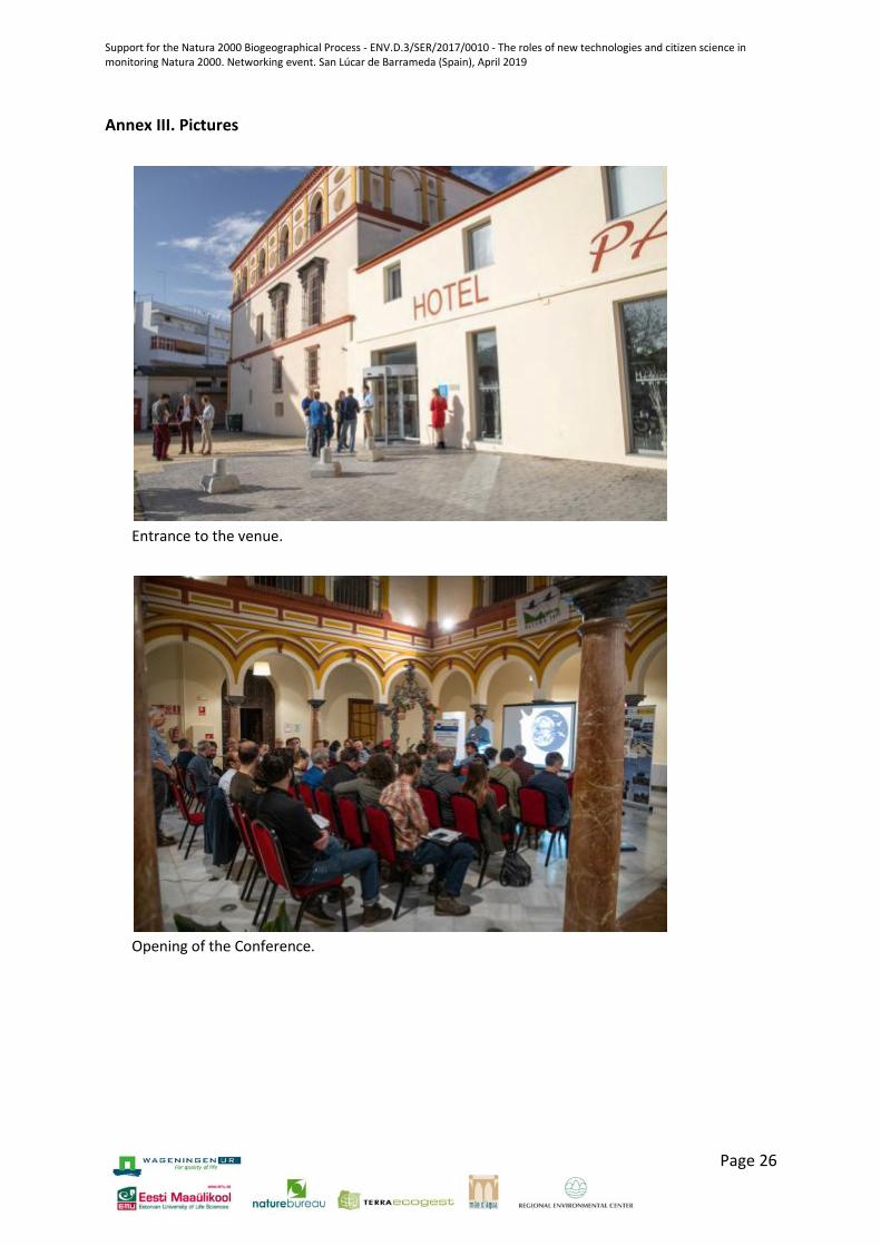
Entrance to the venue.
Opening of the Conference.

Support for the Natura 2000 Biogeographical Process - ENV.D.3/SER/2017/0010 - The roles of new technologies and citizen science in monitoring Natura 2000. Networking event. San Lúcar de Barrameda (Spain), April 2019
Page 27
Theo Vander Sluis presenting the Biogeographical Process.
Knowledge market.
Support for the Natura 2000 Biogeographical Process - ENV.D.3/SER/2017/0010 - The roles of new technologies and citizen science in monitoring Natura 2000. Networking event. San Lúcar de Barrameda (Spain), April 2019
Page 28
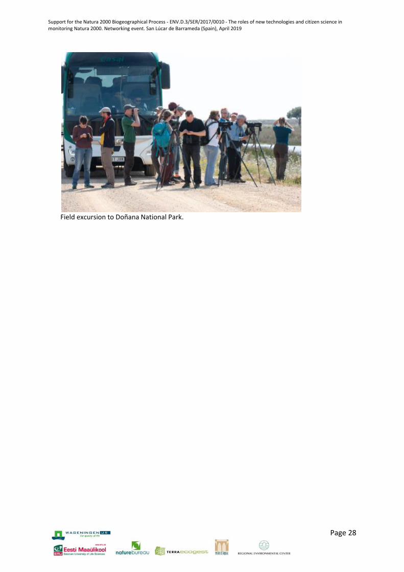
Field excursion to Doñana National Park.


![CENTERITY SERVICE PACK FOR CLOUDERA€¦ · OOZIE [roles status] • CLOUDERA ROLES SOLR [roles status] • CLOUDERA ROLES SPARK [roles status] • CLOUDERA ROLES SQOOP [roles status]](https://img.pdfslide.net/doc/110x75/5fc0df6d43307a59a12ae0a7/centerity-service-pack-for-cloudera-oozie-roles-status-a-cloudera-roles-solr.jpg)