Embed Size (px)
Citation preview

THE SACRAMENTO REGIONAL MODEL
Model Overview and Potential Applications
Norm JonesMichelle Smilowitz
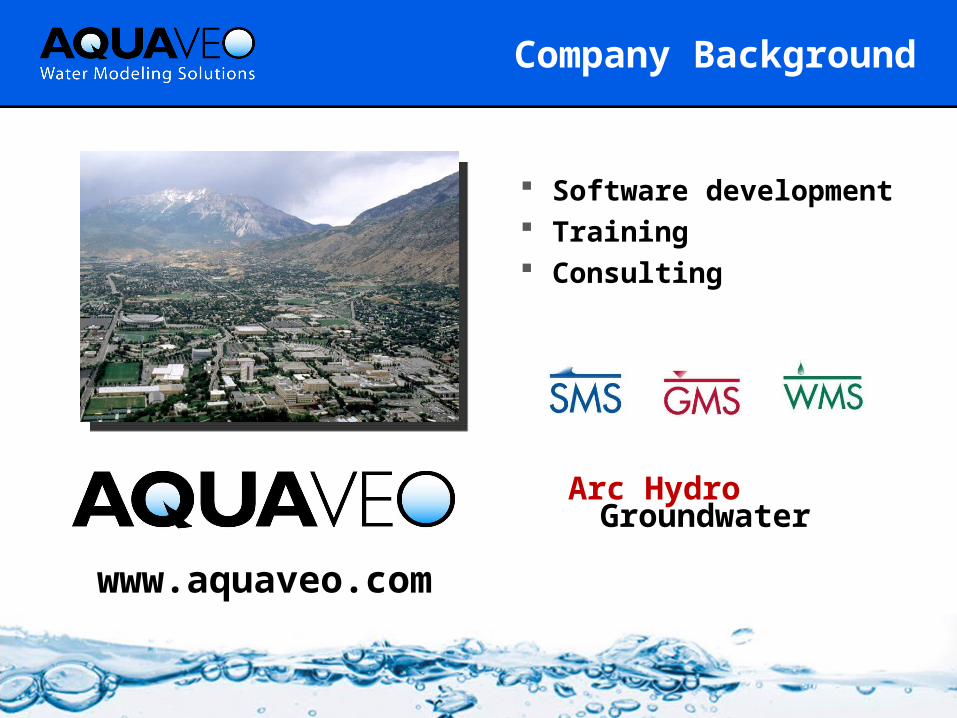
Company Background
Software development
Training Consulting
www.aquaveo.com
Arc HydroGroundwater

Project Objectives
Regional groundwater model ASR design and optimization Flexible and cost-effective Incorporate the latest data Accurate representation of
regional hydrogeology

Code Selection
1
1
2
4
119
5
7
8
3
10
6
1. Confined/unconfined aquifers
2. Interbeds3. Faults and barriers4. Confining units5. Rivers6. Drains and springs7. Streams8. Reservoirs9. Recharge10.Evapotranspiration11.Wells
MODFLOW

Model Domain
Area Acres % Model Domain
North American Sub Basin 340,170 39.2%
South American Sub Basin 247,745 28.5%
Cosumnes Sub Basin 280,490 32.3%
Total Model Domain Acreage: 868,405 100.0%
AREAS

Conceptual Model - Hydrogeology
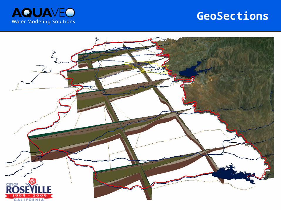
GeoSections

Wedge Model - Outcropping
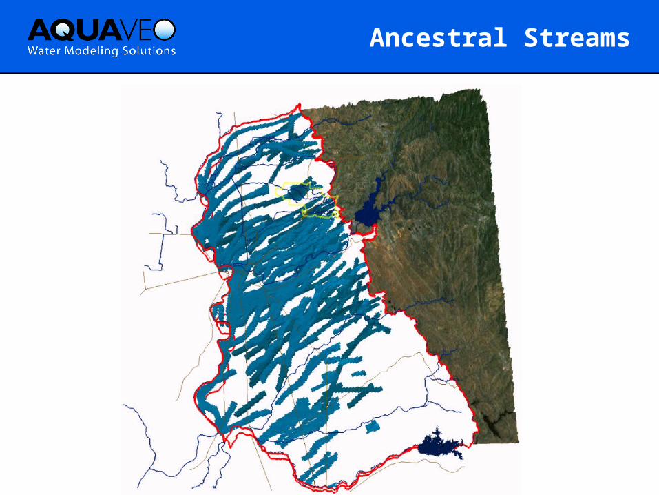
Ancestral Streams
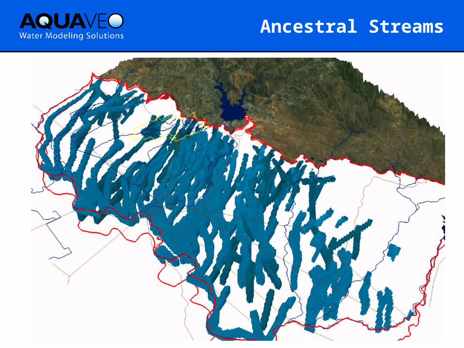
Ancestral Streams

Ancestral Streams

Riverbank Model Layer 1
Consists of sands, silts, and clays from floodplain and alluvial deposits Superjacent ancestral stream channels cut across this formation
creating lateral channels of gravels and unconsolidated sediments

Predominantly consists of sands, silts, and clays Superjacent ancestral stream channels cut across this formation,
creating lateral channels of gravels and unconsolidated sediments
Turlock Lake Laguna FormationModel Layers 3,4 and 5

Composed of two dominant units: Black andesitic sands “salt and pepper sand” and blue and brown
clays Hard gray and black tuff-breccias “lava”
Mehrten FormationModel Layers 6,7 and 8

Consists of rhyolite ash, quartz sand , and ashy clay
Valley Springs FormationModel Layer 9

Consists of sandstone, silts, and clays
Ione FormationModel Layer 10

Rivers, Streams, and Canals
Losing River
Gaining River
Disconnected River
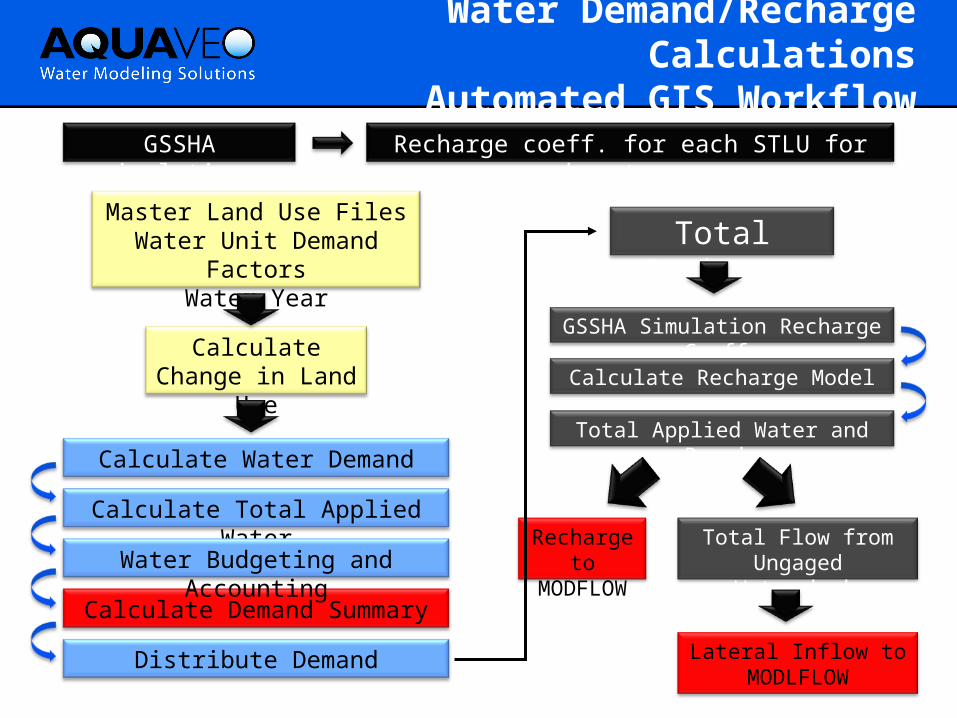
Water Demand/Recharge Calculations
Automated GIS Workflow
GSSHA Simulation Recharge Coeffs
Master Land Use FilesWater Unit Demand
FactorsWater Year
Calculate Change in Land
Use
Calculate Total Applied Water
Calculate Water DemandTotal Applied Water and
Precip
Total Recharge
Recharge to
MODFLOW
Total Flow from Ungaged
Watersheds
Lateral Inflow to MODLFLOW
Calculate Recharge Model
Calculate Demand Summary
Water Budgeting and Accounting
Distribute Demand
GSSHA simulations
Recharge coeff. for each STLU for each water year

Steady State Calibrated Heads

Roseville Pilot Test Calibration

Mokelumne River

Model Applications
Contaminant transport analysis Design of remediation systems ASR design and optimization Probabilistic modeling and risk
analysis Water banking and exchange Surface water/ground water
interaction

ASR Simulation

Summary
Realistic and accurate model of regional hydrogeology
Incorporates the latest field investigations
Based on MODFLOW suite of codes Rapid response as questions and
opportunities arise Effective communication of results Low-cost development and maintenance

Contacts
Norm Jones
(801) [email protected]
Michelle Smilowitz
(305) [email protected]
Royd Nelson
(801) [email protected]
Derrick Whitehead
(916) [email protected]
Cathy Lee
(916) [email protected]