Embed Size (px)
Citation preview
B R I A N VA N E E R D E N
D I R E C TO R , V I RG I N I A P I N E L A N D S P RO G R A M
The State of Virginia Beach’s
Forests
USING NATURE TO ADDRESS FLOODING
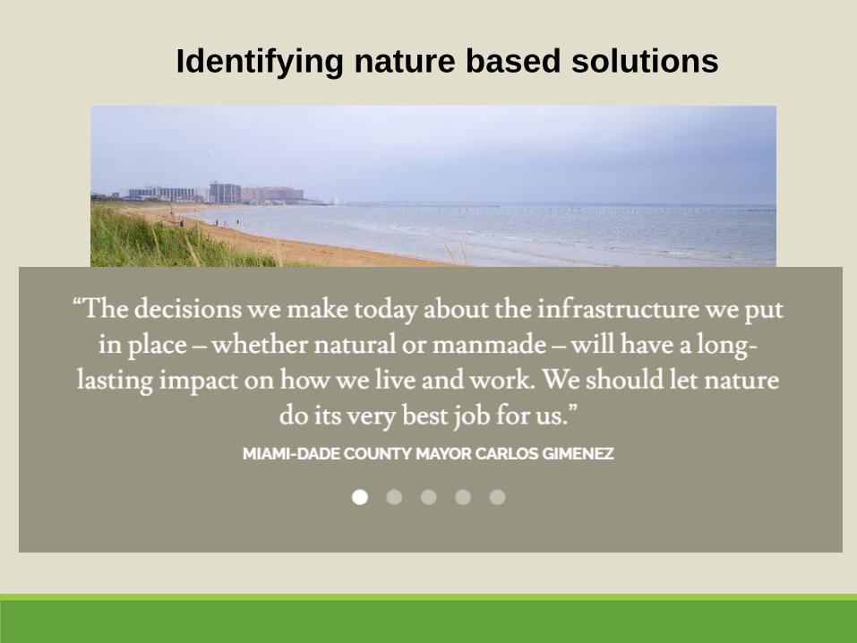
Identifying nature based solutions
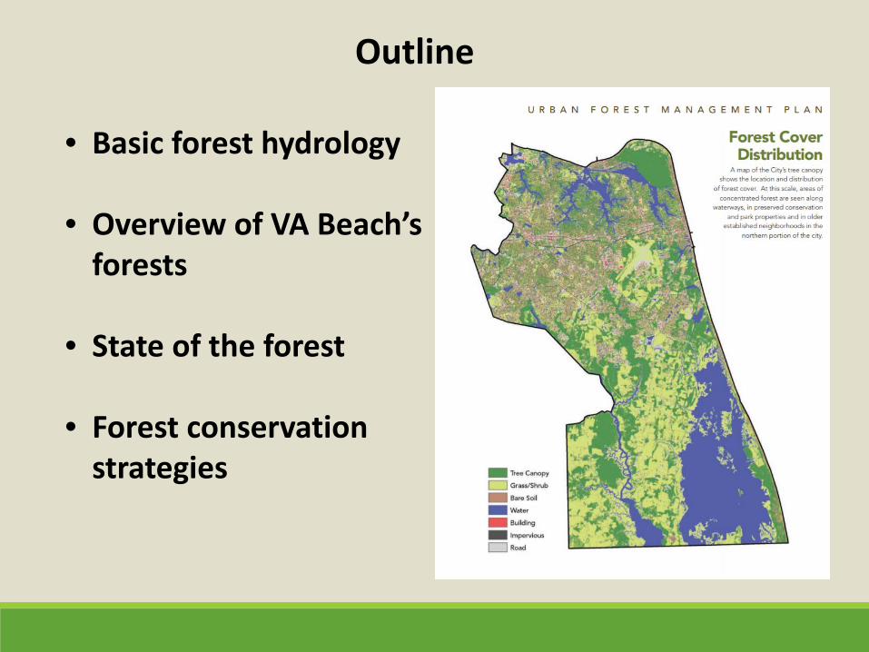
• Basic forest hydrology
• Overview of VA Beach’s
forests
• State of the forest
• Forest conservation strategies
Outline
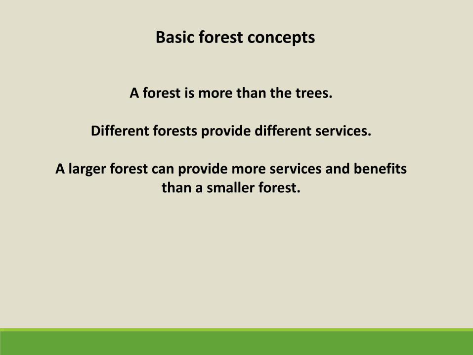
A forest is more than the trees.
Different forests provide different services.
A larger forest can provide more services and benefits
than a smaller forest.
Basic forest concepts
• Flood storage • Shoreline armoring/storm surge protection • Water quality protection • Wildlife habitat • Commercial forest products • Aesthetics • Recreation • Carbon storage • Air quality protection
Services Forests Provide
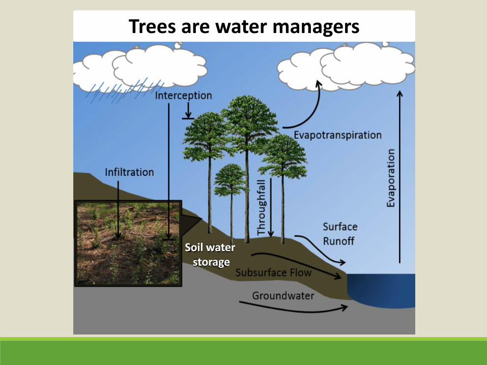
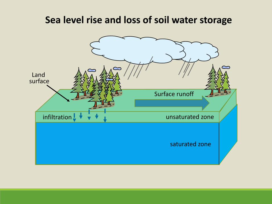
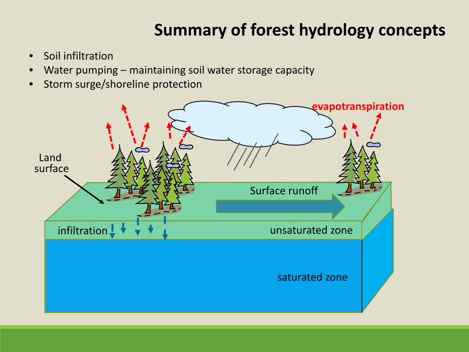
Soil water storage
Trees are water managers
saturated zone
unsaturated zone
Land surface
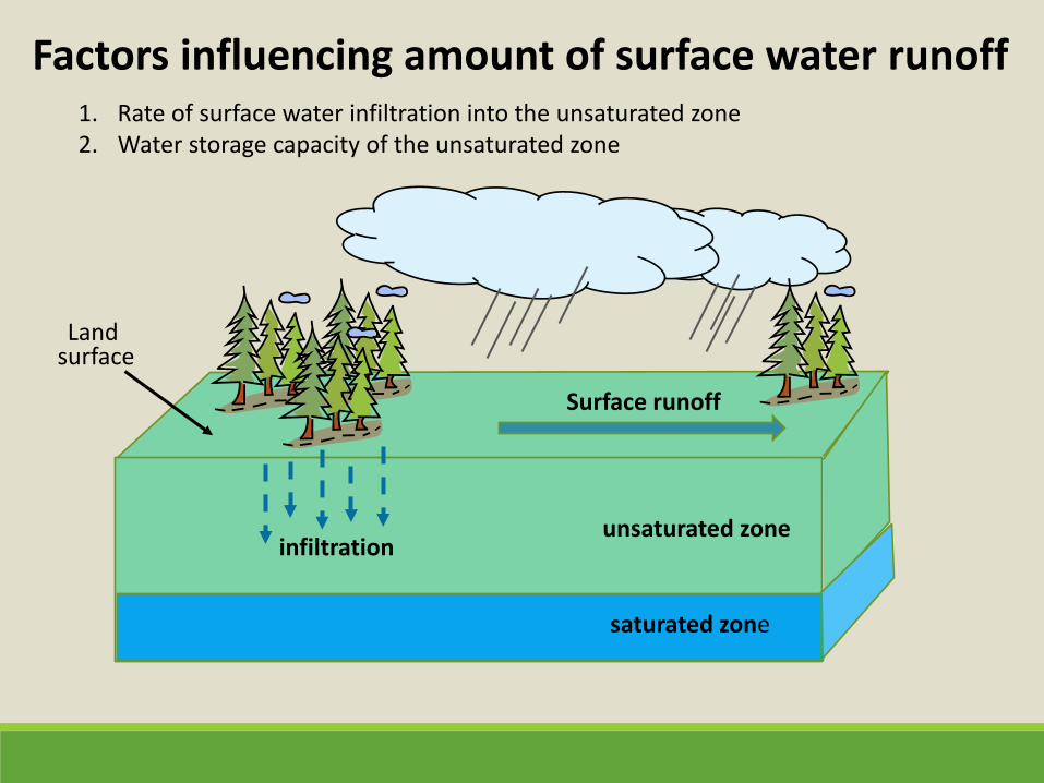
1. Rate of surface water infiltration into the unsaturated zone 2. Water storage capacity of the unsaturated zone
infiltration
Surface runoff
Factors influencing amount of surface water runoff
saturated zone
unsaturated zone
Land surface
infiltration
Surface runoff
Sea level rise and loss of soil water storage
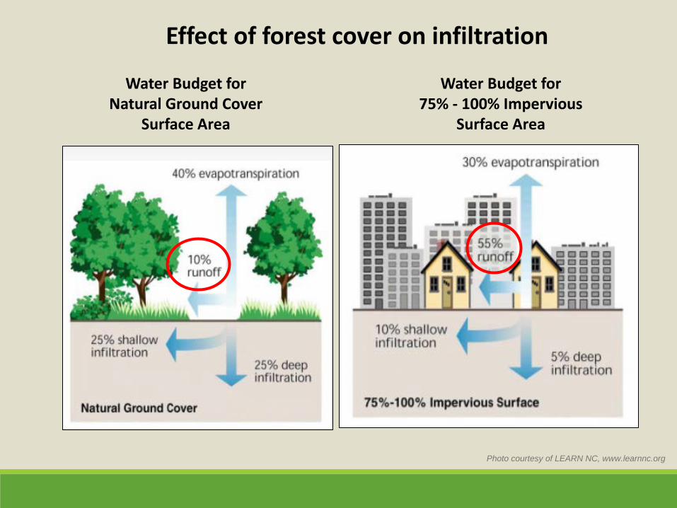
Photo courtesy of LEARN NC, www.learnnc.org
Water Budget for Natural Ground Cover
Surface Area
Water Budget for 75% - 100% Impervious
Surface Area
Effect of forest cover on infiltration
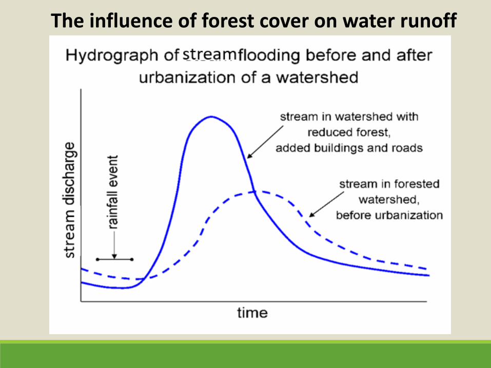
The influence of forest cover on water runoff
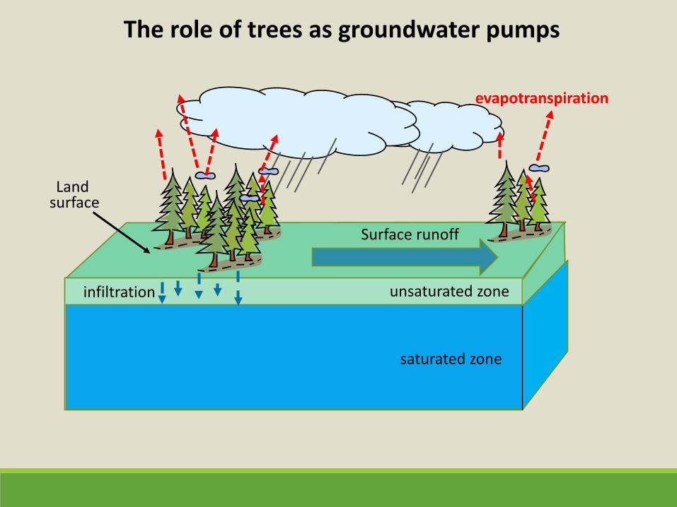
saturated zone
unsaturated zone
Land surface
infiltration
Surface runoff
The role of trees as groundwater pumps
evapotranspiration
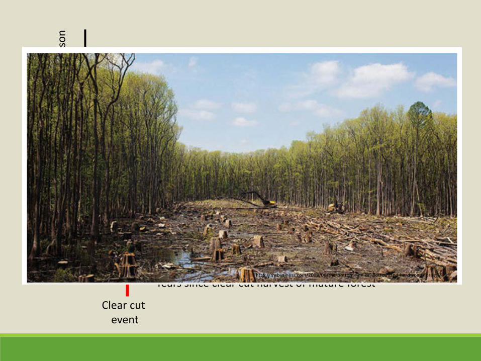
Clear cut event
Years since clear cut harvest of mature forest
Aver
age
grou
nd w
ater
leve
l dur
ing
grow
ing
seas
on
http://msbusiness.com/2018/06/the-bottom-line-on-bottomland-hardwood-forests/
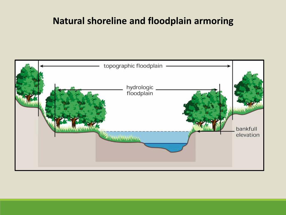
Natural shoreline and floodplain armoring
saturated zone
unsaturated zone
• Soil infiltration • Water pumping – maintaining soil water storage capacity • Storm surge/shoreline protection
Land surface
infiltration
Surface runoff
Summary of forest hydrology concepts
evapotranspiration
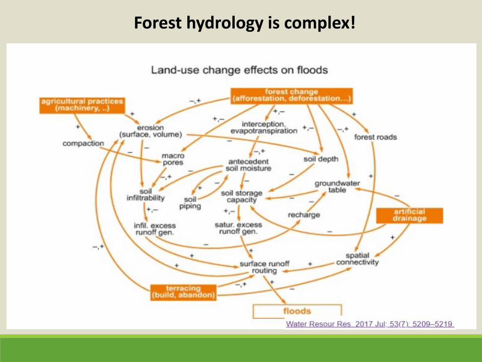
Forest hydrology is complex!
Outline Basic forest hydrology
• Overview of VA Beach’s
forests
• State of the forest
• Forest conservation strategies
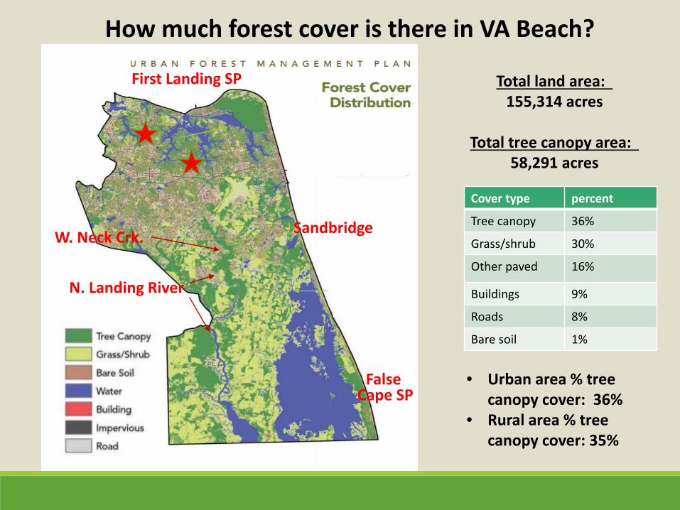
How much forest cover is there in VA Beach?
Total land area: 155,314 acres
Total tree canopy area:
58,291 acres
False Cape SP
First Landing SP
Sandbridge
N. Landing River
W. Neck Crk.
Cover type percent
Tree canopy 36%
Grass/shrub 30%
Other paved 16%
Buildings 9%
Roads 8%
Bare soil 1%
• Urban area % tree canopy cover: 36%
• Rural area % tree canopy cover: 35%
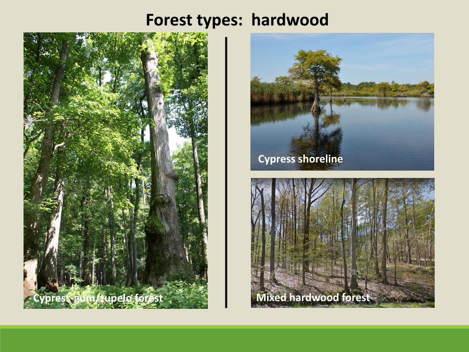
Forest types: hardwood
Fire-maintained pine woodland
Cypress-gum/tupelo forest Mixed hardwood forest
Cypress shoreline
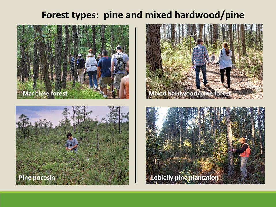
Forest types: pine and mixed hardwood/pine
Pine pocosin
Fire-maintained pine woodland Maritime forest Mixed hardwood/pine forest
Loblolly pine plantation
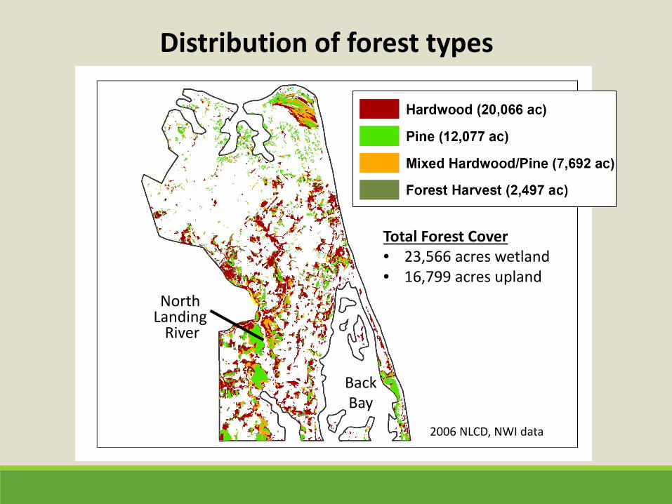
2006 NLCD, NWI data
Distribution of forest types
Total Forest Cover • 23,566 acres wetland • 16,799 acres upland
Back Bay
North Landing
River
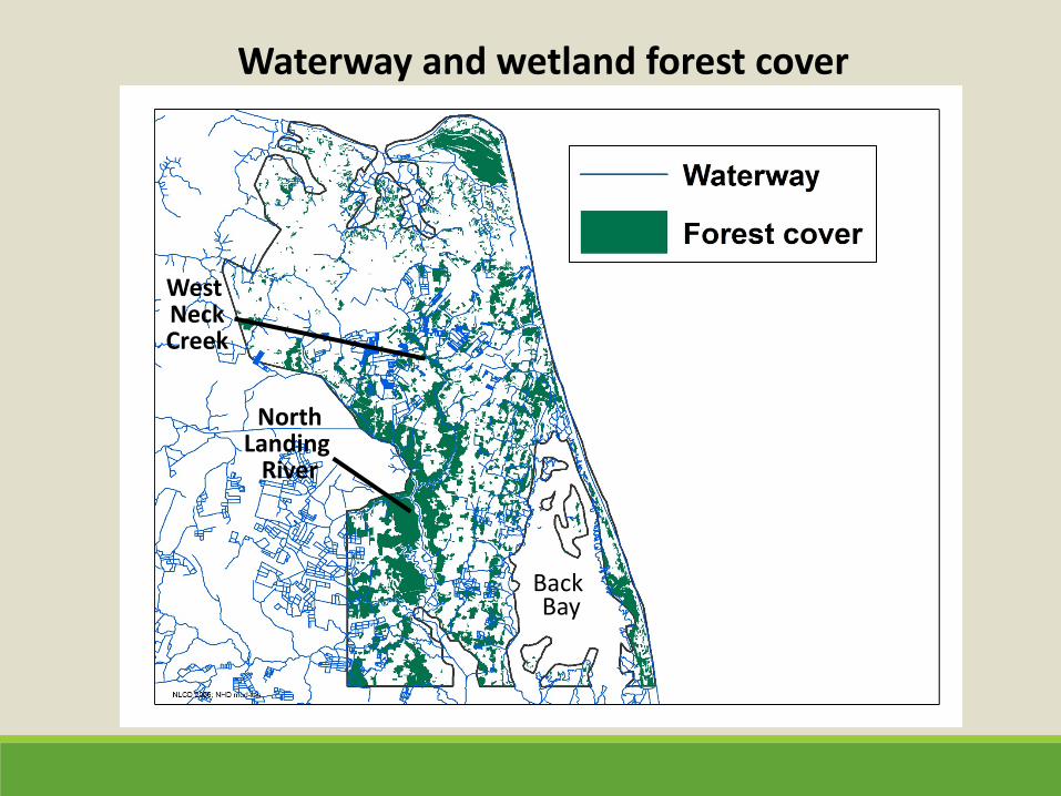
Waterway and wetland forest cover
Back Bay
North Landing
River
West Neck Creek
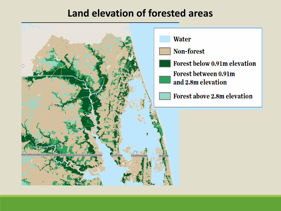
Land elevation of forested areas
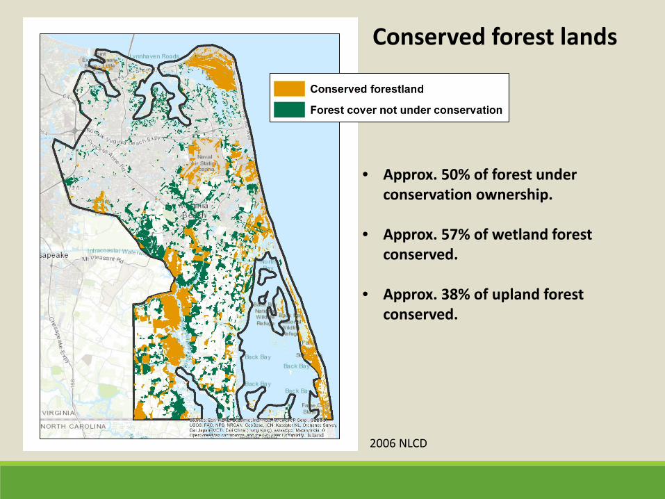
Conserved forest lands
• Approx. 50% of forest under conservation ownership.
• Approx. 57% of wetland forest conserved.
• Approx. 38% of upland forest conserved.
2006 NLCD
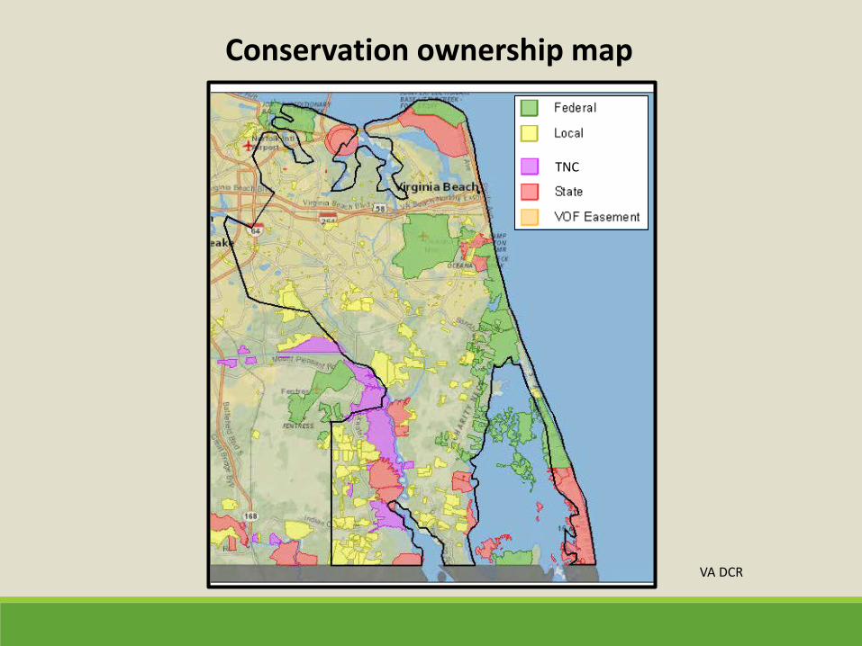
Conservation ownership map
VA DCR
TNC
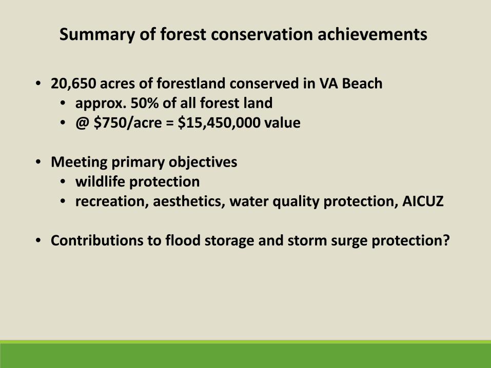
Summary of forest conservation achievements
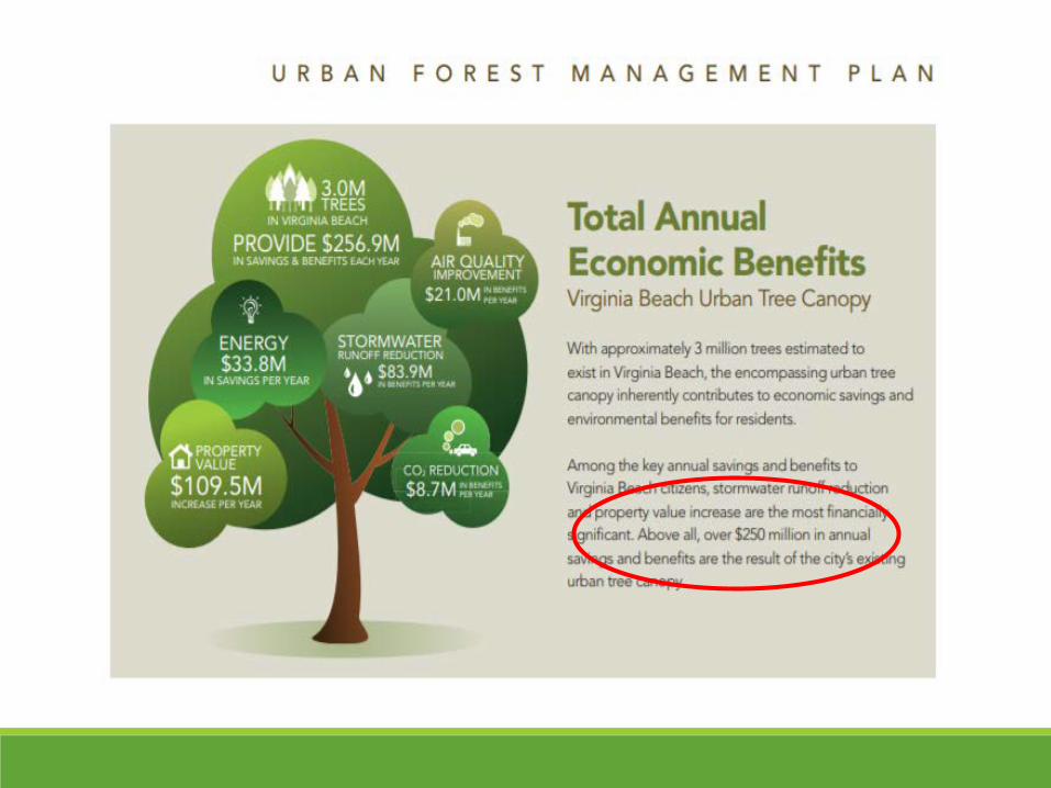
• 20,650 acres of forestland conserved in VA Beach • approx. 50% of all forest land • @ $750/acre = $15,450,000 value
• Meeting primary objectives • wildlife protection • recreation, aesthetics, water quality protection, AICUZ
• Contributions to flood storage and storm surge protection?
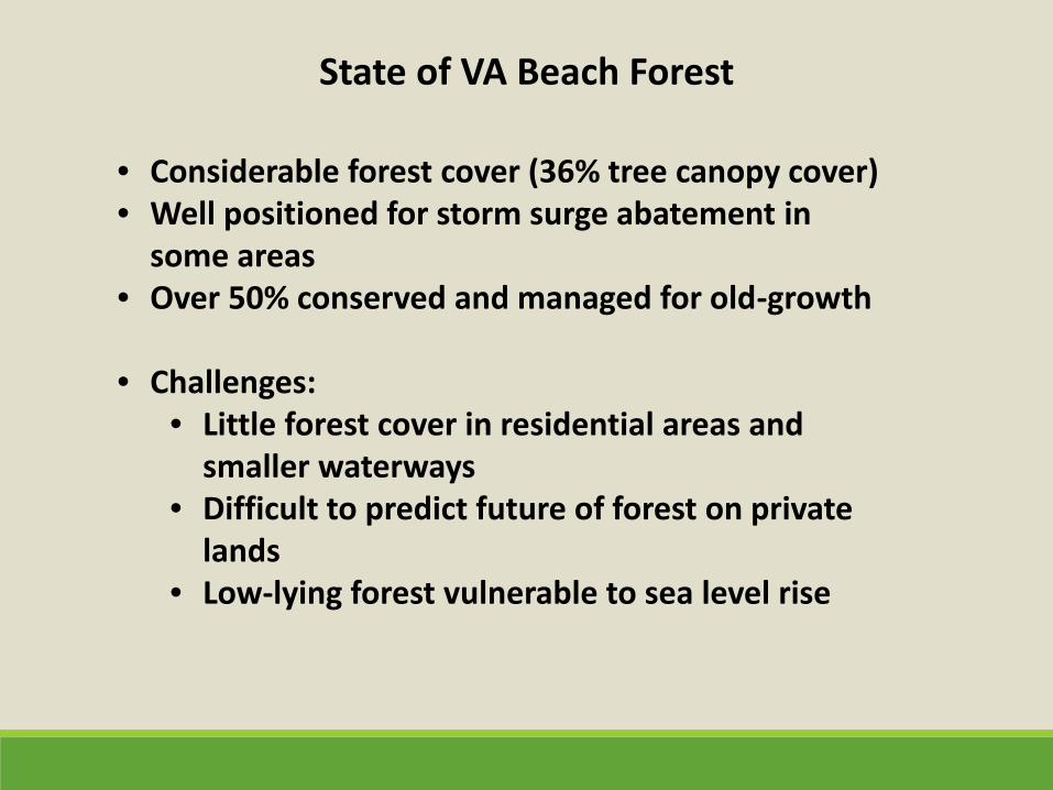
State of VA Beach Forest
• Considerable forest cover (36% tree canopy cover) • Well positioned for storm surge abatement in
some areas • Over 50% conserved and managed for old-growth
• Challenges:
• Little forest cover in residential areas and smaller waterways
• Difficult to predict future of forest on private lands
• Low-lying forest vulnerable to sea level rise
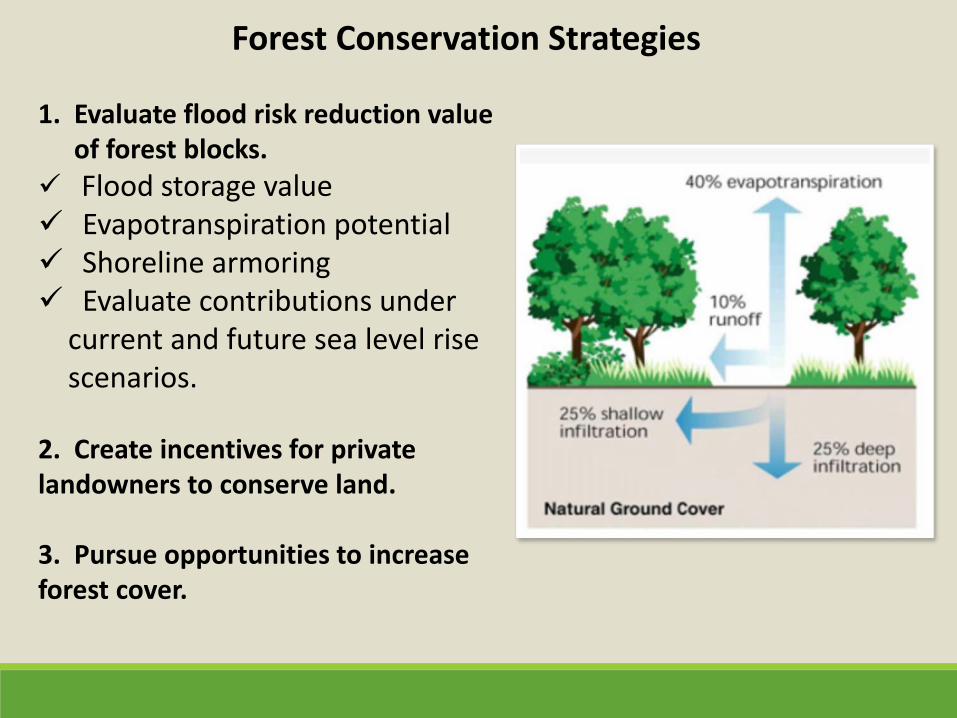
Forest Conservation Strategies
1. Evaluate flood risk reduction value of forest blocks.
Flood storage value Evapotranspiration potential Shoreline armoring Evaluate contributions under
current and future sea level rise scenarios.
2. Create incentives for private landowners to conserve land. 3. Pursue opportunities to increase forest cover.
Questions?


![[DPnF] Lying Lips](https://img.pdfslide.net/doc/110x75/577cdae41a28ab9e78a6cf58/dpnf-lying-lips.jpg)