Embed Size (px)
Citation preview

Dokumentname > 23.11.2004
The TerraSAR-X Mission: A German Public-Private Partnership Undertaking
Rolf Werninghaus
TerraSAR-X Project Manager, DLR
Vienna, February 20, 2006

20.02.2006TerraSAR-X Mission
IntroductionPublic-Private-PartnershipMission DesignData AvailabilityProject StatusOutlook
Agenda

20.02.2006TerraSAR-X Mission
Introduction
National, German Radar-SatelliteHigh geometric resolution Flexible operational modesMulti-Polarisation high information content
Scientific and commercial Applications
cartography and planningagriculture and forestryenvironmentrisk management and securitygeology, mining and exploration
Launch: Summer 2006
SIR-C/X-SAR
SRTM

20.02.2006TerraSAR-X Mission
TerraSAR-X is the first space-mission in Germany (in Europe?, worldwide?) to be implemented in a public-private partnership scheme
Cooperation Agreement (PPP-contract)
DLR EADS Astrium GmbH
Scientific Exploitation:
Commercial Exploitation:
Public-Private Partnership

20.02.2006TerraSAR-X Mission
Public-Private Partnership (2)
Cooperation-agreement defines the tasks and obligations of DLR and EADS Astrium:
EADS Astrium GmbH contributes funds for implementing TerraSAR-X
Exclusive commercial exploitation rights for EADS Astrium GmbH / Infoterra GmbH
DLR coordinates the scientific utilization of TerraSAR-X Data
Satellite tasking will be shared equally 50/50 (scientific/commercial)
In case of conflict commercial order will have priority
DLR is the owner of all TerraSAR-X data
If commercially successful TerraSAR-X2 (to be financed by industry)

20.02.2006TerraSAR-X Mission
TerraSAR-X Mission-Design
DNEPR-1
514 km Orbit

20.02.2006TerraSAR-X Mission
TerraSAR-X Mission-Design
Mission Control Center Oberpfaffenhofen
Cmd & Tlm
Data
DNEPR-1
514 km Orbit
GroundstationNeustrelitz
GroundstationWeilheim

20.02.2006TerraSAR-X Mission
TerraSAR-X Mission-Design
Mission Control Center Oberpfaffenhofen
Cmd & Tlm
Data
DNEPR-1
514 km Orbit
GroundstationNeustrelitz
GroundstationWeilheim

20.02.2006TerraSAR-X Mission
TerraSAR-X Mission-Design
Mission Control Center Oberpfaffenhofen
Cmd & Tlm
Data
DNEPR-1
514 km Orbit
GroundstationNeustrelitz
GroundstationWeilheim
DACDAC
20.02.2006TerraSAR-X Mission
Stripmap Mode30 km swath width3 m resolution
ScanSAR Mode100 km swath width16 m resolution
Spotlight Mode5 km x 10 km scene1 m resolution
Dual Receive Antenna ModeAlong-Track Interferometry, Moving Target Identification
Imaging Modes

20.02.2006TerraSAR-X Mission
Simulated TerraSAR-X Image
Testsite Oberpfaffenhofen (1,5 m resolution)

20.02.2006TerraSAR-X Mission
TerraSAR-X: high operational flexibility
Very fast change between different imagingmodes and target areas
Very high resolution in SpotLight mode
Possibility of large area coverage byutilizing ScanSAR mode
Simultaneous imaging and data downlinkpossible
Secure operation by encryption of commands and data downlink
20.02.2006TerraSAR-X Mission
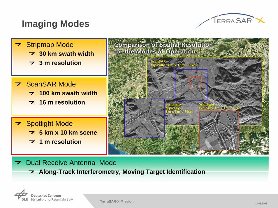
Data availabilityScientific Data:
DLR is in charge of coordinating the scientific use of the TerraSAR-X data
Data will be generally provided via a Announcement of Opportunity (AO)
A pre-launch AO has already been released
DLR will ensure the an independant and fair review of the proposals
Data will be provide for COFUR-cost (cost of fullfillingthe user request)
License agreement is required
Commercial data:
Commercial Customers will receive data via Infoterra GmbH
Market price will be determined by Infoterra GmbHCommercialCustomer
ScientificCustomer
http://www.eid.dlr.de/tsx/start_en.htm

20.02.2006TerraSAR-X Mission
Project Status
TerraSAR-X project has been initiated in 2001
Satellite integration will be completed by April 2006
Launch is scheduled for summer 2006
5 months Commissioning Phase after launch
Check-out of satellite bus
Check-out of SAR-instrument
Calibration activities
First product available in December 2006
Fully operational by April 2007

20.02.2006TerraSAR-X Mission
•• The only thing more useful thanThe only thing more useful than TerraSARTerraSAR--X …X …
TerraSAR-X Vision

20.02.2006TerraSAR-X Mission
•• The only thing more useful thanThe only thing more useful than TerraSARTerraSAR--X … is two of them.X … is two of them.•• The only thing more useful thanThe only thing more useful than TerraSARTerraSAR--X …X …
TanDEM-X proposal

20.02.2006TerraSAR-X Mission
TanDEM-X
• TanDEM-X main mission objective is to generate a high precision, global Digital Elevation Model (DEM)
• TanDEM-X is a national SAR interferometrymission employing
- the TanDEM-X satellite as a rebuild ofTerraSAR-X
- TSX-1 to form the tandem constellation
• Proposed launch early 2009
• TanDEM-X Public Private Partnership (PPP) model amending the TerraSAR-X PPP scheme


![arXiv:1706.04862v1 [physics.soc-ph] 15 Jun 2017 2007 and 2010 the German Aerospace Center (DLR) launched the EO radar satellites TerraSAR-X and TanDEM-X, respectively. In particular](https://img.pdfslide.net/doc/110x75/5ecb6f2f3e6cc57ab23d60db/arxiv170604862v1-15-jun-2017-2007-and-2010-the-german-aerospace-center-dlr.jpg)