Embed Size (px)
DESCRIPTION
A quarterly newsletter of Lewis and Clark National Historic Trail.
Citation preview
A Newsletter of lewis ANd ClArk NAtioNAl HistoriC trAil
February 2014
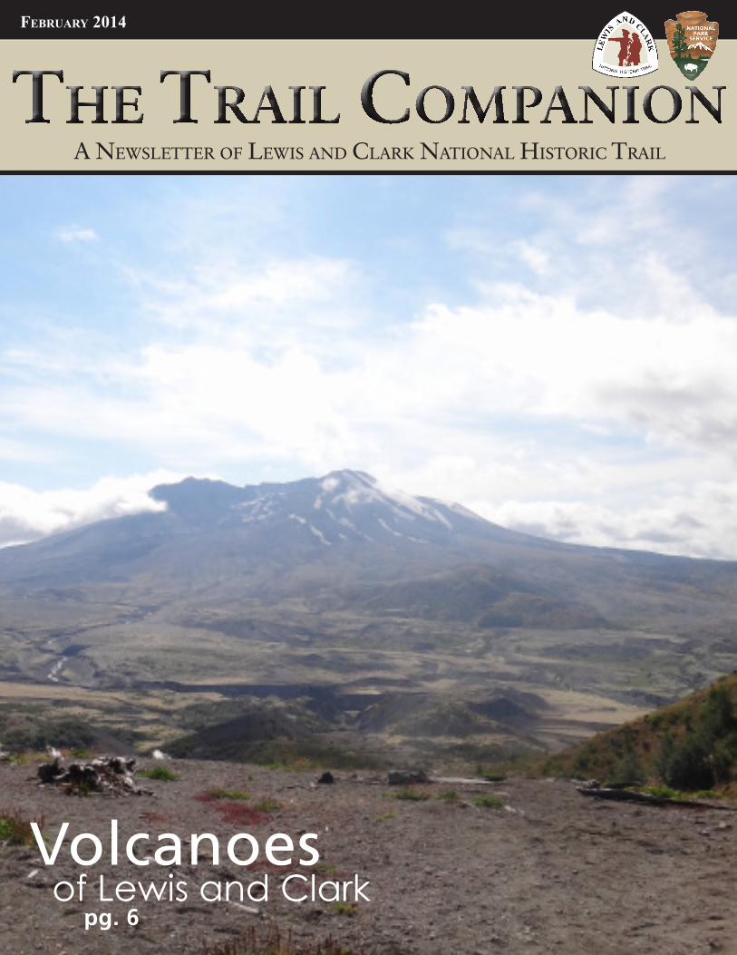
Volcanoes of Lewis and Clarkpg. 6
National Trails System Act The Lewis and Clark National Historic Trail, a trail of approximately three thousand seven hundred miles, extending from Wood River, Illinois, to the mouth of the Columbia River in Oregon, following the outbound and inbound routes of the Lewis and Clark Expedition depicted on maps identified as, 'Vicinity Map, Lewis and Clark Trail' study report dated April l977. The map shall be on file and available for public inspection in the office of the Director, National Park Service, Washington, D.C. The trail shall be administered by the Secretary of the Interior. No land or interest in land outside the exterior boundaries of any federally administered area may be acquired by the Federal Government for the trail except with the consent of the owner of the land or interest in land. The authority of the Federal Government to acquire fee title under this paragraph shall be limited to an average of not more than 1/4 mile on either side of the trail.
2 The Trail Companion
From the Superintendent
Lewis and Clark National Historic Trail 3
The language above, from the National Trails System Act’s 1978 amendment, directed the creation the Lewis and Clark National Historic Trail and provided critical guidance to those charged with administrating it. While this amendment to the Act is only a few sentences long, it has profound impact on how the trail is administered. The rest of the act also contains important guidance and direction that applies to all long distance trails. There are also many other laws and regulations that come into play regarding how trails should be administered. However, if you want to have a better understanding of the legal side of national trails, a great place to start is by reading the National Trails System Act.
Long distance trails are designated by acts of Congress. This typically occurs after extensive study and public input. However, the enabling legislation for long distance trails, including the Lewis and Clark National Historic Trail, is a bit different than the legislation for most “traditional” NPS areas. Unlike the legislation for most NPS areas, national trails are created by amending
the National Trails System Act of 1968.
The Trails Act was first passed in 1968 and created the first two National Scenic Trails (NST); the Appalachian NST and the Pacific Crest NST. In later years the act was amended many times to add new trails for a current total of 30. The act has also been
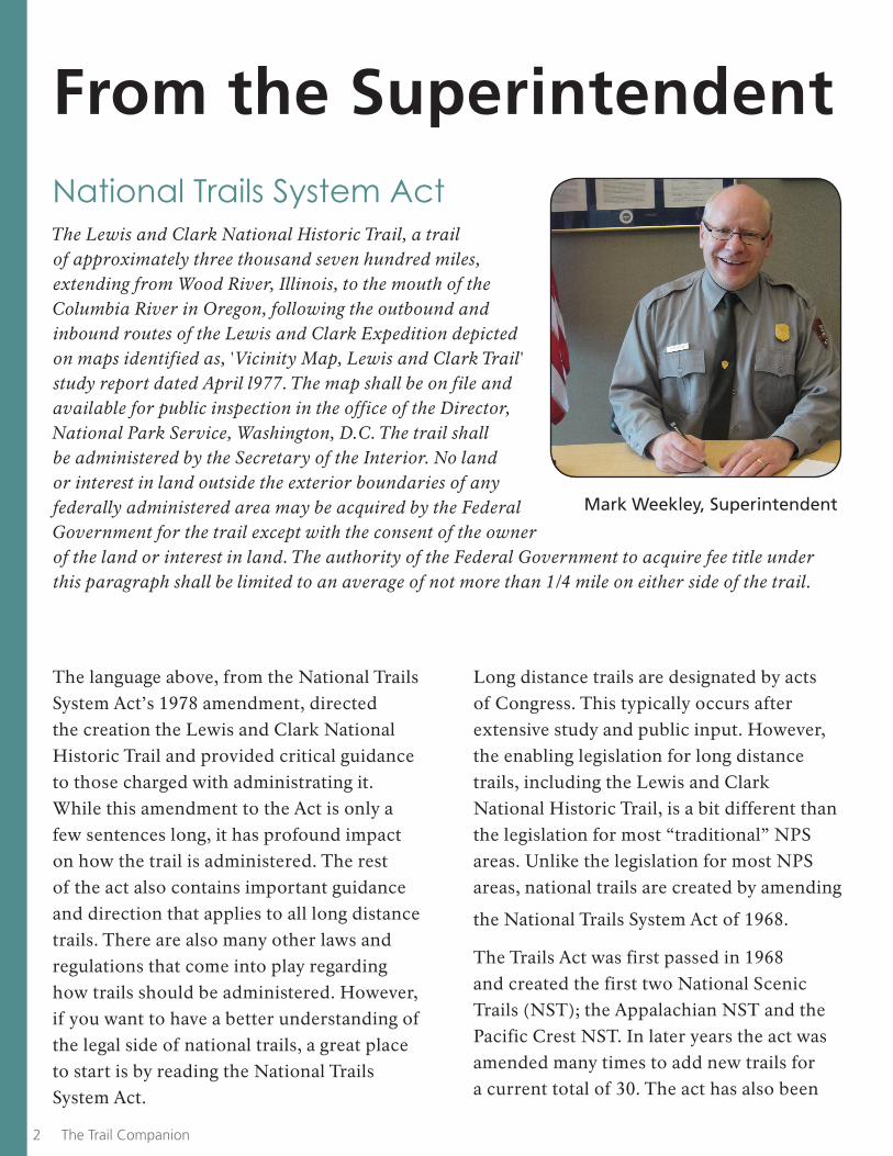
Mark Weekley, Superintendent
Lewis and Clark National Historic Trail 3
amended to create new categories of trails, such as National Historic Trails or to change specific aspects of the law. In 1978 the act was amended to create the second group of trails, four historic and one scenic. Included in this group was the Lewis and Clark National Historic Trail. In 2009, the Act was amended to allow historic trails to acquire land from willing sellers. Today, the Trails
Act is currently 32 pages long.
National Historic Trails are those which closely follow historic routes. To qualify for designation as a National Historic Trail they must meet three criteria as set forth in Section 5 of the Act:( A) It must be a trail or route established by historic use and must be historically significant as a result of that use. The route need not currently exist as a discernible trail to qualify, but its location must be sufficiently known to permit evaluation of public recreation and historical interest potential. A designated trail should generally accurately follow the historic route, but may deviate somewhat on occasion of necessity to avoid difficult routing through subsequent development, or to provide some route variations offering a more pleasurable recreational experience. Such deviations shall be so noted on site. Trail segments no longer possible to travel by trail due to subsequent development as motorized transportation routes may be designated and marked onsite as segments which link to the historic trail.
(B) It must be of national significance with respect to any of several broad facets of American history, such as trade and commerce, exploration, migration and settlement, or military campaigns. To qualify as nationally significant, historic use of the trail must have had a far reaching effect on broad patterns of American culture. Trails significant in the history of Native Americans may be included.
(C) It must have significant potential for public recreational use or historical interest based on historic interpretation and appreciation. The potential for such use is generally greater along roadless segments developed as historic trails and at historic sites associated with the trail. The presence of recreation potential not related to historic appreciation is not sufficient justification for designation
under this category.
Addressing these three criteria thoroughly and to the satisfaction of Congress
is a very high hurdle. The Act actually specifies in detail 10 steps that must be followed to determine if a proposed historic trail actually meets the three criteria listed above. For a number of reasons it appears that this hurdle has become harder to meet today than in the past. Fortunately, in 1978, Congress agreed that the Lewis and Clark Trail met the criteria to be a National Historic Trail. ■
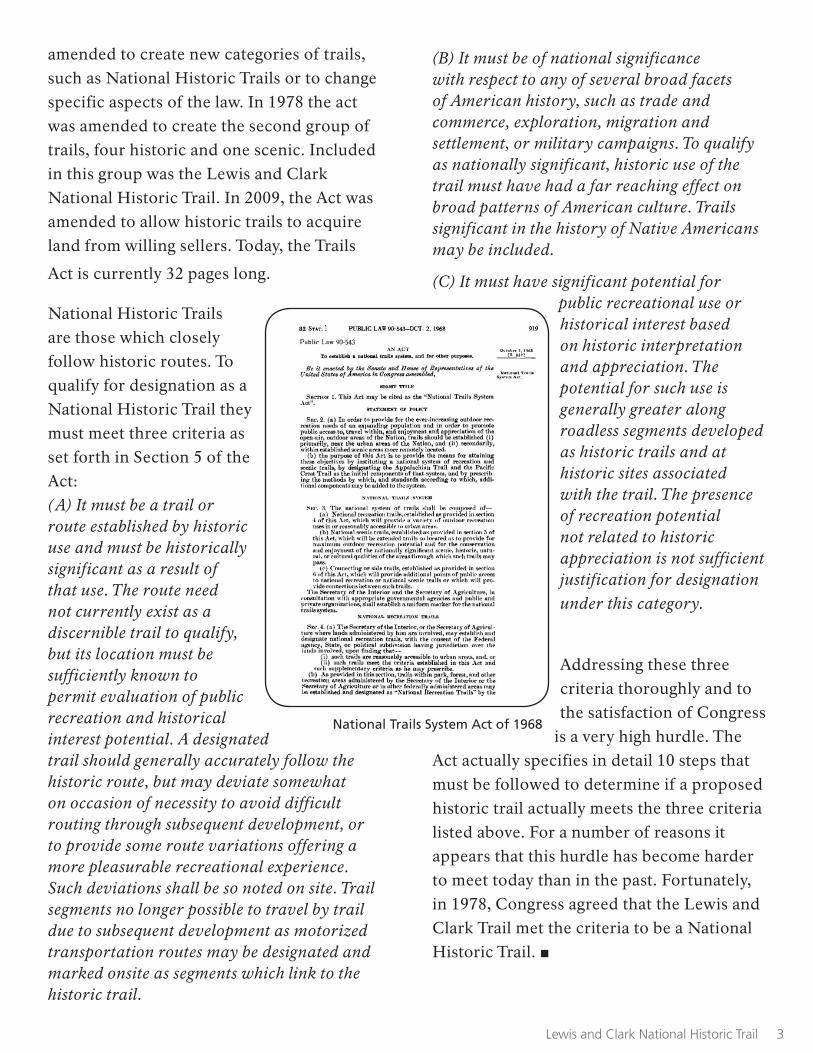
National Trails System Act of 1968
Volunteers-in-Action 9,063 Hours of Service
Volunteers are the lifeblood of the Lewis and Clark National Historic Trail. They selflessly dedicate their lives for the betterment of the organization and the community. Lewis and Clark National Historic Trail applauds Volunteer Managers along the trail who honor and celebrate their volunteers. Volunteers give so much in
so many ways, like Ms. Webster. Join me in celebrating Persis Webster, who gave 9,063 hours of her time to the Lewis and Clark National Historic Trail Interpretive Center in Great Falls, Montana. She is a testament to the power of service. Congratulations on your retirement, Persis!
Nichole McHenry,
Volunteer Program Manager
184 The Trail Companion Lewis and Clark National Historic Trail 5
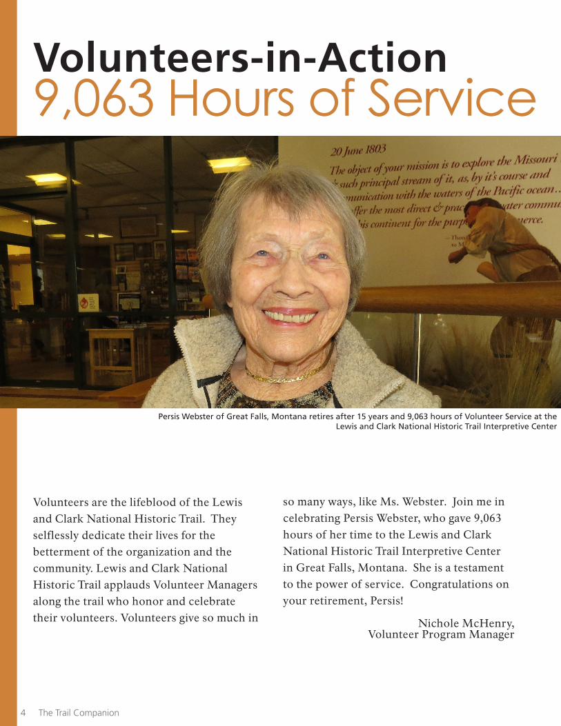
Persis Webster of Great Falls, Montana retires after 15 years and 9,063 hours of Volunteer Service at the Lewis and Clark National Historic Trail Interpretive Center
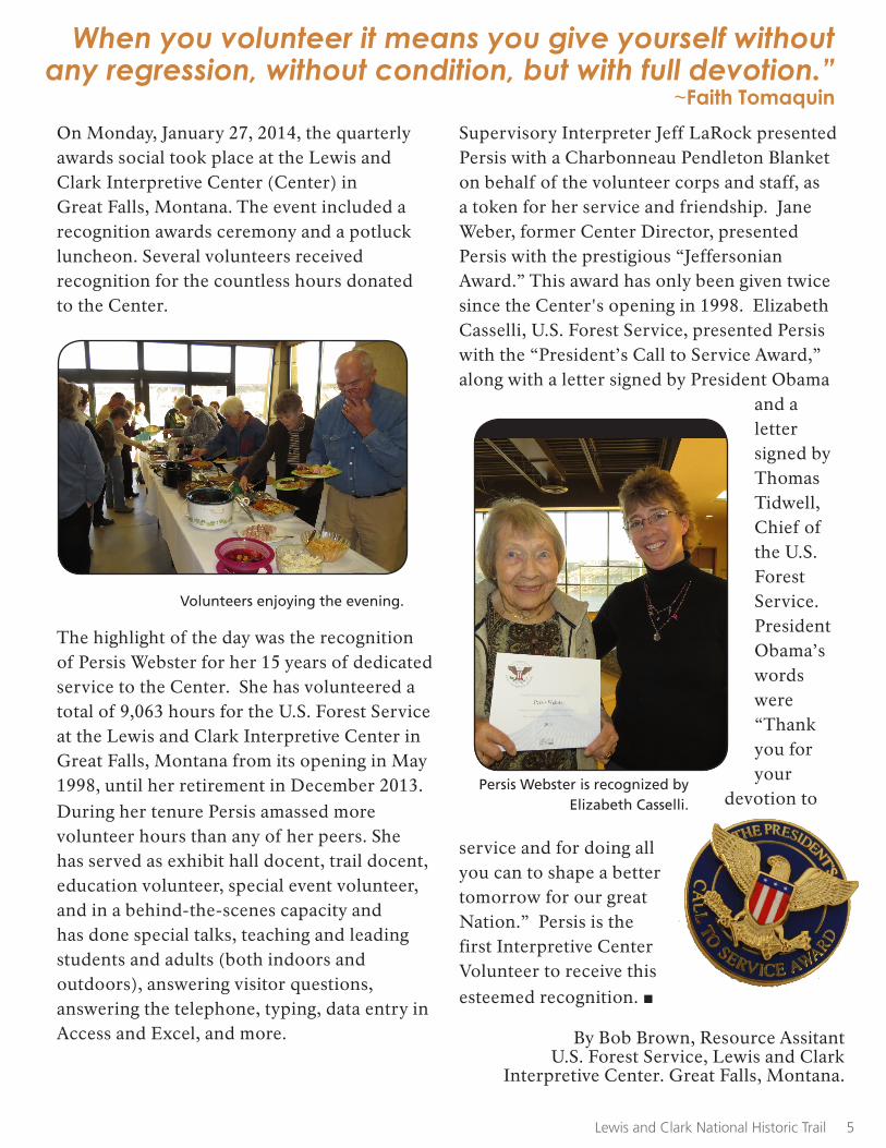
Supervisory Interpreter Jeff LaRock presented Persis with a Charbonneau Pendleton Blanket on behalf of the volunteer corps and staff, as a token for her service and friendship. Jane Weber, former Center Director, presented Persis with the prestigious “Jeffersonian Award.” This award has only been given twice since the Center's opening in 1998. Elizabeth Casselli, U.S. Forest Service, presented Persis with the “President’s Call to Service Award,” along with a letter signed by President Obama
and a letter signed by Thomas Tidwell, Chief of the U.S. Forest Service. President Obama’s words were “Thank you for your
devotion to
service and for doing all you can to shape a better tomorrow for our great Nation.” Persis is the first Interpretive Center Volunteer to receive this esteemed recognition. ■
On Monday, January 27, 2014, the quarterly awards social took place at the Lewis and Clark Interpretive Center (Center) in Great Falls, Montana. The event included a recognition awards ceremony and a potluck luncheon. Several volunteers received recognition for the countless hours donated to the Center.
The highlight of the day was the recognition of Persis Webster for her 15 years of dedicated service to the Center. She has volunteered a total of 9,063 hours for the U.S. Forest Service at the Lewis and Clark Interpretive Center in Great Falls, Montana from its opening in May 1998, until her retirement in December 2013. During her tenure Persis amassed more volunteer hours than any of her peers. She has served as exhibit hall docent, trail docent, education volunteer, special event volunteer, and in a behind-the-scenes capacity and has done special talks, teaching and leading students and adults (both indoors and outdoors), answering visitor questions, answering the telephone, typing, data entry in Access and Excel, and more.
Volunteers enjoying the evening.
Persis Webster is recognized by Elizabeth Casselli.
Lewis and Clark National Historic Trail 5
When you volunteer it means you give yourself without any regression, without condition, but with full devotion.”
~Faith Tomaquin
By Bob Brown, Resource Assitant U.S. Forest Service, Lewis and Clark
Interpretive Center. Great Falls, Montana.
16
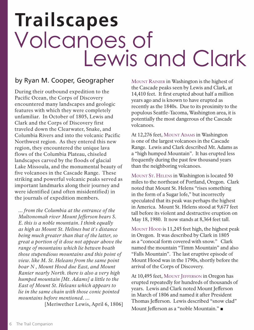
MouNt rAiNier in Washington is the highest of the Cascade peaks seen by Lewis and Clark, at 14,410 feet. It first erupted about half a million years ago and is known to have erupted as recently as the 1840s. Due to its proximity to the populous Seattle-Tacoma, Washington area, it is potentially the most dangerous of the Cascade volcanoes. At 12,276 feet, MouNt AdAMs in Washington is one of the largest volcanoes in the Cascade Range. Lewis and Clark described Mt. Adams as a “high humped Mountain”. It has erupted less frequently during the past few thousand years than the neighboring volcanoes.
MouNt st. HeleNs in Washington is located 50 miles to the northeast of Portland, Oregon. Clark noted that Mount St. Helens “rises something in the form of a Sugar lofe,” but incorrectly speculated that its peak was perhaps the highest in America. Mount St. Helens stood at 9,677 feet tall before its violent and destructive eruption on May 18, 1980. It now stands at 8,364 feet tall.
MouNt Hood is 11,245 feet high, the highest peak in Oregon. It was described by Clark in 1805 as a “conocal form covered with snow.” Clark named the mountain “Timm Mountain” and also “Falls Mountain”. The last eruptive episode of Mount Hood was in the 1790s, shortly before the arrival of the Corps of Discovery.
At 10,495 feet, MouNt JeffersoN in Oregon has erupted repeatedly for hundreds of thousands of years. Lewis and Clark noted Mount Jefferson in March of 1806 and named it after President Thomas Jefferson. Lewis described “snow clad” Mount Jefferson as a “noble Mountain.” ■
6 The Trail Companion
Volcanoes of Lewis and Clark
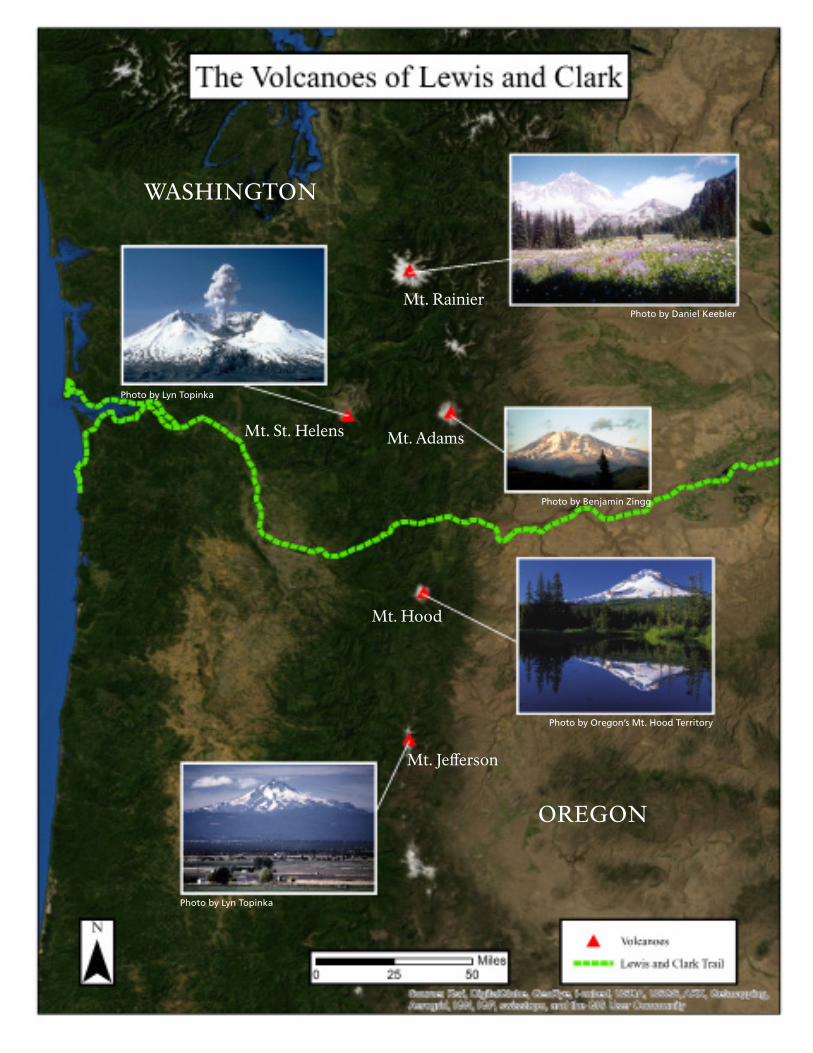
During their outbound expedition to the Pacific Ocean, the Corps of Discovery encountered many landscapes and geologic features with which they were completely unfamiliar. In October of 1805, Lewis and Clark and the Corps of Discovery first traveled down the Clearwater, Snake, and Columbia Rivers and into the volcanic Pacific Northwest region. As they entered this new region, they encountered the unique lava flows of the Columbia Plateau, chiseled landscapes carved by the floods of glacial Lake Missoula, and the monumental beauty of five volcanoes in the Cascade Range. These striking and powerful volcanic peaks served as important landmarks along their journey and were identified (and often misidentified) in the journals of expedition members.
... from the Columbia at the entrance of the Multonomah river Mount Jefferson bears S. E. this is a noble mountain. I think equally as high as Mount St. Helines but it's distance being much greater than that of the latter, so great a portion of it dose not appear above the range of mountains which lie betwen boath those stupendious mountains and this point of view. like M. St. Heleans from the same point boar N , Mount Hood due East, and Mount Ranier nearly North. there is also a very high humped mountain [Mt. Adams] a little to the East of Mount St. Heleans which appears to lie in the same chain with those conic pointed mountains before mentioned. ...
[Meriwether Lewis, April 6, 1806]
by Ryan M. Cooper, Geographer
Trailscapes
17
WASHINGTON
OREGON
Mt. Rainier
Mt. Adams
Mt. Hood
Mt. Jefferson
Mt. St. Helens
Photo by Daniel Keebler
Photo by Lyn Topinka
Photo by Benjamin Zingg
Photo by Lyn Topinka
Photo by Oregon’s Mt. Hood Territory
Lewis and Clark National Historic Trail 9
The TrailheadOne Section at a Time
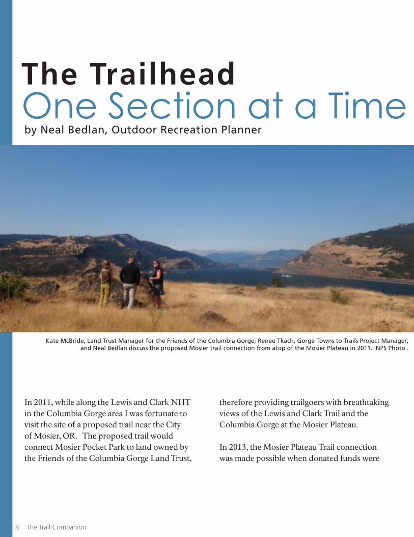
In 2011, while along the Lewis and Clark NHT in the Columbia Gorge area I was fortunate to visit the site of a proposed trail near the City of Mosier, OR. The proposed trail would connect Mosier Pocket Park to land owned by the Friends of the Columbia Gorge Land Trust,
by Neal Bedlan, Outdoor Recreation Planner
8
therefore providing trailgoers with breathtaking views of the Lewis and Clark Trail and the Columbia Gorge at the Mosier Plateau.
In 2013, the Mosier Plateau Trail connection was made possible when donated funds were
8 The Trail Companion
Kate McBride, Land Trust Manager for the Friends of the Columbia Gorge; Renee Tkach, Gorge Towns to Trails Project Manager; and Neal Bedlan discuss the proposed Mosier trail connection from atop of the Mosier Plateau in 2011. NPS Photo .
Lewis and Clark National Historic Trail 9
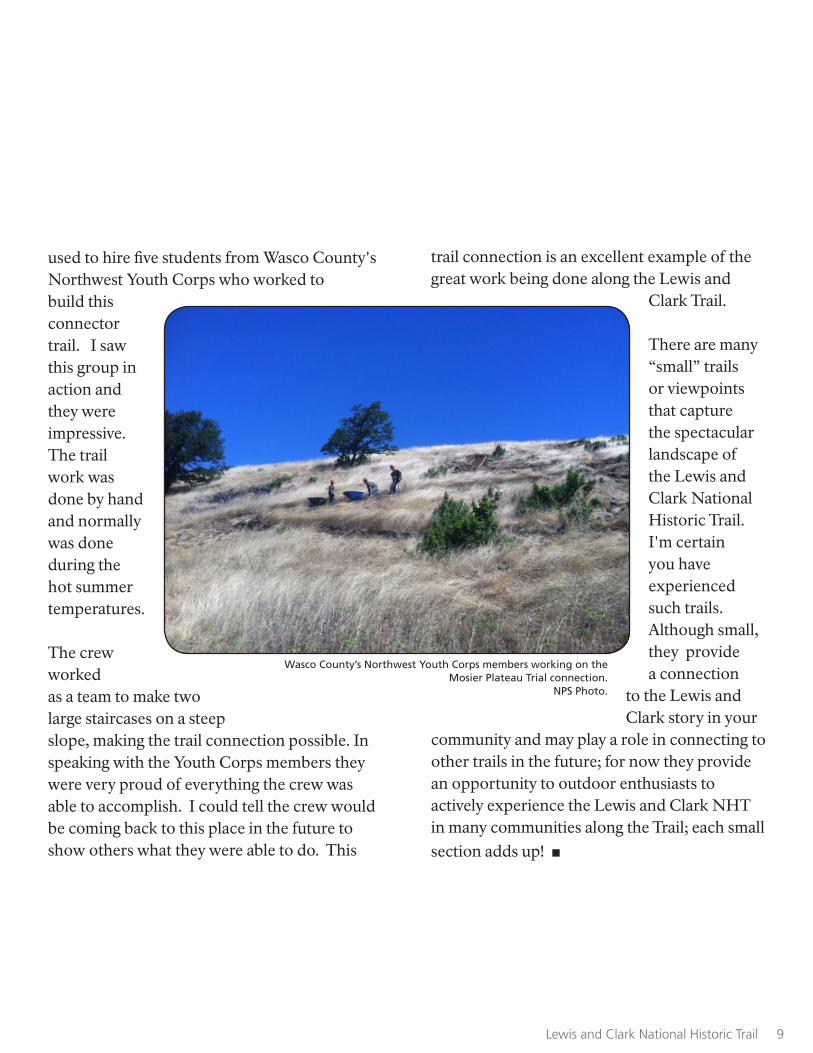
used to hire five students from Wasco County's Northwest Youth Corps who worked to build this connector trail. I saw this group in action and they were impressive. The trail work was done by hand and normally was done during the hot summer temperatures.
The crew worked as a team to make two large staircases on a steep slope, making the trail connection possible. In speaking with the Youth Corps members they were very proud of everything the crew was able to accomplish. I could tell the crew would be coming back to this place in the future to show others what they were able to do. This
trail connection is an excellent example of the great work being done along the Lewis and
Clark Trail.
There are many “small” trails or viewpoints that capture the spectacular landscape of the Lewis and Clark National Historic Trail. I'm certain you have experienced such trails. Although small, they provide a connection
to the Lewis and Clark story in your
community and may play a role in connecting to other trails in the future; for now they provide an opportunity to outdoor enthusiasts to actively experience the Lewis and Clark NHT in many communities along the Trail; each small section adds up! ■
Wasco County’s Northwest Youth Corps members working on the Mosier Plateau Trial connection.
NPS Photo.
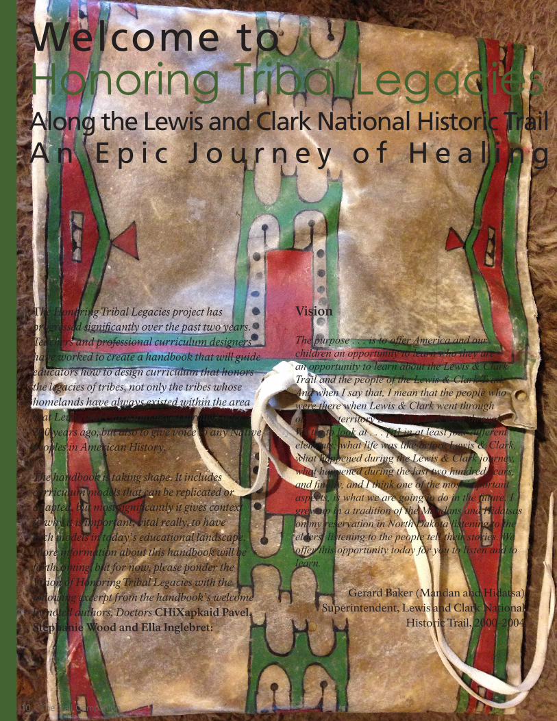
Welcome to Honoring Tribal LegaciesAlong the Lewis and Clark National Historic TrailA n E p i c J o u r n e y o f H e a l i n g
The Honoring Tribal Legacies project has progressed significantly over the past two years. Teachers and professional curriculum designers have worked to create a handbook that will guide educators how to design curriculum that honors the legacies of tribes, not only the tribes whose homelands have always existed within the area that Lewis and Clark journeyed through over 200 years ago, but also to give voice to any Native peoples in American History.
The handbook is taking shape. It includes curriculum models that can be replicated or adapted, but most significantly it gives context to why it is important, vital really, to have such models in today’s educational landscape. More information about this handbook will be forthcoming, but for now, please ponder the Vision of Honoring Tribal Legacies with the following excerpt from the handbook’s welcome by noted authors, Doctors CHiXapkaid Pavel, Stephanie Wood and Ella Inglebret:
Vision
The purpose . . . is to offer America and our children an opportunity to learn who they are – an opportunity to learn about the Lewis & Clark Trail and the people of the Lewis & Clark Trail. And when I say that, I mean that the people who were there when Lewis & Clark went through or whose territory Lewis & Clark went through. We try to look at . . . [it] in at least four different elements: what life was like before Lewis & Clark, what happened during the Lewis & Clark journey, what happened during the last two hundred years, and finally, and I think one of the most important aspects, is what we are going to do in the future. I grew up in a tradition of the Mandans and Hidatsas on my reservation in North Dakota listening to the elders, listening to the people tell their stories. We offer this opportunity today for you to listen and to learn.
Gerard Baker (Mandan and Hidatsa)Superintendent, Lewis and Clark National
Historic Trail, 2000-2004
Lewis and Clark National Historic Trail 1110 The Trail Companion
continued on page 12
This welcome serves as the foundation for the work that will become a part of a comprehensive handbook addressing the need to design curriculum honoring tribal legacies. The Handbook on Designing Curriculum Honoring Tribal Legacies: An Epic Journey of Healing will present a chance to embrace the spirit and vision of what has been accomplished to arrive at this point in history where appreciation, respect, and love of learning are interwoven to create a stronger, compassionate, and more resilient America. We need to revisit the history of the Lewis and Clark expedition (1804–06) to honor the past, present, and future voices of Tribal communities. Observations of the Bicentennial of the Corps of Discovery involved millions of taxpayer dollars, donations, and tribal resources invested in exhibitions, commemorative activities, research publications, and the recording of a vast collection of oral histories from representatives of more than forty tribes along the National Park Service’s Lewis and Clark National Historic Trail (hereafter referred to as the Trail). It takes time for this outpouring of interest and productivity to have a significant impact upon higher education, as well as on our classroom textbooks and therefore our students and society.
The Handbook will set forth the rationale for designing curriculum about honoring Native memory that was so very potent and vital in the past and yet still rings true in the present, and more importantly to our collective futures as a nation. The Handbook will embrace and confront all the influences that are brought to the forefront of curriculum planning, design
and adoption in a manner that reinvigorates the passion and commitment that so many educators had when they dreamed about becoming an amazing teacher. The Handbook will advance powerful curriculum expressions that invoke the Big Idea, convey Enduring Understandings, present Essential Questions, and ask and answer Entry Questions associated with honoring tribal legacies. The Handbook will advance a place-based multiliteracies framework to designing curriculum that conceptualizes teaching and learning as a holistic and dynamic process. Dynamic in that the process involves the interactions among many elements that can rekindle and maintain the curiosity that we are all born with and that should be cultivated in American classrooms, today and tomorrow. The Handbook will follow established precedents and plans of action already in progress that recognize the need for our classrooms, and indeed our society, to embrace an epic journey of healing to make sure that all of us are capable of addressing together the most pressing circumstances that the human population has ever faced in the history of civilization.
The Handbook will not address the all too real colonization and genocide that tribal communities experienced as a result of the Manifest Destiny policies of an expanding nation obsessed with staking out and claiming territory at all cost (Miller, 2008). It is not about the untold multitude of Native children who have suffered the intergenerational effects of historical trauma brought about by colonization and genocide. It is not about the highest suicide rates, abject poverty, lowest educational
Lewis and Clark National Historic Trail 11
attainment, teenage pregnancy, or substance abuse. Those realities haunt us every day. This Handbook is about honoring tribal legacies in order to embody the reality that tribal communities still exist despite the widespread long-term campaign to undermine their place in society and are still relevant today. It is a means to enjoy the power of positive thinking that there are teachings in honoring tribal legacies and to seize the opportunity to refocus our mind set to promote learning among Native and non-Native children in America’s classrooms.
In his bestseller, The Brain that Changes Itself: Stories of Personal Triumph from the Frontiers of Brain Science, Norman Doidge (2007) reminds us that the act of refocusing is essential to healing and so when we honor tribal legacies it is to refocus and tell a story not of tragedy but more so of the triumph, to look away from a deficient way of perceiving toward a more asset oriented perspective, and that death, dying and despair are counter balanced by life, living and joy. Such possibilities present us with many choices. It even expands the two futures expressed by Peter Diamandis and Steven Kotler (2012) in Abundance: The Future is Better than You Think where the choice might be to either revert to a luddite mode of living or to accept an amped up version of merging with technology to experience ultra-enhancement both physically and cognitively. Honoring tribal legacies may defy and transcend both time and space by embracing ancestral teachings to guide our futures; our dynamic of way of being is ever evolving yet steadfastly grounded and rooted in the existence of our ancestors who came before us. As a result, it cultivates a personal responsibility to care for those who will come after us. Why deny ourselves such a reality?
A Time to Honor Our Ancestors Worldwide
…every culture honors its ancestors through ritual at some time during the year. Flowers, candles, greenery, and symbols of beauty are always used in one form or another. Such heartfelt offerings are a natural expression of the gratitude we feel for what we have received from those who have passed on. . . . We recognize that the gifts we are thankful for today have deep roots in the past.. . . . Indigenous peoples worldwide believe that these spirits literally stand behind us to support us . . . They believe these spirits are invested in seeing that the current generation and those to come can fulfill their dreams, or life purpose.
Angeles Arrien, 2011 Living in Gratitude: A Journey That Will
Change Your Life, p. 102
Honoring tribal legacies is about healing for the sake of goodness; a goodness extended to the young people of this world who need heroes and true stories of inspiration to aspire, to dream, and to strive to meaningfully contribute to the health and vitality of their communities each and every day. It is a bold and courageous act of kindness and consideration that oozes strength and integrity.
The ultimate reward, benefit and outcome will be more laughter, learning and loyalty all across this great country. Is that possible? Absolutely, it is possible. ■
12 The Trail Companion
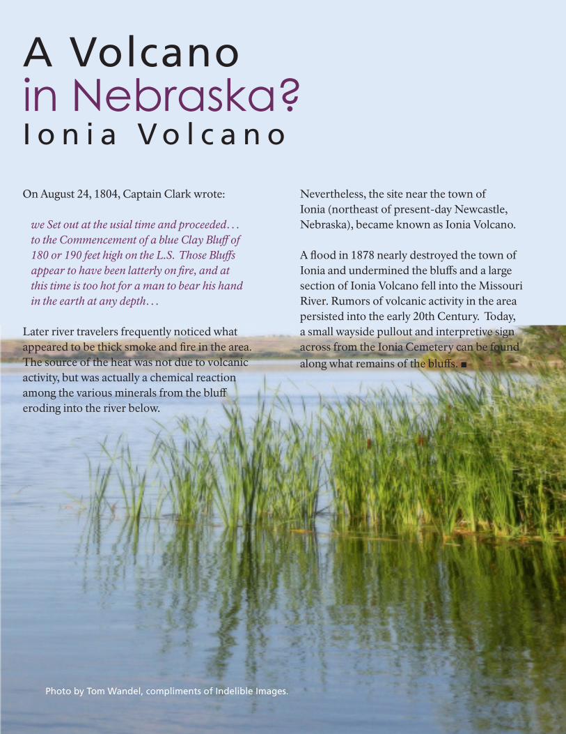
A Volcano in Nebraska? I o n i a V o l c a n o
On August 24, 1804, Captain Clark wrote:
we Set out at the usial time and proceeded…to the Commencement of a blue Clay Bluff of 180 or 190 feet high on the L.S. Those Bluffs appear to have been latterly on fire, and at this time is too hot for a man to bear his hand in the earth at any depth…
Later river travelers frequently noticed what appeared to be thick smoke and fire in the area. The source of the heat was not due to volcanic activity, but was actually a chemical reaction among the various minerals from the bluff eroding into the river below.
Nevertheless, the site near the town of Ionia (northeast of present-day Newcastle, Nebraska), became known as Ionia Volcano.
A flood in 1878 nearly destroyed the town of Ionia and undermined the bluffs and a large section of Ionia Volcano fell into the Missouri River. Rumors of volcanic activity in the area persisted into the early 20th Century. Today, a small wayside pullout and interpretive sign across from the Ionia Cemetery can be found along what remains of the bluffs. ■
Photo by Tom Wandel, compliments of Indelible Images.
Lewis and Clark National Historic Trail 1514 The Trail Companion
Captain Meriwether Lewis began in earnest his preparations for the expedition that bears his name when he visited the nation’s armory at Harpers Ferry in late March of 1803. He and his mentor, President Thomas Jefferson, had estimated his mission there would take about one week. It took four. As Lewis explained to Jefferson in his letter of April 20th from Lancaster, Pennsylvania, the most time-consuming task turned out to be the design, fabrication and testing of two prototype sections of an experimental
“collapsible” iron-framed boat he proposed to take on the expedition. He was supposed to head to Philadelphia as soon as his
business at the armory was finished, there to receive tutoring in the natural sciences, medicine and celestial navigation from some of the nation’s leading scientists. Lewis, however, prolonged his stay at Harpers Ferry in order to supervise the trial-and-error efforts of the ironworkers to get the design of the experimental vessel “just right.” That put him three weeks behind schedule. The absence of any diagrams or charts detailing the design of the unusual boat is both puzzling and disappointing. The papers and effects of Lewis and Jefferson have not yielded any such documents, nor have the records at Harpers Ferry or the War Department. Fortunately, posterity does have Lewis’s fairly detailed verbal description of the two prototype sections of the boat in his letter to President Jefferson on April 20, 1803. Lewis described one section as “Curved,” like the prow of a voyageur’s canoe; the other was straight and “Semi-cylindrical,” like the body of the same. The frame of the curved section contained 22 pounds of iron, as did that of the semi-cylindrical section; hence, the two sections required only 44
The Myth of Captain Lewis's Ultra-light Iron Boat
Little Known Factsof the Lewis & Clark Expeditionby Dr. H. Carl Camp
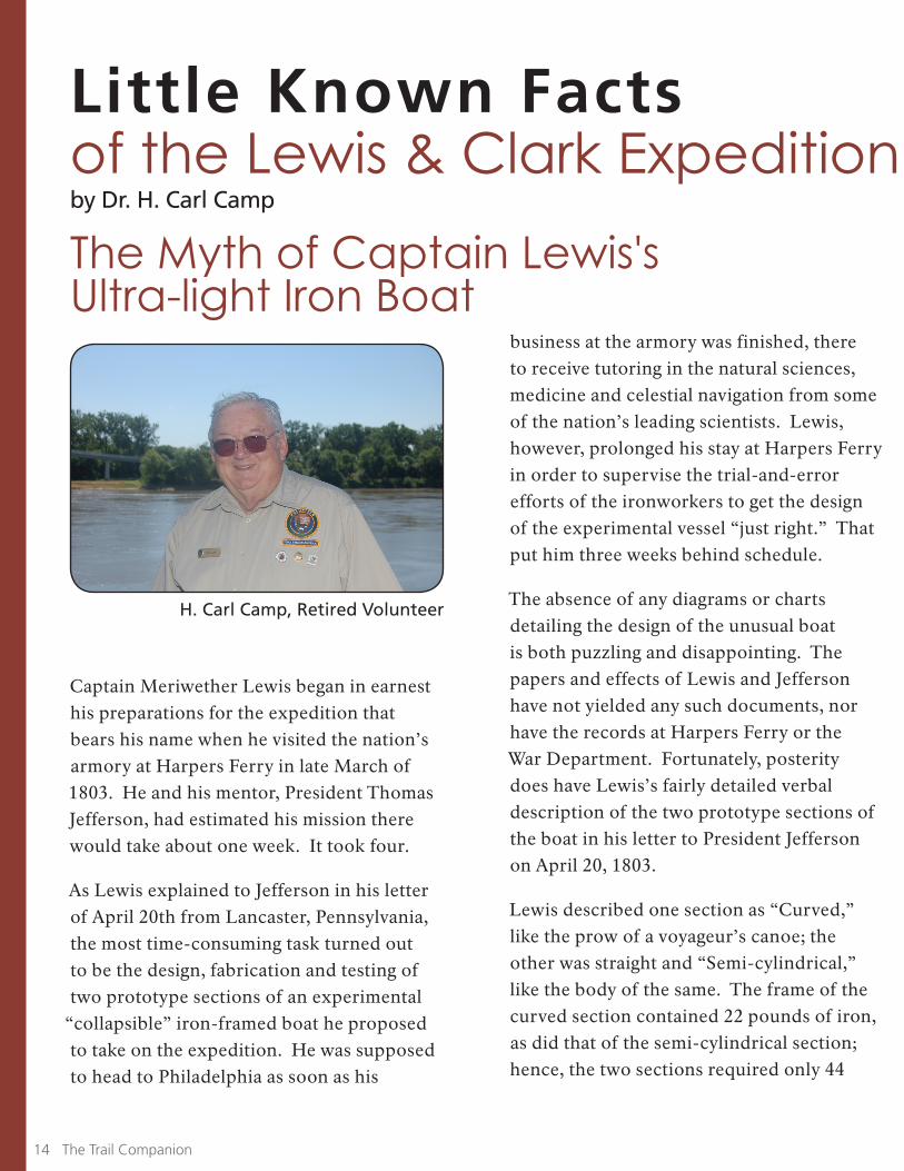
H. Carl Camp, Retired Volunteer
Lewis and Clark National Historic Trail 15
of the Lewis & Clark Expeditionpounds of iron to define the basic shape of the vessel. Hides to cover both sections added 55 pounds, for a total of 99 pounds up to that point in the fabrication process. Wood and bark used for thwarts, struts and reinforcements added another 63 pounds, meaning the combined weight of the two sections amounted to 162 pounds. In terms of length, the curved section figured out to be about 4 feet and 9 inches and the semi-cylindrical section came to 4 feet and 6 inches. In his letter from Lancaster to the president, Lewis triumphantly reported the merits of the boat: “Thus the weight of this vessel competent to a burthen [burden] of 1,770 lbs. amount[s] to no more than 99 lbs….” Well, not quite; Lewis was fudging the stats a little. That figure of 99 included 44 pounds of iron and 55 of hides, but it ignored the additional 63 pounds of wood and bark used in the two sections he tested at Harpers Ferry. Even so, whether at 99 pounds, or the actual weight of 162 pounds, the total weight was notably on the light side. Lewis’s highly selective description of the principal features of his “favorite boat” is undoubtedly the source of a durable myth that evolved over time into the popular perception of a collapsible iron-framed lightweight vessel of only 99 pounds or, according to some less observant interpreters, maybe as little as 44 pounds. What the later propagators of this duo of Lewis and Clark myths failed to realize was that those figures represented the weight
of only two sections of “the Experiment” (as the boat was called by members of the expedition). When fitted together, those two prototype sections would have produced a boat less than 10 feet long. However, as he prepared to launch the expedition, Lewis listed in his inventory of supplies and equipment
“1 Iron frame canoe 40 feet long.” Clearly, he contemplated an iron-framed boat composed of more than two sections. Nevertheless, the mythical dimensions of the iron boat, as it came to be called in later times, gained a firm foothold in the burgeoning literature about the Lewis and Clark expedition. It became entrenched as it was repeated over and over in a variety of publications. No less an authority on the expedition than Lewis’s biographer, Stephen E. Ambrose, repeated the myth in his influential book, Undaunted Courage. Even as late as 2004, otherwise knowledgeable authors were still touting the myth of the 99-pound iron boat. That this misreading, or misinterpretation, of the historical record assumed such mythical proportions in the Lewis and Clark saga is quite astonishing in view of the ready accessibility of the full complement of facts bearing upon the eventual assembly of the iron boat at the Great Falls of the Missouri in July of 1805. Much like the boat itself, all of the relevant facts awaited some sharp-eyed observer to come along and assemble them, thereby setting the record straight.
21
continued on page 17
Lewis and Clark National Historic Trail 17
Lewis and Clark National Historic TrailInteractive Trai l Atlas Give it a Try!
National Park Service U.S. Department of the Interior
Lewis and Clark National Historic Trail
Interactive Trail AtlasExplore the Trail! Plan your trip! Create and export your own custom maps.Dynamically display dozens of map layers, including the historic route and campsites of the Corps of Discovery, river channels, tribal homelands, auto tours, visitor centers, historic sites, and more.
www.lewisandclarktrailmap.comTrail Informationwww.nps.gov/lecl
Tutorialswww.youtube.com/lewisandclarknhtnps
16 The Trail Companion
Lewis and Clark National Historic Trail 17
Little Known Facts, continued from page 11
That long-delayed event finally took place. In a tightly-reasoned and well-written essay entitled “Meriwether Lewis’s Ingenious Iron Boat,” published in We Proceeded On (May 2003), Mark W. Jordan “put two-and-two together,” so to speak, and laid the foundation for dispelling the myth of Captain Lewis’s ultra-light iron boat. He combined the crucial data recorded in Lewis’s Lancaster letter to Jefferson with two vital pieces of information about the boat’s assembly at the falls: there Lewis wrote in his journal that the finished boat was 36 feet long; and Private Joseph Whitehouse wrote that it consisted of eight sections. Thus, the boat turned out to be somewhat shorter than the 40 feet Lewis listed in his inventory, and it definitely contained considerably more than the two sections tested at Harpers Ferry. Using the aforementioned set of data, Jordan by extrapolation persuasively deduced the likely weight and dimensions of “the
Experiment” once it was fully assembled. Two curved sections, the stem and stern, contained 44 pounds of iron (no surprise there), 50 pounds of hides and 62 pounds of wood and bark, for a combined weight of 156 pounds. The six remaining semi-cylindrical sections making up the boat’s body would have contained 132 pounds of iron, 180 pounds of hides (28 elk skins and 4 buffalo hides), 222 pounds of wood and bark, for a total of 534 pounds. Added together, the two curved and six semi-cylindrical sections weighed in all probability in the neighborhood of 690 pounds – considerably more than the 44 pounds, or 99 pounds, so long ensconced in the surprisingly durable myth. That should end the myth of Captain Lewis’s
“ultra-light collapsible iron boat,” but it probably will stick around a while longer given its tenacious grip on the popular imagination and given the usual difficulty of getting factual corrections into circulation. ■
Stephen E. Ambrose, Undaunted Courage: Meriwether Lewis, Thomas Jefferson and the Opening of the American West (New York: Simon & Schuster, 1996). Verne Huser, On the River with Lewis and Clark (College Station: Texas A & M University Press, 2004). Donald Jackson, ed., Letters of the Lewis and Clark Expedition, with Related Documents, 1783-1854, 2nd ed. (Urbana: University of Illinois Press, 1978), pp. 38-40. Mark W. Jordan, “Meriwether Lewis’s Ingenious Iron Boat,” We Proceeded On (Great Falls, MT: Lewis and Clark Trail Heritage Foundation, May 2003), pp. 25-35. Gary E. Moulton, ed., The Journals of the Lewis & Clark Expedition (Lincoln: University of Nebraska Press, 1983-2001), vol. 4, (Lewis), pp. 329-369; vol. 11 (Whitehouse), pp. 38-40.
sourCes:

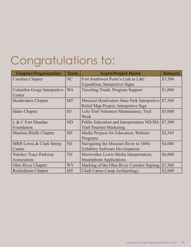
The Lewis and Clark Trail Heritage Foundation, headquartered in Great Falls, Montana, is pleased to announce this year’s grant recipients for the Bicentennial Trail Stewardship Endowment: A National Council of the Lewis and Clark Expedition Bicentennial Legacy Project. Ten grants have been awarded, for a total of $52,150 from the Endowment.
During the Lewis and Clark Bicentennial, the U.S. Mint issued and sold Lewis and Clark Expedition Bicentennial Commemorative Silver Dollars. Some of the proceeds from the sale of the coins were provided to the Lewis and Clark Trail Heritage Foundation to create an Endowment for the purpose of preservation, protection, and interpretation of the natural, historic, educational, and cultural resources of the Lewis and Clark National Historic Trail.
Ten grants were awarded to 6 chapters of the Lewis and Clark Trail Heritage Foundation and 4 other non-profit associations for projects at various locations along the Lewis and Clark National Historic Trail and with the Eastern Legacy. The projects are located in 9 different states and range from trail marking and historic
trail maintenance, to the development of interpretive signs and smart phone applications to enhance the reach of Lewis and Clark information to younger students of the Lewis and Clark story and in locations where there is currently no “on the ground” interpretation.
“I am so pleased that the Lewis and Clark Trail Heritage Foundation is able to contribute to projects that furthers the mission of the Foundation to preserve, promote, and teach the diverse heritage of Lewis and Clark for the benefit of all people.” said Margaret Gorski, President of the Lewis and Clark Trail Heritage Foundation.
“I am particularly pleased to see so many quality project applications this year that carry out the intent of the Trail Stewardship Endowment to preserve, protect, and interpret the resources along the Lewis and Clark National Historic Trail.”
The deadline for grant applications is October 1 for this annual program. For further information on the Lewis and Clark Trail Heritage Foundation and the Bicentennial Trail Stewardship Endowment Program, visit www.lewisandclark.org. ■
Lewis and Clark Trail Heritage Foundation Annouces Recipients
Lewis and Clark National Historic Trail 1918 The Trail Companion
by Margaret Gorski, President LCTHF and Chair of the Bicentennial Trail Stewardship Advisory Committee
Lewis and Clark National Historic Trail 19
Chapter/Organization State Grant/Project Name AmountCarolina Chapter NC Fort Southwest Point’s Link to L&C
Expedition; Interpretive Signs$7,500
Columbia Gorge Interpretive Center
WA Traveling Trunk; Program Support $1,000
Headwaters Chapter MT Missouri Headwaters State Park Interpretive Relief Map Project; Interpretive Sign
$7,500
Idaho Chapter ID Lolo Trail Volunteer Maintenance; Trail Work
$5,000
L & C Fort Mandan Foundation
ND Public Education and Interpretation ND/SD; Trail/Tourism Marketing
$7,500
Manitou Bluffs Chapter SD Media Projects for Education; Website/Programs
$3,545
MRB Lewis & Clark Interp. Center
NE Navigating the Missouri River in 1804; Exhibitry Software Development
$4,000
Natchez Trace Parkway Association
TN Meriwether Lewis Media Interpretation; Smartphone Applications
$6,000
Ohio River Chapter WV Marking of the Ohio River Corridor Signing $7,500Rochejhone Chapter MT Clark Canoe Camp Archaeology $2,600
Congratulations to:
Lewis and Clark Brochure"Let Me Show You..."
Lewis and Clark National Historic Trail 2120 The Trail Companion
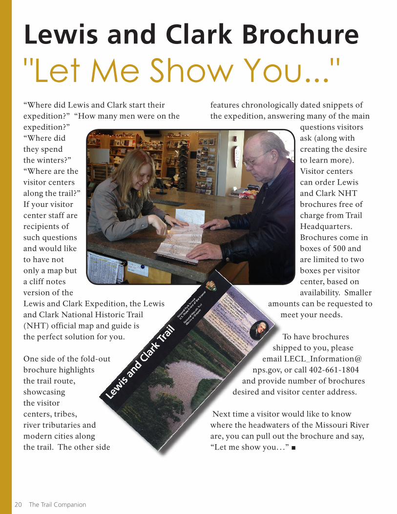
“Where did Lewis and Clark start their expedition?” “How many men were on the expedition?” “Where did they spend the winters?” “Where are the visitor centers along the trail?” If your visitor center staff are recipients of such questions and would like to have not only a map but a cliff notes version of the Lewis and Clark Expedition, the Lewis and Clark National Historic Trail (NHT) official map and guide is the perfect solution for you.
One side of the fold-out brochure highlights the trail route, showcasing the visitor centers, tribes, river tributaries and modern cities along the trail. The other side
features chronologically dated snippets of the expedition, answering many of the main
questions visitors ask (along with creating the desire to learn more). Visitor centers can order Lewis and Clark NHT brochures free of charge from Trail Headquarters. Brochures come in boxes of 500 and are limited to two boxes per visitor center, based on availability. Smaller
amounts can be requested to meet your needs.
To have brochures shipped to you, please
email [email protected], or call 402-661-1804
and provide number of brochures desired and visitor center address.
Next time a visitor would like to know where the headwaters of the Missouri River are, you can pull out the brochure and say, “Let me show you…” ■
Lewis and Clark National Historic Trail 21
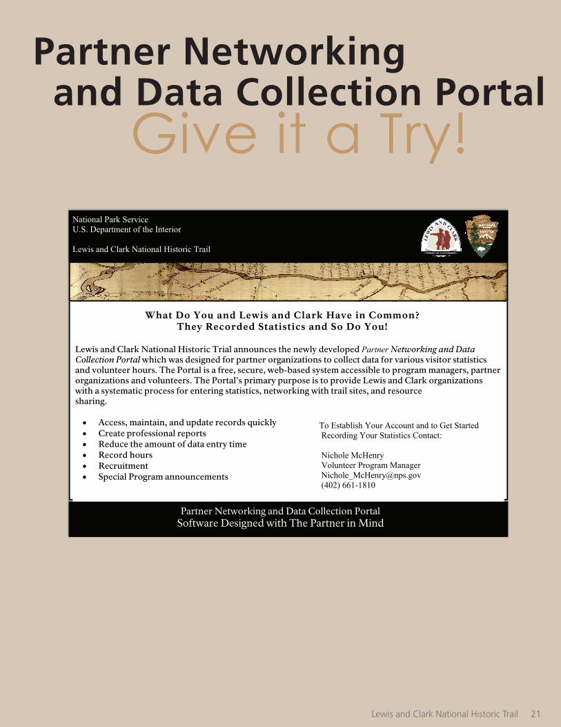
Partner Networking and Data Collection Portal Software Designed with The Partner in Mind
National Park Service U.S. Department of the Interior Lewis and Clark National Historic Trail
What Do You and Lewis and Clark Have in Common?
They Recorded Statistics and So Do You!
Lewis and Clark National Historic Trial announces the newly developed Partner Networking and Data Collection Portal which was designed for partner organizations to collect data for various visitor statistics and volunteer hours. The Portal is a free, secure, web-based system accessible to program managers, partner organizations and volunteers. The Portal’s primary purpose is to provide Lewis and Clark organizations with a systematic process for entering statistics, networking with trail sites, and resource sharing. Access, maintain, and update records quickly Create professional reports Reduce the amount of data entry time Record hours Recruitment Special Program announcements
To Establish Your Account and to Get Started Recording Your Statistics Contact: Nichole McHenry Volunteer Program Manager [email protected] (402) 661-1810
Partner Networking and Data Collection Portal
Give it a Try!
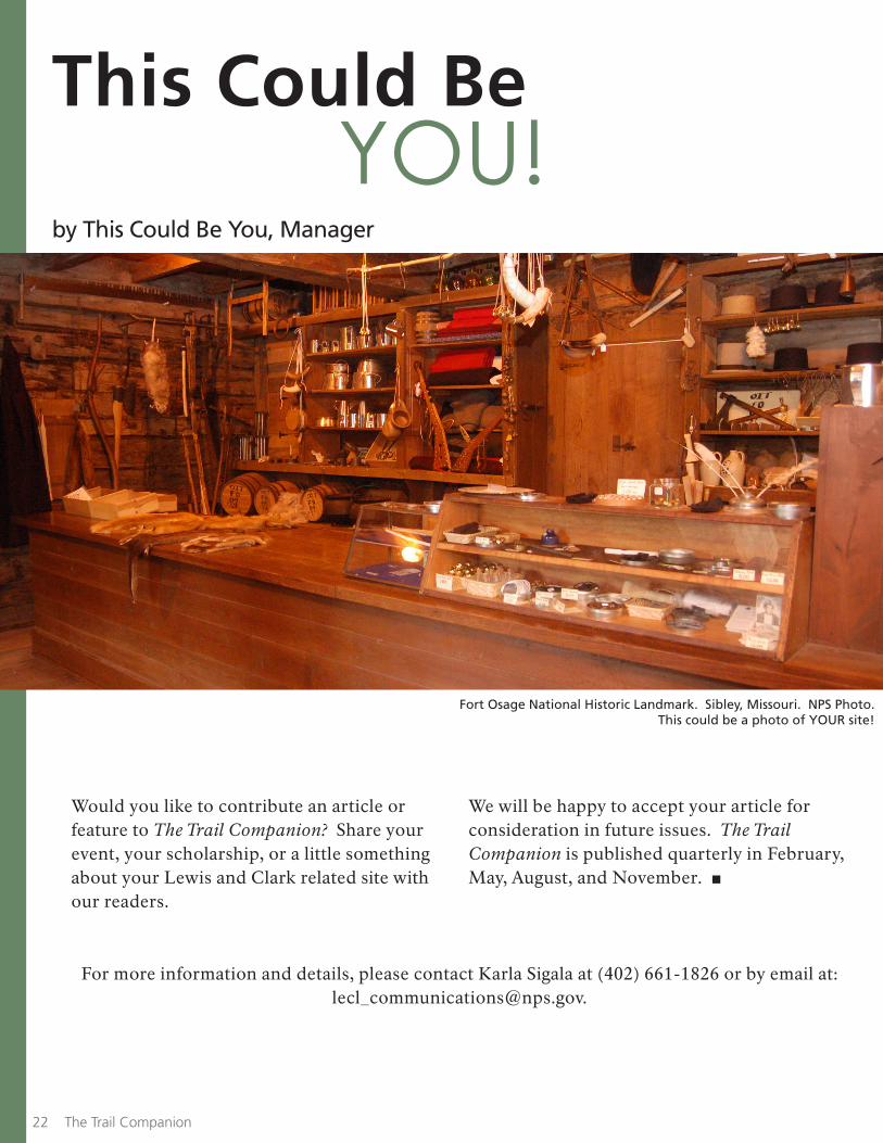
This Could BeYOU!
Would you like to contribute an article or feature to The Trail Companion? Share your event, your scholarship, or a little something about your Lewis and Clark related site with our readers.
We will be happy to accept your article for consideration in future issues. The Trail Companion is published quarterly in February, May, August, and November. ■
Fort Osage National Historic Landmark. Sibley, Missouri. NPS Photo.This could be a photo of YOUR site!
For more information and details, please contact Karla Sigala at (402) 661-1826 or by email at: [email protected].
Lewis and Clark National Historic Trail 2322 The Trail Companion
by This Could Be You, Manager

Subscribe or Update Y o u r P r o f i l e to Stay InformedIn an effort to better serve you, we are taking steps to improve our mailing list. To conserve resouces, much of our communication efforts have transitioned to digital format. Periodically we still send hardcopy announcements on various topics. Having an accurate email and surface mailing address
Click Here to Subscribe or Update Your Profile
your e-mail address
will ensure that we can reach you effectively. Please take this opportunity to either subscribe or update your contact information and provide us with your interests. For questions, contact Karla Sigala, Editor at (402) 661-1826 or at: [email protected].
Do You Have a Passport Stamp?
“Excuse me, do you have a passport stamp?” You may not work for customs in a foreign country, but chances are if your site is in on the Lewis and Clark National Historic Trail, you have been asked this question. And if you haven’t been, you will be!
The National Park Passport books are a growing trend, and more and more visitors are seeking cancellations for their books. Your site can become a part of this experience by having its own, personalized cancellation stamp. The stamp will say “Lewis and Clark National Historic Trail,” and have your location and the current date on it. Even if you just need a replacement, just let us know!
If you’re interested in obtaining a stamp, please contact Lewis and Clark NHT Interpretive Specialist Karla Sigala at
402-661-1826 or via email at [email protected].
Lewis and Clark National Historic Trail 23
Superintendent, Mark Weekley
Columns:Trailhead, Neal BedlanTrailscapes, Ryan CooperVolunteers in Action, Nichole McHenry
Would you like to contribute an article or feature to The Trail Companion? Share the good work you are doing.
We will be happy to accept your article for consideration in future issues. The Trail Companion is published quarterly in February, May, August, and November.
Please contact the Editor, Karla Sigala at: [email protected]
The Trail Companion
Tracing the courses of the Missouri and Columbia Rivers, the Lewis and Clark National Historic Trail stretches through 11 states. The Trail winds over mountains, along rivers, through plains and high deserts, and extends to the wave-lapped Pacific coast. In this diversity of landscapes, visitors to the Trail create their own journeys of discovery.
Lewis and Clark National Historic Trail601 Riverfront DriveOmaha, Nebraska 68102
Phone402 661-1804 - visitor center402 661-1814 - administration
E-mail [email protected] Internet www.nps.gov/lecl
Visitor Center at Trail Headquarters
Summer HoursMay through October• Monday - Friday, 8 am to 5 pm • Saturday - Sunday, 9 am to 5 pm
Winter HoursNovember through April• Monday - Friday, 8 am to 4:30 pm• Saturday - Sunday, Closed
Missouri River at sunset. Great Falls, Montana