Embed Size (px)
Citation preview

The U.S.A.’s Next Generation Geostationary Weather Satellites
TRAINING GOES-R Amanda M. Terborg - Satellite Meteorologist NOAA/Aviation Weather Center Leroy Spayd and Tony Mostek – NOAA Office of the Chief Learning Officer Wendy Shreiber-Abshire – UCAR’s COMET program Scott Lindstrom – University of Wisconsin/CIMSS Bernie Connell – Colorado State University/CIRA

OVERVIEW • What is the GOES-R training plan for forecasters in the United States?
• Foundational Applications Continuous learning
• Satellite Training Advisory Team (STAT)
• What training resources are widely available?
• COMET domestic and international
• SATURN WMO training portal
• VISIT modules and chats
• Data visualization tools
• Useful links

National plan Satellite Training Advisory Team (STAT)
The U.S.A.’s GOES-R training plan

4
SATELLITE TRAINING TIMELINE
FY15 Mar 2017 Launch 2018 & Beyond
Nov 4 2016 Launch
Application Prerequisites Making
it Stick
Data
Foundation Exercise Continuous Learning
Training Stages ‒ Prerequisites – overall basics ‒ Foundation – satellite specifics ‒ Application – operational setting ‒ Exercise – simulations, practice ‒ Making it Stick – multi-situational, sharing ‒ Continuous Learning – evolve and update

5

STAT - SATELLITE TRAINING AND ADVISORY TEAM
Brian Carcione – Huntsville, AL
Frank Alsheimer – Columbia, SC
Dan Nietfeld – Omaha, NE / Boulder, CO
Mike Stavish – Medford, OR
Nat Eckstein – Anchorage, AK
Mike DeWeese – Chanhassen, MN
NCEP SOOs – Bruce Entwistle (AWC)/Chris Landsea (NHC)
• Field connection - provide the team with ops perspective and input.
• STAT prepared plan and is reviewing modules in Foundational Course

Current GOES Data Volume
ABI Data Volume
7
5X Faster coverage (5-minute full disk vs. 25-minute)
4X Improved spatial resolution (2 km IR vs. 4 km)
3X More spectral bands (16 on ABI vs. 5 on current imager)
ADVANCED BASELINE IMAGER The ABI : a game-changing instrument, scanning more wavelengths faster and with better spatial resolution
GOES-R will send about 1 terabyte of data daily!! ~60-fold increase
SATELLITE FOUNDATIONAL COURSE - GOES-R

SATELLITE FOUNDATIONAL COURSE • GOESR Introduction and SatMet Background Track (240 minutes)
- Basic principles of radiation (15 minutes)
- Basic operation of the GOES-R satellites (15 minutes)
- Spectral bands (90 minutes)
- Multichannel interpretation approaches (30 minutes)
- Baseline products (90 minutes)
• Geostationary Lightning Mapper Track (40 minutes)
• Mesoscale/Convection Track (120 minutes)
• Synoptic Features Track (80 minutes)
• NWP/Data Assimilation Track (30 minutes)
• Interactive Lessons and Simulations - Provide an opportunity to view & interact with the GOES- R imagery & products to firmly establish understanding and interpretation.
8
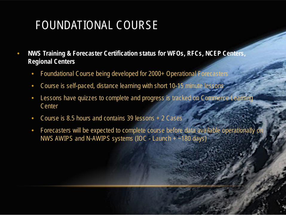
FOUNDATIONAL COURSE
• NWS Training & Forecaster Certification status for WFOs, RFCs, NCEP Centers, Regional Centers
• Foundational Course being developed for 2000+ Operational Forecasters
• Course is self-paced, distance learning with short 10-15 minute lessons
• Lessons have quizzes to complete and progress is tracked on Commerce Learning Center
• Course is 8.5 hours and contains 39 lessons + 2 Cases
• Forecasters will be expected to complete course before data available operationally on NWS AWIPS and N-AWIPS systems (IOC - Launch + ~180 days)

GOES-R TIMELINE
• Launch date is November 4, 2016
• Upon successful launch and orbit, Foundational Course is announced.
• There will be about 4 months to complete course prior to actual data feed and test period starting in March 2017.
• Initial GOES-R Data at WFO’s = Feb 2017 ABI Channels
• GLM & Derived Products will take longer up to 6 months.
• Operational test & evaluation phase begins March until September ?? While GOES-R is at Central Position.

STAT TRACKING DOC
Development of Satellite Foundational Course - GOES-R
• 39 modules + 2 cases
• Each 10-15 min
• Total time 8.5 hrs.
• Called “GOES-R Satellite Foundational” in CLC/LMS
11F-11

CONCERNS AND FOCUSING LOCAL… • Forecaster time concerns
• One plan doesn’t exactly fit all • 128 Weather Forecast Offices
• Half a dozen River Forecast Centers
• 12 Central Weather Service Units (aviation)
• ~9 National Centers
• Multiple types of training • Modules
• One on one training
• Quick guides
• Mini case studies
• Train the trainer one forecaster to another
12

Training material availability for international users
Where can training resources be found?

Course and lessons
COMET and METED

COMET MetEd Website
www.meted.ucar.edu
Online Lessons: (as of 1 Aug 2016) • 410 English, 135 Spanish, 58 French, and others • 87 of the lessons are on Satellite
Meteorology Registered Users: • > 450,000, growing ~5,000/month • ~52,000 return users each year complete
~5.7 hours of instruction annually Sponsors: • NESDIS GOES-R and JPSS fund satellite
training at COMET and attract additional funding and in kind support from both EUMETSAT and the Meteorological Service of Canada

Full GOES-R Specific Lessons: English and Spanish
• The short movies from the first introductory lesson are also available on our YouTube Channel https://www.youtube.com/user/cometmeted
• These 3 lessons are all available in English and Spanish

GOES-R TRAINING EN ESPAÑOL
17
https://www.meted.ucar.edu/
Additional COMET modules are available in Spanish in topic areas related to climate, satellite data and applications, dust, tropical meteorology, volcanic ash, fire, space weather and more!

Mini Foundational Lessons in Support of NWS GOES-R Training
• COMET is responsible for 8 of the 40 elements in the Satellite Foundation GOES-R Course • All 8 will be complete and in NOAA LMS before GOES-R launch
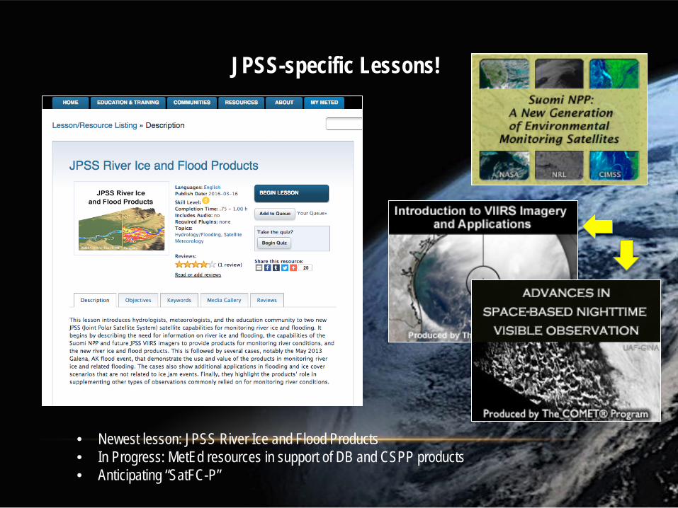
JPSS-specific Lessons!
• Newest lesson: JPSS River Ice and Flood Products • In Progress: MetEd resources in support of DB and CSPP products • Anticipating “SatFC-P”

20
Ocean Theme: (Lessons Sponsored by EUMETSAT & NESDIS)
Advanced level lesson. Just over 1-hr long. Includes:
Scatterometer & Altimeter Basics
Computing Wind Estimates
Rain Effects
Key Applications
Case Studies
• One of 5 lessons developed in collaboration with EUMETSAT

21
Climate Theme:
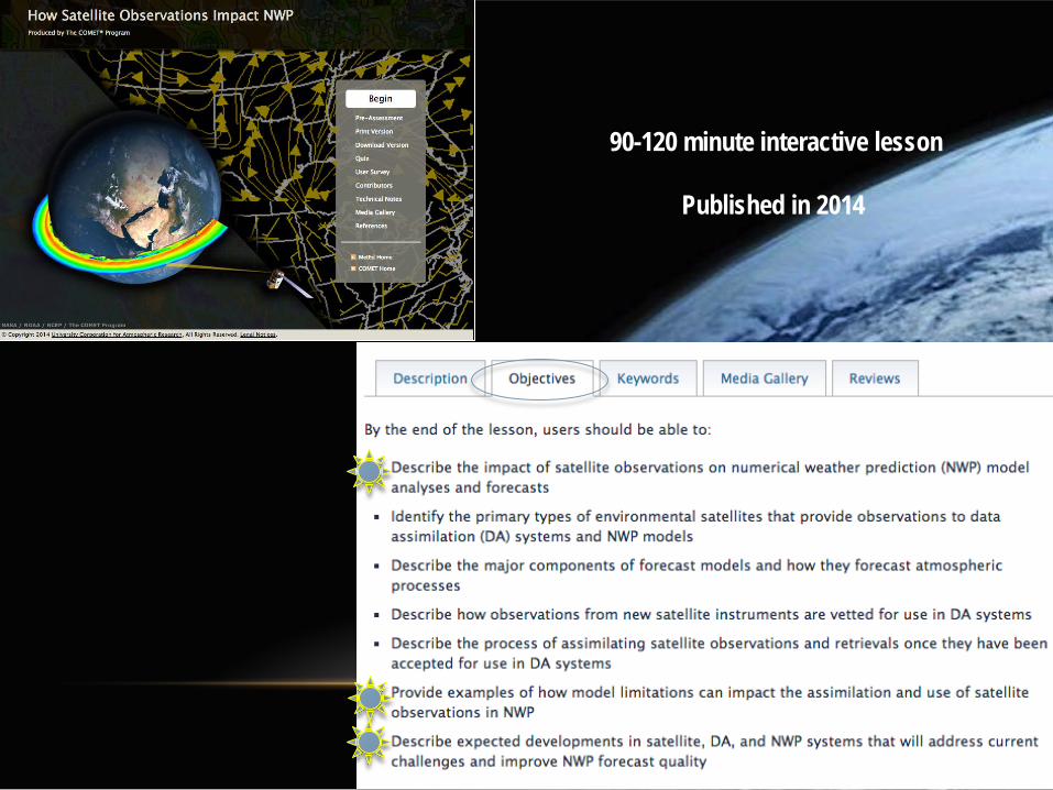
90-120 minute interactive lesson
Published in 2014


25
Water Vapour Interpretation Training: MSC

1
4
2
or


WMO Satellite User Readiness Navigator
SATURN

SATELLITE USER READINESS NAVIGATOR (SATURN) • Portal developed by WMO for all satellite user readiness, including GOES-R
https://www.wmo-sat.info/satellite-user-readiness/topic/satellites/goes-r/

Virtual Institute for Satellite Integration Training
VISIT

VIRTUAL INSTITUTE FOR SATELLITE INTEGRATION TRAINING (VISIT) • Portal developed by Colorado State and CIRA; contains lessons and chat calendar
http://rammb.cira.colostate.edu/training/visit/

VIRTUAL INSTITUTE FOR SATELLITE INTEGRATION TRAINING (VISIT) • Only in English
http://rammb.cira.colostate.edu/training/visit/

McIDAS-V
Quick data visualization tools

MCIDAS-V DISPLAY OF GEONETCAST GEOTIFF
McIDAS-V is a FREE software package that can read a wide variety of data types, including netcdf, AREA, and GEOTIFF from GEONETCAST
http://www.ssec.wisc.edu/mcidas/software/v/

TO VISUALIZE GEONETCAST DATA IN MCIDAS-V, YOU WILL NEED:
• McIDAS-V • Latest version 1.6, available on http://www.ssec.wisc.edu/mcidas/software/v/
• GEONETCAST plugin for McIDAS-V, GNCA_Sep2016.jar • Reads GEOTIFFs into Mc-V • Provides typical color maps used with GNC
• Sample GNC-A data • Any GNC-A geotiff files should work • Sample Barbados files
• McIDAS-V Manipulating GeoTiffs tutorial • Step by step instructions on plugin installion • Guide to color maps locations • Guide to geotiff interrogation and analysis
• All material available on request

With the GEONETCAST plugin for McIDAS-V, the geotiff data can be viewed and interrogated via colors used with that system.
http://www.ssec.wisc.edu/mcidas/software/v/

CASE STUDIES AND LINKS FOR GOES-R/HIMAWARI IN MCIDAS-V
• McIDAS-V GNC plugin and sample geotiff data • ftp://rammftp.cira.colostate.edu/Connell/GNCA_Sept2016.jar • ftp://rammftp.cira.colostate.edu/Connell/GNCA/data/geotiff_GOES_EAST/ • ftp://rammftp.cira.colostate.edu/Connell/GNCA/Tutorials/McV_GeoTIFF_Aug2016.do
cx • McIDAS-V Himawari case
• ftp://rammftp.cira.colostate.edu/Connell/GNCA/data/AHI_examples • ftp://rammftp.cira.colostate.edu/Connell/GNCA/Tutorials/McV_ViewingHimawari8Ima
gery_Aug2016.docx • McIDAS-V GOES-R example
• ftp://rammftp.cira.colostate.edu/Connell/CMI_aug2016/ • ftp://rammftp.cira.colostate.edu/Connell/GNCA/Tutorials/McV_ViewingGOESR_CMI_
2Sept2016.docx • http://www.goes-r.gov/products/data/data-cloud-moisture-imagery.html

Modules, quick guides, and other information
Useful training links

More Resources
• ABI Band quick–guides are available now.
• http://www.goes-r.gov/education/outreach.html#FS
• Also quick guides for L2 baseline products
Resources -> Fact sheets
QUICK GUIDES

LINKS – RESOURCES COMET GOES-R links at goes-r.gov http://www.goes-r.gov/resources/links.html SATURN http://www.wmo-sat.info/product-access-guide/ Product Access Guide http://www.wmo-sat.info/satellite-user-readiness/ Satellite User Readiness Guide (SATURN) VISIT http://rammb.cira.colostate.edu/training/visit/

LINKS – GLM/LIGHTNING GOES-R Program- http://www.goes-r.gov http://www.goes-r.gov/education/docs/Factsheet_GLM.pdf http://www.goes-r.gov/resources/docs.html (includes link to GLM ATBD) Lightning Facts/Lightning Resources
NWS- http://www.lightningsafety.noaa.gov/ NWS- http://www.weather.gov/iln/lightningsafetyweek NWA- http://www.nwas.org/committees/rs/ltng.html
Satellite Lightning Research and Data Sets
NASA MSFC- http://lightning.nsstc.nasa.gov/ http://lightning.nsstc.nasa.gov/data/data_lis-otd-climatology.html http://thunder.msfc.nasa.gov/data/data_lis-otd-climatology.html
NOAA NSSL- http://www.nssl.noaa.gov/education/svrwx101/lightning/ Lightning Forecasts
NOAA Rapid Refresh - http://rapidrefresh.noaa.gov/HRRR/Welcome.cgi NCAR Ensemble Forecasts (Hourly-Max)- http://ensemble.ucar.edu/
Lightning Training
COMET- https://www.meted.ucar.edu GOES-R GLM: Introduction to the Geostationary Lightning Mapper
NASA SPoRT- http://weather.msfc.nasa.gov/sport/training/

LINKS – REALTIME DATA (WEB AND SOFTWARE) McIDAS-V http://www.ssec.wisc.edu/mcidas/software/v/documentation.html GEO-CSPP http://cimss.ssec.wisc.edu/csppgeo/ CIMSS Real Earth – various global satellite imagery, FD ABI, GEO imagery (winds, etc.) http://realearth.ssec.wisc.edu/ CIRA RAMMB South America/Caribbean sectors http://rammb.cira.colostate.edu/ramsdis/online/rmtc.asp CIMSS RGB creation http://cimss.ssec.wisc.edu/goes/webapps/satrgb/overview.html
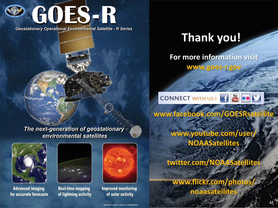
Thank you! For more information visit
www.goes-r.gov
www.facebook.com/GOESRsatellite
www.youtube.com/user/ NOAASatellites
twitter.com/NOAASatellites
www.flickr.com/photos/
noaasatellites 44