Embed Size (px)
Citation preview
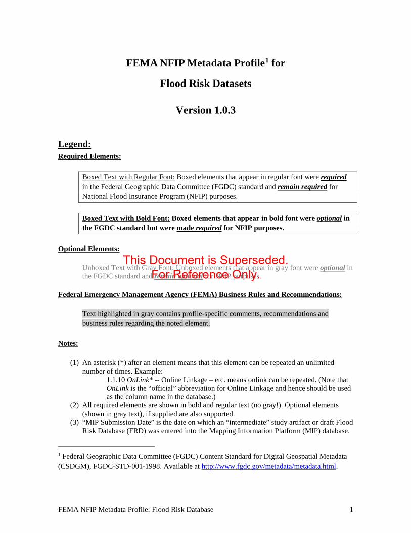
FEMA NFIP Metadata Profile1 for
Flood Risk Datasets
Version 1.0.3
Legend: Required Elements:
Boxed Text with Regular Font: Boxed elements that appear in regular font were required in the Federal Geographic Data Committee (FGDC) standard and remain required for National Flood Insurance Program (NFIP) purposes.
Boxed Text with Bold Font: Boxed elements that appear in bold font were optional in the FGDC standard but were made required for NFIP purposes.
Optional Elements:
Unboxed Text with Gray Font: Unboxed elements that appear in gray font were optional in the FGDC standard and remain optional for NFIP purposes.
Federal Emergency Management Agency (FEMA) Business Rules and Recommendations:
Text highlighted in gray contains profile-specific comments, recommendations and business rules regarding the noted element.
Notes:
(1) An asterisk (*) after an element means that this element can be repeated an unlimited number of times. Example:
1.1.10 OnLink* -- Online Linkage – etc. means onlink can be repeated. (Note that OnLink is the “official” abbreviation for Online Linkage and hence should be used as the column name in the database.)
(2) All required elements are shown in bold and regular text (no gray!). Optional elements (shown in gray text), if supplied are also supported.
(3) “MIP Submission Date” is the date on which an “intermediate” study artifact or draft Flood Risk Database (FRD) was entered into the Mapping Information Platform (MIP) database.
1 Federal Geographic Data Committee (FGDC) Content Standard for Digital Geospatial Metadata (CSDGM), FGDC-STD-001-1998. Available at http://www.fgdc.gov/metadata/metadata.html.
FEMA NFIP Metadata Profile: Flood Risk Database 1
This Document is Superseded. For Reference Only.

(4) Flood Risk metadata files should be named according to the convention: <Project ID>_<FRD >_metadata. The Project ID may be an 8-digit Hydrologic Unit Code (HUC) identifying the watershed; a text description of the area’s flooding source (e.g., Delaware Bay); or a FEMA Community Identification (CID) or Federal Information Processing Standards (FIPS) code identifying the primary county or community mapped.
FEMA NFIP Metadata Profile: Flood Risk Database 2
This Document is Superseded. For Reference Only.
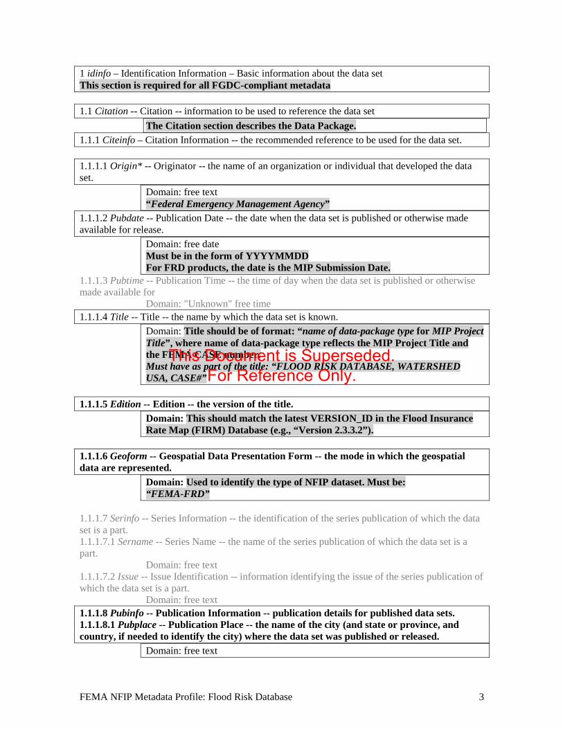
1 idinfo – Identification Information – Basic information about the data set This section is required for all FGDC-compliant metadata 1.1 Citation -- Citation -- information to be used to reference the data set
The Citation section describes the Data Package. 1.1.1 Citeinfo – Citation Information -- the recommended reference to be used for the data set. 1.1.1.1 Origin* -- Originator -- the name of an organization or individual that developed the data set.
Domain: free text “Federal Emergency Management Agency”
1.1.1.2 Pubdate -- Publication Date -- the date when the data set is published or otherwise made available for release.
Domain: free date Must be in the form of YYYYMMDD For FRD products, the date is the MIP Submission Date.
1.1.1.3 Pubtime -- Publication Time -- the time of day when the data set is published or otherwise made available for
Domain: "Unknown" free time 1.1.1.4 Title -- Title -- the name by which the data set is known.
Domain: Title should be of format: “name of data-package type for MIP Project Title”, where name of data-package type reflects the MIP Project Title and the FEMA CASE number. Must have as part of the title: “FLOOD RISK DATABASE, WATERSHED USA, CASE#”
1.1.1.5 Edition -- Edition -- the version of the title.
Domain: This should match the latest VERSION_ID in the Flood Insurance Rate Map (FIRM) Database (e.g., “Version 2.3.3.2”).
1.1.1.6 Geoform -- Geospatial Data Presentation Form -- the mode in which the geospatial data are represented.
Domain: Used to identify the type of NFIP dataset. Must be: “FEMA-FRD”
1.1.1.7 Serinfo -- Series Information -- the identification of the series publication of which the data set is a part. 1.1.1.7.1 Sername -- Series Name -- the name of the series publication of which the data set is a part.
Domain: free text 1.1.1.7.2 Issue -- Issue Identification -- information identifying the issue of the series publication of which the data set is a part.
Domain: free text 1.1.1.8 Pubinfo -- Publication Information -- publication details for published data sets. 1.1.1.8.1 Pubplace -- Publication Place -- the name of the city (and state or province, and country, if needed to identify the city) where the data set was published or released.
Domain: free text
FEMA NFIP Metadata Profile: Flood Risk Database 3
This Document is Superseded. For Reference Only.
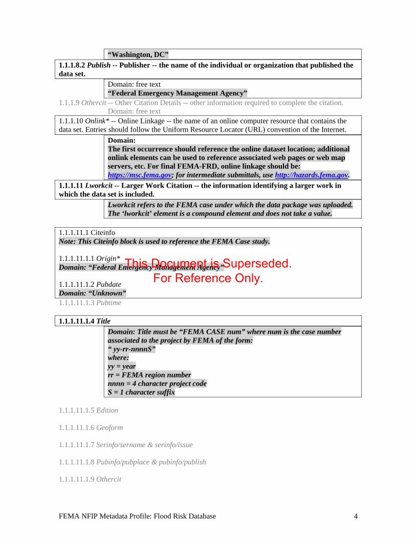
“Washington, DC” 1.1.1.8.2 Publish -- Publisher -- the name of the individual or organization that published the data set.
Domain: free text “Federal Emergency Management Agency”
1.1.1.9 Othercit -- Other Citation Details -- other information required to complete the citation. Domain: free text
1.1.1.10 Onlink* -- Online Linkage -- the name of an online computer resource that contains the data set. Entries should follow the Uniform Resource Locator (URL) convention of the Internet.
Domain: The first occurrence should reference the online dataset location; additional onlink elements can be used to reference associated web pages or web map servers, etc. For final FEMA-FRD, online linkage should be: https://msc.fema.gov; for intermediate submittals, use http://hazards.fema.gov.
1.1.1.11 Lworkcit -- Larger Work Citation -- the information identifying a larger work in which the data set is included.
Lworkcit refers to the FEMA case under which the data package was uploaded. The ‘lworkcit’ element is a compound element and does not take a value.
1.1.1.11.1 Citeinfo Note: This Citeinfo block is used to reference the FEMA Case study. 1.1.1.11.1.1 Origin* Domain: “Federal Emergency Management Agency” 1.1.1.11.1.2 Pubdate Domain: “Unknown” 1.1.1.11.1.3 Pubtime 1.1.1.11.1.4 Title
Domain: Title must be “FEMA CASE num” where num is the case number associated to the project by FEMA of the form: “ yy-rr-nnnnS” where: yy = year rr = FEMA region number nnnn = 4 character project code S = 1 character suffix
1.1.1.11.1.5 Edition 1.1.1.11.1.6 Geoform 1.1.1.11.1.7 Serinfo/sername & serinfo/issue 1.1.1.11.1.8 Pubinfo/pubplace & pubinfo/publish 1.1.1.11.1.9 Othercit
FEMA NFIP Metadata Profile: Flood Risk Database 4
This Document is Superseded. For Reference Only.
1.1.1.11.1.10 Onlink 1.2 Descript -- Description -- a characterization of the data set, including its intended use and limitations.
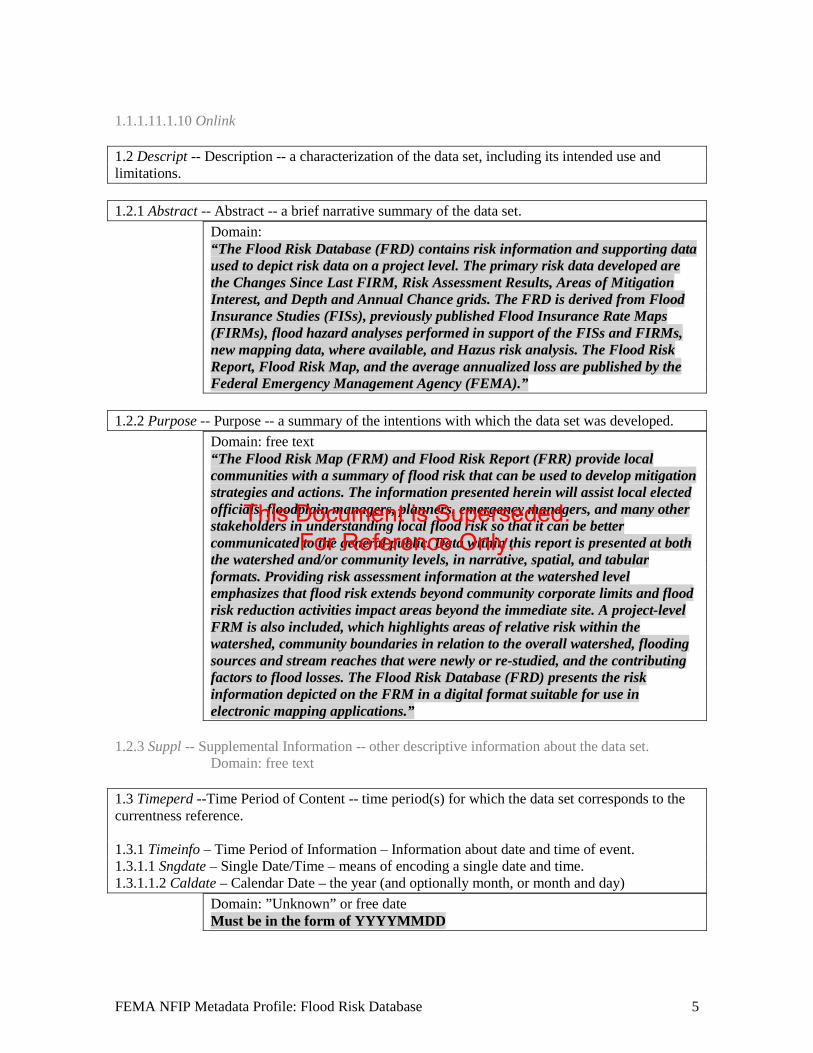
1.2.1 Abstract -- Abstract -- a brief narrative summary of the data set.
Domain: “The Flood Risk Database (FRD) contains risk information and supporting data used to depict risk data on a project level. The primary risk data developed are the Changes Since Last FIRM, Risk Assessment Results, Areas of Mitigation Interest, and Depth and Annual Chance grids. The FRD is derived from Flood Insurance Studies (FISs), previously published Flood Insurance Rate Maps (FIRMs), flood hazard analyses performed in support of the FISs and FIRMs, new mapping data, where available, and Hazus risk analysis. The Flood Risk Report, Flood Risk Map, and the average annualized loss are published by the Federal Emergency Management Agency (FEMA).”
1.2.2 Purpose -- Purpose -- a summary of the intentions with which the data set was developed.
Domain: free text “The Flood Risk Map (FRM) and Flood Risk Report (FRR) provide local communities with a summary of flood risk that can be used to develop mitigation strategies and actions. The information presented herein will assist local elected officials, floodplain managers, planners, emergency managers, and many other stakeholders in understanding local flood risk so that it can be better communicated to the general public. Data within this report is presented at both the watershed and/or community levels, in narrative, spatial, and tabular formats. Providing risk assessment information at the watershed level emphasizes that flood risk extends beyond community corporate limits and flood risk reduction activities impact areas beyond the immediate site. A project-level FRM is also included, which highlights areas of relative risk within the watershed, community boundaries in relation to the overall watershed, flooding sources and stream reaches that were newly or re-studied, and the contributing factors to flood losses. The Flood Risk Database (FRD) presents the risk information depicted on the FRM in a digital format suitable for use in electronic mapping applications.”
1.2.3 Suppl -- Supplemental Information -- other descriptive information about the data set.
Domain: free text 1.3 Timeperd --Time Period of Content -- time period(s) for which the data set corresponds to the currentness reference. 1.3.1 Timeinfo – Time Period of Information – Information about date and time of event. 1.3.1.1 Sngdate – Single Date/Time – means of encoding a single date and time. 1.3.1.1.2 Caldate – Calendar Date – the year (and optionally month, or month and day)
Domain: ”Unknown” or free date Must be in the form of YYYYMMDD
FEMA NFIP Metadata Profile: Flood Risk Database 5
This Document is Superseded. For Reference Only.

For intermediate FRD submittals, the date is the MIP Submission Date. For final FRD submittals, the date is the effective date of the corresponding regulatory products
1.3.2 Current -- Currentness Reference -- the basis on which the time period of content information is determined.
Domain: For intermediate FRD submittals, Currentness Reference should be “MIP Submission Date.” For Final FRD, Currentness Reference should be “FIRM and FIS Effective Date”. Currentness Reference must synchronize with Progress element (1.4.1), see guidance under element 1.4.1.
1.4 Status -- Status -- the state of and maintenance information for the data set. 1.4.1 Progress -- Progress -- the state of the data set.
Domain: "Complete" "In work" For intermediate FRD submittals: “In work”. For final FRD submittals: “Complete”. Note that the Progress element must synchronize with Currentness Reference (1.3.2) as follows: when Progress is “In work”, Currentness Reference is “MIP Submission Date”; alternatively, when Progress is “Complete”, Currentness Reference is “FIRM and FIS Effective Date”.
1.4.2 Update -- Maintenance and Update Frequency -- the frequency with which changes and additions are made to the data set after the initial data set is completed.
Domain: "Unknown" 1.5 Spdom -- Spatial Domain - the geographic areal domain of the data set. 1.5.1 Bounding -- Bounding Coordinates - the limits of coverage of a data set expressed by latitude and longitude values in the order western-most, eastern-most, northern-most, and southern-most. For data sets that include a complete band of latitude around the earth, the West Bounding Coordinate shall be assigned the value -180.0, and the East Bounding Coordinate shall be assigned the value 180.0 1.5.1.1 Westbc -- West Bounding Coordinate -- western-most coordinate of the limit of coverage expressed in longitude.
Domain: -180.0 <= real number < 180.0 1.5.1.2 Eastbc -- East Bounding Coordinate -- eastern-most coordinate of the limit of coverage expressed in longitude.
Domain: -180.0 <= real number <= 180.0 1.5.1.3 Northbc -- North Bounding Coordinate -- northern-most coordinate of the limit of coverage expressed in latitude.
Domain: -90.0 <= real number <= 90.0; North Bounding Coordinate >= South Bounding Coordinate
1.5.1.4 Southbc -- South Bounding Coordinate -- southern-most coordinate of the limit of coverage expressed in latitude.
FEMA NFIP Metadata Profile: Flood Risk Database 6
This Document is Superseded. For Reference Only.
Domain: -90.0 <= real number <= 90.0; South Bounding Coordinate <= North Bounding Coordinate
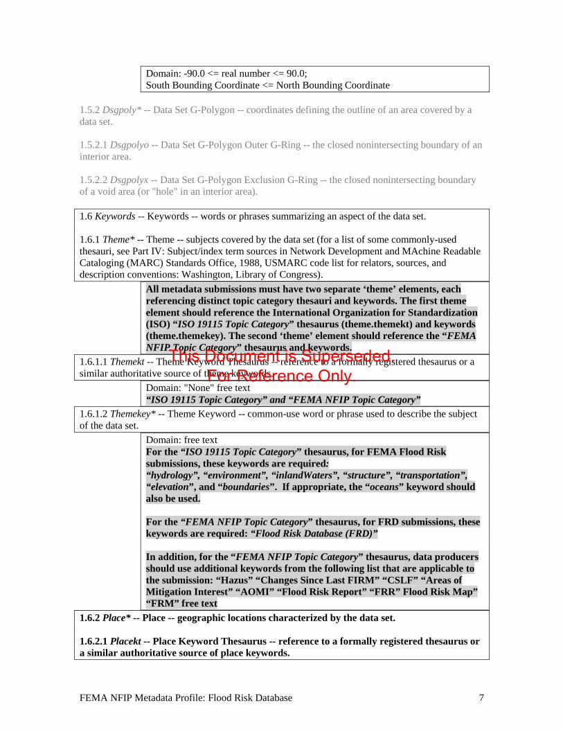
1.5.2 Dsgpoly* -- Data Set G-Polygon -- coordinates defining the outline of an area covered by a data set. 1.5.2.1 Dsgpolyo -- Data Set G-Polygon Outer G-Ring -- the closed nonintersecting boundary of an interior area. 1.5.2.2 Dsgpolyx -- Data Set G-Polygon Exclusion G-Ring -- the closed nonintersecting boundary of a void area (or "hole" in an interior area). 1.6 Keywords -- Keywords -- words or phrases summarizing an aspect of the data set. 1.6.1 Theme* -- Theme -- subjects covered by the data set (for a list of some commonly-used thesauri, see Part IV: Subject/index term sources in Network Development and MAchine Readable Cataloging (MARC) Standards Office, 1988, USMARC code list for relators, sources, and description conventions: Washington, Library of Congress).
All metadata submissions must have two separate ‘theme’ elements, each referencing distinct topic category thesauri and keywords. The first theme element should reference the International Organization for Standardization (ISO) “ISO 19115 Topic Category” thesaurus (theme.themekt) and keywords (theme.themekey). The second ‘theme’ element should reference the “FEMA NFIP Topic Category” thesaurus and keywords.
1.6.1.1 Themekt -- Theme Keyword Thesaurus -- reference to a formally registered thesaurus or a similar authoritative source of theme keywords.
Domain: "None" free text “ISO 19115 Topic Category” and “FEMA NFIP Topic Category”
1.6.1.2 Themekey* -- Theme Keyword -- common-use word or phrase used to describe the subject of the data set.
Domain: free text For the “ISO 19115 Topic Category” thesaurus, for FEMA Flood Risk submissions, these keywords are required: “hydrology”, “environment”, “inlandWaters”, “structure”, “transportation”, “elevation”, and “boundaries”. If appropriate, the “oceans” keyword should also be used. For the “FEMA NFIP Topic Category” thesaurus, for FRD submissions, these keywords are required: “Flood Risk Database (FRD)” In addition, for the “FEMA NFIP Topic Category” thesaurus, data producers should use additional keywords from the following list that are applicable to the submission: “Hazus” “Changes Since Last FIRM” “CSLF” “Areas of Mitigation Interest” “AOMI” “Flood Risk Report” “FRR” Flood Risk Map” “FRM” free text
1.6.2 Place* -- Place -- geographic locations characterized by the data set. 1.6.2.1 Placekt -- Place Keyword Thesaurus -- reference to a formally registered thesaurus or a similar authoritative source of place keywords.
FEMA NFIP Metadata Profile: Flood Risk Database 7
This Document is Superseded. For Reference Only.
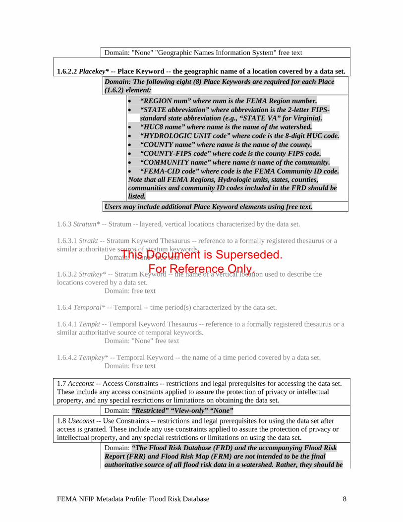
Domain: "None" "Geographic Names Information System" free text 1.6.2.2 Placekey* -- Place Keyword -- the geographic name of a location covered by a data set.
Domain: The following eight (8) Place Keywords are required for each Place (1.6.2) element:
• “REGION num” where num is the FEMA Region number. • “STATE abbreviation” where abbreviation is the 2-letter FIPS-
standard state abbreviation (e.g., “STATE VA” for Virginia). • “HUC8 name” where name is the name of the watershed. • “HYDROLOGIC UNIT code” where code is the 8-digit HUC code. • “COUNTY name” where name is the name of the county. • “COUNTY-FIPS code” where code is the county FIPS code. • “COMMUNITY name” where name is name of the community. • “FEMA-CID code” where code is the FEMA Community ID code. Note that all FEMA Regions, Hydrologic units, states, counties, communities and community ID codes included in the FRD should be listed.
Users may include additional Place Keyword elements using free text. 1.6.3 Stratum* -- Stratum -- layered, vertical locations characterized by the data set. 1.6.3.1 Stratkt -- Stratum Keyword Thesaurus -- reference to a formally registered thesaurus or a similar authoritative source of stratum keywords.
Domain: "None" free text
1.6.3.2 Stratkey* -- Stratum Keyword -- the name of a vertical location used to describe the locations covered by a data set.
Domain: free text
1.6.4 Temporal* -- Temporal -- time period(s) characterized by the data set. 1.6.4.1 Tempkt -- Temporal Keyword Thesaurus -- reference to a formally registered thesaurus or a similar authoritative source of temporal keywords.
Domain: "None" free text
1.6.4.2 Tempkey* -- Temporal Keyword -- the name of a time period covered by a data set. Domain: free text
1.7 Accconst -- Access Constraints -- restrictions and legal prerequisites for accessing the data set. These include any access constraints applied to assure the protection of privacy or intellectual property, and any special restrictions or limitations on obtaining the data set.
Domain: “Restricted” “View-only” “None” 1.8 Useconst -- Use Constraints -- restrictions and legal prerequisites for using the data set after access is granted. These include any use constraints applied to assure the protection of privacy or intellectual property, and any special restrictions or limitations on using the data set.
Domain: “The Flood Risk Database (FRD) and the accompanying Flood Risk Report (FRR) and Flood Risk Map (FRM) are not intended to be the final authoritative source of all flood risk data in a watershed. Rather, they should be
FEMA NFIP Metadata Profile: Flood Risk Database 8
This Document is Superseded. For Reference Only.
used in conjunction with other data sources (including hazard mitigation plans and emergency action plans) to provide a more complete picture of flood risk. Flood risk is always changing, and there may be other studies, reports, and other sources of information available that provide more information. Acknowledgement of FEMA would be appreciated in products derived from these data.”
1.9 Ptcontac -- Point of Contact -- contact information for an individual or organization that is knowledgeable about the data set.
This point of contact is the same as the Distributor point of contact in Section 6. If the Originator (1.1.1) of the data chooses to distribute the data themselves, then this should be the contact information of the Distributor. Otherwise, this (and the Distributor point of contact) should be FEMA.
1.9.1 Cntinfo -- Contact Information -- Identity of, and means to communicate with, person(s) and organization(s) associated with the data set. 1.9.1.1 Cntperp2 -- Contact Person Primary -- the name of the individual to which the contact type 1.9.1.1.1 Cntper -- Contact Person -- the name of the individual to which the contact type applies.
Domain: free text
1.9.1.1.2 Cntorg -- Contact Organization -- the name of the organization to which the contact type applies.
Domain: free text
1.9.1.2 Cntorgp2 -- Contact Organization Primary -- the organization, and the member of the organization associated with the data set. Used in cases where the association of the organization to the data set is more significant than the association of the person to the data set.
Domain: Compound 1.9.1.2.1 Cntorg -- Contact Organization -- the name of the organization to which the contact type applies.
Domain: Federal Emergency Management Agency 1.9.1.2.2 Cntper -- Contact Person -- the name of the individual to which the contact type applies.
Domain: free text
1.9.1.3 Cntpos -- Contact Position -- the title of individual. Domain: free text
1.9.1.4 Cntaddr* -- Contact Address -- the address for the organization or individual. 1.9.1.4.1 Addrtype -- Address Type -- the information provided by the address.
Domain: mailing 1.9.1.4.2 Address* -- Address -- an address line for the address.
Domain: 500 C Street, S.W.
2 Note: Use of the Cntinfo.Cntperp and Cntinfo.Cntorgp elements is mutually exclusive. Cntinfo.Cntorgp is specified in this context as mandatory so the Cntinfo.Cntperp element must not be used here.
FEMA NFIP Metadata Profile: Flood Risk Database 9
This Document is Superseded. For Reference Only.
1.9.1.4.3 City -- City -- the city of the address. Domain: Washington
1.9.1.4.4 State -- State or Province -- the state or province of the address. Domain: District of Columbia
1.9.1.4.5 Postal -- Postal Code -- the ZIP or other postal code of the address. Domain: 20472
1.9.1.4.6 Country -- Country -- the country of the address. Domain: USA
1.9.1.5 Cntvoice* -- Contact Voice Telephone -- the telephone number by which individuals can speak to the organization or individual.
Domain: 1-877-336-2627 1.9.1.6 Cnttdd* -- Contact Telephone Device for the Deaf /Text Telephone (TDD/TTY) Telephone -- the telephone number by which hearing-impaired individuals can contact the organization or individual.
Domain: free text
1.9.1.7 Cntfax* -- Contact Facsimile Telephone -- the telephone number of a facsimile machine of the organization or individual.
Domain: free text
1.9.1.8 Cntemail* -- Contact Electronic Mail Address -- the address of the electronic mailbox of the organization or individual.
Domain: For intermediate FRD submittals: [email protected]; For final FRD submittal: [email protected]
1.9.1.9 Hours -- Hours of Service -- time period when individuals can speak to the organization or individual.
Domain: free text
1.9.1.10 Cntinst -- Contact Instructions -- supplemental instructions on how or when to contact the individual or organization.
Domain: free text
1.10 Browse* -- Browse Graphic -- a graphic that provides an illustration of the data set. The graphic should include a legend for interpreting the graphic. 1.10.1 Browsen -- Browse Graphic File Name -- name of a related graphic file that provides an illustration of the data set.
Domain: free text
1.10.2 Browsed -- Browse Graphic File Description -- a text description of the illustration. Domain: free text
1.10.3 Browset -- Browse Graphic File Type -- graphic file type of a related graphic file. Domain: domain values in the table below; free text Value Definition "CGM" Computer Graphics Metafile
FEMA NFIP Metadata Profile: Flood Risk Database 10
This Document is Superseded. For Reference Only.

"EPS" Encapsulated Postscript format "EMF" Enhanced Metafile "GIF" Graphic Interchange Format "JPEG" Joint Photographic Experts Group format "PBM" Portable Bit Map format "PS" Postscript format "TIFF" Tagged Image File Format "WMF" Windows metafile "XWD" X-Windows Dump
1.11 Datacred -- Data Set Credit -- recognition of those who contributed to the data set.
Domain: free text 1.12 Secinfo -- Security Information -- handling restrictions imposed on the data set because of national security, privacy, or other concerns.
Security information is optional; however, if some of the data contains sensitive information (bridges, dams, etc), the publisher can specify that information in this Section. There is currently no process to remove any information that has security information attached to it. Everything submitted in the FRD is available for public distribution.
1.12.1 Secsys -- Security Classification System -- name of the classification system.
Domain: free text
1.12.2 Secclass -- Security Classification -- name of the handling restrictions on the data set. Domain: "Top secret" "Secret" "Confidential" "Restricted" "Unclassified" "Sensitive" free text
1.12.3 Sechandl -- Security Handling Description -- additional information about the restrictions on handling the data set.
Domain: free text
1.13 Native -- Native Data Set Environment -- a description of the data set in the producer's processing environment, including items such as the name of the software (including version), the computer operating system, file name (including host-, path-, and filenames), and the data set size.
This section is used to capture information about production of FRD datasets. It must include the software release of the submitted file geodatabase. Example: “Original data development environment may vary. Finishing of the data is done using Esri’s ArcGIS software. The submitted file geodatabase was created using ArcGIS version 10.0.” Domain is free text
1.14 Crossref* -- Cross Reference -- information about other, related data sets that are likely to be of interest.
The Cross Reference section is used to relate the Study Package to the Flood Risk Map (FRM)/Flood Risk Report (FRR).
1.14.1 Citeinfo – Citation Information -- the recommended reference to be used for the data set.
FEMA NFIP Metadata Profile: Flood Risk Database 11
This Document is Superseded. For Reference Only.
1.14.1.1 Origin* Federal Emergency Management Agency
1.14.1.2 Pubdate Represents the Submission Date or Effective Date. 1.14.1.3 Pubtime 1.14.1.4 Title
Domain: Name of the Flood Risk Map, Watershed USA (e.g., Flood Risk Map, Watershed, USA.) Name of the Flood Risk Report, Watershed USA (e.g., Flood Risk Report, Watershed, USA.)
1.14.1.5 Edition 1.14.1.6 Geoform 1.14.1.7 Serinfo.sername & serinfo.issue 1.14.1.8 Pubinfo.pubplace & pubinfo.publish 1.14.1.9 Othercit 1.14.1.10 Onlink* 1.14.1.11 Lworkcit 2 dataqual -- Data Quality Information -- General assessment of the quality of the data set This section is required for all FRD submissions 2.1 Attracc -- Attribute Accuracy -- an assessment of the accuracy of the identification of entities and assignment of attribute values in the data set. 2.1.1 Attraccr -- Attribute Accuracy Report -- an explanation of the accuracy of the identification of the entities and assignments of values in the data set and a description of the tests used.
Domain: “The Flood Risk Database (FRD) consists of vector and raster files containing the associated attributes produced in conjunction with the Flood Risk Map (FRM) and Flood Risk Report (FRR). To obtain more detailed information users are encouraged to consult the FRR that accompanies this FRD.” “Independent quality control testing of FEMA's FRD was also performed.”
2.1.2 Qattracc* -- Quantitative Attribute Accuracy Assessment -- a value assigned to summarize the accuracy of the identification of the entities and assignments of values in the data set and the identification of the test that yielded the value.
FEMA NFIP Metadata Profile: Flood Risk Database 12
This Document is Superseded. For Reference Only.
2.1.2.1 Attraccv -- Attribute Accuracy Value -- an estimate of the accuracy of the identification of the entities and assignments of attribute values in the data set.
Domain: "Unknown" free text 2.1.2.2 Attracce -- Attribute Accuracy Explanation -- the identification of the test that yielded the Attribute Accuracy Value.
Domain: free text 2.2 Logic -- Logical Consistency Report -- an explanation of the fidelity of relationships in the data set and tests used.
Domain: “The FRR and FRM are developed from the FRD to ensure that the information shown on the FRM and in the FRR agree with the FRD.”
2.3 Complete -- Completeness Report -- information about omissions, selection criteria, generalization, definitions used, and other rules used to derive the data set.
Domain: “The Flood Risk Database (FRD) stores the data used to prepare the accompanying Flood Risk Report (FRR) and Flood Risk Map (FRM) as well as other ancillary data generated during a flood risk project. The FRD provides a standard, systematic method for FEMA to collect, store, and distribute comprehensive details of flood studies to the public and others in a digital format. However, it is not intended to be the final authoritative source of all flood risk data in a watershed. Rather, the FRD, FRR, and FRM should be used in conjunction with other data sources (including hazard mitigation plans and emergency action plans) to provide a more complete picture of flood risk. Flood risk is always changing, and there may be other studies, reports, and other sources of information available that provide more information. ”
2.4 Posacc -- Positional Accuracy -- an assessment of the accuracy of the positions of spatial objects. 2.4.1 Horizpa -- Horizontal Positional Accuracy -- an estimate of accuracy of the horizontal positions of the spatial objects. 2.4.1.1 Horizpar -- Horizontal Positional Accuracy Report -- an explanation of the accuracy of the horizontal coordinate measurements and a description of the tests used.
Domain: free text “The Flood Risk Database (FRD) consists of vector and raster data containing the associated attributes produced in conjunction with the Flood Risk Map and Flood Risk Report. Independent quality control testing of FEMA's FRD was also performed.”
2.4.1.2 Qhorizpa* -- Quantitative Horizontal Positional Accuracy Assessment -- numeric value assigned to summarize the accuracy of the horizontal coordinate measurements and the identification of the test that yielded the value. 2.4.1.2.1 Horizpav -- Horizontal Positional Accuracy Value -- an estimate of the accuracy of the horizontal coordinate measurements in the data set expressed in (ground) meters.
Domain: free real
FEMA NFIP Metadata Profile: Flood Risk Database 13
This Document is Superseded. For Reference Only.

2.4.1.2.2 Horizpae -- Horizontal Positional Accuracy Explanation – the identification of the test that yielded the Horizontal Positional Accuracy Value.
Domain: free text
2.4.2 Vertacc -- Vertical Positional Accuracy -- an estimate of accuracy of the vertical positions in the data set. 2.4.2.1 Vertaccr -- Vertical Positional Accuracy Report -- an explanation of the accuracy of the vertical coordinate measurements and a description of the tests used.
Domain: “The Flood Risk Database (FRD) consists of vector and raster data containing associated attributes produced in conjunction with the Flood Risk Map and Flood Risk Report. Independent quality control testing of FEMA's FRD was also performed.”
2.4.2.2 Qvertpa* -- Quantitative Vertical Positional Accuracy Assessment -- numeric value assigned to summarize the accuracy of vertical coordinate measurements and the identification of the test that yielded the value. 2.4.2.2.1 Vertaccv -- Vertical Positional Accuracy Value -- an estimate of the accuracy of the vertical coordinate measurements in the data set expressed in (ground) meters.
Domain: free real 2.4.2.2.2 Vertacce -- Vertical Positional Accuracy Explanation – the identification of the test that yielded the Vertical Positional Accuracy Value.
Domain: free text
2.5 Lineage -- Lineage -- information about the events, parameters, and source data which constructed the data set, and information about the responsible parties. 2.5.1 Srcinfo* -- Source Information -- list of sources and a short discussion of the information contributed by each.
All FRD datasets must reference all sources used in production of this dataset per the mechanism described in FEMA’s Guidelines and Standards for Flood Risk Analysis and Mapping.
o BASE o FIRM o LOMC o FIS o STUDY o HAZUS
Particular emphasis is placed on the use of the <srccitea> element to reference features/layers in the FRD dataset for which this is a source. Should be synchronized with Entity Types (5.1.1) described in Section 5.1
2.5.1.1 Srccite -- Source Citation -- reference for a source data set. 2.5.1.1.1 Citeinfo 2.5.1.1.1.1 Origin*
FEMA NFIP Metadata Profile: Flood Risk Database 14
This Document is Superseded. For Reference Only.
2.5.1.1.1.2 Pubdate 2.5.1.1.1.3 Pubtime 2.5.1.1.1.4 Title 2.5.1.1.1.5 Edition 2.5.1.1.1.6 Geoform 2.5.1.1.1.7 Serinfo.sername & serinfo.issue 2.5.1.1.1.8 Pubinfo.pubplace & pubinfo.publish 2.5.1.1.1.9 Othercit 2.5.1.1.1.10 Onlink* 2.5.1.1.1.11 Lworkcit 2.5.1.2 Srcscale -- Source Scale Denominator -- the denominator of the representative fraction on a map (for example, on a 1:24000-scale map, the Source Scale Denominator is 24000).
Domain: integer > 1 Note: This is an integer number and must not contain a comma character, decimal point nor the numerator part of the representative fraction.
2.5.1.3 Typesrc -- Type of Source Media -- the medium of the source data set.
Domain: “online” “CD-ROM” “DVD-ROM” free text 2.5.1.4 Srctime -- Source Time Period of Content -- time period(s) for which the source data set corresponds to the ground. 2.5.1.4.1 Timeinfo – Time Period of Information – Information about date and time of event. 2.5.1.4.1.1 Sngdate – Single Date/Time – means of encoding a single date and time. 2.5.1.4.1.1.1 Caldate – Calendar Date – the year (and optionally month, or month and day) 2.5.1.4.2 Srccurr -- Source Currentness Reference -- the basis on which the source time period of content information of the source data set is determined.
Domain: "ground condition" "publication date" free text 2.5.1.5 Srccitea -- Source Citation Abbreviation -- short-form alias for the source citation.
Domain: All FRD datasets must reference all sources used in their production. Publishers should create a unique source information entry for each of the following types of input sources that were used (Source: FRD Technical Reference):
o BASE o FIRM o LOMC o FIS o STUDY o HAZUS
FEMA NFIP Metadata Profile: Flood Risk Database 15
This Document is Superseded. For Reference Only.
2.5.1.6 Srccontr -- Source Contribution -- brief statement identifying the information contributed by the source to the data set. Domain: free text
2.5.2 Procstep* -- Process Step -- information about a single event. 2.5.2.1 Procdesc -- Process Description -- an explanation of the event and related parameters or tolerances.
Domain: First occurrence of Process Description must state: “The Flood Risk Database is a non-regulatory database that includes flood hazard information from previously effective and new studies. Flood depth grids were compiled using computed water surface elevations along flooding sources. Risk assessment results were derived from Hazus calculations. Areas of Mitigation Interest were compiled from information gathered from local mitigation plans or discussion with local officials.” Additional occurrences optional.
2.5.2.2 Srcused* -- Source Used Citation Abbreviation -- the Source Citation Abbreviation of a data set used in the processing step.
Domain: Source Citation Abbr. <srccitea> from the Source info entries for the data set. A comma delimited list of <srccitea> values is NOT VALID. Each <srccitea> must be listed individually using one or more <srcused> elements.
2.5.2.3 Procdate -- Process Date -- the date when the event was completed.
Domain: free date Must be in the form of YYYYMMDD For intermediate FRD submittals the date is MIP submission date. For final FRD submittals, the date is the effective date of the corresponding regulatory products. See also Section 1.1.1.2 and Section 1.3.1
2.5.2.4 Proctime -- Process Time -- the time when the event was completed.
Domain: free time 2.5.2.5 Srcprod -- Source Produced Citation Abbreviation -- the Source Citation Abbreviation of an intermediate data set that (1) is significant in the opinion of the data producer, (2) is generated in the processing step, and (3) is used in later processing steps.
Domain: Source Citation Abbr. from the Source info entries for the data set.
2.5.2.6 Proccont -- Process Contact -- the party responsible for the processing step information. 2.5.2.6.1 Cntinfo – Contact Information -- Identity of, and means to communicate with, person(s) and organization(s) associated with the data set. 2.5.2.6.1.1 Cntperp3 -- Contact Person Primary -- the name of the individual to which the contact type.
3 Note: Use of the Cntinfo.Cntperp and Cntinfo.Cntorgp elements is mutually exclusive.
FEMA NFIP Metadata Profile: Flood Risk Database 16
This Document is Superseded. For Reference Only.
2.5.2.6.1.1.1 Cntper -- Contact Person -- the name of the individual to which the contact type applies.
Domain: free text
2.5.2.6.1.1.2 Cntorg -- Contact Organization -- the name of the organization to which the contact type applies.
Domain: free text
2.5.2.6.1.2 Cntorgp3 -- Contact Organization Primary -- the organization, and the member of the organization associated with the data set. Used in cases where the association of the organization to the data set is more significant than the association of the person to the data set.
Domain: Compound
2.5.2.6.1.2.1 Cntorg -- Contact Organization -- the name of the organization to which the contact type applies.
Domain: free text
2.5.2.6.1.2.2 Cntper -- Contact Person -- the name of the individual to which the contact type applies.
Domain: free text
2.5.2.6.1.3 Cntpos -- Contact Position -- the title of individual. Domain: free text
2.5.2.6.1.4 Cntaddr* -- Contact Address -- the address for the organization or individual. 2.5.2.6.1.4.1 Addrtype -- Address Type -- the information provided by the address.
Domain: "mailing" "physical" "mailing and physical", free text
2.5.2.6.1.4.2 Address* -- Address -- an address line for the address. Domain: free text
2.5.2.6.1.4.3 City -- City -- the city of the address. Domain: free text
2.5.2.6.1.4.4 State -- State or Province -- the state or province of the address. Domain: free text
2.5.2.6.1.4.5 Postal -- Postal Code -- the ZIP or other postal code of the address. Domain: free text
2.5.2.6.1.4.6 Country -- Country -- the country of the address. Domain: free text
2.5.2.6.1.5 Cntvoice* -- Contact Voice Telephone -- the telephone number by which individuals can speak to the organization or individual.
Domain: free text
2.5.2.6.1.6 Cnttdd* -- Contact TDD/TTY Telephone -- the telephone number by which hearing impaired individuals can contact the organization or individual.
Domain: free text
FEMA NFIP Metadata Profile: Flood Risk Database 17
This Document is Superseded. For Reference Only.

2.5.2.6.1.7 Cntfax* -- Contact Facsimile Telephone -- the telephone number of a facsimile machine of the organization or individual.
Domain: free text
2.5.2.6.1.8 Cntemail* -- Contact Electronic Mail Address -- the address of the electronic mailbox of the organization or individual.
Domain: free text
2.5.2.6.1.9 Hours -- Hours of Service -- time period when individuals can speak to the organization or individual.
Domain: free text
2.5.2.6.1.10 Cntinst -- Contact Instructions -- supplemental instructions on how or when to contact the individual or organization.
Domain: free text
2.6 Cloud -- Cloud Cover -- area of a data set obstructed by clouds, expressed as a percentage of the spatial extent.
Domain: 0 <= Integer <= 100 "Unknown"
3 Spdoinfo – Spatial Data Organization Information – the mechanism used to represent spatial information in the data set. This section NOT required for Flood Risk submissions. 3.1 Indspref -- Indirect Spatial Reference -- name of types of geographic features, addressing schemes, or other means through which locations are referenced in the data set.
Domain: free text
3.2 Direct -- Direct Spatial Reference Method -- the system of objects used to represent space in the data set.
Domain: “Vector” “Raster” “Vector and Raster”
3.3 Ptvctinf4 -- Point and Vector Object Information -- the types and numbers of vector or nongridded point spatial objects in the data set.
This element or <spdinfo.rastinfo>, not both.
3.3.1 Sdtsterm* -- SDTS Terms Description -- point and vector object information using the terminology and concepts from Spatial Data Transfer Standard (SDTS)
Must occur 3 times for Point, String and GT-polygon composed of chains.
3.3.1.1 Sdtstype -- SDTS Point and Vector Object Type -- name of point and vector spatial objects used to locate zero-, one-, and two-dimensional spatial locations in the data set.
Domain: “Point”, “String” and “GT-polygon composed of chains” 3.3.1.2 Ptvctnt -- Point and Vector Object Count -- the total number of the point or vector object type occurring in the data set.
4 Note: Use of the spdoinfo.ptvctinf and spdoinfo.rastinfo elements is mutually exclusive.
FEMA NFIP Metadata Profile: Flood Risk Database 18
This Document is Superseded. For Reference Only.
Domain: Integer > 0
3.3.2 Vpfterm -- VPF Terms Description -- point and vector object information using the terminology and concepts from Department of Defense, 1992, Vector Product Format (VPF) (MILSTD-600006) 3.3.2.1 Vpflevel -- VPF Topology Level -- the completeness of the topology carried by the data set. The levels of completeness are defined in Department of Defense, 1992, Vector Product Format (MIL-STD-600006).
Domain: 0 <= Integer <= 3
3.3.2.2 Vpfinfo* -- VPF Point and Vector Object Information -- information about VPF point and vector objects 3.3.2.2.1 Vpftype -- VPF Point and Vector Object Type -- name of point and vector spatial objects used to locate zero-, one-, and two-dimensional spatial locations in the data set.
Domain: "Node" "Edge" "Face" "Text"
3.3.2.2.2 Vpfcnt -- VPF Point and Vector Object Count. Domain: Integer > 0
3.4 Rastinfo4 -- Raster Object Information -- the types and numbers of raster spatial objects in the data set.
This must not be included if <spdinfo.ptvctinf> is used.
3.4.1 Rasttype -- Raster Object Type -- raster spatial objects used to locate zero-, two-, or three-dimensional locations in the data set.
Domain: "Point" "Pixel" "Grid Cell" "Voxel"
3.4.2 Rowcount -- Row Count -- the maximum number of raster objects along the ordinate (y) axis. For use with rectangular raster objects.
Domain: Integer > 0
3.4.3 Colcount -- Column Count -- the maximum number of raster objects along the abscissa (x) axis. For use with rectangular raster objects.
Domain: Integer > 0 3.4.4 Vrtcount -- Vertical Count -- the maximum number of raster objects along the vertical (z) axis. For use with rectangular volumetric raster objects (voxels).
Domain: Integer > 0
4 Spref -- Spatial Reference Information – the description of the reference frame for, and the means to encode coordinates in the data set. This section is required for all Flood Risk submissions. 4.1 Horizsys -- Horizontal Coordinate System Definition -- the reference frame or system from which linear or angular quantities are measured and assigned to the position that a point occupies. (4.2.1 or 4.2.2 or 4.2.3) Must specify either Geograph (4.1.1) OR Planar (4.1.2) OR Local (4.1.3), exclusive.
FEMA NFIP Metadata Profile: Flood Risk Database 19
This Document is Superseded. For Reference Only.

4.1.1 Geograph5 -- Geographic -- the quantities of latitude and longitude which define the position of a point on the Earth's surface with respect to a reference spheroid. 4.1.1.1 Latres -- Latitude Resolution -- the minimum difference between two adjacent latitude values expressed in Geographic Coordinate Units of measure.
Domain: real > 0.0
4.1.1.2 Longres -- Longitude Resolution -- the minimum difference between two adjacent longitude values expressed in Geographic Coordinate Units of measure.
Domain: real > 0.0
4.1.1.3 Geogunit -- Geographic Coordinate Units -- units of measure used for the latitude and longitude values.
Domain: "Decimal degrees" "Decimal minutes" "Decimal seconds" "Degrees and decimal minutes" "Degrees, minutes, and decimal seconds" "Radians" "Grads"
4.1.2 Planar* -- Planar5 -- the quantities of distances, or distances and angles, which define the position of a point on a reference plane to which the surface of the Earth has been projected. 4.1.2.1 Mapproj6 -- Map Projection -- the systematic representation of all or part of the surface of the Earth on a plane or developable surface. 4.1.2.1.1 Mapprojn – Map Projection Name – name of the map projection.
Domain: "Albers Conical Equal Area" "Azimuthal Equidistant" "Equidistant Conic" "Equirectangular" "General Vertical Nearsided Projection" "Gnomonic" "Lambert Azimuthal Equal Area" "Lambert Conformal Conic" "Mercator" "Modified Stereographic for Alaska" "Miller Cylindrical" "Oblique Mercator" "Orthographic" "Polar Stereographic" "Polyconic" "Robinson" "Sinusoidal" "Space Oblique Mercator" "Stereographic" "Transverse Mercator" "van der Grinten" free text
4.1.2.1.2 [map projection parameters for selected projection, e.g., projection center, meridian, false easting/northing, etc.1 ] 4.1.2.2 Gridsys6 -- Grid Coordinate System -- a plane-rectangular coordinate system usually based on, and mathematically adjusted to, a map projection so that geographic positions can be readily transformed to and from plane coordinates. 4.1.2.2.1 Gridsysn -- Grid Coordinate System Name -- name of the grid coordinate system.
Domain: "Universal Transverse Mercator" "Universal Polar Stereographic" "State Plane Coordinate System 1927" "State Plane Coordinate System 1983" "ARC Coordinate System" "other grid system"
4.1.2.2.2 [grid system parameters for selected grid system. E.g., Universal Transverse Mercator (UTM ) or state zone]
5 Note: Use of the horizsys.geograph, horizsys.planar and horizsys.local elements is mutually exclusive (i.e., only one of these can be used). 6 Note: Use of the planar.mapproj, planar.gridsys and planar.localp elements is mutually exclusive (i.e., only one of these can be used).
FEMA NFIP Metadata Profile: Flood Risk Database 20
This Document is Superseded. For Reference Only.
4.1.2.3 Localp6 -- Local Planar -- any right-handed planar coordinate system of which the z-axis coincides with a plumb line through the origin that locally is aligned with the surface of the Earth. 4.1.2.3.1 Localpd – Local planar description 4.1.2.3.2 Localpgi – Georeference Information 4.1.2.4 Planci -- Planar Coordinate Information -- information about the coordinate system developed on the planar surface. 4.1.2.4.1 Plance – planar coordinate encoding method (Domain: “coordinate pair” “distance and bearing” “row and column”) 4.1.2.4.2 Coordrep7 – coordinate representation (specify either coordrep OR distbrep NOT BOTH) 4.1.2.4.2.1 Absres – Abscissa resolution (Domain: real) 4.1.2.4.2.2 Ordres – Ordinate resolution (Domain: real) 4.1.2.4.3 Distbrep7 – distance and bearing representation 4.1.2.4.3.1 Distres – Distance resolution (Domain: real) 4.1.2.4.3.2 Bearres – Bearing resolution (Domain: real) 4.1.2.4.3.3 Bearunit – Bearing units (Domain: “Decimal degrees” “Decimal minutes” “Decimal seconds” “Degrees and decimal minutes” “Degrees, minutes, and decimal seconds” “Radians” “Grads”) 4.1.2.4.3.4 Bearrefd – Bearing reference direction (Domain: “North” “South”) 4.1.2.4.3.5 Bearrefm – Bearing reference meridian (Domain: “Assumed” “Grid” “Magnetic” “Astronomic” “Geodetic”) 4.1.2.4.4 Plandu – planar distance units 4.1.3 Local5 -- Local -- a description of any coordinate system that is not aligned with the surface of the Earth. 4.1.3.1 Localdes -- Local Description -- a description of the coordinate system and its orientation to the surface of the Earth.
Domain: free text 4.1.3.2 Localgeo -- Local Georeference Information -- a description of the information provided to register the local system to the Earth (e.g., control points, satellite ephemeral data, inertial navigation data).
7 Note: Use of the planci.coordrep and planci.distbrep elements is mutually exclusive. Since planci.coordrep is mandatory, use of planci.distbrep element is therefore invalid.
FEMA NFIP Metadata Profile: Flood Risk Database 21
This Document is Superseded. For Reference Only.
Domain: free text
4.1.4 Geodetic -- Geodetic Model -- parameters for the shape of the earth. 4.1.4.1 Horizdn -- Horizontal Datum Name -- the identification given to the reference system used for defining the coordinates of points.
Domain: "North American Datum of 1983" free text 4.1.4.2 Ellips -- Ellipsoid Name -- identification given to established representations of the Earth's shape.
Domain: "Clarke 1866" "Geodetic Reference System 80" free text 4.1.4.3 Semiaxis -- Semi-major Axis -- radius of the equatorial axis of the ellipsoid.
Domain: real > 0.0 4.1.4.4 Denflat -- Denominator of Flattening Ratio -- the denominator of the ratio of the difference between the equatorial and polar radii of the ellipsoid when the numerator is set to 1.
Domain: Denominator of Flattening > 0.0 4.2 Vertdef -- Vertical Coordinate System Definition -- the reference frame or system from which vertical distances (altitudes or depths) are measured. 4.2.1 Altsys -- Altitude System Definition -- the reference frame or system from which altitudes (elevations) are measured. The term "altitude"' is used instead of the common term "elevation" to conform to the terminology in Federal Information Processing Standards 70-1 and 173. 4.2.1.1 Altdatum -- Altitude Datum Name -- the identification given to the surface taken as the surface of reference from which altitudes are measured.
Domain: North American Vertical Datum of 1988" free text 4.2.1.2 Altres* -- Altitude Resolution -- the minimum distance possible between two adjacent altitude values, expressed in Altitude Distance Units of measure.
Domain: real > 0.0 4.2.1.3 Altunits -- Altitude Distance Units -- units in which altitudes are recorded.
Domain: "meters" "feet" free text 4.2.1.4 Altenc -- Altitude Encoding Method -- the means used to encode the altitudes.
Domain: "Explicit elevation coordinate included with horizontal coordinates" "Implicit coordinate" "Attribute values"
4.2.2 Depthsys -- Depth System Definition -- the reference frame or system from which depths are measured. 4.2.2.1 Depthdn -- Depth Datum Name -- the identification given to surface of reference from which depths are measured.
Domain: see FGDC standard 4.2.2.2 Depthres* -- Depth Resolution -- the minimum distance possible between two adjacent depth values, expressed in Depth Distance Units of measure.
Domain: real > 0.0
FEMA NFIP Metadata Profile: Flood Risk Database 22
This Document is Superseded. For Reference Only.

4.2.2.3 Depthdu -- Depth Distance Units -- units in which depths are recorded.
Domain: "meters" "feet" free text
4.2.2.4 Depthem -- Depth Encoding Method -- the means used to encode depths. Domain: "Explicit depth coordinate included with horizontal coordinates" "Implicit coordinate" "Attribute values"
5 eainfo –Entity and Attribute Information – details about information content of the data set, including entity types, their attributes and the domains from which attribute values may be assigned. This section is required to summarize information about the different pieces of a submission. 5.1 Detailed* -- Detailed Description -- description of the entities, attributes, attribute values, and related characteristics encoded in the data set.
Create an entity type for each entity enclosed in the current submission (entity type label and definition included below). Authority is FEMA Flood Risk Database Technical Reference. Only spatial Flood Risk tables and rasters used in a submission should be included as entities. enttypl enttypd S_AOMI_Pt
Location and attributes of Areas of Mitigation Interest on the FRM and referenced in the FRR.
S_Carto_Ar Location and attributes for cartographic polygons for the background on the FRM.
S_Carto_Ln Location and attributes for cartographic lines for the background on the FRM.
S_Carto_Pt Location and attributes for cartographic points for the background on the FRM.
S_CenBlk_Ar Location and attributes for U.S. Census Block data used in the FRM.
S_Cr_Fac_Pt Location and attributes of critical facilities identified for modeled dam release scenarios in the flood risk project.
S_CSLF_Ar Location and attributes for the Changes Since Last FIRM for the study area referenced in the FRR.
S_Cst_Inc_Inundation_Ar Location and attributes for additional areas of inundation associated with a 1, 2, or 3-foot increase to the base flood level.
S_Cst_Wave_Haz_Ar Location and attributes for polygons representing the relative level of wave hazard severity within the 1% annual chance floodplain.
FEMA NFIP Metadata Profile: Flood Risk Database 23
This Document is Superseded. For Reference Only.

enttypl enttypd S_Dams_Xs_Ln Location and attributes for cross sections used for
dam inundation modeling in the flood risk project.
S_DS_Inundation_Ar Location and attributes for the downstream inundation areas of the dams studied in the flood risk project.
S_Easement_Ar Location and attributes for the easements associated with the dams studied in the flood risk project.
S_ErDune_Pk_Ln Location and attributes for 3D lines representing the peak of the dune, as identified during the erosion analysis.
S_FRD_Pol_Ar Location and attributes for political jurisdictions shown on the FRM.
S_FRD_Proj_Ar Location and attributes for the spatial footprint of the project.
S_FRM_Callout_Ln Location and attributes for callout/leader lines used on the FRM.
S_HUC_Ar Location and attributes for watersheds in and around the project area shown on the FRM.
S_Levee_Ln Location and attributes for the levee as a line feature along the top of a levee.
S_Lev_Breach_Pt Location and attributes for community-supplied levee breach and armored overtopping points.
S_Lev_Elements_Pt Location and attributes for drainage and protection features along a levee.
S_Lev_Freeboard_Ln Location and attributes for freeboard information associated with a levee scenario.
S_Lev_Inundation_Ar Location and attributes for the inundation area associated with levee scenarios.
S_Lev_Rating_Curve_Pt Location for points along a levee where a rating curve has been developed.
S_PFD_Ersn_Ar Location and attributes for FEMA regulatory Primary Frontal Dune (PFD), delineated between the dune toe and heel.
S_RM_Dams_Pt Location and attributes for dams studied in the flood risk project.
S_UDF_Pt Location and attributes for user defined facilities shown on the FRM.
FEMA NFIP Metadata Profile: Flood Risk Database 24
This Document is Superseded. For Reference Only.
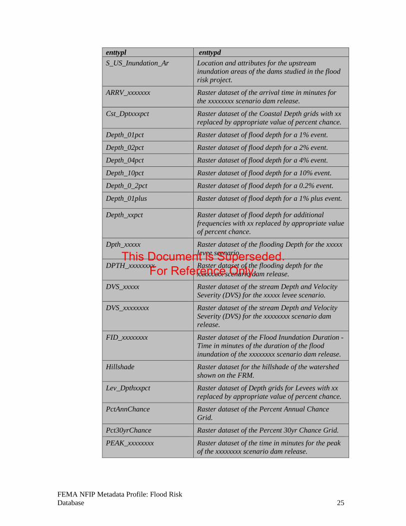
enttypl enttypd S_US_Inundation_Ar Location and attributes for the upstream
inundation areas of the dams studied in the flood risk project.
ARRV_xxxxxxx Raster dataset of the arrival time in minutes for the xxxxxxxx scenario dam release.
Cst_Dptxxxpct Raster dataset of the Coastal Depth grids with xx replaced by appropriate value of percent chance.
Depth_01pct Raster dataset of flood depth for a 1% event.
Depth_02pct Raster dataset of flood depth for a 2% event.
Depth_04pct Raster dataset of flood depth for a 4% event.
Depth_10pct Raster dataset of flood depth for a 10% event.
Depth_0_2pct Raster dataset of flood depth for a 0.2% event.
Depth_01plus Raster dataset of flood depth for a 1% plus event.
Depth_xxpct Raster dataset of flood depth for additional frequencies with xx replaced by appropriate value of percent chance.
Dpth_xxxxx Raster dataset of the flooding Depth for the xxxxx levee scenario.
DPTH_xxxxxxxx Raster dataset of the flooding depth for the xxxxxxxx scenario dam release.
DVS_xxxxx Raster dataset of the stream Depth and Velocity Severity (DVS) for the xxxxx levee scenario.
DVS_xxxxxxxx Raster dataset of the stream Depth and Velocity Severity (DVS) for the xxxxxxxx scenario dam release.
FID_xxxxxxxx Raster dataset of the Flood Inundation Duration - Time in minutes of the duration of the flood inundation of the xxxxxxxx scenario dam release.
Hillshade Raster dataset for the hillshade of the watershed shown on the FRM.
Lev_Dpthxxpct Raster dataset of Depth grids for Levees with xx replaced by appropriate value of percent chance.
PctAnnChance Raster dataset of the Percent Annual Chance Grid.
Pct30yrChance Raster dataset of the Percent 30yr Chance Grid.
PEAK_xxxxxxxx Raster dataset of the time in minutes for the peak of the xxxxxxxx scenario dam release.
FEMA NFIP Metadata Profile: Flood Risk Database 25
This Document is Superseded. For Reference Only.
enttypl enttypd Vel_xxpct Raster dataset of the velocity grids with xx
replaced by appropriate value of percent chance.
VEL_xxxxx Raster dataset of the velocity for the xxxxx levee scenario.
VEL_xxxxxxxx Raster dataset of the velocity for the xxxxxxxx scenario dam release.
WSE_01pct Raster dataset of the water surface for a 1% event.
WSE_02pct Raster dataset of the water surface for a 2% event.
WSE_04pct Raster dataset of the water surface for a 4% event.
WSE_10pct Raster dataset of the water surface for a 10% event.
WSE_0_2pct Raster dataset of the water surface for a 0.2% event.
WSE_01plus Raster dataset of the water surface for a 1% plus event.
WSE_xxpct Raster dataset of the water surface for additional frequencies with xx replaced by appropriate value of percent chance.
WSE_Change Raster dataset of the water surface change since the last FIRM.
WSE_xxxxx Raster dataset of the water surface elevation for the xxxxx levee scenario.
WSE_xxxxxxxx Raster dataset of the water surface elevation for the xxxxxxxx scenario dam release.
Wvht_xxxpct Raster dataset of wave height in feet resulting from overland wave propagation.
5.1.1 Enttyp -- Entity Type -- the definition and description of a set into which similar entity instances are classified. 5.1.1.1 Enttypl -- Entity Type Label -- the name of the entity type.
Domain: free text See table above.
5.1.1.2 Enttypd -- Entity Type Definition -- the description of the entity type. Domain: free text See table above.
5.1.1.3 Enttypds -- Entity Type Definition Source -- the authority of the definition.
FEMA NFIP Metadata Profile: Flood Risk Database 26
This Document is Superseded. For Reference Only.
Domain: “FEMA FRD Technical Reference (available at http://www.fema.gov/guidelines-and-standards-flood-risk-analysis-and-mapping and on the FEMA Risk MAP Knowledge Sharing Site).” Additional definition sources may be included as free text.
5.1.2 Attr* -- Attribute -- a defined characteristic of an entity. 5.1.2.1 Attrlabl -- Attribute Label -- the name of the attribute.
Domain: free text
5.1.2.2 Attrdef -- Attribute Definition -- the description of the attribute. Domain: free text
5.1.2.3 Attrdefs -- Attribute Definition Source -- the authority of the definition. Domain: free text
5.1.2.4 Attrdomv* -- Attribute Domain Values -- the valid values that can be assigned for an attribute. 5.1.2.4.1 Edom – enumerated domain (value & definition & source) 5.1.2.4.2 Rdom – range domain 5.1.2.4.3 Codesetd – codeset domain 5.1.2.4.4 Udom – unrepresentable domain 5.1.2.5 Begdatea* -- Beginning Date of Attribute Values -- earliest or only date for which the attribute values are current. In cases when a range of dates are provided, this is the earliest date for which the information is valid.
Domain: free date
5.1.2.6 Enddatea* -- Ending Date of Attribute Values -- latest date for which the information is current. Used in cases when a range of dates are provided.
Domain: free date
5.1.2.7 Attrvai -- Attribute Value Accuracy Information -- an assessment of the accuracy of the assignment of attribute values. 5.1.2.7.1 Attrva – attribute value accuracy 5.1.2.7.2 Attrvae – attribute value accuracy explanation 5.1.2.8 Attrmfrq -- Attribute Measurement Frequency -- the frequency with which attribute values are added.
Domain: "Unknown" "As needed" "Irregular" "None planned" free text
5.2 Overview* -- Overview Description -- summary of, and citation to detailed description of, the information content of the data set.
FEMA NFIP Metadata Profile: Flood Risk Database 27
This Document is Superseded. For Reference Only.
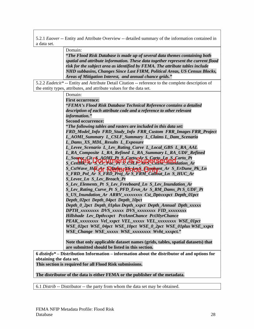
5.2.1 Eaover -- Entity and Attribute Overview -- detailed summary of the information contained in a data set.
Domain: “The Flood Risk Database is made up of several data themes containing both spatial and attribute information. These data together represent the current flood risk for the subject area as identified by FEMA. The attribute tables include NHD subbasins, Changes Since Last FIRM, Political Areas, US Census Blocks, Areas of Mitigation Interest, and annual chance grids.”
5.2.2 Eadetcit* -- Entity and Attribute Detail Citation -- reference to the complete description of the entity types, attributes, and attribute values for the data set.
Domain: First occurrence: “FEMA’s Flood Risk Database Technical Reference contains a detailed description of each attribute code and a reference to other relevant information.” Second occurrence: “The following tables and rasters are included in this data set: FRD_Model_Info FRD_Study_Info FRR_Custom FRR_Images FRR_Project L_AOMI_Summary L_CSLF_Summary L_Claims L_Dam_Scenario L_Dams_XS_MDL_Results L_Exposure L_Levee_Scenario L_Lev_Rating_Curve L_Local_GBS L_RA_AAL L_RA_Composite L_RA_Refined L_RA_Summary L_RA_UDF_Refined L_Source_Cit S_AOMI_Pt S_Carto_Ar S_Carto_Ln S_Carto_Pt S_CenBlk_Ar S_Cr_Fac_Pt S_CSLF_Ar S_CstInc_Inundation_Ar S_CstWave_Haz_Ar S_Dams_XS_Ln S_Easement_Ar S_ErDune_Pk_Ln S_FRD_Pol_Ar S_FRD_Proj_Ar S_FRM_Callout_Ln S_HUC_Ar S_Levee_Ln S_Lev_Breach_Pt S_Lev_Elements_Pt S_Lev_Freeboard_Ln S_Lev_Inundation_Ar S_Lev_Rating_Curve_Pt S_PFD_Ersn_Ar S_RM_Dams_Pt S_UDF_Pt S_US_Inundation_Ar ARRV_xxxxxxxx Cst_Dptxxxpct Depth_01pct Depth_02pct Depth_04pct Depth_10pct Depth_0_2pct Depth_01plus Depth_xxpct Depth_Annual Dpth_xxxxx DPTH_xxxxxxxx DVS_xxxxx DVS_xxxxxxxx FID_xxxxxxxx Hillshade Lev_Dpthxxpct PctAnnChance Pct30yrChance PEAK_xxxxxxxx Vel_xxpct VEL_xxxxx VEL_xxxxxxxx WSE_01pct WSE_02pct WSE_04pct WSE_10pct WSE_0_2pct WSE_01plus WSE_xxpct WSE_Change WSE_xxxxx WSE_xxxxxxxx Wvht_xxxpct.” Note that only applicable dataset names (grids, tables, spatial datasets) that are submitted should be listed in this section.
6 distinfo* – Distribution Information – information about the distributor of and options for obtaining the data set. This section is required for all Flood Risk submissions. The distributor of the data is either FEMA or the publisher of the metadata. 6.1 Distrib -- Distributor -- the party from whom the data set may be obtained.
FEMA NFIP Metadata Profile: Flood Risk Database 28
This Document is Superseded. For Reference Only.
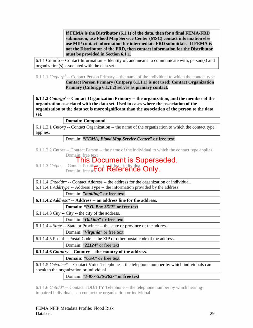
If FEMA is the Distributor (6.1.1) of the data, then for a final FEMA-FRD submission, use Flood Map Service Center (MSC) contact information else use MIP contact information for intermediate FRD submittals. If FEMA is not the Distributor of the FRD, then contact information for the Distributor must be provided in Section 6.1.1.
6.1.1 Cntinfo -- Contact Information -- Identity of, and means to communicate with, person(s) and organization(s) associated with the data set. 6.1.1.1 Cntperp2 -- Contact Person Primary -- the name of the individual to which the contact type.
Contact Person Primary (Cntperp 6.1.1.1) is not used; Contact Organization Primary (Cntorgp 6.1.1.2) serves as primary contact.
6.1.1.2 Cntorgp2 -- Contact Organization Primary -- the organization, and the member of the organization associated with the data set. Used in cases where the association of the organization to the data set is more significant than the association of the person to the data set.
Domain: Compound 6.1.1.2.1 Cntorg -- Contact Organization -- the name of the organization to which the contact type applies.
Domain: “FEMA, Flood Map Service Center” or free text 6.1.1.2.2 Cntper -- Contact Person -- the name of the individual to which the contact type applies.
Domain: free text
6.1.1.3 Cntpos -- Contact Position -- the title of individual. Domain: free text
6.1.1.4 Cntaddr* -- Contact Address -- the address for the organization or individual. 6.1.1.4.1 Addrtype -- Address Type -- the information provided by the address.
Domain: "mailing" or free text 6.1.1.4.2 Address* -- Address -- an address line for the address.
Domain: “P.O. Box 3617” or free text 6.1.1.4.3 City -- City -- the city of the address.
Domain: “Oakton” or free text 6.1.1.4.4 State -- State or Province -- the state or province of the address.
Domain: “Virginia” or free text 6.1.1.4.5 Postal -- Postal Code -- the ZIP or other postal code of the address.
Domain: “22124” or free text 6.1.1.4.6 Country -- Country -- the country of the address.
Domain: “USA” or free text 6.1.1.5 Cntvoice* -- Contact Voice Telephone -- the telephone number by which individuals can speak to the organization or individual.
Domain: “1-877-336-2627” or free text 6.1.1.6 Cnttdd* -- Contact TDD/TTY Telephone -- the telephone number by which hearing-impaired individuals can contact the organization or individual.
FEMA NFIP Metadata Profile: Flood Risk Database 29
This Document is Superseded. For Reference Only.

Domain: free text 6.1.1.7 Cntfax* -- Contact Facsimile Telephone -- the telephone number of a facsimile machine of the organization or individual.
Domain: free text
6.1.1.8 Cntemail* -- Contact Electronic Mail Address -- the address of the electronic mailbox of the organization or individual.
Domain: For intermediate FEMA-FRD submittals: [email protected]; for final FEMA-FRD submittal: [email protected] or free text
6.1.1.9 Hours -- Hours of Service -- time period when individuals can speak to the organization or individual.
Domain: free text
6.1.1.10 Cntinst -- Contact Instructions -- supplemental instructions on how or when to contact the individual or organization.
Domain: “Data requests must include the full name of the community, county, watershed, or watershed code covered by the request.”
6.2 Resdesc -- Resource Description -- the identifier by which the distributor knows the data set.
Domain: free text
6.3 Distliab -- Distribution Liability -- statement of the liability assumed by the distributor. Domain: “No warranty expressed or implied is made by FEMA regarding the utility of the data on any other system nor shall the act of distribution constitute any such warranty. FEMA will warrant the delivery of this product in a computer-readable format, and will offer appropriate adjustment of credit when the product is determined unreadable by correctly adjusted computer input peripherals, or when the physical medium is delivered in damaged condition. Requests for adjustment of credit must be made within 90 days from the date of this shipment from the ordering site.”
6.4. Stdorder* -- Standard Order Process – the common ways in which the data set may be
obtained or received, and related instructions and fee information.
Note: the child elements, <nondig> (6.4.1) and <digform> (6.4.2) are mutually exclusive (i.e., only one can occur within a given <stdorder> element).
6.4.1 Nondig -- Non-digital Form -- the description of options for obtaining the data set on non-computer- compatible media.
Domain: free text
6.4.2 Digform* -- Digital Form -- the description of options for obtaining the data set on computer-compatible media
FEMA NFIP Metadata Profile: Flood Risk Database 30
This Document is Superseded. For Reference Only.
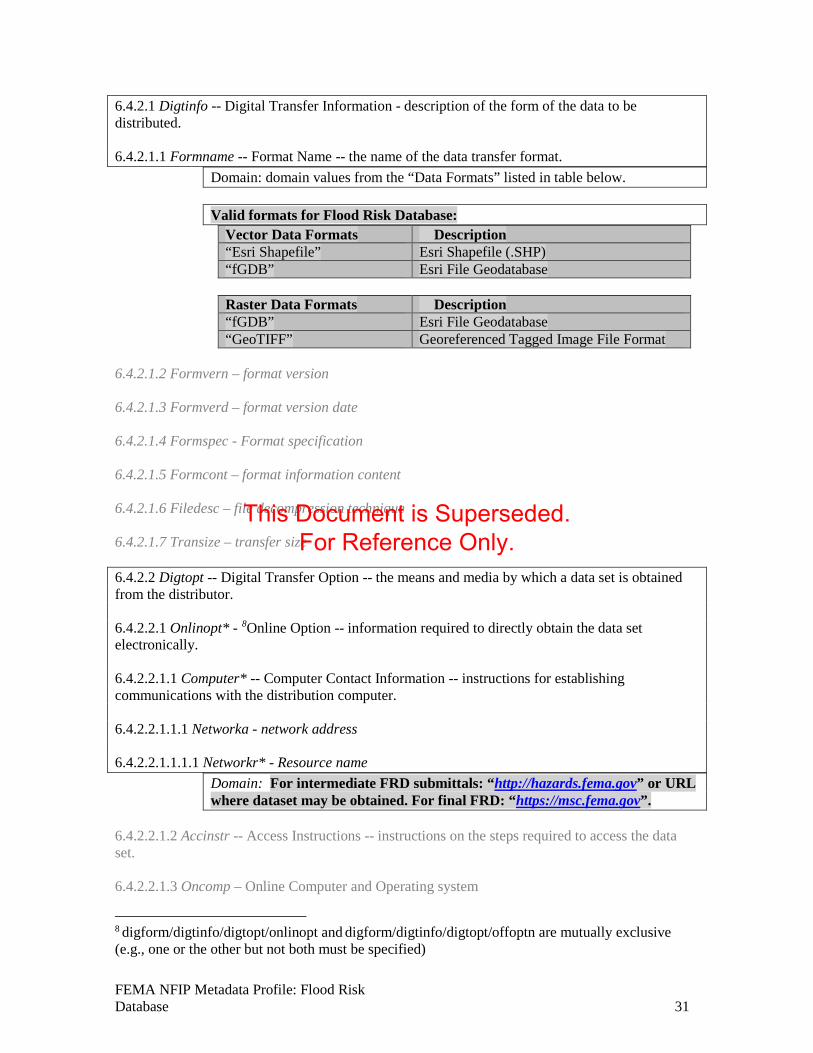
6.4.2.1 Digtinfo -- Digital Transfer Information - description of the form of the data to be distributed. 6.4.2.1.1 Formname -- Format Name -- the name of the data transfer format.
Domain: domain values from the “Data Formats” listed in table below.
Valid formats for Flood Risk Database: Vector Data Formats Description “Esri Shapefile” Esri Shapefile (.SHP) “fGDB” Esri File Geodatabase
Raster Data Formats Description “fGDB” Esri File Geodatabase “GeoTIFF” Georeferenced Tagged Image File Format
6.4.2.1.2 Formvern – format version 6.4.2.1.3 Formverd – format version date 6.4.2.1.4 Formspec - Format specification 6.4.2.1.5 Formcont – format information content 6.4.2.1.6 Filedesc – file decompression technique 6.4.2.1.7 Transize – transfer size 6.4.2.2 Digtopt -- Digital Transfer Option -- the means and media by which a data set is obtained from the distributor. 6.4.2.2.1 Onlinopt* - 8Online Option -- information required to directly obtain the data set electronically. 6.4.2.2.1.1 Computer* -- Computer Contact Information -- instructions for establishing communications with the distribution computer. 6.4.2.2.1.1.1 Networka - network address 6.4.2.2.1.1.1.1 Networkr* - Resource name
Domain: For intermediate FRD submittals: “http://hazards.fema.gov” or URL where dataset may be obtained. For final FRD: “https://msc.fema.gov”.
6.4.2.2.1.2 Accinstr -- Access Instructions -- instructions on the steps required to access the data set. 6.4.2.2.1.3 Oncomp – Online Computer and Operating system
8 digform/digtinfo/digtopt/onlinopt and digform/digtinfo/digtopt/offoptn are mutually exclusive (e.g., one or the other but not both must be specified)
FEMA NFIP Metadata Profile: Flood Risk Database 31
This Document is Superseded. For Reference Only.
6.4.2.2.2 Offoptn8 -- Offline Option -- information about media-specific options for receiving the data set. 6.4.2.2.2.1 Offmedia – Offline Media Domain: For Flood Risk datasets, only “DVD-ROM” are officially supported. 6.4.2.2.2.2 Reccap – recording capacity 6.4.2.2.2.3 Recfmt – recording format
For DVD-ROM: “ISO 9660” 6.4.2.2.2.4 Compat – compatibility information 6.4.3 Fees -- Fees -- the fees and terms for retrieving the data set.
Domain: “Contact distributor” free text 6.4.4 Ordering -- Ordering Instructions -- general instructions and advice about, and special terms and services provided for, the data set by the distributor.
Domain: free text
6.4.5 Turnarnd -- Turnaround -- typical turnaround time for the filling of an order. Domain: free text
6.5 Custom -- Custom Order Process -- description of custom distribution services available, and the terms and conditions for obtaining these services.
Domain: free text
6.6 Techpreq -- Technical Prerequisites -- description of any technical capabilities that the consumer must have to use the data set in the form(s) provided by the distributor.
Domain: free text
6.7 Availabl -- Available Time Period -- the time period when the data set will be available from the distributor.
Domain: timeperiod (single, multiple, range of dates)
7 metainfo – Metadata Reference Information – information on the currentness of the metadata information and the responsible party. This section is required for all FGDC-compliant metadata. 7.1 Metd -- Metadata Date -- the date that the metadata were created or last updated.
Domain: free date YYYYMMDD
7.2 Metrd -- Metadata Review Date -- the date of the latest review of the metadata entry.
Domain: free date; Metadata Review Date later than Metadata Date This element may be used when a FRD is revised or amended, etc.
FEMA NFIP Metadata Profile: Flood Risk Database 32
This Document is Superseded. For Reference Only.
7.3 Metfrd -- Metadata Future Review Date -- the date by which the metadata entry should be reviewed.
Domain: free date; Metadata Future Review Date later than Metadata Review Date 7.4 Metc -- Metadata Contact -- the party responsible for the metadata information. 7.4.1 Cntinfo – Contact Information -- Identity of, and means to communicate with, person(s) and organization(s) associated with the data set. 7.4.1.1 Cntperp9 -- Contact Person Primary -- the name of the individual to which the contact type.
Domain: Compound 7.4.1.1.1 Cntper -- Contact Person -- the name of the individual to which the contact type applies.
Domain: free text 7.4.1.1.2 Cntorg -- Contact Organization -- the name of the organization to which the contact type applies.
Domain: free text 7.4.1.2 Cntorgp9-- Contact Organization Primary -- the organization, and the member of the organization associated with the data set. Used in cases where the association of the organization to the data set is more significant than the association of the person to the data set.
Contact Organization Primary (Cntorgp 7.4.1.2) is not used; Contact Person Primary (Cntperp 7.4.1.1) serves as primary contact.
7.4.1.3 Cntpos -- Contact Position -- the title of individual. Domain: Federal Insurance and Mitigation Administration
7.4.1.4 Cntaddr* -- Contact Address -- the address for the organization or individual. 7.4.1.4.1 Addrtype -- Address Type -- the information provided by the address.
Domain: free text 7.4.1.4.2 Address* -- Address -- an address line for the address.
Domain: free text 7.4.1.4.3 City -- City -- the city of the address.
Domain: free text 7.4.1.4.4 State -- State or Province -- the state or province of the address.
Domain: free text 7.4.1.4.5 Postal -- Postal Code -- the ZIP or other postal code of the address.
Domain: free text 7.4.1.4.6 Country -- Country -- the country of the address.
Domain: free text 7.4.1.5 Cntvoice* -- Contact Voice Telephone -- the telephone number by which individuals can speak to the organization or individual.
Domain: free text
9 Note: Use of the Cntinfo.Cntperp and Cntinfo.Cntorgp elements is mutually exclusive. Cntinfo.Cntperp is specified in this context as mandatory so the Cntinfo.Cntorgp element must not be used here.
FEMA NFIP Metadata Profile: Flood Risk Database 33
This Document is Superseded. For Reference Only.
7.4.1.6 Cnttdd* -- Contact TDD/TTY Telephone -- the telephone number by which hearing-impaired individuals can contact the organization or individual.
Domain: free text
7.4.1.7 Cntfax* -- Contact Facsimile Telephone -- the telephone number of a facsimile machine of the organization or individual.
Domain: free text
7.4.1.8 Cntemail* -- Contact Electronic Mail Address -- the address of the electronic mailbox of the organization or individual.
Domain: free text 7.4.1.9 Hours -- Hours of Service -- time period when individuals can speak to the organization or individual.
Domain: free text
7.4.1.10 Cntinst -- Contact Instructions -- supplemental instructions on how or when to contact the individual or organization.
Domain: free text
7.5 Metstdn -- Metadata Standard Name -- the name of the metadata standard used to document the data set.
Domain: "FGDC Content Standard for Digital Geospatial Metadata" free text 7.6 Metstdv -- Metadata Standard Version -- identification of the version of the metadata standard used to document the data set.
Domain: free text 7.7 Mettc -- Metadata Time Convention -- form used to convey time of day information in the metadata entry. Used if time of day information is included in the metadata for a data set.
Domain: "local time" "local time with time differential factor" "universal time"
7.8 Metac -- Metadata Access Constraints -- restrictions and legal prerequisites for accessing the metadata. These include any access constraints applied to assure the protection of privacy or intellectual property, and any special restrictions or limitations on obtaining the metadata.
Domain: free text
7.9 Metuc -- Metadata Use Constraints -- restrictions and legal prerequisites for using the metadata after access is granted. These include any metadata use constraints applied to assure the protection of privacy or intellectual property, and any special restrictions or limitations on using the metadata.
Domain: free text
7.10 Metsi -- Metadata Security Information -- handling restrictions imposed on the metadata because of national security, privacy, or other concerns. 7.10.1 Metscs -- Metadata Security Classification System -- name of the classification system for the metadata.
Domain: free text
FEMA NFIP Metadata Profile: Flood Risk Database 34
This Document is Superseded. For Reference Only.
7.10.2 Metsc -- Metadata Security Classification -- name of the handling restrictions on the metadata.
Domain: "Top secret" "Secret" "Confidential" "Restricted" "Unclassified" "Sensitive" free text
7.10.3 Metshd -- Metadata Security Handling Description -- additional information about the restrictions on handling the metadata.
Domain: free text
7.11 Metextns* -- Metadata Extensions a reference to extended elements to the standard which may be defined by a metadata producer or a user community. Extended elements are elements outside the Standard, but needed by the metadata producer. If extended elements are created, they must follow the guidelines in Appendix D, Guidelines for Creating Extended Elements to the Content Standard for Digital Geospatial Metadata. 7.11.1 Onlink* -- Online Linkage -- the name of an online computer resource that contains the metadata extension information for the data set. Entries should follow the Uniform Resource Locator convention of the Internet.
Domain: Two onlinks are required: - Link to URL on MIP for information on this profile: http://hazards.fema.gov - Link to the data’s Ethernet POWERLINK Standardization Group (EPSG) code (in the form of a URL). More info about EPSG code can be found at: http://www.epsg.org
7.11.2 Metprof -- Profile Name -- the name given to a document that describes the application of the Standard to a specific user community.
Domain: “FEMA NFIP Metadata Content and Format Standard”
FEMA NFIP Metadata Profile: Flood Risk Database 35
This Document is Superseded. For Reference Only.
Document Management History Revision History
Version Number Version Date Summary of Changes Team/Author
0.5 Oct 19, 2010 Released for PTS review. STARR 0.6 Nov 05, 2010 Released for FEMA SME Review STARR
0.7 Nov 23, 2010 Released for FEMA IPT & External Stakeholder Rev STARR
0.8 Dec 10, 2010 Released for FEMA SME Review STARR 0.9 Jan 14, 2011 Released for FEMA & Public Review STARR 0.95 Feb 10, 2011 Released for FEMA HQ Review STARR 1.0 March 31, 2011 Published with Procedure Memorandum 65 STARR
1.0.1 July 2013 Revised to align with Metadata Profiles Technical Reference. RAMPP
1.0.2 May 2014 Revised FRD metadata file name to align with the requirements in the Data Capture Technical Reference.
RAMPP
1.0.5 November 2014
Updated reference to Flood Map Service Center, updated URLs. RAMPP
FEMA NFIP Metadata Profile: Flood Risk Database 36
This Document is Superseded. For Reference Only.