Embed Size (px)
Citation preview
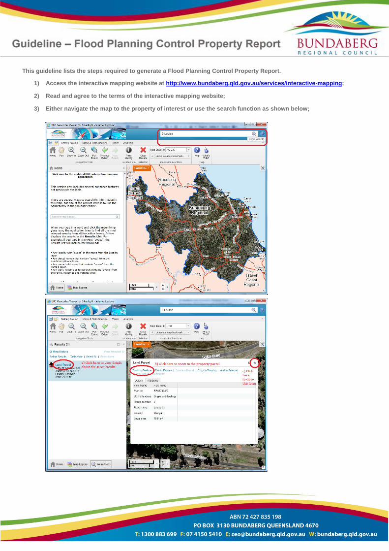
This guideline lists the steps required to generate a Flood Planning Control Property Report.
1) Access the interactive mapping website at http://www.bundaberg.qld.gov.au/services/interactive-mapping;
2) Read and agree to the terms of the interactive mapping website;
3) Either navigate the map to the property of interest or use the search function as shown below;
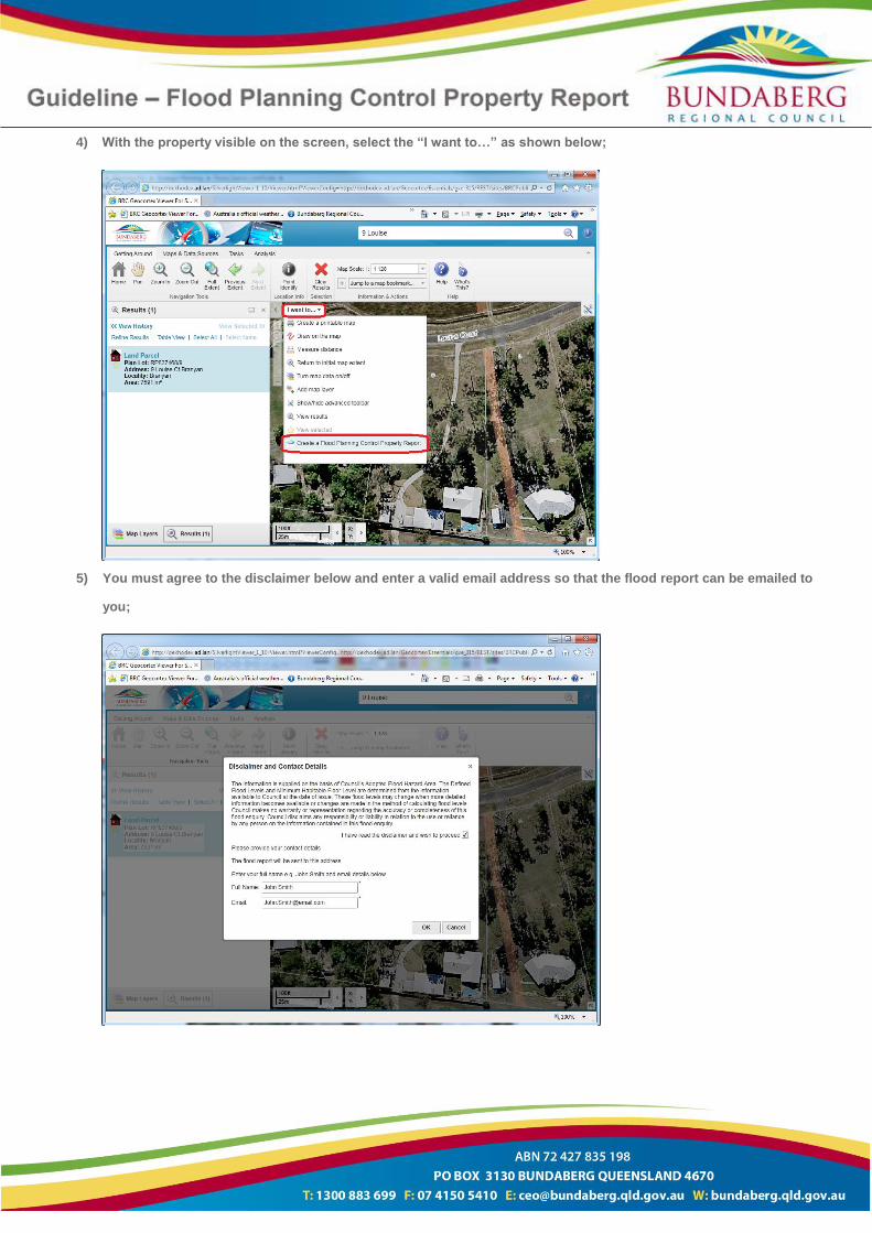
4) With the property visible on the screen, select the “I want to…” as shown below;
5) You must agree to the disclaimer below and enter a valid email address so that the flood report can be emailed to
you;
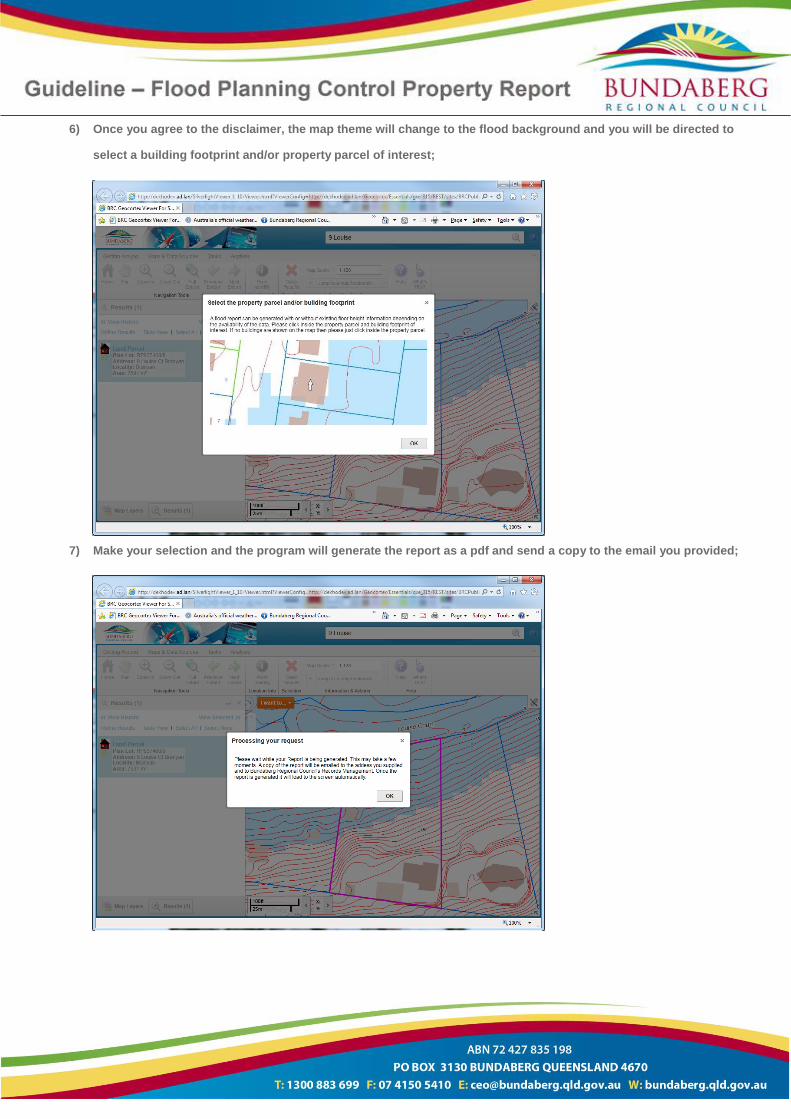
6) Once you agree to the disclaimer, the map theme will change to the flood background and you will be directed to
select a building footprint and/or property parcel of interest;
7) Make your selection and the program will generate the report as a pdf and send a copy to the email you provided;
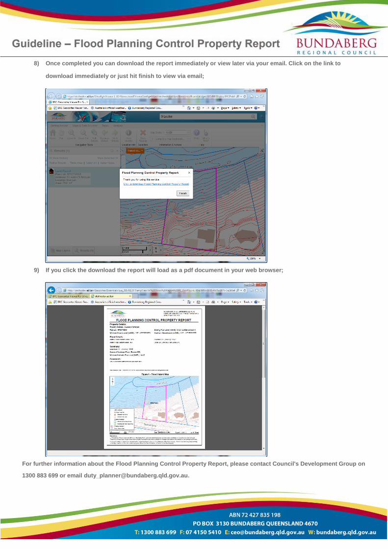
8) Once completed you can download the report immediately or view later via your email. Click on the link to
download immediately or just hit finish to view via email;
9) If you click the download the report will load as a pdf document in your web browser;
For further information about the Flood Planning Control Property Report, please contact Council's Development Group on
1300 883 699 or email [email protected].