Embed Size (px)
Citation preview

Three Worlds Meet

Wall Timeline
17
00
15
00
16
00
18
00
17
50
16
50
15
50
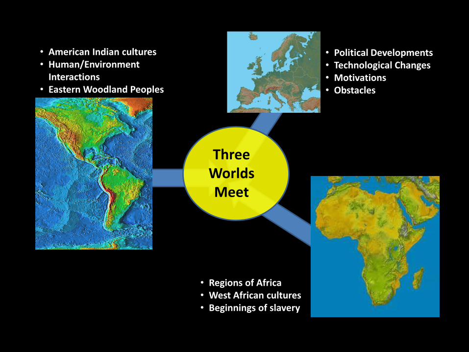
• Political Developments• Technological Changes• Motivations• Obstacles
• American Indian cultures• Human/Environment
Interactions• Eastern Woodland Peoples
• Regions of Africa• West African cultures• Beginnings of slavery
ThreeWorlds Meet

The World in 1491

What had been happening?

Ghana
Carolingian
Byzantine
Abbasid Caliphate
Axum
Gurjara-PratiharaTang China
Srivijaya
Parhae
Silla
Cordoba Caliphate
Heian Japan
States and Empires in 800 CE

Mongol Empire
Russia
Sung China
Koryo
Kamakura Japan
Delhi Sultanate
Scandanavian Kingdoms
Mali
Zimbabwe
BeninOyo
France
Ethiopia
Ayyubid Caliphate
Almohad Caliphate
Poland
Rum
H.R.E.
Hungary
England
Portugal
Spain
States and Empires in 1237 CE
Angkor

Mali
Oyo Benin
Zimbabwe
Zanj City-States
Ethiopia VijayanagaraSiam
Majapahit
Ashikaga JapanKorea
Marinids HafsidsMamluk Sultanate
Granada
Portugal Castile
France
ScotlandEngland
Union of Kalmar
Holy Roman Empire
Poland-Lithuania
Hungary
Ottoman Emp.
Russian States
Khanate of the Golden Horde
Jagatai Khanate
Ming ChinaTimurid Empire
States and Empires in 1400 CE

The World in 1491: Trade Routes

World One
The Americas

Aztec EmpireMayan States
Inca Empire
Microsoft®Encarta®Reference Library 2002. ©1993-2001 Microsoft Corporation. All rights reserved.

Lesson 3Comparing SW Native Americans and Pacific NW Native Americans
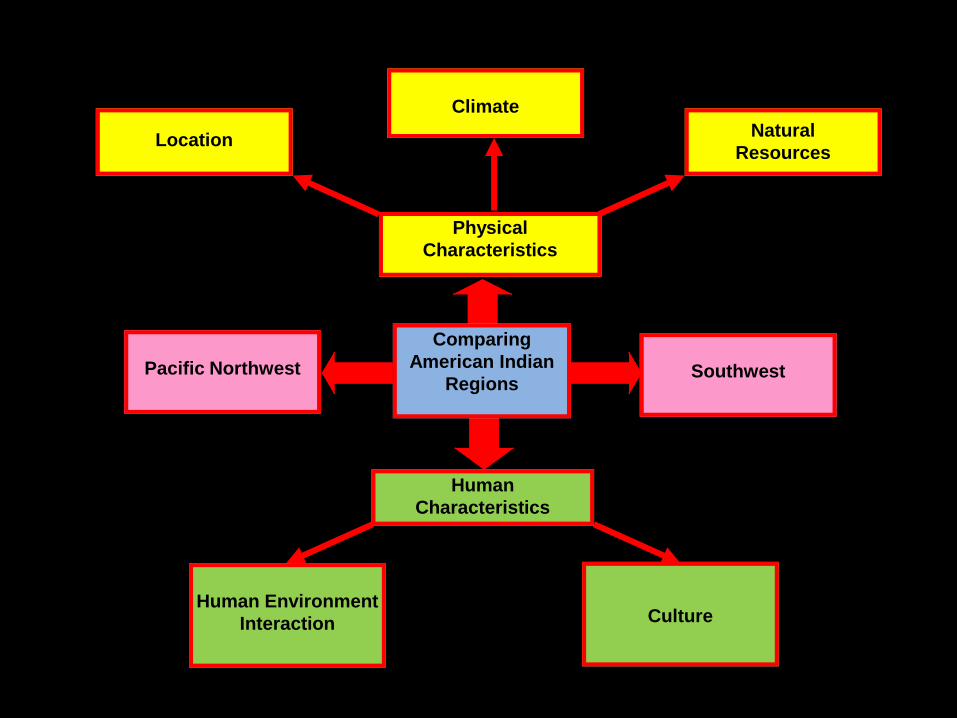
CultureHuman Environment
Interaction
Human
Characteristics
SouthwestPacific Northwest
Comparing
American Indian
Regions
Natural
Resources
Climate
Location
Physical
Characteristics

Su
mm
ary
Typ
e o
f
Ta
le
Cu
ltu
ral
Gro
up
Re
gio
nN
am
e o
f
Fo
lkta
le

Connecting Back to Grade 4
Think back to studying the Five Themes of Geography in fourth grade.
Jot down any of the themes you remember in your journal

Theme Questions
Location
Where is it?
What is its absolute location?
What is its relative location?
Place
What is it like there?
What are its natural characteristics?
What are its human characteristics?
Human/Environment
Interaction
How do people interact with the environment?
How have people used the environment?
How have people adapted to the environment?
How have people modified or changed the
environment?
Movement
How is the place connected to other places?
How and why have people, goods, and ideas
moved in and out of the place?
Regions
How might common geographic characteristics
help us understand this place?
How can the place be divided into regions?
To what regions does the place belong?
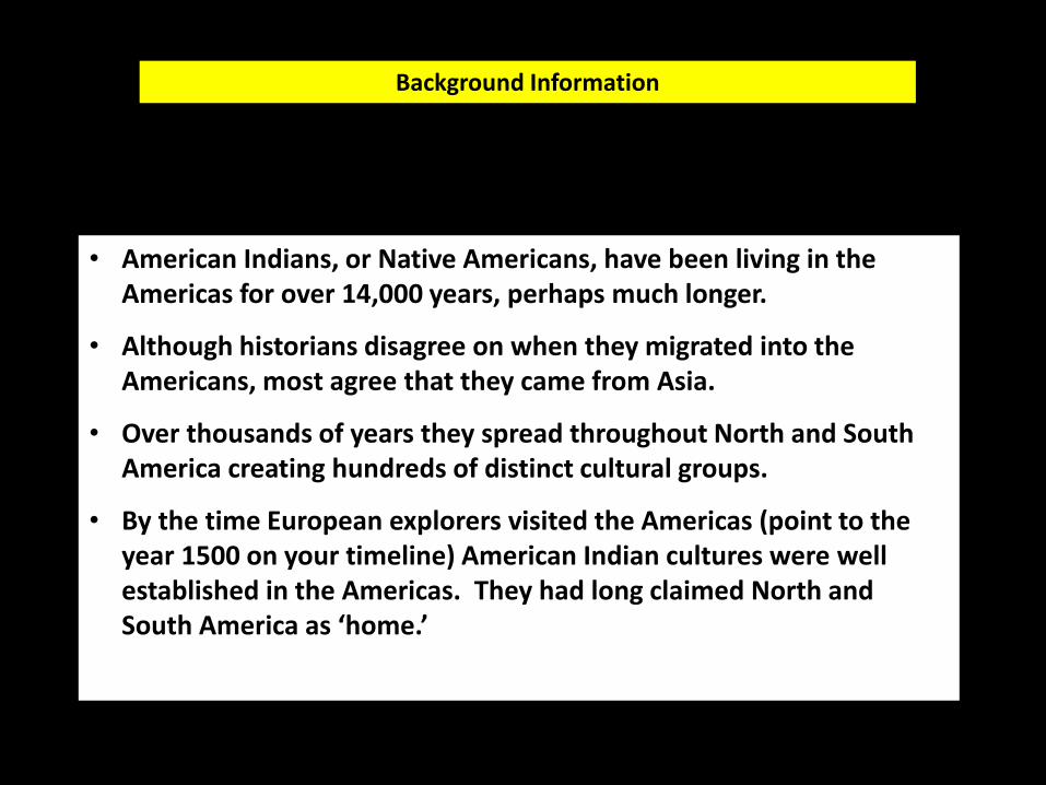
• American Indians, or Native Americans, have been living in the Americas for over 14,000 years, perhaps much longer.
• Although historians disagree on when they migrated into the Americans, most agree that they came from Asia.
• Over thousands of years they spread throughout North and South America creating hundreds of distinct cultural groups.
• By the time European explorers visited the Americas (point to the year 1500 on your timeline) American Indian cultures were well established in the Americas. They had long claimed North and South America as ‘home.’
Background Information

Locating American Indian Regions
Pacific Northwest (blue)Desert Southwest (yellow)Great Plains (brown)Eastern Woodland Peoples east of the Mississippi River (green)


Connecting Back to Grade 4
Southwest Northwest
Climate
Landforms
Bodies of Water
Vegetation
Other
geographic
information
• Dry• Extreme temperatures: hot
days and cold nights
Mild and wet
• Mountains• Plateaus• Canyons• Deserts
• Rocky, narrow coastline• Some offshore islands
Very little water
• Ocean• Some rivers flowing into
the ocean
Very few trees or other plants
• Lots of trees• Lots of berries and plants
that provided food
Will vary Will vary

GEOGRAPHY CULTURE
Where peoplelive
How peoplelive

Gathering Information

Southwest American IndiansReference Sheet
Examples of People of the Region: Acoma, Hopi, Zuni, Navajo, Tewa
Location: Where was it?• Southwest part of what is now the United States• Present day states of: most of Arizona and New Mexico, small parts of California, Utah, Colorado and Texas
Place: What was it like there?• Rugged high country in the north with mesas and canyons• Areas with mountains and lots of desert• Common feature: dryness• Special feature: The Grand Canyon
Human/Environment Interaction: How did people use the land? How did people adapt to the land?• Stone and adobe brick was used for pueblo houses since there were few trees for building.• People learned to farm in the dry regions and used irrigation to water crops.• People ate little meat since animals were scarce.• Water was a precious resource and there were strict rules about the use of water.
Cultural Information• Two types of life in this area: farming and nomadic hunting and gathering• The nomadic groups lived in single houses called wickiups or hogans• Pottery and weaving were important art forms

Pacific Northwest American IndiansReference Sheet
Examples of People of the Region: Haida, Kwakiutl, Makah, Salish, Tlingit
Location: Where was it?• Along Pacific Ocean in northwest• Present day states of: southern Alaska, northern California, Washington, and Oregon
Place: What was it like there?• Long, narrow region about 150 miles wide and 2000 miles long• Mountains come right down to the ocean in many places• Mild climate with lots of rainfall• Many vast forests
Human/Environment Interaction: How did people use the land? How did people adapt to the land?• Most people lived right at the ocean’s edge on narrow sand and gravel beaches• Houses and many other things were made of cedar wood from the forests• Traveled by sea since it was hard to travel in the mountainous area• Made rain gear of bark
Cultural Information• Lived in large plank houses that held several families• Wood was used to make chests, canoes, boxes, masks, etc.• Potlatch ceremonies were important cultural events• Totem poles were an important cultural characteristic

Southwest Pacific Northwest
Fo
od
Ho
us
es
Clo
thin
gA
rtT
rad
itio
ns
Oth
er
Summarizing Information

Southwest Pacific NorthwestF
oo
d Corn
Beans
Squash
Fish
Deer and elk
Berries
Shellfish
Ho
us
es
Adobe and stone pueblos
Single family hogans
Large wooden houses that held several
families
Clo
thin
g
Cotton clothing
Embroidery on clothing
Clothing of cedar bark
Bark rainwear
Art
Pottery
Weaving
Baskets
Totem poles
Decorated pieces of copper
Carved wooden boxes
Baskets
Tra
dit
ion
s
Kivas for religious ceremonies
Kachinas Potlatch ceremony
Oth
er
Irrigated land so they could farm in a dry area
Strict rules about water use
Made fishing nets of cedar rope
Hollowed out logs for large canoes

Southwest Pacific Northwest
Adapting to the Environment
• People built houses of adobe and rocks because trees were scarce.
• People learned how to farm in a dry region.
• People found crops that would grow in a dry region like beans.
• People made lots of things of wood because there were so many trees.
• People depended on fish, wildlife and plants instead of farming .
• People built their villages on the narrow coastlines where the land was flat.

Southwest Pacific Northwest
Changing the Environment
• People dug irrigation ditches to water their crops.
• People used land for farms.
• People cut down trees to use for houses, clothing, etc.
• People hunted animals and caught fish and shellfish.

A Poem for Two Voices – Writing Plan
Southwest (Reader #1)
BothReader #1 and #2
Pacific Northwest (Reader #2)
We lived in the
Southwest
Northwest near the Pacific Ocean
Our climate was
We ate
We made
Our houses
We adapted to our environment by


Assessment
SOUTHWEST PACIFIC NORTHWEST
HO
WD
IDT
HE
YA
DA
PT
TO
TH
EIR
EN
VIR
ON
ME
NT?
HO
WD
IDT
HE
YM
OD
IFY,
OR
CH
AN
GE,
TH
EIR
EN
VIR
ON
ME
NT?

Pacing
1. Reviewing the Five Themes of Geography2. Map: Native American Regions3. Reviewing the geography of the Pacific
Northwest and Southwest regions.4. Gathering cultural information on the
Pacific Northwest and Southwest5. Comparing the PNW and SW6. Optional: Writing assignment

Lesson 4Eastern Woodland Native Americans

Eastern
Woodland
American
Indians
Trade
Family
Structure
Land Use
Government Property
Ownership

Eastern Woodland Native Americans

Connecting back to grade 3…

The
Three
Fires
FoodGroups
Houses
Other
Things
they
made
Things
they
did

The
Three
Fires
FoodGroups
Houses
Other
Things
they
made
Things
they
did

Ojibwa Potawatomi Odawa/Ottawa
Where did they
live in
Michigan?
Southern shore of
Lake Superior
Western shore of
Lake Huron
Southwest Michigan
Later in area near
Saginaw
Eastern shore of Lake
Michigan
What were their
houses like?
Small round
wigwams
Wigwams
Rectangular lodges
Wigwams
Longhouses for many
families
What did they
eat?
Crops like corn and
squash
Maple syrup
Wild rice
Nuts and berries
Squash, melons,
corn, beans
Maple syrup and
sugar
Maple syrup
Fish
Farming crops
What was
special about
them?
Excellent hunters,
fishers, and trappers
Made excellent birch
bark canoes
Great farmers
Moved to forests in
winter
They were great traders
Had a great leader
named Chief Pontiac
Built log walls around
villages
What did they
make?
Deerskin moccasins
and bags with quills
Birch bark baskets
and boxes
Beadwork
Quill embroidery
Baskets
Beadwork
Woven mats
Bags
Baskets
People of the “Three Fires”

Eastern Woodland Regions: Northeast

Examples of People of the Region: Abenaki, Delaware, Fox, Huron, Iroquois, Miami, Oneida, Seneca, Odawa
Location: Where was it?
• East to west: from the Atlantic Ocean to the Mississippi River• North to South: from the Great Lakes to the Ohio Valley• Present day states of: Maine, Vermont, New Hampshire,
Massachusetts, Rhode Island, Connecticut, New York, New Jersey, Pennsylvania, Delaware, Ohio, Indiana, Illinois and Michigan; plus most of Maryland, West Virginia, Kentucky and Wisconsin; and smaller parts of Virginia, North Carolina, Missouri, Iowa, and Minnesota.
Place: What was it like there?
• Most of the land was woodland.• Lots of variety: sea coasts, hills, mountains, lakes, and river valleys.• The climate had four seasons. Many places had a fairly short growing
season and cold winters.• Special features: the Great Lakes, many large rivers

Human/Environment Interaction: How did people use the land? How did people adapt to the land?
• Trees for houses, boats, tools, clothing, fuel, and bedding• Forests for food and hides for clothing• Rivers and lakes for food and transportation• Soil for farming
Cultural Information:
• Most densely populated Native American region• The people of this region spoke dialects of two language families:
Algonquian and Iroquoian.• Houses included wigwams and longhouses• Mostly permanent villages

Eastern Woodland Regions: Southeast

Eastern Woodland Regions: Southeast
Examples of People of the Region: Cherokee, Chickasaw, Choctaw, Lumbee, Natchez, Seminole, Timucua
Location: Where was it?
• East to west: from the Atlantic Ocean to the Mississippi River• North to South: Ohio Valley to the Gulf of Mexico• Present day states of: Florida, Georgia, Alabama, Louisiana and South Carolina;
most of Mississippi, Tennessee, North Carolina and Virginia; and parts of Texas, Oklahoma, Arkansas, Illinois, Kentucky, West Virginia, and Maryland.
Place: What was it like there?
• Most of the land was woodland especially yellow pine• Lots of variety: coastal plains with saltwater marshes, grasses and cypress trees,
river valleys, mountains• Much of the area had a fairly mild climate and long growing season.• Special feature: the Everglades
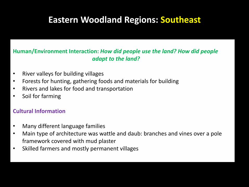
Eastern Woodland Regions: Southeast
Human/Environment Interaction: How did people use the land? How did people adapt to the land?
• River valleys for building villages• Forests for hunting, gathering foods and materials for building• Rivers and lakes for food and transportation• Soil for farming
Cultural Information
• Many different language families• Main type of architecture was wattle and daub: branches and vines over a pole
framework covered with mud plaster• Skilled farmers and mostly permanent villages

Comparing the Northeast and the Southeast Woodland Regions
Similarities:
• Farming• Forests• Rivers were important• Mostly permanent villages
Differences:
• Types of houses• Climate• Length of growing season• Language families

5 – U1.1.3: Describe Eastern Woodland American Indian life with respect to governmental and family
structures, trade, and views on property
ownership and land use.
• People in the Great lakes region used the lakes and waterways of the area as
trade routes.
• People like the Odawa developed as great traders – moving goods between other groups.
• Traders looked for goods that could not be found or made from the resources in their area. For example, people in good farming areas traded crops for meat and furs offered by skilled hunters in other areas. Traders from areas with birch trees traded birchbark containers for things made of copper which was not available in their area.

Looking at one representative group
5 – U1.1.3: Describe Eastern Woodland American Indian
life with respect to governmental and family structures, trade, and
views on property ownership and land use.

The Haudenosaunee Confederation(Iroquois)
"People of the Longhouse"

• Men and women played different roles in the society but both genders were viewed as making valuable contributions.
• Clans were an important part of village life.
• Women had power within the village.
• Houses and property were shared.
• Land was communally owned
• Villages (and nations) had boundaries for hunting and farming but no one ‘owned the land.’

Forming a Confederation
We agree to…
_______________________________________________________________________________________________________________________________________________________
_______________________________________________________________________________________________________________________________________________________
_______________________________________________________________________________________________________________________________________________________

Agreements of the Haudenosaunee (Iroquois) Confederation
• Each of the five nations could send representatives to the Great Council
• The council would meet at least once a year to discuss relations with other nations, plan warfare and resolve disagreements
• All members of the league had to agree on major decisions
• Members agreed not to fight among themselves.
• Individual nations could still live according to their own traditions and beliefs.
• The people of each nation retained control over their own territory.

Assessment – Part 1
Directions: Choose the best answer.
1. What best describes the Eastern Woodlands region?
A. a region with a good climate but few resourcesB. a region with many different climates and natural featuresC. a region with mainly flat land and forestsD. a region where it was difficult to survive
2. Which of the following is an example of how Eastern Woodland Native Americans adapted to their environment?
A. They found many different ways to use trees.B. They were members of both a family and a clan.C. They sometimes removed trees from an area so they could farm.D. They sometimes had conflicts over hunting areas.
3. What was the main reason people in this region traded?
A. They wanted to own as many goods as they could.B. They wanted to use rivers and lakes as trade routes.C. They wanted to get goods that could not be found or made from the resources they had.D. They had few resources of their own.
4. What best describes the five nations of the Haudenosaunee, or Iroquois, League before they formed a confederation?
A. The five nations lived in peace and got along well.B. The five nations were often in conflict with one another.C. The five nations did not interact with each other.D. The five nations were mainly trading partners.
5. How was land viewed by most Eastern Woodlands American Indians?
A. Land was something to be owned and cared for by only chiefs and other leaders.B. Land was only important because it could be used for hunting.C. Land should be divided up among families and fenced off.D. Land was something you could use but not really own.

Assessment – Part 2
Directions: Write a paragraph describing Eastern Woodland American Indian Life. Make sure to include at least two of the following: government, family structure, trade, land use. Use the graphic organizer below to help you plan your paragraph.
Characteristic Characteristic
Characteristic Characteristic

Pacing
1. Connecting Back to Grade 3: People of the Three Fires
2. Eastern Woodlands of the Northeast3. Eastern Woodland of the Southeast4. Comparing the NE and SE5. Looking at a representative group: The
Haudenosaunee


![Kejatuhan Srivijaya dalam Sejarah Melayu[O.W.Wolters].pdf](https://img.pdfslide.net/doc/110x75/56d6c0181a28ab301698eb3b/kejatuhan-srivijaya-dalam-sejarah-melayuowwolterspdf.jpg)


