Embed Size (px)
Citation preview

TiftonTifton
GeorgiaGeorgia
FloridaFloridaGulf of MexicoGulf of Mexico
AtlantaAtlanta
AthensAthens
Irrigation AssociationIrrigation AssociationAnaheimAnaheim
Revisiting Farm Ponds for Irrigation Revisiting Farm Ponds for Irrigation Water Supply in the Southeast USWater Supply in the Southeast US
presented by:presented by:
Jim Hook, Shane Conger, and Kerry HarrisonJim Hook, Shane Conger, and Kerry Harrison
National Environmentally Sound Production Agriculture LaboratoryNational Environmentally Sound Production Agriculture Laboratory
The University of Georgia, Tifton CampusThe University of Georgia, Tifton Campus
http://www.nespal.org/SIRPhttp://www.nespal.org/SIRP
Assessment of man-made pondsAssessment of man-made ponds
As State and Federal Governments begin to look stream As State and Federal Governments begin to look stream flow for flow for withdrawal and discharge permittingwithdrawal and discharge permitting
As they examine As they examine threatened habitats and speciesthreatened habitats and species As ground As ground water level declinewater level decline
Agricultural IrrigationAgricultural Irrigation
Ponds asPonds as As alternative to As alternative to directdirect stream withdrawals during dry periods stream withdrawals during dry periods
that trigger irrigationthat trigger irrigation As alternative to GW withdrawals from aquifers that sustain As alternative to GW withdrawals from aquifers that sustain
base flowbase flow As alternative to GW withdrawals that lower heads in areas As alternative to GW withdrawals that lower heads in areas
with long term decline (confined aquifers)with long term decline (confined aquifers)
Ponds supply water for Ponds supply water for irrigationirrigation
on Coastal Plain Farmson Coastal Plain Farms Early irrigation in GeorgiaEarly irrigation in Georgia
Tobacco, vegetables, and various supplemental Tobacco, vegetables, and various supplemental irrigationirrigation
Mostly applied by portable and temporary irrigationMostly applied by portable and temporary irrigation
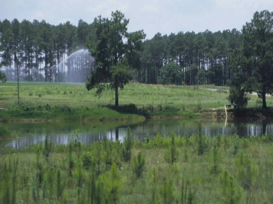
Water supplies from the Water supplies from the streamsstreams flowing through and flowing through and along their property, but because many of these along their property, but because many of these streams dried during growing season they turned to streams dried during growing season they turned to pondsponds
PondsPonds among earliest irrigation water among earliest irrigation water sourcessources..
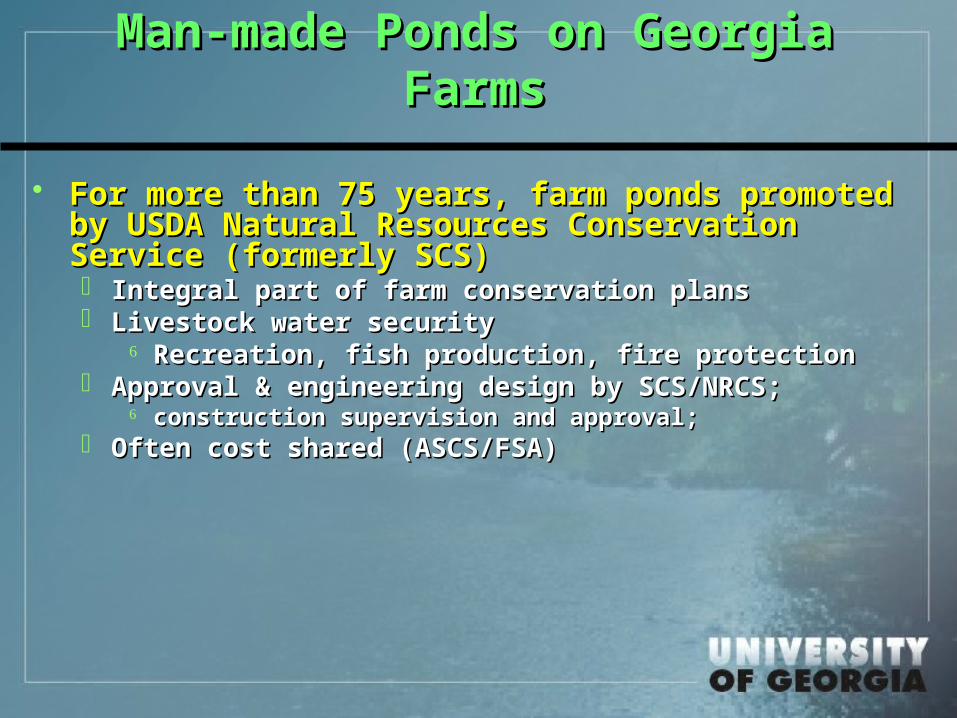
Man-made Ponds on Georgia Man-made Ponds on Georgia FarmsFarms
For more than 75 years, farm ponds promoted For more than 75 years, farm ponds promoted by USDA Natural Resources Conservation by USDA Natural Resources Conservation Service (formerly SCS)Service (formerly SCS) Integral part of farm conservation plansIntegral part of farm conservation plans Livestock water securityLivestock water security
Recreation, fish production, fire protectionRecreation, fish production, fire protection Approval & engineering design by SCS/NRCS;Approval & engineering design by SCS/NRCS;
construction supervision and approval;construction supervision and approval; Often cost shared (ASCS/FSA)Often cost shared (ASCS/FSA)
0.00
0.20
0.40
0.60
0.80
1.00
1.20
1.40
1.60
1.80
1970 1975 1977 1980 1982 1986 1989 1992 1995 1998 2000 2004
Are
a (m
illio
n a
c)
Area of irrigation systemsArea of Irrigated Crops
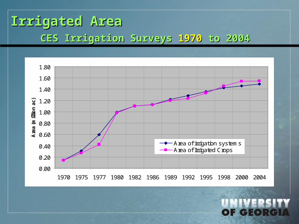
Irrigated Area Irrigated Area CES Irrigation Surveys CES Irrigation Surveys 19701970 to 2004 to 2004
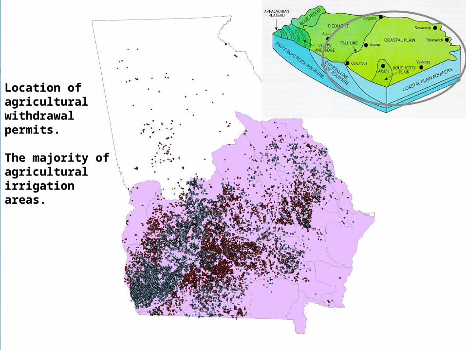
Location of agricultural withdrawal permits.
The majority of agricultural irrigation areas.

Assessment of Farm PondsAssessment of Farm Ponds Quantity and their hydrologic significanceQuantity and their hydrologic significance
The Study Area: South Georgia HUC08 (Sub-basins)
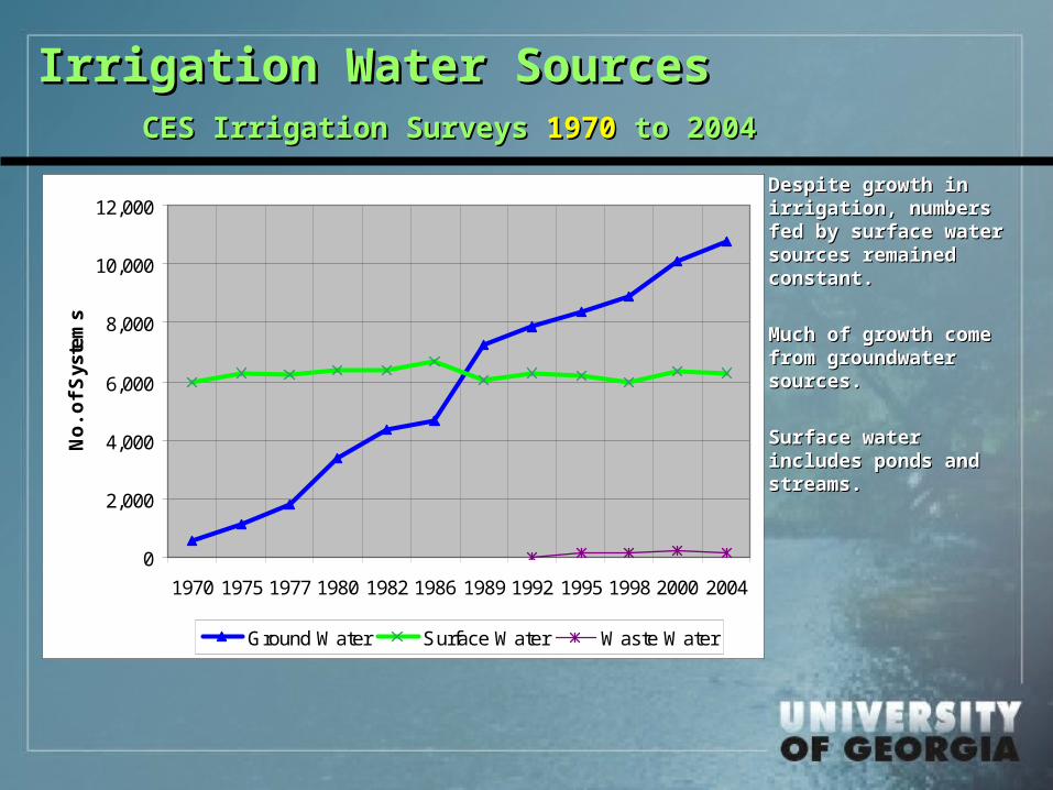
Irrigation Water SourcesIrrigation Water SourcesCES Irrigation Surveys CES Irrigation Surveys 19701970 to 2004 to 2004
0
2,000
4,000
6,000
8,000
10,000
12,000
1970 1975 1977 1980 1982 1986 1989 1992 1995 1998 2000 2004
No
. o
f S
yste
ms
Ground Water Surface Water Waste Water
Despite growth in Despite growth in irrigation, numbers irrigation, numbers fed by surface water fed by surface water sources remained sources remained constant.constant.
Much of growth come Much of growth come from groundwater from groundwater sources.sources.
Surface water Surface water includes ponds and includes ponds and streams.streams.
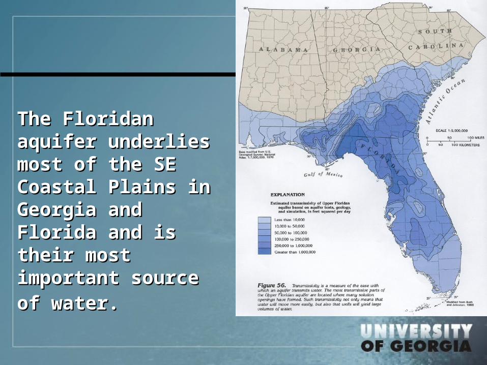
The Floridan The Floridan aquifer underlies aquifer underlies most of the SE most of the SE Coastal Plains in Coastal Plains in Georgia and Georgia and Florida and is their Florida and is their most important most important source of water.source of water.
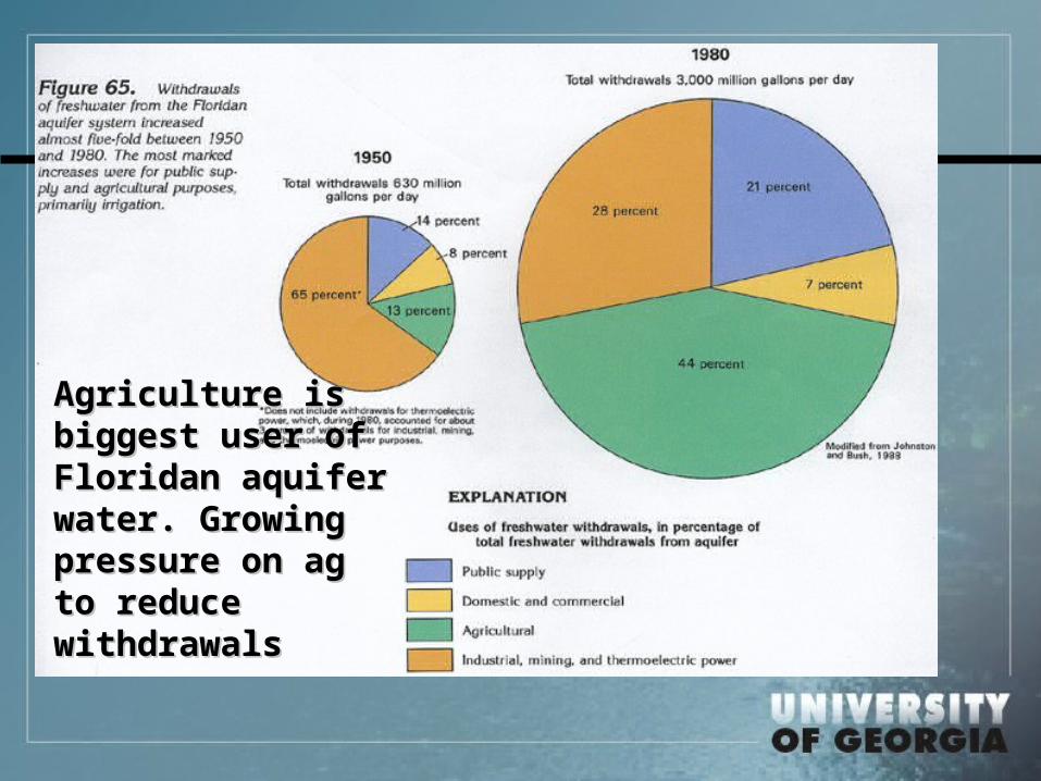
Agriculture is Agriculture is biggest user of biggest user of Floridan aquifer Floridan aquifer water. Growing water. Growing pressure on ag pressure on ag to reduce to reduce withdrawalswithdrawals
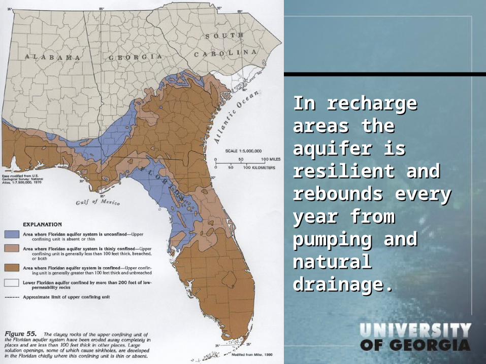
In recharge areas In recharge areas the aquifer is the aquifer is resilient and resilient and rebounds every rebounds every year from year from pumping and pumping and natural drainage.natural drainage.
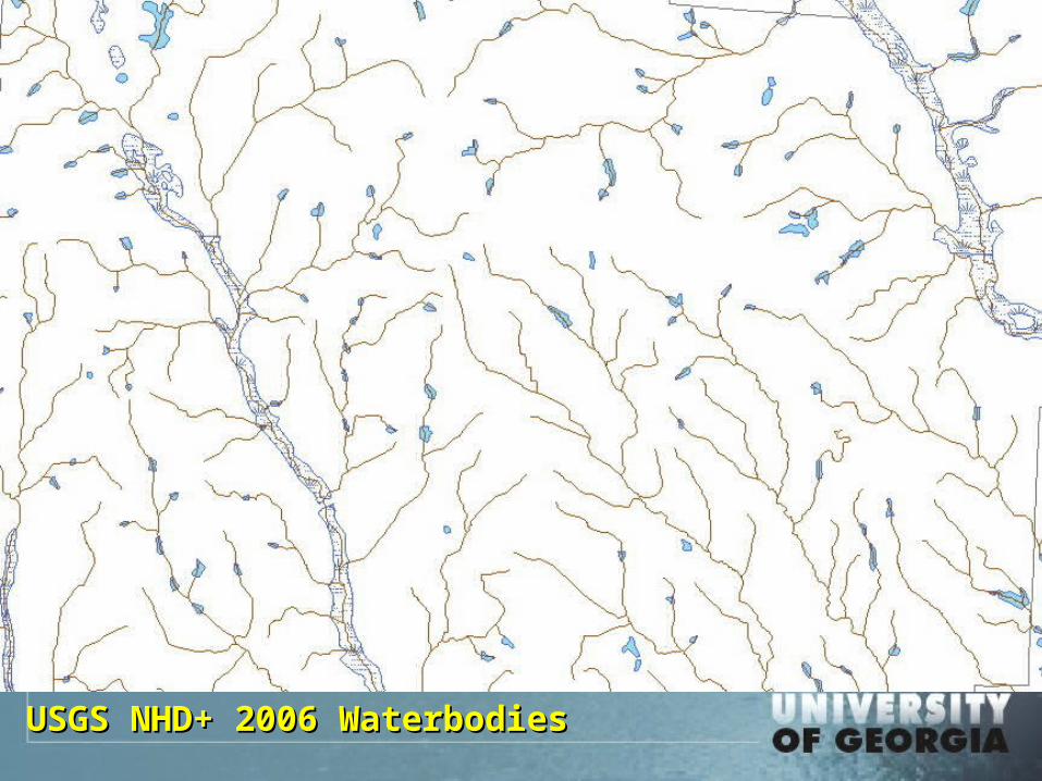
USGS NHD+ 2006 WaterbodiesUSGS NHD+ 2006 Waterbodies
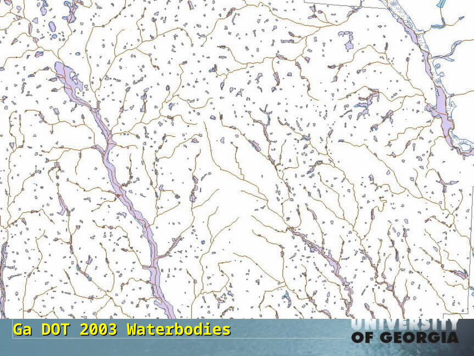
Ga DOT 2003 WaterbodiesGa DOT 2003 Waterbodies
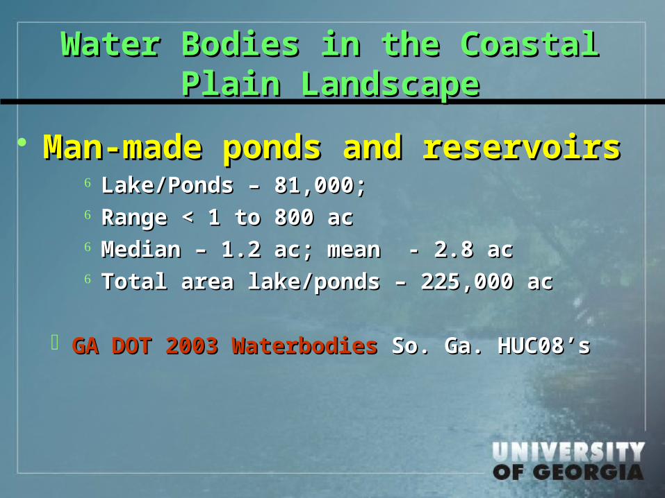
Water Bodies in the Coastal Water Bodies in the Coastal Plain LandscapePlain Landscape
Man-made ponds and Man-made ponds and reservoirsreservoirs
Lake/Ponds – 81,000;Lake/Ponds – 81,000; Range < 1 to 800 ac Range < 1 to 800 ac Median – 1.2 ac; mean - 2.8 acMedian – 1.2 ac; mean - 2.8 ac Total area lake/ponds – 225,000 ac Total area lake/ponds – 225,000 ac
GA DOT 2003 WaterbodiesGA DOT 2003 Waterbodies So. Ga. HUC08’s So. Ga. HUC08’s
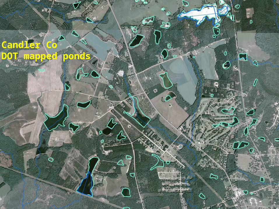
Candler Co DOT mapped ponds
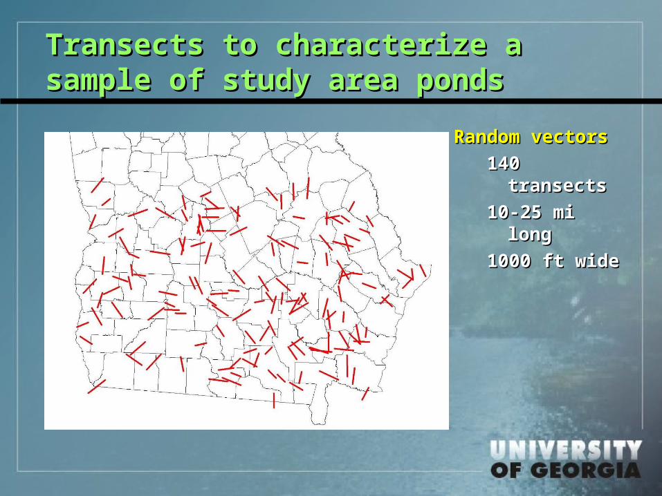
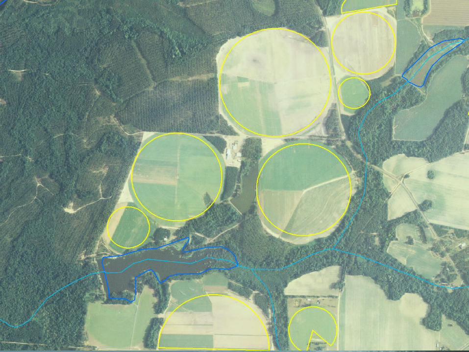
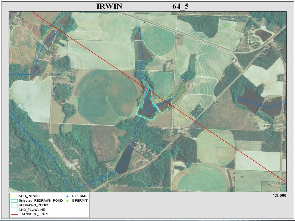
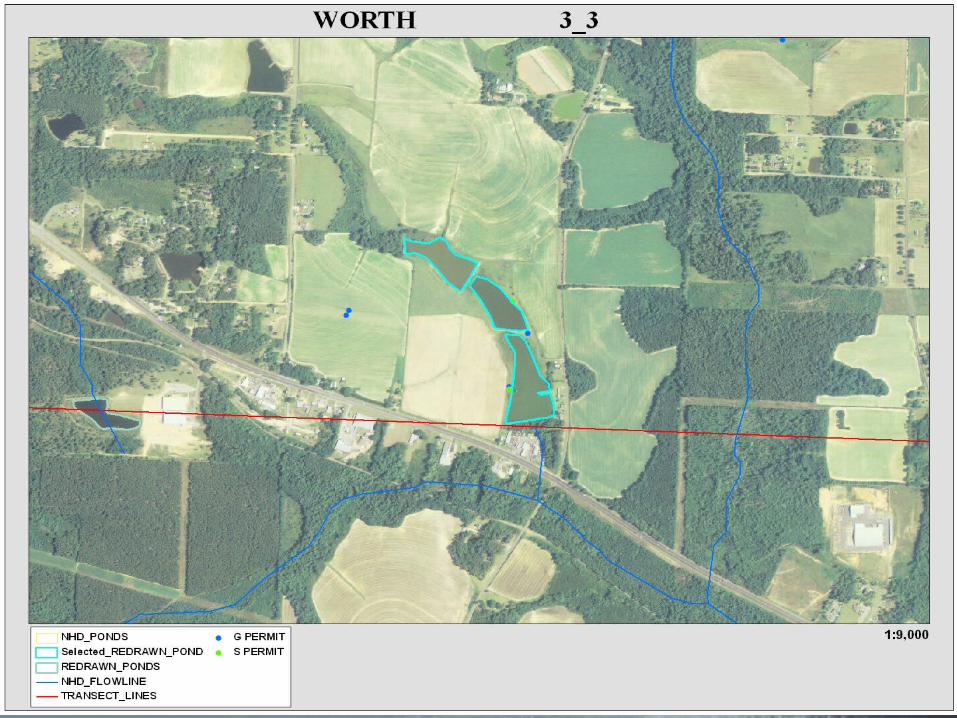
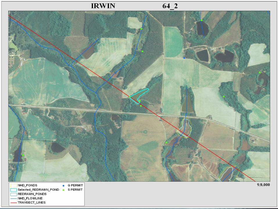
Transects to characterize a Transects to characterize a sample of study area pondssample of study area ponds
Random vectorsRandom vectors
140 140 transectstransects
10-25 mi 10-25 mi longlong
1000 ft wide1000 ft wide
Assessment of man-made pondsAssessment of man-made ponds
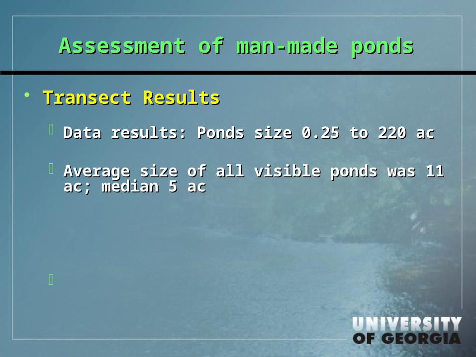
Transect ResultsTransect Results
Data results: Ponds size 0.25 to 220 acData results: Ponds size 0.25 to 220 ac
Average size of all visible ponds was 11 Average size of all visible ponds was 11 ac; median 5 acac; median 5 ac
Assessment of man-made pondsAssessment of man-made ponds
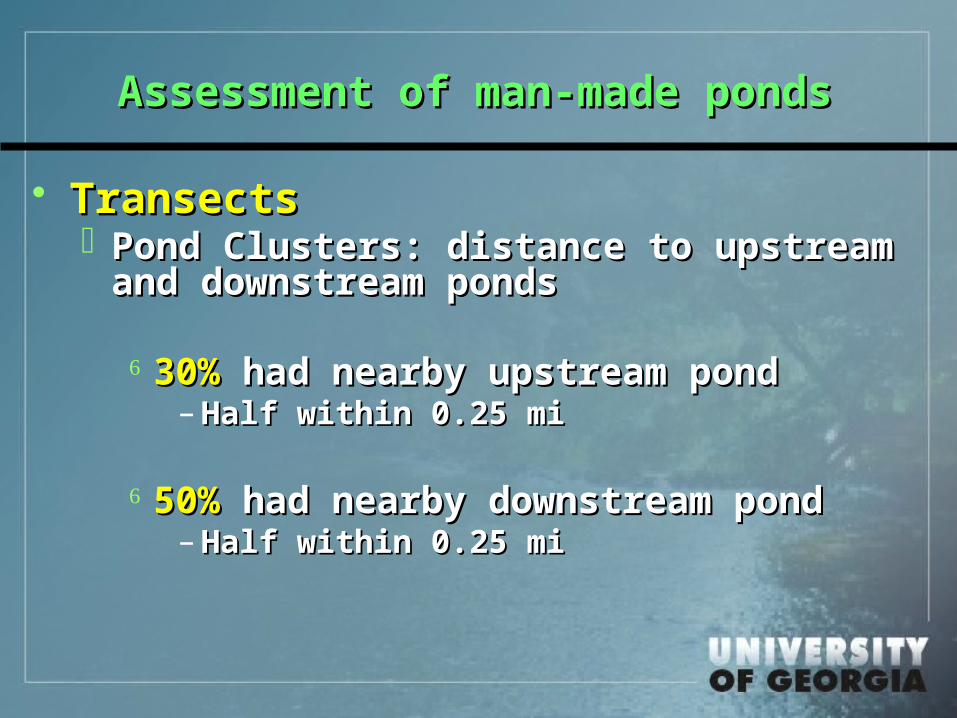
TransectsTransects Pond Clusters: distance to upstream Pond Clusters: distance to upstream
and downstream pondsand downstream ponds
30%30% had nearby upstream pond had nearby upstream pond– Half within 0.25 miHalf within 0.25 mi
50%50% had nearby downstream pond had nearby downstream pond– Half within 0.25 miHalf within 0.25 mi
Assessment of man-made pondsAssessment of man-made ponds
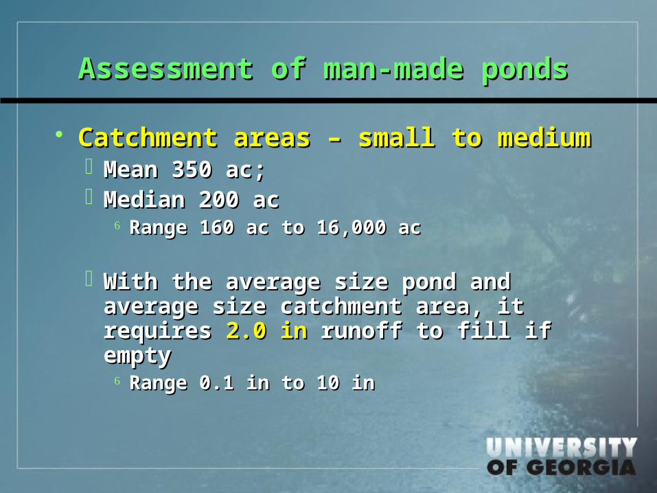
Catchment areas – small to mediumCatchment areas – small to medium Mean 350 ac; Mean 350 ac; Median 200 acMedian 200 ac
Range 160 ac to 16,000 acRange 160 ac to 16,000 ac
With the average size pond and average With the average size pond and average size catchment area, it requires size catchment area, it requires 2.0 in2.0 in runoff to fill if emptyrunoff to fill if empty
Range 0.1 in to 10 in Range 0.1 in to 10 in

Assessment of man-made pondsAssessment of man-made ponds
Proximity and Use for irrigationProximity and Use for irrigation 83% within 0.25 mi of farm field 83% within 0.25 mi of farm field 64% adjacent to farm field64% adjacent to farm field
25% had existing pump or permitted 25% had existing pump or permitted withdrawal presentwithdrawal present
Within Ga, 12,700 permits for ag water Within Ga, 12,700 permits for ag water withdrawal from pondswithdrawal from ponds
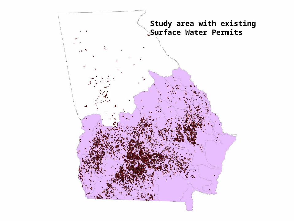
Study area with existing Surface Water Permits

Reliability of Farm Water SupplyReliability of Farm Water Supply Quantity of stored waterQuantity of stored water
Assume ratio of mapped to unmapped NHD and Assume ratio of mapped to unmapped NHD and relative sizes, there arerelative sizes, there are
9,500 farm ponds in South Georgia having average 9,500 farm ponds in South Georgia having average area of 11 acarea of 11 ac
At average depth of only 5 ft these store 530,000 At average depth of only 5 ft these store 530,000 ac-ftac-ft
Relative to irrigation in GeorgiaRelative to irrigation in Georgia
With a typical to high annual consumption With a typical to high annual consumption of 1 ac-ft/ac, this would supply of 1 ac-ft/ac, this would supply 1/3 to ½ 1/3 to ½ of of all irrigated acreage in Georgia without in-all irrigated acreage in Georgia without in-season resupplyseason resupply
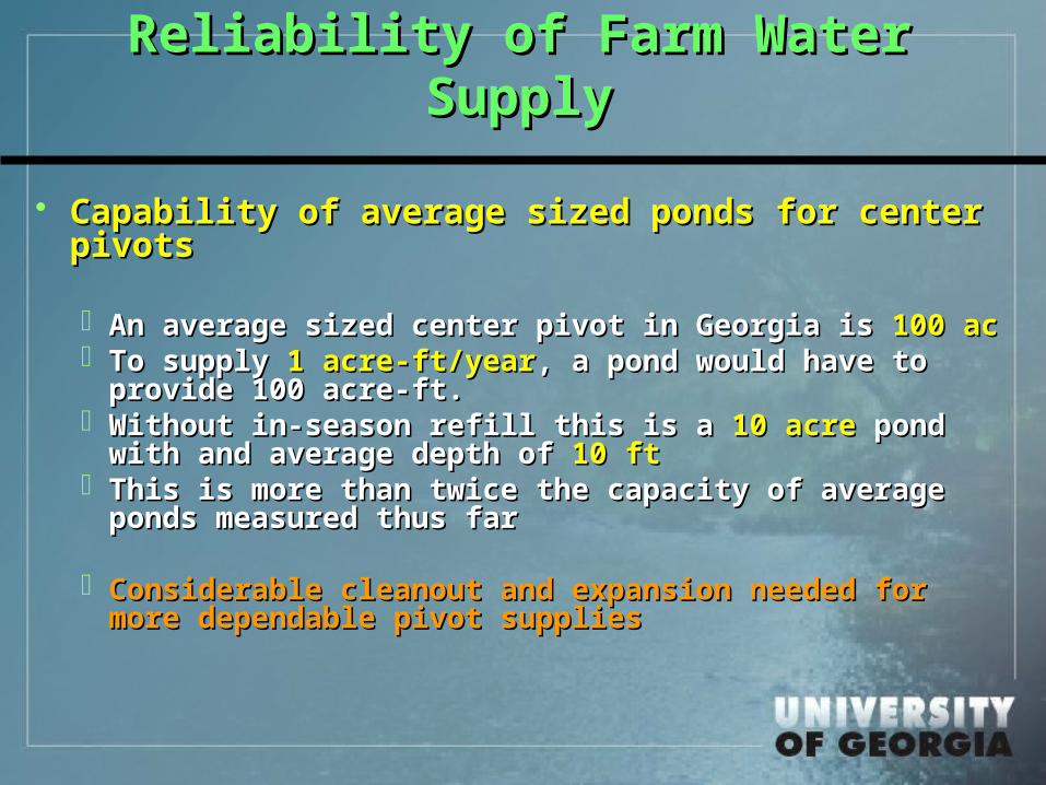
Reliability of Farm Water SupplyReliability of Farm Water Supply
Capability of average sized ponds for center Capability of average sized ponds for center pivotspivots
An average sized center pivot in Georgia is An average sized center pivot in Georgia is 100 ac100 ac To supply To supply 1 acre-ft/year1 acre-ft/year, a pond would have to , a pond would have to
provide 100 acre-ft.provide 100 acre-ft. Without in-season refill this is a Without in-season refill this is a 10 acre10 acre pond pond
with and average depth of with and average depth of 10 ft10 ft This is more than twice the capacity of average This is more than twice the capacity of average
ponds measured thus farponds measured thus far
Considerable cleanout and expansion needed for Considerable cleanout and expansion needed for more dependable pivot suppliesmore dependable pivot supplies
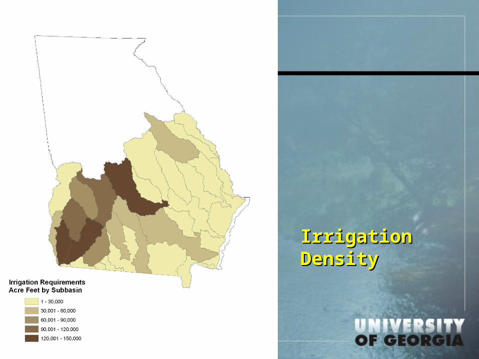
Irrigation Irrigation DensityDensity
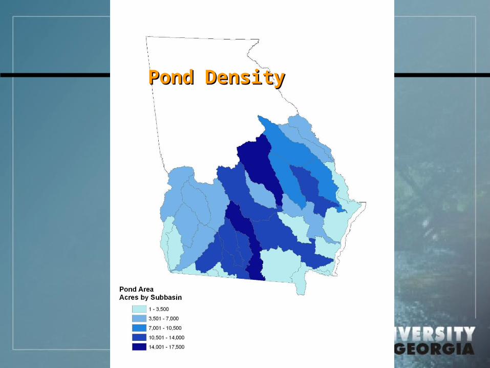
Pond DensityPond Density

For existing For existing ponds and ponds and irrigationirrigation
Capability to Capability to meet irrigation meet irrigation demanddemand
Reliability of Farm Water SupplyReliability of Farm Water Supply
ConclusionsConclusions Existing and refined GIS data show that Existing and refined GIS data show that
man-made ponds are numerous and man-made ponds are numerous and widespread.widespread.
Many are too small or too remote from farm Many are too small or too remote from farm fields to serve as reliable irrigation supplies. fields to serve as reliable irrigation supplies. Still there are at least 10 thousand suitable Still there are at least 10 thousand suitable for irrigation supply.for irrigation supply.
Expansion and cleanout efforts on existing Expansion and cleanout efforts on existing ponds could substantially increase water ponds could substantially increase water security for irrigated farmers and lower security for irrigated farmers and lower dependence on groundwaterdependence on groundwater