Embed Size (px)
Citation preview

TO ALL PERSONS INTERESTED IN WATER APPLICATIONS IN WATER DIVISIO...ed applications filed in the office of the Water Clerk for Water
TO ALL PERSONS INTERESTED IN WATER APPLICATIONS IN WATER DIVISION 1: Pursuant to CRS, 37-92-302, you are hereby notified that the following pages comprise a resume of applications and amended applications filed in the office of the Water Clerk for Water Division No. 1 during the month of June, 1999.
99CW079 ROBERT FREEMAN, 40092 St. Hwy. 14, Briggsdale, CO 80611. Application for Underground Water Right, IN WELD COUNTY. Both wells are in the NW1/4NW1/4, S26, T8N, R62W, 6th P.M.. Well #1 is 165' from N section line and 588' from W section line. Well #2-96274 is 300' from N section line and 500' from W section line. Source: Laramie Fox Hills Aquifer. Depth: Well #1-384.5', Well #2-96274-431' Appropriation: Well #1 prior to 1928; Well #2-96274-12/11/1978 Amount for each well: 15 gpm Proposed use: Irrigation of 1/2 acre of lawns and garden. Household use for 2 dwellings & livestock, both on the range and in confinement. Remarks: The original well (#1) was used for the dwellings and livestock.. The new well (#2) is now also used for both as another point of diversion for the original well. The confined feeding operation will have a maximum capacity of 5,000 head. I have contacted GASP to provide augmentation water. (2 pages)
99CW080 JAMES LEE SHUFORD & RAELYNN MARIE SHUFORD, 12946 N. 4th St., Parker, CO 80134. Application for Underground Water Right, IN DOUGLAS COUNTY. Well #1-105120 is located in the NW1/4NE1/4, S7, T6S, R66W, 6th P.M., 4Authorized Gateway Customer Page 1 8/4/9945' from the N section line and 1895' from the E section line, a/k/a Lot 2, Block 3, Filing 1, Grandview Estates Subdivision. Source: Groundwater Depth: 280' Appropriation: 3/21/1979 Amount claimed: 12 gpm (2 A/F annually) If well is non-tributary: Name of Aquifer: Dawson Use: Household use and irrigation of one-half acre and possible use for watering 3 horses at a maximum. (2 pages)
99CW081 ARLENE G. HOVLAND, 1050 Clear Creek Road, Evergreen, CO 80439. Application for Underground Water Right, IN CLEAR CREEK COUNTY. Arlene's Well #1-98037 is located in the NW1/4, S3, T4S, R72W, 6th P.M., 962' from N section line and 740' from W section line, a/k/a Lot 9, Filing 3 Saddle Back Ridge Subdivision. Source: Groundwater Depth: 345' Appropriation: 5/1/1978 Amount claimed: 4 1/2 gpm Use: Household use only. (2 pages)
99CW082 WILLIAM G. & IVA J. BRATTEBO, 27223 Armadillo Way, Evergreen, CO 80439-6229. Application for Underground Water Right, IN JEFFERSON COUNTY. Well #1-156106 is located in the NW1/4SW1/4, S2, T6S, R71W, 6th P.M., 1800' from the S section line and 955' from the W section line, a/k/a Lot 73, Filing 6, Evergreen Meadows. Source: Groundwater Depth: 543' Appropriation: 4/26/ 1990 Amount claimed: 15 gpm Use: Household use only, well is limited to ordinary purposes inside a single family dwelling. (2 pages)
file:///U|/supct/watercourts/wat-div1/1999resumes/june1999.htm (1 of 52) [9/10/2008 9:28:16 AM]

TO ALL PERSONS INTERESTED IN WATER APPLICATIONS IN WATER DIVISIO...ed applications filed in the office of the Water Clerk for Water
99CW083 THOMAS G. TROSTEL & BEVERLY R. TROSTEL, 18470 WCR 19, Johnstown, CO 80534. Application for Water Rights (Surface), IN WELD COUNTY. Both structures are located in the NW1/4SW1/4, S34, T4N, R67W. 6th P.M. Trostel N Ditch is at a point approximately 1350' from N. line and 100' for W line S34. Trostel Center Ditch is at a point approximately 2600' from N line and 100' from W line S19. Source: Not runoff Amount claimed: 2 cfs each (CONDITIONAL) Use: 20 acres proposed to be irrigated in NW1/4SW1/4, S34, T4N, R67W. (2 pages)
99CW084 JANET FRAZIER, 395 Ash St., Denver, CO 80220-4921. Application for Change of Water Right, IN WELD COUNTY. Well No. 1-11495 decreed 7/5/1973 in Case No. W-2730, Water Division 1.. Decreed point of diversion: Well No. 1-11495 is located 19' N and 585' W of the E1/4 corner of S33, T4N, R65W, 6th P.M. Source: Groundwater Appropriation: 1/6/55 Amount: 1.067 cfs Historic use: Irrigation of approximately 45 acres in the NE1/4, S33, T4N, R65W, 6th P.M., until 1989 when pivot sprinkler installed. Now , supplemental source on 84.0 acres in NE1/4, S33, T4N, R65W, 6th P.M. Ditch water is the primary source of water in the sprinkler, with water from this well supplementing it in dry years. Well water alone irrigates only 2.5 acres of the 84.0 acres total. Proposed change: To allow continued use of the well as a supplemental source on 84.0 acres. The primary source on the 84.0 acres has historically been and will continue to be 2 shares of Platte Valley Irrigation Company. 9 shares of Farmers' Reservoir and Irrigation Company water are used on other land. Thus, the only change proposed is the number of acres the well can be used to supplement. (2 pages)
99CW085 (92CW169) MUSSER B. MOORE AND MARY ANN DOHN MOORE, 2117 Stonecrest Drive, Ft. Collins, CO 80521. Application to Make Absolute a Conditional Water Right, IN LARIMER COUNTY. Moore Pond (Reservoir) decreed 6/18/1993 in Case No. 81CW183, Water Division No. 1. Location: NE1/4NE1/4, S16, T7N, R70W, 6th P.M. Source: Intermittent Stream tributary to Redstone Creek Appropriation: 8/15/1979 Amount: 0.2 acre feet Use: Irrigation Outline of what has been toward completion: Activity toward completion for appropriation includes improvement to water transfer system by pvc tubing and valves and planting trees. Other improvements are consistent with those outlined in the referee's Finding filed on 5/24/1993. If claim to make absolute-water applied to beneficial use: summer-1993 to 1999 Amount: 0.2 AF Use: Irrigation Description of place of use where water is applied to beneficial use: NE1/4NE1/4, S16, T7N, R70 W, 6th P.M., approx. 200' S and 950' W of NE Corner, S16. (2 pages)
99CW086 HOWARD AND JULIE HETTINGER, 13341 County Road 8, Merino, CO 80741. (P. Andrew Jones, LIND, LAWRENCE & OTTENHOFF LLP, 1011 - 11th Ave., Greeley, CO 80631). Application for Underground Water Rights, IN LOGAN COUNTY. 2. Name of Structure: Hettinger Domestic Well (shallow), permit No. 45802. A. Legal Description In the SE 1/4 of the NE1/4 of S20, T6N, R53W, 6th P.M., and 1926' S of the N line of S20,T6N,
file:///U|/supct/watercourts/wat-div1/1999resumes/june1999.htm (2 of 52) [9/10/2008 9:28:16 AM]

TO ALL PERSONS INTERESTED IN WATER APPLICATIONS IN WATER DIVISIO...ed applications filed in the office of the Water Clerk for Water
R53W AND 168' W of E line of said section. b. Source: Alluvium. c. Depth: 81'. d. Date of Appropriation: 5/23/1971. e. How Appropriation was initiated: Well drilled f. Amount claimed: 15 gpm absolute. g. Use: Household use in one single family dwelling, fire protection, watering domestic animals and livestock, irrigation of less than 1 acre in the NE1/4 of S20, T6N, R53W, 6th P.M. 3. Name of structure: Hettinger Domestic Well (deep). Permit No. 11066. a. legal description: In the SE1/4NE1/4, S20, T6N, R53W, 6th P.M., 1974' S of the N line of S20, T6N, R67W, 6th P.M. and 300' W of the E line of said section. b. Source: Pierre Shale. c. Depth: 201'. D. Date of appropriation:6/30/1961. E. How appropriation was initiated: Well drilled. F. Amount claimed: 15 gpm, absolute. g. Use: Household use for l single family dwelling, fire protection, water domestic animals and livestock, irrigation of less than 1 acre in the NE1/4, S20, T6N, R53W, 6th P.M. 4. Name and address of owner upon which structures are located: Howard and Julie Hettinger, 13341 County Road 8, Merino, CO 80741. (2 pages)
99CW087 (92CW077) APPLICATION FOR FINDING OF REASONABLE DILIGENCE, IN LARIMER COUNTY. c/o Glenn E. Porzak, Porzak Browning & Johnson LLP, 929 Pearl Street, Suite 300, Boulder, CO 80302, and William H. Brown, Fischer, Brown and Gunn, P.C., P.O. Box Q, Fort Collins, CO 80521. 1. Names and addresses of applicants: Rex G. Baker, Jr. ("Baker"), 3535 Westheimer, Suite #205, Houston, TX 77027; Lois Hoke Smith, Trustee for the Lois H. Smith Revocable Trust ("Smith"), P.O. Box 4445, Estes Park, CO 80517. 2. Name of Structures: Baldpate Well Nos. 4, 5 and 6 (the "Baldpate Wells") and the Lily Lake Reservoir First Enlargement and Second Filling ("Lily Lake Reservoir"). 3. Description of conditional water rights: A. Decree: Ruling of Referee dated May 15, 1986, confirmed and approved by the District Court in and for Water Division No. 1, State of Colorado (the "Water Court") on June 19, 1986 in Case No. 84CW576. B. Location: (1) Baldpate Well No. 4, located in the SW1/4 SW1/4 of Section 14, T. 4 N., R. 73 W., 6th P.M., 312 feet from the South section line and 266 feet from the West section line of said Section 14. (2)Baldpate Well No. 5, located in the NW1/4 NW1/4 of Section 23, T. 4 N., R. 73 W., 6th P.M., 217 feet from the North section line and 711 feet from the West section line of said Section 23. (3) Baldpate Well No. 6, located in the NE1/4 SE1/4 of Section 15, T. 4 N., R. 73 W., 6th P.M., 1798 feet from the South section line and 306 feet from the East Section line of said Section 15.(4) Lily Lake Reservoir First Enlargement and Second Filling, the Southerly dam abutment of which is located at a point in the SW1/4 of Section 14, T. 4 N., R. 73 W., 6th P.M., whence the NE corner of said Section 14 bears N. 45 09' E. 5205 feet. C. Source: (1) The source of the Baldpate Wells is ground water tributary to Fish Creek. (2) The source of Lily Lake Reservoir First Enlargement and Second Filling is Fish Creek. D. Appropriation Dates: The subject water rights each have an appropriation date of December 20, 1984. E. Amount: (1) Baldpate Wells are decreed for 25 gpm conditional each. (2) Lily Lake Reservoir First Enlargement is decreed for 6 acre feet conditional and Lily Lake Reservoir Second Filling is decreed for 100.6 acre feet conditional. F. Use: (1) The Baldpate Wells are decreed for domestic, municipal (including fire protection) and commercial uses. (2) Lily Lake Reservoir First Enlargement and Second Filling is decreed for domestic, municipal (including fire
file:///U|/supct/watercourts/wat-div1/1999resumes/june1999.htm (3 of 52) [9/10/2008 9:28:16 AM]

TO ALL PERSONS INTERESTED IN WATER APPLICATIONS IN WATER DIVISIO...ed applications filed in the office of the Water Clerk for Water
protection), commercial, irrigation, stock watering, recreation and fish preservation uses. 4. Detailed outline of work done to complete project and apply water to beneficial use: The subject water rights are part of an integrated system intended to serve property in portions of Sections 14, 15 and 23, T. 4 N., R. 73 W. of the 6th P.M., Larimer County, Colorado. During the past six years, applicants have engaged in the following activities with respect to the subject water rights: (a) Baker has spent in excess of $56,000 on the operation, maintenance and repair of the pumphouse, water storage tank and ground water wells which are components of the integrated water system that includes the subject water rights, and to administer the augmentation plan governing the operation of the Baldpate Wells. (b) Baker recently consummated a sale of the Baldpate Well No. 4 and portions of Lily Lake Reservoir for use in connection with a restaurant and lodge known as the Baldpate Inn. (c) Baker has engaged in negotiations with the National Park Service regarding the potential sale of the Baldpate Wells Nos. 5 and 6 and Lily Lake Reservoir. (d) Smith owns and operates the Baldpate Inn. Smith purchased Well No. 4 for the sole purpose of using it in the development of the Baldpate Inn’s potable water supply, and spent in excess of $100,000 for such purchase, the development of the water system, the obtaining and approval of a temporary substitute supply plan, and for legal and engineering analyses as to how Well No. 4 could be utilized in developing a permanent water supply. All of the foregoing activities assisted in the eventual application of the subject water rights to the beneficial uses for which they were decreed. Wherefore, applicants request that the Court enter a finding of reasonable diligence with respect to the Baldpate Wells Nos. 4, 5 and 6, and the Lily Lake Reservoir First Enlargement and Second Filling. (4 pages) 99CW088 (82CW289) THE WATER SUPPLY AND STORAGE COMPANY, POB 1584, Ft. Collins, CO 80522. (William R. Fischer, Fischer, Brown & Gunn, P.C., P.O. Box Q, Fort Collins, CO 80522. APPLICATION FOR SEXENNIAL FINDING OF REASONABLE DILIGENCE, IN LARIMER COUNTY. Name and location of structure: Trap Lake II. To be located in the S½, Sec. 21, T7N, Rng 75 W. 6th P.M., Larimer County, CO. The northerly point of the main embankment will be located at a point from which the NW Corner of Sec. 27 bears S 66°30’ E 5457 ft.; the northerly point of the NE embankment will be located at a point from whence the NW Corner of Sec. 27 bears S 42°18’20” E 3136 ft.; and the northerly point beginning of the SE embankment will be located at a point whence the NW Corner of Section 27 bears S 69°41’35” E 2363 ft. Source: Trap Creek, a tributary of the Cache La Poudre River and transbasin water from the Grand River Ditch by exchange. Date of Original Decree: The original decree was entered on 10/5/84; and following appeal to the Supreme Court of Colorado, an Amendment to the Decree was entered on 4/19/88 (all in Case No. 82CW289, Water Div. 1). Appropriation Date: 7/16/82. Amount: 3,800 a.f., CONDITIONAL. Uses: Agricultural, industrial, municipal, recreational and fisheries. Trap Lake II was and is conceived and planned to be constructed and operated as a component part of a common plan and development with the other water supply facilities owned by Applicant. The land upon which Trap Lake II is to be constructed is part of the Roosevelt National Forest (RNF) administered by the U.S. Department
file:///U|/supct/watercourts/wat-div1/1999resumes/june1999.htm (4 of 52) [9/10/2008 9:28:16 AM]

TO ALL PERSONS INTERESTED IN WATER APPLICATIONS IN WATER DIVISIO...ed applications filed in the office of the Water Clerk for Water
of Agriculture, Forest Service (FS). During the diligence period, Applicant has spent considerable time and money consulting, coordinating, negotiating, commenting upon, and participating in opinions, studies and decisions and administrative and judicial appeals of decisions made by federal agencies concerning the use of lands in the RNF. Such activities have included, without limitation, the following: Activities associated with the renewal of FS land use authorizations for Long Draw Reservoir, owned by Applicant, including without limitation: (a) development and implementation of an innovative joint operations program to coordinate winter water storage releases to enhance aquatic habitat, (b) participation in administrative and judicial appeals of the renewal decisions concerning that facility, and (c) negotiation of appropriate terms and conditions to satisfy FS management objectives and protect the Applicant’s long-term investments and the water available therefrom (some or all of these activities are likely to have precedent-setting effects for the FS issuance of future land use authorizations); responding to U.S. Fish & Wildlife assertions that water depletions associated with storage in the Poudre River headwaters reservoirs caused jeopardy to certain species listed as endangered under the Endangered Species Act, including without limitation, either independently or through membership in a protective association, participating in the development of the Cooperative Agreement executed by the states of Nebraska, Colorado and Wyoming and the United States Department of Interior and other efforts relating to endangered species habitat along the Central Platte River, Nebraska (dated 7/1/97), which proposes a recovery implementation program for such species; participating in the revision of the Land and Resource Management Plan (Forest Plan) for the RNF by reviewing, commenting upon, and appealing draft and final documents related to the Forest Plan revision which were generated pursuant to the National Environmental Policy Act and National Forest Management Act; providing comments to the Water Rights Federal Task Force created by P.L. 104-127 on the impropriety of the imposition of bypass flows as the condition of a federal land use authorization. Protection of the right-of-way of the Grand River Ditch as various bills to designate Rocky Mountain National Park as a Wilderness Area were and are considered by members of the United States Congress; and participation as an opposer in various Division 5 water rights cases to ensure that the Grand River Ditch and its decreed rights are not adversely impacted. Maintaining Poudre River water supply facilities, including without limitation a significant dam rehabilitation project for Chambers Lake, owned by Applicant and utilized in the Joint Operations Plan, referred to above. Applicant reserves the right to supplement this Application to raise additional and further activities in addition to those listed above. During the diligence period, Applicant spent many thousands of dollars on outside legal, engineering, and environmental consultants on these activities. 99CW089 (83CW345,90CW020)PERRY PARK WATER AND SANITATION DISTRICT% Manager, 5676 West Red Rock Drive, Larkspur, Colorado, 80118, Telephone 303-681-2050. (Alan G. Hill, Law Office of Stephen T. Williamson, P.O. Box 850, Louisville, Colorado, 80027, Telephone 303-666-4060) APPLICATION FOR WATER RIGHTS OF PERRY PARK WATER
file:///U|/supct/watercourts/wat-div1/1999resumes/june1999.htm (5 of 52) [9/10/2008 9:28:16 AM]

TO ALL PERSONS INTERESTED IN WATER APPLICATIONS IN WATER DIVISIO...ed applications filed in the office of the Water Clerk for Water
AND SANITATION DISTRICT IN THE SOUTH PLATTE RIVER OR ITS TRIBUTARIES IN DOUGLAS COUNTY 2. Description of water right for which diligence is claimed: A. Name of structure: Gravel Pit Reservoir (1)Legal description: Located in the SW 1/4 of the NE 1/4 of Section 22, Township 9 South, Range 68 West of the 6th P.M., Douglas County, Colorado. The axis of right abutment of the dam is located South 55 degrees West, 3,200 feet from the NE corner of said section 22. (2)Source of water: Bear Creek, a tributary of West Plum Creek. (3)Date of appropriation: February 24, 1983. (4)Amount of water: 125 acre feet, CONDITIONAL. (5)Use of water: Municipal, irrigation, domestic, fire protection, recreational, piscatorial, power production, and as replacement storage under Court approved augmentation plan. 3. Detailed outline of what has been done toward completion, or for completion of the appropriations, and application of water to a beneficial use as conditionally decreed: Applicant has incurred substantial expenses for engineering and geological work performed toward the development of the applicant’s water system. Specifically, applicant obtained a decree in Case No. 89CW225 approving a plan for augmentation that includes the Gravel Pit Reservoir. In addition, applicant has opposed applications filed by others to protect the rights decreed to the Gravel Pit Reservoir. Expenses for engineering work during the diligence period totals $75,837.00. Expenses for geological work during the diligence period totals $37,762.40. Applicant has also had continuing negotiations with landowners within the applicant's service area, and potential developers of land within the service area, in an effort to provide for water service for the existing and potential development.Work has also been done on other elements within the applicant's integrated water supply system, including construction of facilities, all of which evidences applicant's reasonable diligence toward the development of the conditional water right described herein. WHEREFORE, applicant requests that the court find diligence in the development of Gravel Pit Reservoir, and continue the conditional decrees for said structure for the statutory period. 99CW090 (CR CA14622 AND 90CW049) CITY OF BOULDER, P.O. Box 791, Boulder,
file:///U|/supct/watercourts/wat-div1/1999resumes/june1999.htm (6 of 52) [9/10/2008 9:28:16 AM]

TO ALL PERSONS INTERESTED IN WATER APPLICATIONS IN WATER DIVISIO...ed applications filed in the office of the Water Clerk for Water
Colorado 80306, 303-441-3200, Veronica A. Sperling, Moses, Wittemyer, Harrison & Woodruff, P.C., P.O. Box 1440, Boulder, CO 80306-1440 (303) 443-8782. Application for Finding of Reasonable Diligence IN BOULDER COUNTY. 2. Name of structure: Park Reservoir. 3. Describe conditional water right giving the following from the Referee's Ruling and Judgment and Decree: A.Date of original decree: March 4, 1964; Case No.: C.A. 14622; Court: District Court, County of Boulder; B.Location: Located in and upon parts of: SW¼ SW¼, Section 34, T1N, R73W, 6th P.M.; SE¼ SE¼, Section 33, T1N, R73W, 6th P.M.; NE¼ SE¼, Section 33, T1N, R73W, 6th P.M.; East half of Lot 3, West half of Lot 2, Section 4, T1S, R73W, 6th P.M.; East half of Lot 2, Section 4, T1S, R73W, 6th P.M., all in Boulder County. C. Source: South branch of North Boulder Creek, Horseshoe Creek, the South branch of the South Fork of North Boulder Creek, sometimes known as Caribou Creek, and a creek whose name is unknown to claimants, all of which are tributary to North Boulder Creek. D.Appropriation date: October 11, 1960. Amount: 3,000.00 acre-feet, CONDITIONAL. E.Use: Irrigation, domestic, mechanical, sanitary, fire protection, municipal uses, fish propagation, recreation, for maintaining adequate storage reserves, for reregulation and for multiple uses. PRIVATE F. Depth (if well): Not applicable. 4. Provide a detailed outline of what has been done toward completion or for completion of the appropriation and application of water to a beneficial use as conditionally decreed, including expenditures: Boulder has continued to plan for and pursue the use of the Park Reservoir conditional water right in its overall water supply system. Specifically, Boulder has undertaken the following work during the diligence period, all of which is related to completion of the subject appropriation and application of water to beneficial use:Boulder has repaired or reconstructed the following components of its system which are necessary to use the Park Reservoir conditional water right for municipal supply: Lakewood Reservoir Spillway in 1993; North Boulder Creek Diversion Structure and Parshall flume in 1995; Lakewood Reservoir Dam in 1996; Intake Structure from Lakewood Reservoir into Lakewood Pipeline in 1996. The approximate cost of these projects was $1,210,000. Boulder continued to investigate the use of the Park Reservoir conditional water right to satisfy the multiple purpose project objectives of its 1988 Raw Water Master Plan. These investigations included evaluation of the joint use of the Park Reservoir conditional water right for municipal purposes and habitat protection, including the potential for a boreal toad study site. This evaluation resulted in the submission of a proposal in July 1996 for a Legacy Grant under the Wetlands Initiative Program of the Colorado Division of Wildlife. The cost of this investigation and grant proposal, including staff time, was approximately $1,000. In 1998, Boulder also contracted for an investigation of the Park Reservoir site for the presence of the boreal toad, a state-listed species of concern. No boreal toads were discovered. In addition, a wetlands delineation was made of the reservoir site. The cost of the boreal toad investigation and the wetlands delineation was approximately $1,000. In addition, Boulder has incurred engineering and attorneys fees during the diligence period to protect the Park Reservoir conditional water right by participating in water court cases. 5. If claim to make absolute -- water applied to beneficial use: Not applicable. A. Date: Not applicable. Amount: Not applicable. Use: Not
file:///U|/supct/watercourts/wat-div1/1999resumes/june1999.htm (7 of 52) [9/10/2008 9:28:16 AM]
TO ALL PERSONS INTERESTED IN WATER APPLICATIONS IN WATER DIVISIO...ed applications filed in the office of the Water Clerk for Water
applicable. B. Description of place of use where water is applied to beneficial use: Not applicable. WHEREFORE, Boulder requests the Court to enter an order finding that it has exercised reasonable diligence in the development of the above-described conditional water right and continuing the water right in full force and effect for an additional six-year diligence period. 99CW091 DAVID E. STEINER, 1389 Big Owl Road, Allenspark, CO 80510. Application for Underground Water Right, IN BOULDER COUNTY. David E. Steiner #211069-A is located in the SW1/4SW1/4, S1, T3N, R73W, 6th P.M., 270' from S section line and 980' from W section line. Source: Groundwater Depth: 360' Appropriation: 4/16/1998 Amount claimed: 7 gpm Use: Household use only. (2 pages) 99CW092 Lord Aberdare, Judith Susan Portrait, and the Honorable James Bruce, as Trustees of the West Wycombe Trust c/o 1515 Arapahoe Street, Suite 1200, Denver, Colorado 80202. Telephone: 303-292- (Robert E. Schween, P.C., P.O. Box 262104, Highlands Ranch, Colorado 80163) Application for Conditional Underground Water Right, PRIVATE IN DOUGLAS COUNTY.2. Well Permits:A. Application has been made for well permit(s) for well(s) to withdraw ground water from the Dakota aquifer pursuant to this application and subsequent decree. The State Engineer has not acted on such application(s) as of the date of this filing. B. Applicant asks the State Engineer to issue such well permit(s) with a finding that withdrawal of such ground water at this location will have no measurable impact on the surface stream system.3. Names and Descriptions of Conditional Underground Water Rights: Nelson Dakota Well No. 1 (MH-20425).A. Legal description of the point of diversion: At a point in the NW1/4 of the SE1/4 of Section 30, Township 7 South, Range 68 West of the 6th P.M., in Douglas County, Colorado, at a point 1,800 feet from the South line and 1,550 feet from the East line of said Section 30.B. Amount claimed: 75 gallons per minute (120 acre feet per year).C. Well depth: 625 feet.D. Appropriation date: June 2, 1993.E. Date applied to beneficial use: Water has not yet been applied to beneficial use, hence a conditional water right is sought.F. Source of water: The underground water in the Dakota aquifer at the location of the well described herein is not tributary to the surface stream as that term is described in section 37-90-103(11), C.R.S. Applicant has made such determination and shall present clear and convincing evidence that the ground water in question is not tributary to any stream system at this location based on the following hydrologic conditions extant: (1) Based on measured water levels in the well described herein. Such measurements were taken on June 2, 1993, and again on June 9, 1999. The static water levels at those dates were respectively 366 feet and 368 feet below ground surface.
file:///U|/supct/watercourts/wat-div1/1999resumes/june1999.htm (8 of 52) [9/10/2008 9:28:16 AM]

TO ALL PERSONS INTERESTED IN WATER APPLICATIONS IN WATER DIVISIO...ed applications filed in the office of the Water Clerk for Water
(2) The well collar elevation was determined to be 6,200 feet above sea level. The Dakota aquifer outcrops in Indian Creek, the only nearby continuously flowing stream, which is about one mile southeast of the subject well. Accounting for 15± feet of alluvium and a stream/Dakota outcrop intersection at a surface elevation of 6,160 feet, the water level in the well is approximately 328 feet below the stream and its alluvium. (3) An analysis of the above facts has been completed by Wm. Curtis Wells & Co. This analysis concludes that the surface stream system has been and presently is losing water to the aquifer. Accordingly, the withdrawal of ground water from the Dakota aquifer at this location will not increase, or in any way affect, stream losses.G. Proposed Uses: (1) Applicant intends to use the ground water requested herein, to be reused and successively used and, after use, leased, sold, or otherwise disposed of for the following beneficial purposes: central water supply system, domestic, industrial, agricultural, commercial, lawn and garden irrigation, greenbelt irrigation, stock watering, recreational, fish and wildlife, fire protection, and any other beneficial purposes, to be used on or off the land, as shown at Exhibit A (General Location Map) and Exhibit B (Site Location Map), and as described in Exhibit C (Property Description) hereto. (2) Such water will be produced for immediate application to said uses for storage and subsequent application to said uses, exchange purposes, replacement of depletions resulting from the use of water from other sources, and augmentation purposes.4. Jurisdiction: The Water Court has jurisdiction over the subject matter of this application pursuant to §§ 37-92-302(2) and 37-90-137(6), C.R.S.5. Name and Address of Owner of the Land on Which Structures are Located: The owner of the overlying land area described herein is the Applicant, the West Wycombe Trust, address as stated above. Applicant's property consists of 1140 acres, more or less, in Sections 29, 30, and 31, Township 7 South, Range 68 West of the 6th P.M., in Douglas County, Colorado. See General Location Map, Exhibit A, Site Location Map, Exhibit B, and Property Description, Exhibit C hereto.6. Retained Jurisdiction:A. Applicant requests the Court to retain jurisdiction for a period to be determined at the entry of the decree to protect against injury to other water rights. Applicant requests that any party or entity invoking such retained jurisdiction must make a prima facie case that injury to its water rights has been actually caused by Applicant's withdrawals hereunder.B. Applicant requests that the Court retain jurisdiction to resolve any controversy which may arise with respect to well construction, well location(s), and amount of ground water to be withdrawn hereunder. WHEREFORE, Applicant West Wycombe Trust, asks the Court to enter a decree in this matter:A. Granting the application sought herein, andB. Specifically determining:
file:///U|/supct/watercourts/wat-div1/1999resumes/june1999.htm (9 of 52) [9/10/2008 9:28:16 AM]

TO ALL PERSONS INTERESTED IN WATER APPLICATIONS IN WATER DIVISIO...ed applications filed in the office of the Water Clerk for Water
(1) That the ground water sought to be withdrawn by Applicant hereunder is not tributary to the surface stream system; (2) That granting this application will not injuriously affect the owners or persons entitled to use water under vested water rights or decreed conditional water rights; and (3) That jurisdiction will be retained for the following purposes: (a) On the question of injury to other water rights; and (b) To allow Applicant or its successor(s) to file a separate application to claim, recapture, and reuse its consumptive use return flows that may accrue to the stream system. FURTHER, Applicant prays this Court grant this and such other relief as it deems proper and necessary.
99CW093 Western Mobile, Inc., a subsidiary of Lafarge Corporation, c/o Mr. John Hickman, P.O.Box 21588, Denver, CO 80221. (Michael D. Shimmin, & R. Woodruff Curran, VRANISH & RAISCH, 1720 14th Street, Suite 200, P.O.Box 871), Boulder, CO 80306-0871. APPLICATION FOR WATER STORAGE RIGHT, IN ADAMS AND JEFFERSON COUNTIES. Name of Reservoir: Magic Mountain Dam & Reservoir Enlargement. Legal Description: A. location of Dam: Magic Mountain Dam and Reservoir is located such that the southwest corner of its concrete spillway bears N 71 degrees, 20" E, approximately 933 feet from the south corner of Section 10, T4S, R70W of the 6th P.M., Jefferson County, Colorado. The dam is located in Jackson Gulch, and it will capture and store water flowing down Jackson Gulch, when in priority.
B. Location of Diversion Points:
The Magic Mountain Dam and Reservoir is an on-stream reservoir. The Magic Mountain Dam and Reservoir is also fed by the Lena Gulch Feeder Ditch and the Apex Gulch Feeder Ditch.
The Lena Gulch Feeder Ditch will divert at a point on the west bank of Lena Gulch Creek from whence the northeast corner of Section 15, T4S, R70W of the 6th P.M., bears north 11 degrees, 0 minutes east, approximately 2050 feet. The capacity of said feeder ditch is 2.0 cubic feet per second. The Apex Gulch Feeder Ditch will divert at a point on the south bank of Apex Gulch Creek from whence the southwest corner of Section 10, T4S, R70W of the 6th P.M., bears south 72 degrees, 40 minutes east, approximately 3480 feet. The capacity of said feeder ditch is 3.0 cubic feet per second.
4. Source:
file:///U|/supct/watercourts/wat-div1/1999resumes/june1999.htm (10 of 52) [9/10/2008 9:28:16 AM]

TO ALL PERSONS INTERESTED IN WATER APPLICATIONS IN WATER DIVISIO...ed applications filed in the office of the Water Clerk for Water
Lena Gulch, a tributary to Clear Creek, Apex Gulch, a tributary to Lena Gulch, Jackson Gulch, a tributary to Lena Gulch and Clear Creek, a tributary to the South Platte River.
5. A. Date of appropriation:
March 25, 1999.
B. How appropriation initiated:
Applicant was enlarging the previously constructed dam and reservoir and ultimately planned and constructed an enlarged dam and reservoir with a capacity greater than the amount originally decreed in Case Nos. 90CW215 and 91CW047.
C. Date water applied to beneficial use:
The 27 acre feet applied for in this application has not yet been put to beneficial use. This application is for a conditional storage right.
6. Amount claimed:
A. 27 acre feet, CONDITIONAL
B. The Lena Gulch Feeder Ditch has a capacity of 2.0 cubic feet per second. The Apex Gulch Feeder Ditch has a capacity of 3.0 cubic feet per second. This application is for conditional rights in addition to those decreed in Case Nos. 90CW215 and 91CW047 in order to fill the additional 27 acre feet of capacity constructed in Magic Mountain Dam and Reservoir Enlargement.
7. Uses: Commercial, domestic, industrial, mining operations, irrigation, reclamation of mined lands, dust suppression, washed aggregate processing, augmentation, exchange and replacement of evaporative losses. 8. Surface area of high water line: 6.6 acre.
A. Maximum height of dam: 51 feet.
B. Length of dam: 806 feet.
file:///U|/supct/watercourts/wat-div1/1999resumes/june1999.htm (11 of 52) [9/10/2008 9:28:16 AM]
TO ALL PERSONS INTERESTED IN WATER APPLICATIONS IN WATER DIVISIO...ed applications filed in the office of the Water Clerk for Water
9. Total capacity of reservoir in acre feet:
147 acre feet, with 120 of those acre feet previously decreed in Case Nos. 90CW215 and 91CW047.
Active capacity: 83.5 acre feet.
Dead storage: 63.5 acre feet.
10. Names and addresses of owners of land upon which structures for the water rights are located:
Applicant owns all of the property upon which structures supporting the applied-for water rights are situated.
WHEREFORE, Applicant respectfully requests that the Court enter a decree granting Applicant’s request for a conditional storage right for the Magic Mountain Dam and Reservoir Enlargement in the amount of 27 acre feet. (3 Pages) 99CW094 (90CW215) WESTERN MOBILE,INC., a subsidiary of Lafarge Corporation, c/o Mr. John Hickman, P.O.Box 21588, Denver, CO 80221. APPLICATION FOR FINDINGS OF REASONABLE DILIGENCE, IN ADAMS AND JEFFERSON COUNTIES.
2. Name of Structures:
A. Magic Mountain Dam and Reservoir.
B. The Fisher Ditch, Kershaw Ditch, and Manhart Ditch Exchanges.
3. Description of Conditional Water Rights:
A. The original decree for these conditional water rights was entered on June 13, 1993 in Case Nos. 90CW215 and 91CW047, Water Court for Water Division 1.
B. Locations:
Magic Mountain Dam and Reservoir is located such that the southwest
file:///U|/supct/watercourts/wat-div1/1999resumes/june1999.htm (12 of 52) [9/10/2008 9:28:16 AM]

TO ALL PERSONS INTERESTED IN WATER APPLICATIONS IN WATER DIVISIO...ed applications filed in the office of the Water Clerk for Water
corner of its concrete spillway bears north 71 degrees, 20 minutes east, approximately 933 feet from the south corner of Section 10, T4S, R70W of the 6th P.M., Jefferson County, Colorado. The dam is located in Jackson Gulch, and it will capture and store water flowing down Jackson Gulch, when in priority.
The Lena Gulch Feeder Ditch will feed the Magic Mountain Dam and Reservoir and will divert at a point on the west bank of Lena Gulch Creek from whence the northeast corner of Section 15, T4S, R70W of the 6th P.M., bears north 11 degrees, 0 minutes east, approximately 2050 feet. The capacity of said feeder ditch is 2.0 cubic feet per second.
The Apex Gulch Feeder Ditch will feed the Magic Mountain Dam and Reservoir and will divert at a point on the south bank of Apex Gulch Creek from whence the southwest corner of Section 10, T4S, R70W of the 6th P.M., bears south 72 degrees, 40 minutes east, approximately 3480 feet. The capacity of said feeder ditch is 3.0 cubic feet per second.
The Fisher Ditch Exchange has a downstream terminus located at the headgate of the Fisher Ditch, which diverts on the south bank of Clear Creek in the NW1/4, NW1/4 of Section 17, T3S, R68W, of the 6th P.M., Adams County, Colorado, approximately 60 feet east and 200 feet south of the northwest corner of said Section 17, and for which the decreed point of diversion is in the SW1/4 of Section 8, T3S, R68W, of the 6th P.M., Adams County, Colorado. (See decree in Case No. 89CW132). The upstream terminus of the Fisher Ditch Exchange is at Magic Mountain Dam and Reservoir, and the diversion points for the Lena Gulch Feeder Ditch and the Apex Gulch Feeder Ditch, all specifically described above.
The Kershaw Ditch Exchange has a downstream terminus located at the headgate of the Kershaw Ditch, which is decreed to divert from the north bank of Clear Creek at the center of the SE1/4 of Section 7, T3S, R68W, of the 6th P.M., Adams County, Colorado (see decree in Case No. 86CW398), but which is actually located in the NW1/4 of Section 18, T3S, R68W, of the 6th P.M., Adams County, Colorado. The upstream terminus of the Kershaw Ditch Exchange is at Magic Mountain Dam and Reservoir, and the diversion points for the Lena Gulch Feeder Ditch and the Apex Gulch Feeder Ditch, all specifically described above.
The Manhart Ditch Exchange has a downstream terminus located at the headgate of the Manhart Ditch, which diverts on the north bank of Ralston Creek in the SW1/4 of Section 12, T3S, R69W, of the 6th P.M., Adams County, Colorado, and continues down Ralston Creek to its confluence with Clear Creek. The upstream
file:///U|/supct/watercourts/wat-div1/1999resumes/june1999.htm (13 of 52) [9/10/2008 9:28:16 AM]

TO ALL PERSONS INTERESTED IN WATER APPLICATIONS IN WATER DIVISIO...ed applications filed in the office of the Water Clerk for Water
terminus of the Manhart Ditch Exchange is at Magic Mountain Dam and Reservoir, and the diversion points for the Lena Gulch Feeder Ditch and the Apex Gulch Feeder Ditch, all specifically described above.
C. Source: Lena Gulch, a tributary to Clear Creek, Apex Gulch, a tributary to Lena Gulch, Jackson Gulch, a tributary to Lena Gulch and Clear Creek, a tributary to the South Platte River.
D. Appropriation Dates and Amounts:
The appropriation date for the storage rights for Magic Mountain Dam and Reservoir is December 28, 1990, and the amount appropriated is 120 acre feet.
The appropriation date for the Fisher Ditch Exchange is December 28, 1990, and the maximum flow rate authorized under the decree is 0.53 cubic feet per second.
The appropriation date for the Kershaw Ditch Exchange is December 28, 1990, and the maximum flow rate authorized under the decree is 0.08 cubic feet per second.
The appropriation date for the Manhart Ditch Exchange is December 28, 1990, and the maximum flow rate authorized under the decree is 0.05 cubic feet per second.
E. Use:
Commercial, domestic, industrial, mining operations, irrigation, reclamation of mined lands, dust suppression, washed aggregate processing, augmentation, exchange and replacement of evaporative losses.
4. Outline of Work Done Toward Completion of Appropriation:
A. Applicant has continued to pursue its plan to develop the Magic Mountain Dam and Reservoir as the key element in developing the entire water supply project which includes the exchanges.
B. Applicant hired a consultant, Tuttle Applegate, Inc., to design and assist in the permitting of the Magic Mountain Dam and Reservoir enlargement, the new spillway, and the rehabilitation of the existing outlet works. The Applicant spent
file:///U|/supct/watercourts/wat-div1/1999resumes/june1999.htm (14 of 52) [9/10/2008 9:28:16 AM]

TO ALL PERSONS INTERESTED IN WATER APPLICATIONS IN WATER DIVISIO...ed applications filed in the office of the Water Clerk for Water
approximately $96,000.00 for those services.
C. Applicant constructed augmentation and measuring facilities including an augmentation station on the Fisher Ditch and concrete weirs on Apex Gulch, Jackson Gulch and below the old spillway of Magic Mountain Dam and Reservoir, at a combined cost of approximately $33,361.00.
D. Applicant and a contractor, ASI RCC, Inc., constructed the Magic Mountain Dam and Reservoir enlargement. ASI RCC, Inc. performed the specialty work and Applicant performed the earthwork and riprap.
E. Applicant obtained conditional approval of the dam and reservoir on April 6, 1999, contingent upon final completion of the spillway. Construction costs for the dam and reservoir project were approximately $398,635.00.
F. Applicant’s efforts represent a substantial and reasonably diligent effort to develop and put to beneficial use the conditional water right and exchange rights. Applicant intends to continue its efforts to develop these conditional rights.
5. At this time, Applicant does not claim that any of the conditional water rights decreed in Case Nos. 90CW215 and 91CW047 have been made absolute. The claim in this application is for continuing diligence.
WHEREFORE, Applicant respectfully requests that the Court enter a decree finding that reasonable diligence in the development of these conditional water rights has been exercised and continuing the conditional water right for the Magic Mountain Dam and Reservoir, and the Fisher Ditch, Kershaw Ditch, and Manhart Ditch Exchanges for an additional six years. (4 Pages) 99CW095 SAMUEL H. AND CYNTHIA L. CLARK, POB 171, Hygiene, CO 80533. (Karl F. Kumli, III, 2060 Broadway, Suite 400, Boulder, CO 80302. Application for Water Rights (Surface), IN WELD COUNTY. Clark Pump and Pipeline #1 is located in the NE1/4, S13, T4N, R68W, 6th P.M., at a point 420' S of the N line and 2130' W of the E line of said S13. Source: Natural runoff, seepage and waste water, together with water from an unnamed tributary of the Little Thompson River. Appropriation: 8/1/1971 Amount claimed: 1.5 cfs Use: Irrigation - 110 acres historically irrigated & 120 proposed to be irrigated. Land to be irrigated is located in the NE1/4 of S13, T4N, R68W, 6th P.M., This land is also irrigated using water rights represented by shares of the Consolidated Home Supply Ditch and Reservoir Company. Remarks: Land is also irrigated by other water rights owned by the applicant. The pump and pipeline system is also used to apply these other water rights, owned by the applicant to irrigation on land owned by the applicant.(2 pages)
file:///U|/supct/watercourts/wat-div1/1999resumes/june1999.htm (15 of 52) [9/10/2008 9:28:16 AM]

TO ALL PERSONS INTERESTED IN WATER APPLICATIONS IN WATER DIVISIO...ed applications filed in the office of the Water Clerk for Water
99CW096 SCOTT A. WILSON, 8859 West Crestline Drive, Littleton, Colorado 80123, NORTH FORK ASSOCIATES AND THE MOUNTAIN MUTUAL RESERVOIR COMPANY, 2525 South Wadsworth Blvd., Suite 306, Denver, Colorado 80227. (David C. Lindholm, Esq., P.O. Box 18903, Boulder, Colorado 80308-1903). APPLICATION FOR WATER STORAGE RIGHT AND UNDERGROUND WATER RIGHT AND APPROVAL OF A PLAN FOR AUGMENTATION AND CHANGE OF WATER RIGHTS, INCLUDING EXCHANGES. IN JEFFERSON COUNTY. APPLICATION FOR WATER STORAGE RIGHT: 1. Name of Reservoir: Wilson Pond. 2. Legal Description of Location of Dam: The Wilson Pond will be located in the SE 1/4 SW 1/4 of Section 25, Township 4 South, Range 71 West, 6th P.M., Jefferson County, Colorado. The abutment of the dam will be at a point which is approximately 1,200 feet from the South section line and 2,250 feet from the West section line of said Section 25. This is an on-stream reservoir. 3. Source: Cold Spring Gulch. 4. A. Date of Appropriation: March 26, 1999. B. How Appropriation was Initiated: By field survey. C. Date Water Applied to Beneficial Use: N/A. 5. Amount Claimed: 1.5 acre feet, CONDITIONAL. 6. Uses: Recreational, piscatorial, wildlife propagation, fire protection, augmentation and replacement purposes. A. Total Number of Acres Irrigated or Proposed to be Irrigated and Legal Description: N/A. 7. Surface Area of High Water Line: 0.25 of an acre. A. Maximum Height of Dam: 9 feet. B. Length of Dam: 90 feet. 8. Total Capacity of Reservoir: 1.5 acre feet. A. Active Capacity: 1.5 acre feet. B. Dead Storage: 0 acre feet. 9. Names and addresses of owners of land on which the dam is located and land within the high water line: Scott A. Wilson and Staci R. Wilson, as described above. 10. Remarks or Other Pertinent Information: A map illustrating the location of the Pond is attached as Exhibit "A." APPLICATION FOR UNDERGROUND WATER RIGHT: 1. Name of Well and Permit, Registration or Denial Number: Wilson Well No. 1, Permit No. 206535. 2. Legal Description of the Well: Wilson Well No. 1 is located in the SW 1/4 SW 1/4 of Section 25, Township 4 South, Range 71 West, 6th P.M., Jefferson County, Colorado, at a point approximately 1,000 feet from the South section line and 1,100 feet from the West section line of said Section 25. 3. A. Source of Water: Groundwater which is tributary to Cold Spring Gulch. B. Depth of Well: 600 feet. 4.A. Date of Appropriation: November 18, 1997. B. How Appropriation Was Initiated: By field survey followed up by construction of the well. C. Date Water Applied to Beneficial Use: February 8, 1999. 5. Amount Claimed: 15 gallons per minute, of which 1 gpm is Absolute and 14 gpm is Conditional. 6. Uses: Ordinary household purposes inside one single family dwelling, the watering of domestic animals, the irrigation of up to an acre of lawns and gardens and fire protection purposes. 7. Names and Addresses of Owners of Land on which the Well is Located: Scott A. Wilson and Staci R. Wilson, as described above. 8. Remarks or Other Pertinent Information: This well is exempt from administration by the State Engineer pursuant to §37-92-602, 10 C.R.S., (1998). A copy of Well Permit No. 206535 is attached as Exhibit "B." APPLICATION FOR APPROVAL OF A PLAN FOR AUGMENTATION, CHANGE OF WATER RIGHTS AND EXCHANGES: 1. Names of Structures to be Augmented: Scott A. Wilson ("Wilson"), or his assigns, will construct ten wells on individually owned lots located within the S 1/2 SW 1/4 of Section 25 and the NW 1/4 of Section 36, Township 4 South, Range 71 West, 6th P.M., Jefferson County, Colorado. Each lot will be approximately ten acres in size. The exact locations of the wells will not be determined until a subdivision plat is approved by Jefferson County. The wells will divert ground water from the alluvium and the fractured granites underlying the subject property which is tributary to Swede Gulch or Cold Spring Gulch in the Bear Creek drainage basin. The water will be used for domestic and ordinary household purposes, the irrigation of a limited area of lawn grass and/or gardens, the watering of livestock and fire protection purposes. 2. Water Rights to be Used for Augmentation Purposes. Wilson has contracted with North Fork Associates for the purchase of 32.6 shares of the capital stock of the Mountain Mutual Reservoir Company ("MMRC"). The holder of the shares is entitled to receive 1.022 acre feet of augmentation water per year from the water rights and storage facilities MMRC holds for the benefit of its shareholders. North Fork Associates and MMRC hold the following water rights which will be used to meet the annual augmentation requirements for this
file:///U|/supct/watercourts/wat-div1/1999resumes/june1999.htm (16 of 52) [9/10/2008 9:28:16 AM]
TO ALL PERSONS INTERESTED IN WATER APPLICATIONS IN WATER DIVISIO...ed applications filed in the office of the Water Clerk for Water
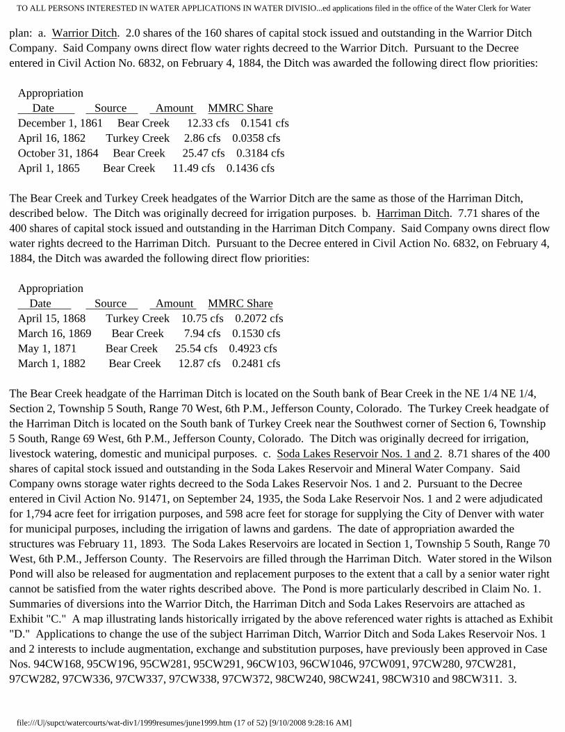
plan: a. Warrior Ditch. 2.0 shares of the 160 shares of capital stock issued and outstanding in the Warrior Ditch Company. Said Company owns direct flow water rights decreed to the Warrior Ditch. Pursuant to the Decree entered in Civil Action No. 6832, on February 4, 1884, the Ditch was awarded the following direct flow priorities: Appropriation Date Source Amount MMRC Share December 1, 1861 Bear Creek 12.33 cfs 0.1541 cfs April 16, 1862 Turkey Creek 2.86 cfs 0.0358 cfs October 31, 1864 Bear Creek 25.47 cfs 0.3184 cfs April 1, 1865 Bear Creek 11.49 cfs 0.1436 cfs The Bear Creek and Turkey Creek headgates of the Warrior Ditch are the same as those of the Harriman Ditch, described below. The Ditch was originally decreed for irrigation purposes. b. Harriman Ditch. 7.71 shares of the 400 shares of capital stock issued and outstanding in the Harriman Ditch Company. Said Company owns direct flow water rights decreed to the Harriman Ditch. Pursuant to the Decree entered in Civil Action No. 6832, on February 4, 1884, the Ditch was awarded the following direct flow priorities: Appropriation Date Source Amount MMRC Share April 15, 1868 Turkey Creek 10.75 cfs 0.2072 cfs March 16, 1869 Bear Creek 7.94 cfs 0.1530 cfs May 1, 1871 Bear Creek 25.54 cfs 0.4923 cfs March 1, 1882 Bear Creek 12.87 cfs 0.2481 cfs The Bear Creek headgate of the Harriman Ditch is located on the South bank of Bear Creek in the NE 1/4 NE 1/4, Section 2, Township 5 South, Range 70 West, 6th P.M., Jefferson County, Colorado. The Turkey Creek headgate of the Harriman Ditch is located on the South bank of Turkey Creek near the Southwest corner of Section 6, Township 5 South, Range 69 West, 6th P.M., Jefferson County, Colorado. The Ditch was originally decreed for irrigation, livestock watering, domestic and municipal purposes. c. Soda Lakes Reservoir Nos. 1 and 2. 8.71 shares of the 400 shares of capital stock issued and outstanding in the Soda Lakes Reservoir and Mineral Water Company. Said Company owns storage water rights decreed to the Soda Lakes Reservoir Nos. 1 and 2. Pursuant to the Decree entered in Civil Action No. 91471, on September 24, 1935, the Soda Lake Reservoir Nos. 1 and 2 were adjudicated for 1,794 acre feet for irrigation purposes, and 598 acre feet for storage for supplying the City of Denver with water for municipal purposes, including the irrigation of lawns and gardens. The date of appropriation awarded the structures was February 11, 1893. The Soda Lakes Reservoirs are located in Section 1, Township 5 South, Range 70 West, 6th P.M., Jefferson County. The Reservoirs are filled through the Harriman Ditch. Water stored in the Wilson Pond will also be released for augmentation and replacement purposes to the extent that a call by a senior water right cannot be satisfied from the water rights described above. The Pond is more particularly described in Claim No. 1. Summaries of diversions into the Warrior Ditch, the Harriman Ditch and Soda Lakes Reservoirs are attached as Exhibit "C." A map illustrating lands historically irrigated by the above referenced water rights is attached as Exhibit "D." Applications to change the use of the subject Harriman Ditch, Warrior Ditch and Soda Lakes Reservoir Nos. 1 and 2 interests to include augmentation, exchange and substitution purposes, have previously been approved in Case Nos. 94CW168, 95CW196, 95CW281, 95CW291, 96CW103, 96CW1046, 97CW091, 97CW280, 97CW281, 97CW282, 97CW336, 97CW337, 97CW338, 97CW372, 98CW240, 98CW241, 98CW310 and 98CW311. 3.
file:///U|/supct/watercourts/wat-div1/1999resumes/june1999.htm (17 of 52) [9/10/2008 9:28:16 AM]

TO ALL PERSONS INTERESTED IN WATER APPLICATIONS IN WATER DIVISIO...ed applications filed in the office of the Water Clerk for Water
Statement of Plan for Augmentation, Covering all Applicable Matters under Sections 37-92-103(9), 302(1)(2) and 305(8), 10 C.R.S., (1998): a. Wilson proposes to subdivide a tract of land consisting of approximately 114 acres into eleven residential lots, each consisting of approximately 10 acres. The property is located in the S 1/2 SW 1/4 of Section 25 and the NW 1/4 of Section 36, Township 4 South, Range 71 West, 6th P.M., Jefferson County, Colorado. The water supply for ten of the lots will be obtained from the wells described in Paragraph No. 1, above. Water for the eleventh lot will be obtained from the existing exempt well which is more particularly described in Claim No. 2. b. Wastewater from all in-building uses of water will be treated by non-evaporative septic systems using soil absorption leach fields. Return flows will be to Swede Gulch and Cold Spring Gulch. c. Based on prior engineering studies of similar residential subdivisions, it is assumed that the maximum average occupancy for each single family residence will be 3.5 persons, and that the per capita daily water usage will not exceed 80 gallons. The augmentation plan will also cover the water requirements for the irrigation of up to 500 square feet of lawn grass, or equivalent gardens, per lot, and the watering of a total of three horses per lot. Lot owners will have the option of increasing the amount of turf or garden irrigation by decreasing the number of horses by the equivalent amount of consumptive use. Each horse equates to approximately 500 square feet of irrigated lawn grass. Gross irrigation requirements for lawn grass are anticipated to be no more than 1.25 acre feet of water per irrigated acre. Gross irrigation requirements for gardens are anticipated to be no more than 0.5 of an acre foot of water per irrigated acre. Horses are assumed to require 10 gallons per day, all of which is consumed. The total volume of water required for the ten lots to be covered by this plan for augmentation is projected to be approximately 3.62 acre feet per year. d. Depletions associated with water which is used inside the single family residences will be based on a ten percent (10%) consumption factor. Consumption of lawn grass at this location is 1.0 acre foot per acre. Consumption of gardens is 0.4 of an acre foot per acre. The consumptive use for irrigation operations was determined using the SCS TR-21 modification to the Blaney Criddle consumptive use method with the Pochop elevation adjustment, and the Evergreen turf adjustment as outlined in a report prepared by Blatchley Associates, Inc. which is titled "Turf Irrigation in Mountainous Areas of Evergreen, Colorado." Maximum stream depletions are not anticipated to exceed 1.0232 acre feet per year. This figure includes 0.26 of an acre foot of evaporation losses from the open water surface of the Wilson Pond. e. The required volume of augmentation water will be provided from one or more of the sources described in Paragraph No. 2, supra. Due to the small volume of annual stream depletions projected to occur under this plan, instantaneous stream depletions may be aggregated and replaced by one or more releases from storage of short duration. Replacement water will be provided under one of the following alternative methods: i. If there is a live stream between the points of depletion and the headgate of the Harriman Ditch on Bear Creek, augmentation and replacement water in the Warrior Ditch and the Harriman Ditch may be left in the stream system to replace depletions then occurring. ii. If there is a live stream between the points of depletion and Bear Creek Lake, augmentation and replacement available to MMRC in the Soda Lakes Reservoirs may be released to Turkey Creek to replace depletions. iii. To the extent that a senior water right is commanding the entire flow of the stream system and neither of the above referenced exchanges can operate, MMRC water supplies previously exchanged to the Wilson Pond, or MMRC water physically transported into the basin, will be released to the stream system above the point of diversion of the senior water right. f. In order to assure that sufficient augmentation water will be available for this augmentation plan, North Fork Associates has agreed to assign to MMRC, for the benefit of Wilson and his assigns, and for use in this augmentation plan, 0.00234 of a cubic foot per second of the Warrior Ditch Priority No. 4, yielding up to 0.628 of an acre foot of consumptive use water per year, and 0.394 of an acre foot of consumptive use water decreed to the Harriman Ditch/Soda Lakes Reservoir system. g. To provide the necessary augmentation water for this plan, Wilson will attempt to fill the Wilson Pond under the structure's own priority. If the Pond cannot be so filled, Wilson and MMRC will exchange to storage in the Wilson Pond, Harriman Ditch or Warrior Ditch water, or water released from the Soda Lakes Reservoirs. h. Out-of-priority depletions associated with water diverted from the subject wells and evaporation losses from the Wilson Pond will be included in the reports which MMRC
file:///U|/supct/watercourts/wat-div1/1999resumes/june1999.htm (18 of 52) [9/10/2008 9:28:16 AM]

TO ALL PERSONS INTERESTED IN WATER APPLICATIONS IN WATER DIVISIO...ed applications filed in the office of the Water Clerk for Water
presently makes to the State water officials for other plans for augmentation which utilize MMRC augmentation water supplies. On the basis of the submitted reports, not only for this plan but other plans administered by MMRC, and in accordance with the directives of the Division Engineer, MMRC will make the required release of augmentation water by properly documenting the in-stream delivery of replacement water or the release of storage water. Wilson will be responsible for all releases of water from the Wilson Pond. i. Applicants seek judicial confirmation that the water available to them from the Harriman Ditch, Warrior Ditch, the Soda Lakes Reservoirs and the Wilson Pond can be utilized for replacement and augmentation purposes to replace depletions as described herein. j. Since the points of depletion associated with water use within the proposed subdivision are on Swede Gulch and Cold Spring Gulch, Wilson asserts appropriative rights of substitute supply and exchange pursuant to Sections 37-80-120 and 37-92-302(1)(a), 10 C.R.S., (1998). The reach of one exchange shall extend from the confluence of Bear Creek and the South Platte River; thence up Bear Creek to the confluence of Bear Creek and Swede Gulch in the NE 1/4 SW 1/4 of Section 36, Township 4 South, Range 71 West, 6th P.M.; thence up Swede Gulch to the point where depletions impact Swede Gulch in the NE 1/4 of Section 35, Township 4 South, Range 71 West, 6th P.M. The reach of the second exchange shall extend from the confluence of Bear Creek and the South Platte River; thence up Bear Creek to the confluence of Bear Creek and Cold Spring Gulch in the NW 1/4 NW 1/4 of Section 31, Township 4 South, Range 71 West, 6th P.M.; and thence up Cold Spring Gulch to the point where depletions impact Cold Spring Gulch in the SW 1/4 of Section 25, Township 4 South, Range 71 West, 6th P.M. The exchanges will operate to replace depletions to the flow of water in Swede Gulch, Cold Spring Gulch and Bear Creek as the depletions occur. The exchanges will also be used to fill the Wilson Pond if the Pond cannot be filled under its own priority. The exchanges will be administered with a priority date of April 12, 1999, at a maximum flow rate of 0.25 of a cubic foot per second to the extent of 1.022 acre feet per year. 4. Names and Addresses of Owners of Land on which Structures are or will be Located: a. Harriman Ditch and Warrior Ditch: Harriman Ditch Company, c/o Jerry Foster, 1600 West 12th Avenue, Denver, Colorado 80254. b. Soda Lakes Reservoir Nos. 1 and 2: Soda Lakes Reservoir and Mineral Water Company, c/o Jerry Foster, 1600 West 12th Avenue, Denver, Colorado 80254. c. Property Described in Paragraph No. 1: Scott A. Wilson and Staci R. Wilson, as described above. Bruce D. Hungate, 27400 Highway 74, Evergreen, Colorado 80434. WHEREFORE, Wilson, North Fork Associates and MMRC request the entry of a decree approving this Application, specifically determining that the source and location of delivery of augmentation water are sufficient to eliminate material injury to vested water rights. Wilson also requests a determination that the ten wells described herein can be operated without curtailment so long as out•of•priority stream depletions are replaced as proposed herein. Wilson further requests the entry of an Order directing the State Engineer to issue permits for the construction and use of the subject wells. (10 pages; with 4 pages of exhibits). 99CW097 APPLICATION FOR CHANGE OF WATER RIGHTS, CONCERNING THE APPLICATION FOR WATER RIGHTS OF ROBERT AND CATHERINE HOWREY, IN DOUGLAS COUNTY, COLORADO, 1. Name, address, telephone of Applicant: Robert and Catherine Howrey, 10530 S. Parker Road, Parker, CO 80134, (303) 660-8608, Please transmit all correspondence to: Holly I. Holder, P.C., 518 17 Street, #1500, Denver, CO 80202, 2. Water rights for which change is sought: Water rights as decreed on December 3, 1986 in Case No. 85CW168, Water Division No. 1., 3. Proposed change: In the above referenced case, Everitt Acres, as Applicant, obtained a decree (the “Decree”) for unappropriated water recoverable from the nontributary Lower Dawson, Denver, Arapahoe and Laramie-Fox Hills aquifers (the “Water Rights”) underlying its property located in Sections 27, 28, 33 and 34, Township 7 South, Range 66 West of the 6th P. M., as more fully described on Exhibit A attached hereto. Under the Decree, a question was raised as to the depth of the top and base of the Lower Dawson aquifer and the top of the Denver aquifer. Paragraph 7 of the Decree outlines the amounts of available water under each aquifer as determined by the State. Paragraph 14 of the Decree outlines procedures to be followed by
file:///U|/supct/watercourts/wat-div1/1999resumes/june1999.htm (19 of 52) [9/10/2008 9:28:16 AM]

TO ALL PERSONS INTERESTED IN WATER APPLICATIONS IN WATER DIVISIO...ed applications filed in the office of the Water Clerk for Water
Applicant in order to make a determination of the final amounts of available water under the Decree which are different from the amounts of water described in Paragraph 7 of the Decree. Paragraph 14 requires Applicant to drill test holes and file geophysical logs with the State and also outlines appeal procedures if Applicant disagrees with the State’s final determination of available amounts of water. Applicant herein desires to accept the State’s determination of amounts of available water as described in Paragraph 7 of the Decree and to forego the procedures described in Paragraph 14 of the Decree. Accordingly, Applicant herein requests that the Decree be changed to eliminate the first subparagraph of Paragraph 14 and to make a final determination that Paragraph 7 correctly reflects the amounts of available water under each aquifer, subject to standard retained jurisdiction and the State Engineer’s review when the wells are drilled. 4. Amount: A total of 972 acre-feet annually., 5. Location: 652 acres in Sections 27, 28, 33 and 34 Township 7 South, Range 66 West of the 6th P.M. in Douglas County, Colorado as described on Exhibit A attached hereto. 6. Name and address of owner of land on which water will be used: Robert and Catherine Howrey, 10530 S. Parker Road, Parker, CO 80134, 7. No other terms or conditions of the decree are changed herein. WHEREFORE, Applicant prays that this Court enter a decree granting this application, finding that the change herein will not injuriously affect other owners of or persons entitled to use water under vested water rights or decreed conditional water rights, and for such other relief as it deems proper in the premises. 99CW098 CONCERNING THE APPLICATION FOR WATER RIGHTS OF PONDEROSA LAND GROUP, INC, APPLICATION FOR APPROVAL OF A PLAN FOR AUGMENTATION, IN ELBERT COUNTY. 1. Name, Address, Telephone Number of Applicant: Ponderosa Land Group, Inc., P.O. Box 268, Franktown, Colorado 80116-0268 (303) 688-1979 (Holly I. Holder, Holly I. Holder, P.C., 518 17th Street, #1500, Denver, Colorado 80202 (303) 534-3636). 2. Description of plan for augmentation: A. Groundwater to be augmented: 132 acre-feet per year over a 300 year period of not nontributary Upper Dawson aquifer groundwater available underlying the Subject Property as decreed in Case No. 93CW051, District Court, Water Division 1, being the water decreed to The Estate of Marsha E. Reynolds. Applicant is the owner of the water rights decreed in that case, underlying and associated with approximately 1130 acres of land, located in parts of Sections 13, 14, 15, 22, and 27, T8S, R65W, 6th P.M., as more particularly described and shown on Attachment A hereto ("Subject Property"). This augmentation plan may also be operated by a special district which may be formed in the future for that purpose. B. Water rights to be used for augmentation: Return flows from the use of not nontributary Upper Dawson aquifer water and return flows and direct discharge of nontributary groundwater underlying the Subject Property as previously decreed in this court in Case No. 93CW051. Applicant is the owner of the following amounts of in the nontributary water underlying the Subject Property:Aquifer Annual AmountLower Dawson 255 acre-feetDenver 367 acre-feetArapahoe 457 acre-feetLaramie-Fox Hills 391 acre-feetC. Statement of plan for augmentation: The subject Upper Dawson aquifer groundwater may be used to serve up to 250 residential lots on the Subject Property through central or individual wells for a 300 year period. It is estimated that each lot will require approximately 0.528 acre-feet per year for 300 years. Inhouse use will require 0.3 acre-feet per residence or building, irrigation will require approximately 0.178 acre-feet per year for irrigation of 3000 square-feet, and stockwatering will require 0.05 acre-feet for each 4 large domestic animals. Applicant reserves the right to amend these values and the number of lots to be served based on final planning of the Subject Property. Sewage treatment for inhouse and limited commercial use will be provided by non-evaporative septic systems. Consumptive use associated with in-house and limited commercial use will be approximately 10% of water used and it is estimated that approximately 10% of water used for irrigation will be returned to the stream system. Before any other type of sewage treatment is proposed in the future, including incorporation of the lots into a central sewage collection and treatment system, Applicant, or successors and assigns, will amend this decree prior to such change and thereby provide notice of the proposed change to other water users by publication procedures in use at that time. D. During
file:///U|/supct/watercourts/wat-div1/1999resumes/june1999.htm (20 of 52) [9/10/2008 9:28:16 AM]

TO ALL PERSONS INTERESTED IN WATER APPLICATIONS IN WATER DIVISIO...ed applications filed in the office of the Water Clerk for Water
pumping Applicant will replace actual depletions to the affected stream system pursuant to Section 37-90-137(9)(c), C.R.S. Applicant estimates that depletions occur to the Running Creek stream system. Return flows from use of the subject water rights from inhouse use through nonevaporative septic systems and from irrigation use, will accrue to the South Platte River system and those return flows are sufficient to replace actual depletions while the subject groundwater is being pumped. E. After the 300th year, after all the Upper Dawson water is withdrawn, or after pumping ceases, Applicant will demonstrate that any depletions which may occur to the stream systems are non-injurious and need not be replaced. However, if the Court finds that such depletions need to be replaced, Applicant will reserve an adequate amount of nontributary groundwater underlying the Subject Property to meet augmentation requirements.3. Remarks: Applicant will withdraw the not nontributary Upper Dawson aquifer water underlying the Subject Property under the plan of augmentation requested herein pursuant to Section 37-90-137(9)(c), C.R.S. WHEREFORE, Applicant prays that this Court enter a Decree: 4. Granting the application herein and specifically determining that vested or conditionally decreed water rights of others will not be materially injured by the withdrawals of groundwater and the plan for augmentation proposed herein; FURTHER, Applicant prays that this Court grant such other relief as seems proper in the premises. 99CW099 CONCERNING THE APPLICATION FOR WATER RIGHTS OF LIVING WORD CHRISTIAN ASSEMBLY, INC., APPLICATION FOR UNDERGROUND WATER RIGHTS FROM NOT NONTRIBUTARY AND NONTRIBUTARY SOURCES, IN THE NONTRIBUTARY LOWER DAWSON, DENVER, ARAPAHOE AND LARAMIE-FOX HILLS AND THE NOT NONTRIBUTARY UPPER DAWSON AQUIFERS, IN DOUGLAS COUNTY. 1. Name, Address, Telephone Number of Applicant: Living Word Christian Assembly, Inc., P.O. Box 335, Franktown, Colorado 80116 (303) 688-8730 (Holly I. Holder, Holly I. Holder, P.C., 518 17th Street, #1500, Denver, Colorado 80202 (303) 534-3636). 2. Well Permits: Well permits will be applied for prior to construction of the wells. 3. Legal Description of Wells and Subject Property: The property which is the subject of this application is approximately 40acres of land located in Section 10, T8S, R66W of the 6th P.M., as more particularly described and shown on Attachment A hereto. The wells which will withdraw the subject groundwater will be located at any location on the Subject Property subject to Section 37-90-137(4), C.R.S. 4. Source of Water Rights: The source of the groundwater to be withdrawn from the Arapahoe and Laramie-Fox Hills aquifers underlying the Subject Property is nontributary groundwater as described in 37-90-103(10.5), C.R.S. The groundwater to be withdrawn from Denver aquifer is not nontributary as described in 37-90-137(9)(c), C.R.S. 5. Estimated Amounts: The estimated average annual amounts of withdrawal available from the subject aquifers as indicated below, are based upon the Denver Basin Rules, 2 C.C.R. 402-6. For purposes of this application, Applicant estimates that the following annual amounts are representative of the Dawson, Denver, Arapahoe and Laramie-Fox Hills aquifers underlying the Subject Property: Saturated Estimated Aquifer Thickness Annual AmountUpper Dawson 73 feet 5 acre-feetLower Dawson 45 feet 4 acre-feetDenver 240 feet 16 acre-feet Arapahoe 290 feet 19 acre-feet Laramie-Fox Hills 185 feet 11 acre-feetThe average annual amounts available for withdrawal from the subject aquifers will depend on the hydrogeology and the legal entitlement of the Applicant and represents a claim to all not nontributary and nontributary groundwater underlying the Subject Property. Applicant may reserve part of the Upper Dawson aquifer water which may be available underlying the Subject Property for use through an exempt well pursuant to Section 37-92-602, C.R.S. 6. Well Fields: Applicant requests that this Court determine that Applicant has the right to withdraw all of the legally available groundwater lying below the Subject Property, through the wells requested herein and any additional wells
file:///U|/supct/watercourts/wat-div1/1999resumes/june1999.htm (21 of 52) [9/10/2008 9:28:16 AM]

TO ALL PERSONS INTERESTED IN WATER APPLICATIONS IN WATER DIVISIO...ed applications filed in the office of the Water Clerk for Water
which may be completed in the future as Applicant's well fields. As additional wells are constructed, applications will be filed in accordance with 37-90-137(10), C.R.S. 7. Proposed Use: The water will be used, reused, successively used, leased, sold, or otherwise disposed of for the following beneficial purposes: municipal, domestic, industrial, commercial, irrigation, livestock watering, recreational, and fish and wildlife. Said water will be produced for immediate application to said uses, both on and off the Subject Property, for storage and subsequent application to said uses, for exchange purposes, for replacement of depletions resulting from the use of water from other sources, and for augmentation purposes. 8. Jurisdiction: The Water Court has jurisdiction over the subject matter of this application pursuant to 37-92-302(2), and 37-90-137(6), C.R.S. 9. Remarks: A. Applicant claims the right to withdraw more than the average annual amounts estimated in paragraph 5 above pursuant to Rule 8A of the Statewide Rules, 2 C.C.R. 402-7. B. Although Applicant has estimated the amounts of water available for withdrawal from the subject aquifers based on estimates of relative values for specific yield and saturated thicknesses, Applicant requests the right to revise the estimates upward or downward, based on better or revised data, without the necessity of amending this application or republishing the same. WHEREFORE, Applicant prays that this Court enter a Decree: 10. Granting the application herein and awarding the water rights claimed herein as final water rights, except as to those issues for which jurisdiction of the Court will be specifically retained; 11. Specifically determining that: A. Applicant has complied with 37-90-137(4), C.R.S., and water is legally available for withdrawal by the wells proposed herein, but that jurisdiction will be retained with respect to the average annual amounts of withdrawal specified herein to provide for the adjustment of such amounts to conform to actual local aquifer characteristics from adequate information obtained from wells or test holes drilled on or near the Subject Property, pursuant to 37-92-305(11), C.R.S. and Denver Basin Rule 9.A.;B. The groundwater in the Lower Dawson, Denver, Arapahoe and Laramie-Fox Hills aquifers is nontributary groundwater. The groundwater in the Upper Dawson aquifer is not nontributary and that water will not be withdrawn until a plan for augmentation is approved by the Court; C. Vested or conditionally decreed water rights of others will not be materially injured by the withdrawals of groundwater proposed herein and no findings of diligence are required to maintain these water rights. FURTHER 96CW003 - PINEHURST COUNTRY CLUB, SUCCESSOR IN INTEREST TO NORGREN PROPERTIES, 1. c/o Ken Miller, 6255 West Quincy Avenue, Denver, Colorado 80235. (Attorney: William B. Tourtillott of Friedlob, Sanderson, Raskin, Paulson & Tourtillott, LLC, 1400 Glenarm Place, Suite 300, Denver, Colorado 80202, (303) 571-1400)Amended Application For Underground Water Rights from Nontributary and Not-Nontributary Sources; IN DENVER COUNTY.2. Sources and location of water rights:
a. In this proceeding, Pinehurst seeks adjudication of its ground water rights in the Denver, Upper Arapahoe, Lower Arapahoe and Laramie-Fox Hills aquifers underlying approximately 207.7 acres of land located in the SW3 of Section 1, and parts of Section 2, Township 5 South, Range 69 West of the 6th P.M., in Denver County, Colorado. The legal description of the land is more fully set forth in Exhibit A hereto. No part of such land lies within a designated ground water basin.b. The ground water in the Denver Aquifer underlying Applicant=s property is not- nontributary ground water located within one mile from geologic contact with a surface stream.c. The ground water in the Upper Arapahoe Aquifer underlying Applicant=s property in Section 2 is not-nontributary ground water located more than one mile from geologic contact with a surface stream.. d. The ground water in the Upper Arapahoe Aquifer underlying Applicant=s property in Section 1 is nontributary groundwater located more than one mile from geologic contact with a surface stream.e. The ground water in the Lower Arapahoe and Larimie-Fox Hills aquifers underlying Applicant=s property is nontributary groundwater.
3. Well Permits:
file:///U|/supct/watercourts/wat-div1/1999resumes/june1999.htm (22 of 52) [9/10/2008 9:28:16 AM]

TO ALL PERSONS INTERESTED IN WATER APPLICATIONS IN WATER DIVISIO...ed applications filed in the office of the Water Clerk for Water
Applicant will make application for well permits at such time as Applicant is ready to construct wells.4. Ownership of the water rights:Pinehurst is the owner of the water rights which are the subject of this application.
5. Estimated Rates of Withdrawal and Well Depths:Applicant estimates that the pumping rate for wells constructed pursuant to any decree entered in this case will be 150 gpm.
6. Estimated Average Annual Amounts of Withdrawal:The estimated average annual amounts of water available for withdrawal from the aquifers as listed below are consistent with the State Engineer=s Determination of Findings dated April 29, 1996, prepared pursuant to the original Application in this case. The acreage has been adjusted downward to reflect Applicant=s conveyance of approximately 5.7 acres of land since the date of the State Engineer=s Findings..
Saturated Specific Annual AverageAquifer Acres Thickness Yield Withdrawal
Denver(Not nontributary) 207.7 170 0.17 60.0 acre-feetUpper Arapahoe 166.7 35 0.17 9.9 acre-feet
Under Section 1(Nontributary)
Upper Arapahoe 0 35 0.17 0 acre-feet
Under Section 2(Not nontributary)Lower Arapahoe
(Nontributary) 207.7 70 0.17 24.7 acre-feet
Laramie-Fox Hills(Nontributary) 207.7 200 0.15 62.3 acre-feet
Total 156.9 acre-feet
7. Additional Wells and Well Fields:The Applicant proposes to build a unified water supply system over a period of many years and will construct its wells as required in order to maintain levels of production, to meet water supply system demands of to recover the entire amount of ground water in the subject aquifers underlying the subject property, as described herein.8. Uses:The subject water will be used, reused, successively used and, after use, leased, sold or otherwise disposed of, for the following beneficial purposes: municipal, domestic, industrial, commercial, irrigation, stock watering, recreational, fish and wildlife, and any other beneficial purpose, to be used on or off the land described. Such water will be produced for immediate application to such uses, for storage and subsequent application to such uses, for exchange purposes, for replacement of depletions resulting from the use of water from other sources, and for augmentation purposes.9. Jurisdiction:The Water Court has jurisdiction over this proceeding pursuant to Sections 37-92-302(2) and 37-90-137(6), C.R.S.10. Name and address of owner of land on which well is located:
Pinehurst Country Club, at the address listed in paragraph one, above.WHEREFORE, Applicant requests that this Court enter a decree awarding the water rights claimed herein as final
file:///U|/supct/watercourts/wat-div1/1999resumes/june1999.htm (23 of 52) [9/10/2008 9:28:16 AM]

TO ALL PERSONS INTERESTED IN WATER APPLICATIONS IN WATER DIVISIO...ed applications filed in the office of the Water Clerk for Water
water rights, except as to those issues for which jurisdiction of the Court will be specifically retained.. (5 pages, plus 7-page exhibit) 94CW244 THE AGRICULTURAL DITCH AND RESERVOIR COMPANY, 165 S. Union Blvd., #670, Lakewood, CO 80228. (Richard M. Foster, 1700 Broadway, Suite 1516, Denver, CO 80290-1501). Amended Application for Water Storage Right, IN CLEAR CREEK COUNTY. Loch Lomond Reservoir--Loch Lomond Group of Reservoirs. Legal description of reservoir site: A. Location of outlet pipe outfall of Loch Lomond Dam. In Clear Creek County, Colorado beginning at the Bureau of Land Management benchmark at the center point of S33, T2S, R74W, 6TH P.M., thence 38 48'50" E a distance of 812.50 ' to the concrete pipe outfall of Loch Monomd Dam: Source: The Loch Lomond or Northerly Branch of Fall River, a tributary of Clear Creek. A. Date of appropriation: 8/24/1987. B. How appropriation was initiated: by a field surrvey. C. Date water applied to beneficial use: not applicable. 6. Amount claimed: A. 735 acre feet CONDITIONAL. Use: All beneficial uses, including irrigation, municipal, domestic, mechanical, commercial, industrial, recreation, fish and wildlife, augmentation and replacement, reuse, successive use, and disposition. Surface area of high water line: 43 acres (+) A. Maximum height of dam in feet: 60 B. Length of dam in feet: 1,250 Total capacity of reservoir storage in acre feet: 1650 A.F. active, dead storage unknown. Names and addresses of owners of the land on which structures for water rights are located: U.S. Forest Service, Arapahoe National Forest, 2995 Baseline Road, Boulder, CO 80300. The Agricultural Ditch and Reservoir Company, 333 W. Hampden Ave., Suite 1050, Englewood, CO 80110. Remarks: Loch Lomond Group of Reservoirs is a closely grouped interconnected unit of reservoirs consisting of Loch Lomond Reservoir, Lake Caroline Reservoir, Twin Lakes Reservoir (sometimes referred to as Upper Loch Lomond or Stuart Reservoir, Ice Lake Reservoir and Ohman Lake Reservoir which are described in the Decree entered in case No. 60052, in the District Court in and for the City and County of Denver, State of Colorado, on May 13, 1936. This application involves an enlargement of the storage capacity of Loch Lomond Reservoir. It is the Applicant's intention that the conditional water rights that are the subject of this application will not be stored solely in Loch Lomond Reservoir, but may be stored in any one or more of the Loch Lomond group of reservoirs identified herein. (3 pages) 99CW062 (89CW234) Coors Brewing Company (“Coors”), c/o Neil G. Jaquet, Director of Water Resources and Real Estate, Mail No. CC370, Golden, Colorado 80401•1295.Jack F. Ross, Esq., Joanne Herlihy, Esq., Dufford & Brown, P.C., 1700 Broadway, Ste. 1700, Denver, CO 80290•1701. AMENDED APPLICATION:( X ) FOR SEXENNIAL FINDING OF REASONABLE DILIGENCE FOR CONDITIONAL RIGHT OF EXCHANGE, IN JEFFERSON COUNTY . This Amended Application for Sexennial Finding of Reasonable Diligence is filed pursuant to the Water Right Determination and Administration Act of 1969, § 37-92-302, C.R.S.
file:///U|/supct/watercourts/wat-div1/1999resumes/june1999.htm (24 of 52) [9/10/2008 9:28:16 AM]

TO ALL PERSONS INTERESTED IN WATER APPLICATIONS IN WATER DIVISIO...ed applications filed in the office of the Water Clerk for Water
The original verified Application was published in the April, 1999 Water Division No. 1 resume. This amendment is to add a paragraph 2.g. to the Application to include a specific identification, including a full legal description, of the structures involved in the conditional exchange otherwise identified in Case No. 89CW234. In all other respects, the Application remains the same.2. Description of conditional right of exchange:
a. Date of Original Decree: April 30, 1993 Case No. 89CW234 Court District Court, Water Division No. 1b. Location: Coors’ exchange reach lies between the headgate of the Farmers High Line Canal which diverts from Clear Creek on the north bank of Clear Creek in the NW/4 of the SW/4 of Section 27, Township 3 South, Range 70 West, of the 6th P.M., a short distance below the Ford Street Bridge across Clear Creek in the City of Golden, Jefferson County, Colorado, at a point approximately 950 feet East and 1,500 feet North of the Southwest corner of said section and Coors’ easternmost reservoir of the Jefferson Storage System, being Prospect Park Lake, located in the W1/2 Section 21, Township 3 South, Range 69 West of the 6th P.M. c. Source: The waters of Clear Creek which may have been stored or be divertible in the exercise of the water rights changed by Decree in Case No. 89CW234.
d. Appropriation Date: December 29, 1989.e. Amount: Up to 13.2 cfs for an annual volume of up to 1500 acre•feet.f. Use: For all of the purposes for which water may lawfully be used through the structures to which the exchanges are made.
g. Legal Description of Structures:i. Farmers High Line with point of diversion located on the north bank of Clear Creek in the SW 1/4 of Section 27, Township 3 South, Range 70 West of the 6th P.M., a short distance below the Ford Street Bridge across Clear Creek in the City of Golden, Jefferson County, Colorado.ii. The Wannamaker Ditch with point of diversion located on the north bank of Clear Creek in the NE1/4 of Section 27, Township 3 South, Range 70 West, whence the NE Corner of Section 27, Township 3 South, Range 70 West of the 6th P.M. bears North 38°17'17.5" East, 2099.64 feet in Jefferson County, Colorado iii. . The Agricultural Ditch with point of diversion, located on the south bank of Clear Creek in the SW1/4 of Section 27, Township 3 South, Range 70 West in the City of Golden, Jefferson County, Colorado iv. Coors’ Underground Springs.
(1)Underground Spring NO. 11-3271: Located in the NEl/4 of NW1/4 of
file:///U|/supct/watercourts/wat-div1/1999resumes/june1999.htm (25 of 52) [9/10/2008 9:28:16 AM]

TO ALL PERSONS INTERESTED IN WATER APPLICATIONS IN WATER DIVISIO...ed applications filed in the office of the Water Clerk for Water
Section 26, Township 3 South, Range 70 West of the 6th P.M., at a point 1043 feet South and 3631 feet West of the NE Corner of said Section 26.(2) Underground Spring No. 12•2822: Located in the NEl/4 of NW1/4 of Section 26, Township 3 South, Range 70 West of the 6th P.M., at a point 828 feet South and 3950 feet West of the NE Corner of said Section 26.(3) Underground Spring No. 14•3952:Located in the NW1/4 of NW1/4 of Section 26, Township 3 South, Range 70 West of the 6th P.M., at a point 1090 feet South and 940 feet East of the NW Corner of said Section 26.
(4) Underground Spring No. 15•2823: Located in the NEl/4 of NW1/4 of Section 26, Township 3 South, Range 70 West of the 6th P.M., at a point 800 feet South and 3881 feet West of the NE Corner of said Section 26.
(5) Underground Spring No. 18•3269: Located in the NEl/4 of NW1/4 of Section 26, Township 3 South, Range 70 West of the 6th P.M., at a point 616 feet South and 3911 feet West of the NE Corner of said Section 26.
(6) Underground Spring No. 19•3953: Located in the NW1/4 of NW1/4 of Section 26, Township 3 South, Range 70 West of the 6th P.M., at a point 1100 feet South and 300 feet East of the NW Corner of said Section 26.
(7) Underground Spring No. 20•3302: Located in the NEl/4 of NW1/4 of Section 26, Township 3 South, Range 70 West of the 6th P.M., at a point 896 feet South and 2858 feet West of the NE Corner of said Section 26. (8) Underground Spring No. 21•3954: Located in the NW1/4 of NW1/4 of Section 26, Township 3 South, Range 70 West of the 6th P.M., at a point 680 feet South and 280 feet East of the NE Corner of said Section 26.
(9) Underground Spring No. 22•3955: Located in the NEl/4 of NEl/4 of Section 27, Township 3 South, Range 70 West of the 6th P.M., at a point 870 feet South and 50 feet West of the NE Corner of said Section 27.
file:///U|/supct/watercourts/wat-div1/1999resumes/june1999.htm (26 of 52) [9/10/2008 9:28:16 AM]

TO ALL PERSONS INTERESTED IN WATER APPLICATIONS IN WATER DIVISIO...ed applications filed in the office of the Water Clerk for Water
(10) Underground Spring No. 23•3956: Located in the NEl/4 of NEl/4 of Section 27, Township 3 South, Range 70 West of the 6th P.M., at a point 1175 feet South and 172 feet West of the NE Corner of said Section 27.
(11) Underground Spring No. 28•3414: Located in the NEl/4 of NW1/4 of Section 26, Township 3 South, Range 70 West of the 6th P.M., at a point 826 feet South and 2708 feet West of the NE Corner of said Section 26.
(12) Underground Spring No. 32•3270: Located in the NEl/4 of NW1/4 of Section 26, Township 3 South, Range 70 West of the 6th P.M., at a point 636 feet South and 3028 feet West of the NE Corner of said Section 26.
(13) Underground Spring No. 35-3303: Located in the NW/4 of NE/4 of Section 26, Township 3 South, Range 70 West of the 6th P.M., at a point 656 feet South and 2428 feet West of the NE Corner of said Section 26.
(14) Underground Spring No. 55-3889: Located in the NW/4 of NE/4 of Section 26, Township 3 South, Range 70 West of the 6th P.M., at a point 370 feet South and 1878 feet West of the NE Corner of said Section 26.
(15) Underground Spring No. 56-3888: Located in the NW/4 of NE/4 of Section 26, Township 3 South, Range 70 West of the 6th P.M., at a point 267 feet South and 1400 feet West of the NE Corner of said Section 26.
(16) Underground Spring No. 68-4364: Located in the NE/4 of NE/4 of Section 26, Township 3 South, Range 70 West of the 6th P.M., at a point 140 feet South and 840 feet West of the NE Corner of said Section 26.
(17) Underground Spring No. 69-4889: Located in the SE/4 of SE/4 of Section 23, Township 3 South, Range 70 West of the 6th P.M., at a point 210 feet North and 445 feet West of the SE Corner of said Section 23.
file:///U|/supct/watercourts/wat-div1/1999resumes/june1999.htm (27 of 52) [9/10/2008 9:28:16 AM]

TO ALL PERSONS INTERESTED IN WATER APPLICATIONS IN WATER DIVISIO...ed applications filed in the office of the Water Clerk for Water
(18) Underground Spring No. 70-6156: Located in the NE/4 of NE/4 of Section 26, Township 3 South, Range 70 West of the 6th P.M., at a point 175 feet South and 450 feet West of the NE Corner of said Section 26.
(19) Underground Spring No. 71-4891: Located in the SE/4 of SE/4 of Section 23, Township 3 South, Range 70 West of the 6th P.M., at a point 352 feet North and 50 feet West of the SE Corner of said Section 23.
(20) Underground Spring No. 72-6157: Located in the NE/4 of NE/4 of Section 26, Township 3 South, Range 70 West of the 6th P.M., at a point 40 feet South and 48 feet West of the NE Corner of said Section 26.
(21) Underground Spring No. 73-5925: Located in the NW/4 of NW/4 of Section 25, Township 3 South, Range 70 West of the 6th P.M., at a point 630 feet South and 830 feet East of the NW Corner of said Section 25,
(22) Underground Spring No. 74-5926: Located in the NE/4 of NW/4 of Section 25, Township 3 South, Range 70 West of the 6th P.M., at a point 605 feet South and 3820 feet West of the NE Corner of said Section 25.
(23) Underground Spring No. 75-6367: Located in the NW/4 of NW/4 of Section 25, Township 3 South, Range 70 West of the 6th P.M., at a point 510 feet South and 220 feet East of the NW Corner of said Section 25.
(24) Underground Spring No. 76-6368: Located in the SE/4 of NW/4 of Section 25, Township 3 South, Range 70 West of the 6th P.M., at a point 1370 feet South and 3655 feet West of the NE Corner of said Section 25.
(25) Underground Spring No. 77-13721: Located in the NE/4 of NW/4 of Section 25, Township 3 South, Range 70 West of the 6th P.M., at a point 800 feet South and 3335 feet West of the NE Corner of said Section 25.
file:///U|/supct/watercourts/wat-div1/1999resumes/june1999.htm (28 of 52) [9/10/2008 9:28:16 AM]

TO ALL PERSONS INTERESTED IN WATER APPLICATIONS IN WATER DIVISIO...ed applications filed in the office of the Water Clerk for Water
(26) Underground Spring No. 78-11908: Located in the NE/4 of NW/4 of Section 25, Township 3 South, Range 70 West of the 6th P.M., at a point 630 feet South and 2727 feet West of the NE Corner of said Section 25.
(27) Underground Spring No. 79-9358: Located in the NE/4 of NW/4 of Section 25, Township 3 South, Range 70 West of the 6th P.M., at a point 1230 feet South and 2732 feet West of the NE Corner of said Section 25.
(28) Underground Spring No. 80•5123: Located in the SW1/4 of SW1/4 of Section 27, Township 3 South, Range 70 West of the 6th P.M., at a point 720 feet North and 1060 feet East of the SW Corner of said Section 27.
(29) Underground Spring No, 81•5124: Located in the SW1/4 of SW1/4 of Section 27, Township 3 South, Range 70 West of the 6th P.M., at a point 748 feet North and 982 feet East of the SW Corner of said Section 27.
(30) Underground Spring No. 82•5125: Located in the SW1/4 of SW1/4 of Section 27, Township 3 South, Range 70 West of the 6th P.M., at a point 1055 feet North and 820 feet East of the SW Corner of said Section 27.
(31) Underground Spring No. 83•5126: Located in the SW1/4 of SW1/4 of Section 27, Township 3 South, Range 70 West of the 6th P.M., at a point 1285 feet North and 795 feet East of the SW Corner of said Section 27.
(32) Underground Spring No. 85•4892: Located in the NEl/4 of SW1/4 of Section 27, Township 3 South, Range 70 West of the 6th P.M., at a point 3287 feet South and 3907 feet West of the NE Corner of said Section 27.
(33) Underground Spring No, 87-9359: Located in the SE/4 of NW/4 of Section 25, Township 3 South, Range 70 West of the 6th P.M., at a point 3450 feet North and 2740 feet West of the SE Corner of said Section 25.
file:///U|/supct/watercourts/wat-div1/1999resumes/june1999.htm (29 of 52) [9/10/2008 9:28:16 AM]

TO ALL PERSONS INTERESTED IN WATER APPLICATIONS IN WATER DIVISIO...ed applications filed in the office of the Water Clerk for Water
(34) Underground Spring No. 88-11910: Located in the SE/4 of SW/4 of Section 19, Township 3 South, Range 69 West of the 6th P.M., at a point 1092 feet North and 3190 feet West of the SE Corner of said Section 19.
(35) Underground Spring No. 89-11905: Located in the SW/4 of SE/4 of Section 19, Township 3 South, Range 69 West of the 6th P.M., at a point 1091 feet North and 2623 feet West of the SE Corner of said Section 19.
(36) Underground Spring No. 90-13722: Located in the SW/4 of SE/4 of Section 19, Township 3 South, Range 69 West of the 6th P.M., at a point 1100 feet North and 2095 feet West of the SE Corner of said Section 19.
(37) Underground Spring No. 91-13723: Located in the SW/4 of SE/4 of Section 19, Township 3 South, Range 69 West of the 6th P.M., at a point 1050 feet North and 1555 feet West of the SE Corner of said Section 19.
(38) Underground Spring No. 92-11907: Located in the SE/4 of SW/4 of Section 19, Township 3 South, Range 69 West of the 6th P.M., at a point 485 feet North and 3780 feet West of the SE Corner of said Section 19.
(39) Underground Spring No. 93-11906: Located in the SE/4 of SW/4 of Section 19, Township 3 South,, Range 69 West of the 6th P.M., at a point 475 feet North and 3180 feet West of the SE Corner of said Section 19.
(40) Underground Spring No. 94-11909: Located in the SW/4 of SE/4 of Section 19, Township 3 South, Range 69 West of the 6th P.M., at a point 480 feet North and 2579 feet West of the SE Corner of said Section 19.
(41) Underground Spring No. 95•11904: Located in the SW/4 of SE/4 of Section 19, Township 3 South, Range 69 West of the 6th P.M., at a point 300 feet North and 1978 feet West of the SE Corner of said Section 19.
file:///U|/supct/watercourts/wat-div1/1999resumes/june1999.htm (30 of 52) [9/10/2008 9:28:16 AM]

TO ALL PERSONS INTERESTED IN WATER APPLICATIONS IN WATER DIVISIO...ed applications filed in the office of the Water Clerk for Water
(42) Underground Spring No. 96•13725: Located in the SW/4 of SE/4 of Section 19, Township 3 South, Range 69 West of the 6th P.M., at a point 300 feet North and 1373 feet West of the SE Corner of said Section 19.
(43) Underground Spring No. 97•13727: Located in the SE/4 of SE/4 of Section 19, Township 3 South, Range 69 West of the 6th P.M., at a point 950 feet North and 795 feet West of the SE Corner of said Section 19.
(44) Underground Spring No. 98•13728: Located in the SE/4 of SE/4 of Section 19, Township 3 South, Range 69 West of the 6th P.M., at a point 975 feet North and 232 feet West of the SE Corner of said Section 19.
(45) Underground Spring No. 99•13729: Located in the SW/4 of SW/4 of Section 20, Township 3 South, Range 69 West of the 6th P.M., at a point 950 feet North and 370 feet East of the SW Corner of said Section 20.
(46) Underground Spring No. 100•13724: Located in the SW/4 of SW/4 of Section 20, Township 3 South, Range 69 West of the 6th P.M., at a point 710 feet North and 950 feet East of the SW Corner of said Section 20.
(47) Underground Spring No. 101: Located in the NEl/4 of NW/4 of Section 30, Township 3 South, R69W of the 6th P.M. at a point 3270 feet west of the east line and 30 feet south of the north line of said Section 30.
(48) Underground Spring No. 102: Located in the SW/4 of SE/4 of Section 19, Township 3 South, Range 69 West of the 6th P.M. at a point 2620 feet west of the east line and 30 feet north of the south line of said Section 19.
(49) Underground Spring No. 103: Located in the NE/4 of NW/4 of Section 30, Township 3 South, Range 69 West of the 6th P.M. at a point 3770 feet west of the east line and 20 feet south of the north line of said Section 30.
file:///U|/supct/watercourts/wat-div1/1999resumes/june1999.htm (31 of 52) [9/10/2008 9:28:16 AM]

TO ALL PERSONS INTERESTED IN WATER APPLICATIONS IN WATER DIVISIO...ed applications filed in the office of the Water Clerk for Water
(50) Underground Spring No, 115: Located in the SE/4 of SE/4 of Section 19, Township 3 South, Range 69 West of the 6th P.M., at a point 720 feet west of the east line and 460 feet north of the south line of said Section 19.
(51) Underground Spring No. 116: Located in the SE/4 of SE/4 of Section 19, Township 3 South, Range 69 West of the 6th P.M. at a point 250 feet west of the east line and 60 feet north of the south line of said Section 19.
(52) Underground Spring No. 117: Located in the NW/4 of NW/4 of Section 29, Township 3 South, Range 69 West of the 6th P.M. at a point 200 feet east of the west line and 410 feet south of the north line of said Section 29.
(53) Underground Spring No. 118: Located in the NW/4 of NW/4 of Section 29, Township 3 South, Range 69 West of the 6th P.M. at a point 550 feet east of the west line and 780 feet south of the north line of said Section 29.
(54) Underground Spring No. 120: Located in the SW/4 of SW/4 of Section 24, Township 3 South, Range 70 West of the 6th P.M. at a point 600 feet east of the west line and 500 feet north of the south line of said Section 24.
(55) Underground Spring No. 121: Located in the SW/4 of SW/4 of Section 24, Township 3 South, Range 70 West of the 6th P.M. at a point 1200 feet east of the west line and 530 feet north of the south line of said Section 24.
(56) Underground Spring No. 122: Located in the SE/4 of SW/4 of Section 24, Township 3 South, Range 70 West of the 6th P.M. at a point 1810 feet east of the west line and 580 feet north of the south line of said Section 24.
(57) Underground Spring No. 123: Located in the SE/4 of SW/4 of Section 24, Township 3 South, Range 70 West of the 6th P.M. at a point 2480 feet east of the west line and 620 feet north of the south line of said Section 24.
file:///U|/supct/watercourts/wat-div1/1999resumes/june1999.htm (32 of 52) [9/10/2008 9:28:16 AM]
TO ALL PERSONS INTERESTED IN WATER APPLICATIONS IN WATER DIVISIO...ed applications filed in the office of the Water Clerk for Water
(58) Underground Spring No. 124: Located in the NW/4 of NW/4 of Section 25, Township 3 South, Range 70 West of the 6th P.M. at a point 650 feet east of the west line and 110 feet south of the north line of said Section 25.
(59) Underground Spring No. 125: Located in the NW/4 of NW/4 of Section 25, Township 3 South, Range 70 West of the 6th P.M. at a point 1280 feet east of the west line and 90 feet south of the north line of said Section 25.
(60) Underground Spring No. 126: Located in the NE/4 of NW/4 of Section 25, Township 3 South, Range 70 West of the 6th P.M. at a point 1890 feet east of the west line and 110 feet south of the north line of said Section 25.
(61) Underground Spring No. 127: Located in the SE/4 of SW/4 of Section 24, Township 3 South, Range 70 West of the 6th P.M. at a point 2500 feet east of the west line and 20 feet north of the south line of said Section 24.
(62) Underground Spring No. 133: Located in the NE1/4 of SW1/4 of Section 27, T3S, R70W of the 6th P.M. at a point 3100 feet west of the east line and 2830 feet south of the north line of said Section 27.
(63) Underground Spring No. 134: Located in the NE1/4 of SW1/4 of Section 27, T3S, R70W of the 6th P.M. at a point 3300 feet west of the east line and 3070 feet south of the north line of said Section 27.
(64) Underground Spring No. 135: Located in the NE1/4 of SW1/4 of Section 27, T3S, R70W of the 6th P.M. at a point 3350 feet west of the east line and 2860 feet south of the north line of said Section 27.
(65) Underground Spring No. 136: Located in the SE1/4 of NW1/4 of Section 27, T3S, R70W of the 6th P.M. at a point 3270 feet west of the east line and 2620 feet south of the north line of said Section 27.
file:///U|/supct/watercourts/wat-div1/1999resumes/june1999.htm (33 of 52) [9/10/2008 9:28:16 AM]

TO ALL PERSONS INTERESTED IN WATER APPLICATIONS IN WATER DIVISIO...ed applications filed in the office of the Water Clerk for Water
(66) Underground Spring No. 1: Located in the NE1/4 of SW1/4 of Section 27, T3S, R70W of the 6th P.M. at a point 3300 feet west of the east line and 3090 feet south of the north line of said Section 27.
(67) Underground Spring No. 2: Located in the NE1/4 of SW1/4 of Section 27, T3S, R70W of the 6th P.M. at a point 3320 feet west of the east line and 3120 feet south of the north line of said Section 27.
(68) Underground Spring No. 5: Located in the NE1/4 of SW1/4 of Section 27, T3S, R70W of the 6th P.M. at a point 3660 feet west of the east line and 3080 feet south of the north line of said Section 27.
(69) Underground Spring No. 9: Located in the SE1/4 of NW1/4 of Section 27, T3S, R70W of the 6th P.M. at a point 3050 feet west of the east line and 2380 feet south of the north line of said Section 27.
(70) Underground Spring No. 148: Located in the NW/4 of NW/4 of Section 25, Township 3 South, Range 70 West of the 6th P.M., at a point 380 feet South of the North section line and 460 feet East of the West section line of said Section 25.
(71) Underground Spring No. 149: Located in the NW/4 of NW/4 of Section 25, Township 3 South, Range 70 West of the 6th P.M., at a point 380 feet South of the North section line and 1015 feet East of the West section line of said Section 25.
(72) Underground Spring No. 150: Located in the NW/4 of NW/4 of Section 25, Township 3 South, Range 70 West of the 6th P.M., at a point 500 feet South of the North section line and 1315 feet East of the West section line of said Section 25.
(73) Underground Spring No. 151: Located in the NE/4 of NW/4 of Section 25, Township 3 South, Range 70 West of the 6th P.M., at a point 380 feet South of the North section line and 1695 feet East of the West section line of said Section 25.
file:///U|/supct/watercourts/wat-div1/1999resumes/june1999.htm (34 of 52) [9/10/2008 9:28:16 AM]

TO ALL PERSONS INTERESTED IN WATER APPLICATIONS IN WATER DIVISIO...ed applications filed in the office of the Water Clerk for Water
In Case No. 90CW064, Coors has applied for approval to use the following new underground springs as alternate points of diversion for underground springs decreed in Case Nos. W-8036(75) and W-8256(76) and Case No. W-7809. Coors Case No. 90CW064 is pending before the Water Court.
(74) Underground Spring No. 152: Located in the of SE/4 of SW/4 of Section 19, Township 3 South, Range 69 West of the 6th P.M., at a point 880 feet North of the South section line and 1605 feet East of the West section line of said Section 19.
(75) Underground Spring No. 153: Located in the SE/4 of SW/4 of Section 19, Township 3 South, Range 69 West of the 6th P.M., at a point 1060 feet North of the South section line and 2460 feet East of the West section line of said Section 19.
(76) Underground Spring No. 154: Located in the SW/4 of SE/4 of Section 19, Township 3 South, Range 69 West of the 6th P.M., at a point 1060 feet North of the South section line and 2280 feet West of the East section line of said Section 19.
(77) Underground Spring No. 155: Located in the SW/4 of SE/4 of Section 19, Township 3 South, Range 69 West of the 6th P.M., at a point 1060 feet North of the South section line and 1780 feet West of the East section line of said Section 19.
(78) Underground Spring No. 156: Located in the SW/4 of SE/4 of Section 19, Township 3 South, Range 69 West of the 6th P.M., at a point 850 feet North of the South section line and 1380 feet West of the East section line of said Section 19.
(79) Underground Spring No. 157: Located in the SE/4 of SW/4 of Section 19, Township 3 South, Range 69 West of the 6th P.M., at a point 180 feet North of the South section line and 1455 feet East of the West section line of said Section 19.
(80) Underground Spring No. 158: Located in the SE/4 of SW/4 of Section 19, Township 3 South, Range 69 West of the 6th P.M., at a point 470 feet North of the South section line and 1855 feet East of the West section line of said Section 19.
file:///U|/supct/watercourts/wat-div1/1999resumes/june1999.htm (35 of 52) [9/10/2008 9:28:16 AM]

TO ALL PERSONS INTERESTED IN WATER APPLICATIONS IN WATER DIVISIO...ed applications filed in the office of the Water Clerk for Water
(81) Underground Spring No. 159: Located in the SE/4 of SW/4 of Section 19, Township 3 South, Range 69 West of the 6th P.M., at a point 470 feet North of the South section line and 2460 feet East of the West section line of said Section 19.
(82) Underground Spring No. 160: Located in the SW/4 of SE/4 of Section 19, Township 3 South, Range 69 West of the 6th P.M., at a point 450 feet North of the South section line and 1380 feet West of the East section line of said Section 19.
(83) Underground Spring No. 162: Located in the NE/4 of NW/4 of Section 30, Township 3 South, Range 69 West of the 6th P.M., at a point 172 feet South of the North section line and 2493 feet East of the West section line of said Section 30.
(84) Underground Spring No. 165: Located in the NW/4 of NE/4 of Section 30, Township 3 South, Range 69 West of the 6th P.M., at a point 485 feet South of the North section line and 2590 feet West of the East section line of said Section 30.
(85) Underground Spring No. 166: Located in the NW/4 of NE/4 of Section 30, Township 3 South, Range 69 West of the 6th P.M., at a point 485 feet South of the North section line and 2183 feet West of the East section line of said Section 30.
(86) Underground Spring No. 167: Located in the NW/4 of NE/4 of Section 30, Township 3 South, Range 69 West of the 6th P.M., at a point 485 feet South of the North section line and 1789 feet West of the East section line of said Section 30.
(87) Underground Spring No. 168: Located in the NW/4 of NE/4 of Section 30, Township 3 South, Range 69 West of the 6th P.M., at a point 485 feet South of the North section line and 1400 feet West of the East section line of said Section 30.
(88) Underground Spring No. 169: Located in the NE/4 of NE/4 of Section 30, Township 3 South, Range 69 West of the 6th P.M., at a point 190 feet South of the North section line and 1260 feet West of the East section line of said Section 30.
file:///U|/supct/watercourts/wat-div1/1999resumes/june1999.htm (36 of 52) [9/10/2008 9:28:16 AM]

TO ALL PERSONS INTERESTED IN WATER APPLICATIONS IN WATER DIVISIO...ed applications filed in the office of the Water Clerk for Water
(89) Underground Spring No. 110: Located in the NE1/4 of NW1/4 of Section 30, Township 3 South, Range 69 West of the 6th P.M., at a point 210 feet South of the North section line and 1997 feet East on the West section line of said Section 30.
In addition, Case No. 90CW064 seeks an adjudication that Underground Spring Nos. 148, 149, 150 and 151, set forth above, may be used as Alternate Points of Diversion as described in that decree.
v. Jefferson Storage System:
(1) Names of Structures. (a) Clinton Reservoir (b) Crawford Reservoir (c) Wanemaker Reservoir (d) Hawley Reservoir (e) Lee Reservoir (f) Frost Reservoir (g) Waldorf Reservoir (h) Summers Reservoir (i) Eskins Reservoir (j) Pearson Reservoir No. 1 (k) Pearson Reservoir No. 1 Enlargement (l) B•2 Lake (m) B•3 Lake (n) B-4 Lake (o) B-5 East Lake (p) B-6 Lake (q) B-7 Lake (r) B-9 Lake (s) West Lake (t) Bass Lake (u) Tabor Lake (v) Prospect Park Lake (w) West Gravel Lakes
(2) Locations: The locations of the various components of the Jefferson Storage System are described by reference to the original decree in Case No. W•152 and W•152•73 as modified by the
file:///U|/supct/watercourts/wat-div1/1999resumes/june1999.htm (37 of 52) [9/10/2008 9:28:16 AM]

TO ALL PERSONS INTERESTED IN WATER APPLICATIONS IN WATER DIVISIO...ed applications filed in the office of the Water Clerk for Water
decree in Case No. 88CW206: (a) Clinton Reservoir. (From W-152)
Said reservoir is located in the SE1/4 of the SW1/4 of Section 24 and in the NE1/4 of the NW1/4 of Section 25, Township 3 South, Range 70 West, of the 6th P.M., in Jefferson County, Colorado. Water for said reservoir will be diverted from the right bank of Clear Creek at a point whence the SW Corner of Section 24, Township 3 South, Range 70 West of the 6th P.M. bears South 0° East, 700 feet.
Amount: 1100 acre-feet (conditional) Source: Clear Creek Appropriation date: October, 1965 (b) Crawford Reservoir. (From W-152)
Said reservoir is located in the SW1/4 of the SW1/4 of Section 24 and in the NW1/4 of the NW1/4 of Section 25, Township 3 South, Range 70 West, of the 6th P.M., in Jefferson County, Colorado. Water for said reservoir will be diverted from the right bank of Clear Creek at a point whence the SW Corner of Section 24, Township 3 South, Range 70 West, of the 6th P.M. bears South 0° West, 700 feet.
Amount: 1000 acre-feet (conditional) Source: Clear Creek Appropriation date: October, 1965
(c) Wanemaker (Wannamaker) Reservoir. (From W-152)
Said reservoir is located in the SE1/4 of the SE1/4 of Section 23 and in the NE1/4 of the NE1/4 of Section 26, Township 3 South, Range 70 West, of the 6th P.M., in Jefferson County, Colorado. Water for said reservoir will be diverted from the right bank of Clear Creek at a point whence the SE Corner of Section 23, Township 3 South, Range 70 West, of the 6th P.M. bears North 90° East, 1,300 feet.
file:///U|/supct/watercourts/wat-div1/1999resumes/june1999.htm (38 of 52) [9/10/2008 9:28:16 AM]

TO ALL PERSONS INTERESTED IN WATER APPLICATIONS IN WATER DIVISIO...ed applications filed in the office of the Water Clerk for Water
Amount: 530 acre-feet (conditional) Source: Clear Creek Appropriation date: October, 1965 (d) Hawley Reservoir. (From W-152)
Said reservoir is located in the E1/2 of the NW1/4 of Section 30, Township 3 South, Range 69 West, of the 6th P.M., in Jefferson County, Colorado. Water for said reservoir will be diverted from the right bank of Clear Creek at a point whence the SW Corner of Section 19, Township 3 South, Range 69 West, of the 6th P.M. bears South 0° West, 1,100 feet.
Amount: 570 acre-feet (conditional) Source: Clear Creek Appropriation date: May 27, 1966 (e) Lee Reservoir. (From W-152)
Said reservoir is located in the W1/2 of the NE1/4 of Section 30, Township 3 South, Range 69 West, of the 6th P.M., in Jefferson County, Colorado. Water for said reservoir will be diverted from the right bank of Clear Creek at a point whence the SW Corner of Section 19, Township 3 South, Range 69 West, of the 6th P.M. bears South 0° West, 1,100 feet.
Amount: 310 acre-feet (conditional) Source: Clear Creek Appropriation date: May 27, 1966 (f) Frost Reservoir. (From W-152)
Said reservoir is located in Sections 10 and 15 of Township 5 South, Range 75 West, of the 6th P.M., in Clear Creek County, Colorado. The height of dam is 44 feet. The dam axis bears South 87°26' West, 646 feet from a point whence the NW Corner of Section 1, Township 5 South, Range 75 West, of the 6th P.M. bears North 29°24' East, 11,200 feet.
Amount: 400 acre-feet (conditional)
file:///U|/supct/watercourts/wat-div1/1999resumes/june1999.htm (39 of 52) [9/10/2008 9:28:16 AM]

TO ALL PERSONS INTERESTED IN WATER APPLICATIONS IN WATER DIVISIO...ed applications filed in the office of the Water Clerk for Water
Source: Clear Creek Appropriation date: October 28, 1965 (g) Waldorf Reservoir. (From W-152)
Said reservoir is located in the SW1/4 of the NE1/4 of Section 2, Township 5 South, Range 75 West, of the 6th P.M., in Clear Creek County, Colorado. The height of dam is 60 feet. The dam axis bears South 56°57' East, 922 feet from a point whence the NW Corner of Section 1, Township 5 South, Range 75 West, of the 6th P.M. bears North 40°17' East, 2,582 feet.
Amount: 400 acre-feet (conditional) Source: Clear Creek Appropriation date: October 28, 1965 (h) Summers Reservoir. (From W-152)
Said reservoir is located in the SE1/4 of the SW1/4 of Section 19, and in the NE1/4 of the NW1/4 of Section 30, Township 3 South, Range 69 West, of the 6th P.M., in Jefferson County, Colorado. Water for said reservoir will be diverted from the right bank of Clear Creek at a point whence the SW Corner of Section 19, Township 3 South, Range 69 West, of the 6th P.M. bears South 0° West, 1,100 feet.
Amount: 700 acre-feet (conditional) Source: Clear Creek Appropriation date: October, 1965 (i) Eskins Reservoir. (From W-152)
Said reservoir is located in the SW1/4 of the SE1/4 of Section 19, and in the NW1/4 of the NE1/4 of Section 30, Township 3 South, Range 69 West, of the 6th P.M., in Jefferson County, Colorado. Water for said reservoir will be diverted from the right bank of Clear Creek at a point whence the S1/4 Corner of Section 19, Township 3 South, Range 69 West, of the 6th P.M. bears South 0° East, 1,300 feet.
file:///U|/supct/watercourts/wat-div1/1999resumes/june1999.htm (40 of 52) [9/10/2008 9:28:16 AM]

TO ALL PERSONS INTERESTED IN WATER APPLICATIONS IN WATER DIVISIO...ed applications filed in the office of the Water Clerk for Water
Amount: 1500 acre-feet (conditional) Source: Clear Creek Appropriation date: October, 1965 (j) Pearson Reservoir No. 1. (From W-152)
Said reservoir is located in the NE1/4 of the NE1/4 of Section 30 in the SE1/4 of the SE1/4 of Section 19, Township 3 South, Range 69 West, of the 6th P.M., in Jefferson County, Colorado. Water for said reservoir will be diverted from the Pearson Ditch at a point whence the corner common to Sections 19, 20, 29 and 30, Township 3 South, Range 69 West, of the 6th P.M. bears North 77° East, 1,310 feet, in the amount of 101 acre-feet with an appropriation date of October 1, 1965.
Amount: 101 acre-feet (conditional) Source: Clear Creek Appropriation date: October 1, 1965
(k) Pearson Reservoir No. 1 Enlargement. (From W-152)
Said reservoir is located in the SE1/4 of the SE1/4 of Section 19 and in the NE1/4 of the NE1/4 of Section 30 and in the NW1/4 of the NW1/4 of Section 29, Township 3 South, Range 69 West, of the 6th P.M., in Jefferson County, Colorado. Water for said reservoir will be diverted from the right bank of Clear Creek at a point whence the SW Corner of Section 19, Township 3 South, Range 69 West, of the 6th P.M. bears South 64° West, 2,800 feet.
Amount: 700 acre-feet (conditional) Source: Clear Creek Appropriation date: January 16, 1968 (l) B•2 Lake: (From 88CW206)
file:///U|/supct/watercourts/wat-div1/1999resumes/june1999.htm (41 of 52) [9/10/2008 9:28:16 AM]
TO ALL PERSONS INTERESTED IN WATER APPLICATIONS IN WATER DIVISIO...ed applications filed in the office of the Water Clerk for Water
Said Lake is located on a parcel of land in the Southwest 1/4 of Section 24, Township 3 South, Range 70 West of the 6th P.M., County of Jefferson, State of Colorado.
Point of diversion: On the left bank of Clear Creek at a point whence the NE Corner of Section 27, T3S, R70W of the 6th P.M., bears N 38 ° 17.5' E, 2099.64 feet (more commonly known as the headgate of the Wannamaker Ditch).
Source: Clear Creek Amount: 300 acre-feet (absolute)
Appropriation date: October, 1965 (Duke’s Lake Reservoir)
(m) B•3 Lake: (From 88CW206)
Said Lake is located on a parcel of land in the Northwest 1/4 of Section 30 and in the Southwest 1/4 of Section 19, Township 3 South, Range 69 West of the 6th P.M., County of Jefferson, State of Colorado.
Points of diversion:
(i) On the right bank of Clear Creek at a point whence the South 1/4 Corner of Section 24, Township 3 South, Range 70 West of the 6th P.M. bears S 0° E., 900 feet.
(ii) On the right bank of Clear Creek at a point whence the SE Corner of Section 24, Township 3 South, Range 70 West of the 6th P.M., bears S. 60° E., 1900 feet.
(iii) On the sought side of Clear Creek which is on the south side of the diversion dam common to the Croke Canal and the Rocky Mountain Ditch in the NE1/4 NE1/4 NW1/4 of Section 26,
file:///U|/supct/watercourts/wat-div1/1999resumes/june1999.htm (42 of 52) [9/10/2008 9:28:16 AM]

TO ALL PERSONS INTERESTED IN WATER APPLICATIONS IN WATER DIVISIO...ed applications filed in the office of the Water Clerk for Water
T3S, R70W of the 6th P.M. and which bears South 18°12'25" West a distance of 401.11 feet from the North 1/4 corner of said Section 26.
(iv) On the Miles & Eskins Drainage, Seepage and Waste Water Ditch at a point whence the NW Corner of Section 30, T3S. R69W bears N 18° 46' W, 1,621 feet.
Source: Clear Creek Amounts Appropriation Dates 156 acre feet May 13, 1941 (absolute) 1094 acre feet March 22, 1968 (absolute) 1250 acre feet October 1965 (absolute) (n) B-4 Lake. (From 88CW206)
Located on a parcel of land in the Northeast 1/4 of Section 25, and the Southeast 1/4 of Section 24, Township 3 South, Range 70 West of the 6th P.M., County of Jefferson, State of Colorado.
Points of diversion:
(i) On the right bank of Clear Creek at a point whence the South 1/4 Corner of Section 24, Township 3 South, Range 70 West of the 6th P.M. bears S 0° E., 900 feet.
(ii) On the right bank of Clear Creek at a point whence the SE Corner of Section 24, Township 3 South, Range 70 West of the 6th P.M., bears S. 60° E., 1900 feet.
(iii) On the south side of Clear Creek which is on the south side of the diversion dam common to the Croke Canal and the Rocky Mountain Ditch in the NE1/4 NE1/4 NW1/4 of Section 26, T3S, R70W of the 6th P.M. and which bears South 18°12'25" West a distance of 401.11 feet from the North 1/4 corner of
file:///U|/supct/watercourts/wat-div1/1999resumes/june1999.htm (43 of 52) [9/10/2008 9:28:16 AM]

TO ALL PERSONS INTERESTED IN WATER APPLICATIONS IN WATER DIVISIO...ed applications filed in the office of the Water Clerk for Water
said Section 26.
(iv) On the Miles & Eskins Drainage, Seepage and Waste Water Ditch at a point whence the NW Corner of Section 30, T3S, R69W bears N 18°46' West 1,621 feet.
Source: Clear Creek Amounts Appropriation Dates 14.7 acre feet March 22, 1968 (absolute) 991.3 acre feet March 22, 1968 (conditional) 250 acre feet October, 1965 (conditional) 840 acre feet October, 1965 (conditional) 1200 acre feet March 22, 1968 (conditional) 720 acre feet March 22, 1968 (conditional) (o) B-5 East Lake. (From 88CW206)
Located on a parcel of land in the Southwest 1/4 of Section 20, and in the Northwest 1/4 of Section 29, and in the Northeast 1/4 of Section 30, and in the Southeast 1/4 of Section 19, Township 3 South, Range 69 West of the 6th P.M., County of Jefferson, State of Colorado.
Points of diversion:
(i) On the right bank of Clear Creek at a point whence the SW Corner of Section 19, Township 3 South, Range 69 West of the 6th P.M., bears S 64° W., 2800 feet.
(ii) On the Pearson Ditch at a point whence the corner common to Sections 19, 20, 29, and 30, Township 3 South, Range 69 West of the 6th P.M., bears N 77°E, 1310 feet.
Source: Clear Creek Amounts Appropriation Dates
file:///U|/supct/watercourts/wat-div1/1999resumes/june1999.htm (44 of 52) [9/10/2008 9:28:16 AM]

TO ALL PERSONS INTERESTED IN WATER APPLICATIONS IN WATER DIVISIO...ed applications filed in the office of the Water Clerk for Water
105 acre feet October 1, 1965 (conditional) 530 acre feet January 16, 1968(conditional) 420 acre feet January 1, 1968 (conditional) 200 acre feet May 27, 1966 (conditional) (p) B-6 Lake. (From 88CW206)
Located on a parcel of land in the Northeast 1/4 and the Southeast 1/4 of Section 23, Township 3 South, Range 70 West of the 6th P.M., County of Jefferson, State of Colorado.
Point of diversion: Through the Wannamaker Ditch at a point on the north bank of Clear Creek in the NE1/4 of Section 27, Township 3 South, Range 70 West of the 6th P.M., whence the NE Corner of said Section 27, bears N. 38°17.5' East, 2099.64 feet.
Source: Clear Creek Amount: 700 acre-feet (conditional)
Appropriation date: October, 1965 (Summers Reservoir)
(q) B-7 Lake. (From 88CW206)
Located on a parcel of land in the SW1/4 of Section 24 and in the SE1/4 of Section 23, Township 3 South, Range 70 West of the 6th P.M., County of Jefferson, State of Colorado.
Point of diversion: Through the Wannamaker Ditch at a point on the north bank of Clear Creek in the NE1/4 of Section 27, Township 3 South, Range 70 West of the 6th P.M., whence the NE Corner of said Section 27, beards N. 38°17.5' East, 2099.64 feet.
Source: Clear Creek Amount: 500 acre-feet (conditional)
file:///U|/supct/watercourts/wat-div1/1999resumes/june1999.htm (45 of 52) [9/10/2008 9:28:16 AM]

TO ALL PERSONS INTERESTED IN WATER APPLICATIONS IN WATER DIVISIO...ed applications filed in the office of the Water Clerk for Water
Appropriation date: October, 1965 (Summers Reservoir)
(r) B-9 Lake. Alternate place of storage for the Frost and Waldorf Rights. (From 88CW206)
Location: Located on a parcel in the N1/2 SE1/4 of Section 19, Township 3 South, Range 69 West of the 6th P.M., lying South of Highway 58; East of the Denver Water Board R.O.W.; and North of Clear Creek.
Points of Diversion:
(i) On the North side of Clear Creek in the NW1/4 SE1/4 of Section 19, Township 3 South, Range 69 West of the 6th P.M., at a point which is approximately 1700 feet from the East section line and 1400 feet from the South section line of said Section 19.
(ii) Through the Slough Ditch at a point on the North bank of Clear Creek in the NW1/4 SE1/4 of Section 19, Township 3 South, Range 69 West of 6th P.M., at a point which is approximately 2400 feet from the East section line and 1320 feet from the South section line of said Section 19.
(iii) Through the Reno and Juchem Ditch at a point on the North bank of Clear Creek in the SE1/4 SW1/4 of Section 19, Township 3 South, Range 69 West of the 6th P.M., at a point approximately 1320 feet from the West section line and 1250 feet from the South section line of said Section 19.
Source: Clear Creek
Amount: Up to 400 acre feet each from the Frost Reservoir and Waldorf Reservoir rights as an alternate place of storage under Case No. 88CW206.
Appropriation date: October 28, 1965
file:///U|/supct/watercourts/wat-div1/1999resumes/june1999.htm (46 of 52) [9/10/2008 9:28:16 AM]

TO ALL PERSONS INTERESTED IN WATER APPLICATIONS IN WATER DIVISIO...ed applications filed in the office of the Water Clerk for Water
(s) West Lake. (From 88CW206)
Located on a parcel of land in the South 1/2 of Section 20 and the North 1/2 of Section 30, Township 3 South, Range 69 West of the 6th P.M., County of Jefferson, State of Colorado.
Point of diversion: At a point on the South side of Clear Creek in the SW1/4 of Section 20, Township 3 South, Range 69 West of the 6th P.M., whence the South quarter corner of said Section 20, bears S. 1° E., 1920 feet.
Source: Clear Creek Amount: 400 acre-feet (conditional)
Appropriation date: January 16, 1968 (Pearson Res. No. 1 Enlargement)
(t) Bass Lake. (From 88CW206)
Located on a parcel of land in the South 1/2 of Section 20 and the North 1/2 of Section 30, Township 3 South, Range 69 West of the 6th P.M., County of Jefferson, State of Colorado.
Point of diversion: At a point on the South side of Clear Creek in the SE1/4 of Section 20, Township 3 South, Range 69 West of the 6th P.M., whence the South quarter corner of said Section 20, bears S. 30°W., 1880 feet.
Source: Clear Creek Amount: 100 acre-feet (conditional)
Appropriation date: May 27, 1966 (Lee Reservoir)
(u) Tabor Lake. (From 88CW206)
Located on a parcel of land in
file:///U|/supct/watercourts/wat-div1/1999resumes/june1999.htm (47 of 52) [9/10/2008 9:28:16 AM]

TO ALL PERSONS INTERESTED IN WATER APPLICATIONS IN WATER DIVISIO...ed applications filed in the office of the Water Clerk for Water
the East 1/2 of Section 20, Township 3 South, Range 69 West of the 6th P.M., County of Jefferson, State of Colorado.
Point of diversion: Through the Slough ditch at a point on the North side of Clear Creek in the NW1/4 SE1/4 of Section 19, Township 3 South, Range 69 West of the 6th P.M., at a point which is approximately 2400 feet from the East section line and 1320 feet from the South section line of said Section 19.
Source: Clear Creek Amount: 500 acre-feet (conditional)
Appropriation date: October, 1965 (Eskins Reservoir)
(v) Prospect Park Lake. (From 88CW206)
Located on a parcel of land in the West 1/2 of Section 21, Township 3 South, Range 69 West of the 6th P.M., County of Jefferson, State of Colorado.
Point of diversion: Through the Slough ditch at a point on the North side of Clear Creek in the NW1/4 SE1/4 of Section 19, Township 3 South, Range 69 West of the 6th P.M., at a point which is approximately 2,400 feet from the East section line and 1,320 feet from the South section line of said Section 19.
Source: Clear Creek Amount: 100 acre-feet (conditional)
Appropriation date: October, 1965 (Summers Reservoir) (w) West Gravel Lakes. Alternate places of storage for the Frost and Waldorf rights. (From 88CW206)
These facilities are owned by City of Thornton. Coors may not store water in these facilities
file:///U|/supct/watercourts/wat-div1/1999resumes/june1999.htm (48 of 52) [9/10/2008 9:28:16 AM]

TO ALL PERSONS INTERESTED IN WATER APPLICATIONS IN WATER DIVISIO...ed applications filed in the office of the Water Clerk for Water
from the Frost Reservoir and Waldorf Reservoir conditional water storage rights without Thornton's prior approval.
Location: Located just west of the South Platte River about 1/2 mile East of the intersection of East 80th Avenue and North York Street in Thornton, Colorado; in Sections 25 and 36, Township 2 South, Range 68 West of the 6th P. M., Adams County, Colorado.
Point of diversion: Lower Clear Creek Ditch, which point of diversion is located on the North bank of Clear Creek at a point 1,400 feet West and 1,200 feet North of the Southeast corner of Section 4, Township 3 South, Range 68 West of the 6th P. M., Adams County, Colorado.
Source: Clear Creek
Amount: Up to 400 acre feet each from the Frost Reservoir and Waldorf Reservoir rights as alternate places of storage under Case No. 88CW206.
Appropriation date: October 28, 1965
vi. Coors Industries Ditch. Coors is the owner of direct flow water rights decreed by this Court for diversion of water from Clear Creek as described below.
(1) The Coors Industries Ditch was decreed in Case No. W-224 for domestic, agricultural, and mechanical purpose, including drinking water, sanitation, fire protection, cooling, manufacturing, and normal urban usage, including operating, detention and surging purposes. The decreed point of diversion is located on the southern bank of Clear Creek at a point which is South 25 6'12" East, 1525.92 feet from the NW corner of the SW/4 of Section 27, Township 3 South, Range 70 West of the 6th P.M., Jefferson County, Colorado. Rate: 157.31 cfs absolute.
(2) Alternate points of diversion for the Coors Industries Ditch were decreed in Case Nos. W-7585
file:///U|/supct/watercourts/wat-div1/1999resumes/june1999.htm (49 of 52) [9/10/2008 9:28:16 AM]

TO ALL PERSONS INTERESTED IN WATER APPLICATIONS IN WATER DIVISIO...ed applications filed in the office of the Water Clerk for Water
and W-8256(76) to allow 13.03 cfs of the amount decreed in W-224 to be withdrawn through the following:
(a) The Wannamaker Ditch: Point of diversion located in the NE/4 of Section 27, Township 3 South, Range 70 West of the 6th P.M. at a point on the North bank of Clear Creek whence the NE corner of Section 27, Township 3 South, Range 70 West of the 6th P.M. bears North 38 17.5' East, 2099.64 feet.
(b) The Rocky Mountain Ditch: Point of diversion located on the South side of the Crook Dam in the NE/4NE/4NW/4 of Section 26, Township 3 South, Range 70 West of the 6th P.M. at a point on the South side of Clear Creek which bears South 18 12'25" West, a distance of 401.11 feet from the North 1/4 corner of said Section 26.
(c) Coors Industries Ditch Alternate Point of Diversion #3: Point of diversion at a headgate in SE/4 of Section 24, Township 3 South, Range 70 West of the 6th P.M. located at a point on the South bank of Clear Creek whence the South 1/4 corner of Section 24, Township 3 South, Range 70 West of the 6th P.M. bears South 47 51'47" West, a distance of 1375.04 feet.
3. In support of this Application for Sexennial Finding of Reasonable Diligence, it is stated: During this diligence period, in continuing the development of the conditional right of exchange for this water system, Applicant has been engaged in use, construction and completion of the some of the diversions facilities and water rights involved. In addition, Applicant has been engaged in the legal defense and protection of said water right, and has continued in the planning, designing, and exploration of the physical and business problems associated with the construction and use of the diversion facilities and water rights involved including the following activities:
a. New pumps were installed on Underground Springs Nos. 2 and 9. On Underground Spring #101 the housing was repainted and a new door was installed. In addition, a new hose was installed and the waste line for that underground spring was replaced. On Underground Spring #102 a check valve and nipple was replaced, a new stainless steel float valve assembly was installed, a pipe fitting was replaced
file:///U|/supct/watercourts/wat-div1/1999resumes/june1999.htm (50 of 52) [9/10/2008 9:28:16 AM]

TO ALL PERSONS INTERESTED IN WATER APPLICATIONS IN WATER DIVISIO...ed applications filed in the office of the Water Clerk for Water
and new stainless steel piping was installed. The total cost of maintenance and labor performed by Applicant during this diligence period for these water rights is approximately $15,210.00;
b. Additional sums have been expended by Applicant for metering and general development of the individual subject springs;
c. Applicant has continuously operated its systems, including these structures and water rights, in order to support its commercial operations;
d. Applicant has stored and put to the decreed beneficial uses 1602 acre•feet of water in Lake B•4; 150 acre•feet of water in Lake B•6; and 258 acre•feet of water in Lake B•7;
e. Inspections on the reservoirs used for the Jefferson Storage System by both Wright Water Engineers and the State of Colorado have been conducted on a regular basis;
f. Applicant completed construction of Lake B•7 in 1993 at a cost of over $600,000.00. The lake was subsequently filled and has been in operation since that time. The completion of this lake increased the total active storage capacity of the Jefferson Storage System to 7780 acre•feet;
g. Applicant installed aeration systems in Lakes B•2, B•3, B•4 and the A•Lakes, to assure quality of stored water adequate for Applicant needs at a cost exceeding $100,000.00;
h. Applicant performed maintenance costing in excess of $10,000.00 on various components of the Jefferson Storage System;
i. Applicant entered into a gravel lease agreement with Asphalt Paving from 1990 through 1997 for the Mount Olivet South property. Approximately 1.5 million tons of sand and gravel were mined during the diligence period from this property. The Reclamation Plan calls for the use of excavated soils from Lake B•5 to reclaim the mined area. Because of the excavation of soils from Lake B•5 additional storage within the lake will be created. All permits are presently in place to begin the reclamation, which is expected to occur within the next 2 to 3 years;
j. Applicant completed the Jefferson Storage Realignment Case, Case No. 88CW206. The Jefferson Storage Realignment Case was a very important step in
file:///U|/supct/watercourts/wat-div1/1999resumes/june1999.htm (51 of 52) [9/10/2008 9:28:16 AM]

TO ALL PERSONS INTERESTED IN WATER APPLICATIONS IN WATER DIVISIO...ed applications filed in the office of the Water Clerk for Water
continuing the development and protection of the Jefferson Storage System water rights;
k. Applicant successfully prosecuted Case Nos. 91CW122 and 84CW671 to a conclusion during the diligence period. Operations under the decrees in those cases enhance the Applicant’s ability to make beneficial uses of the waters stored in the exercise of the water rights and conditional water rights decreed to the Jefferson Storage System. Applicant also filed and is prosecuting 96CW1117 in continuation of the development of the Jefferson Storage System water rights;
l. Applicant has been an objector in numerous cases in order to protect the Jefferson Storage System water rights from injury. A non•exhaustive listing of these cases include: 91CW062, 91CW125, 92CW168, 93CW135, 93CW136, 93CW138, 93CW165, 94CW087, 94CW172, 94CW197, 94CW244, 95CW248, 96CW098, 96CW099, 96CW148, 96CW176, 96CW463, 96CW534, 96CW1032, 96CW1035; and 96CW1116;
m. Applicant has expended approximately $2,000,000.00 during the diligence period in continuing to develop the Jefferson Storage System for its incorporation into Applicant's unified water supply system;
n. Following expiration of a gravel mining lease on the B•5 property in 1995 by the L.G. Everest Company, the Applicant requested that the designated operator of the gravel mine be transferred into the Applicant’s name under rules of the Colorado Division of Minerals and Geology. The transfer was completed in 1996.
An affidavit verifying the above information is attached hereto as Exhibit A. WHEREFORE Applicant respectfully requests that this Court find that Applicant has exercised reasonable diligence in the development of the conditional right of exchange which is the subject of this application, continuing such right in full force and effect for a period of six years after the entry of the Court’s decree herein; and for such other and further relief as this Court deems just and proper in the premises. (30 Pages) YOU ARE HEREBY NOTIFIED THAT YOU HAVE, until the last day of August, 1999 to file with the Water Clerk in quadruplicate a verified statement of opposition setting forth facts as to why a certain application should not be granted or why it should be granted only in part or on certain conditions. A copy of such statement of opposition must also be served upon the Applicant or the Applicant’s attorney and an affidavit or certificate of such service shall be filed with the Water Clerk, as prescribed by Rule 5, CRCP. (Filing fee: $45.00). Mary A. Crespin, Water Clerk, Water Division 1, POB “C, Greeley, CO 80632.
file:///U|/supct/watercourts/wat-div1/1999resumes/june1999.htm (52 of 52) [9/10/2008 9:28:16 AM]