Embed Size (px)
Citation preview
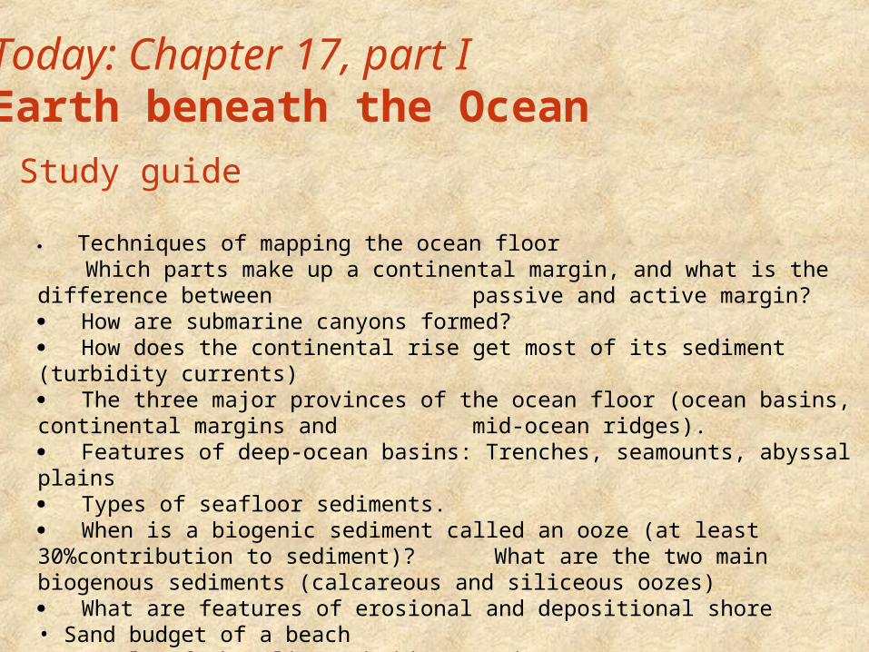
Today: Chapter 17, part IEarth beneath the Ocean
Techniques of mapping the ocean floor Which parts make up a continental margin, and what is the difference between
passive and active margin? How are submarine canyons formed? How does the continental rise get most of its sediment (turbidity currents) The three major provinces of the ocean floor (ocean basins, continental margins and
mid-ocean ridges). Features of deep-ocean basins: Trenches, seamounts, abyssal plains Types of seafloor sediments. When is a biogenic sediment called an ooze (at least 30%contribution to sediment)? What are the two main biogenous sediments (calcareous and siliceous oozes) What are features of erosional and depositional shore• Sand budget of a beach• Example of shoreline subsidence and emergence• Cause of sealevel rise
Study guide

1.Mapping the ocean floor
2.Oceanic provinces
3.Seafloor sediments
4.Sampling the ocean floor
Today: Chapter 17, part IEarth beneath the Ocean
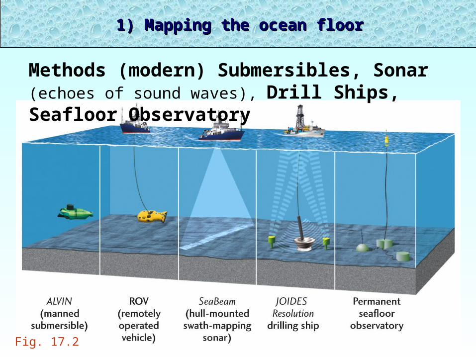
1) Mapping the ocean floor1) Mapping the ocean floor
Methods (modern) Submersibles, Sonar (echoes of
sound waves), Drill Ships, Seafloor Observatory
Fig. 17.2
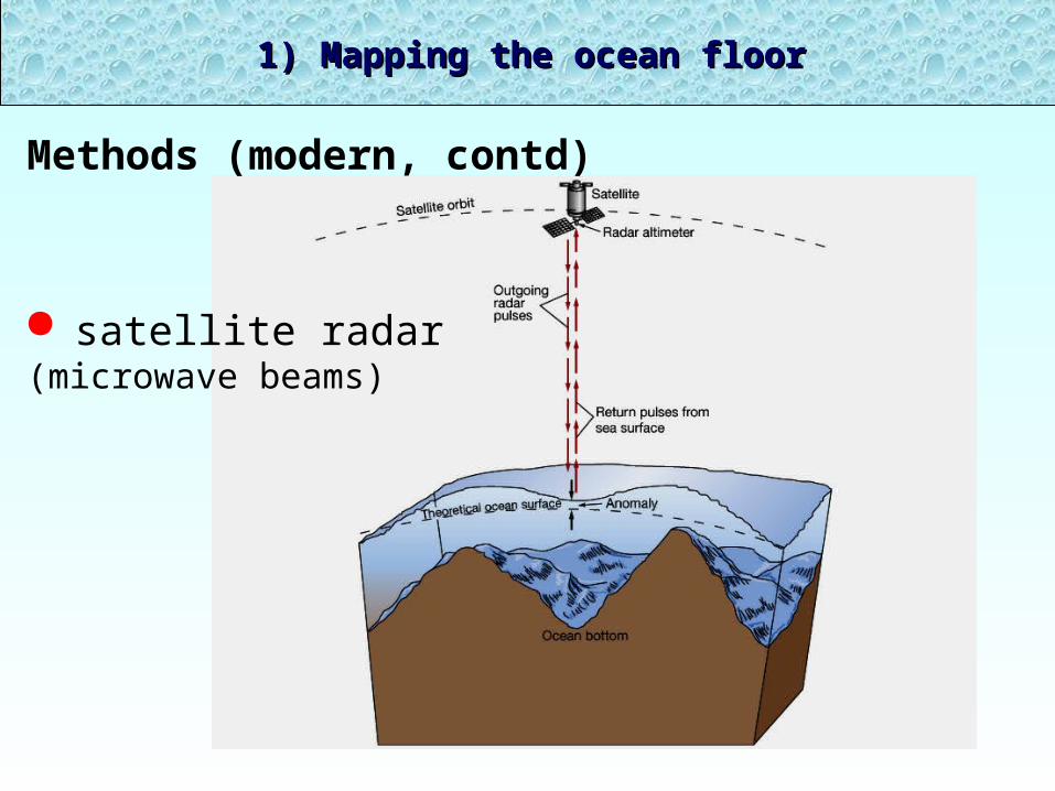
1) Mapping the ocean floor1) Mapping the ocean floor
Methods (modern, contd)
satellite radar(microwave beams)
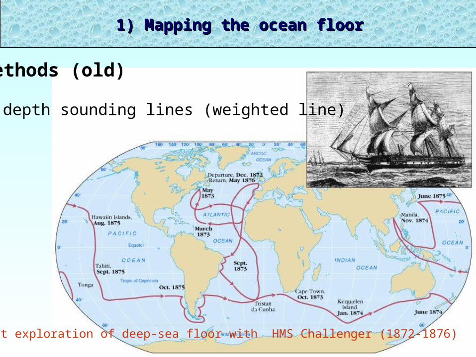
1) Mapping the ocean floor1) Mapping the ocean floor
Methods (old)
depth sounding lines (weighted line)
First exploration of deep-sea floor with HMS Challenger (1872-1876)

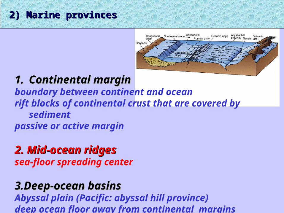
1.1. Continental margin Continental margin boundary between continent and oceanrift blocks of continental crust that are covered by sedimentpassive or active margin
2. Mid-ocean ridges 2. Mid-ocean ridges sea-floor spreading center
3.Deep-ocean basins3.Deep-ocean basinsAbyssal plain (Pacific: abyssal hill province)deep ocean floor away from continental margins
2) Marine provinces2) Marine provinces
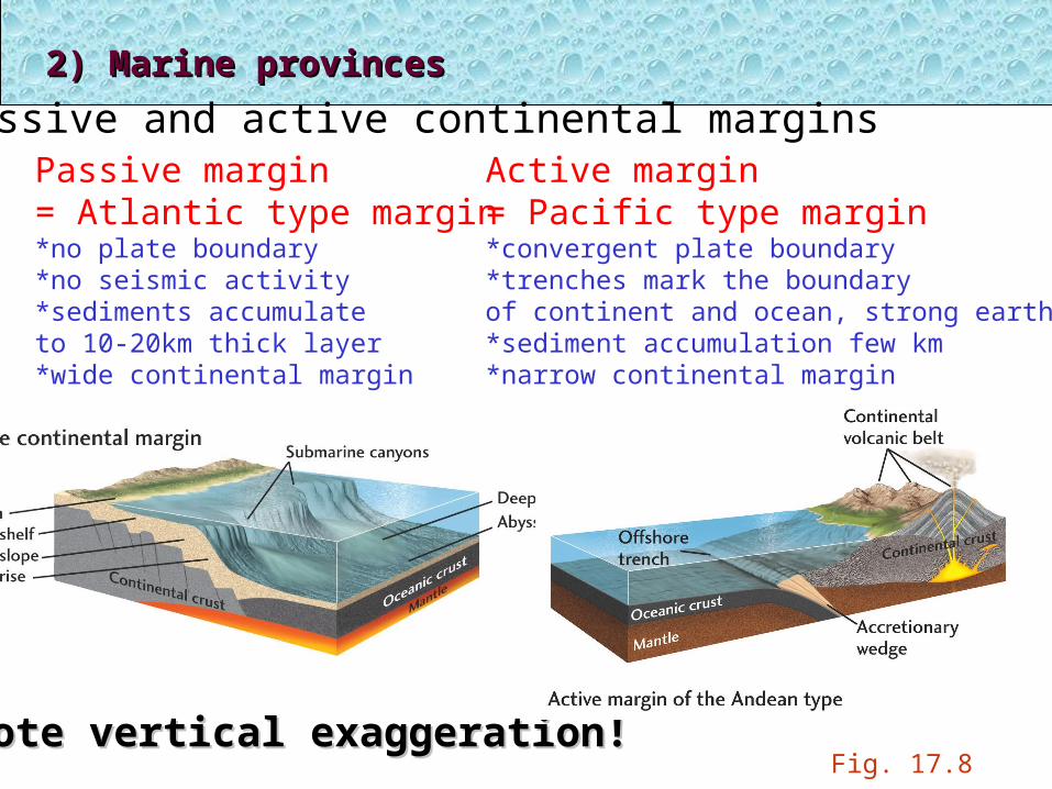
Passive and active continental marginsPassive margin= Atlantic type margin*no plate boundary*no seismic activity*sediments accumulate to 10-20km thick layer*wide continental margin
Active margin= Pacific type margin*convergent plate boundary*trenches mark the boundaryof continent and ocean, strong earthquakes*sediment accumulation few km*narrow continental margin
Note vertical exaggeration!Note vertical exaggeration!
2) Marine provinces2) Marine provinces
Fig. 17.8

Turbidity currents move downslope and erode submarine canyons inthe continental slope.
Deep sea fans are created by turbidite deposits at the mouths of the canyons, merge at the base of the continental slope and make up most of the sediments of the continental rise.
These turbidity deposits exhibit graded bedding.
How are submarineCanyons created?
See Fig. 17.9
1.1. Continental margin Continental margin boundary between continent and oceanrift blocks of continental crust that are covered by sedimentpassive or active margin
2. Mid-ocean ridges 2. Mid-ocean ridges sea-floor spreading center
3.Deep-ocean basins3.Deep-ocean basinsAbyssal plain (Pacific: abyssal hill province)deep ocean floor away from continental margins
2) Marine provinces2) Marine provinces
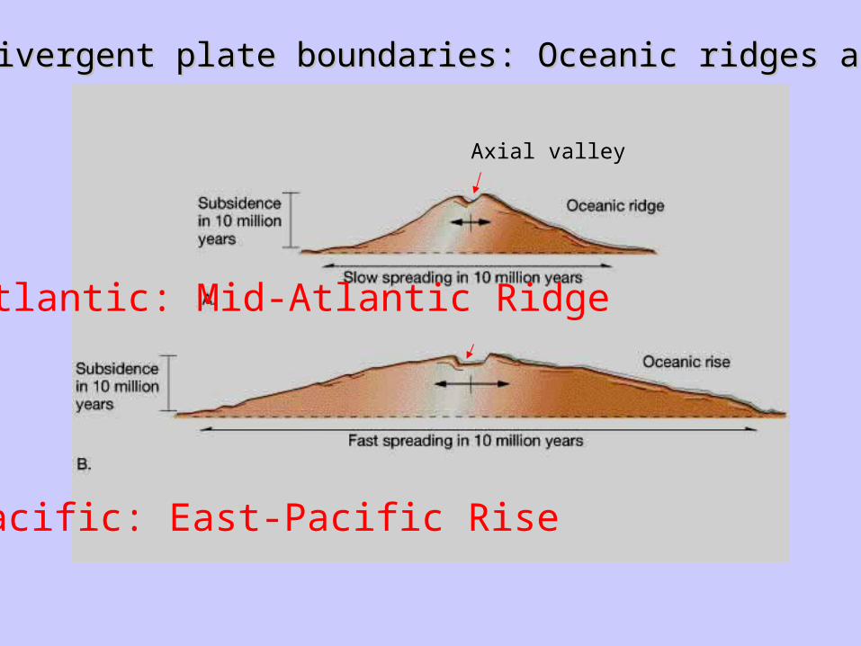
Oceanic divergent plate boundaries: Oceanic ridges and risesOceanic divergent plate boundaries: Oceanic ridges and rises
Pacific: East-Pacific Rise
Atlantic: Mid-Atlantic Ridge
Axial valley

3) Mid-ocean ridges3) Mid-ocean ridges
longest topographic feature on Earth (70,000 km!)
2-3 km above ocean basins
Rift valley along ridge axis
basaltic rocks
2) Marine provinces2) Marine provinces
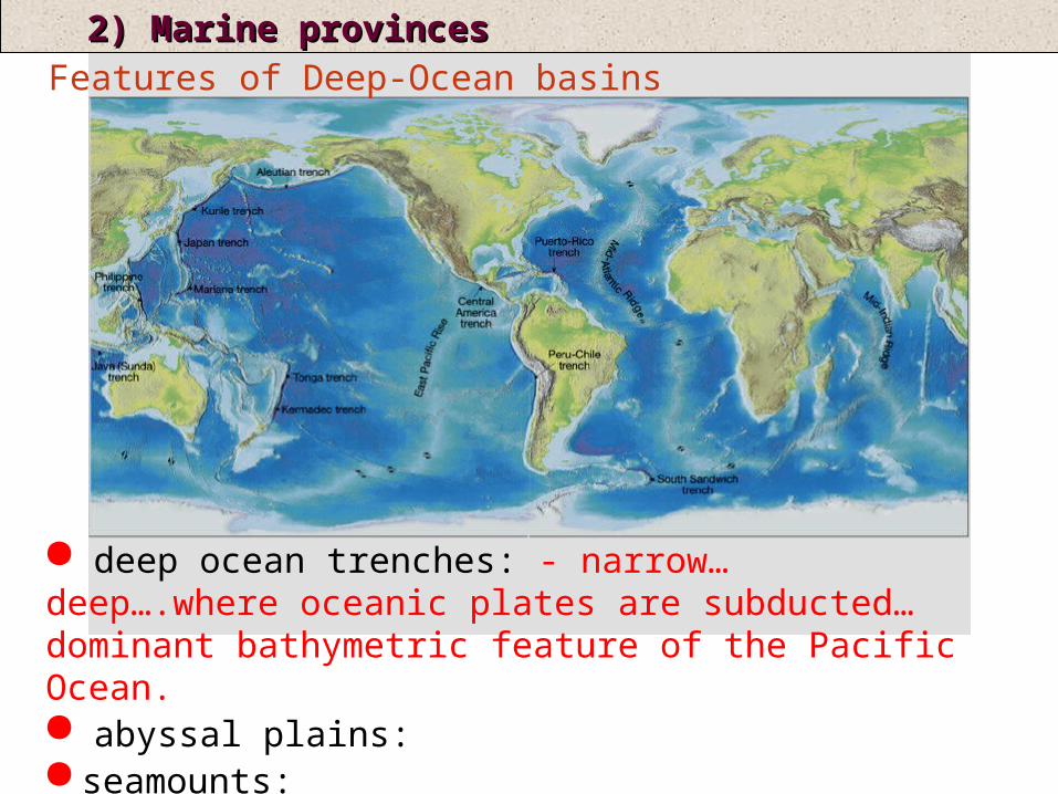
2) Marine provinces2) Marine provincesFeatures of Deep-Ocean basins
deep ocean trenches: - narrow… deep….where oceanic plates are subducted…dominant bathymetric feature of the Pacific Ocean. abyssal plains: seamounts:
NOT ridges, NOT margins
30% of Earth’ssurface
deep ocean trenches: - narrow, deep, where oceanic plates are subducted, dominant bathymetric feature of the Pacific Ocean. abyssal plains: - incredibly FLAT areas, thick sediments seamounts:
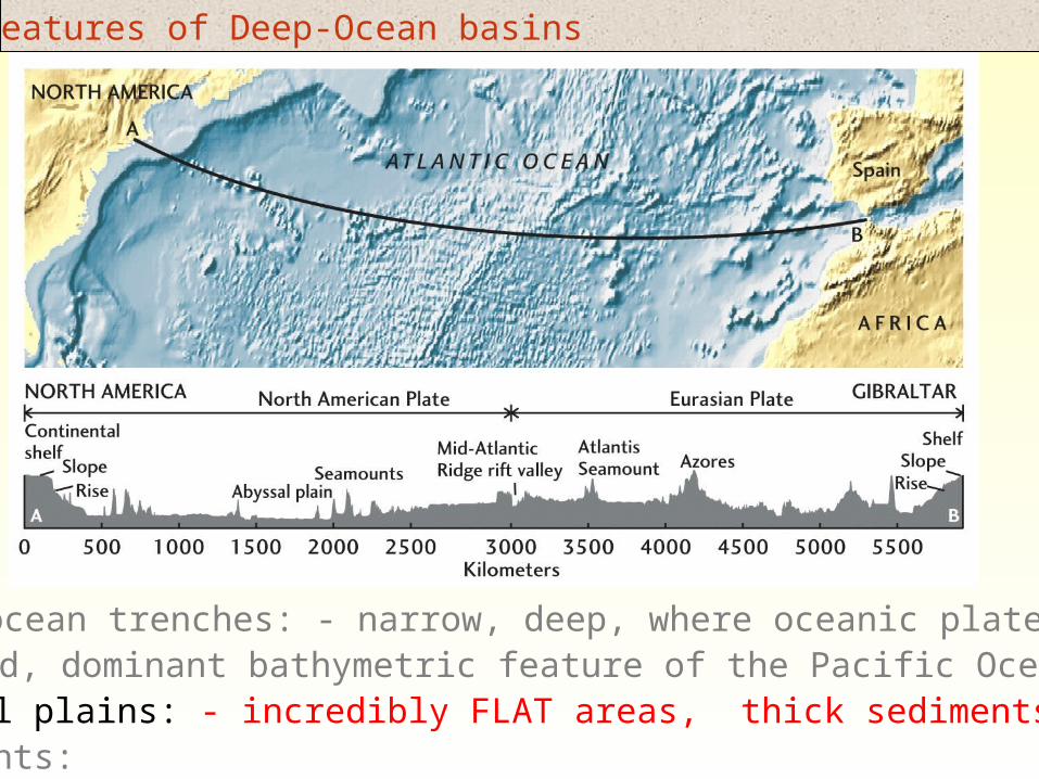
Features of Deep-Ocean basins
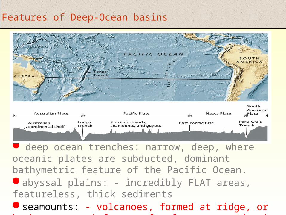
deep ocean trenches: narrow, deep, where oceanic plates are subducted, dominant bathymetric feature of the Pacific Ocean. abyssal plains: - incredibly FLAT areas, featureless, thick sediments seamounts: - volcanoes, formed at ridge, or by hot spots, below sea-level, most are in the Pacific
Features of Deep-Ocean basins
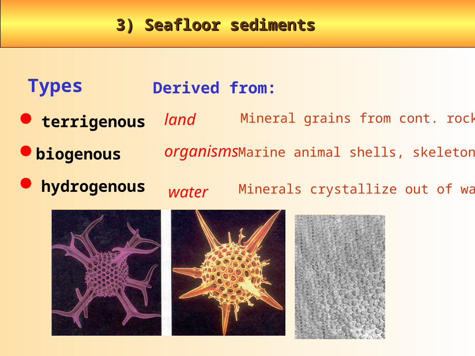
3) Seafloor sediments3) Seafloor sediments
terrigenous
biogenous
hydrogenous
Types Derived from:
land Mineral grains from cont. rocks
water Minerals crystallize out of water
organisms Marine animal shells, skeletons

Most lithogenous sedimentis made up of quartz (SiO2 )and clay
Transport media includeRivers, glaciers, and wind.
Terrigenous sedimentsTerrigenous sediments
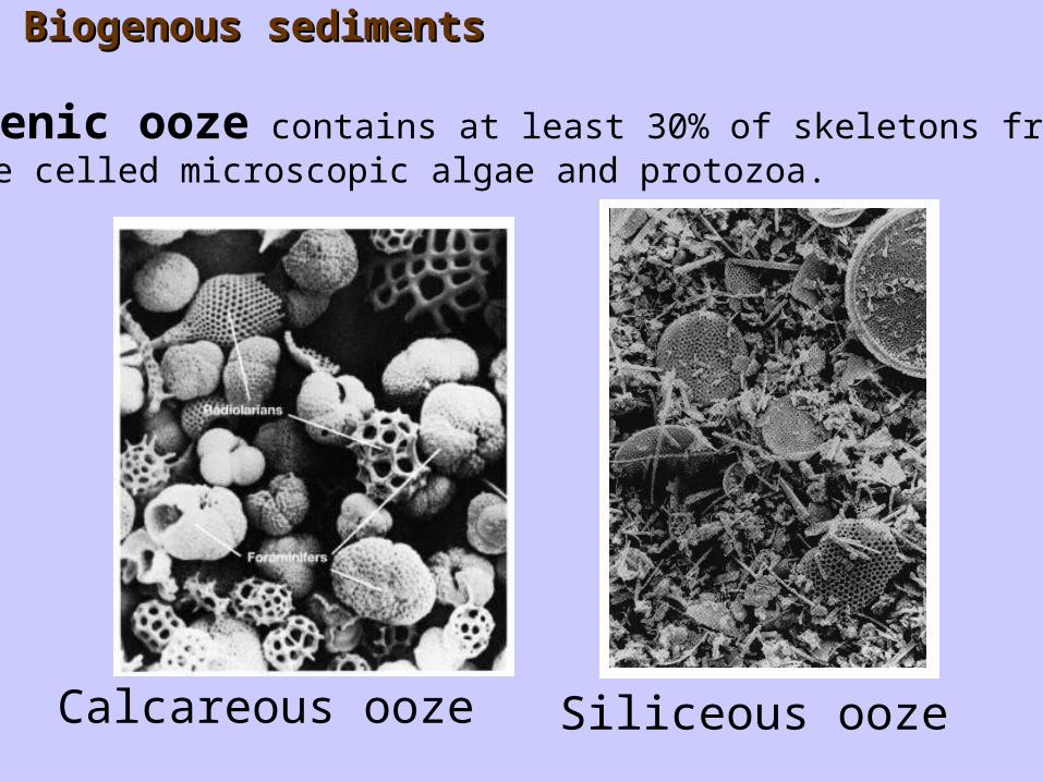
Biogenic ooze contains at least 30% of skeletons from single celled microscopic algae and protozoa.
Siliceous oozeCalcareous ooze
Biogenous sedimentsBiogenous sediments

3) Seafloor sediments3) Seafloor sediments
Carbonate oozes are only found above the calcium carbonate dissolution depth (CCD). Deeper water is more acidic (has more dissolved CO2) and will dissolve the calcite shells.
Fig. 17.11

Calcium carbonate in modern surface sediments in the world oceans. The distribution follows the relatively shallow mid-ocean ridge that is above the CCD.
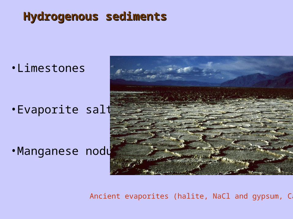
•Limestones
•Evaporite salts
•Manganese nodules
Hydrogenous sedimentsHydrogenous sediments
Ancient evaporites (halite, NaCl and gypsum, CaSO4)

Manganesenodules Manganese nodules
on the Pacific OceanFloor
Cross sectionthrough a manganese nodule
SEM of the surfaceof a nodule, evidencefor microbial mediationof nodule formation?Mining of nodules
contain
Contain Mn, Fe, Co, Cu, Ni
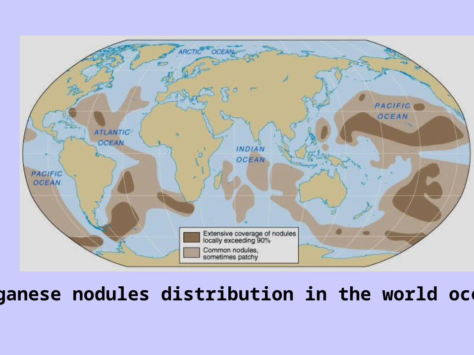
Manganese nodules distribution in the world ocean’s.
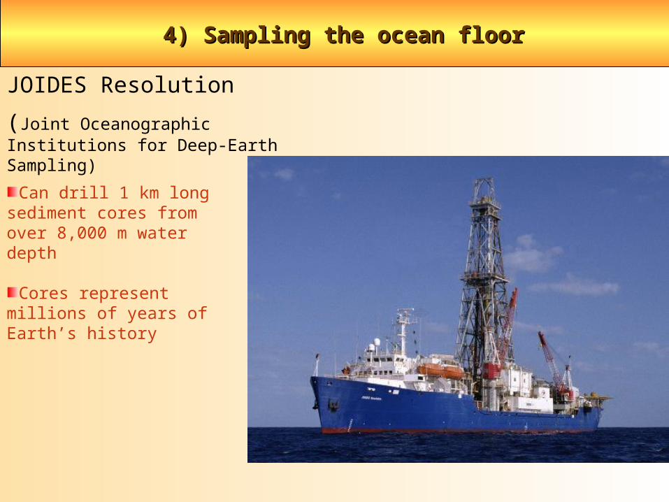
4) Sampling the ocean floor 4) Sampling the ocean floor
JOIDES Resolution
(Joint Oceanographic Institutions for Deep-Earth Sampling)
Can drill 1 km long sediment cores from over 8,000 m water depth
Cores represent millions of years of Earth’s history
4) Sampling the ocean floor 4) Sampling the ocean floor
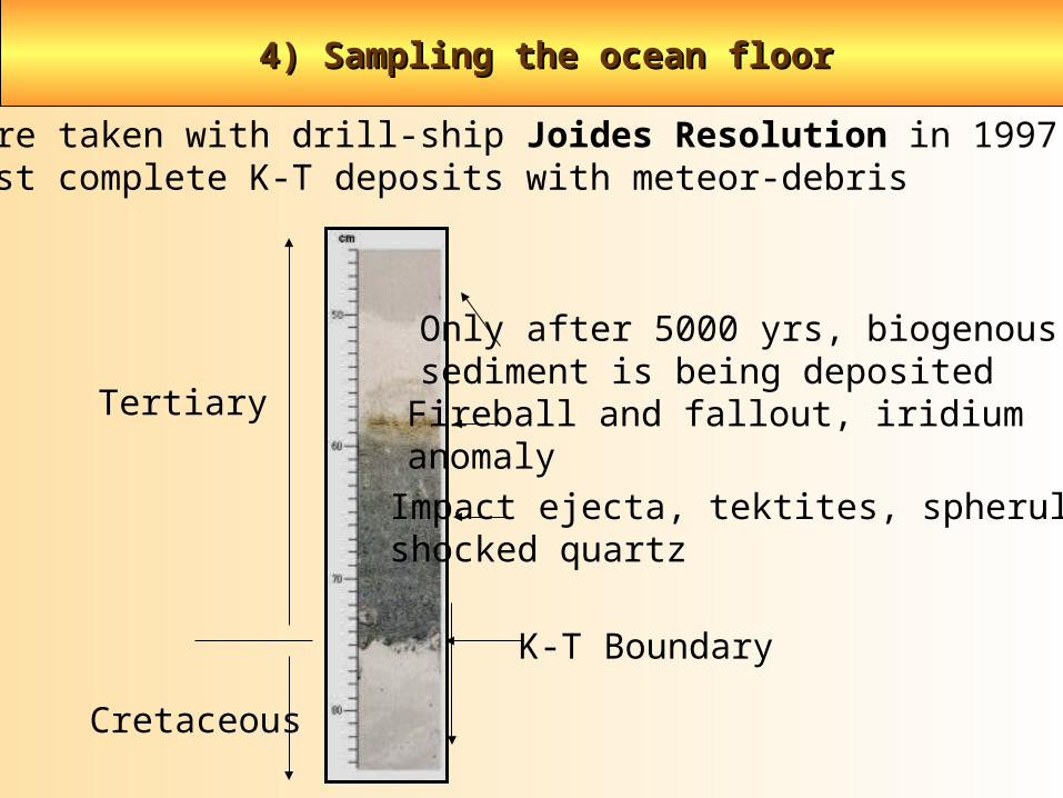
Sediment core taken with drill-ship Joides Resolution in 1997 off Floridareveals first complete K-T deposits with meteor-debris
K-T Boundary
Tertiary
Impact ejecta, tektites, spherules,shocked quartz
Fireball and fallout, iridiumanomaly
Only after 5000 yrs, biogenoussediment is being deposited
Cretaceous